Tag Archives: Metro bus

Unspeakables. Unmentionables.

Where ever we walk some sort of crime is likely to have been committed in past years, centuries, or millennia – that is, if the concept of crime is part of the culture.

In the past week, Tasmanian police have been hopeful for a breakthrough in the search for Lucille Butterworth, a young woman who has been missing for almost half a century, believed murdered.  Reports indicate that police ‘have the best lead yet with credible new information leading them to the lonely gravelled roadside area 8.5km from the Granton turn-off on the Lyell Highway’. The location is next to the Derwent River.

Having seen the latest news media photos, I remember walking this section of the road on my jaunt from Granton to New Norfolk. It was the section where no road verge offered protection from the traffic and I needed to walk on the tarmac.  No sign of human habitation.  Only vehicles with their racing drivers charging along the highway.  I had no clairvoyant moments that day – I never felt the presence of anyone interred in the land nearby.  But I hope the scientific and systematic exploration of the area between the road and the Derwent River will bring answers to the many questions which the family have lived with for decades.

Lucille disappeared at a time in history preceding the invasion of mobile phones.  By all accounts she waited for a public bus in Hobart’s northern suburbs but the bus never arrived so she accepted a ride with someone in a passing car.  These days, a person in a similar situation would simply phone a friend or a relative for help.

Should a blog reader have more information about Lucille Butterworth’s disappearance please contact Tasmania Police.

The last leg to the New Norfolk Bridge on Stage 14

A couple of minutes after passing below the Bush Inn, I enjoyed walking underneath the grandeur of an elderly spreading oak tree.  And then moments later, ahead of me I could see small portion of a massive horizontal girder belonging to the New Norfolk bridge over the Derwent River.

20150413_145236

Information panels provided details about earlier bridges across the Derwent, and historic buildings located nearby.

20150413_145250 20150413_145254

20150413_145302

20150413_145328 20150413_145335

The grand and stately houses pictured above, are located near the bridge.

But back to my path to the bridge. In front of me was a gated fence with a sign informing me the gate was locked overnight.  I pushed it open and walked across an impeccably kept mowed lawn. A private sanctuary. Green and lush. The sparkle on the river to my right.  A strongly built bridge ahead.  I reached my destination for Stage 14 at 2.58 pm.

20150413_145518 2015-04-13 15.11.01

2015-04-13 15.11.08 20150413_145514

Instead of charging off up and into the New Norfolk township, and finding a bus to return me to Hobart, I lay down on that green carpet and, soaking in the sun, I felt incredibly fortunate.

My stage 14 day had started with a  5.30 am rise (in the dark) and a Metro bus departure from central Hobart at 7.17 am. The bus left New Norfolk at 4.20 pm and returned me to Hobart. I walked in my front door at 6 pm (as the sun set) feeling quite chuffed because I had seen and experienced many beautiful natural features, the sun had lit up the landscape and the river, and I had talked with interesting people. A wonderful day!

Raceway at Sorell Creek

Signs alerted me that I was approaching a raceway on my left as I walked toward the Mountain Dew Race Park on the edge of the tiny settlement of Sorell Creek (which is located closer to New Norfolk than Granton).  Photos on http://www.mountaindewiceraceway.com/ give an indication of the types of vehicles which race on this circuit.  It was all quiet as I walked past, and looking at their events calendar it seems no races are scheduled in the future.

A bus stop for the Derwent Valley Link bus service is located on this part of the Lyell Highway.

It was the rows of poplars changing from summer green to autumn gold that I will remember most. Absolutely stunning.

20150413_111323 20150413_111706

20150413_111901 20150413_111930

Seeing the paper mill at Boyer for the first time during the Stage 14 walk, was a thrill

After 15 minutes of walking, following my departure from the powerboat racing arena, the tarred road verges disappeared and weedy grass grew over lumpy and uneven ground to the edge of the Highway. I was forced to stand clear as cars and trucks approached, but there were moments when I could step out a rhythm walking on the Lyell Highway tarmac.  This situation continued for half an hour, however I was pleased that before and after this section I had a good metre or more width of road verge to walk along safely.

The features that could be seen from the Highway were varied: a feeding family of pelicans across the water; prominent Mt Terra on the other side of the Derwent River with Mt Dromedary behind; occasional tiny creeks lost in verdant grasses passing under the road; vehicle pull-offs at the edge of the road so boats could be entered into the water; corrugated iron cut-out full sized cows standing in a paddock; and a paddock full of horses their heads turned towards the sun.

20150413_100618 20150413_101444

20150413_104129 20150413_110252

20150413_110707 20150413_110741

At one part of the walk, in the distance and way south, the peak ‘Collins Cap’ pointed into the autumn sky.

20150413_105456

The distant paper making mills at Boyer showed their steaming stacks – an expanse of water, farming land or thickets of trees kept me separated. I knew these mills were very close to New Norfolk so that the larger the buildings seemed, the closer I was to reaching my destination.

20150413_100955 20150413_110604

By 10.50am I had a sense that I was returning to peopled land. Firstly I walked passed a long drive leading to a private house at the bottom of the hill; with long rows of old Radiata pines edging the highway.

A few moments later I passed the sheep grazing property named ‘Sunnyside’ on the western side of the road – a sign announced ‘Sunnyside’ was for sale.  You can make an expression of interest at http://www.domain.com.au/property/for-sale/rural/tas/sorell-creek/?adid=2010785567&sp=1 if interested. In the write up on that site, mention is made that the soils are based on limestone – makes the establishment of the lime kilns further south understandable.

At 10.54 am I reached a large cherry growing orchard on my right.

20150413_105358

Over the road to my left, on the property named ‘Scottsdale’ sat two old buildings which seemed late 19th century in architectural style. The sign on the gate declared this was the Derwent Dorper Stud (Rams), however this seems not to have a presence on the internet.

20150413_105407 20150413_105628

I noticed a Derwent Valley Link bus stop outside Scottsdale and the cherry orchard – for fruit pickers or shearers???  Certainly not for me. I had many kilometres yet to walk. New Norfolk was my destination, and so onwards I continued.

Arriving in Granton for Stage 14 of the walk along the Derwent River

Since walking along the Derwent River in the northern suburbs on the western shore earlier this year, I have revisited MONA at Berriedale on a number of occasions but I have not been further north. So it was a great delight when my X1 Metro bus, which departed from Hobart city at 7.17am, used the old main road after the Glenorchy bus mall to travel through Berriedale, Claremont and Austins Ferry before reaching Granton.  I was able to see the acres of majestic gold and red leafed vines of Moorilla Wines, to observe Cadbury’s chocolate factory puffing plumes of white steam into the crisp blue sky morning, to identify a range of native birds that were using Goulds Lagoon as a safe resting place, and to recognise various bays and other features that I had passed previously.  Everything seemed edged with the early sunlight which glowed strongly through rain washed, impeccably clean air.

I was off the bus at stop 49 on the last of the Brooker Highway at 7.50am.  Looking northwards, the sign made it clear the direction to take was straight ahead. An earlier post introduced the history of the old Granton watch house (search Historic Granton, Tasmania) – that’s the low yellow building on the left in the first photo below, and then the second photo shows the sun-struck front of the building.

20150413_074858 20150413_075049

I was aware New Norfolk, over last weekend, had been celebrating the glories of its autumn foliage as indicated by the sign below. The sign served to increase my anticipation of those colourful delights.

20150413_075028

The unmemorable architecture of the Granton Memorial Hall solidly facing the morning sun, seemed very out of place in this beautiful area.

20150413_075136

Equally solid and immediately serviceable was the public toilet block at the edge of the carpark used by many city bus commuters.

20150413_075231

In front of the carpark a sign reminded me of the importance of grape growing in Tasmania – not the least because the wine from our vineyards is very drinkable (as agreed by wine judges from around the world).

Vineyards ahead

My eyes swung across to the roundabout for vehicles travelling north on the Midlands Highway to Launceston via many rural towns. In the distance, the vertical towers of the Bridgewater Bridge marked the Derwent River crossing.  The calmness of the day, and the quality of the light was sublime.

20150413_075150

I hadn’t walked far along the Lyell Highway when I saw the sign below which indicated that 16 kilometres further along the highway I would reach New Norfolk.  But could I trust the sign? Two or so kilometres further back, when I was still bussing on the Brooker Highway, I had seen a sign indicating the distance was 16 kilometres.

Leaving Granton

Not far away another roadside sign alerted motorists (and the occasional pedestrian): Welcome to The Rivers Run Touring Route.

The Rivers Run

Walking on the right hand side of the road facing oncoming traffic and with the Derwent River on my right, I continued into the icy breeze heading towards New Norfolk.  It wasn’t much after 8am when I left the (comparatively) built up area of Granton on the first leg of Stage 14.

I pay my own way as I walk along the Derwent River

stockfreeimage.com Aust money notes rolled

Some friends feel sure I must be asking for freebies, discounts, backhanders, cash-in-hand or other special deals from businesses, restaurants, accommodation facilities, buses and other organisations which I comment on in my blog, as I pass along the Derwent River.  No, I do not. I have not asked for, I do not seek for, and I do not expect to receive service or goods for free or cheaper simply because I have something to say about them in my blog.

I would not like to feel fettered by an obligation to ‘go easy’ on a business or product which was substandard.  I would not like to feel pressured to remark on a particular product or service that I was not interested in, or I could not make relevant to the walk along the Derwent.

In the current environment when travel writers routinely have their costs covered and often have access to premium products and services for no charge, I can understand why some people might be surprised to learn I have not joined that gravy train. That way of funding travel is not necessary for me; to date, my only cost has been small local bus fares.  I would like to be able to make any comment I prefer about Hobart’s Metro bus service and, therefore, I have not approached them for assistance.

Of course, the future is a different place and when I venture northwards, no longer will I be able to organise walks as one day events.

I will need places to stay overnight occasionally. In addition, I will be using different public bus services so my costs may be greater than those which I am used to. Despite the likelihood of increased costs, I view these walks as my ‘holidays’ and I am prepared to pay for them.

When I started the blog, one of my intentions was to inspire local people to follow in some or all of my footsteps. I want local readers to know exactly what the situation is and so my walks will not be doctored by special privilege.

???????????????????????????????????????

Another matter concerns me.  I hear rumours that a few tourism operators away from the main cities and towns are not always serving their customers in the hospitable contemporary way many of us feel visitors to Tasmania should expect.  If I find some ‘bad eggs’ in the more remote parts of Tasmania, then I want to be able to expose their weaknesses or recommend possible improvements in my blog (and probably on Trip Advisor as well).

??????????????????????????????????????????????????????????????????????????????????????????????????????????????????????????????????

(Photo above ‘Fresh Start” from Dreamstime.com)

On the other hand, where I find excellent service, I want to reward that with the words and pictures of my choosing. On this basis, I see no reason to persuade people to give me a free night’s accommodation or meal or pay for any other expense which I might incur.

Hmmmm.  Almost seems a shame to take this point of view!  I wonder if blogger jenspen1961 from Cairns, when she sets off walking around Australia, will think differently.

Freeimage sockfreeimage.com of map of money australia

Mount Nelson Signal Station

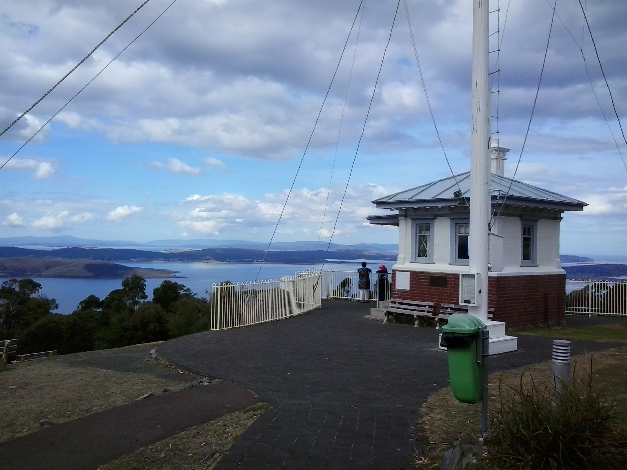
Overlooking the centre of the city of Hobart and with a view sweeping across to the eastern shore of the Derwent River, Mount Nelson is host to a significant historical site, the Mount Nelson Signal Station.

2015-03-09 14.49.17

Wikipedia provides the information that originally this rise in the landscape was named ‘Nelson’s Hill’ after botanist David Nelson, who sailed on the ship ‘Bounty’ which visited Van Diemens Land on its way to Tahiti (the ship that was involved in the infamous Mutiny on the Bounty). In geological form, Mount Nelson amounts to not much more than a low foothill, however its name gives an indication that something grand awaits you if you venture to the top.

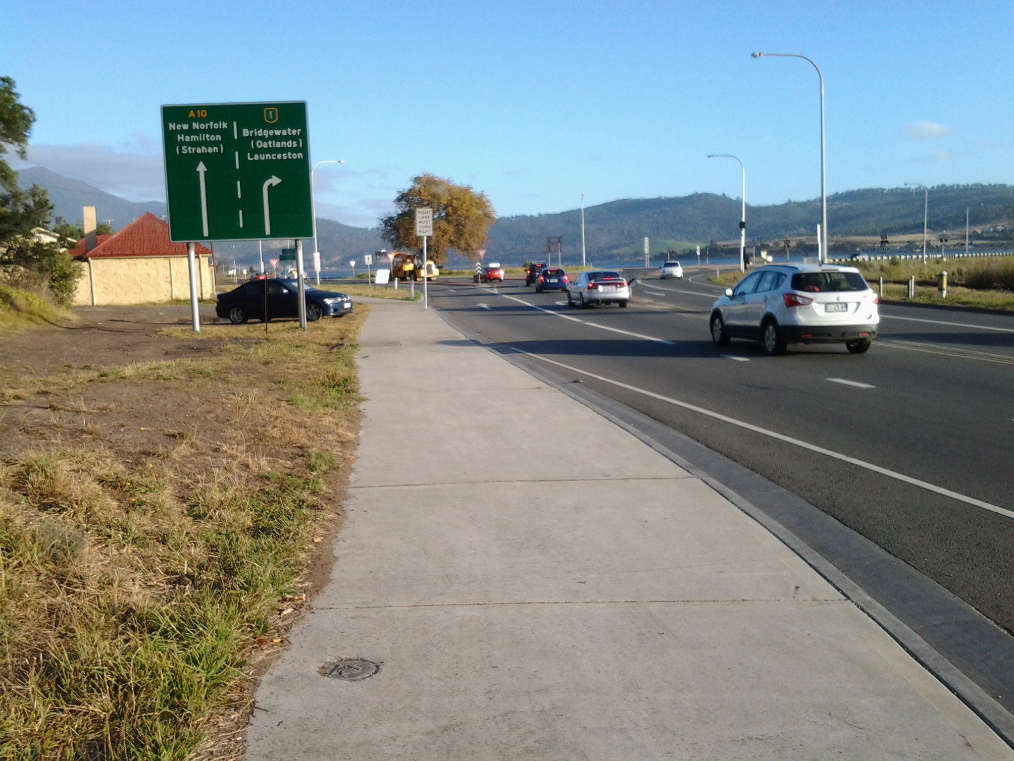
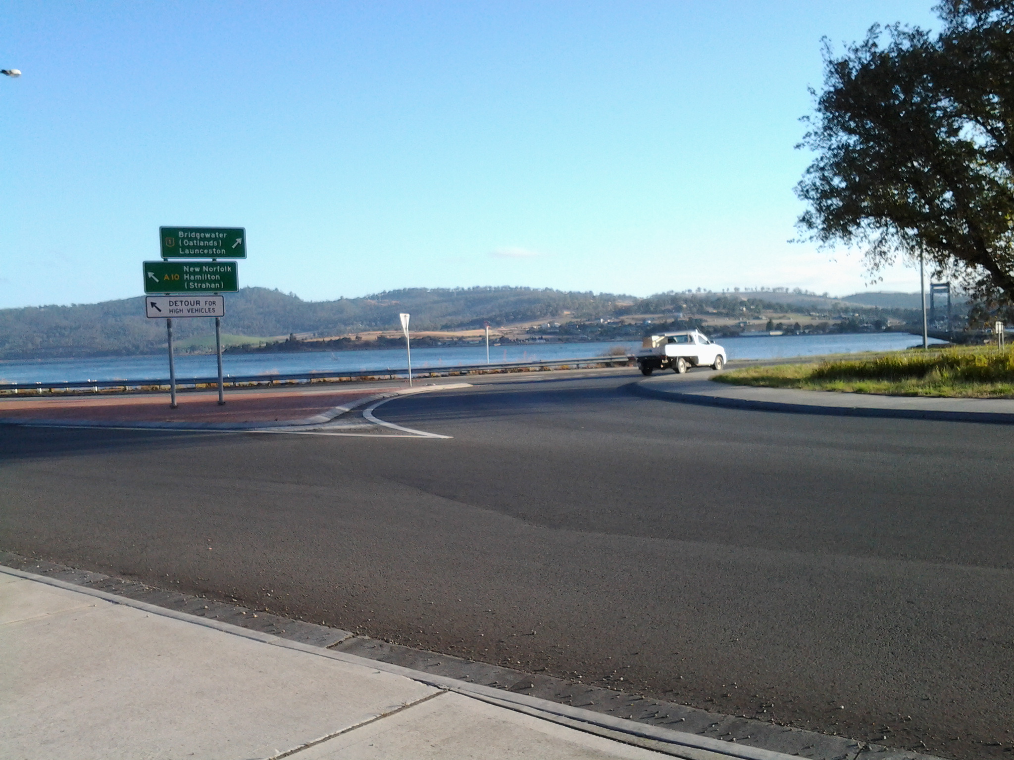
And such a visit is easy in a vehicle, or if you want to take an uphill walk from Hobart’s suburb of Sandy Bay.  In addition, the Mount Nelson via Dynnyrne and Tolmans Hill Metro bus service can deliver you to your destination.  If you like walking, you might choose to catch a bus to the top and then follow any one of a number of clearly marked tracks downhill. Yesterday I made a visit thanks to blog follower Je’s transport, accompanied by another follower Be who is visiting from Cairns.

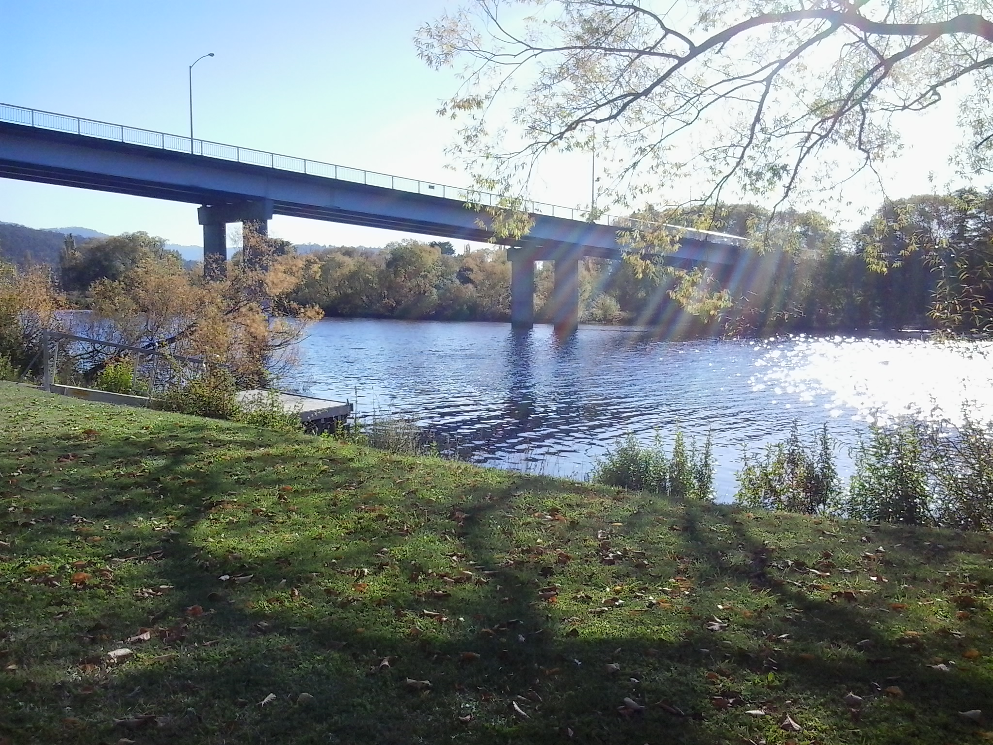
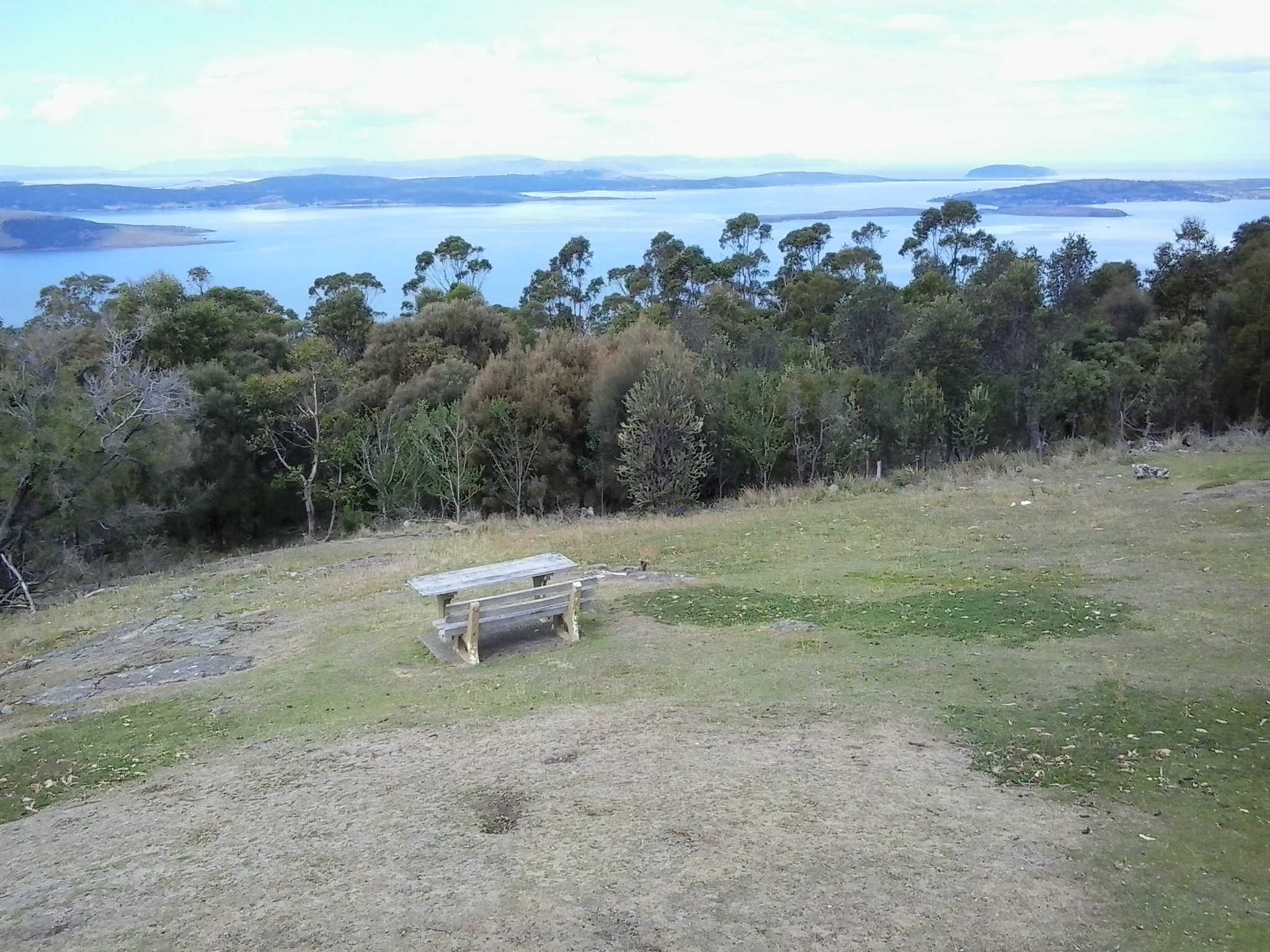
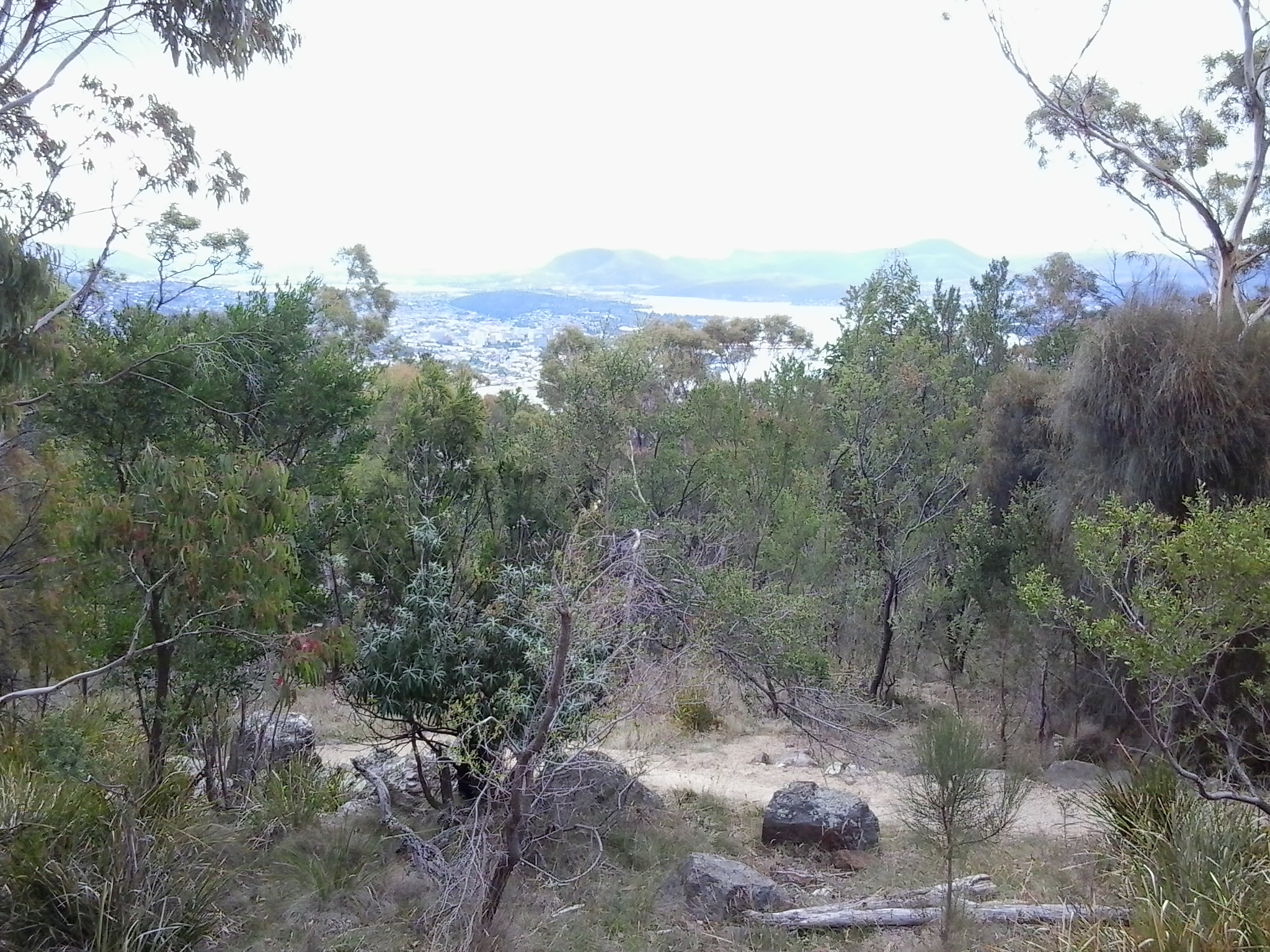
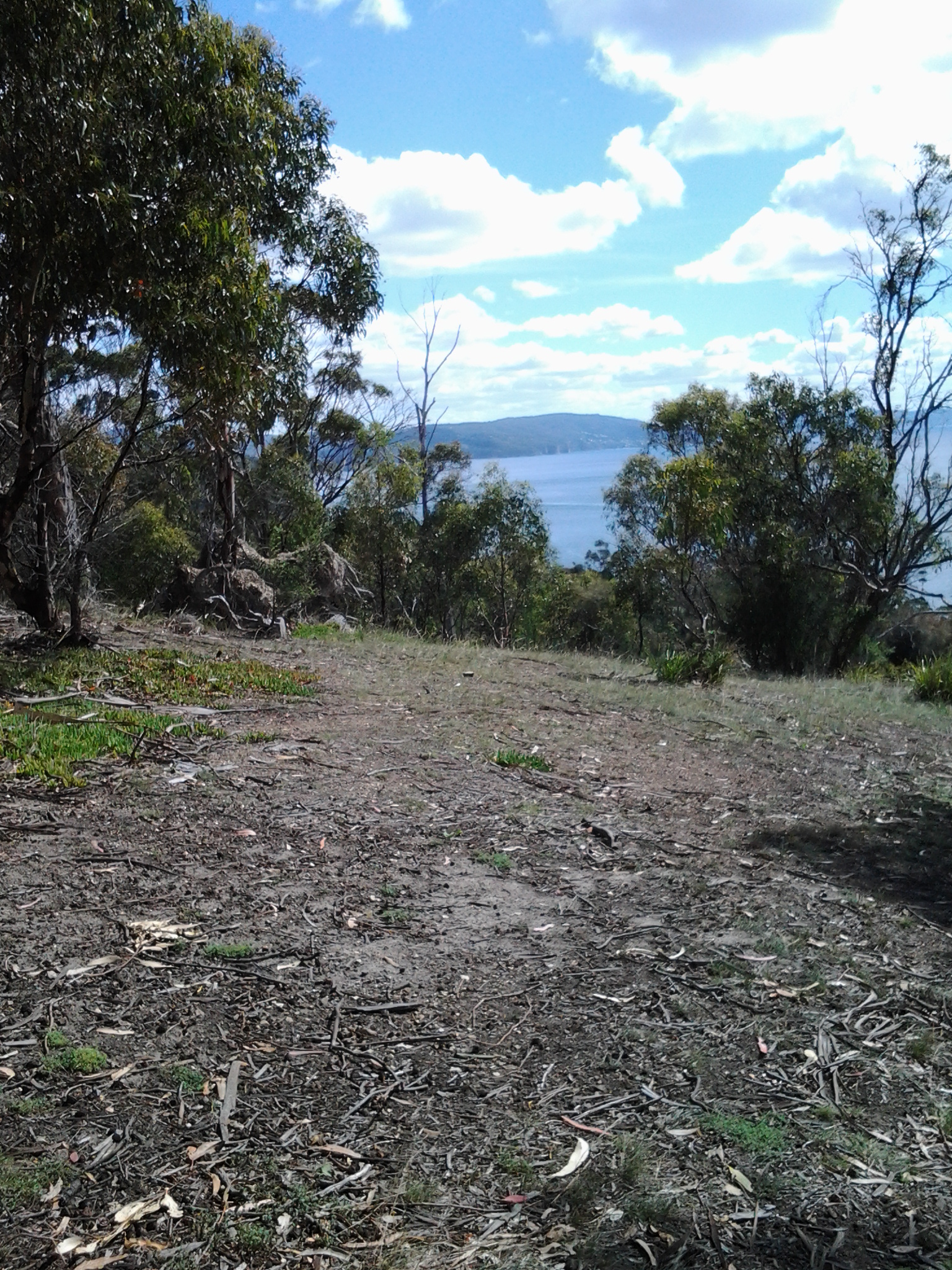
From different vantage points, the spectacle of the Derwent River spread out below, made us breathless with delight. When I am walking at ground level along the Derwent River, the grand panoramas extending into the distance are denied me.  But yesterday it was exciting to see the bays and hills further afield.

2015-03-09 14.50.30

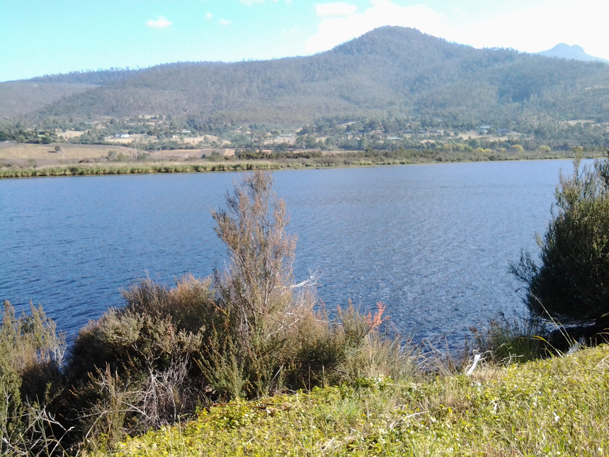
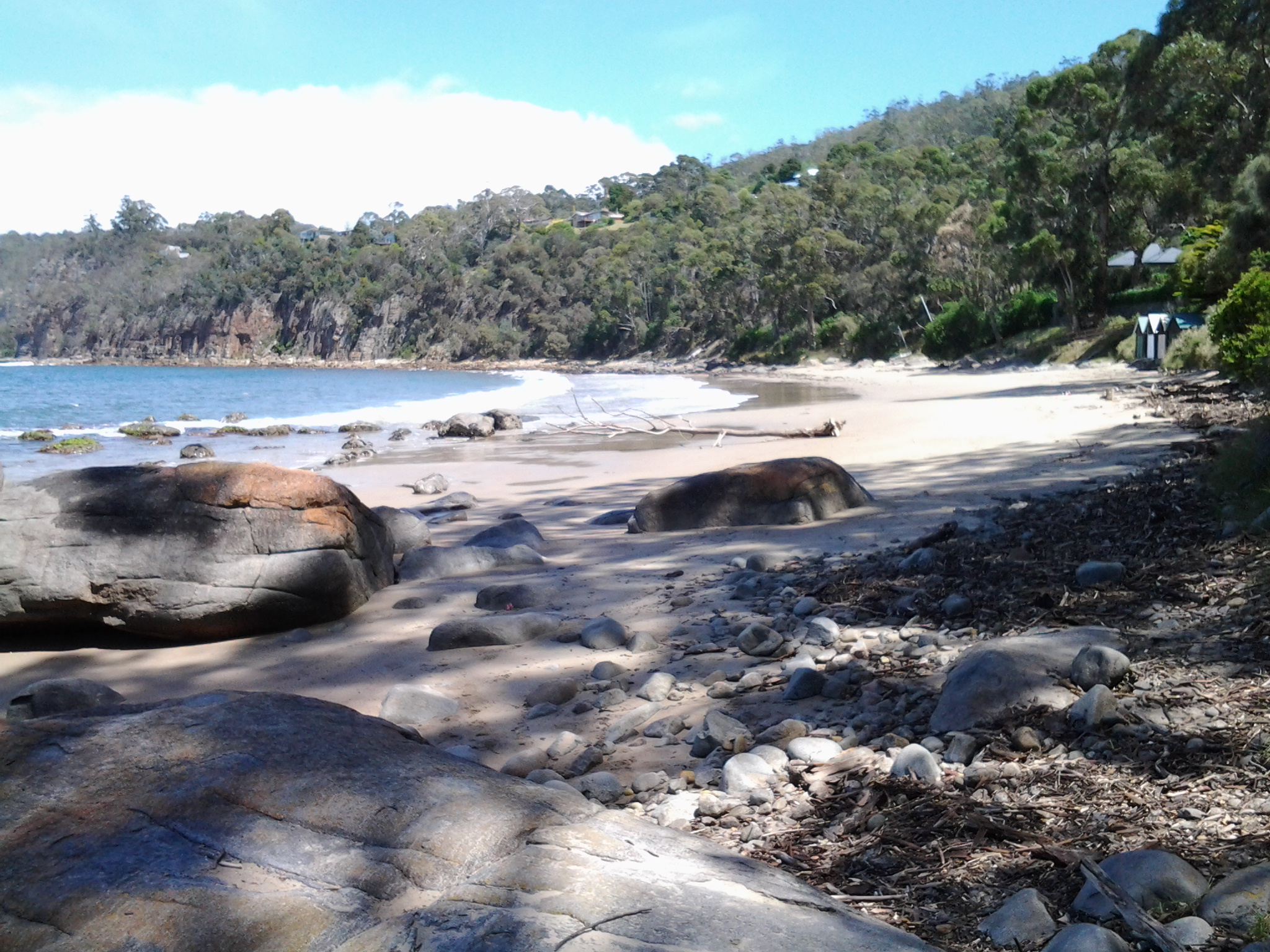
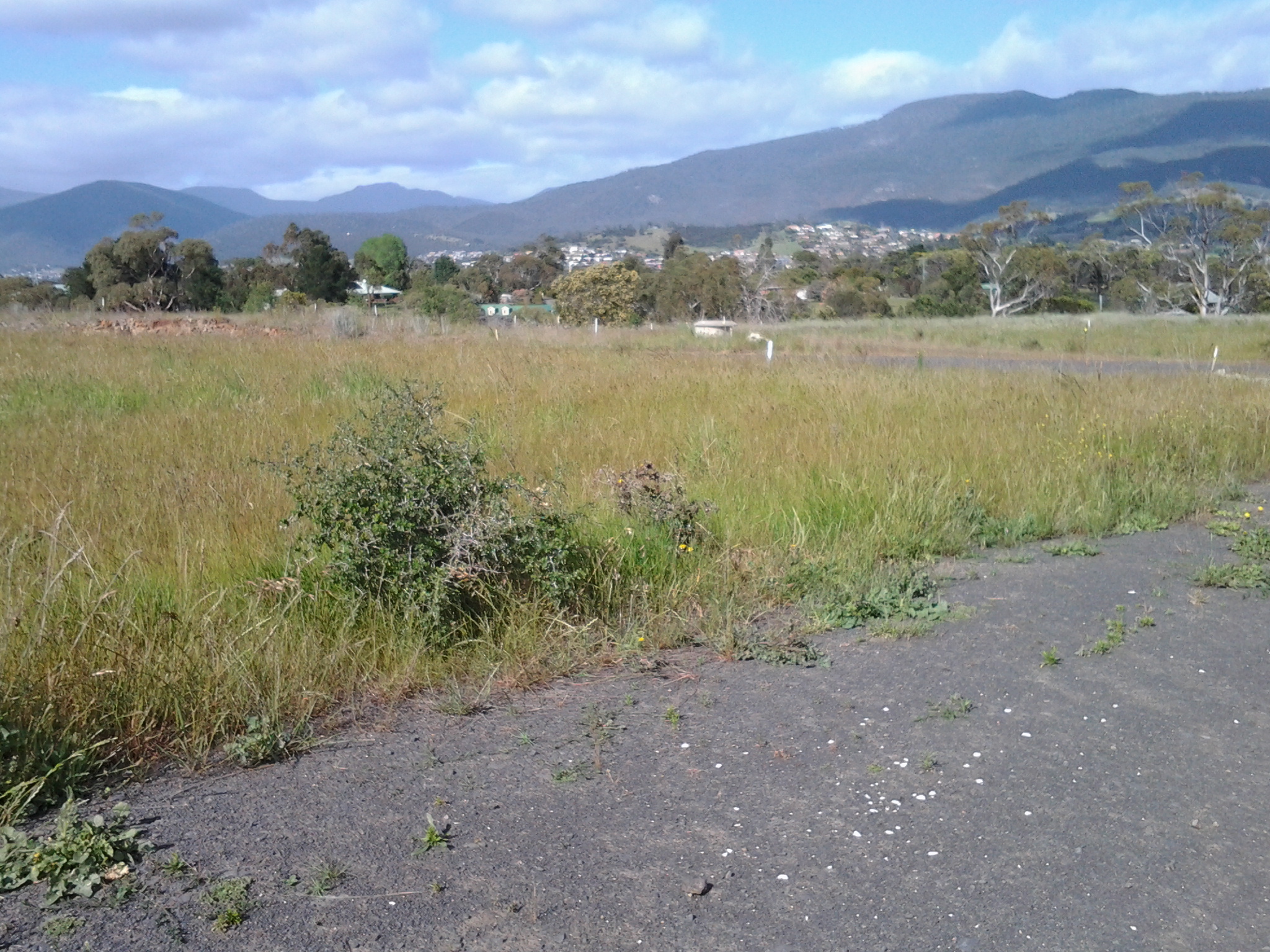
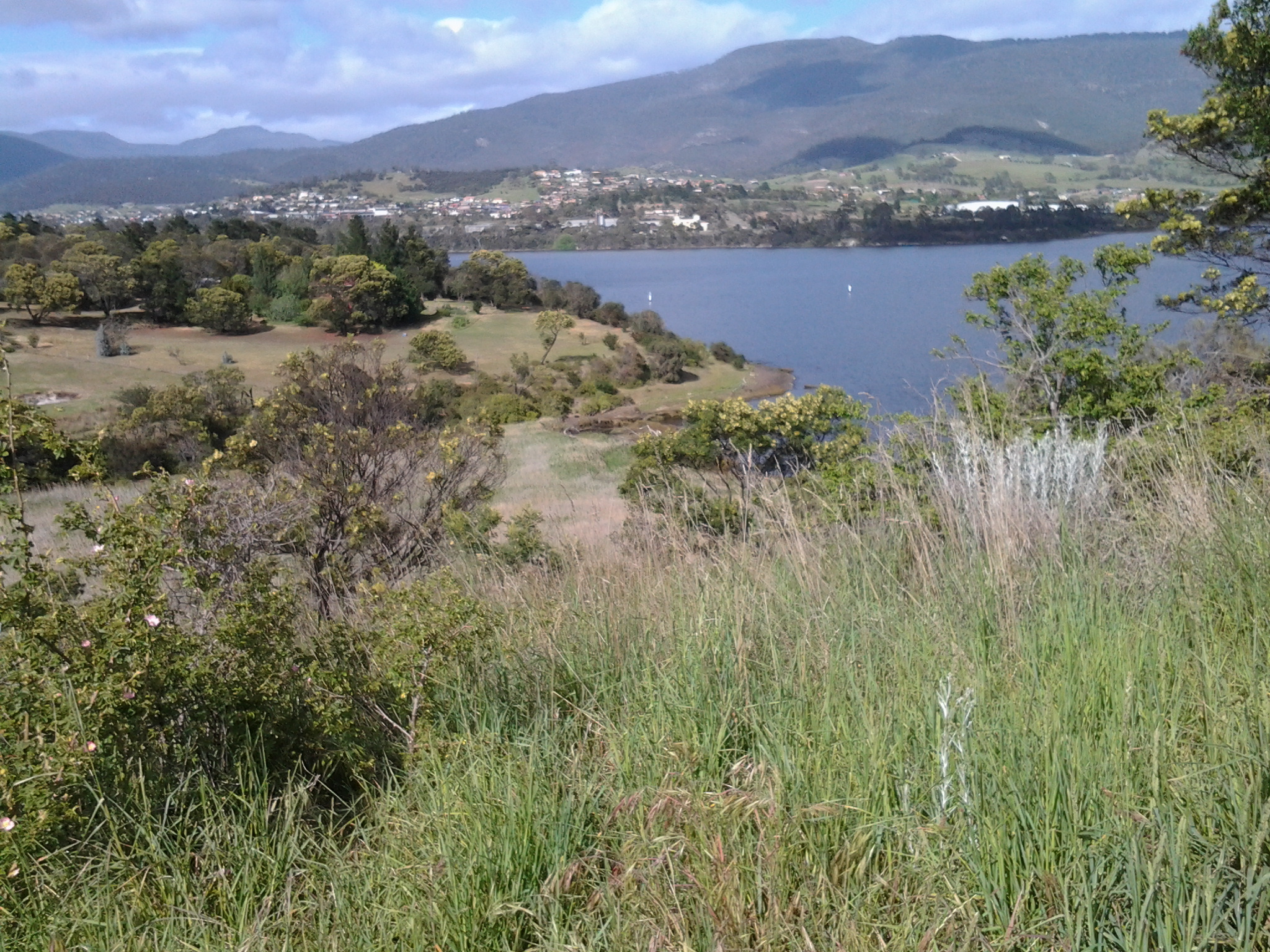
The photo above looks toward the mouth of the Derwent River on the eastern shore. South Arm peninsula can be seen extending along the water.  As  I stood on Mount Nelson I could clearly identify the Iron Pot, Fort Direction Hill, South Arm Beach, Opossum Bay and its beach, and  Gellibrand Point all of which I walked on during Stage 1 and 2 of my walk along the Derwent River.

2015-03-09 14.50.16

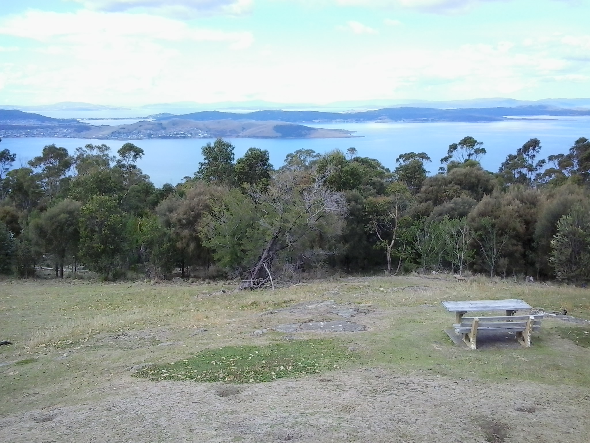
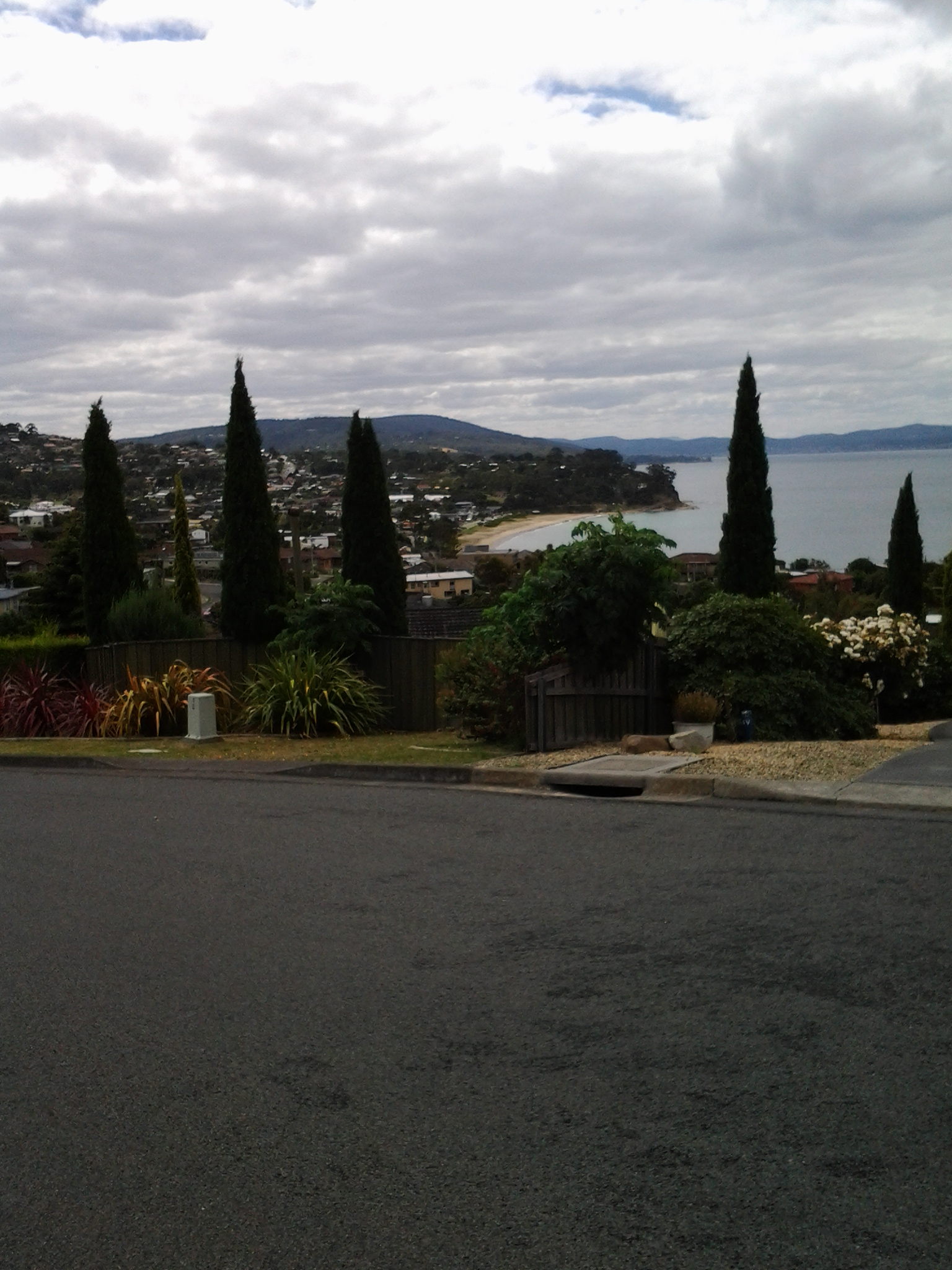
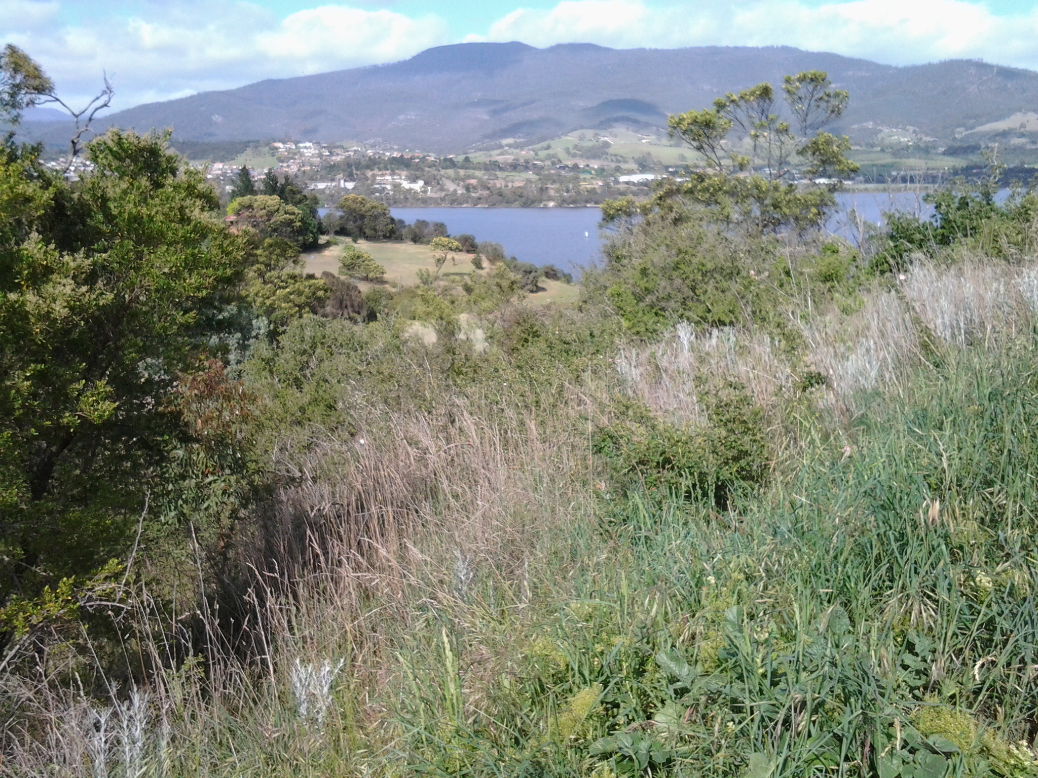
The photo above shows the eastern shore of the Derwent River with Gellibrand Point to the right on the northern tip of the South Arm peninsula. Then the great gaping space of Ralph’s Bay appeared straight ahead. To the left of the image, Trywork Point is in view; this was the starting point for Stage 3 of my walk (after I had walked there from the suburb of Tranmere).

2015-03-09 14.50.09

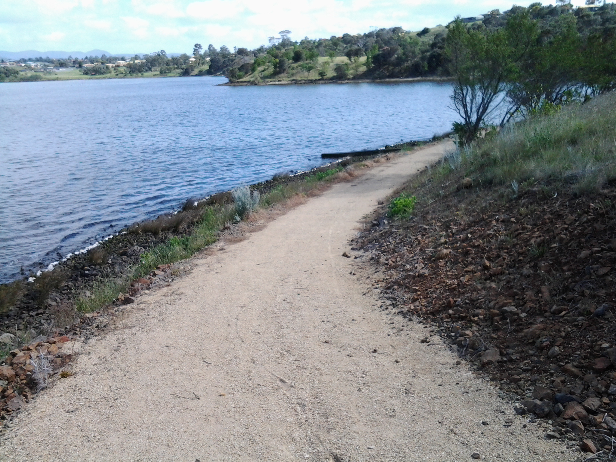
The photo above shows Ralphs Bay to the right, Trywork Point and then the suburb of Tranmere to the left – on the eastern shore of the Derwent River.

2015-03-09 14.49.55

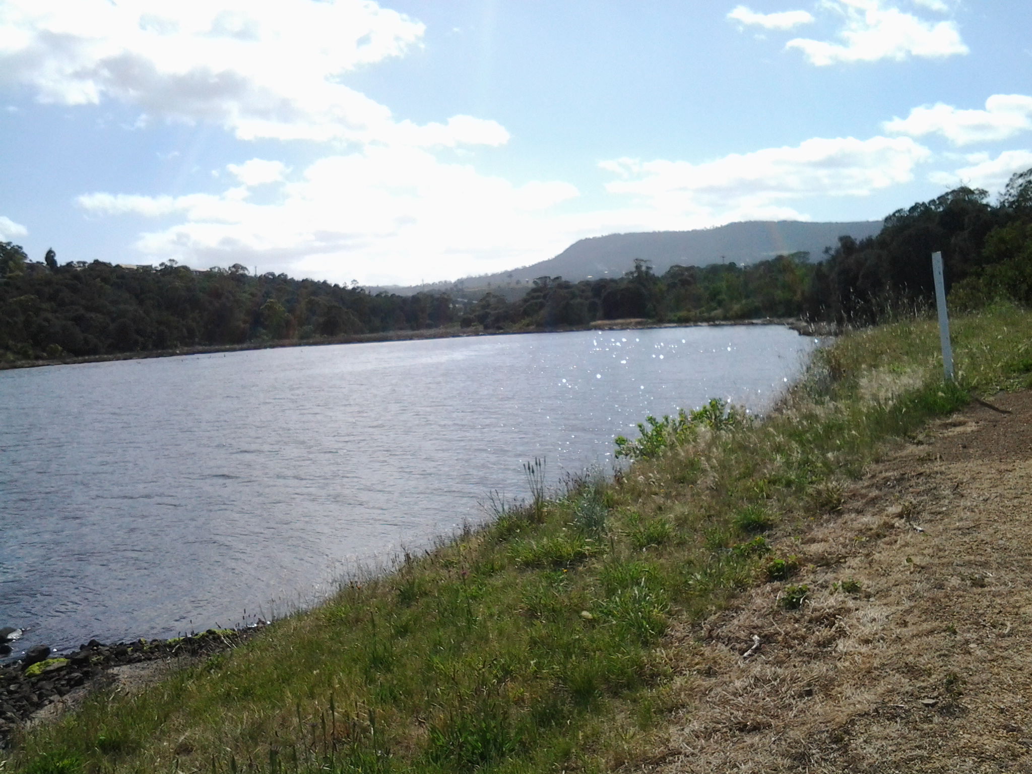
The photo above shows the eastern shore from Tranmere on the right, through the suburbs of Howrah to Bellerive on the left – the River edges which I walked during Stages 4 and 5.

Across the parkland at the Mount Nelson Signal Station, native Wrens flitted around feeling safe as they hunted for insect meals on the ground.

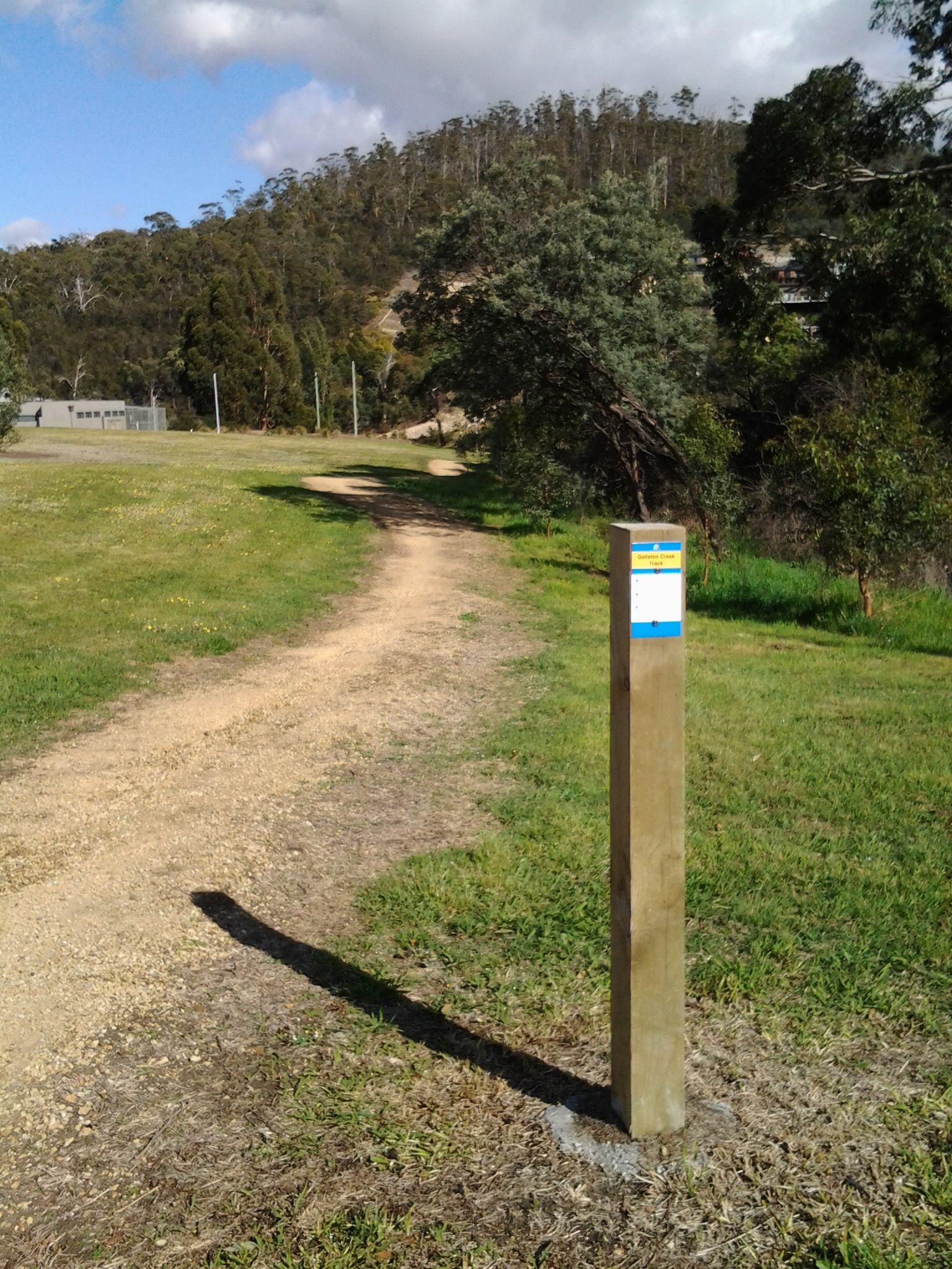
I enjoyed looking at information panels on the site and learning more about how the place operated.  In addition, one panel showed the location of walking tracks.

2015-03-09 14.53.12

So … what is the history? Not long after Hobart was settled in the early 1800s, locals needed speedy and efficient communication between the convict settlement at Port Arthur and Hobart.  In addition, Hobart residents wanted foreknowledge of sailing ships approaching from the ocean through Storm Bay and on their way to the Derwent River in case any provided a threat to trade or security. To gather this information, in 1811 the Mount Nelson Signal Station was established and designed to use semaphore.  The method of communication was flags waving across the hills.  Details about the semaphore flag signalling system can be read at http://www.anbg.gov.au/flags/semaphore.html.  The site http://en.wikipedia.org/wiki/Semaphore_line provides further information. At the Mount Nelson Signal Station, flags were run up a pole – this seems a very cumbersome process compared to a person waving flags. I hope that someday the signal station will offer a demonstration to the public so I can understand the process.  Give me a re-enactment please.

This semaphore communication service continued in use until a more reliable system was available (what happened at the Signal Station on windy days, in wet weather and when clouds obscured the view?).   It was not until 1880 that a telephone line connected Hobart and Mount Nelson.

Walking around the area is free of charge.  Some pathways are provided. The site has various public amenities including picnic tables, public toilets, carpark, barbecues and a restaurant.

2015-03-09 14.50.39

For further information about eating in the heritage building pictured above, go to http://www.signalstation.com.au.  I recommend that you phone in advance if you are depending on eating there. Yesterday, despite permanent signs indicating the Brasserie was open, another sign on the building indicated it was closed.

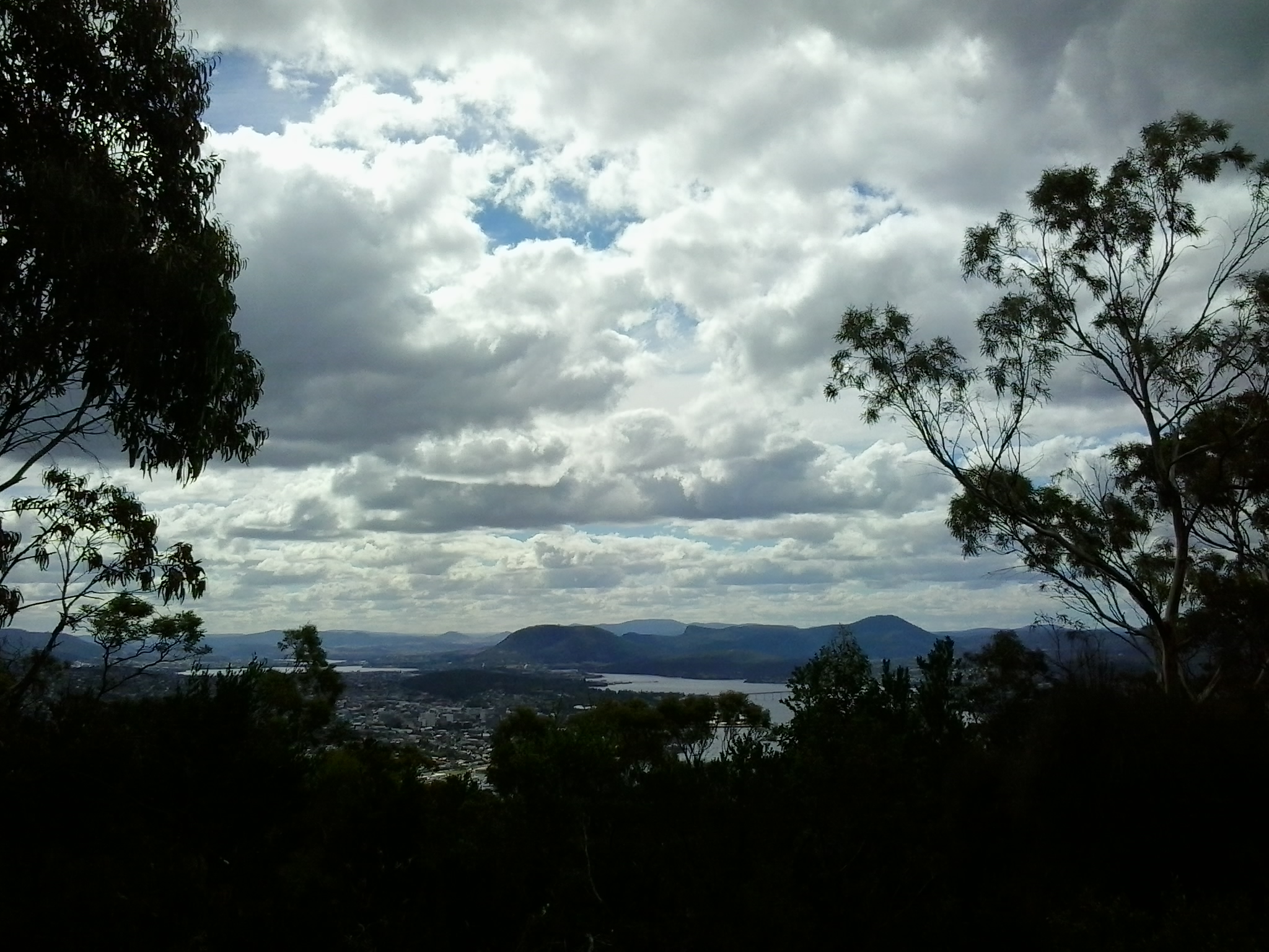
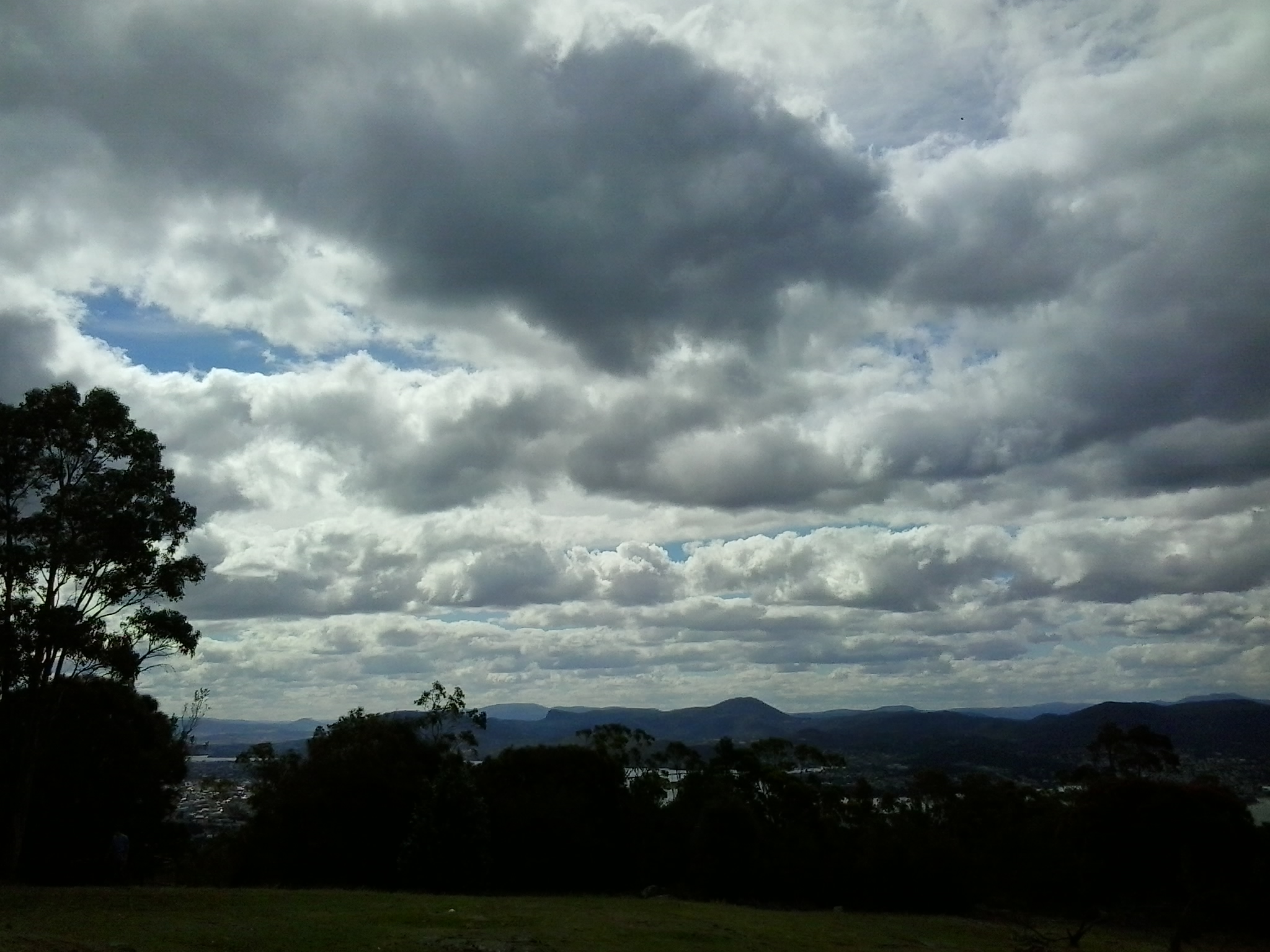
During my visit, clouds loomed powerfully over the city and river. The day light was so bright and strong that when I turned northwards and photographed the land and riverscapes, the sky glowed white.  So I clicked a few images pointed at the sky and this silhouetted the landscape.  Using my simple mobile phone as camera, I was never able to control the light of the images.

2015-03-09 14.55.09 2015-03-09 14.55.16 2015-03-09 14.51.33 2015-03-09 14.51.23

Although these looked like rain clouds, it did not rain.  These large puffs were just passing through.

Finally I reached the mouth of the Derwent River on the western shore at Pearsons Point

The goal of walking along the western shore of the Derwent River was to reach the mouth and during Stage 13 I reached this destination marked by Pearsons Point.

Before then at 10.44am I walked past a turn off: Mt Louis Road. There was a lump up in the sky on my right.  Maybe another time it might be pleasant to see what is up there and to look at the view – which is probably a spectacular 360 degree outlook along the Derwent River, the D’entrecasteaux Channel and Bruny Island.

As I panted up the final hill, I heard the thwack of balls and realised the fencing I could see in the distance amounted to a tennis court.  A tennis court!  Ye gods! Out here in the bush and miles from anywhere?  Yes it was.  Two women were slamming the balls up and down the court.  Their two cars were the only vehicles in sight.

10.52am: I reached the Pearsons Point Reserve and was feeling rather chuffed.

20150224_105032

I wandered around the site which included a disused gun emplacement and a couple of large historic cannons.  Guess Pearsons Point would have been the first line of defence against any Russian threat (which seemed to be the main thought through the 19th century).

20150224_105306 20150224_105429

Note: the bump behind the gun emplacement and tennis court is Mt Louis. A large white edifice on the end of the Point (on the other side of the cannon) appeared to be a marine navigation beacon.

In front of me to the right hand side of the Point, the D’entrecasteaux Channel separated the mainland of Tasmania from Bruny Island (famous for its fresh produce such as cheeses, smoked fish and meats, berries, premium wines, and local oysters).

20150224_105437 20150224_105647

I was very surprised how close Bruny Island (Dennes Point) was to this part of Tasmania’s mainland.  So close.  So accessible.  And its green hills and the white sandy Jetty Beach were most attractive.

On the other side of Pearsons Point to my left, the Derwent River flowed out to Storm Bay and then onto the ocean. I could see the Iron Pot and Cape Direction at the southern tip of the South Arm peninsula on the eastern shore of the River.

I found a pleasant picnic table and at 11am ate half my lunch under a small cluster of gum trees hoping no branches would be shed on my head.  Feeling on top of the world. The sun was out and the tiniest of breezes moved through the area.  Past the trees I could see motoring boats leaving white streams behind them as they sliced through the River. I looked back northwards to the Alum Cliffs between Taroona and Kingston.

20150224_112527

With a little sadness I left Pearsons Point at 11.25am.

By 12.40pm I was passing the Hidden Cove turnoff, at 1.05pm I reached the Fossil Cove Drive junction, at 1.25pm I walked across the intersection with Treatment Plant Road, and at 1.30 I stopped for a moment at Suncoast Drive.  I looked at the one bus stop (there wasn’t a pair one either side of the road) and it did not have a timetable attached to the post, so I continued walking to Wells Parade.  I had been told this was a long road, and now I know it is.

20150224_133752

I stopped and waited for a bus which didn’t come (the first in my entire travels) and left and walked up and down and up and downhill until eventually I was back parallel to the Blackmans Bay Beach.  I sat for a while at the beach soaking in the atmosphere, smelling the salt, and relishing the fact my feet were having a rest.  When the time came (according to my bus timetable), I walked to the bus stop where I had alighted hours earlier in the morning, and before long Metro bus number 85 arrived.  After passing via the Suncoast Drive bus stop that I had looked at earlier in the afternoon on arrival back in Blackmans Bay, Maranoa Heights, other suburbs, and Kingston, I was back in Hobart city by 4pm feeling elated.  Stage 13 was over.

Before my walk along the Derwent River last Tuesday

As my bus from home into Hobart city passed over the Tasman Bridge before 7am, I looked down onto a dozen or so rowing boats slipping along the Derwent River. The wedges that their passing craft made were the only patterns on the still surface of the River.

The morning was suffused with golden light forewarning the rise of the sun over the hills.  The few wisps of cloud in an otherwise blue sky were coloured silvery pink.  The temperature was a brisk 8 degrees, but I felt clean and alive prompted by such a vital looking day.

Once in the city, I walked to Franklin Square ready to wait for the next bus to Blackmans Bay, my starting point for Stage 13. While waiting, I walked through the park and admired the grand symmetrical fountain splashes around a large bronze sculpture of the eminent 19th century Rear Admiral Sir John Franklin.  Overhead, I watched a squawk of Sulphur-Crested Cockatoos, with their wings lit by the first rays of sunshine, flying as a family.  Street cleaners were clearing rubbish bins and pathway surfaces.  Very few other people were out and about in the centre of the city (people were being active in the suburbs before commuting to work in the city a while later).

The large public chess set had been set out and was ready for play.

20150224_071013

As the sun struck the Treasury buildings at one end of Franklin Square park, clusters of fat seagulls (Silver Gulls) were nipping at early rising insects across the grass lawns.

Metro bus number 84 departed at 7.17am. By 7.33am we had climbed up and travelled along the Southern Outlet and were passing through Kingston. This gave me a clear cut side view of majestic Mount Wellington.  Every rock was hard edge and clear. The air was so clean.

At 7.41am I stepped off the bus at Wells Parade in Blackmans Bay, the location where I had finished Stage 12 of my walk.  The final walk to the mouth of the Derwent River was about to begin.

Geological and Social History of our Alum Cliffs

Patricia Roberts-Thompson (http://taroona.tas.au/assets/document/1354363720-a_walk_along_alum_cliffs.pdf) indicates that the first recorded reference to the Alum Cliffs was in 1847.  She explains that these rocks, Permian mudstone (250 million years old, contain iron pyrites and, as the rock weathers, the pyrite oxidises and produces sulphuric acid which reacts with the limey clay to produce alum. Roberts-Thompson could find no evidence that the alum has been extracted from our cliffs for commercial purposes.

Simon Stephen’s research (http://taroona.tas.au/assets/document/1352547986-geology_reduced.pdf) is in sync with that of Patricia Roberts-Thompson  when he says the mudstone on the Alum Cliffs contains much sulphur so that when struck a strong smell is emitted. “Much of the sulphur manifests itself as a white encrustation on thee sheltered areas of the cliffs. It has a distinct bitter taste…”  (Trust me – I won’t be taking a bite or licking it). Stephen’s article is exceptionally interesting not the least because it pin points a geological fault line which is near Crayfish Point (where I have already walked) and which extends out through the end of Hinsby Beach and then under the water along the Alum Cliffs.  I don’t know if any seismological activity has occurred in my life time there nor whether any is expected. I’d rather nothing happened during my forthcoming Stage 12 walk along the Alum Cliffs.

The Kingborough Council distributes a brochure with the following information: “The route followed by today’s Alum Cliffs Track has long been a coastal path used by local people. In 1988 it was formally developed as part of Australia’s Bicentennial celebrations. In more recent years, Council has upgraded the southern section of the track, which climbs from Tyndall Beach through coastal blue gum forest with tall silver banksias. The track then winds up through silver peppermint bushland, dips into a glorious fern filled gully, before rising again onto headlands for commanding views over Storm Bay and the Derwent Estuary. A new start to the track without steps has now been constructed above Tyndall Beach to make the track accessible to more users. The Alum Cliffs are so named because alum – a compound used in dyeing, tanning and medicinal products – is found in the cliffs.”

It is a shame that all instructions to reach and walk the Alum Cliffs use Kingston Beach in the south as the base to walk north and then return. Websites provide information about multiple entrances along the route at Tyndall Rd, Harpers Rd, Taronga Rd.  Apparently a Metro bus stop is located 100m south of the intersection of Taronga Rd and Channel Highway. I wonder how many people have walked the Alum Cliffs Track from the northern end and, if not, like me would like to read advice about how to tackle the cliffs departing from Hinsby Beach.

20150119_131327

It may be that, on Stage 12, I will start out at the end of the Hinsby Beach and then be forced to retrace my steps, return to the Channel Highway and walk up the winding fairly narrow Highway with no pedestrian walkway until I reach the Brickfields Track. From http://www.greaterhobarttrails.com.au/track/brickfields-track I understand that “the Brickfields Track links between Taronga Rd (adjacent to the Channel Highway) in Bonnet Hill and links to the Alum Cliffs Track. The route of the Brickfields Track takes you through the historic remains of the brick-making area; part of the nearby and short lived 1840’s convict probation station. The track is a mix of narrow bush track and timber boardwalk with some steps along the route.”

Buses in southern Tasmania – tips for their use

In communicating with some people, it has become clear that using the local public bus service makes them nervous. They don’t know how it works and therefore they are cautious about following in my footsteps as I walk in Stages, along the Derwent River.  I have written some tips which might allay fears. You can read these at:

https://walkingthederwent.com/about/buses-in-southern-tasmania-tips-for-their-use

If you have a question concerning my experience with bus travel in southern Tasmania, don’t hesitate to ask.  I sold my car almost 4 years ago, so I have considerable experience getting around using public transport.

Starting stage 8 of my walk along the Derwent River

My starting point was the jetty half way through Old Beach on the eastern shore, and to reach this from my home in Bellerive on the eastern shore of the Derwent River was not straightforward. There are no direct buses from Bellerive to Old Beach.

Instead, I left home at 6.45am (way too early for my liking but no other choice), passed three Black Cockatoos feasting on a native tree in a private home (one acted as a sentry high up while the others gorged themselves), walked to the Eastlands bus mall and caught the first bus through to the bus mall in Elizabeth St in Hobart’s CBD. At 7.17am the X1 express bus to Glenorchy in the northern suburbs of the Greater Hobart Area (and beyond) departed. This arrived at 7.35am at the Glenorchy bus mall and, anticipating public toilets would be non-existent for my walk, I walked over to the Northgate shopping centre to use their facilities. I was back at the bus mall in time to catch Metro bus 126 to Old Beach which departed at 8am. At 8.20am I stepped off the bus ready for the day.

The sky was overcast and I was wearing a thermal top over my T-shirt and topped with a fleece jacket.  Blowy. Hard air hitting my face.

Since there was no direct water access from the jetty northwards, I walked through the suburban streets staying on the hard concrete footpaths. Plovers and Blackbirds were my constant companions and extravagant blooming roses and wattles perfumed the air. It was rubbish removal day and the streets were lined with bulging large faded red wheelie bins and yellow lidded green bins. The wind had lifted many lids and these were thrown back as if saluting when on parade (a vision that friend Jo exclaimed he saw).

At 8.33am I reached the intersection with the East Derwent Highway and lost a footpath. I turned left and walked beside the highway where it was obvious a few other people had walked but there was no formal pathway. At this point I could see the water of the Derwent River but I was not close. It was clear that property owners had fenced and gated off any access to the River and I need to determine whether they had the right to do this in all cases.  I continued on the Highway noticing the signpost to the Bonorong Wildlife Park and Compton Agistment Centre marking the turn off from the highway away from the River.

Not much further along I saw a track between new houses on the left and followed it then through the grassy bushland but, as lovely as it was, it was impassable offering no easy way to the River and so I had to retrace my steps. At 8.54am I was back on the Highway walking to the left of the guard rails (so that I wasn’t directly on the Highway) on rolling gravel where a path was never intended.  Then the guard rail disappeared so I walked carefully as far off the road on the narrow verge as I could.  Sometimes I walked in the ditch. By 8.58am I was passing Compton Road and at 9.01 I reached Clarrie’s Creek. I began to disrobe as the morning and the exercise began to warm me: off came my thermal top.

The perfume from the flowering wattle trees was invasive and pervasive in the nicest way.  Please feel free to use any of the photos below as a screen saver. I have.

20141111_103700 20141111_103704 20141111_103708 20141111_103711 20141111_103716

Continuing along the Highway, I walked up an incline until I could turn left on a bitumen roadway. This was blocked by a gate, but there was walking space around this, used by others. I had reached the newest part of Old Beach on its own rounded headland. Once past the gate I turned left towards the Verve Village site office signs and walked on. Through the mesh fence to my right I could see the Verve café, not open. The time was 9.10am.

Not long afterwards I was snapping photos of the low mountains and hills across the Derwent River on the western shore. Grandly beautiful in a simple way.

20141111_091212  20141111_091128

This ‘roadway’ eventually ended at a locked gate but again a regularly padded informal path was clearly visible around the obstacle.  I turned left and 100 metres along, a yellow gravel path appeared. The path had no sign but I hoped it was a foreshore trail and followed it. It was.  A trail with almost no signs of animal life except a massive black furry feral cat bounding away and a sole man out for exercise.  Crows carrhh carrhh carrhhed in the distance and overhead. Casuarina trees edged the path and through them the woodland was open and airy. Water lapped onto the shore. Mudstone rocks edged out of the soil on the banks. I enjoyed a flash of colour when I noticed yellow and orange flowering nasturtiums that had escaped from a suburban garden into the bush.

The photos below show a view southwards to the River from the first 100 metres of the path.

20141111_091838 20141111_091955  20141111_092155

The foreshore trail was easy to follow, wide and clear.

20141111_092752

At 9.36am I reached the point where the Derwent River and Gage Cove met.

20141111_093443

The trail curved into the Cove but not before a man-made construction, to the right of the path, seemed to flush deep below and then a dreadful stink followed. I tried not to think what was going on there.

20141111_093606

By 9.42am I was walking up into the suburb having enjoyed watching black swans floating around in the Cove, and a few minutes later I reached a gate which, as usual, I walked around.  I turned left and followed the road from the cul de sac amidst the noise of every neighbourhood dog barking to indicate a stranger was nearby.  Me.

At 9.45am I turned left at the T junction and by 9.48am I reached the intersection of Stanfield Drive with the East Derwent Highway.  Continuing on I could look down in Gage Cove with its coating of red algae or some other red plant.

20141111_100127

So far my morning had gone well and I was enjoying myself. Also, I was pleased that I had finished passing through all parts of the suburb of Old Beach and was ready for the next suburb.

Bus routes and public bus services are a great help to me as I walk along the Derwent River

Today’s TasWeekend insert magazine in The Saturday Mercury newspaper included a piece by Bushwalking enthusiast John Cannon. From the content of his article, it suggests to me that he may have been reading my walking the Derwent River blog, particularly when he talked about the possibilities for accessing walks amongst Hobart suburbs by using Metro bus services. I am sorry the address for my blog was not included in the article as an incidental extra to encourage more locals  to follow in my footsteps. I wonder whether one day I will find John Cannon getting off the bus when I do at one of the walking stage starting points.

Metro bus timetables are located on http://www.metrotas.com.au/. The bus below is travelling in the centre of Hobart (image is from www.totallysouth.com.au)

metro-bus-service

From Geilston Bay to Risdon on Stage 6 of my walk along the Derwent River yesterday

Yesterday’s walk was a sensationally wonderful experience. Over a few posts I will colour in the rich fabric of the day, much of it in clean fresh smelling bushland (such as that at Tommy’s Bight in the photo below).

20141015_133405

To start with, I caught Metro bus 694 destined for Risdon Vale and Glenorchy (scheduled from the Hobart city bus mall at 9.03) on the eastern shore and travelled to bus stop 14 on the East Derwent Highway at Geilston Bay. Thankfully the Clarence City Council has erected a sign marking the start of the walk.

20141015_093747

From the bus stop, I walked along the edge of Geilston Bay then northwards around Bedlam Walls Point to Shag Bay and onwards to the top of the Bedlam Walls, where I was rewarded with panoramas across the Derwent River. My northwards walk continued into and across the East Risdon State Reserve before descending into the suburb of Risdon. I turned south and walked on the edge of the Derwent River to Porters Bay where I took my lunch break before continuing south to Tommy’s Bight.

Eventually I retraced my steps back to Risdon and continued along the water’s edge to the junction of Saunderson’s Road with the East Derwent Highway. The return bus stop for a 694 bus, which arrived at 2.35pm (with not another one due for two hours), was on the Highway across from Risdon and adjacent to the land and water marking the Risdon Cove area.

I was away from home for approximately 6 and ¼ hours, and walked a total of around 12 kms winding over many tracks and retracing parts of my walk.

Previously I had walked 23 kms of the length of the Derwent River.  Yesterday I added 3 kms which brings the new tally to 26 kms.

Walking the Derwent from Rosny Point to Geilston Bay – Stage 5 October 10th

A maximum temperature of 20 degrees but with a 70% chance of rain was Friday’s weather forecast.  However, I was so desperate to get out and walk another stage that I decided to brave whatever today would throw at me. I am delighted to record that only sunshine between partly clouded skies and the occasional warm breeze greeted me for the 4 and ¼ hours I was away from home.

First up, I was the only passenger to catch the 9.15am Metro bus number 675 to Rosny Point from the Eastlands Shopping Centre at Rosny (Note: this bus started at Eastlands and not from Hobart. Refer to my next posting to understand the range of bussing options for today’s walk).  Soon after passing Rosny College, the tennis courts and Bowling Club on the left in Bastick Street, I got off at bus stop number 21. I walked down Seabird Lane; this road angled down off Bastick Street between bus stops 20 and 21 and went along closer to the water of Kangaroo Bay. Seabird Lane leads into a continuing Clarence Foreshore Trail that passes along close to the River through the five suburbs: Rosny, Montagu Bay, Rose Bay, Lindisfarne and Geilston Bay. Later postings will detail how the quality of this path changes from one where a person in a wheelchair could comfortably navigate the Trail to other sections where a mountain bike would be more useful. I will also provide information about the challenges of lack of directions on and off the Trail from time to time.

Walking Time

The walking time between the point of Rosny Point and the point where the Derwent River meets the entrance to Geilston Bay is approximately 2 hours and 20 minutes. However, if you decide to take this walk, then in order to get to the starting point by bus from Eastlands and leave the Geilston Bay area by bus, the total walking time will be around 3 and ½ hours.

Walking distance

Today I walked approximately 12 kilometres, but this distance covered only 3.5 kms of the River length. Previously I had covered 19.5 kms of the length. Now I have achieved a total of 23 kms of the Derwent River.

Favourite photo

The photo below is my favourite from today’s walk. I clicked it while sitting eating my lunch on the wharf at Geilston Bay. The water reflections on the bow of the yachts on the left were sparkling, and the blue mountain provided a rich and colourful contrast in the background. Experiencing Geilston Bay for the first time was a treat. The starting point for Stage 6 of my walk along the Derwent River will begin here, so I look forward to seeing the place in the early morning light next time.

20141010_122959