Tag Archives: Metro

Either side of Bowen bridge – posting 1 of 9

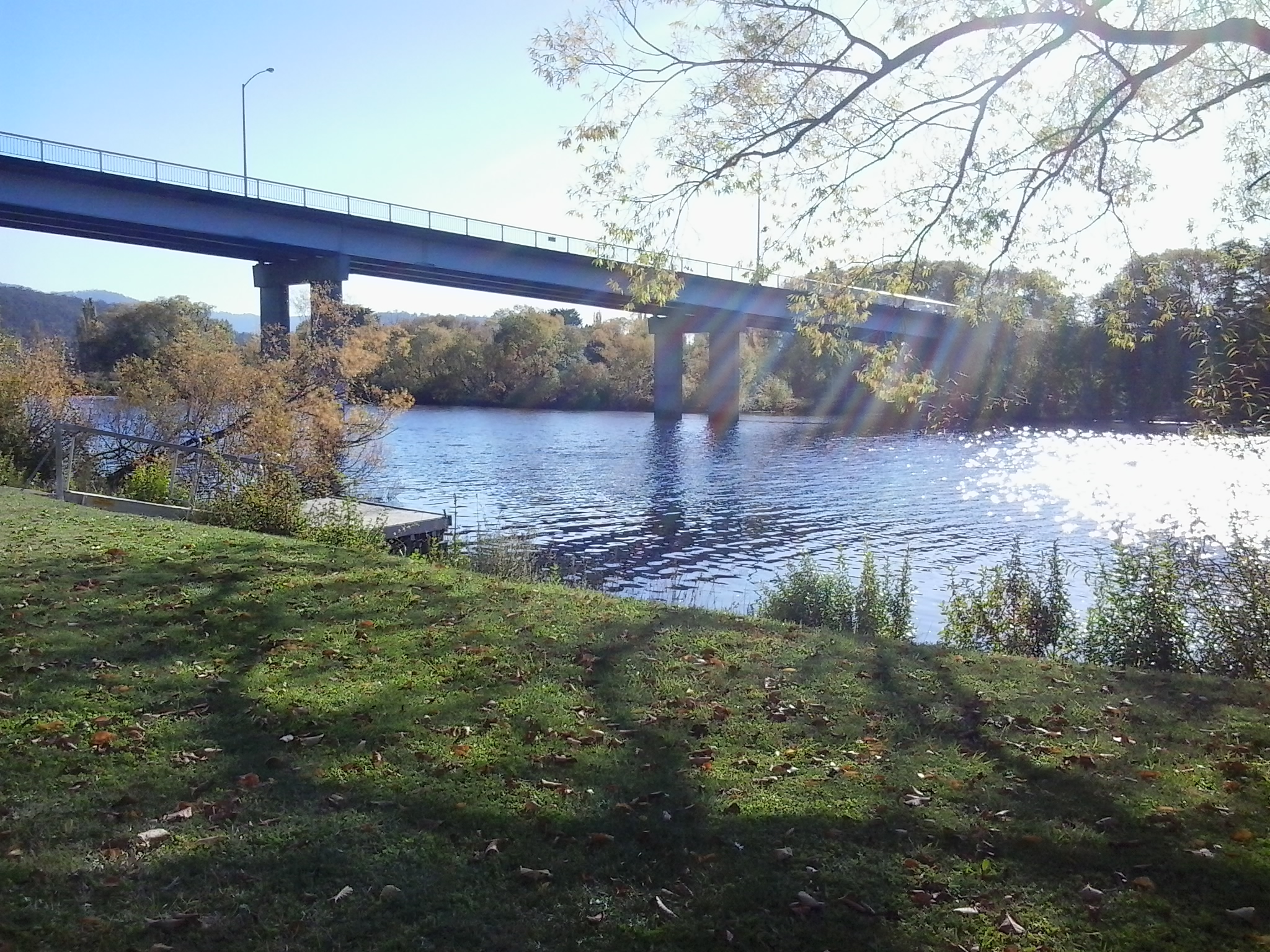
Stage 8 of my walk from the mouth the source of the Derwent River took me under the Bowen Bridge on the eastern shore, and during Stage 10 I walked past the Bridge at Dowsing Point on the western shore after deciding to walk to the mouth on both sides of the river. However, when on the western shore I could not easily see a way to stick by the river edge at Dowsing Point, and since that day promised to be a long one I took the easy option and followed the streets which cut across the Point. I always felt that I hadn’t been quite honest in taking this approach and that I needed to return and be serious about walking the Derwent edge to the extent it was possible.

So return I did, and this series of postings records that visit.

As usual within the Greater Hobart Area, I took a Metro bus which dropped me off one morning within the Technopark precinct at Dowsing Point on the Hobart side of the Bowen Bridge. Technopark is a state government initiative started over 15 years ago with the aim of providing support and encouragement for small businesses and creative individuals with technological related ideas that could be developed into significant money earners for Tasmania’s productive growth. It’s brief has expanded since its inception.

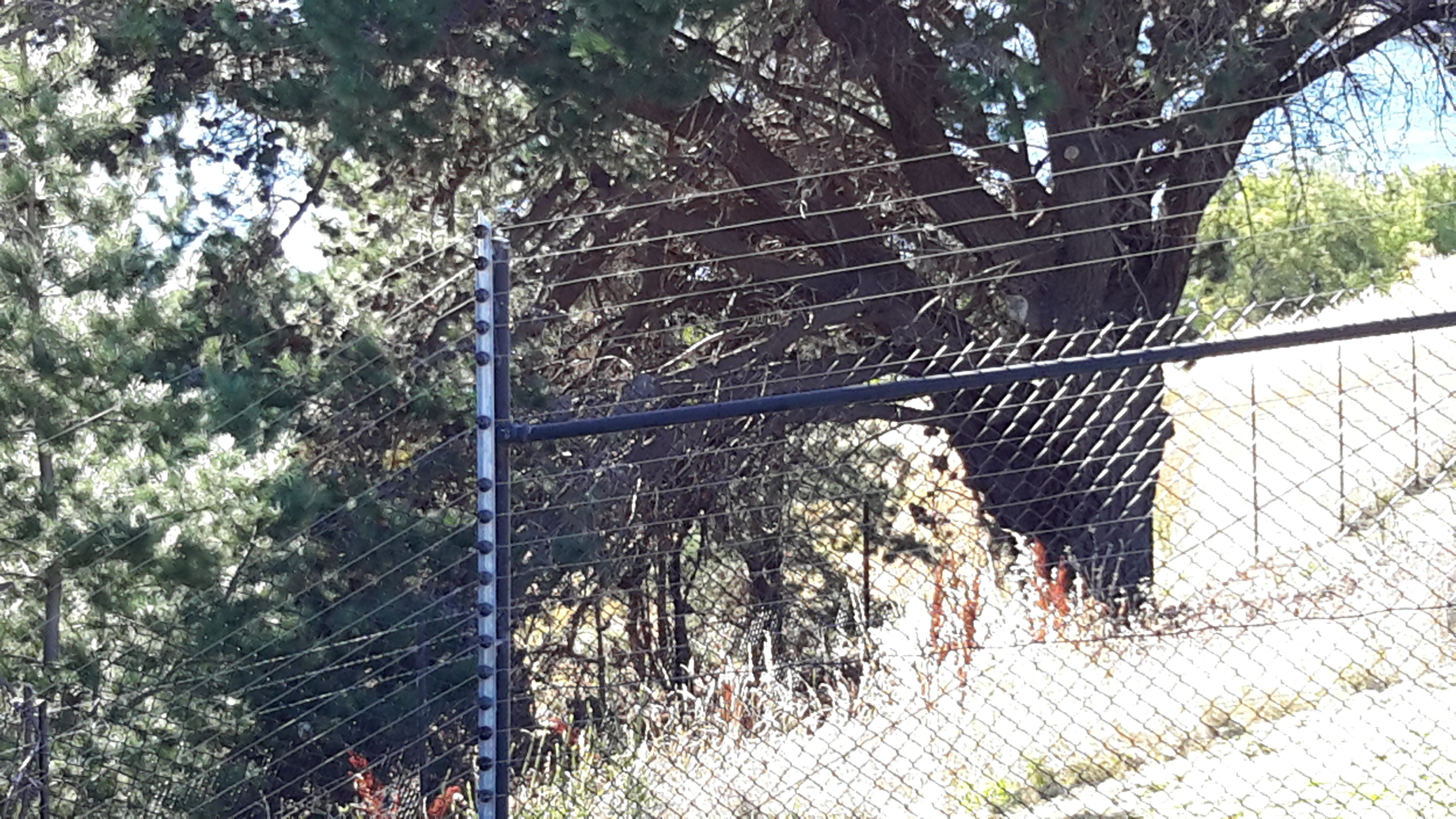
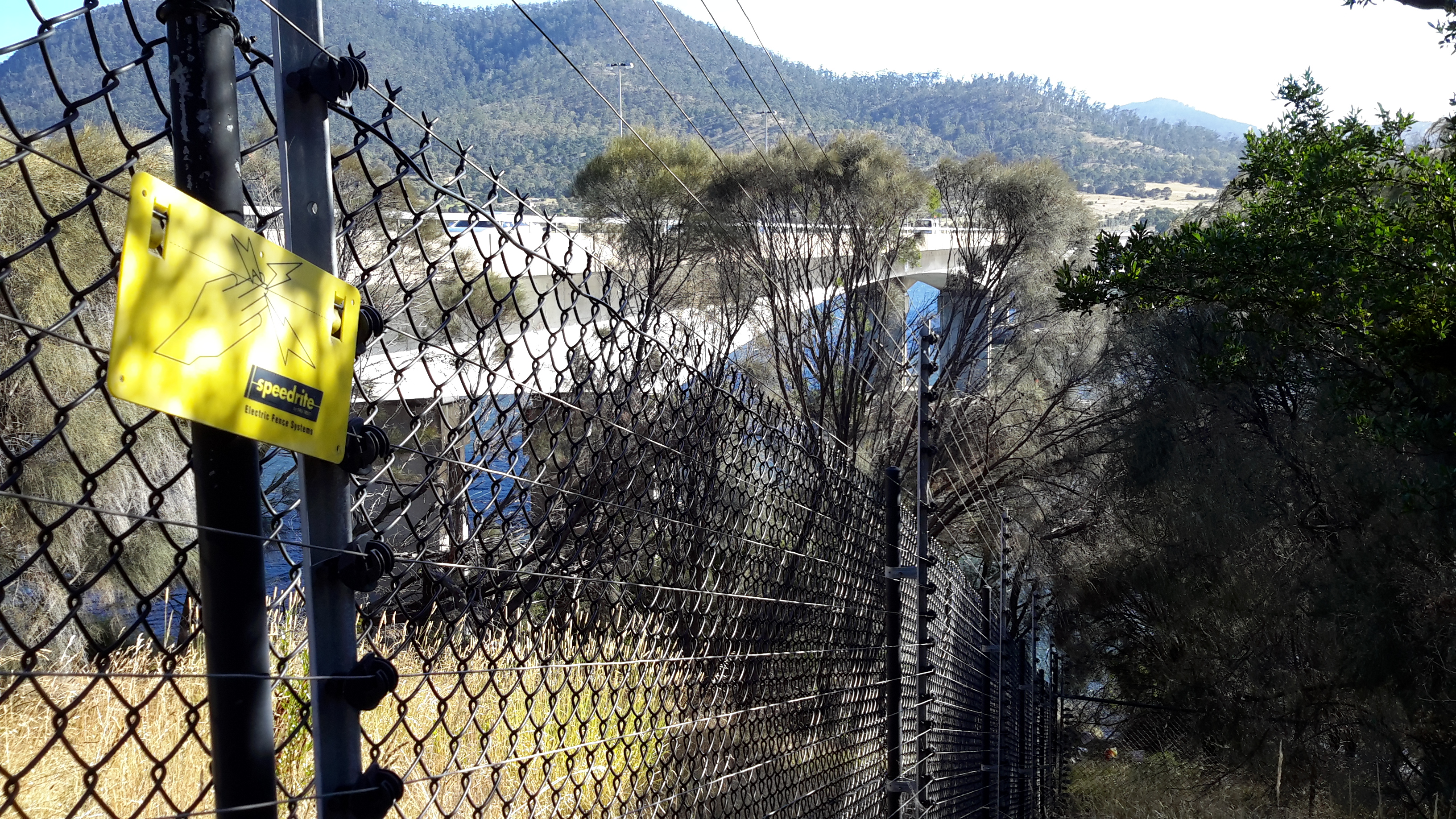
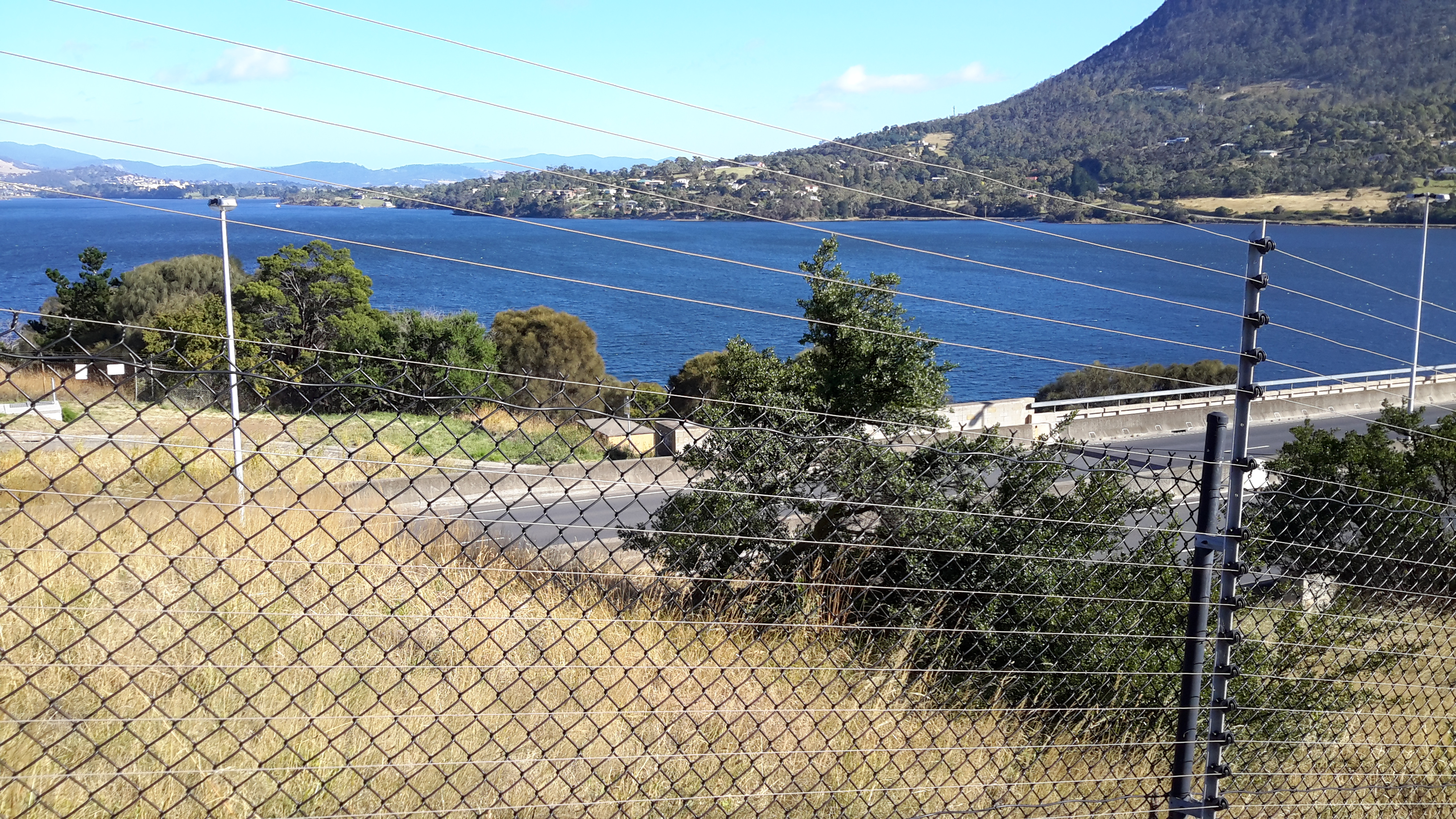
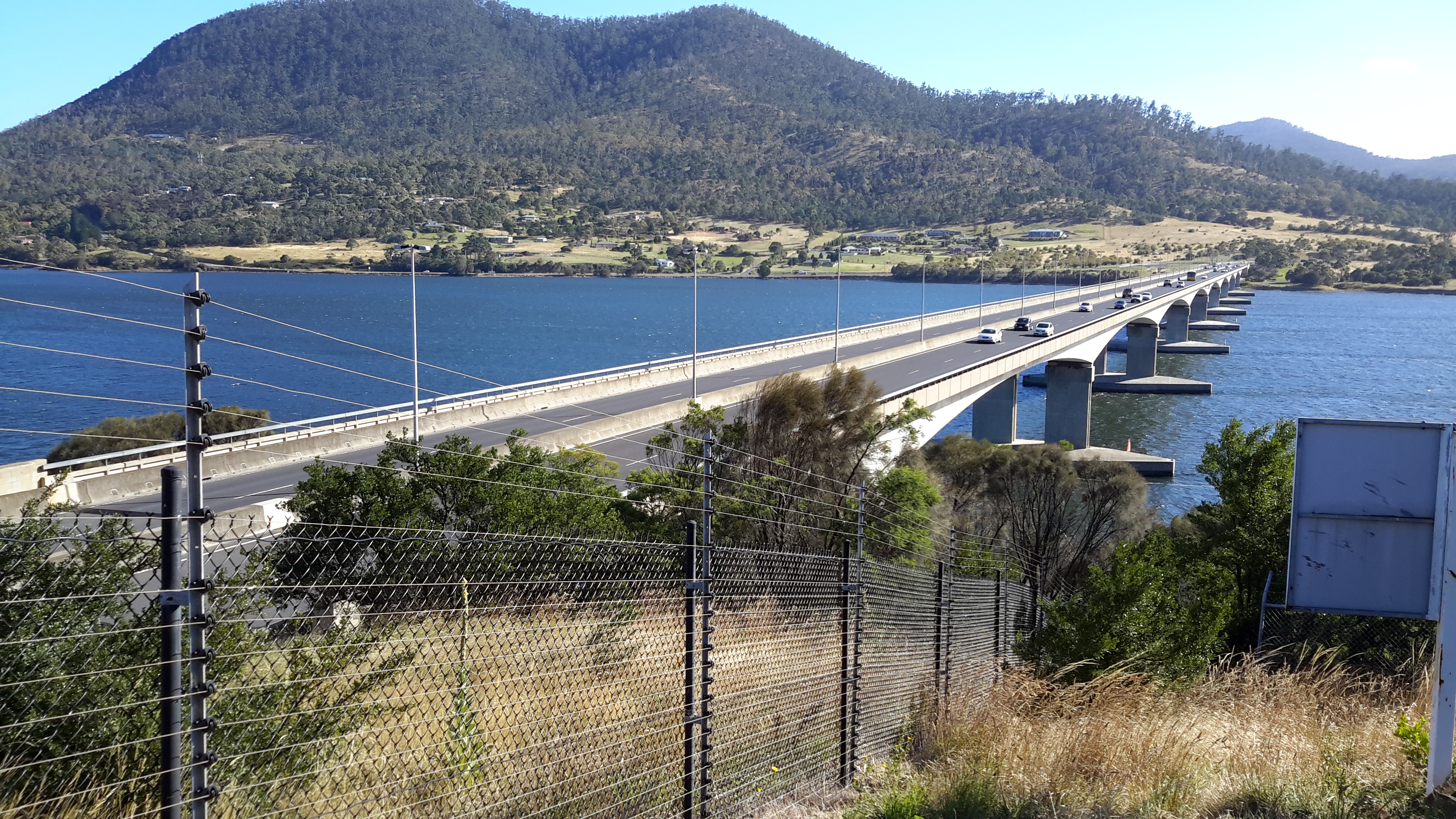
By leaving the bus at the turning circle within Technopark I hoped there might be ways to walk to the river edge and then continue around Dowsing Point.  Until I looked around that day, I had not realised this precinct is seriously fenced, including the installation of electric fencing, and there is no exit except through the main fortified entrance gates.  In the photo below you can see three layers of fencing, with barbed wire strung up at the top of the closer two fence lines- and the Bowen Bridge across the Derwent River in the distance.

20170125_084025.jpg

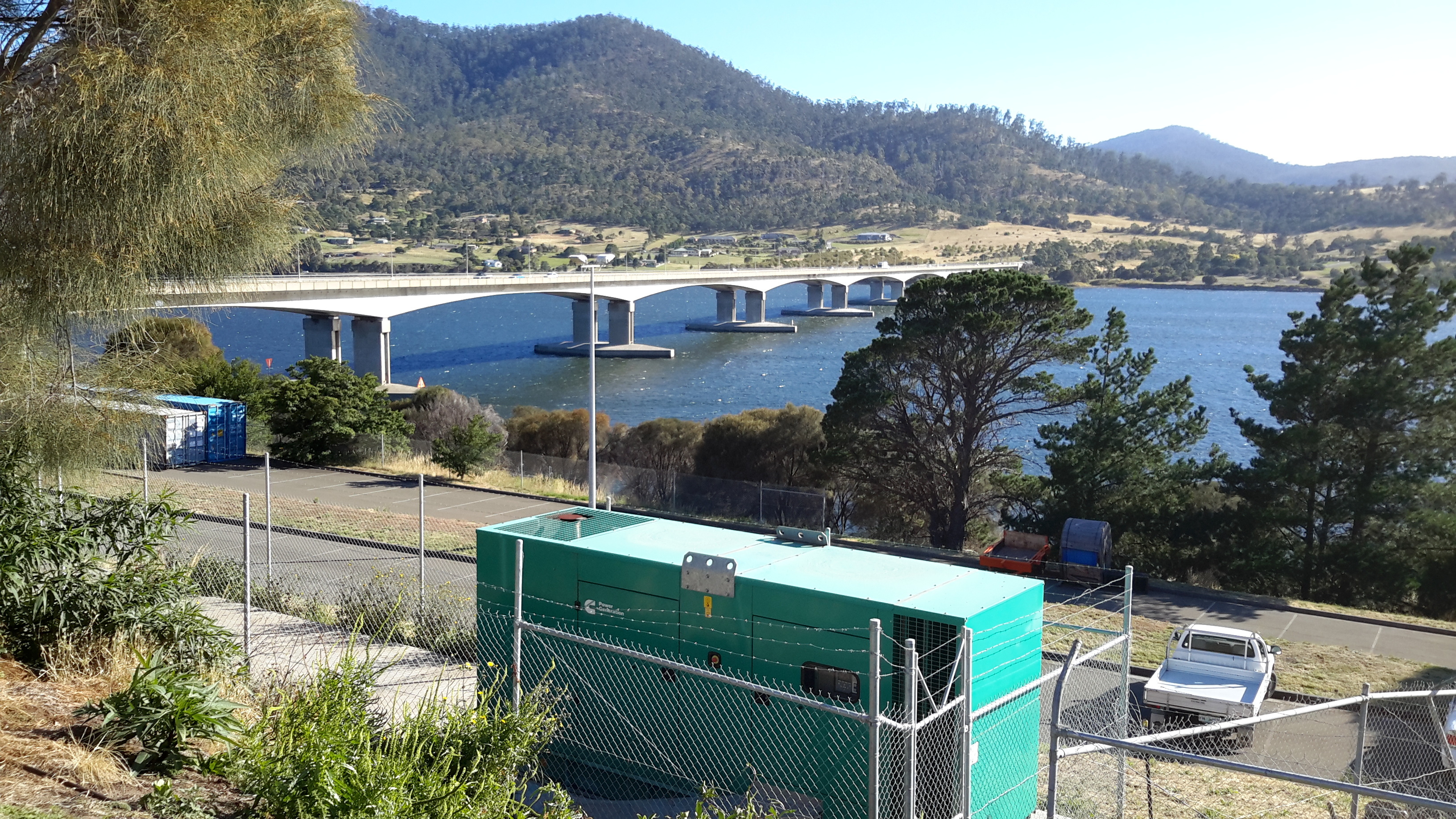
I walked to corners and along the fence lines without finding a gap, a gate or any chance of passing through.  I could see the Derwent River and the Bowen Bridge with Mt Direction overlooking both – but I could not reach them from the Technopark site.

20170125_084247.jpg

20170125_084753.jpg

20170125_085012.jpg

20170125_085019.jpg

So I had no choice except to leave the Technopark and try other options to reach the River.  The day displayed a stunning blue sky overhead and a moderate breeze which rattled the long grasses.  Mount Wellington was ever present as I walked away from the river.

20170125_085256.jpg

Before long I passed through the gates and headed away from Technopark with the aim to walk to the Bowen Bridge.

20170125_085847.jpg


The last leg to the New Norfolk Bridge on Stage 14

A couple of minutes after passing below the Bush Inn, I enjoyed walking underneath the grandeur of an elderly spreading oak tree.  And then moments later, ahead of me I could see small portion of a massive horizontal girder belonging to the New Norfolk bridge over the Derwent River.

20150413_145236

Information panels provided details about earlier bridges across the Derwent, and historic buildings located nearby.

20150413_145250 20150413_145254

20150413_145302

20150413_145328 20150413_145335

The grand and stately houses pictured above, are located near the bridge.

But back to my path to the bridge. In front of me was a gated fence with a sign informing me the gate was locked overnight.  I pushed it open and walked across an impeccably kept mowed lawn. A private sanctuary. Green and lush. The sparkle on the river to my right.  A strongly built bridge ahead.  I reached my destination for Stage 14 at 2.58 pm.

20150413_145518 2015-04-13 15.11.01

2015-04-13 15.11.08 20150413_145514

Instead of charging off up and into the New Norfolk township, and finding a bus to return me to Hobart, I lay down on that green carpet and, soaking in the sun, I felt incredibly fortunate.

My stage 14 day had started with a  5.30 am rise (in the dark) and a Metro bus departure from central Hobart at 7.17 am. The bus left New Norfolk at 4.20 pm and returned me to Hobart. I walked in my front door at 6 pm (as the sun set) feeling quite chuffed because I had seen and experienced many beautiful natural features, the sun had lit up the landscape and the river, and I had talked with interesting people. A wonderful day!

Finally I reached the mouth of the Derwent River on the western shore at Pearsons Point

The goal of walking along the western shore of the Derwent River was to reach the mouth and during Stage 13 I reached this destination marked by Pearsons Point.

Before then at 10.44am I walked past a turn off: Mt Louis Road. There was a lump up in the sky on my right.  Maybe another time it might be pleasant to see what is up there and to look at the view – which is probably a spectacular 360 degree outlook along the Derwent River, the D’entrecasteaux Channel and Bruny Island.

As I panted up the final hill, I heard the thwack of balls and realised the fencing I could see in the distance amounted to a tennis court.  A tennis court!  Ye gods! Out here in the bush and miles from anywhere?  Yes it was.  Two women were slamming the balls up and down the court.  Their two cars were the only vehicles in sight.

10.52am: I reached the Pearsons Point Reserve and was feeling rather chuffed.

20150224_105032

I wandered around the site which included a disused gun emplacement and a couple of large historic cannons.  Guess Pearsons Point would have been the first line of defence against any Russian threat (which seemed to be the main thought through the 19th century).

20150224_105306 20150224_105429

Note: the bump behind the gun emplacement and tennis court is Mt Louis. A large white edifice on the end of the Point (on the other side of the cannon) appeared to be a marine navigation beacon.

In front of me to the right hand side of the Point, the D’entrecasteaux Channel separated the mainland of Tasmania from Bruny Island (famous for its fresh produce such as cheeses, smoked fish and meats, berries, premium wines, and local oysters).

20150224_105437 20150224_105647

I was very surprised how close Bruny Island (Dennes Point) was to this part of Tasmania’s mainland.  So close.  So accessible.  And its green hills and the white sandy Jetty Beach were most attractive.

On the other side of Pearsons Point to my left, the Derwent River flowed out to Storm Bay and then onto the ocean. I could see the Iron Pot and Cape Direction at the southern tip of the South Arm peninsula on the eastern shore of the River.

I found a pleasant picnic table and at 11am ate half my lunch under a small cluster of gum trees hoping no branches would be shed on my head.  Feeling on top of the world. The sun was out and the tiniest of breezes moved through the area.  Past the trees I could see motoring boats leaving white streams behind them as they sliced through the River. I looked back northwards to the Alum Cliffs between Taroona and Kingston.

20150224_112527

With a little sadness I left Pearsons Point at 11.25am.

By 12.40pm I was passing the Hidden Cove turnoff, at 1.05pm I reached the Fossil Cove Drive junction, at 1.25pm I walked across the intersection with Treatment Plant Road, and at 1.30 I stopped for a moment at Suncoast Drive.  I looked at the one bus stop (there wasn’t a pair one either side of the road) and it did not have a timetable attached to the post, so I continued walking to Wells Parade.  I had been told this was a long road, and now I know it is.

20150224_133752

I stopped and waited for a bus which didn’t come (the first in my entire travels) and left and walked up and down and up and downhill until eventually I was back parallel to the Blackmans Bay Beach.  I sat for a while at the beach soaking in the atmosphere, smelling the salt, and relishing the fact my feet were having a rest.  When the time came (according to my bus timetable), I walked to the bus stop where I had alighted hours earlier in the morning, and before long Metro bus number 85 arrived.  After passing via the Suncoast Drive bus stop that I had looked at earlier in the afternoon on arrival back in Blackmans Bay, Maranoa Heights, other suburbs, and Kingston, I was back in Hobart city by 4pm feeling elated.  Stage 13 was over.

Yearning to walk the next stage

For the past almost two weeks I have yearned to be out walking and discovering another length of the Derwent River. Unfortunately, when snow storms powdered the mountain (Mt Wellington) last week it was simply too cold and then some of the days when I was free to walk were overcast. I find that I continue to make my own rules about what should happen as and when I walk the Derwent River. The latest ‘rule’ is that I will not walk unless the sun is shining.  The reason is that I only want to take photographs to show you the land and the river in full sparkle. I only want to see it that way myself as I walk.

Again yesterday snow storms on the mountain brought the temperature low and the forecast is for rain to continue off and on until this Saturday, when not only will the day be dry but the sun will shine.   Come on Saturday!

Another thing I must consider is the availability of public transport because, as you know, my walks must be able to be reached and finished in touch with our local public transport system, the Hobart Metro buses. If you have a car to duplicate my walks then you are lucky. Not everyone has access to their own transport.  Weekend bus times are not nearly as frequent as during the weekdays.  For example, the Camelot Park bus that I need for travel on Stage 3 of the walk is around in that suburb every half an hour during the week but only once an hour at the weekends. Research and vigilance is always the key.