Tag Archives: Risdon Cove

From Risdon Cove walking towards Otago Bay along the Derwent River- part of the 7th stage of my walk

For safety’s sake I continued walking along on the Derwent River side rather than on the road side of the guard rail, although there were moments when the edge fell away and so I was forced temporarily back onto the road. This stage certainly would not be one that someone using crutches or a wheel chair could follow. There were no official paths and so I made do with whatever I could in terms of a suitable walking path.

I enjoyed this part of the walk observing more black swans in pairs and families of ducklings out for a paddle.  At the end of the bay of Risdon Cove, I exchanged friendly greetings with a couple of woman who were selling bunches of colourful flowers from the boot of their car on a set back on the other side of the road.

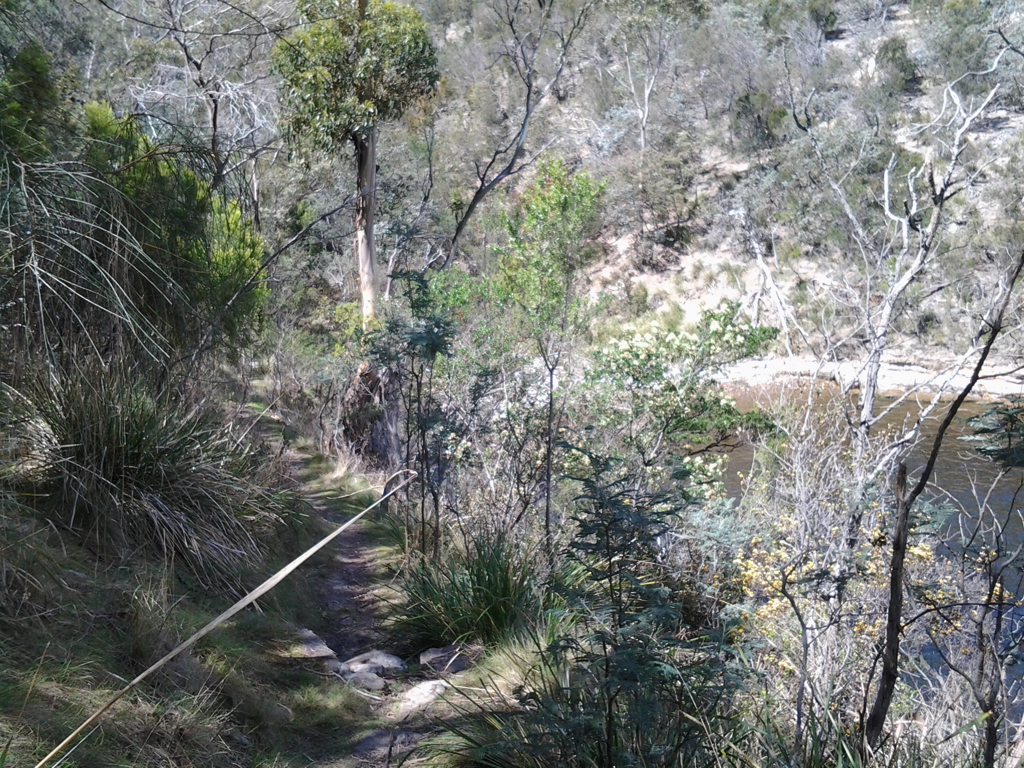
I continued up an incline still on the ‘safe’ side of the railing amidst blown and thrown rubbish, tall weeds, and native grasses.  Whispering casuarina trees separated me from the River. Clearly people have walked here before but it is a rough ‘non-path’.

At 9.54am I reached the turn off signposted to Bridgewater, began the left hand walk downhill, and passed the furry remains of dead possums (unfortunately ex- road-kill).  To my right, on the other side of the road, the 19th century heritage listed Cleburne Homestead and its scatter of old sandstone buildings popped occasionally into view through large trees and bushes.  The Homestead operates as a luxury bed and breakfast art hotel style establishment (http://www.visitcleburne.com.au/).

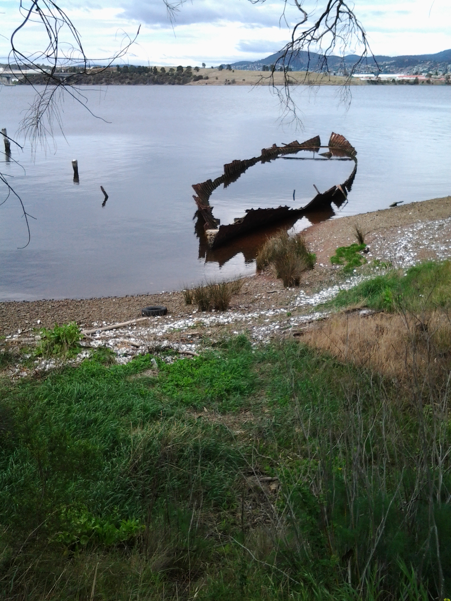
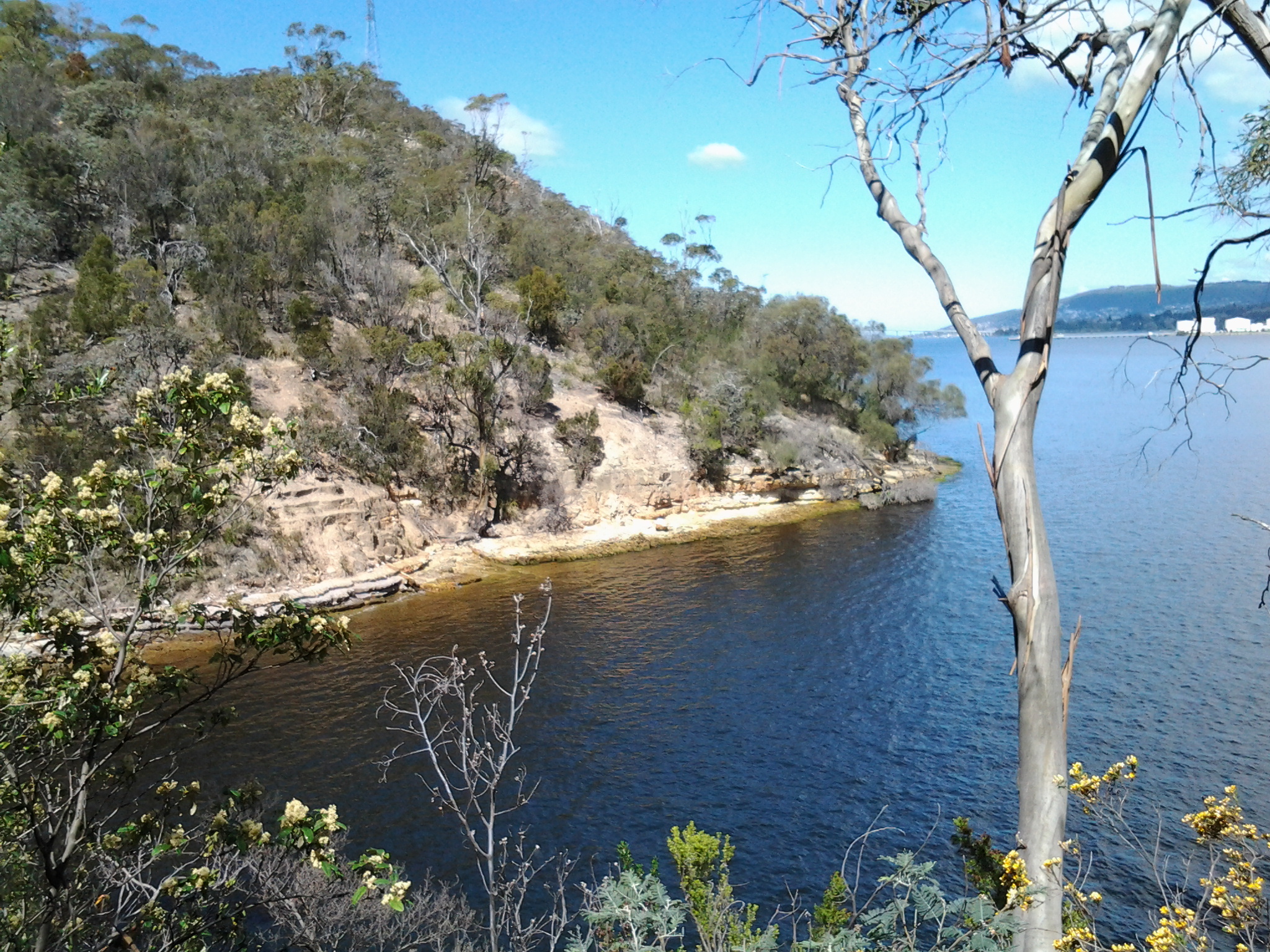
The photo below shows the Cleburne Spit which inserts itself into the Derwent River, with the Bowen Bridge crossing the River in the distance.

20141031_095246

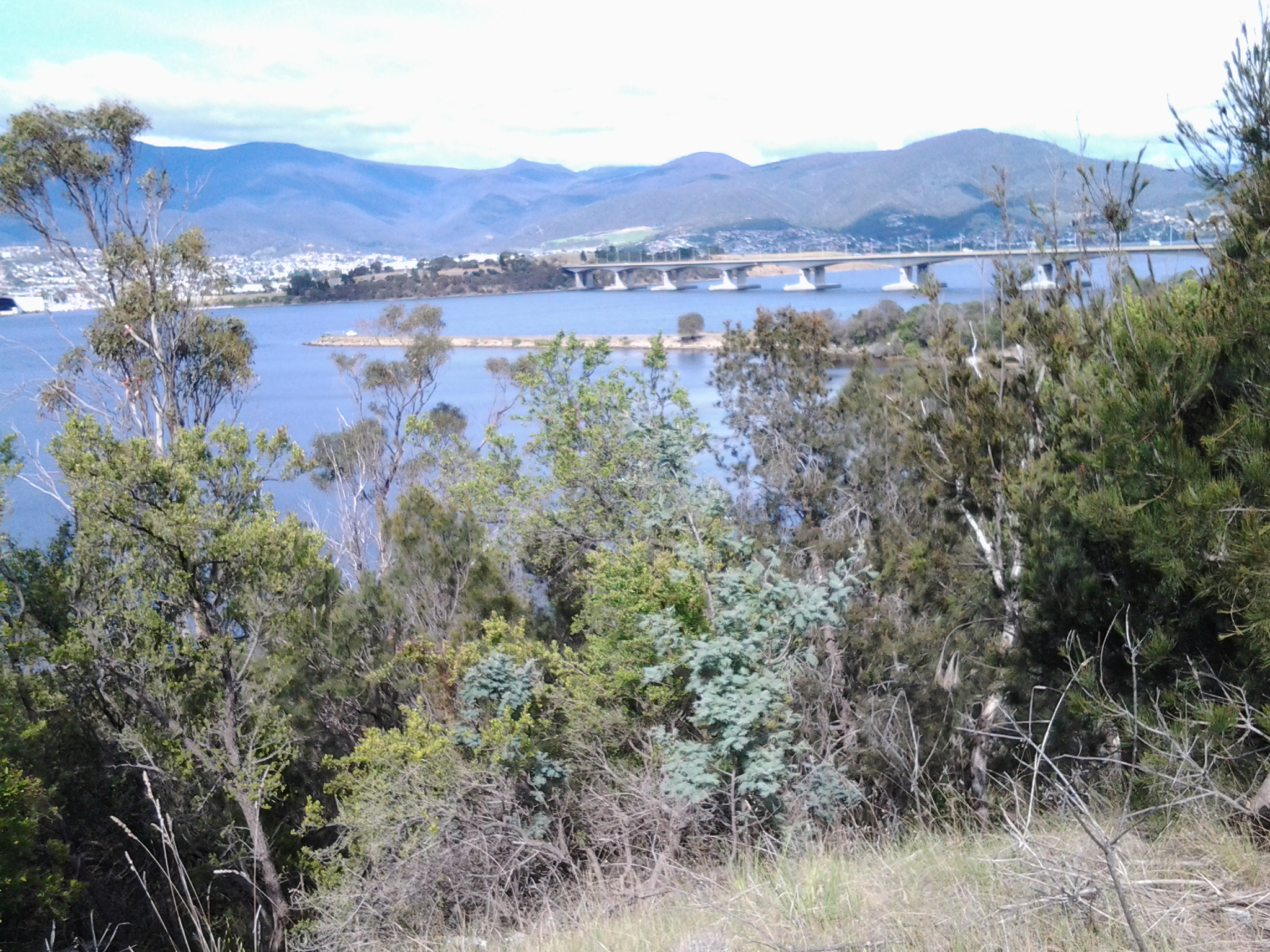
At 10am I arrived at the junction road leading left to the Cleburne Spit. The Spit looked very much like a man made raised wall approximately one or two car widths wide that extends out in a straight line into the Derwent River.  Perhaps it was a series of rocks that once could be walked upon and then someone dropped filling rocks to create a breakwater to fish from or some other activity. I wonder what the real story is. My guess is that the Spit was named after 19th century settler Richard Cleburne.  He was an interesting character who had a property in the area and was suspected of smuggling. Did the Spit figure in such illegal activities I wonder? More information about Richard can be read at http://adb.anu.edu.au/biography/cleburne-richard-1903.

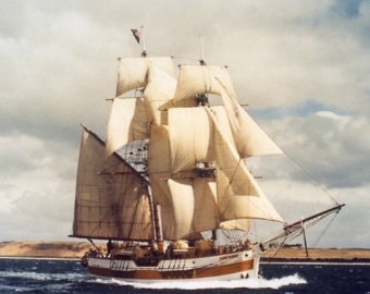
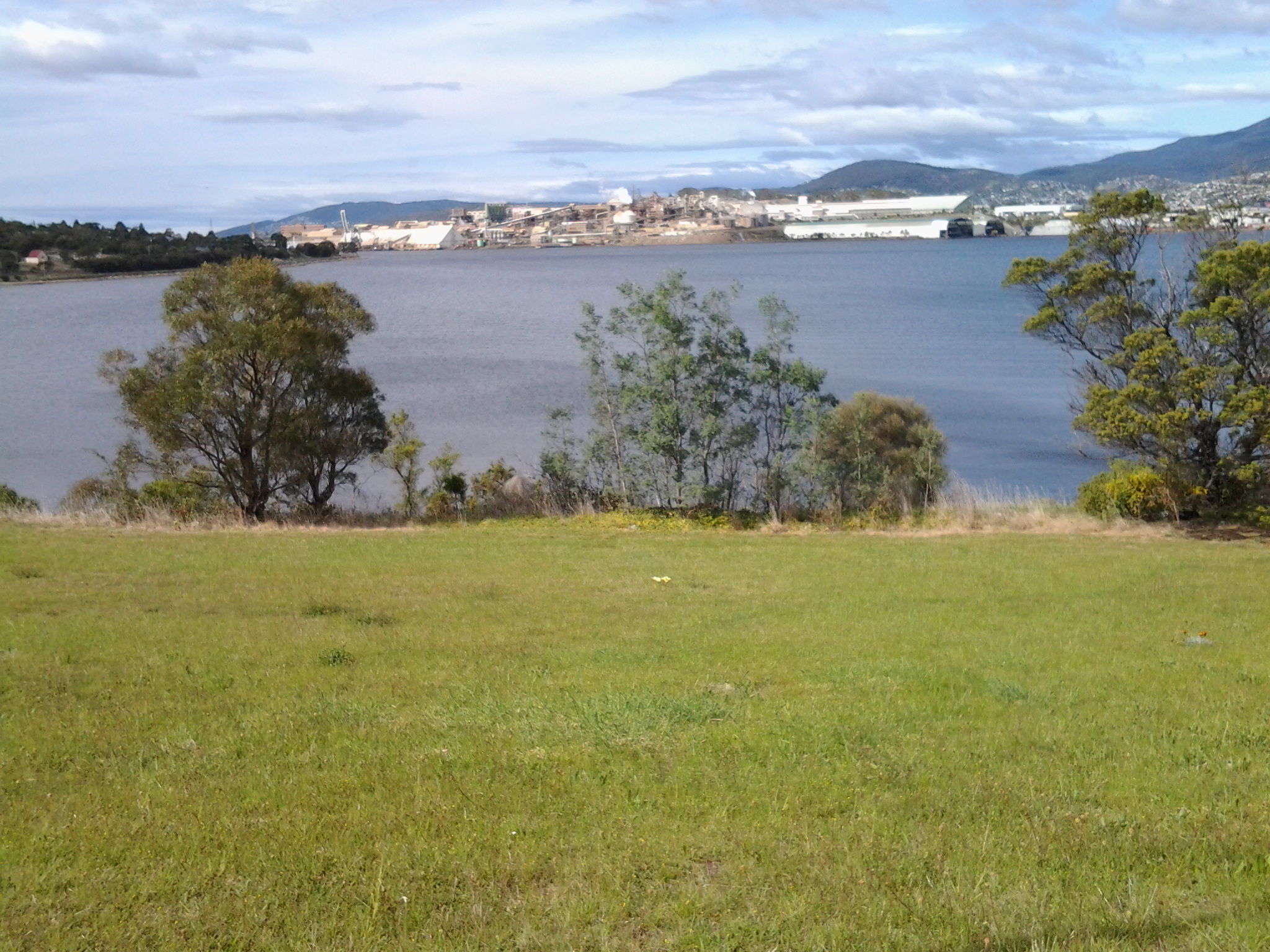
My view across the Derwent took in the noisy Nystar works previously seen and heard on Stage 6 of the walk.  Immediately next to Nystar and further north, I could see another major industrial site: Incat, a manufacturer of very large catamarans.  In the photo below, a massive white structure has two dark ends. Inside each of these spaces, a new catamaran is being built – usually for an overseas market.

20141031_095558

The East Derwent Highway curved in a sweeping right-hand bend from its junction with the road to Cleburne Spit. I walked straight ahead to the River and then curved around to the right keeping parallel with the Highway.  Amidst discarded rubbish, straggling weeds and under the casuarina trees I discovered two plaques: one commemorating the beginning of the building of the nearby Bowen Bridge and the second marking the official opening ceremony of the Bridge. On both occasions an Australian Prime Minister was given the honoured task. Two very strong and formidable men: Malcolm Fraser began the bridge and Bob Hawke opened the bridge.

20141031_100200

I followed a short bitumen pathway and stood underneath the Bowen Bridge a few minutes after 10am. Eventually I walked beside the guard rail and, depending on the safety of the ‘non-path’, I walked on one side or the other.  Sometimes there was a sandy rough drop to the water below, and sometimes I was walking next to the River at ‘sea level’.

By 10.07am I reached the sign indicating I had moved from the Risdon area into the Otago Bay suburb.  At 10.11am another sign gave me advance warning that Otago Bay Road was up ahead.

In a pull-off-the-road siding, a middle aged man wearing clean moleskin trousers and a sporting peaked cap advertised new season South Arm Pink Eye potatoes. The back of his truck was open and he sold his vegetables to people who, once their cars had skidded to a halt on the gravelly surface, climbed out of their vehicles for a stretch and then a leisurely meander over to check the goods. There was something slightly furtive about the way he wouldn’t meet my eyes which left me wondering why.

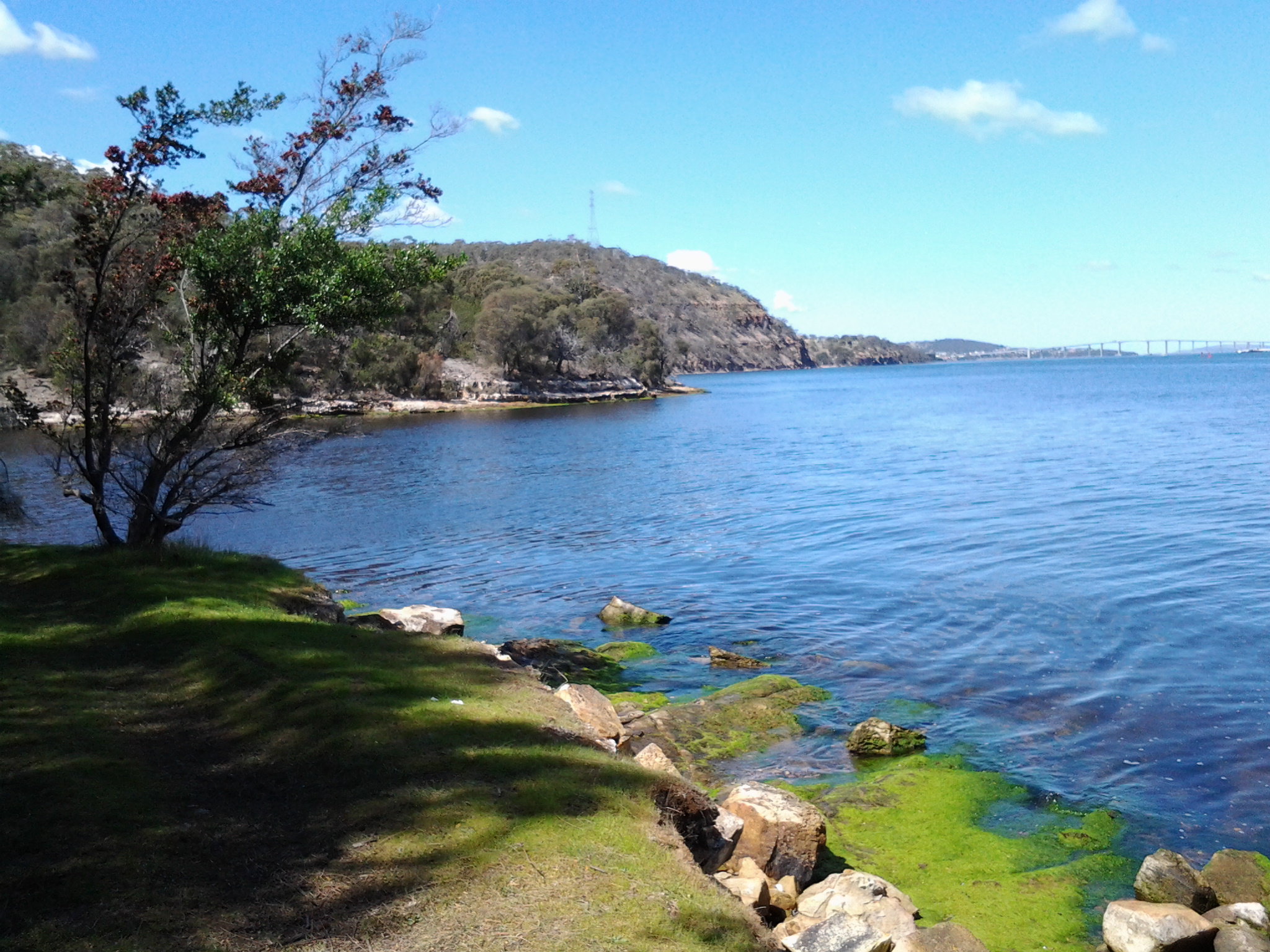
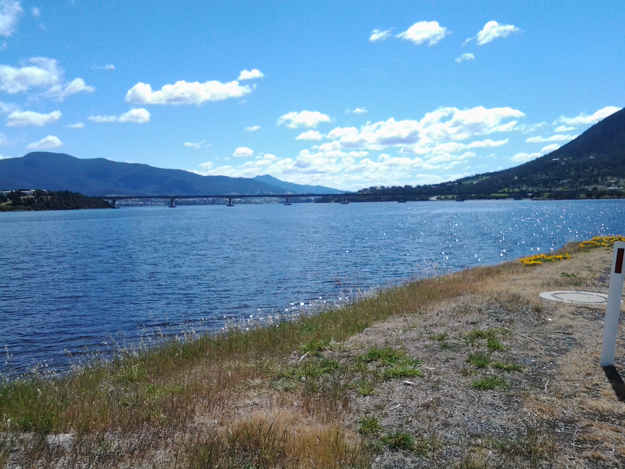
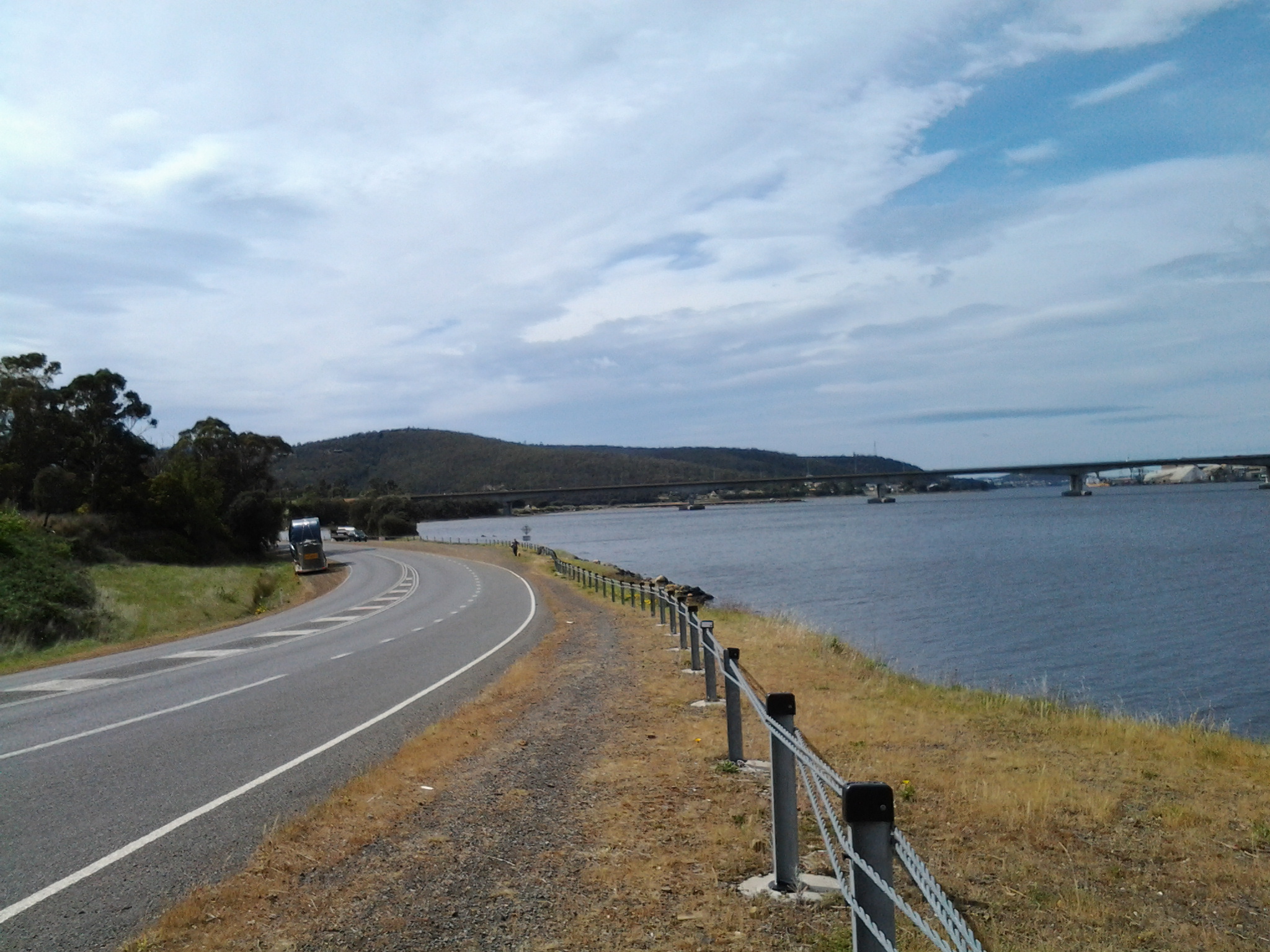
The photo below looks southward towards the Bowen Bridge. One of the vehicles in the distance on the right is the truck selling the potatoes.

20141031_101844

At 10.18am I turned left off the East Derwent Highway onto Otago Bay Road.  The sound of traffic in the distance as it poured along the Highway, and the way the wind boxed my ears, meant it was difficult to hear cars coming behind me. Constantly I was watching my back as I walked along non-existent road verges.  I did not discover a safer path for this part of the walk.

Earlier, near the Cleburne Spit, I had exchanged brief friendly words with a woman walking southwards with her dog.  When she caught up with me on her northward return journey, we found we had a great deal in common and spent some time walking together towards Otago Bay.

Leaving home last Friday towards the start of Stage 7 of my walk along the Derwent

From my house early morning, I could see a mirror sheen across the Derwent River. This promised a great day for walking and so I was eager to get going.  Unfortunately the bus service to the area I was starting from departs only every couple of hours. Eventually I caught the Metro bus 694 when it passed through the Eastlands Shopping Centre bus mall at 9.13am.

The bus passed through upper Lindisfarne as it headed along the East Derwent Highway. When I looked left across the Derwent River, my view of the top of the mountain was cut off by a thick resting white cloud. The roads were calm. People were at work and kids at school. When we passed Geilston Bay I could the water was serenely flat. By this point, I was the only passenger on the bus and felt luxuriously chauffeured.  We detoured for a scenic view through the upper Geilston Bay residential area, then back to the highway.  As we travelled onwards, I noted the start of the trail to Bedlam Walls which I had walked previously, then the electricity pylons and fire trails marking the East Risdon State Reserve. The Willows Tavern loomed on the left and on the right hand side of the highway I glimpsed the starkness of the barb wired fencing of the state Prison.

At the roundabout (where I wanted to go left) the bus turned right to travel through the suburb of Risdon Vale.  Lots of small weatherboard houses and lawns with a few bushes rather than complex luscious gardens. ‘Donut’ burnout tyre marks on the intersections of roads. Rooves needing paint.  Neat and tidy. Streets prettily named after plants: Spinifex, Sycamore, Lindon (although Lindon Park had no Lindon trees), Poplar, Heather, Banksia, Kerria, Hawthorn, Marlock, Gardenia, Lantana and Holly.

Side view of the mountain: I marvelled at the speed with which clouds were being pushed across the top of the mountain southwards.

At 9.39 I was off the bus just before the junction of Saundersons Road, Risdon with the East Derwent Highway.  This is on the southern side of Risdon Cove. Around the corner of the road in the photo below, I could look over the railing in the direction of the Derwent River.

20141031_093816

I walked to that distant railing and realised that walking on the road would be very dangerous with traffic speeding on the narrow lanes.  I legged it over the railing and walked on the River side. The photo below is one of my first views.  Note the pair of black swans.

20141031_094126  20141031_094118

No longer did I have Mount Wellington as my standard backdrop across the water. In the photos above, the elevated section on the other side of the Derwent River (above the Bowen Bridge) is the Mount Faulkner Conservation Area.

Yesterday I completed Stage 7 of my walk along the Derwent River

I will write details at length in later posts, however these few words record the walk between Risdon Cove and half way into Old Beach happened amidst spitting rain, strong breezes, gloomy clouds across the northern suburbs, beautiful vistas across the Derwent River, rich native bushlands and bird wandering wetlands, the sunken remains of historic boats, interesting people met along the way, new angles on the mountain (Mt Wellington), and reliable bus services.

I was away from home for around 6 and a half hours, walked about 14 or so kilometres, and covered an extra 8 kms of the Derwent River as it snaked around the suburbs (different from its straight run out to sea on previous walks). All up, I have now covered approximately 34 kilometres of the Derwent River, and the walking experience continues to inspire me.

The photo below shows the sunken remains of the ship Otago.  Notice the calm waters of the Derwent River.  Sensationally beautiful. Through the branches on the top right of the photo is the blue shape of Mount Wellington.  Only when I looked at this photo and registered the relatively small size of our mountain, did I truly understand the distances I have walked from the mouth of the river to this spot on Otago Bay. In the beginning, I was south of the mountain and now I am north. There will come a time when I can no longer see the mountain as I walk along the Derwent River.

20141031_104811

Aboriginal and European cultures clash at Risdon Cove

1804 was a memorable year for Van Diemen’s Land (later to be renamed Tasmania). Historical records show that in May 1804 a significant and deadly clash occurred between the European new settlers and the peoples of the local Moomairremener aboriginal tribes.

I have been trying to picture the circumstances which might have caused fighting to break out.

Starting with the European settlers

From January 1804 onwards, Bowen sailed to Sydney from Risdon Cove and back again before making a final departure from Van Diemen’s Land in August. It is not clear how many people remained at Risdon Cove while he was away. During the months from February to May, the two officers were confused in relation to who was in charge. It wasn’t until 8 May 1804 that Bowen officially handed control over to Collins.

Another problem is that personality conflicts existed between Bowen’s free settlers, and that there were difficulties working with the few members of the military which accompanied this initial settlement. The contributing factors to the uneasiness between people are easy enough to guess: an environment that is physically unusual and unknown to the new settlers, unpredictable weather conditions, inadequate food and water, no services or shelter buildings available and everything needing to be built, the hard labour required to eat and live each day, the fact that half the number were convicts and not free to do as they please, the fact the other half had to manage and feed those convicts.  In a small community of 49 people, should one person not like another, there would be no escape, and it is easy to imagine in these harsh pioneering days irritability could burst. Even minor civic scuffles would be unsettling for such a community.

In relation to the Moomairremener indigenous peoples

Their land entitlements and living practices had been established for thousands of years. Therefore, the incursion of the European strangers would have started as a puzzling surprise and then proceeded to become a despairing resentment as their land was taken over and their food sources mismanaged. The food stores brought by Bowen’s and Collins’ ships were often unusable leading the new settlers to kill kangaroo and other game for survival. Their means for obtaining such additional food supplies included using firearms. Not only were these weapons unfamiliar to the Moomairremener peoples, they were stronger and more efficiently deadly than the weapons which the aboriginal tribes owned. Without a common language nor shared cultural beliefs, the failure of the aboriginal and Europeans to communicate clearly with each other, set a path towards localised warfare.

According to Wikipedia, on the 3rd May 1804 “a large group of Abo­rigines blundered into the British settlement. The sol­diers mistakenly thought they were under attack and killed some of the intruders. About 300 aboriginals, men, women and children who had banded together, approached the Risdon Cove settlement whilst occupied on a kangaroo hunt during a seasonal migration. The Aborigines had arrived at the settlement and some were justifiably upset by the presence of the colonists. There had been no widespread aggression, but if their displeasure spread and escalated, Lieutenant Moore, the commanding officer at the time, and his dozen or so soldiers, could not be expected to be able to protect the settlement from a mob of such size. The soldiers were therefore ordered to fire a carronade (a small cannon used for firing salutes at the settlement) in an attempt to disperse the aboriginals; it is not known if this was a blank round, although some allege grape shot was used to explain an alleged but uncorroborated high figure of deaths.

In addition, two soldiers fired muskets in protection of a Risdon Cove settler being beaten on his farm by aboriginals carrying waddies (clubs). These soldiers killed one aboriginal outright, and mortally wounded another, who was later found dead in a valley. Lieutenant Moore’s account lists three killed and some wounded. It is therefore known that in the conflict, some aboriginals were killed, and that the colonists ‘had reason to suppose more were wounded, as one was seen to be taken away bleeding’. ‘There were a great many of the Natives slaughtered and wounded’ according to the Edward White, an Irish convict who later spoke before a committee of inquiry nearly 30 years later in 1830, but could not give exact figures. White alleged to have been an eyewitness, although he was working in a creek bed where the escarpment prevented him from viewing events, claiming to be the first to see the approaching aboriginals, and also said that ‘the natives did not threaten me; I was not afraid of them; (they) did not attack the soldiers; they would not have molested them; they had no spears with them; only waddies’, though that they had no spears with them is questionable, and his claims need to be assessed with caution. His contemporaries had believed the approach to be a potential attack by a group of aboriginals that greatly outnumbered the colonists in the area, and spoke of ‘an attack the natives made’, their ‘hostile appearance’, and ‘that their design was to attack us’.” Neither  Bowen or Collins were present at the time of this attack.

Ahhh. The sadness caused by misunderstandings, ignorance, fear and lack of leadership!

Another informative site is http://members.iinet.net.au/~rwatson1/bowen/risdon_cove.htm which includes  20th and 21st century history of Risdon Cove.

The birthplace of European Settlement in Tasmania (Van Diemen’s Land): Risdon Cove

The start of my walk along the next stage of the Derwent River will be at Risdon Cove.

Earlier blogs explained how Lieutenant John Hayes, with two ships, entered the River and named it the Derwent in 1793. Twenty six kilometres upstream, while mapping the River, he saw an inlet on the eastern shore and named it Risdon Cove. Risdon, Risdon Vale and Risdon Cove were named after Captain William Bellamy Risdon. Risdon took command of the Duke of Clarence, the second ship that was part of Hayes excursion up the Derwent River.

Another decade passed before European colonisation began.

The Lady Nelson was the first ship to arrive at Risdon Cove in September 1803 when Lieutenant Bowen was sent from Port Jackson (Sydney area) to establish the first settlement at Risdon Cove, and rename it Hobart. As an aside, in the late 1980s a replica was built and the new Lady Nelson became well known on the Derwent River round Hobart. Currently locals and visitors volunteer time to maintain and crew the ship. Short sails are scheduled throughout the year for those who are interested. The website http://www.ladynelson.org.au/ provides further information, and has published the photo which I have reproduced below.

Lady Nelson

Despite the recommendation of the explorer George Bass, Risdon Cove proved to be a bad choice for a settlement site because the soil was poor and fresh water minimal.

In early February 1804, Lieutenant Colonel David Collins arrived from establishing the first small settlement at Sullivan Bay in the state of, what is now known, as Victoria. Quickly Collins realised Risdon Cove was inadequate and ordered the relocation of the settlement to a new site at Sullivan’s Cove, the present wharf-front centre of today’s Hobart. By late February 1804, the military and convicts had been moved to Sullivan’s Cove on the western shore of the Derwent River.

How many settlers were there?

Gathering reliable figures for the numbers of people remaining at Risdon while Bowen was away sailing and exploring and once Collins had moved some of his people to Sullivan’s Cove has proved to be impossible. According to the reputable Australian Dictionary of Biography, Bowen’s landing party in 1803 numbered 49 persons in total including 24 convicts previously transported from England via Port Jackson (Sydney). The site http://www.treasury.tas.gov.au/domino/historyW.nsf/v-all/021976A07261DACBCA256EB400107431 declared that in 1803, 100 people were settled at Risdon Cove, so I assume that further ships arrived after Bowen later that year. The same website refers to “Collins’s expedition of more than 430 people.” Apparently by July 1804, Collins had ‘hutted’ 400 people on the western shore around Sullivan’s Cove and bays further along the Derwent River. Other reports indicate an unspecified number of people stole a boat and escaped from Risdon Cove, thereby reducing the number of people living in that tiny settlement.  I wanted to have a sense of the scale of the residents remaining at Risdon Cove in order to determine whether the settlers might be afraid of the aboriginals simply on the basis of being outnumbered.

From Risdon to Tommy’s Bight via Porters Bay and finally to the bus stop

Once I had walked through the East Risdon State Reserve and down the hill to the edge of the Derwent River in the suburb of Risdon, despite sore feet, I felt compelled to walk south along the water’s edge towards Tommy’s Bight. Much of my walk over the previous hour or so had not been at the edge of cliffs, so for an authentic walk along the River I liked the idea of following tracks to determine how far back south I could walk (all the while knowing I would need to retrace my steps to get to the bus stop for my return home).

I turned left into Saundersons Road from Risdon St and continued walking until, opposite the No Through Road and the 50km/hour speed signs, a gravel and dirt single-foot track led down around the water’s edge. The track seemed infrequently walked, and it was delightfully soft and gentle on my feet.

20141015_124824

I loved listening to the lightly lapping water and my world seemed very still until three sulphur crested cockatoos screamed overhead.

At 12.50pm I arrived at a Bay, and without checking my maps, mistakenly thought I had reached Tommy’s Bight.

20141015_124844  20141015_125201

I had a good look around the Bay before sitting on a sunny rock to eat my lunch.

20141015_125354

After munching I dragged out my map and discovered I had been enjoying the peace and quiet of Porter’s Bay.

Ignoring my aching feet, I began on the track towards Tommy’s Bight. When the track split into two directions, I walked uphill for a while before realising this would take me back to the top of the East Risdon State Reserve. I turned back until I could follow the track parallel to Porters Bay. The time was 1.20pm and the metal-saw whining noise from over the River was ever present.

Parts of this track were dappled with sunlight and the lack of direct searing sun was a relief.  However, it was difficult to read the irregular root strewn and rocky pathway and not roll my ankles. A number of splits in the track and a mess of tracks generally all led back to the one track. Usually the detours were the result of fallen trees along the way.

It was along this track that the walk’s greatest thrill materialised.

I had never seen one before and was staggered how large it was: a perfectly camouflaged Green Rosella. With deep olive green feathers and broad tail, the bird was resting on a low branch. I stood watching for the few seconds before it flew off through the trees and disappeared. Today, as I write this blog post, I have checked the internet for photos and I am sorry to say I cannot find an image showing a bird as green as the bird I saw. I realise the Green Rosella has other colours which should have flashed at me, but they didn’t and it is the overwhelming sense of the green that I remember – even on its head (although perhaps the shadows of the green surrounding foliage led me to ‘see’ green).  I feel immensely privileged to have seen this spectacular specimen.

At 1.30pm I was passing a tiny curved shell beach below and continued on to where the waters of the Derwent River and Tommy’s Bight met.

20141015_133435

By 1.35pm the bottom of Tommy’s Bight was in full view.

20141015_133405

Tracks on the other side of the bay made it obvious that it was possible to continue walking south. On the hill top in the distance I could see the electricity pylon against which I had walked earlier in the day.  Another day, I will return to discover more.

By 1.45pm I had begun the return walk north and was back at Porters Bay and by 1.50pm I was back on the bitumen at Risdon. Only then did I notice an electricity pole on the other side of the road with its own name, ‘The Leaning Pole of Risdon’!

By the way, there are no public toilets, no cafes or restaurants, and no other facilities and services during this walk or in the suburb of Risdon.  So be prepared.

The rest of my walk was undertaken on the edge of Saundersons Road as it wound around the Derwent River with Risdon’s houses on the right. I reached the bottom of Risdon St by 2pm and then continued on in full view of the Bowen Bridge further north

20141015_135550

before passing Cleburne Street and Cemetery/Church Point Road. I reached the intersection with the East Derwent Highway at 2.10pm.

The view below was photographed at Risdon Cove looking towards the Derwent River while waiting for the bus.  The suburb Risdon can be accessed to the left of the car that is seen travelling on the road.  Land has been reclaimed across the Cove so that the East Derwent Highway can continue uninterrupted further north. I will walk along that road in Stage 7.

20141015_141139

Once at the bus stop (an unnumbered bus stop) at 2.15pm, I relaxed into the wait for Metro Bus number 694 that arrived 20 minutes later. Meanwhile, I was able to take a broad view of Risdon Cove, knowing this to be the starting point for Stage 7 of my walk along the Derwent River.

On the return bus I was treated to a ride through the large and dispersed suburb of Risdon Vale located some kilometres away. This suburb sits in an open valley skirting behind Tasmania’s main prison site, the Risdon Prison Complex.  ‘The mountain’ (Mount Wellington) is ever visible.

Eventually the bus turned back onto the East Derwent Highway and travelled via some suburban detours to the Eastlands Bus mall at Rosny Park on its way to Hobart. I am excited by the rich experiences offered by Stage 6 of this walk and look forward to leading friends along these paths. I hope my stories inspire others to have a look at this area or find their own walks of discovery.

From Geilston Bay to Risdon on Stage 6 of my walk along the Derwent River yesterday

Yesterday’s walk was a sensationally wonderful experience. Over a few posts I will colour in the rich fabric of the day, much of it in clean fresh smelling bushland (such as that at Tommy’s Bight in the photo below).

20141015_133405

To start with, I caught Metro bus 694 destined for Risdon Vale and Glenorchy (scheduled from the Hobart city bus mall at 9.03) on the eastern shore and travelled to bus stop 14 on the East Derwent Highway at Geilston Bay. Thankfully the Clarence City Council has erected a sign marking the start of the walk.

20141015_093747

From the bus stop, I walked along the edge of Geilston Bay then northwards around Bedlam Walls Point to Shag Bay and onwards to the top of the Bedlam Walls, where I was rewarded with panoramas across the Derwent River. My northwards walk continued into and across the East Risdon State Reserve before descending into the suburb of Risdon. I turned south and walked on the edge of the Derwent River to Porters Bay where I took my lunch break before continuing south to Tommy’s Bight.

Eventually I retraced my steps back to Risdon and continued along the water’s edge to the junction of Saunderson’s Road with the East Derwent Highway. The return bus stop for a 694 bus, which arrived at 2.35pm (with not another one due for two hours), was on the Highway across from Risdon and adjacent to the land and water marking the Risdon Cove area.

I was away from home for approximately 6 and ¼ hours, and walked a total of around 12 kms winding over many tracks and retracing parts of my walk.

Previously I had walked 23 kms of the length of the Derwent River.  Yesterday I added 3 kms which brings the new tally to 26 kms.

How did Hobart’s Derwent River get its name?

Dan Sprod’s information for the Centre for Tasmanian Historical Studies was a great help in understanding that our Derwent’s (http://www.utas.edu.au/library/companion_to_tasmanian_history/R/River%20Derwent.htm) European discovery was made during the second (1793) visit to what is now the island of Tasmania, by French explorer Bruny d’Entrecasteaux. The given French name ‘Rivière du Nord’ never took hold. When Englishman Lieutenant John Hayes arrived in April 1793, he was unaware of d’Entrecasteaux’s visit two months earlier, and named the river after the Derwent River in England.

Great Britain’s Derwent River flows through Cumbria, a sparsely populated non-metropolitan county in the north west of England.

Cumbria contains the famously beautiful Lakes District, and presents as a combination of mountains, rugged seashore, parkland and rural landscape. In the early eighteenth century, the landscape and climate similarities between Cumbria and our island’s river backed by the stunning Mount Wellington make it easy to understand how our river came to be named.  In England, the name Derwent is derived from a Celtic word for “oak trees”.  Australia and Tasmania do not have native trees with the same leaf and character as English Oaks. However the heavy thick forests with large stands of trees either side of Tasmania’s Derwent River, would have made a strong impression on Lieutenant Hayes.

The Cumbrian Derwent flows westwards towards the Irish Sea; the city of Workington sits at the mouth. Google Earth includes photos of a mountain, powdered with snow, showing similarities with our Mount Wellington at cooler times.  I imagine Lieutenant Hayes would have been away from England for many months, if not years, and so his ability to make direct comparisons between his English and our river would be based on hazy memories.  Notwithstanding this, when I look at a current photo of the Derwent in Cumbria, the landscape has a character similar to our local environment. Of course, the landscape and its features at both locations will not be the same as when seen in the late 1700s. However and despite the passing of centuries, I can see how and why Lieutenant Hayes chose to name our river, the Derwent.

But what about the man; what was Lieutenant Hayes connection with Cumbria and the Derwent River?

The Australian Dictionary of Biography (MUP Volume 1 1996) notes that Sir John Hayes (1768-1831), naval officer and explorer, was baptized on 11 February 1768, the son of Fletcher Hayes of Tallentire on the River Derwent, England. On 7 December 1781, when 13, he joined the Bombay Marine as a midshipman on the Bombay. By December 1788 he was promoted to second lieutenant and his rise through the ranks continued over the years. Hayes is best remembered for a private voyage undertaken between February 1792 and December 1794. Glowing accounts of New Guinea’s economic potential fired Hayes to lead an expedition financed by some Calcutta merchants. On 6 February 1793 the Duke of Clarence (250 tons) and the Duchess of Bengal (100 tons) left Calcutta, India. Because of adverse winds Hayes could not sail direct to New Guinea, so at the young age of 27 years, he decided to voyage round New Holland (this was the original European name for Australia). He reached Van Diemen’s Land on 24 April and left on 9 June. During that time, he discovered and named the Derwent River, and other features of the terrain. Risdon Cove and Cornelian Basin still bear the names he gave them. According to the publication “British Heritage of Tasmania’, (http://members.iinet.net.au/~rwatson1/britishheritage/BRITISH%20HERITAGE%20OF%20TASMANIA.pdf

Hayes named Ralphs’ Bay (a beautiful bay which I have mentioned during both my first and second stage of walking along the eastern shore of Tasmania’s Derwent River) at Lauderdale, after William Ralph who was in charge of the Duchess of Bengal.

While I would like to think that the City of Clarence (the eastern shore city of the Greater Hobart Area and the one in which I live) must have been named specifically after the ship which Hayes’ commanded, this apparently isn’t true.  It seems that the City of Clarence was named after King William IV of the United Kingdom who as he ascended the throne was titled His Royal Highness, The Duke of Clarence and St Andrews. However, let’s look at this a little more closely. In 1843, Prince William (the future King William IV crowned in 1830) began a career in the Royal Navy by becoming a midshipman at 13 years. In 1789 he was made Duke of Clarence, and then retired from the Navy in 1790.  The elements are: the future king is a naval man who held the title of Duke of Clarence before Lieutenant John Hayes (who started his naval career as a midshipman) set out from India towards Australia. Travelling to Tasmania, Hayes just happens to be in command of a ship named the Duke of Clarence in 1793. How did his ship get the name?  Considering the timing, surely Hayes ship was named in honour of the new Duke of Clarence (the Sailor King or Silly Willy as the future king was known). I would prefer to believe that the name of today’s City of Clarence lying along the eastern edges of the Derwent River, is a reference to the ship of the man who named our River, and only indirectly refers back to the early title of King William IV.