Tag Archives: Alum Cliffs

Picnic on Hinsby Beach

Local Hobart followers have, from time to time, been fascinated by the new places discovered on various Stages of my walks along the Derwent River.  A number of followers fell in love with my description and photos of Hinsby Beach, a beach which I like many others had not previously known existed.

Recently a group of us made our way to Hinsby Beach for a picnic. This was not a normal bus connected walk; rather I sat in the luxury of a car as we travelled to our destination. We parked at the bottom end of Hinsby St which drops down from the main road in the suburb of Taroona. Then, with small backpacks and an esky, we strolled down the tree-lined bitumen track to the beach.  This short track is enticing because, from Hinsby St a circular shape of light can be seen at the bottom end and the picture you see is a small arc of sand and waves spreading up and down.  Seductive.

Rugs were spread out over the sand. Food was spread out. Drinks were shared.  Stories were told. Laughter wove its way around us.

For a short period after we arrived, we ‘owned the beach’. Then couples strolled down, swimmers dashed into the wavy water, and kids of various ages enjoyed their own space at different points along the sand.  We felt we had all the space in the world.  A big sky. An expansive Derwent River.  Deep clean pale yellow sand. Despite clouds crossing the sky, the temperature wasn’t cold.

20150301_123325

Being on Hinsby Beach brought back all the memories of the day I discovered this wonderful hideaway at the end of Stage 11, and then I remembered the day I started off at Hinsby Beach and clambered around over the Alum Cliffs before finding the official track on Stage 12. Before leaving the beach we walked to the southern end and found the correct track a few metres to the left of the track ascending from wooden stairs, which I took and led me to an awkward gully crossing,being on private property and fence hopping to get back onto the ‘real’ path.  Where are the signs?  Kingborough Council, can you please make it clear which track to take?

20150301_123311

My photos make the beach seem gloomy but I remember the picnic experience was bright. It was a wonderful way to end my birthday celebrations which had spread over a couple of weeks.  Thanks Fe for organising the day.

Finally I reached the mouth of the Derwent River on the western shore at Pearsons Point

The goal of walking along the western shore of the Derwent River was to reach the mouth and during Stage 13 I reached this destination marked by Pearsons Point.

Before then at 10.44am I walked past a turn off: Mt Louis Road. There was a lump up in the sky on my right.  Maybe another time it might be pleasant to see what is up there and to look at the view – which is probably a spectacular 360 degree outlook along the Derwent River, the D’entrecasteaux Channel and Bruny Island.

As I panted up the final hill, I heard the thwack of balls and realised the fencing I could see in the distance amounted to a tennis court.  A tennis court!  Ye gods! Out here in the bush and miles from anywhere?  Yes it was.  Two women were slamming the balls up and down the court.  Their two cars were the only vehicles in sight.

10.52am: I reached the Pearsons Point Reserve and was feeling rather chuffed.

20150224_105032

I wandered around the site which included a disused gun emplacement and a couple of large historic cannons.  Guess Pearsons Point would have been the first line of defence against any Russian threat (which seemed to be the main thought through the 19th century).

20150224_105306 20150224_105429

Note: the bump behind the gun emplacement and tennis court is Mt Louis. A large white edifice on the end of the Point (on the other side of the cannon) appeared to be a marine navigation beacon.

In front of me to the right hand side of the Point, the D’entrecasteaux Channel separated the mainland of Tasmania from Bruny Island (famous for its fresh produce such as cheeses, smoked fish and meats, berries, premium wines, and local oysters).

20150224_105437 20150224_105647

I was very surprised how close Bruny Island (Dennes Point) was to this part of Tasmania’s mainland.  So close.  So accessible.  And its green hills and the white sandy Jetty Beach were most attractive.

On the other side of Pearsons Point to my left, the Derwent River flowed out to Storm Bay and then onto the ocean. I could see the Iron Pot and Cape Direction at the southern tip of the South Arm peninsula on the eastern shore of the River.

I found a pleasant picnic table and at 11am ate half my lunch under a small cluster of gum trees hoping no branches would be shed on my head.  Feeling on top of the world. The sun was out and the tiniest of breezes moved through the area.  Past the trees I could see motoring boats leaving white streams behind them as they sliced through the River. I looked back northwards to the Alum Cliffs between Taroona and Kingston.

20150224_112527

With a little sadness I left Pearsons Point at 11.25am.

By 12.40pm I was passing the Hidden Cove turnoff, at 1.05pm I reached the Fossil Cove Drive junction, at 1.25pm I walked across the intersection with Treatment Plant Road, and at 1.30 I stopped for a moment at Suncoast Drive.  I looked at the one bus stop (there wasn’t a pair one either side of the road) and it did not have a timetable attached to the post, so I continued walking to Wells Parade.  I had been told this was a long road, and now I know it is.

20150224_133752

I stopped and waited for a bus which didn’t come (the first in my entire travels) and left and walked up and down and up and downhill until eventually I was back parallel to the Blackmans Bay Beach.  I sat for a while at the beach soaking in the atmosphere, smelling the salt, and relishing the fact my feet were having a rest.  When the time came (according to my bus timetable), I walked to the bus stop where I had alighted hours earlier in the morning, and before long Metro bus number 85 arrived.  After passing via the Suncoast Drive bus stop that I had looked at earlier in the afternoon on arrival back in Blackmans Bay, Maranoa Heights, other suburbs, and Kingston, I was back in Hobart city by 4pm feeling elated.  Stage 13 was over.

The land begins to open, making possible expansive views across the Derwent River.

Every so often, along Tinderbox Road, a cluster of a few properties on 5 acres or so of land each would appear after a kilometre or so of the densely bush environment.

The closer I walked to Pearsons Point the more likely that Tinderbox Road was close to the River or I could see more of the River.  Around 10.20am, while on a long and winding road (on which I considered breaking out into one of the Beatles favourite songs) which undulated so that I was walking uphill then downhill seemingly repeating this process ad nauseum, I was stopped by the beauty of a rose bush in its glorious rose hips stage. I took photographs at that point and in a number of roadside places in the following kilometres.

20150224_101936 20150224_114116

In the distance after climbing one hill, I looked back northwards to Lucas Point behind the steep rock edged bay of ‘Fishermans Haul’ (see photo below).

20150224_103427

In the photo above, the far distant hill on the left is the Alum Cliffs between Taroona and Kingston.  It gives you an idea of the distance covered in these walks.  The other land is on the eastern shore of the Derwent River.

A little further along I was looking down on a disused farmhouse at what I believe was Passage Point.  The photo below shows (green plastic protective shelters around new plants) new trees have been planted in the paddock. I saw such revegetation practices on a number of properties throughout the day.

20150224_103846

Another photo looks across the Derwent River to the southern tip of the South Arm peninsula. The glistening white buildings are those of the Fort Direction defence services complex which I passed through on Stage 1 of my walk along the Derwent River.

 20150224_105611

An extra historical morsel regarding Browns River which runs out into the Derwent River

Browns River separates Tyndall Beach (below the Alum Cliffs) from Kingston Beach. On the Kingston side, a plaque remembers Robert Brown.

According to http://www.rampantscotland.com/placenames/placename_hobart.htm  the township of “Browns River was named after the noted Scottish botanist Robert Brown who explored the area a week after Hobart was founded. “  Apparently Hobart (Sullivans Cove) was established on 21 February 1804 (I shall remember the date because it is my birthday – well not the 1804 bit) and therefore before the end of February this ‘township’ of Browns River was in its infancy. A week – ye gods!  How quickly these pioneering settlers got around.  Nothing could happen so fast these days.  But, is the timing true or simply a legend? I don’t know.

The name was changed to Kingston in 1851 by the Governor of Van Diemens Land, Sir William Thomas Denison.  The website http://tasmaniaforeveryone.com/tasmanias-names-the-suburbs-of-hobart suggests “The name Kingston was advocated by the then Police Magistrate, Mr Lucas. Although his exact reason for deciding on the name of Kingston is unknown, there are many theories. His parents, Thomas and Anne Lucas, the district’s first settlers, lived at Norfolk Island before coming to Van Diemen’s Land and the capital of Norfolk Island was Kingston. Another possible reason is that Thomas was born in Surrey, England in a village close to New Kingston. It had been settled in 1808 by Thomas Lucas and his family, who were evacuated from Norfolk Island. He named his property ‘Kingston’, after the settlement on Norfolk Island. “

On through Kingston still heading southwards past Boronia Beach

I finished my lunch on the south side of Browns River, crossed the pedestrian bridge over Browns River at 12.17 pm then proceeded along Osborne Esplanade (parallel and next to the Derwent River) towards the Kingston shops.  Over Christmas I holidayed in Kingston and my 3 posts titled I am on holiday watching over the Derwent River, Getting out into the air at Kingston Tasmania and Kingston Beach, Tasmania offer more information about this leg of my walk along the Derwent River.

I had the pleasure of meeting with Em for cups of tea and a long happy chat and saying hello to people I knew as they walked past the outdoor café Beachfront 32.  Immensely pleasant.

At 1.52 pm I restarted my walk southwards amidst foreshore joggers, walkers and seagulls – the sun was shining again and my world was warm.

By 1.59 pm I reached the Kingston Beach Sailing Club and could look back northwards across the sweep of water and the arc of Kingston’s white sandy beach.

20150202_135849 20150202_135818 20150202_135809 20150202_135813

The last photo looks north to the headland at the end of Tyndall Beach which was spread at the bottom of the southern end of the Alum Cliffs.

A minute later I reached the Boronia Beach Walking Track and turned left.

20150202_135909

A gentle shady path meandered along above the water and I could hear happy voices on the rocks below.   The views through the trees were spectacular.

20150202_140623

Up above me on my right were large houses with massive picture windows surrounded by high mesh fences. Then the landscape opened out and I could still look northwards to the Alum Cliffs where I had walked during the morning.

20150202_141612

At 2.18 pm I reached a gate marking the entrance to the track down to Boronia Beach, a beach that I had previously not known existed.

20150202_141714 20150202_141816 20150202_141954 20150202_142008

By 2.24 pm I was walking on the beach.

20150202_142513 20150202_142154

I remembered the chitons which had featured on a public art work at Taroona Beach and wondered whether they could be found on this beach (refer back to my posting Public art works along the Derwent River –Taroona’s Chiton for more information). I checked the rocks but found none.  I  concluded the chitons must collect together only on the Taroona Beach rocks.

The rock formations at the southern end of the beach were a surprise.  The soft sandstone has been weathered and small caves were formed into the cliff.

20150202_142346 20150202_142436

Seeing these caves cast my mind back to Kalambaka in north western Greece. Last year I visited this town and marvelled at the stunning beauties of the Meteora (refer http://en.wikipedia.org/wiki/Meteora for more information) Below is one of my photos showing the caves in some of the cliffs which hermits used to climb up and live in (and which Roger Moore as James Bond climbed over dramatically in the movie “For Your Eyes Only”).

20140607_190315 20140608_094209

Boronia Beach’s caves are smaller and different in many ways from those of the Meteora.  However they surprised me in this tucked away gem of a beach.

For those who loved the photo of mussels growing on Boronia Beach rocks which I provided in an earlier posting about the Stage 12 walk, here is another.

20150202_142536

Five or so minutes later I began the trek uphill out of Boronia Beach under old pine trees.

20150202_143006 20150202_143214

I was horrified to see thousands of escaped ‘forget me not’ plants, some flowering as they carpeted lots of the area near the beach and up the hill. I pulled out a few dozen and their roots came out easily but a concerted effort of a few days’ work to remove these before they spread any further is essential if the wild bush is to stay as pure as it can.

A gate half way up the hill let me out onto a continuing walking track at 2.36pm.  Not long after I decided to sit on the steep steps and smell, look and listen to the environment. Very peaceful.

By 2.45pm  I was walking again and a couple of minutes later I reached a gate to exit the entire walking track area.

20150202_144535

The entry was signed but, while the exit was easy, it was entirely unclear whether to turn left or right.  At the end of the dirt road in both directions I could see gates closed over the road.  Murphy’s Law has it that I will often make the wrong choice and it was no different at that point. I chose to walk down to the gate at the bottom of the road but found it entered into private property. Back up the road, lined one side with large girthed pine trees, I walked to the other gate and found no obstacle to walk around it. At 2.54 pm, I was continuing along the road watching a family of magpies fossicking in an open paddock, and later marvelling at an old crab apple and a pear tree both of which were laden with fruit.

At 3 pm I arrived at the junction with Kingston and Blackmans Bay’s main linking road, Roslyn Avenue.  The address for the dirt road on which I had been walking is Roslyn Ave 82-88, and it is directly across from Jindabyne St over the roundabout on Roslyn Ave.  One corner of the intersection is occupied by the Catholic Church of Christ the Priest and the Aloysius Primary School.

Tawas

One follower asked what was tawas, which I mentioned in the posting: Alum – what is it?

The powder of some alums is used as a ‘natural’ deodorant, and in some countries is named as Tawas. Wikipedia explains “Alum’s antiperspirant and antibacterial properties contribute to its traditional use as an underarm deodorant. It has been used for this purpose in Europe, Mexico, Thailand (where it is called sarn-som), throughout Asia and in the Philippines (where it is called tawas).

In Hobart and other places in Australia, potassium alum is sold commercially as a “deodorant crystal”. This information prompted me to check my deodorant which is marketed as Body Crystal comprised of natural mineral salts. I was surprised to read its main constituent is Potassium Alum. I have been using this deodorant for years and years and years as an alternative to the usual aluminium based deodorants which I understand are more toxic to the body over time.  Besides it has always worked effectively whatever the climate or the situation.

Thanks for the question because it forced me to learn more.

By the way, a new reader today was from the Phillipines. I wonder whether he or she was searching on the word Tawas and came up with the connection to my blog.

Down from the Alum Cliffs onto Tyndall Beach on the edge of the Derwent River

Discovering the Alum Cliffs had been a goal and now this part of the Stage 12 walk (on the cliffs) along the edge of the Derwent River was coming to an end. At 11.42 am I was walking above Tyndall Beach and a minute later reached the sign indicating a steep pathway leading down to the beach.

20150202_114250 20150202_114603

By 11.49am I was walking on the softly squishing expressive white sand. The day was now overcast, but it was refreshing to be at sea/river level again and feel the onshore breeze.  I noticed a track continued at the cliff bottom along a grassy area but chose not to take that route when I saw a sign indicating snakes might be around.

20150202_114838

I have never seen this sign before in Australia.

20150202_114944 20150202_115006 20150202_115435 20150202_115423

I walked along the sand until I reached Browns River, then turned inland along the river until I arrived at the Christopher Johnson Memorial Park with its public toilet, picnic tables and kids play area near the cross bridge.

At midday I stopped for a lunch break on this reserve and watched contented dogs and owners roaming.  A very brave Mr Blue Wren grabbed at insects in the grass around my feet and talked away to me (or someone – never saw Mrs Wren) incessantly. Parts of his wings were iridescent blue in the light of the greying day. I was afraid to move and frighten him away.  Wonderful.

The ebb and flow of the Derwent River against the Alum Cliffs

I made a 25 second video of the seemingly gentle movement on the surface of the Derwent River as it moved backwards and forwards to and from the Alum Cliffs, as seen through dry forest. It was rather hypnotic and I can now see the video would have been more powerful if longer.

To see South of Hinsby Beach with waves on the Derwent River Tasmania go to : https://www.youtube.com/watch?v=MdnLETfiRWA

Onto the ‘proper’ Alum Cliffs track near Taroona Tasmania

After walking across the Shot Tower carpark I had one last look back to where I had been. The sky was amazing.

20150202_100551

In the trees then and often further again along the track, Kookaburra birds laughed at me many times. Ha Ha Ha Ha!  Ha Ha Ha! Ha Ha Ha Ha Ha.  Their feathers camouflaged perfectly with the shadows from leaves and the colours of tree trunks and branches.  They were impossible to photograph. Ha Ha Ha Ha!  Ha Ha Ha!

A sign seen at 10.08am indicated the start of the Alum Cliffs track.

20150202_100632

Then I began the careful descent on a steep 100 metres or so length of a four wheel drive wide smooth gravel track. Partly eroded. Basic stairs were irregularly constructed on one side of this incline.  Bush either side.  A small wallaby surprised me bouncing through the undergrowth.

At 10.15 am I reached the creek crossing below. Peaceful.  Looking up, an even longer climb on the other side was rather dispiriting. On the trek uphill I stopped and sat for a while to take in the view of dense gum tree foliage. There were smooth gum trunks as far as the eye could see.  No wind. Trickling creek below. Peaceful.   As I walked higher, the Shot Tower came into view bit by bit over the trees.

20150202_102950

It was 10.33am when I reached a picnic table and lookout at the top of the Alum Cliffs.

Passing white crowned toadstools with sharp white gills when open, I walked along a shady path which was quiet except for the occasional birdsong, rustling water in the creek below, or the soft voices of other walkers. I learnt from one of the walkers that the Alum Cliffs track used to follow the edge and in order to cross creek gullies, ropes were installed up and down the cliff to steady yourself during the climbs.  Part of those walks included rock hopping along the shoreline as well.

At 10.45am I reached the turn-off to Taronga Road – I did not want to exit the Cliff walk so I continued on. At 10.53am I reached the junction with the Brickfields Track – another time I will return to this area and walk that track to look at the remains of any social history along the way.

A few minutes afterwards, I felt I was identifying exposed alum rock.  I decided it was the rock which had partly oxidised into a greenish colour in places. Whether or not it is the real deal I cannot say.

20150202_105708

Despite tree roots and rocks intruding on this track, the well-trodden dirt with a slight leaf covering made for very easy walking.  Off to the side of the track walking would not have been quick and easy.

20150202_104740 20150202_113018

I loved the colours on gum tree trunks as bark peeled away naturally.

20150202_105347

I loved seeing the signs of insects which once burrowed their way under the tree bark.

20150202_112428

At 11.07am I reached a seat with a viewing platform from where I watched an oil tanker motoring up the Derwent, having passed Gellibrand Point on the eastern shore.

20150202_110637

It was a long way down to the River over the Cliffs.

20150202_110656

Then I walked some way with another walker until I needed to stop and start with notetaking and the clicking of photographs.  I continued down across another creek and stopped when I noticed the clay at the bottom.  My earlier research/posting had indicated a connection between the alum rock and clay.

20150202_113327 20150202_113303

The track passed through a tiny wet forest area with green pronged tree ferns.  Back up onto a drier track I reached a picnic table at 11.26am. Nearby, a teepee of tree branches and leaves had been built casually.  Would it be better than no shelter in a rainy storm?  Not too sure how long the ‘tent’ would survive much wind.

20150202_112545

Walking past native flowers; pink heath, lots of yellow tiny daisy like flowers, and a delicate 5 petal lavender blue coloured solitary flower.

20150202_103455

I passed smaller tracks off to the left which ended by hovering over the edge of the Cliff, and some to the right which I imagine found their way back into suburbia or onto the Channel Highway.

A glossy scarlet red spider, black legs with a blue iridescent tail crossed my path.  I have never seen one before and knew nothing until I researched once back home; this was Nicodamidae –Red and Black Spider.  Apparently, ‘toxicity unknown, treat with caution’.  Trust me – I didn’t touch it.  The size was that of a woman’s finger nail.

Not long after chatting with a man and his dog, at 11.40am through the trees I could see bits and pieces of Kingston Beach.  My trek across the Alum Cliffs was almost over.

Wandella Avenue to the Shot Tower, Tasmania

My previous posting explained that the first part of my Stage 12 walk along the Derwent River took me to Wandella Ave but then I retraced some steps and took an Alum Cliff-side disused track, which ultimately resulted in my returning to Wandella Avenue.

So – when you walk from Hinsby Beach and the track arrives at Wandella Ave, turn left, walk for a short while and then turn right into Baringa Rd (the signpost for this is missing). Continue walking around and uphill until you reach the junction with the Channel Highway. I reached there at 9.44am

Nearby was bus stop 32.

I enjoyed soaking in the view across the Derwent River where I could see Gellibrand Point and Opossum Bay.

20150202_094257

Further down the River, South Arm and Fort Direction Hill were visible at the mouth of the Derwent on the eastern shore.

20150202_094443

I turned left onto the Channel Highway (which has no footpath) and was able, for some metres, to walk inside a guard rail and then later on a narrow gravel verge with traffic streaming by.  At 9.50 am I was passing the sign indicating this was the Huon Trail Touring Route.

In the bush which I had clambered through earlier and now as I walked along the road, I was concerned to see an exotic which has escaped and been self-seeding rapidly everywhere.  I don’t know the name of the plant but from experience in my own garden, I know it grows fast and furiously into a medium sized plant with a purple pea flower. I did pull out some of the smaller plants and with the moist soil the roots came out as well.  But there were thousands of plants and continuing my walk was the greater priority, so I stopped pulling.

Further up the road, I could see the top of the Shot Tower above the trees.

20150202_095550

Before long I was standing outside the Shot Tower complex. The time was 10.05am.

20150202_095803 20150202_095850 20150202_095810 20150202_095929

The person manning the souvenir shop and entrance to the Tower gave me a booklet with all the tracks and walks in the Kingborough area, and he pointed out a nearby gum tree just over a rise. ‘That’s where the Alum Cliffs track starts’, he told me. He felt sure the Kingborough Council were ready to build the final part of the Alum Cliffs track from the Shot Tower to Hinsby Beach so I guess we wait and see what progress is made in the months to come.  However, it does seem the track won’t be marked out close to the Cliff edges on that northern part.

On my list of things to do in the future will be to return to the Shot Tower to take the walk up the many stairs and look out over where I have walked. The cost is only $8 including the opportunity to watch an interpretative DVD. The Shot Tower site includes a shop, museum, carpark and public toilets.  Plus the fabulous view!

Starting out from Hinsby Beach and walking south to Wandella Avenue – Stage 12

I left home in Bellerive on the eastern shore of the Derwent River before 7am while the morning was cool and the light was soft grey. By the time my bus into Hobart city was travelling over the Tasman Bridge, the sun had hit the top of Mount Wellington, the sky was blue, and the day promised to be sensational.   The dramatic circus tent on the Queens Domain was being dismantled. People on the bus seemed to be dozing. Yet outside the bus, I wondered at the stunning crispness of shadows and sunlight causing windows to sparkle.  The look of the day made me feel like I was sparkling.  But my eyes were wide open.  Waiting at the bus stop at Franklin Square for a bus headed towards Kingston but passing through Taroona,  all I could think was ‘glorious, glorious, glorious’.

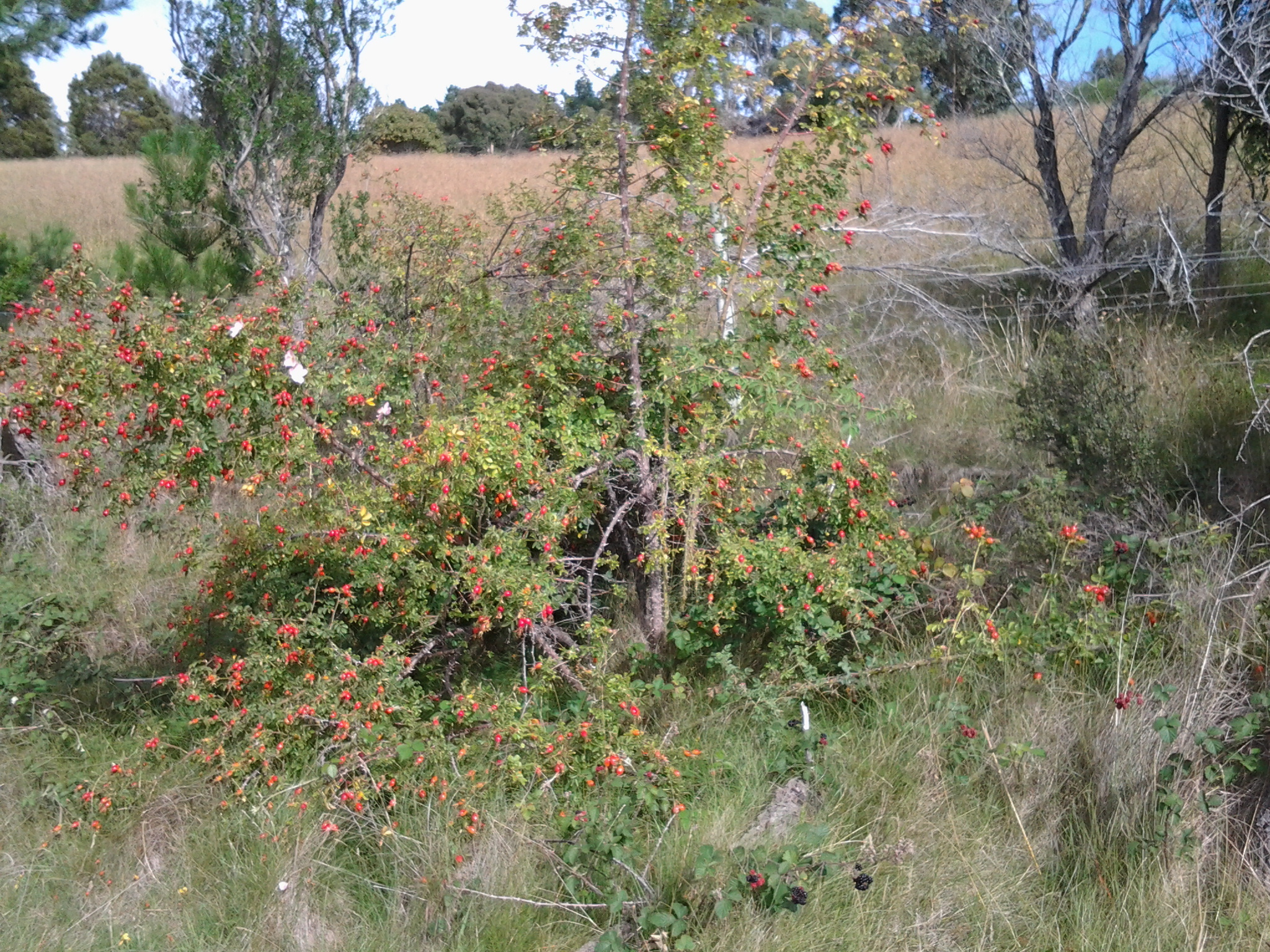
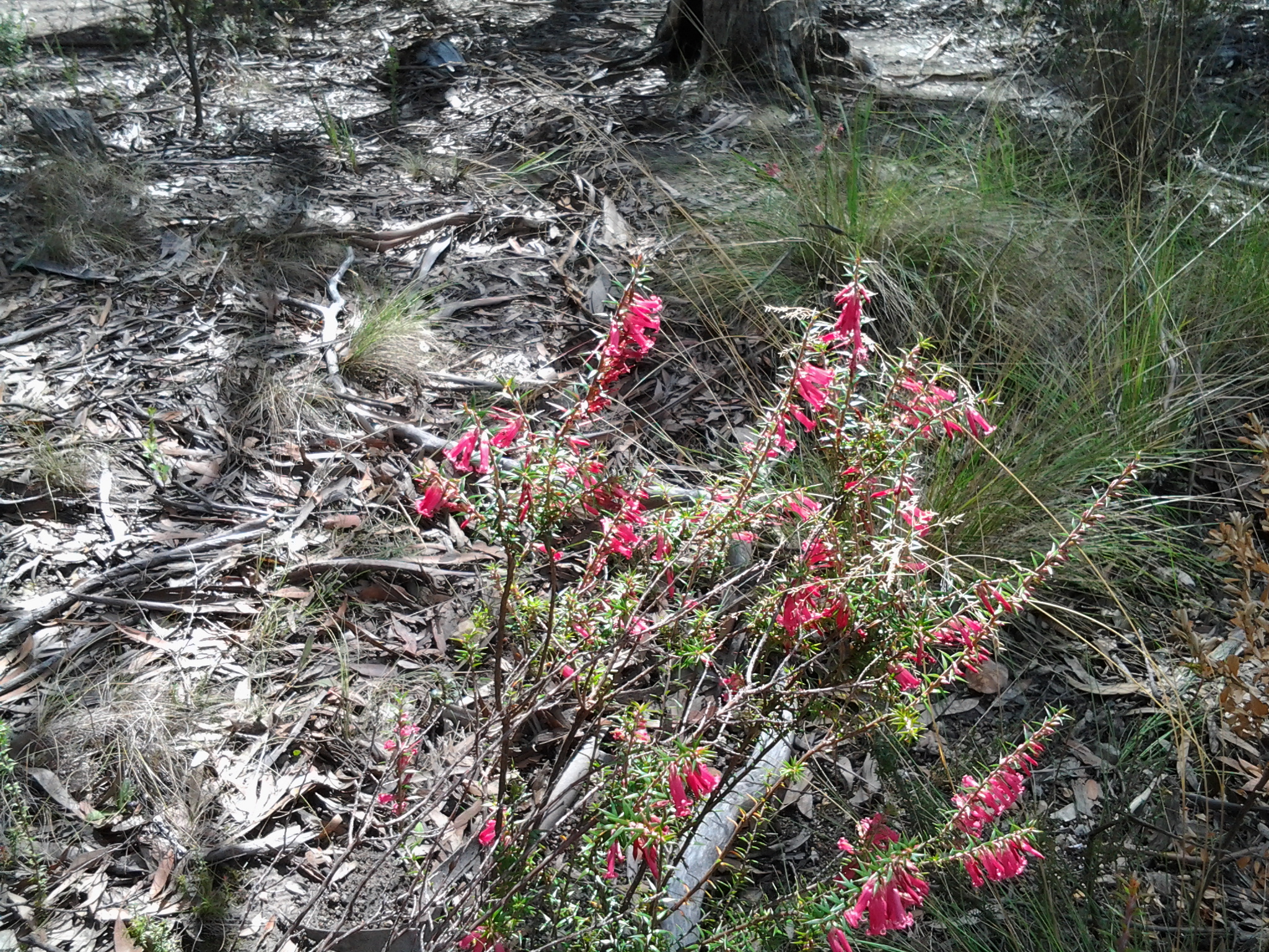
With few people on board, the trip to bus stop 30 in Taroona (the one where I finished in Stage 11) only took 22 minutes and then I was out in the fresh air on the Channel Highway at 7.52am. Gulls calling. Gardens were flush with sunflowers, roses, agapanthus, wandering pumpkin plants, lavenders of all types, and flowering gum trees.  All overlaid by the sounds of bush birds flitting here and there.

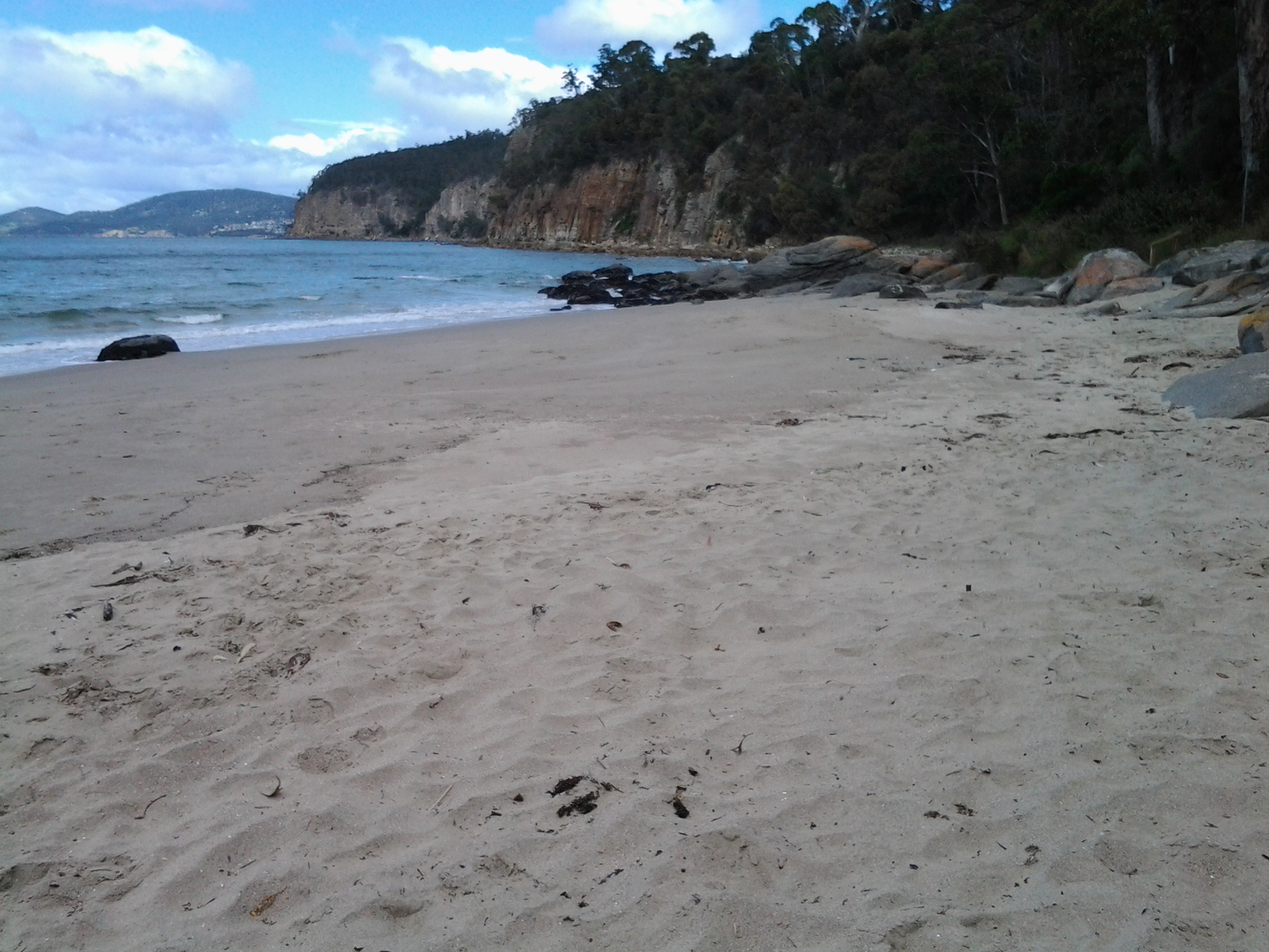
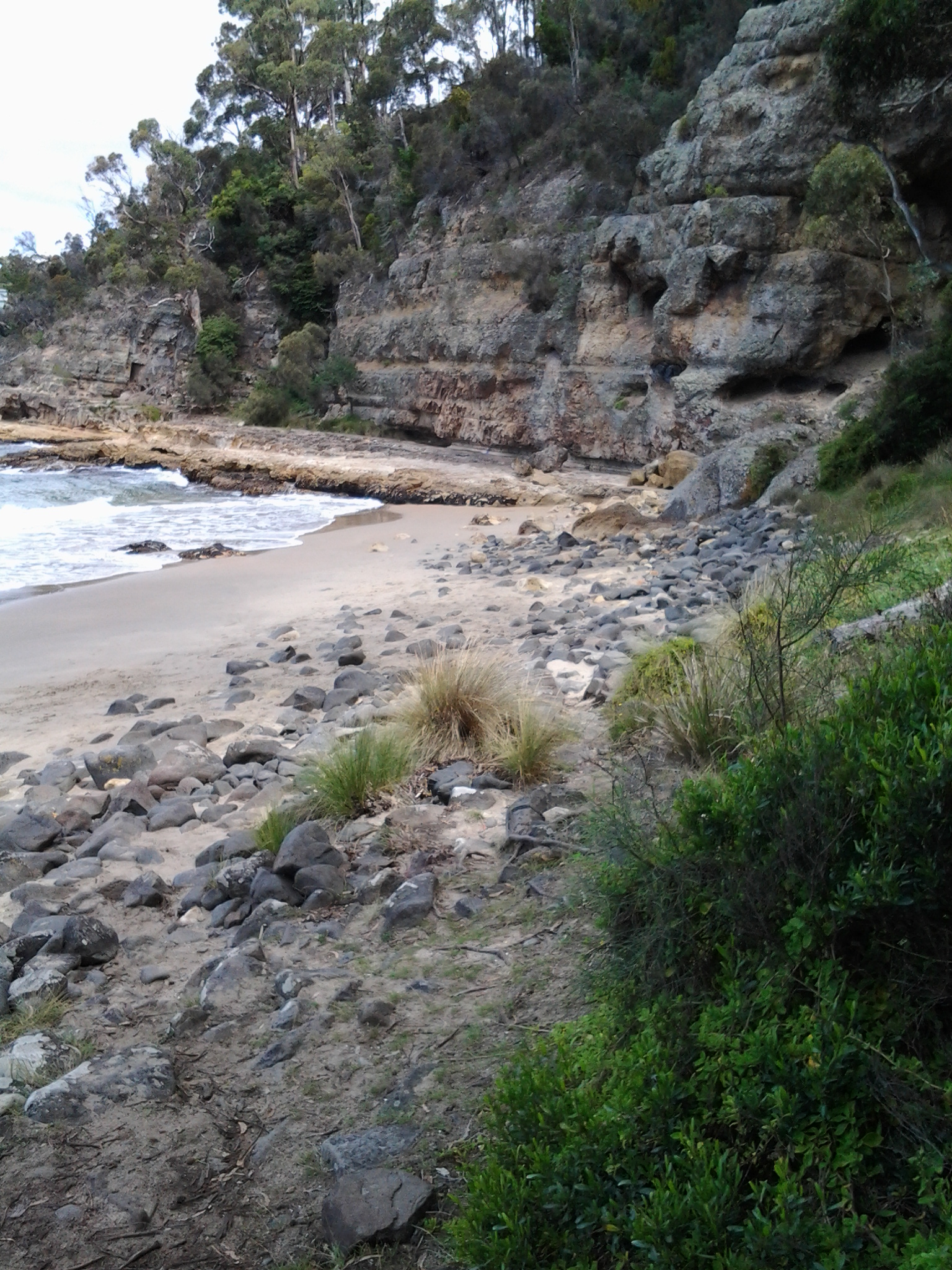
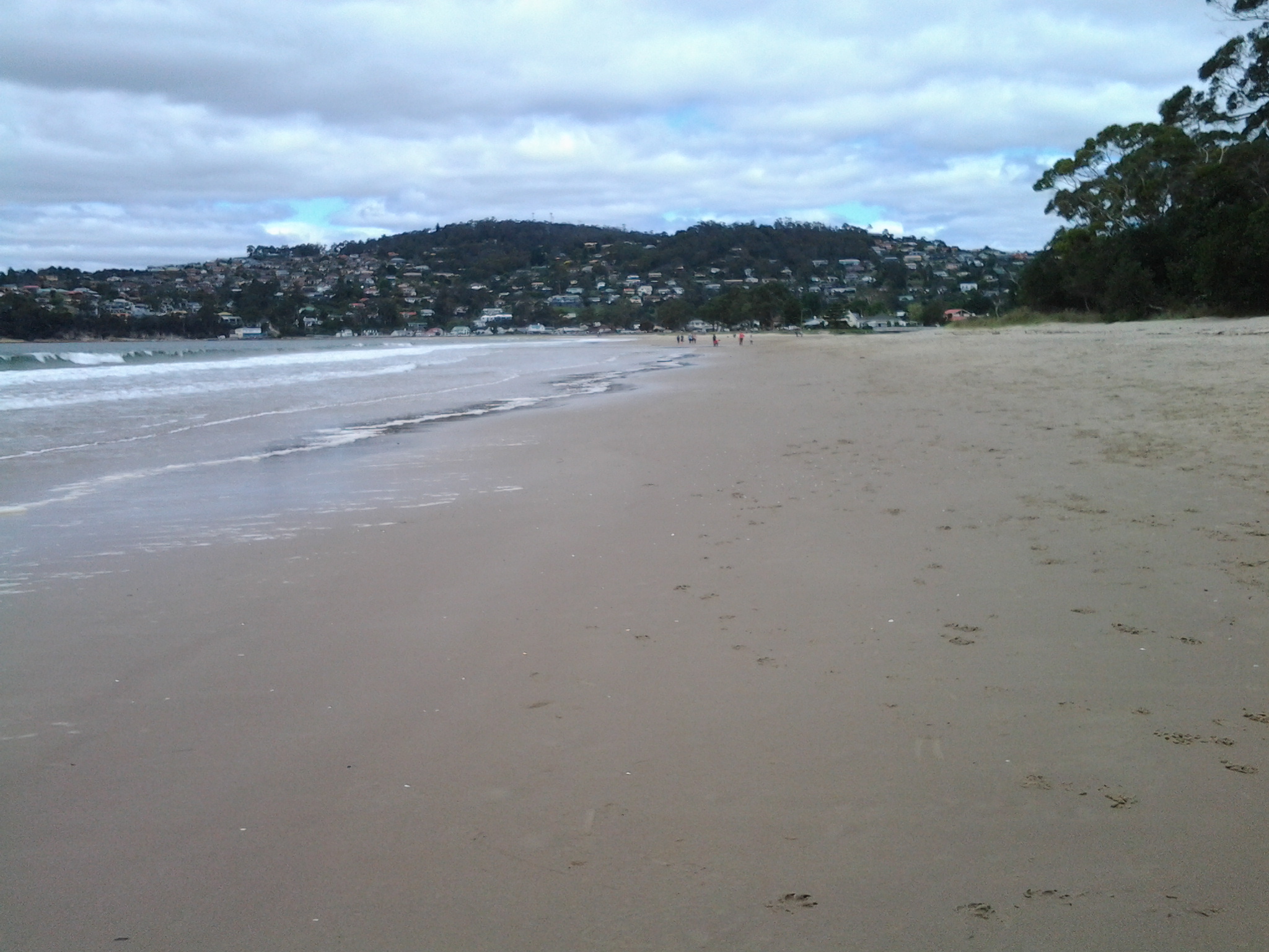
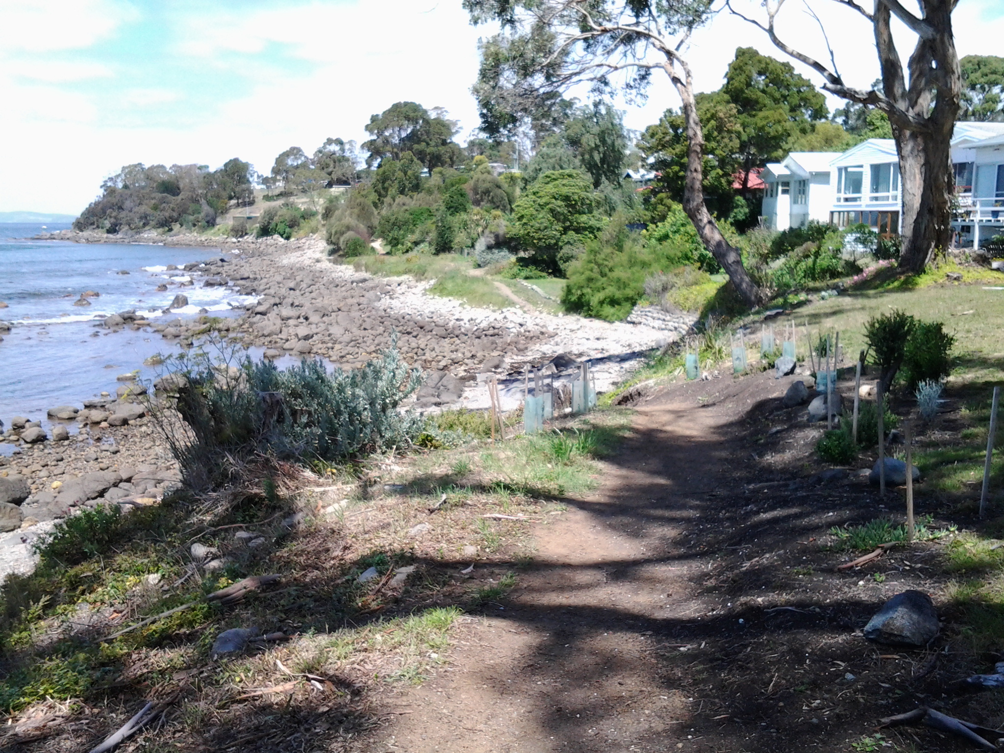
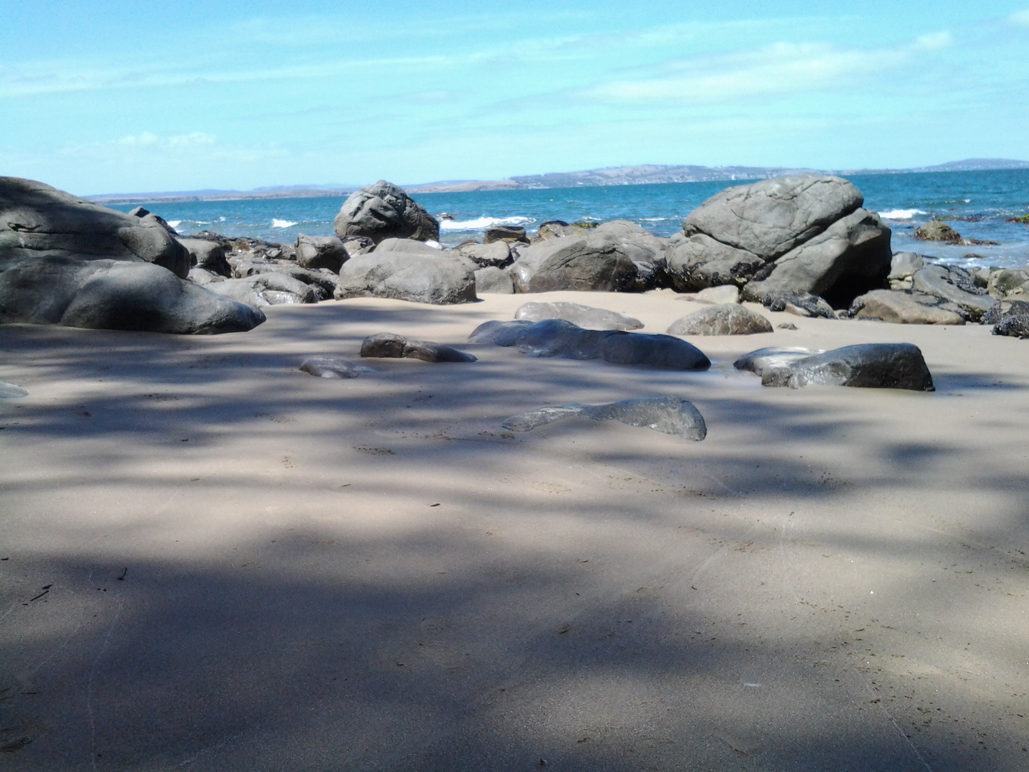
By 7.58am I had walked down Hinsby Street and reached the top of the walkway leading to the Hinsby Beach.  I could hear the shushing of the soft waves along the beach and glimpse a tiny bit of water at the end of the shady path.

20150202_075819

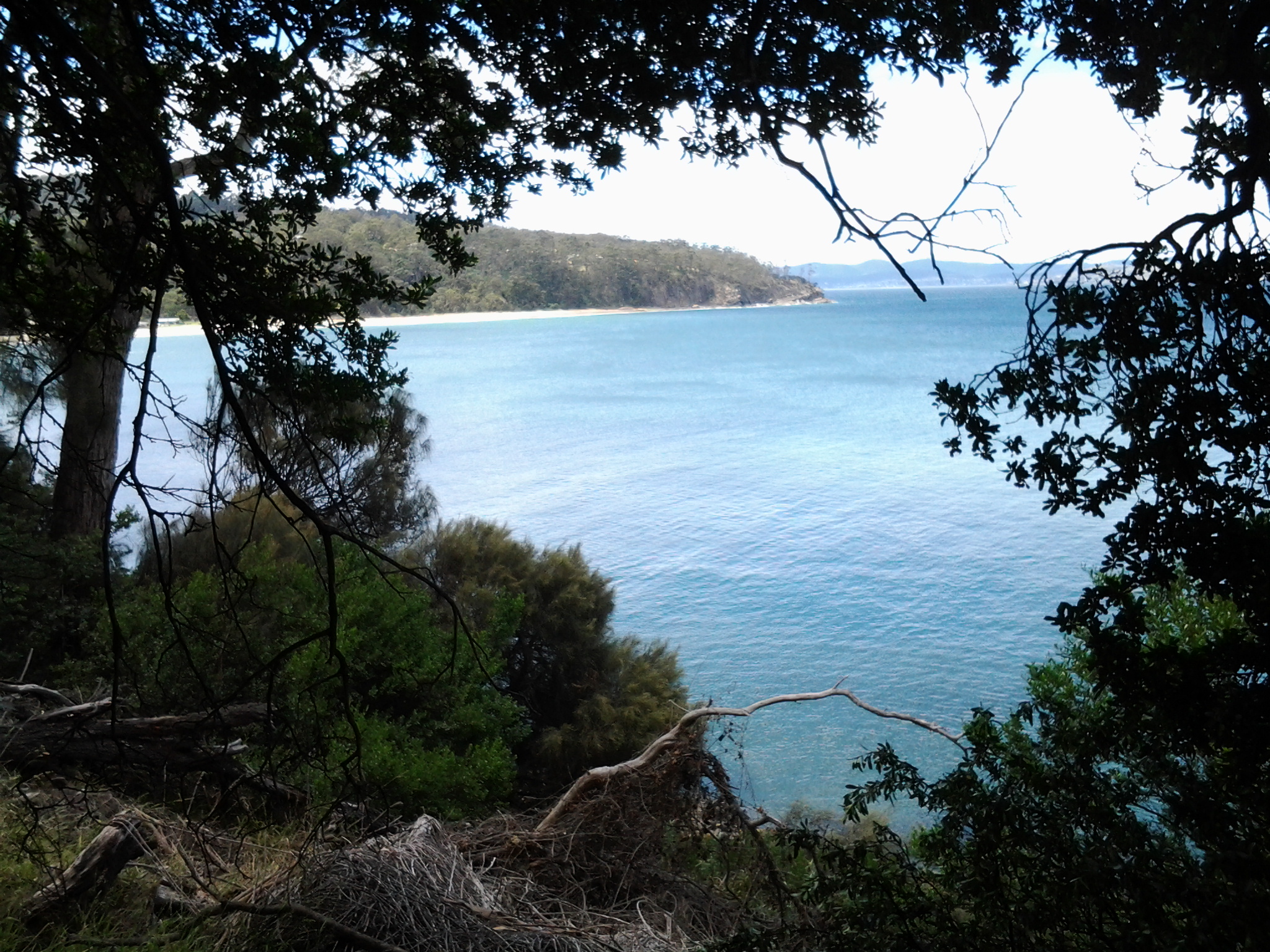
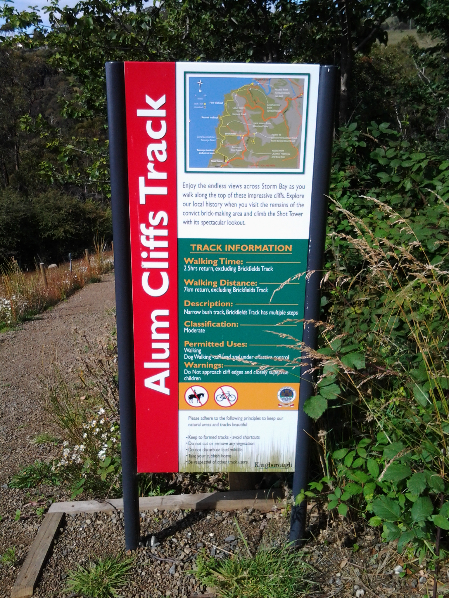
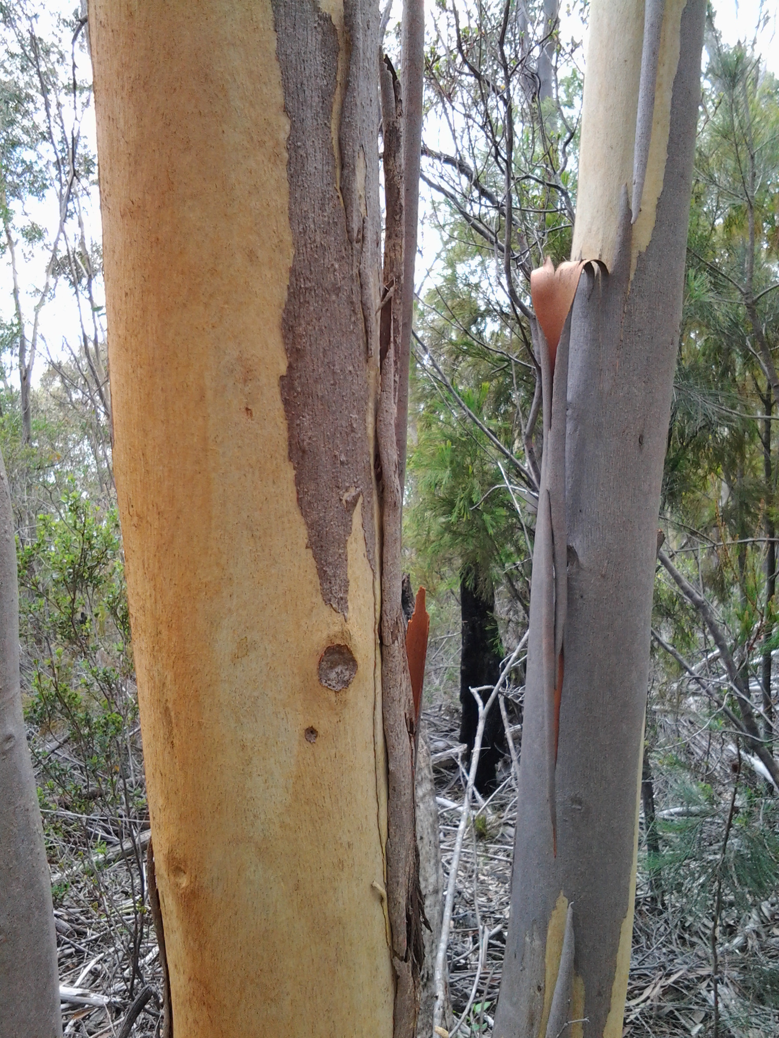
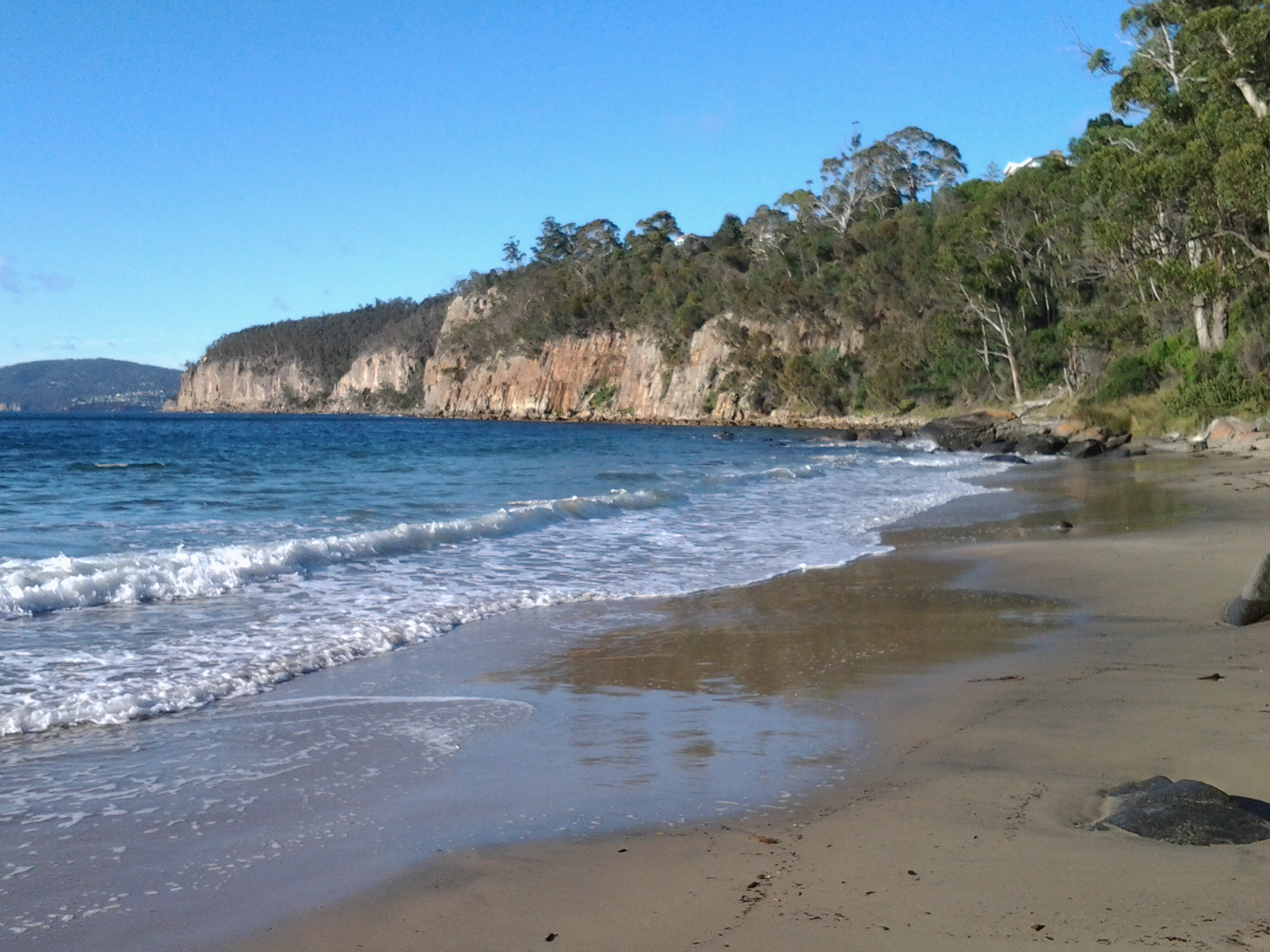
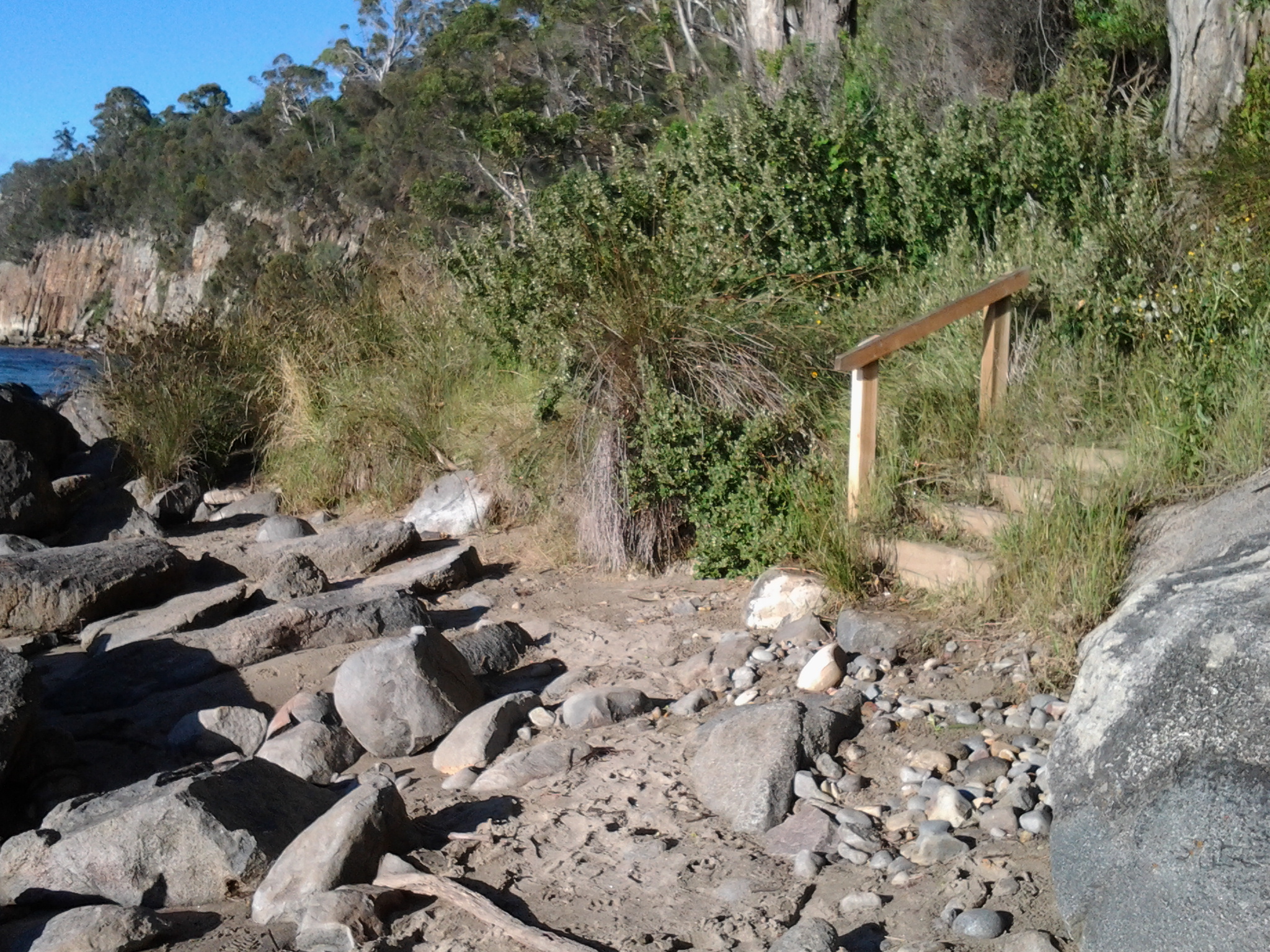
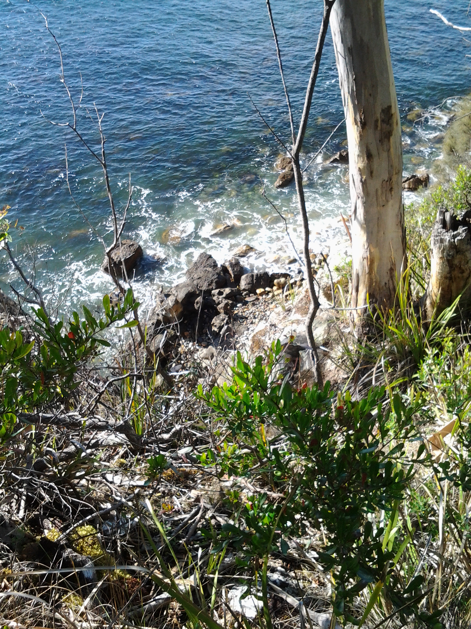
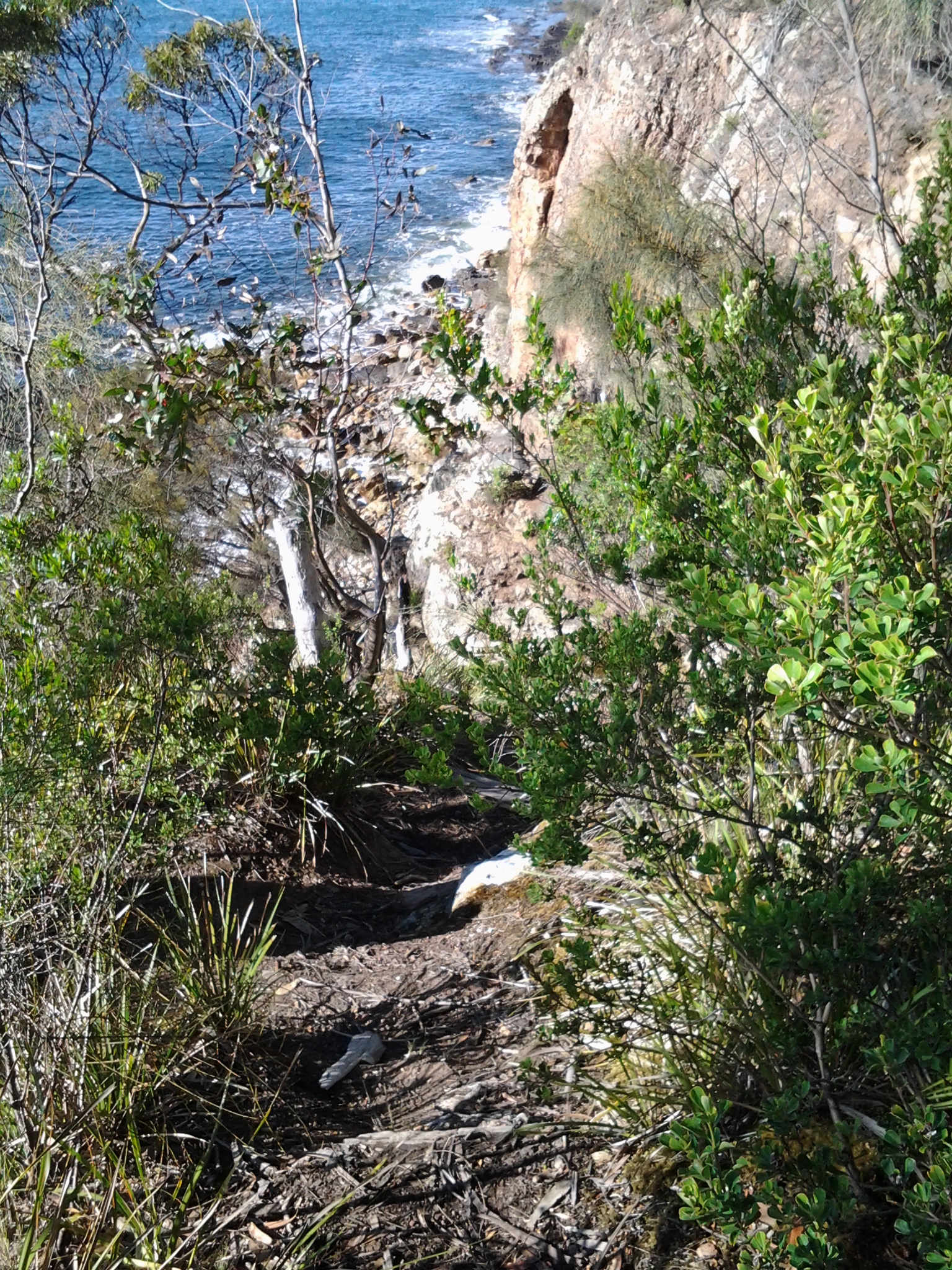
I could see the Alum Cliffs through the trees.

20150202_075858

A swimmer was leaving the water as I clicked a photograph. When I registered his angry body language, I realised I had been feeling the place without really seeing.  Of course my finger on the tablet’s camera clicked mechanically without seeing or feeling – but featuring photographs with him was not to his liking. I immediately claimed to be photographing the Alum Cliffs at the end of the beach and promised not to blog his picture.

20150202_080143

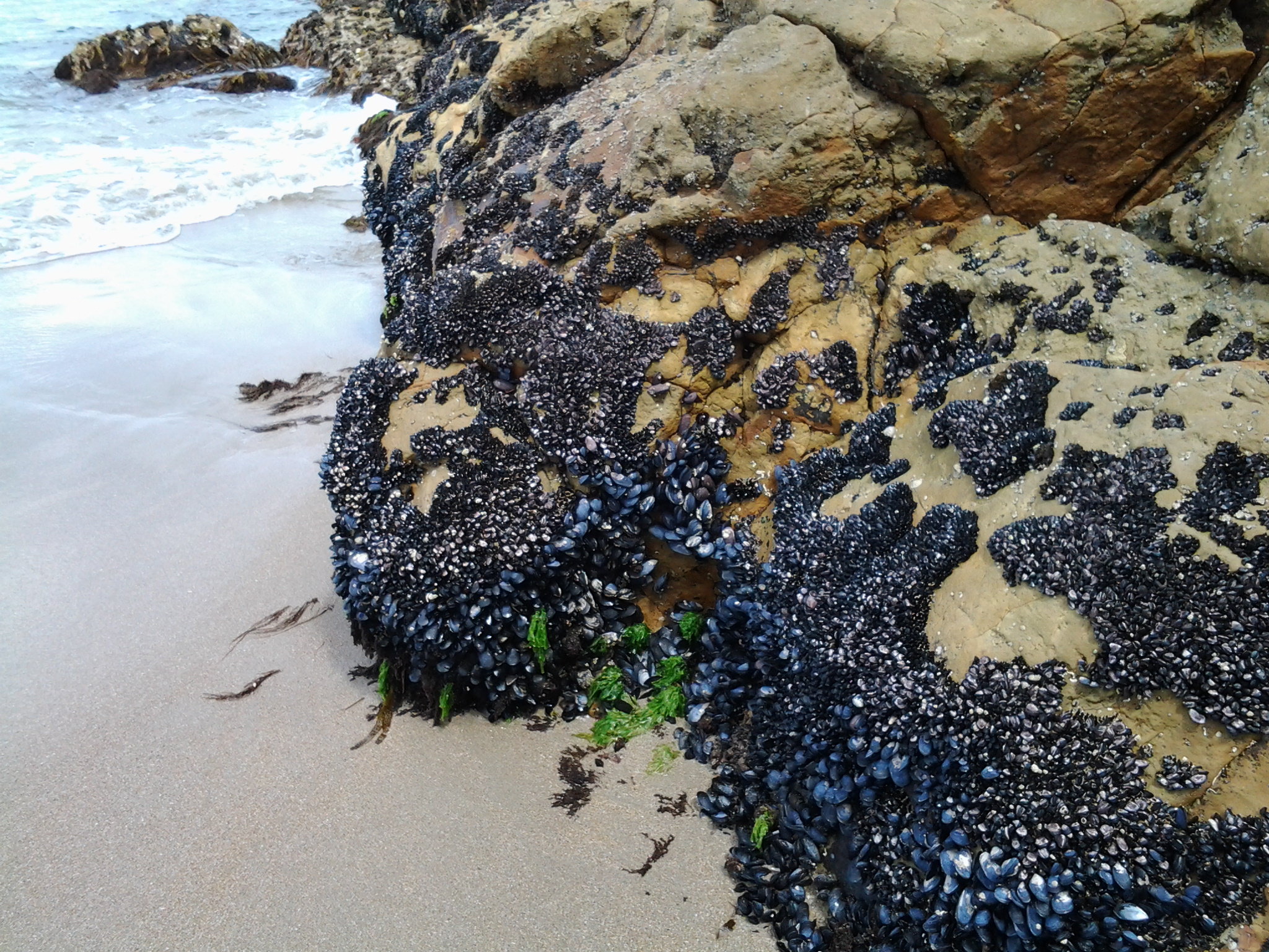
I guess the swimmer was not used to sharing the beach with anybody else that early and could only repeat rather manically, ‘you must come in’, ‘you must come in’ as he gesticulated towards the water.  I was thickly dressed from neck to toe and already wearing my sun hat.  ‘Going in’ was not in my plan.  I continued along the beach. A little later on a path, I took the following photo – I hope you can understand that getting undressed would never have been an option.

20150202_080640

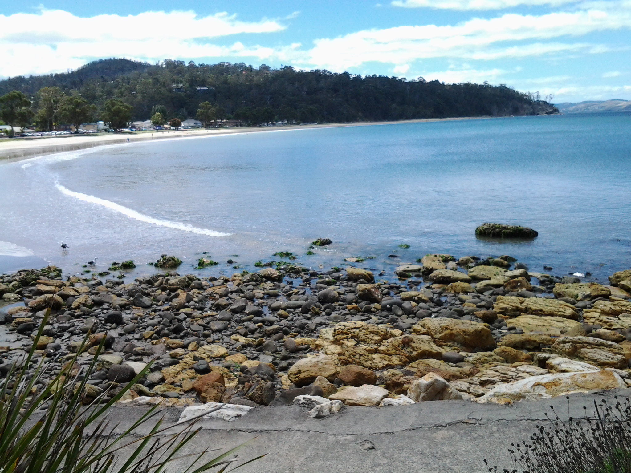
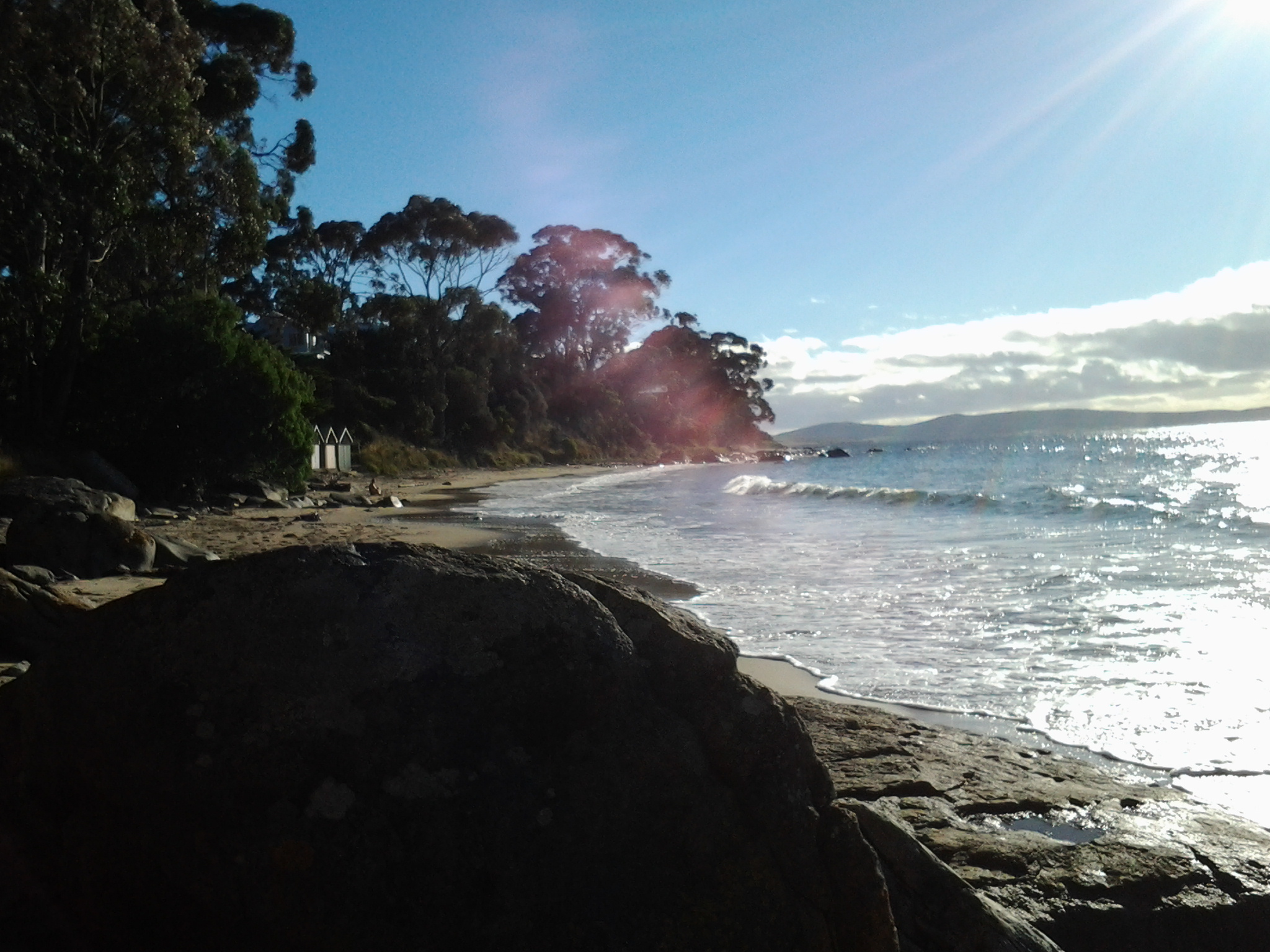
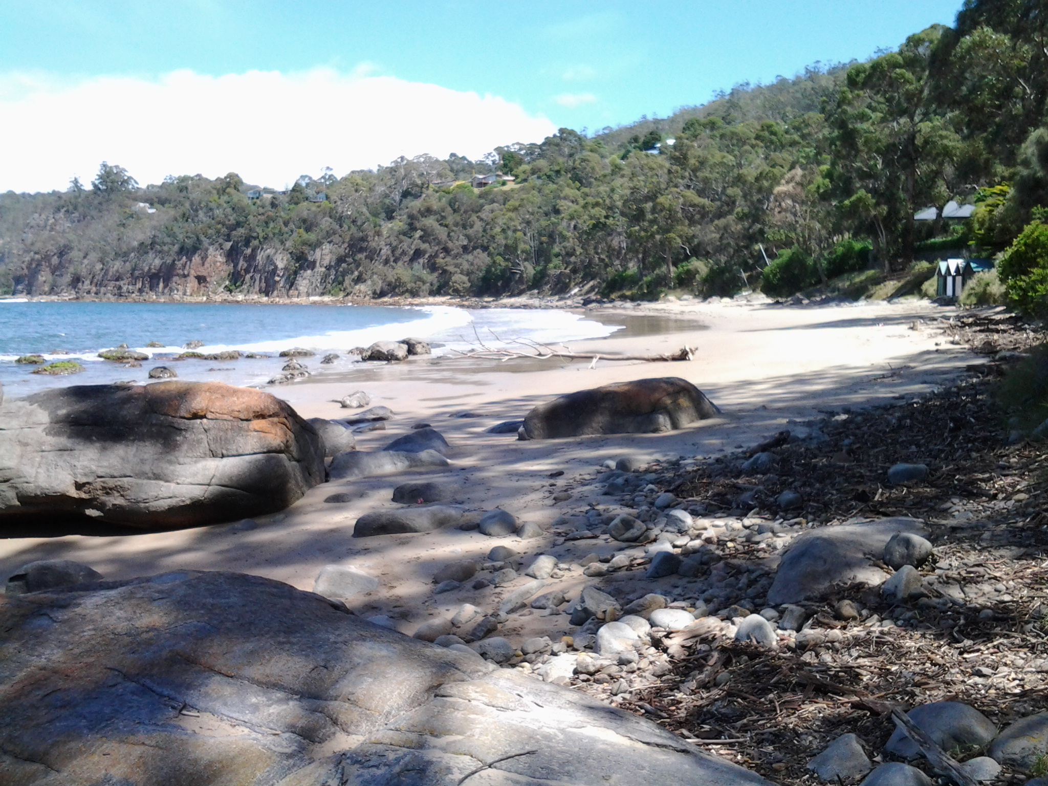
At 8.05am, at the end of Hinsby Beach, I looked back for one last sea-level view of Hinsby Beach.

20150202_080405

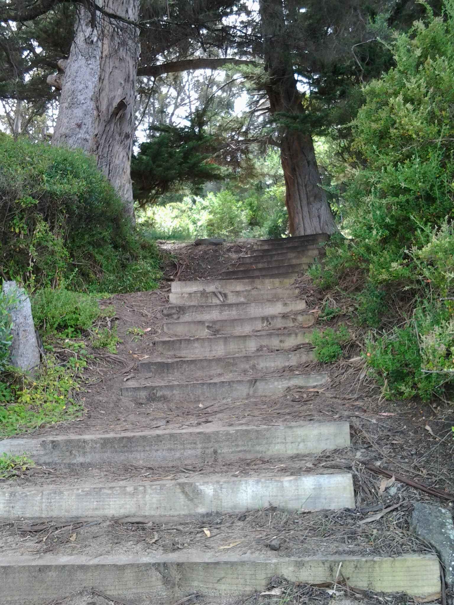
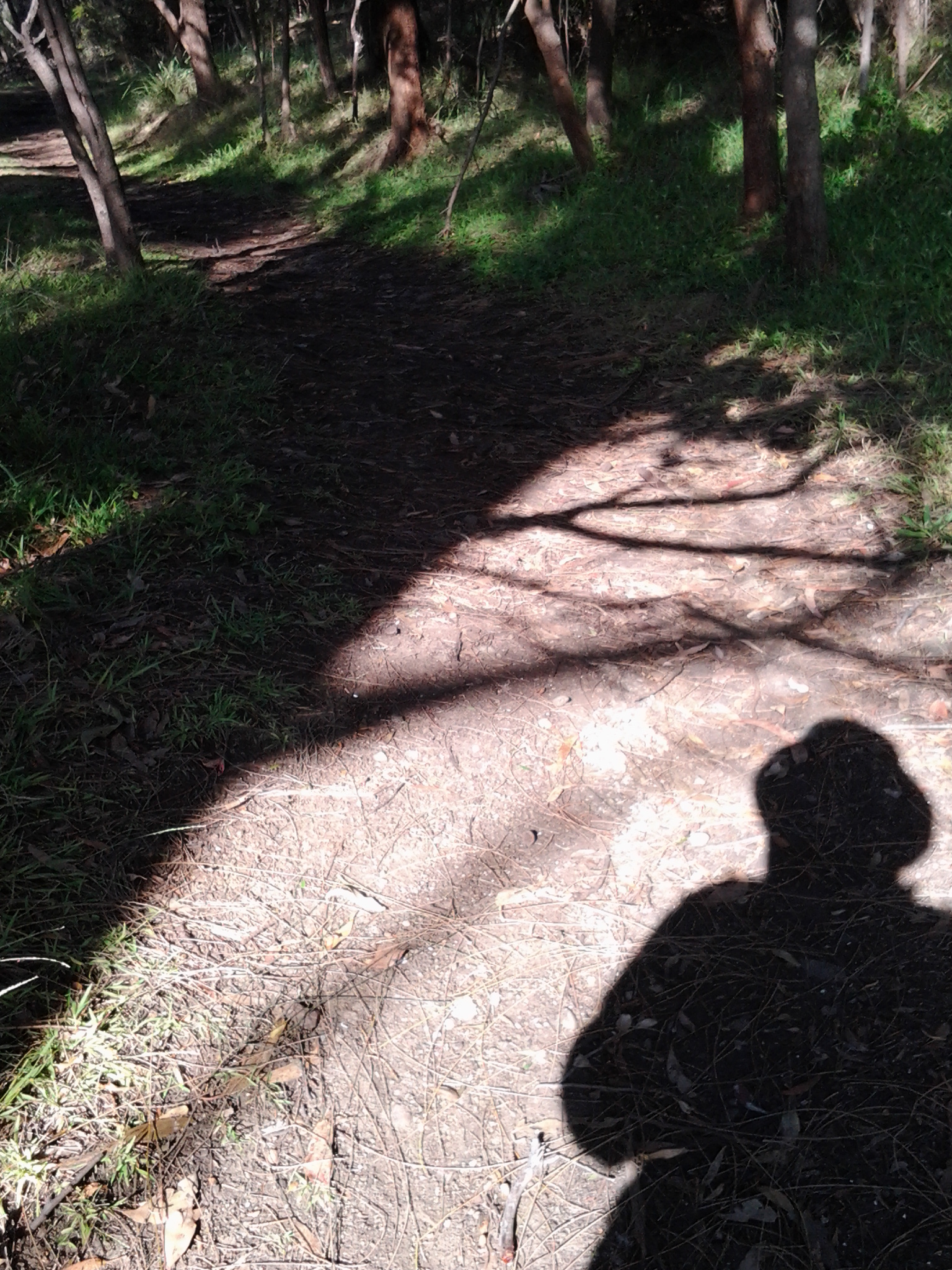
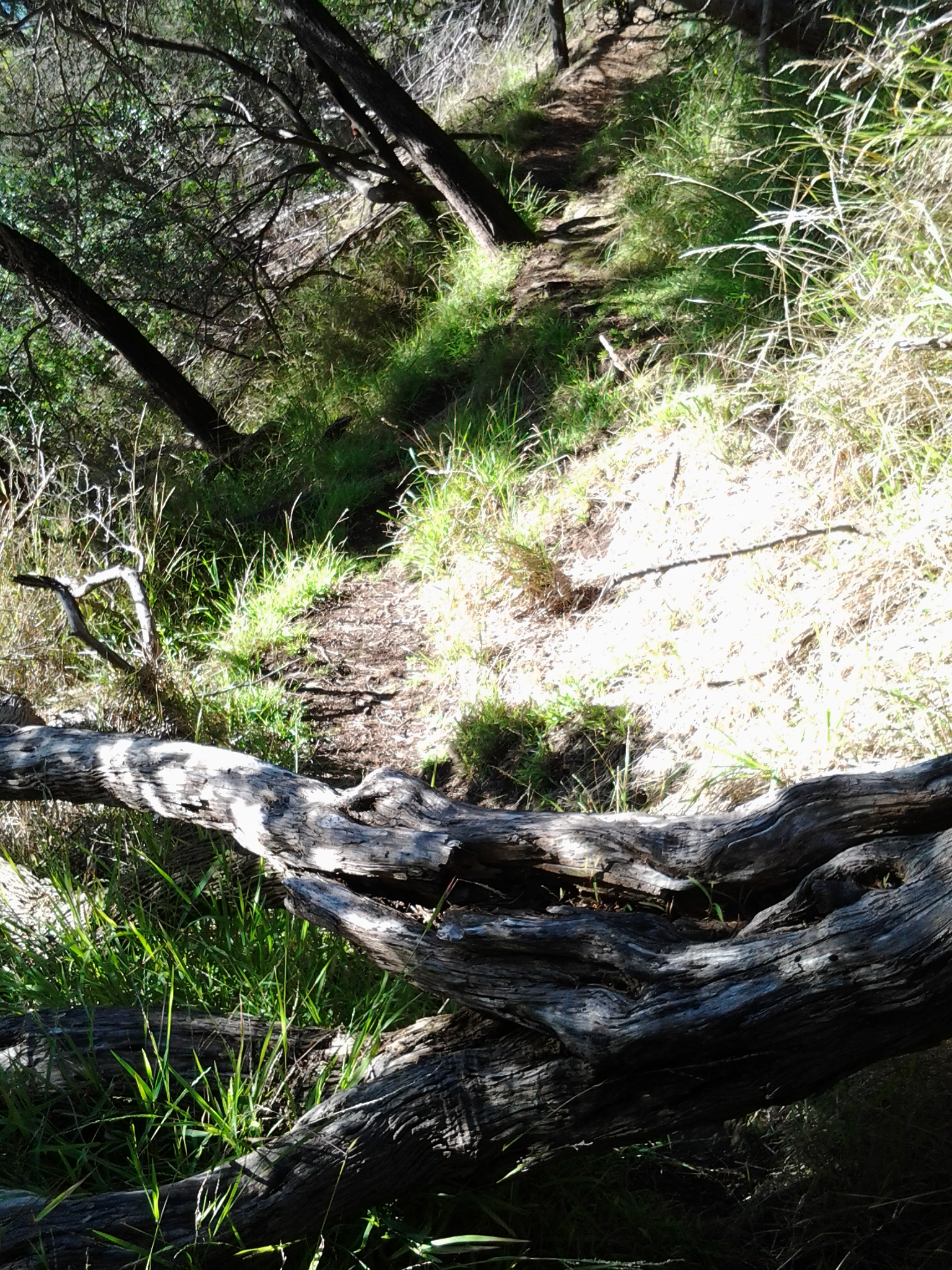
I reached a stairway with rails and walked uphill until I seemed not to be on a clear track.

20150202_080359

When you read further below you will realise the photo above does not show the start of the track which I should have taken.

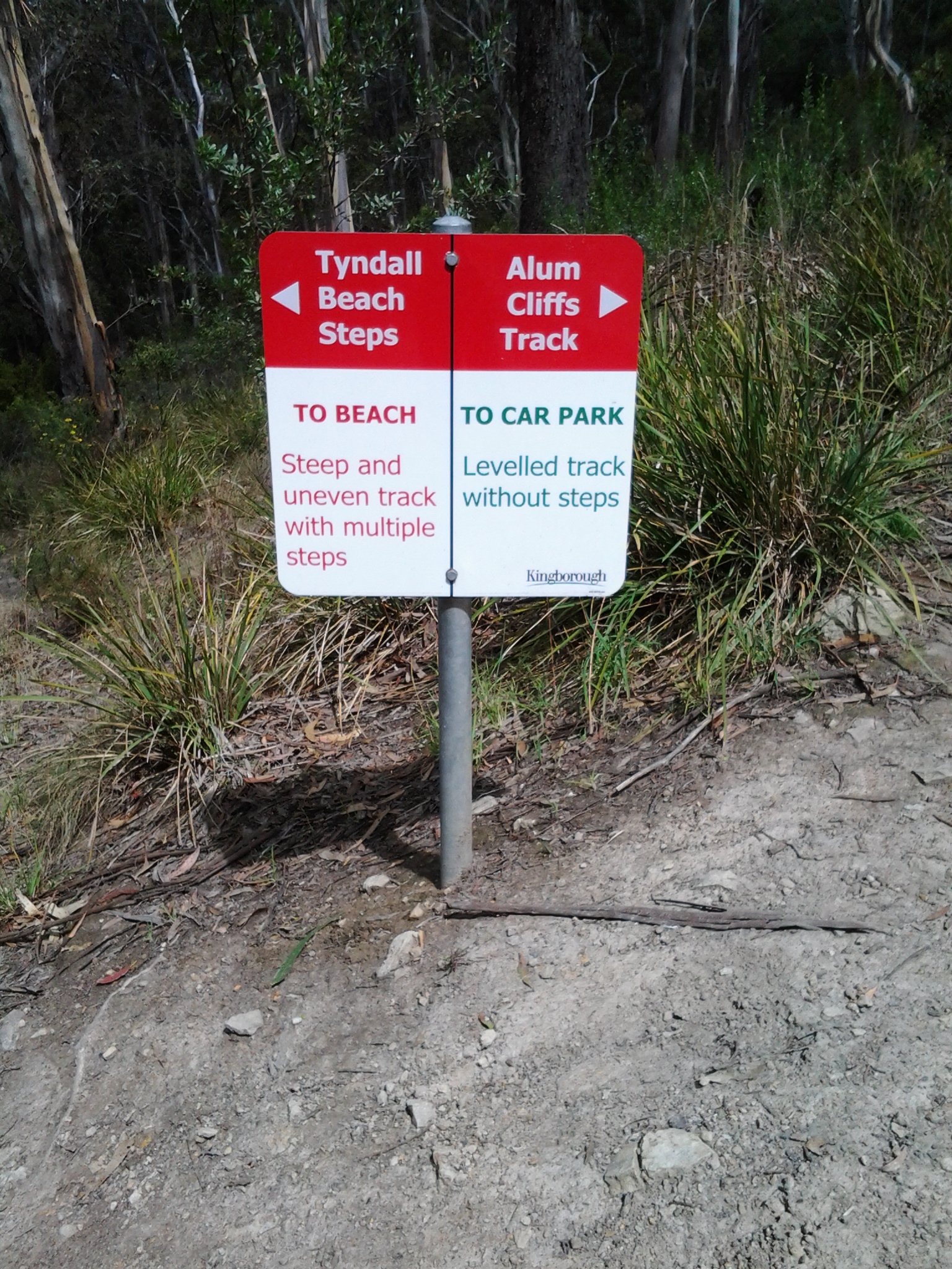
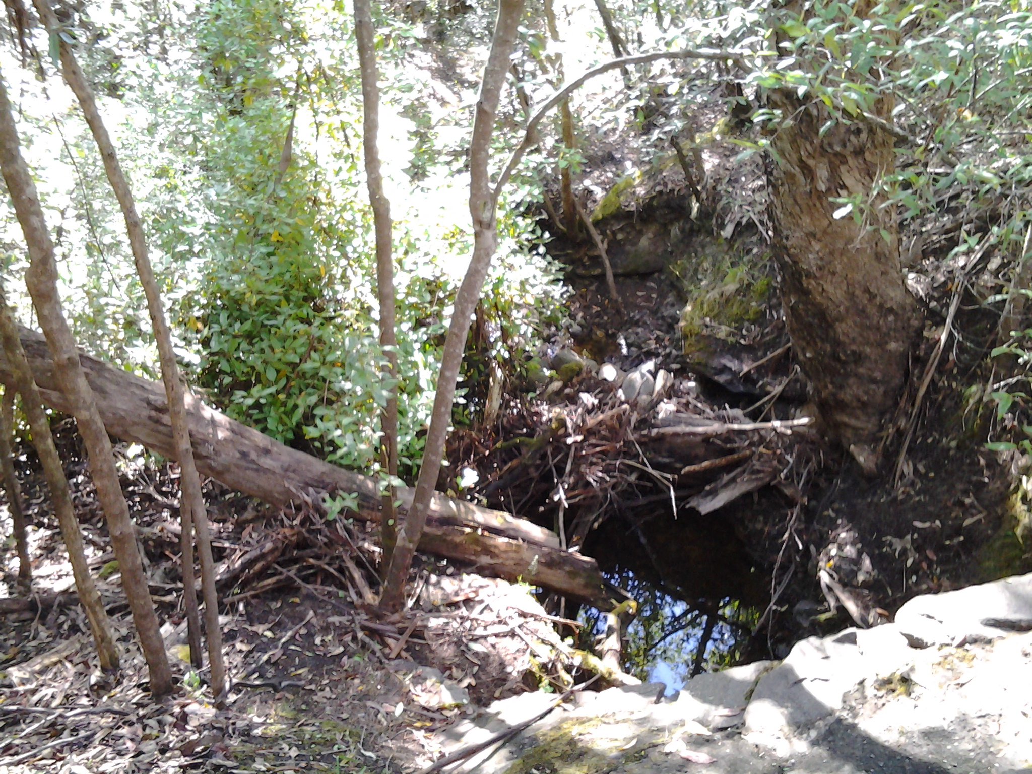
Very soon I arrived at a gully with a small trickle of water passing downhill. I chose not to cross by balancing as a gymnast on the dead tree trunks that criss-crossed it. Instead I simply walked easily down, stepped across a few rocks and walked up the other side.  Before long it was clear I was fenced in and that a proper dirt track passed on the other side of the fence. The fence was elastic so I swayed over it rather dramatically without falling off and down the cliff on the other side of the track. When I righted myself and looked back along the track which I hadn’t known existed, three women and a dog stood very still, their mouths agape. ‘Are you alright?’ they chorused. ‘Yes’, I assured them as I smiled.  Some moments I wonder if I am losing my once good judgement.  ‘But where have you come from?’ I asked with a puzzled wrinkling of my forehead. ‘Where did you find this track?’  Apparently, if I had bypassed the stairs and track I had chosen and walked around over the rocks of Hinsby Beach a little further, the real track started there.  Time for the installation of a few signs!

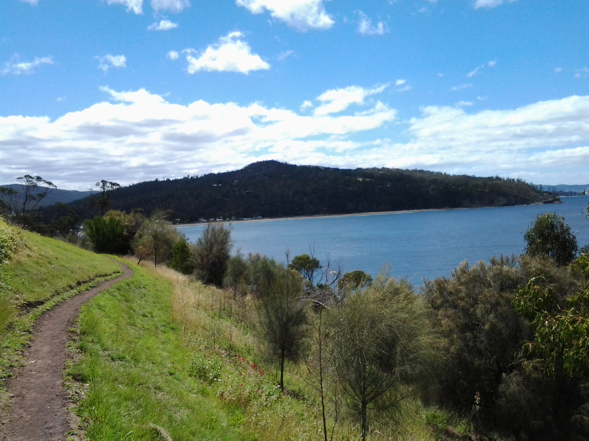
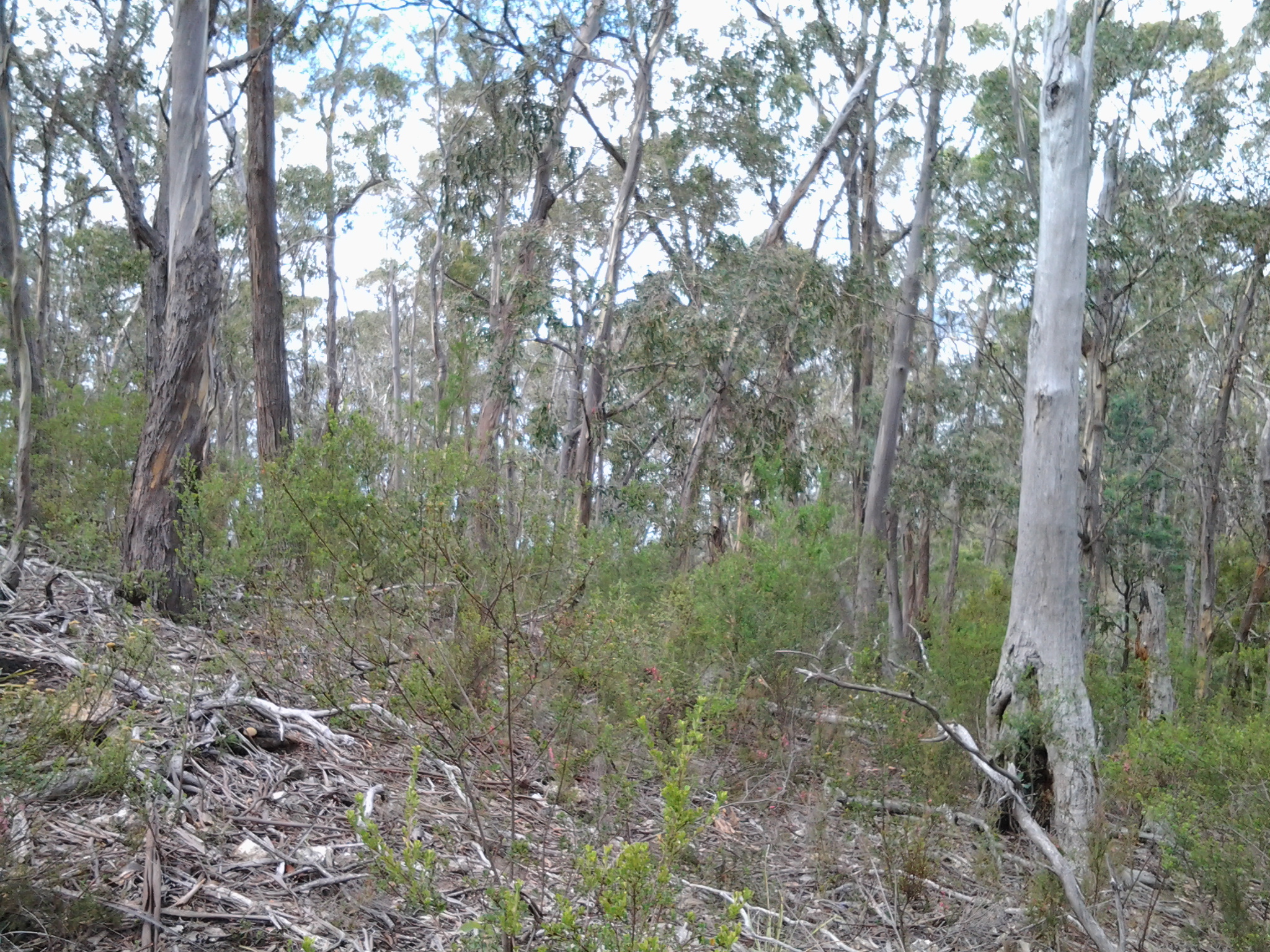
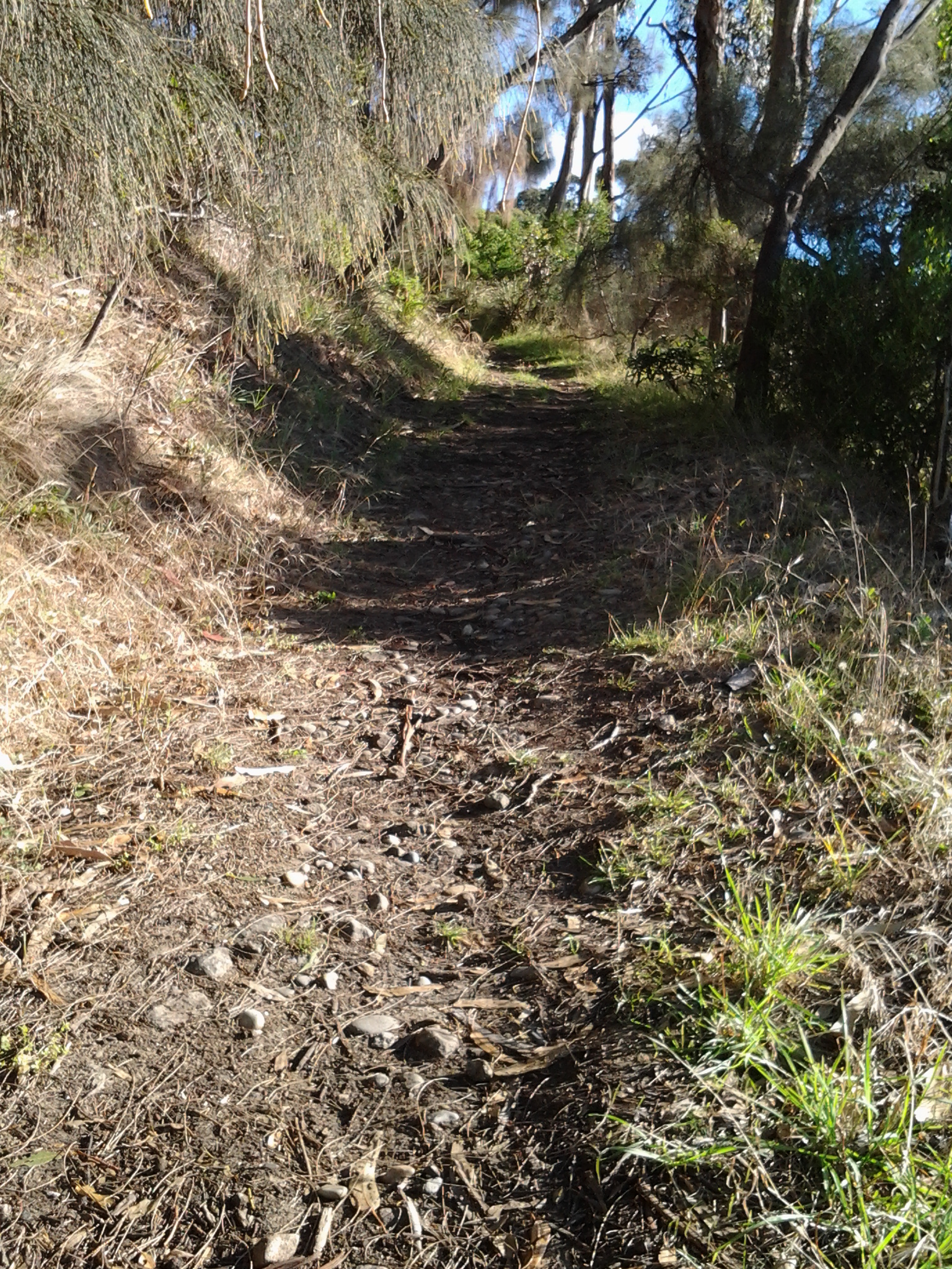
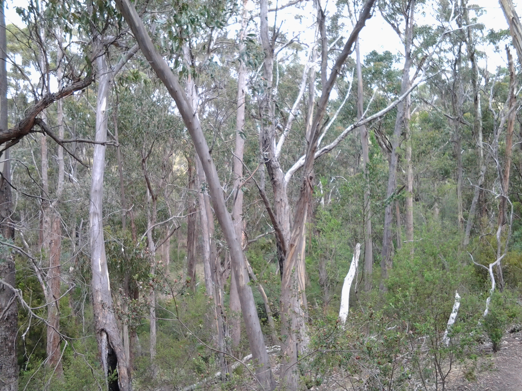
This ‘new’ track was fine.

20150202_080456

Although there were occasional diversions across the track.

20150202_084019

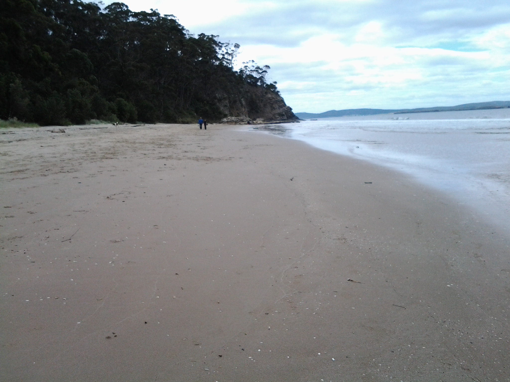
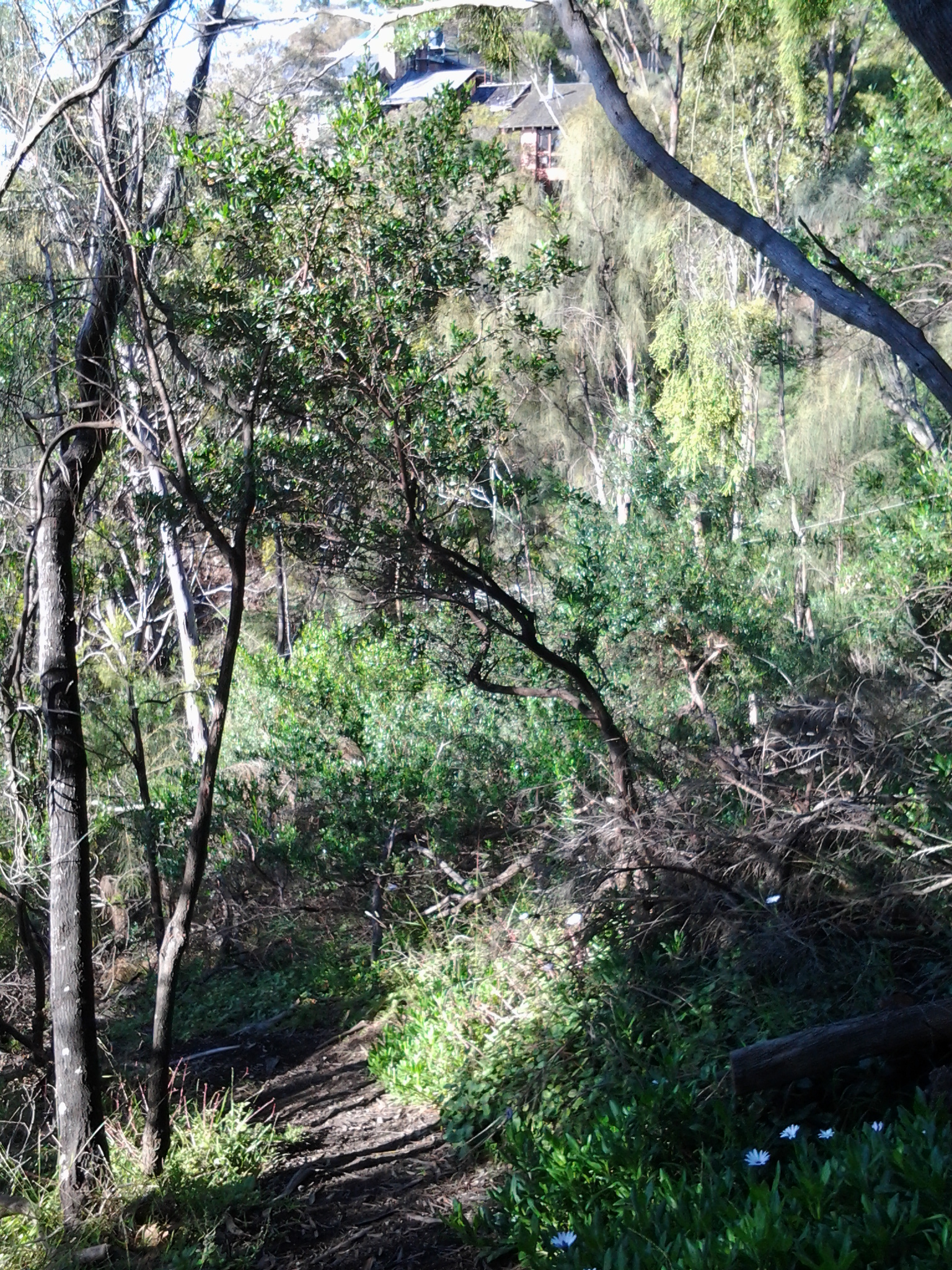
The view back towards Hinsby Beach was clear.

20150202_082252

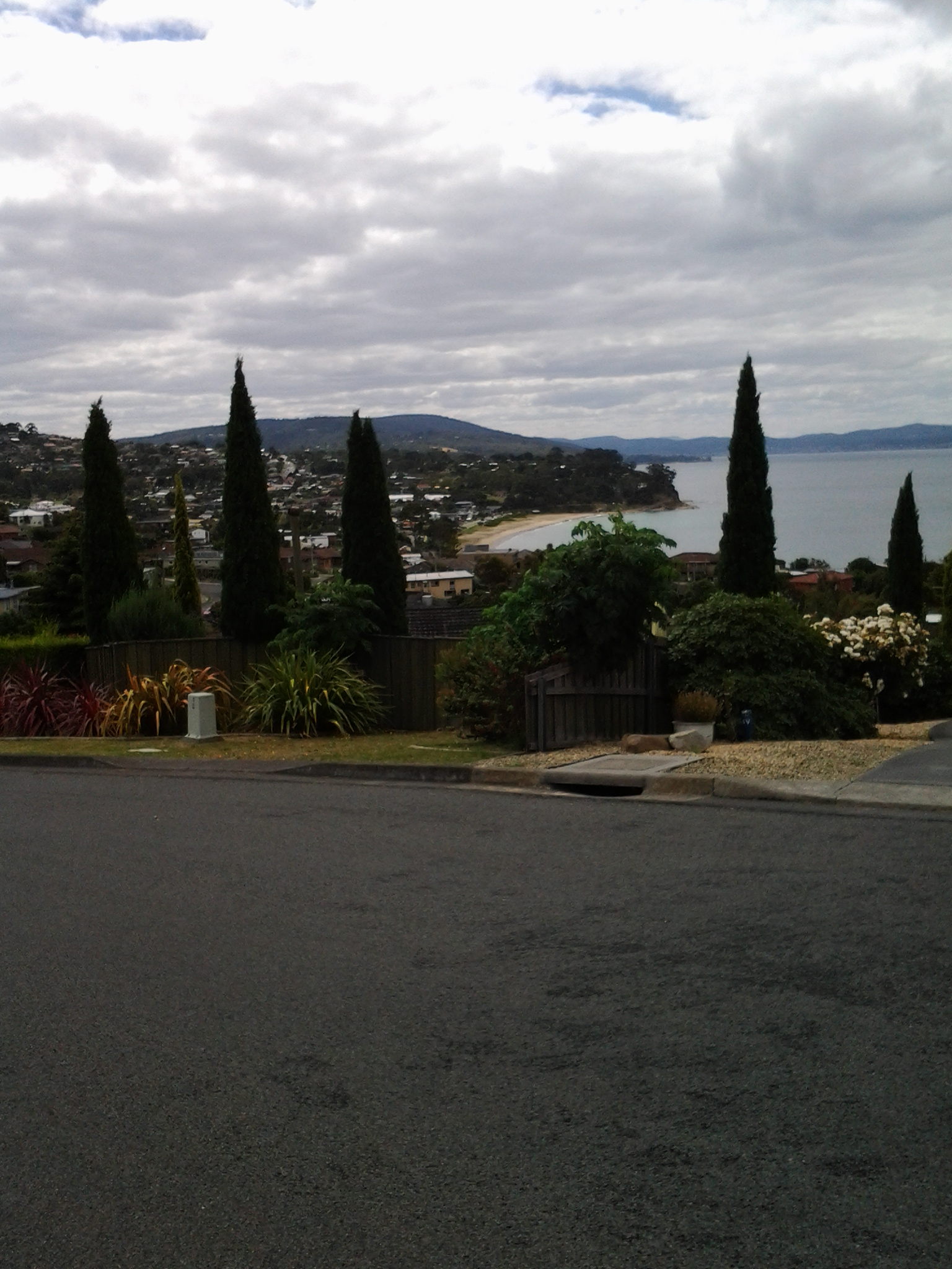
The time was 8.22am as I offloaded my jacket, smeared sunscreen across exposed parts of my body and continued walking along the track until it extended up into a suburban street.  At 8.25am I turned left into Wandella Ave, wandered along past houses for a while, could not see any further tracks back to the Alum Cliffs, talked to a local who did not think there was one and recommended that I should walk up to the Channel Highway and continue southwards on that road.

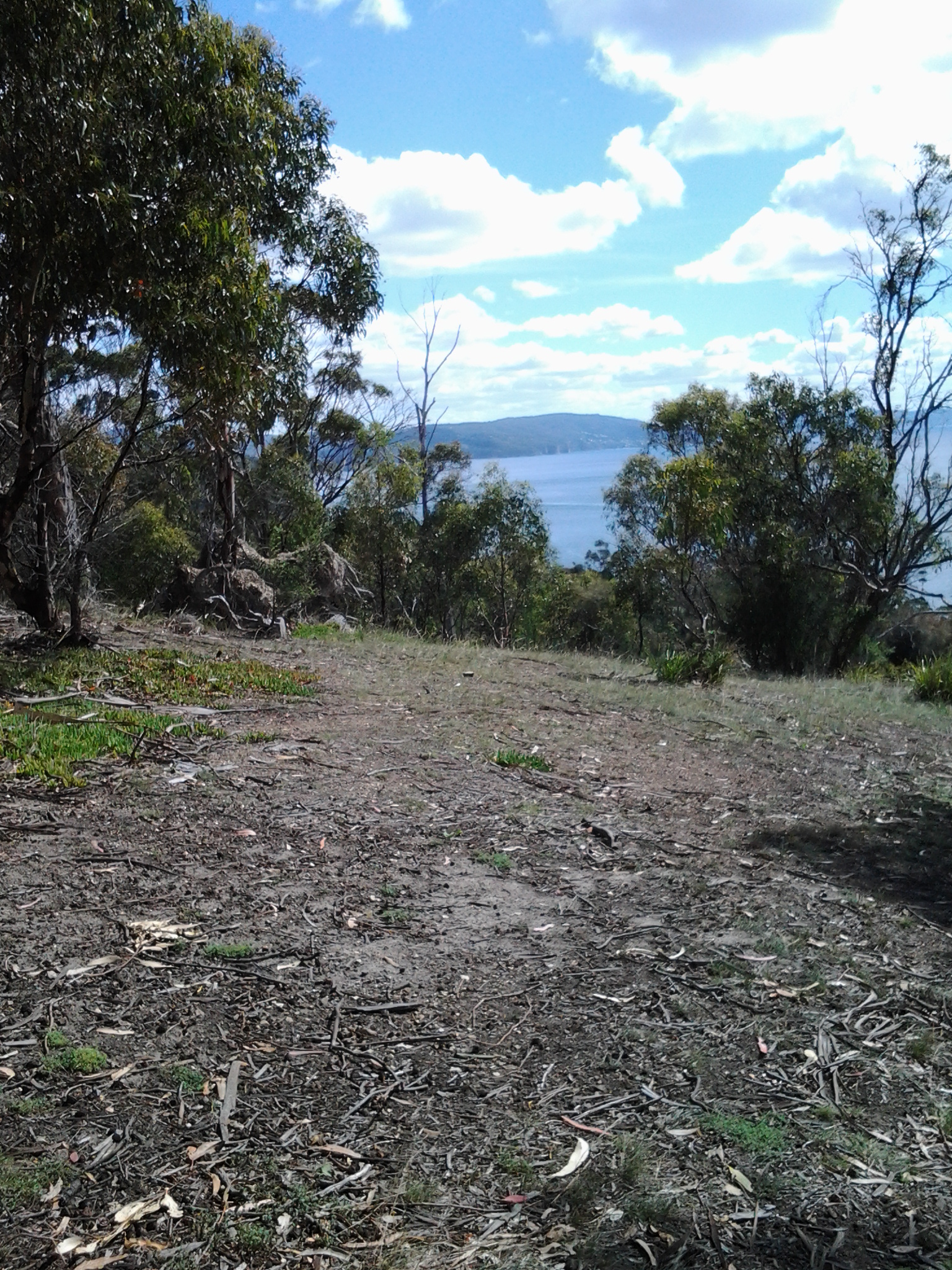
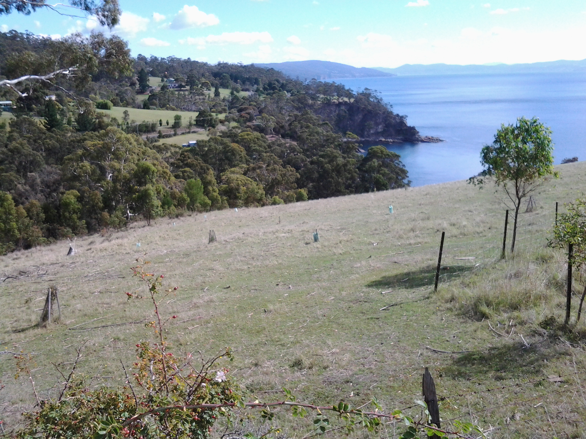
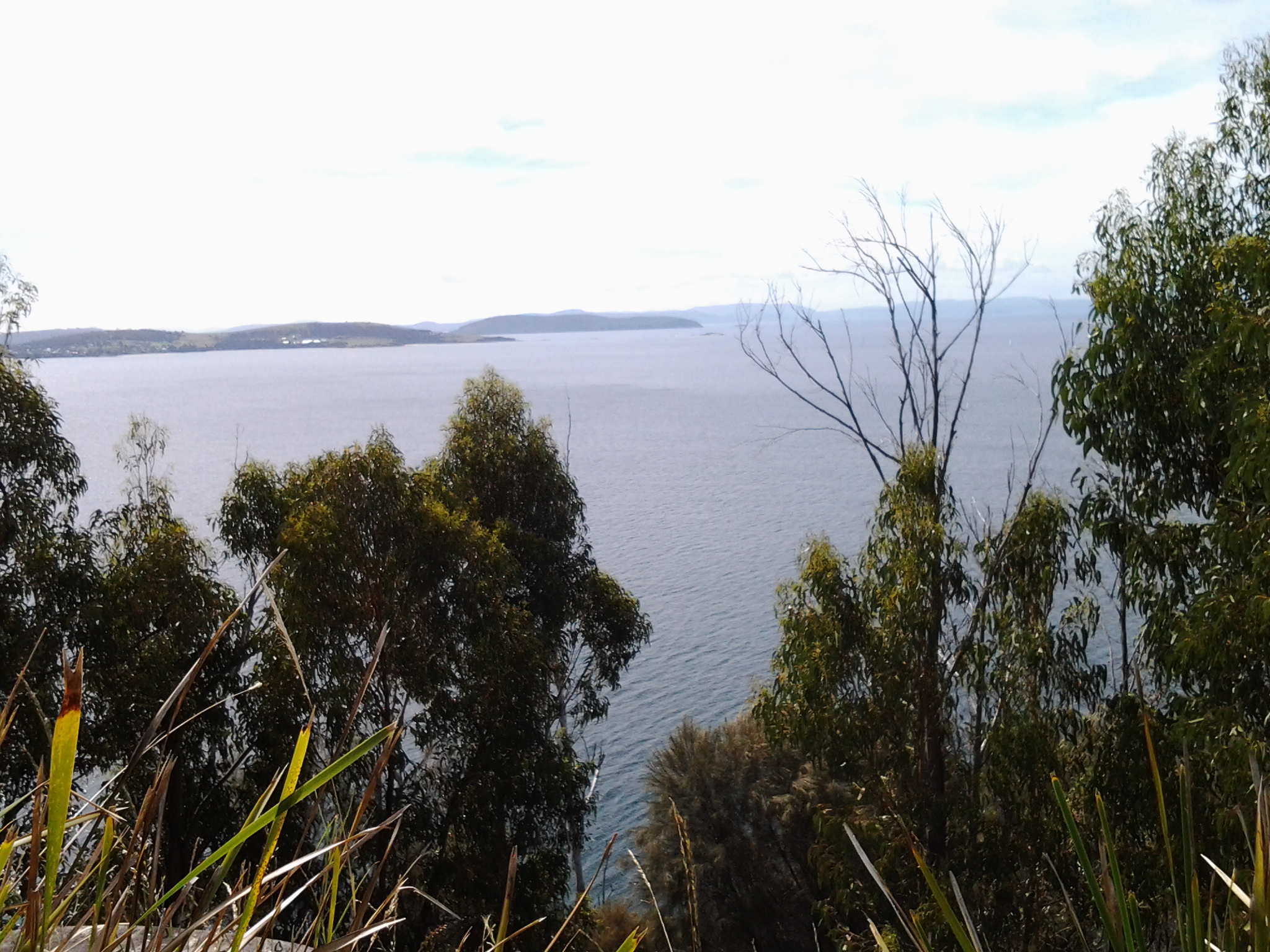
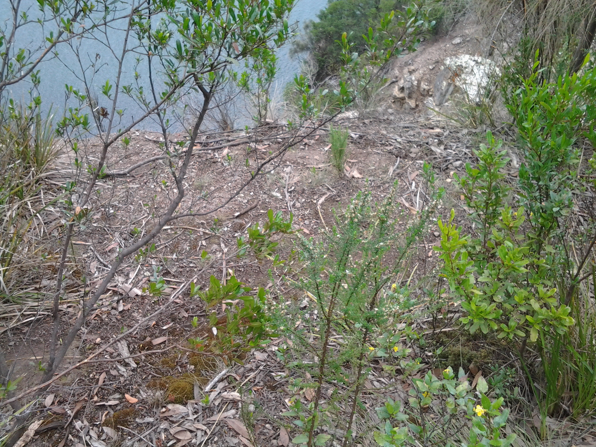
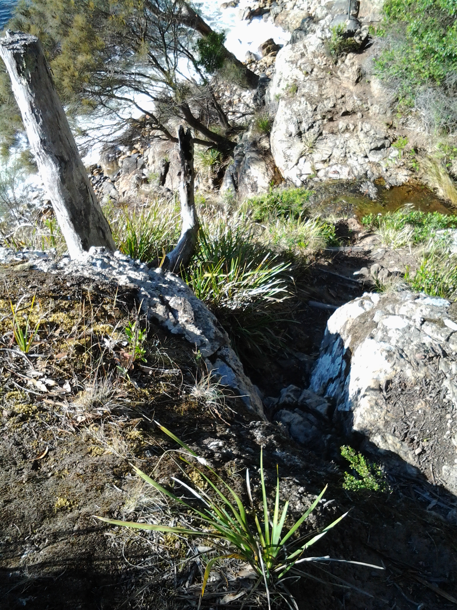
Not to be defeated, I retraced my steps down the original pathway until I discerned an old disused track that seemed to continue along the Cliffs.  I walked it but casual inexperienced walkers and those walking alone absolutely should not. Incredibly unsafe in just about every way.  I didn’t fall nor receive injuries but there were so many ways and places I could have damaged or killed myself on that route.  I won’t relay all the details of that walk except to say that the views across the Derwent River though the trees were grand. Blue Wrens darted around me through the bush. Waves pounded against the Cliffs, and I could hear the roar of waves crashing on distant beaches.  Because photographs flatten the vistas, the ones I have taken do not present the feeling of isolation, steepness nor roughness of this non-track.  But it was incredibly beautiful and I am glad to have seen that landscape.

20150202_085324

I started this diversion at 8.37am. After following a collapsing path (although parts were good), I managed a deep descent into and an ascent out of an unnamed gully by 9.12am, rounded an extensive private house, talked with the house owner about the future of tracks along the Alum Cliffs and the non-availability of any tracks passing his house (which stood on the very edge of the Cliff) around 9.25am, and walked down and around the very long winding private driveway over a trickling creek, I reached suburbia again at 9.35am – the same point on Wandella Ave I had been earlier in the morning. I had completed a loop. Certainly I had been close to the Derwent River more than most but I had not advanced along the River.

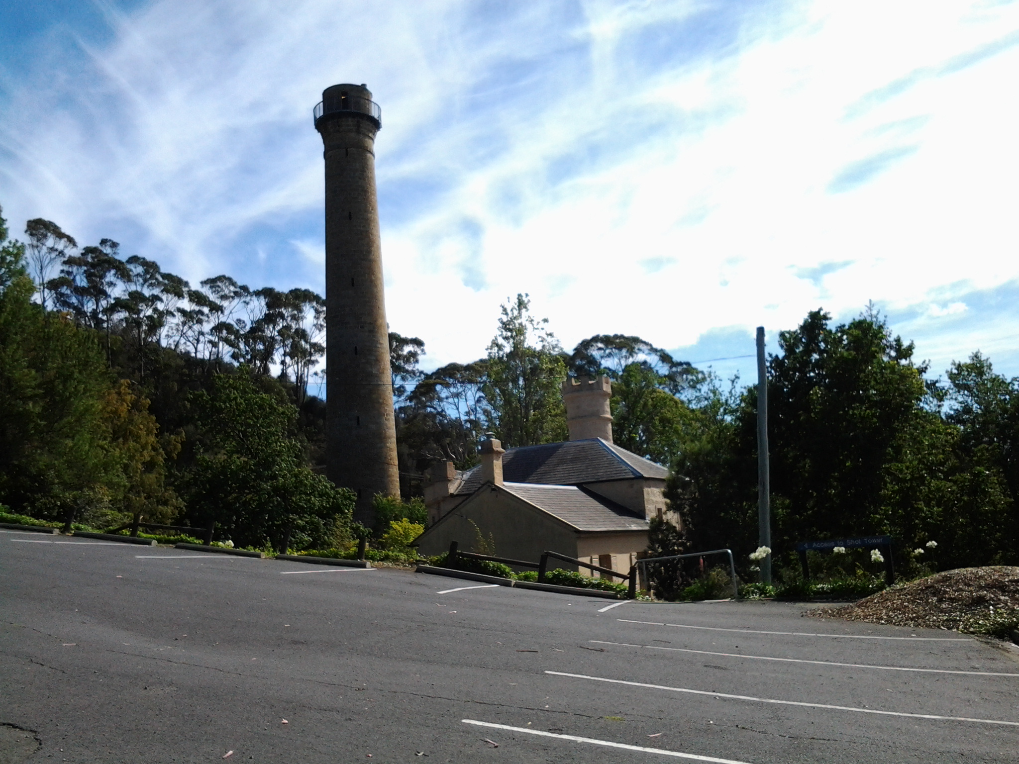
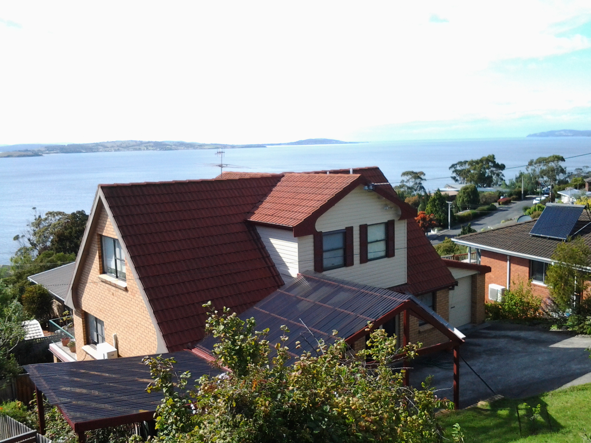
The first photo below shows the house I climbed up to on top of the cliff after descending into a gully, the waters of which plunged over a rocky edge to the River.

20150202_084704 20150202_085446 20150202_092605

I recommend that all evidence of the existence of the disused track should be eliminated.

From Hinsby Beach to Blackmans Bay accomplished on Stage 12 yesterday

The goal of my walk along the Derwent River for Stage 12 was to start at my last stopping point, Bus Stop 30 on the Channel Highway at Taroona on the western shore of the Derwent River, and continue to Blackmans Bay in the local government area of Kingborough.  I did not get as far as expected, but I was satisfied when I finished 2/3 of the way along the Blackman’s Bay Beach.

Over future posts, I will write up the stories of the walk, what I saw and what I experienced, but for now it’s enough to say that I am continuing with this massive project to walk both sides of the Derwent between the mouth and Bridgewater, and then onwards to Lake St Clair.

Yesterday I covered 5 ¾ kilometres of the length of the Derwent River on the western shore (making 35 3/4 kms in total on the western shore), and walked approximately 11 kilometres (making a total of 154 kms to date) to achieve that distance; there were a lot of steep ascents and descents.

20150202_085332

This distance also takes in the streets and paths on which I walked that led to dead ends so that I needed to retrace my footsteps.

The highlights of the walk include finding a way through some of the early part of the almost untracked Alum Cliffs, the delightful walk along the tracked part of the Alum Cliffs, meeting some friendly people along the way, the unusual snake sign at Tyndall Beach, stopping for a long cup of tea in Kingston with a friend, my discovery of another tucked away beach – Boronia Beach, and the Blackmans Bay Blowhole.

There are many memorable images but my favourite for today is one of my photos of mussels growing on the rocks at Boronia Beach.  I have already made it my desktop background image. When enlarged, the blues glow.

20150202_142540

Fundamentally the Stage 12 walk was about forest and water.

20150202_113014 20150202_104740  20150202_115156 20150202_152557

The day started with my being roughly opposite Gellibrand Point at the northern tip of South Arm and finishing opposite the long South Arm Beach.

I intend my next walk will start from where I left off at Blackmans Bay and then continue into the Tinderbox area to Fossil Cove.  But before then I need to record the details of yesterday’s walk.  So Stage 13 will be a while away.

Geological and Social History of our Alum Cliffs

Patricia Roberts-Thompson (http://taroona.tas.au/assets/document/1354363720-a_walk_along_alum_cliffs.pdf) indicates that the first recorded reference to the Alum Cliffs was in 1847.  She explains that these rocks, Permian mudstone (250 million years old, contain iron pyrites and, as the rock weathers, the pyrite oxidises and produces sulphuric acid which reacts with the limey clay to produce alum. Roberts-Thompson could find no evidence that the alum has been extracted from our cliffs for commercial purposes.

Simon Stephen’s research (http://taroona.tas.au/assets/document/1352547986-geology_reduced.pdf) is in sync with that of Patricia Roberts-Thompson  when he says the mudstone on the Alum Cliffs contains much sulphur so that when struck a strong smell is emitted. “Much of the sulphur manifests itself as a white encrustation on thee sheltered areas of the cliffs. It has a distinct bitter taste…”  (Trust me – I won’t be taking a bite or licking it). Stephen’s article is exceptionally interesting not the least because it pin points a geological fault line which is near Crayfish Point (where I have already walked) and which extends out through the end of Hinsby Beach and then under the water along the Alum Cliffs.  I don’t know if any seismological activity has occurred in my life time there nor whether any is expected. I’d rather nothing happened during my forthcoming Stage 12 walk along the Alum Cliffs.

The Kingborough Council distributes a brochure with the following information: “The route followed by today’s Alum Cliffs Track has long been a coastal path used by local people. In 1988 it was formally developed as part of Australia’s Bicentennial celebrations. In more recent years, Council has upgraded the southern section of the track, which climbs from Tyndall Beach through coastal blue gum forest with tall silver banksias. The track then winds up through silver peppermint bushland, dips into a glorious fern filled gully, before rising again onto headlands for commanding views over Storm Bay and the Derwent Estuary. A new start to the track without steps has now been constructed above Tyndall Beach to make the track accessible to more users. The Alum Cliffs are so named because alum – a compound used in dyeing, tanning and medicinal products – is found in the cliffs.”

It is a shame that all instructions to reach and walk the Alum Cliffs use Kingston Beach in the south as the base to walk north and then return. Websites provide information about multiple entrances along the route at Tyndall Rd, Harpers Rd, Taronga Rd.  Apparently a Metro bus stop is located 100m south of the intersection of Taronga Rd and Channel Highway. I wonder how many people have walked the Alum Cliffs Track from the northern end and, if not, like me would like to read advice about how to tackle the cliffs departing from Hinsby Beach.

20150119_131327

It may be that, on Stage 12, I will start out at the end of the Hinsby Beach and then be forced to retrace my steps, return to the Channel Highway and walk up the winding fairly narrow Highway with no pedestrian walkway until I reach the Brickfields Track. From http://www.greaterhobarttrails.com.au/track/brickfields-track I understand that “the Brickfields Track links between Taronga Rd (adjacent to the Channel Highway) in Bonnet Hill and links to the Alum Cliffs Track. The route of the Brickfields Track takes you through the historic remains of the brick-making area; part of the nearby and short lived 1840’s convict probation station. The track is a mix of narrow bush track and timber boardwalk with some steps along the route.”

Taroona’s coastline as experienced on Stage 11 of my walk along the Derwent River

The last leg of this Stage was the most interesting because I made discoveries which delighted me deeply.

At 12.18pm, I left my Channel Highway resting spot and walked downhill toward the people-free Taroona High School (closed for school holidays). Close to the bottom of the hill I could see the tops of boathouses and a ‘beach’ to my right so I took a dogleg to Melinga Place on my right and continued downhill.

20150119_122623

I didn’t know this existed. Mostly a rocky shore, a little sand, edged by a mown green lawn.  Serene.  Across the Derwent River, I could see Gellibrand Point at the north of the South Arm peninsula.

20150119_122608

Walking southwards it wasn’t long before I entered the foreshore bushland on an easy-to-walk dirt track.

20150119_122632 20150119_123039

Later I found this had a name: the Taroona Foreshore Track. At one point the ‘track’ passed over a ‘beach’ of shells and rocks then returned to dirt and rose up over areas raised above the water.

20150119_123407 20150119_123610

An onshore breeze kept me moving.  Every so often, steep trails descended to the rocky shore but I realised that staying on the track would be more comfortable than rock hopping the edge of the River.

When I walked through a grove of trees that were obviously different, I was delighted to read an information panel which informed me this was an “unusual and isolated stand of blackwoods.  Acacia melanoxylon.”  The species is also known as Sally wattle, lightwood, hickory, mudgerabah, Tasmanian blackwood or black wattle. Their rough bark seemed as if it would flake off in small pieces but it was toughly attached.

20150119_124053 20150119_124059

At 12.46pm I looked back northward and could still see the boathouses near the High School.

Looking back to boathouses below Taroona HS

A couple of minutes later I reached Crayfish Point where I noticed craypot markers bobbing in the Derwent River as evidence that fishing for crayfish/lobster was taking place.  However, a sign seemed to indicate this was part of fisheries research by the University of Tasmania.

20150119_124945

Brilliant orange lichen sprawled across some of the rocks.  Huge Pied Cormorants rested on rocks with water lapping at their feet.  This was one of those brilliant days when all the superlatives in the world seem inadequate.

It was near here that an information panel enlightened me about some of the native vegetation.  Now I can identify not only Pigface which I love, but also Bower Spinach and Grey Saltbush. Why I didn’t take photos of the real thing while I was walking I cannot say. Daft!  So I have Googled for images:  If you type in Bower Spinach Tasmania Images, up comes a suite of pictures showing this fleshy leaved plant.  Try something similar to find images of the softly grey coloured Grey Saltbush.

When I reached the start of Taroona Beach at 12.53pm, I looked up the hill and in the distance I could see the Shot Tower that had been built in 1870 (the Shot Tower, a major tourist attraction, is normally accessible from the Channel Highway).

The Batchelor’s Grave Historic Site, just above the foreshore of Taroona Beach, was a surprise.  Wikipedia provides the information that this is “the grave of a young sailor, Joseph Batchelor, who died on the sailing ship Venus in the Derwent Estuary in 1810, and was buried ashore on 28 January 1810. It is reputed to be the oldest European grave in Tasmania”. I am amazed at this idea.  I cannot imagine that many Europeans didn’t die and were buried in Van Diemens Land before 1810 – however, maybe this is the only stone grave marker left from early in the 19th century.

20150119_125452 20150119_125441

Taroona Beach is backed by Taroona Park with pleasant picnicking facilities and public toilets.

20150119_125327 20150119_125918

I left at 1.06pm and walked along Niree Parade for a couple of minutes until the Taroona Foreshore Track restarted.

Within moments I arrived at Hinsby Beach, which was the find of the day as far as I am concerned. Isolated.  Small.  Tree edged. Calm.  Small wave break.  A few boathouses.  A family beach with a few swimmers and sun bathers.  Located at the end of the River edge before the steep Alum Cliffs which flow for 3 or four kilometres to Kingston.

20150119_131323 20150119_131402

I soaked in the atmosphere before starting uphill on a public access walkway at 1.22pm, under shady bushes with lush surrounding ground cover. The track connected to the bottom of Hinsby Road. At the top of Hinsby Road the Channel Highway flowed by. As I arrived at bus stop 30 at 1.36pm, a Metro bus came by on which I made the trip back into Hobart. Half an hour later I was in the city and ready to make the bus trip back home in Bellerive.  I walked in the door at 2.40pm after an exhilarating day when my feet didn’t want to carry me, but I insisted and they persisted. This really is a wonderful part of the world.

Yesterday I walked Stage 11 from Hunter St in Hobart city to Hinsby Beach south of Taroona

The goal of my walk along the Derwent River for Stage 11 was to start at my last stopping point, Hunter St at the wharf in Hobart on the western shore of the Derwent River, and continue to Kingston in the local government area of Kingborough.  But I did not get that far.  My feet said enough was enough once I found the delightful and almost hidden Hinsby Beach.

20150119_131327

Over future posts, I will write up the stories of the walk, what I saw and what I experienced, but for now it’s enough to say that I am continuing with this massive project to walk both sides of the Derwent between the mouth and Bridgewater, and then onwards to Lake St Clair.

The day was sunny with a bright blue sky, Mount Wellington was clear, and a cool breeze featured through much of the day – making it perfect walking weather.

Yesterday I covered 8 kilometres of the length of the Derwent River on the western shore (making 30 kms in total on the western shore), and walked approximately 13kilometres (making a total of 143 kms to date) to achieve that distance. This distance also takes in the streets and paths on which I walked that led to dead ends so that I needed to retrace my footsteps.

The highlights of the walk include discovering the road next to Taroona High School is a public access route which took me down to the Derwent River to a row of colourful boathouses, getting off the main road at places like Cartwright Park Reserve, and seeing the Alum Cliffs in all their majesty.  My next walk will start along the top of these.

20150119_125317

It was a revelation to watch the eastern shore and to see the suburbs and beaches on which I walked in the early stages of my walk. The day started with my being roughly opposite Bellerive and finished with my being opposite Gellibrand Point at the northern tip of South Arm.  The photo below, taken from Hinsby Beach, looks across the Derwent River to Opossum Bay Beach.

20150119_131757

I intend my next walk will start from Hinsby Beach and continue to Blackmans Bay.  But before then I need to record the details of yesterday’s walk.  So my walk for Stage 12 could be a week or more away.