Tag Archives: Silver Gulls

Before my walk along the Derwent River last Tuesday

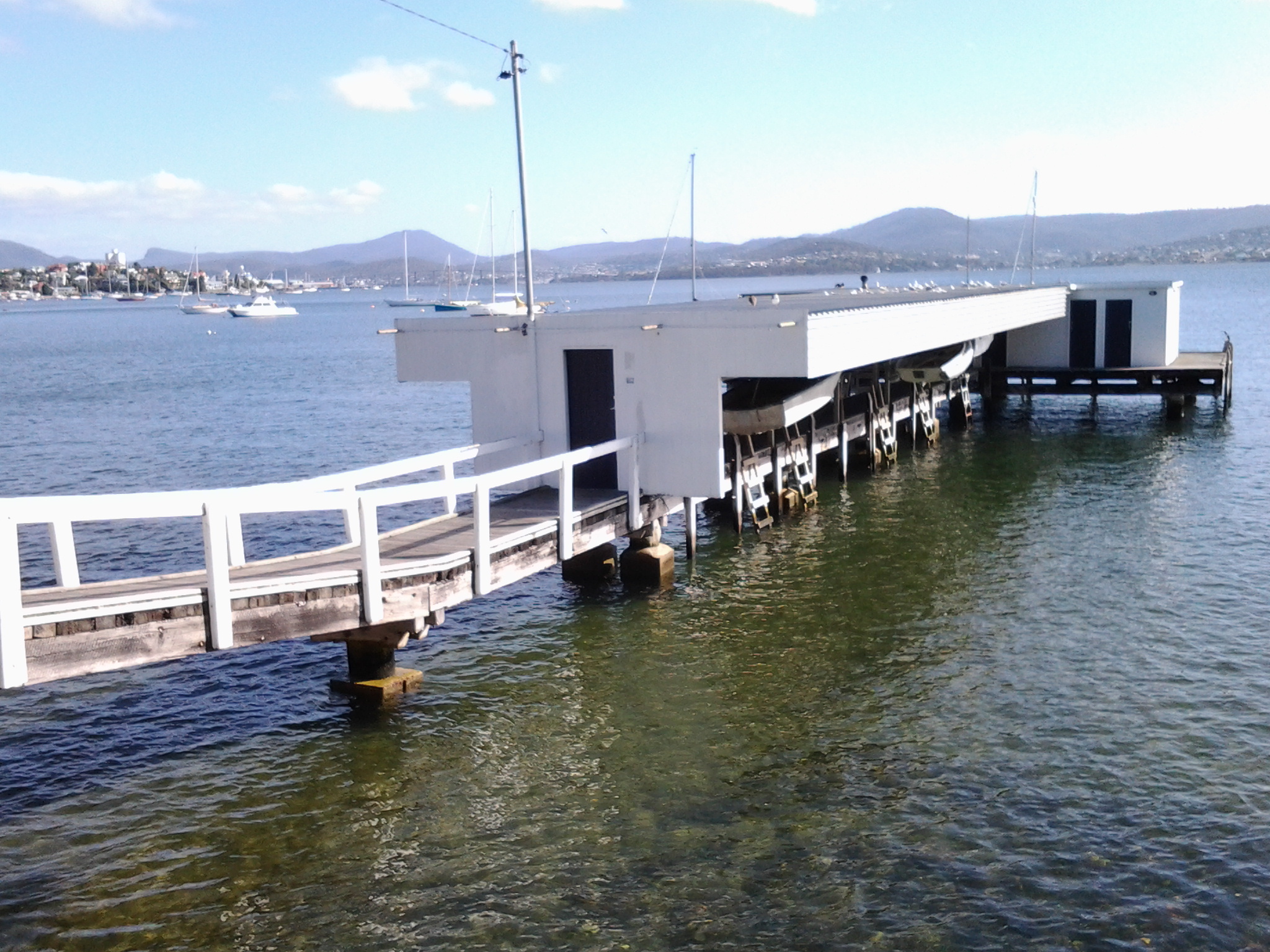
As my bus from home into Hobart city passed over the Tasman Bridge before 7am, I looked down onto a dozen or so rowing boats slipping along the Derwent River. The wedges that their passing craft made were the only patterns on the still surface of the River.

The morning was suffused with golden light forewarning the rise of the sun over the hills.  The few wisps of cloud in an otherwise blue sky were coloured silvery pink.  The temperature was a brisk 8 degrees, but I felt clean and alive prompted by such a vital looking day.

Once in the city, I walked to Franklin Square ready to wait for the next bus to Blackmans Bay, my starting point for Stage 13. While waiting, I walked through the park and admired the grand symmetrical fountain splashes around a large bronze sculpture of the eminent 19th century Rear Admiral Sir John Franklin.  Overhead, I watched a squawk of Sulphur-Crested Cockatoos, with their wings lit by the first rays of sunshine, flying as a family.  Street cleaners were clearing rubbish bins and pathway surfaces.  Very few other people were out and about in the centre of the city (people were being active in the suburbs before commuting to work in the city a while later).

The large public chess set had been set out and was ready for play.

20150224_071013

As the sun struck the Treasury buildings at one end of Franklin Square park, clusters of fat seagulls (Silver Gulls) were nipping at early rising insects across the grass lawns.

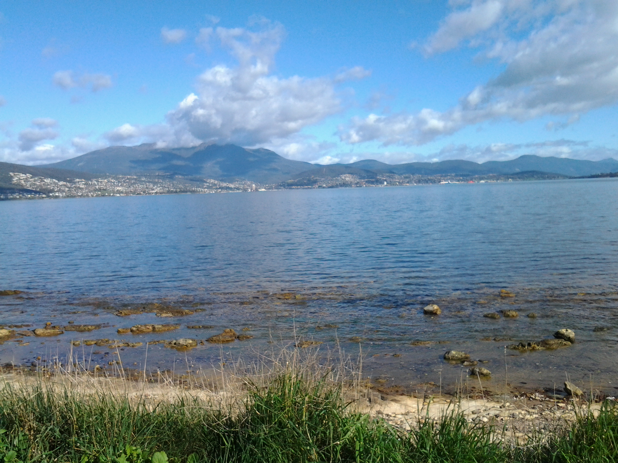
Metro bus number 84 departed at 7.17am. By 7.33am we had climbed up and travelled along the Southern Outlet and were passing through Kingston. This gave me a clear cut side view of majestic Mount Wellington.  Every rock was hard edge and clear. The air was so clean.

At 7.41am I stepped off the bus at Wells Parade in Blackmans Bay, the location where I had finished Stage 12 of my walk.  The final walk to the mouth of the Derwent River was about to begin.

Selection of landmarks along Sandy Bay Road

Once on Sandy Bay Road I turned left and continued walking southwards.When past the University of Tasmania grounds, over the road on my right was a Catholic co-educational secondary school operating in the Josephite tradition. This Mt Carmel College site includes an attractive 19th century sandstone building.

In a small park, a family of Sulphur Crested Cockatoos feasted on insects in the grass along with ducks and Silver Gulls.

20150119_083933

The day was very peaceful.

20150119_083937

At 8.40am I reached the entrance to Wrest Point Hotel (http://www.wrestpoint.com.au) which, in the 1970s, established the first legal casino in Australia.

20150119_084114

Apart from its poker machines and gambling rooms, this Hotel offers many bars and different restaurants. In addition, it runs a continuous program of concerts, guest artists and other entertainment events so that thousands of people pass through its doors weekly. With exploratory meandering I think it may be possible to walk through different parts of this Hotel and find a route close to the water’s edge. I didn’t feel confident that I would find my way around without finding myself in ‘no go’ areas. Instead I continued walking along Sandy Bay Road.

The business Network Gaming lives in what used to be a well-known and much loved pub, Travellers Rest:  one which I knew well in my student days.

20150119_084249

The Wrest Point Hotel land wraps around the old Travellers Rest hotel so, it wasn’t until I continued to walk along Sandy Bay Road that I discovered an original entrance to the Wrest Point property area.

20150119_084657

I reached the Derwent Water Beach Reserve at 8.50am.

20150119_085149

From there I could see two private jetties jutting out into the water.

20150119_084905

When I walked closer, it was clear that dozens of dinghies hung under protection waiting for their owners to come and row them out to yachts moored on the Derwent River.  In fact, as I watched, one fellow set off rowing.

20150119_085231

The time of day and the quality of the sunlight made this vista exceptionally beautiful; seagulls perched on the jetties, the water sparkled, a mild breeze dappled the surface of the River, happy dogs walked along attached to owners, and I was able to blot out the sound of noisy traffic streaming past behind and beside me. The water was crystal clear.

20150119_085408 20150119_085637

By 9.05am I was reading the information panel at the Maning Ave Reserve. This Reserve seemed to mark the change from the suburb of Sandy Bay to the suburb of Lower Sandy Bay. I learnt Fred Maning arrived in 1824 and his family farmed in the area (however I understand he spent most of his life in New Zealand, and it is not clear why he is remembered with his name on this park and on streets etc in the Lower Sandy Bay area).  Information boards such as these help me to understand how Hobart developed.

Taking Bus 615 to Tranmere last Friday – Starting Stage 4 of walk along Derwent River

Having travelled across the Tasman Bridge, through the Eastlands bus mall near the shopping centre, and onwards, the bus takes the main route along Clarence Street. Along the way a sign marking the Clarence High School, established in 1959, looms large on the right. The 8.23am bus typically will carry a swarm of students who will jump off at this point and then the bus may quieten for the remainder of the trip.  But others will jump on after desperate running and laugh as they fall onto the bus with eyes sparkling from the exertion. Bus trips can be alive with life being expressed in all sorts of ways.

By 8.44am the bus pulled in at the Shoreline Shopping Centre mini bus mall.  Once moving again, the bus run goes the other way to a stream of traffic heading towards the city centre. Moving down the hill, and near bus stop 19, the bus passes the Howrah Primary School located across the intersection diagonally from the Shoreline shopping centre, and a Shell fuel service station which is located on the opposite corner. Further down, the bus passes The Sunshine Tennis Club and the Howrah Recreation Centre including the Guide Hall. Near bus stop 20, a Caltex fuel service station and a suite of small shops is located on the right with the Howrah Beach beyond.  It’s not long before, as a passenger, I am greeted by stupendous views of the Derwent Harbour, Hobart city on the western shore, and the all-powerful Mount Wellington peering over all.  Soon after the bus turns left into Tranmere Road, I noticed Tranmere Hall on the right, and then a little later near bus stop 23, I saw a sign designating the Tranmere Coastal Reserve and a nearby public walk way down to the Derwent River.

After passing Anulka Park at bus stop 25, I continued on and left the bus at stop 31 at 8.53am.

Yet again I was fortunate that the day was magical. As I crossed the road to stand next to the serene Derwent River, I listened to the lyrical lapping of soft tiny waves across the rocks.  Silver gulls were floating languidly. A lone Pied Oyster Catcher was watching and waiting. Fluffs of cumulus cloud like fairy floss hung suspended in front of the mountain.  Cabbage butterflies flew through the long grass. Orange flowering nasturtiums climbed through bushes edging the shore.

I soaked in the grandeur of the environment and prepared to start the walk – this fourth stage of my walk along the Derwent River.

20140926_085649