Tag Archives: Sydney to Hobart Yacht Race

Iron Pot Lighthouse

My wonderful walk from the mouth to the source of the Derwent River seems long past, however from time to time a blog reader refers me to new information.  Thanks Mary for these leads. If you read here and here you will learn more about the history of the Iron Pot Lighthouse.

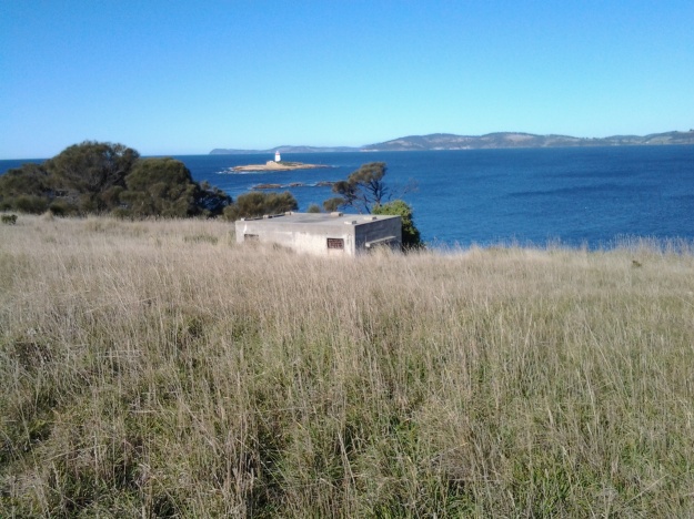
People who have read my earlier posts will know that I judged the tip of land opposite the Iron Pot to be the ‘mouth’ of the river on the northern/eastern side. I had to walk there from South Arm before my walk along the length of the river from the mouth could start. Here is one of the photos I took of the Iron Pot that day.

20140822_100305.jpg

The Iron Pot enters into the consciousness of many at this time of year.  On Boxing Day the annual Sydney to Hobart international yacht race will get underway.  After the yachts reach Tasmania and have sailed down the east coast, eventually they turn north west into Storm Bay. Not long after, the race organisers will be reporting yachts are in the vicinity of the Iron Pot. I expect the maxi yachts could start rounding the Iron Pot this Friday if they get a dream run.

If you would like to see this rocky outcrop up close without walking, take a Pennicott boat tour from Hobart (https://www.ironpotcruises.com.au/)


A traveller – at the Salamanca Market set up by the Derwent River

Since April I have been waiting for the weather to warm up so I can continue my walk to the source of the Derwent River more comfortably. Between then and now my posts have connected with the Derwent River by various degrees. This posting is no different. Months ago I walked past historic Salamanca in Hobart as I walked the edge of the Derwent River and last Saturday, I headed back again to the area for the renowned Salamanca Market.

The big find was an Englishman who has relocated to live in Tasmania and had set up a stall to sell his book.  A few years ago his Tasmanian wife lured him here for a holiday and when she flew back to England, he decided to return by hitching his way half way around the world.  After starting from Hobart by accepting a lift on a Sydney to Hobart Yacht Race yacht returning to Sydney, his trek took 6 months via the countries north of the Himalayas.  Apparently it only took 800 rides, through 19 countries! Out of the adventure and experiences Jamie Maslin wrote his story: ‘The Long Hitch Home’.

The Long Hitch Home Jamie Maslin book cover

In more recent times, Jamie has relocated to Hobart for permanent residence.

Past posts have indicated my awe and amazement about the achievements of people who take on, what seem to me to be, herculean tasks – These always excite me to make yet another step.  Inspiring others to make the first step in their own backyard is one of the goals of this ongoing blog.

Where will I find authentic and reliable information about Tasmania’s aborigines prior to 1803?

This question has been asked because I am not concerned with researching European settlement or its impact on Tasmania’s indigenous population.

It seems that three categories of information sources might be used for my study:

  1. the written/printed word,
  2. material anthropology, and
  3. oral histories. Such histories might exist in association with the continuance of authentic movements such as dance and sound making.

As stated in an earlier post, the original settlers in Van Diemen’s Land, the descendants of non-indigenous peoples, and other non-indigenous people have left historical written/printed documentation. In addition, exploring visitors to this island before European settlement made written records. Each of these writers will have their own perspective, and so my challenge will be to remember what they write is not necessarily a fact. This means I will need supporting and corroborating evidence of other kinds; material artefacts and/or oral histories.  I do not expect to find any early 19th century documentation written by Tasmanian aborigines – but I would be very excited to read such records if I should find them.

James Joyce, in his essay “Fantasy Island” (Manne, 2003, Whitewash Black Inc. Agenda, Melbourne) refuted the evidence of Keith Windshuttle’s book (2002, Fabrication of Aboriginal History: Volume One, Van Diemen’s Land 1803-1847 Macleay Press, Sydney) when he declared ‘Windshuttle can impose his contemporary conclusions on Van Diemen’s Land history only by limiting the selection of sources …’.  Joyce’s position reminds me to stay focused and to explore broadly.

At the moment, I have started working through a mountain of freely available reference material seeking clues as to what I might need to follow up with careful research.  As yet, I have found very little that pertains to the Derwent River. These are early days during which I will come to an understanding of the limitations and challenges of my project.

Before my walk along the Derwent River last Tuesday

As my bus from home into Hobart city passed over the Tasman Bridge before 7am, I looked down onto a dozen or so rowing boats slipping along the Derwent River. The wedges that their passing craft made were the only patterns on the still surface of the River.

The morning was suffused with golden light forewarning the rise of the sun over the hills.  The few wisps of cloud in an otherwise blue sky were coloured silvery pink.  The temperature was a brisk 8 degrees, but I felt clean and alive prompted by such a vital looking day.

Once in the city, I walked to Franklin Square ready to wait for the next bus to Blackmans Bay, my starting point for Stage 13. While waiting, I walked through the park and admired the grand symmetrical fountain splashes around a large bronze sculpture of the eminent 19th century Rear Admiral Sir John Franklin.  Overhead, I watched a squawk of Sulphur-Crested Cockatoos, with their wings lit by the first rays of sunshine, flying as a family.  Street cleaners were clearing rubbish bins and pathway surfaces.  Very few other people were out and about in the centre of the city (people were being active in the suburbs before commuting to work in the city a while later).

The large public chess set had been set out and was ready for play.

20150224_071013

As the sun struck the Treasury buildings at one end of Franklin Square park, clusters of fat seagulls (Silver Gulls) were nipping at early rising insects across the grass lawns.

Metro bus number 84 departed at 7.17am. By 7.33am we had climbed up and travelled along the Southern Outlet and were passing through Kingston. This gave me a clear cut side view of majestic Mount Wellington.  Every rock was hard edge and clear. The air was so clean.

At 7.41am I stepped off the bus at Wells Parade in Blackmans Bay, the location where I had finished Stage 12 of my walk.  The final walk to the mouth of the Derwent River was about to begin.

Blinking Billy Point, Lower Sandy Bay next to the Derwent River

Continuing Stage 11 of my walk along the Derwent River, I walked the foreshore from Long Beach towards Blinking Billy Point. Looking northwards, the crescent of Long Beach stretched before me.

20150119_100336

I passed a new set of public toilets around 10am and ten minutes later I was walking around Blinking Billy Point.

20150119_101600

This was an area to which Charles Darwin (http://www.biography.com/people/charles-darwin-9266433) walked from Sullivans Cove (my starting point for this Stage of the walk) in February 1836. The area’s local government has remembered the occasion with an information plaque.

20150119_101336

Out in the water is a marker for water craft: the John Garrow Light (established in 1953).  I have known this was a marker used in the Sydney to Hobart Yacht race but I had never known where it was located.  Now I know: almost east of the Blinking Billy old lighthouse.  According to http://www.maritimetas.org/sites/all/files/maritime/nautical_news_winter_2002.pdf, John Garrow was a Sandy Bay pastry-cook, who lived in Bath St. Battery Point and died 1924. This begs the question – how did a nautical navigation tool come to be named after someone that seemingly had no connection with the Derwent?

I noticed that the Point has old defence structures embedded in the cliff. I learned that these were an adjunct to the huge hill behind with the remnants of the 19th century Alexandra Battery.

20150119_100941

20150119_101150  20150119_101159

Looking down the Derwent River through the glitter of the distance to the eastern shore, I could pick out Trywork Point (the southernmost tip of land before Ralphs Bay begins) and Gellibrand Point (the northern most point of the South Arm peninsula) both providing the ‘gateposts’ to Ralphs Bay. Previously, I explored these distant Points on Stage 2 and 3 of my walk.

20150119_100933

Then I looked back to Long Beach from Blinking Billy Point with Mount Wellington in the distance. How peaceful the world seemed.

20150119_100704

Despite the promises of a short beach in Geography Bay after the Blinking Billy Point, I knew better than to have expectations that continuing my walk on the foreshore was possible. The Sandy Bay Foreshore Track finishes at Blinking Billy Point.

20150119_101600

Some years ago a friend and I tried to walk the rocky shore southwards from Blinking Billy Point but, as the tide came in, there came a moment when we couldn’t move forward or backwards.  I remembered we scrambled up through someone’s property; the people were not at home and we let ourselves out onto the street hoping no alarm systems would be alerted. We were lucky that day.

Based on that memory, I knew it was not worth proceeding any further and retraced my steps around Blinking Billy Point until I could walk up to Sandy Bay Road.

From Sandy Bay to Lower Sandy Bay on Stage 11 of my walk along the Derwent River

After Maning Ave Reserve I continued walking along Sandy Bay Road and used every opportunity to glimpse the Derwent River down the driveways of large houses with expensive River frontage.

By 9.10am I reached the Red Chapel Reserve. Red Chapel Ave is one of Hobart’s well-known streets extending up the hill and connecting to other main streets but I had never known, until this walk, where the name came from. I wonder how many Hobartians know the source. Of course the source turned out to be so obvious once I knew and used my eyes. It was named after the red coloured chapel of the 20thcentury St Stephens Anglican church that was built on the River side of the Road next to the Reserve and opposite the uphill Avenue.  What can be said about the impoverishment of imagination? Refer to https://stainedglassaustralia.wordpress.com/2014/08/02/1914-st-stephens-anglican-church-lower-sandy-bay-tasmania/ for some glorious images. The photo below is courtesy ofhttp://www.anglicantas.org.au/parishes/?item=37

St Stephens Church

A minute or so further down the road and on the right was the highly esteemed Lipscombe Larder on the corner of … Lipscombe Ave.  Where else would it be?

20150119_091152

In addition to all its tasty delicatessen products and wines, this food paradise also sells exquisite cakes: refer to http://lipscombelarder.com.au/  for images.

At some stage during my walk in this suburb, I realised that no one was walking a mongrel dog. At the end of leads were expensive pedigreed dogs.  Certainly their owners seemed happy.

Before long, a set of steep stairs attracted my attention on the left. These were for public access to Nutgrove Beach. As I approached the Beach I was staggered by the size of an old pear tree on the dune edge, and loved the pigface plant which carpeted the area either side of the pathway. I was on the beach at 9.20am and turned right to walk southwards.

20150119_091845 20150119_092401  20150119_091903 20150119_091858

Behind low sand dunes on my right, the roofs and second storeys of beach front houses were visible. At 9.23am, I passed public toilets almost hidden under a large pine tree, and by 9.30 I reached a corner of the beach with the Sandy Bay Sailing Club located up in the dunes.
20150119_093155

Moments later I turned the corner and was no longer able to look back at Wrest Point and Battery Point in the distance.

20150119_092759

I continued on a pathway over the shore and over the dunes some of which would be impassable at high tide without getting wet feet. Some of the rocks were unstable underfoot presenting the risk of a turned ankle or knee. Nutgrove Beach had been a simple delight, and before long I was on an easy, vegetated, and shaded walking track to Long Beach at Lower Sandy Bay. Then I arrived.

20150119_093816

Back out into the open by 9.35am, I could see public toilets nearby, and by looking across the Derwent River to the eastern shore, the yellow strips of Bellerive and Howrah Beaches (on which I walked in an early stage of my walk) were visible.

20150119_100332

I had been walking for over two hours so sat for a while in the gorgeous sun, watched the tiny waves rippling fluidly and regularly, stared at two fishing boats motoring out of the Derwent Harbour, listened to kids’ riotous laughter in a kids’ playground nearby, and then stood up and got going again at 9.50am.

I was delighted to discover Stephen Walker’s huge many part bronze sculpture, Tidal Pools, with its inbuilt water feature at Long Beach in Lower Sandy Bay.

20150119_095728 20150119_095831 20150119_095757 20150119_095739

The remarkable 86 year old Tasmanian artist died only about 7 months ago leaving a great many large scale works around Tasmania and other parts of Australia, such as his Tank Stream Fountain (1981), near Circular Quay in Sydney. In the 1950s, Stephen Walker studied under the celebrated sculptor Englishman Henry Moore. Apparently Walker continued his bronze casting work well into his 70s using his foundry underneath the house.

Five minutes of walking the developed walkways of Long Beach brought me to a cul-de-sac with its carpark full of vehicles.  Further along that loop off Beach Road were bakeries, cafes, restaurants, etc.

Walking along the wharves of Sullivans Cove, Hobart

On Stage 11, after walking along Hunter St, I turned right to walk along the Franklin Wharf street, and had the Derwent River on my left and an enclosure for fishing and other vessels to my right. The morning was fresh, the sun was shining and it was all together delightful. Not many people around. The mountain, clearly visible, looked down on the centre of Hobart and over the wharves. Clouds were reflected serenely in the water.

20150119_072745 20150119_072147

A family of bronze sculptures, perched life-like on rocks on the River side, is much loved by visitors.

20150119_072515 20150119_072503

Passing Mures fish restaurant on my right, I continued on until I could see the row of floating fish shops selling fresh and cooked fish and other seafood.

20150119_072706 20150119_072651

A minute later, I was standing on the celebration platform used when the Sydney to Hobart Yacht race boats arrive. I looked across to Elizabeth Pier which contains accommodation, conference facilities and a number of eateries (where sitting outside is such a pleasure).  In the photo below the ‘tall-ship’ replica Lady Nelson sits outside the T42 restaurant.

20150119_072901

Opposite Elizabeth St pier, a number of buildings of different architectural styles and vintages line part of the street. Continuing to the other side of the Elizabeth St pier, a second tall ship, the Windward Bound offers sailing trips.

20150119_073148 20150119_073111

On the next pier after the one in the photo above, a couple of the contemporary camouflaged MONA ferries sat either side within the slightly mobile surface of beautiful glassy water.  Taking a trip on these ferries down the Derwent to and from MONA (Museum of New and Old Art) located in the suburb of Berriedale (I walked through that on recent Stages) helps you to see parts of Hobart you would not normally see, and it gives you a perspective on the distances over which the Greater Hobart Area sprawls. It is interesting to reflect on the two extremes of water vessel technology, when you look at the 19th century sailing ship close by a state-of-the-art catamaran.

20150119_073231

These starting sections of my Stage 11 were colourful and tranquil. It’s a free, easy, stroll along the waterfront and there is much to see looking out onto the side of the Derwent River. The next posting on this blog will look at landmarks on the non-River side of the streets.

The end of the Rolex Sydney to Hobart 2014 yacht race

This afternoon I needed to walk to Bellerive’s Village for basic shopping. Once there (20 minute walk) it seemed a waste to be so close to the Derwent River and not to walk around Kangaroo Bay to Bellerive Bluff and see if any more yachts were sailing up to the finish line.

Today has been exceptionally blustery and Mount Wellington keeps disappearing from view as rain squalls and clouds move across in waves.

2014-12-30 13.37.39  2014-12-30 13.39.41

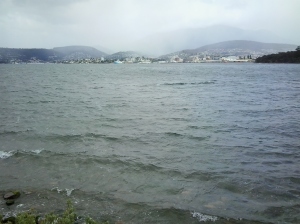
It was clear to me that a major storm was passing and could reasonably be expected to travel across the Derwent River and saturate me. Nevertheless, knowing its only water and that my umbrella could be expected to be blown inside out with the wind, I walked on.  And it was worth it.

The wild water of the River showed peaks and troughs and there in the blurry distance, trying to keep close to protection of the land on the western shore close to Wrest Point Hotel Casino, two of the last yachts were fighting it out to see who would cross the line first.

2014-12-30 13.40.23  2014-12-30 13.41.19

At home I have checked and learned that the two were Maluka of Kermandie and Charlie’s Dream.  As I stood on that windswept shore, I could see it was a battle between the two but I was surprised to discover their finish time had only 3 seconds between them. Can you imagine?  After hundreds of miles/kilometres in some very testing weather, three seconds separated these two at the line. Inspirational!  The message for me was that one must never give up; I must keep pushing onwards.

Only two yachts are yet to cross the line. One is charging up the Derwent as I type and has almost reached the finish line (Southern Myth) and the other seems almost to be stalled in Great Oyster Bay slightly south of Freycinet peninsula on Tasmania’s east coast.  I can only imagine that yacht is taking it slow and easy to cope with the weather and arrive in one piece.  Many yachts have withdrawn from the race with expensive rigging, sail, rudder, lost masts, and other boat damage. Perhaps the last yacht, Landfall, is considering making landfall earlier than the Hobart docks.

If you don’t mind thickly padded appearances and wind-blown hair, then today is a wonderful day to be wearing your winter woollies and outside walking and filling the lungs with fresh (and it is fresh) air.

In the right place at the right time watching the Derwent River

From my front windows I can look down the Derwent River, and when I am lucky, over the curve of Bellerive Bluff sloping into the water I can see tall masts suddenly appearing.  If I wait a few moments, the sails become visible and then the entire yacht sails into view, trying to fly to the finish line of the Sydney to Hobart yacht race.

Last night, my mind was full of stories and ideas. Earlier in the day I had relaxed in the large chairs within the Gold Class at the cinema courtesy of a friend, and been moved strongly by Russell Crowe’s new movie The Water Diviner.  We were both very impressed by the movie and were thrown into thinking and talking about World Wars, and the futility of lost lives and the consequences for families. Then later, once back at home, I finished reading our Tasmania’s Richard Flanagan’s Booker Prize winning novel The Narrow Road to the Deep North. Until then I had never truly felt the situation for our Prisoner of War soldiers forced by the Japanese army to build the Thai-Burma railway.  It is an extraordinary story, which made me feel quite breathless with despair about how different cultural values and beliefs can neutralise or destroy the natural talents of men.

So with two war stories swirling in my head, I dozed. When I woke from a half sleep at 2.20am I thought not of mud and death rather of water and the achievement of goals.

I ambled to my front windows and was brought wide awake. As I stood looking onto the dark Derwent River with the lights of streets, buildings and Wrest Point Hotel marking the western shore line, I realised something tall was slipping along behind Bellerive Bluff.  Within seconds the tall mast was momentarily blocking my view of bits of light on the other shore.  Before long the supermaxi was entirely in view and charging towards the finish line. I was surprised at its speed. Majestic. This morning, after checking the race standings, I now know I watched the third boat to arrive, Ragamuffin100.

Today’s arriving yachts have not been so lucky with the wind once they have come into my view. It’s almost as if once they pass Bellerive Bluff, the wind stalls.  I have watched yachts tacking across trying to make the most of a fickle breeze. Sometimes one almost passes another which had been way ahead.  It’s a beautiful clear morning in Hobart, and the surface of the Derwent River seems to be without a ruffle, but I doubt if any of the crew are thinking about that as they try to cover the last kilometre or so and improve their race standing and time.

The great and wonderful Sydney to Hobart Yacht race is about to enter the Derwent River

For 69 years annually on Boxing Day (26th December), over 100 yachts have set sail from Sydney Harbour for the internationally renowned Sydney to Hobart Yacht race.  Their well-trained crews have great ambitions of becoming line or overall winner depending on the size and class of their yachts.

The website (http://rolexsydneyhobart.com/about-the-race) explains this race is an egalitarian event, attracting yachts as small as 30-footers or large maxis, sailed by crews who range from weekend club sailors to professionals from the America’s Cup and Volvo Ocean Race circuits. The Rolex Sydney Hobart Race 2014 is a classic long ocean race open to anyone who owns a yacht that qualifies for this challenging event and which meets all the safety requirements of a Category 1 safety race.

Today is the exciting one for Hobart residents, thousands of yachtie fans and plane loads of tourists who expect to see the first two towering maxis come over the final line later this afternoon.  As I type this posting, an Australian yacht Wild Oats XI (which has won the race 7 times) leads the USA maxi Comanche which is trailing by 10 kilometres. The rest of the fleet are over 140 kilometres north and none of those yachts can be expected to arrive until tomorrow at the earliest.

But, for today’s two maxis, the big trial will be sailing the final 11 nautical miles of the Derwent River to the finish line.  A change in the wind is forecast and this could be to Comanche’s advantage.  The history of this race is littered with leaders who are overtaken during the last leg on the Derwent due to fickle, conflicting or no winds. Currently the winds around Hobart are north-westerly 15 to 20 km/h and are expected to shift south to south-easterly 15 to 25 km/h in the early afternoon then become light in the late evening.

As I sign off, Wild Oats XI has entered Storm Bay which is the last expanse of water before the Derwent River.

Check out the website http://rolexsydneyhobart.com/ for stunning photos of the yachts and in a few hours you will see the arrival of the first two in Hobart, on this gorgeous sunny blue sky day.

22 Aug 2014 Arriving in South Arm and starting the walk – Posting 3 of 8

At 8.50am the bus was darting past the Clifton Beach turn off and then, after speeding across the low lying road of the isthmus, a little after 9am I was stepping off the bus opposite the South Arm shop. For anyone following in my footsteps, if you need a public toilet, there is one near the beach and the South Arm Shop can point you towards it.

The photo below shows the South Arm Shop, a multipurpose village convenience store.

20140822_112154

As I stepped off the bus, a wonderful wedge of water beckoned me. This was the Derwent River showing itself down the end of a track to the beach. That track started from a roadway that passed by the Cenotaph where the road made a 90 degree angle bend to head onwards to Opossum Bay, all a short way down from the bus stop. But instead of walking towards the river, I turned back along the main road to find my starting street.

My main task was to reach the starting point of the walk along the Derwent, and then to walk as far along the river’s edge as my feet would carry me before the return bus arrived. From maps it was clear I could walk along the Fort Direction Road to the starting point at Cape Direction and then I could return via the coast for a change of scenery. Fort Direction Road was a few metres away from the bus stop.  As I walked up the road (which wasn’t level and wasn’t going downhill) the expression that this was ‘a decent short pull’ came to mind. I seem to remember Nan used the word ‘pull’ when talking about getting a team of bullocks up a short steep hill. Thankfully the pull only lasted about 5 minutes before I was able to follow a gentle upward incline in a more relaxed fashion.

Coming over the rise of one hill, I was surprised to see the crisp white lighthouse with its sharp red painted top on the Iron Pot, not far over the water from the flat top of Cape Deliverance. With the fresh smogless air, the outlines were smart and the tiny rocky islet seemed so close to the mainland.  I was thrilled to see it.  For years I have heard how the Sydney to Hobart Yachts ‘round’ the Iron Pot to enter the Derwent River every December. Now I can visualise this happening. What a sight it must be if the yachts are bulging with colourful spinnakers. Perhaps visiting the area between Cape Direction and Cape Deliverance for such a spectacle should be added to my ‘to do’ list.

My research unearthed interesting tidbits about the Iron Pot. The http://www.abc.net.au/local/stories/2008/11/03/2408589.htm tells that “From 1832 until the early 1880s the lighthouse was the main feature of the site, warning ships of the treacherous waters through which they were navigating. Then, in 1884, it was decided to build a home next to the lighthouse for its keeper James Parkinson and his ever growing family. The home was built only 20 feet above sea level and made the most of a minimal amount of land. One of the greatest challenges for the residents came in 1895 when 90 feet waves battered the coastline. “Waves were breaking over the top of the lighthouse. The people that were in the house moved into the lighthouse for safety. The storm left kelp hanging in the iron railings on top of the lighthouse. Stories also claim the Parkinson home was found to have substantially shifted on its foundations following the extreme conditions.” The site http://www.seasidelights.com.au/au/tas/ironpot.asp?fState=TAS gives some dramatic stormy photos.

The photo below was taken from Fort Direction Road. The flat headland is Cape Deliverance. The white Iron Pot lighthouse shows near the horizon over the slope of Fort Hill.

20140822_092426

The photo below shows a piece of Cape Deliverance on the left and a piece of the Tinderbox area on the right. In between the two prominences, flows the Derwent River.

20140822_092437