Tag Archives: wines

Around Windy Point on Stage 14 of my walk along the Derwent River

Despite having driven and been driven along this patch of the Lyell Highway many times, its shape and character were not well known to me. I guess I have always looked out at the Derwent River and more or less disregarded the land.

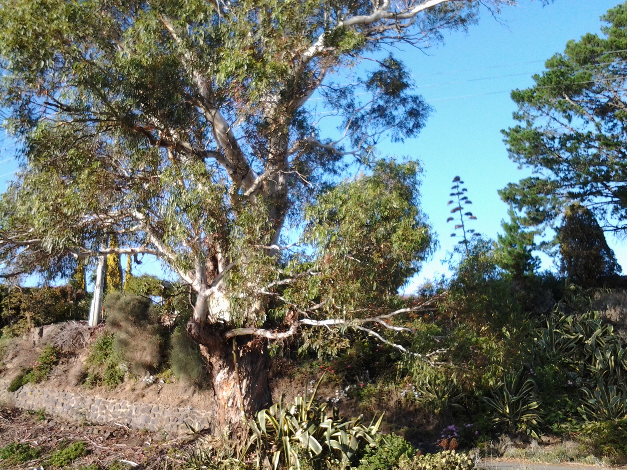
The area jutting into the River, causing it to curve from a north west to western orientation, has been labelled Windy Point. I reached the start of this about 8.20 and it was another 15 minutes of walking before I reached its western end. There was some wind and when blowing my dribbling nose, the icy breeze flattened my handkerchief across my face. I sought visual distractions against the cold. A magnificent old gum tree amidst a range of exotic plants was a grand surprise.

20150413_081138

On one hill to my left were half a dozen dappled sheep with twins on their teats.  Sometimes their heads were black or brown but most fascinating was the dinner plate sized brown woollen shapes across their otherwise beige woollen bodies. I was too cold to take a photo of this sight.

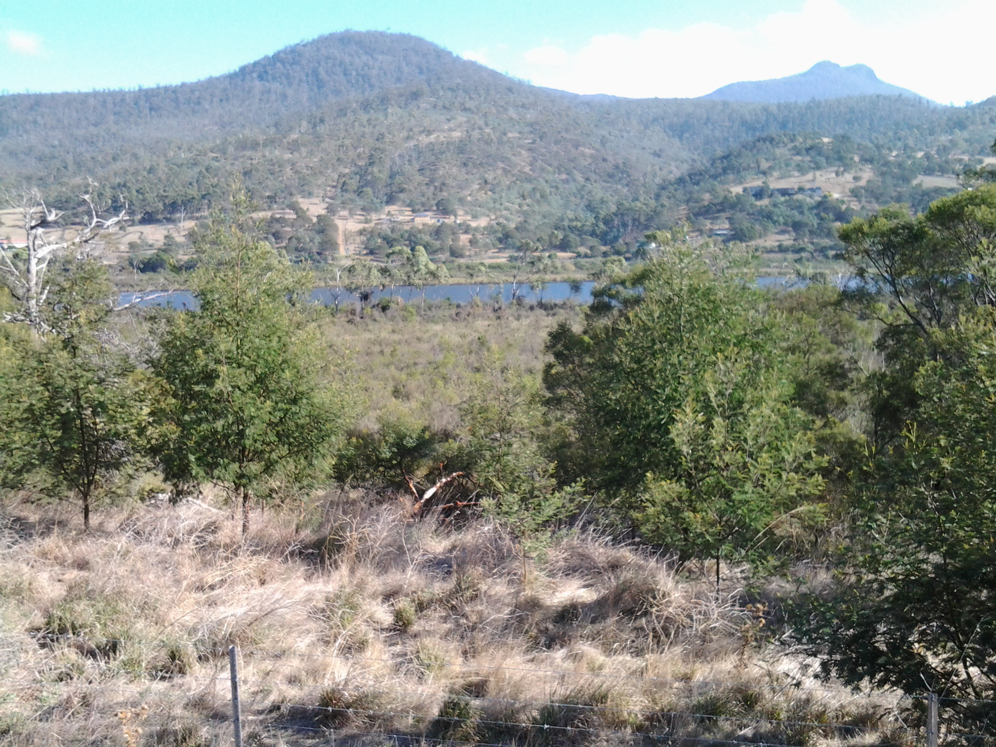
In parts, the flowing river was a distance from the road.  Between the highway and the clear water, marshy water plants grew profusely, and access to the River was impossible.  The photo below looks across the Derwent River to Mt Dromedary in the distance and Mt Terra in the left  foreground.

20150413_095018

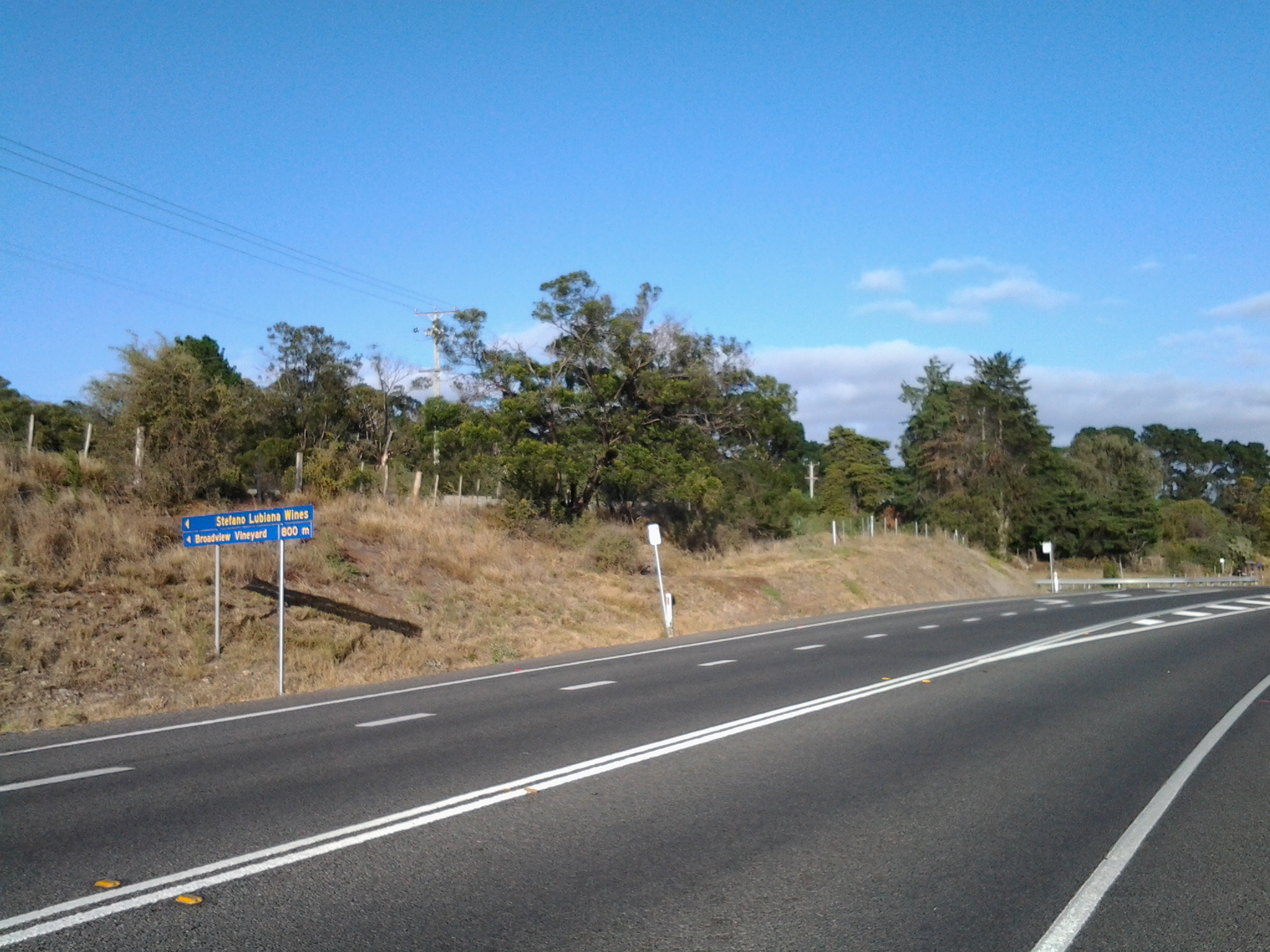
During my walk around Windy Point, at 8.30am I passed the road turn-off leading to Stefano Lubiana wines and noted there was a Derwent Valley Link bus stop on the highway – which, if you are a tourist without transport, would allow you easy access to the winery and the odd glass or two of some special liquid. I didn’t stop and visit – drinking at such an early hour didn’t seem like a good idea.

20150413_082819

Ten minutes later at 8.40am I was passing the road turn-off to the Derwent Estate Wines.

20150413_083657

I was surprised as I passed the estate to see what seems like late 19th century buildings nestled into the hill.  While the website explains: ‘the historic Mt Nassau property has been in the current owner’s family since 1913, I can find no information about these buildings which appear to be an earlier architectural style.  More research required.

20150413_084136

Opposite, in the River and its edging long grasses, white faced herons, coots, ducks and black swans were at home.

20150413_082210 20150413_082826

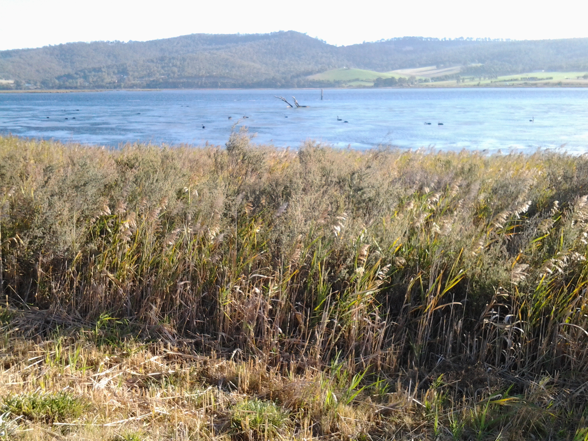
The day was offering truly magical sights aided by the intense blue of the sky and the water.

Finally I reached the mouth of the Derwent River on the western shore at Pearsons Point

The goal of walking along the western shore of the Derwent River was to reach the mouth and during Stage 13 I reached this destination marked by Pearsons Point.

Before then at 10.44am I walked past a turn off: Mt Louis Road. There was a lump up in the sky on my right.  Maybe another time it might be pleasant to see what is up there and to look at the view – which is probably a spectacular 360 degree outlook along the Derwent River, the D’entrecasteaux Channel and Bruny Island.

As I panted up the final hill, I heard the thwack of balls and realised the fencing I could see in the distance amounted to a tennis court.  A tennis court!  Ye gods! Out here in the bush and miles from anywhere?  Yes it was.  Two women were slamming the balls up and down the court.  Their two cars were the only vehicles in sight.

10.52am: I reached the Pearsons Point Reserve and was feeling rather chuffed.

20150224_105032

I wandered around the site which included a disused gun emplacement and a couple of large historic cannons.  Guess Pearsons Point would have been the first line of defence against any Russian threat (which seemed to be the main thought through the 19th century).

20150224_105306 20150224_105429

Note: the bump behind the gun emplacement and tennis court is Mt Louis. A large white edifice on the end of the Point (on the other side of the cannon) appeared to be a marine navigation beacon.

In front of me to the right hand side of the Point, the D’entrecasteaux Channel separated the mainland of Tasmania from Bruny Island (famous for its fresh produce such as cheeses, smoked fish and meats, berries, premium wines, and local oysters).

20150224_105437 20150224_105647

I was very surprised how close Bruny Island (Dennes Point) was to this part of Tasmania’s mainland.  So close.  So accessible.  And its green hills and the white sandy Jetty Beach were most attractive.

On the other side of Pearsons Point to my left, the Derwent River flowed out to Storm Bay and then onto the ocean. I could see the Iron Pot and Cape Direction at the southern tip of the South Arm peninsula on the eastern shore of the River.

I found a pleasant picnic table and at 11am ate half my lunch under a small cluster of gum trees hoping no branches would be shed on my head.  Feeling on top of the world. The sun was out and the tiniest of breezes moved through the area.  Past the trees I could see motoring boats leaving white streams behind them as they sliced through the River. I looked back northwards to the Alum Cliffs between Taroona and Kingston.

20150224_112527

With a little sadness I left Pearsons Point at 11.25am.

By 12.40pm I was passing the Hidden Cove turnoff, at 1.05pm I reached the Fossil Cove Drive junction, at 1.25pm I walked across the intersection with Treatment Plant Road, and at 1.30 I stopped for a moment at Suncoast Drive.  I looked at the one bus stop (there wasn’t a pair one either side of the road) and it did not have a timetable attached to the post, so I continued walking to Wells Parade.  I had been told this was a long road, and now I know it is.

20150224_133752

I stopped and waited for a bus which didn’t come (the first in my entire travels) and left and walked up and down and up and downhill until eventually I was back parallel to the Blackmans Bay Beach.  I sat for a while at the beach soaking in the atmosphere, smelling the salt, and relishing the fact my feet were having a rest.  When the time came (according to my bus timetable), I walked to the bus stop where I had alighted hours earlier in the morning, and before long Metro bus number 85 arrived.  After passing via the Suncoast Drive bus stop that I had looked at earlier in the afternoon on arrival back in Blackmans Bay, Maranoa Heights, other suburbs, and Kingston, I was back in Hobart city by 4pm feeling elated.  Stage 13 was over.