Tag Archives: Derwent River

The Derwent River in 1958

Recently a friend sent me a link to an extraordinary 9 minute film that was made in 1958. The film is based around New Norfolk, a town located approximately 35 kms west of Hobart. The Derwent River bends around the edges of the rural town that is now built up on both sides of the river.

Enjoy watching the film ‘Valley of the Derwent’, produced by the Tasmanian government, here. Please bear with the excruciating sound of the music so you can listen to the 1950s style narration. The images start at Granton about 18 kilometres west of Hobart. The voice-over explains the original virgin bush ‘had never known the axe or the plough’ indicating a firm belief in the 1950s that taming the wilderness (a euphemism for ‘removing the bush’) was what humans should do. Regrettably there are still too many people (including governments) who feel similarly in 2020.

Early on you see the black swans on the river. David Walsh owner of MONA has just released a diary entry where he refers to the black swan as the unknown unknowns. Makes for interesting reading – here.

I was fascinated that a composer William Wallace, according to the film,  wrote the opera “The Spirit of the Valley” while he stayed at the historic Bush Inn in New Norfolk. It led me on a merry chase through archives and online resources. However recent academic research indicates this is a myth generated over the years, and that even the writing of one song for an opera while he visited New Norfolk is unlikely.

For long term blog followers, the filmed section on the oast houses may bring back to memory my fascination with those at Bushy Park when I ‘discovered’ the texts on the buildings as I walked west from New Norfolk. Refer here.

It made me think how many years have passed and what a world of difference there is since the film was made. For example, I was six years old when the film was produced yet I noted the clothes being worn have the familiar shapes of those of my life through the 1960s.

‘But it’s the river that captivates the eye, twisting and turning along the valley’, so says the narrator. I would say this was true for the entire 213 or so kilometres of the length of the Derwent River.


Iron Pot Lighthouse

My wonderful walk from the mouth to the source of the Derwent River seems long past, however from time to time a blog reader refers me to new information.  Thanks Mary for these leads. If you read here and here you will learn more about the history of the Iron Pot Lighthouse.

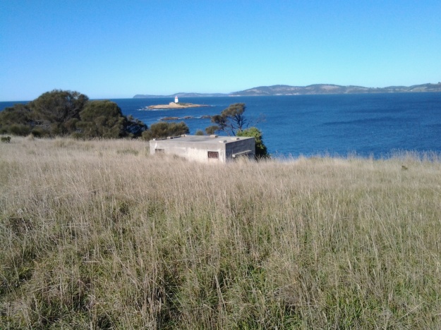
People who have read my earlier posts will know that I judged the tip of land opposite the Iron Pot to be the ‘mouth’ of the river on the northern/eastern side. I had to walk there from South Arm before my walk along the length of the river from the mouth could start. Here is one of the photos I took of the Iron Pot that day.

20140822_100305.jpg

The Iron Pot enters into the consciousness of many at this time of year.  On Boxing Day the annual Sydney to Hobart international yacht race will get underway.  After the yachts reach Tasmania and have sailed down the east coast, eventually they turn north west into Storm Bay. Not long after, the race organisers will be reporting yachts are in the vicinity of the Iron Pot. I expect the maxi yachts could start rounding the Iron Pot this Friday if they get a dream run.

If you would like to see this rocky outcrop up close without walking, take a Pennicott boat tour from Hobart (https://www.ironpotcruises.com.au/)


Erratum –correction of the name of a geographical position

My walk along the Derwent River started at its eastern shore mouth, at Cape Deliverance opposite the Iron Pot. I walked inland along the river’s edge, crossed the bridge at Bridgewater and walked back to the mouth on the western shore.

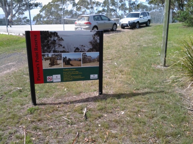
My blog posts referred to that mouth as Pearson’s Point.  That name was an error. The location was Pierson’s Point, as was clearly apparent in one of the photos I included in the blog posts.20150224_105032.jpgHow could I have got it so wrong!  Thankfully, the error has been drawn to my attention and you can now revisit the blog posts knowing I reached Pierson’s and not Pearson’s Point. The two blog posts that contain the outstanding error are titled:

  • A new milestone marking the 13th stage of my walk along the Derwent River: I reached the mouth on the western shore. Whoopee Doo!!
  • Finally I reached the mouth of the Derwent River on the western shore at Pearsons Point

Pierson’s Point was named after a Benedictine chaplain, Dom or Abbe Ambroise Pierson (1765–94) who assisted conscientiously in essential astronomical work. He undertook this work while travelling on board the l’Espérance, a companion vessel to explorer Bruni d’Entrecasteaux’s La Recherche vessel. In 1792 (note the first European settlement by the Derwent River edge at Risdon did not take place until 1803) these French vessels sailed through what has since been named, the D’Entrecasteaux Channel. As a civilian astronomer, Pierson kept journals recording the readings from the chronometers along with astronomical calculations to determine longitude and workbooks comparing the two.

Ambroise Pierson, the 26 year old astronomer who remained after (Abbe Claude) Bertrand’s departure at the Cape (Town), was a Benedictine whose community, in which he had taught mathematics, had been dissolved during the Revolution.  He joined the Esperance as a chaplain-astronomer on a salary of 2400 livres. His loyalty to the civil constitution of the clergy seems not to have affected his relations with the traditionalists aboard;  he was to be one of the most widely respected amongst the savants. (Looking For La Pérouse by Frank Horner Melbourne Univ. Publishing, 18 Oct 2016)

The Fall of the Derwent

Early during my walk along Tasmania’s Derwent River from the mouth to the source, I was travelling near Repulse Dam on a reconnaissance trip when I came across two others.  It was a strange experience.  Previously I had become aware that two women planned, with assistance and support from others, and with the direct engagement of specific groups of people in some parts, to walk from the mouth to the source.  That day, as Andrew and I drove around for me to suss the landscape and the walking route options, when I saw two women seeming to do the same, we stopped them and I asked questions.  ‘Yes we are those women’, said Justy Phillips and Margaret Woodward.  I am sure they were as surprised as I was.

Since then, Justy and Margaret have made their way alongside various parts of Tasmania’s Derwent River and arrived at Lake St Clair where they were Facebooked taking a dip in those cold waters, seemingly delighted with their arrival.

Their project was very different from mine.  In my case, I wanted to walk around the whole of the Greater Hobart Area, and then to walk every metre of the way to the source at St Clair Lagoon dam.   By contrast, Justy and Margaret walked alongside parts of two Derwent Rivers; Tasmania’s Derwent River and the other in Cumbria England.  The experience of and learnings from their walks were used as part of the basis to write what they describe as a ‘fictionella’; written in the form of text artwork, similar in appearance to poetry.

That book is titled Fall of the Derwent. In this website you can see  range of photographs including two where Justy and Margaret are holding their black covered book.

Cover of book.jpg

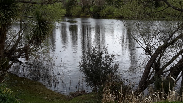
The title of the book references a drawing by an early Tasmanian surveyor George Frankland which he named ‘Fall of the Derwent’.  Colonial artist Thomas Bock engraved the image and James Ross printed the picture in The Hobart Town Almanac in 1830. The picture was drawn at a site near unpassable rapids on the Derwent River upriver from New Norfolk.  When Justy and Margaret walked past what they believed was that place, they took a suite of black and white photographs;  half a dozen or so of these images are bound into their book.  Without returning to that area I seem to remember the spot.  After reviewing my photographs in that area, clearly I was looking for serenity and simplicity.  I was looking at colours and contrasts.  It seems I was focusing on one way of seeing that world of the Derwent River, and Justy and Margaret’s view is an alternative.20150917_094036.jpg
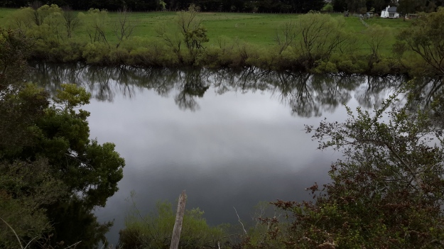
20150917_095352.jpgI did not focus on the twisted interlacing of stark and scrappy vegetation at the river edge like Justy and Margaret have done  The differences in our images is a reflection on the different nature of our projects. I wanted to entice others to be seduced by the beauty of the landscape and then to make their own journeys along the river edge (I now wonder why I didn’t see vegetation tangles as beautiful).  When I read their book it seemed they wanted to use their experiences as the basis for creative abstract thoughts; perhaps even a metaphysical approach involving questions such what is there in that world and what is it like at a more profound level.  My approach was literal and descriptive.

The Phillips/Woodward Fall of the Derwent publication presents poetry-styled ideas and comments in ‘chapters’ headed by the days of the week; the book proceeds over  44 days consecutive days – but the ideas associated with both rivers are intermixed.

“Let us begin with two rivers / And a Dad not long for living. / Two daughters …”

Despite the introductory lines, theirs is not a chronological story connecting the sequences of walking the two rivers; reference is made to other locations such as Cape Barren Island, Dover Point, and Brisbane. And the English father walked with Justy and Margaret when they traipsed near the Cumbrian Derwent. As an intertwined overlay in this book, mention is made of his declining health – Dad in pain, no longer able to feed himself, no longer speaking.  For this reason and for the manner of writing which removes easily identifiable meaning through much of the publication, this book has a limited audience and is obviously a set of personal ideas to be understood, remembered and perhaps loved by the authors. For their personal satisfaction. I was surprised that this book uses combinations of words that do not create, for most of the book,  visual images of either of the two rivers. Instead, the poetry reads as a meshing of many experiences which presumably helps Phillips/Woodward to reconstruct a feel of those experiences.

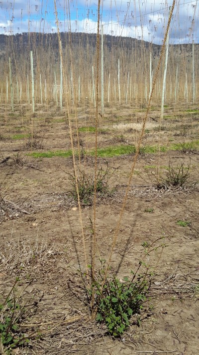
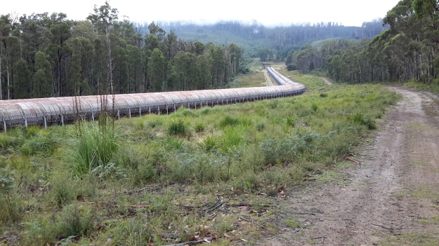
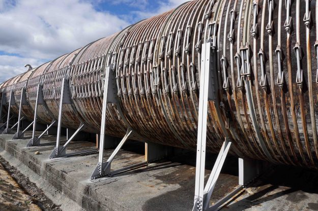
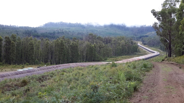
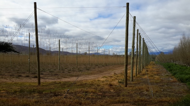
On occasion, where the meaning was clear because I could recognise specific locations, I enjoyed some of the lines. For example, “…rows of hops that string this neck of the river…” referred to the hop vines and their structural strings in the Bushy Park area.  These hop fields obviously made a significant impression on Justy and Margaret because there was a second comment on the same topic; “…the hops in single file march orderly disruption to the valley.”  Then, when they walked around the Wayatinah Power Station, “…the woodstave pipeline is a blistering gland … Draws the corset of her breathing”.  Like Justy and Margaret, I looked in awe at these two locations and their dramatic impact was described during my posts.  To remind you – here are photos of the hop fields and others of the wooden pipeline.   20150918_104145.jpg
20150918_113007.jpg

20170424_114515.jpg

DSC01655e.jpgJusty and Margaret learnt in Cumbria; “On the banks of the River Derwent, that the term ‘black market’ is born. Through the illegal trading of graphite.”  Then they found graphite was part of the geological structure at Wayatinah on Tasmania’s Derwent.  From these findings, grew the idea to play with ‘black’; the book’s cover is black, some copies are cloth bound and impregnated with carbon powder, the Fall of the Derwent and ‘black’ are interconnected within the text, and one section of the book presents a list of locations along Tasmania’s Derwent which include ‘black’ in the name; examples include Black Bob’s Rivulet and Blackmans Bay.

Phillips/Woodward’s book Fall of the Derwent was part of a public artwork presented in association with GASP (Glenorchy Art & Sculpture Park) in 2016. Further information can be accessed here. If you click on ‘Download Hydrographic Score’ you will be able to read the book online.
Reason for travel

Below I have included an excerpt from the most recent publication of Tasmanian-based internationally renowned author Robert Dessaix:  The Pleasures of Leisure.  In the last pages of the book, when Robert was discussing travel and its connection to leisure, I realised he was expressing my reasons for the Walking the Derwent project as he talked about his view of travel destinations which satisfy.

 As far as I’m concerned, for a place to be worth going to, three things must dovetail: firstly, it will be somewhere behind enemy lines because that puts you on your mettle – so Canada is out; going to Canada is just like staying home, but colder. Canada is nice.  Canadians are nice.  You don’t want ‘nice’ when you travel. The god of travel, after all, is Hermes – god of boundaries and boundary crossings, of transition and transgression, constantly darting in and out of enemy territory.  In a word, he’s the god of changing places. I doubt Hermes could even spell ‘Canada’.

Uganda, on the other hand, is definitely behind enemy lines, as is Cuba  (so far as I’m concerned), but neither of them strongly tempts  me as a destination because I doubt I’d find myself interesting there.  It’s not a judgement on Uganda or Cuba, but on the match. It’s like a conversation, really, any conversation that leaves you feeling elated: you want to be part of it so long as it makes you feel larger, richer and more interesting than you’ve felt up to now, so long as it magnifies something you cherish, so long as it makes what could feel unremarkable (about you or the universe) remarkable, as someone you love does.  To be remarkable in itself – as the Taj Mahal is, or Machu Pichu, or Angkor Wat – is not enough. It must make everything that has been ordinary about you now feel extraordinary. That’s the second criterion in where to go.

And the third thing I look for when I travel well is hunger: where you go should leave you feeling slightly hungry, should sharpen your appetite for life, not quench it.

To walk against the Derwent River from the mouth to the source took me onto land that belonged to others and into and through forested landscapes which were never designed with the expectation that humans might roam the earth. I never thought of landowners, their fences and gates, or the bush as enemies, but their expectations and nature kept me  ‘on my mettle’. Despite working hard on each stage, my walks left me ‘feeling elated’ and ‘larger, richer and more interesting than’ I had felt up to that point.  After the adventures of each walking stage along the Derwent, I felt more alive and even more excited to go on living, and to travel more for new experiences.  Dessaix’s exposition helps me to understand why I have not felt the need to travel overseas. The Derwent River and the Tarkine locations are close to home yet they offer the three essential ingredients: they put me on my mettle, make me feel richer and more interesting, and stimulate my hunger for more.

Robert Dessaix offers a myriad of wonderful ideas in his book. I recommend you add it to your reading list. This insightful book is so wonderfully easy to read and offered me a great deal of pleasure  on every page.

The Pleasures of Leisure.jpg

More silvery views of the Derwent

Another of my favourite local bloggers No Visible Means has, in recent months, taken new photographs and some of these show the Derwent River. Soft, wispy and silver.

In particular look at his blog post titled Autumn for photos from Mt Knocklofty and Mt Stuart looking down to the silver ribbon.  Other wonderful blue Derwent River photos are also on display in this blog post.

The mouth of the Derwent from a long way off

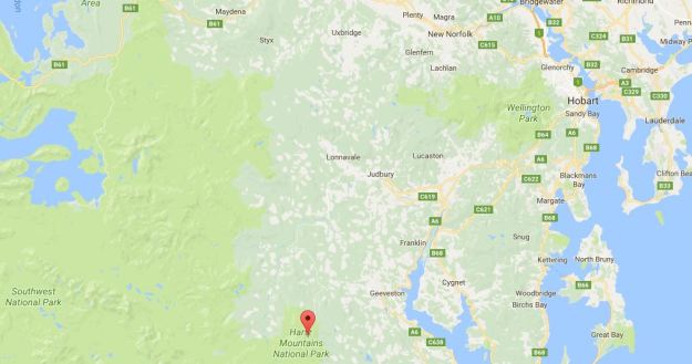
Over the weekend one of my favourite bloggers This Amazing Planet published an image from his latest foray into Tasmania’s south.  The location of his ‘viewing platform’ is indicated on the following Google map.

Hartz to Hobart.JPG

The post, titled View from Hartz Peak thru to the mouth of the Derwent River. Southern Tasmania , describes the scene accurately.

 I am in awe of Mark’s walk up to the top of Hartz Peak clambering over snow covered rocks and unreadable depressions in the ground.  But I am so very grateful to see this photograph.  Sensational.  It presents the Derwent River as a soft silvery ribbon.  Beautiful!

Rivers of music

Mark Miles wrote a wonderful post The Music of a River that Flows through the Soul.  This post is informative and reminds me of the emotional connection that sounds make – the sounds of waters and the sounds of instruments.

When I walked along some sections of the Derwent River, I sang loudly and with great joy as a result of the emotional uplift which the river environment offered, and because I had the privilege of being able to walk freely.

It is easy for me to understand the motivations of musical composers over the centuries, and to love their work.  Only now do I recall that the music played as I walked down the church aisle to be married, was Handel’s Water Music.  Only now do I recall that one of Mum’s favourite vinyl LP was Strauss waltzes, with the Blue Danube Waltz ever present on the turntable.  As I sit here and type, a flood of memories of water and music connections throughout my life thrill me.  Were these happy memories the result of my being born in late February- Piscean territory?

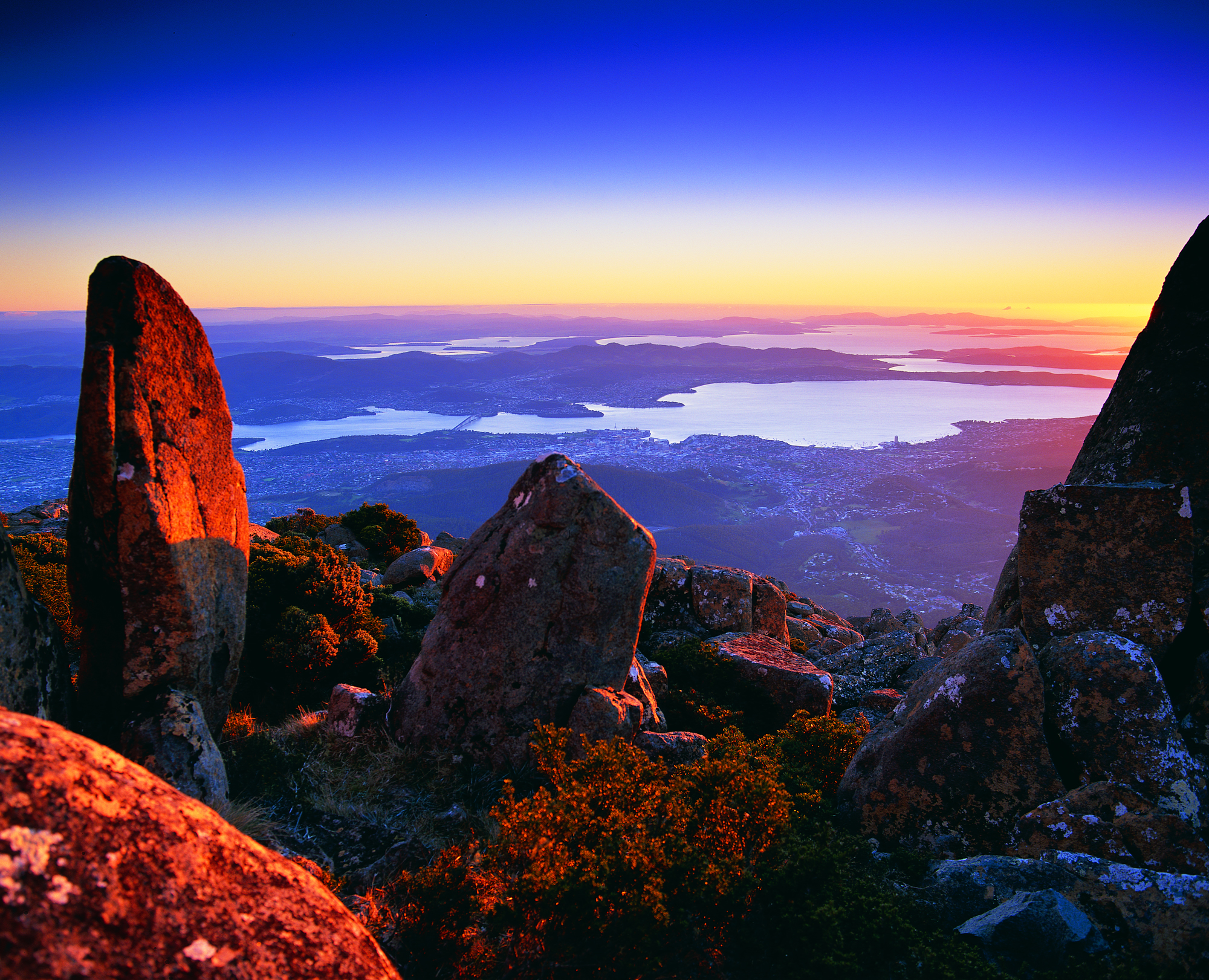
Hobart and the Derwent River from above

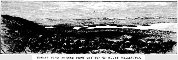
Recently, as I delved into the National Library of Australia’s online digitalised newspapers for family research purposes, I stumbled across the following image.

The newspaper was the now defunct The Australasian Sketcher with Pen and Pencil produced in Melbourne Victoria between 1873 and 1889.  The image below was published in the Saturday issue of 17 April 1875.

Taken from the vantage point of Mount Wellington we are looking down onto the dots of a growing Hobart city, across the Derwent River to the eastern shore which is as yet unsettled in any dense sort of way.  As usual, the River is the star!

River Derwent from top of Mt W17041875.JPG

Not for human consumption

Today’s ABC News Online gives us the headline suggesting an exciting story – “Amateur dive photographer shares snaps of Hobart’s hidden underwater world”.

We are told “Under the surface of the River Derwent you’ll find an otherwise hidden and surprising colourful world of marine creatures.” Accompanying the story are photos of divers and underwater creatures.  Quite startling is the beauty of what divers can see. Wonderful.  The gorgeous photo of a crayfish by Millie Banner attracted my attention – who doesn’t love eating a crayfish. However, “… heavy metal levels in the river make them not safe to eat.”  So please do not go down deep seeking a feed from the waters under the Tasman Bridge.  Besides the river currents might sweep you out to sea.  Maybe.

From Catagunya to Wayatinah – post 4 of 4

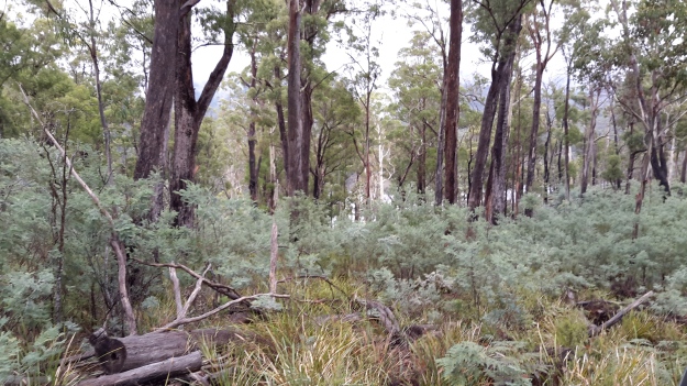
I took a series of forest photos most of which are blurred. I am adding some here to give you an idea of what parts looked like – sorry about the quality.

20170424_113247.jpg

20170424_111909.jpgThen the white shape of the Wayatinah Power Station appeared between the tree trunks.

20170424_114138.jpg

20170424_113538.jpg

The closer I came to the Wayatinah Power Station the steeper the hills seemed. For vehicles travelling down the road, the final gradient requires a low gear in a 4WD. The drizzle on a day like the one on which I went, meant the clay and soil track surface was exceptionally slippery and dangerous for the inexperienced or inept.

Then I was out in the open again. This time looking down to Lake Catagunya past the Wayatinah Power Station.

20170424_114211.jpg

To my right, additional infrastructure punctured the sky.

20170424_114227.jpg

20170424_114340.jpg

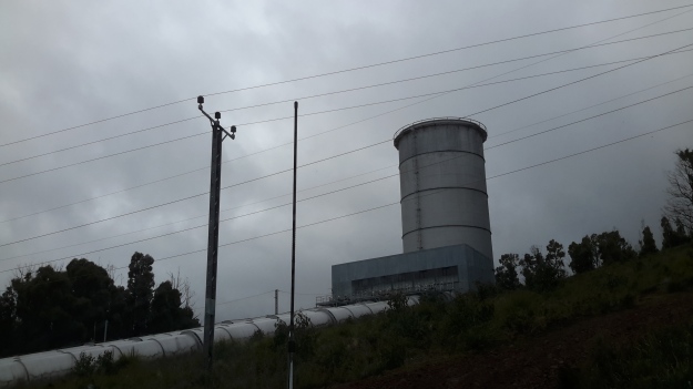
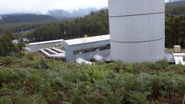
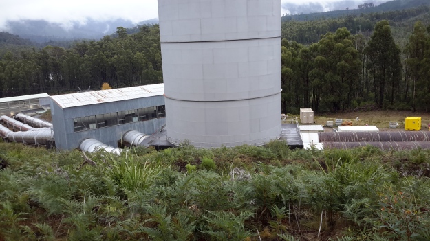
Further up the hill and connecting to the huge surge tank, the snaking length of wooden penstocks started.  See my earlier post for more information about wooden penstocks here. Can you remember the wonderful photos which Andrew took in this blog posting?  My photos are less detailed but still show the dramatic line of the penstocks.

20170424_114338.jpg

20170424_114345.jpg

20170424_114515.jpg

I ended the day with a thick coating of mud on my boots and a smile on my face. Yet another day offering me a memorable experience along the Derwent River. I am especially grateful for the extensive information and access provided by GL. Please note that private and corporate owners control access to this section of the Derwent River and the many gates are locked with an assortment of sophisticated processes. General public access is not available.

From Catagunya to Wayatinah – post 3 of 4


I followed a road aiming to intersect with the transmission lines ready to follow that towards Wayatinah to the extent it would be possible.  Massive heavily forested gullies made continued close access to Lake Catagunya (full of Derwent River water) impossible.

20170424_110654.jpg

Even the cleared area wasn’t clear enough for anyone to walk through on foot, although it was sufficiently clear to keep the power lines unaffected.

20170424_110907.jpg

When I stood on high, misty wisps reshaped distant hills and threatened to obliterate views of Lake Catagunya. Fortunately I could always see its glistening surface way below.

20170424_111136.jpg

20170424_111350.jpg

On top of the second last hill before reaching Wayatinah Power Station, the western end of Lake Catagunya appeared through the clouds.

20170424_111533.jpg

Before long the metal pipeline streaming water into the Wayatinah Power Station became visible.

pipelinewpscropped.JPG

Often the bush was amazingly quiet. This film  seems to be without sound. Only near the end can the faint crarking of a crow be heard.  This bush silence was an unexpected beauty of my day from Catagunya to Wayatinah.

From Catagunya to Wayatinah – post 1 of 4

Well over a year ago, one morning I walked through smoky air westwards into the Catagunya Power Station.  After a night camping, entwined by the thick atmosphere of a far distant bush fire and desperate for water, I was relieved to be received hospitably at the Station.  At that time I was thrilled by a guided tour of the building and its operation, however I never proceeded to walk the extra few hundred metres to look at the Dam wall holding back the large Lake Catagunya.  I was most grateful when many months ago, my walking proxy Andrew climbed the hills from Wayatinah Power Station to arrive at and photograph the Catagunya Dam.  A blog search using “Catagunya” as the term, will help you to locate those past stories plus a swag of descriptive photographs.

Recently, I was privileged to make the journey between the Catagunya and Wayatinah Power Stations and to experience that stimulating environment. Thanks to the generous assistance of GL from TasNetworks,  I was able to enter the locked Catagunya Road off the Lyell Highway, and travel the 8 or so kilometres to the Catagunya Dam.

The wall of the Dam curved magnificently and  the landscape-green Lake Catagunya spread impassively to the west. 20170424_104221.jpg

20170424_104055.jpg

Below I could see the old Derwent River bed as a rocky almost water free pathway.

20170424_104042.jpg

Bypassing the river bed, a massive Canal drained water from the Lake into the Power Station. It appeared as a giant marker on the landscape that seemed much wider and more substantial than the Tarraleah Canals that run from Lake King William and the Butlers Gorge Power Station further inland.    20170424_104148

20170424_104228.jpg

20170424_104330.jpg

20170424_104504.jpg

The apparently still Canal water was deceptive. Only on closer inspection could I see the dramatic gush of water moving underneath the left hand entrance at the end of the race.  Obviously electrical power was being generated in the Catagunya Power Station that day.

From vantage points near the Dam and the Canal I could see the Power Station building way below. Oh how tiny it seemed by comparison with the larger constructions. Yet when I had first approached and walked around it, the building seemed cavernous.

20170424_104537 with PSarrowed.jpg

20160210_092533.jpg

More than anything I was as excited as a three year old having a birthday party with lots of surprises.  Recent rain had cleared the air of dust, the day was overcast and the fairy weight of moisture from low clouds kept the air moist. I kept breathing deeply, absorbing the cleanness of the air. Loving the damp air. Feeling cleansed. So profoundly happy to be back in the bush and walking besides my beloved Derwent River.

The Max Angus 1990 exhibition

A few weeks ago I added a couple of posts to this blog about an art exhibition by the late renowned Tasmanian artist Max Angus titled Aspects of the Derwent from the source to the sea.

I did not have a copy of the exhibition catalogue and encouraged any reader who had a copy to let me know.  I imagined the publication would contain only a list of the names of each work of art and the price and not contain photographs, nevertheless I did believe reading it would be instructive. I hoped to learn the locations which Max Angus painted along the Derwent River.  Unfortunately a copy of the catalogue has not surfaced.

Since then I have been working through microfiche at the State Library of Tasmania looking at The Mercury newspaper hoping to find a review of the exhibition.  From Googling I knew the exhibition’s title and the year – 1990.  Thankfully that information limited the search.  In addition, the watercolour painting, purchased from the exhibition by my friend’s mother, was dated October 1990. Yesterday I found the gallery list in The Mercury on the 6th October 1990 providing the information that the Aspects of the Derwent from the source to the sea exhibition was already open at the Freeman Gallery and would continue until October 22nd. Since the exhibitions at that venue typically lasted 14 – 21 days, probably the show opened around the 5th October.

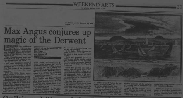
With continued research I was fortunate to find the exhibition review in the Saturday Weekend Arts of The Mercury newspaper for the 13 October 1990. I was particularly interested to read a few of journalist Susan Leggett’s comments:

“This very large exhibition – 64 works in all – is a powerful, careful and stunning collection.”

“Angus has read and evoked the nature of the turbulent, dynamic entity …” when referring to the Derwent River.

“He has not only painted images  of a real river travelling along its course, but created a sort of separate reality for it – an extra dimension.”

“It is all well observed and stunningly translated.”

Aspects of the Derwent Anhus article.JPG

The image included with the article is of the painting Yachts on the Harbour. The friend mentioned elsewhere in this post, is an avid sailor on the Derwent Harbour.  I wonder whether she was out there that day when Max Angus painted this picture and her yacht is in the mix.

Last but not least, since the painting belonging to my friend’s mother was painted in October 1990, then the paint was hardly dry before being taken into the Gallery for hanging.

Piguenit at Lake St Clair

Since my walk from the mouth along the Derwent River culminated at the source, Lake St Clair, writing one of the final blog postings about my favourite Tasmanian artist Piguenit who painted Lake St Clair a number of times, seems appropriate.  Previously in the posting Piguenit- artist extraordinaire in southern Tasmania, I extolled some of his virtues.

The story goes – in one of my former lives, in my arts and museum career, I started in the profession working at the Tasmanian Museum and Art Gallery – in three ways: I gave the occasional public lecture in the art gallery section, I volunteered and worked on the art collection in the bowels of the building, and I was employed as a cleaning and security attendant.  Because of my art knowledge and interest I was usually allocated the large gallery at the top of the building for the security detail, the one with the 19th century paintings and sculptures. In those days there was no cover on the roof windows, no insulation and no heating.  This is late 1970s and I recall being frozen for most of my winter shifts standing there.  But the win for me was that all the TMAG’s big Piguenit paintings were hung at one end of the gallery.  Until then I had never seen his work. I was bowled over by their majesty, their drama and with the artist’s skill.  Most especially, for the first time, I saw an artist painting serious pictures in oil but sometimes only using black and white paint and creating an image with greys (some were slightly yellow greys).  I marvelled at this and have adored his work ever since.  When I come across one of his pictures in any Gallery of Australia I simply stand in reverent silence. His work has that effect on me.

Recently I received a card for a milestone birthday from a couple of stalwart walkingthederwent supporters. The image on the cover was Lake St Clair, the Source of the River Derwent, Tasmania 1887.  Piguenit delighted in this lake and its glorious mountainous surrounds.  The image below, courtesy of Artnet, is very similar to that on my birthday card (regrettably I can find no online reproduction of ‘my’ image).

william-charles-piguenit-lake-st-clair-the-source-of-the-river-derwent-tasmania

The original oil on canvas, shown on my card, was presented to the Tasmanian Government  in 1889 and is now housed in the Tasmanian Museum and Art Gallery. The differences between ‘mine’ and the Artnet versions include the fact that the latter is a smaller canvas and the foreground rocks and sand are shaped and painted differently. My earlier posting has another image of the same location – one which is held in the collection of the Art Gallery of New South Wales.

Clearly the birthday card was sent with my recent walkingthederwent project in mind but without knowing my decades long ‘connection’ with Piguenit’s work. That image of Lake St Clair with Mount Olympus spot-lit is a stunner.  Now I wonder if the impetus for my walk along the Derwent began in that freezing Gallery all those years ago.  How could I have known what my future held and where I would end up?