Tag Archives: New Norfolk

The Derwent River in 1958

Recently a friend sent me a link to an extraordinary 9 minute film that was made in 1958. The film is based around New Norfolk, a town located approximately 35 kms west of Hobart. The Derwent River bends around the edges of the rural town that is now built up on both sides of the river.

Enjoy watching the film ‘Valley of the Derwent’, produced by the Tasmanian government, here. Please bear with the excruciating sound of the music so you can listen to the 1950s style narration. The images start at Granton about 18 kilometres west of Hobart. The voice-over explains the original virgin bush ‘had never known the axe or the plough’ indicating a firm belief in the 1950s that taming the wilderness (a euphemism for ‘removing the bush’) was what humans should do. Regrettably there are still too many people (including governments) who feel similarly in 2020.

Early on you see the black swans on the river. David Walsh owner of MONA has just released a diary entry where he refers to the black swan as the unknown unknowns. Makes for interesting reading – here.

I was fascinated that a composer William Wallace, according to the film,  wrote the opera “The Spirit of the Valley” while he stayed at the historic Bush Inn in New Norfolk. It led me on a merry chase through archives and online resources. However recent academic research indicates this is a myth generated over the years, and that even the writing of one song for an opera while he visited New Norfolk is unlikely.

For long term blog followers, the filmed section on the oast houses may bring back to memory my fascination with those at Bushy Park when I ‘discovered’ the texts on the buildings as I walked west from New Norfolk. Refer here.

It made me think how many years have passed and what a world of difference there is since the film was made. For example, I was six years old when the film was produced yet I noted the clothes being worn have the familiar shapes of those of my life through the 1960s.

‘But it’s the river that captivates the eye, twisting and turning along the valley’, so says the narrator. I would say this was true for the entire 213 or so kilometres of the length of the Derwent River.


The Fall of the Derwent

Early during my walk along Tasmania’s Derwent River from the mouth to the source, I was travelling near Repulse Dam on a reconnaissance trip when I came across two others.  It was a strange experience.  Previously I had become aware that two women planned, with assistance and support from others, and with the direct engagement of specific groups of people in some parts, to walk from the mouth to the source.  That day, as Andrew and I drove around for me to suss the landscape and the walking route options, when I saw two women seeming to do the same, we stopped them and I asked questions.  ‘Yes we are those women’, said Justy Phillips and Margaret Woodward.  I am sure they were as surprised as I was.

Since then, Justy and Margaret have made their way alongside various parts of Tasmania’s Derwent River and arrived at Lake St Clair where they were Facebooked taking a dip in those cold waters, seemingly delighted with their arrival.

Their project was very different from mine.  In my case, I wanted to walk around the whole of the Greater Hobart Area, and then to walk every metre of the way to the source at St Clair Lagoon dam.   By contrast, Justy and Margaret walked alongside parts of two Derwent Rivers; Tasmania’s Derwent River and the other in Cumbria England.  The experience of and learnings from their walks were used as part of the basis to write what they describe as a ‘fictionella’; written in the form of text artwork, similar in appearance to poetry.

That book is titled Fall of the Derwent. In this website you can see  range of photographs including two where Justy and Margaret are holding their black covered book.

Cover of book.jpg

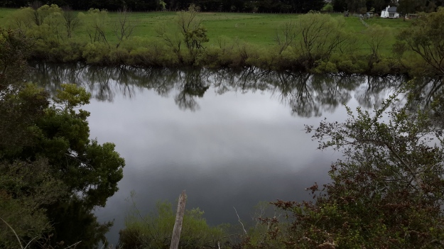
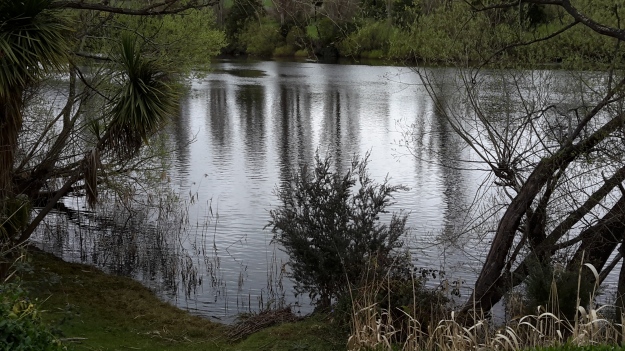
The title of the book references a drawing by an early Tasmanian surveyor George Frankland which he named ‘Fall of the Derwent’.  Colonial artist Thomas Bock engraved the image and James Ross printed the picture in The Hobart Town Almanac in 1830. The picture was drawn at a site near unpassable rapids on the Derwent River upriver from New Norfolk.  When Justy and Margaret walked past what they believed was that place, they took a suite of black and white photographs;  half a dozen or so of these images are bound into their book.  Without returning to that area I seem to remember the spot.  After reviewing my photographs in that area, clearly I was looking for serenity and simplicity.  I was looking at colours and contrasts.  It seems I was focusing on one way of seeing that world of the Derwent River, and Justy and Margaret’s view is an alternative.20150917_094036.jpg

20150917_095352.jpgI did not focus on the twisted interlacing of stark and scrappy vegetation at the river edge like Justy and Margaret have done  The differences in our images is a reflection on the different nature of our projects. I wanted to entice others to be seduced by the beauty of the landscape and then to make their own journeys along the river edge (I now wonder why I didn’t see vegetation tangles as beautiful).  When I read their book it seemed they wanted to use their experiences as the basis for creative abstract thoughts; perhaps even a metaphysical approach involving questions such what is there in that world and what is it like at a more profound level.  My approach was literal and descriptive.

The Phillips/Woodward Fall of the Derwent publication presents poetry-styled ideas and comments in ‘chapters’ headed by the days of the week; the book proceeds over  44 days consecutive days – but the ideas associated with both rivers are intermixed.

“Let us begin with two rivers / And a Dad not long for living. / Two daughters …”

Despite the introductory lines, theirs is not a chronological story connecting the sequences of walking the two rivers; reference is made to other locations such as Cape Barren Island, Dover Point, and Brisbane. And the English father walked with Justy and Margaret when they traipsed near the Cumbrian Derwent. As an intertwined overlay in this book, mention is made of his declining health – Dad in pain, no longer able to feed himself, no longer speaking.  For this reason and for the manner of writing which removes easily identifiable meaning through much of the publication, this book has a limited audience and is obviously a set of personal ideas to be understood, remembered and perhaps loved by the authors. For their personal satisfaction. I was surprised that this book uses combinations of words that do not create, for most of the book,  visual images of either of the two rivers. Instead, the poetry reads as a meshing of many experiences which presumably helps Phillips/Woodward to reconstruct a feel of those experiences.

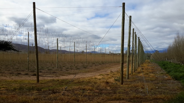
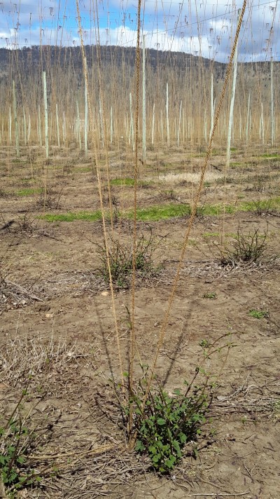
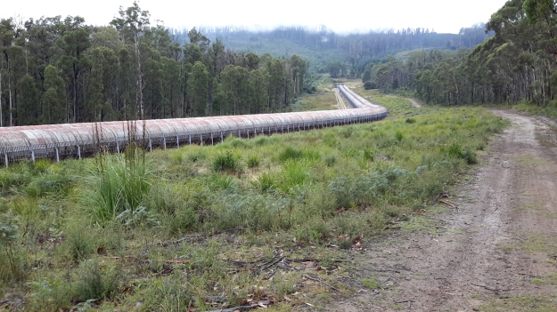
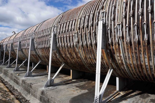
On occasion, where the meaning was clear because I could recognise specific locations, I enjoyed some of the lines. For example, “…rows of hops that string this neck of the river…” referred to the hop vines and their structural strings in the Bushy Park area.  These hop fields obviously made a significant impression on Justy and Margaret because there was a second comment on the same topic; “…the hops in single file march orderly disruption to the valley.”  Then, when they walked around the Wayatinah Power Station, “…the woodstave pipeline is a blistering gland … Draws the corset of her breathing”.  Like Justy and Margaret, I looked in awe at these two locations and their dramatic impact was described during my posts.  To remind you – here are photos of the hop fields and others of the wooden pipeline.   20150918_104145.jpg

20150918_113007.jpg

20170424_114515.jpg

DSC01655e.jpgJusty and Margaret learnt in Cumbria; “On the banks of the River Derwent, that the term ‘black market’ is born. Through the illegal trading of graphite.”  Then they found graphite was part of the geological structure at Wayatinah on Tasmania’s Derwent.  From these findings, grew the idea to play with ‘black’; the book’s cover is black, some copies are cloth bound and impregnated with carbon powder, the Fall of the Derwent and ‘black’ are interconnected within the text, and one section of the book presents a list of locations along Tasmania’s Derwent which include ‘black’ in the name; examples include Black Bob’s Rivulet and Blackmans Bay.

Phillips/Woodward’s book Fall of the Derwent was part of a public artwork presented in association with GASP (Glenorchy Art & Sculpture Park) in 2016. Further information can be accessed here. If you click on ‘Download Hydrographic Score’ you will be able to read the book online.

‘What’s in a name? A fair bit , actually’ says Rex Gardner

On page 14 of The Mercury newspaper on 5th February Rex Gardner asked ‘What’s in a name?  A fair bit , actually’ about a part of my favourite Tasmanian river.

He talked about the area near the Hobart docks and further out into the harbour and remarked that it ‘really doesn’t have a proper name’.

Rex commented: ‘We call it the River Derwent, or Derwent River. But that name aptly describes the Derwent around New Norfolk, and upriver from there, because a river is a naturally flowing fresh watercourse, flowing towards the sea.  Heading downstream towards Bridgewater, the Derwent becomes an estuary, defined as brackish water fed by streams and rivers, and flowing to the sea.’

When Rex added ‘What flows through the city of Hobart is not a river’, I gasped.  Over time, my blog has addressed the challenges of defining where the Derwent River starts and stops.

To help you to visualise the location, below is an excerpt from Google maps.

Harbour.JPG

Rex Gardner explained, ‘It could be loosely called an estuary, and more properly a harbour, which is a body of water surrounded by land.  The Derwent is 1.4km wide at the Tasman Bridge. From the Hobart docks to Howrah Point is 6km.  From Sandy Bay to Tranmere is 5km.  The Mississippi and the Amazon rivers don’t boast distances like that, except at their mouths or when they flow through lakes.’  Finally he remarked: ‘You have to wonder how the Derwent has suffered the indignity of being called a river for so long.  Just like Mount Wellington got a name change, so too should our Hobart Harbour.’  An alternative fact: our mountain has two official names – Mount Wellington and Kunanyi.

Rex Gardner’s approach adds a new dilemma. To understand some of the legal issues associated with defining a ‘river’ read here, here and here.

The Derwent Estuary Program describes the section of the Derwent between the Iron Pot (at the inner edge of Storm Bay near the eastern shore river mouth) and New Norfolk as the Derwent Estuary rather than the Derwent River and explains it is “a unique environment; a partially enclosed body of water where tidal seawater and fresh river water mix”.

What constitutes our Derwent River – where does it start and stop?  What is the location of its mouth? I have become so used to thinking of the Derwent River starting in the Lake St Clair area and ending around the Iron Pot that these ideas have shaken me up; they are making me question my position.  Does it matter to you? I wonder what others think.

Recapping the walk along the Derwent River


I lived the walk along the Derwent with a vital obsession but, after so many months intensely engaged on other projects, now some of the details are vague. To re-immerse myself into the experience, I am writing this post.

In addition, I suspect it will be a great help to people who have become followers of my blog during the past 6 months.  Despite my inactivity, it surprises me how many visitors and views the blog gets daily, how many different posts are read, and how many different countries around the world are represented.

In August 2014, from an impulsive unplanned idea, I took a bus to a spot near the mouth of the Derwent River on the eastern shore, walked to the sea then retraced my steps and began the walk towards the source of this great river approximately 214kms inland.  On day trips, and around other life commitments, I walked in stages along the eastern shore until I reached the Bridgewater Bridge which crosses the Derwent approximately 43 kms upstream.

Instead of continuing inland, I crossed the bridge and headed back on the western shore towards the southernmost  mouth of the River.  Most of the walks along the eastern and western shores between the sea and the Bridgewater Bridge were along designated pathways, although some informal track walking, road walking and beach walking was required during my trips.

Then I returned to the Bridgewater Bridge and began the journey inland expecting only to walk on the side of the river that made passage easiest.  I had no intention to walk both sides from this point onwards in anticipation the landscape would be inaccessible for a number of reasons or particularly wild with dense and difficult forests. I walked to New Norfolk on the western/southern side of the Derwent but from then on, I switched from side to side. Using maps I determined where I must take up each new stage of a walk while switching from side to side, so that I could say I had traipsed the entire length of the Derwent River.

The farthest inland stages of my walk are easily defined.  I walked from near the township of Tarraleah besides Canal 1 (along which is transported Derwent River water) above the actual River bed, past Clark Dam, and around majestic Lake King William to the township of Derwent Bridge.  From there I followed the river to its source at St Clair Lagoon dam.  In case some people believe the source of the Derwent is further inland, I walked onwards to the weir where the Derwent Basin empties into the St Clair Lagoon via passing the southern end of Lake St Clair.

Between New Norfolk and the area near  Tarraleah, my walk beside the River was in country near  townships (some of which were located at a great distance from the River) such as Bushy Park, Gretna, Hamilton, Ouse, and Wayatinah.  This necessitated additional travel to or from the highway and roads, on which these towns exist, to reach the river or to return home from a walk along the river.

Inland, the water of the Derwent River is controlled by dams constructed to create hydro-electricity for Tasmania: I walked past them all. From the end of the river closest to the mouth, these are the Meadowbank, Cluny, Repulse, Catagunya, Wayatinah, Clark and St Clair Lagoon dams.  Each of these has a bank of water behind them:  Meadowbank Lake, Cluny Lagoon, Lake Repulse, Lake Catagunya, Wayatinah Lagoon, Lake King William and St Clair Lagoon.  Most of these dams and bodies of water has a power station: Meadowbank Power Station, Cluny Power Station, Repulse Power Station, Catagunya Power Station, Wayatinah Power Station and Butlers Gorge Power Station.  I was privileged to be shown around one of these power stations during one walk.

Water from the Derwent passes through two other power stations:  Nieterana mini hydro and the Liapootah Power Station.  I did not follow the trail of these Derwent River managed flows.  The water from other locations inland passes through the Lake Echo Power station and Tungatinah Power Station then flows into the Derwent after power generation, thereby increasing the volume of water flowing downstream.  I did not walk along these feeder rivers.

The few stages of the walks which have not been recorded in this blog, are in all the zone between Gretna and the area near Tarraleah – a stretch of perhaps  120 km.  I have written up and posted most of the walks in this zone, and now it’s time to add the missing sections.
Tea from Linden flowers

When I walked from New Norfolk to Bushy Park, I passed a property named Linden.  You can reread my post and the informative additional comments provided by blog followers.

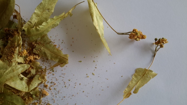
Not long afterwards, a local friend exclaimed with surprise when I informed her that I did not know what a Linden tree looked like, and that I had never drunk tea brewed from Linden tree flowers.  Imagine my pleasure when, one day, Alex called by with a bag of dried linden flowers.  They seemed to possess an ethereal beauty. Out came my camera and here are the resulting photos.

20160516_151652.jpg

20160516_151658.jpg

20160516_151708.jpg

The tea was delicate but refreshing. Most enjoyable. Thanks Alex.

Growing up as a Hydro boy

Thanks to blog follower Mary, I have discovered a series of online stories about past Hydro workers some of whom helped build the Tarraleah Canal No 1 and others who lived near other electricity generating power stations along the Derwent River. These short stories make interesting reading and include photographs of the people and places.

I recommend you look at Hydro Tasmania’s site where the son of Jack Warren records his history.  The photo below from that site shows Jack at Canal No 1 in 1935.

Jack Warren 1935 from Mary

Simon Stansbie’s record of growing up at Wayatinah can be read on the Hydro Tasmania’s website. Ian Berry tells us what it was like to grow up at Butlers Gorge (where the Clark Dam was built to hold back the waters of Lake King William).  You can read this and see photos at Hydro Tasmania’s site.

Collectively these stories give a little insight into the human reality of living and working in remote central Tasmania to create the extraordinary electricity generating infrastructure last century which used the waters of the Derwent River.

Heather Felton published a book, which tells these and other stories of the people of ‘The Hydro’.  Read more about the book: The Ticklebelly Tales.

Cover Ticklebelly Tales - Hydro.jpg

Information about the book launch can be read in issues of the Cultural Heritage Program Newsletter ; and at a second site.

I am not sure what the word ‘Tickleberry’ refers to.  Do I have any blog followers with this knowledge?  According to Wikipedia part of Tarraleah, the area for the married quarters of the original community, was known as Tickleberry Flat. In addition, during my walks I know that I have passed an area mapped as Tickleberry Flat which is south east of Curringa Farm, and almost south of the town of Hamilton mid-way along Meadowbank Lake – a long way from Tarraleah.  In New Norfolk Tickleberry Farm grows raspberries.  The name Tickleberry comes up in many internet searches.  The Brighton, Central Highlands, Derwent Valley and Southern Midlands Councils Joint Land Use Planning Initiative – Stage 2 Heritage Management Plan tells us “Hydro-electric power schemes which commenced in the early 1910s saw the development of construction villages across the highlands at Waddamana (from 1911), Shannon (1925), Tarraleah (1934), Tickleberry Flats (1935), Butlers Gorge (1938), Bronte Park (1948) and Wayatinah (1952). As these small communities grew, schools, shops, community halls, medical facilities and offices were established.”

After all of this, I still wonder what the original meaning of Tickleberry is: maybe someone’s name or a common name for a plant.

Hamilton and Ouse in Tasmania

These two historic towns straddle the Lyell Highway and both are situated a distance from the Derwent River.  Private farms fill the distance. Direct access to the River can only be achieved by driving approximately 15 kms when leaving Hamilton, or when driving from Ouse, the River or Meadowbank Lake can be reached from two directions; one approximately 7 and the other approximately 10 kms away.

Hamilton is located approximately 4kms ‘as the crow flies’ to the east of Meadowbank Lake.  The Clyde River, which passes through Hamilton empties into Meadowbank Lake (and it once flowed directly into the Derwent River before the Meadowbank Dam was built in 1967).  Tasmania for Everyone claims ‘Hamilton had its origins at a time when early European settlement of Van Diemen’s Land (Tasmania) had progressed from Hobart up the Derwent Valley. The first settlers arrived here shortly after New Norfolk was settled in 1807. A ford across the “Fat Doe River” probably led to the first settlement of the area then known as Sorell Plains, with the village first named Macquarie’s Town, and later, Lower Clyde.By 1828 there were a few weatherboard and sod cottages on the banks of the Clyde, whilst by the 1830s a visitor noted there were some thirty sly grog shops as one entered the town. The name Hamilton had already been suggested for the settlement sometime in 1825 when, during a visit, Lt. Governor Arthur asked if Bothwell would not be suitable, being a Scot himself and dining with the mainly Scottish settlers. The “Fat Doe River” was renamed the Clyde and Hamilton and Bothwell chosen as names for the new settlements, both names recalling towns on the lower and upper Clyde in Scotland.
Occupying a strategic location in the development of roads and agriculture, Hamilton became the focal point of the transport of produce into and out of the district.  By 1832 there were sixty persons living in the settlement and surrounding landholders successfully petitioned for a police establishment as protection from marauding bushrangers and a spate of robberies.
By 1835 the district population had zoomed to 779, including 309 convicts and by 1837 the Police establishment had eleven petty constables and a flagellator (for whipping punishment).  With cheap convict labour it was during this period that many of the town’s buildings (which still stand today) and bridges were constructed.
By 1844 Hamilton was a bustling town, with two breweries, six or seven Inns, a blacksmith, stone quarries, mills, three agricultural implement makers and a large convict probation station; it held its own Races and Hunts, indeed development was so promising that the town was marked out as a major country town, in the style of an English town at the time, with squares, an esplanade, a Circus and Municipal Reserve.
A drive up onto the Hamilton Plains shows the roads laid out, and the decaying, dry stone walls are a reminder of the failed attempt by the mainly Irish settlers to farm the rich volcanic but dry soils of the plains. Nevertheless, Hamilton remained a bustling country town throughout the remainder of the 19th century, with the population peaking at 400 in 1881 and developments like the Langloh Coal mine to the northwest of the town in the late 1930s ensured its importance as a major rural centre.
Increasing mechanisation and improved road transport effectively put an end to Hamilton’s growth. Whilst sadly these factors led to Hamilton’s decay and ultimate demolition of some notable buildings, many fine examples remain in the streetscape having an ambience redolent of our colonial history.’ 

Hamilton is located on the far side of the hill in the photo below. The water is part of Meadowbank Lake.

20151028_114436.jpg

In Chantale’s photo below, the Clyde River is running into Meadowbank Lake. At the top centre of the photo you can see a few houses and these form part of the town of Hamilton.

IMG_3904

Ouse (pronounced ooze) is located approximately 3 kms ‘as the crow flies’ to the east of the Derwent River between Cluny Dam and the north western end of Meadowbank Lake. Tasmania for Everyone claims Ouse is ‘a small rural Central Highlands town on the Lyell Highway, situated on the junction with the Victoria Valley Road and on the banks of the Ouse River. Ouse is the settlement where convicts James Goodwin and Thomas Connolly broke out of the South West Wilderness four weeks after their escape from Sarah Island. Ouse Post Office opened on 1 October 1835.’

In Michelle’s photo below you will need to imagine that Ouse is located over the low hills in the distance away from the Derwent River.

PA280084Top of Meadowbank Lane and then Derwent again.JPG

John Wadsley’s Brighton, Central Highlands, Derwent Valley and Southern Midlands Councils Joint Land Use Planning Initiative – Stage 2 Heritage Management Plan of July 2010 provides additional historical information concerning the building of bridges to enable expansion and ease transport, the significance of convict labour in settling the Valley, and the growth of farming, the development of industries, and the establishment of hydro power generating facilities.

Catherine Nicholson’s Highland Lakes Settlement Strategy of December 2009 offers further information about the history of settlement in the Derwent Valley.

What I notice, in all the histories of the Derwent Valley that I have read, is that attention is seldom given to the Derwent River rather it is focused on the rivers which fed into the Derwent, and also on the central highland lakes.  The search for fertile soil in which to grow wheat and other crops, and for land offering suitable pastures for sheep and cattle, was of paramount importance.

The photo below shows me in Hamilton. Behind me, the Clyde River (which flows into Meadowbank Lake) is located at the bottom of the hill and edges a delightful park which suits picnicking. I am sort of smiling but I was hot and bothered after a delightful day’s walk elsewhere.

20151031_140708.jpg

Meadowbank Lake

IMG_3898Dunrobin bridge

Chantale’s photo above shows the north western end (the furthest end from Hobart) of Meadowbank Lake. You can see the trail of Dunrobin Bridge strung across.

Collecting historical information about Meadowbank is not easy, however the information  I have located has added to my store of knowledge.

According to Environmental Flows for the Lower Derwent River Final Report to DPIWE February 2002 Freshwater Systems, Meadowbank Dam is located approximately 107km upstream of the river mouth.  This report divides the lower Derwent into ‘two major sections: 1. The lower River Derwent – the freshwater river between Meadowbank Dam and New Norfolk; and 2. The upper Derwent estuary – the estuary between New Norfolk (in the vicinity of the upstream tidal limit) and Bridgewater.’

A brochure providing information about access to Meadowbank Lake for anglers includes details about Recreational Fishery Management (Meadowbank Lake is managed by the Inland Fisheries Service as a Family Fishery and is open to angling all year round. Regular stocking with brown trout, rainbow trout and trophy sized Atlantic salmon maintains the quality of the angling.); Native Fish Management (The short-finned eel (Anguilla Australis) is stocked upstream of the dam wall. The blackfish (Gadopsis marmoratus), which is native to northern Tasmanian rivers, has been introduced into the Derwent system and may be encountered in the lake.); and Pest Fish Management (Meadowbank Lake has populations of the pest fish species, redfin perch (Perca fluviatilis) and tench (Tinca tinca). If either of these species are caught, anglers are asked to humanely kill the captured fish and dispose of appropriately.)

Discover Tasmania provides information which encourages access to and usage of the Lake and its shores.

Wikipedia gives background information about the Power Station.

The September 2013 LAKE MEADOWBANK PLANNING PROJECT BACKGROUND REPORT  prepared for the Central Highlands Council in partnership with Hydro Tasmania and the Department of Economic Development, Tourism and the Arts includes panoramic photographs of the Lake and explanations of many of its aspects.

Hydro Tasmania provides information about Lake- side facilities and also about changing water levels.

A little history associated with Meadowbank Farm since the 1970s can be read at this site.

IMG_3908

Perched between treed hills sits Meadow Bank dam, roughly 15 kms downstream from Meadowbank Lake’s far western end.   Chantale’s photo shows the start of that water catchment behind the dam wall and the Meadowbank Power Station nestled at its feet.

Fields of Dreams

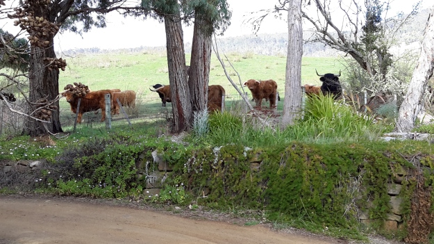
Under the subheading of Horns of Plenty in a local newspaper article, I read about the farmer of the Highland Cattle which I photographed during my walk from New Norfolk to Bushy Park.  By reading the article, I learnt how enterprising Bev Lynd has been, and how useful these cattle are to control the inroads of overwhelming vegetation.  I thought you might be interested in this information.

20150918_090330.jpg 20150918_090340.jpg

My original post can be read at Woolly Long Horned Cattle.

Dunrobin Bridge over Meadowbank Lake


Meadowbank Lake map.jpg

Meadowbank Lake, a large spread of dammed water through which the Derwent River runs,  is located west of New Norfolk: an expanse of water which measures at least 15 kms in length.  Like many other dams and lakes on the Derwent, Meadowbank has been designed for electricity generation purposes.  The Meadowbank Power Station was commissioned in 1967. In a document The Power of Nature, Hydro Tasmania provides information about Meadowbank and the other electricity-generating lakes and stations across Tasmania.

The Dunrobin Bridge carries Dawson Road; a road which extends from the Lyell Highway, crosses Meadowbank Lake then continues on the western shore until it reaches Lake Repulse Dam.

The first Dunrobin Bridge over the Derwent River was built in the early 1850s. The National Library of Australia’s Trove repository of historic documents provides information from a 1910 copy of The Mercury newspaper: ‘Dunrobin Bridge was built over the Derwent, between the Ouse and Hamilton during the regime of Governor Denison. Governor Denison’s rule in Tasmania lasted from 1847 to 1855. It is a fine stone structure, and the cost is stated in the Legislative Council Journals of 1856 to have been £13,875. Its construction seems to have occupied six years, from 1850 to 1856. Dawson’s Road, which was named after the man who superintended its construction, went from Dunrobin Bridge…’ westwards.

In 1900, according to the blog Tasmanian Gothic , the bridge looked like:

Dunrobin Bridge

Dunrobin Bridge

The bridge was damaged during flooding in 1952 according to Linc Tasmania.

Dunrobin 1952

This site shows the remains of the bridge in 1963.

Dunrobin Bridgen1851

Once the Meadowbank Dam was built, the gorge behind gradually filled with water. The remnants of the old Dunrobin Bridge apparently remain beneath the current Meadowbank Lake.  I cannot find when the new Dunrobin Bridge was built.  Anybody know the date?

The photos of Chantale, Michelle and I show the current bridge across the northern section of Meadowbank Lake.

IMG_3898Dunrobin bridge.JPG PA280082Dunrobin Bridge over Meadowbank Lake.JPG

20151028_114634

At ground level, the Dunrobin Bridge curves across the Lake in a stunning simple arc.

20151029_161758.jpg 20151029_161743

As I walked in the vicinity, time and again I was almost overwhelmed by the beauty of the landscape.

20151029_161746.jpg

20151029_161842.jpg


Brilliant bird’s eye view

Thankyou blog follower Ju.  Recently Ju connected me with a woman with a husband who has a Private Pilot’s Licence.  Once I made contact, Michelle and Dave were delighted to fly me in their four seater plane, a Cirrus SR20 which Michelle referred to as the BMW of the skies.

Today we flew.  Not a cloud in the sky.  Clean blue sky. Hardly a breeze.  The landscape rich and varied.  The Derwent River sparkled from start to finish.

The experience was stunningly magnificent.  I love words but I find it difficult to express my excitement, my pleasure, and the sheer joy of the flight in the depth which I felt.  There below me was the river I have come to love and know a little more. There below me were the tracks, paths, roads and landscape over which I have walked – and I laughed occasionally remembering certain experiences during my walks. There below me were logging tracks, dam roads, and fading vehicular pathways.  And then we were flying over impenetrable sections which may not be walkable.

We left Hobart airport and flew to Storm Bay by rounding the Iron Pot, then we followed the river upstream to the source. Dave flew on until we reached the northern most point of Lake St Clair. The return journey was equally as beautiful and engaging. The light had changed presenting us with a ‘new’ landscape.

Of the hundreds of photos taken by Michelle, friend Chantale and myself, I include a tiny selection here.

OLYMPUS DIGITAL CAMERA

The photo above taken by Michelle caught me totally preoccupied by the view.

OLYMPUS DIGITAL CAMERA

MIchelle’s photo above shows the Derwent River snaking around the Claremont Golf course with Cadbury’s Chocolate Manufacturing buildings in white to the left.

OLYMPUS DIGITAL CAMERA

The photo above shows a straight section of the Derwent River before the township of New Norfolk on the upper left.

OLYMPUS DIGITAL CAMERA

The photo above shows the Derwent River circling part of Reid’s cherry orchards.

IMG_3864

Chantale’s photo of the Pumphouse Point accommodation projecting into Lake St Clair, also shows the dam across the Derwent Basin where the water enters St Clair Lagoon.  The source of the Derwent River starts to the right of the photo.

OLYMPUS DIGITAL CAMERA

Michelle’s photo above shows part of sprawling Hobart set against the Derwent Harbour.

Those photos taken while flying over the river westwards of Gretna will be incorporated into the stories of my walks from Gretna onwards, in future posts.  From now on, you can expect both ground-based and aerial photos to enrich the stories.
I feel like the luckiest person in the world for the opportunity to travel in a smooth flying small plane, to see the Derwent River winding through the landscape in glorious blueness, and to be reminded Tasmania is a superb place. A truly wonderful and memorable day. Thankyou to all concerned.

Possible locations where the Derwent River can be ‘touched’

I have compiled a list of those locations where I believe, with a vehicle, it will be possible to ‘touch’ the Derwent River occasionally along its length between Gretna and Lake St Clair.  Please let me know if any section listed below takes your fancy and if you would be interested to try it out.

Almost all sections include driving on bitumen highway, gravel roads and poor tracks. Some of these may be forestry roads.  If you wish to volunteer to take me to one of these sections (let me know on walkingthederwent@gmail.com), please feel comfortable that your car can handle the different conditions.  Of course, common sense will prevail and we will never push on if a road is too rough for your vehicle and your peace of mind.

If you are happy to help me reach my goal, albeit differently than originally expected, I would like to fill up your tank with petrol as some compensation.  You know my ‘walking the Derwent’ is a non-commercial project, but since I do not own a car nor drive, I need transport – and therefore, I am happy to cover the cost.

  1. On eastern shore – From New Norfolk drive along the Lyell Highway and then, not far past Gretna’s Sports ground, take a left turn into Clarendon Road and drive to farmstead buildings about 250 metres from the river on a hill. Perhaps 140km return trip.
  2. On western shore – From New Norfolk drive along Glenora Road, and turn left at Bushy Park then right onto Meadowbank Road over the Tyenna River then next to Derwent, then on over Meadowbank Creek to a hill top with buildings. It may be possible to continue quite a way on this road. Minimum 130 and maybe up to 160kms return trip
  3. On eastern shore – From New Norfolk drive along the Lyell Highway and turn left off the Highway onto Meadowbank Dam Road. Continue to dam and southern end of Meadowbank Lake. At least 170 kms for round trip.
  4. On western shore – Travel from New Norfolk and turn left into Gordon River Road at Bushy Park, then turn right off Gordon River Rd into Ellendale Rd and then right onto Rockmount Road before you reach the township of Ellendale. There seem to be many dirt forestry tracks to Meadowbank Lake. At least 170kms return trip and maybe 200kms return or more depending on roads.
  5. On western shore – Travel from New Norfolk and turn left into Gordon River Road at Bushy Park, then turn right off Gordon River Rd into Ellendale Rd and drive on through the township of Ellendale until you reach Dawson Rd / Dunrobin bridge over Meadowbank Lake. Turn left before bridge and it seems we can drive 2kms further up along the Lake edge. Return to Ellendale Road, cross bridge and connect with the Lyell Highway. At least 170kms return trip and maybe 200kms return or more depending on roads.
  6. On eastern shore – From New Norfolk drive up Lyell Highway and continue past the left turn off to Dunrobin bridge and afterwards and to the left there are a number of dirt tracks seemingly without gates. After a while these tracks/roads only extend to the Ouse River and not the Derwent River so map consultation is crucial. At least 180kms return and maybe over 200kms return depending on how many side roads/tracks can be driven along.
  7. On eastern shore – Drive up Lyell Highway past Ouse then turn left at Lake Repulse Road. Continue to intersection with Cluny Lagoon Road and turn left and go to Cluny Dam. Return to intersection and continue on Lake Repulse Road to the Repulse Dam. Can cross a bridge and continue back south around Cluny Lagoon to a ‘settlement’ named Cluny.  Perhaps could access this road from the Ellendale Rd on the western shore? By driving north from Repulse Dam along Dawson Road/then renamed Thunderbolt Road it seems we can take right hand detours to Lake Repulse. Over 200kms maybe 250kms or more minimum round trip.
  8. On eastern shore – Drive up Lyell Highway past Ouse, over the Dee River until the sign appears for a left turn at Catagunya Road. Drive down to Catagunya Dam. 200kms minimum return trip
  9. On eastern shore – Drive up Lyell Highway past Ouse, over the Dee River, past Black Bobs and turn left at Long Spur Road. This runs around Wayatinah Lagoon. Go past the intersection to Wayatinah Dam, turn left and travel to Wayatinah Power Station on Lake Catagunya. Return to intersection and turn left and travel to Wayatinah Dam. Cross bridge and continue on to Wayatinah township. Access dirt tracks in the vicinity of all. Drive south from the Wayatinah Dam on the western shore along the Florentine Road but don’t bother crossing the Florentine River because the road goes inland away from the river. Minimum of 230kms but most likely  at least 300kms round trip.
  10. On eastern shore – Drive up Lyell Highway and when you reach a canal passing under the road, and where the road turns right to go to Tarraleah, go straight ahead on Butlers Gorge Road. Note there are limited roads off and around going closer to the river near that intersection. Continue along Butlers Gorge Road for 10-15 kms heading for Lake King William. Reach Clark Dam and Power Station. Continue onto Switchback Track along side of Lake King William. This track stops and you have to return the same way – swamp separates you from the track north about 500 metres away. This would be a big day and I suggest take overnight accommodation at Tarraleah before setting out. PERHAPS it is possible to walk across the swamp and then walk about 7 kms to Derwent Bridge. Unknown over 300 kms return trip.
  11. On eastern shore – Drive up Lyell Highway to Derwent Bridge and continue past to left hand turn off on the western side of Lake King William and drive the track to the lake. 360 kms return trip minimum.
  12. On eastern shore – Drive up Lyell Highway to Derwent Bridge. Walk from the bridge over the Derwent River near the township of Derwent Bridge to St Clair Dam at the bottom of Lake St Clair Lagoon where the Derwent River starts. Walk to Pump House Point and St Clair Weir at the southern end of the Derwent Basin. 350kms return trip minimum.


Postscript on Stage 15’s walk from New Norfolk to Gretna

Throughout my project to walk from the mouth to the source of the Derwent River, I have been urging readers to walk some or all of the stages I have undertaken just for the pleasure of it. But I cannot do so for Stage 15. I cannot recommend that you follow in my footsteps and take this walk from New Norfolk to Gretna.  I cannot suggest you walk on private property without permission.  I cannot encourage you to walk on the narrow roads with speeding drivers where no pedestrian access has been provided.

I am so sorry to say that, if some of my recent posts inspired you to put on your walking boots and tackle the roads and paths and tracks, you must take them off.  I must only recommend you access a car and drive the road route for Stage 15.  It will mean you will miss out on seeing the black velvet ears of cattle in the moonlight, hearing the river ripping along towards Hobart, meeting those who move cattle or wheelie bins, and enjoying the smell of fresh air.  It will mean you will pass some of my favoured finds so quickly that, in a blink, you miss them altogether.  However, you may not grind your teeth in frustration that access to the Derwent River is denied you so often, you may not get run over, and you may not be shot by a gun toting land owner.

Take care.

Unpredictable water levels

20150918_102136

This sign is located near Rayners Corner beside Glenora Road on route to Bushy Park.

Years ago a friend and I drove up along the Lyell Highway, and then took a track down to the river somewhere between New Norfolk and Gretna.

We walked across a gravel bed to a rocky scrubby clump edging the water.  For a couple of hours we sat on the river side with our feet swinging above the glossy glassy black racing water of the Derwent River, lulled by the sun. I remember the clear reflections of the dense vegetation on the other side of the river. It was a joy to see fish rising to grab an insect that had been flitting near the water surface. Clouds began to pile up in the distance and around that time I looked down and realised the water was nearly touching my feet. The river’s water level was rising. We clambered back to the other side of this outcrop and discovered, to our horror, a swirling and dramatic pour of water separated us from the river bank. In recent blog postings I have mentioned the speed with which the Derwent River travels towards the sea. That day was my first experience of its dangerous fast moving flows.

The river was rising as we watched. We were stranded on an island and we didn’t know how much water had been released upstream. This meant we didn’t know whether the island would become submerged. Within seconds we knew we had to try our luck and get back to land.

Quickly we cast our eyes around for a couple of suitable branches that could act as walking sticks, as balancing poles, so we could cross the raging torrent.  Each of us started the crossing with a balancing stick. I remember stepping into that cold water and finding how uneven the ground was. It was not a simple gravel bed rather I was trying to walk on irregular sized rocks that rolled when I was pushed onto them by the force of the water. I remember that it was important to tread slowly and to lean my body at an angle towards upstream to counteract the pressure to send me downstream.

When I started the crossing the water level was at the top of my thighs. The distance wasn’t far but the water reached around my waist and splashed higher as I approached the safety of the river bank.  Once out of the water, we felt exhilarated.  But we both knew the danger we had been in.  And similar signs to the one in the photograph above were not around.  Situations like this remind me of the powerful importance of local knowledge.

Linden

20150917_110024

The name Linden is used to name streets, roads and courts in the Derwent Valley and elsewhere across Tasmania perhaps as a marker of someone with that surname who made an impact on the community in the past. But I could not find a Linden family history, or any other historical reason to justify the naming of the property I passed at approximately 5 kilometres west of New Norfolk.

Perhaps the naming was related to Linden trees native to England from where an early property owner may have travelled.  I cannot recognise this tree so I cannot say whether the trees on the property were lindens.

Alternatively, does Elena Gover’s account in Tasmania through Russian eyes (Nineteenth and early twentieth centuries) create another possibility? Was this property named after crew member Lieutenant Vilgelm Andreevich Linden of the Russian corvette Boyerin which arrived in Hobart in 1870 at a time of goodwill in terms of Australia-Russia relations? Linden wrote notes and collected extensive information about many aspects of Tasmania. ‘As well as chapters on geography, he made an analysis of the aftermath of transportation on the economic development of the island. Linden collected interesting information about the government and electoral system of Tasmania, and of the system of land allocation which allowed an influx of free settlers…

I did not walk down the driveway so I did not see existing residences at Linden. Apparently ‘Bryn Estyn’ homestead was built on the property in the 1840s, and named after the family home of new settler Lieutenant Henry Lloyd who had relocated from Wales. The State Library of Tasmania holds a photograph of the building:

Bryn Estyn

You may recall an earlier posting showed the Water Treatment Plant named ‘Bryn Estyn’. I can only assume the original land grants for Lloyd included the acres for the Treatment Plant.

A sandstone quarry on the property was the centre of attention when the building of Tasmania’s High Court in Hobart was being planned. Back in 1982, when A. A. Ashbolt owned the mineral lease, the quarry on the Linden property was surveyed to determine whether sufficient stone of ‘acceptable quality’ existed that would be suitable for cladding the new Court. Previously this stone was used on the Supreme Court of Tasmania. The stone was found to have been laid down in the Triassic period (about 3 million years ago), a time when the early dinosaurs were roaming the earth.

I suspect the property, marked with Linden at the entrance, is now known as Ashbolt Farm. The farm specialises in producing products from elderflower and olive trees and additional information is located here.  I wish I had known about this property prior to walking because I would have made arrangements to visit and enjoy a cup of hot elderberry tea.  When I passed this property last Thursday, there was no sign of life and no welcome sign posted.

Immediately past and in the vicinity of the property ‘Linden’, the racing Derwent River was visible from the road.

20150917_111214 20150917_111338 20150917_111407 20150917_111617