Category Archives: Hobart

The Derwent River in 1958

Recently a friend sent me a link to an extraordinary 9 minute film that was made in 1958. The film is based around New Norfolk, a town located approximately 35 kms west of Hobart. The Derwent River bends around the edges of the rural town that is now built up on both sides of the river.

Enjoy watching the film ‘Valley of the Derwent’, produced by the Tasmanian government, here. Please bear with the excruciating sound of the music so you can listen to the 1950s style narration. The images start at Granton about 18 kilometres west of Hobart. The voice-over explains the original virgin bush ‘had never known the axe or the plough’ indicating a firm belief in the 1950s that taming the wilderness (a euphemism for ‘removing the bush’) was what humans should do. Regrettably there are still too many people (including governments) who feel similarly in 2020.

Early on you see the black swans on the river. David Walsh owner of MONA has just released a diary entry where he refers to the black swan as the unknown unknowns. Makes for interesting reading – here.

I was fascinated that a composer William Wallace, according to the film,  wrote the opera “The Spirit of the Valley” while he stayed at the historic Bush Inn in New Norfolk. It led me on a merry chase through archives and online resources. However recent academic research indicates this is a myth generated over the years, and that even the writing of one song for an opera while he visited New Norfolk is unlikely.

For long term blog followers, the filmed section on the oast houses may bring back to memory my fascination with those at Bushy Park when I ‘discovered’ the texts on the buildings as I walked west from New Norfolk. Refer here.

It made me think how many years have passed and what a world of difference there is since the film was made. For example, I was six years old when the film was produced yet I noted the clothes being worn have the familiar shapes of those of my life through the 1960s.

‘But it’s the river that captivates the eye, twisting and turning along the valley’, so says the narrator. I would say this was true for the entire 213 or so kilometres of the length of the Derwent River.
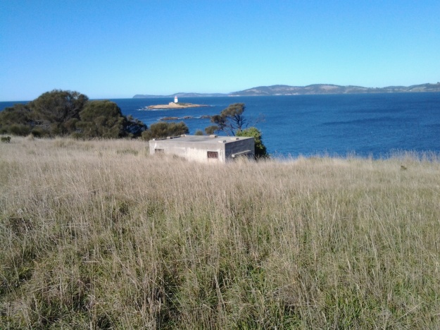
 

Iron Pot Lighthouse

My wonderful walk from the mouth to the source of the Derwent River seems long past, however from time to time a blog reader refers me to new information.  Thanks Mary for these leads. If you read here and here you will learn more about the history of the Iron Pot Lighthouse.

People who have read my earlier posts will know that I judged the tip of land opposite the Iron Pot to be the ‘mouth’ of the river on the northern/eastern side. I had to walk there from South Arm before my walk along the length of the river from the mouth could start. Here is one of the photos I took of the Iron Pot that day.

20140822_100305.jpg

The Iron Pot enters into the consciousness of many at this time of year.  On Boxing Day the annual Sydney to Hobart international yacht race will get underway.  After the yachts reach Tasmania and have sailed down the east coast, eventually they turn north west into Storm Bay. Not long after, the race organisers will be reporting yachts are in the vicinity of the Iron Pot. I expect the maxi yachts could start rounding the Iron Pot this Friday if they get a dream run.

If you would like to see this rocky outcrop up close without walking, take a Pennicott boat tour from Hobart (https://www.ironpotcruises.com.au/)


Reading past Walking the Derwent posts

The local Friends of Australian Writers (FAW) group has invited me to be one of two guest readers on Sunday 2 July at 3pm at the Republic Hotel (corner of Elizabeth and Burnett Streets) in North Hobart.

I will be reading a selection of posts from my ‘Walking the Derwent’ blog, for about 20 minutes.

If you have missed your regular dose of the Derwent story or simply want to catch up for a drink perhaps you would like to come.  I will be especially interested to meet followers of  this blog who have generously made comments, and offered information and help during my walk; those who I have never met.

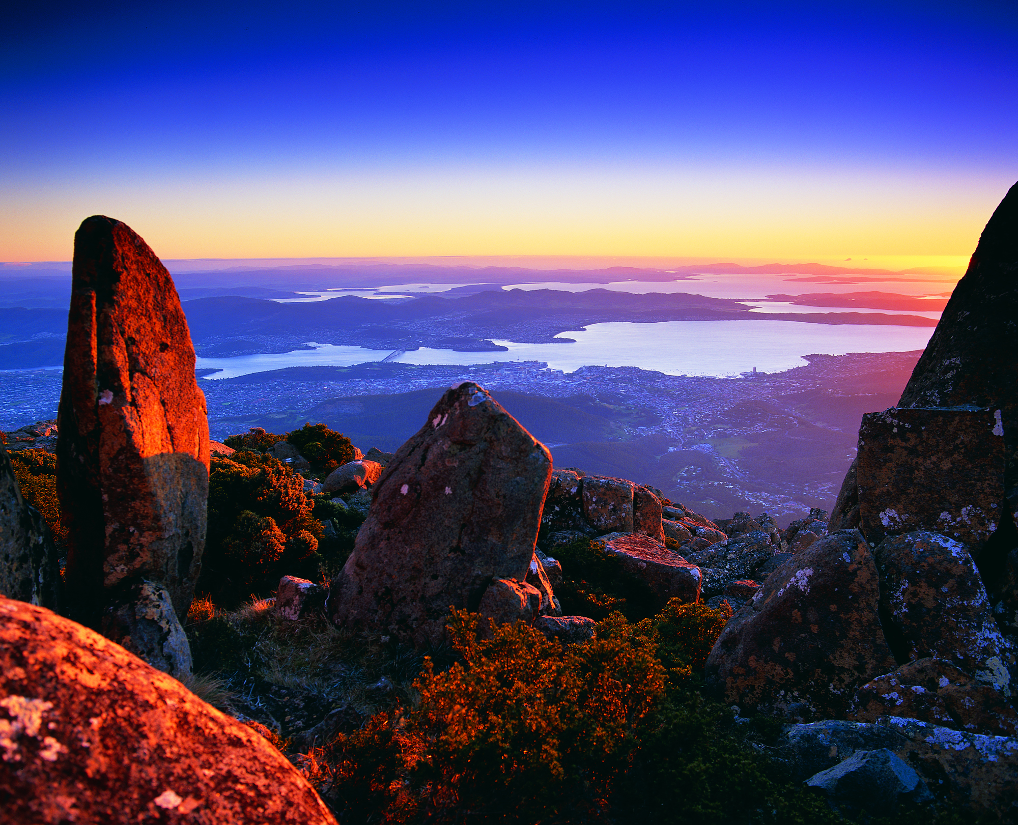
Hobart and the Derwent River from above

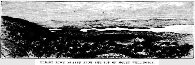
Recently, as I delved into the National Library of Australia’s online digitalised newspapers for family research purposes, I stumbled across the following image.

The newspaper was the now defunct The Australasian Sketcher with Pen and Pencil produced in Melbourne Victoria between 1873 and 1889.  The image below was published in the Saturday issue of 17 April 1875.

Taken from the vantage point of Mount Wellington we are looking down onto the dots of a growing Hobart city, across the Derwent River to the eastern shore which is as yet unsettled in any dense sort of way.  As usual, the River is the star!

River Derwent from top of Mt W17041875.JPG

Not for human consumption

Today’s ABC News Online gives us the headline suggesting an exciting story – “Amateur dive photographer shares snaps of Hobart’s hidden underwater world”.

We are told “Under the surface of the River Derwent you’ll find an otherwise hidden and surprising colourful world of marine creatures.” Accompanying the story are photos of divers and underwater creatures.  Quite startling is the beauty of what divers can see. Wonderful.  The gorgeous photo of a crayfish by Millie Banner attracted my attention – who doesn’t love eating a crayfish. However, “… heavy metal levels in the river make them not safe to eat.”  So please do not go down deep seeking a feed from the waters under the Tasman Bridge.  Besides the river currents might sweep you out to sea.  Maybe.

‘What’s in a name? A fair bit , actually’ says Rex Gardner

On page 14 of The Mercury newspaper on 5th February Rex Gardner asked ‘What’s in a name?  A fair bit , actually’ about a part of my favourite Tasmanian river.

He talked about the area near the Hobart docks and further out into the harbour and remarked that it ‘really doesn’t have a proper name’.

Rex commented: ‘We call it the River Derwent, or Derwent River. But that name aptly describes the Derwent around New Norfolk, and upriver from there, because a river is a naturally flowing fresh watercourse, flowing towards the sea.  Heading downstream towards Bridgewater, the Derwent becomes an estuary, defined as brackish water fed by streams and rivers, and flowing to the sea.’

When Rex added ‘What flows through the city of Hobart is not a river’, I gasped.  Over time, my blog has addressed the challenges of defining where the Derwent River starts and stops.

To help you to visualise the location, below is an excerpt from Google maps.

Harbour.JPG

Rex Gardner explained, ‘It could be loosely called an estuary, and more properly a harbour, which is a body of water surrounded by land.  The Derwent is 1.4km wide at the Tasman Bridge. From the Hobart docks to Howrah Point is 6km.  From Sandy Bay to Tranmere is 5km.  The Mississippi and the Amazon rivers don’t boast distances like that, except at their mouths or when they flow through lakes.’  Finally he remarked: ‘You have to wonder how the Derwent has suffered the indignity of being called a river for so long.  Just like Mount Wellington got a name change, so too should our Hobart Harbour.’  An alternative fact: our mountain has two official names – Mount Wellington and Kunanyi.

Rex Gardner’s approach adds a new dilemma. To understand some of the legal issues associated with defining a ‘river’ read here, here and here.

The Derwent Estuary Program describes the section of the Derwent between the Iron Pot (at the inner edge of Storm Bay near the eastern shore river mouth) and New Norfolk as the Derwent Estuary rather than the Derwent River and explains it is “a unique environment; a partially enclosed body of water where tidal seawater and fresh river water mix”.

What constitutes our Derwent River – where does it start and stop?  What is the location of its mouth? I have become so used to thinking of the Derwent River starting in the Lake St Clair area and ending around the Iron Pot that these ideas have shaken me up; they are making me question my position.  Does it matter to you? I wonder what others think.

Walking on an industrial site – posting 5 of 5

Eventually we walked onto the Nyrstar wharf, after sometimes successfully dodging water sprays to keep the dust down. Here I was able to look upstream and enjoy the expanse of the Derwent River, and to recognise the Bowen Bridge and Mount Direction in the distance.  20170227_111100.jpg

20170227_111713.jpg

20170227_113451.jpg

20170227_114243.jpg

We passed equipment such as the dust measurer shown below.

20170227_114227.jpg

At the western end I was able to look past the big sheds of the INCAT boat building industry over Prince of Wales Bay and see Technopark perched on top of Dowsing Point.

20170227_113557.jpg

A view looking across the Derwent River to the inlet where the first European settlers set up camp in 1803 is shown below: 20170227_114246.jpg

Looking back downstream the river and landscape appeared as follows:       20170227_111525.jpg

20170227_114217.jpg

20170227_111515.jpg

I also enjoyed walking through parts of the large industrial site for the geometric shapes of the structures and for the various vintages of buildings. Most of all, similarly to my feelings about the Hydro Tasmania structures in the upper Derwent Valley and beyond, I admired the pioneering and massive engineering works that created the manmade parts of the site. 20170227_112925.jpg

20170227_112930.jpg

20170227_113459.jpgI was surprised at the extent of chemical hazards which need good management; associated with the zinc smelting process are dangerous chemicals such as mercury, cadmium and lead. During the walk I learnt a great deal about the attitude of the business towards instituting and maintaining good environmental practices. In addition, I was shown revegetated expanses and different buildings which prioritise care for the environment and make it a reality. Seeing and experiencing all of this was much more than I expected, and I remain immensely grateful for the time and interest given by my excellent host Todd.

In a special showcase at Nyrstar’s Reception, plaques and various awards are clustered together. One example, a National River Prize, was presented by the International River Foundation in 2010 to the Derwent Estuary Program,  of which Nyrstar is a founding member.  A list of the Australian winners that year can be read here and if you refer to page eight, more information about Nyrstar and the Derwent estuary is available. My photo below includes that framed paper award with another sculptural award sitting in front.

20170227_095942cropped.JPG

Overall, I was delighted to be able to fill a gap in my walk along the Derwent River, on this private property.  I am indebted to friend Clinton for his connections with Nyrstar that helped to make the walk a reality. Especial thanks to my thoughtful host Todd, and to Nyrstar.

Celebrating 200 years of ferries on the Derwent River

The Eastern Shore Sun newspaper for December 2016 provided a community news story which added to the knowledge of the history of ferries plying Derwent River waters.  Turn to Page 11 for the full story and photo.

Two hundred years ago the first licenced ferry travelled from the fledgling township of Hobart across to the eastern shore to a place very close to where I live. The landscape would have been so different; trees would have covered the area where my house now stands.  I wonder if the weather was as warm and pleasant as it has been in the past few weeks around the Greater Hobart area – even exceeding 30 degrees.  Wind is a constant across Tasmania, and the early ferries would have needed skilled personnel to bring their craft safely across the expanse of water and into moorings – especially considering the fact that early vessels were rowed across the river.

Earlier postings on my blog introduced some information about the Derwent ferries, and this latest article supplements what I have offered previously.  While you can search the blog for many posts that mention ferries,  key posts are Ferries on the Derwent River and Historic Granton Tasmania .

Where have I been?

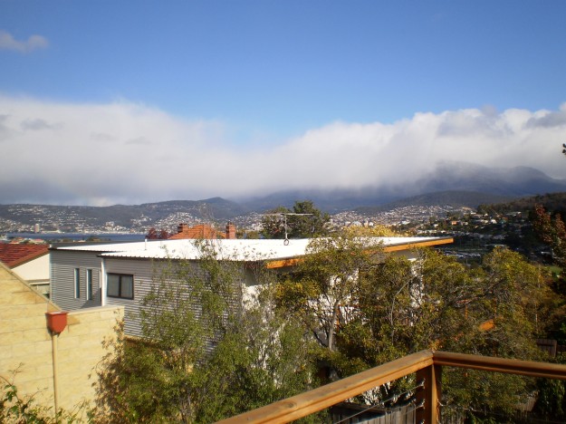
Answer: Mostly looking through my windows and watching the seasons pass across snippets of Derwent River and Mount Wellington.

032 cropped.JPG

Helens_AirBnB_11.jpg

snow clouds over mountain 27-04-2009 11-03-53 AM.JPG

mt-wellington-with-snow-from-10-veronica-cropped

mountain under snow 1July 08 002.jpg

moon over mountain-auto.jpg

For the past six months, the almost daily posts of earlier times on this Walking the Derwent blogsite stopped. While my thoughts have never been far from the Derwent River, since March I have posted only two or three stories. Avid followers of my walk along the Derwent River from the mouth to the source,  will realise that stories of particular sections of the walk have not been recorded.   Over the next month or two that gap will be filled.

When I halted writing this blog, I focused on compiling and publishing the book William Baker Tyzack and descendants in Australia  and running a blog associated with the anniversary of my great great grandfather’s arrival in Australia 150 years ago. Then I authored and published a book of an artist friend’s letters that had been sent to me over a quarter of a century.  During the processes of putting both books together, an opportunity to author and publish a third book came to my attention. Recently I published a book about my goddaughter. All non-fiction. All personal. I have been enthralled by the wonderful ease of self-publishing resources, and the professional look of the final publications.

Now I am inspired to turn my Walking the Derwent blog into a user-friendly book, which can be purchased both in book shops and on the internet.  But first, I need to finish writing the posts which record the remainder of my walk. I aim to complete the posts within the next two months then, early next year, begin the massive task to condense over 200,000 words and thousands of photos into a comparatively tiny tome.

Tasmania’s Derwent River continues to remain a feature of magic for me. I have missed my past regular walks inland discovering its nature and its pathway through the landscape.  Thankfully, here in Hobart, I live with a constant view of the changing appearances of the Derwent and the glorious sky above.

Whispy sky  over Hobart from Veronica St with removed aerial.jpg

clouds in dusty red 009.jpg


Sailing ships

Yesterday I had the pleasure of sailing around the Derwent River Harbour in a full scale replica of the Lady Nelson sailing ship.  The original was built in 1798 in England and plied the waters between Newcastle and Norfolk Island and Tasmania for the next  twenty five years.  My day on the water was glorious with blue skies, golden sunshine and a firm breeze. When all the sails went up, we scudded along at 7 knots.  Quite wonderful. The image below is of the replica in which I sailed.

Lady nelson from theirwebsite.jpg

The water surface had an almost millpond quality as we returned to the wharf. I couldn’t imagine how sailing ships would cope with heavy seas.

2016-11-18 14.52.17.jpg

I spent a great deal of time thinking about earlier sailing ships and I tried to imagine what it might have been like, with so many ropes and so many sails being part of the picture for months at sea.

The Lady Nelson came out to Australia with around 20 people. The original crew size was 12.

Records show that at times there were perhaps 60 or more people sailing for days on the Lady Nelson.  Yesterday with passengers and crew I suspect our number was around 40. It was standing room only on the deck when all were assembled. Sailing for days would have been very cramped and most uncomfortable by today’s standards (although I recognise that people were generally physically smaller back then than we are today). Add to that, on the original Lady Nelson, the area below deck remained unstructured with one open hold. Apparently people slept on boxes and ropes and all.

My photos below give some idea of the majesty of a sailing ship however small (and it also shows how glorious it is to be out on the Derwent River in Hobart).

2016-11-18 13.34.22.jpg

2016-11-18 14.10.08.jpg

2016-11-18 13.58.40.jpg

2016-11-18 14.14.43.jpg

2016-11-18 14.04.14.jpg

2016-11-18 14.06.14.jpg


The Lady Nelson was approx 53 feet long ,  approx 17 feet wide and weighed 61 tons. I have compared this with the larger ships that arrived in the Derwent River in the early part of the 19th century and so,  after yesterday’s most stimulating sail, I feel I have a small but greater understanding of what travellers (convicts and free settlers) might have been exposed to at sea before they started their comparatively mild run up the Derwent.

The Lady Nelson replica runs trips lasting a few days; I am considering taking one of these small voyages. Part of the deal, if you wish, is to learn to handle the ropes and even climb around the sails.  I wonder if the 19th century crews allowed such liberties to its passengers.

Yesterday I walked to the source of the Derwent River

Over the past four days I have enjoyed remote, off-the-main-track inland Tasmania from Clark Dam at Butlers Gorge, along the edge of Lake King William to the town ship of Derwent Bridge, and then further north to where the Derwent River commences out of the gates of St Clair Lagoon.  I continued further north also to the Weir which controls water into St Clair Lagoon from the Derwent Basin (which is kept filled with water flowing from Lake St Clair).  Dozens of posts with all the details of the walks, and accompanied by some grand photos, will be forthcoming over the coming days.

This latest walk means I have walked most of the length of the Derwent River from the mouth to the source.  There are only a few gaps to fill if I have the courage (or a moment perhaps of insanity because of the level of difficulty I believe is involved) in the coming weeks.

For the moment, I thought a few photos would be in order to whet your appetite for more.

The photo below shows one aspect of a view across Lake King William in the late afternoon.

20160102_170531.jpg

The photo below looks across Lake King William early in the morning.

20160103_072935.jpg

Sun passing through gum leaves.

20160103_110629.jpg

The Derwent River early morning near Derwent Bridge.

20160104_064805.jpg

The source of the Derwent River – the water as it leaves St Clair Lagoon. I was standing on the dam when I took the second photo, and watching the water run away eventually to pass New Norfolk then Hobart and finally exit into Storm Bay before dispersing into the wide ocean.  The whole experience was quite marvellous.  The river was fresh and alive!  And so was I!

20160104_075644 20160104_081109


Fires above the Derwent River

On too many nights last week the sky was dense with a rosy fire haze across my suburb.  The smoke slipped through crevices in my house so that, through each evening, I felt like I inhaled a camp fire.  Back then I checked the Tas Fire Alert website and learned the closest fire was in Quarry Road less than half a kilometre away. Today I went off to see what the burn looked like.

I chose to walk through the bushland of Waverley Flora Park first and then descend down Quarry Road.

2015-11-09 09.37.10

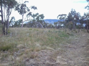
From the top of one of the Park’s walking tracks, I looked through stands of gum trees towards the mouth of the Derwent River.

2015-11-09 09.22.36 2015-11-09 09.22.51

In the other direction Mount Wellington loomed large over the Hobart CBD and the Derwent Harbour.

2015-11-09 09.24.47

I followed in the footsteps of Charles Darwin, ‘father’ of the theory of evolution, who walked around Hobart in 1836. At some time during that visit he crossed to the eastern shore and wandered around the Bellerive suburb and beyond.

2015-11-09 09.22.59 2015-11-09 09.20.23 2015-11-09 09.20.15

I saw unfamiliar medium-sized birds collecting nesting material and insect food morsels (who flitted away far too fast for me to take a photograph): one was dressed in silvery greys with a long strand floating after its tail, and another with a rich olive green coat. None of my bird books help me to identify either of these birds – any locals with bird knowledge?

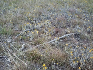
A profusion of native spring flowers carpeted parts of the Park, or stood as single colourful spikes amidst the dull dry green grasses.

2015-11-09 09.32.36 2015-11-09 09.25.26

It soon became clear that lots of burned vegetation and scorched earth passages were scattered next to the walking track and beyond.

2015-11-09 09.29.05 2015-11-09 09.28.19

Later when I walked down Quarry Road with not a burn mark in sight, I realised that for bureaucratic purposes the Tas Fire Alert site had to indicate the best road for fire trucks to follow.  It had been parts of the Waverley Flora Park that suffered fire damage.

As I continued downhill, I heard the siren sounds of a fire truck and watched it whip past the intersection below.  When I turned the corner, the truck was parked askew with hefty yellow clad guys preparing their gear.  The screams of other sirens were closing in. I watched wisps of smoke escaping from all manner of slits and slots and dirty brown smoke puffing from the front door of the house below.  I saw an approaching ambulance and guessed this wasn’t someone’s best day.

Brilliant bird’s eye view

Thankyou blog follower Ju.  Recently Ju connected me with a woman with a husband who has a Private Pilot’s Licence.  Once I made contact, Michelle and Dave were delighted to fly me in their four seater plane, a Cirrus SR20 which Michelle referred to as the BMW of the skies.

Today we flew.  Not a cloud in the sky.  Clean blue sky. Hardly a breeze.  The landscape rich and varied.  The Derwent River sparkled from start to finish.

The experience was stunningly magnificent.  I love words but I find it difficult to express my excitement, my pleasure, and the sheer joy of the flight in the depth which I felt.  There below me was the river I have come to love and know a little more. There below me were the tracks, paths, roads and landscape over which I have walked – and I laughed occasionally remembering certain experiences during my walks. There below me were logging tracks, dam roads, and fading vehicular pathways.  And then we were flying over impenetrable sections which may not be walkable.

We left Hobart airport and flew to Storm Bay by rounding the Iron Pot, then we followed the river upstream to the source. Dave flew on until we reached the northern most point of Lake St Clair. The return journey was equally as beautiful and engaging. The light had changed presenting us with a ‘new’ landscape.

Of the hundreds of photos taken by Michelle, friend Chantale and myself, I include a tiny selection here.

OLYMPUS DIGITAL CAMERA

The photo above taken by Michelle caught me totally preoccupied by the view.

OLYMPUS DIGITAL CAMERA

MIchelle’s photo above shows the Derwent River snaking around the Claremont Golf course with Cadbury’s Chocolate Manufacturing buildings in white to the left.

OLYMPUS DIGITAL CAMERA

The photo above shows a straight section of the Derwent River before the township of New Norfolk on the upper left.

OLYMPUS DIGITAL CAMERA

The photo above shows the Derwent River circling part of Reid’s cherry orchards.

IMG_3864

Chantale’s photo of the Pumphouse Point accommodation projecting into Lake St Clair, also shows the dam across the Derwent Basin where the water enters St Clair Lagoon.  The source of the Derwent River starts to the right of the photo.

OLYMPUS DIGITAL CAMERA

Michelle’s photo above shows part of sprawling Hobart set against the Derwent Harbour.

Those photos taken while flying over the river westwards of Gretna will be incorporated into the stories of my walks from Gretna onwards, in future posts.  From now on, you can expect both ground-based and aerial photos to enrich the stories.
I feel like the luckiest person in the world for the opportunity to travel in a smooth flying small plane, to see the Derwent River winding through the landscape in glorious blueness, and to be reminded Tasmania is a superb place. A truly wonderful and memorable day. Thankyou to all concerned.

Postscript on Stage 15’s walk from New Norfolk to Gretna

Throughout my project to walk from the mouth to the source of the Derwent River, I have been urging readers to walk some or all of the stages I have undertaken just for the pleasure of it. But I cannot do so for Stage 15. I cannot recommend that you follow in my footsteps and take this walk from New Norfolk to Gretna.  I cannot suggest you walk on private property without permission.  I cannot encourage you to walk on the narrow roads with speeding drivers where no pedestrian access has been provided.

I am so sorry to say that, if some of my recent posts inspired you to put on your walking boots and tackle the roads and paths and tracks, you must take them off.  I must only recommend you access a car and drive the road route for Stage 15.  It will mean you will miss out on seeing the black velvet ears of cattle in the moonlight, hearing the river ripping along towards Hobart, meeting those who move cattle or wheelie bins, and enjoying the smell of fresh air.  It will mean you will pass some of my favoured finds so quickly that, in a blink, you miss them altogether.  However, you may not grind your teeth in frustration that access to the Derwent River is denied you so often, you may not get run over, and you may not be shot by a gun toting land owner.
Take care.

Tassie Link back to Hobart

When the Tassie Link bus rolled to a halt at Gretna, I was surprised it was only a small one designed to carry approximately 20 people. I later learnt that if there are minimal bookings the small bus is used but with more bookings a standard larger bus is put into service.  This is the main bus line that links the historic west coast to Hobart via Lake St Clair.  Previously, I had been surprised that the service only runs four days a week, making the development of travel plans more challenging for tourists and locals alike.  Obviously most people drive.

As the driver got out to collect my fare, the side door was swung open by a happy guy and everyone on the bus called out a friendly “Hi” followed by the command, “Give us y’ pack”.  My pack joined a high pile at the back of the bus and once I sat, the happy chat began and lasted through to Hobart.  Everyone was on holiday from different part of mainland Australia and they had all just finished walking the Overland Track from the famed Cradle Mountain to Lake St Clair. Similarly to me they had been at the Derwent Bridge pub for a few hours waiting for the bus to arrive. So we were all very merry regaling each other with the stories of our walks.  It was the perfect ending to a brilliant two days of discovery.

When I walked in through my front door at 11pm, a warm glow spread across my face.  I was home!