Tag Archives: Mount Wellington

Hobart and the Derwent River from above

Recently, as I delved into the National Library of Australia’s online digitalised newspapers for family research purposes, I stumbled across the following image.

The newspaper was the now defunct The Australasian Sketcher with Pen and Pencil produced in Melbourne Victoria between 1873 and 1889.  The image below was published in the Saturday issue of 17 April 1875.

Taken from the vantage point of Mount Wellington we are looking down onto the dots of a growing Hobart city, across the Derwent River to the eastern shore which is as yet unsettled in any dense sort of way.  As usual, the River is the star!

River Derwent from top of Mt W17041875.JPG

Walking on an industrial site – posting 2 of 5

Once decked out in our safety gear, Nyrstar’s Todd and I strode off down the road towards the entrance to the industrial estate all the while admiring the day and the view of the Derwent River whenever it appeared around buildings and between parts of the landscape.

20170227_095403 crop.JPG

20170227_102454 crop.JPG

Once through a gate in a high protective fence, we came to a junction. Should we walk forward directly to the river or turn right on a track around a hill shaped by metallic discards decades ago?

20170227_103056.jpg

The choice was easy. We turned right and continued as the track took us above but on the edge of the Derwent River in New Town Bay.  20170227_103354.jpg

20170227_103446.jpg

I could look inland to Mount Wellington and across the Bay to Self’s Point.  An early record of my walk along the Derwent at Self’s Point can be read here and here.

20170227_103356.jpg

20170227_103632.jpg

20170227_104106.jpg

As usual, I loved the brilliant colours that a clear day produces on the river and the landscape.  I hope you find the photos as stunning as I do – long term blog followers know I never set out to create heart-stopping reproduction photos only to record in a casual way what I see. During my walk on Nyrstar property, the world and the Derwent River in particular, seemed spectacular.

20170227_103624.jpg

20170227_103627.jpg

As we walked around the hill, the eastern shore came into view – some of it built up with private houses and other parts remaining as uncleared bushland. My host and I mused on how the first European explorers and settlers would have seen both sides of the Derwent River completely forested. By  being able to see such forests today helped me to have some appreciation of their world at the end of the 18th century.  If those travellers arrived on a day like we were having then the landscape would have looked wonderful, although somewhat impenetrable.

20170227_103635.jpg

20170227_103650.jpg


Soaring eagle

I was privileged to watch not one but three endangered Tasmanian Wedge Tailed Eagles during one walk along the Derwent River. The third eagle was being chased by a black Crow and I was fortunate to be able to photograph it.  A Crow is not a small bird but, in comparison to the expansive eagle, it appears tiny.

20160328_111212(0).jpg

20160328_111213.jpg

20160328_111215.jpg

Tasmania’s Parks and Wildlife Service provides more information about this majestic eagle here.

The DPIWE government site provides information including:

“Ever since Europeans settled in Australia, wedge-tailed eagles have been accused of attacking and killing almost anything from horses to honey-eaters. In some States bounties were paid for their destruction and a total of about 20 000 were slaughtered per year in the mid 1960’s. 
Today, despite legal protection and changing attitudes, the wedge-tailed eagle remains vulnerable to extinction. Some landowners believe that wedge-tailed eagles pose a threat to lambs and kids. However, studies have shown these fears to be unwarranted. In 1970, for example, the CSIRO published an analysis of the cause of death of over 12 000 lambs in several States. Although up to 34% of dead lambs had been at least partly eaten, only 2% of lambs born had been actually killed by predators such as eagles. More importantly, only 2.7% of dead lambs would have survived if a predator had not attacked. Exposure to bad weather and miss-mothering were the most important causes of death.
Studies in Tasmania show that in sheep grazing areas, rabbits, hares, brushtail possums and wallabies are the most important prey, although a great variety of animals are eaten dead or alive, from cormorants and echidnas to snakes. With rare exceptions, eagles simply do not create an economic problem.”

It is rare to see these eagles.  The last time I saw one was years ago when I had walked to the bottom of the ‘organ pipes’ on Mount Wellington and sat in the sun on a smooth rock looking down on the city of Hobart with the ribbon of the Derwent River splitting it apart.  My peripheral vision recognised movement.  Just then, an eagle used an updraft and soared in front of me, then over the edge of the mountain out of sight.  Another never to be forgotten experience.


Where have I been?

Answer: Mostly looking through my windows and watching the seasons pass across snippets of Derwent River and Mount Wellington.

032 cropped.JPG

Helens_AirBnB_11.jpg

snow clouds over mountain 27-04-2009 11-03-53 AM.JPG

mt-wellington-with-snow-from-10-veronica-cropped

mountain under snow 1July 08 002.jpg

moon over mountain-auto.jpg

For the past six months, the almost daily posts of earlier times on this Walking the Derwent blogsite stopped. While my thoughts have never been far from the Derwent River, since March I have posted only two or three stories. Avid followers of my walk along the Derwent River from the mouth to the source,  will realise that stories of particular sections of the walk have not been recorded.   Over the next month or two that gap will be filled.

When I halted writing this blog, I focused on compiling and publishing the book William Baker Tyzack and descendants in Australia  and running a blog associated with the anniversary of my great great grandfather’s arrival in Australia 150 years ago. Then I authored and published a book of an artist friend’s letters that had been sent to me over a quarter of a century.  During the processes of putting both books together, an opportunity to author and publish a third book came to my attention. Recently I published a book about my goddaughter. All non-fiction. All personal. I have been enthralled by the wonderful ease of self-publishing resources, and the professional look of the final publications.

Now I am inspired to turn my Walking the Derwent blog into a user-friendly book, which can be purchased both in book shops and on the internet.  But first, I need to finish writing the posts which record the remainder of my walk. I aim to complete the posts within the next two months then, early next year, begin the massive task to condense over 200,000 words and thousands of photos into a comparatively tiny tome.

Tasmania’s Derwent River continues to remain a feature of magic for me. I have missed my past regular walks inland discovering its nature and its pathway through the landscape.  Thankfully, here in Hobart, I live with a constant view of the changing appearances of the Derwent and the glorious sky above.

Whispy sky  over Hobart from Veronica St with removed aerial.jpg

clouds in dusty red 009.jpg


Sport and the Derwent River

A couple of weeks ago an international Test cricket match between Australia and the West Indies was staged at the Blundstone Arena in Bellerive. Australian cricket tragics (but probably not those from the West Indies) may enjoy these photos. When you stand in the open or sit in the grandstands, fabulous views of the Derwent appear before you and distract.  Cricket Tasmania’s website  shows a glorious aerial shot of the Arena with the Derwent River beyond and mysterious Mount Wellington looming behind the city.

Last Friday night, I was on the Hobart Domain at the Hobart tennis courts. First I watched retired Tasmanian tennis player Richard Fromberg (he reached about number 20 in the world when he was playing on the world circuit) play an up and coming Tasmanian player, Harry Bourchier, who hopes to break into the Australian Open Grand Slam in January.  Fromberg is circled below watching a later match.

Richard Fromberg.jpg

A fun doubles game followed with two 7 year olds (one of which was Cruz Hewitt, Lleyton Hewitt’s son) teaming up with their adult coaches to play a short game.  Those extraordinary 7 year olds stood firmly at the base line and served their balls over the net, despite the net being a great distance off and higher than they were tall. The night finished with ex World number 1 tennis player Lleyton Hewitt playing an exhibition match against Australian Sam Groth who currently has the fastest serve in the world.  In the photo below, Groth wears red at the left of the net and Hewitt wears blacks to the right.

2015-12-18 20.43.38 Sam Groth in red and Lleyton Hewitt in black.jpg

I was thrilled by the hard and fast hitting.  A good game!

Beforehand I wandered to one end of the main court and looked out through an overcast evening, to the Derwent River.

2015-12-18 18.13.43

On occasions when the sky is clear and blue, the Derwent River sparkles.  Getty Images has one shot I particularly like.  The blue tennis court in the foreground seems separated from the Derwent River by a giant cruise ship at anchor in port.

Fires above the Derwent River

On too many nights last week the sky was dense with a rosy fire haze across my suburb.  The smoke slipped through crevices in my house so that, through each evening, I felt like I inhaled a camp fire.  Back then I checked the Tas Fire Alert website and learned the closest fire was in Quarry Road less than half a kilometre away. Today I went off to see what the burn looked like.

I chose to walk through the bushland of Waverley Flora Park first and then descend down Quarry Road.

2015-11-09 09.37.10

From the top of one of the Park’s walking tracks, I looked through stands of gum trees towards the mouth of the Derwent River.

2015-11-09 09.22.36 2015-11-09 09.22.51

In the other direction Mount Wellington loomed large over the Hobart CBD and the Derwent Harbour.

2015-11-09 09.24.47

I followed in the footsteps of Charles Darwin, ‘father’ of the theory of evolution, who walked around Hobart in 1836. At some time during that visit he crossed to the eastern shore and wandered around the Bellerive suburb and beyond.

2015-11-09 09.22.59 2015-11-09 09.20.23 2015-11-09 09.20.15

I saw unfamiliar medium-sized birds collecting nesting material and insect food morsels (who flitted away far too fast for me to take a photograph): one was dressed in silvery greys with a long strand floating after its tail, and another with a rich olive green coat. None of my bird books help me to identify either of these birds – any locals with bird knowledge?

A profusion of native spring flowers carpeted parts of the Park, or stood as single colourful spikes amidst the dull dry green grasses.

2015-11-09 09.32.36 2015-11-09 09.25.26

It soon became clear that lots of burned vegetation and scorched earth passages were scattered next to the walking track and beyond.

2015-11-09 09.29.05 2015-11-09 09.28.19

Later when I walked down Quarry Road with not a burn mark in sight, I realised that for bureaucratic purposes the Tas Fire Alert site had to indicate the best road for fire trucks to follow.  It had been parts of the Waverley Flora Park that suffered fire damage.

As I continued downhill, I heard the siren sounds of a fire truck and watched it whip past the intersection below.  When I turned the corner, the truck was parked askew with hefty yellow clad guys preparing their gear.  The screams of other sirens were closing in. I watched wisps of smoke escaping from all manner of slits and slots and dirty brown smoke puffing from the front door of the house below.  I saw an approaching ambulance and guessed this wasn’t someone’s best day.

A trotting track in the middle of nowhere

Once past the Water Treatment Plant, the country views were expansive.  I looked across green paddocks and could see the back of Mount Wellington with a drift of cloud obscuring its peak.

20150917_102908

The river views were, as ever, seductive.

20150917_102931 20150917_103910

Then suddenly I was surprised to find a property with its own horse racing track.

20150917_104156

During the time it took for me to walk past, a trainer with his horse in harness pulled a two wheeled cart and trotted around and around the track. Last Sunday a harness race was held in Launceston in Tasmania’s north, and the next race meeting in Hobart will be on the 27th September so I guess the horse ran a few days ago or will be running soon.

Race track on Glenora Road

The Derwent River at night

Tasmania’s bush, its coast and urban areas offer a photographer’s paradise at all times of day and night across the four seasons.

This Amazing Planet  is one of many blogs that show spectacular photographs of Tasmania’s flora, fauna and landscape. Go to Nightscape-Hobart for a stunning visual treat. Enjoy looking at part of the glorious Greater Hobart Area, at night, photographed from on top of Mount Wellington. Between the two sides of the city, the rich blue Derwent River passes on its way to Stormy Bay and then the sea. The brightly lit Tasman Bridge can be seen to join the two shore lines.

Special Anniversary

Establishment Milestone remembered:

On 15 August 2014 I conceived the idea to walk the length of our Derwent River from the mouth to the source, and began this blog.  That was when I found the glorious photo of the Derwent River taken from the top of Mount Wellington and set it as my heading for permanent sharing with you.

The crustacean that walks – and only in Tasmania

My last post introduced a giraffe who took a long walk. Since giraffes typically walk as part of their locomotion, the surprise of that story cannot be as great as the fact of the shrimp (prawn if you like) which walks around the high creeks and streams which flow down into the Derwent River in Tasmania.

Anaspides tasmaniae from Parks&Wildlife Service

(Photo courtesy of Parks & Wildlife Service Tasmania – http://www.parks.tas.gov.au/indeX.aspX?base=11244)

Geoffrey Smith, in his book A Naturalist in Tasmania (Oxford, 1909), describes the Anaspides tasmaniae. “A number of streams rise in the plateau of Mount Wellington, some of them attaining a considerable size before joining the estuary of the Derwent, and all of them characterised by the beautiful clearness of their water, owing to their beds being formed entirely of hard greenstone boulders.

In the pools of the upper reaches of these streams near the top of the mountain, a very peculiar shrimp-like animal is found.  It is now recognised as one of those survivals of a bygone age of which the Australian continent has furnished so many and such interesting examples. The nearest allies of this animal appear to be some marine shrimps which come down to us as fairly common fossils in the sand deposited round the Permian and Carboniferous seas of Europe and North America: subsequent to this very remote period they do not seem to have existed in the seas, at any rate in the northern hemisphere, so that an enormous passage of the earth’s history has occurred between their peopling the northern seas and their survival on the mountain tops of Tasmania.

The Tasmanian Mountain Shrimp (Anaspides tasmaniae) is sometimes as much as two inches in length, of a brown colour, and walks about on the stones and among the weeds at the bottom of the pools, browsing on the mosses and liver-worts and any small creatures it can catch; it very rarely swims, but when frightened it darts forward by flicking its tail and takes cover under a stone.

In other parts of the world no trace of the animal’s survival has been discovered.

Goethe somewhere remarks that the most insignificant natural object is, as it were, a window through which we can look into infinity. And certainly when I first saw the Mountain Shrimp walking quietly about its crystal-clear habitation, as if nothing of any great consequence had happened since its ancestors walked in a sea peopled with great reptiles … time for me was annihilated and the imposing kingdom of man shrunk indeed to a little measure.”

The website http://www.anaspides.net/other/website_name_why.html believes “Anaspides tasmaniae has remained unchanged for 250 million years (Triassic Period): it is a living fossil. The first published record of Anaspides tasmaniae was made in 1893 from alpine pools on Mt. Wellington behind Hobart.”  More details about this discovery, and about the later involvement of the author of the book excerpt above, Geoffrey Smith, can be read at http://www.tasfieldnats.org.au/TasNaturalist/Articles/1967/TasNat_1967_No8_Feb_pp1-2_Hewer_AnaspidesTasmaniae.pdf

Another revision: naturally therapeutic images from stages 7-10

I can’t help myself. Having reviewed my favourite images from the first half a dozen stages of my walk along the Derwent River, I felt compelled to continue looking through my collection from the subsequent walks.  I have chosen photos showing aspects of both the natural and man-made world and I believe all will prompt thinking about the Derwent River, Hobart and its suburbs, and the natural environment. My selection of the images with the most memorable impact for me, from stages 7-10, are given below.

20141031_094126

From the eastern shore looking northwards towards the Bowen Bridge, with a couple of black swans on the river.

20141031_100200

Two plaques ‘opened’ by two great Australian prime ministers near the Bowen Bridge.

20141031_104822

The rusting raw-edged remains of a ship, the Otago, at Otago Bay.

20141031_113132

My enjoyment of any family’s black sheep.

20141031_123000

Heading into Old Beach and gradually leaving Mount Wellington behind.

20141031_132519

The gloominess of the approaching storm when I reached Old Beach.

20141111_092342 20141111_092805

The pleasures of well-made pathways, thanks to local government.

Green Point from new Old Beach

Looking northward across the Jordon River to Greens Point.

20141111_103700 20141111_121906

The glories of native flora. In these instances, it was blooming wattle and a spectacular stand of eucalyptus/gum trees which attracted my attention.

20141111_120752

The remains and the signs of a burnt out car on a back track.

20141111_130523

Knowing that it is still possible to have a laugh when walking.

20141111_131133

Arriving at the Bridgewater Bridge.

20141111_134311

Walking on the western shore of the Derwent River for the first time during this project.

20141125_095438

The house of one of first European settlers, James Austin, at Austins Ferry.

20141125_115047

At Dogshear Point, walking around the Claremont golf course, with the thwacking sound of hit balls crossing the greens.

20141125_110906

Reaching Cadbury’s chocolate manufacturing factory in Claremont.

20141125_143454

The hand-hewn rustic style seat near Connewarre Bay.

20150109_074126
Passing MONA somewhat camouflaged as it nestles into a tiny hill against the Derwent River.

20150109_081644

The mosaics along the foreshore.

20150109_101243

The jumble of boats and boat houses at Prince of Wales Bay.

Hoon tyre marks

Road mark making in Lutana.

20150109_132008

Cornelian Bay’s oil tanks up close.

20150109_153103

The Tasman Bridge.

20150109_155515

The circus had come to town.

20150109_161747

The emptiness of an arena of stands waiting to be filled during wood chopping competitions.

20150109_161339

Reaching the ‘end of the line’ on arrival in Hobart city.

Nature is cheaper than therapy

A Californian fiction writer M.P. Zarrella offered the opinion ‘nature is cheaper than therapy’.  Since then, her point of view has spawned posters, cushion covers, and T shirts such as:

Nature cheaper than therapy  and tshirt nature its cheaper than therapy

The use of this comment spread until people couldn’t help themselves …

facebook cheaper than therapy and Beer is cheaper than therapy

Thinking about whether nature is cheaper (with the inference of ‘better’ than therapy), I have been inspired to trawl through my walking-the-derwent photos.

Here are a few favourite natural scenes clicked during Stages 1-6 of my walks along the eastern shore of the Derwent River.  Most of these images spent time as my computer screen background where they lifted my spirits daily.

20140822_100301

Iron Pot off the southern end of South Arm peninsula

20140822_101716

Driftwood beach shack on Pot Bay Beach, South Arm peninsula

20140822_114606

Mount Wellington across the Derwent River from South Arm Beach

20140904_110312

Looking northwards into the gigantic Derwent Harbour from Gellibrand Point at the northern end of the South Arm peninsula.

20140920_102738

Looking uphill from Trywork Point

20140926_095629

Lichen on rocks at Tranmere Point

20140926_104056

Little Howrah Beach

20140926_115158

Looking southwards along Bellerive Beach

20141010_093842

The suburb of Sandy Bay across the Derwent River through the casuarina trees from Rosny Point

20141010_123003

Tranquil Geilston Bay looking toward Mount Wellington

20141015_101248

Bedlam Walls Point

20141015_104855

Shag Bay

20141015_122048

Native flowers in the East Risdon State Reserve

20141015_133435

Tommys Bight

Whenever the weather is deteriorating outside my window, by looking at these photographs from the first 6 of 14 walking stages, I ‘revisit’ the various locations and feel most uplifted. No therapy needed here.

Mirror smooth waters of Kangaroo Bay, an inlet off the Derwent River

Last weekend, when I walked to Bellerive Village via the Bellerive Yacht Club and Boardwalk, I was stunned by the beauty of the view.  The water in the marina was smooth as glass.  The yachts were clear edged by the crisp air and hard bright morning sun.  Despite puffs of cloud obscuring full vision of Mount Wellington in the distance, the vista was spectacular.

2015-03-28 08.22.12 2015-03-28 08.22.28 2015-03-28 08.22.21

The question has been asked: when will I walk the New Norfolk leg?

The answer is that I don’t know because this year’s style of autumn weather is making decisions difficult.

Last year it was mid-May before I removed the summer cotton sheets from my bed and changed to the fleecy flannelette sheets for winter warmth. Until that time I wasn’t wearing thermal tops. But this year before the end of March, I am rugging up and friends are lighting warming fires.

With this drop in temperature, we have continued to have light or heavy rain, not for all the day but off and on unpredictably. The idea of walking with a raincoat on and off or an umbrella up and down all day does not thrill me.  I want an uninterrupted view of everything around me.  I want to be able to hear the sounds of the Derwent River and the birds without the distortion of pattering raindrops.

For my walks from the mouth to the mouth of the Derwent River via the Bridgewater Bridge, routinely I consulted the Bureau of Meteorology (BOM) for their forecasts. Then, typically, I adjusted these predictions according to what I could see happening in the air over Mount Wellington.  Unfortunately, the leg from Bridgewater Bridge to New Norfolk is out of sight of the mountain and so I need to trust the BOM.  At this stage both next Monday and Tuesday look promising weather-wise in the New Norfolk area. Hopefully I will have fresh new stories of lived experience to post mid next week.

Theatre Royal, Hobart – proximity to the Derwent River

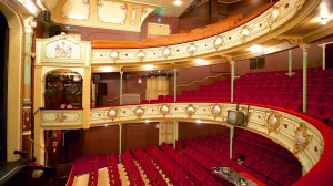
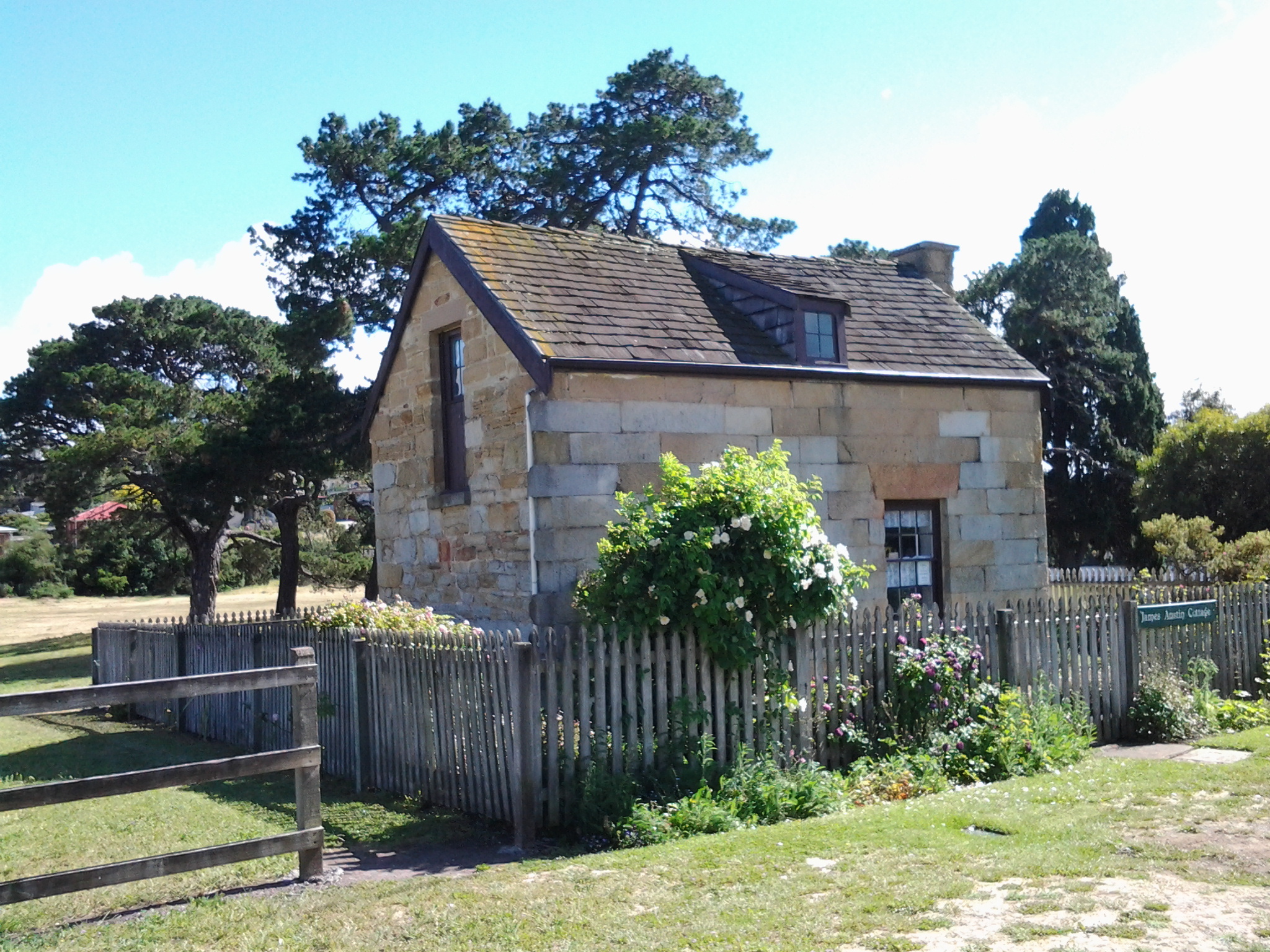
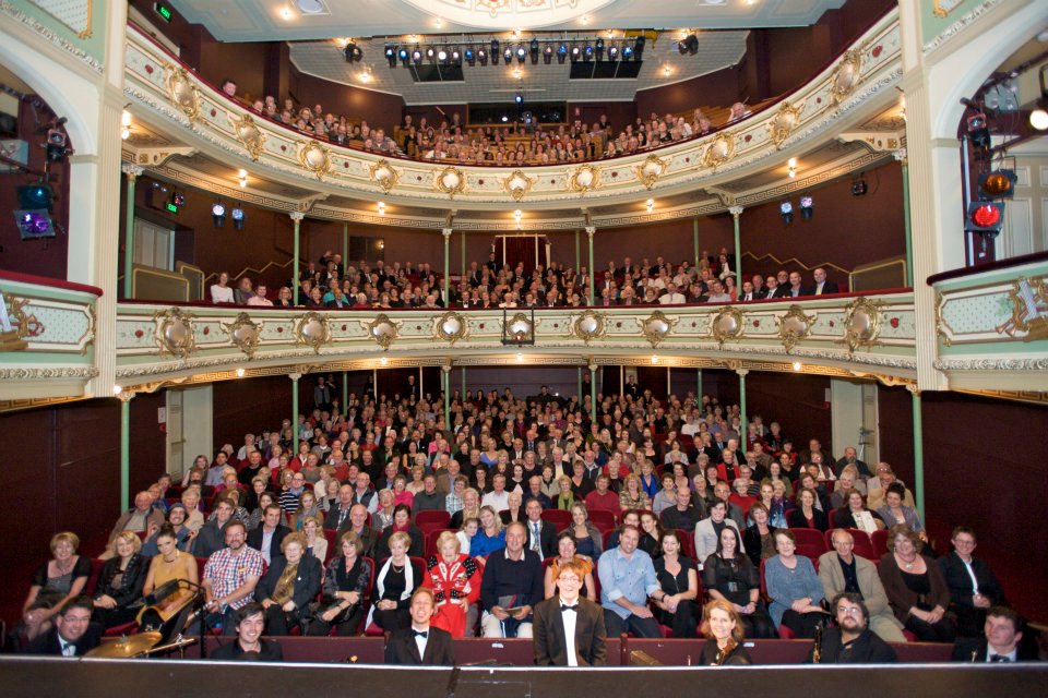
The Theatre Royal located on Campbell St Hobart was built in 1834 and is the earliest theatre built in Australia that is still fully operational today – each week the Theatre Royal stages various events: theatre, dance, musicals, opera, eisteddfods, music concerts or comedy. After a disastrous fire in 1984, the building was restored to its former glory and its delightful small but grand interior is now well worth a visit.  Guided tours are on offer during the day.

Theatre-Royal-67902

But what does the Theatre Royal have to do with the Derwent River you may wonder.

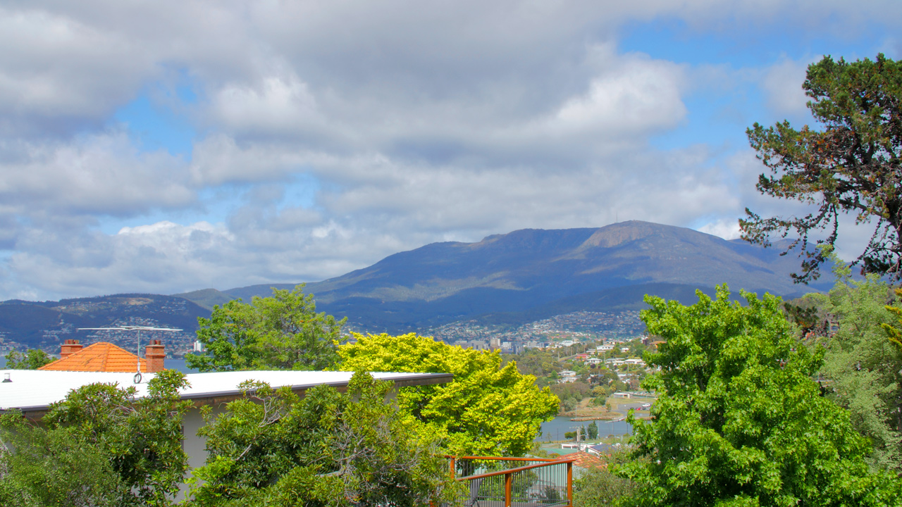
Firstly, it is located only a stone’s throw from the Hobart Rivulet that flows into the Derwent River. The Hobart Rivulet was the source of fresh water to the first settlers in Sullivans Cove (a bay in the Derwent River) in the years after they established the colony in 1804. Picking up the crystal clear waters from flows on Mount Wellington, the Hobart Rivulet wound its way through the early ‘Hobarton’ and these days it continues to flow under much of the current city of Hobart.

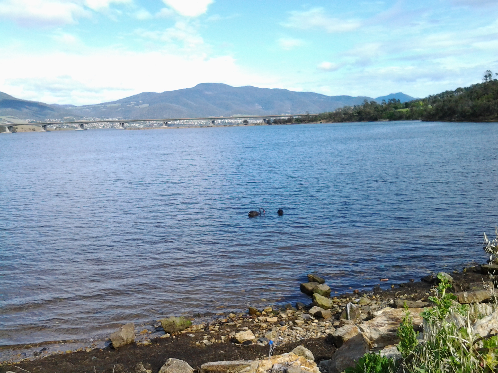
Secondly, the early shores of the Derwent River were further inland in the early 19th century than today. Considerable land fill has been added over the past two centuries.  When the Theatre Royal was built, the Derwent River was a little closer than today.

I have entertained myself with searches for old maps of Hobart so that I could understand where the Theatre Royal was located in relation to the original foreshore.

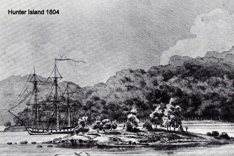
The image of the foreshore at Sullivans Cove below was drawn in 1804 (this was the year of first settlement here). Hunter Island was on its own before it was connected to the mainland by a causeway. This island was located not far from where Campbell St (the street on which the Theatre Royal is built) was established much later. The drawing shows the extensive forests which were removed over subsequent years to make way for the streets, houses and public buildings (image from http://www.tasfamily.net.au/~schafferi/images/Ocean&LNHunterIs1804img141.jpg

Ocean&LNHunterIs1804img141  Hunter island 1804

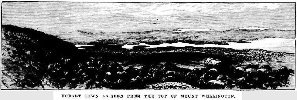
The site http://www.tasfamily.net.au/~schafferi/index.php?file=kop15.php offers the opinion ‘It is hard to imagine what Hobart Town would have been like when Lt. Gov. Collins arrived in 1804.  The rivulet ran free, (except when it rained heavily sending logs that blocked the rivulet, sending water spilling across its banks) large gum trees stood on both sides of the rivulet, some of which had to be cut down to make room for the new settlement.‘  The drawing below, made by George P Harris in 1805 or 1806, seems to look across Hobarton from what today is referred to as the Domain.  I think Harris employed a great deal of creativity when making the picture because the Mount Nelson Signal Station looms large on the distant hill yet it could not realistically have been that height.  

HobartTown1821closeup2-tasfamily.net.auschafferi

Below, the 1811 town layout has an overlay of our contemporary streetscape (from http://www.abc.net.au/news/2015-02-24/footsteps-towards-freedom-art-project-begins/6251596).  If you can locate the intersection of Campbell St and Collins St, then you can appreciated that the yet to be built Theatre Royal will be sited a few metres along Campbell St (on the block at the top side of the letter E of Street). You can appreciate how close this is to the Rivulet and to the Derwent River.

1811 -abc

George Evans lithograph of 1819 below shows how little progress had been made in terms of new buildings and street construction 15 years after settlement ( http://www.abc.net.au/news/2014-08-22/1819-slnsw-south-west-view-of-hobart-town-1819-george-william-e/5689410)

George Evans South west view of Hobart town

By 1832 significant developments had been made to Hobarton .  The map below (from http://www.auspostalhistory.com/articles/180.php) was made two years before the Theatre Royal was built.  Can you locate Campbell St?  Once found, can you see the thick black line that crosses it – that line is the Hobart Rivulet? The future location for the new theatre was a couple of house blocks away from the intersection between the street and the rivulet.  Looking at the shoreline with the Derwent River, already it is clear land has been reclaimed along the edge; the shape is manmade and the landscape no longer flows naturally.

180_TN.IMAGE3 1832 hobart

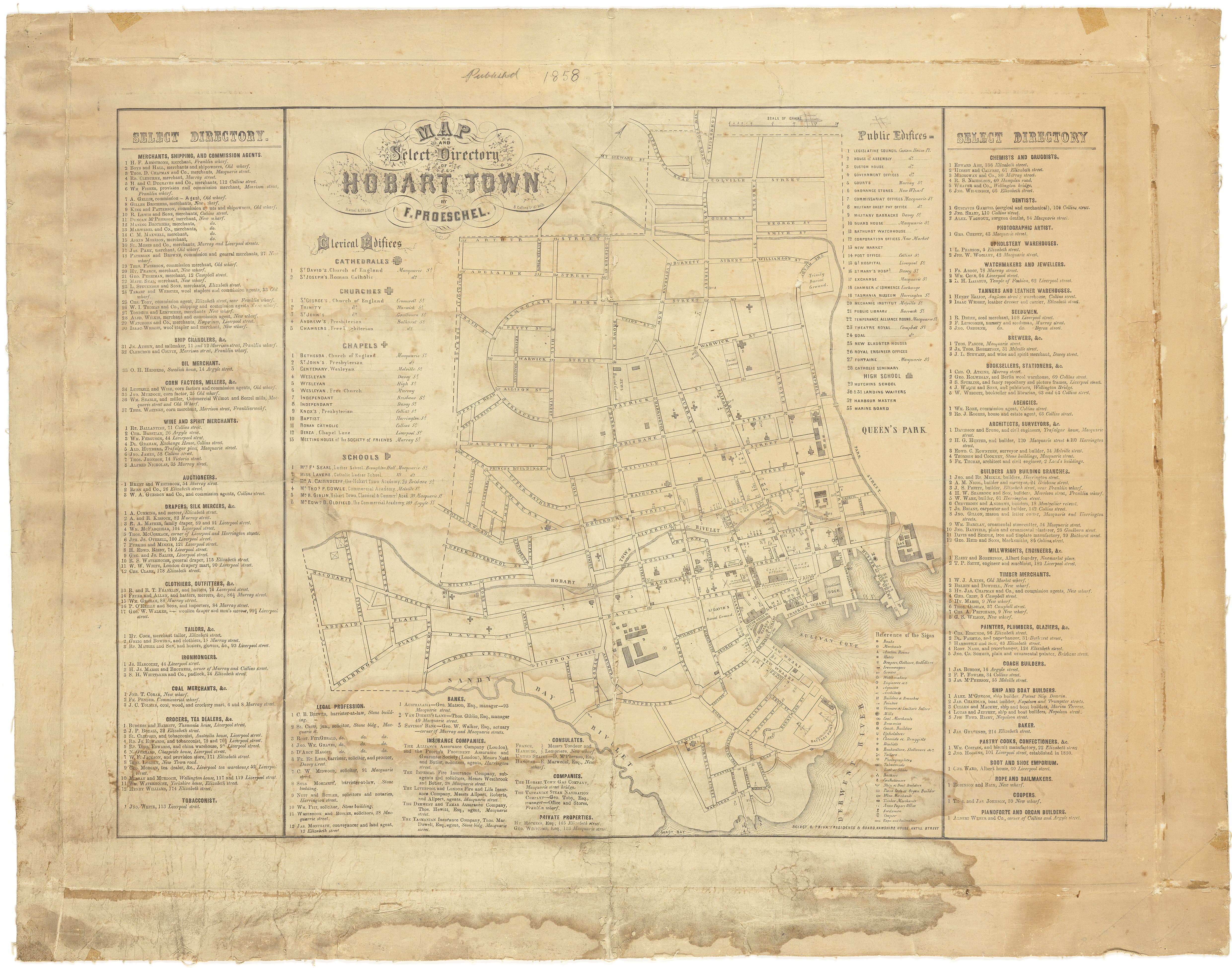
On the Proeschel map below (with the hand writing at the top of the map indicating 1858), locate the intersection of Collins and Campbell Streets.  Nearby, the Theatre Royal is listed as Public Edifice number 23 (from http://catalogue.statelibrary.tas.gov.au/item/?id=879658)

Map_and_select_directory_of_Hobart_Town

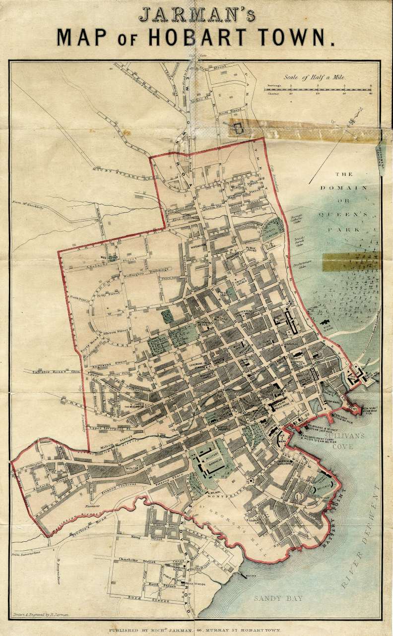
In Jarman’s map of Hobart Town (http://catalogue.statelibrary.tas.gov.au/item/?id=573294 indicates the date for this is 1858, although if the Proeschel map’s date is correct then the differences are too marked for this to be correct. More research required.), the end of Collins St has been modified so that two streets are located one either side of the Rivulet (black rectangle above Collins St is the Theatre Royal).

Hobart Town

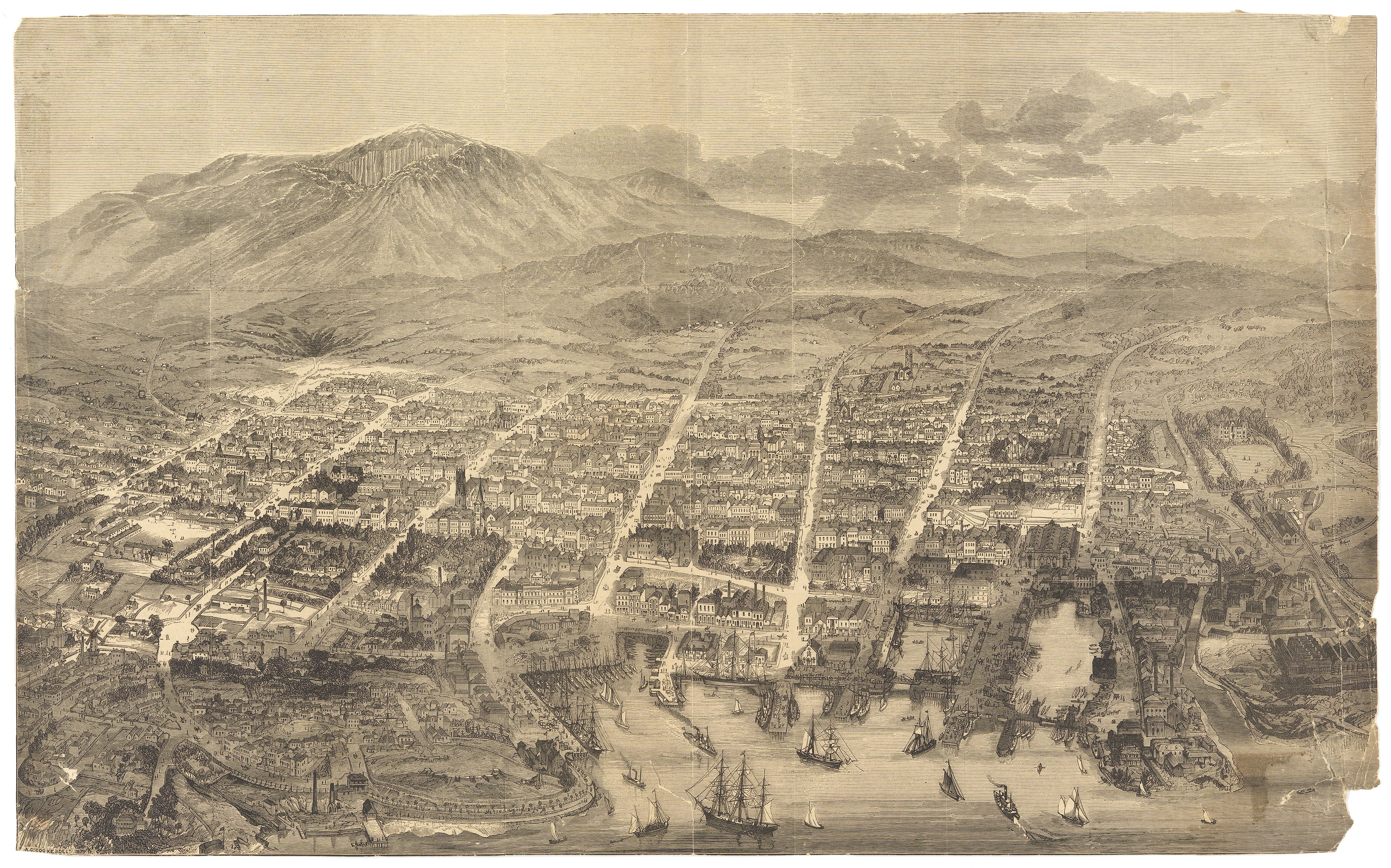
A woodcut map of 1879 by A C Cooke (from http://catalogue.statelibrary.tas.gov.au/item/?id=94421) gives a bird’s eye view of Hobart Town. On the lower right, the large watery dock can be seen intruding into the townscape. At the top end of this water is the large City Hall with Campbell St on its right hand side. Immediately behind the City Hall is Collins St.  Therefore the Theatre Royal is located on the right hand side of Campbell St a little above Collins St.

_Hobart_Town____A_C__Cooke__delt

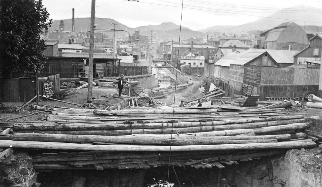
The area around the Hobart Rivulet routinely flooded the streets after heavy rains in the 19th and early 20th centuries (substantial new drainage systems now prevents such occurrences). The photo below (from http://www.linc.tas.gov.au/tasmaniasheritage/browse/exhibitions/hobartrivulet/diversions-and-floods/image-3) was taken after a flood in the 1920s. We are looking back towards the centre of Hobart Town along the Hobart Rivulet. The large curved roof at the right of the photograph is the top of the Theatre Royal and, therefore, the first bridge in the distance which crosses over the Rivulet will distinguish Campbell Street.

Floods-NS869-1-497 1920s rivulet end of Collins

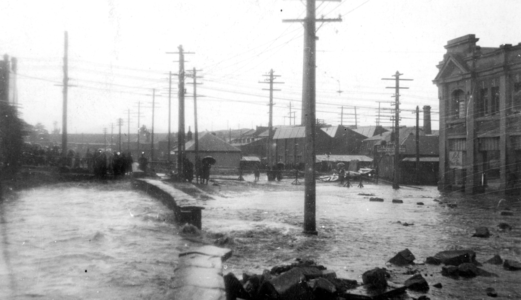
The photo below (http://www.linc.tas.gov.au/tasmaniasheritage/browse/exhibitions/hobartrivulet/diversions-and-floods/image-2) was taken during flooding in the 1930s.  The building on the right hand side is the City Hall which still functions as such today.  The road to the right of the flooding Rivulet is Collins St and people are standing on Campbell St above the Rivulet.  Therefore, the Theatre Royal is just out of shot to the left from where people are standing watching the torrent.

flood1 1930s flooding rivulet near theatre royal

Leo Schofield’s short-lived but internationally renowned Hobart Baroque festival lit up the Theatre Royal with spectacular performances.

Theatre-Royal-Hobart  seated people

Our Theatre Royal was located for easy public access 180 odd years ago, and the site continues to attract crowds easily. A new performing arts centre will be built next door over the next couple of years.  The Tasmanian Art School is located close by in Hunter St adjacent to the wharves and jetties jutting into the Derwent River. It fits with history to develop an artistic precinct near the water.