Category Archives: Mount Wellington

Hobart and the Derwent River from above

Recently, as I delved into the National Library of Australia’s online digitalised newspapers for family research purposes, I stumbled across the following image.

The newspaper was the now defunct The Australasian Sketcher with Pen and Pencil produced in Melbourne Victoria between 1873 and 1889.  The image below was published in the Saturday issue of 17 April 1875.

Taken from the vantage point of Mount Wellington we are looking down onto the dots of a growing Hobart city, across the Derwent River to the eastern shore which is as yet unsettled in any dense sort of way.  As usual, the River is the star!

River Derwent from top of Mt W17041875.JPG

Max Angus

Thanks to blog reader Marion I have been reminded of well-known Tasmanian artist Max Angus and his connection with the Derwent River. His biography (up to 2003) can be read here. Max died aged over 102 years almost a fortnight ago in February (on my birthday so I will never forget it) this year.  You can refer to an ABC news report for more information .

As a celebrated watercolourist, Max documented coastal and inland Tasmanian landscape scenes, and over the decades of his life the Derwent River often featured as a subject for his paintings.

In 1990, one entire exhibition at the Freeman Gallery in Sandy Bay was devoted to the Derwent River Aspects of the Derwent from the Source to the Sea.  I am on the trail and hope to be able to post more exacting information in the future.  Perhaps a blog reader owns a catalogue from that rather special exhibition so I can see and learn more.  I suspect, like so many local art exhibitions, reproductions of the paintings on display were not included.  Nevertheless the descriptive titles which Max used for his work will be informative.

As an example of the artist’s Derwent River related work, a locally owned watercolour (included in this blog with permission from the private owner) titled ‘The Flying Cloud in Victoria Dock’ painted in October 1990, is shown below.  The waters of the Derwent River look fairly glassy in the foreground and a moody Mount Wellington provides a background to Hobart’s port.

Marions mothers max angus watercolour.JPG

Walking on an industrial site – posting 2 of 5

Once decked out in our safety gear, Nyrstar’s Todd and I strode off down the road towards the entrance to the industrial estate all the while admiring the day and the view of the Derwent River whenever it appeared around buildings and between parts of the landscape.

20170227_095403 crop.JPG

20170227_102454 crop.JPG

Once through a gate in a high protective fence, we came to a junction. Should we walk forward directly to the river or turn right on a track around a hill shaped by metallic discards decades ago?

20170227_103056.jpg

The choice was easy. We turned right and continued as the track took us above but on the edge of the Derwent River in New Town Bay.  20170227_103354.jpg

20170227_103446.jpg

I could look inland to Mount Wellington and across the Bay to Self’s Point.  An early record of my walk along the Derwent at Self’s Point can be read here and here.

20170227_103356.jpg

20170227_103632.jpg

20170227_104106.jpg

As usual, I loved the brilliant colours that a clear day produces on the river and the landscape.  I hope you find the photos as stunning as I do – long term blog followers know I never set out to create heart-stopping reproduction photos only to record in a casual way what I see. During my walk on Nyrstar property, the world and the Derwent River in particular, seemed spectacular.

20170227_103624.jpg

20170227_103627.jpg

As we walked around the hill, the eastern shore came into view – some of it built up with private houses and other parts remaining as uncleared bushland. My host and I mused on how the first European explorers and settlers would have seen both sides of the Derwent River completely forested. By  being able to see such forests today helped me to have some appreciation of their world at the end of the 18th century.  If those travellers arrived on a day like we were having then the landscape would have looked wonderful, although somewhat impenetrable.

20170227_103635.jpg

20170227_103650.jpg


Where have I been?

Answer: Mostly looking through my windows and watching the seasons pass across snippets of Derwent River and Mount Wellington.

032 cropped.JPG

Helens_AirBnB_11.jpg

snow clouds over mountain 27-04-2009 11-03-53 AM.JPG

mt-wellington-with-snow-from-10-veronica-cropped

mountain under snow 1July 08 002.jpg

moon over mountain-auto.jpg

For the past six months, the almost daily posts of earlier times on this Walking the Derwent blogsite stopped. While my thoughts have never been far from the Derwent River, since March I have posted only two or three stories. Avid followers of my walk along the Derwent River from the mouth to the source,  will realise that stories of particular sections of the walk have not been recorded.   Over the next month or two that gap will be filled.

When I halted writing this blog, I focused on compiling and publishing the book William Baker Tyzack and descendants in Australia  and running a blog associated with the anniversary of my great great grandfather’s arrival in Australia 150 years ago. Then I authored and published a book of an artist friend’s letters that had been sent to me over a quarter of a century.  During the processes of putting both books together, an opportunity to author and publish a third book came to my attention. Recently I published a book about my goddaughter. All non-fiction. All personal. I have been enthralled by the wonderful ease of self-publishing resources, and the professional look of the final publications.

Now I am inspired to turn my Walking the Derwent blog into a user-friendly book, which can be purchased both in book shops and on the internet.  But first, I need to finish writing the posts which record the remainder of my walk. I aim to complete the posts within the next two months then, early next year, begin the massive task to condense over 200,000 words and thousands of photos into a comparatively tiny tome.

Tasmania’s Derwent River continues to remain a feature of magic for me. I have missed my past regular walks inland discovering its nature and its pathway through the landscape.  Thankfully, here in Hobart, I live with a constant view of the changing appearances of the Derwent and the glorious sky above.

Whispy sky  over Hobart from Veronica St with removed aerial.jpg

clouds in dusty red 009.jpg


What goes up goes down

In any landscape, every hill has its ups and downs. Having crested the hill separating me away from Lake King William but with the Derwent River on my left as I walked northwards, I was astonished that I could see Lake St Clair.  There, as a bright white beacon on the water surface, was the Pumphouse Point Hotel. You will need to enlarge the photo below to see the tiny white block in upper left centre. To its right a small portion of the Derwent Basin can be seen. The Derwent Basin empties into St Clair Lagoon, and where that Lagoon is dammed, the Derwent River starts its long run to the sea.

20160103_103751.jpg

Of course the source was still a long way away, but I knew seeing this vista meant I was closing in on the point where the Derwent River started.

Then I started downhill on the sharp rocky track.

20160103_103831.jpg

At the halfway down point, I photographed the view both up and down.

20160103_110309.jpg

20160103_110407.jpg

20160103_110401.jpg

Before long I was walking with the River to my left and a dry forest beside me.

20160103_110548.jpg

Crossing the plain

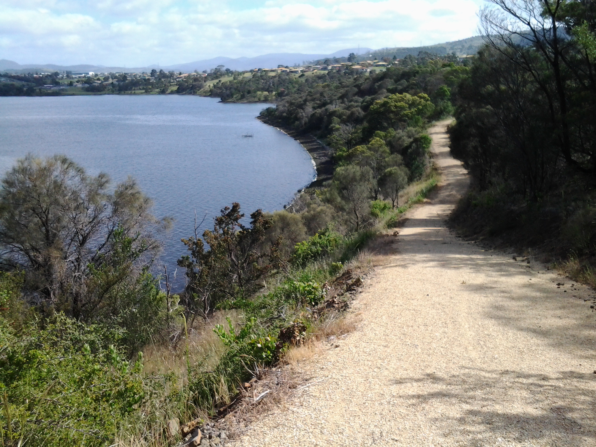
Before reaching the plain, I stepped across a couple of tiny rivulets the waters of which were heading to Lake King William. The map indicated I should expect a number of these. None impacted on the ease of the walk. 20160103_075628.jpg

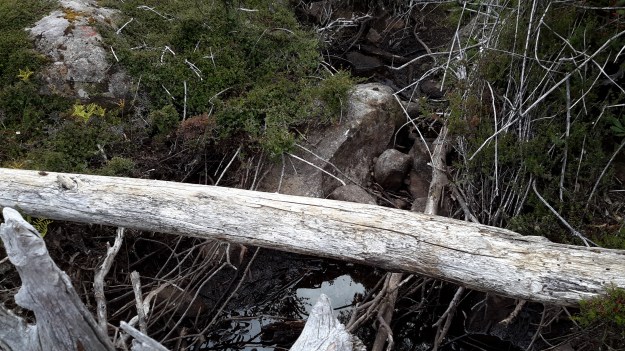
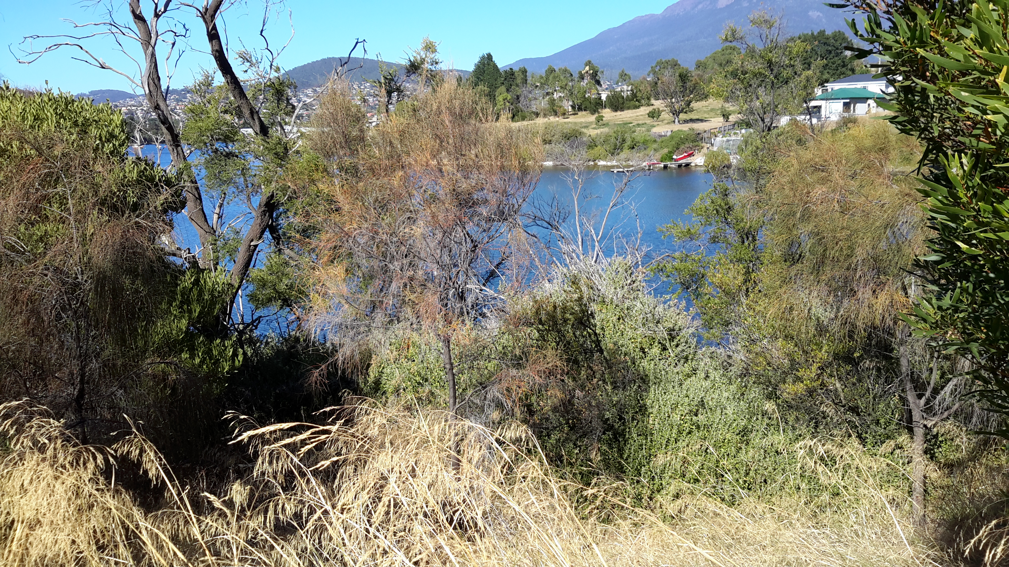
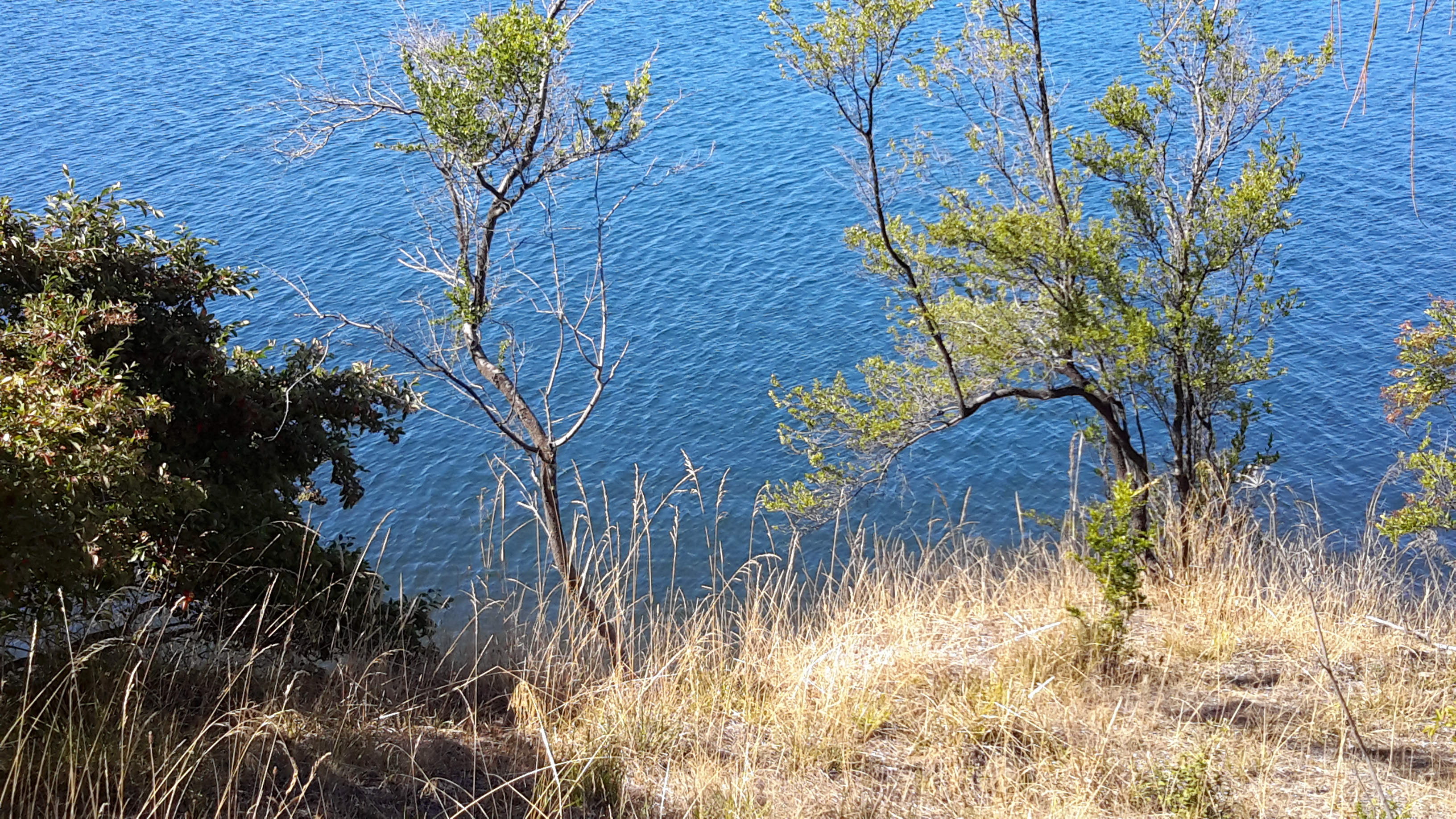
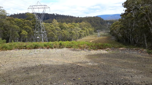
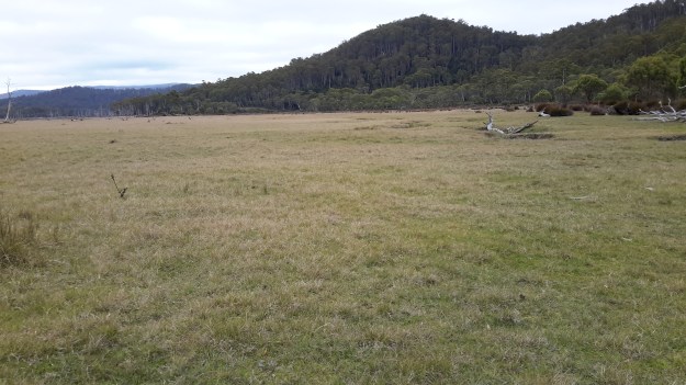
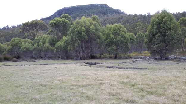
After walking approximately two thirds of the length of Lake King William from the south northwards, the track ended in a mire of deep dry criss-crossing ruts a few hundred metres inland. Obviously when the land was wet, vehicles had tried to continue onto the plain using bits of driftwood to give purchase – but the ruts soon stopped so I knew these man-made beasts had retreated, albeit with difficulty. My photo below, with Mount Charles looking down, does not adequately present the depth or the complexity of the intrusion of vehicles.

20160103_081746.jpg

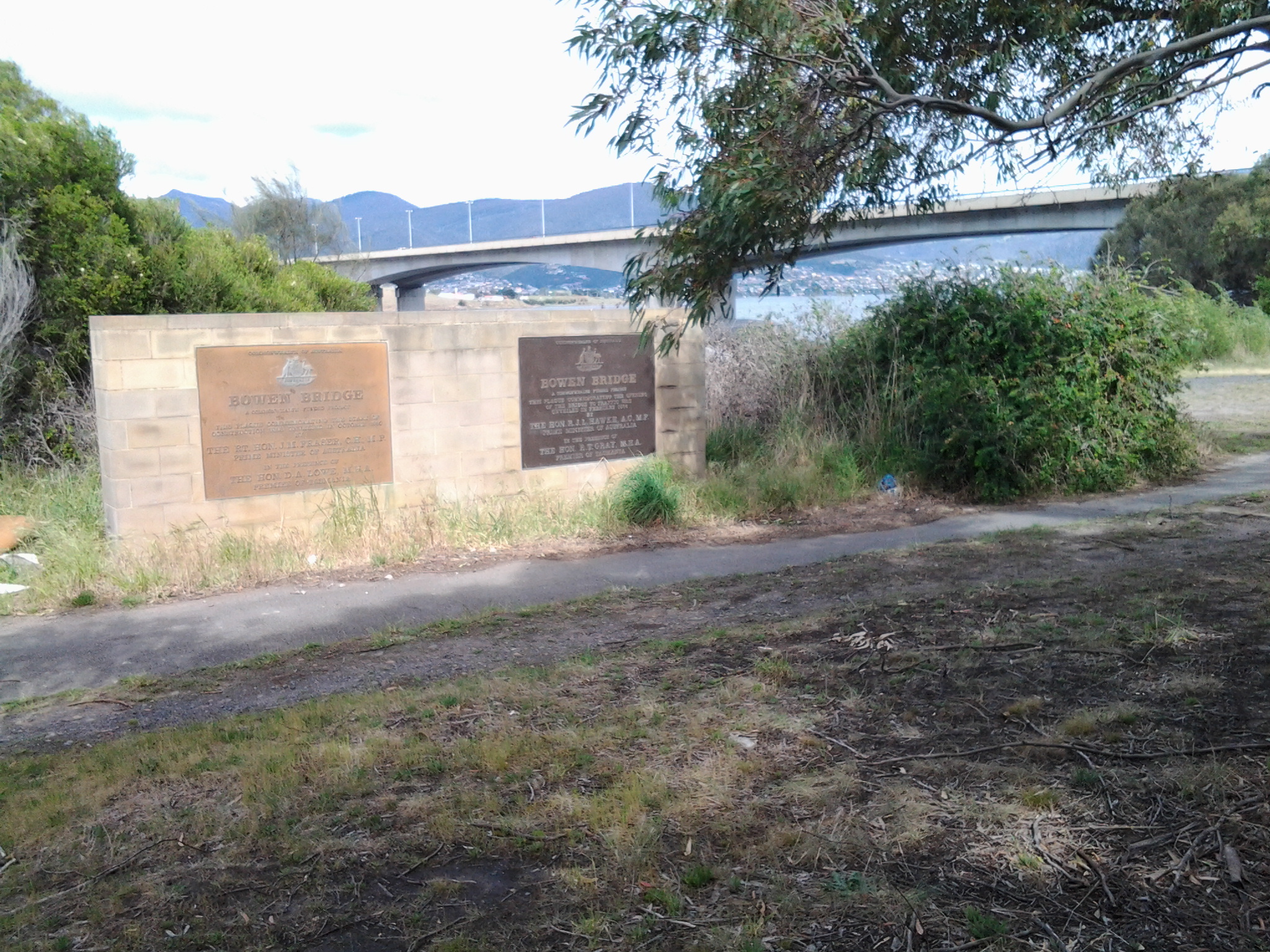
In a recent posting I added in a link to Tassie Rambler’s blog . I suggest you revisit that site to look at the photographs showing what the area looks like when wet. Look for Mount Charles in the photos and then, in the photos that follow, you can see the wet plain that the Tassie Rambler experienced. I am immensely grateful for the dryness I found.

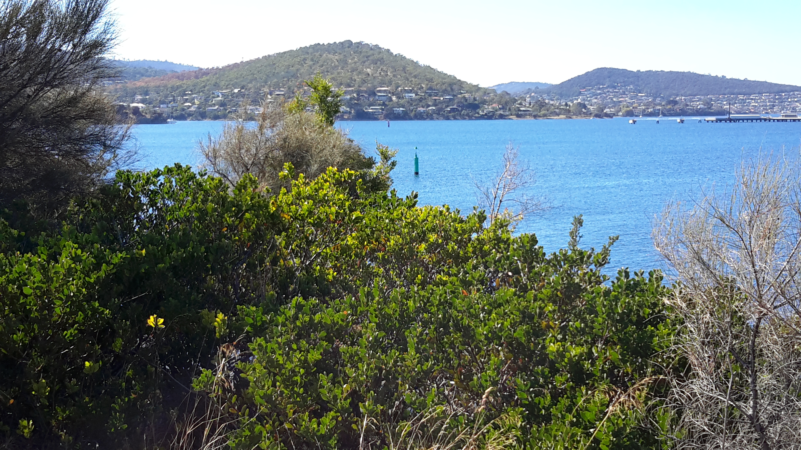
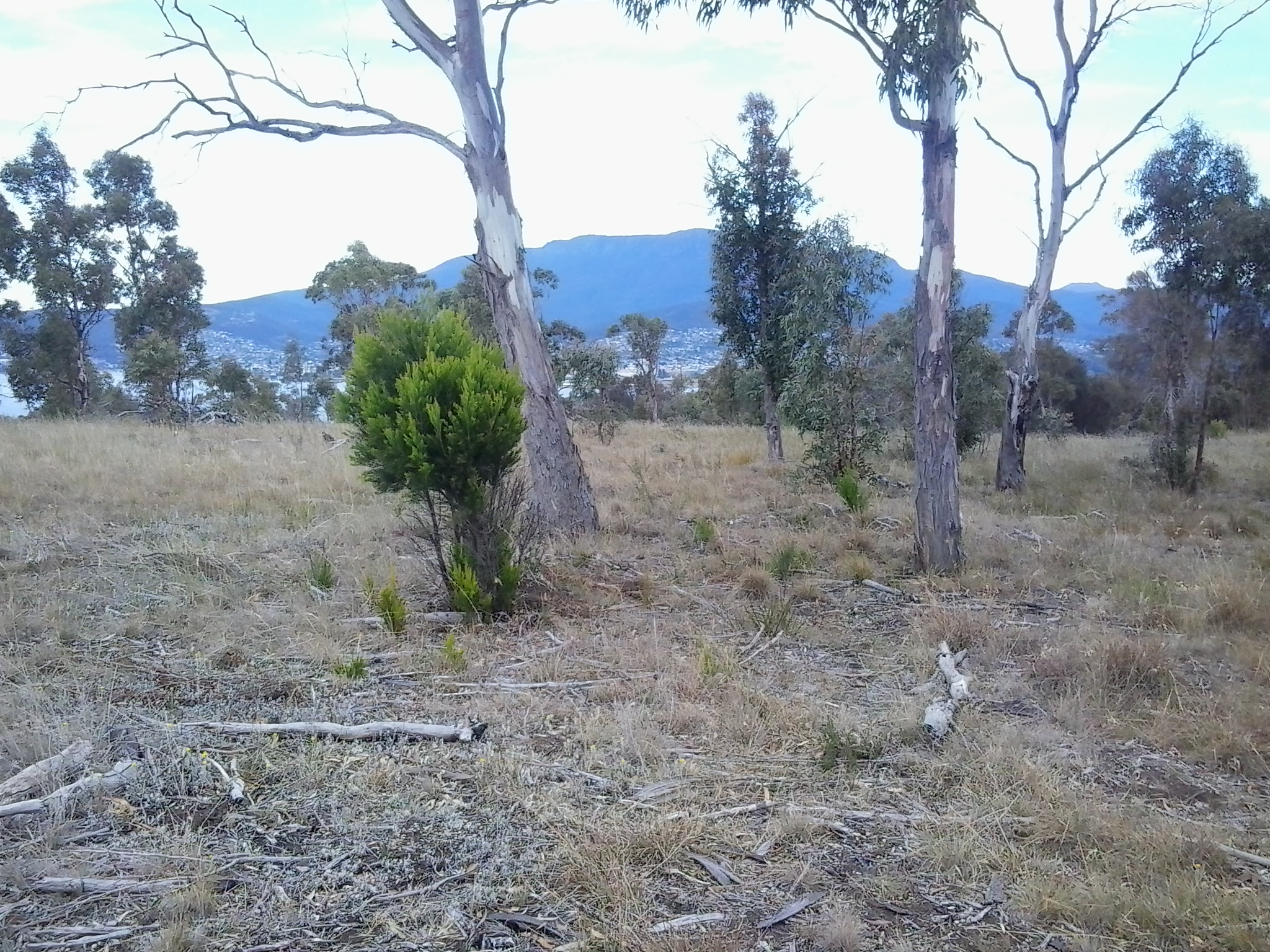
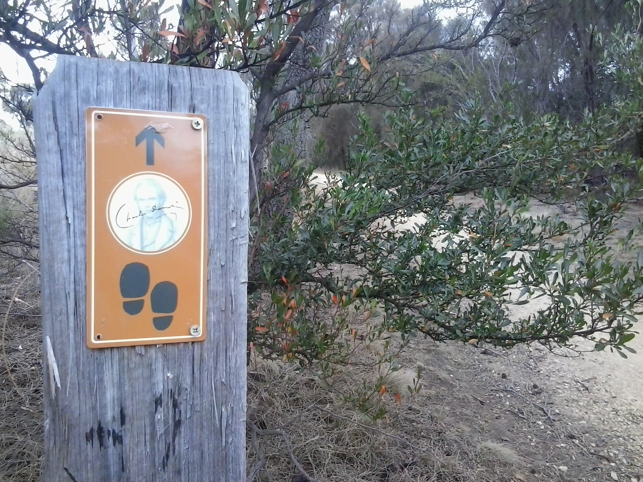
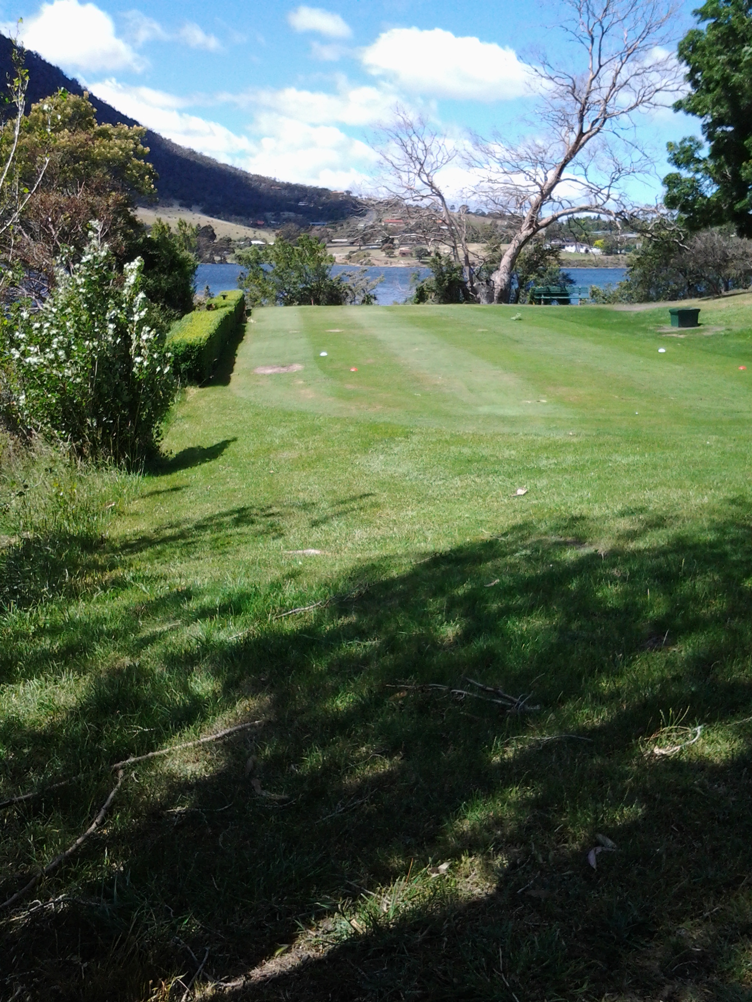
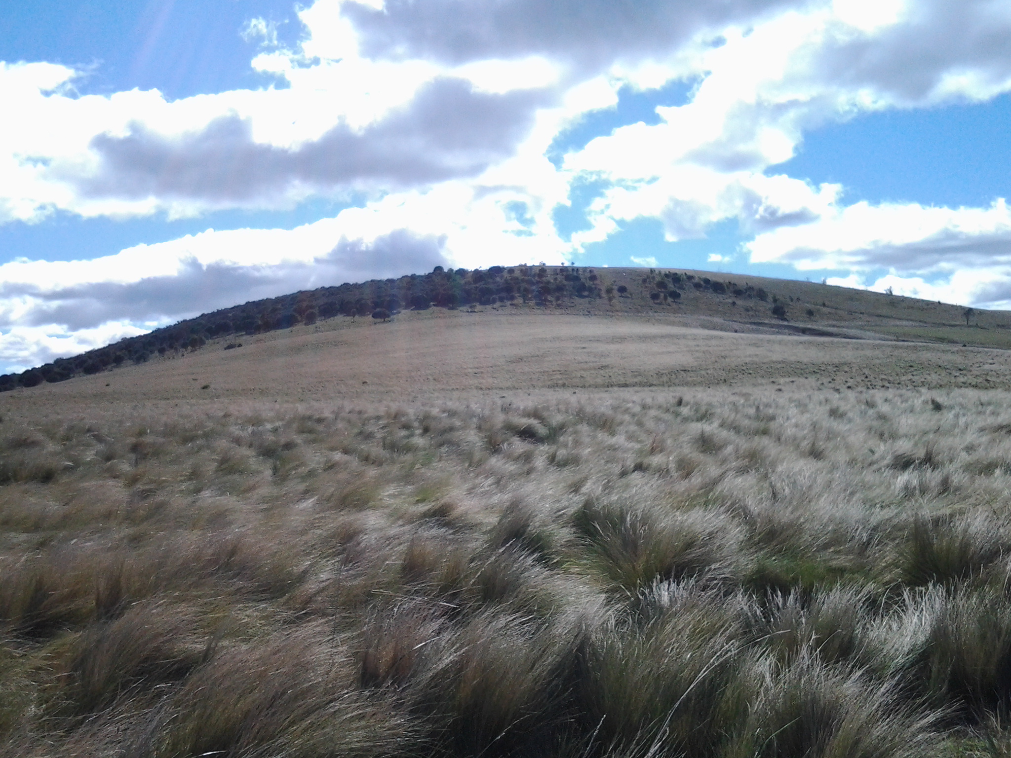
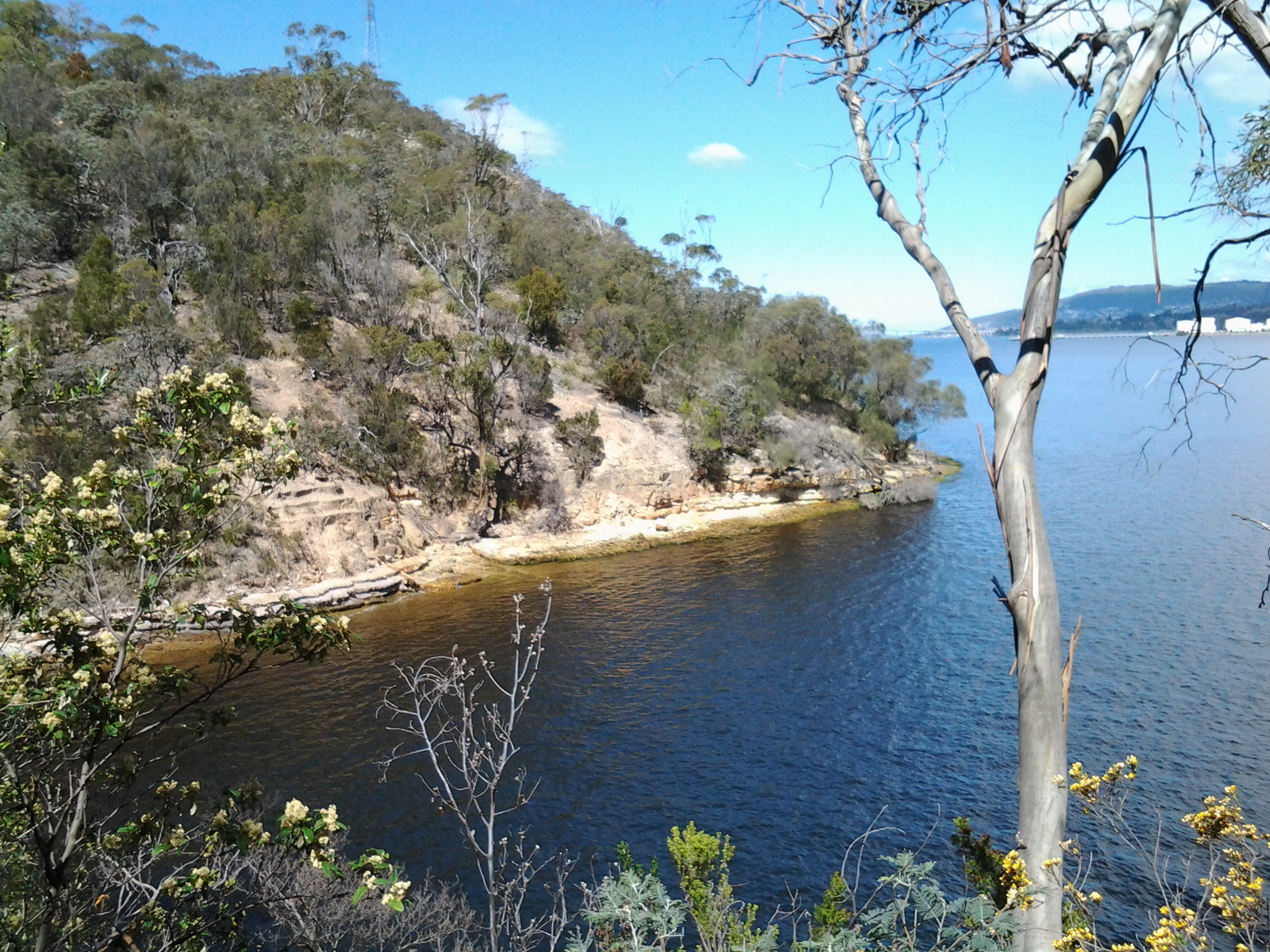
Mount Charles looked down on the plain which stretched wide and extended perhaps a kilometre inland from the Lake.  I knew I needed to aim at the pointed hill (see photo below) in the distance and be prepared to walk around it.

20160103_082040

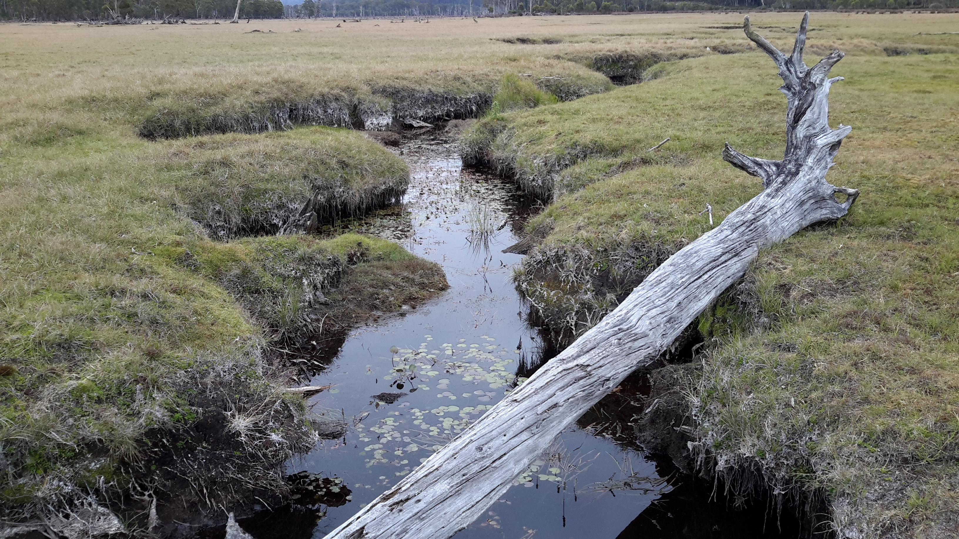
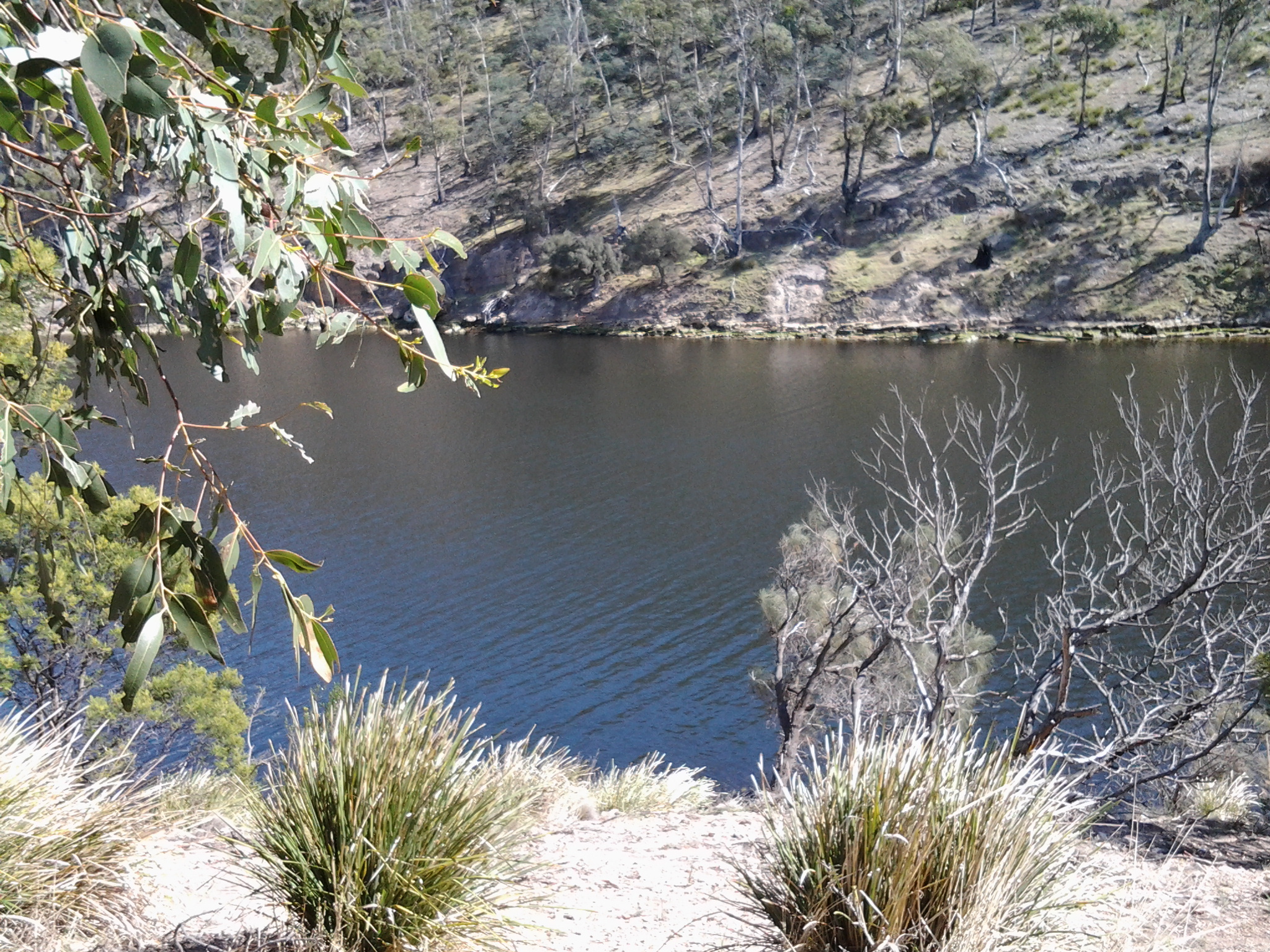
A snaking crevasse meandered through this seeming flatness. My map named Bethune Creek as the main watercourse in the area so I knew I needed to make a water crossing at some stage.  My passage point was a log resting on both sides of the land. Crossing Bethune Creek was easy.

20160103_082043.jpg

20160103_082220.jpg

The ground either side of the Creek and presumably across the plain was not wet, nevertheless it was springy under foot and I bounced as I walked.

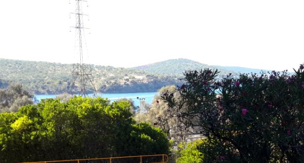
Acres and acres of this ‘ground’ extended in all directions and a decision was required. Should I walk beside Bethune Creek until I was much closer to Lake King William and then try and get through the bush, find a track and continue on solid ground? Alternatively, because I could see the power lines in a row parallel to the plain, I wondered whether I should walk through the bush towards them as soon as I could see an easy route.  From where I stood it was not clear that accessing the power line area would be easy or even possible if I proceeded closer to the Lake so I decided to make a path to the power lines through the band of small bushes and undergrowth which seemed to be the narrowest.  It didn’t look difficult.

This was where the fun started.

Over the years, bushwalkers have groaned at the memory of experiences crossing button grass plains. Until this walk, I had no experience of walking through these plants.  Now I understand bushwalkers’ groans. When you see the images below of the button grass it appears not to present difficulties for walking – but appearances deceive.

20160103_082549.jpg

20160103_082554.jpg

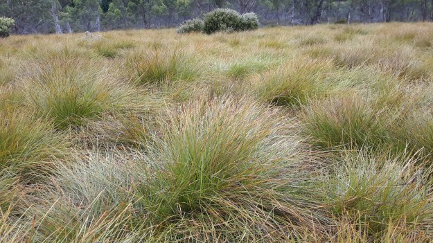
Despite the fact I only needed to cover about 100 metres of these beautiful looking plants, it was one of the most exhausting and frustrating processes I have ever endured. However, even as I tried to negotiate the distance, I could see the funny side if someone else had been watching my antics and halting progress.

Each button grass plant has a thick roughly circular base and then sprouts long arms some of which end with a spherical seed case, the button. Around and between each plant run channels which, in wetter times, would be a muddy, marshy, boot-removing quagmire.  Thankfully, these channels were bone dry when I made the crossing.  The channels were the width of one of my feet so on occasion I tried to walk in the channels. The channels are deep so that the top of the surrounding button grass plants were sometimes around my armpit height. This meant seeing the best forward path was not always possible. After making a few steps around a few plants, I would think I had found a way to continue reasonably comfortably, albeit not in a straight line to my destination. Then suddenly a mesh of grasses from a number of close growing plants would be so thick that I could not force my way through nor step over.  Then I would hump myself up to balance in the middle of a grass plant, my backpack changing my centre of gravity.  The irregularity of the height and thickness of the plants required constant rebalancing to stay upright. And I didn’t stay upright. I couldn’t.  So I would fall onto my back perhaps across a plant or two or perhaps into or straddling a channel. I lay there, rather like a beetle with legs and arms flailing in the air where turning over or getting up seems impossible. Then I would unhitch my back pack, firm my footing in a channel, load my backpack on, and start again. How many times did this happen? I cannot say.  But the landings were always soft and not jarring. These were gentle falls backwards offering marvellous sky views!

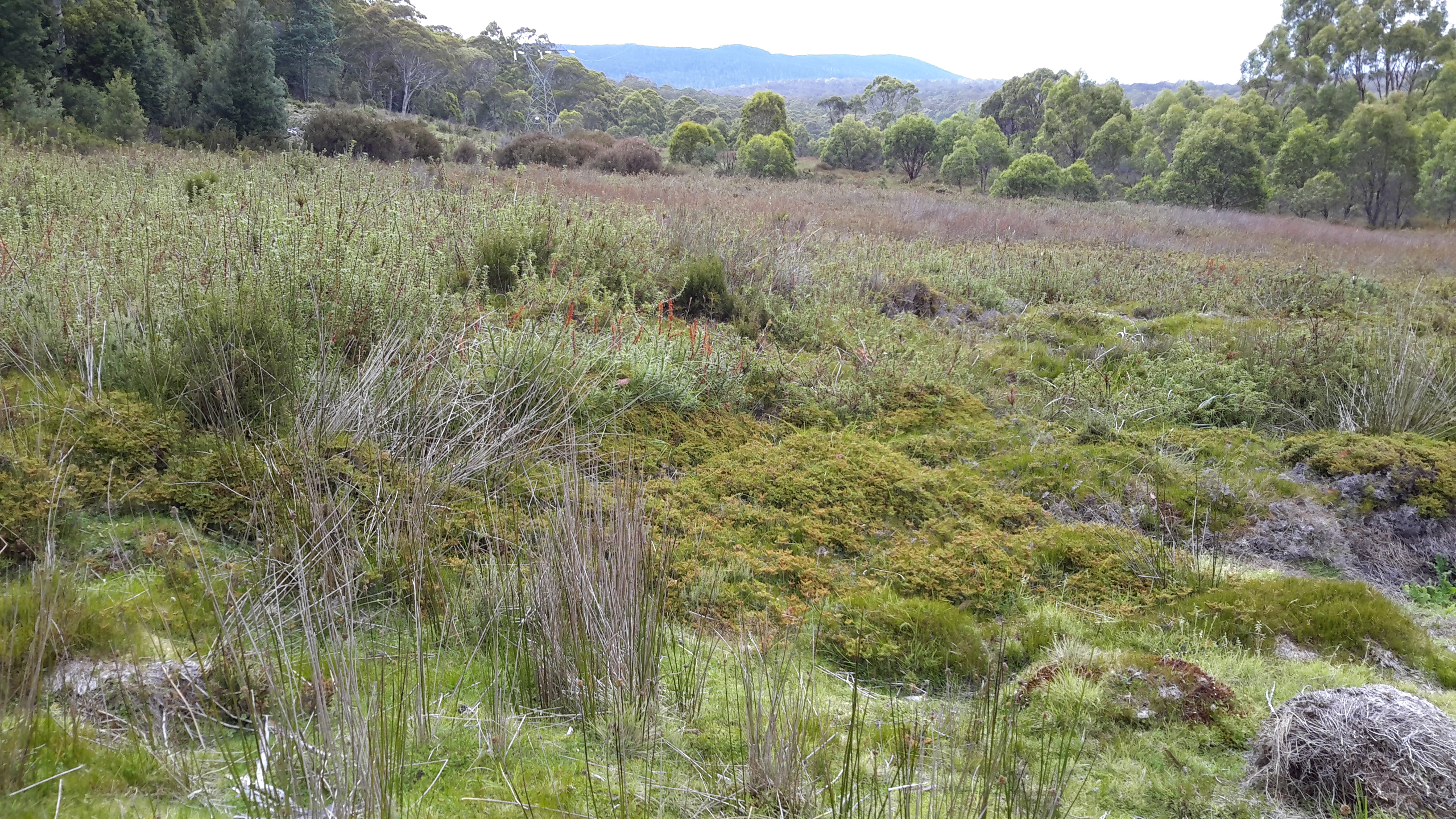
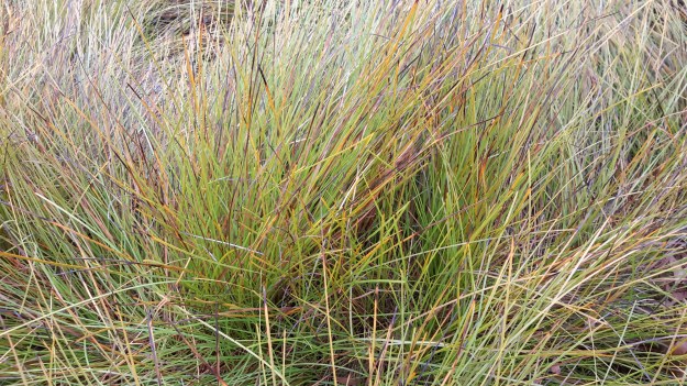
After much time – was it an hour or more? – the vegetation changed to a combination of few button grass plants, a nice little short spiky leaved plant (mind over matter was required to proceed through this), and a deeply spongy moss.

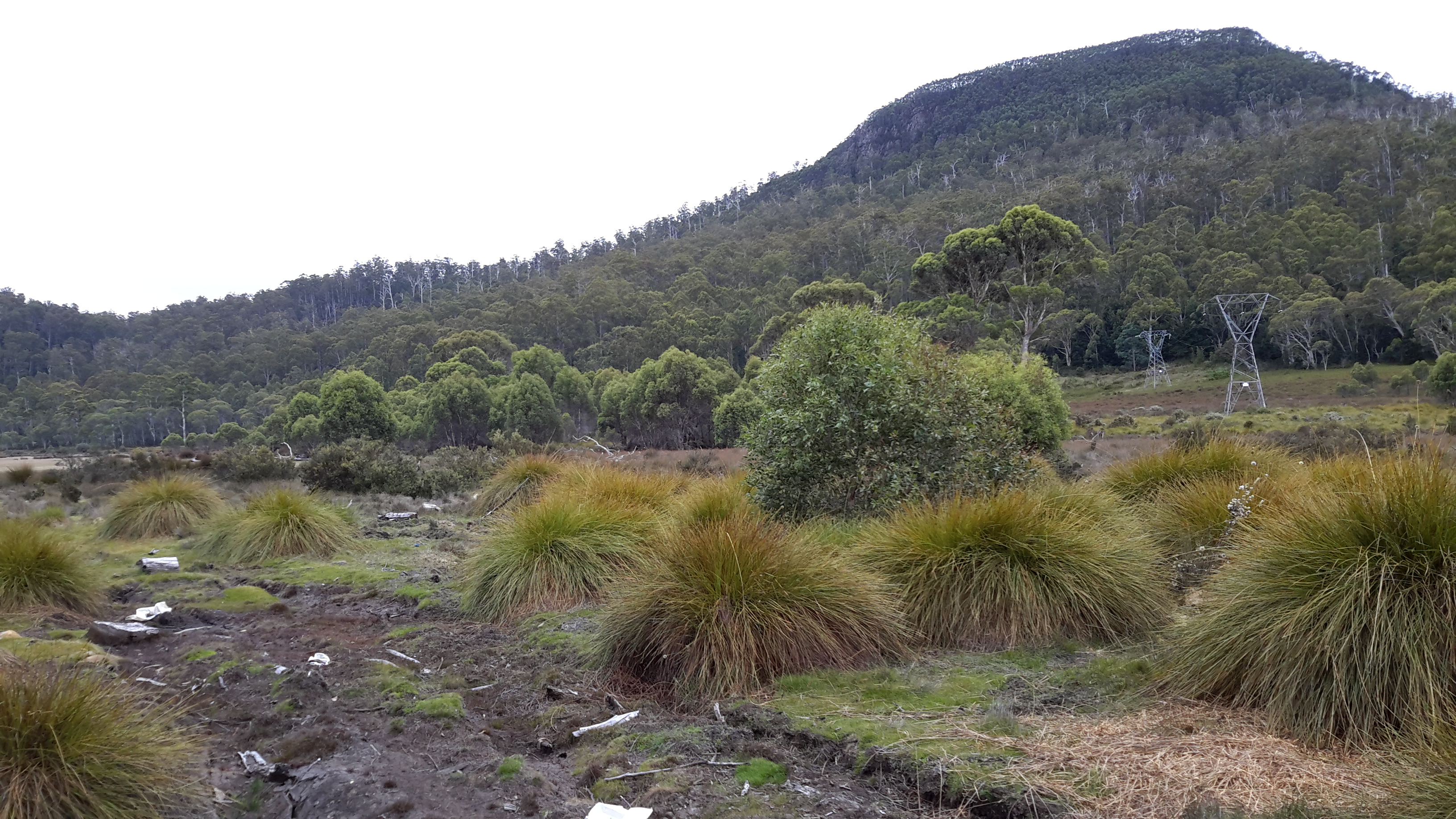
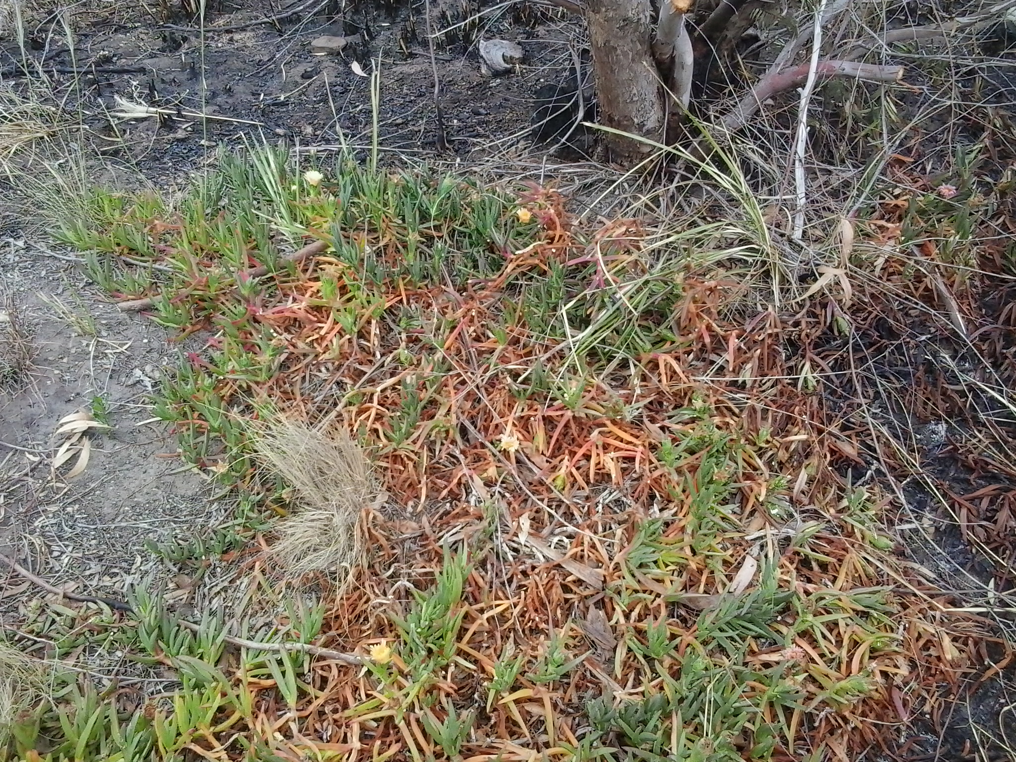
In the photo below, across the low level growth, the taller spiky plant can be seen left of centre, and the pale green plant in the foreground is the moss.  Again this photo shows a landscape that looks easy to walk through.  I promise you that looks deceive greatly. The ground beneath the plants was uneven, and some of the plants were deeply compressible by different degrees.

20160103_090753.jpg

I do not think the soft mossy plant, which slowed my progress considerably, was Sphagnum Moss one of Tasmania’s endemic species; however I am unable to identify it. Looking firm, I would step onto a smooth looking mass and that foot might sink a few inches, twelve inches, or I might drop down to knee height in the mass. Meanwhile the other foot and leg stayed elsewhere up someplace on another firmer plant. Unused muscles got a stretch. Keeping my balance was crucial because falling on the spiky plants held no allure.

A couple of years ago I attended classes to learn to dance the Argentine Tango in which balance is critical to success. During the dance, the man leads and the woman may need to stay balanced mid move on one foot for an unknown time. This means every time I made a step I needed to be prepared to stop, not sway, and keep centred. The dance experience proved useful in Tasmania’s wilderness as I negotiated a path through these plants. Speed was never an option.

I am not proud to say that I disturbed the landscape on this section of the walk.  However, the extraordinary resilience of the plants on which I stepped amazed me. They bounced back to their original shape immediately. When I stepped off the button grass plants and the moss, I could not see any mark of where I had been, although I recognise that at a micro level (perhaps even closer inspection) my steps would be in evidence on these plants.

Eventually I reached the power line clearway. It wasn’t clear. Dreams of easy walking remained dreams.

Season’s greetings

When I am in Hobart on Christmas Day, as I will be this year, I make a point of finding time to walk along Bellerive Beach which forms one border with the Derwent River.   I love the bonhomie of people who walk there that day. Good spirits abound. I can almost hear their bodies groaning from eating too much Christmas food. Many are happily dragged onwards by joyful dogs that are delighted to be out in the fresh air. All of this is a wonderful spirit lifter – the goodwill of people, their gambolling dogs, the grand Mount Wellington in view over the water, and the lapping sound and salty smell of the blue river.

For some people Christmas is a happy time, for others it is surrounded by sadness, and for many people Christmas Eve or Christmas Day is a rush of stressful events.  Of course a person’s level of interest and engagement with Christmassy activities depends on religious persuasion and so some people are never involved in the festivities.  But if Christmas is your thing, then I hope you have rituals with family and friends that relax you and, if not, then I urge you to find a way to be calm.  All in all, I wish everyone happiness during the Christmas season.

Fires above the Derwent River

On too many nights last week the sky was dense with a rosy fire haze across my suburb.  The smoke slipped through crevices in my house so that, through each evening, I felt like I inhaled a camp fire.  Back then I checked the Tas Fire Alert website and learned the closest fire was in Quarry Road less than half a kilometre away. Today I went off to see what the burn looked like.

I chose to walk through the bushland of Waverley Flora Park first and then descend down Quarry Road.

2015-11-09 09.37.10

From the top of one of the Park’s walking tracks, I looked through stands of gum trees towards the mouth of the Derwent River.

2015-11-09 09.22.36 2015-11-09 09.22.51

In the other direction Mount Wellington loomed large over the Hobart CBD and the Derwent Harbour.

2015-11-09 09.24.47

I followed in the footsteps of Charles Darwin, ‘father’ of the theory of evolution, who walked around Hobart in 1836. At some time during that visit he crossed to the eastern shore and wandered around the Bellerive suburb and beyond.

2015-11-09 09.22.59 2015-11-09 09.20.23 2015-11-09 09.20.15

I saw unfamiliar medium-sized birds collecting nesting material and insect food morsels (who flitted away far too fast for me to take a photograph): one was dressed in silvery greys with a long strand floating after its tail, and another with a rich olive green coat. None of my bird books help me to identify either of these birds – any locals with bird knowledge?

A profusion of native spring flowers carpeted parts of the Park, or stood as single colourful spikes amidst the dull dry green grasses.

2015-11-09 09.32.36 2015-11-09 09.25.26

It soon became clear that lots of burned vegetation and scorched earth passages were scattered next to the walking track and beyond.

2015-11-09 09.29.05 2015-11-09 09.28.19

Later when I walked down Quarry Road with not a burn mark in sight, I realised that for bureaucratic purposes the Tas Fire Alert site had to indicate the best road for fire trucks to follow.  It had been parts of the Waverley Flora Park that suffered fire damage.

As I continued downhill, I heard the siren sounds of a fire truck and watched it whip past the intersection below.  When I turned the corner, the truck was parked askew with hefty yellow clad guys preparing their gear.  The screams of other sirens were closing in. I watched wisps of smoke escaping from all manner of slits and slots and dirty brown smoke puffing from the front door of the house below.  I saw an approaching ambulance and guessed this wasn’t someone’s best day.

The Derwent River at night

Tasmania’s bush, its coast and urban areas offer a photographer’s paradise at all times of day and night across the four seasons.

This Amazing Planet  is one of many blogs that show spectacular photographs of Tasmania’s flora, fauna and landscape. Go to Nightscape-Hobart for a stunning visual treat. Enjoy looking at part of the glorious Greater Hobart Area, at night, photographed from on top of Mount Wellington. Between the two sides of the city, the rich blue Derwent River passes on its way to Stormy Bay and then the sea. The brightly lit Tasman Bridge can be seen to join the two shore lines.

Special Anniversary

Establishment Milestone remembered:

On 15 August 2014 I conceived the idea to walk the length of our Derwent River from the mouth to the source, and began this blog.  That was when I found the glorious photo of the Derwent River taken from the top of Mount Wellington and set it as my heading for permanent sharing with you.

The crustacean that walks – and only in Tasmania

My last post introduced a giraffe who took a long walk. Since giraffes typically walk as part of their locomotion, the surprise of that story cannot be as great as the fact of the shrimp (prawn if you like) which walks around the high creeks and streams which flow down into the Derwent River in Tasmania.

Anaspides tasmaniae from Parks&Wildlife Service

(Photo courtesy of Parks & Wildlife Service Tasmania – http://www.parks.tas.gov.au/indeX.aspX?base=11244)

Geoffrey Smith, in his book A Naturalist in Tasmania (Oxford, 1909), describes the Anaspides tasmaniae. “A number of streams rise in the plateau of Mount Wellington, some of them attaining a considerable size before joining the estuary of the Derwent, and all of them characterised by the beautiful clearness of their water, owing to their beds being formed entirely of hard greenstone boulders.

In the pools of the upper reaches of these streams near the top of the mountain, a very peculiar shrimp-like animal is found.  It is now recognised as one of those survivals of a bygone age of which the Australian continent has furnished so many and such interesting examples. The nearest allies of this animal appear to be some marine shrimps which come down to us as fairly common fossils in the sand deposited round the Permian and Carboniferous seas of Europe and North America: subsequent to this very remote period they do not seem to have existed in the seas, at any rate in the northern hemisphere, so that an enormous passage of the earth’s history has occurred between their peopling the northern seas and their survival on the mountain tops of Tasmania.

The Tasmanian Mountain Shrimp (Anaspides tasmaniae) is sometimes as much as two inches in length, of a brown colour, and walks about on the stones and among the weeds at the bottom of the pools, browsing on the mosses and liver-worts and any small creatures it can catch; it very rarely swims, but when frightened it darts forward by flicking its tail and takes cover under a stone.

In other parts of the world no trace of the animal’s survival has been discovered.

Goethe somewhere remarks that the most insignificant natural object is, as it were, a window through which we can look into infinity. And certainly when I first saw the Mountain Shrimp walking quietly about its crystal-clear habitation, as if nothing of any great consequence had happened since its ancestors walked in a sea peopled with great reptiles … time for me was annihilated and the imposing kingdom of man shrunk indeed to a little measure.”

The website http://www.anaspides.net/other/website_name_why.html believes “Anaspides tasmaniae has remained unchanged for 250 million years (Triassic Period): it is a living fossil. The first published record of Anaspides tasmaniae was made in 1893 from alpine pools on Mt. Wellington behind Hobart.”  More details about this discovery, and about the later involvement of the author of the book excerpt above, Geoffrey Smith, can be read at http://www.tasfieldnats.org.au/TasNaturalist/Articles/1967/TasNat_1967_No8_Feb_pp1-2_Hewer_AnaspidesTasmaniae.pdf

Another revision: naturally therapeutic images from stages 7-10

I can’t help myself. Having reviewed my favourite images from the first half a dozen stages of my walk along the Derwent River, I felt compelled to continue looking through my collection from the subsequent walks.  I have chosen photos showing aspects of both the natural and man-made world and I believe all will prompt thinking about the Derwent River, Hobart and its suburbs, and the natural environment. My selection of the images with the most memorable impact for me, from stages 7-10, are given below.

20141031_094126

From the eastern shore looking northwards towards the Bowen Bridge, with a couple of black swans on the river.

20141031_100200

Two plaques ‘opened’ by two great Australian prime ministers near the Bowen Bridge.

20141031_104822

The rusting raw-edged remains of a ship, the Otago, at Otago Bay.

20141031_113132

My enjoyment of any family’s black sheep.

20141031_123000

Heading into Old Beach and gradually leaving Mount Wellington behind.

20141031_132519

The gloominess of the approaching storm when I reached Old Beach.

20141111_092342 20141111_092805

The pleasures of well-made pathways, thanks to local government.

Green Point from new Old Beach

Looking northward across the Jordon River to Greens Point.

20141111_103700 20141111_121906

The glories of native flora. In these instances, it was blooming wattle and a spectacular stand of eucalyptus/gum trees which attracted my attention.

20141111_120752

The remains and the signs of a burnt out car on a back track.

20141111_130523

Knowing that it is still possible to have a laugh when walking.

20141111_131133

Arriving at the Bridgewater Bridge.

20141111_134311

Walking on the western shore of the Derwent River for the first time during this project.

20141125_095438

The house of one of first European settlers, James Austin, at Austins Ferry.

20141125_115047

At Dogshear Point, walking around the Claremont golf course, with the thwacking sound of hit balls crossing the greens.

20141125_110906

Reaching Cadbury’s chocolate manufacturing factory in Claremont.

20141125_143454

The hand-hewn rustic style seat near Connewarre Bay.

20150109_074126
Passing MONA somewhat camouflaged as it nestles into a tiny hill against the Derwent River.

20150109_081644

The mosaics along the foreshore.

20150109_101243

The jumble of boats and boat houses at Prince of Wales Bay.

Hoon tyre marks

Road mark making in Lutana.

20150109_132008

Cornelian Bay’s oil tanks up close.

20150109_153103

The Tasman Bridge.

20150109_155515

The circus had come to town.

20150109_161747

The emptiness of an arena of stands waiting to be filled during wood chopping competitions.

20150109_161339

Reaching the ‘end of the line’ on arrival in Hobart city.

Nature is cheaper than therapy

A Californian fiction writer M.P. Zarrella offered the opinion ‘nature is cheaper than therapy’.  Since then, her point of view has spawned posters, cushion covers, and T shirts such as:

Nature cheaper than therapy  and tshirt nature its cheaper than therapy

The use of this comment spread until people couldn’t help themselves …

facebook cheaper than therapy and Beer is cheaper than therapy

Thinking about whether nature is cheaper (with the inference of ‘better’ than therapy), I have been inspired to trawl through my walking-the-derwent photos.

Here are a few favourite natural scenes clicked during Stages 1-6 of my walks along the eastern shore of the Derwent River.  Most of these images spent time as my computer screen background where they lifted my spirits daily.

20140822_100301

Iron Pot off the southern end of South Arm peninsula

20140822_101716

Driftwood beach shack on Pot Bay Beach, South Arm peninsula

20140822_114606

Mount Wellington across the Derwent River from South Arm Beach

20140904_110312

Looking northwards into the gigantic Derwent Harbour from Gellibrand Point at the northern end of the South Arm peninsula.

20140920_102738

Looking uphill from Trywork Point

20140926_095629

Lichen on rocks at Tranmere Point

20140926_104056

Little Howrah Beach

20140926_115158

Looking southwards along Bellerive Beach

20141010_093842

The suburb of Sandy Bay across the Derwent River through the casuarina trees from Rosny Point

20141010_123003

Tranquil Geilston Bay looking toward Mount Wellington

20141015_101248

Bedlam Walls Point

20141015_104855

Shag Bay

20141015_122048

Native flowers in the East Risdon State Reserve

20141015_133435

Tommys Bight

Whenever the weather is deteriorating outside my window, by looking at these photographs from the first 6 of 14 walking stages, I ‘revisit’ the various locations and feel most uplifted. No therapy needed here.

Mirror smooth waters of Kangaroo Bay, an inlet off the Derwent River

Last weekend, when I walked to Bellerive Village via the Bellerive Yacht Club and Boardwalk, I was stunned by the beauty of the view.  The water in the marina was smooth as glass.  The yachts were clear edged by the crisp air and hard bright morning sun.  Despite puffs of cloud obscuring full vision of Mount Wellington in the distance, the vista was spectacular.

2015-03-28 08.22.12 2015-03-28 08.22.28 2015-03-28 08.22.21

The question has been asked: when will I walk the New Norfolk leg?

The answer is that I don’t know because this year’s style of autumn weather is making decisions difficult.

Last year it was mid-May before I removed the summer cotton sheets from my bed and changed to the fleecy flannelette sheets for winter warmth. Until that time I wasn’t wearing thermal tops. But this year before the end of March, I am rugging up and friends are lighting warming fires.

With this drop in temperature, we have continued to have light or heavy rain, not for all the day but off and on unpredictably. The idea of walking with a raincoat on and off or an umbrella up and down all day does not thrill me.  I want an uninterrupted view of everything around me.  I want to be able to hear the sounds of the Derwent River and the birds without the distortion of pattering raindrops.

For my walks from the mouth to the mouth of the Derwent River via the Bridgewater Bridge, routinely I consulted the Bureau of Meteorology (BOM) for their forecasts. Then, typically, I adjusted these predictions according to what I could see happening in the air over Mount Wellington.  Unfortunately, the leg from Bridgewater Bridge to New Norfolk is out of sight of the mountain and so I need to trust the BOM.  At this stage both next Monday and Tuesday look promising weather-wise in the New Norfolk area. Hopefully I will have fresh new stories of lived experience to post mid next week.