Tag Archives: Greater Hobart Area

The Fall of the Derwent

Early during my walk along Tasmania’s Derwent River from the mouth to the source, I was travelling near Repulse Dam on a reconnaissance trip when I came across two others.  It was a strange experience.  Previously I had become aware that two women planned, with assistance and support from others, and with the direct engagement of specific groups of people in some parts, to walk from the mouth to the source.  That day, as Andrew and I drove around for me to suss the landscape and the walking route options, when I saw two women seeming to do the same, we stopped them and I asked questions.  ‘Yes we are those women’, said Justy Phillips and Margaret Woodward.  I am sure they were as surprised as I was.

Since then, Justy and Margaret have made their way alongside various parts of Tasmania’s Derwent River and arrived at Lake St Clair where they were Facebooked taking a dip in those cold waters, seemingly delighted with their arrival.

Their project was very different from mine.  In my case, I wanted to walk around the whole of the Greater Hobart Area, and then to walk every metre of the way to the source at St Clair Lagoon dam.   By contrast, Justy and Margaret walked alongside parts of two Derwent Rivers; Tasmania’s Derwent River and the other in Cumbria England.  The experience of and learnings from their walks were used as part of the basis to write what they describe as a ‘fictionella’; written in the form of text artwork, similar in appearance to poetry.

That book is titled Fall of the Derwent. In this website you can see  range of photographs including two where Justy and Margaret are holding their black covered book.

Cover of book.jpg

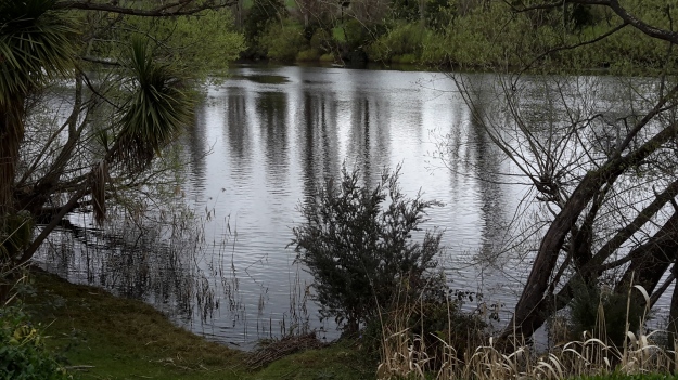
The title of the book references a drawing by an early Tasmanian surveyor George Frankland which he named ‘Fall of the Derwent’.  Colonial artist Thomas Bock engraved the image and James Ross printed the picture in The Hobart Town Almanac in 1830. The picture was drawn at a site near unpassable rapids on the Derwent River upriver from New Norfolk.  When Justy and Margaret walked past what they believed was that place, they took a suite of black and white photographs;  half a dozen or so of these images are bound into their book.  Without returning to that area I seem to remember the spot.  After reviewing my photographs in that area, clearly I was looking for serenity and simplicity.  I was looking at colours and contrasts.  It seems I was focusing on one way of seeing that world of the Derwent River, and Justy and Margaret’s view is an alternative.20150917_094036.jpg
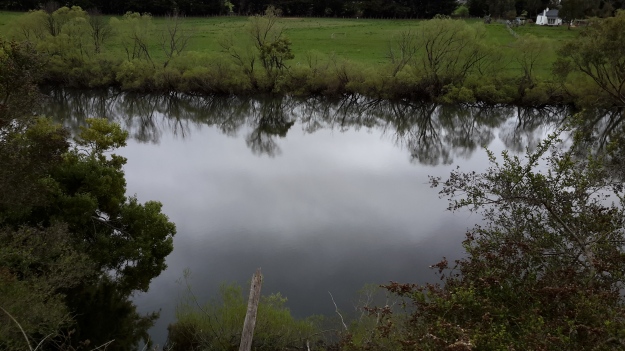
20150917_095352.jpgI did not focus on the twisted interlacing of stark and scrappy vegetation at the river edge like Justy and Margaret have done  The differences in our images is a reflection on the different nature of our projects. I wanted to entice others to be seduced by the beauty of the landscape and then to make their own journeys along the river edge (I now wonder why I didn’t see vegetation tangles as beautiful).  When I read their book it seemed they wanted to use their experiences as the basis for creative abstract thoughts; perhaps even a metaphysical approach involving questions such what is there in that world and what is it like at a more profound level.  My approach was literal and descriptive.

The Phillips/Woodward Fall of the Derwent publication presents poetry-styled ideas and comments in ‘chapters’ headed by the days of the week; the book proceeds over  44 days consecutive days – but the ideas associated with both rivers are intermixed.

“Let us begin with two rivers / And a Dad not long for living. / Two daughters …”

Despite the introductory lines, theirs is not a chronological story connecting the sequences of walking the two rivers; reference is made to other locations such as Cape Barren Island, Dover Point, and Brisbane. And the English father walked with Justy and Margaret when they traipsed near the Cumbrian Derwent. As an intertwined overlay in this book, mention is made of his declining health – Dad in pain, no longer able to feed himself, no longer speaking.  For this reason and for the manner of writing which removes easily identifiable meaning through much of the publication, this book has a limited audience and is obviously a set of personal ideas to be understood, remembered and perhaps loved by the authors. For their personal satisfaction. I was surprised that this book uses combinations of words that do not create, for most of the book,  visual images of either of the two rivers. Instead, the poetry reads as a meshing of many experiences which presumably helps Phillips/Woodward to reconstruct a feel of those experiences.

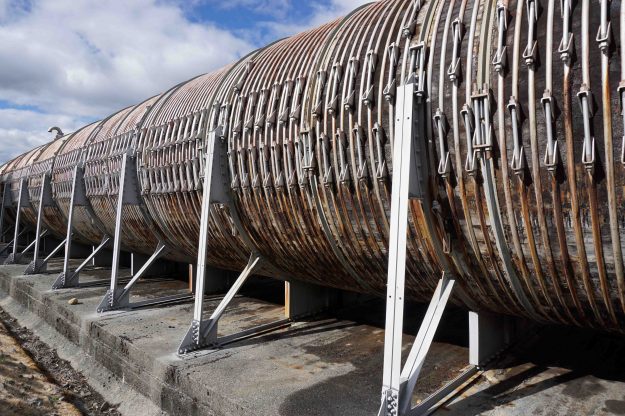
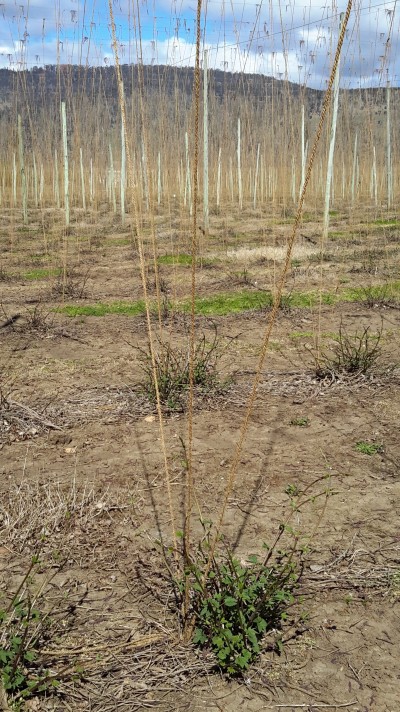
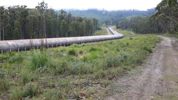
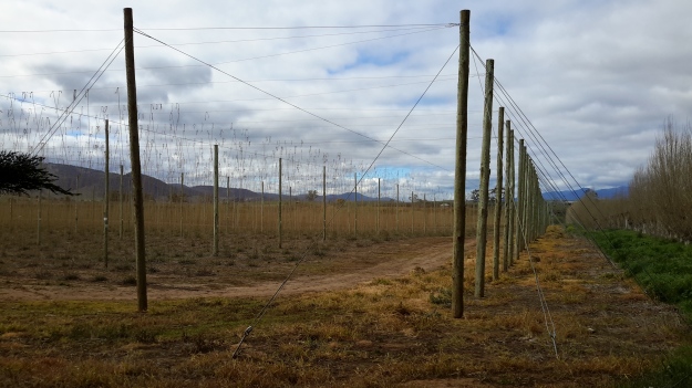
On occasion, where the meaning was clear because I could recognise specific locations, I enjoyed some of the lines. For example, “…rows of hops that string this neck of the river…” referred to the hop vines and their structural strings in the Bushy Park area.  These hop fields obviously made a significant impression on Justy and Margaret because there was a second comment on the same topic; “…the hops in single file march orderly disruption to the valley.”  Then, when they walked around the Wayatinah Power Station, “…the woodstave pipeline is a blistering gland … Draws the corset of her breathing”.  Like Justy and Margaret, I looked in awe at these two locations and their dramatic impact was described during my posts.  To remind you – here are photos of the hop fields and others of the wooden pipeline.   20150918_104145.jpg
20150918_113007.jpg

20170424_114515.jpg

DSC01655e.jpgJusty and Margaret learnt in Cumbria; “On the banks of the River Derwent, that the term ‘black market’ is born. Through the illegal trading of graphite.”  Then they found graphite was part of the geological structure at Wayatinah on Tasmania’s Derwent.  From these findings, grew the idea to play with ‘black’; the book’s cover is black, some copies are cloth bound and impregnated with carbon powder, the Fall of the Derwent and ‘black’ are interconnected within the text, and one section of the book presents a list of locations along Tasmania’s Derwent which include ‘black’ in the name; examples include Black Bob’s Rivulet and Blackmans Bay.

Phillips/Woodward’s book Fall of the Derwent was part of a public artwork presented in association with GASP (Glenorchy Art & Sculpture Park) in 2016. Further information can be accessed here. If you click on ‘Download Hydrographic Score’ you will be able to read the book online.

Walking on an industrial site – posting 1 of 5


This seems an appropriate time to add in the stories of my walk along the water edge of one of Greater Hobart Area’s iconic industrial estates in its 100th year of operation.  This series of postings records the morning when I was privileged to be given permission to walk on some of Nyrstar’s property.  But first – a reminder of what the site looks like from a distance; from other vantage points during my walk along the Derwent.

For example, my blog posting Either side of Bowen bridge – posting 5 of 9 included a photo looking at Nyrstar from Dowsing Point and across Prince of Wales Bay.  Refer also to my postings On through the East Risdon State Reserve along the Derwent River and Along the northern side of Shag Bay and onwards along the Derwent River for additional photos of Nyrstar. These latter two postings were made after my walk through the East Risdon State Reserve on the eastern shore across the Derwent River from Nyrstar on the western shore.

Colloquially known as ‘the zinc works’ or the ‘Risdon works’, Nyrstar’s operation centres around converting raw materials into zinc metal.  More can be read here.

Special permission was required to walk on this land and I needed to agree to particular conditions before I could proceed. The extensive site holds many dangers of physical, chemical, electrical, mechanical and liquid kinds and legislation and internal procedures regulate entry and access. This is not a public access walk.  After arrival at the Reception  office on-site,  I submitted to a health and safety induction process, donned a high-vis vest and other safety gear (including designated boots), and accepted that I must be accompanied by a staff member at all times. My host and guide was a senior manager whose understanding, knowledge and passion  for the environment had to be second to none.  I could not have been more fortunate. And he also loved the Derwent River and told me how he jumped into his kayak to explore the river whenever he could find a moment (no – not while he is at work!).

The day of our walk was gloriously sunny with hardly a puff of white marking the sky; exceptional walking weather where every detail is clear.

A considerable portion of the Nyrstar industrial buildings edge the Derwent River as shown in the Google map excerpt below.

Google Nystar industrial bldgs.JPG

Nyrstar’s property extends into New Town Bay. I expected only to walk on and next to the rocky shore along the lines I marked on the Google map below.  Future postings will reveal whether I actually walked further.

Nystar possible walking track.JPG

I am so very grateful for the support and interest and assistance which Nyrstar provided to ensure that my walk along the Derwent River was complete.  Staff all over the site could not have been more pleasant.


Either side of Bowen bridge – posting 1 of 9

Stage 8 of my walk from the mouth the source of the Derwent River took me under the Bowen Bridge on the eastern shore, and during Stage 10 I walked past the Bridge at Dowsing Point on the western shore after deciding to walk to the mouth on both sides of the river. However, when on the western shore I could not easily see a way to stick by the river edge at Dowsing Point, and since that day promised to be a long one I took the easy option and followed the streets which cut across the Point. I always felt that I hadn’t been quite honest in taking this approach and that I needed to return and be serious about walking the Derwent edge to the extent it was possible.

So return I did, and this series of postings records that visit.

As usual within the Greater Hobart Area, I took a Metro bus which dropped me off one morning within the Technopark precinct at Dowsing Point on the Hobart side of the Bowen Bridge. Technopark is a state government initiative started over 15 years ago with the aim of providing support and encouragement for small businesses and creative individuals with technological related ideas that could be developed into significant money earners for Tasmania’s productive growth. It’s brief has expanded since its inception.

By leaving the bus at the turning circle within Technopark I hoped there might be ways to walk to the river edge and then continue around Dowsing Point.  Until I looked around that day, I had not realised this precinct is seriously fenced, including the installation of electric fencing, and there is no exit except through the main fortified entrance gates.  In the photo below you can see three layers of fencing, with barbed wire strung up at the top of the closer two fence lines- and the Bowen Bridge across the Derwent River in the distance.

20170125_084025.jpg

I walked to corners and along the fence lines without finding a gap, a gate or any chance of passing through.  I could see the Derwent River and the Bowen Bridge with Mt Direction overlooking both – but I could not reach them from the Technopark site.

20170125_084247.jpg

20170125_084753.jpg

20170125_085012.jpg

20170125_085019.jpg

So I had no choice except to leave the Technopark and try other options to reach the River.  The day displayed a stunning blue sky overhead and a moderate breeze which rattled the long grasses.  Mount Wellington was ever present as I walked away from the river.

20170125_085256.jpg

Before long I passed through the gates and headed away from Technopark with the aim to walk to the Bowen Bridge.

20170125_085847.jpg


Celebrating 200 years of ferries on the Derwent River

The Eastern Shore Sun newspaper for December 2016 provided a community news story which added to the knowledge of the history of ferries plying Derwent River waters.  Turn to Page 11 for the full story and photo.

Two hundred years ago the first licenced ferry travelled from the fledgling township of Hobart across to the eastern shore to a place very close to where I live. The landscape would have been so different; trees would have covered the area where my house now stands.  I wonder if the weather was as warm and pleasant as it has been in the past few weeks around the Greater Hobart area – even exceeding 30 degrees.  Wind is a constant across Tasmania, and the early ferries would have needed skilled personnel to bring their craft safely across the expanse of water and into moorings – especially considering the fact that early vessels were rowed across the river.

Earlier postings on my blog introduced some information about the Derwent ferries, and this latest article supplements what I have offered previously.  While you can search the blog for many posts that mention ferries,  key posts are Ferries on the Derwent River and Historic Granton Tasmania .

The euphoria continues

Yesterday a friend An drove me up along the Derwent River where we stopped off at a few dams, power stations and lakes. I was studying the terrain at ground level (our most recent Service Tasmania maps are aged and Google Earth photos are not current either), seeing where forestry and hydro tracks existed and determining where I will need to make my way through bush ‘with walls’. I can see a line of fiction here – turning an almost impassable density of bush into a character (an evil character – even though the bush is sublimely beautiful and bountiful) that has to be overcome.  My strategy will be as always, one slow step at a time and then the bush won’t even know I have come and gone (although my muscles will).

I walked some small sections yesterday, but I won’t write them up until I have walked in the areas westwards from Gretna to those sections.  I know now that it is difficult for some local readers to understand where I have been and therefore, if I change the blog posts from being a chronological record, it may be even more unclear.  Besides, by writing the stories in order and finishing with the last walk to the source it will be clear I have walked the Derwent.

Yesterday explorations and walks were as uplifting as the previous day’s flight; it was as equally wonderful, just different.  I feel gushy with delight when I am in the bush on a blue sky day, with no wind, and with a temp that rises sufficiently but not so that I boil.  Once I am sitting on rocks in the river bed with my lunch, listening to the birds, and sensing the spirit of the place, my life feels so right.  This is the place for me.

Then, despite the day’s experiences already being a treat, life added a new wonderful surprise.  Recently one of my blog followers, Justy, alerted me to the fact she and her partner were engaged in creating a new work of art for GASP beside the Derwent River at Glenorchy, a city in the Greater Hobart Area.  As part of their project, they had already walked along the Derwent River in Cumbria, England and now were planning to walk from the sea to the source of the Derwent early next year.  I hadn’t met them and only communicated a few times by email.  But yesterday, as An drove me towards Cluny Dam, I saw two women step from their car.  I waved and smiled as you do on a country road. As we drove on, I said to An “I bet they’re the two women who are engaged in the GASP project, out conducting a reconnaissance trip”. There was no reason to believe this except I felt I knew it to be the truth (the bush works its miracles). Nevertheless we continued on and had parked near the northern end of Cluny Lagoon when the two women drove past us. Again we waved. On a later road we found ourselves coming towards each other from opposite directions, so An waved them to a stop. The women looked at us queryingly. “Are either of you Justy or Margaret? we asked.” “Yes”, they responded. Instantly I called out, “I’m Helen”.  Their nod of acknowledgement followed. And then we all poured out of our cars, and hugged and had a lively chat standing on a dusty road in strong Spring sunlight. It was a brilliant unexpected meeting and capped off what had been a day of immense discovery and pleasure.

Best wishes for your project Justy and Margaret!

The Derwent River at night

Tasmania’s bush, its coast and urban areas offer a photographer’s paradise at all times of day and night across the four seasons.

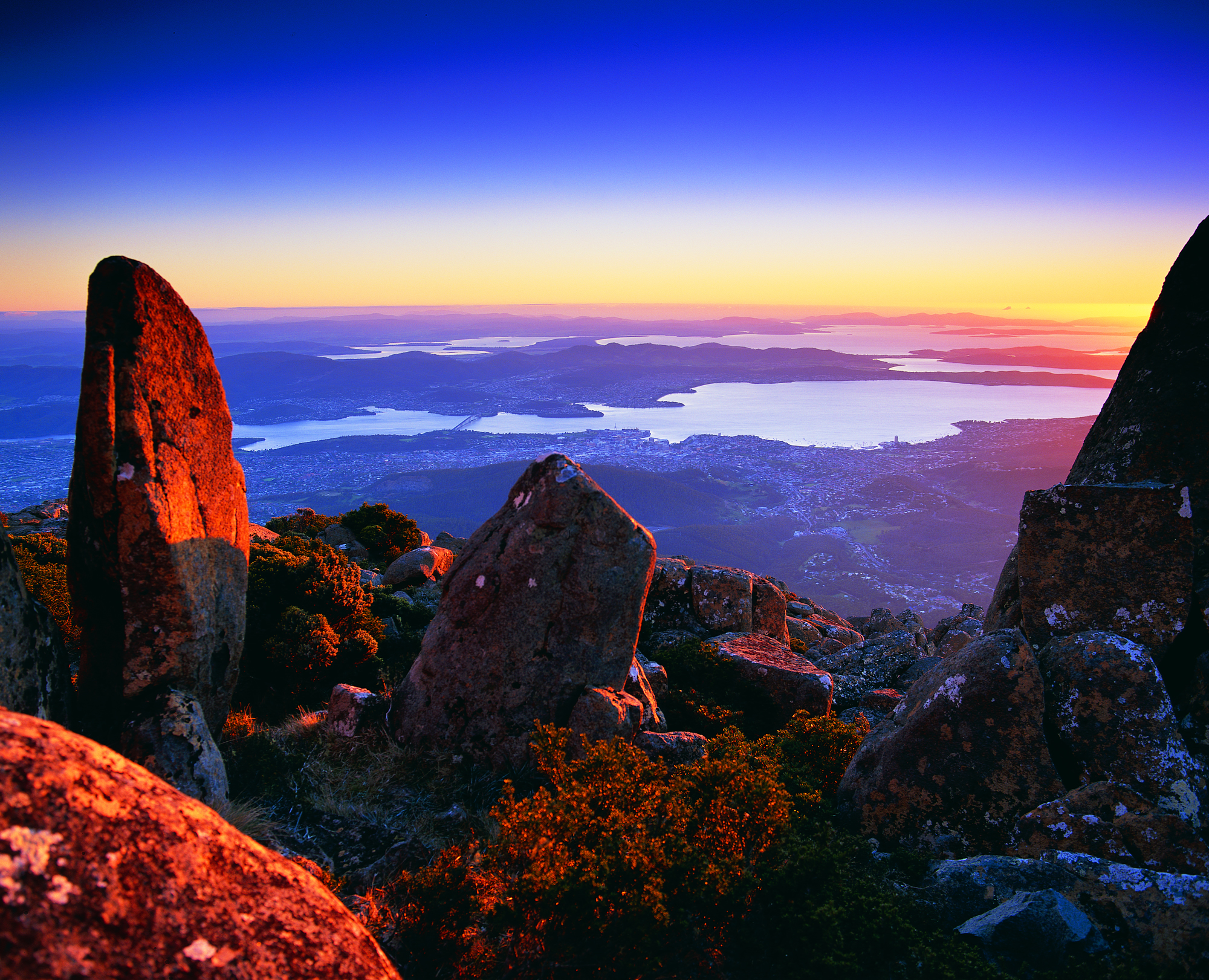
This Amazing Planet  is one of many blogs that show spectacular photographs of Tasmania’s flora, fauna and landscape. Go to Nightscape-Hobart for a stunning visual treat. Enjoy looking at part of the glorious Greater Hobart Area, at night, photographed from on top of Mount Wellington. Between the two sides of the city, the rich blue Derwent River passes on its way to Stormy Bay and then the sea. The brightly lit Tasman Bridge can be seen to join the two shore lines.

From the sea to the source; stories of a river on the other side of the globe

Two years ago, Helen Ivison published River Derwent: From Sea to Source (Amberley Publishing).

 Ivison River Derwent

 The promotional puff declares this book ‘brings to light tales and stories of fascinating events, landmarks and people. River Derwent: From Sea to Source is essential reading for anyone who knows this river well, and also for those who are visiting the River Derwent for the first time.’  But what is the author referring to?

Hers is the Derwent River in the Cumbrian region of England which flows from the mountainous Lakes District in two strands, one of which starts near Styhead Tarn. The two strands meet at Grains Gill, and continue in a north easterly direction as a single river towards an expanse known as Derwent Water. The river passes through this ‘lake’ then eases into a north westerly direction across country before flowing onwards through Bassenthwaite Lake. Finally, the English Derwent River turns westwards and empties into the Irish Sea.

By contrast Tasmania’s Derwent River flows generally in a south easterly direction from Lake St Clair, through steep narrow gorges, curving around farmlands, before passing between the two sides of the Greater Hobart Area into Storm Bay. The man-made lakes of Lake King William, Wayatinah Lagoon, Lake Catagunya, Lake Repulse, Cluny Lagoon and Meadowbank Lake all disrupt the progress of the River. These lakes have resulted from dam building as part of hydro-electricity generating projects over the past century.

Kunanyi

Mount Wellington was a prominent feature in the lives of the Moomairremener people for thousands of years before white settlement of Van Diemens Land, later to be renamed Tasmania.  The indigenous names include Kunanyi, Unghbanyahletta and Poorawetter. I understand that the Palawa (which seems to be a collective term for all Tasmanian aborigines – perhaps a blog reader might be able to supply further information?) who are the surviving descendants of the original indigenous Tasmanians, tend to prefer the former name – Kunanyi.

A couple of years ago, the Tasmanian government introduced a dual naming approach to a number of geographical features around Tasmania, and these included the mountain which towers over the Greater Hobart Area and the Derwent River. The then Premier Lara Giddings remarked ‘Dual naming is about recognising the Aboriginal community’s rightful status as the first inhabitants of this land and celebrating their living culture, traditions and language’.

20140926_123103

Photo taken from Bellerive Bluff on Stage 4 of my walk along the Derwent River.

20141010_103145

Photo taken between Rose Bay and Lindisfarne on Stage 5 of my walk.

20141031_132509

Photo taken from Old Beach on Stage 7 of my walk.

20141111_104035

Photo taken from Green Point on Stage 8 of my walk.

I am including a posting specifically about ‘the mountain’ as locals refer to it, because it has been a significant marker on my trek from the mouth to the mouth of the Derwent River via the Bridgewater Bridge, and I am about to lose sight of it.  From Granton, as I walk west along the River and then northwards, the mountain will no longer be in view.

Current official information about walking tracks, facilities, weather related precautions and other details associated with the mountain can be read at http://www.wellingtonpark.org.au/  Note that you can download maps from this site.

Opera (not Oprah) and the Derwent River

How can I make a connection? This blog is not meant to be a diary of my life rather a record of my walk along the Derwent River in Tasmania. However, when I experience something wonderful I feel enormous pressure to share.  My challenge, therefore, is to make a reasonable connection with the Derwent River.

Yesterday I watched, via their program ‘Live in HD’, one of Metropolitan Opera’s (New York) latest performances of Richard Wagner’s opera Die Meistersinger von Nürnberg.

The connection I am making is slim and relates only to the location of my viewing.  The opera was screened in MONA’s (Museum of New and Old Art) Cinemona theatre.  Long term followers of this blog will know that this internationally renowned Museum is located directly on the western shore of the Derwent River within the Greater Hobart Area (I walked there in Stage 9 and left there on Stage 10).

Another tidbit of connecting information is that a 3 Act opera named ‘Mona’ was premiered at the Metropolitan Opera just over a century ago (yes I am clutching at straws).  In her book American Opera, Elise Kuhl Kirk remarks: “By the time Mona was given its premiere at the Metropolitan Opera in 1912, audiences had wearied of German ideology. Parker’s heroic libretto was ‘somewhat grey’ some said … Parker admired … Wagner.”

The Met’s latest performance of Wagner’s Die Meistersinger von Nürnberg was definitely not grey. It is the story of a man in love who needed to become a mastersinger, but had no experience and possibly no talent, in 16th century Nuremburg Germany. Richard Wagner wrote and composed this opera in the 1860s.

Through their ‘Live in HD’ program, the Met releases a series of operas around the world each year.

Years ago, the CMAX at Devonport on the northwest coast of Tasmania was the only cinema in this State to screen the series. In the past couple of years MONA at Berriedale has also offered the fabulous opportunity to see what amounts to current performances (the actual performance would have been staged in New York only a few weeks ago), current sets and current sophisticated back-stage technology.  The singers are world class at the top of their careers, and the sounds they make can be sublime. During the intermissions, routinely a notable opera singer interviews members of the cast, sometimes the conductor of the orchestra, the Stage Manager or others – all of which adds immeasurably to the pleasure of the experience.

Die Meistersinger von Nürnberg is Wagner’s longest work and the performance lasts over 6 hours including the two intermissions.  The outside temperature in Hobart was very warm yesterday so being able to immerse myself inside watching the performance made me feel extremely fortunate.

Words such as thrilling, brilliant, overwhelming, powerful, breathtaking, and rousing all come to mind when I remember my experience – especially in the third Act.  This opera will be rescreened at MONA tomorrow (23rd Feb) and again on Friday 27th Feb for anyone who is interested to visit MONA by the Derwent River.  I feel sure you will have heard the main theme of this opera before: check out the start of an orchestral performance at  https://www.youtube.com/watch?v=JKG8ZxEOdwE  (Published on Apr 6, 2012 Full Opera Recording “The Mastersingers of Nuremberg”. Sung by Theo Adam, René Kollo, Geraint Evans, Peter Schreier, Helen Donath, Ruth Hesse. Recorded by Staatskapelle Dresden and the Chorus of the Staatsoper Dresden. Conducted by Herbert von Karajan (EMI, studio, 1970).)

Walking along the wharves of Sullivans Cove, Hobart

On Stage 11, after walking along Hunter St, I turned right to walk along the Franklin Wharf street, and had the Derwent River on my left and an enclosure for fishing and other vessels to my right. The morning was fresh, the sun was shining and it was all together delightful. Not many people around. The mountain, clearly visible, looked down on the centre of Hobart and over the wharves. Clouds were reflected serenely in the water.

20150119_072745 20150119_072147

A family of bronze sculptures, perched life-like on rocks on the River side, is much loved by visitors.

20150119_072515 20150119_072503

Passing Mures fish restaurant on my right, I continued on until I could see the row of floating fish shops selling fresh and cooked fish and other seafood.

20150119_072706 20150119_072651

A minute later, I was standing on the celebration platform used when the Sydney to Hobart Yacht race boats arrive. I looked across to Elizabeth Pier which contains accommodation, conference facilities and a number of eateries (where sitting outside is such a pleasure).  In the photo below the ‘tall-ship’ replica Lady Nelson sits outside the T42 restaurant.

20150119_072901

Opposite Elizabeth St pier, a number of buildings of different architectural styles and vintages line part of the street. Continuing to the other side of the Elizabeth St pier, a second tall ship, the Windward Bound offers sailing trips.

20150119_073148 20150119_073111

On the next pier after the one in the photo above, a couple of the contemporary camouflaged MONA ferries sat either side within the slightly mobile surface of beautiful glassy water.  Taking a trip on these ferries down the Derwent to and from MONA (Museum of New and Old Art) located in the suburb of Berriedale (I walked through that on recent Stages) helps you to see parts of Hobart you would not normally see, and it gives you a perspective on the distances over which the Greater Hobart Area sprawls. It is interesting to reflect on the two extremes of water vessel technology, when you look at the 19th century sailing ship close by a state-of-the-art catamaran.

20150119_073231

These starting sections of my Stage 11 were colourful and tranquil. It’s a free, easy, stroll along the waterfront and there is much to see looking out onto the side of the Derwent River. The next posting on this blog will look at landmarks on the non-River side of the streets.

Goodwood. Not sure about the ‘good’.

After walking across Goodwood Road (on Stage 10 of my walk along the Derwent River) which extends from the Bowen Bridge at one end to Glenorchy suburbs at the other, I was puzzled by a sign on one corner indicating behind it was a Model Park.  There were no trees. What sort of park was this? It seems this is a place for big boys to play with their model cars etc.  Special tracks were clustered in different parts of the ‘park’.

20150109_093005

Not much further along the road to the left (Innovation Drive –someone gave this name a lot of thought and presumably smirked in satisfaction) was signed as the entry to Tasmania’s hopes for technological innovation, Tasmanian Technopark.

20150109_093306

The Technopark was the brainchild of a government minister and his public service department around 2000. A small amount of information can be read at http://www.stategrowth.tas.gov.au/home/about_us/tasmanian_technopark. A federal government website has a whisper of additional information at http://www.australiangovernmentgrants.org/TASMANIAN-TECHNOPARK.php. I am surprised that there is no easily googled publicity about the achievements of this program. Can Tasmania ever equal the cut and thrust of innovation coming out of other small or remote places like Singapore, Finland, Iceland, etc?  What are we doing right and what could be done better to achieve successes?  Who knows? I couldn’t find any such information on the internet.

In the absence of any clear way to walk around the Derwent River edge of Dowsing Point, on which the Technopark is located, I thought it best to leave that exploration for another day and to continue along Howard Road.

Goodwood, in my experience, turned out to be the dog poo suburb of the Greater Hobart Area.  Excrement was everywhere in perfect form or squashed on the pavements, or the various colours dotted grassy verges.  I didn’t waste time on photography for which I am sure you are thankful – the choices were too great!

Firstly I turned left into Negara Crescent which was a street combining mean, low level, paint-flaking, unmown lawns, weed infested residential properties (okay – well not all were, but many were) with light industry such as Linen Services Tasmania, boat works, Anchor Wet Suits, Towbar and Crash bar repairs, fishing supplies, and a large unnamed workshop building emitting unpleasant chemical smells. Those houses which had Derwent River frontage sometimes had escaped overgrown blackberry infestations blocking river access in their back yards. There wasn’t a sense of wanting to live caringly or beautifully here. Accessing the River is impossible without entering private land around this locality. The built-in nature of some parts can be seen on the sign for a block of land that has been sold.

20150109_094257

By 9.45am I was joining back onto Howard Road. I walked on past bus stop 34, and the nearby Take Away Food shop and reached the Giblin Reserve around 9.50am. Photos of the surrounds are as follows:

20150109_095701  20150109_095658  20150109_094705

I sat for a while in the Reserve, watching a man in his car eating his take away meal, and taking in the surroundings.  This was a part of Prince of Wales Bay.

20150109_094717  20150109_095819

In the distance I watched the steam/smoke pouring from the zinc works of Nystar, a large industry owning considerable property along the Derwent River a little south from where I sat for a while and soaked in the atmosphere.

20150109_094734

Once I continued walking southwards around the Bay, I passed a kid’s playground, BBQ area, public toilets and ducks quacking.  When stymied by lack of water access around 10.05am, I walked up onto Gepp Parade and walked past a tree laden with not yet ripe nectarines, and later a row of junky looking boathouses. I wondered who wouldn’t be interested in removing their half sunk boat.

20150109_101243

Eventually, through the bitumen path, weeds began to multiply then suddenly this ‘formal’ path stopped and an occasionally trodden pathway through the weeds was all I had to continue on.

20150109_101335

I couldn’t help thinking that wherever a local government area is almost at the end of one and near the start of another area, there is more rubbish not collected and the general appearance of places is rather shabby. This has been the case on earlier stages of my walk, and now as I was at the extremity of the City of Glenorchy and coming closer to the City of Hobart boundary, the amount of visible rubbish and untidiness was escalating.

However, looking out over the water of the Bay (and if I tried not to study the weedy edges with their coloured flotsam and jetsam) to Mt Direction on the other side of the Derwent River, presented me with an attractive view.

20150109_101749

When I could get back down onto a weedy area, I followed man-made tracks and continued almost to the Sewage Treatment Farm (which I could see had wired fencing into the water that barred my continuous shore access) then headed up through the trees and onto a disused railway line. I crossed this, climbed a weedy rise spattered with rubbish, clambered over a metal guard rail and stood on Derwent Park Road which is the main road to Nystar and other industry located by the River. It was 10.25am when I reached this point. I had been plodding along for almost three hours.

Yesterday I completed Stage 10 of my sequential walk along the Derwent River

The goal for Stage 10 was to start at my last stopping point, MONA in the middle of Berriedale on the western shore of the Derwent River, and continue to Lutana the last suburb of the City of Glenorchy before the City of Hobart starts. But I went further.  Much further.  Almost much further than my feet could take me.  I walked to Hobart.

Over future posts I will write up the stories of the walk, what I saw and what I experienced, but for now it’s enough to say that I am continuing with this massive project to walk both sides of the Derwent between the mouth and Bridgewater, and then onwards to Lake St Clair. Once I get walking it is always so addictive.  Even when my feet feel crippled, I say to myself … ‘go just a little bit further. What else will I be able to see with fresh eyes?’

The day was gloomy with a cloudy sky, and Mount Wellington had veils of clouds covering at least part of its prominence most of the day. But it didn’t rain and so was perfect for walking.  However, the weather ensured the photographs were without sunshine.
Yesterday I covered 12 kilometres of the length of the Derwent River on the western shore (making 22 kms in total on the western shore), and walked approximately 19 kilometres (making a total of 130 kms to date) to achieve that distance. This distance also takes in the streets and paths on which I walked that led to dead ends so that I needed to retrace my footsteps.

Of the many highlights of the walk, I saw the building that once started life as Rosetta Cottage, and powerful Clydesdale horses with their large hairy feet.

20150109_162649

I surprised a friend still in pyjamas when I went visiting for the first time in my walks. The hot cups of tea were most welcome.

I am always excited when I walk the striped edged boardwalks of GASP (Glenorchy Arts and Sculpture Park) or pass the boatsheds of Cornelian Bay and it was no different yesterday.  See the photos below for a taste of the colour.

20150109_084404  20150109_145335

I very much enjoyed looking at the eastern shore where I had walked during past stages and seeing the landscape from a different perspective.  I felt it made the Greater Hobart Area seem undeveloped in a way which is quite amazing for a capital city. For example, Bedlam Walls on the eastern shore from the western shore of the Derwent River, in the photo below.

20150109_123940

From comments I have received, I know my walks are inspiring others to think about what they might do. Even if you choose not to walk, perhaps you can set yourself other challenges.

My next walk will start at Hunter St at Sullivans Cove on the wharf in Hobart and probably extend to Kingston.  But before then I need to record the details of yesterday’s walk.

Rosetta on the Derwent River

My next walk along the Derwent River will start half way through Berriedale and pass by the suburb of Rosetta before moving onto others. I have tried to discover how Rosetta came to be named and, while I learned a little of its history, I am not certain why it was given this name.  However, I believe that our local suburb of Rosetta is indirectly named after an Egyptian town.

I suspect it all started around the time when the internationally known Rosetta Stone was found in 1799 (note: the first European settlement along our Derwent River started in 1803).  The Rosetta Stone was found by French soldiers, (under Napoleon Bonaparte’s command) who were rebuilding a fort in Egypt, in a small village called Rashid (but known as Rosetta by the Europeans).

Wikipedia offers the following information: “Rosetta (Arabic: رشيد‎ Rašīd IPA: [ɾɑˈʃiːd]; French: Rosette) is a port city on the Nile Delta in Egypt, located 65 km east of Alexandria. Both the Arabic name Rašīd (Interesting unrelated sideline is that Ar-Rašīd meaning “The Guide”, is one of the 99 names of Allah) and the western name Rosetta or Rosette (“little rose” in Italian and French respectively) are corruptions of a Coptic (language from the native Christians of Egypt) word, Rashit or Trashit.”  I can pronounce Trashit, Rashid and Rosette/Rosetta so that they sound similar. Can you?

Read http://www.touregypt.net/rashid.htm#ixzz3NvMb6Iyk for more information about the town of Rashid. Apparently the highly green Egyptian town on the Nile River was typically tranquil with vast gardens, orchards and date-palm plantations, in addition to a multitude of beautiful historical houses, inns and mosques adorned with exquisite decorative inscriptions and woodworks. The town was known as the ‘Rose of the Nile’ by Europeans. I guess the name Rosetta was given to our suburb for the underlying European meaning of rose; a thing of beauty.  Hobart’s Rosetta is located on the southern side of Tasmania’s major river in a beautiful setting within the City of Glenorchy as part of the Greater Hobart Area.  However it is neither a city nor a port.

In 1807 as part of the Alexandria/Fraser expedition to Rosetta in Egypt, British forces led one group of local inhabitants in a civil war against another group led by a local leader.  Britain’s intention was to break the Ottoman-French alliance. As a result, in the first decade of the 1800s, I suggest that Egypt would have been highly visible in English news and the battles would have been known in the colonies.

Irene Schaffer, a Rosetta resident and local researcher offers historical information about the original settlement at http://www.tasfamily.net.au/~schafferi/index.php?file=kop79.php. John Berrisford and wife arrived in Australia from England on the First Fleet in 1788. Then, in 1808 John and his family sailed to Hobart Town. In subsequent years, they settled along the Derwent River in the area now known as Berriedale Bay and which extended to the south-east past Rosetta High School, and they built Rosetta Cottage (later renamed Undine Inn). 140 acres of land, now part of our suburb of Rosetta, was granted by NSW’s Governor King to John Berrisford in 1813.

My last walk along the Derwent River finished at MONA a little to the north of Rosetta. My next walk will start by passing Berriedale Bay. I look forward to seeing the old house – albeit with extensions and renovations since John Berrisford was alive. A photograph of this property, now known as the Rosetta Colonial Accommodation, can be seen at http://firstfleetfellowship.org.au/stories/john-hannah-beresford/. This website also provides more detail about the Berrisford family and their history.

Perhaps, through news from England, John Berrisford heard that Rosetta was the ‘Rose of the Nile’ and, in believing the British intrusion into Egypt was glorious, named his house as a show of support.

As a contrast from the historical background, I have located a contemporary profile for Rosetta. The population is 2567, the median household weekly income is $1050, the median age of residents is 45 years, the average household size is 2.4, almost 60% are married or in a de facto relationship, almost 40% are either under 5 years of age or over 64 years of age, weekly rent is $340, and the median house price is $319,455.

Around the corner from the mouth of the Derwent River, at Clifton Beach

Yesterday, the temperature at my home was in the high 30 degrees but today the temperature was much more pleasant and only rose to a little over the mid 20s. In the spirit of getting back out into the environment and not worrying about heat exhaustion, this afternoon Je and I headed off to have a look at Clifton Beach. This is not a place easily accessible by public transport unless you have time to take a long walk of many kilometres from a distant bus stop. So this Beach was accessed today by starting with a private car trip.

Neither of us had visited Clifton Beach or the adjacent Clifton Beach Conservation Area nature reserve for many years yet it’s a stunningly beautiful location only 25km from the centre of Hobart. The sky was cloudless, and the onshore breeze kept us comfortably relaxed.

This beachside suburb to the north of the South Arm peninsula and therefore north of the mouth of the Derwent River on the eastern shore, is part of the City of Clarence in which I live, and part of the Greater Hobart Area.

Clifton Beach is a 2.1km long wide sandy beach backed by deep revegetated 20 metre high sandy dunes. The beach is bordered by 54m high Cape Deslacs in the east and 50m high rocky cliffs in the west that run south for 3.5 km rising to 100m high at Cape Contrariety. At the southern end of the beach, a Surf Club is central to the protection of swimmers. However out on the waves, and typically clad in black wet suits, were sun-bleached surfers. Have a look at http://www.surf-forecast.com/breaks/Clifton-Beach which has a changing selection of photographs showcasing this amazing beach – plus you can check out the forecast if you want to go for a surf. One of the photos looks towards the southern end, another looks across Storm Bay to the Tasman Peninsula, and the other is a huge wave the like of which we did not see today.

The photo on http://en.wikipedia.org/wiki/Clifton_Beach,_Tasmania shows the cliffs at the northern end marking Cape Deslacs. When we followed a track out from a carpark, we found ourselves about half way along the long beach so we turned north and walked to the cliffs in the photo, passing a few happy walkers and joggers.  A multitude of empty shells and dying/dead jellyfish lined the high tide mark. Dominican and Silver Gulls hovered. The crumbly sandstone strata in the cliffs were majestic. The rocks at the water edge were covered in baby black mussels. Under the waves crashing onto the rocks were thick unforgiving ribbons of kelp – the sort that could strangle and drown you if you were foolish enough to swim here without care.

Our view across the white capped waters of Storm Bay included a glimpse of Bruny Island to the south west on our right, and the western side of the Tasman Peninsula on our left.

We paddled in the breaking waves of cold water then trailed wet trousers across the hot sand.  We longed to swim, but this is a very dangerous beach for undertows, powerful currents/rips and back surges, and unexpected changing sand bottom levels. People have died here from time to time after being seduced by the jade coloured waters, the clarity and cleanness of the water, and the seeming safety of it all.  But the message ‘to swim between the flags’ indicating you should not swim unless there are life guards present and when they have put up flags indicating the safest stretch to swim between, needs to be adhered to at Clifton Beach.  Today Je and I could see some of the turmoil beneath the waves, and the contrary action of waters moving in and out seemingly simultaneously.  The clear glassiness of the water was so very enticing and, when licking my lips I tasted salt, I had a difficult time resisting going into the water.  But the sand was soft and warm so a great lingering stroll was the wonderful substitute.

History of our Claremont by the Derwent River

It is one thing to muse on who my readers are but now I am focussing on our suburb of Claremont and its history. During my last walk I passed along the Derwent River foreshore of Claremont, discovered the Claremont Plaza, walked around the Claremont Golf course and spent some time in the Cadbury chocolate manufacturing factory.

Wikipedia informs me that “Claremont is a suburb of the City of Glenorchy, part of the greater Hobart area, Tasmania, Australia. It is named after Claremont House (at 12 Lady Clark Avenue, Claremont) which was built in the 1830s by local settler Henry Bilton, who named it after one of the royal homes of England.” When you read http://www.nationaltrust.org.uk/claremont-landscape-garden/, which provides some information about Claremont House in Surrey England, you will learn that it was “Once a Dukes’ retreat and a playground for princesses…” I could find no information about whether any of England’s royal family ever visited our Tasmanian Claremont House. Probably not.

Information about the original owner of the House, Henry Bilton can be read at http://claremonthouse.com.au/history/history-private-ownership-1825-1940/. He first settled in Van Diemen’s Land in 1825 and in the following year he acquired the property on which Claremont House was built. Apparently Bilton’s occupation was a General Merchant and Importer.  The site http://www.watersideaccommodation.com/downloads/HistoricalSummarytheClaremontAustinsFerryArea04May07.pdf declares: “Claremont, or Lady Clark House as it has come to be known as, was built by the early pioneer Henry Bilton. Henry came to Tasmania on medical advice in 1825. He became a merchant and later a gentleman farmer. As the first importer of Leicester sheep to Tasmania he gained significant wealth and turned his attention to politics.”

The following photo of Henry Bilton comes from http://www.glenorchy150.com.au/gallery/.

Henry-Bilton-re Claremont

Detailed information about Tasmania’s 1839 (decades before the Californian settlement) Claremont House can be read at http://claremonthouse.com.au/history/.  Right now, the house is up for sale: see photographs and details at http://www.domain.com.au/property/for-sale/house/tas/claremont/?adid=2009725372.  Perhaps you might want to buy it!  There is no range of prices given, so the sale is ‘by offer’.

Claremont House, in the Greater Hobart Area, is located away from the Derwent River foreshore so I did not go near this during my last walk.