Tag Archives: Blackmans Bay

The Fall of the Derwent

Early during my walk along Tasmania’s Derwent River from the mouth to the source, I was travelling near Repulse Dam on a reconnaissance trip when I came across two others.  It was a strange experience.  Previously I had become aware that two women planned, with assistance and support from others, and with the direct engagement of specific groups of people in some parts, to walk from the mouth to the source.  That day, as Andrew and I drove around for me to suss the landscape and the walking route options, when I saw two women seeming to do the same, we stopped them and I asked questions.  ‘Yes we are those women’, said Justy Phillips and Margaret Woodward.  I am sure they were as surprised as I was.

Since then, Justy and Margaret have made their way alongside various parts of Tasmania’s Derwent River and arrived at Lake St Clair where they were Facebooked taking a dip in those cold waters, seemingly delighted with their arrival.

Their project was very different from mine.  In my case, I wanted to walk around the whole of the Greater Hobart Area, and then to walk every metre of the way to the source at St Clair Lagoon dam.   By contrast, Justy and Margaret walked alongside parts of two Derwent Rivers; Tasmania’s Derwent River and the other in Cumbria England.  The experience of and learnings from their walks were used as part of the basis to write what they describe as a ‘fictionella’; written in the form of text artwork, similar in appearance to poetry.

That book is titled Fall of the Derwent. In this website you can see  range of photographs including two where Justy and Margaret are holding their black covered book.

Cover of book.jpg

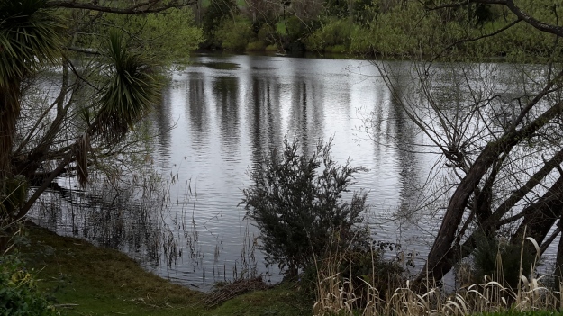
The title of the book references a drawing by an early Tasmanian surveyor George Frankland which he named ‘Fall of the Derwent’.  Colonial artist Thomas Bock engraved the image and James Ross printed the picture in The Hobart Town Almanac in 1830. The picture was drawn at a site near unpassable rapids on the Derwent River upriver from New Norfolk.  When Justy and Margaret walked past what they believed was that place, they took a suite of black and white photographs;  half a dozen or so of these images are bound into their book.  Without returning to that area I seem to remember the spot.  After reviewing my photographs in that area, clearly I was looking for serenity and simplicity.  I was looking at colours and contrasts.  It seems I was focusing on one way of seeing that world of the Derwent River, and Justy and Margaret’s view is an alternative.20150917_094036.jpg
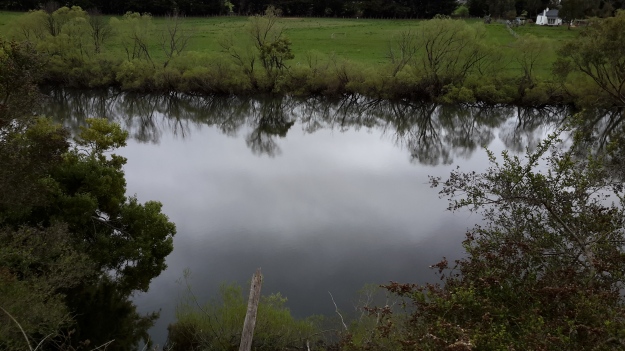
20150917_095352.jpgI did not focus on the twisted interlacing of stark and scrappy vegetation at the river edge like Justy and Margaret have done  The differences in our images is a reflection on the different nature of our projects. I wanted to entice others to be seduced by the beauty of the landscape and then to make their own journeys along the river edge (I now wonder why I didn’t see vegetation tangles as beautiful).  When I read their book it seemed they wanted to use their experiences as the basis for creative abstract thoughts; perhaps even a metaphysical approach involving questions such what is there in that world and what is it like at a more profound level.  My approach was literal and descriptive.

The Phillips/Woodward Fall of the Derwent publication presents poetry-styled ideas and comments in ‘chapters’ headed by the days of the week; the book proceeds over  44 days consecutive days – but the ideas associated with both rivers are intermixed.

“Let us begin with two rivers / And a Dad not long for living. / Two daughters …”

Despite the introductory lines, theirs is not a chronological story connecting the sequences of walking the two rivers; reference is made to other locations such as Cape Barren Island, Dover Point, and Brisbane. And the English father walked with Justy and Margaret when they traipsed near the Cumbrian Derwent. As an intertwined overlay in this book, mention is made of his declining health – Dad in pain, no longer able to feed himself, no longer speaking.  For this reason and for the manner of writing which removes easily identifiable meaning through much of the publication, this book has a limited audience and is obviously a set of personal ideas to be understood, remembered and perhaps loved by the authors. For their personal satisfaction. I was surprised that this book uses combinations of words that do not create, for most of the book,  visual images of either of the two rivers. Instead, the poetry reads as a meshing of many experiences which presumably helps Phillips/Woodward to reconstruct a feel of those experiences.

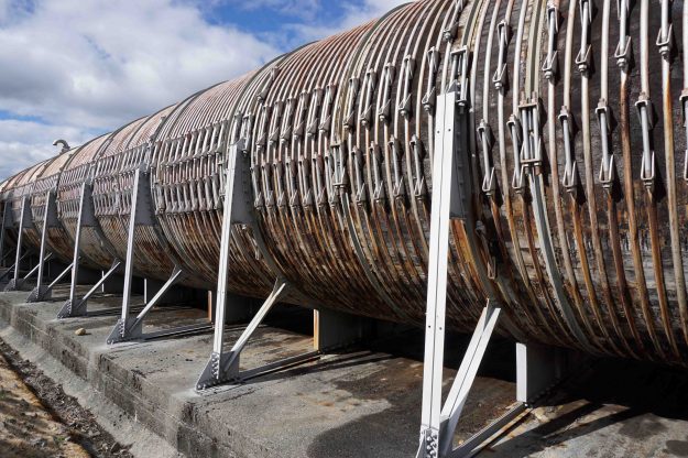
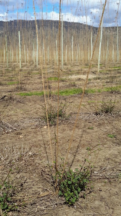
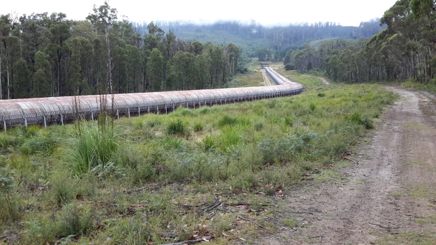
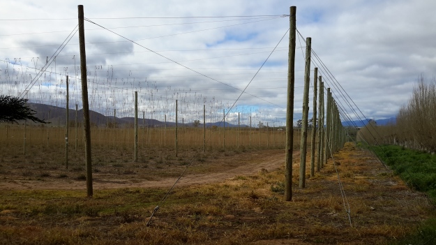
On occasion, where the meaning was clear because I could recognise specific locations, I enjoyed some of the lines. For example, “…rows of hops that string this neck of the river…” referred to the hop vines and their structural strings in the Bushy Park area.  These hop fields obviously made a significant impression on Justy and Margaret because there was a second comment on the same topic; “…the hops in single file march orderly disruption to the valley.”  Then, when they walked around the Wayatinah Power Station, “…the woodstave pipeline is a blistering gland … Draws the corset of her breathing”.  Like Justy and Margaret, I looked in awe at these two locations and their dramatic impact was described during my posts.  To remind you – here are photos of the hop fields and others of the wooden pipeline.   20150918_104145.jpg
20150918_113007.jpg

20170424_114515.jpg

DSC01655e.jpgJusty and Margaret learnt in Cumbria; “On the banks of the River Derwent, that the term ‘black market’ is born. Through the illegal trading of graphite.”  Then they found graphite was part of the geological structure at Wayatinah on Tasmania’s Derwent.  From these findings, grew the idea to play with ‘black’; the book’s cover is black, some copies are cloth bound and impregnated with carbon powder, the Fall of the Derwent and ‘black’ are interconnected within the text, and one section of the book presents a list of locations along Tasmania’s Derwent which include ‘black’ in the name; examples include Black Bob’s Rivulet and Blackmans Bay.

Phillips/Woodward’s book Fall of the Derwent was part of a public artwork presented in association with GASP (Glenorchy Art & Sculpture Park) in 2016. Further information can be accessed here. If you click on ‘Download Hydrographic Score’ you will be able to read the book online.

Fossil Cove posting 1 of 4

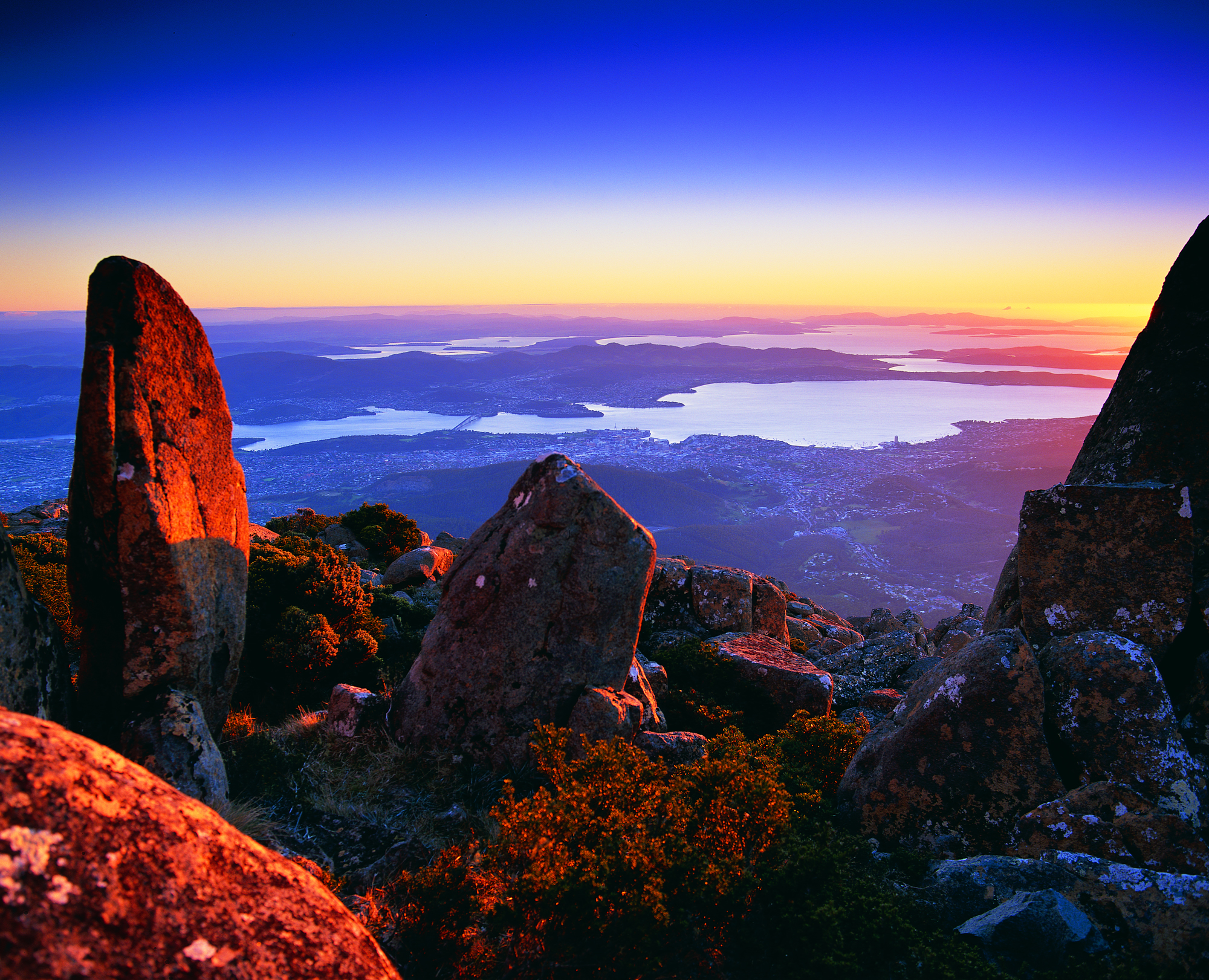
On the day when I walked from Blackman’s Bay to Point Pearson near Tinderbox, then retraced my steps to catch a return bus from Blackman’s Bay, I omitted to walk via Fossil Cove. The pathway to this secluded rock strewn cove required a detour of over 2 kilometres. Since my day’s walk to the mouth of the Derwent River on the western shore and return was expected to be over 20 kms, I resolved at the time to return on another occasion to walk this section.

I was delighted when I finally ‘discovered’ what locals and others have known for a long while.

A couple of kilometres along Tinderbox Road after leaving suburban Blackmans Bay, Fossil Cove Drive is clearly marked.  Around a kilometre down that road, a sign indicates the way to the beach.

20160331_105431.jpg

A further sign declares this area to be a public reserve and a site of national geological significance.

20160331_105508.jpg

The steep descent to the Cove was controlled by steps and dirt pathways.

20160331_110054.jpg

20160331_110749.jpg

20160331_110806.jpg

I was dazzled by views across to Opossum Bay and Gellibrand Point on the eastern shore of the Derwent River.

20160331_110828.jpg

Finally I arrived at sea/river level.

20160331_111141.jpg

20160331_111137.jpg


Maps

The Derwent River will always be your guide if you choose to walk along its length, but sometimes it is difficult to walk directly next to the river; for example structures may be built to the edge, steep drop down cliffs may raise you many metres above the water, and gates and fences may make access impossibly impassable.  In addition, when the terrain forces you away from the river, the vegetation may be sufficiently dense so that you can get lost (without map and compass – and GPS if your technology allows).

If you choose to walk the entire length of Tasmania’s Derwent River you might consult one or more of the 17 maps which cover the territory. One value is that you learn the name and shape of landmarks. Have a look at the list below:

Maps

Bear Grylls guidance

Barely a newspaper or magazine doesn’t publish a story about Bear Grylls, so it seemed only reasonable that I find a way to incorporate him into this blog. His is a life of extreme adventures and fighting for survival in tough environments, so a peaceful walk along a placid river seems a long way from his favoured pursuits.  And none are documented.  However, it is Bear Grylls guidelines for daily life which are useful for me to recall even if the going is easy.  Some of these ideas are recorded below.

  • Make the first step – that should empower you to take more steps. ‘There’s great power in just beginning and committing to action, even when you don’t feel like it.’
  • Challenge yourself – ‘I believe we are like grapes and it is only when we are squeezed that we can see what we are really made of.’
  • Try something you’re afraid of – ‘My Dad inspired me not to be afraid to go for things and take a few risks.’ ‘Failure is never failure rather it is a stepping stone to success.’
  • Energise your day – ‘a little fresh air can do the world of good.’ ‘Almost all cities have some great iconic open spaces and parks. Use them.’

After reading this list, hopefully blog readers will be inspired to get out and about. I found another blogger at http://cdeanblog.blogspot.com.au/2012/04/derwent-river-flows-and-present-people.html referenced Bear Grylls when she faced her fears and descended the cliffs into the Blowhole at Blackmans Bay, located a few kilometres short of the mouth of the Derwent River near Hobart.  Good for her!

Through the trees the Derwent River was ever present on my left then later on my right

The Derwent River flowed on my left when I headed southwards to Pearsons Point, and on my right when I returned northwards to Blackmans Bay.

On occasion I could look down the slippery gravel drop offs:

20150224_101315 20150224_101330

From time to time, surprised wallabies crashed away through the bush.  I never knew whether I was more surprised than the wallaby.  I watched wild hens roaming cleared paddocks.  I listened to all manner of froggy sounds emanating from dammed creeks. The occasional cyclist, with tyres whispering along the gravelled bitumen, passed me unexpectedly. These road bikes were always ridden by women and we exchanged brief hellos.

A few vineyards under netting were located on hill sides without afternoon sun – what does that do to the flavour of wine?  Okay – all the sommeliers and expert wine tasters out there.  What sort of wine would you expect to be produced in a cool winter and warm summer climate with the grapes mostly only seeing the morning sun in the summer? Google maps show the ‘street view’ of one vineyard at Bellendena: https://www.google.com.au/maps/place/Bellendena/@-43.037425,147.335291,3a,75y,13.59h,90t/data=!3m4!1e1!3m2!1sGy5X1ubwdRkyt-93Gur9Sw!2e0!4m7!1m4!3m3!1s0xaa6dd119e082ab39:0x68f8df55775fb029!2sTinderbox+Rd+W,+Tinderbox+TAS+7054!3b1!3m1!1s0x0000000000000000:0xce060676af8374e9!6m1!1e1?hl=en I hope you look at this street view and swivel around so you can see the terrain and can appreciate the beautiful country through which I walked.

By ten to ten in the morning I reached “Hidden Cove”, a property which promotes itself as providing a Day Spa and Retreat service: appointments are essential. For a split second I thought I should make a booking for my walk back to Blackmans Bay from Pearsons Point. The idea of a foot massage later in the day was very appealing although I had no idea whether such a service was on offer.  I did take note of the phone number 03 6229 6050 in case I wish to try it out when I return for my walk to Fossil Cove.  Their website makes the business look attractive: http://www.hiddencovedayspa.com.au/

One of the highlights of my walk was seeing casuarina trees ‘weeping’ with the weight of their strands of blooms.  Seemingly so delicate.

20150224_103233 20150224_103250

Starting out from Blackmans Bay on Stage 13

Once I was off the bus at Blackmans Bay, the Kookaburras started laughing at me  (again like at the beginning of Stage 12). Ha. Ha. Ha. H.H.H. Ha. Ha. Haa. Was this an omen that I was about to do something foolish? My goal for Stage 13 was to walk to Fossil Cove, and then walk another day for a final stage to the mouth of the Derwent River at Pearson’s Point. If you have already read my posting on the 25 February then you know I reached Pearson’s Point.  Future postings will give more details about this change of mind and destination.

As I turned left from Wells Parade into Hazell St towards the Blackmans Bay Beach, a screech of Sulphur-Crested Cockatoos circled overhead. I was on the beach at 7.45am. The water was calm and I looked over the Derwent River towards South Arm beach on the eastern shore.  The Iron Pot lighthouse on the rocky outcrop just offshore from Cape Direction, on the southern tip of the South Arm peninsula, seemed to stand up from the water like a fat thumb.  Back at Blackmans Bay Beach, the fresh sunny morning was complete with power walkers and dogs leading their owners on a walk. Public toilets are located half way along the Blackmans Bay Beach.  These are the last public toilets for anyone walking further south.

How fortunate Tasmanians are to have morning views along beaches such as that at Blackmans Bay.

20150224_074639

I turned southwards and at 7.51am had reached a tiny yellow sign on a post indicating the Suncoast Headlands Walking Track was ahead. A few minutes later I reached the main sign.

20150224_075230

This sign was accompanied by another nearby.

20150224_075213

I followed the good wide dirt track and initially thought how easy it would be for Mums with prams or people in wheelchairs to follow this path. But not so. Not much further along, I needed to climb rough dirt and log stairs and I encountered such interruptions to a smooth walk a number of times.  There were occasional splits in the track without signage, so it is possible to walk a little way off the main track before you realise what is happening.

How gorgeous the morning was.  For example, the photo below is looking back to Blackmans Bay Beach.

20150224_075545

In the photo below, the rocky outcrop at the far end of the beach is where the Blackmans Bay Blowhole is located (my Stage 12 walk there was described in Nudging my way into Blackmans Bay on Stage 12 of my walk along the Derwent River).

20150224_075925

Before my walk along the Derwent River last Tuesday

As my bus from home into Hobart city passed over the Tasman Bridge before 7am, I looked down onto a dozen or so rowing boats slipping along the Derwent River. The wedges that their passing craft made were the only patterns on the still surface of the River.

The morning was suffused with golden light forewarning the rise of the sun over the hills.  The few wisps of cloud in an otherwise blue sky were coloured silvery pink.  The temperature was a brisk 8 degrees, but I felt clean and alive prompted by such a vital looking day.

Once in the city, I walked to Franklin Square ready to wait for the next bus to Blackmans Bay, my starting point for Stage 13. While waiting, I walked through the park and admired the grand symmetrical fountain splashes around a large bronze sculpture of the eminent 19th century Rear Admiral Sir John Franklin.  Overhead, I watched a squawk of Sulphur-Crested Cockatoos, with their wings lit by the first rays of sunshine, flying as a family.  Street cleaners were clearing rubbish bins and pathway surfaces.  Very few other people were out and about in the centre of the city (people were being active in the suburbs before commuting to work in the city a while later).

The large public chess set had been set out and was ready for play.

20150224_071013

As the sun struck the Treasury buildings at one end of Franklin Square park, clusters of fat seagulls (Silver Gulls) were nipping at early rising insects across the grass lawns.

Metro bus number 84 departed at 7.17am. By 7.33am we had climbed up and travelled along the Southern Outlet and were passing through Kingston. This gave me a clear cut side view of majestic Mount Wellington.  Every rock was hard edge and clear. The air was so clean.

At 7.41am I stepped off the bus at Wells Parade in Blackmans Bay, the location where I had finished Stage 12 of my walk.  The final walk to the mouth of the Derwent River was about to begin.

Blackberry pie for dinner tonight?

During the Stage 13 walk, I noticed blackberry canes running wild and plump with glistening black berries.  Fruiting blackberries grew rampant on the sides of the roads.  On my return trip to Blackmans Bay from Pearson’s Point, I sampled the odd juicy berry; they were sufficiently sweet to enjoy but sufficiently tart to add sugar in the cooking if wished.

My thoughts flew to hot blackberry pies. I imagine as you read this that, if you have known such leasure, you are licking your lips and savouring the memories of their deliciousness.

As I walked, I considered how easy it would be to make a pie.

For Hobart locals, I thought you should buy a pack of frozen puff pastry on the way home from work or wherever.  Throw it into the fridge, grab your pie dish, jump in the car or take a bus then travel through Blackmans Bay and onto the Tinderbox Road.  When you have passed the intersections with Wells Parade and Suncoast Drive, the next road left is the Treatment Plant Road.  Drive/walk down this road until you reach the Dog Exercise Reserve.  Walk to the left of the enclosure just a few metres and all along the path are easily accessible blackberries ready to be picked.  Fill your pie dish. Alternatively you can continue driving up Tinderbox Road and stop wherever you see the multiglobes of these very ripe berries.

When you get back home, if you wish, sprinkle with sugar to taste.  Place a slab of puff pastry over the dish.  Make some fancy holes with the fork tines to let the steam rise away from the pie so the pastry becomes crisp, then place in a preheated oven and bake around 200 degrees until the puff pastry has risen and turned a golden colour.  I know some people eat their portion of blackberry pies neat, while others scoop icecream or pour cream over the dish.

Nowhere did the berry bushes seem as if they had been sprayed with pesticides. I talked with a local woman who was picking berries off the fence line at her property and she was confident none had been sprayed. I suffered no ill effects from eating them.

If you are a reader who has never seen a blackberry, here is a photo:

blackberry_blackberries_fruit_224333 free image blackberry_186056

Please tell me if you are now inspired to make a blackberry pie, if you live somewhere close to fruiting blackberry bushes.

A new milestone marking the 13th stage of my walk along the Derwent River: I reached the mouth on the western shore. Whoppee Doo!!

Yesterday, I completed the first part of my walk along the Derwent River: an exciting achievement.

Last August I started walking from the mouth of the River at Cape Direction on the tip of the South Arm peninsula and now, at the end of February, I have completed the distance from that mouth to the Bridgewater Bridge and back on the western shore to Pearson’s Point near the settlement of Tinderbox.

On the 8th stage mid-November, I had the first major milestone when I finished the walk from Cape Direction to the Bridgewater Bridge. This 13th stage was the culmination of walks from the Bridge back to the mouth on the western side of the River.

During yesterday’s walk, I covered about 5km of the length of the Derwent River.  By my reckoning, the total distance of the Derwent River on the western shore from the Bridgewater Bridge to the mouth is 38 3/4 km.

For Stage 13 yesterday, I needed to walk to Pearson’s Point from the bus stop where I finished on Stage 12 and then, on reaching my goal, I needed to retrace my steps back to Blackmans Bay to connect with a bus that could return me to Hobart.  This distance was approximately 17 kms. I have now walked at least 171km not counting getting to and from buses.  But when the walks are staggered over time, this number does not mean much.

The highlights of the walk to Pearson’s Point were mostly small and natural: rosehips, green rosellas, hum of bees, resting sheep, and the taste of delicious ripe blackberries along the way.

20150224_103540

I was surprised how close the northern part of Bruny Island was to the mainland of Tasmania (almost felt like I could swim across the D’entrecasteaux Channel) and I felt overwhelmed by the staggeringly expansive and grand views across and up and down the Derwent River.

20150224_114137

The fun part was singing (including mixing up the words in my excitement) Handel’s Hallelujah chorus (from The Messiah) at the top of my voice when I passed a large sign with the words SING. You can listen to a superb version performed in 2012 by the Royal Choral Society at the Royal Albert Hall in London England at https://www.youtube.com/watch?v=IUZEtVbJT5c

https://www.youtube.com/watch?v=IUZEtVbJT5c

Over the next few days I will write up the journey and the discoveries of Stage 13’s walk.  Then I will be looking towards a long main road walk from the Bridgewater Bridge at Granton to New Norfolk which I expect to undertake in the next couple of weeks.  Once I have reached New Norfolk I will be on the way to Lake St Clair, the source of the Derwent River.

On through Kingston still heading southwards past Boronia Beach

I finished my lunch on the south side of Browns River, crossed the pedestrian bridge over Browns River at 12.17 pm then proceeded along Osborne Esplanade (parallel and next to the Derwent River) towards the Kingston shops.  Over Christmas I holidayed in Kingston and my 3 posts titled I am on holiday watching over the Derwent River, Getting out into the air at Kingston Tasmania and Kingston Beach, Tasmania offer more information about this leg of my walk along the Derwent River.

I had the pleasure of meeting with Em for cups of tea and a long happy chat and saying hello to people I knew as they walked past the outdoor café Beachfront 32.  Immensely pleasant.

At 1.52 pm I restarted my walk southwards amidst foreshore joggers, walkers and seagulls – the sun was shining again and my world was warm.

By 1.59 pm I reached the Kingston Beach Sailing Club and could look back northwards across the sweep of water and the arc of Kingston’s white sandy beach.

20150202_135849 20150202_135818 20150202_135809 20150202_135813

The last photo looks north to the headland at the end of Tyndall Beach which was spread at the bottom of the southern end of the Alum Cliffs.

A minute later I reached the Boronia Beach Walking Track and turned left.

20150202_135909

A gentle shady path meandered along above the water and I could hear happy voices on the rocks below.   The views through the trees were spectacular.

20150202_140623

Up above me on my right were large houses with massive picture windows surrounded by high mesh fences. Then the landscape opened out and I could still look northwards to the Alum Cliffs where I had walked during the morning.

20150202_141612

At 2.18 pm I reached a gate marking the entrance to the track down to Boronia Beach, a beach that I had previously not known existed.

20150202_141714 20150202_141816 20150202_141954 20150202_142008

By 2.24 pm I was walking on the beach.

20150202_142513 20150202_142154

I remembered the chitons which had featured on a public art work at Taroona Beach and wondered whether they could be found on this beach (refer back to my posting Public art works along the Derwent River –Taroona’s Chiton for more information). I checked the rocks but found none.  I  concluded the chitons must collect together only on the Taroona Beach rocks.

The rock formations at the southern end of the beach were a surprise.  The soft sandstone has been weathered and small caves were formed into the cliff.

20150202_142346 20150202_142436

Seeing these caves cast my mind back to Kalambaka in north western Greece. Last year I visited this town and marvelled at the stunning beauties of the Meteora (refer http://en.wikipedia.org/wiki/Meteora for more information) Below is one of my photos showing the caves in some of the cliffs which hermits used to climb up and live in (and which Roger Moore as James Bond climbed over dramatically in the movie “For Your Eyes Only”).

20140607_190315 20140608_094209

Boronia Beach’s caves are smaller and different in many ways from those of the Meteora.  However they surprised me in this tucked away gem of a beach.

For those who loved the photo of mussels growing on Boronia Beach rocks which I provided in an earlier posting about the Stage 12 walk, here is another.

20150202_142536

Five or so minutes later I began the trek uphill out of Boronia Beach under old pine trees.

20150202_143006 20150202_143214

I was horrified to see thousands of escaped ‘forget me not’ plants, some flowering as they carpeted lots of the area near the beach and up the hill. I pulled out a few dozen and their roots came out easily but a concerted effort of a few days’ work to remove these before they spread any further is essential if the wild bush is to stay as pure as it can.

A gate half way up the hill let me out onto a continuing walking track at 2.36pm.  Not long after I decided to sit on the steep steps and smell, look and listen to the environment. Very peaceful.

By 2.45pm  I was walking again and a couple of minutes later I reached a gate to exit the entire walking track area.

20150202_144535

The entry was signed but, while the exit was easy, it was entirely unclear whether to turn left or right.  At the end of the dirt road in both directions I could see gates closed over the road.  Murphy’s Law has it that I will often make the wrong choice and it was no different at that point. I chose to walk down to the gate at the bottom of the road but found it entered into private property. Back up the road, lined one side with large girthed pine trees, I walked to the other gate and found no obstacle to walk around it. At 2.54 pm, I was continuing along the road watching a family of magpies fossicking in an open paddock, and later marvelling at an old crab apple and a pear tree both of which were laden with fruit.

At 3 pm I arrived at the junction with Kingston and Blackmans Bay’s main linking road, Roslyn Avenue.  The address for the dirt road on which I had been walking is Roslyn Ave 82-88, and it is directly across from Jindabyne St over the roundabout on Roslyn Ave.  One corner of the intersection is occupied by the Catholic Church of Christ the Priest and the Aloysius Primary School.

From Hinsby Beach to Blackmans Bay accomplished on Stage 12 yesterday

The goal of my walk along the Derwent River for Stage 12 was to start at my last stopping point, Bus Stop 30 on the Channel Highway at Taroona on the western shore of the Derwent River, and continue to Blackmans Bay in the local government area of Kingborough.  I did not get as far as expected, but I was satisfied when I finished 2/3 of the way along the Blackman’s Bay Beach.

Over future posts, I will write up the stories of the walk, what I saw and what I experienced, but for now it’s enough to say that I am continuing with this massive project to walk both sides of the Derwent between the mouth and Bridgewater, and then onwards to Lake St Clair.

Yesterday I covered 5 ¾ kilometres of the length of the Derwent River on the western shore (making 35 3/4 kms in total on the western shore), and walked approximately 11 kilometres (making a total of 154 kms to date) to achieve that distance; there were a lot of steep ascents and descents.

20150202_085332

This distance also takes in the streets and paths on which I walked that led to dead ends so that I needed to retrace my footsteps.

The highlights of the walk include finding a way through some of the early part of the almost untracked Alum Cliffs, the delightful walk along the tracked part of the Alum Cliffs, meeting some friendly people along the way, the unusual snake sign at Tyndall Beach, stopping for a long cup of tea in Kingston with a friend, my discovery of another tucked away beach – Boronia Beach, and the Blackmans Bay Blowhole.

There are many memorable images but my favourite for today is one of my photos of mussels growing on the rocks at Boronia Beach.  I have already made it my desktop background image. When enlarged, the blues glow.

20150202_142540

Fundamentally the Stage 12 walk was about forest and water.

20150202_113014 20150202_104740  20150202_115156 20150202_152557

The day started with my being roughly opposite Gellibrand Point at the northern tip of South Arm and finishing opposite the long South Arm Beach.

I intend my next walk will start from where I left off at Blackmans Bay and then continue into the Tinderbox area to Fossil Cove.  But before then I need to record the details of yesterday’s walk.  So Stage 13 will be a while away.

Yesterday I walked Stage 11 from Hunter St in Hobart city to Hinsby Beach south of Taroona

The goal of my walk along the Derwent River for Stage 11 was to start at my last stopping point, Hunter St at the wharf in Hobart on the western shore of the Derwent River, and continue to Kingston in the local government area of Kingborough.  But I did not get that far.  My feet said enough was enough once I found the delightful and almost hidden Hinsby Beach.

20150119_131327

Over future posts, I will write up the stories of the walk, what I saw and what I experienced, but for now it’s enough to say that I am continuing with this massive project to walk both sides of the Derwent between the mouth and Bridgewater, and then onwards to Lake St Clair.

The day was sunny with a bright blue sky, Mount Wellington was clear, and a cool breeze featured through much of the day – making it perfect walking weather.

Yesterday I covered 8 kilometres of the length of the Derwent River on the western shore (making 30 kms in total on the western shore), and walked approximately 13kilometres (making a total of 143 kms to date) to achieve that distance. This distance also takes in the streets and paths on which I walked that led to dead ends so that I needed to retrace my footsteps.

The highlights of the walk include discovering the road next to Taroona High School is a public access route which took me down to the Derwent River to a row of colourful boathouses, getting off the main road at places like Cartwright Park Reserve, and seeing the Alum Cliffs in all their majesty.  My next walk will start along the top of these.

20150119_125317

It was a revelation to watch the eastern shore and to see the suburbs and beaches on which I walked in the early stages of my walk. The day started with my being roughly opposite Bellerive and finished with my being opposite Gellibrand Point at the northern tip of South Arm.  The photo below, taken from Hinsby Beach, looks across the Derwent River to Opossum Bay Beach.

20150119_131757

I intend my next walk will start from Hinsby Beach and continue to Blackmans Bay.  But before then I need to record the details of yesterday’s walk.  So my walk for Stage 12 could be a week or more away.

Northern Pacific Seastars

A couple of weeks ago, on some of the beaches in the northern section of the South Arm peninsula, I located some seastars (orange pronged starfish) and threw them up onto the dry sand so they could no longer breed and multiply. I recorded that these seastars had infected our Tasmanian waters and were a proliferating pest. Today’s Sunday Tasmanian newspaper has published an article about the seastars’ new enemy: the University of Tasmania’s Diving Club.  Recently members of the club have been conducting a clean out of the waters at Blackman’s Bay (located across the Derwent River from the South Arm peninsula) – and doing so in a more humane way than I was.  Apparently a species of spotted handfish used to be common in these waters but is now rarely seen.  The divers hope that this fish will return once they rid the area of the seastars.

20140904_094156


Preparing for Stage 2 of the walk along the Derwent

Last week, I used TasMAP 5223 Blackmans Bay to help me navigate the South Arm / Cape Direction start of the walk. Stage 2, taking me northwards along the South Arm peninsula, will require a tiny portion of the same map. However, most of the Stage 2 walk will require TasMAP 5224 Taroona. Having said that, I believe it would be possible to walk  in the two ends of the South Arm peninsula without either map simply by asking locals to point them in useful directions.

22 Aug 2014 South Arm beach and the walking continues – Posting 7 of 8

Around 11.30 am, I made myself comfortable on a rock on the South Arm beach, ate some pre-packed lunch and enjoyed the glorious qualities of the day and the location. The view across the broad Derwent towards Blackmans Bay, Kingston, and Mount Wellington with a scribble of snow on its summit was sensational. South Arm beach stretched as a thinning arc and seemed impossibly long and pure.

The photo below is the viewpoint directly in front of me as I ate my lunch.  Glorious Mount Wellington on the western side of the Derwent River.  Closer to the shore, a platform bobbed with the comings and goings of Pied Cormorants while they searched for their fish dinners.

 20140822_114606

Meanwhile my feet hurt to walk on. I felt crippled. But I had two hours before the bus returned so, as with any days spent travelling overseas, time was not to be wasted simply sitting around.

It wasn’t part of the plan for my first day walking the Derwent, however I decided to walk (shuffle if I must) the length of the South Arm beach, then take to the road and continue on towards Opossum Bay to find a bus stop.

It took me 45 minutes to plod along the long South Arm beach. Apart from a few locals the beach was deserted, except for the Silver Gulls who entertained me with their happy feet.   George Miller – forget those penguins! Here were normal ordinary seagulls performing a manoeuvre that left me astonished. As the short cold waves spread up the sandy beach, a seagull would stand knee deep waiting for the water to recede. When the water thinned, the gull would stamp both feet alternately on the wet sand at a super speed. Obviously this practice dislodged some wonderful edibles from the wet sand. With speed and agility, the gulls grabbed their lunch with a peck of their beaks. Then the speedy stomping began all over again.  Very funny.  Very clever.

From the end of the beach it was clear there was no track around the headland and later, as I walked towards Opossum Bay, I saw a private house ‘owning’ the space – refer to the photo below.

20140822_130337

I used the gravel bicycle and walking track next to the main road which extended from the beach end of South Arm beach to Opossum Bay Store, with a bus stop opposite. This is where I finished my walk. 

During my walk from South Arm to Opossum Bay I looked back at the long stretch of South Arm Beach. Fort Hill is above the township to the upper right.  The photo below gives some idea of the beauty of the place, and I hope it inspires others to take the walk.

 20140822_124948

This last leg took about 45 minutes. On route to the store, I passed two tourist information stands, both of which referred to this roadway being part of a convict trail, something which a team of local residents have researched (http://www.abc.net.au/news/2013-12-22/a-trail-between-south-arm-and-opossum-bay-tells-tales-of-tasman/5171434). The information which I found most interesting was that approximately 70,000 people came to Hobart on the prison and other ships between 1804 and 1853. I reflected that, of course, they all had to pass by Cape Direction, Cape Deliverance, Johns Point and the beaches on which I had been walking. It’s impossible to imagine how foreign this land of ours would have looked. And to think I started the day with trepidation!

Celebrity spotting: Brian Ritchie, once of Violent Femmes and now of MONA fame, filling up his car with fuel at the Opossum Bay store. Well I think it was him.

If you follow my walk and are in need, the public toilets are located 100 metres further along from the Opossum Bay Shop toward Opossum Bay beach.

Outside the Opossum Bay store are tables and benches, so I took the opportunity to finish my lunch. Sitting nibbling and watching people come and go occupied me until it was time to catch the bus.