Tag Archives: Kingborough Council

Picnic on Hinsby Beach

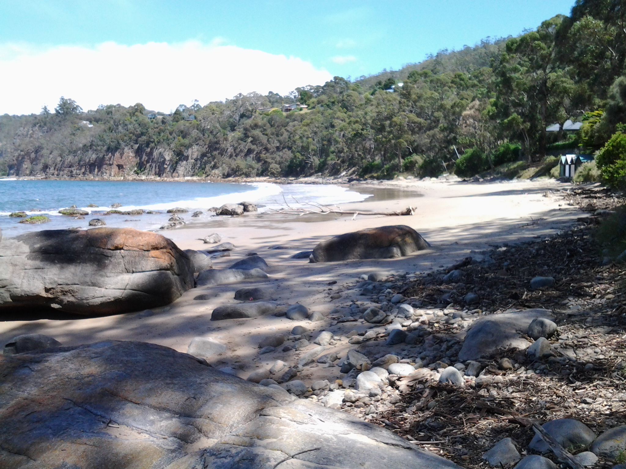
Local Hobart followers have, from time to time, been fascinated by the new places discovered on various Stages of my walks along the Derwent River.  A number of followers fell in love with my description and photos of Hinsby Beach, a beach which I like many others had not previously known existed.

Recently a group of us made our way to Hinsby Beach for a picnic. This was not a normal bus connected walk; rather I sat in the luxury of a car as we travelled to our destination. We parked at the bottom end of Hinsby St which drops down from the main road in the suburb of Taroona. Then, with small backpacks and an esky, we strolled down the tree-lined bitumen track to the beach.  This short track is enticing because, from Hinsby St a circular shape of light can be seen at the bottom end and the picture you see is a small arc of sand and waves spreading up and down.  Seductive.

Rugs were spread out over the sand. Food was spread out. Drinks were shared.  Stories were told. Laughter wove its way around us.

For a short period after we arrived, we ‘owned the beach’. Then couples strolled down, swimmers dashed into the wavy water, and kids of various ages enjoyed their own space at different points along the sand.  We felt we had all the space in the world.  A big sky. An expansive Derwent River.  Deep clean pale yellow sand. Despite clouds crossing the sky, the temperature wasn’t cold.

20150301_123325

Being on Hinsby Beach brought back all the memories of the day I discovered this wonderful hideaway at the end of Stage 11, and then I remembered the day I started off at Hinsby Beach and clambered around over the Alum Cliffs before finding the official track on Stage 12. Before leaving the beach we walked to the southern end and found the correct track a few metres to the left of the track ascending from wooden stairs, which I took and led me to an awkward gully crossing,being on private property and fence hopping to get back onto the ‘real’ path.  Where are the signs?  Kingborough Council, can you please make it clear which track to take?

20150301_123311

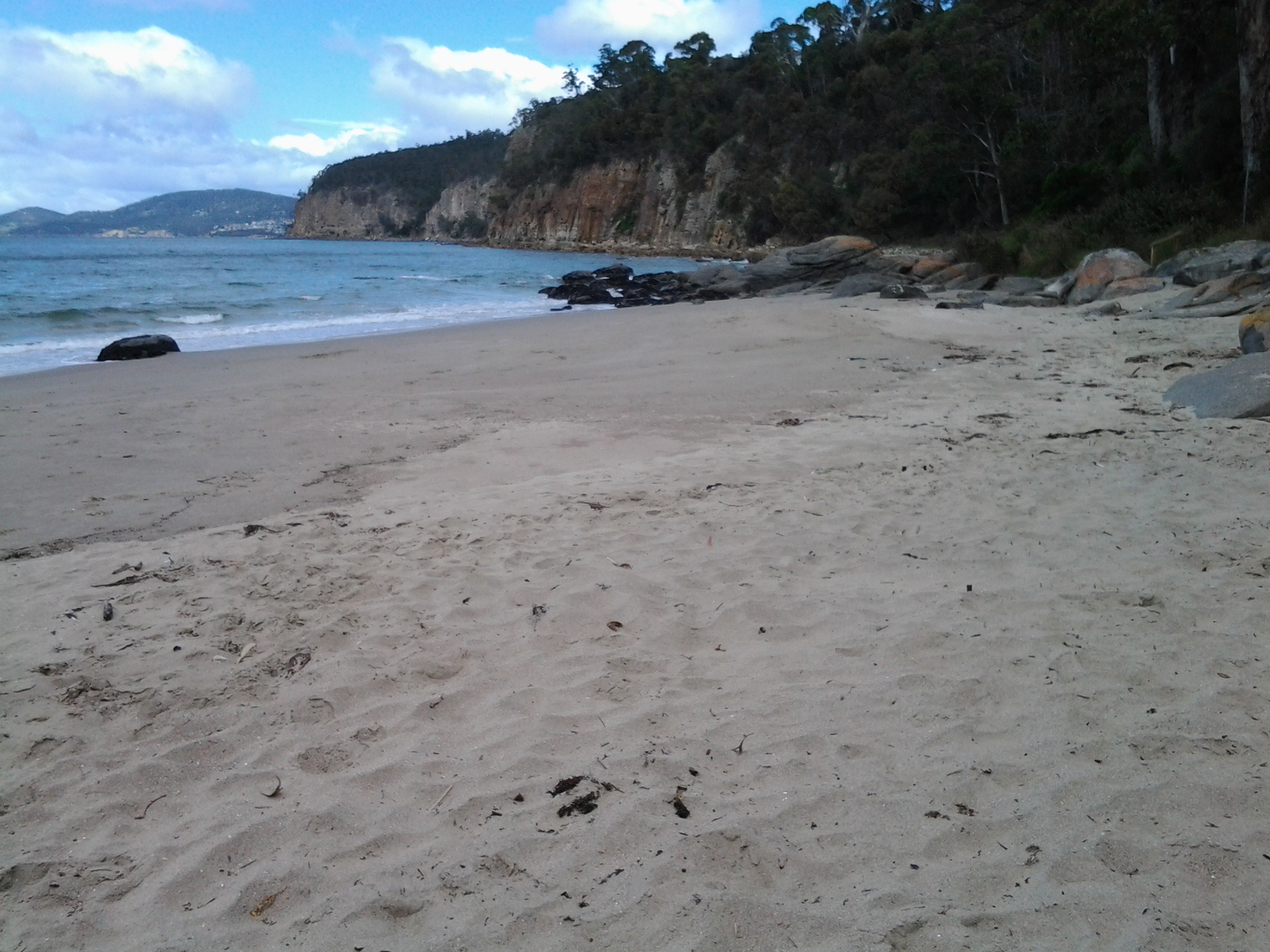
My photos make the beach seem gloomy but I remember the picnic experience was bright. It was a wonderful way to end my birthday celebrations which had spread over a couple of weeks.  Thanks Fe for organising the day.

Geological and Social History of our Alum Cliffs

Patricia Roberts-Thompson (http://taroona.tas.au/assets/document/1354363720-a_walk_along_alum_cliffs.pdf) indicates that the first recorded reference to the Alum Cliffs was in 1847.  She explains that these rocks, Permian mudstone (250 million years old, contain iron pyrites and, as the rock weathers, the pyrite oxidises and produces sulphuric acid which reacts with the limey clay to produce alum. Roberts-Thompson could find no evidence that the alum has been extracted from our cliffs for commercial purposes.

Simon Stephen’s research (http://taroona.tas.au/assets/document/1352547986-geology_reduced.pdf) is in sync with that of Patricia Roberts-Thompson  when he says the mudstone on the Alum Cliffs contains much sulphur so that when struck a strong smell is emitted. “Much of the sulphur manifests itself as a white encrustation on thee sheltered areas of the cliffs. It has a distinct bitter taste…”  (Trust me – I won’t be taking a bite or licking it). Stephen’s article is exceptionally interesting not the least because it pin points a geological fault line which is near Crayfish Point (where I have already walked) and which extends out through the end of Hinsby Beach and then under the water along the Alum Cliffs.  I don’t know if any seismological activity has occurred in my life time there nor whether any is expected. I’d rather nothing happened during my forthcoming Stage 12 walk along the Alum Cliffs.

The Kingborough Council distributes a brochure with the following information: “The route followed by today’s Alum Cliffs Track has long been a coastal path used by local people. In 1988 it was formally developed as part of Australia’s Bicentennial celebrations. In more recent years, Council has upgraded the southern section of the track, which climbs from Tyndall Beach through coastal blue gum forest with tall silver banksias. The track then winds up through silver peppermint bushland, dips into a glorious fern filled gully, before rising again onto headlands for commanding views over Storm Bay and the Derwent Estuary. A new start to the track without steps has now been constructed above Tyndall Beach to make the track accessible to more users. The Alum Cliffs are so named because alum – a compound used in dyeing, tanning and medicinal products – is found in the cliffs.”

It is a shame that all instructions to reach and walk the Alum Cliffs use Kingston Beach in the south as the base to walk north and then return. Websites provide information about multiple entrances along the route at Tyndall Rd, Harpers Rd, Taronga Rd.  Apparently a Metro bus stop is located 100m south of the intersection of Taronga Rd and Channel Highway. I wonder how many people have walked the Alum Cliffs Track from the northern end and, if not, like me would like to read advice about how to tackle the cliffs departing from Hinsby Beach.

20150119_131327

It may be that, on Stage 12, I will start out at the end of the Hinsby Beach and then be forced to retrace my steps, return to the Channel Highway and walk up the winding fairly narrow Highway with no pedestrian walkway until I reach the Brickfields Track. From http://www.greaterhobarttrails.com.au/track/brickfields-track I understand that “the Brickfields Track links between Taronga Rd (adjacent to the Channel Highway) in Bonnet Hill and links to the Alum Cliffs Track. The route of the Brickfields Track takes you through the historic remains of the brick-making area; part of the nearby and short lived 1840’s convict probation station. The track is a mix of narrow bush track and timber boardwalk with some steps along the route.”