Tag Archives: Geology

ROCKY 6 discovered after leaving the Lyell Highway

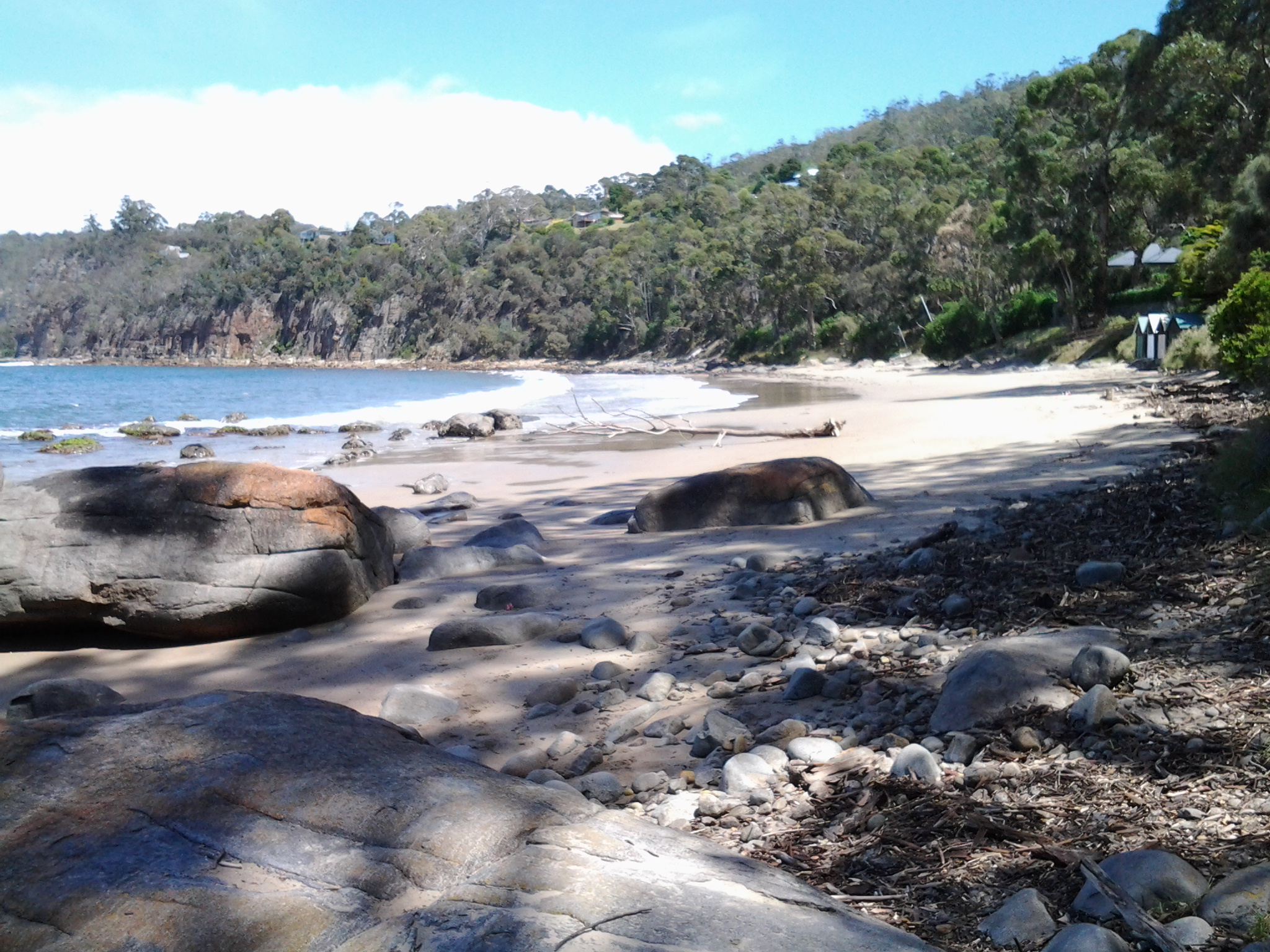
On Stage 14 , I reached the turn off from the Lyell Highway around 12.45 pm and stopped to read my maps in order to be certain that I would find an alternative trail situated closer to the edge of the Derwent River than the highway.  From this boat ramp road (has a sign with boat ramp symbol on the highway), the trail looked definite and continuous so I peeled off from the Highway.

A few metres along the gravel road, a ‘parkland’ to the left of the road was covered with the gentle leaf droppings of the surrounding gum trees. In the dappled light, I noticed a row of large rocks standing to attention neatly, each with a name tag.

20150413_124926

20150413_124835 20150413_124840

20150413_124848 20150413_124908

20150413_124915 20150413_124919

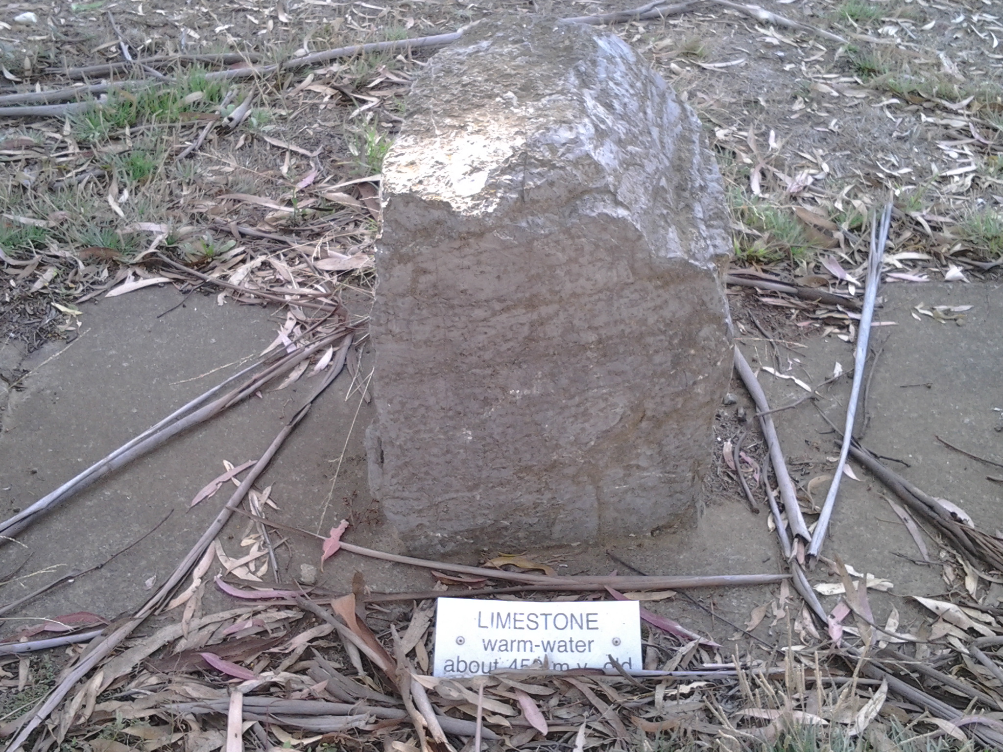
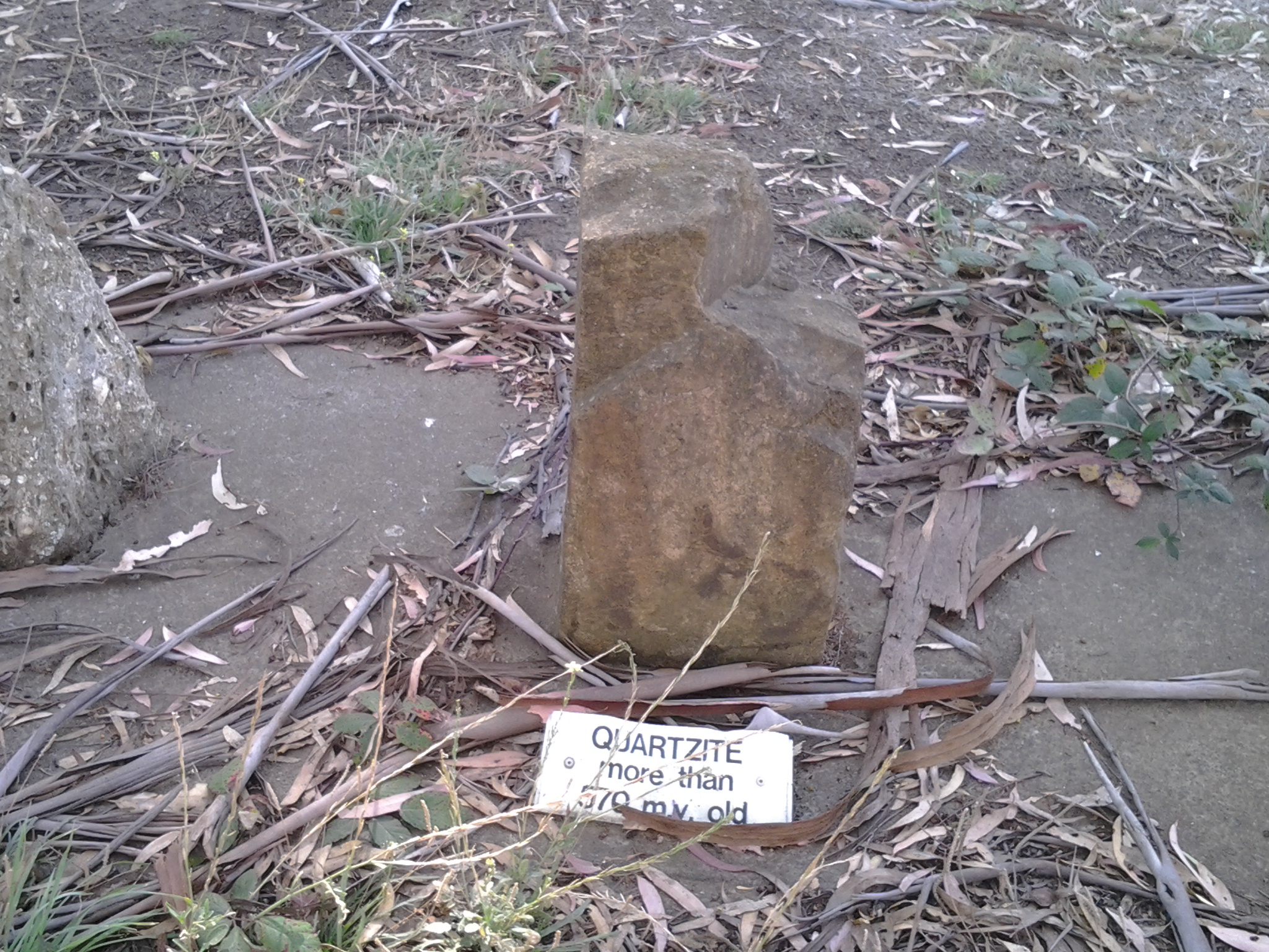
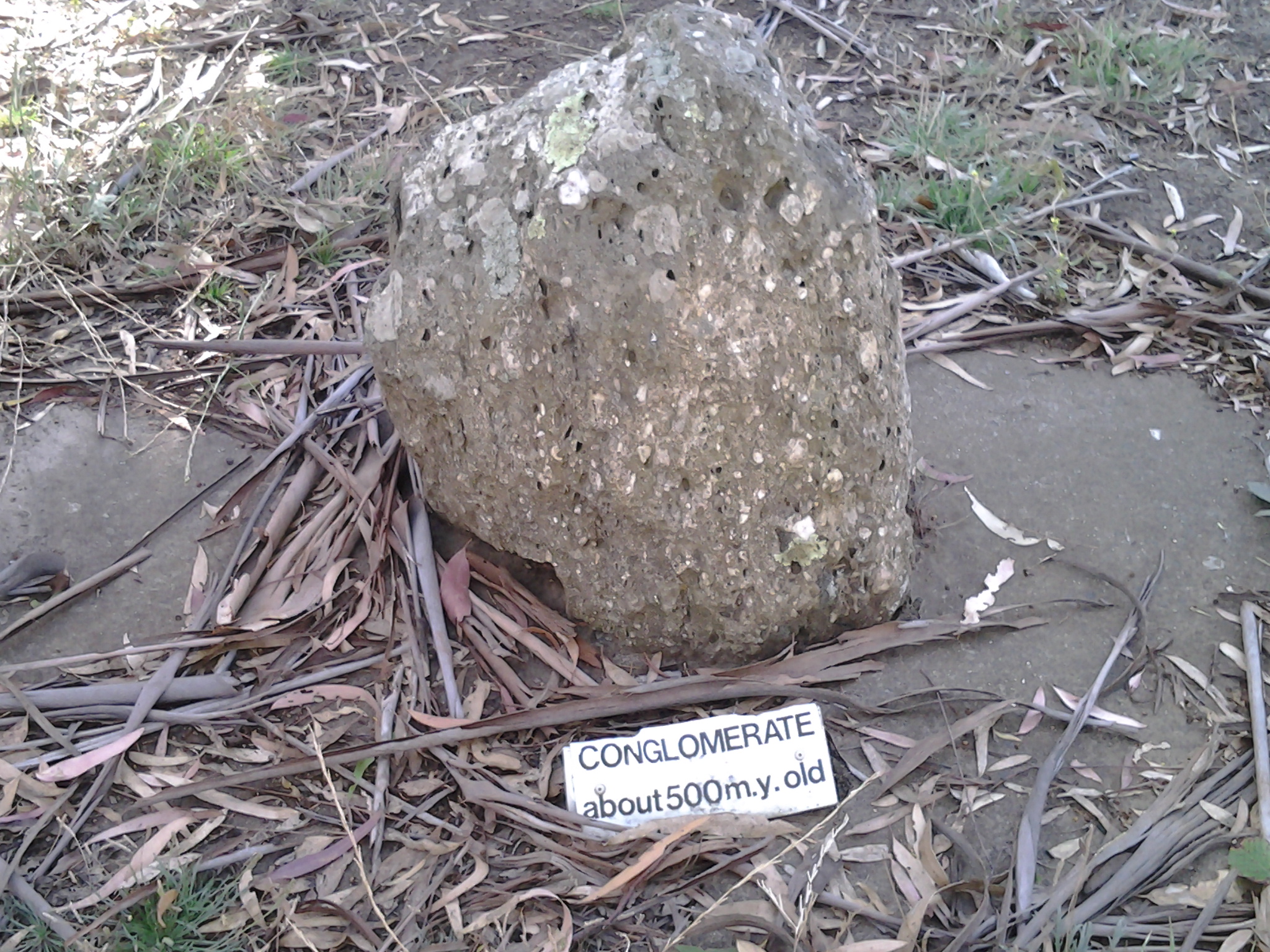
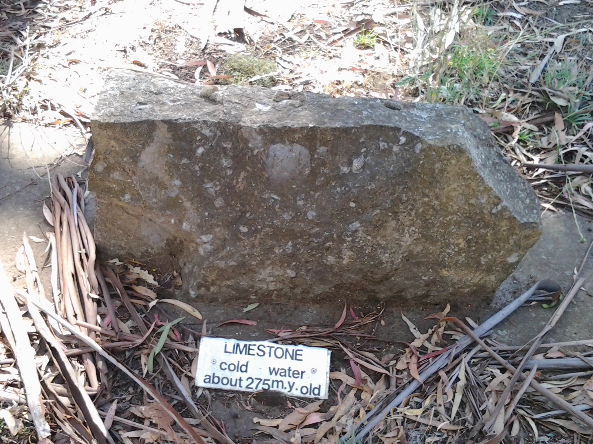
A few metres from the rock row, a sign provided additional information. It seems the sign was placed here in 1988 as part of the Australian Bicentennial year of celebrations of European settlement. Who by and why is not clear.

20150413_124934

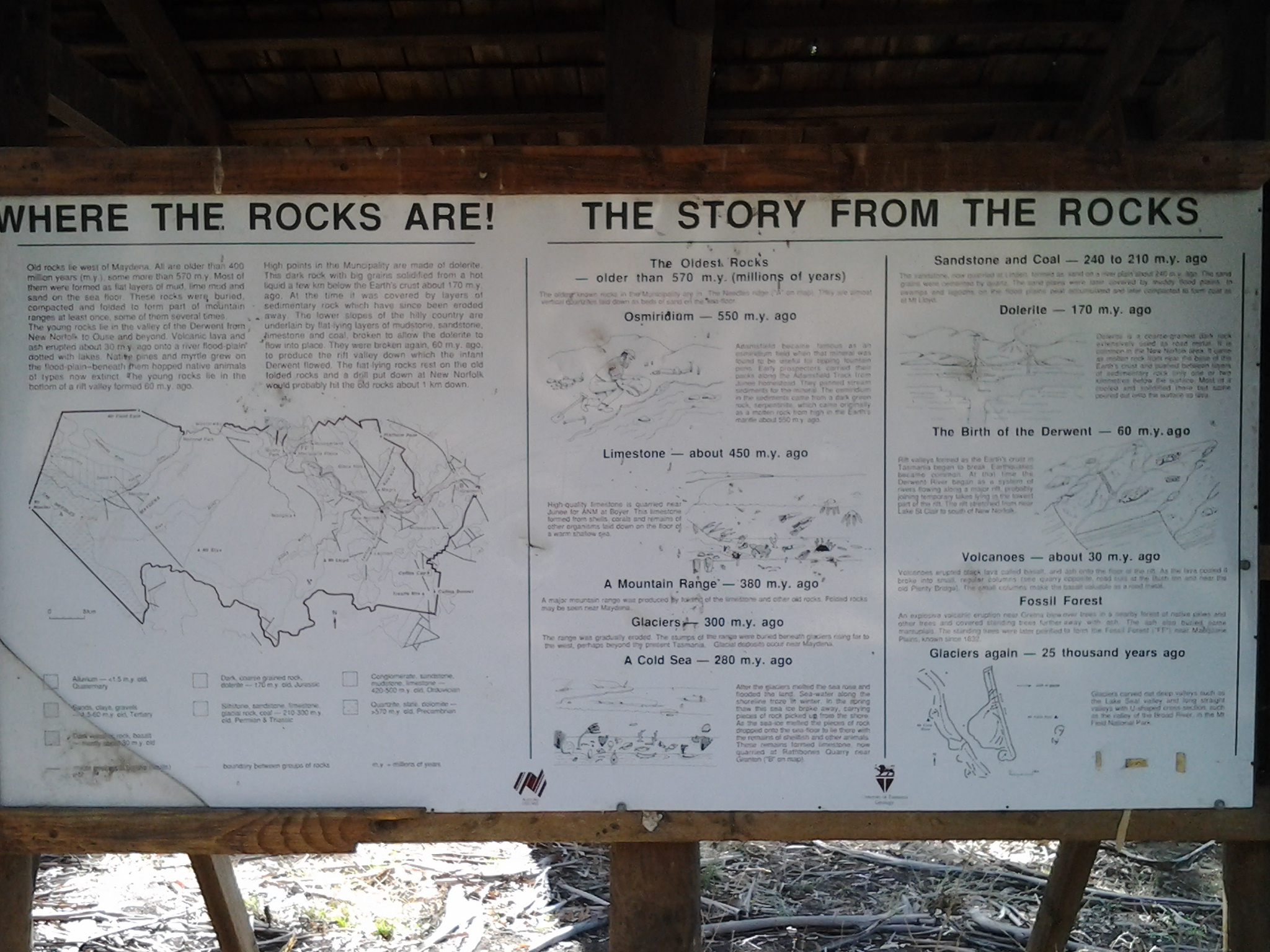
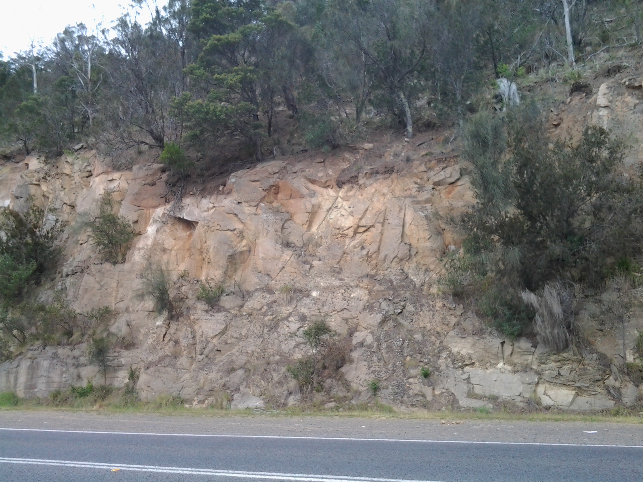
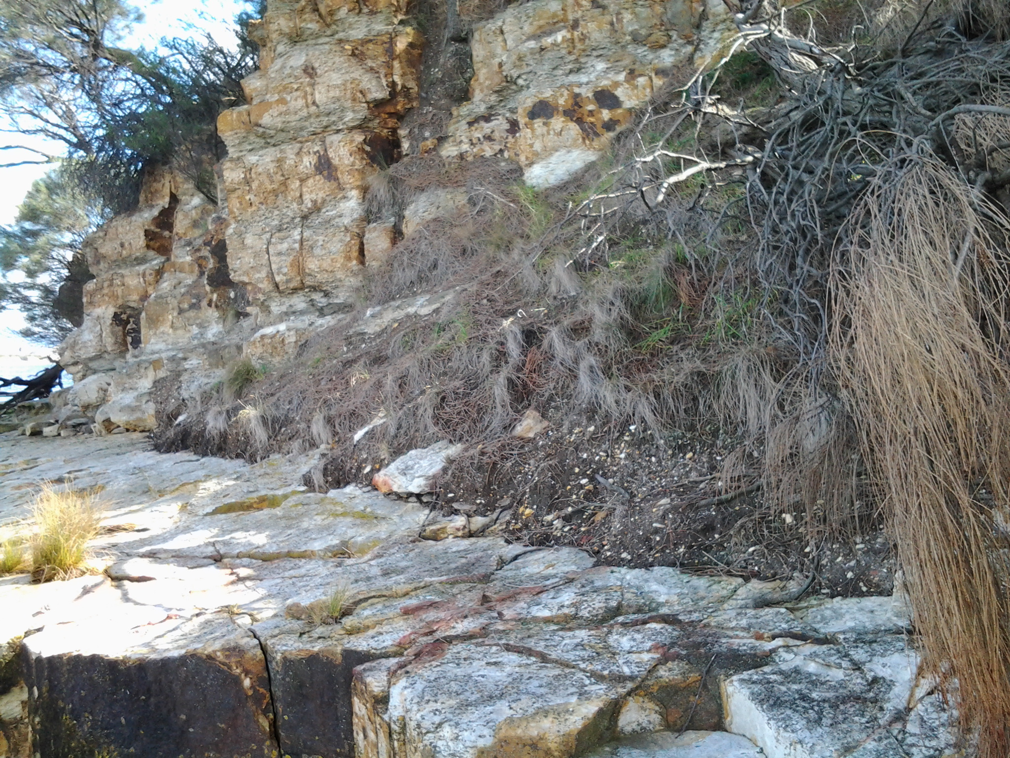
Were these rocks and the sign a help in understanding the local geology? Yes and no. Mostly the information on the sign referred to locations further west and north of New Norfolk, the town which is located a few kilometres west of this display. I did learn that, about the time when Tasmania was beginning to separate from mainland Australia 60 million years ago, the Derwent River began to form; a young river by the standards of some of the rivers of the world (the Rhine River began to form 240 million years ago, the Colorado River started forming about 75 million years ago, and the Nile about 70 million years ago).

Why was this location chosen to present this display?  Who, apart from the occasional walker like me, would find and examine this display? People travelling in vehicles would not be stopping to look. Rather they would be focussed on reaching the river edge ramp to launch their boats. Very strange.

Geological and Social History of our Alum Cliffs

Patricia Roberts-Thompson (http://taroona.tas.au/assets/document/1354363720-a_walk_along_alum_cliffs.pdf) indicates that the first recorded reference to the Alum Cliffs was in 1847.  She explains that these rocks, Permian mudstone (250 million years old, contain iron pyrites and, as the rock weathers, the pyrite oxidises and produces sulphuric acid which reacts with the limey clay to produce alum. Roberts-Thompson could find no evidence that the alum has been extracted from our cliffs for commercial purposes.

Simon Stephen’s research (http://taroona.tas.au/assets/document/1352547986-geology_reduced.pdf) is in sync with that of Patricia Roberts-Thompson  when he says the mudstone on the Alum Cliffs contains much sulphur so that when struck a strong smell is emitted. “Much of the sulphur manifests itself as a white encrustation on thee sheltered areas of the cliffs. It has a distinct bitter taste…”  (Trust me – I won’t be taking a bite or licking it). Stephen’s article is exceptionally interesting not the least because it pin points a geological fault line which is near Crayfish Point (where I have already walked) and which extends out through the end of Hinsby Beach and then under the water along the Alum Cliffs.  I don’t know if any seismological activity has occurred in my life time there nor whether any is expected. I’d rather nothing happened during my forthcoming Stage 12 walk along the Alum Cliffs.

The Kingborough Council distributes a brochure with the following information: “The route followed by today’s Alum Cliffs Track has long been a coastal path used by local people. In 1988 it was formally developed as part of Australia’s Bicentennial celebrations. In more recent years, Council has upgraded the southern section of the track, which climbs from Tyndall Beach through coastal blue gum forest with tall silver banksias. The track then winds up through silver peppermint bushland, dips into a glorious fern filled gully, before rising again onto headlands for commanding views over Storm Bay and the Derwent Estuary. A new start to the track without steps has now been constructed above Tyndall Beach to make the track accessible to more users. The Alum Cliffs are so named because alum – a compound used in dyeing, tanning and medicinal products – is found in the cliffs.”

It is a shame that all instructions to reach and walk the Alum Cliffs use Kingston Beach in the south as the base to walk north and then return. Websites provide information about multiple entrances along the route at Tyndall Rd, Harpers Rd, Taronga Rd.  Apparently a Metro bus stop is located 100m south of the intersection of Taronga Rd and Channel Highway. I wonder how many people have walked the Alum Cliffs Track from the northern end and, if not, like me would like to read advice about how to tackle the cliffs departing from Hinsby Beach.

20150119_131327

It may be that, on Stage 12, I will start out at the end of the Hinsby Beach and then be forced to retrace my steps, return to the Channel Highway and walk up the winding fairly narrow Highway with no pedestrian walkway until I reach the Brickfields Track. From http://www.greaterhobarttrails.com.au/track/brickfields-track I understand that “the Brickfields Track links between Taronga Rd (adjacent to the Channel Highway) in Bonnet Hill and links to the Alum Cliffs Track. The route of the Brickfields Track takes you through the historic remains of the brick-making area; part of the nearby and short lived 1840’s convict probation station. The track is a mix of narrow bush track and timber boardwalk with some steps along the route.”

Rocks 240 million years old – 7th stage of my walk along the Derwent River

Having left Otago Bay and now walking along the Derwent River edge of the East Derwent Highway, the green hills soon disappeared. I calculated that to have entered the Highway from Otago Bay Road and stayed on it would have cut half an hour off the walk, at least.  Once a little way north, I looked back to the river edge near the end of Murtons Road and reflected on the insanity of the path I chose. I like the photo below because I can see where I have just been at the water’s edge in the distance. In addition, I am seeing one side of Mount Wellington with the awareness that once I travel inland further, this will disappear from sight.

As I continued the walk, over the Highway was a wall of rock which continued for a while.

20141031_120644

When I spotted an interpretative sign installed on the rocks, I crossed the road to investigate.  The rocks and ground were teeming with Portuguese Millipedes crawling over the surface looking for a mate.  Rain encourages them to get on the move and, trust me, they were moving.  Thankfully they are completely harmless to humans.

I arrived at the sign at 12.15pm and was glad to be able to read some geological information that was related to the fauna which was living 240 million years ago. This was the time when the Paleozoic era was in transition to the Mesozoic era.  Dinosaurs were dominant in the later period, while in the earlier time, fish, insects, spiders and shells developed.  It seems that increasingly large water creatures were around at the time when these sandstone rocks were formed.

20141031_121240

Once walking along the river again, I stopped to admire the views in all directions.  Looking back, Mount Direction rose up (I knew it sat just behind the Bowen Bridge where I had walked earlier in the day). The rural nature of the area below the small mountain is evident closer to the water’s edge.

20141031_122945

By 12.25pm, I had passed a sign indicating I had reached the locale of Old Beach, and I’d stopped and looked at the headland containing the Cadbury’s chocolate factory on the western side of the Derwent River.

20141031_122520

Walking beside the guard rail on the water side for safety, rather than the road side, was not an easy experience.  Also, it was not safe in parts especially where the slippery gravel dropped down to the water side. Nevertheless I persisted where I could and, after brushing beneath a wattle tree, came out the other side perfumed. A clean sweet smell. Very refreshing. On the rocks, a lone Pied Oyster Catcher wobbled away nervously.  I could see his future meals through the clear water.

Around some more corners, and I arrived at Cassidy’s Bay.

Geological history and the Bedlam Walls area

For readers interested in the rock foundations of the Bedlam Walls Point the information from http://www.mrt.tas.gov.au/mrtdoc/dominfo/download/TR12_116_118/TR12_116_118.pdf may be of help.

“The area examined is rectangular and measures about 700 yards from SW to NE and about 600 yards from NW to SE. It is on an elevated promontory projecting into the Derwent estuary, bounded on the N by Shag Bay, on the W by the Derwent River and on the S by Geilston Bay.

The rocks present are fine light grey sandstone and siltstone of the Malbina Formation of Permian age. The sandstone forms hard, compact massive beds from one foot to six feet in thickness which alternate with siltstone beds generally less than two feet in thickness. The siltstone weathers more readily and so is readily distinguished in outcrop, but it is not markedly softer than the sandstone.

The rocks dip at low angles up to 6° to the W, that is, towards the Derwent. They possess vertical joints usually from nine inches to four feet apart although locally they may be as little as one inch or as far as six feet apart. Scattered isolated pebbles up to eight inches in diameter are present in the Formation Cliffs and on the W side of the area they plunge into the Derwent River. Along the foreshore in the NW corner are three shallow sea caves about 30 feet along any diameter. Their floors are now about twenty feet above sea level. There has been some collapse. No evidence of groundwater was seen either on the promontory or along the shoreline. The soil cover is a shallow silty grey loam overlaying thin stony clay. This forms a podsolic profile up to  eighteen inches and usually less than one foot in thickness.

Comments: In view of the rock types present, the low angle of dip and the well-drained nature at the rocks, the general stability of the area is not in doubt. Locally, the presence of the caves has been mentioned but they are superficial features caused by marine erosion, and do not extend underground for any distance. Except on the steepest slopes, the rocks are adequate to support normal industrial structures. Excavation will be assisted by the jointed and bedded nature of the rocks. Where there are large joint spacings, explosives will be required but in the closely jointed areas heavy earth moving equipment will be sufficient. Blocks up to six feet in diameter could be quarried from the massive sandstone. Groundwater supplies are not likely, and in any case would be limited in quantity to, at the most, 1,000 gallons per hour from a bore hole, and in quality by the proximity of sea water.”

The photo below was taken off the rocks at Bedlam Walls Point.

20141015_101248