Tag Archives: Clarence City Council

Clarence Jazz Festival (mostly bordering the Derwent River) in southern Tasmania

jazz-1-052314-akp

I don’t know when the Clarence Jazz Festival first started, but it was up and running when I returned to Tasmania to live, in 2000. Ever since, it has grown in scale and excitement.

From one Sunday to the next in the third week of each February, performances are scheduled in historic buildings such as the Rosny Barn, next to the water on various bays such as Kangaroo Bay and Lindisfarne Bay (that empty into the Derwent River, and which blog followers may remember from earlier stages of my walk), at beach reserves and on village greens across the local government area of Clarence City Council.

Most are free events and they culminate in the big day next Sunday.  On that day the Bellerive Boardwalk, with its stunning backdrop of sun-drenched water covered in yachts, hosts a grand finale when many different Tasmanian and national jazz musicians perform on an open stage in front of changing throngs of people sitting and moving around the Boardwalk.  Food, wine and coffee stalls surround the venue, and the Clarence City Council offers free sunscreen for those who come unprotected.  At the Jazz at the Boardwalk is where you can expect me to be next Sunday!  Bring on those sexy saxophones!

TheresaKnott-Saxophone

Typically people walk from home often carrying picnics and refreshments to drink.  Families sit outdoors and soak in the atmosphere while kids clamber over public playground equipment when nearby.  Where I live, sometimes the sounds of music float across the air and I am able to enjoy concerts when I cannot get away from home.

The festival Facebook site shows images of past musos and performances and some of the guests for this year (https://www.facebook.com/clarencejazzfestival).

If you are a Hobart local and have forgotten about the Festival go to http://www.ccc.tas.gov.au/page.aspx?u=933&c=386, read the program, and be prepared to see some musicians strut their stuff.

free_3807275 Trumpet in the lights

How common is the name Otago and what is its history?

How did Tasmania come to name its Otago Bay, one of the suburbs in the broader Old Beach area, on my planned Stage 7 of the walk along the Derwent River?

On the Clarence City Council site at http://www.ccc.tas.gov.au/page.aspx?u=1085, Otago Bay was named after the iron barque the Otago, the remains of which can still be seen on the shoreline of Otago Bay. Wikipedia reports that the remains of the Otago (beached in the Bay in 1931) and a steel river steamer the Westralian (beached in 1937) can both still be seen on the beach. The Otago was dismantled at a shipbreaking establishment that operated at the Bay between the 1920s and 1960s. Some excellent current photos of the remains of the Otago can be seen on http://pacific-edge.info/2014/01/otago/.  I look forward to clicking my own photographs later this week.

At http://www.nzgeographic.co.nz/archives/issue-78/joseph-conrads-ship, I learned the Otago was commissioned by Captain Angus Cameron and built by Alexander Stephen & Sons, Glasgow, Scotland. Once in Australasian waters, the Otago was used as a regular carrier of coal from Newcastle, New South Wales Australia to New Zealand’s city of Dunedin in the early 1870s.

The Otago page on the Parks and Wildlife Service website http://www.parks.tas.gov.au/index.aspx?base=1793 explained that the Otago was a three masted ship built in 1869. In 1872 the barque was transferred from Glasgow to Adelaide, South Australia. The Otago‘s chief claim to fame is that the vessel was the only command of the famous Joseph Conrad during 1888-9 (Conrad became a well-known novelist using some of his mariner experiences, after he gave up sea faring in the mid-1890s).

The vessel arrived at Hobart in July 1905. In January 1931 the Otago was sold to a local shipbreaker and towed to its present location in Otago Bay. The hulk was partially dismantled for scrap metal in 1937 and more completely in 1957. The bow of the vessel rests on the shoreline with the stern lying in approximately two metres of water. The iron hull has been cut back to the waterline and the bow and stern have disappeared entirely. The remains can easily viewed from the shore as the interior of the hull and the surrounding area contain a quantity of debris that make closer examination hazardous. The photo below, of the Otago, is from the parks and wildlife website.

Otago 1900 Adelaide

The Otago at Port Adelaide, c.1900 (in the collection of the Archives Office of Tasmania)

The photo below, dated a decade later, is also from the collection of the Archives Office of Tasmania.

Hulk Otago 1910

Hulk of the Otago, c.1910

That is all well and good. We know our Otago Bay was named after a boat that was dismantled in its Bay. But what does the name Otago mean?  How did the boat get its name?

Otago, a well-known region in the southern island of New Zealand, was settled by people from Scotland starting in 1848. Many people believe the name ‘Otago’ is a European corruption of the Maori word ‘Otakou’ which translates as ‘village’. It may be fitting to refer to our Otago Bay as a village because its population only numbers a few hundred and it is isolated from other suburbs by the natural landscape. However, there seems to be no connection between our Tasmanian Otago Bay and with Maori culture (although perhaps some New Zealanders live there – I don’t know).  More than one boat was built in Scotland and named Otago in the second part of the 19th century, so the impact of the Otago region in New Zealand on Scotland was significant.

The founder of the Otago settlement in New Zealand, William Cargill, died in 1860 and a Tasmanian sandstone monument to him was built in Dunedin in 1864. Why Tasmanian sandstone? According to http://freepages.genealogy.rootsweb.ancestry.com/~nzbound/otago_bdm1860.htm, son John Cargill stopped by Tasmania in 1841, before he helped his father to settle in Otago.  Did John collect some local sandstone during his visit? If so, what an extraordinary thing to do considering the Otago ship eventually had its resting place in the Derwent River.

Reaching Shag Bay as I walked along the Derwent River

From Bedlam Walls Point, tracks meandered northward and before long a large quarry was visible on the other side of Shag Bay. At its base I could see the rusting remnants of machinery parts.

20141015_103753

Descending to Shag Bay at this point seemed perilous so I turned right and found tracks moving inland parallel to the Bay.  Fresh wallaby poo beside the track: black olive sized and shaped, glistening in the sun. I did not see the wallaby which undoubtedly would be looking elsewhere for a midday shady rest spot. Large grey-brown fantailed birds darted amongst the trees.

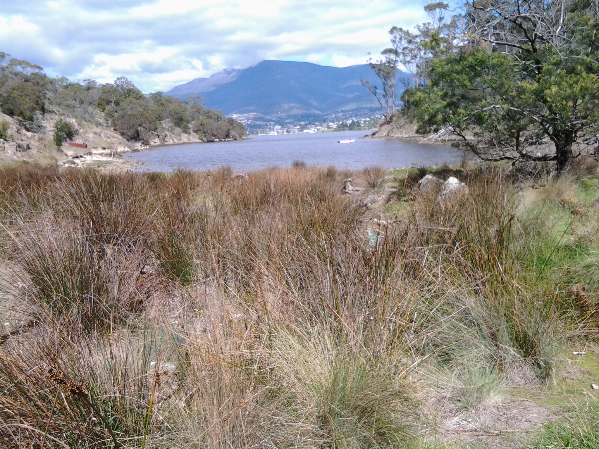
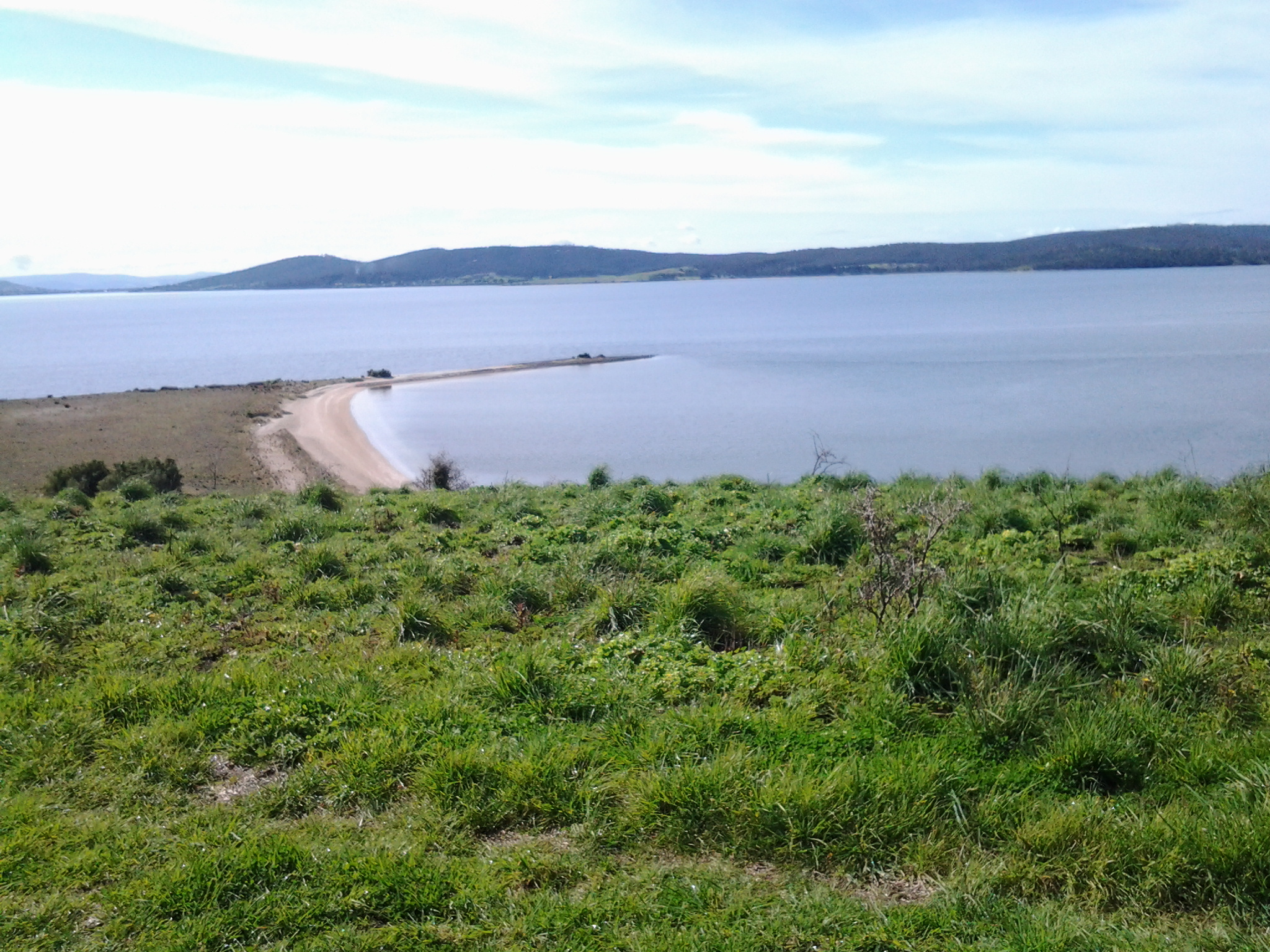
I was back on the main track at 10.45am and a couple of minutes later reached a sign marking the start of the East Risdon State Reserve (dogs prohibited, even on leads). The deep dark brown green water of Shag Bay rested liked a solid plane behind the sign. Very seductive.  Once at the water’s edge I was surprised how clear the water was except for the natural colouring and tannins from native plants.

20141015_104855

I stepped carefully down the rocky crumbling path to the Bay.

20141015_104912

The quality of light was extraordinary. Rain during the night had cleared the air and the colours of the landscape were clear. I reached the bottom next to the water’s edge of Shag Bay after a further five minutes, and breathed in my surrounds, feeling very joyful to have such easy access to this beautiful environment.

Temporarily I was startled by the spectacle of a massive White Bellied Sea Eagle flying up and down Shag Bay. I stood spellbound unable to move to click a photograph.  Have a look at the photo on http://www.parks.tas.gov.au/?base=5115 and see the large fish in the eagle’s talons. It wasn’t long before a large (but much smaller than the eagle) black bird came and swooped at the eagle to drive it away.  It’s not an easy life for these birds; they have no rest.

As I continued along the foot of the Bay, I came across an old rusting boiler up on the rocks, a massive lump of concrete, and other rusting metal in the water and around about.

20141015_105602     20141015_105701

A couple of minutes before 11am I reached the boiler used as part of a blood and bone factory in the late 19th and early 20th centuries, shown in the photos above, then a few minutes later I reached the curve of the Bay and could see a second old boiler partly obscured by the bush.  Apparently the Tasmanian Fertiliser Company was operating here for many years until a massive boiler explosion caused death and destruction resulting in the business folding. You can read the records of the inquest at http://trove.nla.gov.au/ndp/del/article/10403147.

20141015_110028

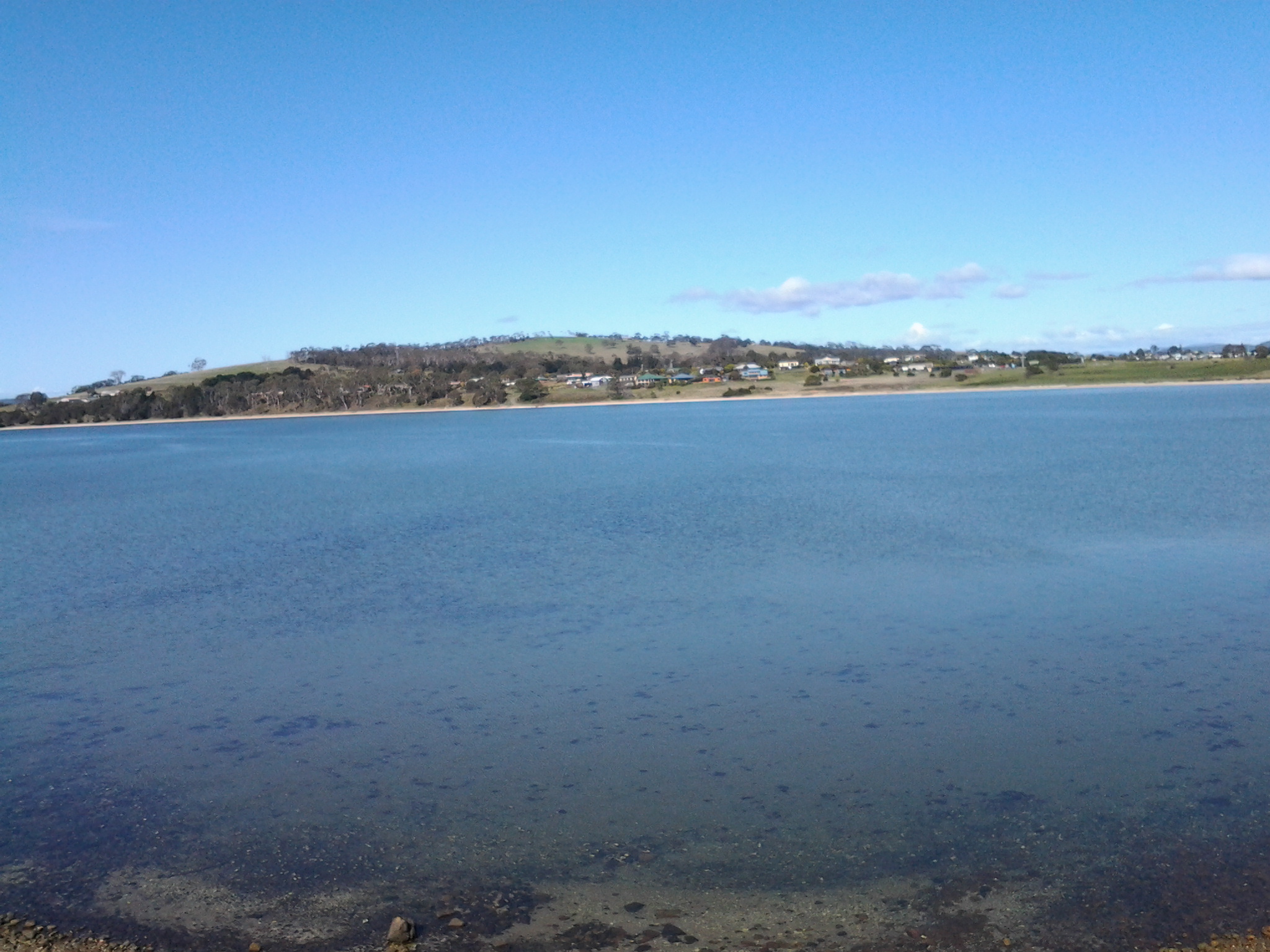
Looking down the Bay, past two fishermen in their outboard motored runabout, I soaked in the view of the western shore of the Derwent River with Mount Wellington rising above it. Hardly any air movement and the temperature was cool enough to make standing in the sun a comfortable delight.

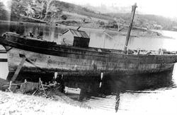
Prior to the walk I did uncover information (http://www.parks.tas.gov.au/indeX.aspX?base=1799) that Shag Bay was used for the demolition of boats such as the HMS Nelson in 1926. The photo below is from the collection of the State Library of Tasmania.

abandonedHMS Nelson Shag Bay

I saw no evidence of boat demolition during my walk around Shag Bay, however on a second visit if I investigate the quarry maybe I will find materials of interest.

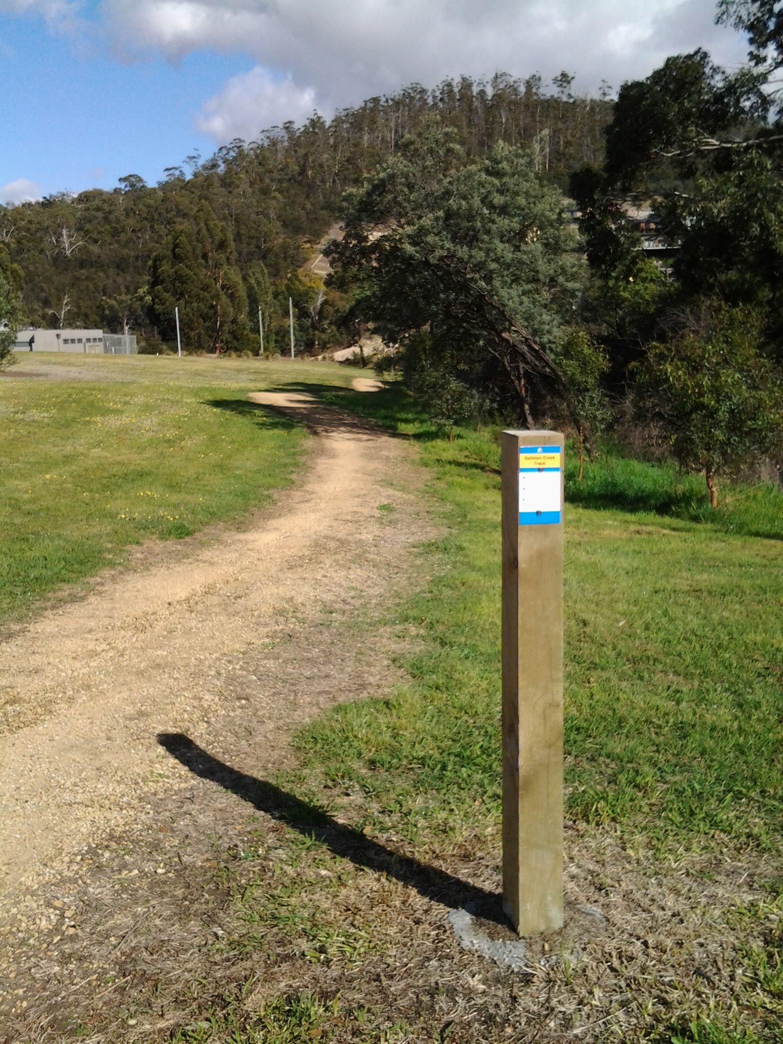
The Clarence City Council (http://www.ccc.tas.gov.au/page.aspx?u=1487) suggests the 3km round trip from

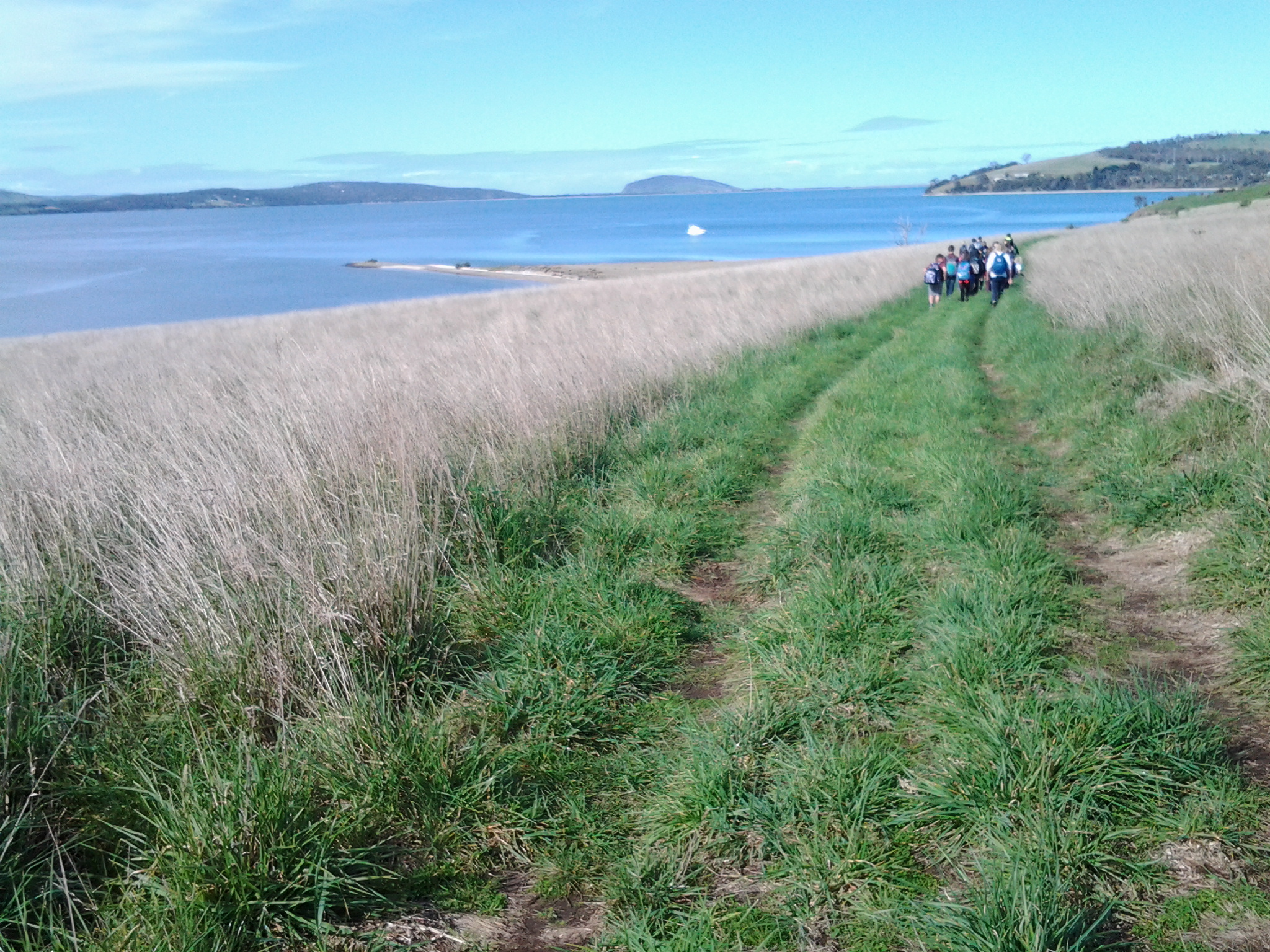
Geilston Bay to Shag Bay will take 45 minutes (although another website suggests an hour and a half for the return trip). I took considerably longer by following unofficial tracks and taking time to observe the land around me as I walked. Apart from the two fishermen on the Bay there was not a soul around. I cannot recommend this walk too strongly. Everything about the walk and the location is attractive so I hope people living in Hobart will take themselves out to Geilston Bay and make their own discoveries.  The website at http://highteawithhominids.squarespace.com/ancient-humans/2011/8/19/bedlam-walls-a-walk-in-tasmania.html provides additional details which may help locate some of the historical sites that I missed.

Also on the Clarence City Council website, the claims are made that the track is well signposted. This is not true.  I saw three signs only: Geilston Creek track from the bus stop, Bedlam Walls sign including a map to Shag Bay at the start of the track, and the East Risdon State Reserve billboard close to Shag Bay. Considering the myriad of unofficial tracks that will attract the attention of many walkers, if you wander aimlessly, you will need to remember to keep the river on your left as you walk north to Shag Bay and on your right when you return to Geilston Bay.  I do not recall seeing any signs at Shag Bay so I missed the aboriginal midden and quarry.

From Geilston Bay to Risdon on Stage 6 of my walk along the Derwent River yesterday

Yesterday’s walk was a sensationally wonderful experience. Over a few posts I will colour in the rich fabric of the day, much of it in clean fresh smelling bushland (such as that at Tommy’s Bight in the photo below).

20141015_133405

To start with, I caught Metro bus 694 destined for Risdon Vale and Glenorchy (scheduled from the Hobart city bus mall at 9.03) on the eastern shore and travelled to bus stop 14 on the East Derwent Highway at Geilston Bay. Thankfully the Clarence City Council has erected a sign marking the start of the walk.

20141015_093747

From the bus stop, I walked along the edge of Geilston Bay then northwards around Bedlam Walls Point to Shag Bay and onwards to the top of the Bedlam Walls, where I was rewarded with panoramas across the Derwent River. My northwards walk continued into and across the East Risdon State Reserve before descending into the suburb of Risdon. I turned south and walked on the edge of the Derwent River to Porters Bay where I took my lunch break before continuing south to Tommy’s Bight.

Eventually I retraced my steps back to Risdon and continued along the water’s edge to the junction of Saunderson’s Road with the East Derwent Highway. The return bus stop for a 694 bus, which arrived at 2.35pm (with not another one due for two hours), was on the Highway across from Risdon and adjacent to the land and water marking the Risdon Cove area.

I was away from home for approximately 6 and ¼ hours, and walked a total of around 12 kms winding over many tracks and retracing parts of my walk.

Previously I had walked 23 kms of the length of the Derwent River.  Yesterday I added 3 kms which brings the new tally to 26 kms.

Howrah

My walk today  (my fourth walk) along the Derwent River must pass through Howrah, an eastern shore suburb adjacent to Tranmere in the City of Clarence (part of the Greater Hobart Area).

The Clarence City Council records that Howrah was named after Howrah House (or Howrah Farm, an alternative source suggests), a property established in the 1830s on Clarence Plains by a retired Indian Army officer Captain James Fielder. According to the Asiatic Journal of the times, when Fielder was a branch pilot in Calcutta (which in our recent times has been renamed Kolkata), his wife had a son in Kolkata on 3 March 1830 so travel to Tasmania occurred sometime after that. On 25 March 1835, ‘the lady of Captain James Fielder’ gave birth to a daughter at Clarence Plains. Fielder arrived in Hobart at least a year earlier if the information in http://vdlworldimmigrants.wordpress.com/stories-of-immigrants-pre-1900 is correct.  “A newspaper notice by James Fielder of Howrah Farm, Clarence Plains, dated 17 November 1834 reads: Run Away On Friday the 14th instant, my apprentice boy, named Charles Connor, a native of India, between 16 and 17 years of age. I therefore warn all persons against harbouring him. He has on a narrow blue striped shirt, under a blue baize shirt, duck trowsers, lace shoes, and a tarpaulin hat. A reward of ten shillings will be given by the Undersigned to any constable who may take him up.”

Captain James Fielder took the name Howrah from a place of the same name near Kolkata. Clarence Plains is now known as Rokeby, a suburb I passed through on route to my first two walking stages on the South Arm peninsula. Rokeby is located over the hill from Howrah.

I found another historical connection when I recalled that Lieutenant John Hayes, who named our Derwent River, sailed from Kolkata in 1793.

With a little online research, I found that Howrah is the twin city to Kolkata in the state of Bengal in India, separated only by the Hoogly River. Back when Hayes was in the India, Kolkata was the capital of India during the British Raj so I imagine a bustling, active and expanding city.

On 11 October 1760, the Indian Howrah district came under control of the East India Company (EIC) – a massive trading company with ships travelling the world.  In 1823, when Bishop Reginald Heber described Howrah as the place “chiefly inhabited by shipbuilders”, it confirmed that location as a significant base for the 27 year old Hayes before he took leave of the EIC, acquired a couple of merchant sponsors who built him two ships, and sailed to Tasmania.  In addition to the shipbuilding industry, I have been pleased to learn that the British created a balance in the landscape by establishing the Indian Botanical Gardens in 1786. Perhaps Hayes experienced this maturing garden before he left in 1793. When he sailed into the Derwent River the Rokeby Hills would have been heavily forested (not cleared or edged with suburbs as they are today) and might have seemed similar to a botanical garden – a place with unusual vegetation.

Is there any chance Lieutenant John Hayes looked at our trees and remembered the Indian Botanical Garden?

Stage 2 on 4/9/2014 Starting the return trip from Gellibrand Point Email 11 of 14

20140904_111425

While eating my morning tea on the gentle slopes at Gellibrand Point, the children had moved ahead but it wasn’t long before I had covered the distance to arrive at the tail of their walking party.

The teacher and I struck up a conversation. I learned that this was a special outing for the South Arm School, and children had to be at least 8 years old to be eligible to join in the 3 or so hours of their planned walk. From anecdotes, this length of walk was deemed potentially a challenge for their children, by some parents.  In this day and age of technological gadgets and constant car use, perhaps walkers are an increasingly rare breed of person. But there were no grumbles from the children and they seemed all very happy to be walking along.

 Just as I have my little project to walk the length of the Derwent River, I was reminded others have their wonderful special projects. The teacher surprised me when she explained that she and some friends had  set themselves the task of walking the 95 kilometres of all the Clarence City Council beaches (Clarence is one of the suburbs of greater Hobart – and the South Arm peninsula is part of that territory). Already they had covered 87 kilometres. What a great idea I enthused.  These are the simple pleasures that give real meaning to our lives.

It wasn’t long before a new geographical feature came into view within the smooth waters of Ralph’s Bay. The Spit.  A slim sandy piece of land that appeared as if the gods had yanked a slight sinew from the main land and pulled it out to a point. A large white cruiser rested languidly in the calm bay nearby.  No chance of sea sickness on that marine vehicle!

20140904_112358

The children decided to take a path in that direction to discover what they might. We parted company and I continued along the 4 wheel driving track.

 I circled around an old disused and collapsing quarry pit all the time enjoying the pleasure of putting one foot in front of the other.

20140904_112512

I passed corralling structures for holding sheep while watching circling hawks in hunting mode for small creatures on the ground.

20140904_113424

Bright sounding small birds tweeted madly. Unseen.

And in a few minutes, there before me was the arc of Shelly Beach – too long to fit into the frame of a photograph.

20140904_113730