Tag Archives: Shag Bay

Walking on an industrial site – posting 3 of 5

After we rounded the hill, it was the colour and nature of grasses which took my attention.

20170227_103718.jpg

20170227_103722.jpg

20170227_103742.jpg

20170227_103747.jpg

The waving grasses skirted a wetlands including ponds and dams. These were created as a treatment works so that water entering the Derwent River is unpolluted.  Deceptively simple, but complex and sophisticated. Some of these treatment areas are located in the foreground of the following photos;

20170227_103716.jpg

20170227_104103.jpg

20170227_104110.jpg

20170227_104144.jpg

20170227_105017.jpgI particularly liked walking along the reclaimed track next to the water of the Derwent and watching a pair of Gulls with their two immature offspring. These were either Kelp or Pacific Gulls. I suspect they were the latter because their yellow bills did not seem so large as those typical of a Pacific Gull.

20170227_104458.jpg

Looking across to the eastern shore I recognised the inlet of Shag Bay, an area which has been the topic of a number of previous blog postings; for example,  refer here and here.

20170227_104816.jpg

I was pleased to see that on a normal working day, someone still had the luxury of time to be sailing.

20170227_104832.jpg

Shag Bay industrial history


In earlier posts I directed your attention to the online magazine Tasmanian Geographic .  The latest issue contains a well-researched and lengthy article, ‘Early Recycling at Shag Bay’, on the early industrial history of late 19th and early 20th century of Shag Bay.  Thanks to authors, John and Maria Grist, I now understand more about what I saw as I walked past the detritus scattered around this Bay. I strongly recommend accessing their article for its historical photographs and the fascinating content. Thanks John and Maria – much appreciated.

My long term blog followers may recall the name of Shag Bay but unless you know this part of the Derwent River, its location will remain a puzzle.  Shag Bay is a small inlet on the eastern shore between Geilston Bay and Risdon, and is mostly easily accessible on a dirt track from the Geilston suburb end. My posts from walking around Shag Bay include:  From Geilston Bay to Risdon on Stage 6 of my walk along the Derwent River yesterday ; Reaching Shag Bay as I walked along the Derwent RiverThe Shag Bay and Bedlam Walls area covers much loved and used aboriginal land of the Moomairremener people ; and Along the northern side of Shag Bay and onwards along the Derwent River.

To help you to remember Shag Bay, here are a few photos I took way back very early in my trek from the mouth the source of the Derwent River.

20141015_103803.jpg

20141015_105602.jpg 20141015_110028.jpg


Nature is cheaper than therapy

A Californian fiction writer M.P. Zarrella offered the opinion ‘nature is cheaper than therapy’.  Since then, her point of view has spawned posters, cushion covers, and T shirts such as:

Nature cheaper than therapy  and tshirt nature its cheaper than therapy

The use of this comment spread until people couldn’t help themselves …

facebook cheaper than therapy and Beer is cheaper than therapy

Thinking about whether nature is cheaper (with the inference of ‘better’ than therapy), I have been inspired to trawl through my walking-the-derwent photos.

Here are a few favourite natural scenes clicked during Stages 1-6 of my walks along the eastern shore of the Derwent River.  Most of these images spent time as my computer screen background where they lifted my spirits daily.

20140822_100301

Iron Pot off the southern end of South Arm peninsula

20140822_101716

Driftwood beach shack on Pot Bay Beach, South Arm peninsula

20140822_114606

Mount Wellington across the Derwent River from South Arm Beach

20140904_110312

Looking northwards into the gigantic Derwent Harbour from Gellibrand Point at the northern end of the South Arm peninsula.

20140920_102738

Looking uphill from Trywork Point

20140926_095629

Lichen on rocks at Tranmere Point

20140926_104056

Little Howrah Beach

20140926_115158

Looking southwards along Bellerive Beach

20141010_093842

The suburb of Sandy Bay across the Derwent River through the casuarina trees from Rosny Point

20141010_123003

Tranquil Geilston Bay looking toward Mount Wellington

20141015_101248

Bedlam Walls Point

20141015_104855

Shag Bay

20141015_122048

Native flowers in the East Risdon State Reserve

20141015_133435

Tommys Bight

Whenever the weather is deteriorating outside my window, by looking at these photographs from the first 6 of 14 walking stages, I ‘revisit’ the various locations and feel most uplifted. No therapy needed here.

From Wrest Point to New Norfolk on the Derwent River

‘Have you got a red hat?’ friend An asked me. Recently she became Princess Pollyanna, an esteemed member of Hobart’s Scarlatt O’Hatters (http://www.hobartredhats.com/), and urged me to join particular excursions that have a connection with my walking project.  The delicious carrot being wriggled before my eyes was a ferry trip from Hobart to New Norfolk on the Derwent River.  I paid my membership fee to Queen Poppi and then found a common red beach hat (although others were wearing all manner of superb creations on their heads – are these the modern day ‘mad hatters’, I wondered). I donned a range of purple clothes and, as the newly appointed Lady Walkabout, jumped on the tiny water taxi ferry with 20 colourful new friends to be.

20150304_093216

The wind was strong and some swell across the River kept us bobbing.  However, the ride was comfortable and no one needed to bark at the fish over the side.  Sprays of salt water marked the windows and there were few opportunities to move outside into the clear moist air.  But the day was beautiful, the wind chopped waves dramatic and the panoramic scenery majestic.

What a thrill the journey was. After we left the jetty at Wrest Point Casino in Sandy Bay, a southern suburb of Hobart, we motored with commentary from our driver.  He pointed out environmental and historical features. This was a wonderful reminder of research and findings I made while walking the edges of the Derwent between the mouth of the River and Bridgewater Bridge, and I learned a few new details.

20150304_093514

The surprise sighting of a white sea eagle perched in a high tree against the cliffs in Shag Bay (an inlet between the Bedlam Walls – refer to my Stage 6 report) inspired the driver to stop and allow us outside to get a privileged view of this large bird.

20150304_095143

One of the great treats of the day was motoring underneath the very low Bridgewater Bridge (reminded me of travelling on some flat top boats in Paris where you feel sure the boat will become wedged against the bridge metal) and passing through without a bump or grind.

During our trip, at one stage hundreds of coots flew up from the water, we were accompanied for part of the journey by a small flock of sleek long necked swans, and in a small inlet a large family of pelicans were flying around.  Our eyes focused on all these birds.

As we continued on the Derwent River against landscape which I am yet to see on foot, it was clear my earlier belief that marshlands will prevent me from walking directly next to the River for most of the way from the Bridgewater Bridge to New Norfolk, is correct.  Occasionally it will be possible to walk on paths and grass, but mostly I will be tramping the hard road verges.  I was not aware the remains of a historic Lime Kiln sits beside the water, and it was good to see that I should be able to walk pass this on my way northwards.

As a result of this one-day excursion and from many car trips up and back to New Norfolk, I have a good understanding of the route. However, I realise that at foot level the world looks completely different and I look forward to finding out more in the near future.

understanding of the route. However, I realise that at foot level the world looks completely different and I look forward to finding out more in the near future.

Along the northern side of Shag Bay and onwards along the Derwent River

I used the mini bridge to cross the tiny creek feeding into Shag Bay and began immediately to take the walking track uphill on the northern side.  From here on I was not particularly confident about the clarity of tracks or, in fact, whether there would be tracks. I was pleased to discover that many tracks existed and as I long as I kept the Derwent River on my left, I couldn’t get lost – even if I did not know at what part of the suburb of Risdon I would arrive (‘all roads lead to Rome’ even if entry is by a different gate).

On the way up the first hill I had stopped for a view and a swig of water. During that time I surprised a dog that came around the corner behind me with her mistress. They both stopped in their tracks.  She told me that in all the dozens of times she has walked this track, she has never seen anyone on it.  Peace and solitude. Yet only a dozen or so kilometres from the heart of a city.  A capital city.

The photo below through a wooded landscape extends a view southwards to the Derwent River with the MONA ferry coming my way.  At this point, I was as high as the uppermost part of the Tasman Bridge located closer to the mouth of the River.

20141015_111529

Around me eucalyptus gum nut shells lay on the ground exuding a clean fresh perfume (think of May Gibbs’ hats on the gumnut babies Snugglepot and Cuddlepie – Tales of Snugglepot and Cuddlepie: their adventures wonderful was first published in 1918.).  Not long afterwards, the track passed through a copse of self-seeding wattle trees: I know some varieties are considered to be weeds in certain parts of Australia and I suspect this collection of specimens may be ‘weeds’.  The problem is that it grows quickly and blocks out the opportunity for other trees to survive. Monocultures are death to the natural landscape.

At the top and moving along parallel to the Derwent River, I was on top of the Bedlam Walls.  Various unofficial tracks disappeared over the cliff but I stayed on the main path. My reasoning was that I had an infrequent bus service to connect with at Risdon Cove and I was not sure how long it would take to reach there.  The downside was that I missed experiencing the actual walls and their walkways and caves. I would have liked to have seen the following (https://www.flickr.com/photos/bleeter/7266025800/), but I must return for a closer inspection.

7266025800_c8d48839e8_b

Along the top I was afforded detailed views of the western shore and especially of the smelting works, Nystar as shown below.

20141015_112338

It is now obvious to me that when I walk south along the western shore of the Derwent I will not be able to be close to the river edge when I pass this massive Nystar industry covering many acres of land. I reached a major electricity pylon around 11.20am and watched its wires swing across the river to the power hungry industry (these wires are just visible in the photo above). Looking southwards and across the River from the top of Bedlam Walls, I could see Mount Wellington overshadowing Cornelian Bay and the Newtown suburb of Hobart.

20141015_112331

My track moved inland and parallel to the electricity pylons. After 5 minutes the track split and I turned left. It came to an end with a rough worker’s seating area in view of the Bowen Bridge crossing the Derwent River further north.  The cliff seemed to drop away and I judged that a slippery slide down might not be a good idea with no one else around if something should go wrong.  Later in the day when I was much further north, I was able to look back to the pylon and see I really should have braved it down the hill and kept closer to the water. But then again it might be safer to walk south and climb that hill rather than slip down it heading northwards. By 11.35am I had walked back to the divide with the original clear but rough 4WD track and chose the other arm along the pylons.

Reaching Shag Bay as I walked along the Derwent River

From Bedlam Walls Point, tracks meandered northward and before long a large quarry was visible on the other side of Shag Bay. At its base I could see the rusting remnants of machinery parts.

20141015_103753

Descending to Shag Bay at this point seemed perilous so I turned right and found tracks moving inland parallel to the Bay.  Fresh wallaby poo beside the track: black olive sized and shaped, glistening in the sun. I did not see the wallaby which undoubtedly would be looking elsewhere for a midday shady rest spot. Large grey-brown fantailed birds darted amongst the trees.

I was back on the main track at 10.45am and a couple of minutes later reached a sign marking the start of the East Risdon State Reserve (dogs prohibited, even on leads). The deep dark brown green water of Shag Bay rested liked a solid plane behind the sign. Very seductive.  Once at the water’s edge I was surprised how clear the water was except for the natural colouring and tannins from native plants.

20141015_104855

I stepped carefully down the rocky crumbling path to the Bay.

20141015_104912

The quality of light was extraordinary. Rain during the night had cleared the air and the colours of the landscape were clear. I reached the bottom next to the water’s edge of Shag Bay after a further five minutes, and breathed in my surrounds, feeling very joyful to have such easy access to this beautiful environment.

Temporarily I was startled by the spectacle of a massive White Bellied Sea Eagle flying up and down Shag Bay. I stood spellbound unable to move to click a photograph.  Have a look at the photo on http://www.parks.tas.gov.au/?base=5115 and see the large fish in the eagle’s talons. It wasn’t long before a large (but much smaller than the eagle) black bird came and swooped at the eagle to drive it away.  It’s not an easy life for these birds; they have no rest.

As I continued along the foot of the Bay, I came across an old rusting boiler up on the rocks, a massive lump of concrete, and other rusting metal in the water and around about.

20141015_105602     20141015_105701

A couple of minutes before 11am I reached the boiler used as part of a blood and bone factory in the late 19th and early 20th centuries, shown in the photos above, then a few minutes later I reached the curve of the Bay and could see a second old boiler partly obscured by the bush.  Apparently the Tasmanian Fertiliser Company was operating here for many years until a massive boiler explosion caused death and destruction resulting in the business folding. You can read the records of the inquest at http://trove.nla.gov.au/ndp/del/article/10403147.

20141015_110028

Looking down the Bay, past two fishermen in their outboard motored runabout, I soaked in the view of the western shore of the Derwent River with Mount Wellington rising above it. Hardly any air movement and the temperature was cool enough to make standing in the sun a comfortable delight.

Prior to the walk I did uncover information (http://www.parks.tas.gov.au/indeX.aspX?base=1799) that Shag Bay was used for the demolition of boats such as the HMS Nelson in 1926. The photo below is from the collection of the State Library of Tasmania.

abandonedHMS Nelson Shag Bay

I saw no evidence of boat demolition during my walk around Shag Bay, however on a second visit if I investigate the quarry maybe I will find materials of interest.

The Clarence City Council (http://www.ccc.tas.gov.au/page.aspx?u=1487) suggests the 3km round trip from

Geilston Bay to Shag Bay will take 45 minutes (although another website suggests an hour and a half for the return trip). I took considerably longer by following unofficial tracks and taking time to observe the land around me as I walked. Apart from the two fishermen on the Bay there was not a soul around. I cannot recommend this walk too strongly. Everything about the walk and the location is attractive so I hope people living in Hobart will take themselves out to Geilston Bay and make their own discoveries.  The website at http://highteawithhominids.squarespace.com/ancient-humans/2011/8/19/bedlam-walls-a-walk-in-tasmania.html provides additional details which may help locate some of the historical sites that I missed.

Also on the Clarence City Council website, the claims are made that the track is well signposted. This is not true.  I saw three signs only: Geilston Creek track from the bus stop, Bedlam Walls sign including a map to Shag Bay at the start of the track, and the East Risdon State Reserve billboard close to Shag Bay. Considering the myriad of unofficial tracks that will attract the attention of many walkers, if you wander aimlessly, you will need to remember to keep the river on your left as you walk north to Shag Bay and on your right when you return to Geilston Bay.  I do not recall seeing any signs at Shag Bay so I missed the aboriginal midden and quarry.

Bird song on the track along the Derwent River

A glorious soundscape within a fresh and embracing landscape was my reward for Stage 6 walking along the Derwent River.

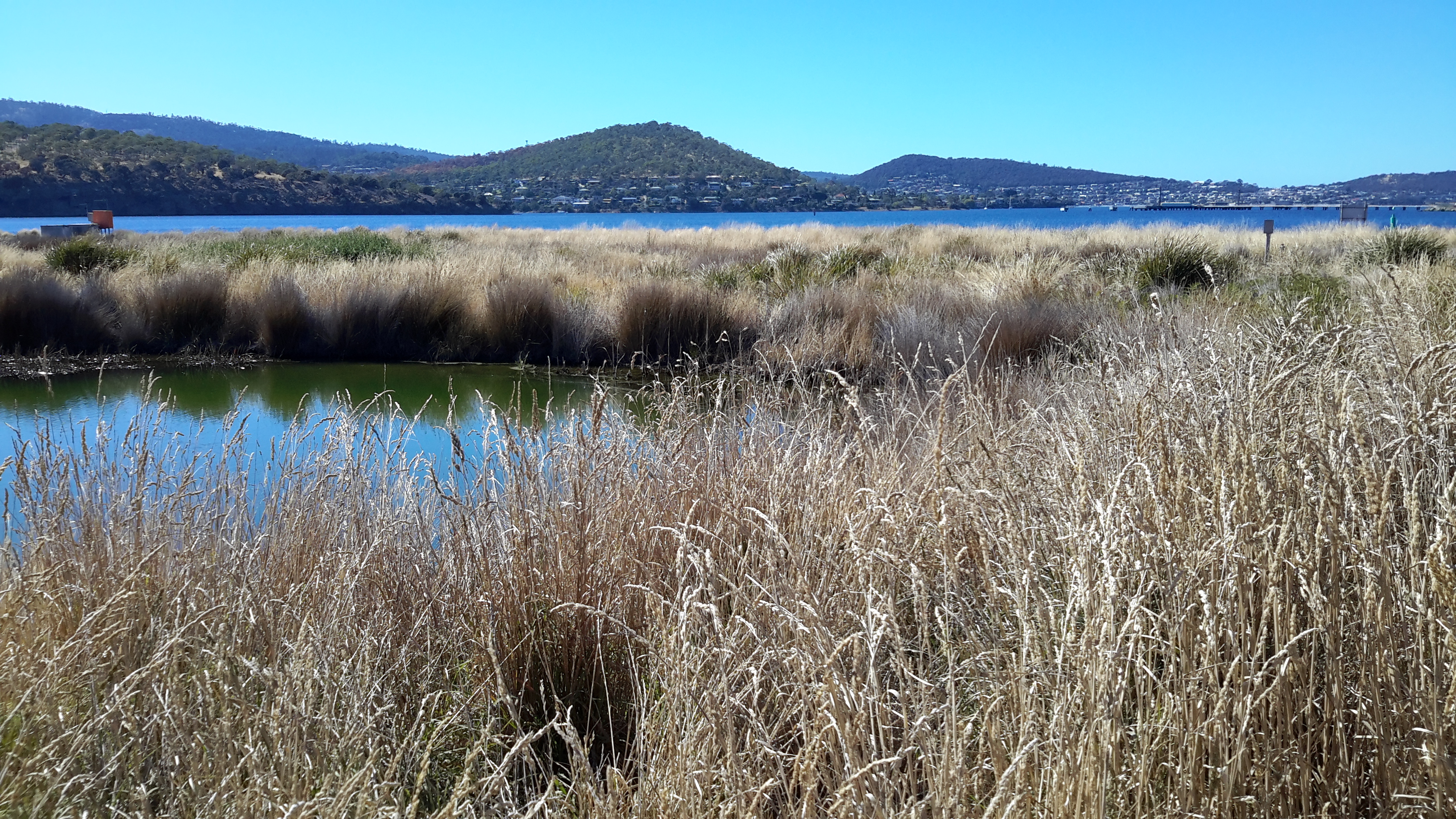
As I left the bus and began to walk along the marked gravel pathway nearby, a sulphur crested cockatoo screeched overhead. It was easy to enjoy the sunlit stand of poplar trees then Peppermint gum trees and other vegetation surrounding me.  Geilston Creek, with its paddling ducks, wound its way towards Geilston Bay on my right.

20141015_094500

The further I walked the more bird song I heard and the more native birds showed their colours. First I noticed a pair of pardalotes, then Jenny Wren and her mate the divine Blue Wren both collecting a meal of insects from the path ahead. To my left were sports ovals and tennis courts. 10 minutes after leaving the bus I reached a new walking bridge over the creek near the edge of Geilston Bay, garlanded by large flowering wattle trees at the entrance.

Once over the bridge I turned left onto a road, with a series of dinghy lockers visible on the other side of the creek, then a couple of minutes later the Bay was clear on my left and the last houses before the bush started were located up on the right. The track to Shag Bay started 15 minutes after I left the bus. Despite no breeze I felt the cold air hard on my face. But the air was deliciously clean, the environment pristine after the rain overnight, and the tranquillity of the vistas was sublime.

20141015_095242

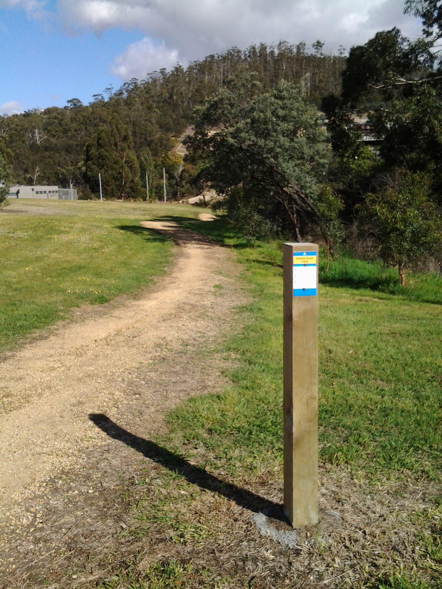
The official sign in the photo above, which was located at the beginning of the track, includes a map showing the way to Shag Bay and on to Bedlam Walls. I trekked gently uphill parallel to Geilston Bay on an undulating gravel track and around me all manner of birds sang, whistled, chirped and squawked. An ornithologist would be able to identify those sounds, but mostly I needed to rely on seeing these feathered friends of the bush.  The sounds were inspiringly musical. It was a feast for the ears. I spotted a Black Faced Cuckoo Shrike.

20141015_100446

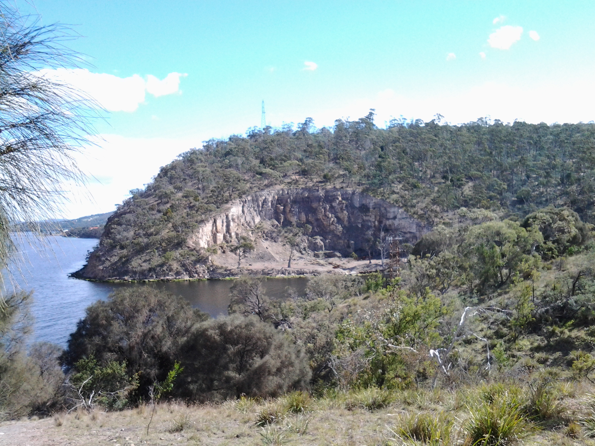
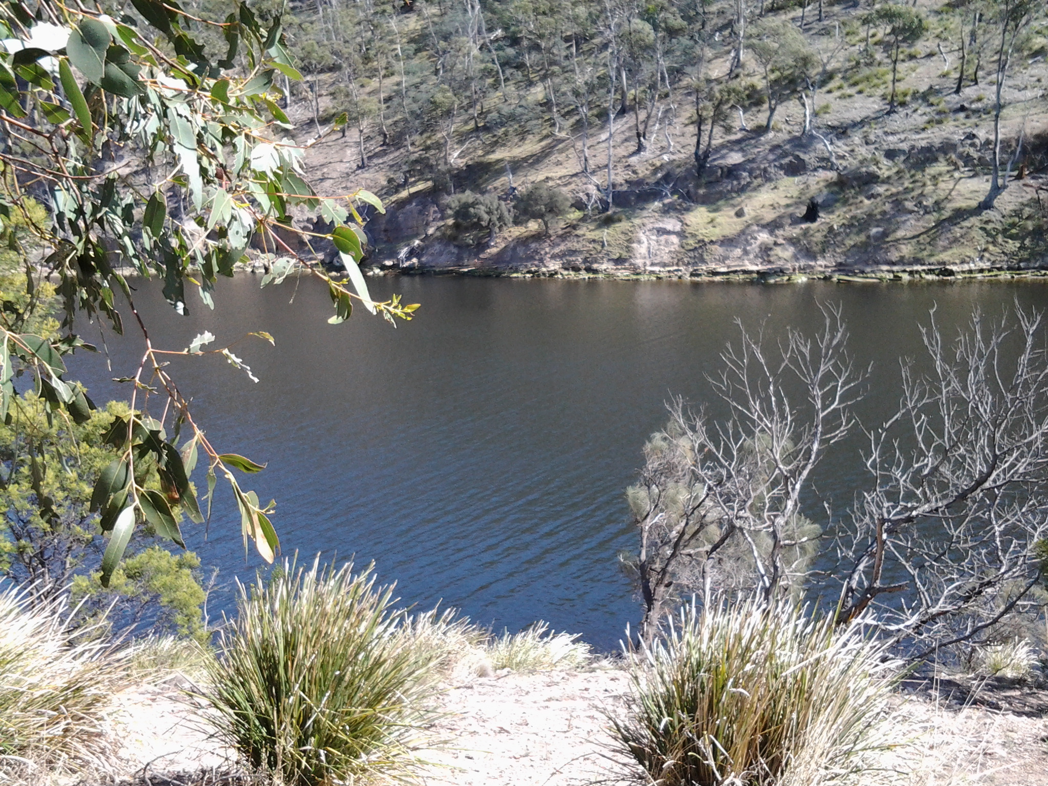
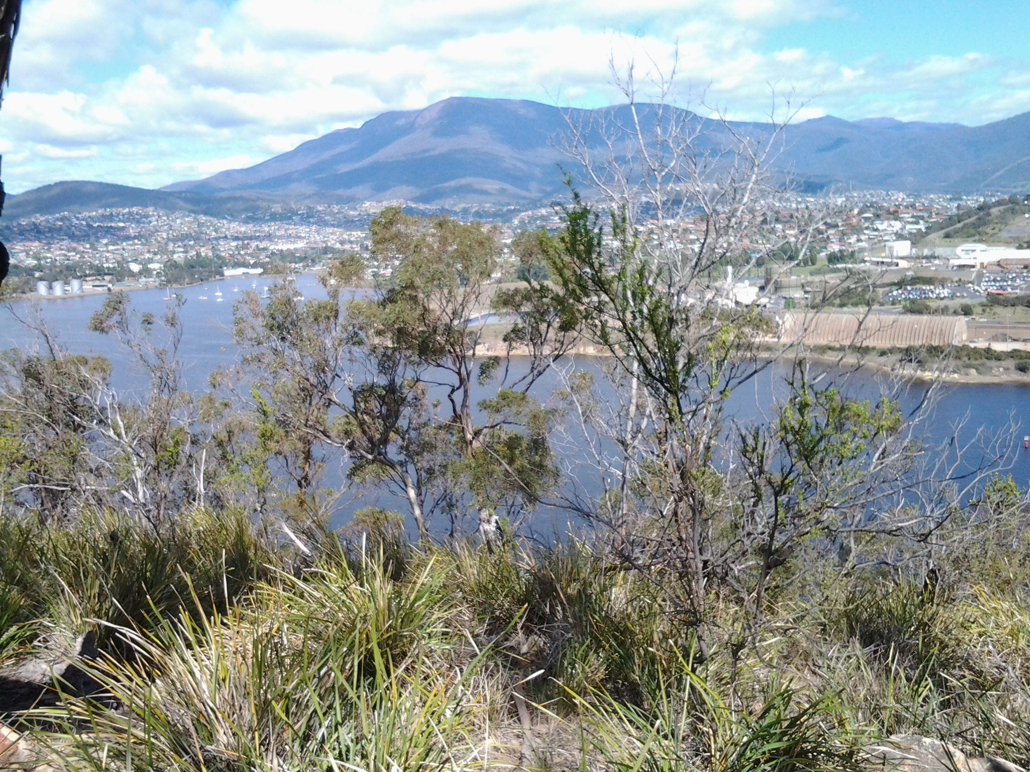
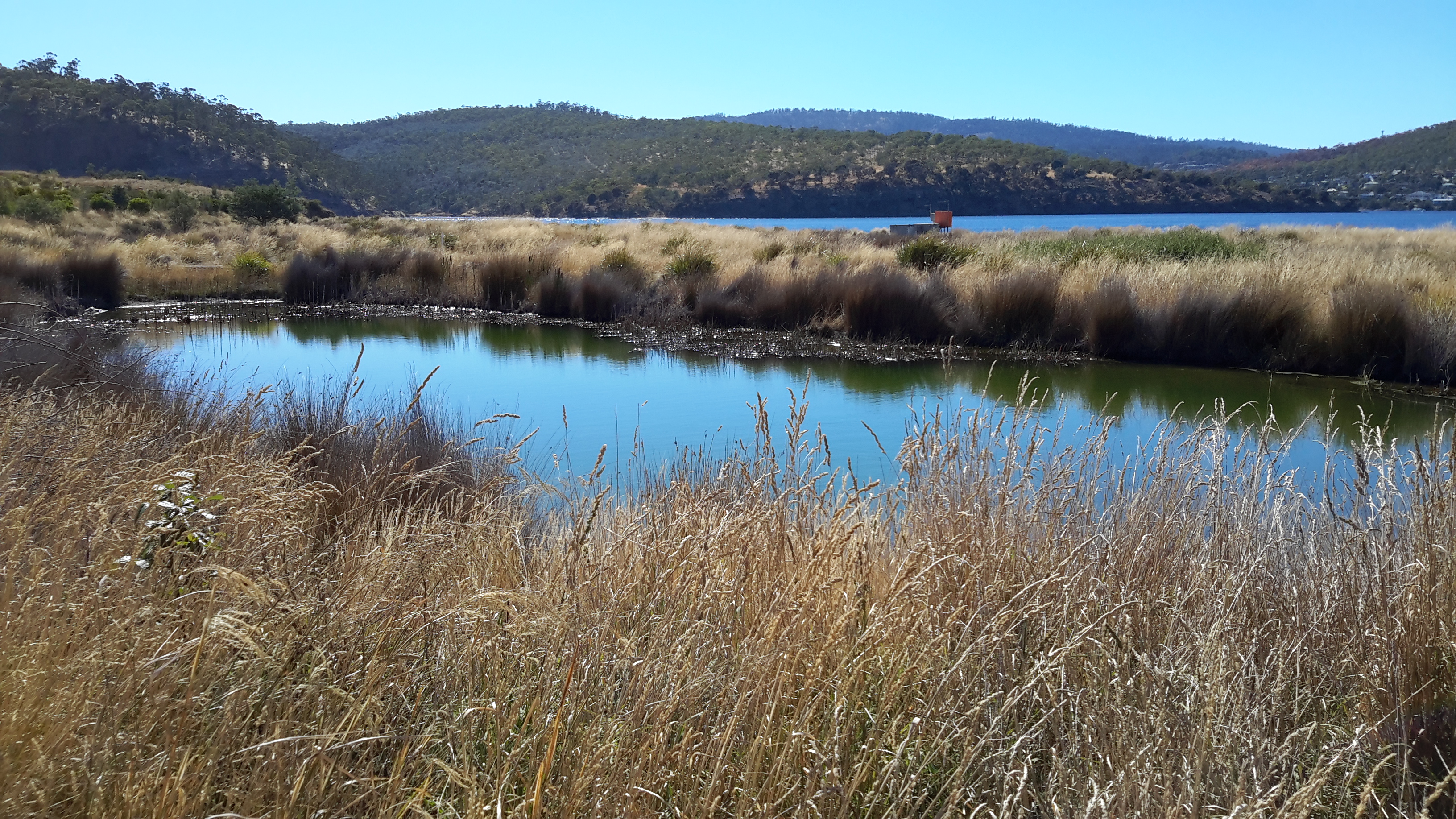
The photo above show where I had walked from: it looks down the track with Geilston Bay on the right.

Along the way, unofficial tracks led down to the water.  On this walk I had hoped to locate the known aboriginal cave but alas, I was unlucky.  I suspect one of those tracks would have led to it, and so I will return another day for further exploration. Previous research had indicated that our Parks and Wildlife Service government department no longer can afford the upkeep and safety practices that are associated with this cave, and that somewhere there are stairs to descend to the cave and a locked gate to prevent entry. Other bloggers have indicated this gate is easily climbed if you are prepared to take the responsibility to accept all risks. As yet I have no idea if Trespassers Prosecuted signs are in place for that location. A clear photo of the cave is available at: http://tastrails.com/shag-bay-heritage-walk/tastrails_shagbay_bedlamwalls/

At 10.05am I reached a split path and took the left hand route. The occasional gum tree was surrounded by open grassland containing frequent clumps of one of our native plants the Diplarrena Moraea, spiked with their white blooms. Tree roots slithered across the path creating a tripping hazard, so I walked slowly in order to absorb the views. At a second split in the path, again I took the left hand track.  This meandered downhill on slippery gravel under old Casuarina trees to the water’s edge. At 10.10am I stood on the rocky shore at Bedlam Walls Point.

20141015_101225

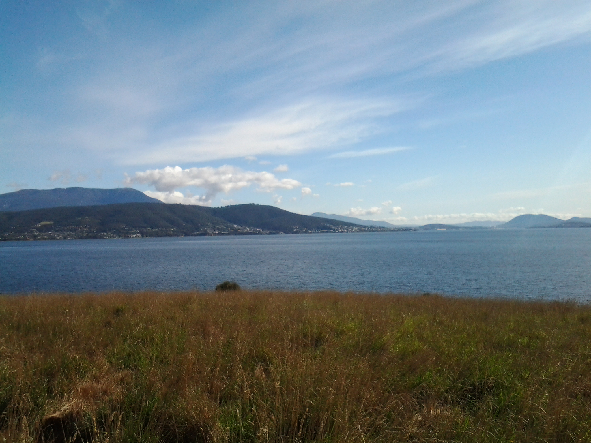
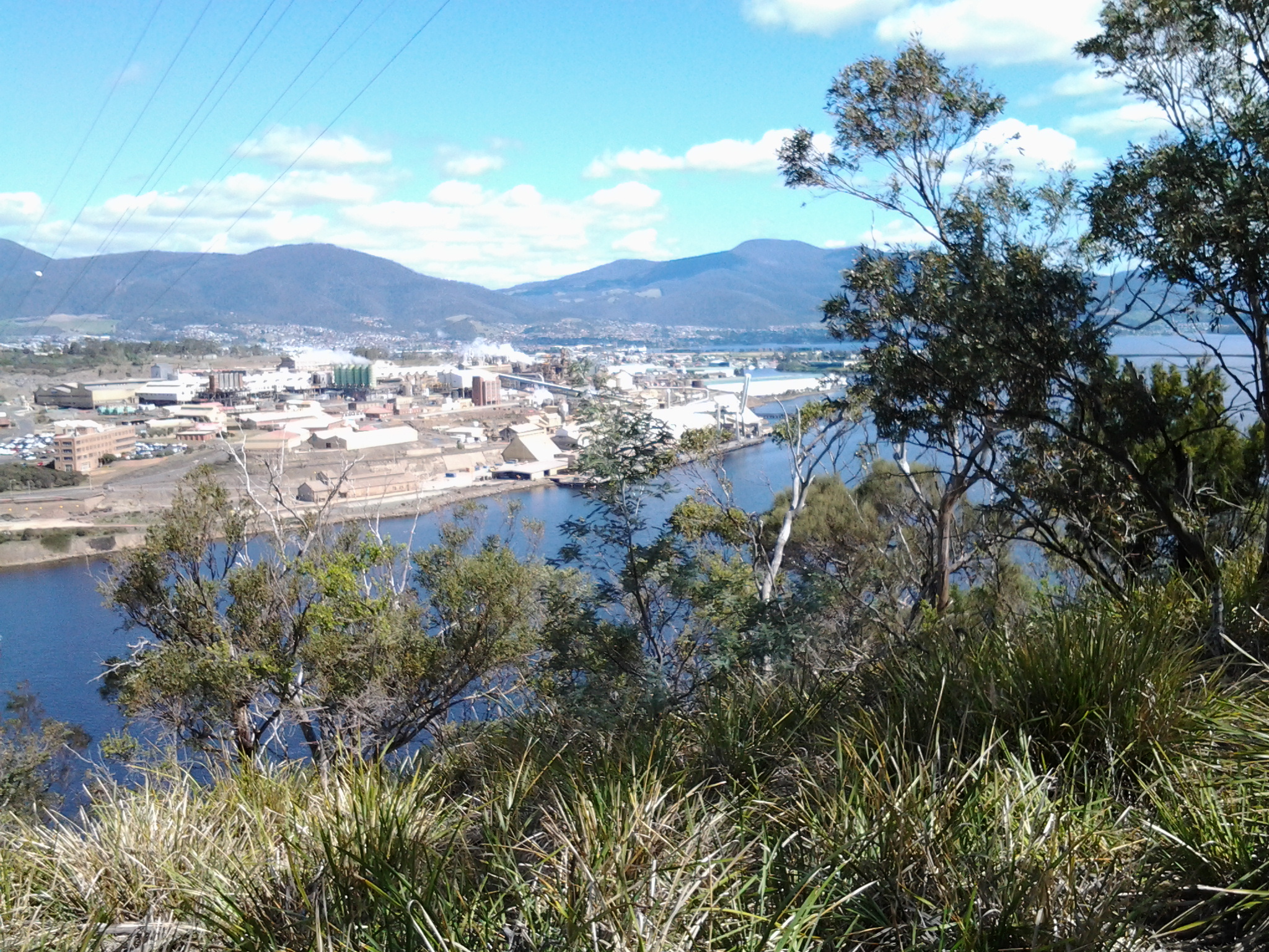
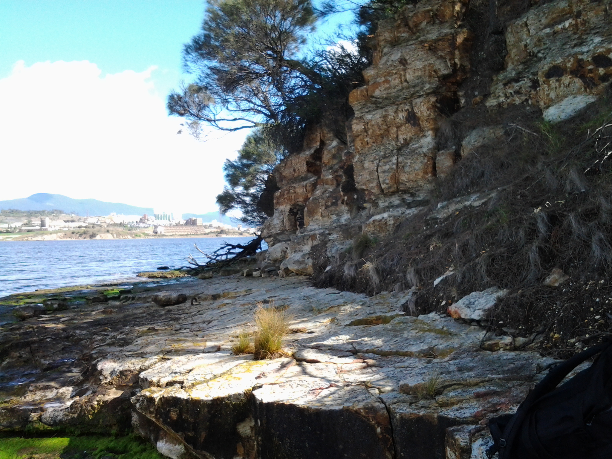
From the foreshore at Bedlam Walls Point, I looked across the Derwent River northwards to the industrial business ‘Nystar’ which edges part of the western shore of the river; a large zinc and lead smelting and alloying operation.

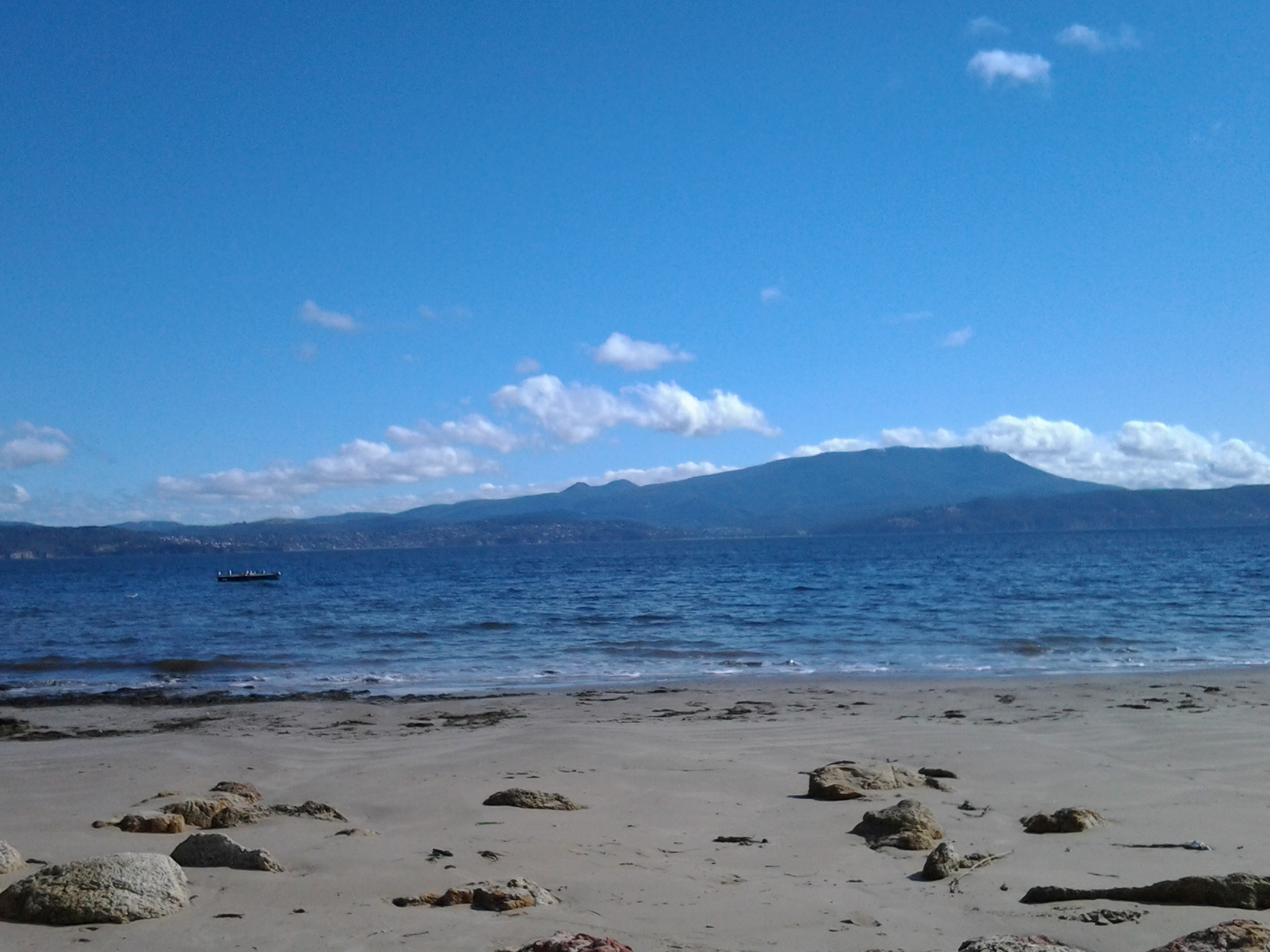
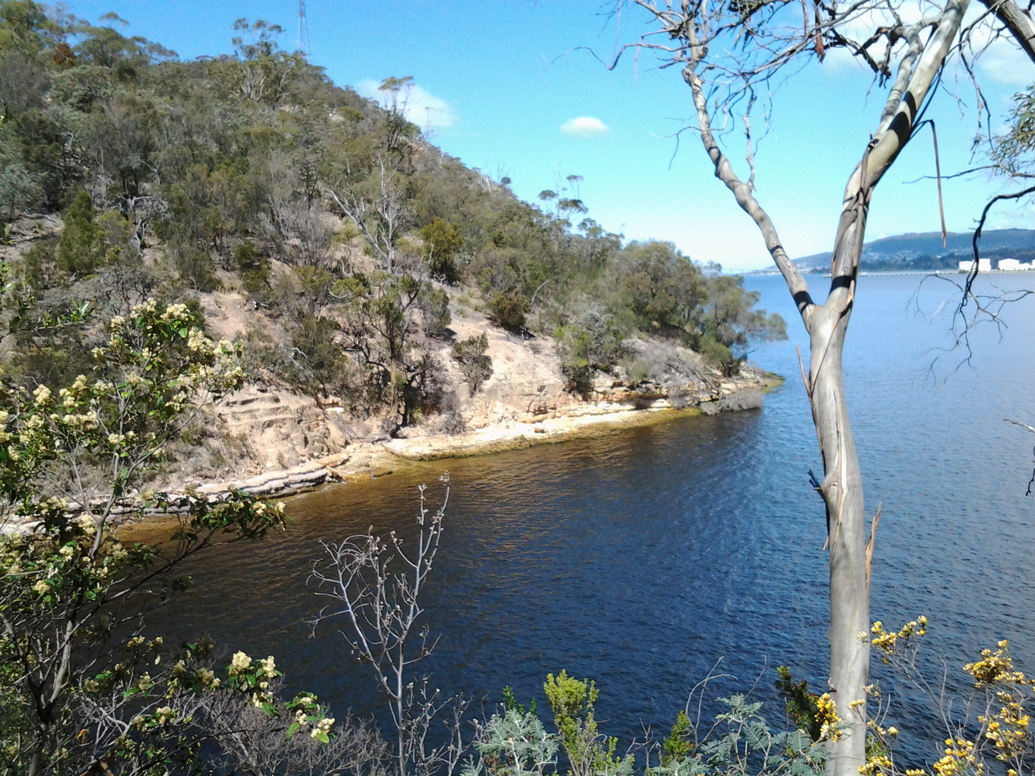
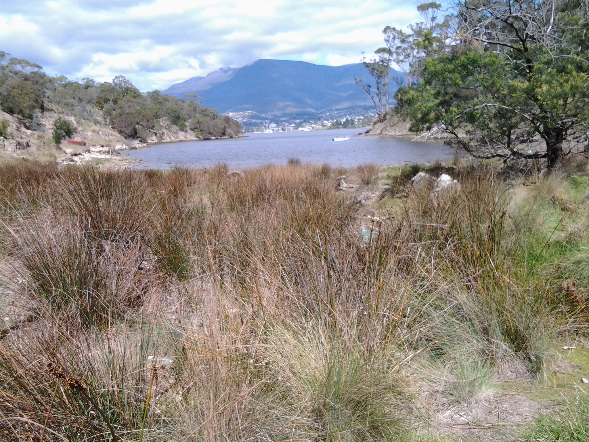
The photo below is also taken from Bedlam Walls Point and looks southwards. The headland on the left is the Lime Kiln Point marking the other entrance into Geilston Bay. Further afield the Tasman Bridge spans the Derwent River.

20141015_101301

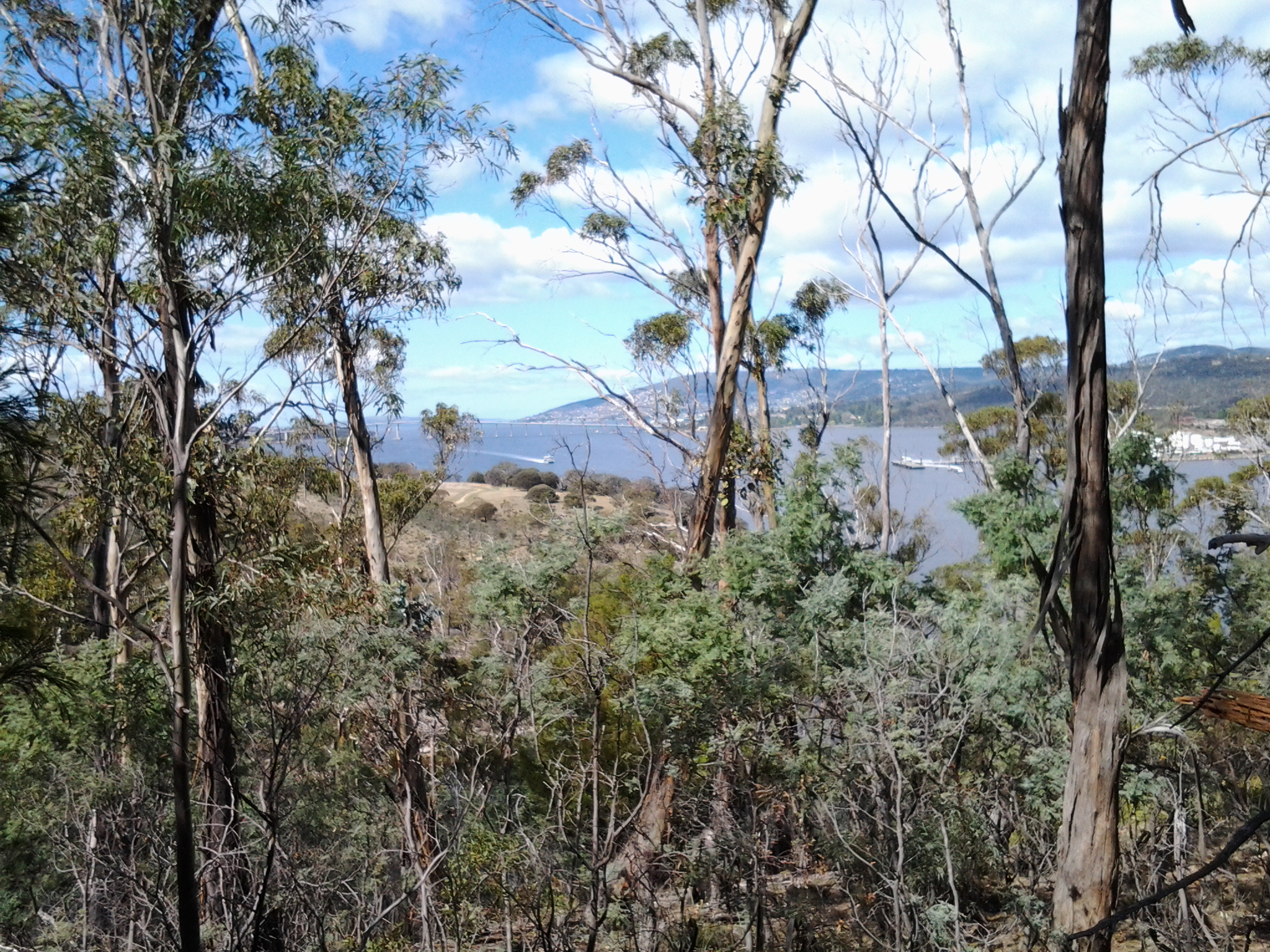
Before I left the Point, I watched a few pieces of river traffic: cormorants diving for their fish dinners, the MONA catamaran, fishing boats, and the sailing yachts.

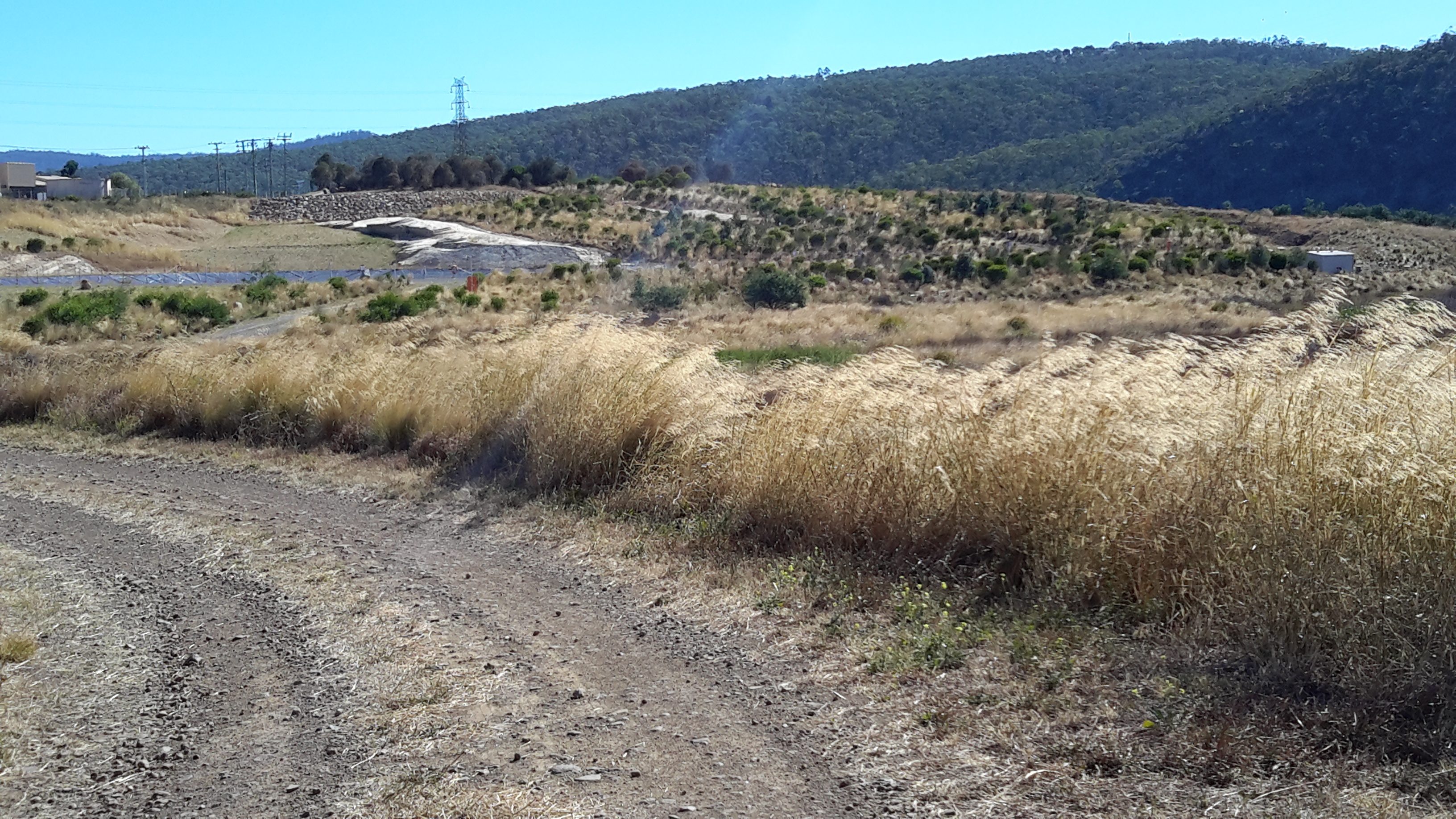
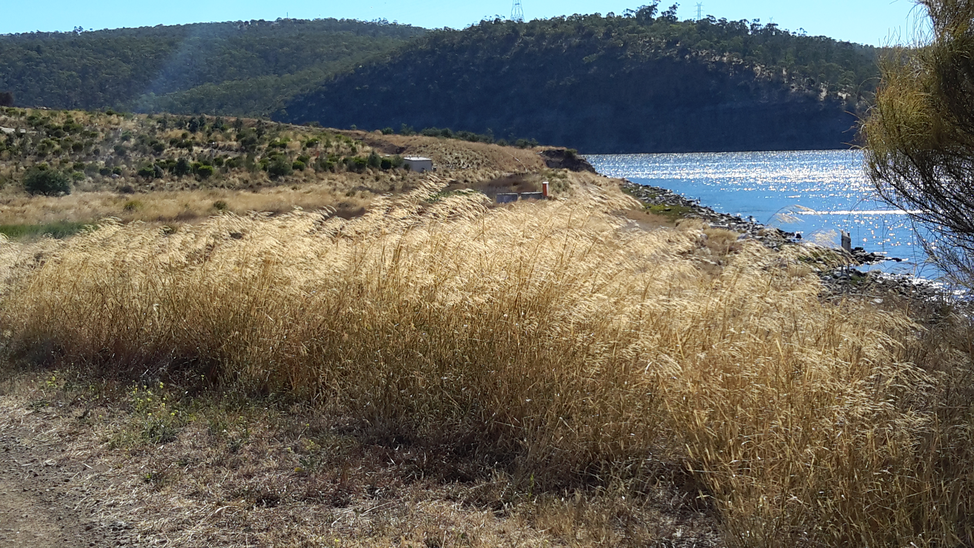
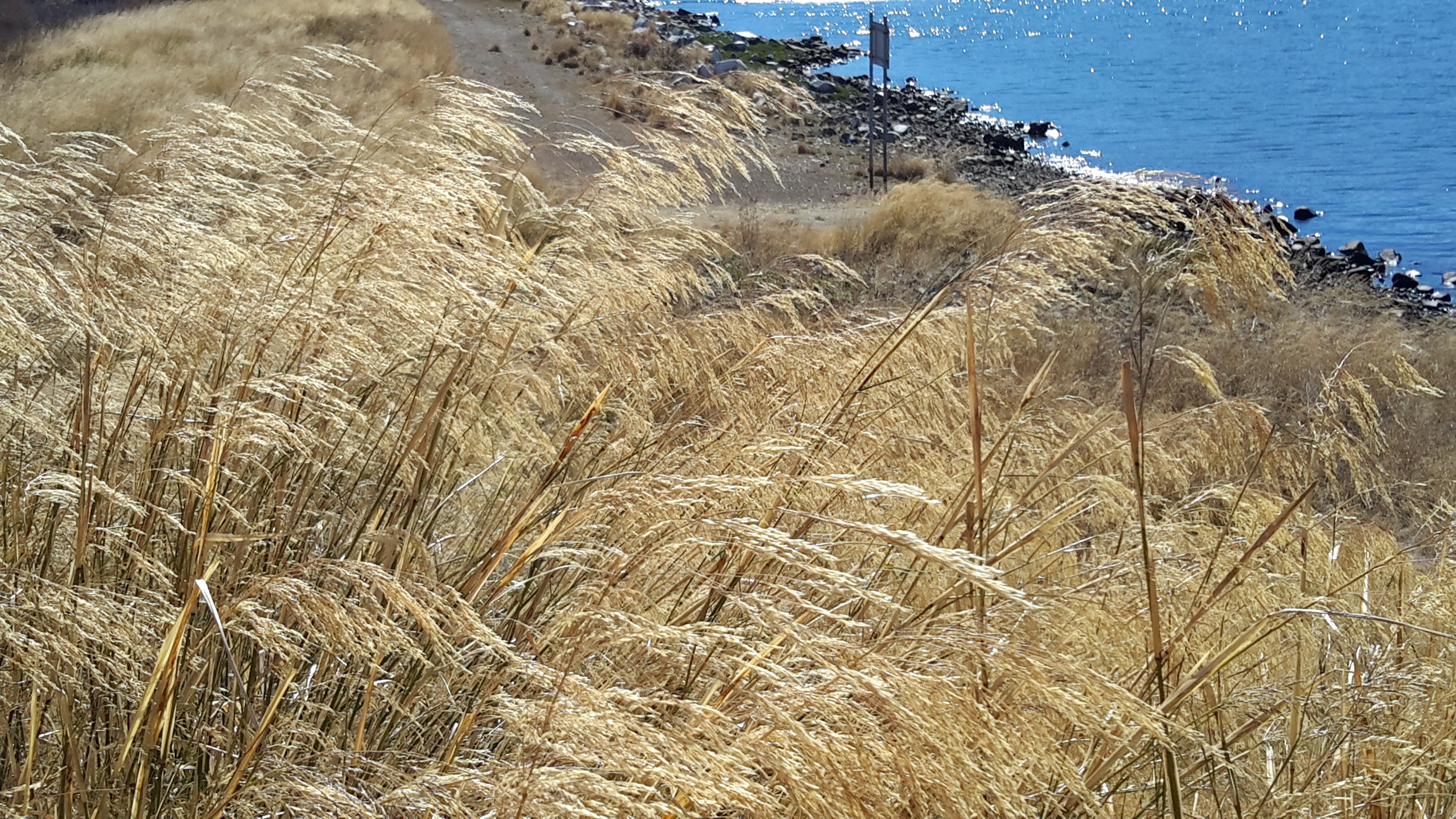
Generally tranquillity reigned. Then for a while, I walked the rocky edge back into Geilston Bay a little then retraced my steps again to walk around the Point and along the Derwent River edge hoping to find the cave.  Once it was obvious success with this search wasn’t likely, I clambered up the hill. By 10.25am, I was standing on top of a cliff on a little used unofficial track. I continued to walk along northwards and up the gentle hill with the intention of rejoining the official track. Before then, however, I came across an infrequently used 4 wheel drive ‘road’ and followed this instead. The main path was only 20 or so metres further inland. By continuing on the ‘road’ I walked closer to the River and found the experience very pleasant.  There were no other people, and no signs of native animals. Only beautiful bird song.

From Geilston Bay to Risdon on Stage 6 of my walk along the Derwent River yesterday

Yesterday’s walk was a sensationally wonderful experience. Over a few posts I will colour in the rich fabric of the day, much of it in clean fresh smelling bushland (such as that at Tommy’s Bight in the photo below).

20141015_133405

To start with, I caught Metro bus 694 destined for Risdon Vale and Glenorchy (scheduled from the Hobart city bus mall at 9.03) on the eastern shore and travelled to bus stop 14 on the East Derwent Highway at Geilston Bay. Thankfully the Clarence City Council has erected a sign marking the start of the walk.

20141015_093747

From the bus stop, I walked along the edge of Geilston Bay then northwards around Bedlam Walls Point to Shag Bay and onwards to the top of the Bedlam Walls, where I was rewarded with panoramas across the Derwent River. My northwards walk continued into and across the East Risdon State Reserve before descending into the suburb of Risdon. I turned south and walked on the edge of the Derwent River to Porters Bay where I took my lunch break before continuing south to Tommy’s Bight.

Eventually I retraced my steps back to Risdon and continued along the water’s edge to the junction of Saunderson’s Road with the East Derwent Highway. The return bus stop for a 694 bus, which arrived at 2.35pm (with not another one due for two hours), was on the Highway across from Risdon and adjacent to the land and water marking the Risdon Cove area.

I was away from home for approximately 6 and ¼ hours, and walked a total of around 12 kms winding over many tracks and retracing parts of my walk.

Previously I had walked 23 kms of the length of the Derwent River.  Yesterday I added 3 kms which brings the new tally to 26 kms.

Stage 6 of my walk along the Derwent River tomorrow – Tuesday

In preparing to walk from Geilston Bay north to Risdon Cove looking at natural and historical features along the way, I expect to make good use of initial research. Apparently I should see considerable evidence of past European and Aboriginal settlements and use of the land. Currently, there are no settlements along this edge of the Derwent River until the tiny suburb of Risdon is reached.

Birds between Geilston and Shag Bay

An obvious bird lover has blogged extensively on Tasmanian birds and, in particular, has walked part of the distance I will cover tomorrow.

More detailed information with glorious photos is available at http://tassiebirds.blogspot.com.au/2012/02/shag-bay-bluewings-more.html however, in summary; I should see a wide range of native birds if fortunate enough to be in the right place at the right time and with my eyes open.

Silvereyes, Black-headed Honeyeaters, Yellow-throated Honey eaters, Grey Currawongs, Blue-wing parrots, Yellow Wattlebirds, Brown Quails, Australasian Pipits, Dusky Woodswallows, Pied Cormorants, White-breasted Sea Eagles, Spotted Pardalotes, Dusky Robins, Black-face Cuckoo Shrikes, Grey Butcherbirds, Green Rosellas, New Holland Honeyeaters, Crescent Honeyeaters, and Brown Thornbills.  Phew!  What a collection!  I can identify some of these birds but not all. Therefore, I will be poring through my bird books later today to give me a better chance of seeing more and knowing what I am seeing.

Name of Shag Bay

Now is a good time to consider the name Shag Bay, the first Bay I will reach after Geilston Bay.  I cannot discover who gave the name, when, or why. In the absence of any information I have a theory. The common European bird Phalacrocorax aristotelis known familiarly as a Shag, is a species of cormorant. Cormorant birds are commonly seen fishing along our Derwent River. In fact, Tasmania has 4 species of cormorants with a vagrant fifth flying in from time to time. It seems very reasonable to imagine that the first Europeans, coming into what is now Shag Bay, repeatedly saw many cormorants fishing and so the name was easily applied.

Australia has developed a useful colloquialism: “like a shag on a rock”. This means abandoned and alone.  The Australian National Dictionary Centre explains “Any isolated person can be described as, or feel like, a shag on a rock – for example, a political leader with few supporters, or a person without friends at a party.”