Tag Archives: Bowen Bridge

Either side of Bowen bridge and Bags on the fence – posting 9 of 9

Because of the isolation of the track and the distance from the residential areas, I find it difficult to believe that people walk here and bring their dogs on a lead.  But what are the tied up plastic bags on the fence if they are not collections of doggy poop.  Any ideas?  They cannot be lunchbags used by Technopark staff because they are on the outside of Technopark’s most outside fence.  Strange. Colourful.  Unnecessary additional reminders of man’s encroachment on natural areas.

20170125_111542.jpg


Either side of Bowen bridge – posting 8 of 9

I continued along this rocky edge of Prince of Wales Bay a few metres away from the main run of the Derwent River, until it was clear that full access around the inlet at water level would not be possible.

20170125_110248

Eventually I came up from the shore and walked through the grass with pounding feet hoping the vibration would deter any snakes.

20170125_110615

I noted that a creative soul had walked this track.  Obviously inspired by the movement of the firm strands of tall grass, on two occasions in different places, a person has plaited stalks together to offer markers of mankind in the neighbourhood, or so it seemed to me.

20170125_111038

20170125_111028.jpg

20170125_111332.jpg

20170125_111337.jpg


Did I have company? – posting 6 of 9

On both sides of the Bowen Bridge lots of dry tall yellow grasses and other scrubby undergrowth grew next to the path. I was the only person around and the track appeared to be used rarely. The area was isolated; the closest residential area was over one kilometre away and I suspect that locals would seldom walk here. With the heat of the day and the nearness of the river, I was alert for the slither of snakes heading down for a desperate drink. However, I feel sure they would be deranged if they drank salty water  –  the Derwent is tidal at this point. Nevertheless I  did not want to step on or corner one – all Tasmanian snakes are venomous.

Strangely, not only did I not see a snake but I also did not see a water bird.  Thankfully there were a few chattering birds in the casuarina and eucalypt trees to keep me company.

Earlier in the day when I was walking around the Technopark fence line downhill nearest the Derwent River,  I had watched dozens of brightly blue and red coloured beetles- I haven’t seen these before, and a website for identifying Tasmanian beetles does not include this one.  Anybody any ideas?

20170125_084516.jpg

20170125_084523.jpg

The experience was very pleasant and I would be very happy to wander this way again.

Word of caution for others who might follow in my footsteps: the seedpods of the casuarina were liberally sprinkled along the pathway and in the light dappled by the trees, full concentration was required so that I didn’t roll on them – a sprained ankle or a fall down the slope were just two possible consequences if I did not watch where I was going.

20170125_105440.jpg

Either side of Bowen bridge – posting 5 of 9

Once under the Bowen Bridge I could see a track continued in the easterly direction, and skirted around the bottom of Technopark.

20170125_104953.jpg

20170125_105002.jpg

20170125_105044.jpg

100 metres along this track I spotted the only sign of bureaucracy.

20170125_105314.jpg

I imagined I might surprise a fisherman at the end of the track or detect one who had made his or her way from the track to the water’s edge and was partially hidden by the bush. But I never did. I never saw anyone.

As I continued walking I spotted the township of Risdon across the river.

20170125_105336.jpg

20170125_105554.jpg

And then the large industrial plant of Nystar came into view.

20170125_105544.jpg

Most prominently, the gaping ‘mouths’ of the  boat building company INCAT stood across the inlet of the Derwent River (Prince of Wales Bay) from Dowsing Point.

20170125_110009.jpg

20170125_110021.jpg

20170125_110024.jpg


Either side of Bowen bridge – posting 4 of 9

I decided to walk from the Bowen Bridge around Dowsing Point towards the Derwent Entertainment Centre on the Glenorchy side of the bridge.  A faint track showing occasional foot traffic looked promising and became my guide.

20170125_095351.jpg

Early in the walk along this track, easy views to and access to the water were not possible although as time passed the river came into constant view. 20170125_095427.jpg

20170125_095500.jpg

Then the pebbled and rocky shore appeared.

20170125_095708.jpg

20170125_095446.jpg

I was delighted when I came across a slight semblance of a track down to the river’s edge.  Soon I was on the shore and walking that rocky ‘beach’.  The wind was fierce but not cold. My sunhat had no chance of staying attached to my head. I lathered on the sunscreen hoping for wind protection. But it was fresh and invigorating. The air was alive and so I felt even more alive. And so pleased that my return visit to Dowsing Point had been able to bring me down to the water of the Derwent River.

20170125_095949.jpg

20170125_100033.jpg

20170125_100222.jpg

20170125_101115.jpg

Clearly native oysters grow on the rocks near the shore.  The whitening shells of long dead oysters were thrown up at the high tide level.  I was surprised not to see any Australian Pied Oystercatcher birds looking for a meal.

20170125_100126.jpg

I continued walking around the contours of Dowsing Point, thankful that the tide was out and the shore was wide enough, dry enough and had no insurmountable obstacles. But beneath the northern section of the fenced-in defence forces precinct suddenly the ground became marshy and a trickle of water in a swampy like environment emptied into the Derwent. I did not believe this was passable.  Perhaps if the tide had been lower and if I was wearing gumboots, I might have continued.  On another day, this most likely could be a doable section and one I could tackle from the Derwent Entertainment Centre end of the walk.

After searching unsuccessfully for alternatives, eventually I retraced my steps, and climbed a grassy hill for another view of the obstacle – which looks benign in the photo below.

20170125_103014.jpg

I have walked along the Dowsing Point suburban streets with paddocks at their ends that extend to the shoreline shown above, such as Park Road and Dwyer Place. Unfortunately high fences,  locked gates and dead ends prevent access to this defence forces land.  Trespassers Prosecuted signs were a deterrent.  20170125_091847.jpg

20170125_092014.jpg

20170125_092225.jpg

From the obstacle preventing my continued shore walking,  I turned back and walked towards the Bowen Bridge.  Eventually I left the beach after reconnecting with the hillside track used earlier.

20170125_100021.jpg

20170125_100230.jpg

Occasionally, next to the faint track through the grass, someone had placed track markers – coloured rectangles on posts. Very thoughtful.  On the way back I found a wonderful confusion of markers; just as we know some mailbox catalogue deliverers dump a pile of undelivered catalogues in drains or over someone’s fence, it seemed the person placing the track markers dumped his/her extras. So there I was, faced with an amusing mini-forest of markers all pointing nowhere and signifying nothing.

20170125_103746.jpg

The markers of mankind are always there to be found, and to be puzzled over by those without experience.  But I found my way and soon returned to the Bridge.

Either side of Bowen bridge – posting 3 of 9

Once at the bridge, I made my way  through long grass and weeds to the fence line hoping to find a gap or to be able to follow the fence downhill and arrive at the water’s edge.   I was relieved when the fences stopped giving me open access to the land below. The Derwent River was clearly visible so I continued scrambling downhill until I stumbled across a track which I followed under the bridge.  20170125_094951.jpg

20170125_094956.jpg

20170125_095256.jpg Once under the bridge I discovered a set of concrete steps which would have made descent easy.  To access these from the bridge pathway above, walk to the left of the plaque and then follow the bridge wall downhill until the steps are reached.  There are no gates to block progress.   20170125_095126.jpg

20170125_104732.jpg

20170125_104538.jpg

Either side of Bowen bridge – posting 2 of 9

As I left Technopark I had a view of a new aspect of the Derwent River.

The Derwent River flows into Prince of Wales Bay and consists of tiny inlets including one at the bottom of the Dowsing Point hill.  I noted there were  no opportunities to walk next to the edge in the bay below – either vegetation hung over the water or private jetties and businesses crowded the edge.

20170125_090417.jpg

20170125_090358.jpg

20170125_090520.jpg

20170125_090532.jpg During the many vehicular crossings of the Bowen Bridge that I have made, I could never see where it would be possible to climb down and be under the bridge. Nevertheless I felt there must be a way.

I walked along a path from the Australian Army Derwent Barracks on Goodwood Road that leads to and crosses the bridge.  The quality of the path is variable and I suspect it is not much used. One cyclist passed me on my walk to the bridge and no-one was around during my return trip.

20170125_093341.jpg

20170125_094433.jpg

20170125_094721.jpg

20170125_111833.jpg

At the bridge I noticed the large bronze plaque marking the official opening of the bridge – heavily graffitied.

20170125_104645.jpg

But was there a path to the river below?  The absence of signage was not encouraging.

Either side of Bowen bridge – posting 1 of 9

Stage 8 of my walk from the mouth the source of the Derwent River took me under the Bowen Bridge on the eastern shore, and during Stage 10 I walked past the Bridge at Dowsing Point on the western shore after deciding to walk to the mouth on both sides of the river. However, when on the western shore I could not easily see a way to stick by the river edge at Dowsing Point, and since that day promised to be a long one I took the easy option and followed the streets which cut across the Point. I always felt that I hadn’t been quite honest in taking this approach and that I needed to return and be serious about walking the Derwent edge to the extent it was possible.

So return I did, and this series of postings records that visit.

As usual within the Greater Hobart Area, I took a Metro bus which dropped me off one morning within the Technopark precinct at Dowsing Point on the Hobart side of the Bowen Bridge. Technopark is a state government initiative started over 15 years ago with the aim of providing support and encouragement for small businesses and creative individuals with technological related ideas that could be developed into significant money earners for Tasmania’s productive growth. It’s brief has expanded since its inception.

By leaving the bus at the turning circle within Technopark I hoped there might be ways to walk to the river edge and then continue around Dowsing Point.  Until I looked around that day, I had not realised this precinct is seriously fenced, including the installation of electric fencing, and there is no exit except through the main fortified entrance gates.  In the photo below you can see three layers of fencing, with barbed wire strung up at the top of the closer two fence lines- and the Bowen Bridge across the Derwent River in the distance.

20170125_084025.jpg

I walked to corners and along the fence lines without finding a gap, a gate or any chance of passing through.  I could see the Derwent River and the Bowen Bridge with Mt Direction overlooking both – but I could not reach them from the Technopark site.

20170125_084247.jpg

20170125_084753.jpg

20170125_085012.jpg

20170125_085019.jpg

So I had no choice except to leave the Technopark and try other options to reach the River.  The day displayed a stunning blue sky overhead and a moderate breeze which rattled the long grasses.  Mount Wellington was ever present as I walked away from the river.

20170125_085256.jpg

Before long I passed through the gates and headed away from Technopark with the aim to walk to the Bowen Bridge.

20170125_085847.jpg


Another revision: naturally therapeutic images from stages 7-10

I can’t help myself. Having reviewed my favourite images from the first half a dozen stages of my walk along the Derwent River, I felt compelled to continue looking through my collection from the subsequent walks.  I have chosen photos showing aspects of both the natural and man-made world and I believe all will prompt thinking about the Derwent River, Hobart and its suburbs, and the natural environment. My selection of the images with the most memorable impact for me, from stages 7-10, are given below.

20141031_094126

From the eastern shore looking northwards towards the Bowen Bridge, with a couple of black swans on the river.

20141031_100200

Two plaques ‘opened’ by two great Australian prime ministers near the Bowen Bridge.

20141031_104822

The rusting raw-edged remains of a ship, the Otago, at Otago Bay.

20141031_113132

My enjoyment of any family’s black sheep.

20141031_123000

Heading into Old Beach and gradually leaving Mount Wellington behind.

20141031_132519

The gloominess of the approaching storm when I reached Old Beach.

20141111_092342 20141111_092805

The pleasures of well-made pathways, thanks to local government.

Green Point from new Old Beach

Looking northward across the Jordon River to Greens Point.

20141111_103700 20141111_121906

The glories of native flora. In these instances, it was blooming wattle and a spectacular stand of eucalyptus/gum trees which attracted my attention.

20141111_120752

The remains and the signs of a burnt out car on a back track.

20141111_130523

Knowing that it is still possible to have a laugh when walking.

20141111_131133

Arriving at the Bridgewater Bridge.

20141111_134311

Walking on the western shore of the Derwent River for the first time during this project.

20141125_095438

The house of one of first European settlers, James Austin, at Austins Ferry.

20141125_115047

At Dogshear Point, walking around the Claremont golf course, with the thwacking sound of hit balls crossing the greens.

20141125_110906

Reaching Cadbury’s chocolate manufacturing factory in Claremont.

20141125_143454

The hand-hewn rustic style seat near Connewarre Bay.

20150109_074126
Passing MONA somewhat camouflaged as it nestles into a tiny hill against the Derwent River.

20150109_081644

The mosaics along the foreshore.

20150109_101243

The jumble of boats and boat houses at Prince of Wales Bay.

Hoon tyre marks

Road mark making in Lutana.

20150109_132008

Cornelian Bay’s oil tanks up close.

20150109_153103

The Tasman Bridge.

20150109_155515

The circus had come to town.

20150109_161747

The emptiness of an arena of stands waiting to be filled during wood chopping competitions.

20150109_161339

Reaching the ‘end of the line’ on arrival in Hobart city.

Fossil Cove Road T junction with the Tinderbox Road

Close to 9.30am I reached the left hand turn of Fossil Cove Road.

My final decision to proceed to Pearsons Point was made at that juncture.  My reason for wanting to walk to Fossil Cove is that it is on the Derwent River and I would be able to appreciate another part of the River’s western shoreline.  By my reckoning, and never having been down the road to check the situation, I believed the return walk would cover 3-4 kilometres and include steep hills. I thought that if my feet were holding up after I reached Pearsons Point and had returned back to this road then I could finish off the day’s Stage with a walk to see the fossils.  Alas … my feet were not ready for this on the return trip (I still had the walk from there back to a Blackmans Bay bus stop to consider) so I will visit another day to make this deviation from Tinderbox Road.

Including this future walk, I count three additional walks I have promised to do, in order to cover a little more of the Derwent River shoreline. I will return to the area between GASP (Glenorchy Arts and Sculpture Park) and Goodwood on the other side of the Bowen Bridge.  I will find out if I can make special arrangements to visit the industrial property of Nystar which sits against a significant length of the Derwent River.  And finally I will return to walk to the fossils at the end of a track at the end of a road off Tinderbox Road.  Most likely these walks will be undertaken on good weather days in winter when walking inland towards Lake St Clair is impossible because of extreme weather conditions.

Goodwood. Not sure about the ‘good’.

After walking across Goodwood Road (on Stage 10 of my walk along the Derwent River) which extends from the Bowen Bridge at one end to Glenorchy suburbs at the other, I was puzzled by a sign on one corner indicating behind it was a Model Park.  There were no trees. What sort of park was this? It seems this is a place for big boys to play with their model cars etc.  Special tracks were clustered in different parts of the ‘park’.

20150109_093005

Not much further along the road to the left (Innovation Drive –someone gave this name a lot of thought and presumably smirked in satisfaction) was signed as the entry to Tasmania’s hopes for technological innovation, Tasmanian Technopark.

20150109_093306

The Technopark was the brainchild of a government minister and his public service department around 2000. A small amount of information can be read at http://www.stategrowth.tas.gov.au/home/about_us/tasmanian_technopark. A federal government website has a whisper of additional information at http://www.australiangovernmentgrants.org/TASMANIAN-TECHNOPARK.php. I am surprised that there is no easily googled publicity about the achievements of this program. Can Tasmania ever equal the cut and thrust of innovation coming out of other small or remote places like Singapore, Finland, Iceland, etc?  What are we doing right and what could be done better to achieve successes?  Who knows? I couldn’t find any such information on the internet.

In the absence of any clear way to walk around the Derwent River edge of Dowsing Point, on which the Technopark is located, I thought it best to leave that exploration for another day and to continue along Howard Road.

Goodwood, in my experience, turned out to be the dog poo suburb of the Greater Hobart Area.  Excrement was everywhere in perfect form or squashed on the pavements, or the various colours dotted grassy verges.  I didn’t waste time on photography for which I am sure you are thankful – the choices were too great!

Firstly I turned left into Negara Crescent which was a street combining mean, low level, paint-flaking, unmown lawns, weed infested residential properties (okay – well not all were, but many were) with light industry such as Linen Services Tasmania, boat works, Anchor Wet Suits, Towbar and Crash bar repairs, fishing supplies, and a large unnamed workshop building emitting unpleasant chemical smells. Those houses which had Derwent River frontage sometimes had escaped overgrown blackberry infestations blocking river access in their back yards. There wasn’t a sense of wanting to live caringly or beautifully here. Accessing the River is impossible without entering private land around this locality. The built-in nature of some parts can be seen on the sign for a block of land that has been sold.

20150109_094257

By 9.45am I was joining back onto Howard Road. I walked on past bus stop 34, and the nearby Take Away Food shop and reached the Giblin Reserve around 9.50am. Photos of the surrounds are as follows:

20150109_095701  20150109_095658  20150109_094705

I sat for a while in the Reserve, watching a man in his car eating his take away meal, and taking in the surroundings.  This was a part of Prince of Wales Bay.

20150109_094717  20150109_095819

In the distance I watched the steam/smoke pouring from the zinc works of Nystar, a large industry owning considerable property along the Derwent River a little south from where I sat for a while and soaked in the atmosphere.

20150109_094734

Once I continued walking southwards around the Bay, I passed a kid’s playground, BBQ area, public toilets and ducks quacking.  When stymied by lack of water access around 10.05am, I walked up onto Gepp Parade and walked past a tree laden with not yet ripe nectarines, and later a row of junky looking boathouses. I wondered who wouldn’t be interested in removing their half sunk boat.

20150109_101243

Eventually, through the bitumen path, weeds began to multiply then suddenly this ‘formal’ path stopped and an occasionally trodden pathway through the weeds was all I had to continue on.

20150109_101335

I couldn’t help thinking that wherever a local government area is almost at the end of one and near the start of another area, there is more rubbish not collected and the general appearance of places is rather shabby. This has been the case on earlier stages of my walk, and now as I was at the extremity of the City of Glenorchy and coming closer to the City of Hobart boundary, the amount of visible rubbish and untidiness was escalating.

However, looking out over the water of the Bay (and if I tried not to study the weedy edges with their coloured flotsam and jetsam) to Mt Direction on the other side of the Derwent River, presented me with an attractive view.

20150109_101749

When I could get back down onto a weedy area, I followed man-made tracks and continued almost to the Sewage Treatment Farm (which I could see had wired fencing into the water that barred my continuous shore access) then headed up through the trees and onto a disused railway line. I crossed this, climbed a weedy rise spattered with rubbish, clambered over a metal guard rail and stood on Derwent Park Road which is the main road to Nystar and other industry located by the River. It was 10.25am when I reached this point. I had been plodding along for almost three hours.

Towards the Bowen Bridge

I plodded away from the GASP and Derwent Entertainment Centre site by walking between the Derwent River and the Elwick Race Course where dogs and horses race regularly for their owners.  I heard the rhythmical thumping on the turf before two trainers galloping their horses came into view over the barb wired fence.

20150109_091131

Otherwise all seemed quiet in that direction. Obviously it wasn’t a race day – well not then. Possibly it was too early in the day.  I walked along the long and winding Loyd Lane past a Department of Defence enclosure around 9.15am.  This is a little used road and pale green lichens were spreading across the bitumen in Rorschach test like splotches.

Before 9.20am I had reached a bar across the road which I walked around to discover inside the Commonwealth Government property was a Regional Training Centre and the base for the First Military Police Battalion, and the 4 Section 8 Platoon Company.  The gates were all locked and there was no sign of life on the other side of the fences.

20150109_091945

I continued along the road, reached the T junction with Park Rd, checked my map and found accessing the River improbable so I continued the few metres to the next T junction, with Centre Road. But there was no walking possible this way. The Road was strongly gated and locked and the signs indicated the Australian Army Derwent Barracks was inside.  Effectively I was denied access to the Derwent River from the end of GASP.

I did not achieve success with edging that headland which pushes out into the Derwent River and which is split in half by Goodwood Road to the Bowen Bridge. I have an idea that perhaps there is another way and at some future time I will try again to follow the River on the northern side.  I didn’t have much more success on the southern side of the Bridge, but again I am inclined to return and to see what else is possible.

So, on Stage 10 of my walk, I proceeded to the traffic lights intersection of Loyd Lane, Goodwood Road and over to the other side at Howard Road. It was 9.30am.

There is more to GASP beside the Derwent River than perhaps seen in first inspection

During Stage 10 of my walk along the edge of the Derwent River and a few minutes before 9am I had walked to Wilkinson’s Point the mostly southern end of the GASP (Glenorchy Arts and Sculpture Park) where I was surprised to discover a redeveloped structure which now forms part of the GASP experience. This was the construction site used for the building of the Bowen Bridge which crosses the Derwent River nearby.

Now, from time, contemporary art installation exhibitions are staged here.  In fact, I expect to see something there in the next week as part of the extraordinary internationally acclaimed MOFO festival (refer http://mofo.net.au/).  The MOFO program indicates that this Friday Jan 16 at midday The Tea Cube will introduce a portable tatami tearoom for a spiritual brew.

I wandered around this site in amazement.

20150109_085808  20150109_08582020150109_085816

With my back to the Derwent River I took the following photograph with clouds over part of Mount Wellington.

20150109_085951

I loved the colour of the surface ‘weeds’.

20150109_085853

And then it was time to begin to wander southwards again back on a non -path, which some readers will recognise from my video of walking feet.  In the photo below you can see the low structure of the ex-construction site, as a dark line separating the land from the water.

20150109_090654

Looking northwards and back to the ex-construction site.

20150109_090856

Part of the new repurposed structure has been cantilevered over the Derwent River.

20150109_085938

Trekking around Windermere Bay

After leaving the Cadbury’s factory I wandered down the hill with brolly up mostly choosing the pathways left of Cadbury Road that were closest to the River. Occasionally there were single file tracks that descended to the River but I preferred to continue in the direction of the open and exposed Windermere Park. As I descended onto the flatter lowlands I had my first resight, since walking on the eastern shore, of the Bowen Bridge further south. In the distance I could see the tops of buildings that are part of the Nystar industry on the western shore opposite Risdon. Soon after arrival on the low parkland around 1.45pm, I walked past a fenced area designated as Windermere’s Passive Stormwater Treatment Wetland – this was attractively landscaped and so I thought it was a shame the fence was so ordinary by comparison. Black swans paraded across the blown waters of Windermere Bay. A new war memorial was in the process of construction.

Further across the lowlands, duckboard paths meandered over the water logged mud and water grasses. Finally I reached the impassable Faulkners Rivulet, a tiny stream with water from the mountains. Clearly others had rock hopped across the Rivulet but the rocks were slippery with green mosses and I was not prepared to slip, get wet and maybe sprain a body part. Instead, I walked up to the Main Road and was able to cross a 19th century simple but handsome sandstone bridge.

Sandstone Bridge Windermere Bay

I looked back across Windermere Bay to the white edifice of Cadbury on the slight rise in the distance.

20141125_140421

Not far along the Main Road from the bridge, I turned left at Windermere Beach Road at 2.07pm. Walking down this suburban street I was constantly amused by the free roaming ducks that were making a temporary home in various front yards, or simply taking a walk along the street. (I remember a house in which I lived in Darwin had ducks on the property, and their disturbing inclination to do their green business on the front door step. I wondered if these ducks had similar bad habits.) I smiled when one street was signposted Teal Street. Ducks were everywhere.

Something new. At the T junction of this road with Curlew Parade, the green shapes on the street corners between slabs of concrete pathway, out of which grew trees, was noticeably even and weed free. Artificial grass turf. I wondered if the City of Glenorchy Council had installed it or whether a frustrated local resident had paid for it. Looking around, straggling weeds and grasses was the norm for the public areas along these streets. I found the fake lawn to be highly attractive.

By 2.15pm I reached the Knights Point Reserve with sombre heavy clouds indicating major rain was on its way. The drops on my umbrella were the start of something stronger to come.

The track continued along behind Windermere Beach before trailing around a headland southwards.

Windermere Beach

Colonial Artists, the Derwent River and the Glenorchy area

A number of 19th century artists made visual references to Roseneath on the Derwent River within the current City of Glenorchy. These include Joseph Lycett, George William Evans and James Taylor (no not ‘Sweet Baby James’) all of whom may have a connection with each other as I will explain.

Background to Joseph Lycett

Let’s start with Joseph Lycett who left a significant body of work depicting Sydney and Newcastle in NSW, and a few pieces named with features along the Derwent River.

Lycett didn’t come to Australia by plan. He was a forger and the British government transported him to Sydney with a sentence of 14 years.  He arrived in 1814. It was clear he had skills and was almost immediately given a ticket of leave on landing, but he couldn’t help himself. Within 15 months Lycett was illegally printing bank notes for use in NSW. His new sentence was relocation to Newcastle for hard labour in the coal mines. I suspect there must have been something charismatic about this man despite the Australian Dictionary of Biography alleging Lycett had ‘habits of intoxication’ that were ‘fixed and incurable’. Before long his abilities were noted and he was out of the mines and drafting designs for new buildings in Newcastle.  In 1821 he was finally pardoned and left Australia for good the following year. But Lycett never visited Van Diemen’s Land.

I wondered how he came to produce the well-known pictorial publication Views of Australia or New South Wales & Van Diemen’s Land, published by John Souter, London, 1824-25 described by eminent Australian Art historian John McPhee as “the most lavish pictorial account of the colony ever produced”. McPhee has come to the conclusion that Lycett couldn’t help being a con man. Though his views of Van Diemen’s Land were supposedly scenes he had witnessed, McPhee (quoted in the Sydney Morning Herald 5/4/2006) says “there’s no doubt he never went there”.  We can be surprised to learn that when Views In Australia didn’t sell in England as well as Lycett hoped, he turned to forging bank notes again. He must have loved his printing press!

So I began to research how Lycett ‘knew’ what the Derwent River and the surrounding land looked like.

When Lycett first landed in Sydney, Governor Macquarie was ruling the colony. During Lycett’s sojourn in Newcastle, Macquarie became acquainted with the artist’s pictorial records of the colony. In 1818, the Governor received the personal gift of a chest. Lycett had  painted eight of the twelve panels on this chest with views of Newcastle as well as copies of William Westall’s Views of Australian Scenery.  In 1820, the year Lycett returned to live in Sydney and earn a living as a painter, according to http://www.nla.gov.au/selected-library-collections/lycett-collection ‘Governor Macquarie and Elizabeth Macquarie were among his patrons’. Obviously impressed, Governor Macquarie sent a selection of the artist’s work to Lord Bathurst, Secretary of State for the Colonies, in England.

But what does this have to do with the Derwent River?

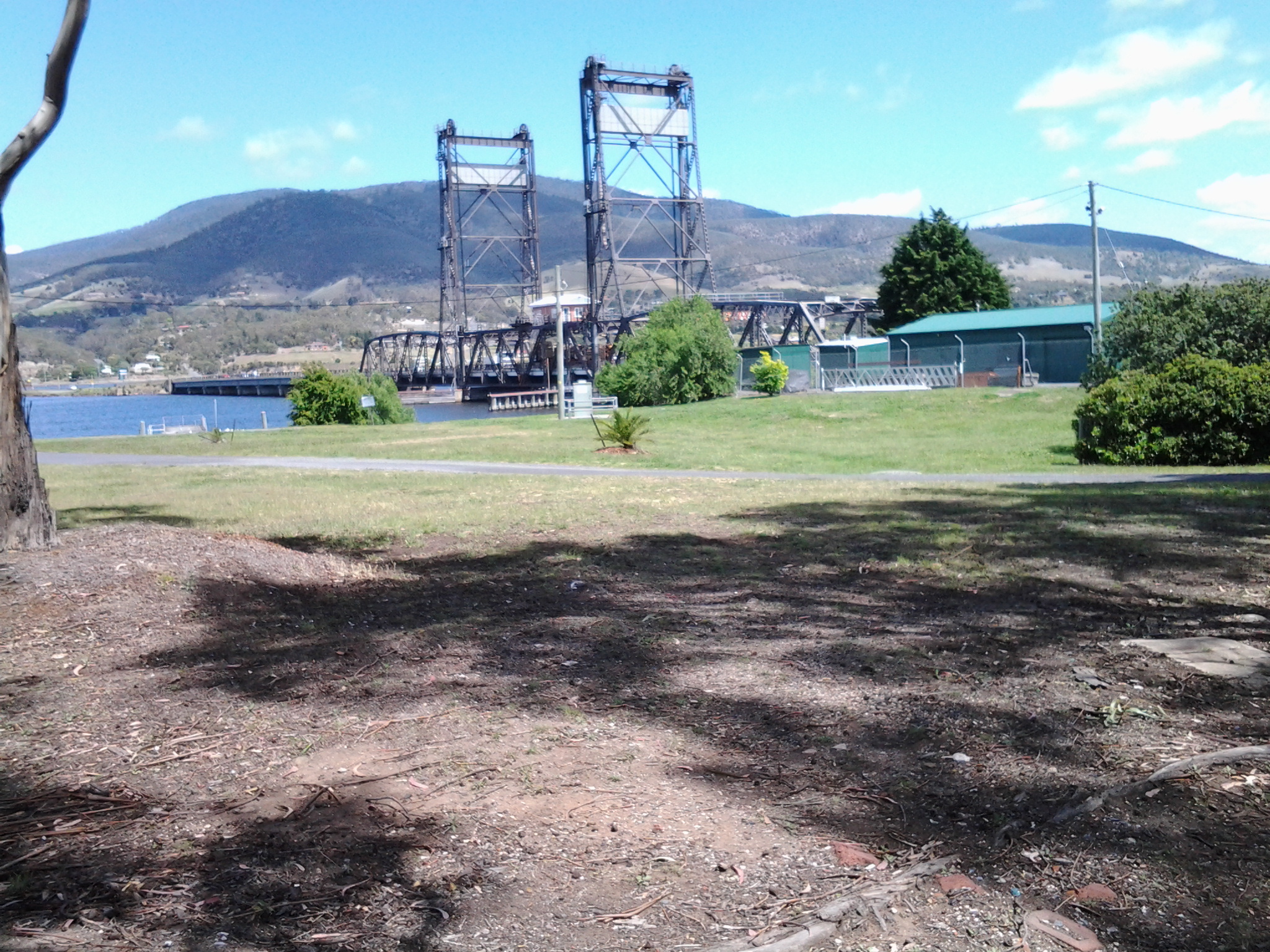
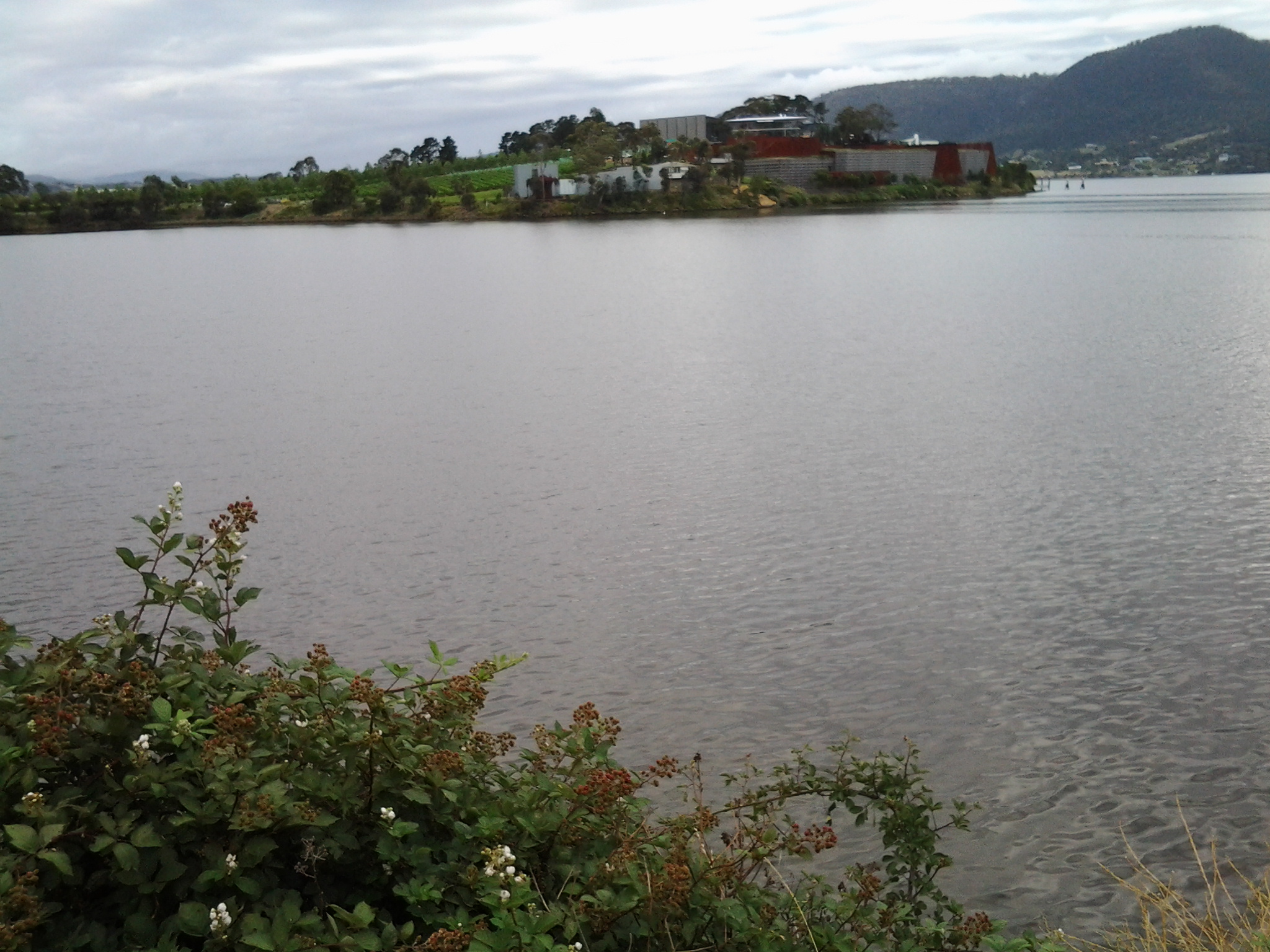
What is the story about Joseph Lycett’s Tasmanian (then named Van Diemen’s Land) pictures? Well … Governor Macquarie visited Van Diemen’s Land on two occasions: in 1811 (before Lycett arrived) and in 1821 (a few months before Lycett left for England). I love connections and so I was pleasantly surprised to discover that Governor Macquarie named the Austins Ferry area as Roseneath when he visited Van Diemen’s Land in 1821. Did the Governor make drawings and bring back sketches?  This is doubtful.  It is more likely that others went to Van Diemen’s Land at the Governor’s request, brought their sketches back to Sydney and that these were shown (perhaps some were given) to Lycett.

I wondered whose sketches, paintings or etchings Lycett saw, and then ‘used’.Two people with drawing skills have been suggested: George Evans and James Taylor.

First, let’s consider George Evans.

In the first two decades of the 1800s, Governor Macquarie sent surveyor George William Evans to Van Diemen’s Land off and on a number of times for short trips to remeasure land previously granted (misconduct involved); various sources suggest different years so I am not sure exactly which years in the second decade of the 1800s Evans was in Tasmania; some suggestions are Sept 1812 to Aug 1813, 1814, July 1815 to 1817. Wikipedia suggests that on two occasions Evans was granted valuable acres of land near in the Coal River Valley near the town of Richmond outside the Greater Hobart Area.

According to  http://www.daao.org.au/bio/george-william-evans/biography, at the end of 1818 Evans was able to resume office as Deputy Surveyor-General of Van Diemen’s Land. His travels around Tasmania are recorded in his Geographical, Historical and Topographical Description of Van Diemen’s Land… (London, 1822). One of his watercolour sketches of Hobart Town was used for the foldout aquatint and etching used as the frontispiece in the original edition. Another of the town was published by Ackermann of London as an independent print. Both depict Hobart as a thriving British colonial seaport town with court-house, commissariat store, St David’s Church, warehouses and numerous domestic dwellings in evidence. A surviving original (Dixson Library) shows a competent understanding of watercolour technique.

The website http://www.nla.gov.au/selected-library-collections/lycett-collection offered: As well as being a competent surveyor and a resolute explorer, Evans was an artist of some note. His aquatint view of Hobart in 1820 was published as a frontispiece in his Geographical, Historical and Topographical Description of Van Diemen’s Land … (London, 1822; second edition, 1824; and a French edition, Paris, 1823). The original, with another aquatint of Hobart in 1829, is in the Dixson Library of New South Wales.’

Second let’s consider James Taylor.

Military officer, Major James Taylor, arrived in Sydney in 1817 with the 48th Foot Regiment. Taylor produced a number of paintings and prints throughout his tours and his panoramic works of Sydney were particularly popular. He travelled to Van Diemen’s Land with Governor Macquarie in 1821. On 15th February 1822 he sailed to Britain with the Macquaries on board the Surry.  Only 50 people including the crew were on board for this 5 month trip around Cape Horn and it is easy to speculate that Macquarie and Taylor would have talked about Lycett.

Comparison of art works

I decided that comparing the works of the three artists Evans, Taylor and Lycett might help me to understand where Lycett’s Tasmanian images came from.  Unfortunately, I have not been able to locate sufficient of the work of Evans and Taylor to make a solid comparison despite knowing Lycett’s work very well (having worked in the Newcastle Art Gallery for a number of years in the presence of a substantial collection of Newcastle district related images by Lycett). Nevertheless some images for Evans and Taylor are available.

Examples of Lycett’s art

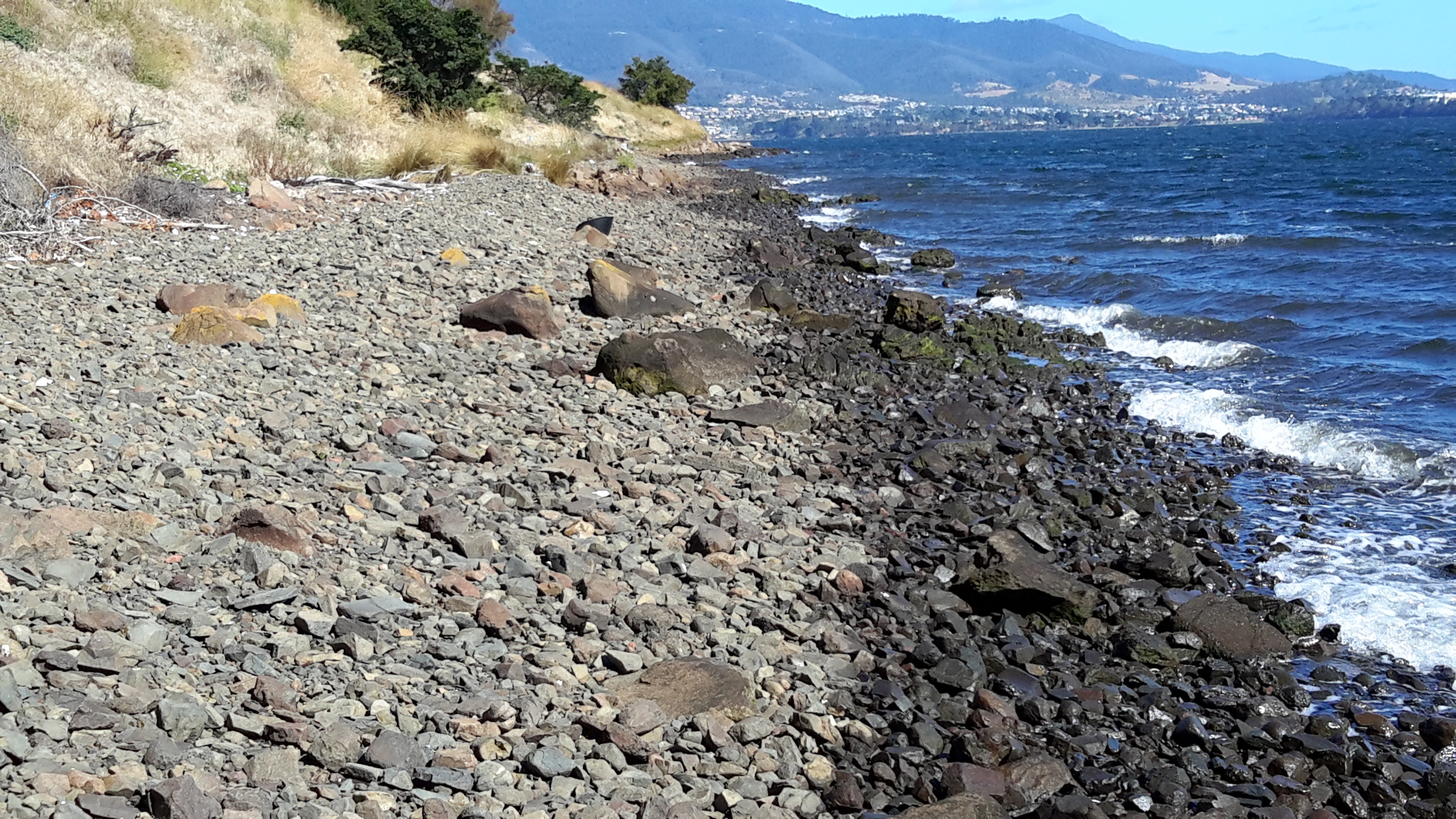
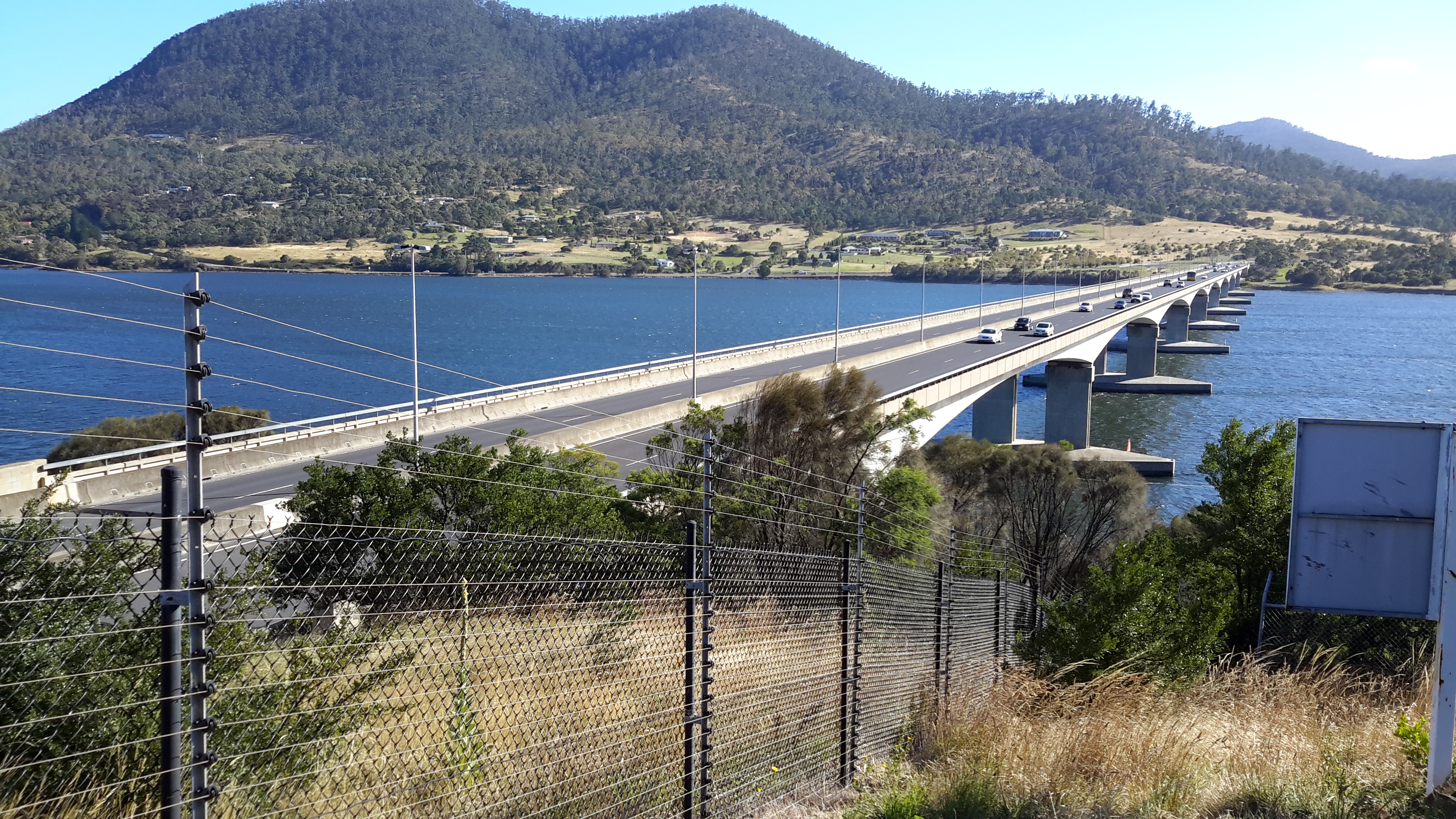
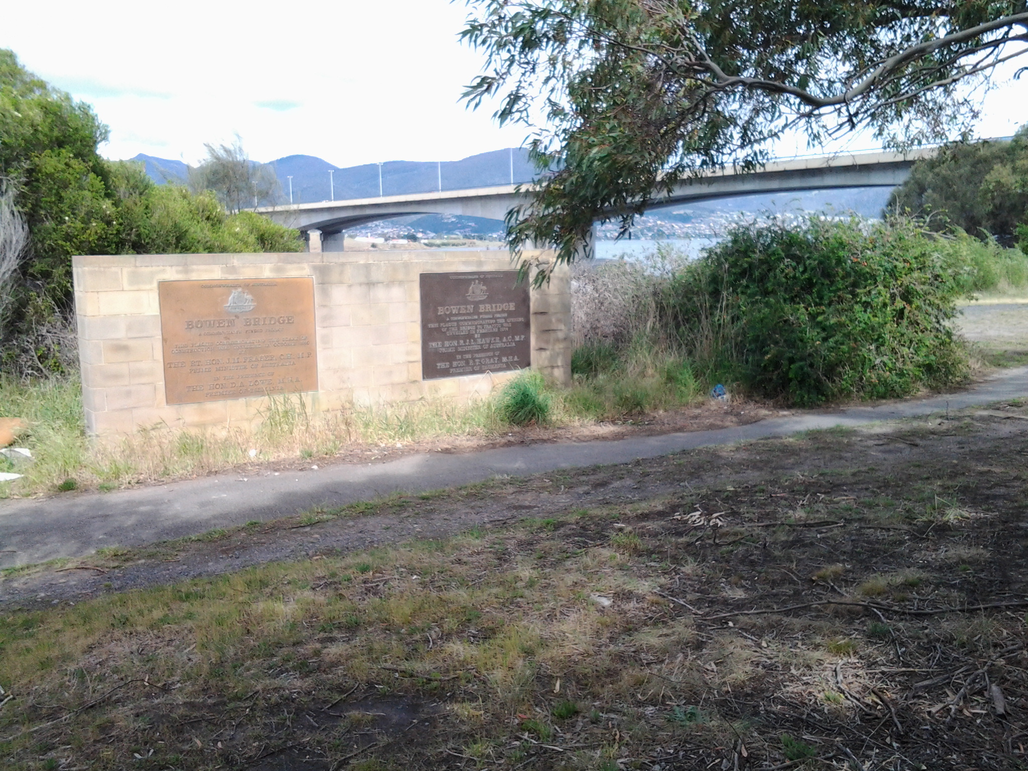
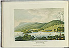
Below is an image of Lycett’s etching (see below) titled Roseneath Ferry near Hobart Town, Van Diemen’s Land dated 1 December 1824 (two years after Lycett left Australia). The etching was published as plate number 4 in Views in Australia or New South Wales and Van Diemen’s Land Delineated. London: J. Souter, 1824. This etching is held in the collection of the National Gallery of Australia in Canberra. Lycett is looking across the Derwent River from somewhere above the western shore and southwards so that the ‘hill’ in the distance to the left of the picture is Mount Direction (you may recall I walked past this as I passed the Bowen Bridge on my way from the suburb of Risdon to the suburb of Otago Bay on the eastern shore).

Lycett in  colour

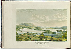
The image below, also by Joseph Lycett, is another hand coloured etching, this time from the viewpoint of the eastern shore.  The title is View of Roseneath Ferry, taken from the Eastside, Van Diemen’s Land and it was produced in 1825 (when he was already living in England).  One of the edition of this etching is in the collection of the National Gallery of Australia in Canberra.

Lycett View of Roseneath Ferry from the eastern shore 1825

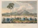
The image below is Distant View of Hobart Town, Van Diemen’s Land, from Blufhead Plate 28 from Views of Australia or New South Wales& Van Diemen’s Land,  published by John Souter, London, 1824-25. This handcoloured aquatint and etching is held in the Joseph Brown Collection of the National Gallery of Victoria, Melbourne.

Lycett Distant view of Hobart Town VDL NGV

Examples of George Evans’s art

The image below comes from http://www.abc.net.au/news/2014-08-22/1819-slnsw-south-west-view-of-hobart-town-1819-george-william-e/5689410 It is titled South West view of Hobart Town and dated 1819

Evans Hobart

The image below comes from http://www.acmssearch.sl.nsw.gov.au/s/search.html?collection=slnsw&meta_e=350

George Evans Hobart Town 1828

Hobart Town, Vandiemen’s Land. 1828 At lower left is printed “G. W. Evans. Pinxt.”; at lower right “R.G. Reeves. Sculpt”; underneath title “Published 1828, by R. Ackermann, 96 Strand, London” he image is from the collections of the State Library of NSW.

Examples of James Raylor’s art

I could find no image by James Taylor that was related to Van Diemen’s Land. I only found two New South Wales images.The image below is from http://www.afloat.com.au/afloat-magazine/2010/july-2010/Lachlan_Macquarie#.VHAuwPmUdqU and titled Panoramic view of Port Jackson c.1821

James Taylor Panoramic-view-of-Port-Jackson-c1821

The image below, from http://www.powerhousemuseum.com/collection/database/?irn=326892 is an aquatint of Port Jackson and Sydney dated 1824.

Aquatint of Port Jackson 1824 by Major James Taylor

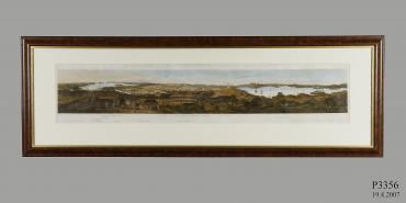
This panorama of Port Jackson and of the town of Sydney was taken from a hill near the Parramatta River, was produced with ink on paper by Major James Taylor, Sydney, New South Wales, Australia, 1820, then engraved by Rittner et Goulpil, Sydney / Paris in 1824. The Powerhouse Museum (Sydney) provided the following information:

‘Statement of significance

In 1820 Major James Taylor created a series of watercolours on paper which, when joined together, formed a panorama of Sydney. When he returned to England in 1822 (did Taylor and Lycett travel on the same ship? – more research required) Taylor arranged for the engraving and printing of a three sheet panorama based on his watercolours. Known as ‘Major Taylor’s Panorama’, this is one of the most informative depictions of Sydney in its early years. Taylor, a topographical draughtsman attached to the 48th Regiment, arrived in 1817 when Sydney was thriving and Governor Macquarie was trying to turn an ‘infantile’ penal colony into a ‘civilised’ society. Taylor’s pictures were intended to be a record of that change. The view, taken from Observatory Hill, encompasses Sydney Harbour from the Heads to Lavender Bay, showing many of the major buildings of the day.
Convicts can be seen cutting the sandstone which provided building material for Sydney’s expansion. The many fences indicate gardens and a respect for private property. The harbour is filled with trade and military ships. Government House and its stables can be seen set in Governor Macquarie’s private park called the Demesne. Much of this park still survives as the Botanic Gardens and the Domain. This area contrasts markedly with the small cottages in the middle ground which were typical of many in The Rocks. They were often occupied by convicts and their families who were encouraged to develop ‘respectable’ habits like gardening in their spare time.
A prominent building is the Military Hospital, built in 1815, where patients can be seen dressed in long coats. On the horizon are the impressive buildings of Macquarie St, including St James Church, the Hyde Park Barracks and the General Hospital. To the right of the Military Windmill is Cockle Bay, later called Darling Harbour. The land beyond is the Ultimo estate owned by the surgeon John Harris. To the far right are the windmills that gave rise to the name Millers Point.
Topographical artists often included indigenous people in their work. These images were intended to educate European viewers about the appearance and customs of the ‘natives’, but such depictions were informed by symbolism and ideology rather than a representation of reality. In Taylor’s panorama Aborigines stand amid uncultivated bush, in contrast to Europeans who are clearing and grazing the land. When the British took possession of New South Wales they argued that, as the Aborigines did not ‘work’ the land, they did not own it. This supported the notion of ‘terra nullius’ or nobody’s land. Taylor’s representation is a graphic rendering of that argument.

Production notes

The engraving is based on watercolours by Major James Taylor. Taylor was a topographical draughtsman attached to the 48th Regiment. He arrived in Sydney on the convict transport Matilda on 9 August 1817. He accompanied the Macquarie’s on their tour of Tasmania in May and June 1821 and some of the Tasmanian views in Joseph Lycett’s Views are probably based on Taylor’s drawings. Taylor received some training in draughtsmanship as part of his military studies and like other military and naval officers, was interested in his surroundings and recorded them in watercolours. Little of Taylor’s work survives, notably the originals of this view of Sydney Harbour. This image is held in the Powerhouse Museum collection.’
My conclusion

Lycett’s style is quite different from each of Evans and Taylor so it is difficult to attribute the work of one or the other as being the ‘aid’ to Lycett’s Tasmanian etchings.

There are three possibilities.

  • Lycett took the shape of the landscape around Roseneath from Taylor’s drawings. I am guessing that since Taylor accompanied Governor Macquarie to Van Diemen’s Land in 1821, he probably went to Roseneath with the Governor on the day that Macquarie named Roseneath. It is conceivable Taylor rushed up a few sketches and it is these that either Taylor showed or gave Lycett, or Taylor gave to the Governor who showed or gave them to Lycett. Perhaps the three of them met in London on arrival in 1822?
  • Lycett had access in Sydney to Evans maps of the land, and using their flat two dimensional nature, he fabricated a three dimensional landscape. If indeed he worked in this way, then the odd shapes of some topographical features of the landscape in Lycett’s pictures from and towards Roseneath can be explained.
  • Lycett had access to both Taylor and Evans work and amalgamated them to create a fictional but partly realistic depiction of Tasmanian sites. Lycett’s history is one of creativity, so sticking to the facts of the situation wouldn’t necessarily be important.

Incidental extra

In conclusion, there is one connection between the current Hobart and the Derwent River and the early 19th century Joseph Lycett – which could never have been foreseen.  I discovered that Lycett was on the list of prisoners that sailed to Newcastle on 8 July 1815: the name of the ship was the Lady Nelson. Pride of place on the today’s wharf at Hobart is a training sailing replica, the original having been stripped, burnt and sunk in 1825.