Tag Archives: Lake King William

From Catagunya to Wayatinah – post 1 of 4

Well over a year ago, one morning I walked through smoky air westwards into the Catagunya Power Station.  After a night camping, entwined by the thick atmosphere of a far distant bush fire and desperate for water, I was relieved to be received hospitably at the Station.  At that time I was thrilled by a guided tour of the building and its operation, however I never proceeded to walk the extra few hundred metres to look at the Dam wall holding back the large Lake Catagunya.  I was most grateful when many months ago, my walking proxy Andrew climbed the hills from Wayatinah Power Station to arrive at and photograph the Catagunya Dam.  A blog search using “Catagunya” as the term, will help you to locate those past stories plus a swag of descriptive photographs.

Recently, I was privileged to make the journey between the Catagunya and Wayatinah Power Stations and to experience that stimulating environment. Thanks to the generous assistance of GL from TasNetworks,  I was able to enter the locked Catagunya Road off the Lyell Highway, and travel the 8 or so kilometres to the Catagunya Dam.

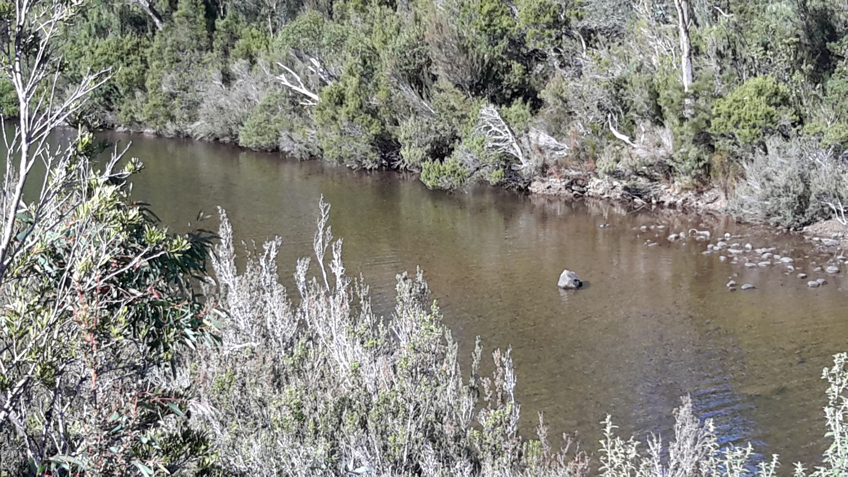
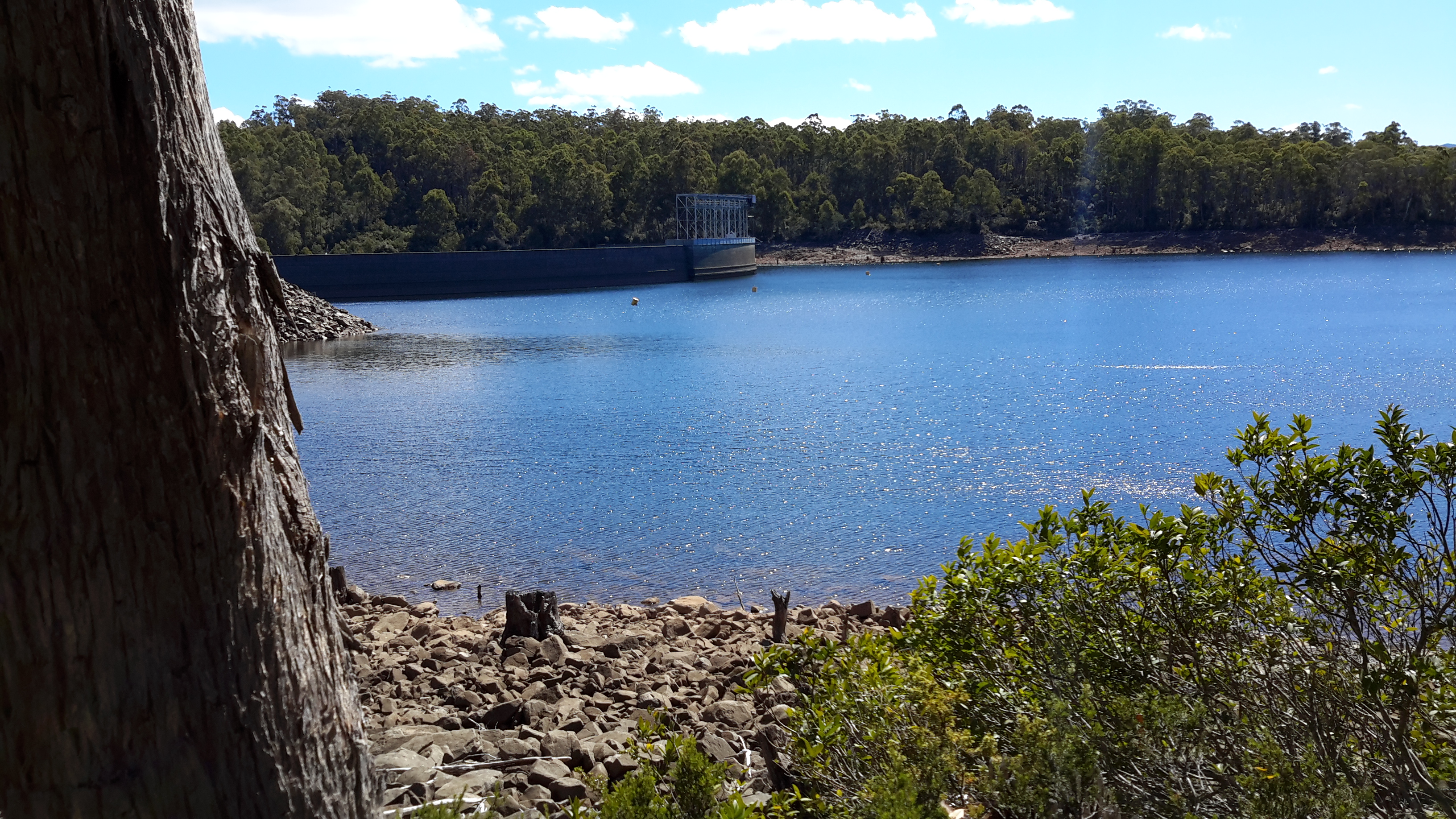
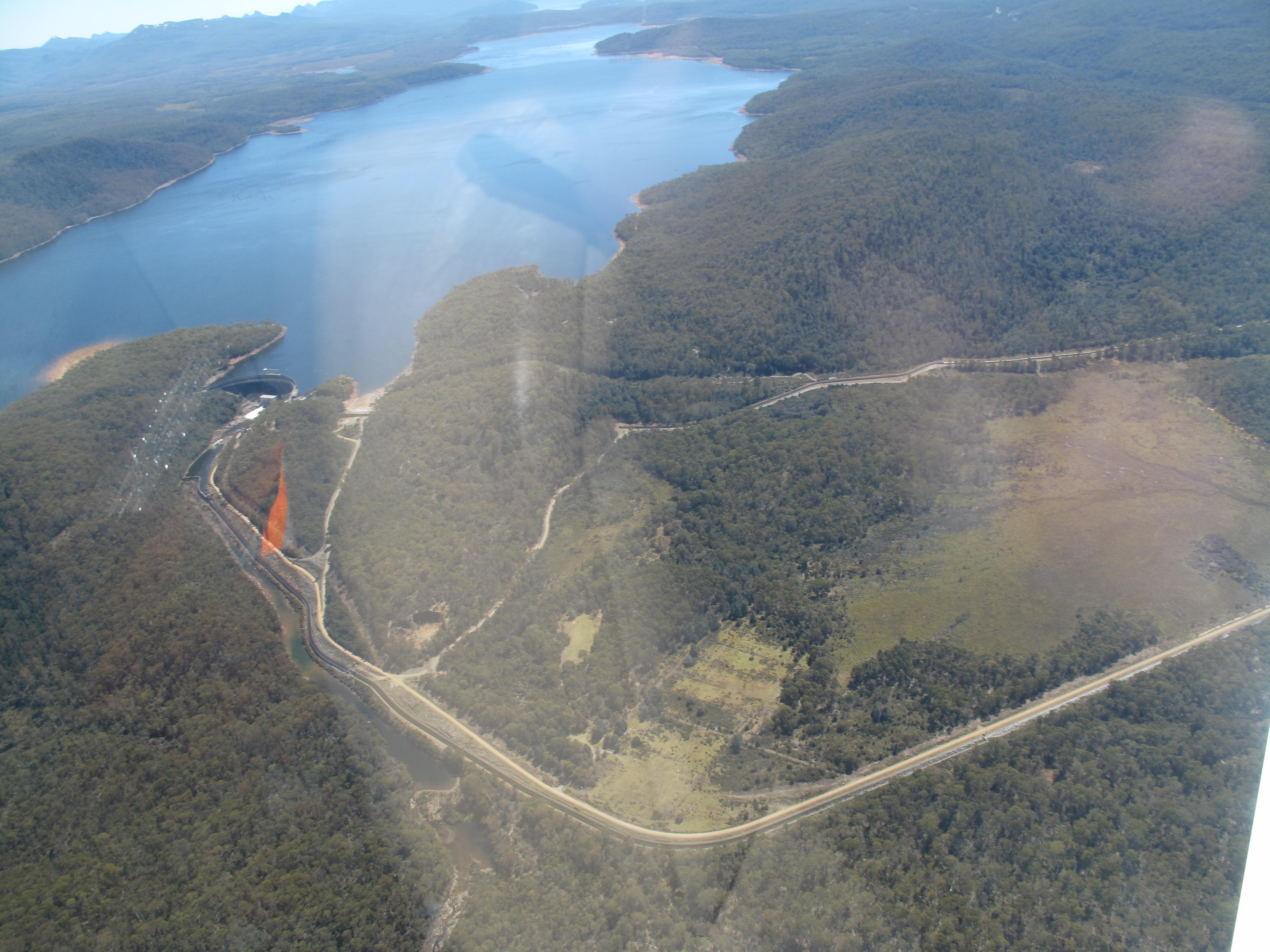
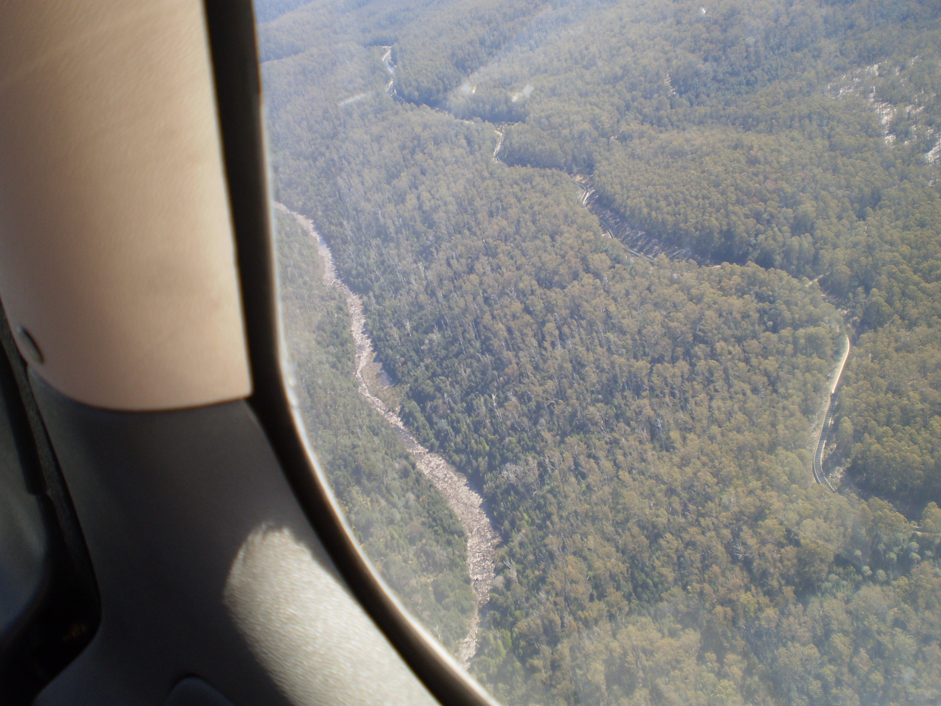
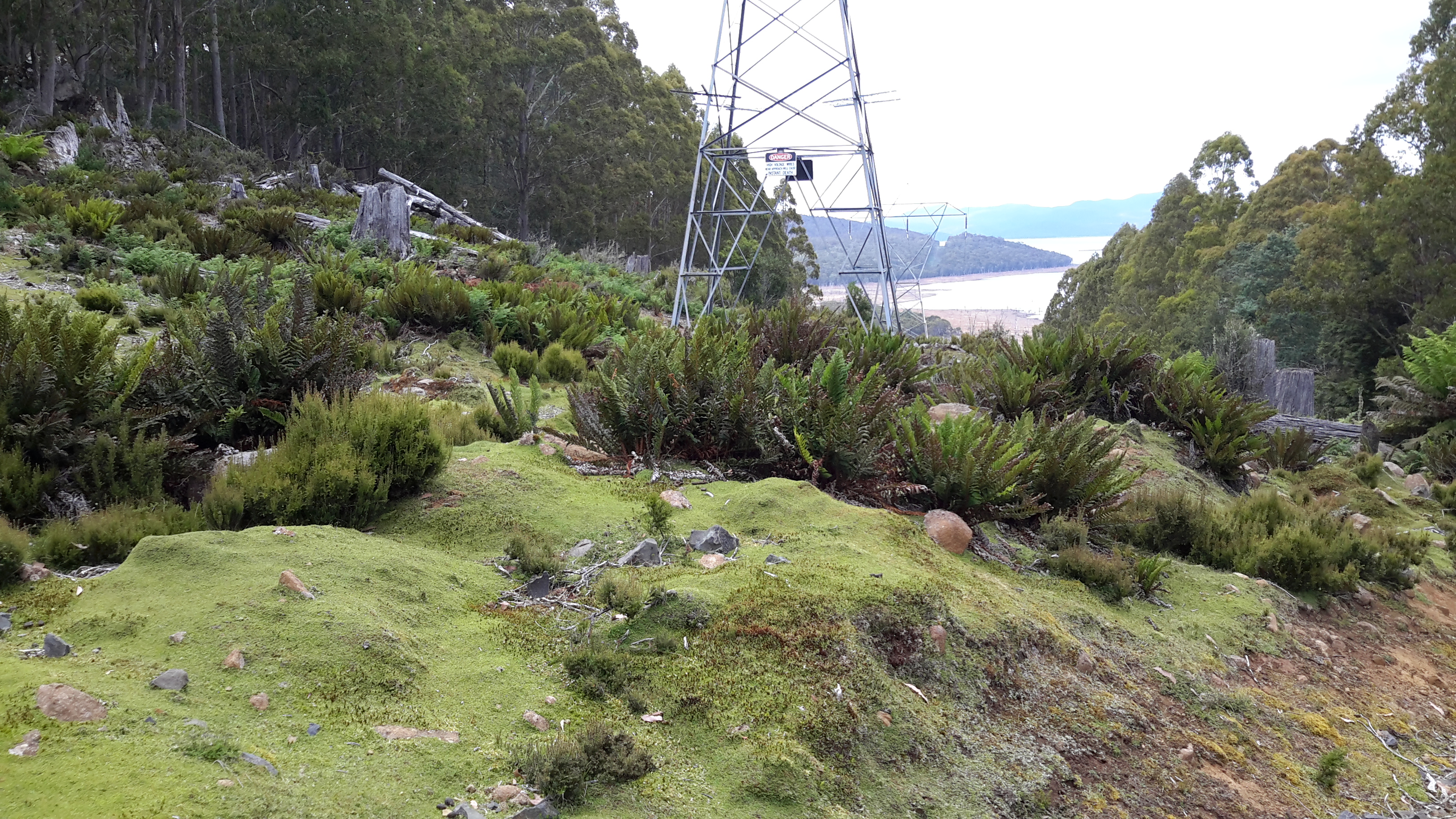
The wall of the Dam curved magnificently and  the landscape-green Lake Catagunya spread impassively to the west. 20170424_104221.jpg

20170424_104055.jpg

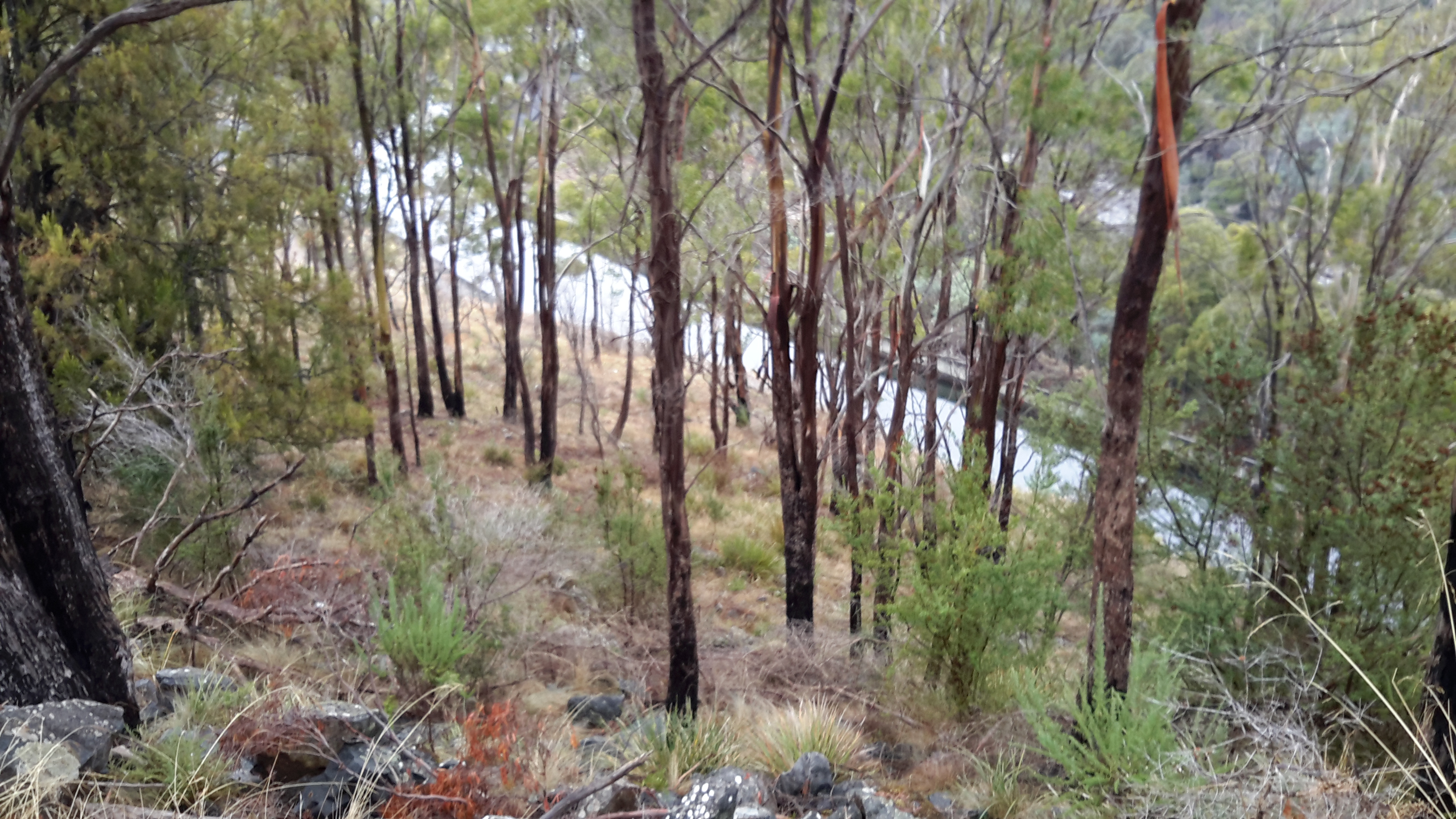
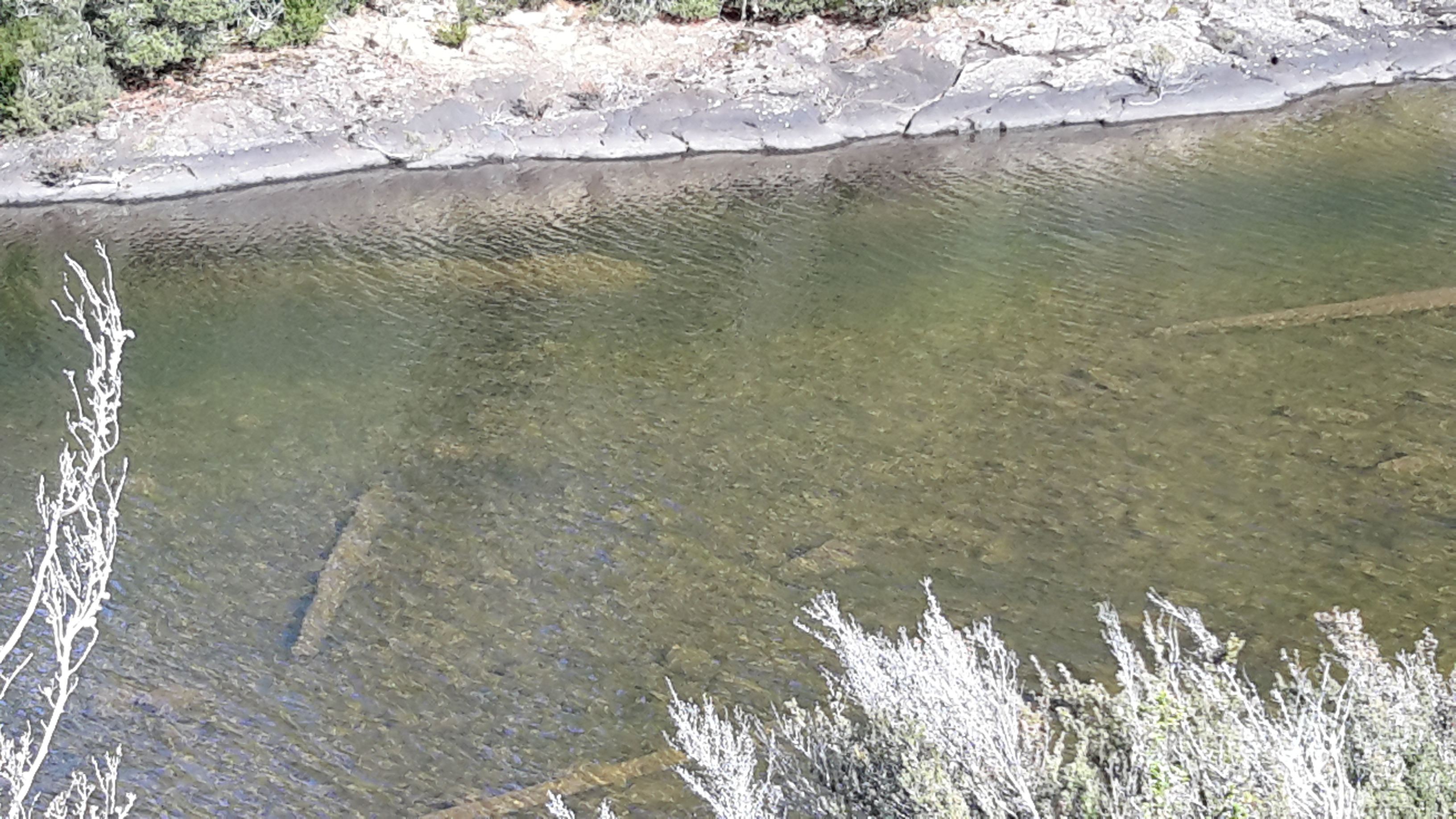
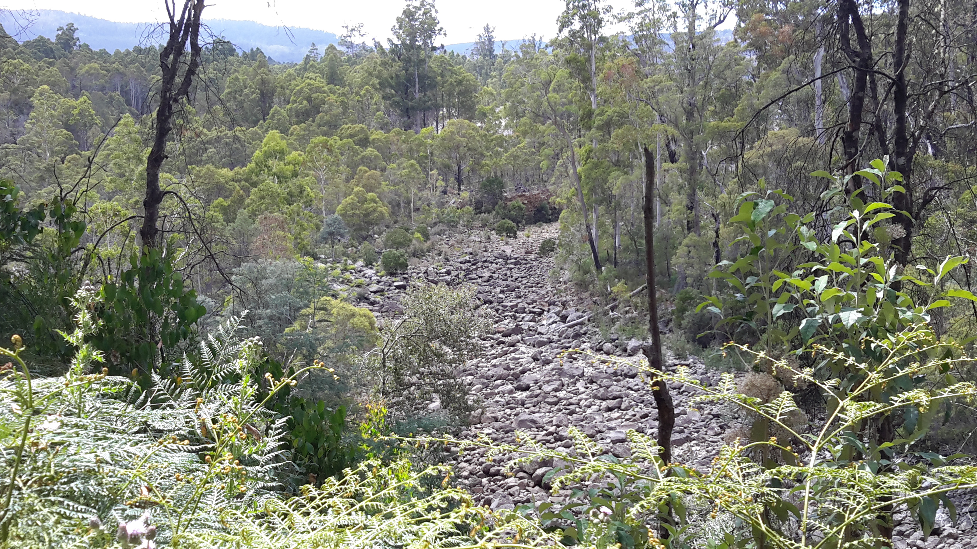
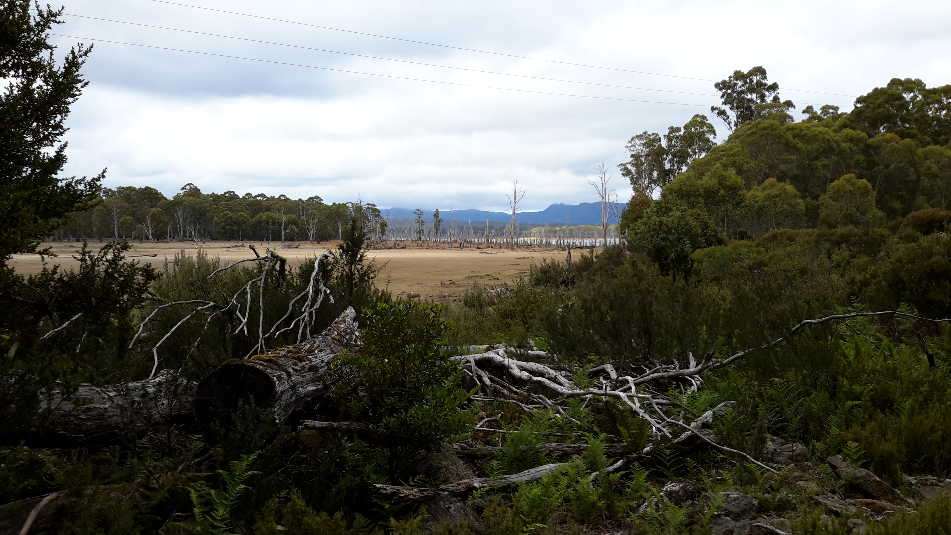
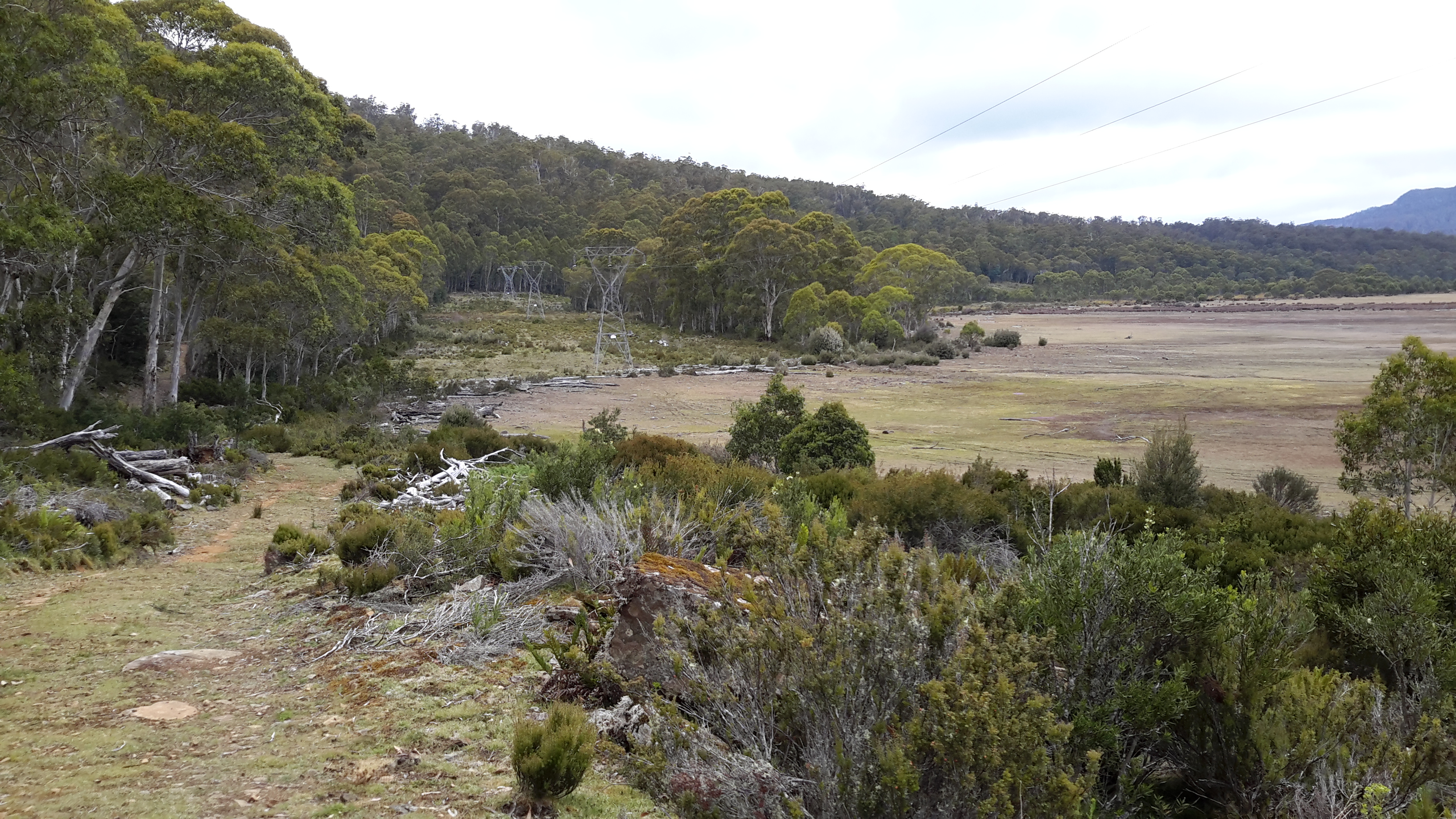
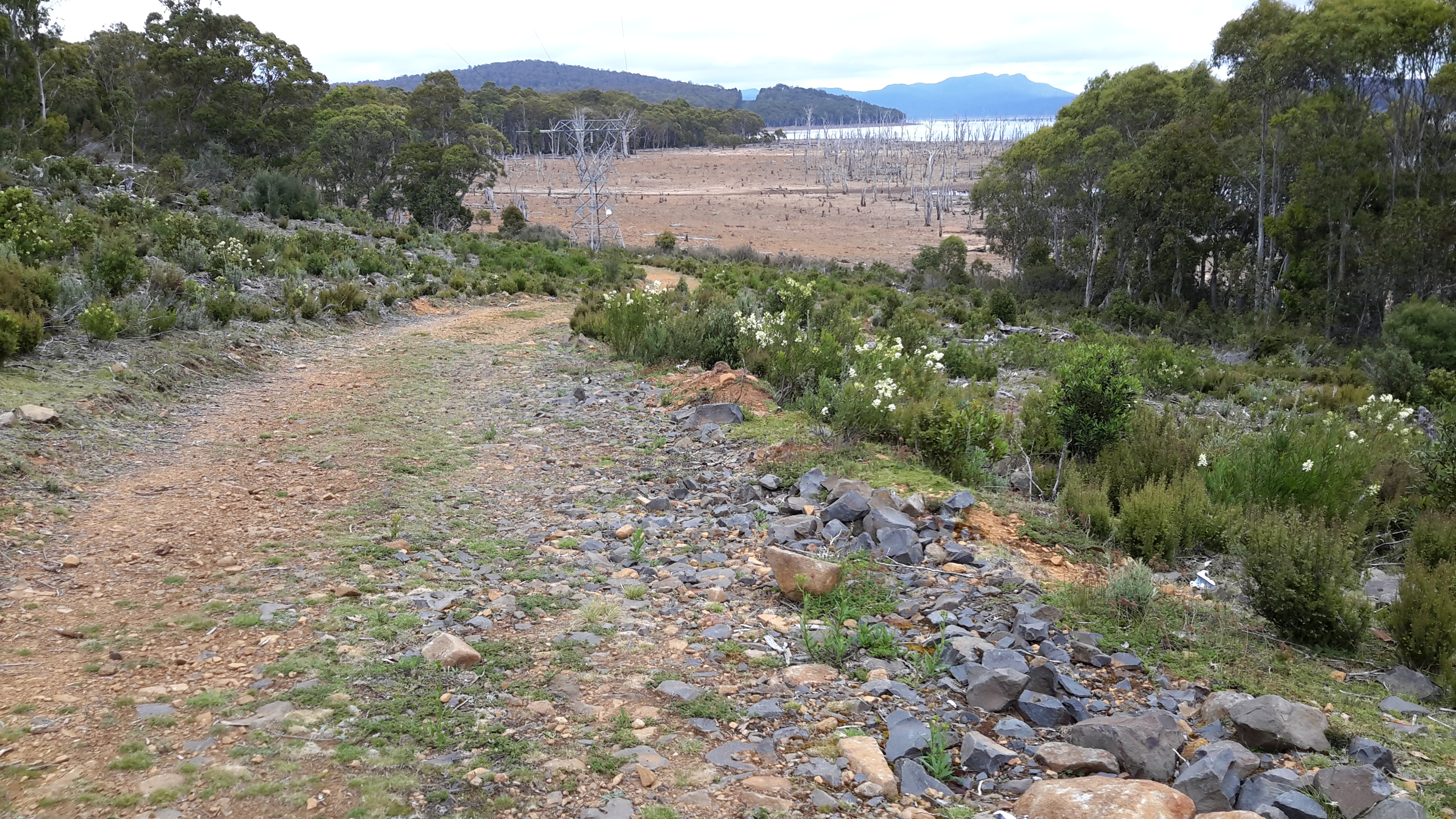
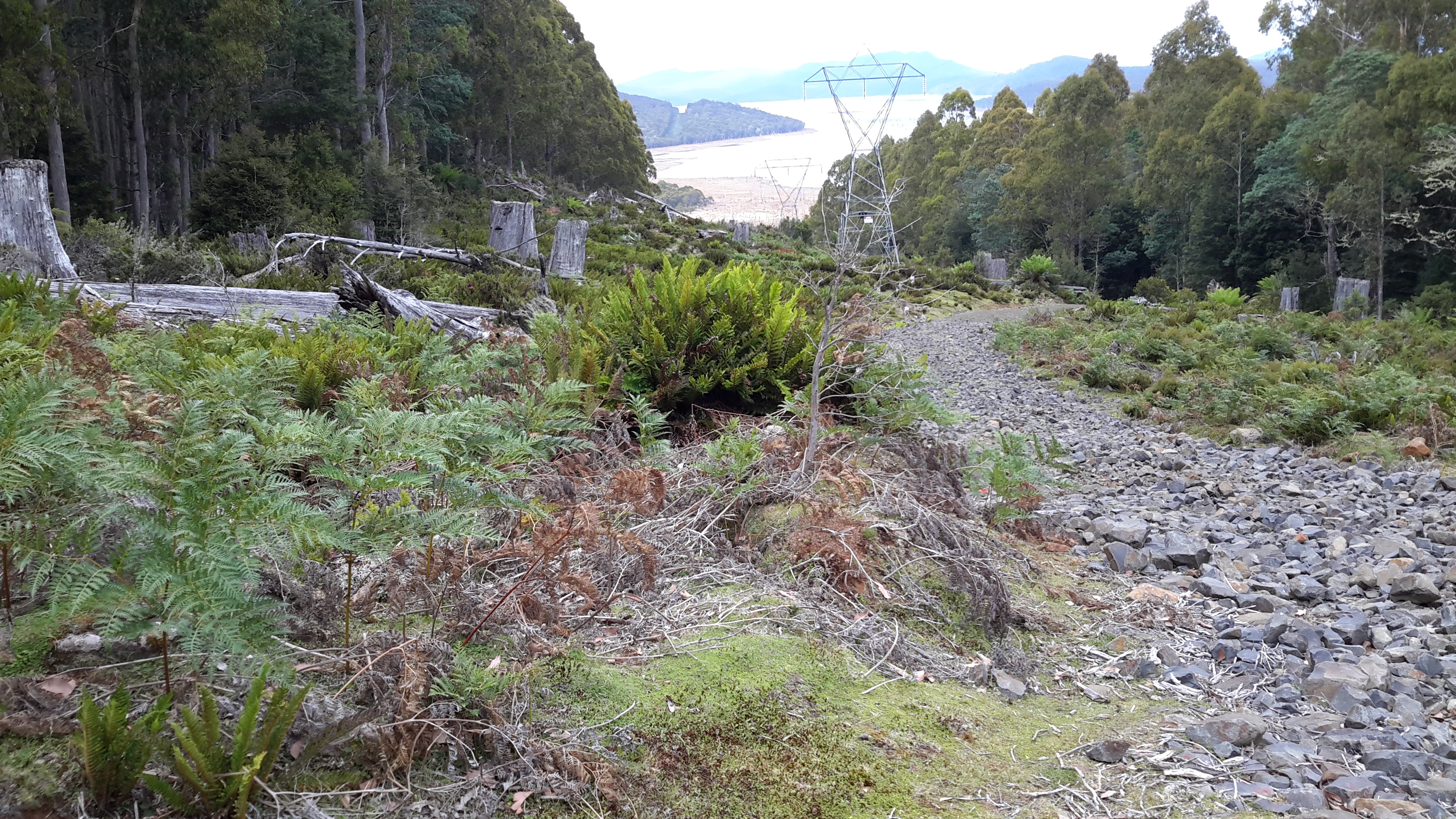
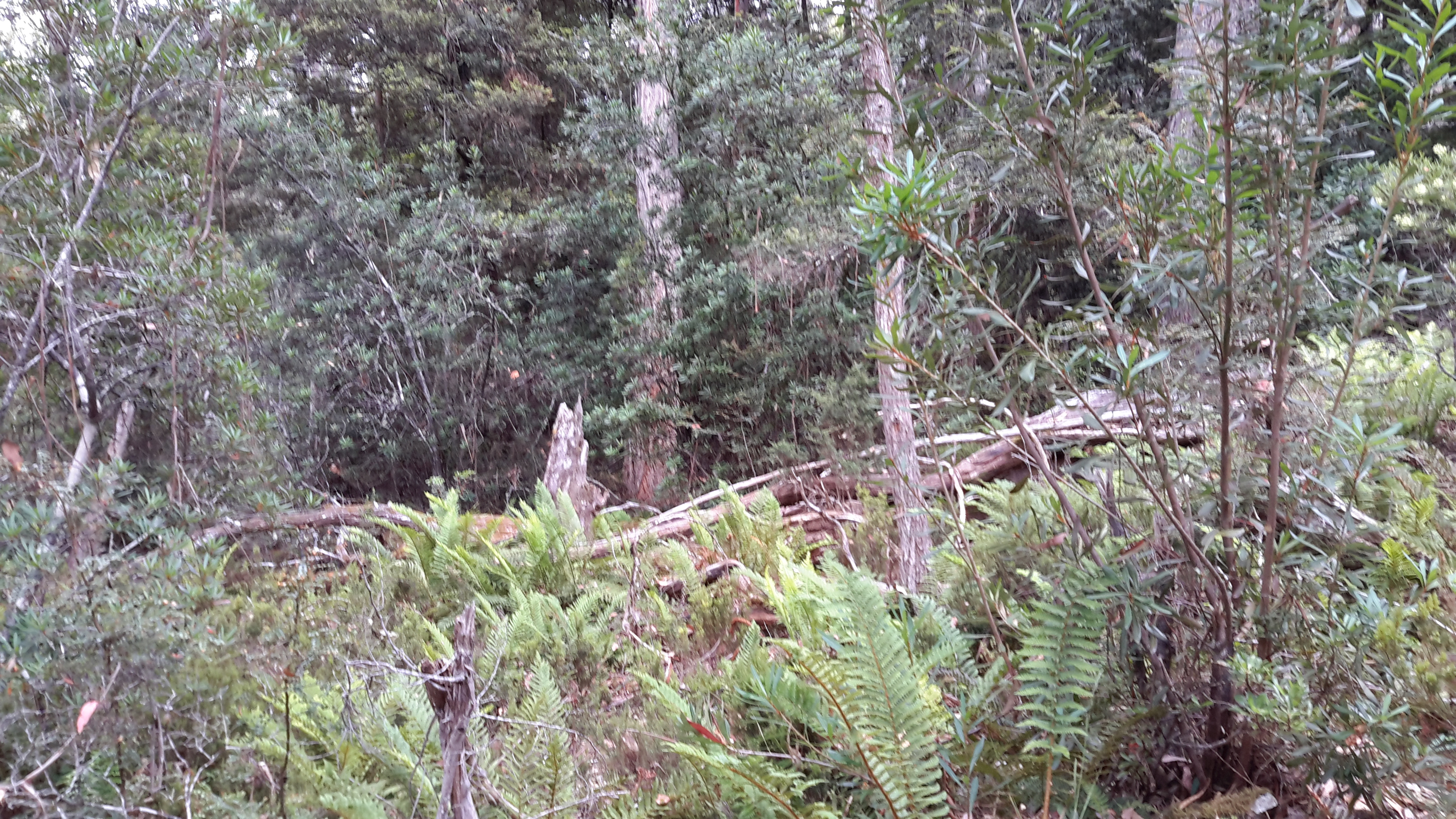
Below I could see the old Derwent River bed as a rocky almost water free pathway.

20170424_104042.jpg

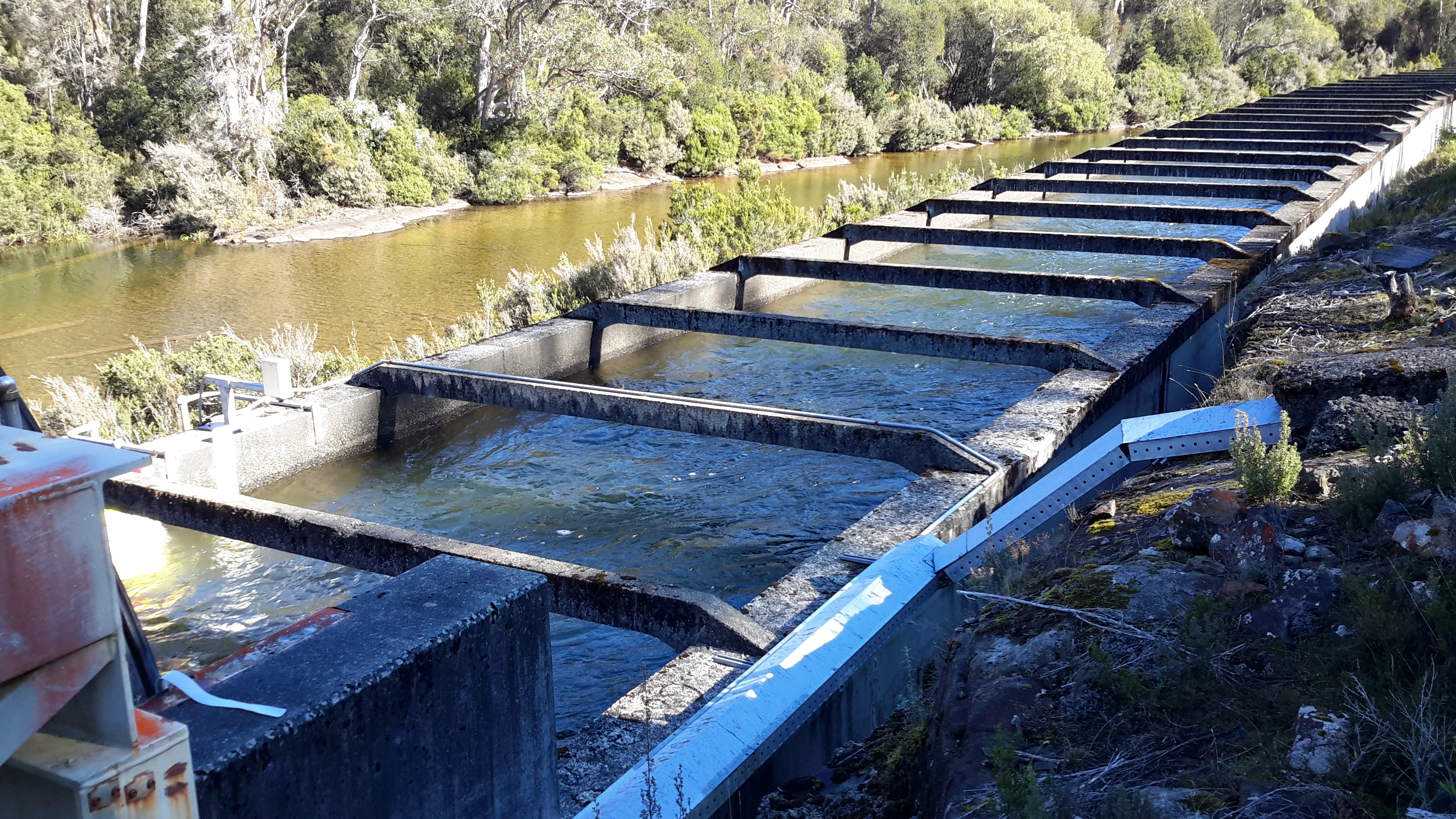
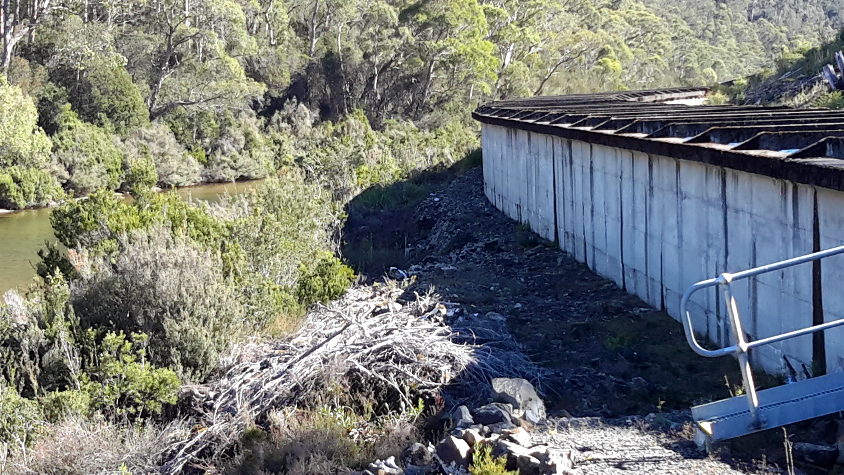
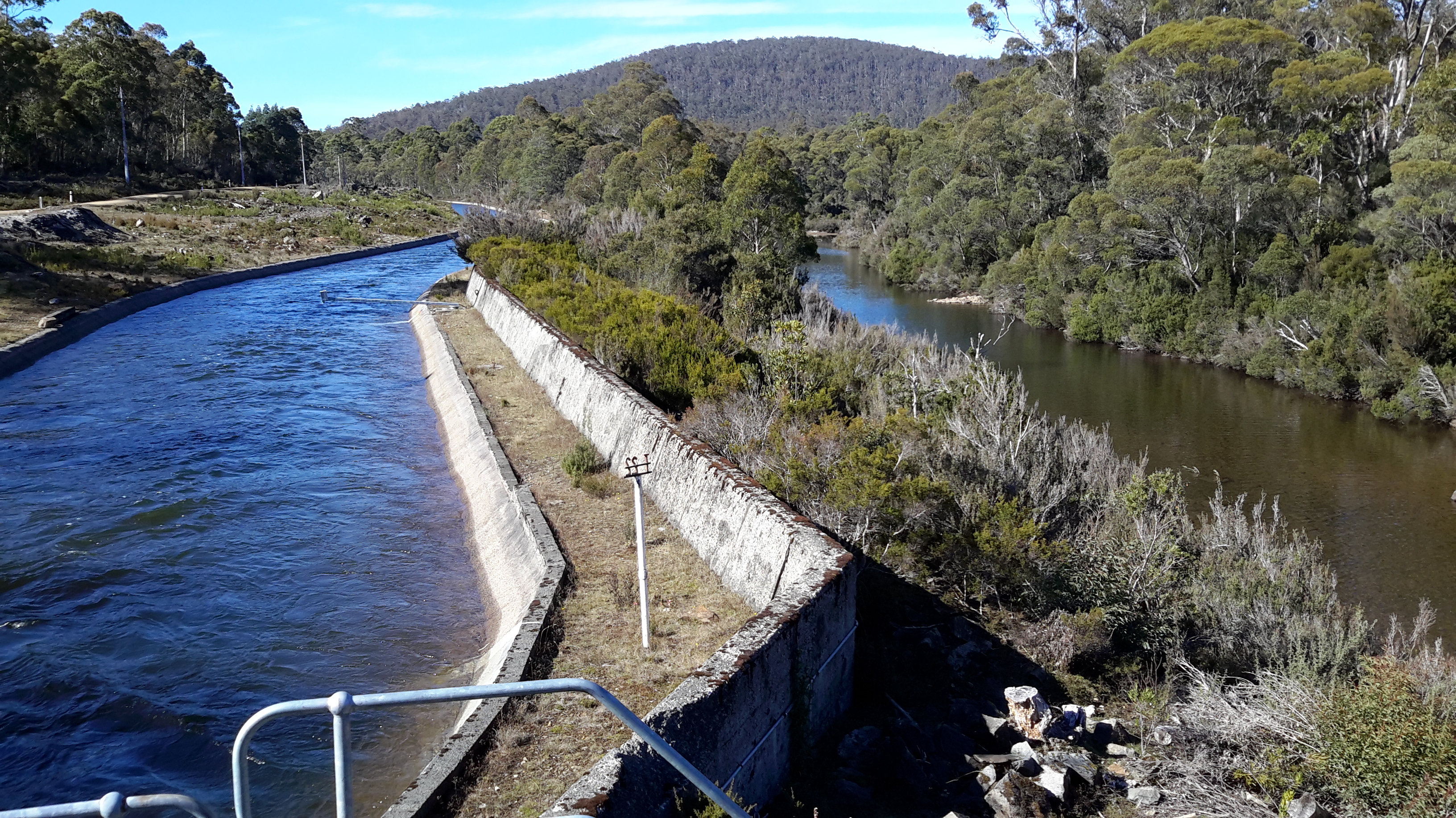
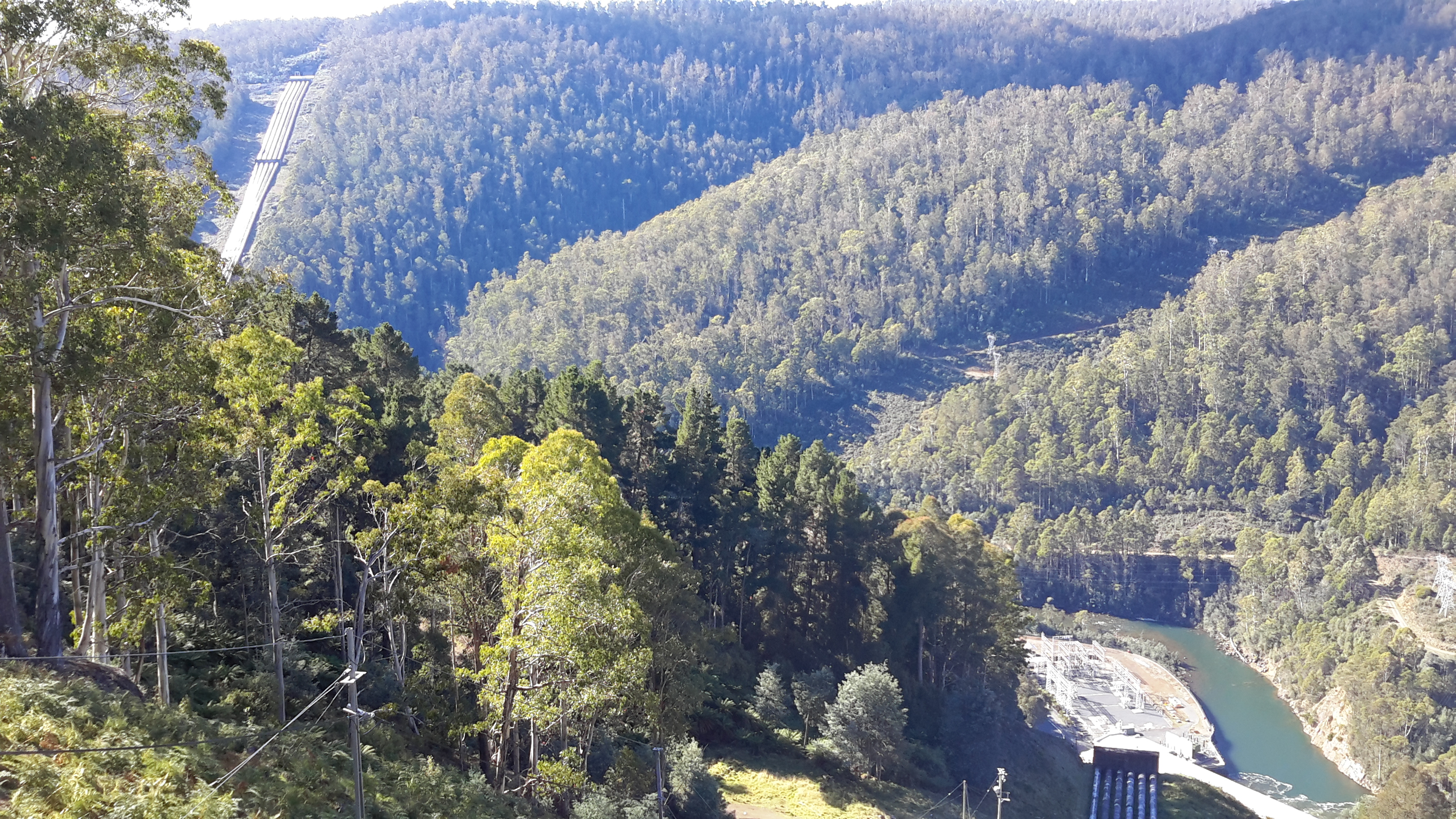
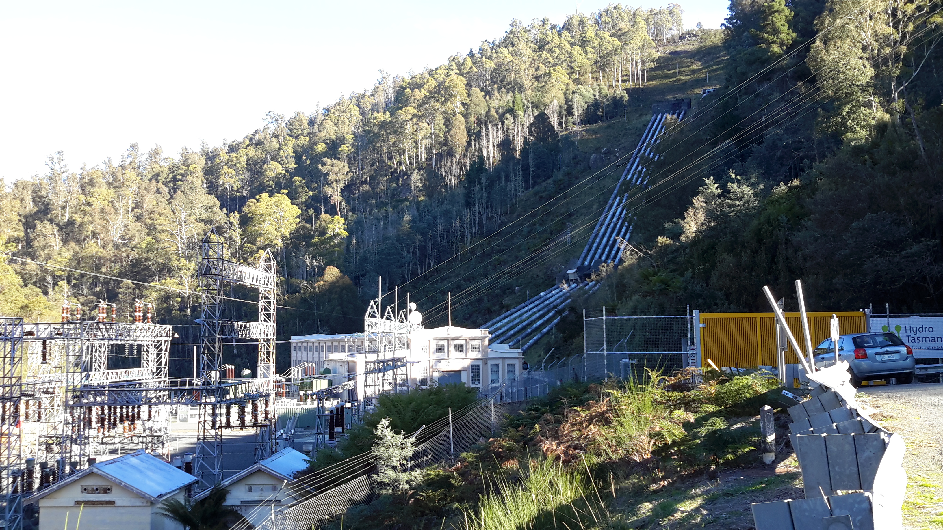
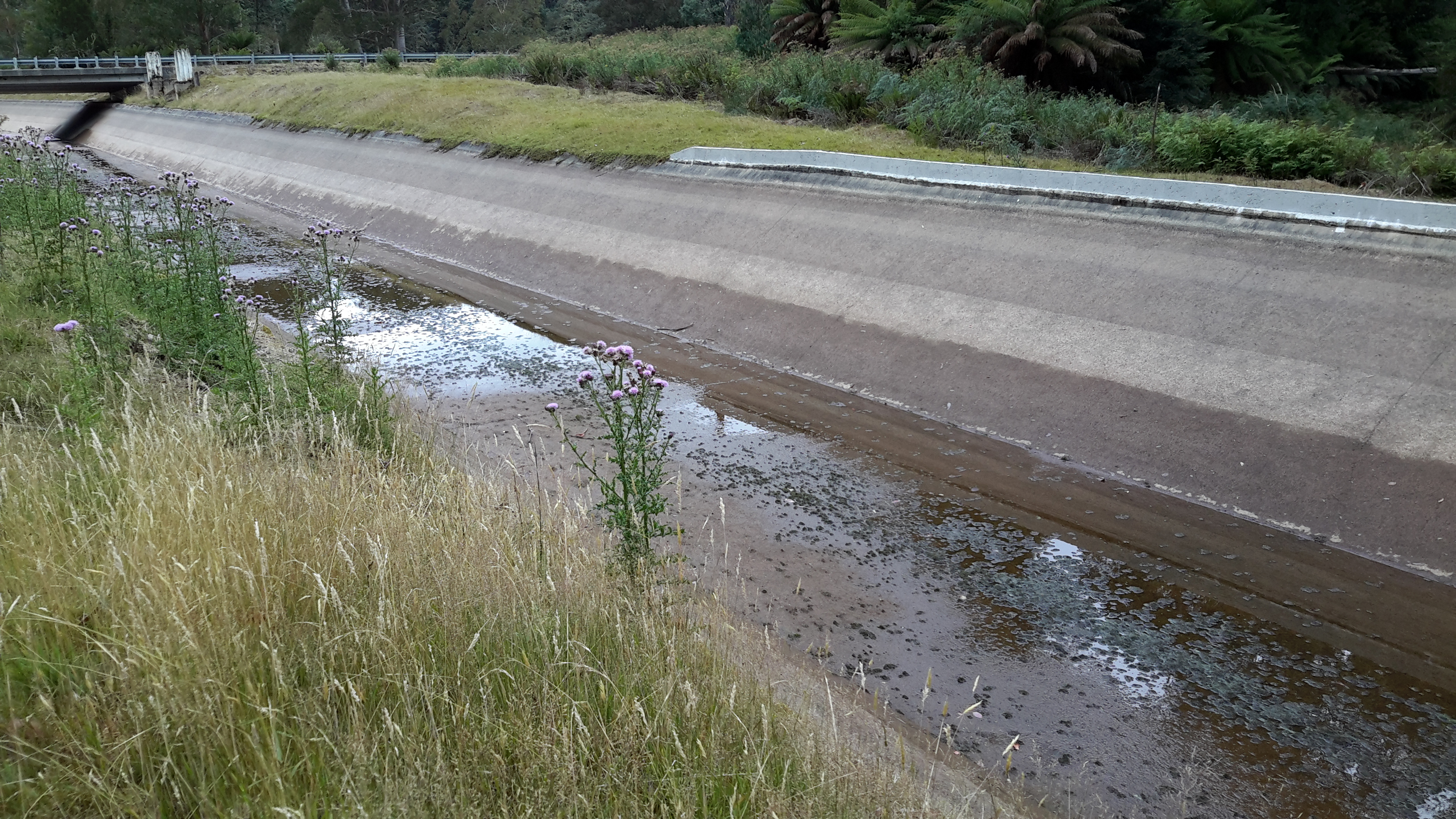
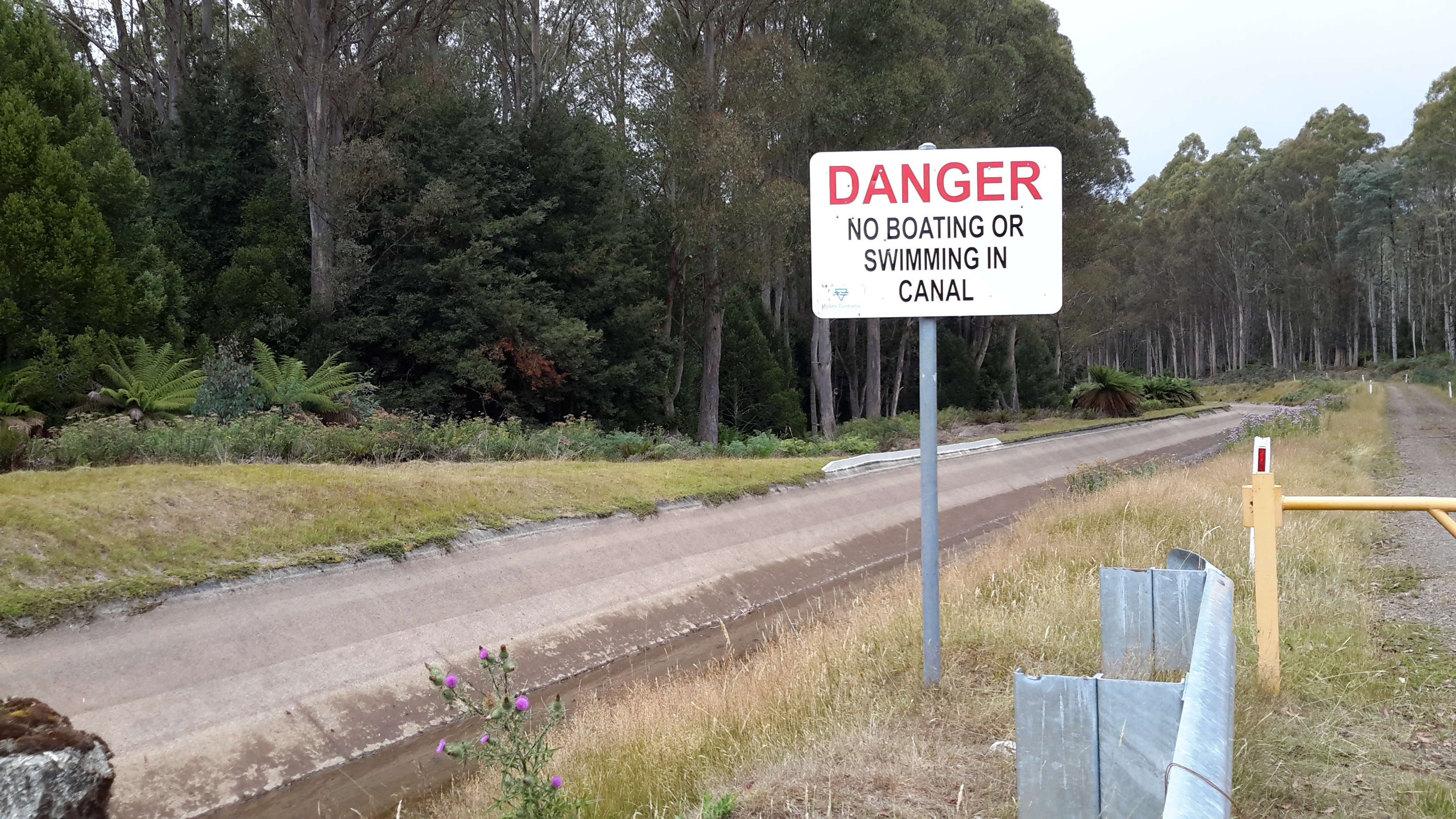
Bypassing the river bed, a massive Canal drained water from the Lake into the Power Station. It appeared as a giant marker on the landscape that seemed much wider and more substantial than the Tarraleah Canals that run from Lake King William and the Butlers Gorge Power Station further inland.    20170424_104148

20170424_104228.jpg

20170424_104330.jpg

20170424_104504.jpg

The apparently still Canal water was deceptive. Only on closer inspection could I see the dramatic gush of water moving underneath the left hand entrance at the end of the race.  Obviously electrical power was being generated in the Catagunya Power Station that day.

From vantage points near the Dam and the Canal I could see the Power Station building way below. Oh how tiny it seemed by comparison with the larger constructions. Yet when I had first approached and walked around it, the building seemed cavernous.

20170424_104537 with PSarrowed.jpg

20160210_092533.jpg

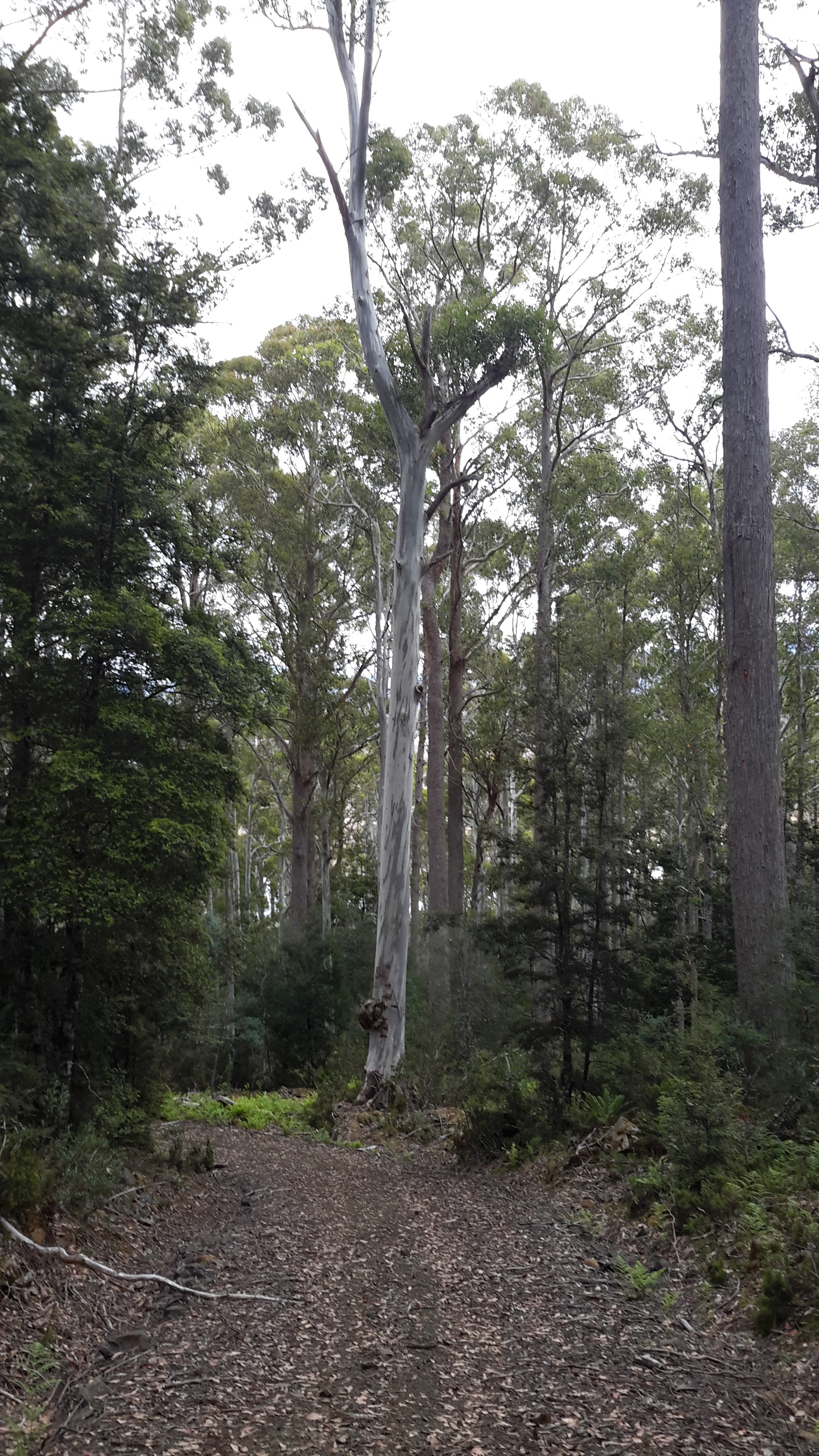
More than anything I was as excited as a three year old having a birthday party with lots of surprises.  Recent rain had cleared the air of dust, the day was overcast and the fairy weight of moisture from low clouds kept the air moist. I kept breathing deeply, absorbing the cleanness of the air. Loving the damp air. Feeling cleansed. So profoundly happy to be back in the bush and walking besides my beloved Derwent River.

Revisiting Butlers Gorge for missing photos – posting 5 of 5

Bushes with native berries, cushion grasses and all manner of other small plants abounded.  20160425_111936.jpg

20160425_111421 cropped.JPG

Later we continued onto Lake King William and sat in the afternoon sun eating our packed lunch, looking at sparkling water backed up to Clark Dam, and enjoying the smells and sounds of the bush.  Thanks Jeanette for your help in driving me back to this area.

20160425_120952.jpg

20160425_121119.jpg


Revisiting Butlers Gorge for missing photos – posting 1 of 5

After I walked from the Lyell Highway at the Butlers Gorge junction and then proceeded to follow Tarraleah Canal No 1 (which contained the bulk of Derwent River water) to Clark Dam holding back the waters of Lake King William, I returned home and checked my photos.  I found some key photos were absent.

I realised that my feet must have been exceptionally painful and my sore knees crumbling so that I was unable to remember to keep taking photos in that last kilometre of the walk.  I had made no record of those last few hundred metres.  Thanks to blog reader Jeanette I returned to the spot one gorgeous morning, walked up and down the area and clicked lots of photos.

At one place we crossed the aqueduct and looked at the serene and clear Derwent River.   20160425_112018.jpg

20160425_112035.jpg

20160425_111710.jpg

The rush of the water through the Canal was recorded.  Watch this video.

20160425_111647.jpg

20160425_111652.jpg

20160425_111614.jpg

20160425_112103.jpg

I loved the views looking along the two strands of the river; the water in the original river bed, and the water in Tarraleah Canal No 1.

20160425_112613.jpg

20160425_112619.jpg

The rocky edges of the river shown above indicate that water is released from Clark Dam from time to time making the river wider.

Recapping the walk along the Derwent River


I lived the walk along the Derwent with a vital obsession but, after so many months intensely engaged on other projects, now some of the details are vague. To re-immerse myself into the experience, I am writing this post.

In addition, I suspect it will be a great help to people who have become followers of my blog during the past 6 months.  Despite my inactivity, it surprises me how many visitors and views the blog gets daily, how many different posts are read, and how many different countries around the world are represented.

In August 2014, from an impulsive unplanned idea, I took a bus to a spot near the mouth of the Derwent River on the eastern shore, walked to the sea then retraced my steps and began the walk towards the source of this great river approximately 214kms inland.  On day trips, and around other life commitments, I walked in stages along the eastern shore until I reached the Bridgewater Bridge which crosses the Derwent approximately 43 kms upstream.

Instead of continuing inland, I crossed the bridge and headed back on the western shore towards the southernmost  mouth of the River.  Most of the walks along the eastern and western shores between the sea and the Bridgewater Bridge were along designated pathways, although some informal track walking, road walking and beach walking was required during my trips.

Then I returned to the Bridgewater Bridge and began the journey inland expecting only to walk on the side of the river that made passage easiest.  I had no intention to walk both sides from this point onwards in anticipation the landscape would be inaccessible for a number of reasons or particularly wild with dense and difficult forests. I walked to New Norfolk on the western/southern side of the Derwent but from then on, I switched from side to side. Using maps I determined where I must take up each new stage of a walk while switching from side to side, so that I could say I had traipsed the entire length of the Derwent River.

The farthest inland stages of my walk are easily defined.  I walked from near the township of Tarraleah besides Canal 1 (along which is transported Derwent River water) above the actual River bed, past Clark Dam, and around majestic Lake King William to the township of Derwent Bridge.  From there I followed the river to its source at St Clair Lagoon dam.  In case some people believe the source of the Derwent is further inland, I walked onwards to the weir where the Derwent Basin empties into the St Clair Lagoon via passing the southern end of Lake St Clair.

Between New Norfolk and the area near  Tarraleah, my walk beside the River was in country near  townships (some of which were located at a great distance from the River) such as Bushy Park, Gretna, Hamilton, Ouse, and Wayatinah.  This necessitated additional travel to or from the highway and roads, on which these towns exist, to reach the river or to return home from a walk along the river.

Inland, the water of the Derwent River is controlled by dams constructed to create hydro-electricity for Tasmania: I walked past them all. From the end of the river closest to the mouth, these are the Meadowbank, Cluny, Repulse, Catagunya, Wayatinah, Clark and St Clair Lagoon dams.  Each of these has a bank of water behind them:  Meadowbank Lake, Cluny Lagoon, Lake Repulse, Lake Catagunya, Wayatinah Lagoon, Lake King William and St Clair Lagoon.  Most of these dams and bodies of water has a power station: Meadowbank Power Station, Cluny Power Station, Repulse Power Station, Catagunya Power Station, Wayatinah Power Station and Butlers Gorge Power Station.  I was privileged to be shown around one of these power stations during one walk.

Water from the Derwent passes through two other power stations:  Nieterana mini hydro and the Liapootah Power Station.  I did not follow the trail of these Derwent River managed flows.  The water from other locations inland passes through the Lake Echo Power station and Tungatinah Power Station then flows into the Derwent after power generation, thereby increasing the volume of water flowing downstream.  I did not walk along these feeder rivers.

The few stages of the walks which have not been recorded in this blog, are in all the zone between Gretna and the area near Tarraleah – a stretch of perhaps  120 km.  I have written up and posted most of the walks in this zone, and now it’s time to add the missing sections.

Derwent River water passes via the township of Tarraleah


Earlier this year the entire town of Tarraleah was on the market for sale.  Refer article 1, article 2 , and article 3.

If you were to follow Derwent River water by walking from the western end of Lake Catagunya at the Wayatinah Power Station inland past the Wayatinah Lagoon to the Liapootah Power Station then follow the Nive River to the bridge next to the Tarraleah Power Station (with the Tungatinah Power Station on the other side of the bridge), you could look up the hill to see massive penstock pipes descending the hill from the township of Tarraleah above.

The water falling down these pipes is Derwent River water which has travelled via Tarraleah Canal 1 and Tarraleah Canal 2 after processing through Butlers Gorge Power Station at the foot of Clark Dam that holds back the waters of Lake King William.

I chose not to walk the route via the penstocks and Tarraleah township when walking from the mouth to the source of the Derwent River,  rather to follow the original river bed albeit a scatter of stones and limited water during the summer, between Wayatinah and Butlers Gorge Power Station.

However, knowing that Derwent River water flowed along the Canals and through the massive pipes, I did visit the township of Tarraleah during the period when it was advertised for sale. I was curious to see what the township of Tarraleah looked like (it had been many years since I last visited). Despite being centred within lush dense rainforest, thankfully no rain fell at Tarraleah and the sky was blue and the day sunny when I visited. I approached the town from the highway and followed the slightly snaking pipes.

20160425_132005.jpg

20160425_132023.jpg

At the point where the pipes arrive at the top of the hill and are about to drop down the hill, I browsed public information boards and plaques.

20160425_132500.jpg

20160425_132512.jpg

20160425_132726.jpg

20160425_132711.jpg

20160425_132826.jpg

20160425_141509.jpg

The views from the township were dramatic. I am forever in awe at the engineering achievements of the past.

20160425_132537.jpg

20160425_132615.jpg

20160425_132653.jpg

These days Tarraleah is a place that acknowledges its social history from the early days of Hydro Tasmania. I was amazed to see the row of freshly renovated houses each with their own array of pastel coloured paint finishes. Perfect location for a science fiction movie.  I felt there was something strange about its lollipop colours and perfection.

20160425_142056.jpg

20160425_142039.jpg

20160425_144341.jpg

20160425_142110.jpg

Afterwards I travelled out of Tarraleah and down to the bridge over the Nive River. The Tarraleah Power Station was partly hidden in shadow from the afternoon sun. My eyes followed the pipes up the hill knowing the township was there on top.

20160425_145718.jpg

20160425_145849.jpg

The Nive River accepts the Derwent River water after processing for electricity generation through the Tarraleah Power Station.  The water passes through a series of further management processes, and ultimately empties into Lake Catagunya and then continues its long journey towards the sea.

20160425_150151.jpg

I have heard rumours the Tarraleah township sold but I cannot find records supporting this.  I haven’t one idea how a buyer could get a return on an investment of $11 million at Tarraleah, so I will be very interested to hear what will happen to this piece of Tasmania’s history.

Floods and water levels rising


When I walked  along bodies of water dammed on the Derwent River such as Lake King William, I remarked on the low water levels, showed photos of deep barren shores, and posted about the coming danger to Tasmania’s electricity supply.  You can refer to a range of posts for different views on this topic including the following examples: Tarraleah Canal No 1 walk – where is the water?,  Lake King William, The rocky shore, Looking for a place to camp overnight, Death and Lake King William, Rise and shine, Trackless under the powerlines, and Andrew Hughes has walked, rafted and canoed the Derwent over the past month.

Newspapers recorded some of the extremes; here is one of The Mercury examples.

Hydro Tasmania is the organisation which manages water resources  by selling power not only to Tasmanians but via an undersea link to Victorians and further afield on mainland Australia.  For a very long while Tasmania had an unusually low rainfall, then when the Bass Link failed at the end of last year, this meant Tasmania could not buy power from the mainland if in crisis.  Over half a year passed before the fault was repaired and in that time water levels in dams, lakes and the river dropped steadily. In damage control, as politicians and the community worried about the reducing water levels, Hydro Tasmania released the information that our State could survive and continue to generate sufficient electricity in the local newspaper with dams at an even lower capacity . Nevertheless failure for rains to fall, created a situation where massive banks of diesel power generators were installed.  The operation of these generators cost Tasmania millions of dollars. The photo in this article shows an area being prepared for generators, and then the next article shows the installation outside Catagunya Power Station.  Generators were placed in many locations.  This article shows banks of generators outside the Meadowbank Power Station;  this is the closest power station to Hobart and is one of many that operates using the water from the Derwent River.

The dry situation was desperate.  Cloud Seeding was being practised as an option to bring on the rain.

Eventually the gods or nature heeded the call and the heavens opened.  As winter approached, welcome rain poured and began to replenish our dams and lakes.  The rain was heavy and persisted so that the water levels improved dramatically.  In the process, many parts of Tasmania experienced severe floods.  Dramatic stories were released in the media . The Ouse River, which feeds into the Derwent River, was the site of the death of one man.

These were terrible days for many.

Now the climate seems has returned to some sense of balance.  Our glorious spring time, albeit with some hotter days than normal, has passed and summer has arrived.  We all hope for prudent management of electricity generating water resources and for intelligent planning for extreme events – which we know are now more frequent around the world. In this way, the Derwent River will remain a living and useful flow of water which poses little risk to affecting people, animals and the surrounding landscape.

Andrew Hughes has walked, rafted and canoed the Derwent over the past month

My last post introduced the Expedition Class’s  latest project.  The key man during the journey was Andrew Hughes and now his trek is complete.

The first newspaper coverage of this story was published in The Mercury last May.

The Mercury published another story recently ‘Warm welcome for adventurer Andrew Hughes as he paddles into GASP‘. His journey started north east of Lake St Clair in central Tasmania and now Andrew has crossed an imaginary finish line between the Iron Pot on the eastern side of the Derwent River and Tinderbox on the western side and this conclusion has been covered again in The Mercury.

If you go to the web,  you can read the mini ‘Live Reports’ of the 28 sections of his journey. You can peruse a collection of photos for each section. The information in the reports is limited and no information is offered with the photographs.  Unless you have travelled the  edge of or on the Derwent River, it would be difficult if not impossible to identify locations.

A comparison of some of Andrew’s photos with those I took during my walk from the mouth to the source of the Derwent River, makes for interesting viewing.

Firstly I would like to compare the rush of water over the river rocks between Wayatinah and Butlers Gorge that Andrew saw compared to the low almost absent water level that I experienced on two occasions. Since I completed my walks along the Derwent earlier this year, Tasmania has been inundated with unexpected high levels of rain which have raised the water levels in the dams and the Derwent River.

The photo below was taken by me in October 2015.

20151029_113841.jpg

The next photo was taken by me in January 2016

20160115_130427.jpg

The photo below is by Andrew as shown in his Live Report 18.

1471514898-IMG_3177 from 18 of expedition class live reports.JPG

My photo below shows the water level of the huge 15 kilometre Lake King William was so much lower in October 2015.

20151029_123314.jpg

My photo taken only 2 ½ months later at the beginning of January this year, showed the water level  had dropped dramatically so that the Tasmanian government was considerably worried about our electricity generation options.

20160102_155721.jpg

In Live Report 15 Andrew shows the Lake King William water backed up to Clark Dam at Butlers Gorge. Tasmania is no longer worrying about our water storage facilities and power generation. Again we have enough water to create clean electricity.

1471254936-IMG_3085 from live report 15.JPG

These photos are wonderful reminders of the unpredictability and power of nature.   Andrew’s reports and photos are an excellent example of people getting out into our Tasmanian wilderness and experiencing it’s challenges and wonders.  I hope his trek inspires others not necessarily to cover the same territory, but to find new country to discover and enjoy.  To be refreshed by the purity of the bush.

Growing up as a Hydro boy

Thanks to blog follower Mary, I have discovered a series of online stories about past Hydro workers some of whom helped build the Tarraleah Canal No 1 and others who lived near other electricity generating power stations along the Derwent River. These short stories make interesting reading and include photographs of the people and places.

I recommend you look at Hydro Tasmania’s site where the son of Jack Warren records his history.  The photo below from that site shows Jack at Canal No 1 in 1935.

Jack Warren 1935 from Mary

Simon Stansbie’s record of growing up at Wayatinah can be read on the Hydro Tasmania’s website. Ian Berry tells us what it was like to grow up at Butlers Gorge (where the Clark Dam was built to hold back the waters of Lake King William).  You can read this and see photos at Hydro Tasmania’s site.

Collectively these stories give a little insight into the human reality of living and working in remote central Tasmania to create the extraordinary electricity generating infrastructure last century which used the waters of the Derwent River.

Heather Felton published a book, which tells these and other stories of the people of ‘The Hydro’.  Read more about the book: The Ticklebelly Tales.

Cover Ticklebelly Tales - Hydro.jpg

Information about the book launch can be read in issues of the Cultural Heritage Program Newsletter ; and at a second site.

I am not sure what the word ‘Tickleberry’ refers to.  Do I have any blog followers with this knowledge?  According to Wikipedia part of Tarraleah, the area for the married quarters of the original community, was known as Tickleberry Flat. In addition, during my walks I know that I have passed an area mapped as Tickleberry Flat which is south east of Curringa Farm, and almost south of the town of Hamilton mid-way along Meadowbank Lake – a long way from Tarraleah.  In New Norfolk Tickleberry Farm grows raspberries.  The name Tickleberry comes up in many internet searches.  The Brighton, Central Highlands, Derwent Valley and Southern Midlands Councils Joint Land Use Planning Initiative – Stage 2 Heritage Management Plan tells us “Hydro-electric power schemes which commenced in the early 1910s saw the development of construction villages across the highlands at Waddamana (from 1911), Shannon (1925), Tarraleah (1934), Tickleberry Flats (1935), Butlers Gorge (1938), Bronte Park (1948) and Wayatinah (1952). As these small communities grew, schools, shops, community halls, medical facilities and offices were established.”

After all of this, I still wonder what the original meaning of Tickleberry is: maybe someone’s name or a common name for a plant.

Tarraleah Canal No 1 walk – where is the water?

My walk started well with the Tassie Link bus depositing me on the Lyell Highway at the junction with Butlers Gorge Road, a very isolated spot.  The day was overcast and sufficiently cool to make for extremely comfortable walking.

20160218_101736.jpg

Instead of following Butlers Gorge Road I walked over to Tarraleah Canal number 1 and was stunned.  It contained no running water and green slime was growing at the bottom in sections.

20160218_102406.jpg

20160218_102403.jpg

A question pounded through my brain – where was ‘my’ Derwent River?  I was annoyed.  I was two hours’ drive from Hobart and returning home was not an option. I was here to walk my ‘choice’ of the Derwent River, yet no water flowed.  I humphed and sighed and decided to walk beside the Canal to Clark Dam despite the absence of water, and that would be my story.

Years ago Tasmania decided to sell its clean electricity supplies into the national grid and in tough times to buy in essential electricity supplies.  So an underwater pipe was built beneath Bass Strait, which separates Tasmania from mainland Australia.  In recent months the connection has failed, the Bass Link is yet to be repaired and our state has been unable to acquire additional electricity to meet our needs in the foreseeable future. Meanwhile with low water levels in our Hydro Tasmania dams, our local electricity supplies are in danger of being exhausted.  Therefore, when I saw the empty Tarraleah Canal number 1 I jumped to the conclusion that the water from Lake King William had been turned off; I thought this was a sign of our increasingly dire situation.  Later (and in a later post I will explain) I learned I was wrong.  The empty Canal had nothing to do with the Bass Link failure.

I laughed to see the warning sign.

20160218_101825.jpg

As later posts will indicate, even when empty this Canal is dangerous and should never be entered.

Tarraleah Canal No 1 walk – aerial views of the terrain

Aerial photos help to situate this part of my walk along the Tarraleah Canal Number 1.

Chantale’s first photo below looks across to Lake King William behind Clark Dam, and down onto the remnants of the meandering ‘dry’ Derwent river bed meander which can be seen in the glare near the lower edge.  The Canal winds its way next to a gravel road close by.  Her second photo shows the curving Canal and the gravel road, on which I walked, immediately to its right. Much further inland a yellow line indicates the gravel Butlers Gorge Road.

IMG_3876Clark Dam.JPG

IMG_3880

My photo below includes the old river bed, the Canal and the Hydro Tasmania gravel road.

20151028_115927.jpg

Michelle’s photos below helps you to appreciate the density and height of the surrounding bush. I stayed on the road and was immensely pleased not to be navigating through that wilderness.  The bush was stunningly beautiful to look at and to smell but would have been a nightmare to walk through.

PA280105Butlers Gorge rd.JPG

PA280107 Canal 1 and Butlers Gorge Rd.JPG


Tarraleah Canal No 1 walk – what is the ‘real’ Derwent?

Will the real Derwent River please stand up!   Where should a person walk if they are ‘walking the Derwent’?

Since the Clark Dam was built in 1952, the Derwent River has not flowed from the area now known as Lake King William downstream across its original bed, until closer to Hobart.  Instead the Tarraleah Canals number 1 and 2 accept Derwent River water from Clark Dam/Lake King William at Butlers Gorge in central Tasmania.  These canals channel the water to penstocks that feed the Tarraleah Power Station.  Electricity is generated and then the water flows on to create more electricity at Liapootah then Wayatinah Power Stations.  Eventually the water empties into Lake Catagunya.

Catagunya Dam to Wayatinah PS.jpg

The old Derwent River bed is stony.  Along its length between Clark Dam and the bridge at Wayatinah, seepage from the steep hills creates pools of water.  There is sufficient water, although limited, to create a continuous running flow between the stones.  At the end of Spring the river bed looking upstream from Wayatinah was as follows:

20151029_113841.jpg

Michelle’s photo shows another view.

PA280100 on route to Tarraleah.JPG

In January the water level had dropped and the river bed looked like …

20160115_130425 Derwent.jpg

Similarly, between the bridge over the Derwent River bed at Wayatinah and the river’s meeting with the Florentine River, and downstream almost to Lake Catagunya, the river is often a stony bed with limited flow.

20160115_124544.jpg

Upstream from the junction of the Florentine and Derwent Rivers, upstream from the Wayatinah Power Station, I walked on the river bed where I could.

20151029_101151.jpg

To ‘walk the Derwent’ should one follow the original river bed or the Canals or a mix of both?

Since Tarraleah Canal number 1 runs more or less parallel to the old river bed and is usually located under 500 metres from that river bed, I chose to walk next to the Canal along the section before it turned inland to travel to Tarraleah Power Station. I rather liked the idea of staying as close to the original Derwent River course rather than following man-made deviations. However this ‘walkingthederwent’ project does raise the question as to what constitutes the ‘real’ Derwent River. Does it exist any longer? And therefore, is it possible to walk the Derwent?

The marks of man

Lake King William, the electricity transmission lines and their towers, the cleared but regrowing areas surrounding them, and the nearby 4WD vehicle tracks changed the landscape from its original form and I spotted other signs of non-aboriginal intervention in the bush.

As I was closing in on civilisation again, while nearing the town ship of Derwent Bridge, I noticed a felled log beside the track with saw marks.  What struck me as strange was the way more than one straight length of timber had been sawn from within the tree trunk.

20160103_111222 20160103_111222

Not a letterbox

When walking through the bush from time to time you see tree stumps with a horizontal man-made slit.  These were not letter boxes for use by the old European settlers.  Rather they were part of the process to fell huge ancient trees. Where I was walking, the trees would have been felled to clear a path for the electrical transmission power lines and the 4WD track.

20160103_101610.jpg

These notches were made in the days when strong men wielded axes with accuracy and extraordinary bush knowledge. This was before chain saws: the massive girth of many trees would have rendered such equipment useless. In addition, such tree clearings were in an area too remote for massive machinery to access, even if it had existed.

At its simplest, the process can be described as: first the axeman cuts a small slit in the tree trunk then jams a board into the gap.  He (and I have never heard of a woman doing this) jumps up onto that board. Then he creates a new slit higher up the tree, grabs a second board and jams that into the new slit.  He jumps up onto the second board and releases the first board, rests it across the one on which he stands, and then he cuts another slit higher up. The process is repeated until he is sufficiently high to start cutting a 45 degree notch which will help the tree fall in a certain direction.  After a while, the axeman descends and repeats the process up the same tree from another angle, then continues on cutting the notch until the top part of the tree sends signs that it will fall. At this point, in order to stay alive, he jumps down the tree as quickly as he can and moves a distance away being careful not to be struck by any other vegetation or tree than is inadvertently brought down at an unexpected angle.

From this practice has grown the international sport of wood chopping which includes a competition on tree felling.  The image below from the Queensland Archive shows how this looks in the sporting arena.

Queensland_State_Archives_5507_Tree_felling_contest_at_the_Royal_National_Show_Brisbane_c_1958 (1).png

Did you know the first wood chopping competitions were held on the north-west coast of Tasmania (not far from where I was born)? These days the competitions have become an international event.  To see how it all works in practice, at least in competitions, I suggest you have a look at a local competition in Canada on You Tube

Snakes alive

In recent walks (Nearing Derwent Bridge from Lake King William, and between the Florentine River and Wayatinah), I have been surprised to see two examples of one of Tasmania’s venomous snakes the White Lipped Snake, also known as the Whip Snake.  What I saw was a delicate slender olive greenish brown snake with soft looking velvety skin.  You can refer to the Department of Primary Industries, Parks, Water and Environment’s site for more information.

The first snake was close to a metre in length and calmly meandered across the stony track, about a metre in front of me, as I descended towards the town of Derwent Bridge. The second snake was just under half a metre in length and was lying on the gravel road in the greenish shade – something made me look down and I realised I was only a couple of steps from standing on it. Naturally I stopped, apologised for my intrusion, stepped away to the other side of the road, and the snake in its own good time, calmly and slowly slid off into the bush away from me.

The length of my snakes is greater than that which the above government website suggests for the standard length. Mine were very slim but long.

These experiences have now made me doubt a ‘fact’ which I had always believed.  The ‘fact’ is that snakes feel the vibration through the ground of something coming towards them and then disappear because they are fundamentally shy and do not seek confrontation. The website listed above suggests the Whip Snake is shy but my experience is at odds with their information.

A chat with another walker recently reminded me that wearing gaiters is a protection against snake bite on the lower legs.  I had forgotten that important use – I was only thinking of wearing them in muddy conditions.  If you don’t know what they look like, then the Paddy Palin website, for example, show a range of gaiter styles.

What goes up goes down

In any landscape, every hill has its ups and downs. Having crested the hill separating me away from Lake King William but with the Derwent River on my left as I walked northwards, I was astonished that I could see Lake St Clair.  There, as a bright white beacon on the water surface, was the Pumphouse Point Hotel. You will need to enlarge the photo below to see the tiny white block in upper left centre. To its right a small portion of the Derwent Basin can be seen. The Derwent Basin empties into St Clair Lagoon, and where that Lagoon is dammed, the Derwent River starts its long run to the sea.

20160103_103751.jpg

Of course the source was still a long way away, but I knew seeing this vista meant I was closing in on the point where the Derwent River started.

Then I started downhill on the sharp rocky track.

20160103_103831.jpg

At the halfway down point, I photographed the view both up and down.

20160103_110309.jpg

20160103_110407.jpg

20160103_110401.jpg

Before long I was walking with the River to my left and a dry forest beside me.

20160103_110548.jpg

Trackless under the powerlines

My map of the Lake King William area showed the 4WD vehicle Switchyard Track restarting on the northern side of the plain on the far side of the power line ‘clearway’.  I believed if I walked westwards under the powerlines then eventually I would see clearings through the trees and locate the track.

20160103_090805.jpg

In my previous post I introduced the deeply compressible mossy plant that prevented rhythmic walking.  All the pale green vegetation in the photo above is that soft spongy moss.  Admirably beautiful to behold but challenging to walk across.

Our world is full of thoughts about ‘mindfulness’ and ‘being present’.  Walking this section required 100% concentration. I was forever present as I focused on the ground checking where my next step might be placed. I stumbled along for seemingly ages until I noticed a row of rocks unnaturally placed at the tree line.  That had to be a marker for the track.  It was. Relieved, I was soon following the track westwards.  I remember taking many photos of the dense forests either side of that track, but obviously I did not properly make the click because there are no photographs. I remember the air was clean and cool. Delightfully fresh. Eventually the track emerged from the forest and continued for a short distance next to the plain. The photo below which looks back inland, clearly shows the extensive depth of that plain.

20160103_091132.jpg

Still parallel to the plain, the track ran westwards towards the water of Lake King William.

20160103_091137.jpg

Soon I was surrounded by forest which, in normal climate conditions, would be a wet forest.

20160103_092129 20160103_092145

Occasionally I could look southwards and see out over the plain to Lake King William.

20160103_093105

Eventually I found great vantage points to look back inland.  I suspect that had I been able to walk across the plain to this point, I would not have needed to battle through the button grass, moss and spiky plants.  But I remembered this spacious landscape might, on other days and after considerable rain, be a sheet of water.

20160103_093447 20160103_093450

20160103_093455

A while later I could see the Derwent River flowing into the northern end of Lake King William.

20160103_094120

20160103_094225

Then I began the uphill climb on, what the maps marked as, an incline topping 800 metres. I realise that the Lake and river would not be at sea level, but in my mind I wanted the exaggeration because it made me feel like I had achieved a major climb once I reached the top.  Silly, I know.  But these are some of my inconsequential mind games.

20160103_094625

20160103_103642.jpg

20160103_103256.jpg

On the way up I deviated through a complex rain forest. Gentle. Beautiful. In the second photo below the Derwent River can be seen as a washed out blue line through the trees – my tablet camera cannot cope with lighting extremes.

20160103_095126

20160103_095353

Majestic tall straight trees amazed me at every turn.

20160103_100523

20160103_101147

By placing one foot over the other and enjoying the bush sounds, the top of the hill was gained.  What an extraordinary morning had passed: from starting the day packing up the tent and collecting fresh Lake water to drink, to battling my way across challenging vegetation, farewelling Lake King William, reuniting with the undammed Derwent River, to climbing a relentless hill with all the unexpected visual pleasures that provided.  I felt clean of mind and spirit. Refreshed. Alive. And grateful.