Tag Archives: City of Hobart

From Lower Sandy Bay to Cartwright Park Reserve and beyond on Stage 11

After leaving breezy Blinking Billy Point, I arrived back on the main road (Sandy Bay Road) at 10.20am, and turned left ready to continue my southward walk.

I was aware the Alexandra Battery once stood in all its glory, waiting to defend Hobart Town from invaders, on the large hill on the other side of the road. Construction on this site commenced around 1880 using stone from the dismantled Battery Point batteries. The heartfelt need of 19th century locals to defend the Derwent River and the new settlements from Russian invasion along its edges has never seemed necessary to me. When I read the following Wikipedia entry I could only think about how fear feeds off misunderstandings. “On 11 May 1870, the corvette Boyarin appeared at the Derwent River and rumours spread in Hobart that a Russian invasion was almost a certainty. The reason for the appearance of the Russian warship was humanitarian in nature; the ship’s purser was ill and Captain Serkov gained permission to hospitalise Grigory Belavin and remain in port for two weeks to replenish supplies and give the crew opportunity for some shore leave. The ship’s officers were guests at the Governor’s Ball held in honour of the birthday of Queen Victoria, and The Mercury (newspaper) noted that the officers were gallant and spoke three languages including English and French. The following day a parade was held, and the crew of the Boyarin raised the Union Jack (the colonys’ ‘national’ flag) on its mast and fired a 21-gun salute in honour to the British queen. This was reciprocated by the town garrison which raised the Russian Naval flag of Saint Andrew and fired a salute in honour of Tsar Alexander II. After the death of Belavin, permission was given to bury him on shore, and his funeral saw the attendance of thousands of Hobart residents, and the locals donated funds to provide for a headstone on his grave. In gratitude of the welcome and care given by the Hobart citizenry, Captain Serkov presented the city with two mortars from the ship, which still stand at the entrance to the Anglesea Barracks. When the Boyarin left Hobart on 12 June, a military band onshore played God Save the Tsar, and the ship’s crew replied by playing God Save the Queen (then our national anthem).”

Alexandra Battery is currently a public access park with some of the original structures embedded in the landscape.  I imagine the view along and across the Derwent River would be spectacular, but since visiting the site would have moved me away from the water, I simply walked on and made a mental note to come back another time and have a close look.  This hill would provide an easily accessible location on which to watch the dying stages of the first Sydney to Hobart Yacht race yachts surging towards the finish line.  I must remember that at the end of this year.

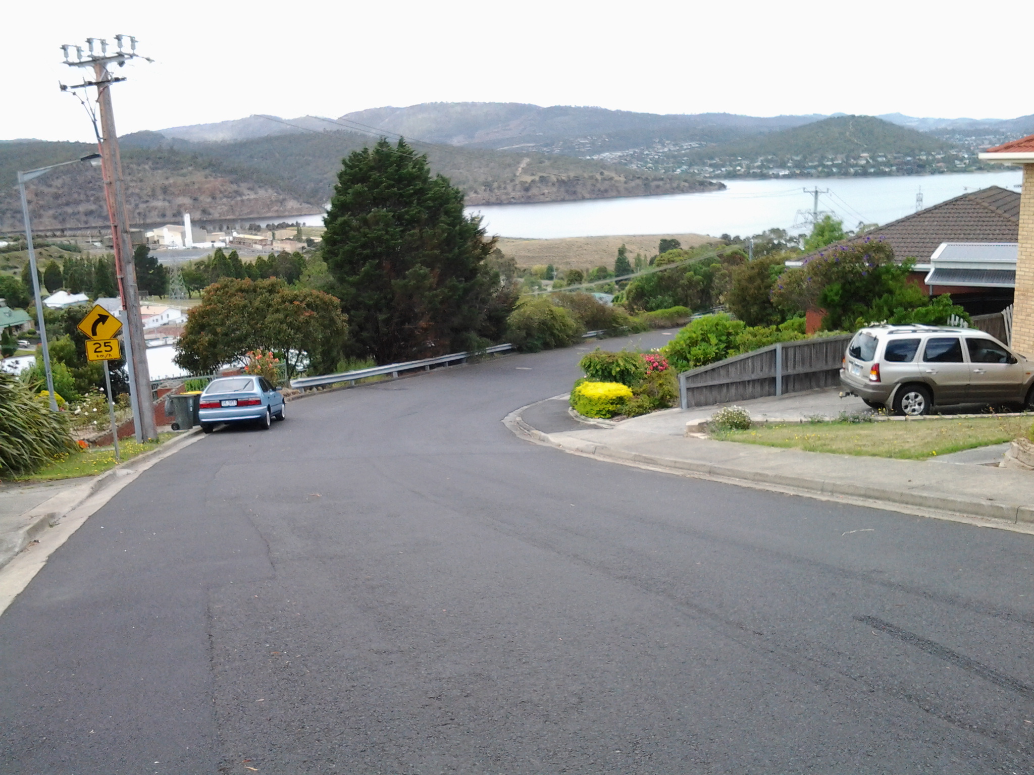
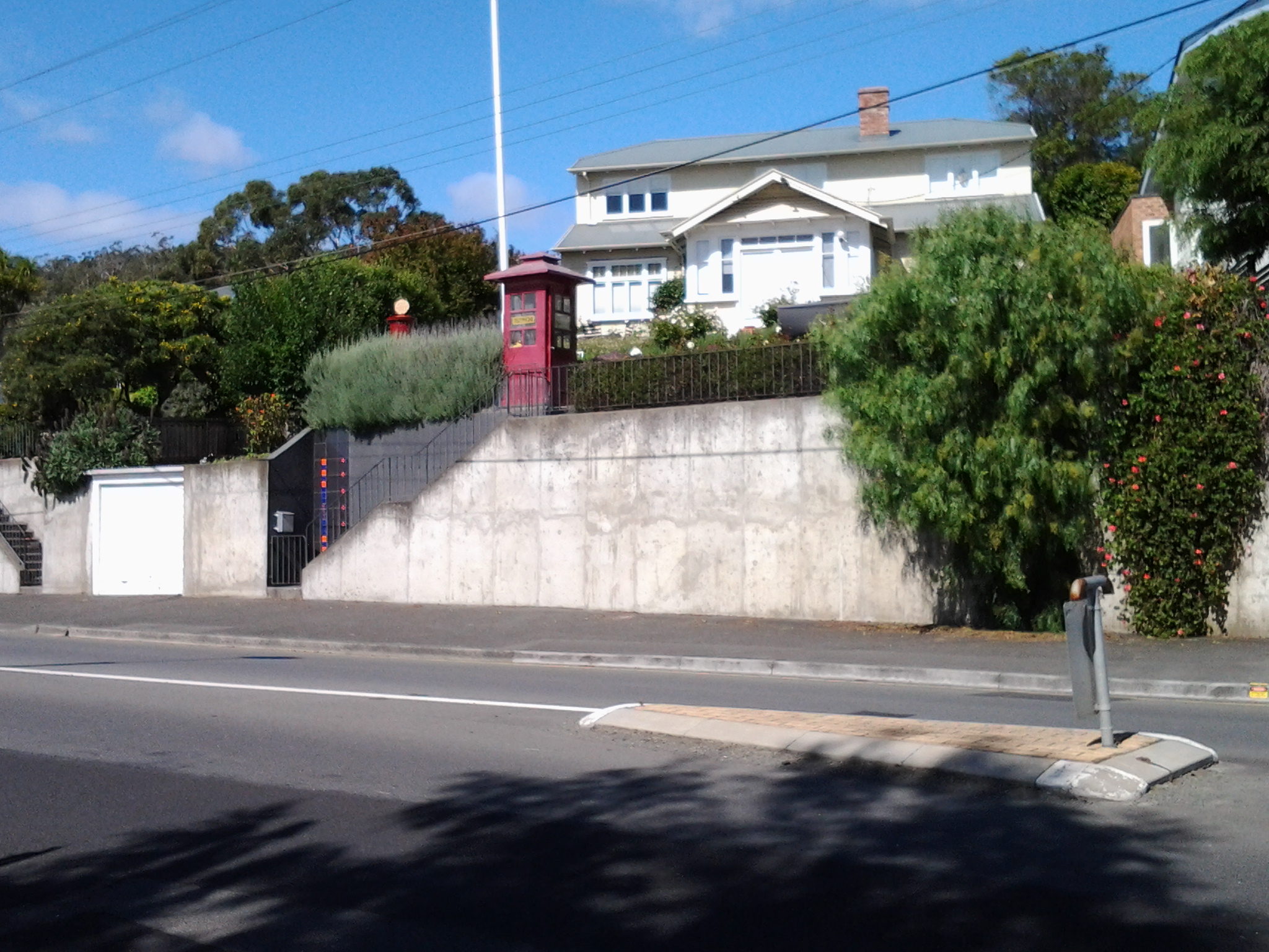
By 10.25am I was continuing past the junction of Sandy Bay Road with Churchill Ave a major thoroughfare wandering across the lower slopes of Mount Nelson.  All the time I was inspecting houses and gardens.  I cannot imagine why an old fashioned red telephone box is now pride of place at the top of entrance stairs to this house.

20150119_102631

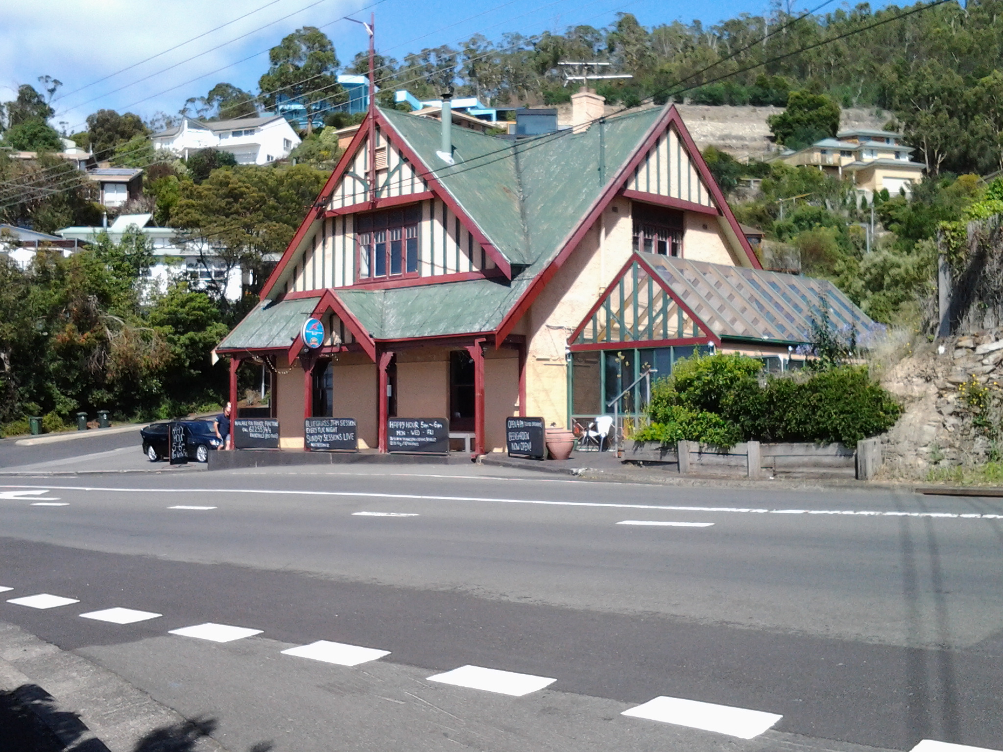
I seriously contemplated popping over to this pub (Riverview Inn) for a glass of cold wine, but restrained myself.  I am surprised with my self-discipline that I have passed a great number of good ‘watering holes’ but have not deviated from the walk – so far.

20150119_104012

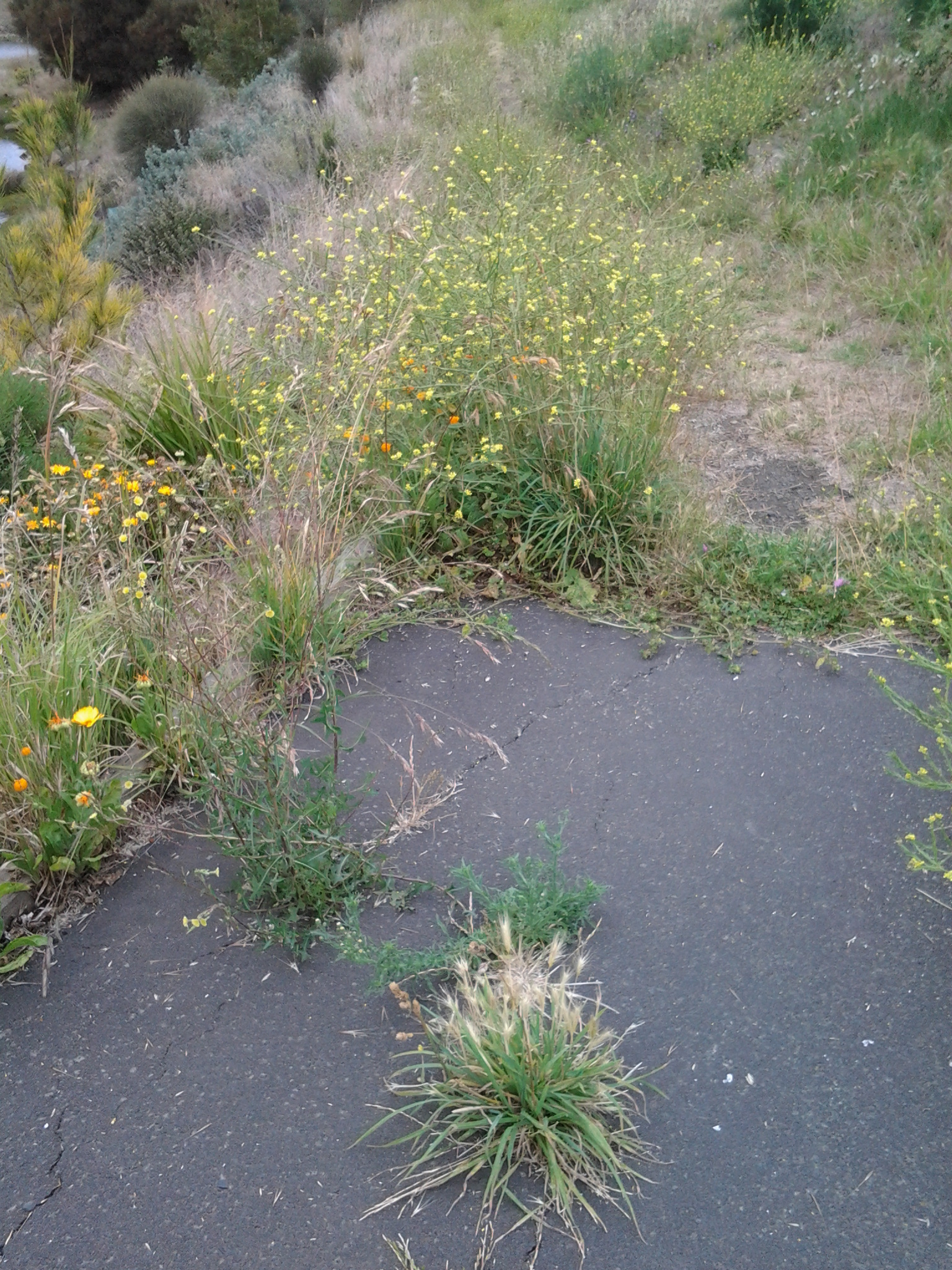
Twenty minutes later I reached Pearce’s Park.  I had never realised before but there are two bits of this Park located either side of the road but with quite some distance between them down the road. Rather strange.  The sign at the Park on the Derwent River side declared it was created to become ‘a window to the River Derwent’.

20150119_104733

An excellent idea to break the relentless strip of residences hogging the river’s edge.  I could look across the Derwent River to Trywork Point south of the suburb of Tranmere on the eastern shore.  Sulphur Crested Cockatoos screeched somewhere behind me.  The day seemed so beautiful.

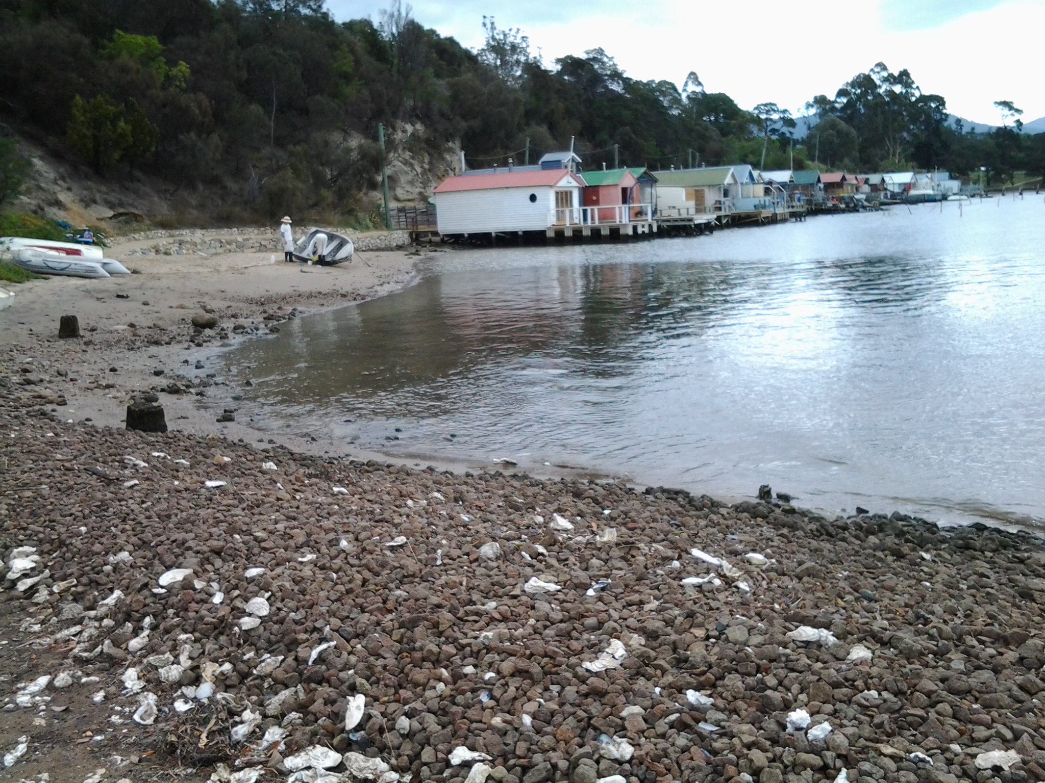
Around 11am I stood at the entrance to the Cartwright Park Reserve.  This parkland swept downhill through open forest and a cleared area with flitting cheeky Wrens, before arriving on a rocky shore of the Derwent River near Cartwright Creek.  The last part of this informal track was a mix of slippery dirt and pebbles and intrusive tree roots like bad varicose veins rippling through the surface – the track was not for those with poor balance or walking limitations.  And the range of rocks on the shore were most unstable and required great care to navigate safely. I learnt this area was settled by the brothers who established the Grange Estate (around the corner in Taroona) in the 1820s. It all seems so long ago, and I can’t help thinking how isolated the area would have been. Beautiful yes, but remote from Hobart Town.  I wonder if the settlers reached the area by boats or whether it was a horse riding trip.  Did they bring in provisions with teams of bullocks.

Once I was stepping across the foreshore rocks it was clear that the track had come to an end. However, because I never like to retrace my steps unless I absolutely must, I stumbled on.  I wondered if I could get back to a road or a track if I continued. I aimed at reaching a tiny smidgin of sand and then decided I would walk up a set of weathered wooden steps next to a blue-doored boathouse.  Was this private property? There were no signs declaring restricted access. It certainly wasn’t clear at the bottom of the steps what the status of the steps was, so I felt it wasn’t unreasonable for me to climb up and find out more.  As it turned out, I walked through someone’s garden (quite lovely) and eventually let myself out through a security gate onto Grange Avenue.  Thankfully no guard dogs were in attendance. The time was 11.20am.

If I had stayed on the main road I would have seen the signs indicating I was leaving the City of Hobart and changing into the Municipality of Kingborough.  As it was, all I knew was that I was leaving Lower Sandy Bay and entering into the suburb of Taroona – and enjoying every moment.

Heading for Selfs Point as it juts out into the Derwent River

Leaving Lutana, I crossed the bridge on the Queens Walk by turning left off Risdon Road.

20150109_130759

Close by was a sign indicating I was now in the City of Hobart and part of the New Town Bay Reserve. I turned left into Marine Esplanade.  A massive Graham Family Funeral direction sign sat in a rugby field on one corner implying a funeral business was behind.  But it is not – the business premises are located perhaps a kilometre or more away within the suburb of New Town.

As I walked along the gum tree sided Esplanade with New Town Creek to my left, I inhaled deeply of the fresh eucalypt smells. A little before 1.15pm I reached the Tasmanian Bridge Association clubhouse. A minute or so later I passed a University of Tasmania building and stood on a landscaped circle of land marking the mouth of New Town Creek as it enters into New Town Bay.

20150109_131411

Continuing amidst trees by the water’s edge I walked outside a high mesh fence marking the territory of a Sewage Treatment Plant.

20150109_131757

A little after 1.20pm, I was forced to turn back and retrace my steps. The property on which the oil tanks stand was effectively fenced, and the barb wire topped mesh extended out into the water. I wasn’t welcome to continue.

20150109_132116

Irritated, I plopped down on some rocks at the edge of the Bay and nibbled on some lunch.

20150109_132028

For the first time that day I felt the effects of a strengthening wind. I liked watching the MONA ferry dragging a chain of churning white water like a fluffy tail, as it travelled between Hobart and Berriedale.

This route was a pleasant and safe distraction but it did not help me to reach Selfs Point.  And then, as I walked back I found there were no connecting pathways between the Esplanade and Selfs Point Road. But I was not unhappy to have walked this way.  It was really tranquil moving along beside the edge of the Creek and then New Town Bay and the return walk.

In addition, the deviation was valuable because it allowed me to muse about the walkings of Charles Darwin, the English naturalist and geologist best known for his contributions to evolutionary theory. Darwin sailed to Hobart on the Beagle at the end of January 1836 and departed in the middle of February.  You can read more information about his Tasmanian stop over and his opinions at http://www.utas.edu.au/library/exhibitions/darwin/hobart.html.  A few years ago I was told that Darwin decided to climb Mount Wellington by starting at New Town Bay and following New Town Creek.  However, I can find no evidence of this and, in fact, the Royal Society of Tasmania states Darwin only made two attempts to scale Mount Wellington and both were from the South Hobart direction.

By 1.45pm, I had returned to the Queens Walk and turned left to find another route to Selfs Point.

Goodwood. Not sure about the ‘good’.

After walking across Goodwood Road (on Stage 10 of my walk along the Derwent River) which extends from the Bowen Bridge at one end to Glenorchy suburbs at the other, I was puzzled by a sign on one corner indicating behind it was a Model Park.  There were no trees. What sort of park was this? It seems this is a place for big boys to play with their model cars etc.  Special tracks were clustered in different parts of the ‘park’.

20150109_093005

Not much further along the road to the left (Innovation Drive –someone gave this name a lot of thought and presumably smirked in satisfaction) was signed as the entry to Tasmania’s hopes for technological innovation, Tasmanian Technopark.

20150109_093306

The Technopark was the brainchild of a government minister and his public service department around 2000. A small amount of information can be read at http://www.stategrowth.tas.gov.au/home/about_us/tasmanian_technopark. A federal government website has a whisper of additional information at http://www.australiangovernmentgrants.org/TASMANIAN-TECHNOPARK.php. I am surprised that there is no easily googled publicity about the achievements of this program. Can Tasmania ever equal the cut and thrust of innovation coming out of other small or remote places like Singapore, Finland, Iceland, etc?  What are we doing right and what could be done better to achieve successes?  Who knows? I couldn’t find any such information on the internet.

In the absence of any clear way to walk around the Derwent River edge of Dowsing Point, on which the Technopark is located, I thought it best to leave that exploration for another day and to continue along Howard Road.

Goodwood, in my experience, turned out to be the dog poo suburb of the Greater Hobart Area.  Excrement was everywhere in perfect form or squashed on the pavements, or the various colours dotted grassy verges.  I didn’t waste time on photography for which I am sure you are thankful – the choices were too great!

Firstly I turned left into Negara Crescent which was a street combining mean, low level, paint-flaking, unmown lawns, weed infested residential properties (okay – well not all were, but many were) with light industry such as Linen Services Tasmania, boat works, Anchor Wet Suits, Towbar and Crash bar repairs, fishing supplies, and a large unnamed workshop building emitting unpleasant chemical smells. Those houses which had Derwent River frontage sometimes had escaped overgrown blackberry infestations blocking river access in their back yards. There wasn’t a sense of wanting to live caringly or beautifully here. Accessing the River is impossible without entering private land around this locality. The built-in nature of some parts can be seen on the sign for a block of land that has been sold.

20150109_094257

By 9.45am I was joining back onto Howard Road. I walked on past bus stop 34, and the nearby Take Away Food shop and reached the Giblin Reserve around 9.50am. Photos of the surrounds are as follows:

20150109_095701  20150109_095658  20150109_094705

I sat for a while in the Reserve, watching a man in his car eating his take away meal, and taking in the surroundings.  This was a part of Prince of Wales Bay.

20150109_094717  20150109_095819

In the distance I watched the steam/smoke pouring from the zinc works of Nystar, a large industry owning considerable property along the Derwent River a little south from where I sat for a while and soaked in the atmosphere.

20150109_094734

Once I continued walking southwards around the Bay, I passed a kid’s playground, BBQ area, public toilets and ducks quacking.  When stymied by lack of water access around 10.05am, I walked up onto Gepp Parade and walked past a tree laden with not yet ripe nectarines, and later a row of junky looking boathouses. I wondered who wouldn’t be interested in removing their half sunk boat.

20150109_101243

Eventually, through the bitumen path, weeds began to multiply then suddenly this ‘formal’ path stopped and an occasionally trodden pathway through the weeds was all I had to continue on.

20150109_101335

I couldn’t help thinking that wherever a local government area is almost at the end of one and near the start of another area, there is more rubbish not collected and the general appearance of places is rather shabby. This has been the case on earlier stages of my walk, and now as I was at the extremity of the City of Glenorchy and coming closer to the City of Hobart boundary, the amount of visible rubbish and untidiness was escalating.

However, looking out over the water of the Bay (and if I tried not to study the weedy edges with their coloured flotsam and jetsam) to Mt Direction on the other side of the Derwent River, presented me with an attractive view.

20150109_101749

When I could get back down onto a weedy area, I followed man-made tracks and continued almost to the Sewage Treatment Farm (which I could see had wired fencing into the water that barred my continuous shore access) then headed up through the trees and onto a disused railway line. I crossed this, climbed a weedy rise spattered with rubbish, clambered over a metal guard rail and stood on Derwent Park Road which is the main road to Nystar and other industry located by the River. It was 10.25am when I reached this point. I had been plodding along for almost three hours.

Yesterday I completed Stage 10 of my sequential walk along the Derwent River

The goal for Stage 10 was to start at my last stopping point, MONA in the middle of Berriedale on the western shore of the Derwent River, and continue to Lutana the last suburb of the City of Glenorchy before the City of Hobart starts. But I went further.  Much further.  Almost much further than my feet could take me.  I walked to Hobart.

Over future posts I will write up the stories of the walk, what I saw and what I experienced, but for now it’s enough to say that I am continuing with this massive project to walk both sides of the Derwent between the mouth and Bridgewater, and then onwards to Lake St Clair. Once I get walking it is always so addictive.  Even when my feet feel crippled, I say to myself … ‘go just a little bit further. What else will I be able to see with fresh eyes?’

The day was gloomy with a cloudy sky, and Mount Wellington had veils of clouds covering at least part of its prominence most of the day. But it didn’t rain and so was perfect for walking.  However, the weather ensured the photographs were without sunshine.

Yesterday I covered 12 kilometres of the length of the Derwent River on the western shore (making 22 kms in total on the western shore), and walked approximately 19 kilometres (making a total of 130 kms to date) to achieve that distance. This distance also takes in the streets and paths on which I walked that led to dead ends so that I needed to retrace my footsteps.

Of the many highlights of the walk, I saw the building that once started life as Rosetta Cottage, and powerful Clydesdale horses with their large hairy feet.

20150109_162649

I surprised a friend still in pyjamas when I went visiting for the first time in my walks. The hot cups of tea were most welcome.

I am always excited when I walk the striped edged boardwalks of GASP (Glenorchy Arts and Sculpture Park) or pass the boatsheds of Cornelian Bay and it was no different yesterday.  See the photos below for a taste of the colour.

20150109_084404  20150109_145335

I very much enjoyed looking at the eastern shore where I had walked during past stages and seeing the landscape from a different perspective.  I felt it made the Greater Hobart Area seem undeveloped in a way which is quite amazing for a capital city. For example, Bedlam Walls on the eastern shore from the western shore of the Derwent River, in the photo below.

20150109_123940

From comments I have received, I know my walks are inspiring others to think about what they might do. Even if you choose not to walk, perhaps you can set yourself other challenges.

My next walk will start at Hunter St at Sullivans Cove on the wharf in Hobart and probably extend to Kingston.  But before then I need to record the details of yesterday’s walk.