Tag Archives: England

The Fall of the Derwent

Early during my walk along Tasmania’s Derwent River from the mouth to the source, I was travelling near Repulse Dam on a reconnaissance trip when I came across two others.  It was a strange experience.  Previously I had become aware that two women planned, with assistance and support from others, and with the direct engagement of specific groups of people in some parts, to walk from the mouth to the source.  That day, as Andrew and I drove around for me to suss the landscape and the walking route options, when I saw two women seeming to do the same, we stopped them and I asked questions.  ‘Yes we are those women’, said Justy Phillips and Margaret Woodward.  I am sure they were as surprised as I was.

Since then, Justy and Margaret have made their way alongside various parts of Tasmania’s Derwent River and arrived at Lake St Clair where they were Facebooked taking a dip in those cold waters, seemingly delighted with their arrival.

Their project was very different from mine.  In my case, I wanted to walk around the whole of the Greater Hobart Area, and then to walk every metre of the way to the source at St Clair Lagoon dam.   By contrast, Justy and Margaret walked alongside parts of two Derwent Rivers; Tasmania’s Derwent River and the other in Cumbria England.  The experience of and learnings from their walks were used as part of the basis to write what they describe as a ‘fictionella’; written in the form of text artwork, similar in appearance to poetry.

That book is titled Fall of the Derwent. In this website you can see  range of photographs including two where Justy and Margaret are holding their black covered book.

Cover of book.jpg

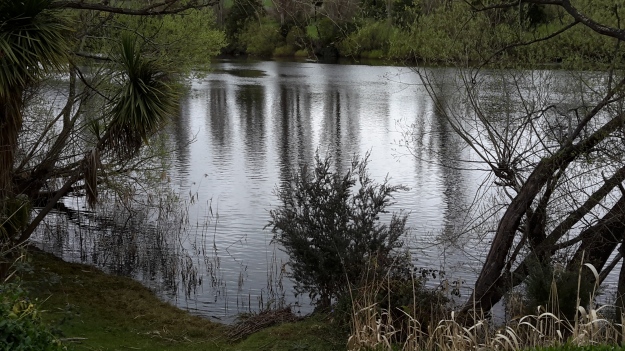
The title of the book references a drawing by an early Tasmanian surveyor George Frankland which he named ‘Fall of the Derwent’.  Colonial artist Thomas Bock engraved the image and James Ross printed the picture in The Hobart Town Almanac in 1830. The picture was drawn at a site near unpassable rapids on the Derwent River upriver from New Norfolk.  When Justy and Margaret walked past what they believed was that place, they took a suite of black and white photographs;  half a dozen or so of these images are bound into their book.  Without returning to that area I seem to remember the spot.  After reviewing my photographs in that area, clearly I was looking for serenity and simplicity.  I was looking at colours and contrasts.  It seems I was focusing on one way of seeing that world of the Derwent River, and Justy and Margaret’s view is an alternative.20150917_094036.jpg
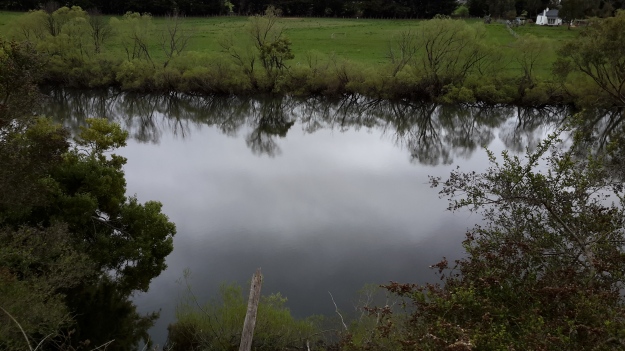
20150917_095352.jpgI did not focus on the twisted interlacing of stark and scrappy vegetation at the river edge like Justy and Margaret have done  The differences in our images is a reflection on the different nature of our projects. I wanted to entice others to be seduced by the beauty of the landscape and then to make their own journeys along the river edge (I now wonder why I didn’t see vegetation tangles as beautiful).  When I read their book it seemed they wanted to use their experiences as the basis for creative abstract thoughts; perhaps even a metaphysical approach involving questions such what is there in that world and what is it like at a more profound level.  My approach was literal and descriptive.

The Phillips/Woodward Fall of the Derwent publication presents poetry-styled ideas and comments in ‘chapters’ headed by the days of the week; the book proceeds over  44 days consecutive days – but the ideas associated with both rivers are intermixed.

“Let us begin with two rivers / And a Dad not long for living. / Two daughters …”

Despite the introductory lines, theirs is not a chronological story connecting the sequences of walking the two rivers; reference is made to other locations such as Cape Barren Island, Dover Point, and Brisbane. And the English father walked with Justy and Margaret when they traipsed near the Cumbrian Derwent. As an intertwined overlay in this book, mention is made of his declining health – Dad in pain, no longer able to feed himself, no longer speaking.  For this reason and for the manner of writing which removes easily identifiable meaning through much of the publication, this book has a limited audience and is obviously a set of personal ideas to be understood, remembered and perhaps loved by the authors. For their personal satisfaction. I was surprised that this book uses combinations of words that do not create, for most of the book,  visual images of either of the two rivers. Instead, the poetry reads as a meshing of many experiences which presumably helps Phillips/Woodward to reconstruct a feel of those experiences.

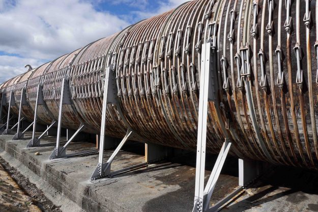
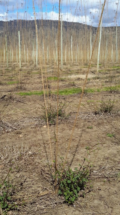
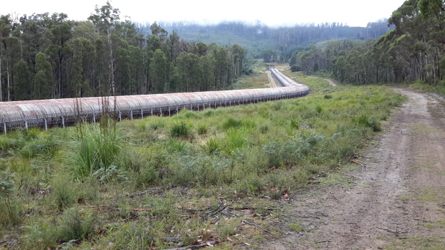
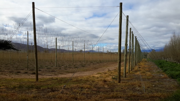
On occasion, where the meaning was clear because I could recognise specific locations, I enjoyed some of the lines. For example, “…rows of hops that string this neck of the river…” referred to the hop vines and their structural strings in the Bushy Park area.  These hop fields obviously made a significant impression on Justy and Margaret because there was a second comment on the same topic; “…the hops in single file march orderly disruption to the valley.”  Then, when they walked around the Wayatinah Power Station, “…the woodstave pipeline is a blistering gland … Draws the corset of her breathing”.  Like Justy and Margaret, I looked in awe at these two locations and their dramatic impact was described during my posts.  To remind you – here are photos of the hop fields and others of the wooden pipeline.   20150918_104145.jpg
20150918_113007.jpg

20170424_114515.jpg

DSC01655e.jpgJusty and Margaret learnt in Cumbria; “On the banks of the River Derwent, that the term ‘black market’ is born. Through the illegal trading of graphite.”  Then they found graphite was part of the geological structure at Wayatinah on Tasmania’s Derwent.  From these findings, grew the idea to play with ‘black’; the book’s cover is black, some copies are cloth bound and impregnated with carbon powder, the Fall of the Derwent and ‘black’ are interconnected within the text, and one section of the book presents a list of locations along Tasmania’s Derwent which include ‘black’ in the name; examples include Black Bob’s Rivulet and Blackmans Bay.

Phillips/Woodward’s book Fall of the Derwent was part of a public artwork presented in association with GASP (Glenorchy Art & Sculpture Park) in 2016. Further information can be accessed here. If you click on ‘Download Hydrographic Score’ you will be able to read the book online.
Sailing ships

Yesterday I had the pleasure of sailing around the Derwent River Harbour in a full scale replica of the Lady Nelson sailing ship.  The original was built in 1798 in England and plied the waters between Newcastle and Norfolk Island and Tasmania for the next  twenty five years.  My day on the water was glorious with blue skies, golden sunshine and a firm breeze. When all the sails went up, we scudded along at 7 knots.  Quite wonderful. The image below is of the replica in which I sailed.

Lady nelson from theirwebsite.jpg

The water surface had an almost millpond quality as we returned to the wharf. I couldn’t imagine how sailing ships would cope with heavy seas.

2016-11-18 14.52.17.jpg

I spent a great deal of time thinking about earlier sailing ships and I tried to imagine what it might have been like, with so many ropes and so many sails being part of the picture for months at sea.

The Lady Nelson came out to Australia with around 20 people. The original crew size was 12.

Records show that at times there were perhaps 60 or more people sailing for days on the Lady Nelson.  Yesterday with passengers and crew I suspect our number was around 40. It was standing room only on the deck when all were assembled. Sailing for days would have been very cramped and most uncomfortable by today’s standards (although I recognise that people were generally physically smaller back then than we are today). Add to that, on the original Lady Nelson, the area below deck remained unstructured with one open hold. Apparently people slept on boxes and ropes and all.

My photos below give some idea of the majesty of a sailing ship however small (and it also shows how glorious it is to be out on the Derwent River in Hobart).

2016-11-18 13.34.22.jpg

2016-11-18 14.10.08.jpg

2016-11-18 13.58.40.jpg

2016-11-18 14.14.43.jpg

2016-11-18 14.04.14.jpg

2016-11-18 14.06.14.jpg


The Lady Nelson was approx 53 feet long ,  approx 17 feet wide and weighed 61 tons. I have compared this with the larger ships that arrived in the Derwent River in the early part of the 19th century and so,  after yesterday’s most stimulating sail, I feel I have a small but greater understanding of what travellers (convicts and free settlers) might have been exposed to at sea before they started their comparatively mild run up the Derwent.

The Lady Nelson replica runs trips lasting a few days; I am considering taking one of these small voyages. Part of the deal, if you wish, is to learn to handle the ropes and even climb around the sails.  I wonder if the 19th century crews allowed such liberties to its passengers.

The Unlikely Pilgrimage of Harold Fry

The Unlikely Pilgirmage of Harold Fry cover.jpg 

This novel by Rachel Joyce (Transworld Publishers 2012) is a seemingly whimsical fiction about a retired man, similar in age to me, who walks down the hill from his house to post a letter.

When he reaches the post box he walks on to the next, and then keeps going.  He lives in the south west of England but as the hours of walking pass he decides to keep walking to the north east corner of England and deliver his letter in person.  He simply cannot stop and go back home. Along the way, as he places one deteriorating tennis shoe covered foot after the other in all weathers, he begins to see the world around him, he reflects on his life, and he attracts unwanted media attention and a gaggle of followers. Somewhere along his walk, he remits his wallet and watch and all personal effects back to his wife before continuing his walk hoping for the goodness of people to survive.  Eventually he staggers into his destination, works at removing his tangled beard and taming his weathered hair.

This is an easy read but full of insights only normally attainable by the relentless pursuit of a goal via a simplified lifestyle.  Harold Fry’s story contains both humour and sadness, and is remarkable for its exposure of the rich ordinariness of a person with a grand vision.  I recommend you read this book.

Has the river of blogs dried up? Is my write up of the walks along the Derwent River over?

from MountWellington.jpg

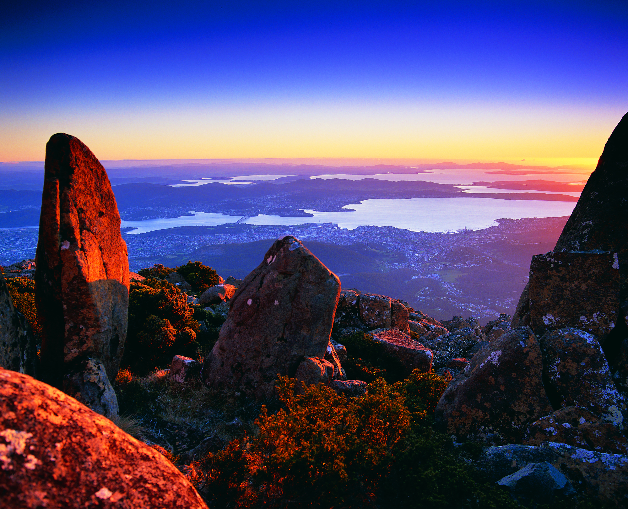
 This wonderful image of ‘Hobart from Mt Wellington’ is the work of Tourism Tasmania and Garry Moore. This free photo has unrestricted copyright.

Has the river of blogs dried up?  Is my write up of the walks along the Derwent River over? The answer to both questions is no.

For a long time, blog followers have received a daily post covering my experiences after I have walked sections of the terrain from the mouth to the source of Tasmania’s Derwent River, plus my additional writings about various aspects of the social and natural history of the Derwent River.  Yesterday and this morning were a rude shock for some Australians – no blog post to absorb over the breakfast cuppas– and for my overseas followers spread across many countries, their regular daily dose arrived at many different times depending on the time zone in which they live.

Have I run out of stories to tell, descriptions to give and photos to show? The answer is a resounding no. I have much more to expose. Please be assured that you have not seen the sights of all the kilometres of the Derwent River, nor heard about all its challenges, in my blog yet.  So why the absence of new posts?

I have committed to another major project which cannot wait any longer for my sustained action. I like huge projects.

Last year I discovered that the first Tyzack in my line (3 different lines came to Australia from England in the 19th century) arrived at Port Melbourne 150 years ago this coming December.  Impulsively I decided (without research or planning just as I conceived the idea to walk the length of the Derwent River) to organise a family gathering later this year for all my great great grandfather’s descendants spread across Australia. Two family members agreed to support me –thankfully one has prepared a family tree. The Tyzack 150th anniversary organisation is now my priority, because there is a book to be put together and published, field trip guides to be developed, and much more – I still haven’t received responses to my introductory letters from most of the over 100 living descendants (almost all whom I have never heard of leave alone know) so I have a big job ahead tracking them down and getting them onside and involved.

This family event is scheduled early in October – so, if not before then, from mid-October onwards I expect to continue writing up the Derwent River walking blog stories.  Probably I won’t be able to restrain myself so that, from time to time, a post may appear.

The photo below taken by Michelle shows the eastern shore mouth of the Derwent River, Cape Direction (on the right) and the Iron Pot islet sits out within Storm Bay.

PA280012.JPG


Lake King William

Van Diemen’s Land (Tasmania)’s mother country England was governed by 3 King Williams preceding settlement of Australia (Tasmania received its first European settlers in 1803).  William IV of the United Kingdom reigned from 1830 and lived until 1837. Indirectly our Lake King William which dams the Derwent River was named after the Fourth.

Watching over Lake King William is Mount King William and the King William Range. Wikipedia  reports that Mount King William was named during Sir John Franklin’s journey into western Tasmania in 1842.  Hydro Tasmania created the Lake in 1950 and referred to the nearby geographical features which had been named by European explorers in the 19th century, for its current name.

20151029_125012

The photo above with snow topping the Range was taken in October 2015. The photo below was taken in January 2016.

20160102_165048.jpg

Where is the source of the Derwent River?

This question was on the minds of the new settlers to Van Diemens Land in the early 1800s.

In 1835 George Frankland, Surveyor General to the government of the time, organised a ‘search’ party to locate the source. After the expedition he wrote a report for despatch to the ‘mother country’, England.  The brief text has been published as The Narrative of an Expedition to the Head of the Derwent and to the Countries bordering the Huon in 1835.  The small book was reprinted by Nags Head Press for the publisher Sullivan’s Cove in 1983.

No description exists of how Frankland and his party travelled inland until they reached a property or area then known then as Marlborough (now known as Bronte) in the Lake country, located west of Lake Echo and directly east of Lake St Clair by over 30 kilometres. Marlborough was a probation station for North American prisoners in the 1830s/40s.

Map of probation stations including Marlborough

The map above can be seen in the story: ‘They left Jefferson County forever…’

The Marlborough district was discovered by Surveyor Sharland who also found Lake St Clair, in 1832, only three years before Frankland felt compelled to find the source of the Derwent.  It seems Sharland did not realise it was the Derwent River that flowed from the southern end of Lake St Clair. Further information can be read in G. H. Stancombe’s paper Notes on the History of The Central Plateau.

The Lyell Highway, according to the Highland Lakes Settlement Strategy has been known as the Marlborough Road where it runs westwards of Ouse and towards the area around Bronte.

Information, which is totally irrelevant to my writings about the Derwent but nevertheless interesting, concerns an earthquake near Marlborough that was recorded in The Courier, a Hobart newspaper on 25 April 1854. Thomas Bellinger reported ‘I beg to inform you of a very strange occurrence on the evening of the 24th of March last. A shock like that of an earthquake was felt in almost every part of the Marlborough District. Two shepherds were gathering sheep the other day and discovered the cause of it.  I went to the place yesterday: there has been some fearful volcanic eruption, rocks of enormous size have been driven about, the face of the earth appears to have been hoisted in the air and pitched surface downwards. I cannot describe to you the appearance, but if you will come up I am sure you will be highly gratified – the distance is about ten miles from this.’  I have no information about where Thomas Bellinger was writing from but I am curious to hunt out the location of this upheaval.

After that information detour, let’s go back to the expedition to find the source of the Derwent River.

Following a ‘difficult journey from the settled Districts’, all members of George Frankland’s party assembled at Marlborough on the 7 February 1835.  The record shows that George Frankland did not follow the edges of the Derwent, rather he crossed the Nive River (which empties into the Derwent River much further south), then travelled north-westwards. Initially densely forested hills stymied progress with horses, and then the boggy plains ahead slowed him down.  He continued generally in a westward direction and after almost five days, found Lake St Clair; ‘we suddenly found ourselves on the edge of a beautiful Lake in the heart of Scenery of the most picturesque Character’.  After further walking around parts of the lake, Frankland reports ‘It was a fine summers day and the Air was so serene that the surface of the Water was scarcely ruffled but the sandy beaches bore evidence of the Lake being at times as rough as the Sea. I will not here dilate on the extreme beauty of this scenery as it might be considered out of place in an official report, but … I feel it difficult to avoid expressing the impressions of delight which were inspired by first discovering of such a romantic Country…’

On the 14th February, Frankland despatched two of his party to return to the source of the Derwent and follow it downstream on the left bank while he set out to explore the country on the right bank.  Both parties walked across open plains where Lake King William now fills the area.  They reunited the next day.  One of the party, a Mister Calder was despatched to continue along the edge of the river until he met the entrance of the Nive, which he successfully achieved (although details are absent).  Meanwhile Frankland tried to continue following after Calder but was only able to proceed for 3 miles. ‘At that point we plainly perceived that the Country had … become such a thick forest that to take the horses any further was out of the question.’  The result was that Frankland split the party further with the horses taking an easier route to Marlborough.

On their first day trying to walk the edge of the Derwent, Frankland recorded ‘This day was consumed by a laborious march of two miles through a most obstinate scrub – and we bivouacked on the steep edge of the Derwent after wading for a considerable distance through the torrent, up to the middle, as the easiest mode of travelling.’  The forest is as dense in 2015 as it was then, so regular blog followers can appreciate why walking some sections of the rest of the way to Lake St Clair concerns me.

At this point Frankland was for giving up. ‘On the 18th February I determined on leaving the Derwent and accordingly struck away to the N.E. The forests continued depressingly thick – but by dint of labour we accomplished about four miles this day’.  Only four miles in a day for strong men!  What chance do I have of walking this part quickly or easily?

A couple of days later Frankland reached Marlborough and from there he set off to cross the Derwent River and explore the Huon River area further south.

Thank you Andrew for alerting me to this report and for the loan of the book.

Linden

20150917_110024

The name Linden is used to name streets, roads and courts in the Derwent Valley and elsewhere across Tasmania perhaps as a marker of someone with that surname who made an impact on the community in the past. But I could not find a Linden family history, or any other historical reason to justify the naming of the property I passed at approximately 5 kilometres west of New Norfolk.

Perhaps the naming was related to Linden trees native to England from where an early property owner may have travelled.  I cannot recognise this tree so I cannot say whether the trees on the property were lindens.

Alternatively, does Elena Gover’s account in Tasmania through Russian eyes (Nineteenth and early twentieth centuries) create another possibility? Was this property named after crew member Lieutenant Vilgelm Andreevich Linden of the Russian corvette Boyerin which arrived in Hobart in 1870 at a time of goodwill in terms of Australia-Russia relations? Linden wrote notes and collected extensive information about many aspects of Tasmania. ‘As well as chapters on geography, he made an analysis of the aftermath of transportation on the economic development of the island. Linden collected interesting information about the government and electoral system of Tasmania, and of the system of land allocation which allowed an influx of free settlers…

I did not walk down the driveway so I did not see existing residences at Linden. Apparently ‘Bryn Estyn’ homestead was built on the property in the 1840s, and named after the family home of new settler Lieutenant Henry Lloyd who had relocated from Wales. The State Library of Tasmania holds a photograph of the building:

Bryn Estyn

You may recall an earlier posting showed the Water Treatment Plant named ‘Bryn Estyn’. I can only assume the original land grants for Lloyd included the acres for the Treatment Plant.

A sandstone quarry on the property was the centre of attention when the building of Tasmania’s High Court in Hobart was being planned. Back in 1982, when A. A. Ashbolt owned the mineral lease, the quarry on the Linden property was surveyed to determine whether sufficient stone of ‘acceptable quality’ existed that would be suitable for cladding the new Court. Previously this stone was used on the Supreme Court of Tasmania. The stone was found to have been laid down in the Triassic period (about 3 million years ago), a time when the early dinosaurs were roaming the earth.

I suspect the property, marked with Linden at the entrance, is now known as Ashbolt Farm. The farm specialises in producing products from elderflower and olive trees and additional information is located here.  I wish I had known about this property prior to walking because I would have made arrangements to visit and enjoy a cup of hot elderberry tea.  When I passed this property last Thursday, there was no sign of life and no welcome sign posted.

Immediately past and in the vicinity of the property ‘Linden’, the racing Derwent River was visible from the road.

20150917_111214 20150917_111338 20150917_111407 20150917_111617

From the sea to the source; stories of a river on the other side of the globe

Two years ago, Helen Ivison published River Derwent: From Sea to Source (Amberley Publishing).

 Ivison River Derwent

 The promotional puff declares this book ‘brings to light tales and stories of fascinating events, landmarks and people. River Derwent: From Sea to Source is essential reading for anyone who knows this river well, and also for those who are visiting the River Derwent for the first time.’  But what is the author referring to?

Hers is the Derwent River in the Cumbrian region of England which flows from the mountainous Lakes District in two strands, one of which starts near Styhead Tarn. The two strands meet at Grains Gill, and continue in a north easterly direction as a single river towards an expanse known as Derwent Water. The river passes through this ‘lake’ then eases into a north westerly direction across country before flowing onwards through Bassenthwaite Lake. Finally, the English Derwent River turns westwards and empties into the Irish Sea.

By contrast Tasmania’s Derwent River flows generally in a south easterly direction from Lake St Clair, through steep narrow gorges, curving around farmlands, before passing between the two sides of the Greater Hobart Area into Storm Bay. The man-made lakes of Lake King William, Wayatinah Lagoon, Lake Catagunya, Lake Repulse, Cluny Lagoon and Meadowbank Lake all disrupt the progress of the River. These lakes have resulted from dam building as part of hydro-electricity generating projects over the past century.

The length of the Derwent River

Past readers of Frequently Asked Questions know that I have not been able to discover the ‘real’ length of the Derwent River.  In conversation recently with blog follower Yo, I was reminded of the challenges involved with determining river lengths.

If a river empties into a sea by more than one waterflow, then which is the ‘real’ river? Do we say there are two river lengths for the same river in such a circumstance?

If a river enters into a bay which opens onto a sea, where does the river end?

If the mouth of a river is a complex delta receiving silt flows and forever changing, can we pinpoint the location of the river mouth? At which time could a reliable measurement be made? No and never, are the answers to these questions.

At the source, rivers sometimes start with a dribble of water oozing from the ground. Is that enough to be able to define the water source as a river?  Some rivers pour from Lakes. Is the middle of the lake the start of the river or is that bank over which the water leaves the Lake, the official starting point? If a dam has been built at the junction of the lake and river, then the starting point may be the water at the top of the dam or at the bottom of the dam – leading to a different final river length.

What about rivers such as the Nile River which have at least two waterflows starting inland and which then meet to form one river?  Which waterflow counts towards the measurement of the river’s length? Or does the river start where the two or more waterflows merge?

Rivers do not travel in neat straight lines so should we measure the distance along the riverbank? If so, which bank?  The shape of the shoreline on either side of a river can be markedly different from each other and one side is usually longer than the other.

How about measuring the length of the river taking a centre line? Will that give the most accurate measurement?  This is the preferred method, however many of our measuring devices are straight – think ruler, think tape – so how can we make a reliable measurement?

On the first day in December 1873, the Commissioner of Patents for Inventions under England’s Patent Law Act 1852 recorded Edward Russell Morris’s invention of a pocket instrument which could measure distances on curved lines.  Since the 19th century, various variations have been developed.

If you check on EBay online, many historical versions of Opisometer Curvimeter Meilograph Map Measurers have been photographed, and are offered for sale. Opisometers have a tiny wheel at one end which, when rolled on a map along a road or river, connects with a graded scale in either a straight or circular format to read a distance. The unit markings refer either to kilometres or miles. You can watch a demonstration of one of these measuring tools on You Tube .

A bushwalking friend purchased an Opisometer many years ago and lent it to me so I could ascertain the length of the Derwent River more closely.  Today I used the Opisometer by rolling it on my maps, along an arbitrary ‘line’ in the centre of the river.

20150828_125903

After using the Opisometer on all seventeen 1:25,000 maps that cover the Derwent River, it seems the length is 214 Kilometres (refer to Frequently Asked Questions for a table showing the breakdown per map).

Based on my measurements today, so far I have walked against 61 kilometres of that length.  I can see that any previous measurements reported in my blog, have been wildly inaccurate – generally too low.

The weather in southern Tasmania

The early non-indigenous settlers in Van Diemen’s Land (now Tasmania), almost all of whom were formerly residents of the typically rainswept and cool British Isles or had lived in hot India, documented their thoughts on the weather.

Their descriptions of our weather were usually based on comparisons with the situation from which they had relocated. Generally the impression given is that the weather on this island is temperate, irritatingly variable, and considerably easier to live with compared to that experienced in the settlers’ original homelands. For example, in James Bischoff’s “Sketch of the History of Van Diemen’s Land” written in 1832, there are many references to the climate and its relationship to agriculture and animal husbandry. More generally he says: ‘To one accustomed to the moist climate and plentifully watered countries of England, Scotland, and Ireland, Van Diemen’s Land, at first sight, may present a dry and unproductive appearance; but upon a nearer acquaintance, it will put on a more inviting aspect.’  It was ‘the regularity and salubrity of its climate’ which Bischoff found attractive.  The author also claims that ‘A book was published at Calcutta, in 1830, giving an account of Van Diemen’s Land, principally intended for the use of persons residing in India, and shewing the advantages it holds out to them for their residence; the following is extracted from that work: Its climate seems so well adapted to the renovating of the constitution of those who have suffered from their residence in India, that it only requires to be pointed out, and the easiest manner of getting there made known, as also the cheapness and comfort of living, when there, to turn the tide of visitors to the Cape and the Isle of France, towards its shores.’

Godwins Guide to Emigrants to VDL

Godwin’s “Emigrants Guide to Van Diemen’s Land more properly called Tasmania held in the collection of the State Library of Victoria, written in 1823, offers the following: ‘This island has to boast of perhaps the most salubrious and congenial climate of any in the known world, for our European constitution: It has been ascertained by the thermometer to be similar to that of the south of France; the general temperature being about 60 degrees Fahrenheit, and the extremes from 43 to 80 degrees. The spring commences early in August, the summer in November, the autumn in March, and the winter in May. The winter, therefore, is not of more than three months’ duration, and the severest part only six weeks.’

Ros Haynes writes on a University of Tasmania site in 2006 ‘In most areas there was adequate rainfall, the climate was more conducive to growing the crops they were used to …. The temperature was also considered more invigorating than the heat and humidity that enervated settlers in the other Australian colonies. Van Diemen’s Land was soon marketing itself as the ‘Sanatorium of the South’, famous for its flowers, fruit and healthy inhabitants.’

Dixons cover

John Dixon, in his 1839 book (available as an E-book) “The Condition and Capabilities of Van Diemen’s Land, as a Place of Emigration: Being the Practical Experience of Nearly Ten Year’s Residence in the Colony“, explained, ‘Lingering illness is seldom heard of in Van Diemen’s Land: and, in consequence, the deaths always seem to be sudden.  These seeming sudden deaths may contribute to praise of the climate: for they may improve its salutary influence, by sustaining the body in health longer there, than in the climate of another country.

These days we would describe our climate as being cool temperate with four distinct seasons. However, across the island, our temperature and rainfall ratings vary according to topography, nearness to the coast and time of the year.  Despite Tasmania’s capital city Hobart being the Australian capital city located closest to South Pole, it is known as the nation’s driest capital city.  By contrast, parts of the west coast of Tasmania expects rain for more than 300 days each year – I lived in Queenstown once and it rained for three weeks straight leaving me feeling very sun deprived.

Helpful tip

When you visit Tasmania for the first time, you will find any and everyone will be happy to talk with you about the weather – for many minutes at a time.  Such conversations may help you to make new friends.  However, please avoid some pitfalls. If you normally live in a super cold climate it may not be appropriate to say our weather is so mild and lovely here, when powder snow tops our mountains in the distance and light drizzle saturates the ground – because we may not think highly of the weather under those circumstances.  Similarly if you come from a very hot climate it may not be appropriate to say the weather is so gorgeously moderate here when we have a 35 Celsius degree day, because it is likely we will consider that to be a hot day. I guess we all have our peculiarities.

Searching for my place in history

When I talk with strangers about my project to walk from the mouth to the source of the Derwent River, people often ask why. I trot out a range of reasons but, in truth, it is never clear to me at a deep level why I am making this walk.

My experiences over the past few days have given me new insights.

Earlier this year I began immersing myself in family history searches, with the view to knowing something of family members who were born and had died before me.

When I realised that the 150th anniversary of arrival in Melbourne Australia from England of the first family with my surname, from which I am a directly descended, will occur next year (2016), I decided to find and see where they lived in Victoria. Last Friday, I walked the Melbourne suburban streets of Carlton and the areas governed by the Boroondara City Council in Hawthorn of Glenferrie, Auburn, Deepdene, Kew and Camberwell.

I found all the streets in which my great great grandfather lived, however his houses have been replaced with various vintages of newer architecture. The landscape was changing while he lived in Melbourne when massive land sale and building booms wiped away acres of farmlands. And, of course, since he died in 1889 ‘development’ has progressed.  Nevertheless, because homes built in the 1880s still exist with their facades intact, I developed some understanding of what an original streetscape might have looked like during that decade.  Unfortunately late 1860s and 1870s buildings are no longer in evidence.

Throughout my-day long walk, I felt very much attached to the areas where he lived. A weird sense of belonging.  Albeit transient. And I was profoundly happy that in every street, one or more magpies warbled as they watched my progress.

My father’s family home, located in rural central Victoria, has always been special to me. It was during my early childhood visits that the music of the magpies perched on trees above nearby gold-mine slag-heaps, caught my attention. I have loved their intelligence and beauty ever since. Therefore, I should have not been surprised when I made a trip to the family home on Saturday and the wonderful sounds of magpies made me weep.  It seems the melodic notes of these black and white beauties provide me with a marker of family places, and also to other places where I gain so much pleasure.

Throughout my blog postings following the walking stages along the Derwent River, I have recorded my observation of magpies, and my delight in their song.  Rarely do magpies fly through my part of suburbia, so now I realise that part of my purpose for walking the Derwent is to hear the glorious communications of magpies. I guess it is my way of finding my place, as I make my own history – which becomes part of my family history.

A traveller – at the Salamanca Market set up by the Derwent River

Since April I have been waiting for the weather to warm up so I can continue my walk to the source of the Derwent River more comfortably. Between then and now my posts have connected with the Derwent River by various degrees. This posting is no different. Months ago I walked past historic Salamanca in Hobart as I walked the edge of the Derwent River and last Saturday, I headed back again to the area for the renowned Salamanca Market.

The big find was an Englishman who has relocated to live in Tasmania and had set up a stall to sell his book.  A few years ago his Tasmanian wife lured him here for a holiday and when she flew back to England, he decided to return by hitching his way half way around the world.  After starting from Hobart by accepting a lift on a Sydney to Hobart Yacht Race yacht returning to Sydney, his trek took 6 months via the countries north of the Himalayas.  Apparently it only took 800 rides, through 19 countries! Out of the adventure and experiences Jamie Maslin wrote his story: ‘The Long Hitch Home’.

The Long Hitch Home Jamie Maslin book cover

In more recent times, Jamie has relocated to Hobart for permanent residence.

Past posts have indicated my awe and amazement about the achievements of people who take on, what seem to me to be, herculean tasks – These always excite me to make yet another step.  Inspiring others to make the first step in their own backyard is one of the goals of this ongoing blog.

Walking Home-the Pennine Way

During Tasmania’s current winter days I am using my time to read books with a travel theme, and mostly those involving a significant walk.  These books both inform and inspire me so that I eagerly look forward to the warmer spring weather when I will be able to continue walking to the source of the Derwent River.

I am thankful some local followers of my blog have alerted me to titles and, in some cases, loaned me their books. Thanks to Ma, my current read is Simon Armitage’s book Walking Home (Faber & Faber 2012).

Walking Home Simon Armitage

In this easy-to-read record, Armitage offers anecdotes and describes his reaction to the walk, the dramatic terrain, the endlessly misty, ferociously windy and inclement weather, the people who walked with him on occasion, the animals, and much more. Through his very entertaining writing style I have come to understand the 256 mile long Pennine Way in England via each step he took as he tramped from the northern to the southern end during 19 days of continuous walking.

The logistics of this walk were well-researched and involved pre-arranged poetry readings each night when he reached each day’s destination in villages, farm cottages, churches, people’s houses, hotels and all manner of other buildings. One of his dry unused walking socks was handed around at the end of each reading and the audience was asked to contribute funds. Simon set out to survive only on the income he could generate in this way. He was so well received that around the journey’s half way point, his wife and daughter came and relieved him of a heavy weight of coins: at the same time they took away a load of very wet and muddy clothes.

I live in a part of the world where rain is not so common, and impenetrable mist is rarely a feature. By contrast, when in summer Simon Armitage walked the higher hills and ridges of the Pennine Way, they were often shrouded in mist and, when the tracks sometimes petered out Simon, would lose his way for a while, become thoroughly drenched and, while trying not to become demoralised, persist in finding his way even if unnecessary miles were covered.  This was an arduous adventure taken one step at a time and I felt a real sense of joy coming from the author as he met each challenge, and as the miles passed. He became both physically and mentally stronger.

Whether or not, you enjoy walking, if you like to be carried along by a book and feel an immense sense of pleasure from reading something which is well written, then add Walking Home to your wish list for reading material. This book made me laugh and certainly lifted my spirits.

The stump remains of a magnificent tree seen on Stage 14

The previous post introduced the rock line-up located beside the gravel road that leads to a boat ramp located east of New Norfolk. Resting impressively nearby, the massive stump pictured below was labelled as a Swamp Gum/Mountain Ash/Eucalyptus Regnans – the world’s tallest flowering tree.

20150413_125105

This Eucalyptus Regnans tree began life when Queen Elizabeth 1st was on the throne in England in the 16th century.

20150413_125041

The tree stump was collected from west of New Norfolk after growing to 90 metres tall and 3 metres wide, before being felled by a bush fire. Nevertheless, the remains of this grand old-growth forest gum tree reminds me of the wonderful original forest trees we have lost to pulp and paper making in Tasmania and how important it is to protect what we have left.

The placement of this 30 tonne tree stump by Australian Newsprint Mills in association with the New Norfolk Council was made as part of the Australian Bicentennial year of celebrations of European settlement in 1988.

The vegetation beside the gravel road was a lush, overgrown, infestation of blackberry bushes. The photo below shows the steam effluent of the Norske Skog newsprint production mill in the distance.

20150413_125243

Map of rocks and tree stump

After the rocks and tree stump diversion, I stepped back onto the gravel road where I could see the Derwent River and some building structures at the bottom of the incline.

20150413_125238

Pumphouses

Tasmania’s productivity was given a boost from the 1930s onwards with the building of hydro-electricity generating schemes to support the development of manufacturing and other industries.  From this activity a number of decommissioned pumphouses now exist across Tasmania.

Recently, when I revisited the Westend Pumphouse (http://www.pumphouse.com.au/) located in Murray Street Hobart, I wanted a reason to document its great service, good wines and terrific food in this blog. From time to time I wander in with a friend and inevitably a Tasmanian sparkling wine finds its way into tall glasses at our table or with us as we loll about on comfortable couches.  Recently a blog follower Ju helped make a couple of connections between this restaurant and bar (which seems to have no connection with hydro-electricity production, except its name) and my Walking the Derwent project.

Firstly, England also has a Derwent River with a pump history which is documented at http://www.middleton-leawood.org.uk/leawood/history.html

Secondly, blog followers may recall that the source of Tasmania’s Derwent River is located at the southern end of Lake St Clair in central Tasmania. A new-you-beaut boutique hotel recently opened near the remote township of Derwent Bridge (located approximately 2 ½ hrs drive from Hobart, and a few minutes from Lake St Clair) – with the name The Pumphouse Point.  This hotel has been repurposed from an original pumphouse. The web site at http://www.pumphousepoint.com.au provides expanses of interesting and useful information, and the photographs are stunning.  According to Charles Woolley in the TasWeekend newspaper of 8/3/15, an ‘abandoned, swallow-haunted piece of mid-20th century hydro technology’ has been ‘transformed’ into ‘a micro resort’. Further viewpoints are expounded at http://hobartandbeyond.com.au/news-posts/architecture-water/.  I do love the title on the home page – ‘the architecture of water’ – I am pondering how to incorporate this idea and those words into my walks.

When I finish walking to Lake St Clair area (in a year or more’s time), surely it will be most reasonable to stay a night at The Pumphouse Point – as a reward for effort.