
I used the mini bridge to cross the tiny creek feeding into Shag Bay and began immediately to take the walking track uphill on the northern side. From here on I was not particularly confident about the clarity of tracks or, in fact, whether there would be tracks. I was pleased to discover that many tracks existed and as I long as I kept the Derwent River on my left, I couldn’t get lost – even if I did not know at what part of the suburb of Risdon I would arrive (‘all roads lead to Rome’ even if entry is by a different gate).
On the way up the first hill I had stopped for a view and a swig of water. During that time I surprised a dog that came around the corner behind me with her mistress. They both stopped in their tracks. She told me that in all the dozens of times she has walked this track, she has never seen anyone on it. Peace and solitude. Yet only a dozen or so kilometres from the heart of a city. A capital city.
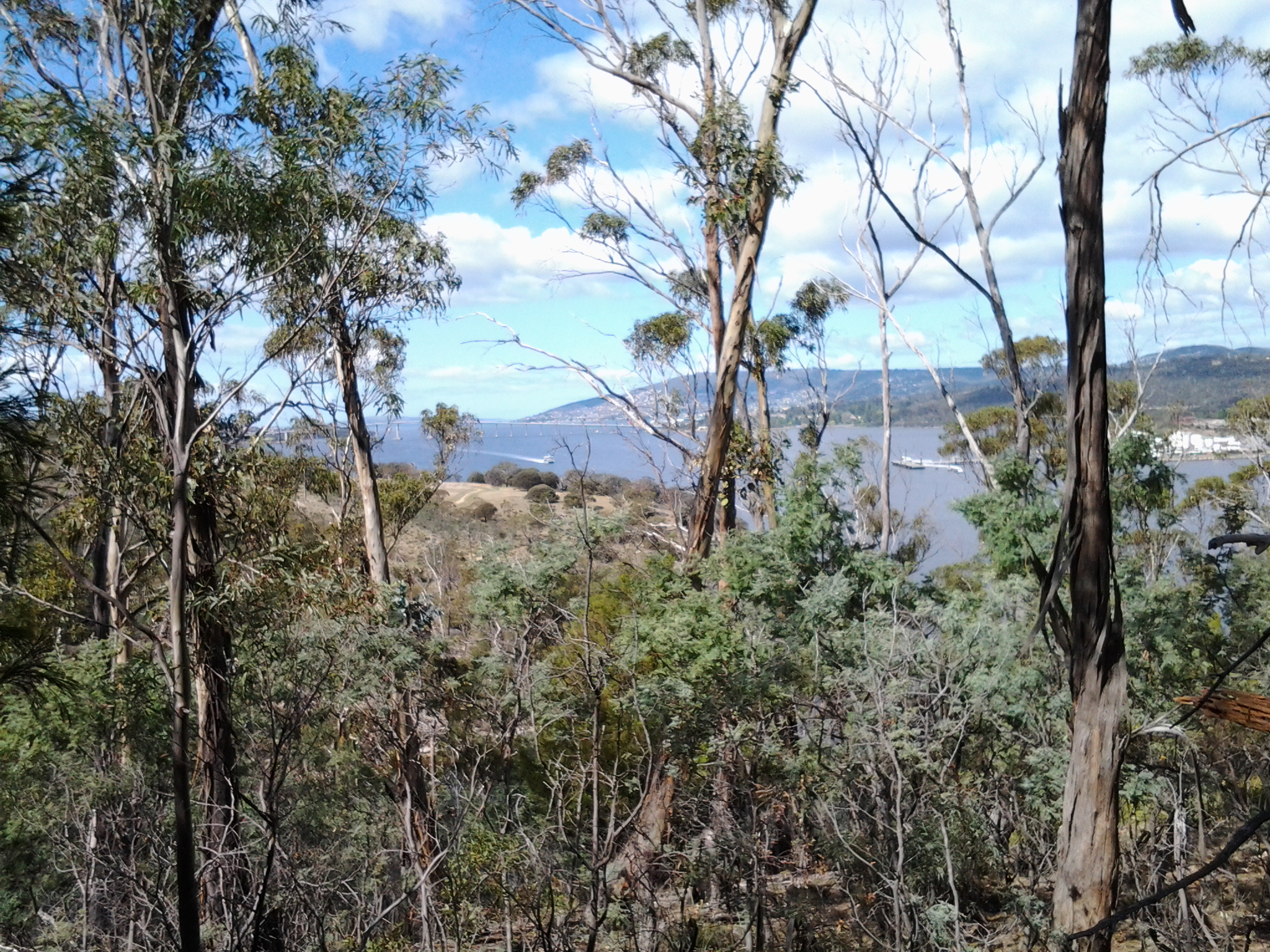
The photo below through a wooded landscape extends a view southwards to the Derwent River with the MONA ferry coming my way. At this point, I was as high as the uppermost part of the Tasman Bridge located closer to the mouth of the River.
Around me eucalyptus gum nut shells lay on the ground exuding a clean fresh perfume (think of May Gibbs’ hats on the gumnut babies Snugglepot and Cuddlepie – Tales of Snugglepot and Cuddlepie: their adventures wonderful was first published in 1918.). Not long afterwards, the track passed through a copse of self-seeding wattle trees: I know some varieties are considered to be weeds in certain parts of Australia and I suspect this collection of specimens may be ‘weeds’. The problem is that it grows quickly and blocks out the opportunity for other trees to survive. Monocultures are death to the natural landscape.
At the top and moving along parallel to the Derwent River, I was on top of the Bedlam Walls. Various unofficial tracks disappeared over the cliff but I stayed on the main path. My reasoning was that I had an infrequent bus service to connect with at Risdon Cove and I was not sure how long it would take to reach there. The downside was that I missed experiencing the actual walls and their walkways and caves. I would have liked to have seen the following (https://www.flickr.com/photos/bleeter/7266025800/), but I must return for a closer inspection.

Along the top I was afforded detailed views of the western shore and especially of the smelting works, Nystar as shown below.
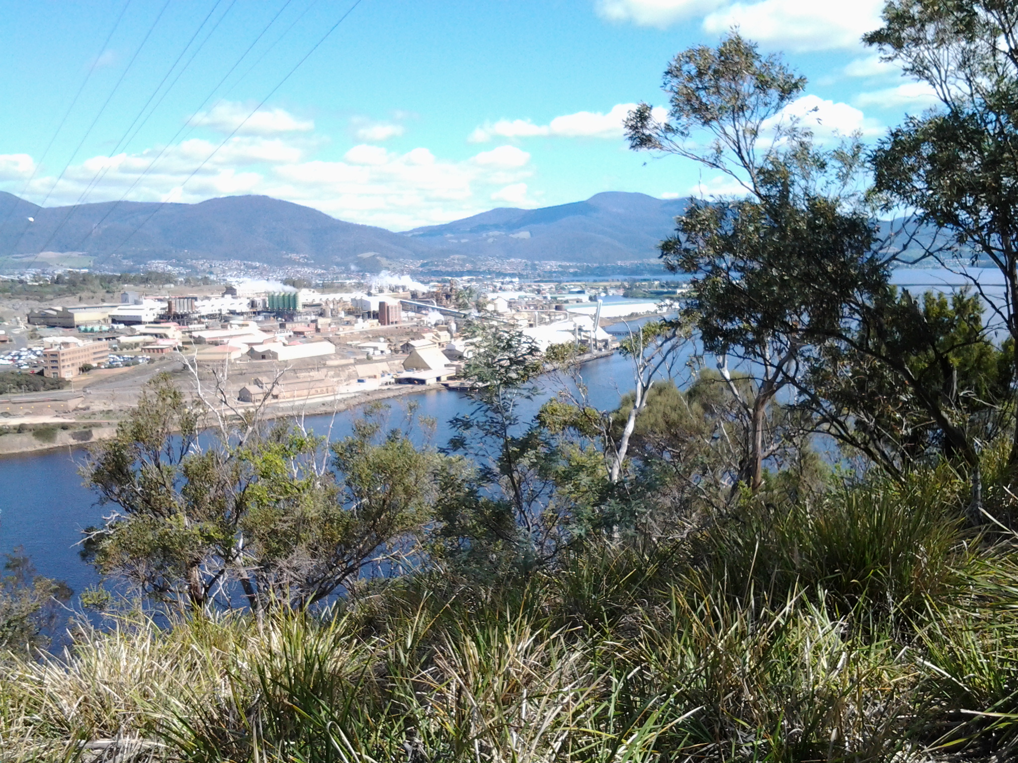
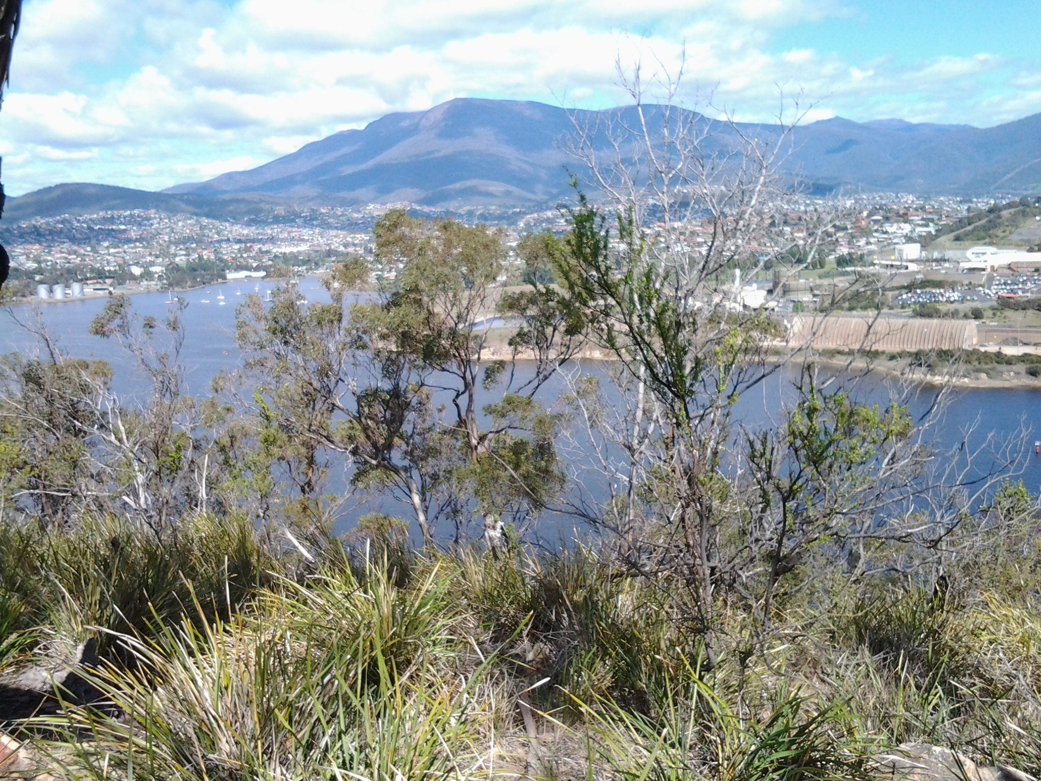
It is now obvious to me that when I walk south along the western shore of the Derwent I will not be able to be close to the river edge when I pass this massive Nystar industry covering many acres of land. I reached a major electricity pylon around 11.20am and watched its wires swing across the river to the power hungry industry (these wires are just visible in the photo above). Looking southwards and across the River from the top of Bedlam Walls, I could see Mount Wellington overshadowing Cornelian Bay and the Newtown suburb of Hobart.
My track moved inland and parallel to the electricity pylons. After 5 minutes the track split and I turned left. It came to an end with a rough worker’s seating area in view of the Bowen Bridge crossing the Derwent River further north. The cliff seemed to drop away and I judged that a slippery slide down might not be a good idea with no one else around if something should go wrong. Later in the day when I was much further north, I was able to look back to the pylon and see I really should have braved it down the hill and kept closer to the water. But then again it might be safer to walk south and climb that hill rather than slip down it heading northwards. By 11.35am I had walked back to the divide with the original clear but rough 4WD track and chose the other arm along the pylons.
