Tag Archives: George Frankland

The Fall of the Derwent

Early during my walk along Tasmania’s Derwent River from the mouth to the source, I was travelling near Repulse Dam on a reconnaissance trip when I came across two others.  It was a strange experience.  Previously I had become aware that two women planned, with assistance and support from others, and with the direct engagement of specific groups of people in some parts, to walk from the mouth to the source.  That day, as Andrew and I drove around for me to suss the landscape and the walking route options, when I saw two women seeming to do the same, we stopped them and I asked questions.  ‘Yes we are those women’, said Justy Phillips and Margaret Woodward.  I am sure they were as surprised as I was.

Since then, Justy and Margaret have made their way alongside various parts of Tasmania’s Derwent River and arrived at Lake St Clair where they were Facebooked taking a dip in those cold waters, seemingly delighted with their arrival.

Their project was very different from mine.  In my case, I wanted to walk around the whole of the Greater Hobart Area, and then to walk every metre of the way to the source at St Clair Lagoon dam.   By contrast, Justy and Margaret walked alongside parts of two Derwent Rivers; Tasmania’s Derwent River and the other in Cumbria England.  The experience of and learnings from their walks were used as part of the basis to write what they describe as a ‘fictionella’; written in the form of text artwork, similar in appearance to poetry.

That book is titled Fall of the Derwent. In this website you can see  range of photographs including two where Justy and Margaret are holding their black covered book.

Cover of book.jpg

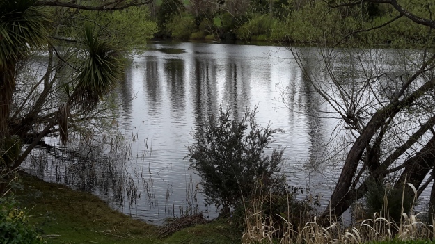
The title of the book references a drawing by an early Tasmanian surveyor George Frankland which he named ‘Fall of the Derwent’.  Colonial artist Thomas Bock engraved the image and James Ross printed the picture in The Hobart Town Almanac in 1830. The picture was drawn at a site near unpassable rapids on the Derwent River upriver from New Norfolk.  When Justy and Margaret walked past what they believed was that place, they took a suite of black and white photographs;  half a dozen or so of these images are bound into their book.  Without returning to that area I seem to remember the spot.  After reviewing my photographs in that area, clearly I was looking for serenity and simplicity.  I was looking at colours and contrasts.  It seems I was focusing on one way of seeing that world of the Derwent River, and Justy and Margaret’s view is an alternative.20150917_094036.jpg
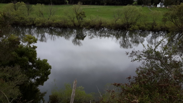
20150917_095352.jpgI did not focus on the twisted interlacing of stark and scrappy vegetation at the river edge like Justy and Margaret have done  The differences in our images is a reflection on the different nature of our projects. I wanted to entice others to be seduced by the beauty of the landscape and then to make their own journeys along the river edge (I now wonder why I didn’t see vegetation tangles as beautiful).  When I read their book it seemed they wanted to use their experiences as the basis for creative abstract thoughts; perhaps even a metaphysical approach involving questions such what is there in that world and what is it like at a more profound level.  My approach was literal and descriptive.

The Phillips/Woodward Fall of the Derwent publication presents poetry-styled ideas and comments in ‘chapters’ headed by the days of the week; the book proceeds over  44 days consecutive days – but the ideas associated with both rivers are intermixed.

“Let us begin with two rivers / And a Dad not long for living. / Two daughters …”

Despite the introductory lines, theirs is not a chronological story connecting the sequences of walking the two rivers; reference is made to other locations such as Cape Barren Island, Dover Point, and Brisbane. And the English father walked with Justy and Margaret when they traipsed near the Cumbrian Derwent. As an intertwined overlay in this book, mention is made of his declining health – Dad in pain, no longer able to feed himself, no longer speaking.  For this reason and for the manner of writing which removes easily identifiable meaning through much of the publication, this book has a limited audience and is obviously a set of personal ideas to be understood, remembered and perhaps loved by the authors. For their personal satisfaction. I was surprised that this book uses combinations of words that do not create, for most of the book,  visual images of either of the two rivers. Instead, the poetry reads as a meshing of many experiences which presumably helps Phillips/Woodward to reconstruct a feel of those experiences.

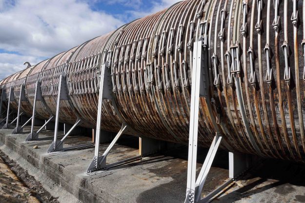
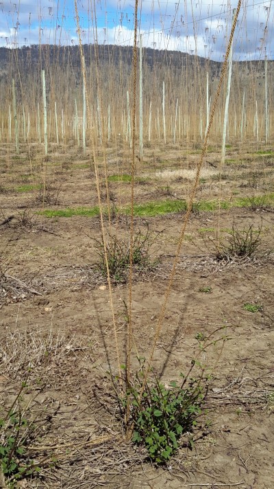
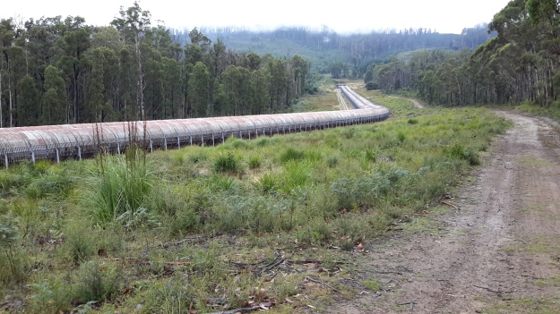
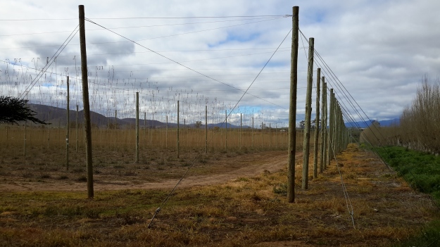
On occasion, where the meaning was clear because I could recognise specific locations, I enjoyed some of the lines. For example, “…rows of hops that string this neck of the river…” referred to the hop vines and their structural strings in the Bushy Park area.  These hop fields obviously made a significant impression on Justy and Margaret because there was a second comment on the same topic; “…the hops in single file march orderly disruption to the valley.”  Then, when they walked around the Wayatinah Power Station, “…the woodstave pipeline is a blistering gland … Draws the corset of her breathing”.  Like Justy and Margaret, I looked in awe at these two locations and their dramatic impact was described during my posts.  To remind you – here are photos of the hop fields and others of the wooden pipeline.   20150918_104145.jpg
20150918_113007.jpg

20170424_114515.jpg

DSC01655e.jpgJusty and Margaret learnt in Cumbria; “On the banks of the River Derwent, that the term ‘black market’ is born. Through the illegal trading of graphite.”  Then they found graphite was part of the geological structure at Wayatinah on Tasmania’s Derwent.  From these findings, grew the idea to play with ‘black’; the book’s cover is black, some copies are cloth bound and impregnated with carbon powder, the Fall of the Derwent and ‘black’ are interconnected within the text, and one section of the book presents a list of locations along Tasmania’s Derwent which include ‘black’ in the name; examples include Black Bob’s Rivulet and Blackmans Bay.

Phillips/Woodward’s book Fall of the Derwent was part of a public artwork presented in association with GASP (Glenorchy Art & Sculpture Park) in 2016. Further information can be accessed here. If you click on ‘Download Hydrographic Score’ you will be able to read the book online.

Taking stock

I feel emotional when I remember my recent walk to the source of the Derwent River. I had promised to write the stories and post them within days, but since returning I have felt overwhelmed by my breathtaking and wonderful experience and afraid to start writing.  In addition, I claimed to have walked the majority of the river’s length and I was afraid the claim was unfounded.

Today I have made the calculations and posted an update on the pages ‘How far have I walked’, ‘Frequently Asked Questions’ , and ‘The inspiration for my walk’ . To summarise, while I had hoped the number would have been closer to 100%, the fact is I have covered a smidgin over 2/3rds of the 215 km length of the Derwent River.

Of the remaining 70 kms, by my reckoning approximately 25 kms can be achieved relatively easily across farming or forestry land subject to permissions.  However, the remaining trackless, uncleared densely forested 45 kms of river edges may be a challenge I cannot rise to.  Blog followers may recall reading my earlier post Where is the source of the Derwent River? which introduced George Frankland’s discovery party’s finding that some of the bush between the area now known as Lake Repulse Dam (which did not exist when he was around in the early 19th century) and Butlers Gorge provoked a huge effort for grown men to cover little distance.  The landscape hasn’t changed since then.

Regardless, and as usual, my plan will be to continue walking.  But before then, I will share new posts and photos taken during my recent walks.  As a taster, the photos below shows forest and ferns in the Lake King William vicinity.

20160103_092208.jpg

20160103_102339.jpg


Clark Dam

Clark Dam map

Late in October 2015, on the northern side of the Derwent River, I walked at Clark Dam built on Butlers Gorge, and then along a little of Lake King William. We know that in 1835, George Frankland followed the Derwent River in a southwesterly direction from Lake St Clair across huge plains until the gorge country commenced. The Clark Dam has been built at that junction, and over the decades the plains behind have been swamped with what is now known as Lake King William. The location is a place of extreme weather conditions, from blizzardly snows to ferocious and bitterly cold winds and to scorching sunny days, but always stunning.

Clark Dam is a massive piece of engineering in a beautiful but remote area of central Tasmania.

20151029_122628.jpg

20151029_122354.jpg

20151029_122454.jpg

Chantale’s aerial photograph below puts the Dam and Lake King William into context.

IMG_3876Clark Dam

Michelle’s photos below provide similar information.

PA280110Clark Dam.JPGPA280111Clark Dam.JPG

In 1952 a special tribute plaque was installed on the Dam: ‘The Hydro Electric Commission, Clark Dam, A Tribute, To those who conceived this project, who laboured on its construction, who made its accomplishment possible, a united effort to harness the forces of nature for the benefit of mankind.’

20151029_122335.jpg

Another plaque nearby records: ‘The Hydro Electric Commission, Clark Dam, Named in honour of his Excellency, Sir Ernest Clark,  G.C.M.G., K.C.B., C.B.E., Governor of this State, 1933- 1945.’

20151029_122849.jpg

My chauffeur for the day Andrew, remembered years ago he walked across the Dam wall but that is now impossible.

20151029_122312.jpg

20151029_122459.jpg

This means it is impossible to change from one side of the Derwent River to the other at this point.  In the photo below despite the walkway beckoning a walker, it was impassably gated at the other end.

20151029_123303.jpg

The reminder that the Clark Dam is part of an electricity generating project is everywhere.

20151029_122528

The complex that makes up Wayatinah – posting 7 of 7

The Derwent River at Wayatinah

20151029_113841.jpg

20151029_113829.jpg

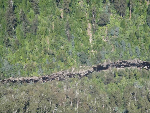
From my aerial experience, I know the river looks like this all the way north-westwards of the Wayatinah Lagoon to Clark Dam at Butlers Gorge; a distance of not much less than 30kms in very steep country with numerous creeks cutting the landscape and flowing into the Derwent River.  In the post introducing George Frankland’s walk, mention was made of the Nive River. The Nive flows into the northern end of Wayatinah Lagoon. Before the Wayatinah dam was built, the Nive flowed directly into the Derwent.  The river edge between Wayatinah and Butlers Gorge is where Frankland and his expedition found two to four miles per day was the going rate because of the density of the bush. And then they gave up and walked inland away from the Derwent River.

 20151028_115431

20151028_115442.jpg  A couple of Chantale’s aerial photos show similar rocky beds along this remote and wild part of the Derwent River.
IMG_3828dryish river bed.JPG

IMG_3832.JPG


Where is the source of the Derwent River?

This question was on the minds of the new settlers to Van Diemens Land in the early 1800s.

In 1835 George Frankland, Surveyor General to the government of the time, organised a ‘search’ party to locate the source. After the expedition he wrote a report for despatch to the ‘mother country’, England.  The brief text has been published as The Narrative of an Expedition to the Head of the Derwent and to the Countries bordering the Huon in 1835.  The small book was reprinted by Nags Head Press for the publisher Sullivan’s Cove in 1983.

No description exists of how Frankland and his party travelled inland until they reached a property or area then known then as Marlborough (now known as Bronte) in the Lake country, located west of Lake Echo and directly east of Lake St Clair by over 30 kilometres. Marlborough was a probation station for North American prisoners in the 1830s/40s.

Map of probation stations including Marlborough

The map above can be seen in the story: ‘They left Jefferson County forever…’

The Marlborough district was discovered by Surveyor Sharland who also found Lake St Clair, in 1832, only three years before Frankland felt compelled to find the source of the Derwent.  It seems Sharland did not realise it was the Derwent River that flowed from the southern end of Lake St Clair. Further information can be read in G. H. Stancombe’s paper Notes on the History of The Central Plateau.

The Lyell Highway, according to the Highland Lakes Settlement Strategy has been known as the Marlborough Road where it runs westwards of Ouse and towards the area around Bronte.

Information, which is totally irrelevant to my writings about the Derwent but nevertheless interesting, concerns an earthquake near Marlborough that was recorded in The Courier, a Hobart newspaper on 25 April 1854. Thomas Bellinger reported ‘I beg to inform you of a very strange occurrence on the evening of the 24th of March last. A shock like that of an earthquake was felt in almost every part of the Marlborough District. Two shepherds were gathering sheep the other day and discovered the cause of it.  I went to the place yesterday: there has been some fearful volcanic eruption, rocks of enormous size have been driven about, the face of the earth appears to have been hoisted in the air and pitched surface downwards. I cannot describe to you the appearance, but if you will come up I am sure you will be highly gratified – the distance is about ten miles from this.’  I have no information about where Thomas Bellinger was writing from but I am curious to hunt out the location of this upheaval.

After that information detour, let’s go back to the expedition to find the source of the Derwent River.

Following a ‘difficult journey from the settled Districts’, all members of George Frankland’s party assembled at Marlborough on the 7 February 1835.  The record shows that George Frankland did not follow the edges of the Derwent, rather he crossed the Nive River (which empties into the Derwent River much further south), then travelled north-westwards. Initially densely forested hills stymied progress with horses, and then the boggy plains ahead slowed him down.  He continued generally in a westward direction and after almost five days, found Lake St Clair; ‘we suddenly found ourselves on the edge of a beautiful Lake in the heart of Scenery of the most picturesque Character’.  After further walking around parts of the lake, Frankland reports ‘It was a fine summers day and the Air was so serene that the surface of the Water was scarcely ruffled but the sandy beaches bore evidence of the Lake being at times as rough as the Sea. I will not here dilate on the extreme beauty of this scenery as it might be considered out of place in an official report, but … I feel it difficult to avoid expressing the impressions of delight which were inspired by first discovering of such a romantic Country…’

On the 14th February, Frankland despatched two of his party to return to the source of the Derwent and follow it downstream on the left bank while he set out to explore the country on the right bank.  Both parties walked across open plains where Lake King William now fills the area.  They reunited the next day.  One of the party, a Mister Calder was despatched to continue along the edge of the river until he met the entrance of the Nive, which he successfully achieved (although details are absent).  Meanwhile Frankland tried to continue following after Calder but was only able to proceed for 3 miles. ‘At that point we plainly perceived that the Country had … become such a thick forest that to take the horses any further was out of the question.’  The result was that Frankland split the party further with the horses taking an easier route to Marlborough.

On their first day trying to walk the edge of the Derwent, Frankland recorded ‘This day was consumed by a laborious march of two miles through a most obstinate scrub – and we bivouacked on the steep edge of the Derwent after wading for a considerable distance through the torrent, up to the middle, as the easiest mode of travelling.’  The forest is as dense in 2015 as it was then, so regular blog followers can appreciate why walking some sections of the rest of the way to Lake St Clair concerns me.

At this point Frankland was for giving up. ‘On the 18th February I determined on leaving the Derwent and accordingly struck away to the N.E. The forests continued depressingly thick – but by dint of labour we accomplished about four miles this day’.  Only four miles in a day for strong men!  What chance do I have of walking this part quickly or easily?

A couple of days later Frankland reached Marlborough and from there he set off to cross the Derwent River and explore the Huon River area further south.

Thank you Andrew for alerting me to this report and for the loan of the book.