Tag Archives: GASP

The Fall of the Derwent

Early during my walk along Tasmania’s Derwent River from the mouth to the source, I was travelling near Repulse Dam on a reconnaissance trip when I came across two others.  It was a strange experience.  Previously I had become aware that two women planned, with assistance and support from others, and with the direct engagement of specific groups of people in some parts, to walk from the mouth to the source.  That day, as Andrew and I drove around for me to suss the landscape and the walking route options, when I saw two women seeming to do the same, we stopped them and I asked questions.  ‘Yes we are those women’, said Justy Phillips and Margaret Woodward.  I am sure they were as surprised as I was.

Since then, Justy and Margaret have made their way alongside various parts of Tasmania’s Derwent River and arrived at Lake St Clair where they were Facebooked taking a dip in those cold waters, seemingly delighted with their arrival.

Their project was very different from mine.  In my case, I wanted to walk around the whole of the Greater Hobart Area, and then to walk every metre of the way to the source at St Clair Lagoon dam.   By contrast, Justy and Margaret walked alongside parts of two Derwent Rivers; Tasmania’s Derwent River and the other in Cumbria England.  The experience of and learnings from their walks were used as part of the basis to write what they describe as a ‘fictionella’; written in the form of text artwork, similar in appearance to poetry.

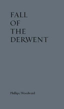
That book is titled Fall of the Derwent. In this website you can see  range of photographs including two where Justy and Margaret are holding their black covered book.

Cover of book.jpg

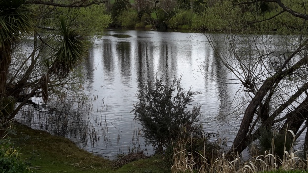
The title of the book references a drawing by an early Tasmanian surveyor George Frankland which he named ‘Fall of the Derwent’.  Colonial artist Thomas Bock engraved the image and James Ross printed the picture in The Hobart Town Almanac in 1830. The picture was drawn at a site near unpassable rapids on the Derwent River upriver from New Norfolk.  When Justy and Margaret walked past what they believed was that place, they took a suite of black and white photographs;  half a dozen or so of these images are bound into their book.  Without returning to that area I seem to remember the spot.  After reviewing my photographs in that area, clearly I was looking for serenity and simplicity.  I was looking at colours and contrasts.  It seems I was focusing on one way of seeing that world of the Derwent River, and Justy and Margaret’s view is an alternative.20150917_094036.jpg
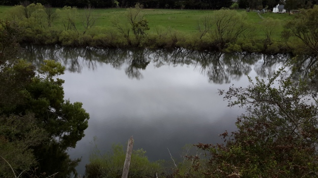
20150917_095352.jpgI did not focus on the twisted interlacing of stark and scrappy vegetation at the river edge like Justy and Margaret have done  The differences in our images is a reflection on the different nature of our projects. I wanted to entice others to be seduced by the beauty of the landscape and then to make their own journeys along the river edge (I now wonder why I didn’t see vegetation tangles as beautiful).  When I read their book it seemed they wanted to use their experiences as the basis for creative abstract thoughts; perhaps even a metaphysical approach involving questions such what is there in that world and what is it like at a more profound level.  My approach was literal and descriptive.

The Phillips/Woodward Fall of the Derwent publication presents poetry-styled ideas and comments in ‘chapters’ headed by the days of the week; the book proceeds over  44 days consecutive days – but the ideas associated with both rivers are intermixed.

“Let us begin with two rivers / And a Dad not long for living. / Two daughters …”

Despite the introductory lines, theirs is not a chronological story connecting the sequences of walking the two rivers; reference is made to other locations such as Cape Barren Island, Dover Point, and Brisbane. And the English father walked with Justy and Margaret when they traipsed near the Cumbrian Derwent. As an intertwined overlay in this book, mention is made of his declining health – Dad in pain, no longer able to feed himself, no longer speaking.  For this reason and for the manner of writing which removes easily identifiable meaning through much of the publication, this book has a limited audience and is obviously a set of personal ideas to be understood, remembered and perhaps loved by the authors. For their personal satisfaction. I was surprised that this book uses combinations of words that do not create, for most of the book,  visual images of either of the two rivers. Instead, the poetry reads as a meshing of many experiences which presumably helps Phillips/Woodward to reconstruct a feel of those experiences.

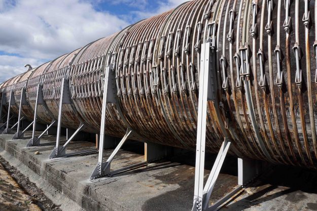
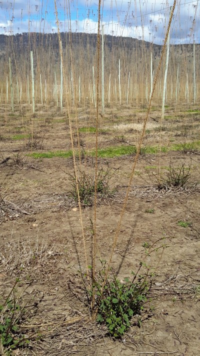
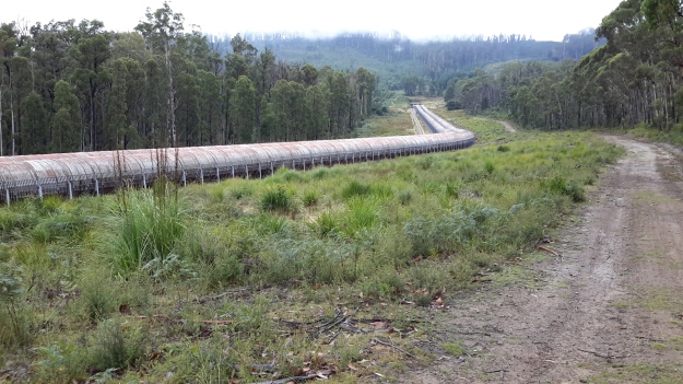
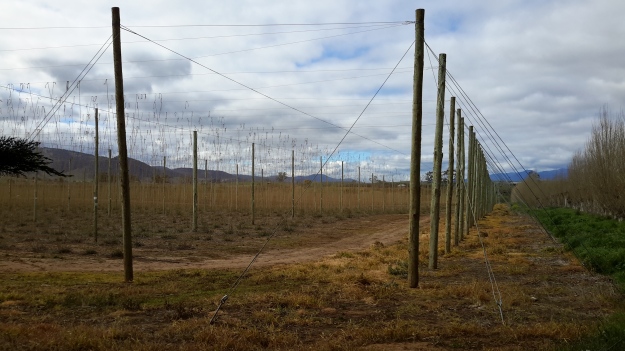
On occasion, where the meaning was clear because I could recognise specific locations, I enjoyed some of the lines. For example, “…rows of hops that string this neck of the river…” referred to the hop vines and their structural strings in the Bushy Park area.  These hop fields obviously made a significant impression on Justy and Margaret because there was a second comment on the same topic; “…the hops in single file march orderly disruption to the valley.”  Then, when they walked around the Wayatinah Power Station, “…the woodstave pipeline is a blistering gland … Draws the corset of her breathing”.  Like Justy and Margaret, I looked in awe at these two locations and their dramatic impact was described during my posts.  To remind you – here are photos of the hop fields and others of the wooden pipeline.   20150918_104145.jpg
20150918_113007.jpg

20170424_114515.jpg

DSC01655e.jpgJusty and Margaret learnt in Cumbria; “On the banks of the River Derwent, that the term ‘black market’ is born. Through the illegal trading of graphite.”  Then they found graphite was part of the geological structure at Wayatinah on Tasmania’s Derwent.  From these findings, grew the idea to play with ‘black’; the book’s cover is black, some copies are cloth bound and impregnated with carbon powder, the Fall of the Derwent and ‘black’ are interconnected within the text, and one section of the book presents a list of locations along Tasmania’s Derwent which include ‘black’ in the name; examples include Black Bob’s Rivulet and Blackmans Bay.

Phillips/Woodward’s book Fall of the Derwent was part of a public artwork presented in association with GASP (Glenorchy Art & Sculpture Park) in 2016. Further information can be accessed here. If you click on ‘Download Hydrographic Score’ you will be able to read the book online.
Blogs can connect people purposefully and with pleasure

Some people refer to social media as a force which separates people, however in my experience I see it brings people together. Through my blog I have ‘met’ interesting people with whom I might not otherwise have connected and I have learnt a great deal.  My blog has introduced me to a world of wonderful ideas, beautiful environments, and to people who demonstrate they are vitally alive.  Every day I love to open my laptop and check who has sent me a comment or an email or to discover and read a recent blog posting by someone I am following.

Earlier this year, blogger Denise from upstate New York emailed to tell me she was coming to Tasmania and would love to walk in one of the locations I had previously written up.  This started what has now developed into a strong online relationship.  Eventually we met and walked when she visited Tasmania.

Denise at MONA 2015

The photo above shows Denise heading off towards the car park. It was the end of the day after we had walked from GASP (Glenorchy Arts and Sculpture Park), lunched at MONA (Museum of Old and New Art), checked out the current exhibitions, and realised it was time to travel home.

This November has been a special month for Denise because she decided to highlight special people in her life: she selected 30 people and wrote a daily post throughout November. I was immensely surprised when she added me in. Denise’s post can be read on her blog ‘Dee Scribes’  When you have read this, you may like to read some of her earlier postings.  As a thoughtful, intelligent and articulate advocate for redefining disability, she is second to none.  Denise is a professional with  humour and flair.  I have learnt so much more by reading her blog posts. Thank you Denise.

The euphoria continues

Yesterday a friend An drove me up along the Derwent River where we stopped off at a few dams, power stations and lakes. I was studying the terrain at ground level (our most recent Service Tasmania maps are aged and Google Earth photos are not current either), seeing where forestry and hydro tracks existed and determining where I will need to make my way through bush ‘with walls’. I can see a line of fiction here – turning an almost impassable density of bush into a character (an evil character – even though the bush is sublimely beautiful and bountiful) that has to be overcome.  My strategy will be as always, one slow step at a time and then the bush won’t even know I have come and gone (although my muscles will).

I walked some small sections yesterday, but I won’t write them up until I have walked in the areas westwards from Gretna to those sections.  I know now that it is difficult for some local readers to understand where I have been and therefore, if I change the blog posts from being a chronological record, it may be even more unclear.  Besides, by writing the stories in order and finishing with the last walk to the source it will be clear I have walked the Derwent.

Yesterday explorations and walks were as uplifting as the previous day’s flight; it was as equally wonderful, just different.  I feel gushy with delight when I am in the bush on a blue sky day, with no wind, and with a temp that rises sufficiently but not so that I boil.  Once I am sitting on rocks in the river bed with my lunch, listening to the birds, and sensing the spirit of the place, my life feels so right.  This is the place for me.

Then, despite the day’s experiences already being a treat, life added a new wonderful surprise.  Recently one of my blog followers, Justy, alerted me to the fact she and her partner were engaged in creating a new work of art for GASP beside the Derwent River at Glenorchy, a city in the Greater Hobart Area.  As part of their project, they had already walked along the Derwent River in Cumbria, England and now were planning to walk from the sea to the source of the Derwent early next year.  I hadn’t met them and only communicated a few times by email.  But yesterday, as An drove me towards Cluny Dam, I saw two women step from their car.  I waved and smiled as you do on a country road. As we drove on, I said to An “I bet they’re the two women who are engaged in the GASP project, out conducting a reconnaissance trip”. There was no reason to believe this except I felt I knew it to be the truth (the bush works its miracles). Nevertheless we continued on and had parked near the northern end of Cluny Lagoon when the two women drove past us. Again we waved. On a later road we found ourselves coming towards each other from opposite directions, so An waved them to a stop. The women looked at us queryingly. “Are either of you Justy or Margaret? we asked.” “Yes”, they responded. Instantly I called out, “I’m Helen”.  Their nod of acknowledgement followed. And then we all poured out of our cars, and hugged and had a lively chat standing on a dusty road in strong Spring sunlight. It was a brilliant unexpected meeting and capped off what had been a day of immense discovery and pleasure.

Best wishes for your project Justy and Margaret!

Walking the Back Roads

My upstate New Yorker blog follower (https://deescribesblog.wordpress.com/about) who came to Tasmania recently and walked with me along GASP to MONA, alerted me to the blogsite (https://walkingbackroads.wordpress.com/about/) re “Walking the Back Roads: A Hundred Years from Philadelphia to New Hampshire“.   She recognised my broad interest in people who decide to walk paths that are not normally walked. Thank you.  I love followers alerting me to such sites.

The walking the backroads blogsite has been inspired by a range of different books written by walkers of the highways and backroads of America through the 19th century. The blogger examines their stories.  He refers to the walk which he undertakes as ‘the long walk home’. Very interesting.

The concept of walking on backroads is instantly appealing to me. I wonder how many backroads exist which connect with Tasmania’s Derwent River in some way. I guess there may be hundreds and that they would all lead to interesting, mostly remote places. I imagine our backroads would peter out into bushland where sheep or cattle graze, rabbits multiply, indigenous wombats might run, Tasmanian devils fight for scraps of native food, or wallabies roam.

Suddenly the question comes to me; what is the definition of a backroad? When is a road no longer a main road? Is it a matter of how many people live along its edges?  Is it a matter of how many vehicles use it? Is it a matter of the road being unknown to the majority of the surrounding population? Is it possible to have a backroad in city areas or can they only be found in rural areas? Or are backroads, roads which are out of the way, difficult to find, and often not on maps?  And does a vehicular unsealed track count as a backroad?

In other words, how would I know if I was on a backroad? Is it sufficient that I make the decision?  Guess it would be. And I guess the locals may not refer to their road as a backroad even when I might.

Reliving GASP and MONA with a new walk along the Derwent River

On Stages 9 and 10 of my walk along the Derwent River, I passed the Museum of Old and New Art (MONA) and the Glenorchy Arts and Sculpture Park (GASP).  Yesterday I had the opportunity to introduce two international visitors to these important arts structures.

Mid-morning I met with a follower of my blog, De from upstate New York and her Arizona cousin Ke as we were chauffeured thanks to Ma, from the centre of Hobart to our starting point near the Derwent Entertainment Centre.

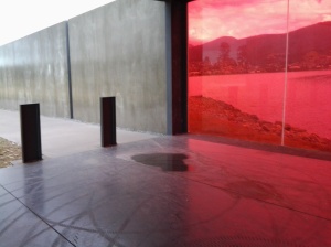
Our excursion started from the Pavilion at the southern end of the Glenorchy Arts and Sculpture Park (GASP) near the Derwent Entertainment Centre.  Do you remember my photos of that surprise pink glass wall?

20150109_085808

From a distance and approaching this structure, it looks dull, industrial and disused. But just as I had felt during my walk, my two new international co-walkers were amazed once we arrived at the site. Quite delightful and I have no doubt De will be displaying her own photos on https://deescribesblog.wordpress.com/ when she has time.

Then we started strolling and rolling along the bike/pedestrian path towards the slatted walkways with their colourful striped edges.  Many photos were clicked every time we reached a new striped walkway with a different set of colours.

20150319_111418

De gets around in a motorised wheelchair so when she spotted a scooter with its dinghy trailer (see photo below) waiting for its owner to return from their boat out on the Derwent River, she stopped in amazement. We talked about how good security seemed to be locally.  The scooter owner had left his/her shoes, helmet and other personal items, and despite a security strap set up to prevent movement, we all knew that enterprising thieves seem to carry bolt cutters with them these days.  But all was well yesterday.

scooter

Gradually clouds disappeared, the mountain looked sharp and much of the sky was blue.

20150319_114408

Glorious.  After a very cold North American winter, De soaked up the sunshine as the day warmed and we did everything to stay outdoors that we could.

We continued along the foreshore and turned towards the highway when we reached the Montrose High School. Then we were onto the bike/pedestrian track past Rosetta and into Berriedale before advancing up the entrance incline to the Museum of Old and New Art (MONA).  Along the way we admired the new autumnal colours of the Moorilla grape vines beside the road.

Vineyards

A visit to the exhibitions at MONA requires descent into cavernous spaces below ground so we decided to enjoy a lunch break first.  Despite the busyiness of the café directly above the museum, De motored through gaps in the visitors and took us outside into the open air where tables and chairs are set on the lawn. We admired great views up, down and across the Derwent River.

Our sparkling Moorilla wines were crisp and delicious, and the food choices were expansive.  De and I settled on a soba noodle with spring peas and pickled ginger salad, and Ke tucked into an Italian summer salad which included a great variety of ingredients dressed with the best local olive oil. Ducks and peacocks were out and about, seemingly comfortable with the thousands of visitors that come to MONA each week.

Satisfied by lunch we returned inside and took the lift to the bottom floor of MONA. Over the next couple of hours we wandered through the three levels of exhibits before De and Ke found the upstairs bookshop. The wonderful conclusion to our visit came when De spotted a spectacle outside.  They left the building and, along with a throng of tourists, took photographs of a huge unblemished and bright rainbow crossing over the entire River.

It was a great pleasure to show non-Tasmanians a small part of where I have been along the Derwent River, and De and Ke’s enjoyment enhanced mine. Thanks for your company and best wishes De for your conference presentation in Burnie tomorrow encouraging people to understand there are few limits other than those we set ourselves.

Denise leaving MONA

Both De and Ke gave me permission to include their photos in this blog.

International traveller may join me for a walk

A few months ago I was excited when a blog follower from upstate New York, told me she was coming to Tasmania and would love to take a walk with me to see some of the sites I have shown in my postings.  With increasing anticipation we have corresponded and now I expect her arrival this week. Sometime around midweek we expect to undertake a comparatively short ‘stroll’ from the southern end of the Glenorchy Arts and Sculpture Park (GASP) over the wonderful striped edged walkways over the edge of the Derwent River.   Do you remember them? For example,

20150109_083005

and

20150109_084404

Then we will head northwards into Berridale and on to MONA (Museum of Old and New Art) with all its fascinations.  Perhaps we won’t be able to get away but if we do, there is always the possibility we might continue on to Cadburys chocolate factory. This doesn’t seem too shabby an itinerary.  What do you think?

Of course we will exercise our right to choose somewhere else to walk if we wish.

If anyone else is visiting and wants to relive a section of the edge of the Derwent River over which I have passed, please email me on walkingthederwent@gmail.com.

Fossil Cove Road T junction with the Tinderbox Road

Close to 9.30am I reached the left hand turn of Fossil Cove Road.

My final decision to proceed to Pearsons Point was made at that juncture.  My reason for wanting to walk to Fossil Cove is that it is on the Derwent River and I would be able to appreciate another part of the River’s western shoreline.  By my reckoning, and never having been down the road to check the situation, I believed the return walk would cover 3-4 kilometres and include steep hills. I thought that if my feet were holding up after I reached Pearsons Point and had returned back to this road then I could finish off the day’s Stage with a walk to see the fossils.  Alas … my feet were not ready for this on the return trip (I still had the walk from there back to a Blackmans Bay bus stop to consider) so I will visit another day to make this deviation from Tinderbox Road.

Including this future walk, I count three additional walks I have promised to do, in order to cover a little more of the Derwent River shoreline. I will return to the area between GASP (Glenorchy Arts and Sculpture Park) and Goodwood on the other side of the Bowen Bridge.  I will find out if I can make special arrangements to visit the industrial property of Nystar which sits against a significant length of the Derwent River.  And finally I will return to walk to the fossils at the end of a track at the end of a road off Tinderbox Road.  Most likely these walks will be undertaken on good weather days in winter when walking inland towards Lake St Clair is impossible because of extreme weather conditions.

Towards the Bowen Bridge

I plodded away from the GASP and Derwent Entertainment Centre site by walking between the Derwent River and the Elwick Race Course where dogs and horses race regularly for their owners.  I heard the rhythmical thumping on the turf before two trainers galloping their horses came into view over the barb wired fence.

20150109_091131

Otherwise all seemed quiet in that direction. Obviously it wasn’t a race day – well not then. Possibly it was too early in the day.  I walked along the long and winding Loyd Lane past a Department of Defence enclosure around 9.15am.  This is a little used road and pale green lichens were spreading across the bitumen in Rorschach test like splotches.

Before 9.20am I had reached a bar across the road which I walked around to discover inside the Commonwealth Government property was a Regional Training Centre and the base for the First Military Police Battalion, and the 4 Section 8 Platoon Company.  The gates were all locked and there was no sign of life on the other side of the fences.

20150109_091945

I continued along the road, reached the T junction with Park Rd, checked my map and found accessing the River improbable so I continued the few metres to the next T junction, with Centre Road. But there was no walking possible this way. The Road was strongly gated and locked and the signs indicated the Australian Army Derwent Barracks was inside.  Effectively I was denied access to the Derwent River from the end of GASP.

I did not achieve success with edging that headland which pushes out into the Derwent River and which is split in half by Goodwood Road to the Bowen Bridge. I have an idea that perhaps there is another way and at some future time I will try again to follow the River on the northern side.  I didn’t have much more success on the southern side of the Bridge, but again I am inclined to return and to see what else is possible.

So, on Stage 10 of my walk, I proceeded to the traffic lights intersection of Loyd Lane, Goodwood Road and over to the other side at Howard Road. It was 9.30am.

There is more to GASP beside the Derwent River than perhaps seen in first inspection

During Stage 10 of my walk along the edge of the Derwent River and a few minutes before 9am I had walked to Wilkinson’s Point the mostly southern end of the GASP (Glenorchy Arts and Sculpture Park) where I was surprised to discover a redeveloped structure which now forms part of the GASP experience. This was the construction site used for the building of the Bowen Bridge which crosses the Derwent River nearby.

Now, from time, contemporary art installation exhibitions are staged here.  In fact, I expect to see something there in the next week as part of the extraordinary internationally acclaimed MOFO festival (refer http://mofo.net.au/).  The MOFO program indicates that this Friday Jan 16 at midday The Tea Cube will introduce a portable tatami tearoom for a spiritual brew.

I wandered around this site in amazement.

20150109_085808  20150109_08582020150109_085816

With my back to the Derwent River I took the following photograph with clouds over part of Mount Wellington.

20150109_085951

I loved the colour of the surface ‘weeds’.

20150109_085853

And then it was time to begin to wander southwards again back on a non -path, which some readers will recognise from my video of walking feet.  In the photo below you can see the low structure of the ex-construction site, as a dark line separating the land from the water.

20150109_090654

Looking northwards and back to the ex-construction site.

20150109_090856

Part of the new repurposed structure has been cantilevered over the Derwent River.

20150109_085938

From Montrose Park to GASP on the edge of the Derwent River

This was the favourite part of the 10th stage of my walk along the Derwent River and still within the bounds of the City of Glenorchy.

The parkland with its majestic gum trees, the few people around, the silvery Derwent, and the wide expanses were incredibly peaceful and attractive.

By 8.30am I reached the first of the four colourfully striped walkways.  The concept was simple and it is probably the simplicity which is so beguiling.  Vertical posts have been painted black on the edge and then coloured inside. Hundreds and hundreds have been so painted. The first walkway that I reached looked as follows:

20150109_082957  20150109_082931  20150109_083005

And then I turned and looked across the Derwent River towards Mt Direction in the Risdon area.

20150109_083020

The atmosphere of the environment with its natural and man-made sophistication was very exciting.  The photo below shows the curved roof of the Derwent Entertainment Centre in the distance.

20150109_083126

A few minutes later I came across the GASP (Glenorchy Arts and Sculpture Park) sign which alerts visitors to the different areas.

20150109_083248

Nearby a plaque indicates that The Hon Julia Gillard MP Prime Minister of Australia officially opened these boardwalks of GASP on 3 October 2011.

Not far away a sound installation has been set up within a protective shelter.

20150109_083928  20150109_083903

Marvellous mosaic frippery continued to surprise me along the walk.

20150109_083807

Then I had the joy of walking across more coloured walkways and,before long, I had the River on my left and the Derwent Entertainment Centre complex on my right.

20150109_084018  20150109_084355

Mt Direction stood prominently over the water on the eastern shore.

20150109_084404

In the far north facing distance, the white buildings of Cadbury’s chocolate factory could be seen vaguely.

20150109_085905

Walking Montrose and GASP parks is an easy and pleasant thing to do. There are opportunities for picnics and barbecues, and kid’s playgrounds.  Water and land birds abound.   And the sense of creativity fills the air.

The meld of Montrose and Rosetta on the shores of the Derwent River

Walking south from Berriedale, a blur exists between the two suburbs of Montrose and Rosetta and I am not sure where either starts or finishes.

Soon after leaving the Strathaven Home and Riverfront Motel, as I walked along the ‘bike’ path beside the Highway, on the right in the distance over the highway I could see an old two storey white painted building. Having just passed the sign indicating the Undine Colonial Bed & Breakfast was in that vicinity, I made what I believe is the reasonable guess that what I was seeing was the developed building that grew from the original Rosetta Cottage of the 1800s.

20150109_080054  20150109_080208

It was impossible to safely cross the highway at this point so I walked on.

By 8.06, I had passed the Montrose Park sign, alerting me to turn left towards the Derwent River in the distance.

20150109_080504

Not long afterwards, I walked past the Montrose Bay High School with its whimsical mosaic decorations, and tennis courts.

20150109_080603  20150109_080720  20150109_080816

Wild hens ran around the bull grasses of the Islet Rivulet.

20150109_080850

Once at the water’s edge I realised, that Montrose Park is the northern end of the Glenorchy Arts and Sculpture Park (GASP) that extends a few kilometres south and passes the Derwent Entertainment Centre.  Across the Montrose Bay High School Bus Mall, and then across the Derwent River I could see Mount Direction in the Risdon area.

20150109_081320

The white buildings of Cadbury’s chocolate factory were visible in the distance to the north.

20150109_081523

Also in a northerly direction, the dramatic walls of MONA were clearly visible.

20150109_081530

Looking south, the white Derwent Entertainment Centre was in view.

20150109_081540

Then I started walking again. By 8.20 I was walking passed the Montrose Bay Yacht Club (Making a great offer to help me learn to sail) and then the Glenorchy Rowing Club.

20150109_081817  20150109_081907

Public toilets were nearby, near a kid’s playground.

I enjoyed looking at other quirky mosaic constructions. The photo below shows the High school and another mosaic figure in the distance, plus the posts for an Australian Rules Football game.

20150109_081644

Continuing along, I passed pontoons and jetties, an immature Dominican Gull standing fluffily on one leg, flowering gums with squawking parrots, an outside adult’s gym with chest presses and other exercise equipment, and the Montrose Foreshore Project sign showing developments since 1946.  The spread of residential development over the years has been substantial.

20150109_082441

Walking next to the Derwent River. The proof.

By accident, I videoed my feet as I walked across the ground near the Derwent Entertainment Centre in the southern extremities of the Glenorchy Arts and Sculpture Park (GASP).  The video lasts 53 seconds, which when you watch seems a long time, and reminds me of the unchanging nature and relentlessness of some of the films of Andy Warhol decades ago.

http://youtu.be/q5sNFzfmFuI

Yesterday I completed Stage 10 of my sequential walk along the Derwent River

The goal for Stage 10 was to start at my last stopping point, MONA in the middle of Berriedale on the western shore of the Derwent River, and continue to Lutana the last suburb of the City of Glenorchy before the City of Hobart starts. But I went further.  Much further.  Almost much further than my feet could take me.  I walked to Hobart.

Over future posts I will write up the stories of the walk, what I saw and what I experienced, but for now it’s enough to say that I am continuing with this massive project to walk both sides of the Derwent between the mouth and Bridgewater, and then onwards to Lake St Clair. Once I get walking it is always so addictive.  Even when my feet feel crippled, I say to myself … ‘go just a little bit further. What else will I be able to see with fresh eyes?’

The day was gloomy with a cloudy sky, and Mount Wellington had veils of clouds covering at least part of its prominence most of the day. But it didn’t rain and so was perfect for walking.  However, the weather ensured the photographs were without sunshine.

Yesterday I covered 12 kilometres of the length of the Derwent River on the western shore (making 22 kms in total on the western shore), and walked approximately 19 kilometres (making a total of 130 kms to date) to achieve that distance. This distance also takes in the streets and paths on which I walked that led to dead ends so that I needed to retrace my footsteps.

Of the many highlights of the walk, I saw the building that once started life as Rosetta Cottage, and powerful Clydesdale horses with their large hairy feet.

20150109_162649

I surprised a friend still in pyjamas when I went visiting for the first time in my walks. The hot cups of tea were most welcome.

I am always excited when I walk the striped edged boardwalks of GASP (Glenorchy Arts and Sculpture Park) or pass the boatsheds of Cornelian Bay and it was no different yesterday.  See the photos below for a taste of the colour.

20150109_084404  20150109_145335

I very much enjoyed looking at the eastern shore where I had walked during past stages and seeing the landscape from a different perspective.  I felt it made the Greater Hobart Area seem undeveloped in a way which is quite amazing for a capital city. For example, Bedlam Walls on the eastern shore from the western shore of the Derwent River, in the photo below.

20150109_123940

From comments I have received, I know my walks are inspiring others to think about what they might do. Even if you choose not to walk, perhaps you can set yourself other challenges.

My next walk will start at Hunter St at Sullivans Cove on the wharf in Hobart and probably extend to Kingston.  But before then I need to record the details of yesterday’s walk.