Tag Archives: St Clair Lagoon

The Fall of the Derwent

Early during my walk along Tasmania’s Derwent River from the mouth to the source, I was travelling near Repulse Dam on a reconnaissance trip when I came across two others.  It was a strange experience.  Previously I had become aware that two women planned, with assistance and support from others, and with the direct engagement of specific groups of people in some parts, to walk from the mouth to the source.  That day, as Andrew and I drove around for me to suss the landscape and the walking route options, when I saw two women seeming to do the same, we stopped them and I asked questions.  ‘Yes we are those women’, said Justy Phillips and Margaret Woodward.  I am sure they were as surprised as I was.

Since then, Justy and Margaret have made their way alongside various parts of Tasmania’s Derwent River and arrived at Lake St Clair where they were Facebooked taking a dip in those cold waters, seemingly delighted with their arrival.

Their project was very different from mine.  In my case, I wanted to walk around the whole of the Greater Hobart Area, and then to walk every metre of the way to the source at St Clair Lagoon dam.   By contrast, Justy and Margaret walked alongside parts of two Derwent Rivers; Tasmania’s Derwent River and the other in Cumbria England.  The experience of and learnings from their walks were used as part of the basis to write what they describe as a ‘fictionella’; written in the form of text artwork, similar in appearance to poetry.

That book is titled Fall of the Derwent. In this website you can see  range of photographs including two where Justy and Margaret are holding their black covered book.

Cover of book.jpg

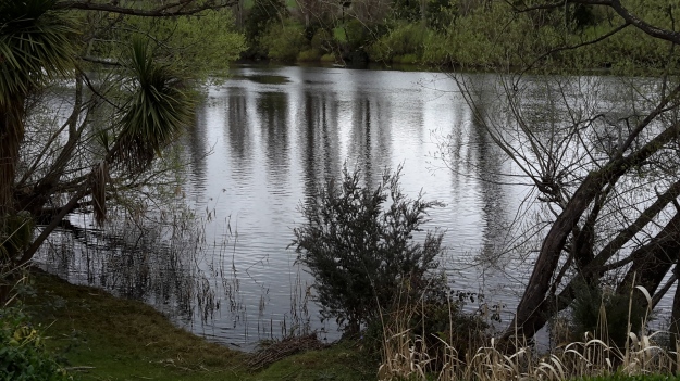
The title of the book references a drawing by an early Tasmanian surveyor George Frankland which he named ‘Fall of the Derwent’.  Colonial artist Thomas Bock engraved the image and James Ross printed the picture in The Hobart Town Almanac in 1830. The picture was drawn at a site near unpassable rapids on the Derwent River upriver from New Norfolk.  When Justy and Margaret walked past what they believed was that place, they took a suite of black and white photographs;  half a dozen or so of these images are bound into their book.  Without returning to that area I seem to remember the spot.  After reviewing my photographs in that area, clearly I was looking for serenity and simplicity.  I was looking at colours and contrasts.  It seems I was focusing on one way of seeing that world of the Derwent River, and Justy and Margaret’s view is an alternative.20150917_094036.jpg
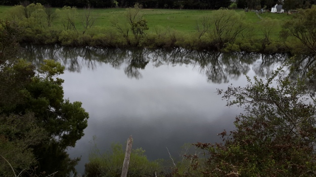
20150917_095352.jpgI did not focus on the twisted interlacing of stark and scrappy vegetation at the river edge like Justy and Margaret have done  The differences in our images is a reflection on the different nature of our projects. I wanted to entice others to be seduced by the beauty of the landscape and then to make their own journeys along the river edge (I now wonder why I didn’t see vegetation tangles as beautiful).  When I read their book it seemed they wanted to use their experiences as the basis for creative abstract thoughts; perhaps even a metaphysical approach involving questions such what is there in that world and what is it like at a more profound level.  My approach was literal and descriptive.

The Phillips/Woodward Fall of the Derwent publication presents poetry-styled ideas and comments in ‘chapters’ headed by the days of the week; the book proceeds over  44 days consecutive days – but the ideas associated with both rivers are intermixed.

“Let us begin with two rivers / And a Dad not long for living. / Two daughters …”

Despite the introductory lines, theirs is not a chronological story connecting the sequences of walking the two rivers; reference is made to other locations such as Cape Barren Island, Dover Point, and Brisbane. And the English father walked with Justy and Margaret when they traipsed near the Cumbrian Derwent. As an intertwined overlay in this book, mention is made of his declining health – Dad in pain, no longer able to feed himself, no longer speaking.  For this reason and for the manner of writing which removes easily identifiable meaning through much of the publication, this book has a limited audience and is obviously a set of personal ideas to be understood, remembered and perhaps loved by the authors. For their personal satisfaction. I was surprised that this book uses combinations of words that do not create, for most of the book,  visual images of either of the two rivers. Instead, the poetry reads as a meshing of many experiences which presumably helps Phillips/Woodward to reconstruct a feel of those experiences.

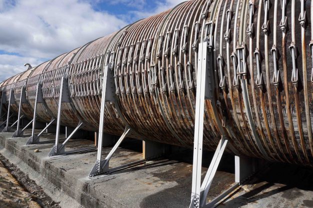
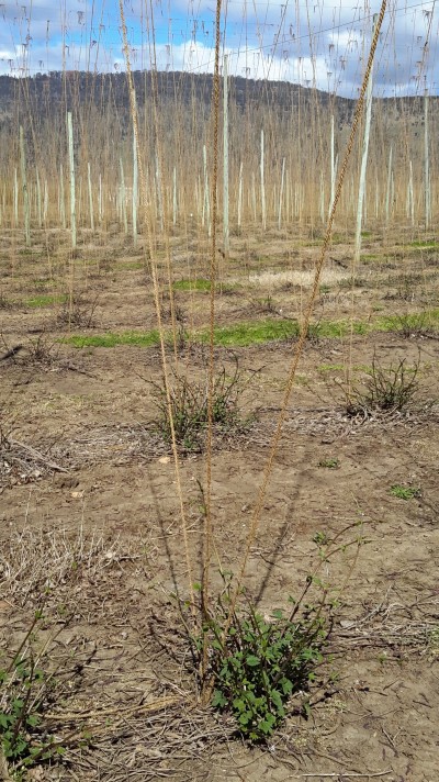
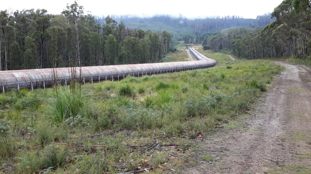
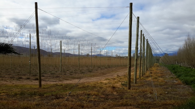
On occasion, where the meaning was clear because I could recognise specific locations, I enjoyed some of the lines. For example, “…rows of hops that string this neck of the river…” referred to the hop vines and their structural strings in the Bushy Park area.  These hop fields obviously made a significant impression on Justy and Margaret because there was a second comment on the same topic; “…the hops in single file march orderly disruption to the valley.”  Then, when they walked around the Wayatinah Power Station, “…the woodstave pipeline is a blistering gland … Draws the corset of her breathing”.  Like Justy and Margaret, I looked in awe at these two locations and their dramatic impact was described during my posts.  To remind you – here are photos of the hop fields and others of the wooden pipeline.   20150918_104145.jpg
20150918_113007.jpg

20170424_114515.jpg

DSC01655e.jpgJusty and Margaret learnt in Cumbria; “On the banks of the River Derwent, that the term ‘black market’ is born. Through the illegal trading of graphite.”  Then they found graphite was part of the geological structure at Wayatinah on Tasmania’s Derwent.  From these findings, grew the idea to play with ‘black’; the book’s cover is black, some copies are cloth bound and impregnated with carbon powder, the Fall of the Derwent and ‘black’ are interconnected within the text, and one section of the book presents a list of locations along Tasmania’s Derwent which include ‘black’ in the name; examples include Black Bob’s Rivulet and Blackmans Bay.

Phillips/Woodward’s book Fall of the Derwent was part of a public artwork presented in association with GASP (Glenorchy Art & Sculpture Park) in 2016. Further information can be accessed here. If you click on ‘Download Hydrographic Score’ you will be able to read the book online.

Recapping the walk along the Derwent River


I lived the walk along the Derwent with a vital obsession but, after so many months intensely engaged on other projects, now some of the details are vague. To re-immerse myself into the experience, I am writing this post.

In addition, I suspect it will be a great help to people who have become followers of my blog during the past 6 months.  Despite my inactivity, it surprises me how many visitors and views the blog gets daily, how many different posts are read, and how many different countries around the world are represented.

In August 2014, from an impulsive unplanned idea, I took a bus to a spot near the mouth of the Derwent River on the eastern shore, walked to the sea then retraced my steps and began the walk towards the source of this great river approximately 214kms inland.  On day trips, and around other life commitments, I walked in stages along the eastern shore until I reached the Bridgewater Bridge which crosses the Derwent approximately 43 kms upstream.

Instead of continuing inland, I crossed the bridge and headed back on the western shore towards the southernmost  mouth of the River.  Most of the walks along the eastern and western shores between the sea and the Bridgewater Bridge were along designated pathways, although some informal track walking, road walking and beach walking was required during my trips.

Then I returned to the Bridgewater Bridge and began the journey inland expecting only to walk on the side of the river that made passage easiest.  I had no intention to walk both sides from this point onwards in anticipation the landscape would be inaccessible for a number of reasons or particularly wild with dense and difficult forests. I walked to New Norfolk on the western/southern side of the Derwent but from then on, I switched from side to side. Using maps I determined where I must take up each new stage of a walk while switching from side to side, so that I could say I had traipsed the entire length of the Derwent River.

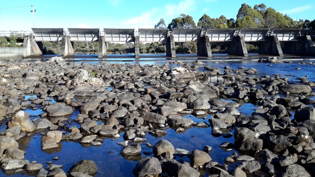
The farthest inland stages of my walk are easily defined.  I walked from near the township of Tarraleah besides Canal 1 (along which is transported Derwent River water) above the actual River bed, past Clark Dam, and around majestic Lake King William to the township of Derwent Bridge.  From there I followed the river to its source at St Clair Lagoon dam.  In case some people believe the source of the Derwent is further inland, I walked onwards to the weir where the Derwent Basin empties into the St Clair Lagoon via passing the southern end of Lake St Clair.

Between New Norfolk and the area near  Tarraleah, my walk beside the River was in country near  townships (some of which were located at a great distance from the River) such as Bushy Park, Gretna, Hamilton, Ouse, and Wayatinah.  This necessitated additional travel to or from the highway and roads, on which these towns exist, to reach the river or to return home from a walk along the river.

Inland, the water of the Derwent River is controlled by dams constructed to create hydro-electricity for Tasmania: I walked past them all. From the end of the river closest to the mouth, these are the Meadowbank, Cluny, Repulse, Catagunya, Wayatinah, Clark and St Clair Lagoon dams.  Each of these has a bank of water behind them:  Meadowbank Lake, Cluny Lagoon, Lake Repulse, Lake Catagunya, Wayatinah Lagoon, Lake King William and St Clair Lagoon.  Most of these dams and bodies of water has a power station: Meadowbank Power Station, Cluny Power Station, Repulse Power Station, Catagunya Power Station, Wayatinah Power Station and Butlers Gorge Power Station.  I was privileged to be shown around one of these power stations during one walk.

Water from the Derwent passes through two other power stations:  Nieterana mini hydro and the Liapootah Power Station.  I did not follow the trail of these Derwent River managed flows.  The water from other locations inland passes through the Lake Echo Power station and Tungatinah Power Station then flows into the Derwent after power generation, thereby increasing the volume of water flowing downstream.  I did not walk along these feeder rivers.

The few stages of the walks which have not been recorded in this blog, are in all the zone between Gretna and the area near Tarraleah – a stretch of perhaps  120 km.  I have written up and posted most of the walks in this zone, and now it’s time to add the missing sections.

The track to the Derwent Basin

I and the floating threads of spider web strands were the only occupants of the sometimes wider and sometimes narrower track from the Pumphouse Point locked gate onwards to the Derwent Basin.  The twists and turns of the tiny track made sure I had new vegetation and bush character to look at, on every moment of the walk.

20160104_084951.jpg

Native animals had passed along the path leaving evidence of their progress.  For example, the dragging of a small kangaroo tail is shown below.

20160104_084709.jpg

Between this track and the clear water of St Clair Lagoon, reedy wetlands extended large distances, so much so, that seeing the water was impossible.

20160104_084943.jpg

20160104_085321.jpg

After winding within the bush, finally the track entered the back of the Pumphouse Point Hotel complex’s visitor carpark, with the reception building and one of the facility blocks nearby.

20160104_090118.jpg

20160104_090127.jpg

No signage existed to direct me to the Derwent Basin weir from the Pumphouse Point complex, so I crossed a small bridge and took ‘pot luck’ along tracks which eventually allowed me to pass the area where the Derwent Basin meets Lake St Clair’s waters, and to continue onto the Derwent Basin Weir.

20160104_090448

Enjoy the crystal sharp birdsong in the bush on this short video.

Later I found a sign and followed the elevated blue metal track from which I could scan glimpses of the large expanse of Derwent Basin.

20160104_090517.jpg

20160104_090646.jpg

20160104_090802

20160104_090846.jpg

20160104_090856.jpg

20160104_091000.jpg

20160104_091114.jpg

On the southern side of the track, St Clair Lagoon filled the space. In the photos below you can see the bump on the horizon; that is Mount Charles to the north east of Lake King William which I had walked beside and around the day before I reached this idyllic spot.

20160104_090836

20160104_090952

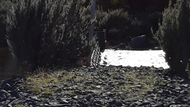
When I reached the tiny weir controlling the flow of water from the Derwent Basin into St Clair Lagoon, the sharp mid-morning sun sparkled intensely on the water. I was almost blinded by the light.

20160104_091137.jpg

20160104_091229.jpg20160104_091226.jpg


What if the water leaving St Clair Lagoon Dam was not the source of the Derwent?


Different people hold views about the start and finish of places and the same is true for the Derwent River.  So, just in case, someone should say to me that the River’s source is at the weir where water flows from the Derwent Basin into St Clair Lagoon, or the source is where the water flows from the body of Lake St Clair into the Derwent Basin, I walked to both other locations to be sure I had arrived at ‘the source’.

From St Clair Lagoon Dam I returned to the Pumphouse Point road and continued towards Lake St Clair and the Hotel.  Trees flanked the walk.

20160104_082932.jpg

20160104_082941.jpg

And I passed unwalkable wetlands.

20160104_083218.jpg

Suddenly one corner of spectacular Lake St Clair stretched before me, and I could see the outlier of the Pumphouse Point Hotel sitting crisply on the Lake, roughly marking the entrance of water to the Derwent Basin.

20160104_083442.jpg

20160104_083436.jpg

20160104_083751.jpg

As I walked towards the Point I fell in love with Mount Olympus standing high in all its grandeur. Zeus would be pleased.

20160104_083958.jpg

Gradually I closed in on the Point so that the white box appeared as a building.

20160104_084007.jpg

20160104_084345.jpg

The entrance to the Hotel seemed barred to me.

20160104_084531.jpg

However to the right of the entrance a sign indicated a walking track would take me to the Weir at the southern end of the Derwent Basin.

20160104_084550.jpg

Again, anglers have been remembered.

20160104_084638.jpg

St Clair Lagoon


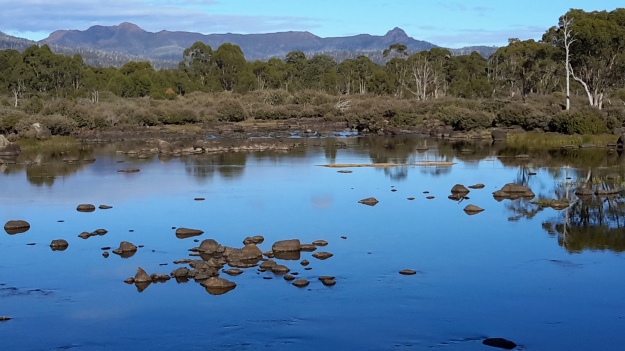
Tranquillity. Restfulness.  Serenity. Untroubled. Vital. Fresh. Clarity. Brilliance. Intense. These words came to mind as I looked over St Clair Lagoon.

The selection of photos below swing from the Dam wall and walkway on the right of my view around to the left across the Lagoon and its central island.

20160104_080854.jpg

20160104_080450.jpg

20160104_080452.jpg

20160104_08045620160104_080501.jpg

20160104_080944.jpg

I loved seeing the tops of hills and mountains, including Mount Olympus, appearing in the distance.

20160104_081032.jpg

20160104_081100

I hope you enjoy these photos – perhaps one of them will become the background on your computer.


St Clair Lagoon signage

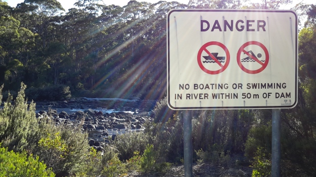
Interpretive signage work needs to be introduced, and current signs rationalised; at least made consistent.  Within metres of each other stood the two signs below:

 20160104_080414.jpg

20160104_080152.jpg

The third sign focuses on the needs of anglers but not on general tourists.

20160104_080445.jpg

One on-site map helps people get their bearings. However, I guess because the water level is generally low, the island close to the St Clair Lagoon Dam which appeared before me as an extensive well-established vegetated outcrop, cannot be seen on the map below.  As a result, visitors may feel disoriented.

20160104_081416.jpg

Four signs exist at St Clair Lagoon. I am disappointed the Derwent River as a whole and the fact this is the River’s source isn’t recognised and celebrated.  The St Clair Lagoon area seems only to anticipate visitation from fishermen who do not have permission to fish here.  A short gravel road detours to the Lagoon Dam from the main gravel road that leads to Pumphouse Point, but no signs have been installed to let people know what they will find if they take the detour, nor the significance of the St Clair Lagoon dam for the Derwent River.

A 215 km river is not a small or insignificant waterway. The Derwent River, as Tasmania’s most iconic river, provides a major marker of thousands of years of social, economic and natural history. In the coming weeks, I plan to communicate with everyone who has influence over the writing and installation of signage and interpretation.

Glistening waters and the final push to the source of the Derwent River

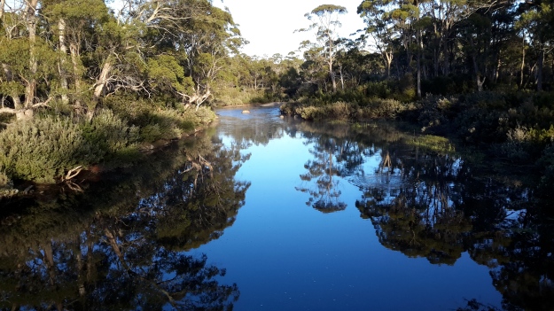
I watched the Derwent River scampering along playfully.  Youthful. The source was nearby.

20160104_075336.jpg

20160104_075414.jpg

Enjoy the sound of the rushing waters in my short video near the River’s source.

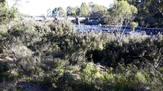
I walked northwards towards the St Clair Lagoon dam, and the first of the Derwent River waters flowing beneath the baffles, showed themselves.

20160104_075514.jpg

20160104_075644.jpg

20160104_075651.jpg

20160104_075654.jpg

This was the time for a selfie and, as usual, it was grossly unflattering – but the moment called for it.  I had reached the source of the Derwent River.

20160104_075844

This striking moment, as are all moments, was impossible to grasp.

While I tried to absorb and ingest the atmosphere of the place with all its aboriginal and non-aboriginal histories, my mind was so muddled I forgot to breathe. Then I felt compelled to take deep and long breaths but was too excited to inhale more than a couple of shallow breaths.  I felt I should stop, stand or sit and never leave yet at the same time I felt I must move on.  I wasn’t sure what to look at nor what to think about. That the natural environment was powerfully enduring despite man’s intervention, reminded me I was like a small scratch on the surface of this land.

Yes – I had arrived at my destination. Finally.

I was amazed that walking the Derwent was possible, not for all people, but definitely possible. That what I had commenced as a whimsical and unresearched idea, had been realised as an epic adventure.  One step at a time.

Of course, I remembered sections of the River had yet to be walked but they were few and I sensed that if I didn’t worry, then each would be achievable in the coming days. I could see it was much more satisfying to enjoy the present and not to plan the future. Only then did I feel like I was blossoming with the profound pleasure of the cool morning, the clean air, the colourful and complex natural environment,and my arrival at the Derwent River’s source. This was one of the most significant moments in my life.

20160104_080317


20160104_080022


What goes up goes down

In any landscape, every hill has its ups and downs. Having crested the hill separating me away from Lake King William but with the Derwent River on my left as I walked northwards, I was astonished that I could see Lake St Clair.  There, as a bright white beacon on the water surface, was the Pumphouse Point Hotel. You will need to enlarge the photo below to see the tiny white block in upper left centre. To its right a small portion of the Derwent Basin can be seen. The Derwent Basin empties into St Clair Lagoon, and where that Lagoon is dammed, the Derwent River starts its long run to the sea.

20160103_103751.jpg

Of course the source was still a long way away, but I knew seeing this vista meant I was closing in on the point where the Derwent River started.

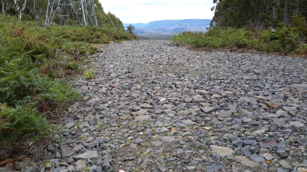
Then I started downhill on the sharp rocky track.

20160103_103831.jpg

At the halfway down point, I photographed the view both up and down.

20160103_110309.jpg

20160103_110407.jpg

20160103_110401.jpg

Before long I was walking with the River to my left and a dry forest beside me.

20160103_110548.jpg

Yesterday I walked to the source of the Derwent River

Over the past four days I have enjoyed remote, off-the-main-track inland Tasmania from Clark Dam at Butlers Gorge, along the edge of Lake King William to the town ship of Derwent Bridge, and then further north to where the Derwent River commences out of the gates of St Clair Lagoon.  I continued further north also to the Weir which controls water into St Clair Lagoon from the Derwent Basin (which is kept filled with water flowing from Lake St Clair).  Dozens of posts with all the details of the walks, and accompanied by some grand photos, will be forthcoming over the coming days.

This latest walk means I have walked most of the length of the Derwent River from the mouth to the source.  There are only a few gaps to fill if I have the courage (or a moment perhaps of insanity because of the level of difficulty I believe is involved) in the coming weeks.

For the moment, I thought a few photos would be in order to whet your appetite for more.

The photo below shows one aspect of a view across Lake King William in the late afternoon.

20160102_170531.jpg

The photo below looks across Lake King William early in the morning.

20160103_072935.jpg

Sun passing through gum leaves.

20160103_110629.jpg

The Derwent River early morning near Derwent Bridge.

20160104_064805.jpg

The source of the Derwent River – the water as it leaves St Clair Lagoon. I was standing on the dam when I took the second photo, and watching the water run away eventually to pass New Norfolk then Hobart and finally exit into Storm Bay before dispersing into the wide ocean.  The whole experience was quite marvellous.  The river was fresh and alive!  And so was I!

20160104_075644 20160104_081109


A change in plan due to the expected large volume of future information

In a blog post written a few weeks ago, I said I would not post a record for any walk on a section of the Derwent River unless it fell into the continuous sequence; that is the next post describing the walk should be from Gretna (the location of the end of the last stage of my walk- Stage 15) westwards.

From now on I will walk sections (yes blow the knee problem, I will continue)  that fit with friends dropping me off at starting points or collecting me from destinations, or that fit with the Tassie Link bus timetable.  In any given week I could be located at any point between Gretna and the source of the river as it leaves St Clair Lagoon. Therefore, in any week, my blog posts will be about where I have been walking and the experiences gained along the route.

The reason for my change of heart is that from the reconnaissance and short walking trips that I have taken in the past few weeks, I can see that there will be simply too much information to dump into the blog once I finish the walk.  Therefore, despite the chance of confusing blog followers, I will write up and post as I complete sections regardless of whether they fit into a seamless sequence.

Another advantage of this approach is that there will be less Derwent River related posts, and more actual walk related posts.

Brilliant bird’s eye view

Thankyou blog follower Ju.  Recently Ju connected me with a woman with a husband who has a Private Pilot’s Licence.  Once I made contact, Michelle and Dave were delighted to fly me in their four seater plane, a Cirrus SR20 which Michelle referred to as the BMW of the skies.

Today we flew.  Not a cloud in the sky.  Clean blue sky. Hardly a breeze.  The landscape rich and varied.  The Derwent River sparkled from start to finish.

The experience was stunningly magnificent.  I love words but I find it difficult to express my excitement, my pleasure, and the sheer joy of the flight in the depth which I felt.  There below me was the river I have come to love and know a little more. There below me were the tracks, paths, roads and landscape over which I have walked – and I laughed occasionally remembering certain experiences during my walks. There below me were logging tracks, dam roads, and fading vehicular pathways.  And then we were flying over impenetrable sections which may not be walkable.

We left Hobart airport and flew to Storm Bay by rounding the Iron Pot, then we followed the river upstream to the source. Dave flew on until we reached the northern most point of Lake St Clair. The return journey was equally as beautiful and engaging. The light had changed presenting us with a ‘new’ landscape.

Of the hundreds of photos taken by Michelle, friend Chantale and myself, I include a tiny selection here.

OLYMPUS DIGITAL CAMERA

The photo above taken by Michelle caught me totally preoccupied by the view.

OLYMPUS DIGITAL CAMERA

MIchelle’s photo above shows the Derwent River snaking around the Claremont Golf course with Cadbury’s Chocolate Manufacturing buildings in white to the left.

OLYMPUS DIGITAL CAMERA

The photo above shows a straight section of the Derwent River before the township of New Norfolk on the upper left.

OLYMPUS DIGITAL CAMERA

The photo above shows the Derwent River circling part of Reid’s cherry orchards.

IMG_3864

Chantale’s photo of the Pumphouse Point accommodation projecting into Lake St Clair, also shows the dam across the Derwent Basin where the water enters St Clair Lagoon.  The source of the Derwent River starts to the right of the photo.

OLYMPUS DIGITAL CAMERA

Michelle’s photo above shows part of sprawling Hobart set against the Derwent Harbour.

Those photos taken while flying over the river westwards of Gretna will be incorporated into the stories of my walks from Gretna onwards, in future posts.  From now on, you can expect both ground-based and aerial photos to enrich the stories.
I feel like the luckiest person in the world for the opportunity to travel in a smooth flying small plane, to see the Derwent River winding through the landscape in glorious blueness, and to be reminded Tasmania is a superb place. A truly wonderful and memorable day. Thankyou to all concerned.

Who am I?

Increasingly blog followers have questioned my enigmatic no-name status.  I have been secretive about my identity to protect myself from predators and weirdos. My surname is so rare that I wouldn’t want someone to track me to my house. When the walk was over I intended to reveal and explain more about myself so everyone could understand why I presented myself only as Tasmanian Traveller.

Despite this approach, for people who have emailed me, I have opened up a little more.  For the woman from upstate New York who visited me and asked to walk on some of the sections she had read about in my blog,  of course she got to learn so much more about me.  And she, and others, have been most respectful and careful to keep my gender and characteristics neutral and non-identifying. Thank you.

Now that the process for my walk from the mouth to the source of the Derwent River is evolving, I no longer see a need to retain my protective shell.  From now on, there will be safety in numbers as I walk with one or more friends.

So who am I?  My name is Helen Tyzack and I come from a working history in the visual arts and museology industries, plus an overlay of working in or for many different types of education institutions, government agencies and not-for-profit organisations.  All my life I have walked to get around, keep costs down, to be kinder to the climate, and to experience the beauties of the natural environment at close quarters. A few years ago I sold my car and have walked or used public transport ever since.  As a female, I have wanted to walk alone in remote and isolated country and by maintaining my anonymity this has been comfortably possible.  I am on the mature side of 60 years of age, short in stature with an overweight body, various health challenges and perpetual problems with my feet.  But I refuse to let these characteristics and impediments prevent me living; they slow me but they do not stop me. I will not let them stop me. I am energised by the possibilities of discovering new places, and my walk along the Derwent River has exceeded all my expectations. In recent years I have flown off to different countries around the world to learn and experience new adventures.  It has been one of the greatest surprises that the Derwent has offered so many revelations that the thought of overseas travel has been halted.  I guess it is always easier to think somewhere else will be more interesting yet a place right on your own doorstep can offer ‘the world’.

Helen at Otago Bay 2014

The photo of me above was taken by a passer-by as I walked past Otago Bay at the end of last year on Stage 7 of my walk along the Derwent River.

For each of the 15 walking stages completed so far, I have walked alone and independently, and have only been supported by public transport when buses deposited me at a starting point and collected me from each walk’s destination. I have realised this practice cannot continue because of the limited public transport options available in central Tasmania. As an alternative, I have decided to try a UBER-style approach to transport – friends are offering to be my chauffeur and in some cases they are offering to walk with me.

To cope with the constraints of private property restrictions, I am working with locals and others to obtain various kinds of alternative access to the Derwent River.  No project ever goes totally to plan and that is the joy of exploration: discovering new ways to meet changing personal expectations keeps my brain active and my mind vitally alive.

During my last walk, I reached the township of Gretna. From now on, as I head inland towards Lake St Clair, I expect to be accompanied by a friend who will drive me to key locations. Whenever we ‘touch’ the river I will walk north and south along the edge to the extent that the river and the landscape allow.  Gradually, I will walk past the river until I sink down with pleasure on the dam wall at the southern end of St Clair Lagoon with my goal achieved.  The next stages of my walk will represent the collection of the final pieces of a fabulous patchwork quilt – and once I have all the pieces, I will stitch them together into my blog to record a sequential and seamless walk from Gretna to Lake St Clair.  And then I will write two books: one will be a how-to-do-it publication for tourists and locals who want to understand how to use public transport to discover the river edges, and the second book will be a fictionalised account of my walk.