Tag Archives: Black Bob’s Rivulet

The Fall of the Derwent

Early during my walk along Tasmania’s Derwent River from the mouth to the source, I was travelling near Repulse Dam on a reconnaissance trip when I came across two others.  It was a strange experience.  Previously I had become aware that two women planned, with assistance and support from others, and with the direct engagement of specific groups of people in some parts, to walk from the mouth to the source.  That day, as Andrew and I drove around for me to suss the landscape and the walking route options, when I saw two women seeming to do the same, we stopped them and I asked questions.  ‘Yes we are those women’, said Justy Phillips and Margaret Woodward.  I am sure they were as surprised as I was.

Since then, Justy and Margaret have made their way alongside various parts of Tasmania’s Derwent River and arrived at Lake St Clair where they were Facebooked taking a dip in those cold waters, seemingly delighted with their arrival.

Their project was very different from mine.  In my case, I wanted to walk around the whole of the Greater Hobart Area, and then to walk every metre of the way to the source at St Clair Lagoon dam.   By contrast, Justy and Margaret walked alongside parts of two Derwent Rivers; Tasmania’s Derwent River and the other in Cumbria England.  The experience of and learnings from their walks were used as part of the basis to write what they describe as a ‘fictionella’; written in the form of text artwork, similar in appearance to poetry.

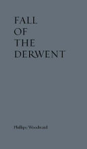
That book is titled Fall of the Derwent. In this website you can see  range of photographs including two where Justy and Margaret are holding their black covered book.

Cover of book.jpg

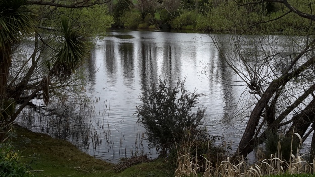
The title of the book references a drawing by an early Tasmanian surveyor George Frankland which he named ‘Fall of the Derwent’.  Colonial artist Thomas Bock engraved the image and James Ross printed the picture in The Hobart Town Almanac in 1830. The picture was drawn at a site near unpassable rapids on the Derwent River upriver from New Norfolk.  When Justy and Margaret walked past what they believed was that place, they took a suite of black and white photographs;  half a dozen or so of these images are bound into their book.  Without returning to that area I seem to remember the spot.  After reviewing my photographs in that area, clearly I was looking for serenity and simplicity.  I was looking at colours and contrasts.  It seems I was focusing on one way of seeing that world of the Derwent River, and Justy and Margaret’s view is an alternative.20150917_094036.jpg
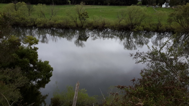
20150917_095352.jpgI did not focus on the twisted interlacing of stark and scrappy vegetation at the river edge like Justy and Margaret have done  The differences in our images is a reflection on the different nature of our projects. I wanted to entice others to be seduced by the beauty of the landscape and then to make their own journeys along the river edge (I now wonder why I didn’t see vegetation tangles as beautiful).  When I read their book it seemed they wanted to use their experiences as the basis for creative abstract thoughts; perhaps even a metaphysical approach involving questions such what is there in that world and what is it like at a more profound level.  My approach was literal and descriptive.

The Phillips/Woodward Fall of the Derwent publication presents poetry-styled ideas and comments in ‘chapters’ headed by the days of the week; the book proceeds over  44 days consecutive days – but the ideas associated with both rivers are intermixed.

“Let us begin with two rivers / And a Dad not long for living. / Two daughters …”

Despite the introductory lines, theirs is not a chronological story connecting the sequences of walking the two rivers; reference is made to other locations such as Cape Barren Island, Dover Point, and Brisbane. And the English father walked with Justy and Margaret when they traipsed near the Cumbrian Derwent. As an intertwined overlay in this book, mention is made of his declining health – Dad in pain, no longer able to feed himself, no longer speaking.  For this reason and for the manner of writing which removes easily identifiable meaning through much of the publication, this book has a limited audience and is obviously a set of personal ideas to be understood, remembered and perhaps loved by the authors. For their personal satisfaction. I was surprised that this book uses combinations of words that do not create, for most of the book,  visual images of either of the two rivers. Instead, the poetry reads as a meshing of many experiences which presumably helps Phillips/Woodward to reconstruct a feel of those experiences.

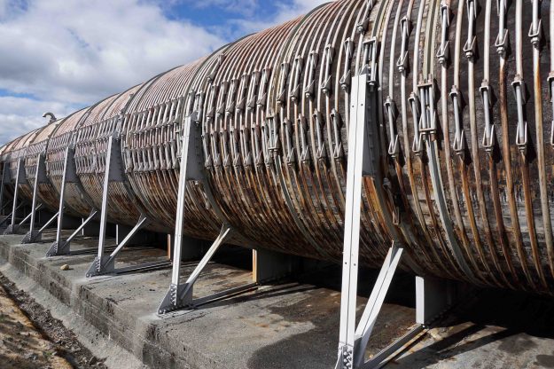
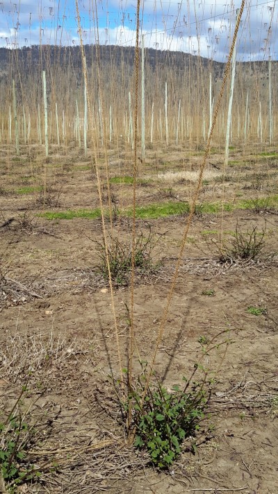
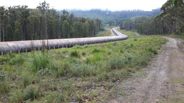
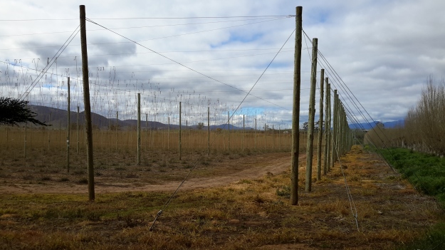
On occasion, where the meaning was clear because I could recognise specific locations, I enjoyed some of the lines. For example, “…rows of hops that string this neck of the river…” referred to the hop vines and their structural strings in the Bushy Park area.  These hop fields obviously made a significant impression on Justy and Margaret because there was a second comment on the same topic; “…the hops in single file march orderly disruption to the valley.”  Then, when they walked around the Wayatinah Power Station, “…the woodstave pipeline is a blistering gland … Draws the corset of her breathing”.  Like Justy and Margaret, I looked in awe at these two locations and their dramatic impact was described during my posts.  To remind you – here are photos of the hop fields and others of the wooden pipeline.   20150918_104145.jpg
20150918_113007.jpg

20170424_114515.jpg

DSC01655e.jpgJusty and Margaret learnt in Cumbria; “On the banks of the River Derwent, that the term ‘black market’ is born. Through the illegal trading of graphite.”  Then they found graphite was part of the geological structure at Wayatinah on Tasmania’s Derwent.  From these findings, grew the idea to play with ‘black’; the book’s cover is black, some copies are cloth bound and impregnated with carbon powder, the Fall of the Derwent and ‘black’ are interconnected within the text, and one section of the book presents a list of locations along Tasmania’s Derwent which include ‘black’ in the name; examples include Black Bob’s Rivulet and Blackmans Bay.

Phillips/Woodward’s book Fall of the Derwent was part of a public artwork presented in association with GASP (Glenorchy Art & Sculpture Park) in 2016. Further information can be accessed here. If you click on ‘Download Hydrographic Score’ you will be able to read the book online.
From Catagunya to Wayatinah – post 2 of 4

Since Andrew had walked this way, much rain had fallen so that any chance of crossing Black Bob’s Rivulet somewhere near where he walked was zero.

20170424_105020.jpg

I continued back to the old Cooma property through more locked gates.

cropped Cooma.JPG

The owners were in the distance checking on some of their animals. Incredibly healthy cattle wandered around the unfenced land. Big curious fellows.  Superb condition. Beautiful black coats. Brown coats. Mixed colours.  As usual I talked to the animals.

20170424_102825 cropped.jpg

20170424_102856.jpg

cropped cows.JPG

Elsewhere, I watched a large family of yellow tailed Black Cockatoos raucously calling from tree to tree.  On another occasion a rush of coloured parrots whipped through the bush with astounding speed.

A large number of gravel roads and tracks meander over the hills between Catagunya and Wayatinah. Many do not appear on maps. Without a compass a walker could spend hours taking useless tracks – apparently people have been known to become so disoriented they find themselves way north of the river and after many kilometres back on the Lyell Highway.  In part, the tracks were created to service plantation forests  grown after original native forests were cleared and burnt.  The other user is TasNetworks, the State company which travels around to access the electrical power transmission towers and to check the levels of vegetation  along the transmission lines.

Since massive bush fires many years ago in one part of the area between Catagunya and Wayatinah, the remnants of hundreds of hectares of pine plantations have created a problem for the forestry industry. The small remaining stands of living trees are awkward to reach and not profitable to harvest.  Much of the land is covered by burnt parts of trees none of which can be used.  The cost to clear seems too high. Lost money. Lost opportunity. And lost original native forests. Nature always attempts to reclaim its place however in practice this means that those plants which breed well and grow quickly can create monocultures no less damaging than the single species plantation forests . In parts along the burnt out section, native plants that act like weeds such as some wattles are already taking over.  Monocultures do not a forest make.

Between Wayatinah and Catagunya Power Stations- posting 4 of 6

Eventually Andrew reached cleared paddocks at the point where the transmission line swung to the south east.  The going then was much easier through low scrub in a shallower gully and then up onto the summit of Bushman’s Hill, some three hours after the start of the day’s walk.  From this hill Mt Wellington above Hobart was visible in the distance, and Andrew’s mobile phone pinged. He had come back into mobile phone coverage range. The one occasional bar of reception was enough for a text message but not sufficient for a phone call. Bushman’s Hill offered a very comfortable spot with the occasional shade tree and logs to rest on.

DSC01689e.jpg

After a quick lunch around 1 pm, Andrew followed the power line easement hoping to get to  Lake Catagunya’s edge. Unfortunately, the terrain became impressively steep and scrubby with a coverage of thick ferns towards the bottom so that idea was abandoned.

Before crossing Lake Catagunya’s inlet, as Andrew skirted around looking for a cross over point, Dunns Hill stood prominently. This hill, pictured below, had to be traversed to reach Catagunya Dam and Catagunya Power Station. But first the water had to be crossed or walked around.

DSC01692e.jpg

The challenge was to find a way of by-passing the large inlet of water where Black Bobs Rivulet enters Catagunya Lake. By heading 1 km north, north east, then east through open forest and then progressively steeper country Andrew reached a point where the rivulet hit the Lake. Right at the junction the exposed rock made for an easy rock-hop to the other side (in flood this part would be impassable as it is obvious that it carries a lot of water after heavy rain). He was so glad to see the low water level at that point. otherwise it would have meant wet feet or more kilometres of walking to skirt around this obstacle.

The first photo below of Black Bob’s Rivulet looks upstream and the second looks downstream to where it enters the lake.

DSC01693e.jpg

DSC01695e.jpg

The open hill in the distance on the second photo is located north of Catagunya Dam and on the other/eastern side of Catagunya Road – this is not Dunns Hill.  Once over Black Bob’s Rivulet, the direction taken was south towards Dunns Hill. After a short scrub-bash, the route emerged into the open paddocks of the cattle country surrounding Catagunya Power Station. Andrew then climbed 1 km steeply up Dunns Hill to rejoin the power lines.  The reward for reaching the top of Dunns Hill was a fine view down into the Lake and westwards to Wylds Craig.

DSC01702e.jpg

Looking westwards the continuing power lines disappear into the distance. The undulating nature of the landscape is also on show.

DSC01698e.jpg

The glorious openness of Dunns Hill with its vistas on a sunny day, provided the stimulus for creative photography showcasing the patterns offered by the electricity transmission pylons and the grass.  DSC01711e.jpg

DSC01721e.jpg

DSC01724e.jpg

The final kilometre to the power station was through open grasslands, buzzing with grasshoppers and butterflies.  It was like creating a bow wave; with each step the masses of insects were spread ahead.  My walk from Lake Repulse Dam to Catagunya Dam was in similar country and the postings  3 and 4 of 13 talk about my experiences with grasshoppers and butterflies.

I am very keen on grass with its colours and textures. Long term blog readers have seen many photos of grasses taken in many locations during my walk along the Derwent.  Andrew’s photo below shows Dunns Hill grass moved by the breeze.

DSC01712e.jpg

Navigation during this walk was never in doubt – the prominent shadow on the grass from the transmission cables overhead marked the route to the power station!  See the shadow line in the photo below.  Of course if the inland forest plantation/logging roads had been followed (which might be necessary in wet weather and when Black Bob’s Rivulet was flooding), then using GPS equipment would have been essential to keep track of your location. power-line-shadowv2-1

The day was glorious and the following panoramic photo captures some of that magic.

DSC01708e.jpg

Visualising walks in advance is another form of planning

A recent blog posting provided the ‘story’ of how I imagined a walking stage would progress along one section of the Derwent River.  On paper, such visualisations have acted as a planning tool to remind me of the potential challenges ahead and the work I needed to do to make sure I was able to have a safe walk within a reasonable time frame.  Another ‘big think’ happened in relation to the walk between Wayatinah and Catagunya Power Stations.

In the photo below, water gushing from the Wayatinah Power Station adds to the volume of Lake Catagunya near its western extremity.   20151029_090827.jpg

20151029_090233.jpg

This expanse of water, fed by the Derwent and Florentine Rivers further upstream, extends approximately 7 -8 kilometres as a substantial water storage holding until it reaches the Catagunya Dam wall and then passes through the Catagunya Power Station at the eastern end of the Lake. Earlier walks had taken me to both hydro electricity generating power stations, and during one walk I was privileged to be shown over the remote and isolated Catagunya Power Station complex.

20160210_092533.jpg

20160210_093101.jpg

How to tackle the distance between the two locations?  Should I start my walk from the eastern or western end?  Should I walk on the southern or northern side of the Lake? The terrain to be covered included private property so what permissions needed to be acquired and from whom?

At first, I inspected the last official map printed by the Tasmanian government, the 1993 map titled ‘Strickland 4630’ in combination with perusing the Google Earth map for the same territory. In addition, I used my on-the-ground first-hand knowledge of the terrain and the vegetation at both ends of the stage from having visited in association with other walks, and aerial photos taken early during this Walking the Derwent project.

Michelle’s photos show Wayatinah Power Station in the distance near the western end of Lake Catagunya,  a section of the curved shape of the Lake, and Catagunya Dam and Power Station. Each photo clearly shows the incline from water level to the plateau above.

PA280092 Lake Catagunya with Wayatinah PS.JPG

PA280091Lake Catagunya.JPG

PA280090Catagunya Dam.JPG

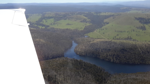
My aerial photos show  Wayatinah Power Station behind an expanse of Lake  Catagunya, the major inlet close to the eastern end of the Lake, and the Catagunya Dam and Power Station complex.  The density of the forests and the hilly terrain are clearly shown.

20151028_115220 Wayatinah PS.jpg

20151028_115159Wayatinah power station.jpg

20151028_115127.jpg

20151028_115121.jpg

20151028_115107.jpg

Chantale’s aerial photos show the inlet, fed by Black Bob’s Rivulet, near the eastern end of the Lake.

IMG_3888.JPG

What I had seen on the ground and in the air was not what maps showed. For example at the Catagunya end, massive comparatively new pine plantations had swept across hills where natural bush once grew.  This meant that a mesh of unmapped forestry roads would have been built and that these would make navigation confusing without a compass and/or GPS equipment.

Clearly the edges of the Lake were/are exceptionally steep and if my walks elsewhere in the region were used as a guide, the slopes would be a mixture of dense wet rainforest tangled around partially hidden rocky outcrops.  Both sides of the Lake have sections which rise over 200 metres within half a kilometre.  All indications are that walking at water level would be impossible. If Plan A to walk alongside the Lake wasn’t possible, what should be Plan B?

On the northern side, skyscraper-high electricity transmission structures with their connecting wires have been installed in a straight line from the Wayatinah to Catagunya Power Stations and located roughly at the top of the steep incline from the Lake. I felt this line would be the best option for progress. During construction, an area of less than hundred metres wide was cleared to create a pathway for vehicles to use. Perfect for easy walking?  Reflections on past experiences suggest not.  This is rainforest territory and as a constantly regenerating living organism, I realised that I should expect the forest to have begun to re-establish itself. I recalled walking along the ‘cleared’ transmission lines area through the most challenging vegetation on unseeable uneven ground at the northern end of Lake King William. It was slow, tedious work where a snapped ankle was always a possibility.

Thinking of the Wayatinah to Catagunya leg, I made a note to contact TasNetworks to see whether their clearing program had reached this transmission area, and whether I could hope for a reasonably straightforward walk along this line.  Google maps indicate a vehicular road leaves the Wayatinah Power Station area and continues eastwards for the first half a kilometre of the 7 km line of towers.  It seems to stops short of the first heavily forested gully that cuts deeply through the landscape and which contributes water downhill to Lake Catagunya.  400 metres past that obstacle is a new similar impediment to smooth walking.  A third such impasse waits a further 400 metres eastwards.  In advance of the walk, it was easy to imagine the vegetation would be slippery with dripping water from the plants, the light levels amidst the tightly packed vegetation in the ravine would be low, and the flow of water over the centuries would have exposed rocky outcrops that would make descent and then ascent on the other side of the creek time consuming and treacherous.  Until in the presence of each ravine,  judgements could not be made as to whether to walk inland to skirt around the worst of the cuttings or whether it might be possible to descend and ascend on the other side safely and with my backpack still attached to my back.

Approximately half way through the walk after the three creeks, an undulating plateau with a lower gradient should be a welcome change for a few minutes before the terrain drops down to Bushman’s Hill. I would expect this site to be seriously forested and not to offer grand views of the Lake, and I would expect a mesh of unexpected and unpredictable forestry and Hydro Tasmania roads across the land. Ahead the land drops away rapidly, is crossed by another deep creek cutting, until it reaches a significant inlet body of water that is more than 100 metres wide. This water extends inland for over one kilometre.  Into this length of water flows Black Bob’s Rivulet which extends for many kilometres north west of this area. There would be no choice but to walk around this obstacle and cross the Rivulet where possible, until a connection with Catagunya Road could be made.  The degree of deviation will depend on the nature, location and extent of the plantation and natural forests.

Once on the Road, an easy gravel surface leads to Catagunya Dam and Power Station; perhaps 4 to 6 kilometres of road will need to be walked depending on the difficulty getting around the inlet.  After panoramic photos are taken to record the Lake and it’s edges, then a 7-8 km walk to the locked gate at the Lyell Highway will conclude this leg of the walk along the Derwent.

20151029_144956.jpg

All up, and at the best, perhaps 18-22 km would be walked in this stage.  If substantial rerouting around the creeks was required then the distance would be much longer.  Fundamentally, I imagined this was a walk of clambering up and descending steep forested hills relentlessly. Depending on the density of vegetation in the ‘cleared’ transmission line area and then the difficulties crossing the creek cuttings, at best this walk might take 10 hours.  At worst, and probably realistically, it will require sleeping out overnight, and therefore I will walk with the full complement of camping gear.