Tag Archives: Wayatinah Lagoon

Between Wayatinah and Catagunya Power Stations- posting 1 of 6

Anticipating a comparatively easy and short day of walking, my proxy Andrew left Hobart at 7 am and drove westwards and inland along the Lyell Highway, until reaching Catagunya Road where he parked his vehicle at the locked gate.

20151029_145020.jpg

A friend drove him further along the highway, turned left just before the Liapootah Power Station and proceeded along the gravel surface of Long Spur Road towards the Wayatinah Power Station.

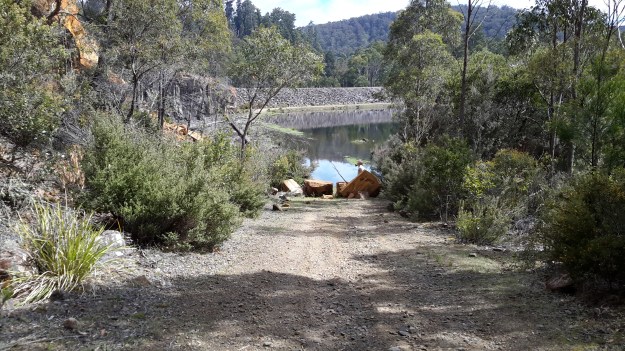
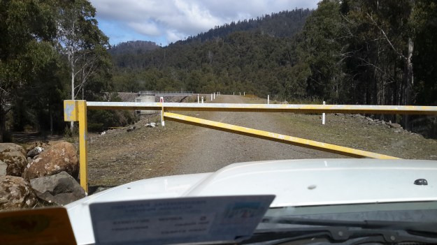
He arrived at the western side of the Station but needed to be on the eastern side to start this sector of the walk. Because it was not possible to cross over the Power Station outlet, and access through the Power Station is not permitted, Hydro tracks were followed to the most accessible part further away from the Lake Catagunya/Derwent River. Private vehicle access to the penstocks and beyond was prevented by a locked gate on the approach to the top of the penstocks, so the walk started there around 10 am. While it would have been possible to scramble beneath the penstocks, a detour to where the penstock began high up on the hill seemed like a good idea.

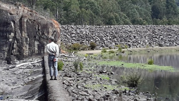
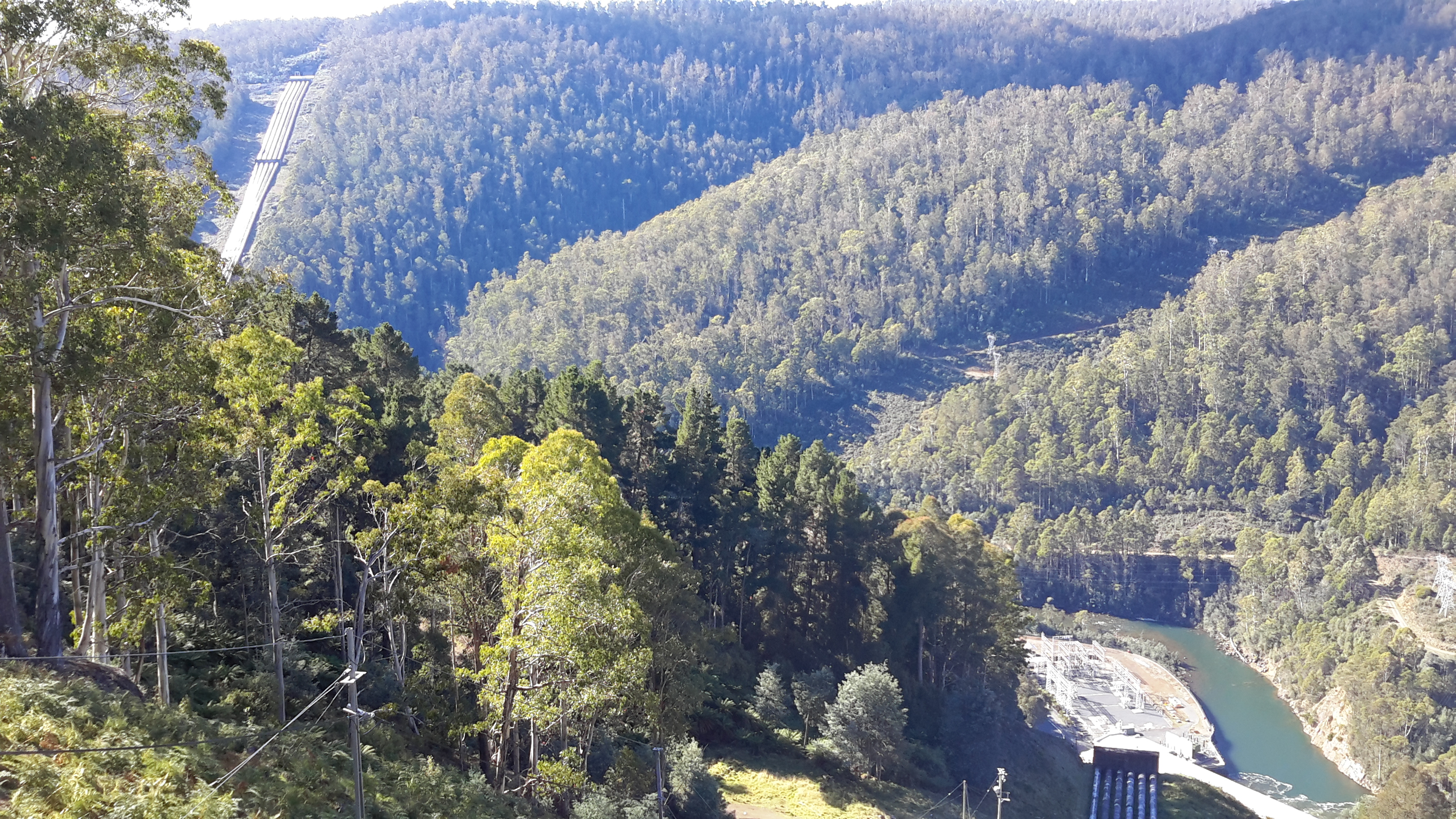
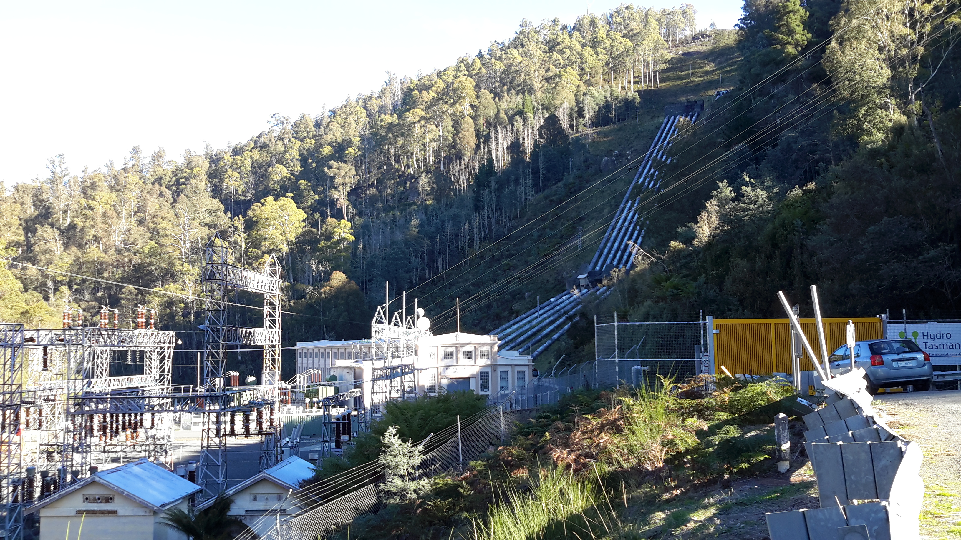
Wayatinah’s penstocks consist of two massive parallel pipes that carry water from the tunnel bored through from Wayatinah Lagoon. The pipes are approximately 1.2 km long and are made entirely of timber – coopered like gigantic continuous barrels. To keep it all together they are tightly bound with steel straps which keep the joints snug, save for the occasional trivial leak. Interestingly, inserted into the walls of the pipes every 50 metres of so, is a fire hose outlet (obviously the timber pipelines are not only protected from the inside!).  DSC01655e.jpg

DSC01657e.jpg

DSC01658e.jpg

The walk began by heading around the top of the penstocks where they emerge from the tunnel.

DSC01651e.jpg

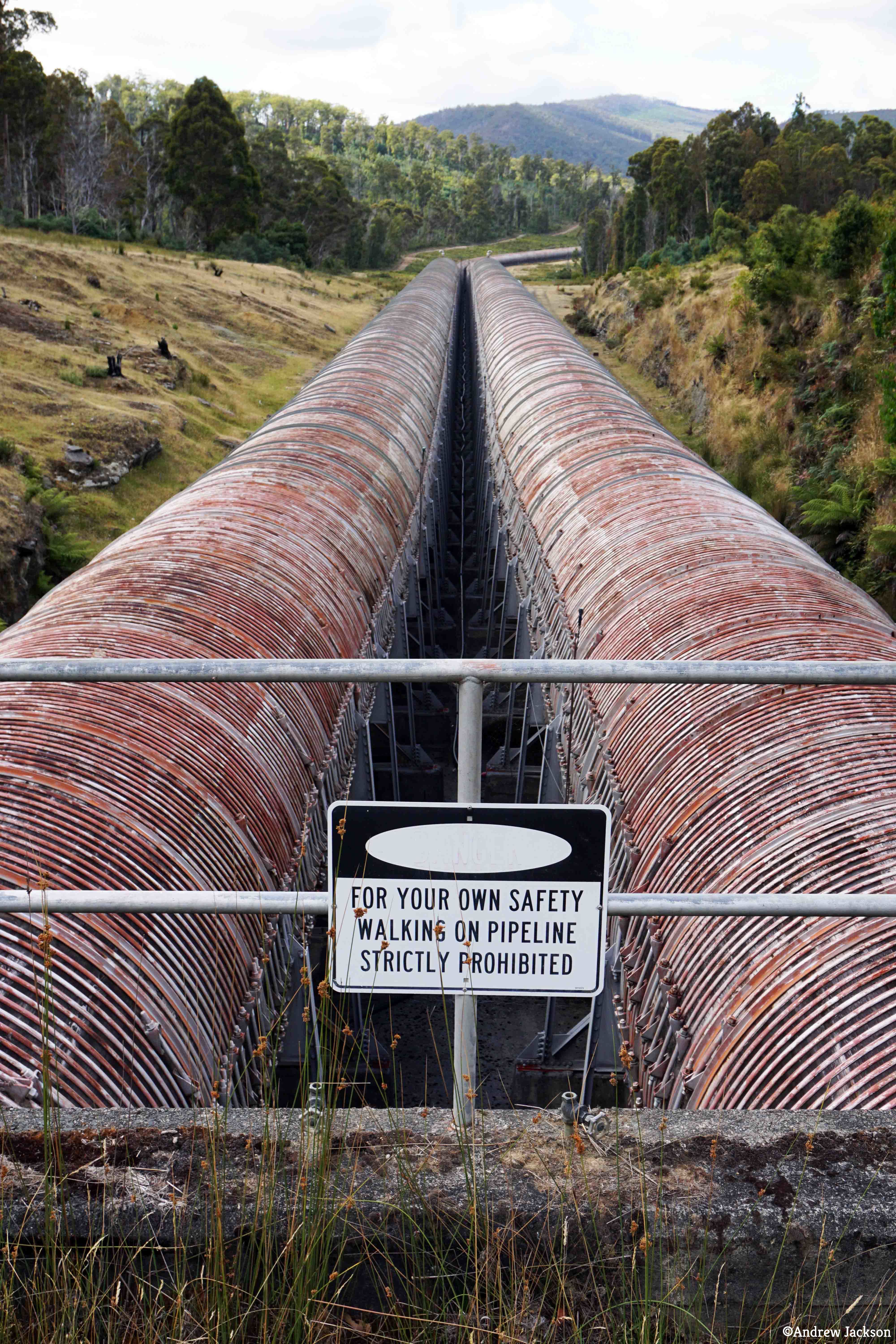
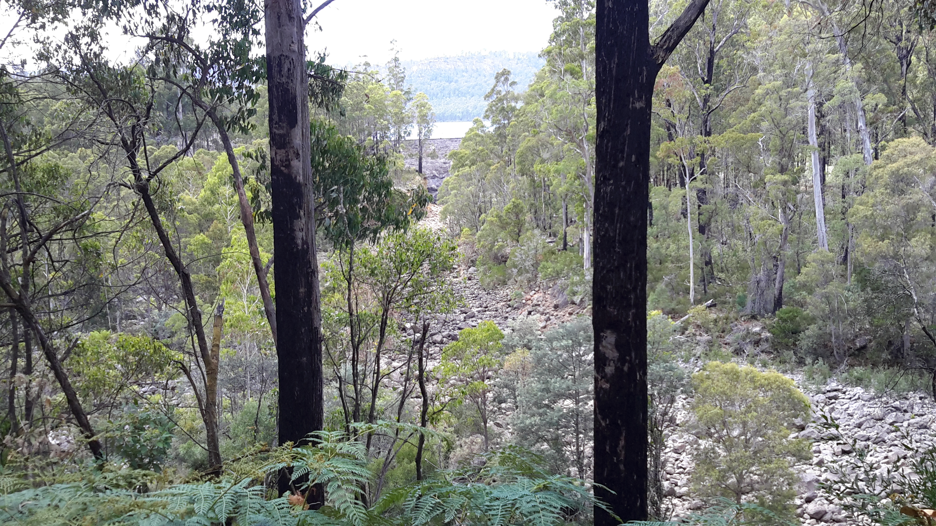
There is an impressive view down the length of the penstocks to where they disappear around a distant bend for the final approach to the Wayatinah Power Station.

DSC01663e.jpg

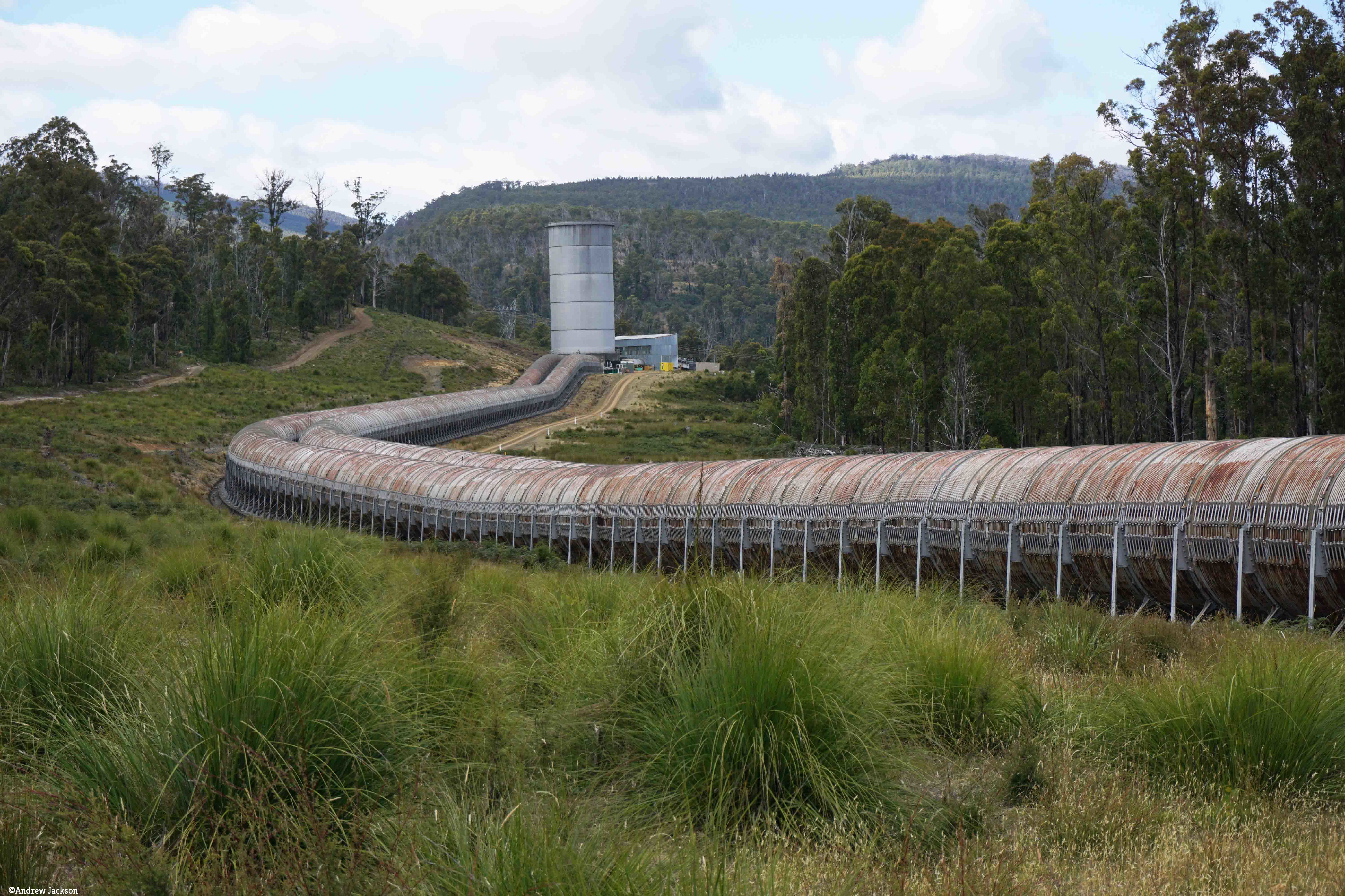
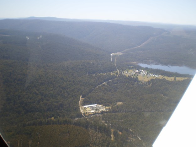
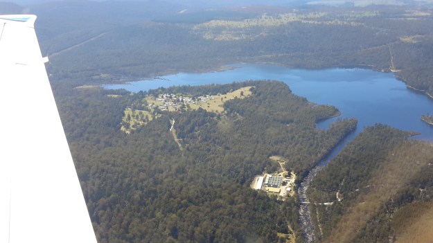
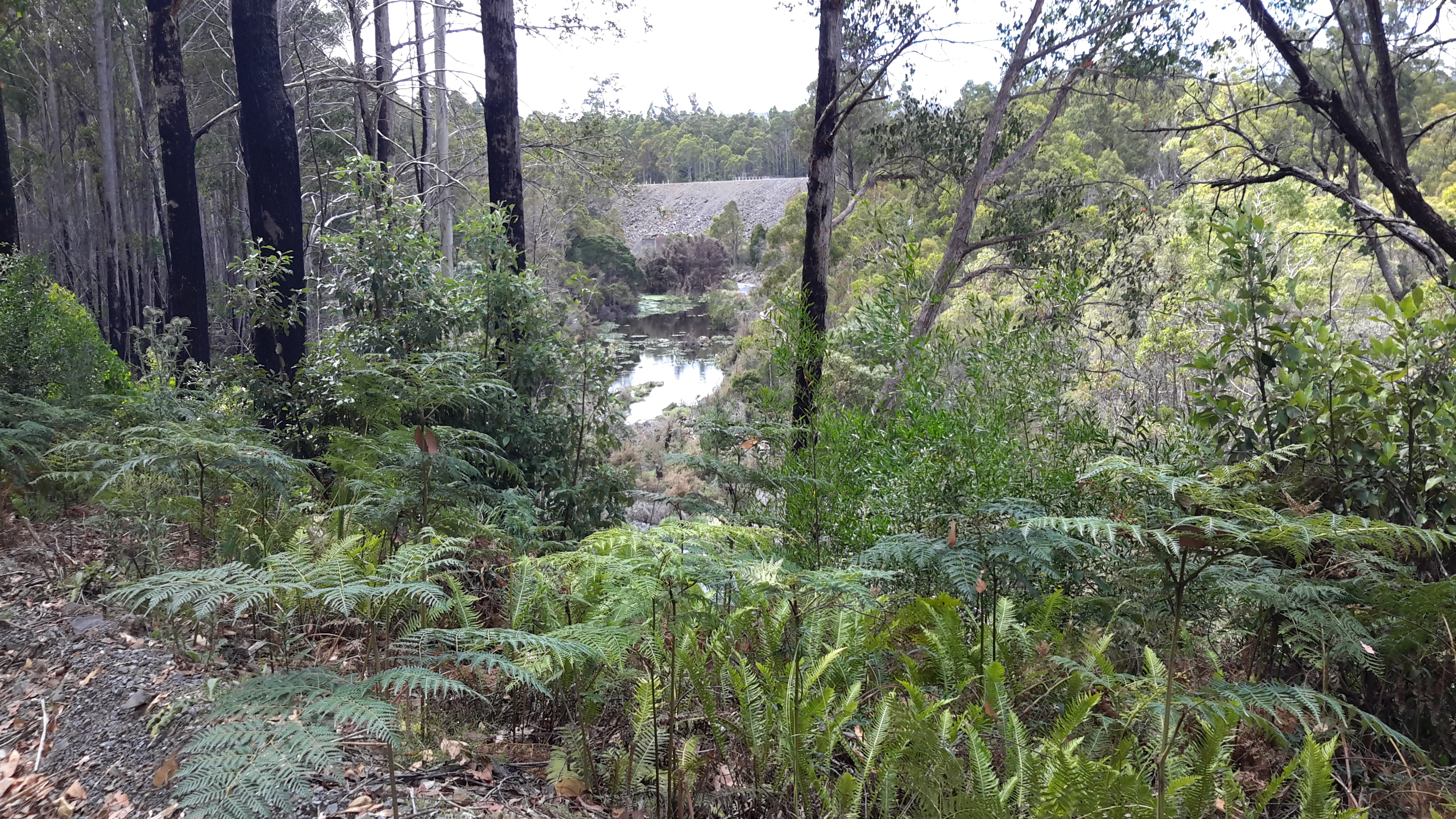
On the far side of the penstocks a good track leads down to the huge surge tank near the entrance to the power station. The glorious panoramic photo below distorts the view so I have also included a Google Earth aerial shot so you can understand the situation.

DSC01666e.jpg

Google Earth view of WPS and surge tank.JPG

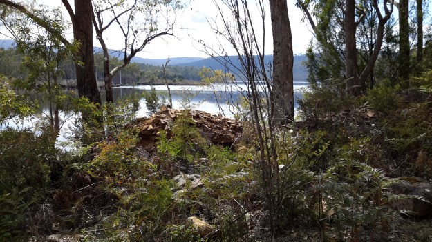
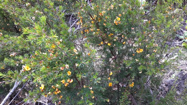
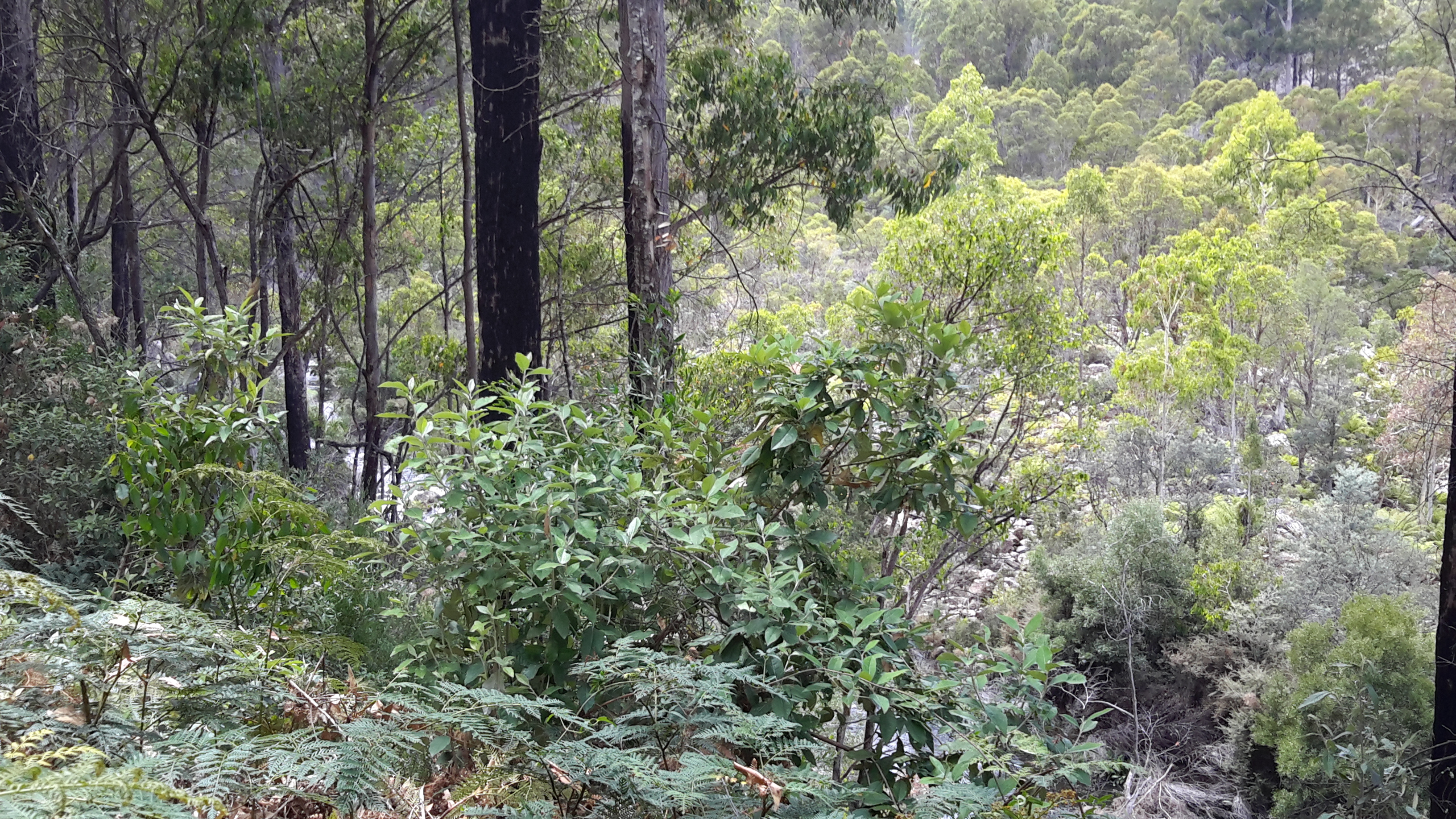
Past the surge tank but before the Power Station, a power line easement heads east, then south east, over a series of ridges and gullies to Catagunya Power Station. The forest next to the track leading to the easement was open with healthy eucalypts, dogwoods and some wattle trees sprinkled across the landscape. The day’s walk was a combination of traversing hills and gullies, and the next photo gives an appreciation of one of the more gentle hills.

DSC01670e.jpg

Because of the steep and scrubby terrain, it was not viable to access or follow against the edge of Catagunya Lake (Derwent River) at water level. Instead, following the power line ‘clearing’ was the smart alternative.

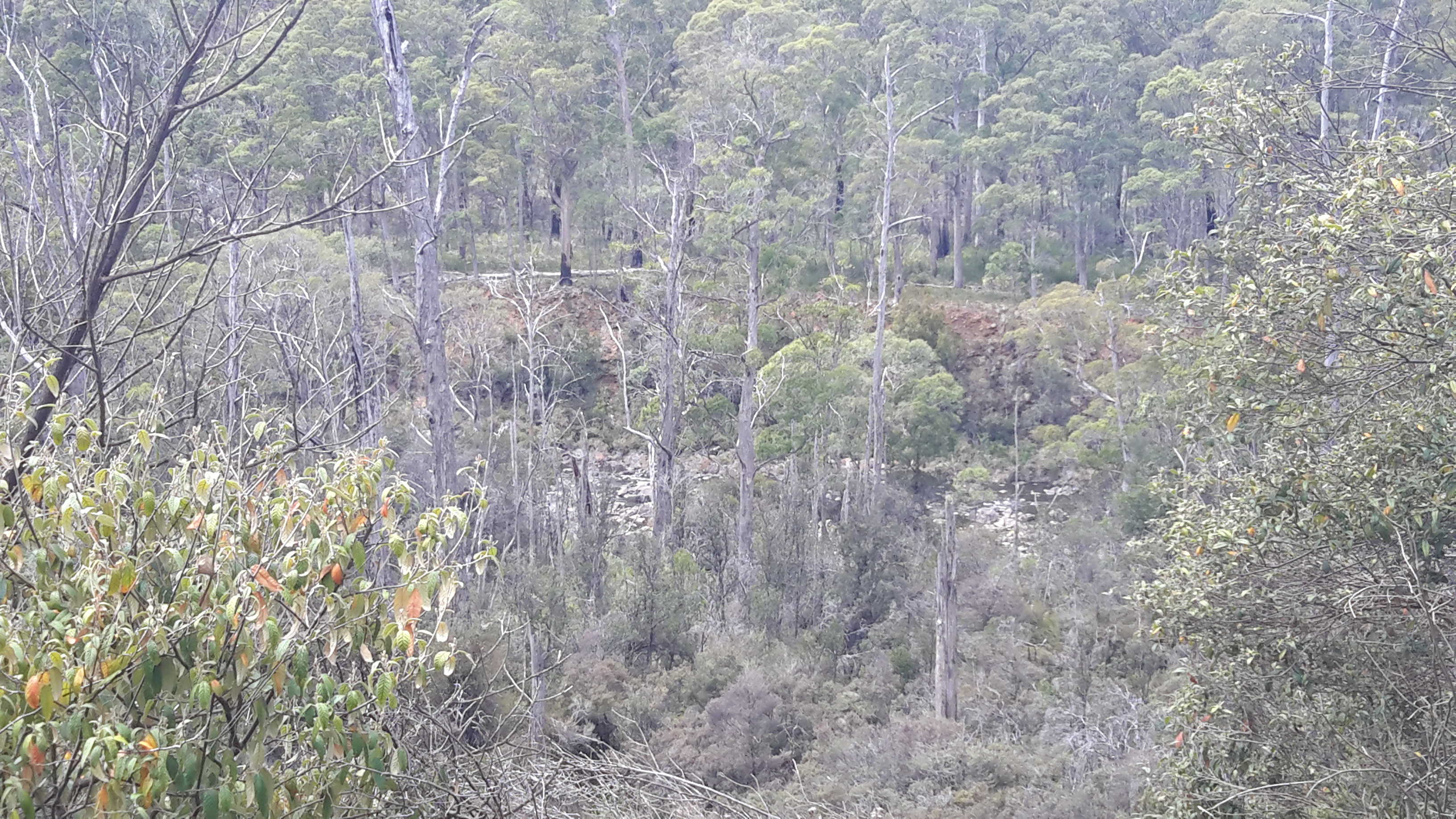
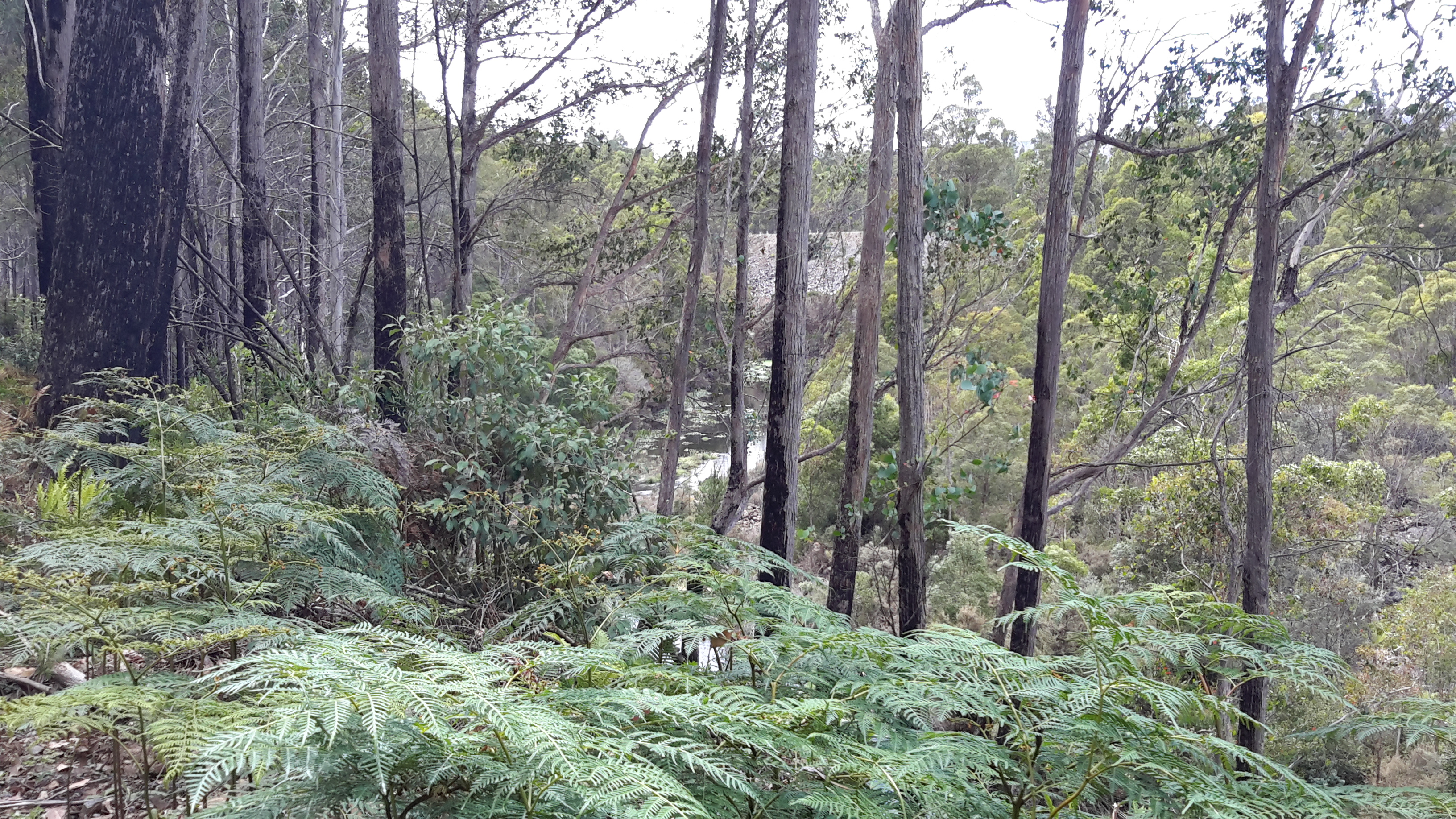
Once serious walking along the transmission line ‘clearing’ began, it was obvious that sections had not been slashed in a long while. The going was irregular with patches of scrubby low level vegetation and fallen logs to negotiate so that, occasionally, Andrew walked off to one side for a clearer route. The next photo shows an example of a less straightforward area along the easement under the power lines, and helps to explain why deviating from this line made sense during the walk.

DSC01678e.jpg

Derwent River water passes via the township of Tarraleah


Earlier this year the entire town of Tarraleah was on the market for sale.  Refer article 1, article 2 , and article 3.

If you were to follow Derwent River water by walking from the western end of Lake Catagunya at the Wayatinah Power Station inland past the Wayatinah Lagoon to the Liapootah Power Station then follow the Nive River to the bridge next to the Tarraleah Power Station (with the Tungatinah Power Station on the other side of the bridge), you could look up the hill to see massive penstock pipes descending the hill from the township of Tarraleah above.

The water falling down these pipes is Derwent River water which has travelled via Tarraleah Canal 1 and Tarraleah Canal 2 after processing through Butlers Gorge Power Station at the foot of Clark Dam that holds back the waters of Lake King William.

I chose not to walk the route via the penstocks and Tarraleah township when walking from the mouth to the source of the Derwent River,  rather to follow the original river bed albeit a scatter of stones and limited water during the summer, between Wayatinah and Butlers Gorge Power Station.

However, knowing that Derwent River water flowed along the Canals and through the massive pipes, I did visit the township of Tarraleah during the period when it was advertised for sale. I was curious to see what the township of Tarraleah looked like (it had been many years since I last visited). Despite being centred within lush dense rainforest, thankfully no rain fell at Tarraleah and the sky was blue and the day sunny when I visited. I approached the town from the highway and followed the slightly snaking pipes.

20160425_132005.jpg

20160425_132023.jpg

At the point where the pipes arrive at the top of the hill and are about to drop down the hill, I browsed public information boards and plaques.

20160425_132500.jpg

20160425_132512.jpg

20160425_132726.jpg

20160425_132711.jpg

20160425_132826.jpg

20160425_141509.jpg

The views from the township were dramatic. I am forever in awe at the engineering achievements of the past.

20160425_132537.jpg

20160425_132615.jpg

20160425_132653.jpg

These days Tarraleah is a place that acknowledges its social history from the early days of Hydro Tasmania. I was amazed to see the row of freshly renovated houses each with their own array of pastel coloured paint finishes. Perfect location for a science fiction movie.  I felt there was something strange about its lollipop colours and perfection.

20160425_142056.jpg

20160425_142039.jpg

20160425_144341.jpg

20160425_142110.jpg

Afterwards I travelled out of Tarraleah and down to the bridge over the Nive River. The Tarraleah Power Station was partly hidden in shadow from the afternoon sun. My eyes followed the pipes up the hill knowing the township was there on top.

20160425_145718.jpg

20160425_145849.jpg

The Nive River accepts the Derwent River water after processing for electricity generation through the Tarraleah Power Station.  The water passes through a series of further management processes, and ultimately empties into Lake Catagunya and then continues its long journey towards the sea.

20160425_150151.jpg

I have heard rumours the Tarraleah township sold but I cannot find records supporting this.  I haven’t one idea how a buyer could get a return on an investment of $11 million at Tarraleah, so I will be very interested to hear what will happen to this piece of Tasmania’s history.

Fish Farms


There are two Tasmanian Atlantic Salmon fish farms adjacent to different sections of the Derwent River; one near Wayatinah Lagoon and the other downstream from Meadowbank Dam.  The privately owned company Salmon Enterprises of Tasmania (SALTAS), which are Australia’s largest producer of Tasmanian Atlantic Salmon smolt, operates the hatchery near Wayatinah.  The second photo below was taken by Michelle and the rest by me.

201 etc cropped.JPG

PA280093Florentine & derwent intersection.JPG

20151028_115422.jpg

20151029_113829.jpg

The family owned and operated Huon Aquaculture operates the farm at Meadowbank. More can be read here.

20160301_125255.jpg

20160301_123045.jpg

20160301_123048.jpg

Michelle’s photo presents an aerial view of the Meadowbank area.

PA280073.JPG

The Derwent River flows over a rocky bed

20160115_123543.jpg

As I walked closer to Wayatinah, two ‘runways’ for the water became clear.

One extended from the Wayatinah Lagoon Dam wall and this was dry. I was glad that last year I had walked around the Lagoon Dam wall and understood how the wide spill-over channel was configured, otherwise seeing the massive dry rocky bed below would not have made sense.

20160115_124455.jpg

20160115_124552.jpg

Then, at a point, I could see the Wayatinah Lagoon in the middle distance.

20160115_124742.jpg

20160115_124812.jpg

The other ‘runway’ came from I knew not where and this was the strand which had water flowing along it. To the left of the dry rocky bed the River ran – and I can see it in the photos below.

20160115_124653.jpg

20160115_124835.jpg

20160115_124859.jpg

By the time I reached the spot where I took the preceding photograph, it was clear that another dam wall was raised at right angles to the one shown in front of the Lagoon earlier in this post.  I imagined that water was being released from the Lagoon at this wall to create the flow.

Further walking released more of that dam wall to view.

20160115_124934.jpg

20160115_124954.jpgAnd down below, the Derwent River chuckled along.

20160115_124913.jpg

The complex that makes up Wayatinah – posting 7 of 7

The Derwent River at Wayatinah

20151029_113841.jpg

20151029_113829.jpg

From my aerial experience, I know the river looks like this all the way north-westwards of the Wayatinah Lagoon to Clark Dam at Butlers Gorge; a distance of not much less than 30kms in very steep country with numerous creeks cutting the landscape and flowing into the Derwent River.  In the post introducing George Frankland’s walk, mention was made of the Nive River. The Nive flows into the northern end of Wayatinah Lagoon. Before the Wayatinah dam was built, the Nive flowed directly into the Derwent.  The river edge between Wayatinah and Butlers Gorge is where Frankland and his expedition found two to four miles per day was the going rate because of the density of the bush. And then they gave up and walked inland away from the Derwent River.

 20151028_115431

20151028_115442.jpg  
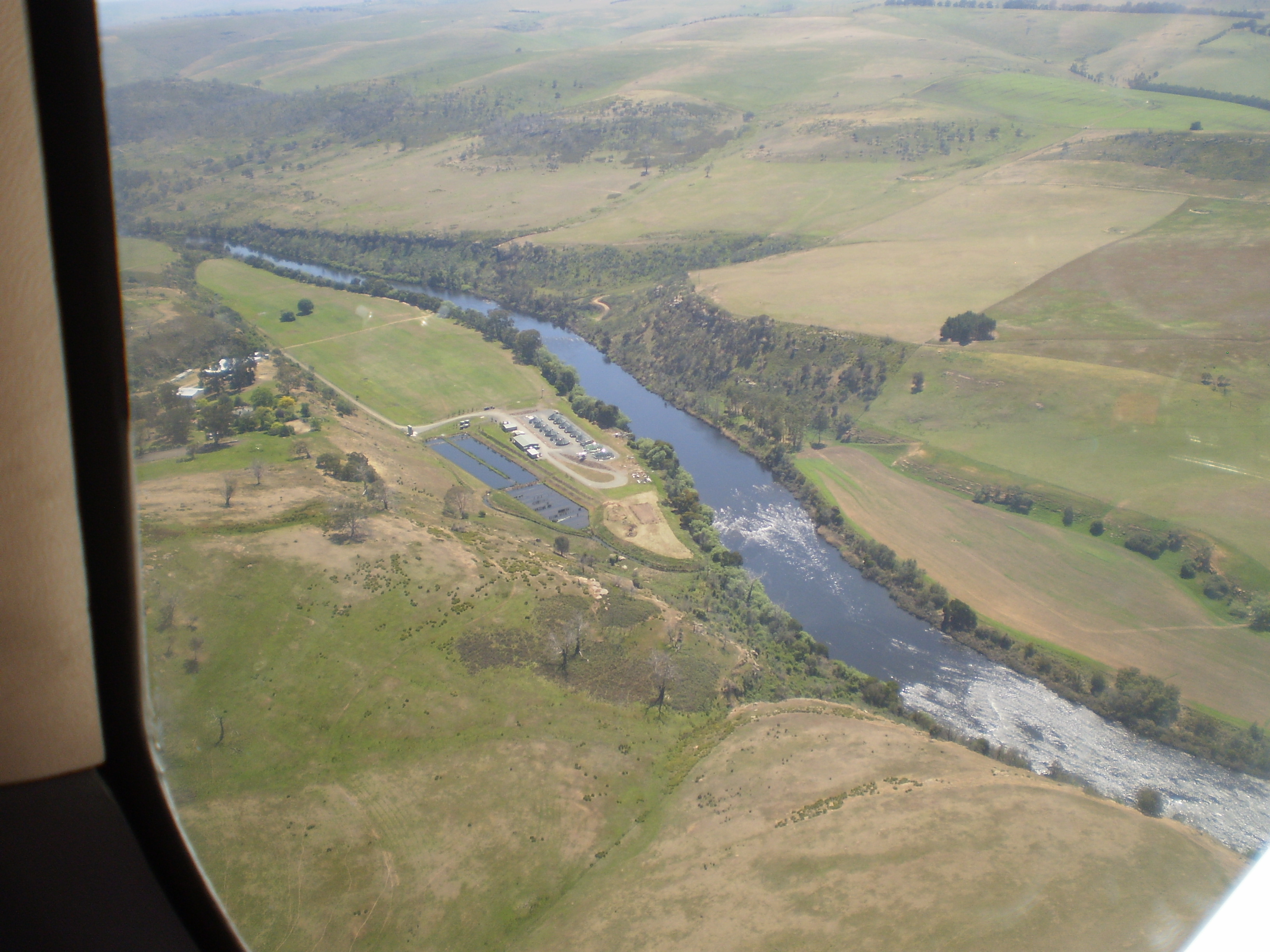
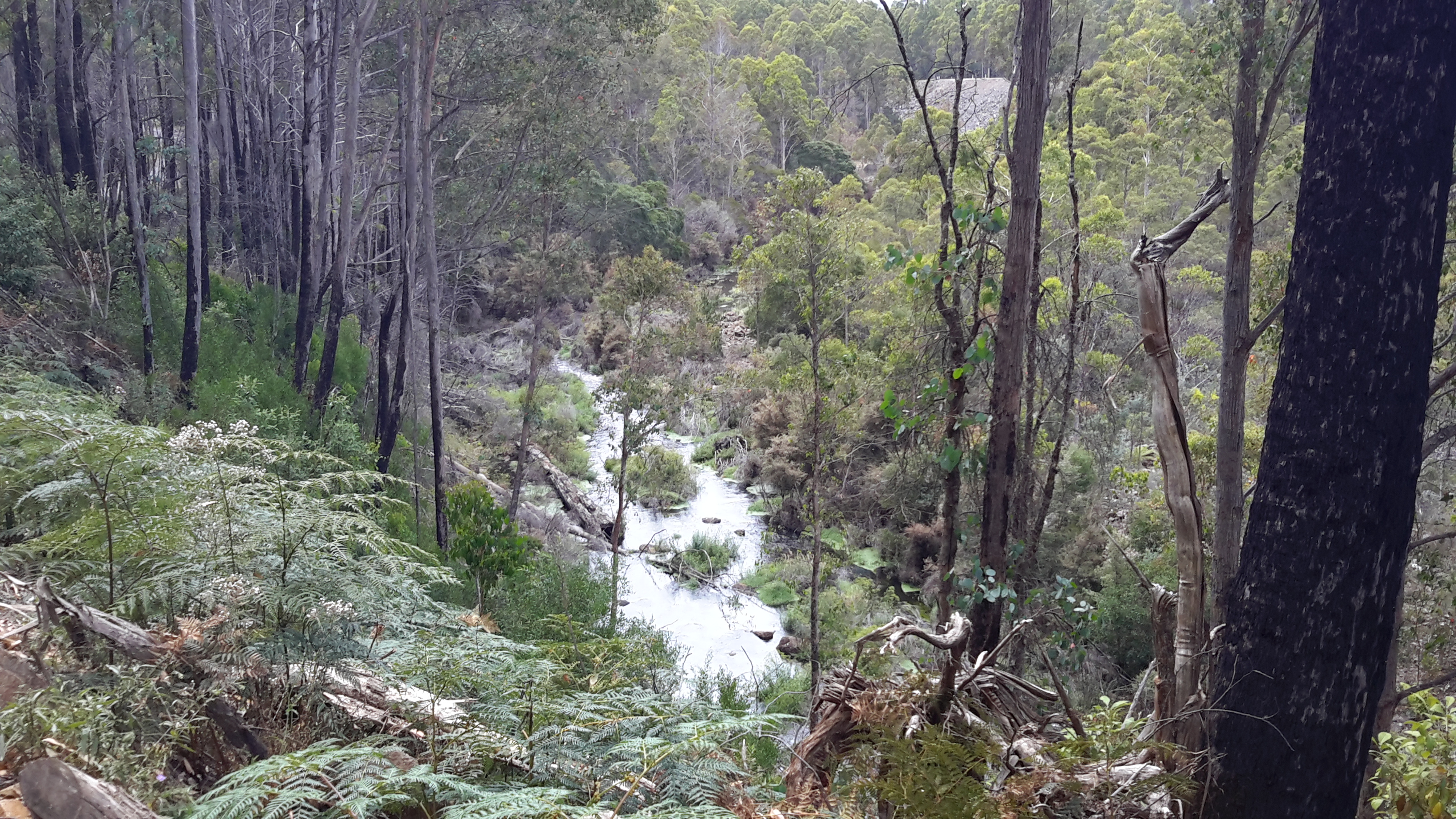
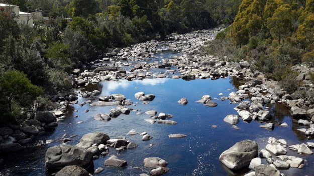
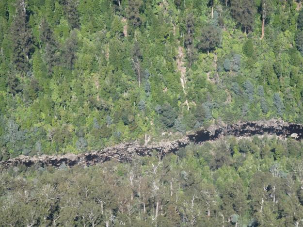
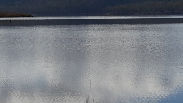
A couple of Chantale’s aerial photos show similar rocky beds along this remote and wild part of the Derwent River.

IMG_3828dryish river bed.JPG

IMG_3832.JPG


The complex that makes up Wayatinah – posting 6 of 7

Wayatinah Dam

Instead of driving back to the Lyell Highway straight away, Andrew and I took a detour left off Long Spur Road and arrived at an impasse with the Wayatinah Dam ahead.  I had hoped we could drive across but this wasn’t to be.

20151029_111237.jpg

Nevertheless the water level was low and it was easy to walk across and connect with the road from Wayatinah township a few kilometres away.

20151029_111352.jpg

Decades ago thousands of tonnes of rock had been blasted to create a slipway beyond the Dam and the Lagoon. The scale of that effort was very impressive.  Clearly huge volumes of water had passed over the Dam in the past; these hard volcanic rocks were somewhat smooth.

20151029_111453.jpg Dam slipway.jpg

Wayatinah Lagoon backed up to the dam wall.

20151029_111239.jpg 20151029_111241.jpg

Looking across the Lagoon gave me an immense sense of calm.

20151029_111527.jpg

Examples of the flowering vegetation:

20151029_111842.jpg

20151029_111849.jpg

Later we drove through the Wayatinah township.  Michelle’s aerial photo shows the town on a cleared hill with some of the Wayatinah Lagoon visible.

PA280097Wayatinah township.JPG

After passing through the town, we proceeded down to the dam wall and were met with locked gates.

20151029_114511.jpg

A sense of the scale of the town in relation to the Lagoon in relation to the Dam can be seen in my aerial photograph.

20151028_115428.jpg

The complex that makes up Wayatinah – posting 3 of 7

Wayatinah Power Station

On Thursday 29 October 2015, Andrew drove me off the Lyell Highway and down Long Spur Road to Wayatinah Power Station. An underground pipeline from Wayatinah Lagoon fills penstocks which fall down steep hills to the Power Station.  The water exiting the Station empties into Lake Catagunya, through which the Derwent River flows.

20151029_090827.jpg

Watch the video.

20151029_091538.jpg 20151029_091554.jpg


The complex that makes up Wayatinah – posting 2 of 7

Wayatinah Lagoon

Having taken a turn off Long Spur Road, Andrew and I were the only visitors to this misted expanse of water on the 29 October 2015, the characteristics of which were almost total silence and an immense sense of quiet peacefulness.  I felt privileged to stand in such a serene environment, and smell the clean fresh air.

20151029_084702 Liapootah PS on hill in distance.jpg 20151029_084713.jpg 20151029_084742.jpg 20151029_084845.jpg

Watch the video.

A boat ramp, away from the infrastructure that accepts the water to be transported to the Wayatinah Power Station, ensures the safety of anglers from any unexpected water level changes.

20151029_084906.jpg 20151029_084829.jpg

Michelle’s aerial photo below gives some indication of the size of this Lagoon, and the way the river bed snakes away from it amidst dense vegetation heading towards Hobart.

PA280095 Wayatinah Lagoon.JPG

The complex that makes up Wayatinah – posting 1 of 7

As an introduction to the widely spread features of Wayatinah, the Derwent River runs in a south easterly direction past many acres of State Forest before flowing into the expansive Wayatinah Lagoon, a waterstore located five or so kilometres north of the Wayatinah Power Station. The Lagoon’s water is piped to the Station first underground and then overground in massive white pipes.

Excess water from the Lagoon seeps, dribbles or spills back into the Derwent River at the Wayatinah Dam, which isn’t far from the Wayatinah township. Then the low water level of the river trickles over a rocky base until it catches the flow of the  Florentine River before continuing on to become part of Lake Catagunya.  The western most reaches of the Lake have already formed before the river reaches the Wayatinah Power Station.

Possible locations where the Derwent River can be ‘touched’

I have compiled a list of those locations where I believe, with a vehicle, it will be possible to ‘touch’ the Derwent River occasionally along its length between Gretna and Lake St Clair.  Please let me know if any section listed below takes your fancy and if you would be interested to try it out.

Almost all sections include driving on bitumen highway, gravel roads and poor tracks. Some of these may be forestry roads.  If you wish to volunteer to take me to one of these sections (let me know on walkingthederwent@gmail.com), please feel comfortable that your car can handle the different conditions.  Of course, common sense will prevail and we will never push on if a road is too rough for your vehicle and your peace of mind.

If you are happy to help me reach my goal, albeit differently than originally expected, I would like to fill up your tank with petrol as some compensation.  You know my ‘walking the Derwent’ is a non-commercial project, but since I do not own a car nor drive, I need transport – and therefore, I am happy to cover the cost.

  1. On eastern shore – From New Norfolk drive along the Lyell Highway and then, not far past Gretna’s Sports ground, take a left turn into Clarendon Road and drive to farmstead buildings about 250 metres from the river on a hill. Perhaps 140km return trip.
  2. On western shore – From New Norfolk drive along Glenora Road, and turn left at Bushy Park then right onto Meadowbank Road over the Tyenna River then next to Derwent, then on over Meadowbank Creek to a hill top with buildings. It may be possible to continue quite a way on this road. Minimum 130 and maybe up to 160kms return trip
  3. On eastern shore – From New Norfolk drive along the Lyell Highway and turn left off the Highway onto Meadowbank Dam Road. Continue to dam and southern end of Meadowbank Lake. At least 170 kms for round trip.
  4. On western shore – Travel from New Norfolk and turn left into Gordon River Road at Bushy Park, then turn right off Gordon River Rd into Ellendale Rd and then right onto Rockmount Road before you reach the township of Ellendale. There seem to be many dirt forestry tracks to Meadowbank Lake. At least 170kms return trip and maybe 200kms return or more depending on roads.
  5. On western shore – Travel from New Norfolk and turn left into Gordon River Road at Bushy Park, then turn right off Gordon River Rd into Ellendale Rd and drive on through the township of Ellendale until you reach Dawson Rd / Dunrobin bridge over Meadowbank Lake. Turn left before bridge and it seems we can drive 2kms further up along the Lake edge. Return to Ellendale Road, cross bridge and connect with the Lyell Highway. At least 170kms return trip and maybe 200kms return or more depending on roads.
  6. On eastern shore – From New Norfolk drive up Lyell Highway and continue past the left turn off to Dunrobin bridge and afterwards and to the left there are a number of dirt tracks seemingly without gates. After a while these tracks/roads only extend to the Ouse River and not the Derwent River so map consultation is crucial. At least 180kms return and maybe over 200kms return depending on how many side roads/tracks can be driven along.
  7. On eastern shore – Drive up Lyell Highway past Ouse then turn left at Lake Repulse Road. Continue to intersection with Cluny Lagoon Road and turn left and go to Cluny Dam. Return to intersection and continue on Lake Repulse Road to the Repulse Dam. Can cross a bridge and continue back south around Cluny Lagoon to a ‘settlement’ named Cluny.  Perhaps could access this road from the Ellendale Rd on the western shore? By driving north from Repulse Dam along Dawson Road/then renamed Thunderbolt Road it seems we can take right hand detours to Lake Repulse. Over 200kms maybe 250kms or more minimum round trip.
  8. On eastern shore – Drive up Lyell Highway past Ouse, over the Dee River until the sign appears for a left turn at Catagunya Road. Drive down to Catagunya Dam. 200kms minimum return trip
  9. On eastern shore – Drive up Lyell Highway past Ouse, over the Dee River, past Black Bobs and turn left at Long Spur Road. This runs around Wayatinah Lagoon. Go past the intersection to Wayatinah Dam, turn left and travel to Wayatinah Power Station on Lake Catagunya. Return to intersection and turn left and travel to Wayatinah Dam. Cross bridge and continue on to Wayatinah township. Access dirt tracks in the vicinity of all. Drive south from the Wayatinah Dam on the western shore along the Florentine Road but don’t bother crossing the Florentine River because the road goes inland away from the river. Minimum of 230kms but most likely  at least 300kms round trip.
  10. On eastern shore – Drive up Lyell Highway and when you reach a canal passing under the road, and where the road turns right to go to Tarraleah, go straight ahead on Butlers Gorge Road. Note there are limited roads off and around going closer to the river near that intersection. Continue along Butlers Gorge Road for 10-15 kms heading for Lake King William. Reach Clark Dam and Power Station. Continue onto Switchback Track along side of Lake King William. This track stops and you have to return the same way – swamp separates you from the track north about 500 metres away. This would be a big day and I suggest take overnight accommodation at Tarraleah before setting out. PERHAPS it is possible to walk across the swamp and then walk about 7 kms to Derwent Bridge. Unknown over 300 kms return trip.
  11. On eastern shore – Drive up Lyell Highway to Derwent Bridge and continue past to left hand turn off on the western side of Lake King William and drive the track to the lake. 360 kms return trip minimum.
  12. On eastern shore – Drive up Lyell Highway to Derwent Bridge. Walk from the bridge over the Derwent River near the township of Derwent Bridge to St Clair Dam at the bottom of Lake St Clair Lagoon where the Derwent River starts. Walk to Pump House Point and St Clair Weir at the southern end of the Derwent Basin. 350kms return trip minimum.


From the sea to the source; stories of a river on the other side of the globe

Two years ago, Helen Ivison published River Derwent: From Sea to Source (Amberley Publishing).

 Ivison River Derwent

 The promotional puff declares this book ‘brings to light tales and stories of fascinating events, landmarks and people. River Derwent: From Sea to Source is essential reading for anyone who knows this river well, and also for those who are visiting the River Derwent for the first time.’  But what is the author referring to?

Hers is the Derwent River in the Cumbrian region of England which flows from the mountainous Lakes District in two strands, one of which starts near Styhead Tarn. The two strands meet at Grains Gill, and continue in a north easterly direction as a single river towards an expanse known as Derwent Water. The river passes through this ‘lake’ then eases into a north westerly direction across country before flowing onwards through Bassenthwaite Lake. Finally, the English Derwent River turns westwards and empties into the Irish Sea.

By contrast Tasmania’s Derwent River flows generally in a south easterly direction from Lake St Clair, through steep narrow gorges, curving around farmlands, before passing between the two sides of the Greater Hobart Area into Storm Bay. The man-made lakes of Lake King William, Wayatinah Lagoon, Lake Catagunya, Lake Repulse, Cluny Lagoon and Meadowbank Lake all disrupt the progress of the River. These lakes have resulted from dam building as part of hydro-electricity generating projects over the past century.