Tag Archives: Dominican Gull

The meld of Montrose and Rosetta on the shores of the Derwent River

Walking south from Berriedale, a blur exists between the two suburbs of Montrose and Rosetta and I am not sure where either starts or finishes.

Soon after leaving the Strathaven Home and Riverfront Motel, as I walked along the ‘bike’ path beside the Highway, on the right in the distance over the highway I could see an old two storey white painted building. Having just passed the sign indicating the Undine Colonial Bed & Breakfast was in that vicinity, I made what I believe is the reasonable guess that what I was seeing was the developed building that grew from the original Rosetta Cottage of the 1800s.

20150109_080054  20150109_080208

It was impossible to safely cross the highway at this point so I walked on.

By 8.06, I had passed the Montrose Park sign, alerting me to turn left towards the Derwent River in the distance.

20150109_080504

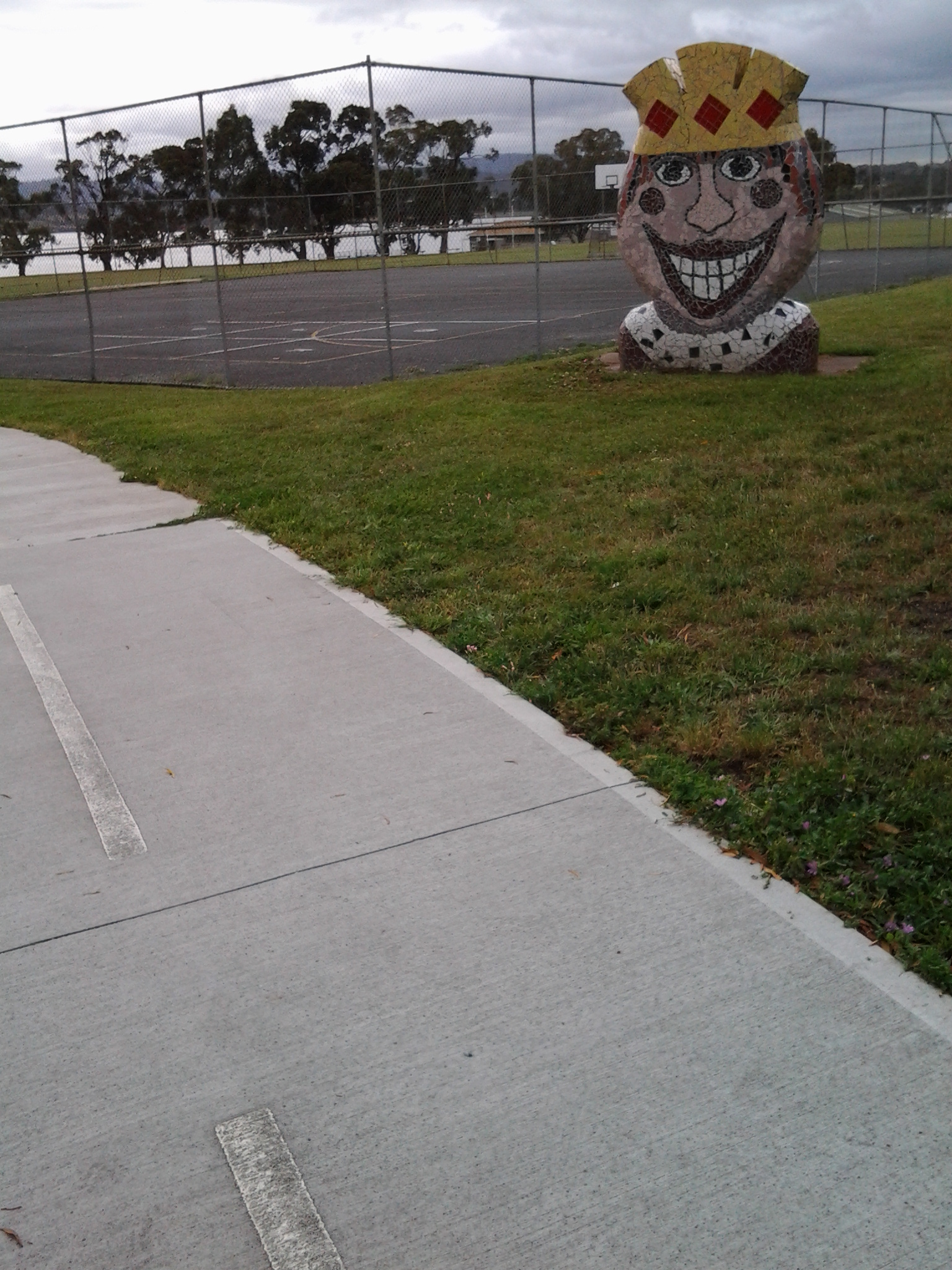
Not long afterwards, I walked past the Montrose Bay High School with its whimsical mosaic decorations, and tennis courts.

20150109_080603  20150109_080720  20150109_080816

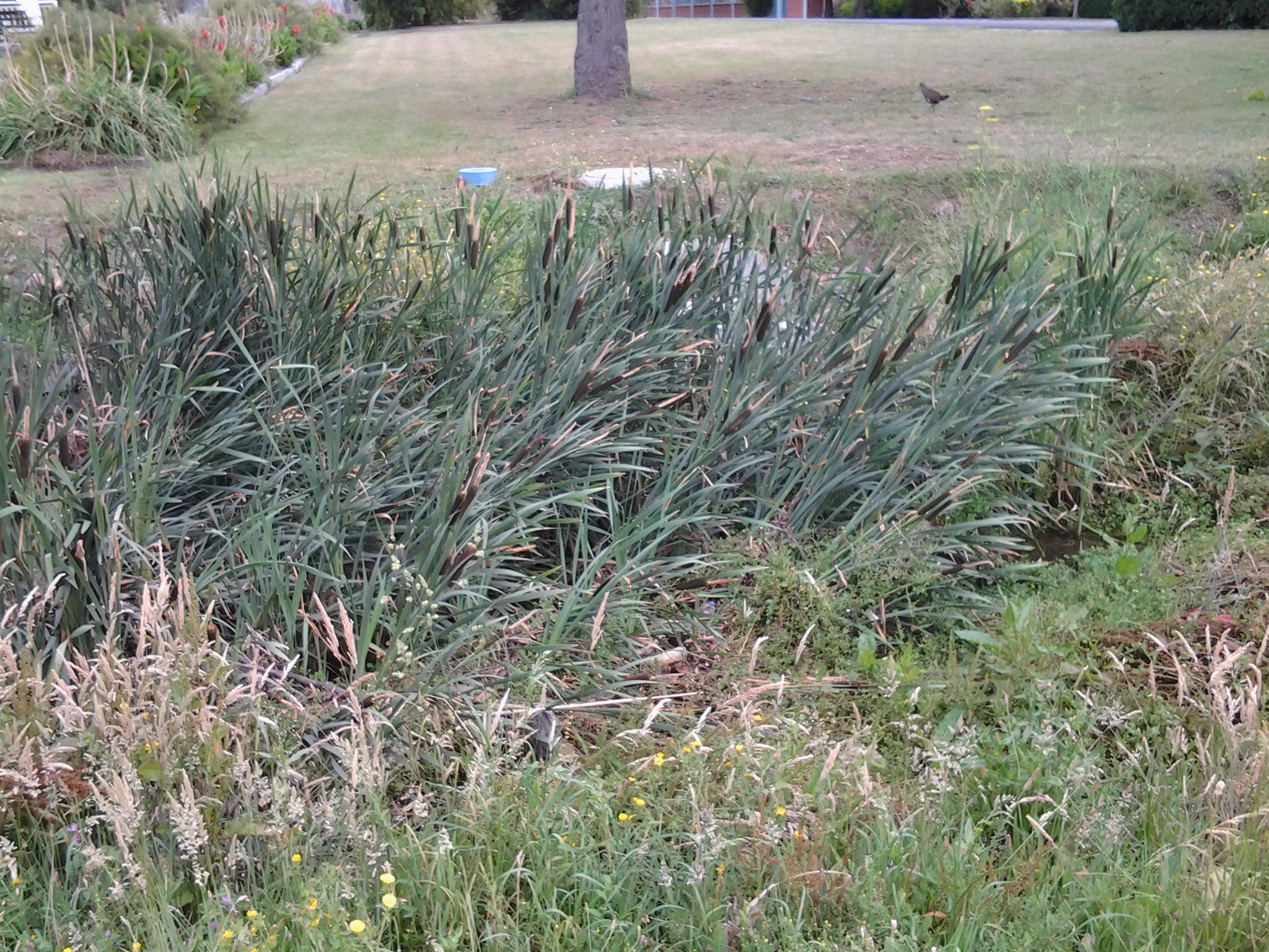
Wild hens ran around the bull grasses of the Islet Rivulet.

20150109_080850

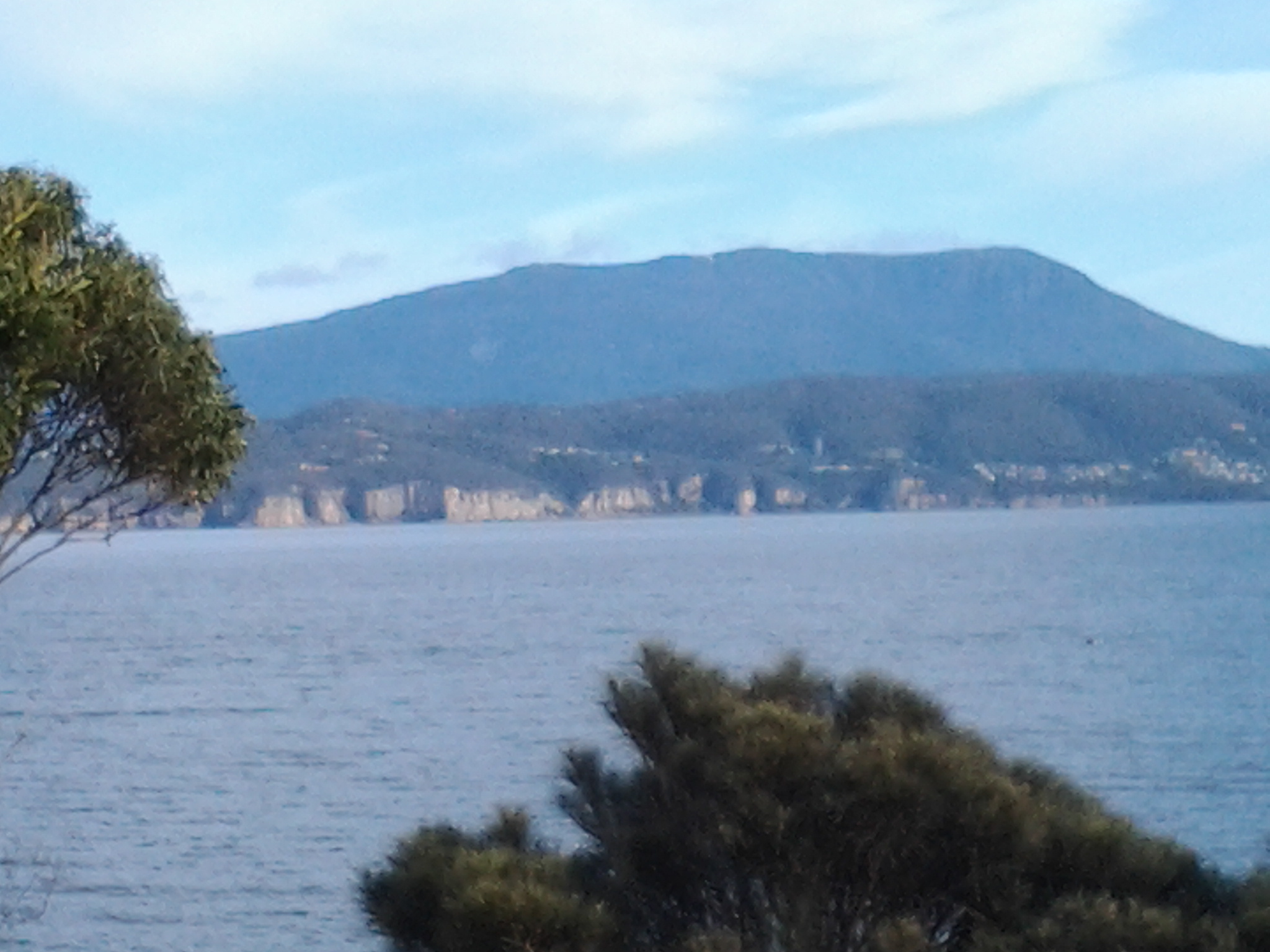
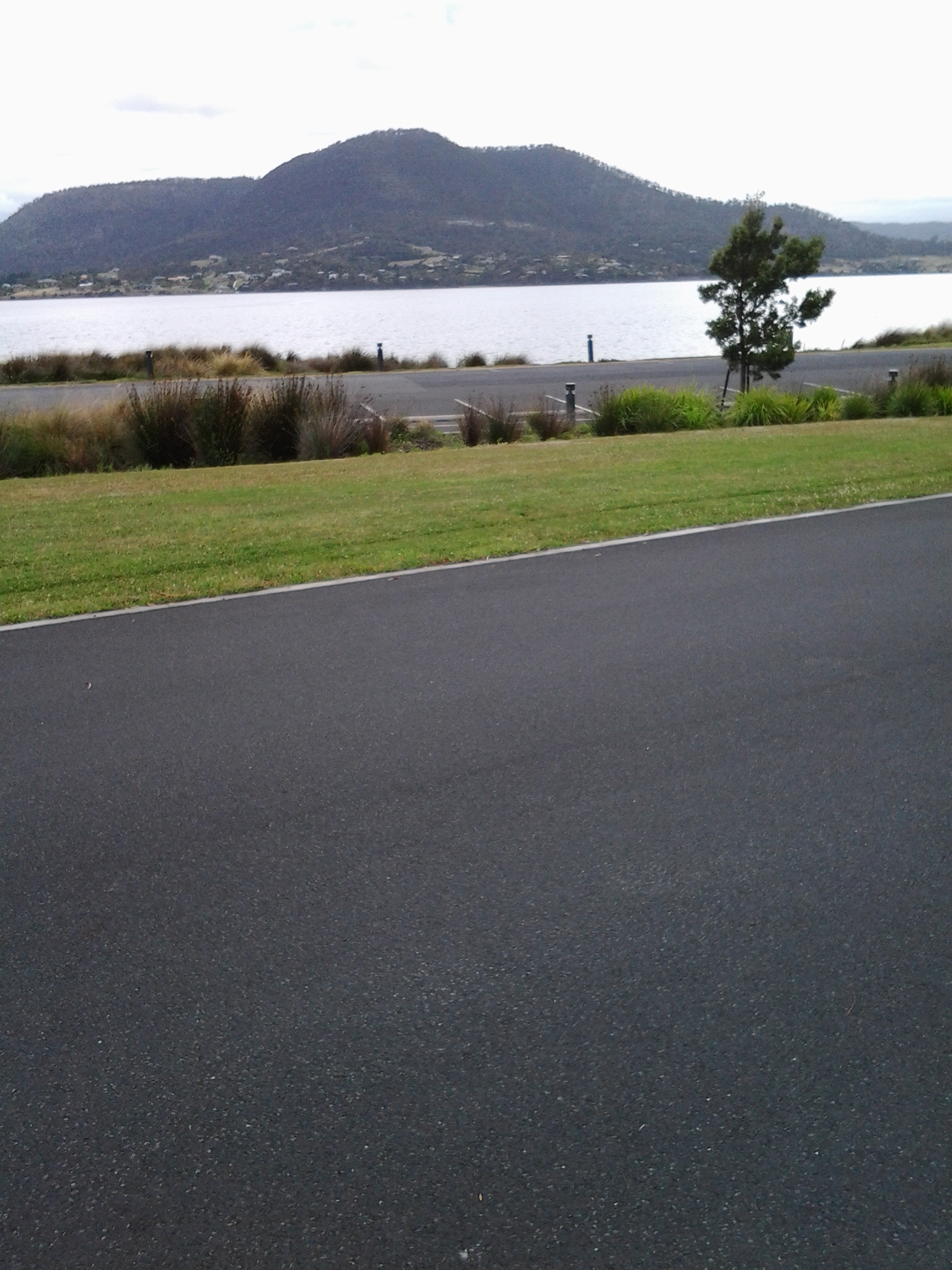
Once at the water’s edge I realised, that Montrose Park is the northern end of the Glenorchy Arts and Sculpture Park (GASP) that extends a few kilometres south and passes the Derwent Entertainment Centre.  Across the Montrose Bay High School Bus Mall, and then across the Derwent River I could see Mount Direction in the Risdon area.

20150109_081320

The white buildings of Cadbury’s chocolate factory were visible in the distance to the north.

20150109_081523

Also in a northerly direction, the dramatic walls of MONA were clearly visible.

20150109_081530

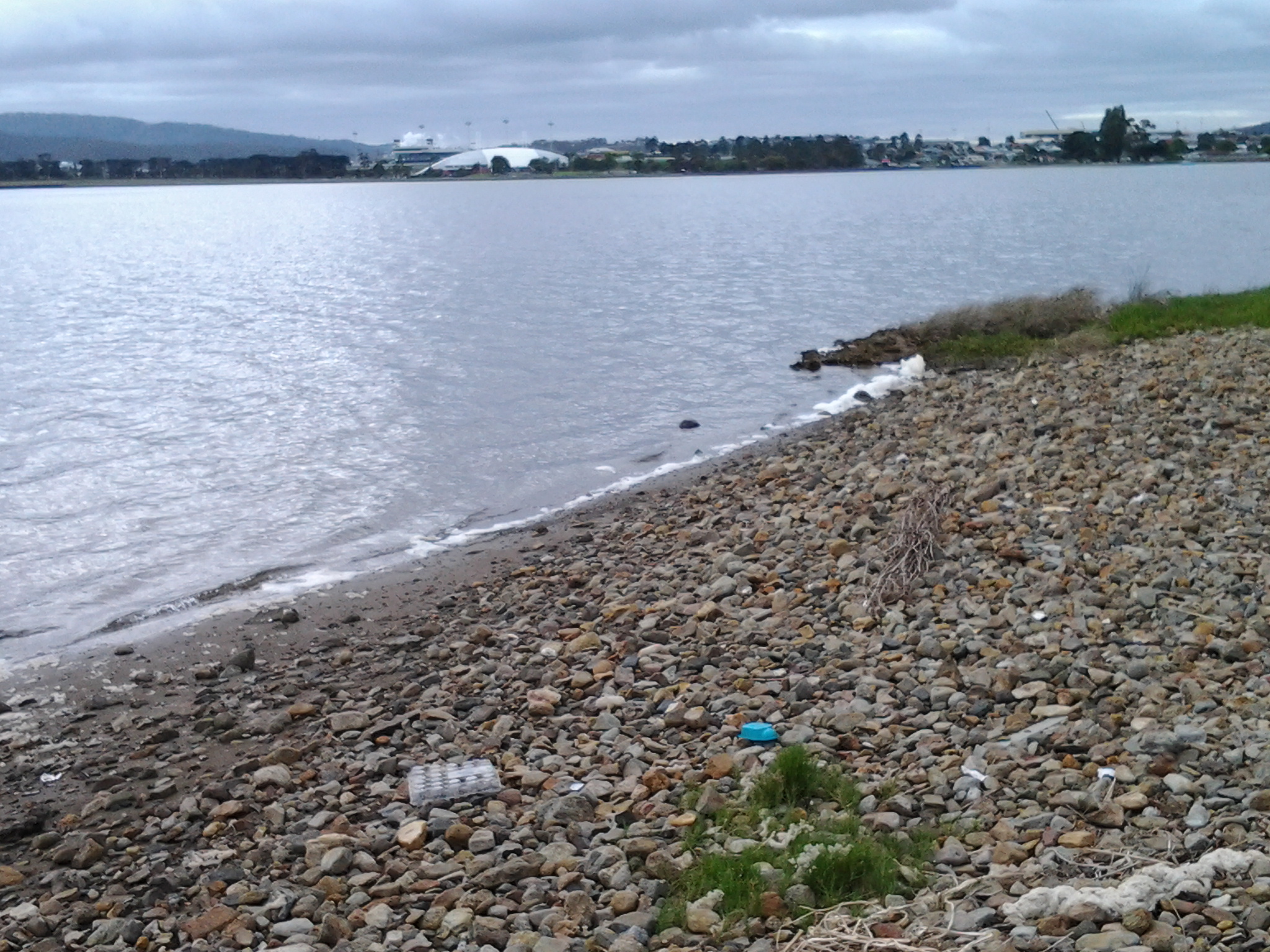
Looking south, the white Derwent Entertainment Centre was in view.

20150109_081540

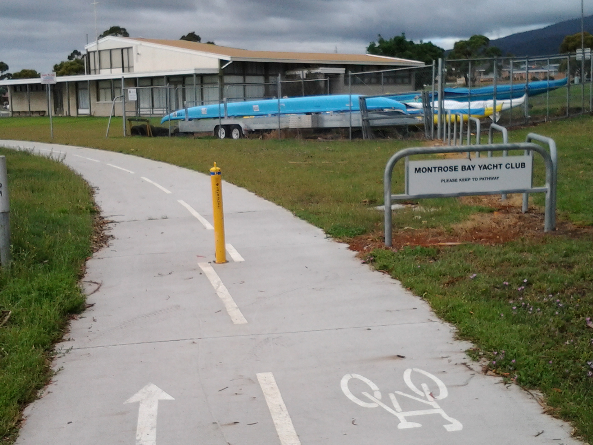
Then I started walking again. By 8.20 I was walking passed the Montrose Bay Yacht Club (Making a great offer to help me learn to sail) and then the Glenorchy Rowing Club.

20150109_081817  20150109_081907

Public toilets were nearby, near a kid’s playground.

I enjoyed looking at other quirky mosaic constructions. The photo below shows the High school and another mosaic figure in the distance, plus the posts for an Australian Rules Football game.

20150109_081644

Continuing along, I passed pontoons and jetties, an immature Dominican Gull standing fluffily on one leg, flowering gums with squawking parrots, an outside adult’s gym with chest presses and other exercise equipment, and the Montrose Foreshore Project sign showing developments since 1946.  The spread of residential development over the years has been substantial.

20150109_082441

Around the corner from the mouth of the Derwent River, at Clifton Beach

Yesterday, the temperature at my home was in the high 30 degrees but today the temperature was much more pleasant and only rose to a little over the mid 20s. In the spirit of getting back out into the environment and not worrying about heat exhaustion, this afternoon Je and I headed off to have a look at Clifton Beach. This is not a place easily accessible by public transport unless you have time to take a long walk of many kilometres from a distant bus stop. So this Beach was accessed today by starting with a private car trip.

Neither of us had visited Clifton Beach or the adjacent Clifton Beach Conservation Area nature reserve for many years yet it’s a stunningly beautiful location only 25km from the centre of Hobart. The sky was cloudless, and the onshore breeze kept us comfortably relaxed.

This beachside suburb to the north of the South Arm peninsula and therefore north of the mouth of the Derwent River on the eastern shore, is part of the City of Clarence in which I live, and part of the Greater Hobart Area.

Clifton Beach is a 2.1km long wide sandy beach backed by deep revegetated 20 metre high sandy dunes. The beach is bordered by 54m high Cape Deslacs in the east and 50m high rocky cliffs in the west that run south for 3.5 km rising to 100m high at Cape Contrariety. At the southern end of the beach, a Surf Club is central to the protection of swimmers. However out on the waves, and typically clad in black wet suits, were sun-bleached surfers. Have a look at http://www.surf-forecast.com/breaks/Clifton-Beach which has a changing selection of photographs showcasing this amazing beach – plus you can check out the forecast if you want to go for a surf. One of the photos looks towards the southern end, another looks across Storm Bay to the Tasman Peninsula, and the other is a huge wave the like of which we did not see today.

The photo on http://en.wikipedia.org/wiki/Clifton_Beach,_Tasmania shows the cliffs at the northern end marking Cape Deslacs. When we followed a track out from a carpark, we found ourselves about half way along the long beach so we turned north and walked to the cliffs in the photo, passing a few happy walkers and joggers.  A multitude of empty shells and dying/dead jellyfish lined the high tide mark. Dominican and Silver Gulls hovered. The crumbly sandstone strata in the cliffs were majestic. The rocks at the water edge were covered in baby black mussels. Under the waves crashing onto the rocks were thick unforgiving ribbons of kelp – the sort that could strangle and drown you if you were foolish enough to swim here without care.

Our view across the white capped waters of Storm Bay included a glimpse of Bruny Island to the south west on our right, and the western side of the Tasman Peninsula on our left.

We paddled in the breaking waves of cold water then trailed wet trousers across the hot sand.  We longed to swim, but this is a very dangerous beach for undertows, powerful currents/rips and back surges, and unexpected changing sand bottom levels. People have died here from time to time after being seduced by the jade coloured waters, the clarity and cleanness of the water, and the seeming safety of it all.  But the message ‘to swim between the flags’ indicating you should not swim unless there are life guards present and when they have put up flags indicating the safest stretch to swim between, needs to be adhered to at Clifton Beach.  Today Je and I could see some of the turmoil beneath the waves, and the contrary action of waters moving in and out seemingly simultaneously.  The clear glassiness of the water was so very enticing and, when licking my lips I tasted salt, I had a difficult time resisting going into the water.  But the sand was soft and warm so a great lingering stroll was the wonderful substitute.

Stage 2 on 4/9/2014 Mitchell’s Beach Email 4 of 14

The roadway above Opossum Bay beach being narrow and without public footpaths meant it was important not to day dream and for me to be vigilant for the occasional car.  But Opossum Bay is a relaxed seaside village and even cars seem to move sedately.

I continued walking on the road from Opossum Bay beach until I reached a 50Km hour sign for cars, then I moved left off the road onto a well-trodden narrow track through a clutch of Casuarina trees and walked down to the next beach – Mitchell’s Beach. When I checked my watch, only 20 minutes had passed since I had left the bus. Yet already my head was filled with ideas and new information, and my heart was open with joy. The pleasure of walking in clean clear environments cannot be underestimated.

The winding track from the road finished on the sandstone rocks. After an easy few movements and a short distance, I walked onto the sand of Mitchell’s Beach. As I padded along the beach, a gentle breeze whispered across my face while the water lapped quietly onto the sandy shore. Silver gulls wandered around. Opened mussel and oyster shells strewn along the beach, were blanching in the sunlight. I marvelled at the various seaweeds thrown up at high tide, at the decaying ribbons of sea grass and at the fish eggs collapsed like bizarre multi-shaped condoms. The air was rich with the sweet and salty smell of dying seaplants. The water a soft greeny grey. Blissful.

When I come across a few bright orange starfish on the edge of the tide, I cartwheeled them into the dry sand at the upper edges of the beach. I was simply doing my tiny bit to reduce the infestation of these seastars (http://www.abc.net.au/science/slab/starfish/) as devastating invaders of our local marine environment.

20140904_094156

From Mitchell’s Beach I looked directly across the Derwent River and could see the suburbs of Kingston and Taroona with the Alum Cliffs below Bonnet Hill between them. Strikingly, Taroona’s Shot Tower stood tall.  Stunning.

20140904_091437

A pair of footprints impressed in the sand let me know that someone had walked the beach earlier.

Mitchell’s Beach was edged with three to four metre high dunes with tussocky grass on top, which were gradually crumbling into the beach. Demarcations between dirt and sand strata were clearly visible. Towards the northern end of the beach, small seas of water smoothed grey stones provided a separation layer between the beach and the dunes.

 20140904_095336

A lone Dominican gull with his pure white tail, pale grey legs and small yellow bill flew off leaving me in charge of his beach.

I reached the end of Mitchell’s beach 40 minutes or so after setting off from the Opossum Bay shop. Again a rocky headland stopped me continuing but I couldn’t see a defined track up the hill onto the land at the top.  Clearly people had found a way judging from a mishmash of bits of tracks.  I chose the least steep section and was surprised when after my first steps up I slid back down. The previous day’s rain had kept the ground lush and damp, and it was clear that the soil included slippery clay. By a more careful choice of foot placements, I eventually reached the top.

20140904_095847