Tag Archives: Wayatinah

The Fall of the Derwent

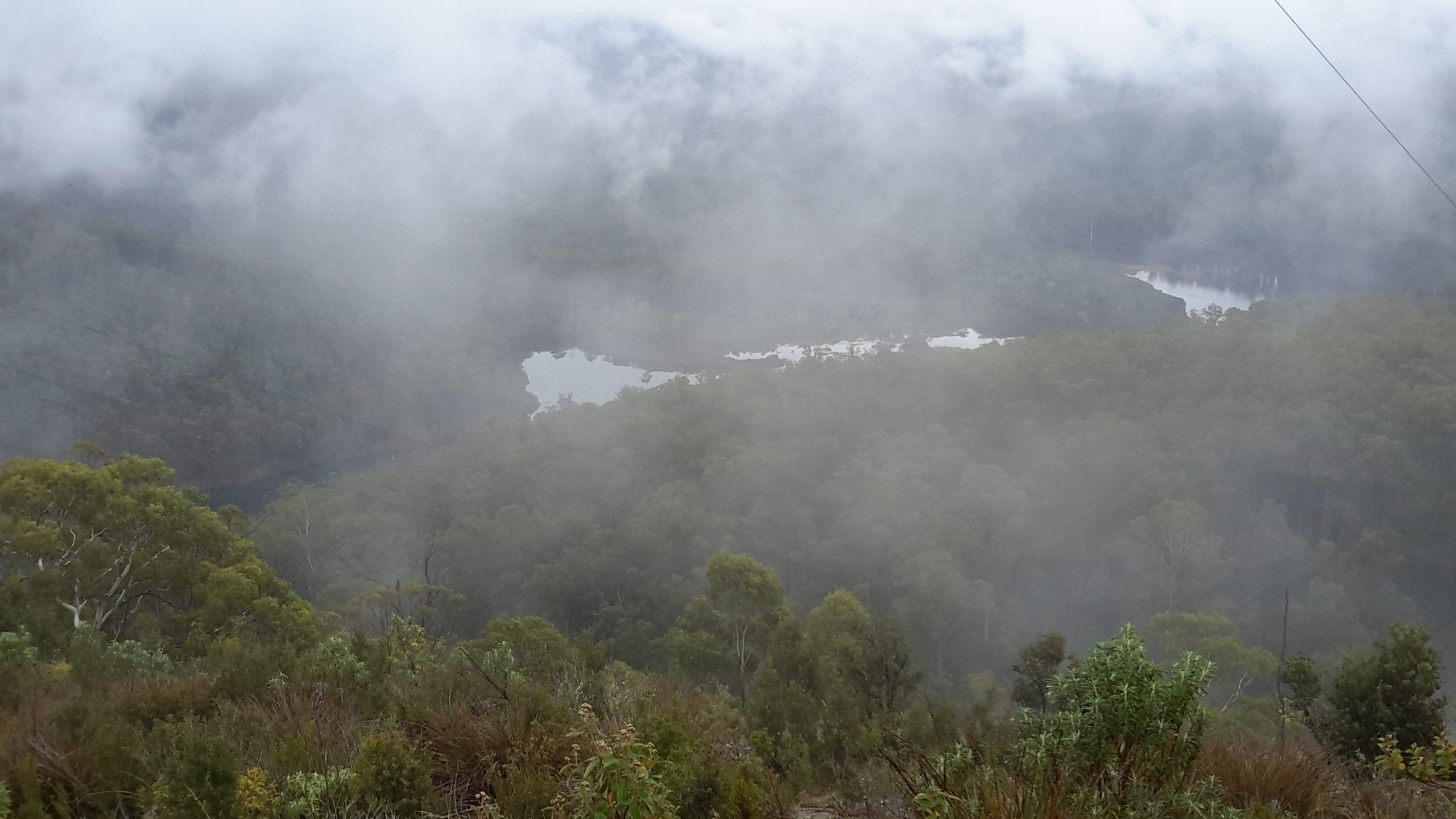
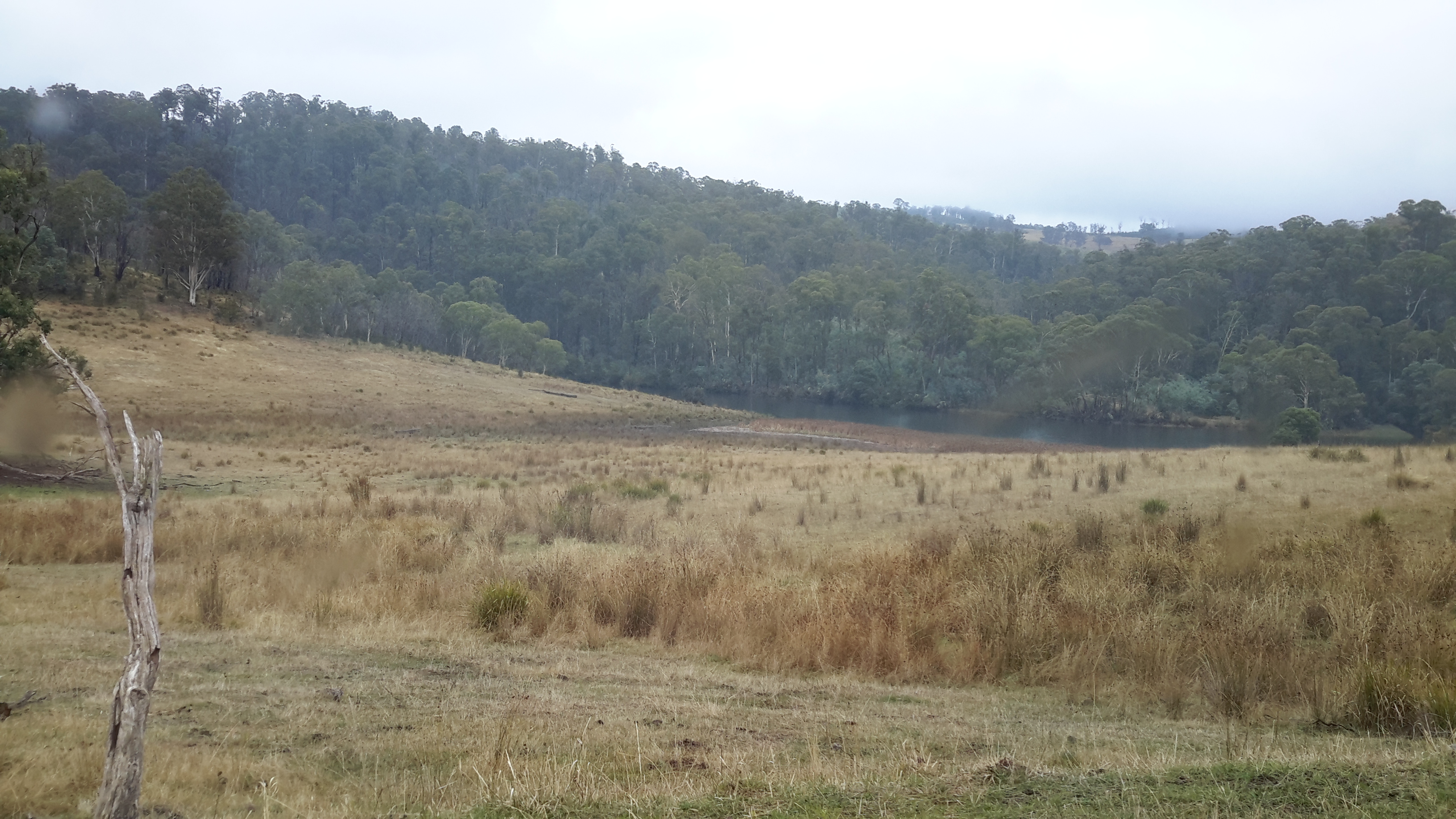
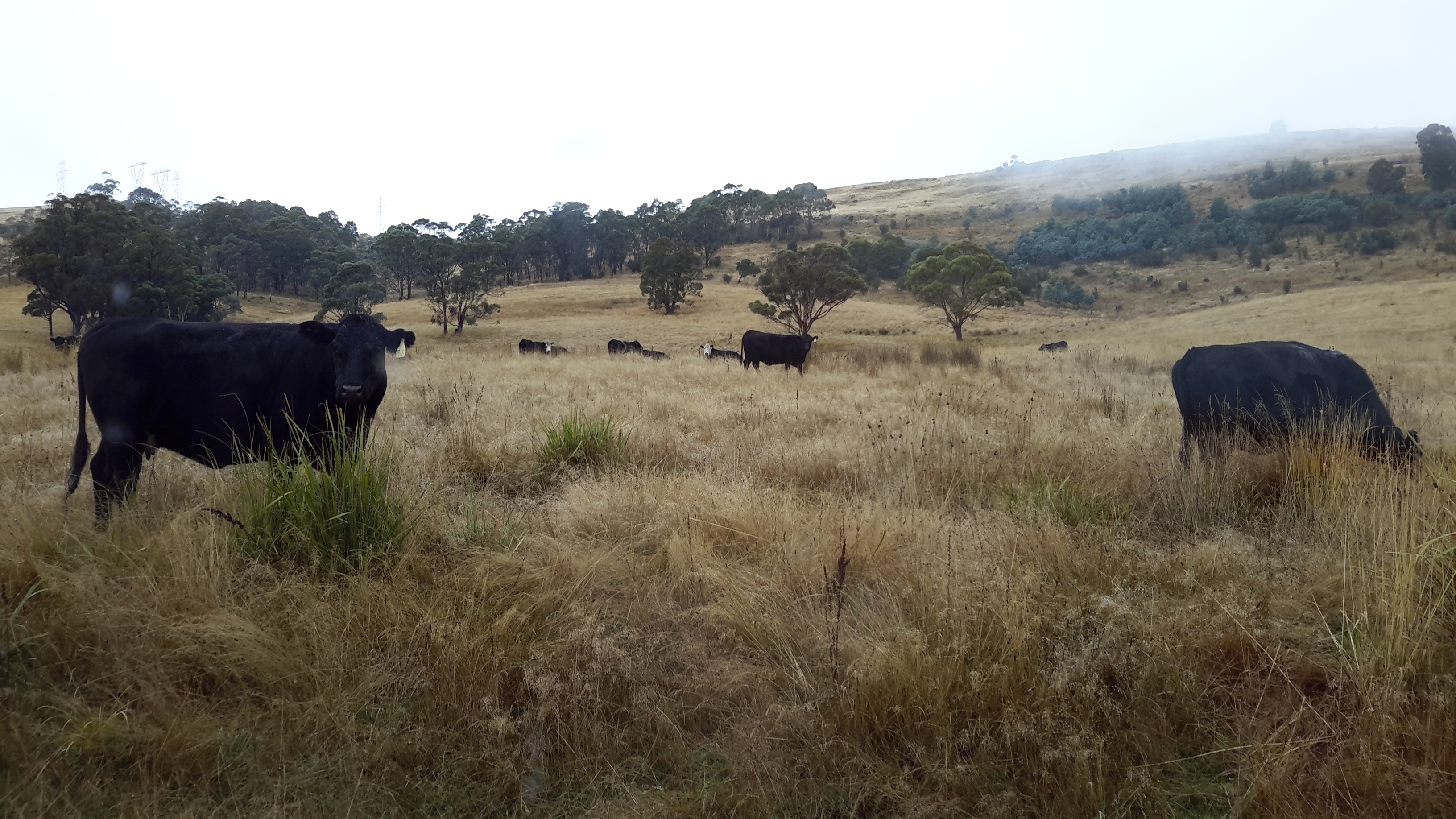
Early during my walk along Tasmania’s Derwent River from the mouth to the source, I was travelling near Repulse Dam on a reconnaissance trip when I came across two others.  It was a strange experience.  Previously I had become aware that two women planned, with assistance and support from others, and with the direct engagement of specific groups of people in some parts, to walk from the mouth to the source.  That day, as Andrew and I drove around for me to suss the landscape and the walking route options, when I saw two women seeming to do the same, we stopped them and I asked questions.  ‘Yes we are those women’, said Justy Phillips and Margaret Woodward.  I am sure they were as surprised as I was.

Since then, Justy and Margaret have made their way alongside various parts of Tasmania’s Derwent River and arrived at Lake St Clair where they were Facebooked taking a dip in those cold waters, seemingly delighted with their arrival.

Their project was very different from mine.  In my case, I wanted to walk around the whole of the Greater Hobart Area, and then to walk every metre of the way to the source at St Clair Lagoon dam.   By contrast, Justy and Margaret walked alongside parts of two Derwent Rivers; Tasmania’s Derwent River and the other in Cumbria England.  The experience of and learnings from their walks were used as part of the basis to write what they describe as a ‘fictionella’; written in the form of text artwork, similar in appearance to poetry.

That book is titled Fall of the Derwent. In this website you can see  range of photographs including two where Justy and Margaret are holding their black covered book.

Cover of book.jpg

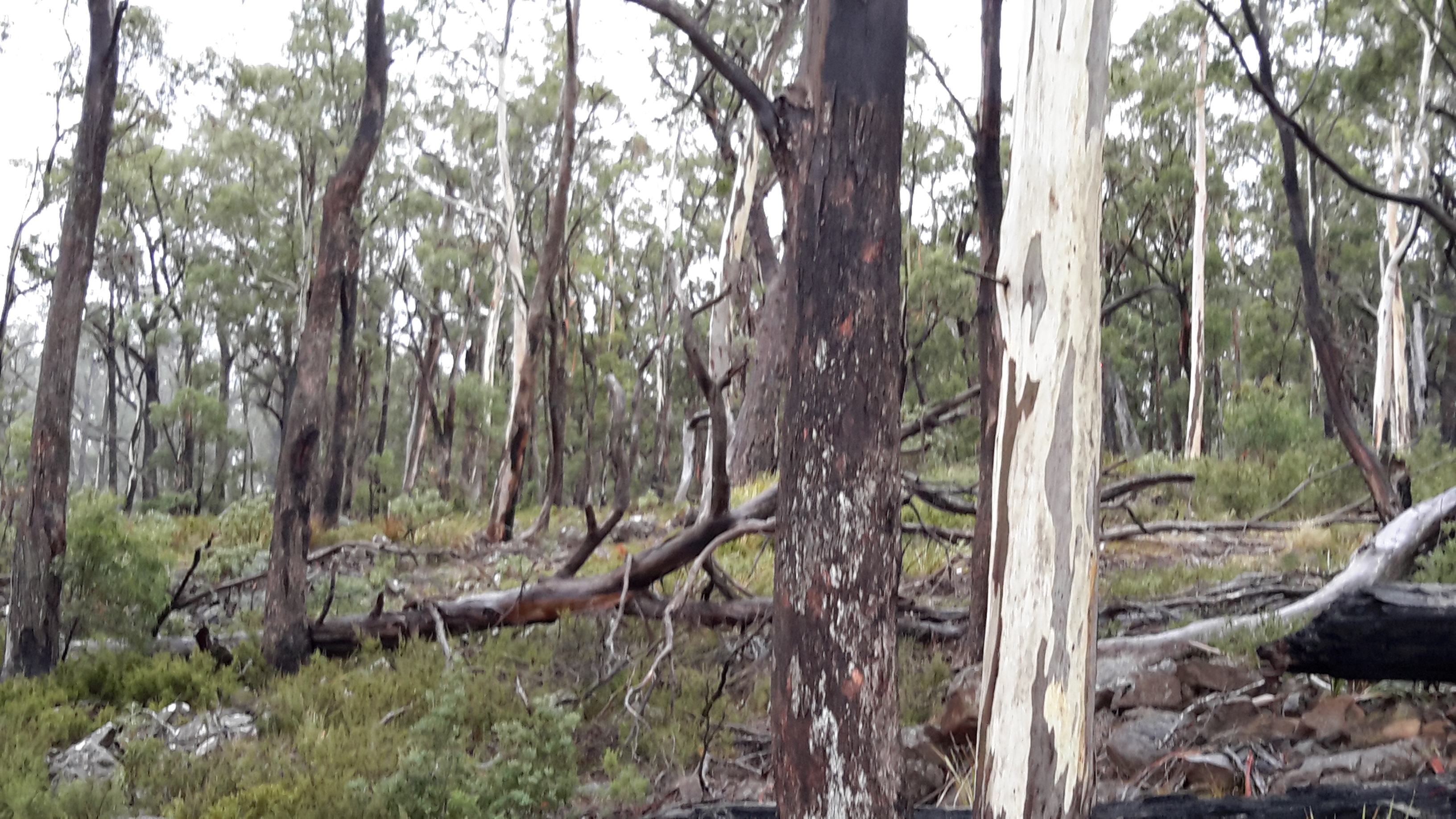
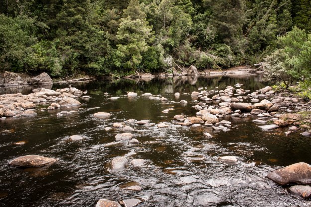
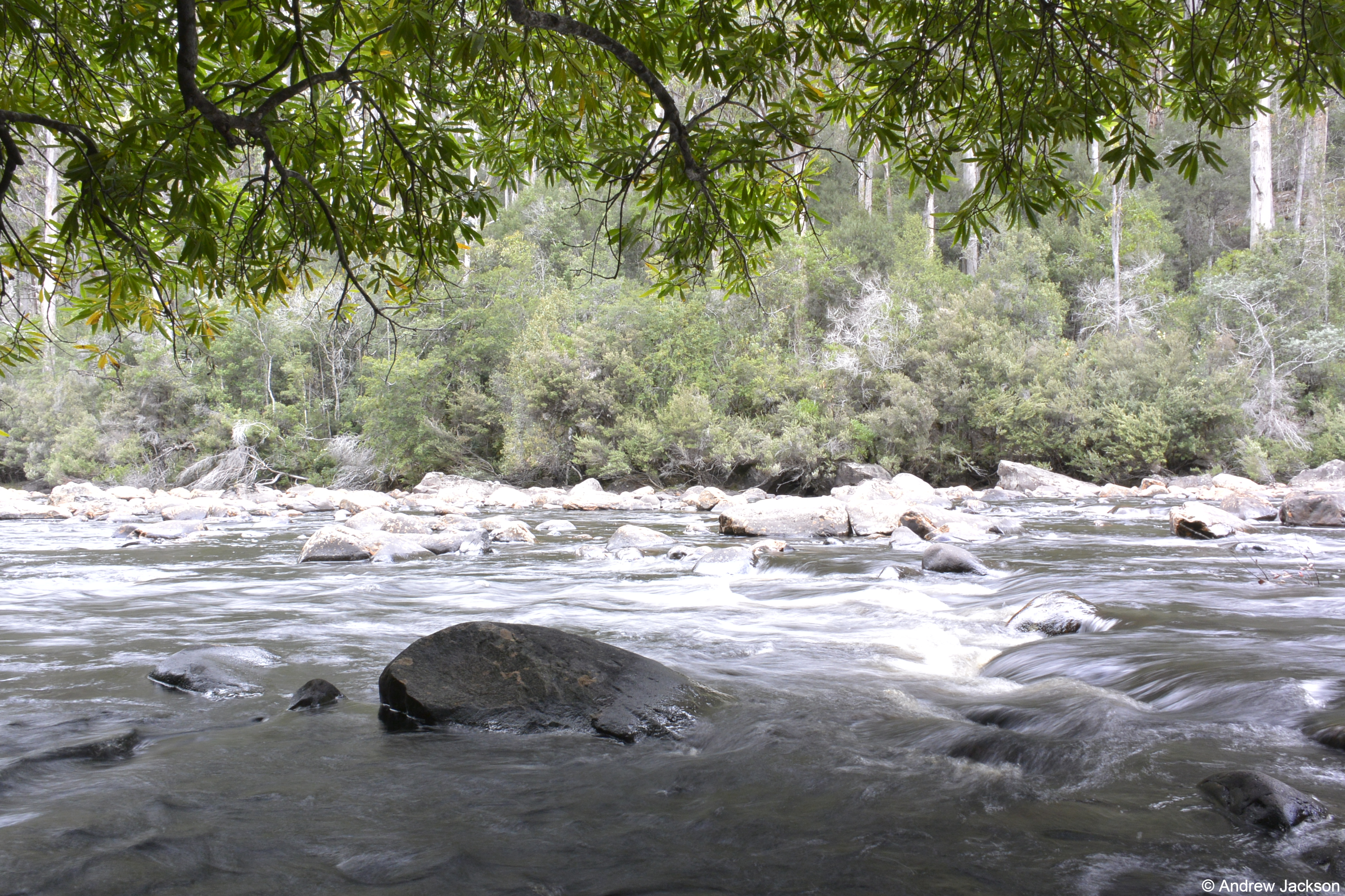
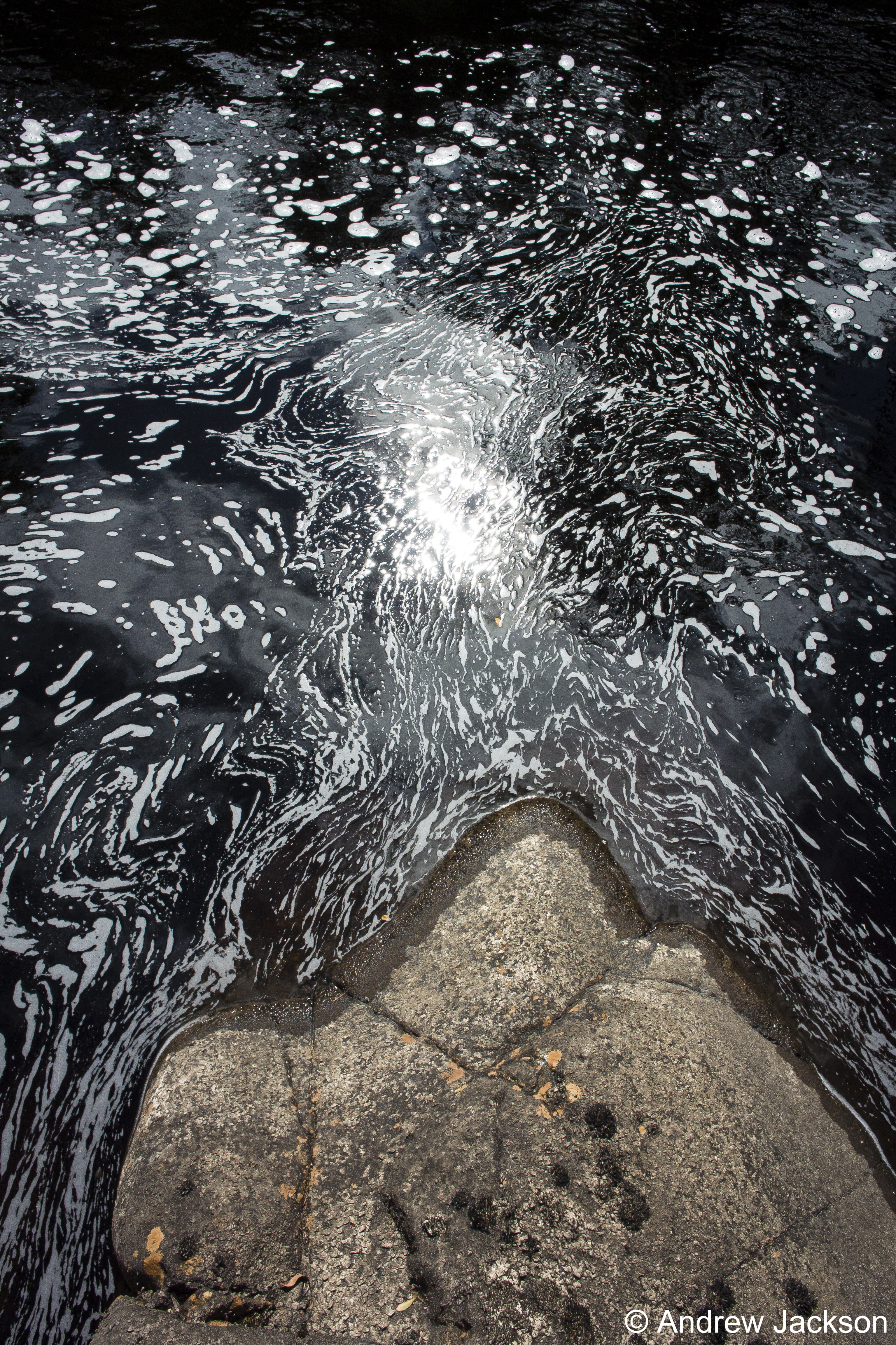
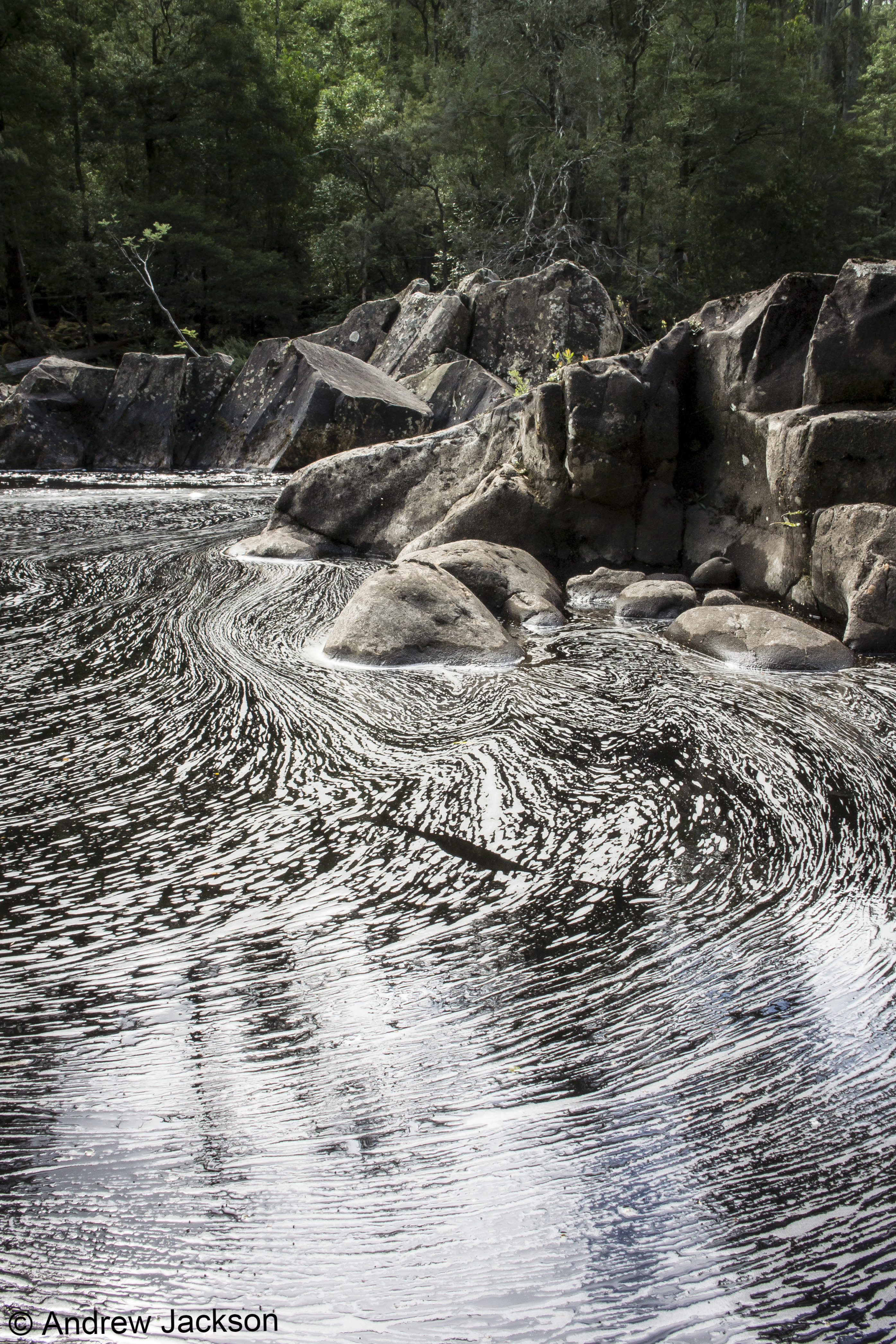
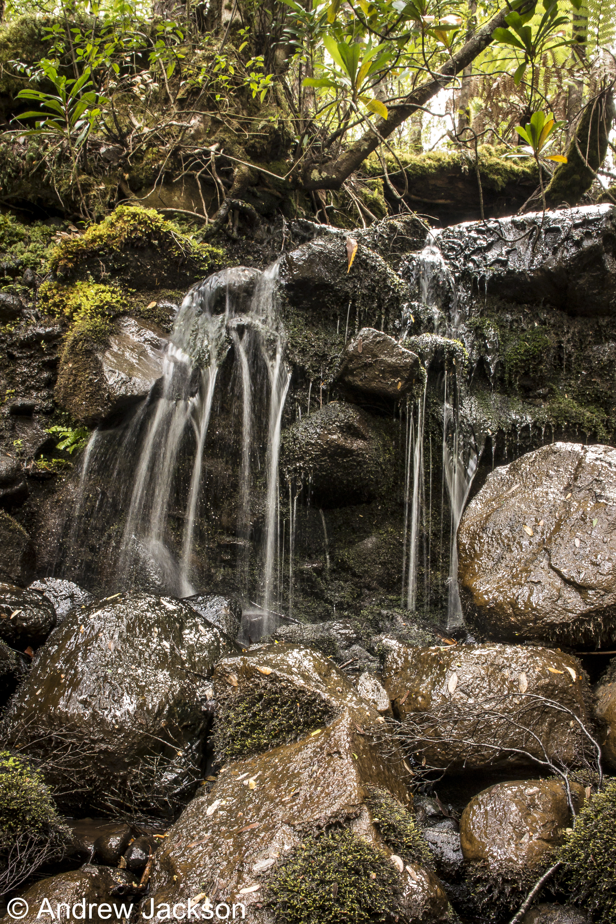
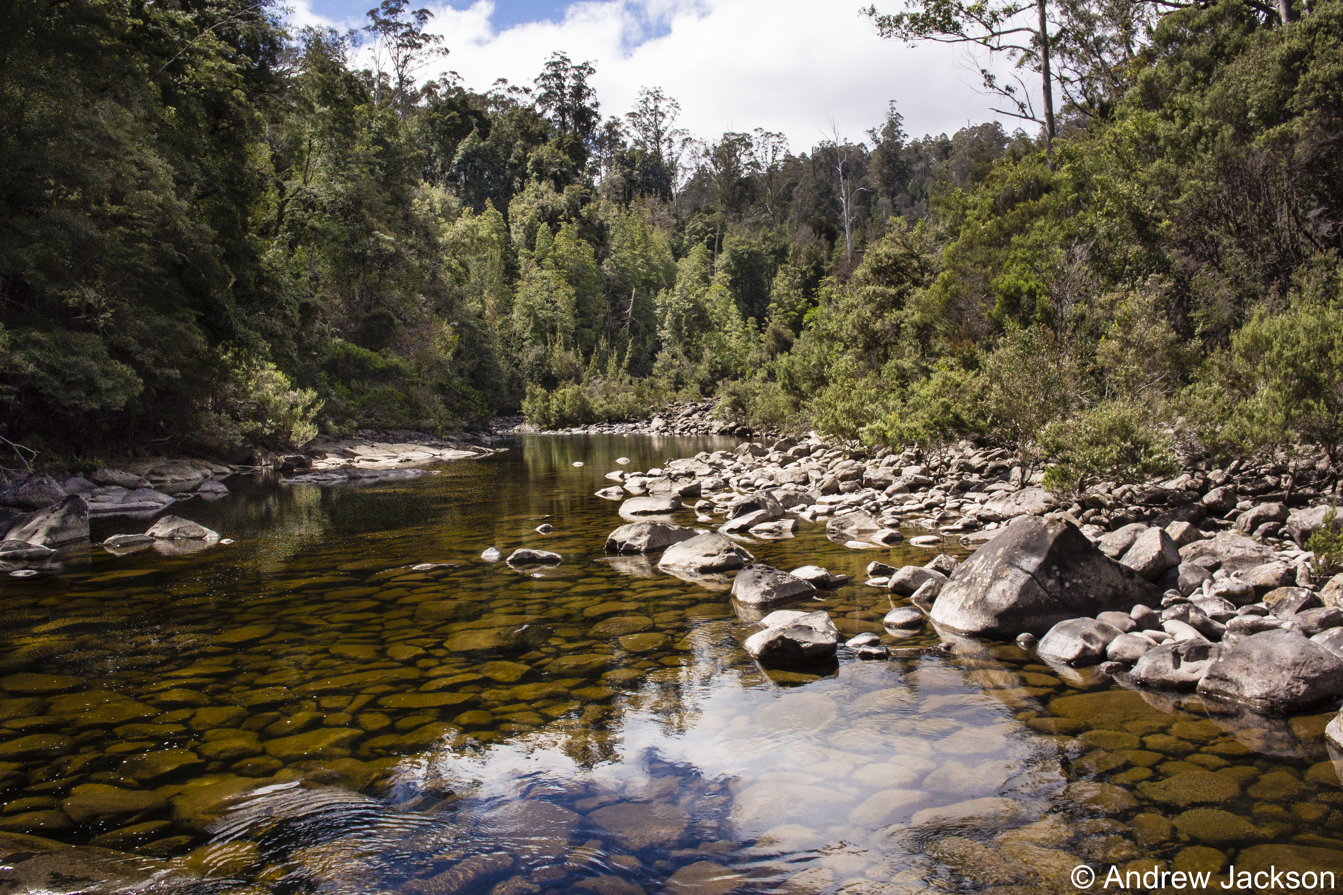
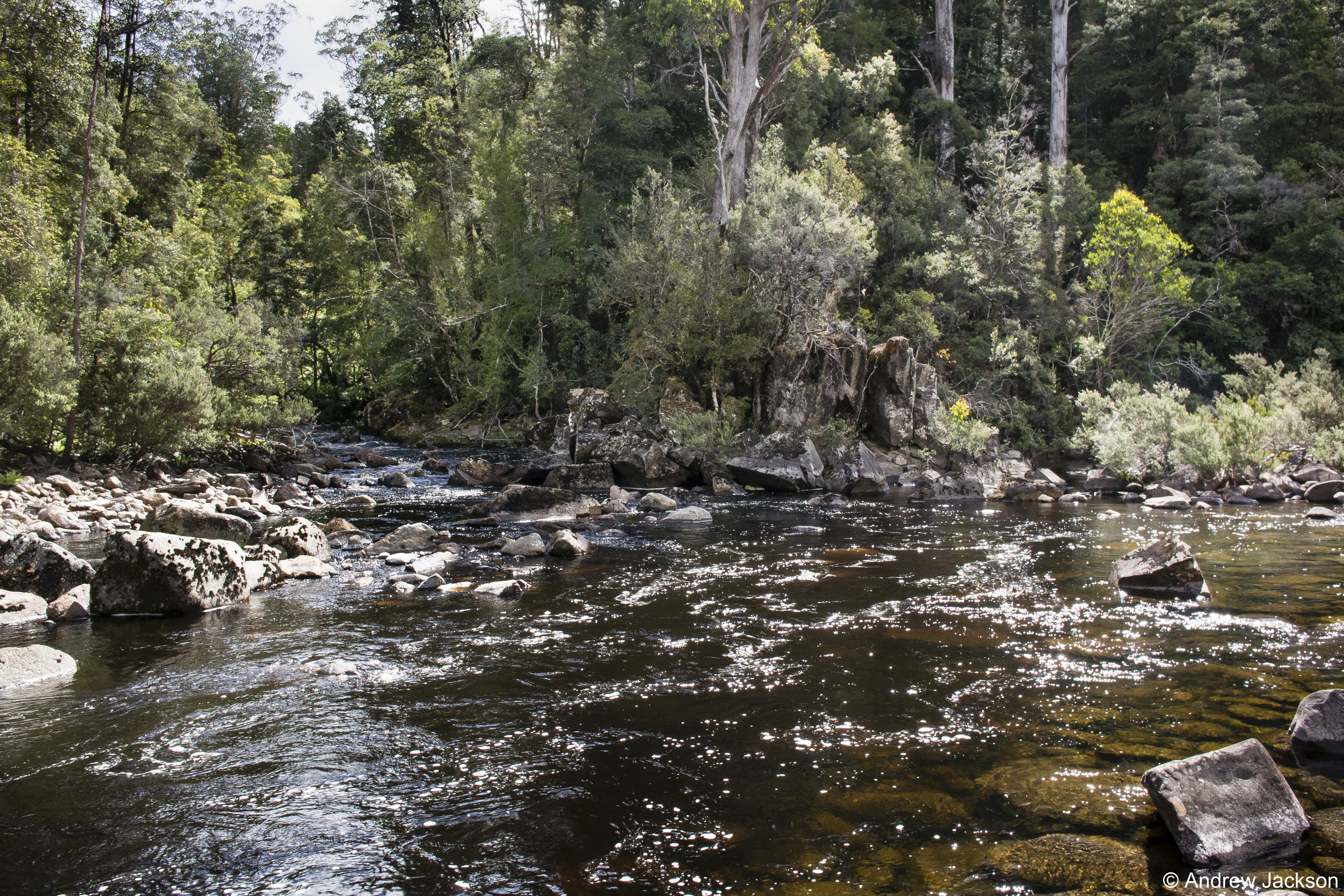
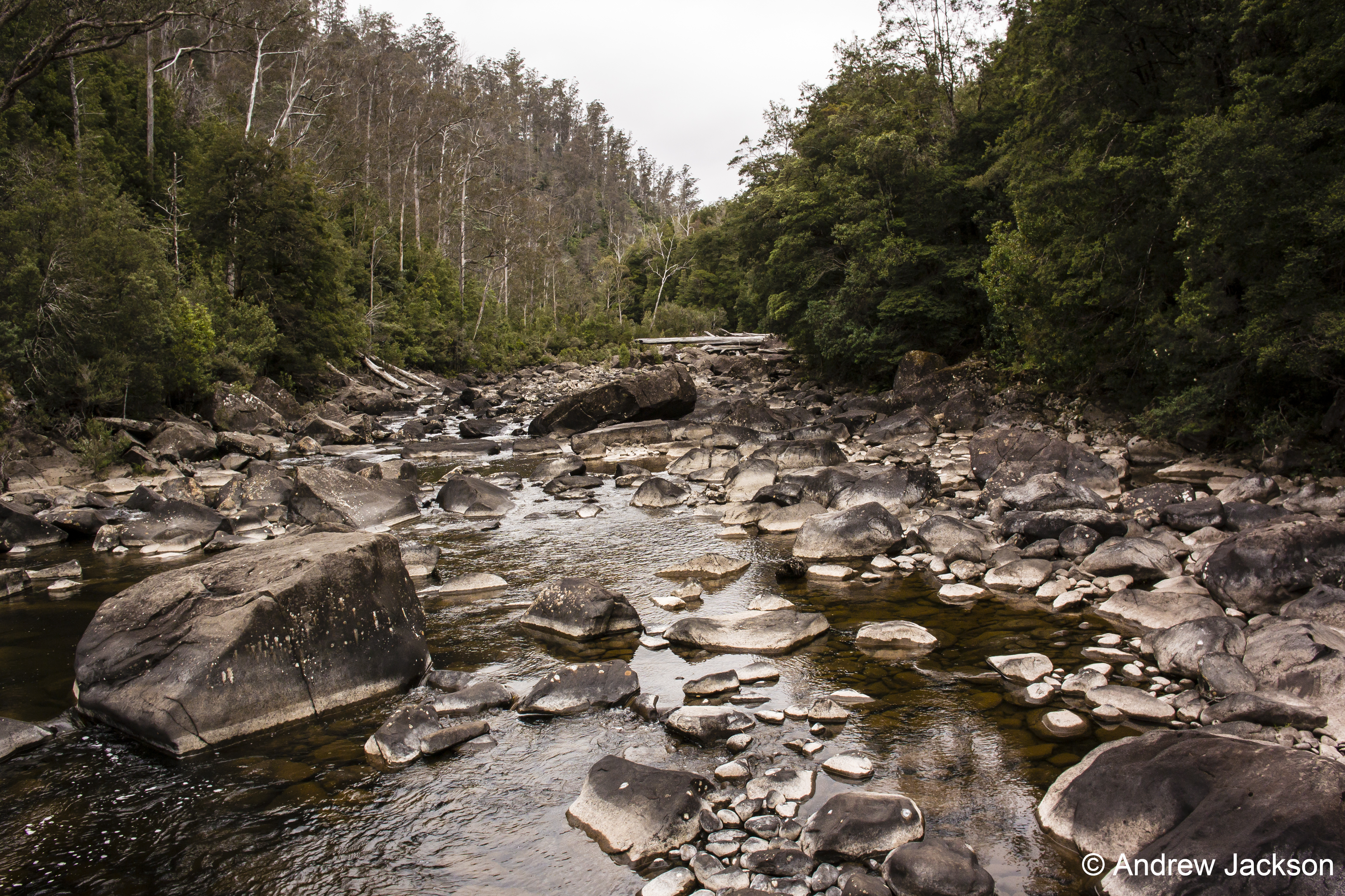
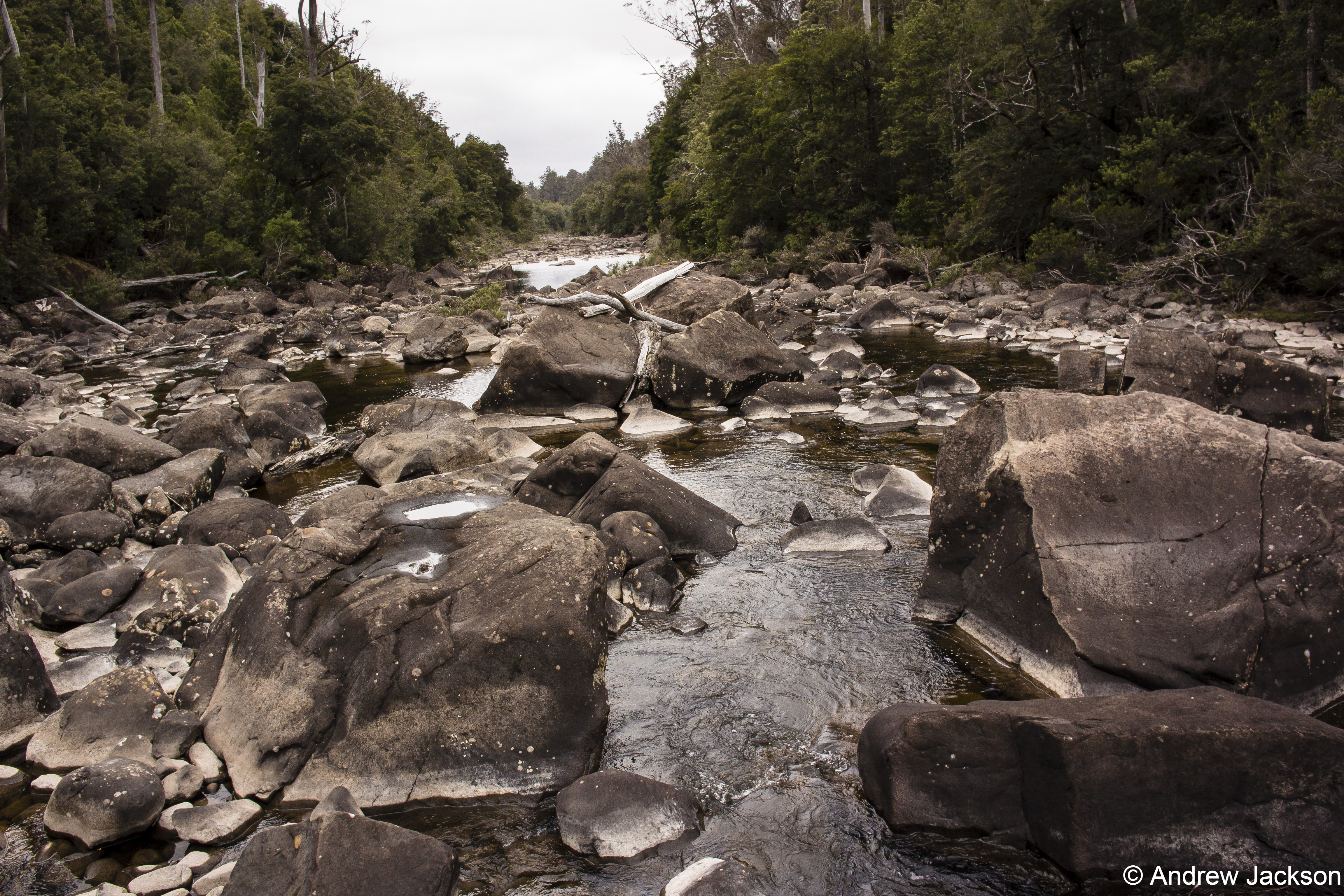
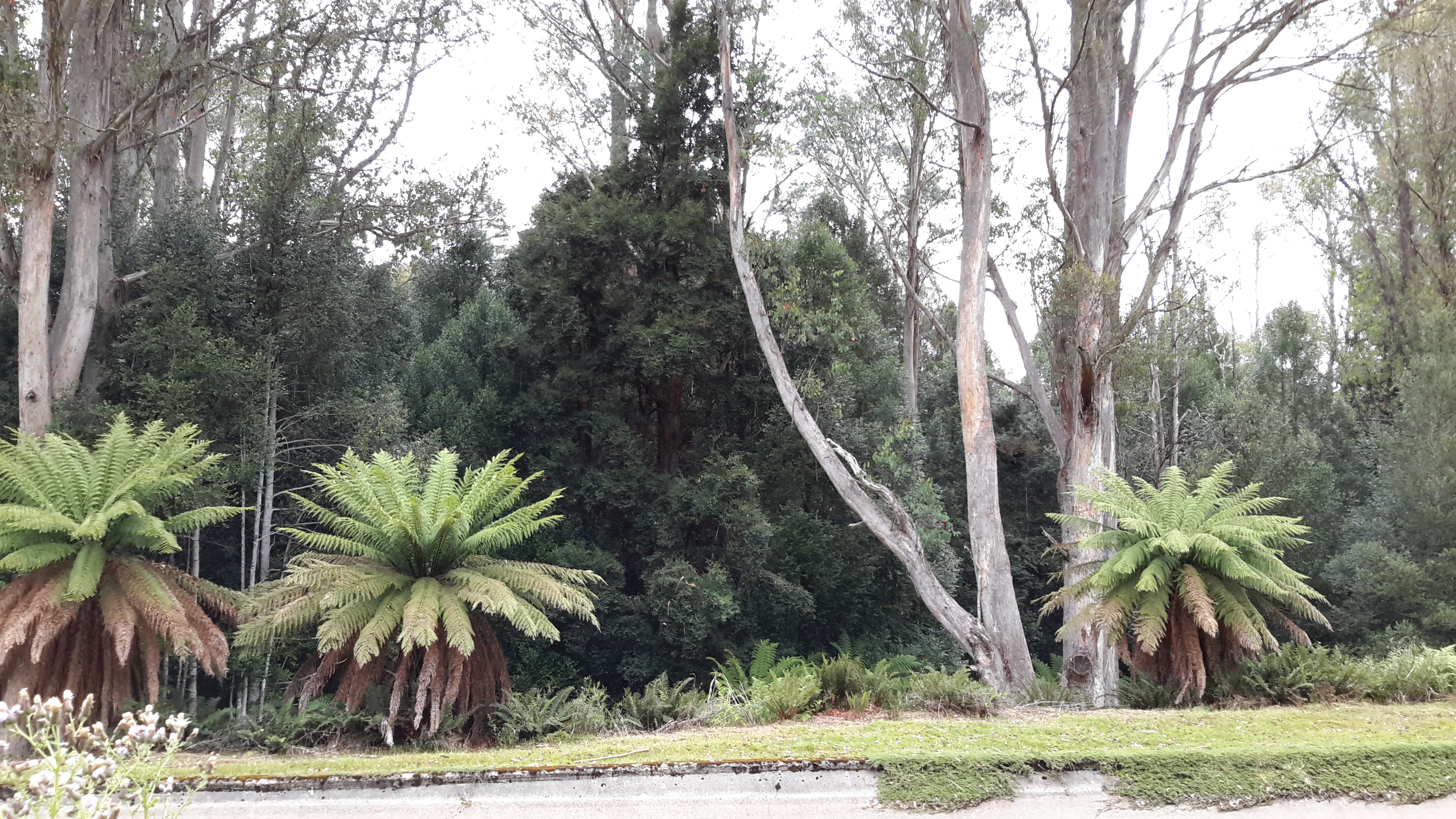
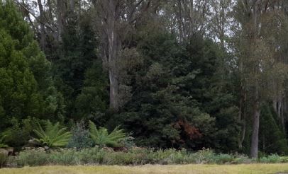
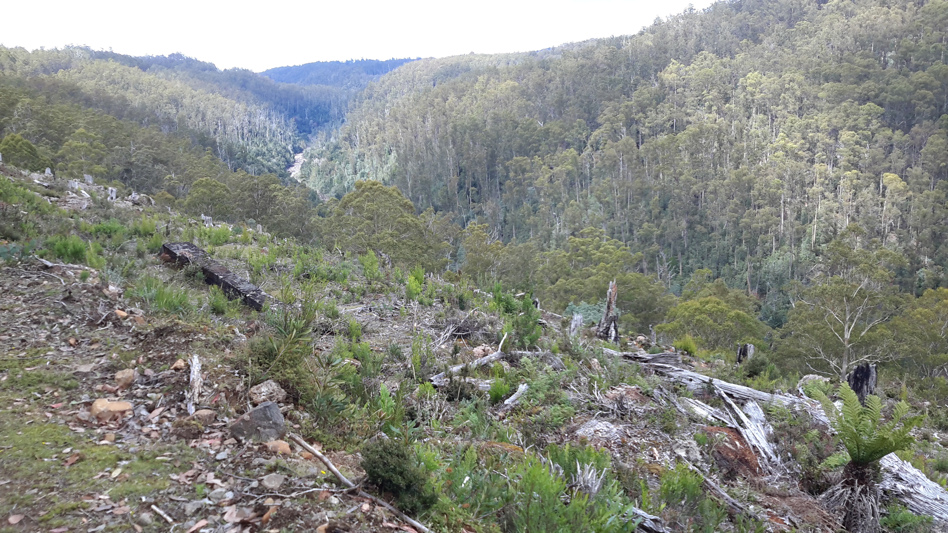
The title of the book references a drawing by an early Tasmanian surveyor George Frankland which he named ‘Fall of the Derwent’.  Colonial artist Thomas Bock engraved the image and James Ross printed the picture in The Hobart Town Almanac in 1830. The picture was drawn at a site near unpassable rapids on the Derwent River upriver from New Norfolk.  When Justy and Margaret walked past what they believed was that place, they took a suite of black and white photographs;  half a dozen or so of these images are bound into their book.  Without returning to that area I seem to remember the spot.  After reviewing my photographs in that area, clearly I was looking for serenity and simplicity.  I was looking at colours and contrasts.  It seems I was focusing on one way of seeing that world of the Derwent River, and Justy and Margaret’s view is an alternative.20150917_094036.jpg

20150917_095352.jpg
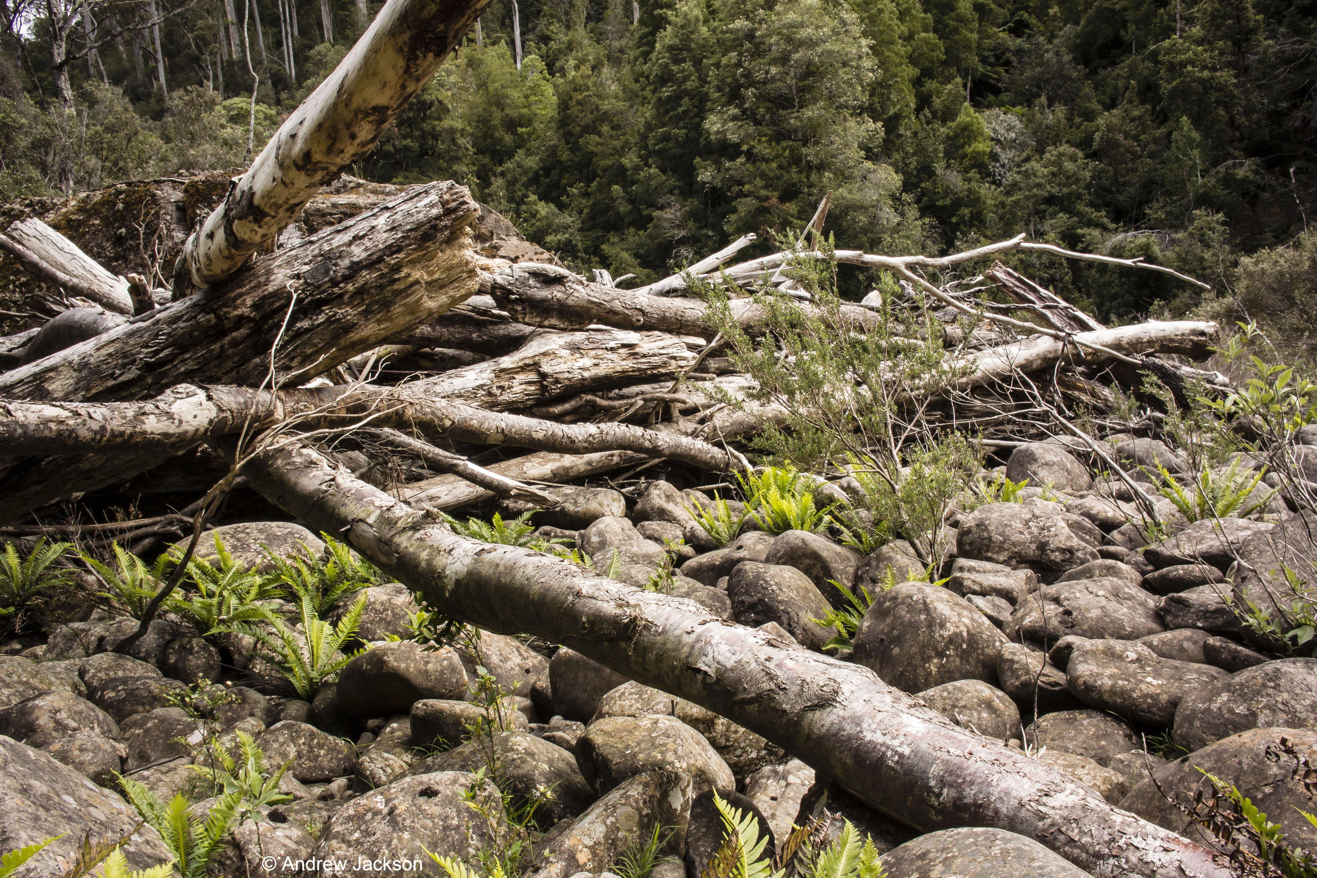
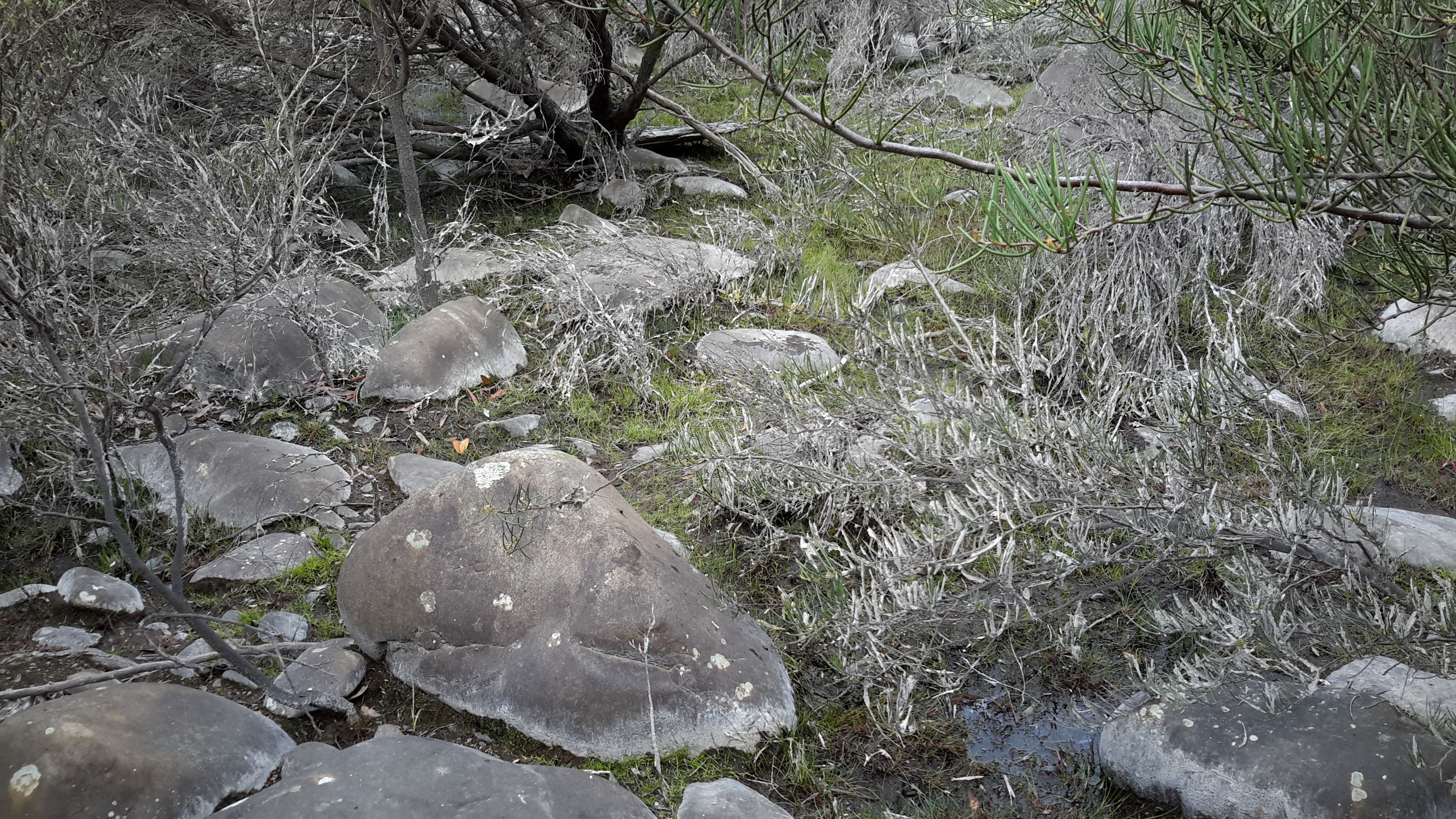
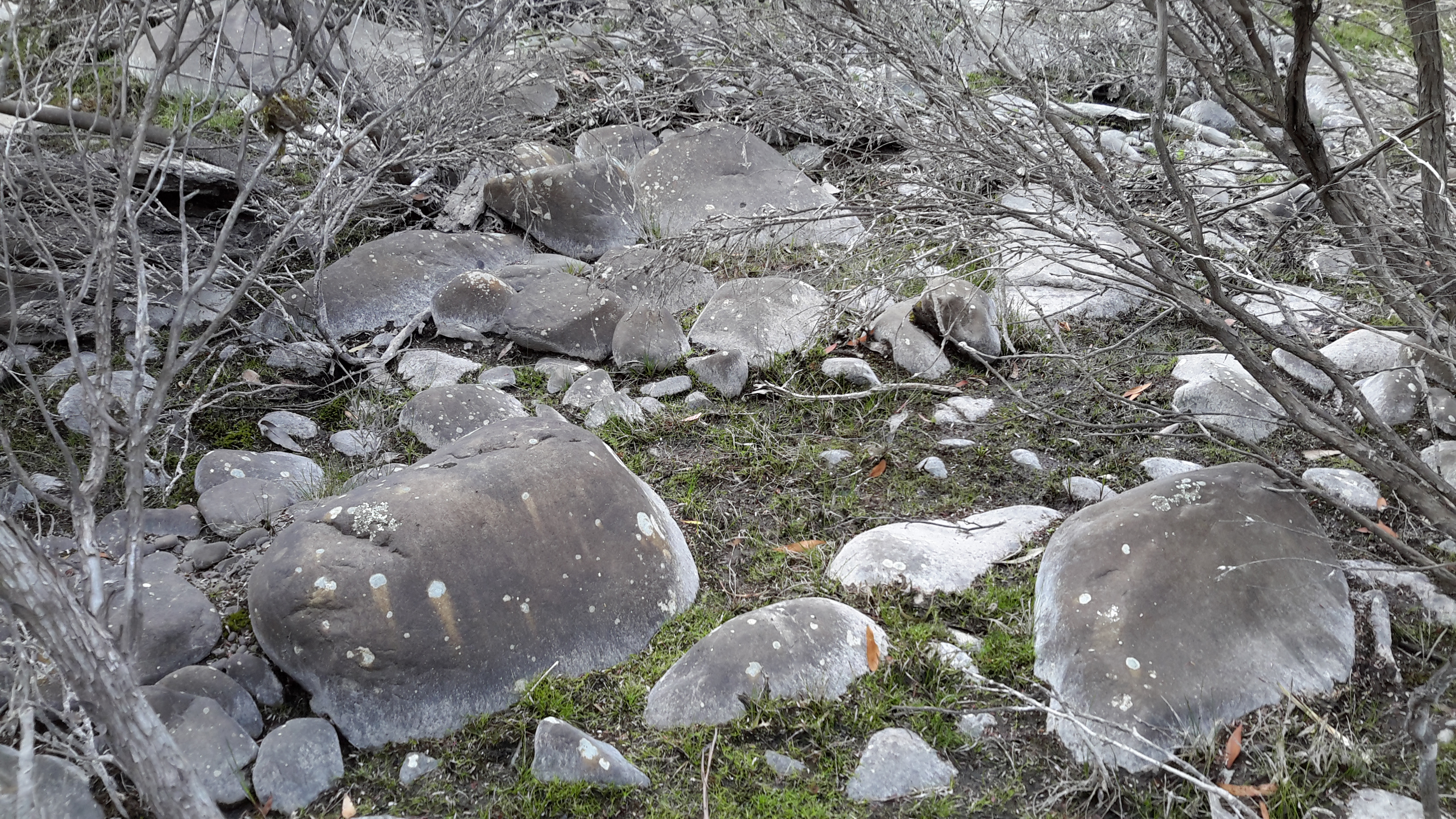
I did not focus on the twisted interlacing of stark and scrappy vegetation at the river edge like Justy and Margaret have done  The differences in our images is a reflection on the different nature of our projects. I wanted to entice others to be seduced by the beauty of the landscape and then to make their own journeys along the river edge (I now wonder why I didn’t see vegetation tangles as beautiful).  When I read their book it seemed they wanted to use their experiences as the basis for creative abstract thoughts; perhaps even a metaphysical approach involving questions such what is there in that world and what is it like at a more profound level.  My approach was literal and descriptive.

The Phillips/Woodward Fall of the Derwent publication presents poetry-styled ideas and comments in ‘chapters’ headed by the days of the week; the book proceeds over  44 days consecutive days – but the ideas associated with both rivers are intermixed.

“Let us begin with two rivers / And a Dad not long for living. / Two daughters …”

Despite the introductory lines, theirs is not a chronological story connecting the sequences of walking the two rivers; reference is made to other locations such as Cape Barren Island, Dover Point, and Brisbane. And the English father walked with Justy and Margaret when they traipsed near the Cumbrian Derwent. As an intertwined overlay in this book, mention is made of his declining health – Dad in pain, no longer able to feed himself, no longer speaking.  For this reason and for the manner of writing which removes easily identifiable meaning through much of the publication, this book has a limited audience and is obviously a set of personal ideas to be understood, remembered and perhaps loved by the authors. For their personal satisfaction. I was surprised that this book uses combinations of words that do not create, for most of the book,  visual images of either of the two rivers. Instead, the poetry reads as a meshing of many experiences which presumably helps Phillips/Woodward to reconstruct a feel of those experiences.

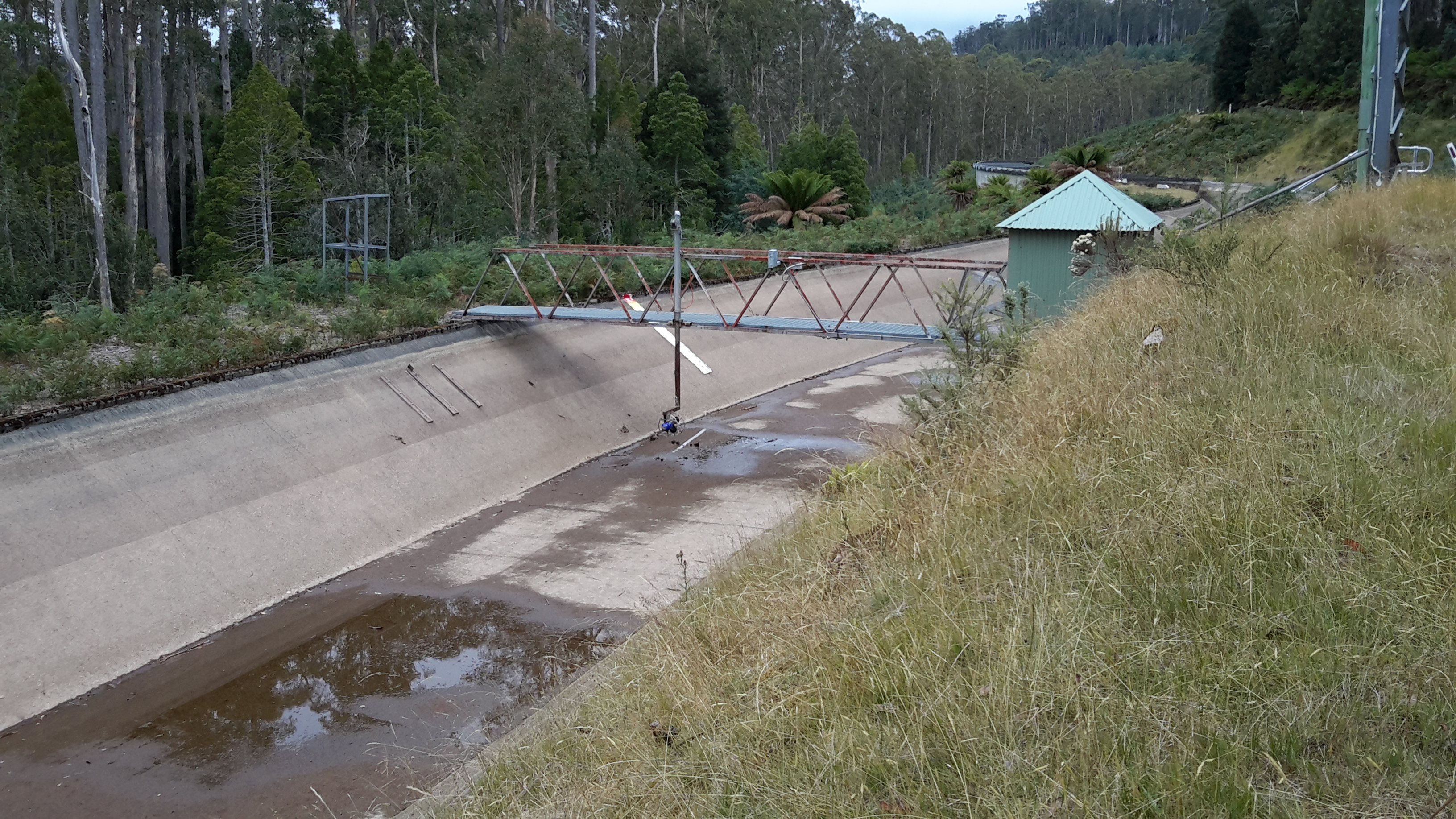
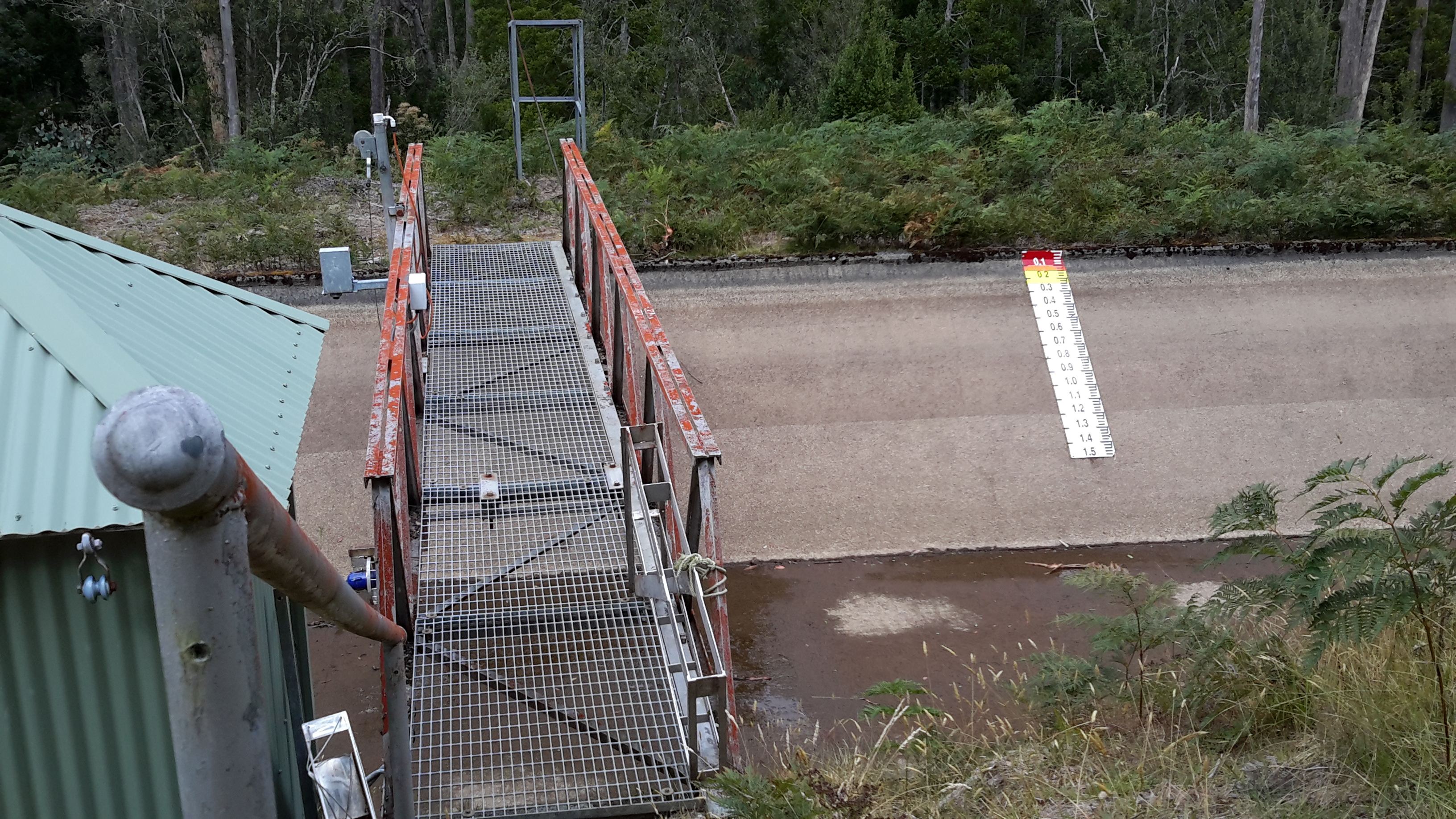
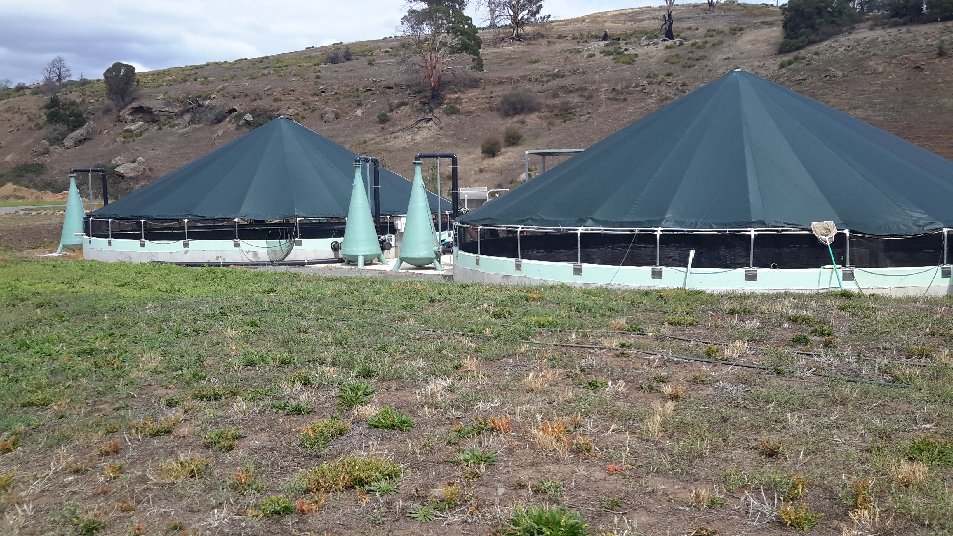
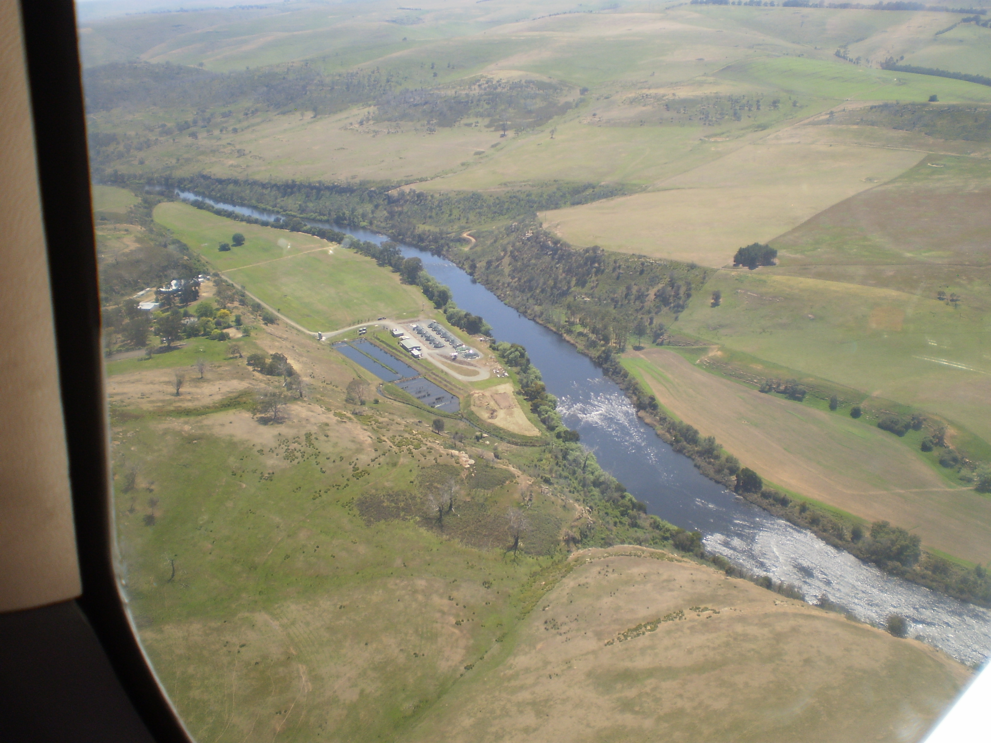
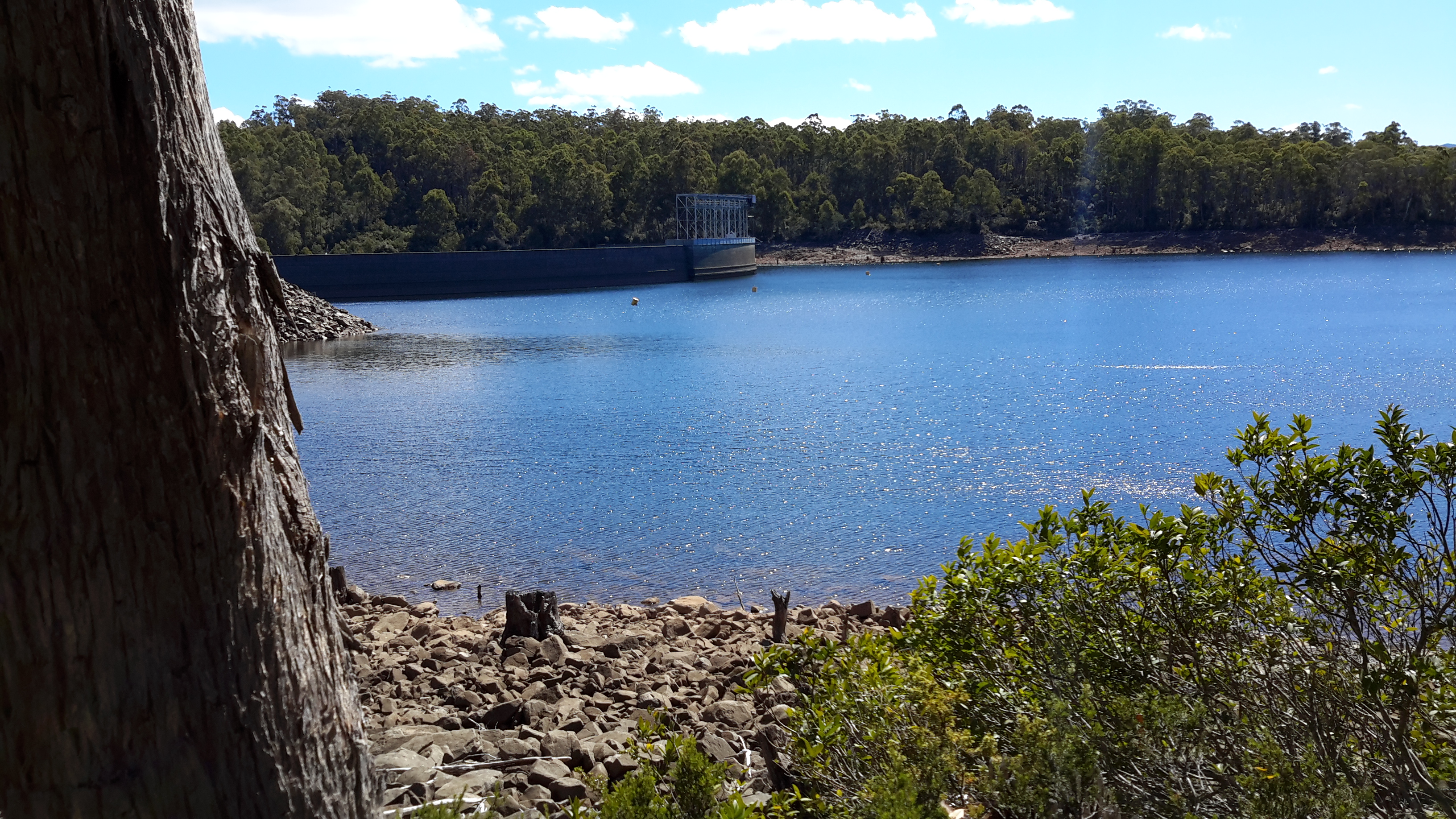
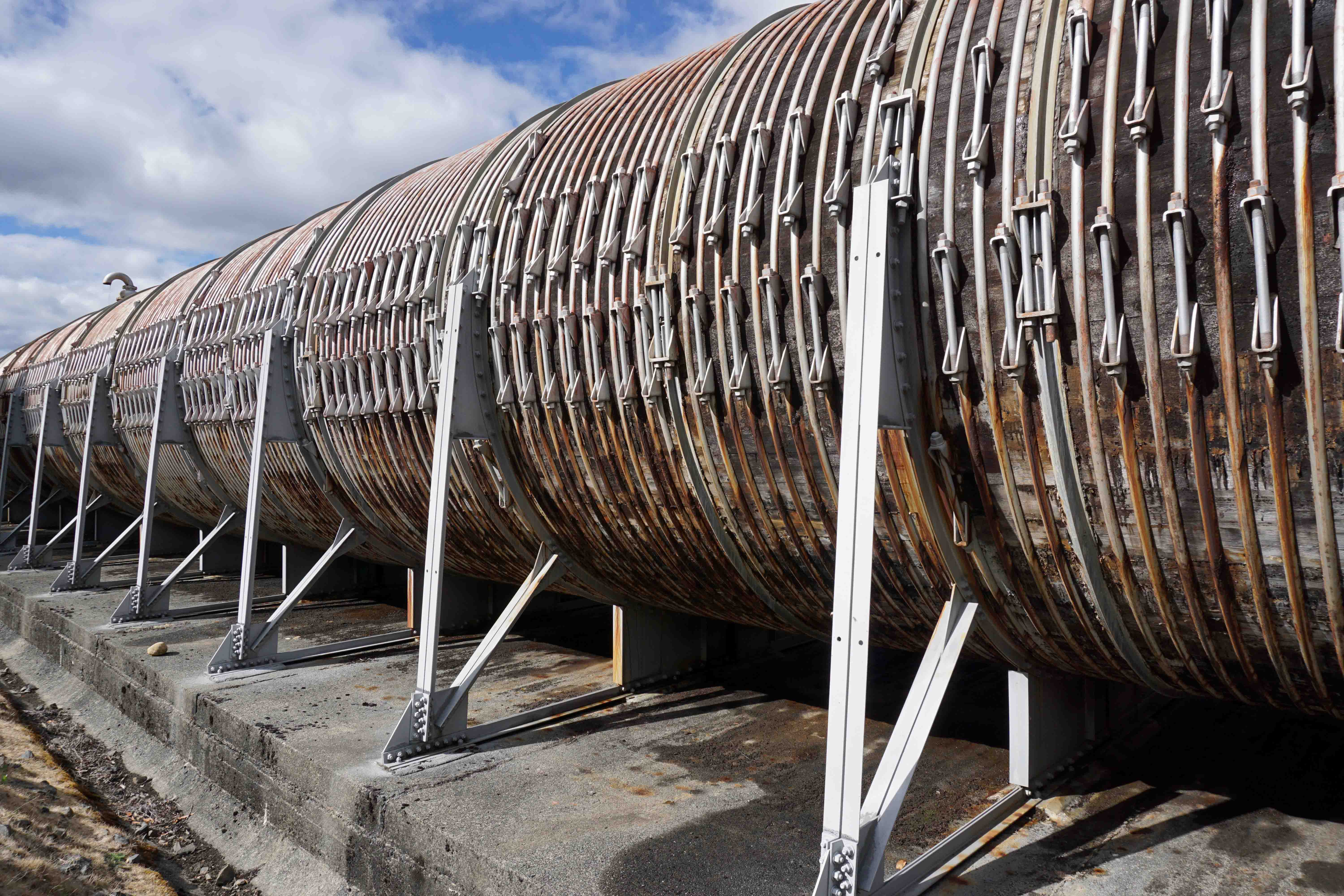
On occasion, where the meaning was clear because I could recognise specific locations, I enjoyed some of the lines. For example, “…rows of hops that string this neck of the river…” referred to the hop vines and their structural strings in the Bushy Park area.  These hop fields obviously made a significant impression on Justy and Margaret because there was a second comment on the same topic; “…the hops in single file march orderly disruption to the valley.”  Then, when they walked around the Wayatinah Power Station, “…the woodstave pipeline is a blistering gland … Draws the corset of her breathing”.  Like Justy and Margaret, I looked in awe at these two locations and their dramatic impact was described during my posts.  To remind you – here are photos of the hop fields and others of the wooden pipeline.   20150918_104145.jpg

20150918_113007.jpg

20170424_114515.jpg

DSC01655e.jpg
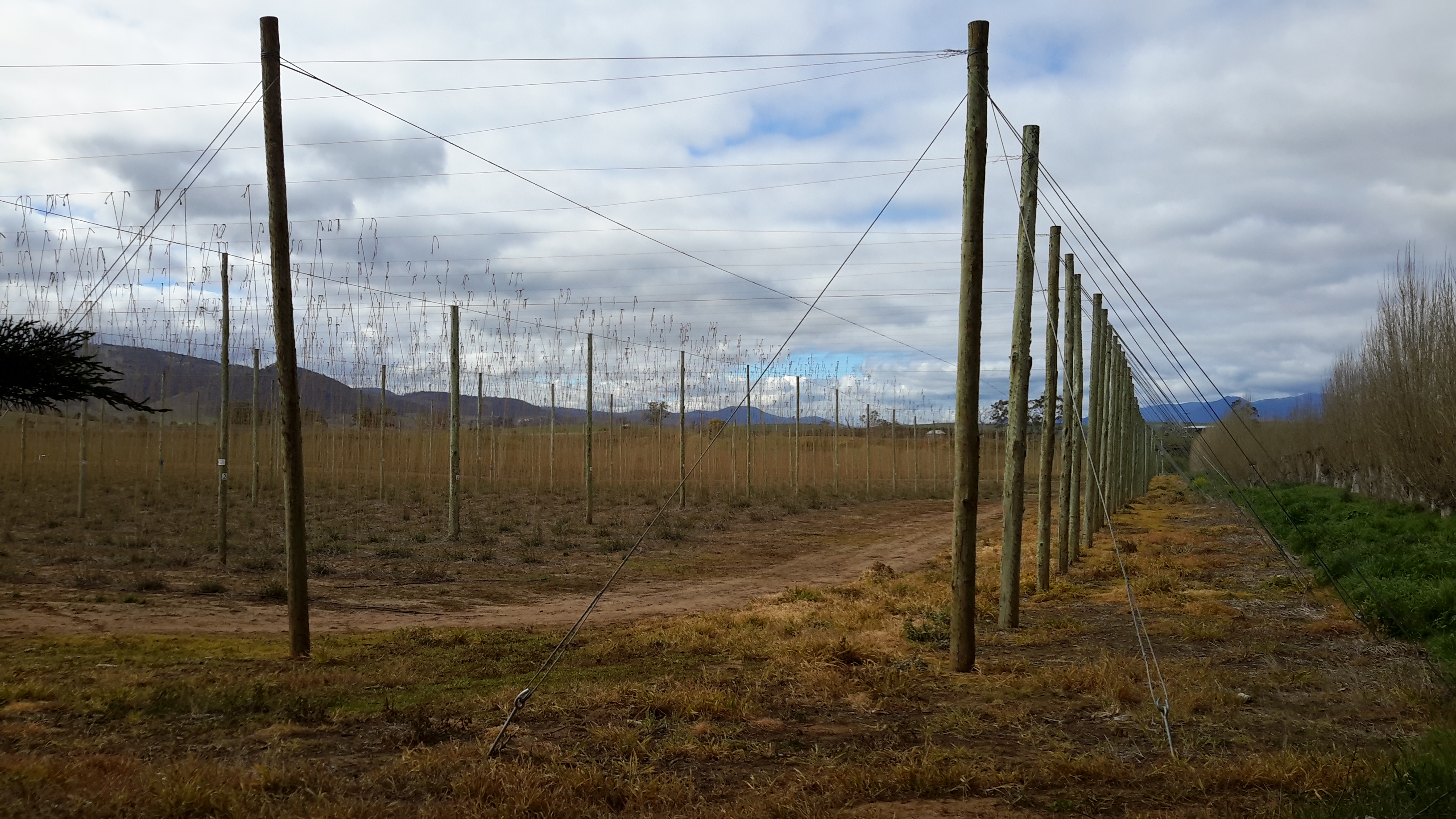
Justy and Margaret learnt in Cumbria; “On the banks of the River Derwent, that the term ‘black market’ is born. Through the illegal trading of graphite.”  Then they found graphite was part of the geological structure at Wayatinah on Tasmania’s Derwent.  From these findings, grew the idea to play with ‘black’; the book’s cover is black, some copies are cloth bound and impregnated with carbon powder, the Fall of the Derwent and ‘black’ are interconnected within the text, and one section of the book presents a list of locations along Tasmania’s Derwent which include ‘black’ in the name; examples include Black Bob’s Rivulet and Blackmans Bay.

Phillips/Woodward’s book Fall of the Derwent was part of a public artwork presented in association with GASP (Glenorchy Art & Sculpture Park) in 2016. Further information can be accessed here. If you click on ‘Download Hydrographic Score’ you will be able to read the book online.

From Catagunya to Wayatinah – post 4 of 4

I took a series of forest photos most of which are blurred. I am adding some here to give you an idea of what parts looked like – sorry about the quality.

20170424_113247.jpg

20170424_111909.jpgThen the white shape of the Wayatinah Power Station appeared between the tree trunks.

20170424_114138.jpg

20170424_113538.jpg

The closer I came to the Wayatinah Power Station the steeper the hills seemed. For vehicles travelling down the road, the final gradient requires a low gear in a 4WD. The drizzle on a day like the one on which I went, meant the clay and soil track surface was exceptionally slippery and dangerous for the inexperienced or inept.

Then I was out in the open again. This time looking down to Lake Catagunya past the Wayatinah Power Station.

20170424_114211.jpg

To my right, additional infrastructure punctured the sky.

20170424_114227.jpg

20170424_114340.jpg

Further up the hill and connecting to the huge surge tank, the snaking length of wooden penstocks started.  See my earlier post for more information about wooden penstocks here. Can you remember the wonderful photos which Andrew took in this blog posting?  My photos are less detailed but still show the dramatic line of the penstocks.

20170424_114338.jpg

20170424_114345.jpg

20170424_114515.jpg

I ended the day with a thick coating of mud on my boots and a smile on my face. Yet another day offering me a memorable experience along the Derwent River. I am especially grateful for the extensive information and access provided by GL. Please note that private and corporate owners control access to this section of the Derwent River and the many gates are locked with an assortment of sophisticated processes. General public access is not available.

From Catagunya to Wayatinah – post 3 of 4


I followed a road aiming to intersect with the transmission lines ready to follow that towards Wayatinah to the extent it would be possible.  Massive heavily forested gullies made continued close access to Lake Catagunya (full of Derwent River water) impossible.

20170424_110654.jpg

Even the cleared area wasn’t clear enough for anyone to walk through on foot, although it was sufficiently clear to keep the power lines unaffected.

20170424_110907.jpg

When I stood on high, misty wisps reshaped distant hills and threatened to obliterate views of Lake Catagunya. Fortunately I could always see its glistening surface way below.

20170424_111136.jpg

20170424_111350.jpg

On top of the second last hill before reaching Wayatinah Power Station, the western end of Lake Catagunya appeared through the clouds.

20170424_111533.jpg

Before long the metal pipeline streaming water into the Wayatinah Power Station became visible.

pipelinewpscropped.JPG

Often the bush was amazingly quiet. This film  seems to be without sound. Only near the end can the faint crarking of a crow be heard.  This bush silence was an unexpected beauty of my day from Catagunya to Wayatinah.

From Catagunya to Wayatinah – post 2 of 4

Since Andrew had walked this way, much rain had fallen so that any chance of crossing Black Bob’s Rivulet somewhere near where he walked was zero.

20170424_105020.jpg

I continued back to the old Cooma property through more locked gates.

cropped Cooma.JPG

The owners were in the distance checking on some of their animals. Incredibly healthy cattle wandered around the unfenced land. Big curious fellows.  Superb condition. Beautiful black coats. Brown coats. Mixed colours.  As usual I talked to the animals.

20170424_102825 cropped.jpg

20170424_102856.jpg

cropped cows.JPG

Elsewhere, I watched a large family of yellow tailed Black Cockatoos raucously calling from tree to tree.  On another occasion a rush of coloured parrots whipped through the bush with astounding speed.

A large number of gravel roads and tracks meander over the hills between Catagunya and Wayatinah. Many do not appear on maps. Without a compass a walker could spend hours taking useless tracks – apparently people have been known to become so disoriented they find themselves way north of the river and after many kilometres back on the Lyell Highway.  In part, the tracks were created to service plantation forests  grown after original native forests were cleared and burnt.  The other user is TasNetworks, the State company which travels around to access the electrical power transmission towers and to check the levels of vegetation  along the transmission lines.

Since massive bush fires many years ago in one part of the area between Catagunya and Wayatinah, the remnants of hundreds of hectares of pine plantations have created a problem for the forestry industry. The small remaining stands of living trees are awkward to reach and not profitable to harvest.  Much of the land is covered by burnt parts of trees none of which can be used.  The cost to clear seems too high. Lost money. Lost opportunity. And lost original native forests. Nature always attempts to reclaim its place however in practice this means that those plants which breed well and grow quickly can create monocultures no less damaging than the single species plantation forests . In parts along the burnt out section, native plants that act like weeds such as some wattles are already taking over.  Monocultures do not a forest make.

The finish is in sight – towards Wayatinah post 9 of 9

Once walking on the hard and consistent surface of the Lyell Highway, good speed was made walking for approximately 8 kilometres, until Andrew reached the turnoff to the township of Wayatinah, pausing only for the passage of multiple camper vans, hire cars and enthusiastic motorcyclists making their winding way between Hobart and the West Coast. This was an extremely unpleasant piece of road for pedestrians.  The road was designed in remote central Tasmania with never an expectation people would walk along its edge.  The result is that verges are narrow or almost non-existent, and guard rails often sit at the top of a dramatic drop. I know elsewhere I have needed to hop over such guard rails when vehicles approach and hold on for dear life so as not to fall down a massive incline.  But Andrew survived the walk with care.  Earlier plans to walk with pleasure listening to music through ear phones had to be abandoned in order to listen for traffic speeding around tight corners in the winding road.

After walking to the Wayatinah township Andrew continued downhill to the bridge over the Derwent River where his vehicle was parked. A moment of concern flashed through his mind as he approached.  When walking towards his ute Andrew could see a couple of guys including a burly chap wearing a high-vis vest hovering around the vehicle and peering in the windows. Oh Oh. Was this someone about to break into the vehicle and steal it? Had he arrived just in time to prevent such a loss? As Andrew approached, the chap called out, “Is this your bus?” “Yes!”, Andrew replied, somewhat relieved.  “Thank God you’re alive!” The fellow was a SALTAS salmon hatchery employee and, rather than having an intent to interfere with the vehicle, he had been deciding whether to call the police. He had seen the ute parked unattended for over 24 hours and feared that a fisherman had fallen into the river and disappeared!

Andrew explained that he was not a fisherman but a bushwalker and then proceeded to describe the project to walk the Derwent. The employee emphatically declared it was not possible to walk the full length between Wayatinah and where Andrew has started the walk the day before. “The river can’t be walked, the country’s too steep!”  He felt the project to walk the Derwent was “nuts”. “You can’t walk down there’.  It was useful to have confirmation supporting Andrew’s experience.

After dropping off his pack at the ute, Andrew then wandered upstream for a few hundred metres to the weir where SALTAS has a water intake.

_DSC5821-1.jpg

He then continued on a track for a further few hundred metres until he reached a bend in the river where there is a flying fox for what looks like Hydro Tasmania equipment. Beyond that point familiar-looking scrub fringed a river bank which steepened quickly and dramatically.  Further walking on the river edge was clearly impossible from then on, and the volume of water in the river made walking in the river impractical.

_DSC5822-1.jpg

_DSC5823-1.jpg

With that, the Tarraleah to Wayatinah section was essentially complete – complete except for about 4-5 km of winding gorge which was undertaken higher up away from the river bed and its edge.

I am so very grateful for Andrew’s persistence with the walk, his notes and his wonderful graphic photos. From these I could ‘feel’ the journey.  I felt my heart soar when I saw the photos. I could feel the rush of the water, smell the freshness of the bush, and hear that clean ‘noisy’ atmosphere of the terrain. They took me out there.

As I had imagined, this was a walk compressed tightly into a narrow valley, over rocks and around water pools and flood debris for endless kms. With steep sided hills pressing in on both sides, there were no vistas or panoramas just the sight of the next corner ahead.  Never a chance to get a walking rhythm.  This was a walk which held both physical and mental challenges.  Other than where to put his feet next,  Andrew’s greatest ‘problem’ could well have been associated with ‘when will this relative sameness ever end’. While he saw snakes sunbaking on the river rocks, he was never in danger. He didn’t turn an ankle and he was able to walk out and live to tell the tale. Bushwalking always involves endless problem solving and I have always felt it is likely to be an activity that could stave off dementia.

One of my hopes was that there would be things to see or hear that are not normally seen – and that Andrew would experience completely new things which will thrill him.  Seeing the Counsel River gave him that excitement and he has planned to return, albeit getting there from the land on the other side of the Derwent River and not via the River.

This was a walk conducted safely.  Andrew used his maps and GPS constantly to be pinpoint his location and monitor progress. For example, walking through the plantation forests without this equipment could have been difficult because maps are out of date and endless new unsignposted roads and tracks exist which do not always follow contours. Getting lost would be easy.

That Andrew accepted having clothes ripped, and his body scratched and bruised in the quest to see if something was possible, is completely admirable. Even a week after the walk, one spectacular bruise on his shin (caused by slipping between two lumps of wood) was still working its way through the green and yellow stages of healing. This is not a walk which others should try; it was rough and the walk was mostly hard going. Regardless, the country was amazing and the rainforests sensationally beautiful – “there were heaps of interesting forests, and cascading waters from the hills”.  I still feel thrilled that he undertook the walk and that there has been a new story to tell and photographic evidence of the journey to walk along the Derwent.

Time to set up camp– towards Wayatinah post 7 of 9

Less than a kilometre downstream from the entrance of Beech Creek, a number of islands sit midstream.  As the day progressed it became clear that it would not be possible to complete the descent to Wayatinah within one day. The walk was increasingly slow and the concentration required to make each step safely, increased fatigue.

As the hillsides closed in and became steeper, the opportunities for a suitable campsite became more limited. At 6.30 pm Andrew came across a delightful flat glade in rainforest on an island. It was a bit early to stop with only 9 km covered, but it was too good a spot to pass by and 8 hours of hard work seemed to justify the stop. The tent was pitched and, after a quick meal of miso soup and ‘beige’ flavoured dried food, the map was checked to determine the plan for the following morning. Then it was off to bed and straight to sleep in the midst of the constant comforting sound of water rushing by.

_DSC5784-1.jpg

A better camping spot would be hard to find!


Beech Creek and beyond– towards Wayatinah post 6 of 9

The water volume (in quantity and sound) increased again where Beech Creek announced its arrival, bringing water from the large catchment around Mt Shakespeare.

_DSC5769-1.jpg

Andrew reached this section of the Derwent around 5.45 pm. Approximately 9 km of the River’s length had been walked through the day. Having first arrived at the river’s edge around 10.50 am, clearly the difficulty of walking the river is apparent.

_DSC5765-1.jpg

_DSC5789.jpg

As the river level rose and the water speed increased, the process of walking downstream slowed. It was taking increasing time to find a safe route. The river was crossed frequently, looking for the most efficient route. At the same time, the river bank edges rose dramatically and the river entered a series of bends. The banks on the outer edge of the bends were invariably steep where the river had cut into the landscape, and the inner edge provided more exposed boulders. Between the bends were large, deep pools with the water moving more slowly. It became increasingly difficult to cross the river above or below these pools and a lot of time was spent scouting the best way forward. It sometimes became a choice of making a difficult crossing in sometimes fast flowing water; clambering up, over, around the flood debris on the river banks; or pushing uphill through tangling scrub and over fallen logs to bypass the cliffs at the water’s edge. Remember all of this activity occurred while carrying a backpack with the weight of overnight gear.

Only once did Andrew fall in the river; after all the inevitable small tumbles and stumbles this was the only mishap. Having picked a sturdy looking large rock to stand on, when it rolled Andrew landed waist deep but feet first in a pool of water.


Nature’s patterns – towards Wayatinah post 5 of 9


Fascinating patterns floated on the water surface at the edges of some pools where the Derwent River’s movement was slower.

_DSC5725-1.jpg _DSC5733-1.jpg

_DSC5738-1.jpg

_DSC5742-1.jpg

_DSC5757-1.jpg

_DSC5771-1.jpg

_DSC5776-1.jpg

_DSC5779-1.jpg


The creation of these white swirling patterns has been explained as follows: The natural tannins from button grass plains and other vegetation seeps into the soil and, with rain, runs off the hills into creeks and rivers. The washing of water over the rocks creates a slight foam. When in deep pools the foam gets pushed into back-waters and the continual slow movement of the water creates the lacework.  Mesmerising to watch the gradual changes.

Increasing water flows – towards Wayatinah post 4 of 9


The water in the river bed came from the many tiny creeks that flow off the surrounding hills, suggesting that even in the height of summer this part of the Derwent would never be completely dry. Some of these creeks seeped into the river bed while others entered by falling over small escarpments.

_DSC5690-1.jpg

_DSC5701-1.jpg

The further Andrew walked downstream, the more the river’s water level rose and the gaps between navigable rocks got wider. Hopping turned to leaping, and occasionally it was necessary to wade to get to another section of walkable rocks. It became a long game of “join the dots” as it was far easier to stay in the river bed than take to the banks and deal with the vegetation, much of which was infested with the flood debris.  Wet feet and legs became the norm.

_DSC5705-1.jpg

_DSC5707-1.jpg

The walking was pleasant with occasional patches of fine riverine rainforest, dominated by myrtles and sassafras, punctuated by tree ferns and moss. Needless to say, when Andrew was forced out of the river he preferred banks with less vegetation. The river valley showed no sign of humans having passed – perhaps the few who might have done so had travelled by raft or kayak during times of flood. The inhabitants seemed to be abundant birds, as well as snakes taking the opportunity for a quiet bask among the warm rocks.  Can you spot the sleeping reptile hidden in the rocks? How close would you have been prepared to get?

_DSC5686-1.jpg

The Counsel River joined the Derwent with a noisy cascade, framed by myrtles standing as a gateway to a secluded rainforested valley. A quick detour was undertaken to look through the gates to see lovely scenes of unexploited river and mossy rainforest – a beautiful place to revisit one day.

_DSC5724-1.jpg

_DSC5710-1.jpg

Below that confluence of rivers the Derwent now ran much fuller, with the water volume having doubled with the Counsel’s contribution.  With more water, larger and deeper pools of water spread across the Derwent and more wading in the dark water over slippery rocks was required to get ahead.  It was easier to walk when the river was wide and more rocks were above water enabling renewed rock hopping.


Onto the river bed – towards Wayatinah post 3 of 9


After a short (45 minutes) and steep walk Andrew chose the easiest exit and popped out of the forest and onto the Derwent. He felt pleasantly relieved that the descent had been easier than expected although ‘not a walk in the park’. At that point, the river bed was mostly water-worn dolerite boulders, but he was surprised there was much more water than expected (or wanted). While there was lots of water rushing around, thankfully there were also plenty of dry rock tops suitable for rock hopping.

There was a fair gradient on the river; the river drops 150 metres from the start of the walk to Wayatinah. The result was high noise levels as the water rushed downstream.

Looking upstream:

_DSC5682-1.jpg

Looking downstream:

_DSC5683-1.jpg

Swapping boots for Dunlop Volleys (good for river walking because of their excellent grip), Andrew progressed downstream hopping from rock to rock. It was not speedy as great care had to be taken to avoid twisting an ankle, but it meant dry feet.

_DSC5685-1.jpg

Occasionally great mounds of flood debris were piled high above the river level, and tangled in the scrub on the river banks – evidence that this was the summer-level of low water and that no water was coming over the Butlers Gorge dam spillway further inland.  While most tangles were at the river edges, one huge beaver-like dam was created by the obstruction of an island in midstream.  All of these required effort and care to pass over and by.  Awkward and unpleasant.   _dsc5760-1_DSC5762-1.jpg

Throughout the walk down the river, very often the water undercut the banks, uncovering tree roots and weakening their hold on the land – many had toppled across the river creating new impediments to progress.


From the visualisation to the actual – towards Wayatinah post 2 of 9

The question remained. Was walking this leg achievable? Was the Derwent River sufficiently friendly to allow humans to walk its length? With my feet and knees complaining every time I walk for more than a couple of hours, I asked friend Andrew to proxy for me and undertake the walk along the Derwent River from near Tarraleah to Wayatinah. Since Andrew is a fit, agile, very experienced and sensible bushwalker, I felt certain if he could not finish this leg of the walk then no-one could. Besides he has been a positive supporter of the project from day one and was happy to undertake the walk on my behalf.

At 6.30 am, the day started with a drive from Hobart to the bridge crossing the Derwent River at Wayatinah. After parking his ute on the Florentine Road near the salmon hatchery at Wayatinah around 8.30 am, a friend drove him westwards along the Lyell Highway to the junction with Butlers Gorge Road. Under overcast skies on a cool day, Andrew began walking next to Tarraleah Canal No 1 around 9.30 am and continued until he reached the first crossover walkway about one kilometre further on. This location promised the shortest distance down to the Derwent river bed.

_dsc5676-1

Andrew crossed, looked downhill and saw nothing but dense scrub ahead. He remembers remarking out loud “don’t dither, just do it. Don’t delay.  Here we go; just do it”.  At 10.10 am he left the Canal. Before stepping into the unknown, he spent time getting a GPS position fix and a magnetic bearing. Once set, he plunged into the thicket and took a series of sightings from one key tree to the next.  This allowed him to stay on his bearing, and meant he would be able to retrace his steps if the going was too tough and the forest impossibly dense.  The route down the steep slope passed massive tree ferns, smaller ferns, myrtles, mature eucalypts and the occasional Sassafras tree.  Many fallen trees littered the understorey and it was clear this was an old forest in a constant state of regeneration. Scrambling over or under logs and negotiating rocky bluffs was a normal part of the descent.

_dsc5677-1

_dsc5680-1

Half way down the steep incline,  it seemed that serious wind was blowing high up in the trees. Before long it was clear the rushing sound was the water of the Derwent River further below.  Once the river could be seen, then it was a comparatively simple process to choose the clearest path to the river bed.

_dsc5681-1

Visualising each walk in advance – towards Wayatinah post 1 of 9

The further I travelled inland towards central Tasmania, the less guidance and direction was available. This meant that I needed to scrutinise every piece of available information more intensely because the challenges of the terrain increased and therefore the dangers of walking alone multiplied.  My friends and relatives feared the worst and hoped for the best and we have all been thankful that my walks and returns home have been safe. Apart from the occasional bruise and scratch or two, no physical harm has befallen me.

During my first walks along the Derwent River, I gradually increased the volume of research I conducted in advance, so that I could make the most of each opportunity.  As the project lengthened, I spent more time visualising the walks so that I could be sure my pack contained the appropriate provisions. In addition, I wanted to be sure that I could achieve my goal.

In particular, I invested a huge amount of time imagining a couple of the walks. These were walks about which I knew very little and which I anticipated would be the trickiest.  One was the walk along the river starting near the junction of the Lyell Highway and Butlers Gorge Road close to Tarraleah, and extending to the bridge over the river at Wayatinah.

Using knowledge from my walk along Tarraleah Canal No 1 and from walking beside the Derwent River near the Wayatinah bridge,  I had some understanding of the challenges. My intention was always to start at the Tarraleah end and work my way downstream along the River bed.

The first obstacle was the dense bush between the Canal and the river bed down an exceptionally steep incline. From what I could see at the top, the rainforest was a tightly packed mangle of massive tree ferns with their fronds at face level and above, amidst all manner of eucalypts, myrtles,  celery-top-pines, sassafras trees and laurels.  If I was very unlucky intermingled with these wonderful but tightly packed specimens, I suspected the tree known as Horizontal (Anodopetalum biglandulous), the anathema to bushwalkers, could be a major impediment.

Photos near my imagined starting point show the beautiful but almost impenetrable bush facing the start of my walk along this section.

20160218_102537.jpg

20160218_101825 cropped.JPG

I believed I had two options; one was to walk along the plush mossy flat Canal verge until I could spot a ‘gap’ and then plunge into the thicket.  The second option was to walk on the track beside the Canal until I reached the first Hydro Tasmania crossing located about a kilometre westwards along the track,  cross over, and hope there was some sort of clearing through the bush down to the bottom of the hill.  If not, then I would have to make my own way until I reached the Derwent River bed.   The first crossing, in the photo below, shows no sign of tracks extending further.

20160218_104456.jpg

20160218_104534.jpg

From that crossing down to the river, I anticipated the distance would be approximately  one and a quarter kilometres on a slope that dropped around 210 metres.  Unless I was fortunate to find a clearing that Hydro Tasmania had made, something like the following example spotted closer to Clark Dam, I expected to be in for a hard time.

20160218_142938.jpg

I knew this was the side of the river that received minimal direct daily sunlight compared to the bush on the other side. I imagined a wet slippery bush environment, that would be dark amidst the undergrowth ( I am short and I realised much of the vegetation would be above me) with interspersed and unpredictable rocky outcrops that would require flexibility and care. If the day was overcast, my ability to see clearly through the dense bush might be limited, so the danger of slipping over a cliff had to be taken into account.

While Michelle’s photo below taken during a flight along the Derwent River shows the vegetation between the Canal and the River bed, the location is further along towards Clark Dam. Nevertheless it does show the density of the bush which needed to be penetrated and walked through.

PA280105Butlers Gorge rd.JPG

My aerial photo below gives a stronger sense of the gradient from the Canal to the river bed in some sections.

20151028_115802.jpg

The photo below, which I took during my Canal walk, looks back and clearly shows the steep gradient.

20160218_130943.jpg

I imagined slipping and sliding part way, with backpack occasionally getting ‘hooked’ to slow me down. Despite the short distance but considering the possible obstructions and the need to skirt around these,  I mentally allowed at least an hour for the descent.

On the River bed I hoped for a low water level in order to be able to rock hop for much of the 14-15 kilometres down to the Wayatinah bridge. If the water level was low, at best the river bed might look like the following photos as it did near the confluence of the Derwent with the Florentine  Rivers.

20151029_101148.jpg

20151029_101151.jpg

Alternatively it might have limited water something like the following photos of the Derwent near Wayatinah.

20151029_113841.jpg

20160115_130425 Derwent.jpg

Of course, hoping for minimal water was likely to be a pipe dream and I realised it would not be realistic to expect this situation for the entire length of the walk. I knew from aerial shots, old maps and out of date Google Earth that large pools of water would present challenges and that clambering up any side of the River to avoid these would be part of the walk.

From maps I could see approximately  eleven small creeks and the Counsel River feed into the Derwent. I fervently hoped little rain had fallen in this area in the preceding weeks, that these creeks were low on water, and therefore that the spill into the Derwent River would be minimal. If much water ran down these creeks then the likelihood of more and larger water holes along the Derwent increased. If this was the case then I could imagine fighting my way through vegetation overhangs in order to clamber onto the bank and then negotiate the forest to bypass the water obstruction.  Anticipation of such exhausting activities did not thrill me.

Once on the River bed, rocks that roll were at the top of my list of fears; such as – would I turn an ankle, break a leg, smash my head into another rock, or get weighted down in a deeper pool with the pack on my back.  I could not see how developing any sort of walking rhythm would be possible. My usual opportunities to walk and look around me would be unlikely. I foresaw the absolute necessity to watch the ground/rocks/water and think about and make decisions where to put each footstep would become mentally exhausting over such a distance.  I doubted if it was possible to walk this stretch of the River and, even if it was, I thought the possibility of covering the length in a day even a long day, would be unlikely.  I allowed two days for this leg of the walk.

I always take my tablet for photos and carry this with me to point and click as a record. Typically on a one-day walk I might take 300-400 photos and then pick a selection for the blog posts.  But for this walk I realised that carrying the tablet would not be wise. I could see that having two free hands to clamber over rocks and debris and vegetation would be smart, and I also needed to allow for the unexpected underfoot changes and the need to grab or balance using my hands.  Clearly stopping to retrieve my tablet for photo ops would slow me down. Therefore, I knew that I would not be taking many photos so that the record of this walk would be less than normal.  But my safety had to be paramount.

From aerial reconnaissance and nearby on-the-ground checks and maps, I found it difficult to visualise where I would set up the tent overnight.  Both hill sides were steep but maps did indicate that near some major bends in the river there was sections beside the water bed that might be a little flatter than elsewhere.  On one bend, some larger islands were mapped mid-stream. I wondered whether I might be lucky to find them water free and accessible and not totally tight with vegetation.  Perhaps there I might find a sleeping spot.

Overall I visualised a most unusual journey. One where the only view would be of steep forested hillsides rising above a comparatively tiny water bed, and never a panoramic vista of distant hills or mountains. Rather I could expect to see only the next bend in the river. While that would provide me with curiosity about what might be around the corner, in advance, already I imagined seeing more of the same.  So this leg of the journey along the Derwent River was to be about physical endurance; surviving without becoming despondent about the relentlessness of watching my feet placement.  This was the ultimate chance for me to understand the limits of my capacity and capabilities.  I looked forward to  snatching and enjoying occasional moments when native birds flitted about, the sun sparkled on wet vegetation, and variations of mosses and lichens on rocks appeared in all their glories.

I envisaged this experience would introduce me to a continuous valley that is currently protected, untouched, unvisited, and not normally seen at close quarters.  Simply wonderful, however great the challenge to see it.

Recapping the walk along the Derwent River


I lived the walk along the Derwent with a vital obsession but, after so many months intensely engaged on other projects, now some of the details are vague. To re-immerse myself into the experience, I am writing this post.

In addition, I suspect it will be a great help to people who have become followers of my blog during the past 6 months.  Despite my inactivity, it surprises me how many visitors and views the blog gets daily, how many different posts are read, and how many different countries around the world are represented.

In August 2014, from an impulsive unplanned idea, I took a bus to a spot near the mouth of the Derwent River on the eastern shore, walked to the sea then retraced my steps and began the walk towards the source of this great river approximately 214kms inland.  On day trips, and around other life commitments, I walked in stages along the eastern shore until I reached the Bridgewater Bridge which crosses the Derwent approximately 43 kms upstream.

Instead of continuing inland, I crossed the bridge and headed back on the western shore towards the southernmost  mouth of the River.  Most of the walks along the eastern and western shores between the sea and the Bridgewater Bridge were along designated pathways, although some informal track walking, road walking and beach walking was required during my trips.

Then I returned to the Bridgewater Bridge and began the journey inland expecting only to walk on the side of the river that made passage easiest.  I had no intention to walk both sides from this point onwards in anticipation the landscape would be inaccessible for a number of reasons or particularly wild with dense and difficult forests. I walked to New Norfolk on the western/southern side of the Derwent but from then on, I switched from side to side. Using maps I determined where I must take up each new stage of a walk while switching from side to side, so that I could say I had traipsed the entire length of the Derwent River.

The farthest inland stages of my walk are easily defined.  I walked from near the township of Tarraleah besides Canal 1 (along which is transported Derwent River water) above the actual River bed, past Clark Dam, and around majestic Lake King William to the township of Derwent Bridge.  From there I followed the river to its source at St Clair Lagoon dam.  In case some people believe the source of the Derwent is further inland, I walked onwards to the weir where the Derwent Basin empties into the St Clair Lagoon via passing the southern end of Lake St Clair.

Between New Norfolk and the area near  Tarraleah, my walk beside the River was in country near  townships (some of which were located at a great distance from the River) such as Bushy Park, Gretna, Hamilton, Ouse, and Wayatinah.  This necessitated additional travel to or from the highway and roads, on which these towns exist, to reach the river or to return home from a walk along the river.

Inland, the water of the Derwent River is controlled by dams constructed to create hydro-electricity for Tasmania: I walked past them all. From the end of the river closest to the mouth, these are the Meadowbank, Cluny, Repulse, Catagunya, Wayatinah, Clark and St Clair Lagoon dams.  Each of these has a bank of water behind them:  Meadowbank Lake, Cluny Lagoon, Lake Repulse, Lake Catagunya, Wayatinah Lagoon, Lake King William and St Clair Lagoon.  Most of these dams and bodies of water has a power station: Meadowbank Power Station, Cluny Power Station, Repulse Power Station, Catagunya Power Station, Wayatinah Power Station and Butlers Gorge Power Station.  I was privileged to be shown around one of these power stations during one walk.

Water from the Derwent passes through two other power stations:  Nieterana mini hydro and the Liapootah Power Station.  I did not follow the trail of these Derwent River managed flows.  The water from other locations inland passes through the Lake Echo Power station and Tungatinah Power Station then flows into the Derwent after power generation, thereby increasing the volume of water flowing downstream.  I did not walk along these feeder rivers.

The few stages of the walks which have not been recorded in this blog, are in all the zone between Gretna and the area near Tarraleah – a stretch of perhaps  120 km.  I have written up and posted most of the walks in this zone, and now it’s time to add the missing sections.

Fish Farms


There are two Tasmanian Atlantic Salmon fish farms adjacent to different sections of the Derwent River; one near Wayatinah Lagoon and the other downstream from Meadowbank Dam.  The privately owned company Salmon Enterprises of Tasmania (SALTAS), which are Australia’s largest producer of Tasmanian Atlantic Salmon smolt, operates the hatchery near Wayatinah.  The second photo below was taken by Michelle and the rest by me.

201 etc cropped.JPG

PA280093Florentine & derwent intersection.JPG

20151028_115422.jpg

20151029_113829.jpg

The family owned and operated Huon Aquaculture operates the farm at Meadowbank. More can be read here.

20160301_125255.jpg

20160301_123045.jpg

20160301_123048.jpg

Michelle’s photo presents an aerial view of the Meadowbank area.

PA280073.JPG

Andrew Hughes has walked, rafted and canoed the Derwent over the past month

My last post introduced the Expedition Class’s  latest project.  The key man during the journey was Andrew Hughes and now his trek is complete.

The first newspaper coverage of this story was published in The Mercury last May.

The Mercury published another story recently ‘Warm welcome for adventurer Andrew Hughes as he paddles into GASP‘. His journey started north east of Lake St Clair in central Tasmania and now Andrew has crossed an imaginary finish line between the Iron Pot on the eastern side of the Derwent River and Tinderbox on the western side and this conclusion has been covered again in The Mercury.

If you go to the web,  you can read the mini ‘Live Reports’ of the 28 sections of his journey. You can peruse a collection of photos for each section. The information in the reports is limited and no information is offered with the photographs.  Unless you have travelled the  edge of or on the Derwent River, it would be difficult if not impossible to identify locations.

A comparison of some of Andrew’s photos with those I took during my walk from the mouth to the source of the Derwent River, makes for interesting viewing.

Firstly I would like to compare the rush of water over the river rocks between Wayatinah and Butlers Gorge that Andrew saw compared to the low almost absent water level that I experienced on two occasions. Since I completed my walks along the Derwent earlier this year, Tasmania has been inundated with unexpected high levels of rain which have raised the water levels in the dams and the Derwent River.

The photo below was taken by me in October 2015.

20151029_113841.jpg

The next photo was taken by me in January 2016

20160115_130427.jpg

The photo below is by Andrew as shown in his Live Report 18.

1471514898-IMG_3177 from 18 of expedition class live reports.JPG

My photo below shows the water level of the huge 15 kilometre Lake King William was so much lower in October 2015.

20151029_123314.jpg

My photo taken only 2 ½ months later at the beginning of January this year, showed the water level  had dropped dramatically so that the Tasmanian government was considerably worried about our electricity generation options.

20160102_155721.jpg

In Live Report 15 Andrew shows the Lake King William water backed up to Clark Dam at Butlers Gorge. Tasmania is no longer worrying about our water storage facilities and power generation. Again we have enough water to create clean electricity.

1471254936-IMG_3085 from live report 15.JPG

These photos are wonderful reminders of the unpredictability and power of nature.   Andrew’s reports and photos are an excellent example of people getting out into our Tasmanian wilderness and experiencing it’s challenges and wonders.  I hope his trek inspires others not necessarily to cover the same territory, but to find new country to discover and enjoy.  To be refreshed by the purity of the bush.