Near the mouth of the Derwent River on its eastern shore, a natural phenomenon has been sparkling at night. Glorious!
See two stories with the most wonderful photographs, and a short video, at:

Near the mouth of the Derwent River on its eastern shore, a natural phenomenon has been sparkling at night. Glorious!
See two stories with the most wonderful photographs, and a short video, at:
As some followers remarked on earlier postings, my selection of past photos on different walk stages has given me a chance to ‘relive’ the experiences. Here are some favourites from the last 4 stages of my walk along the Derwent River.

I love the Hobart wharf area with its crab and other fishing vessels.

I love the pretty 19th century buildings lining Hunter St, one of the first settled areas in Hobart.

I love the drama of the Federation Concert Hall where the Tasmanian Symphony Orchestra presents great performances.

No water is spared. The Parliamentary gardens are always lush and green.

I love the juxtaposition of the old and new: at Wrest Point Casino; at Lower Sandy Bay’s Blinking Billy against new modern houses.
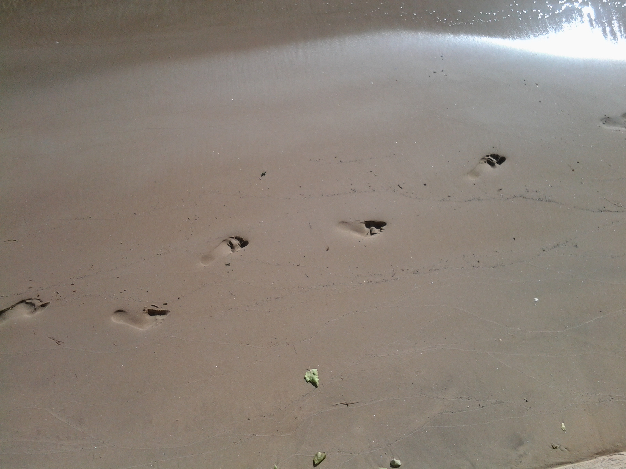

Fresh beaches. Serenity.


Public sculpture.


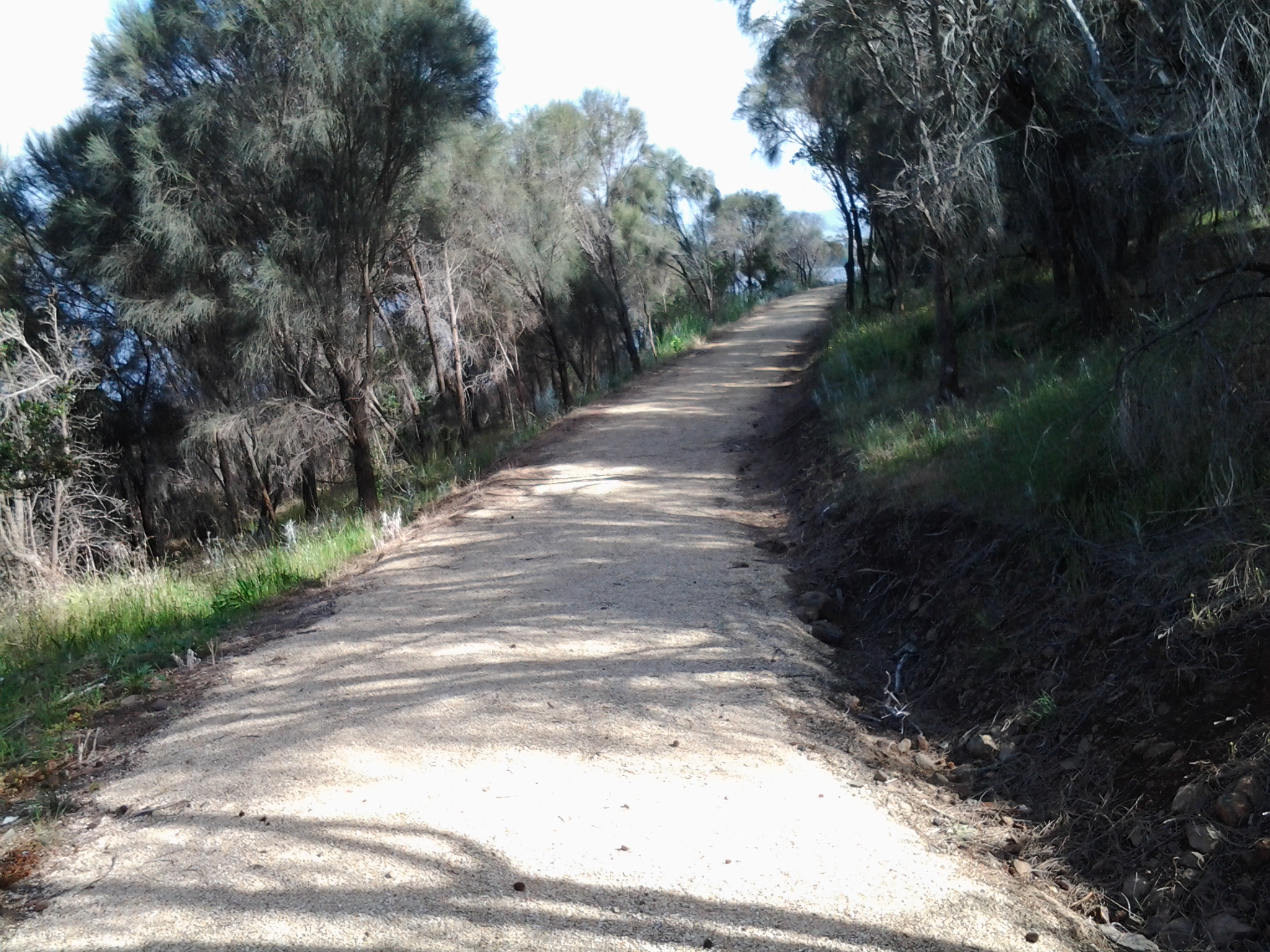
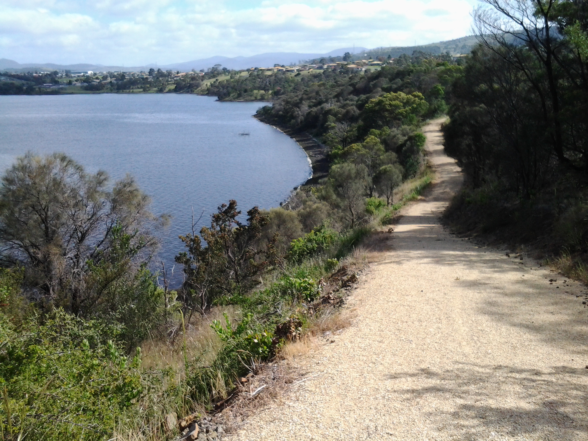
Coastal walking tracks.

Great signage

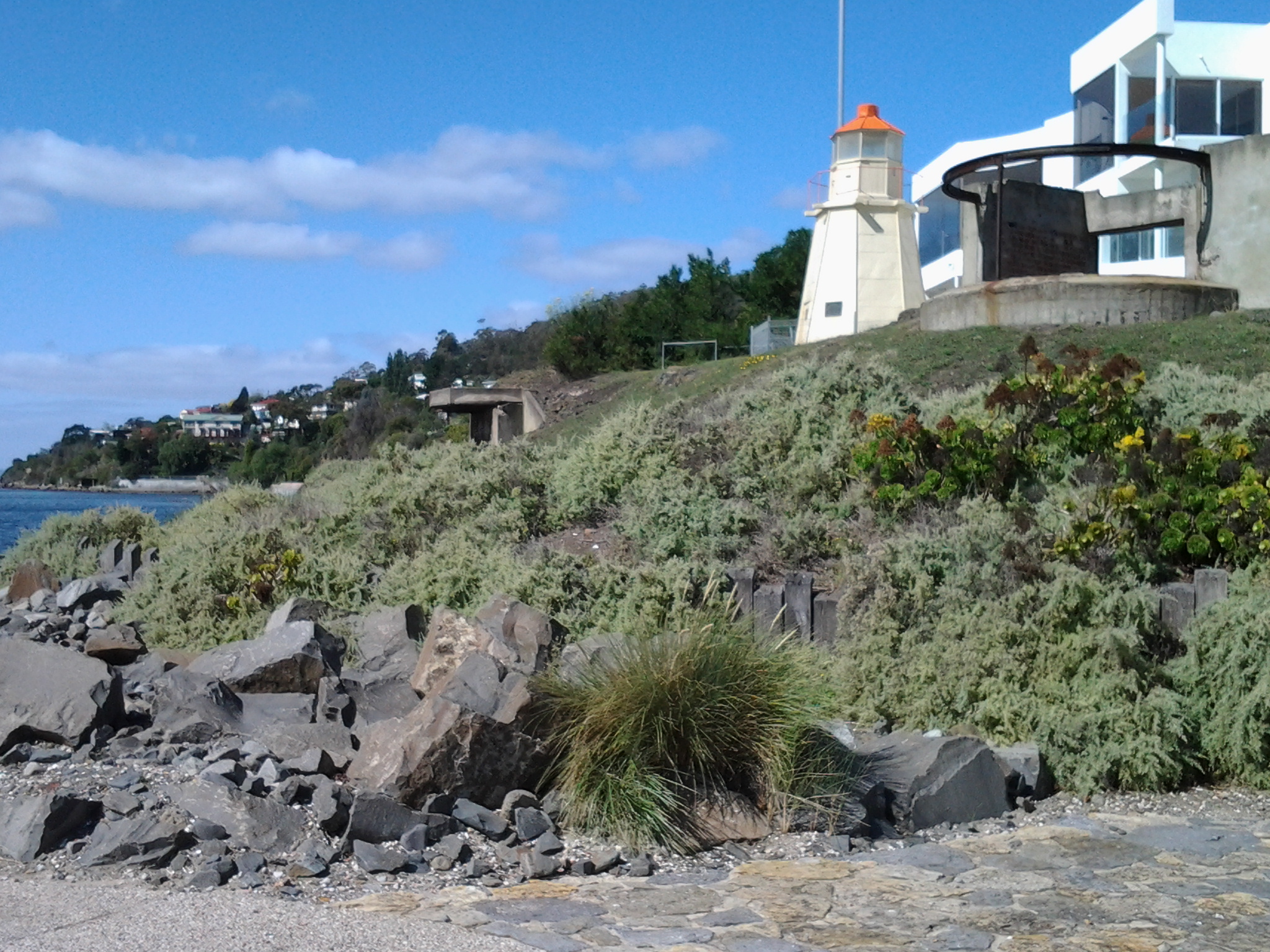
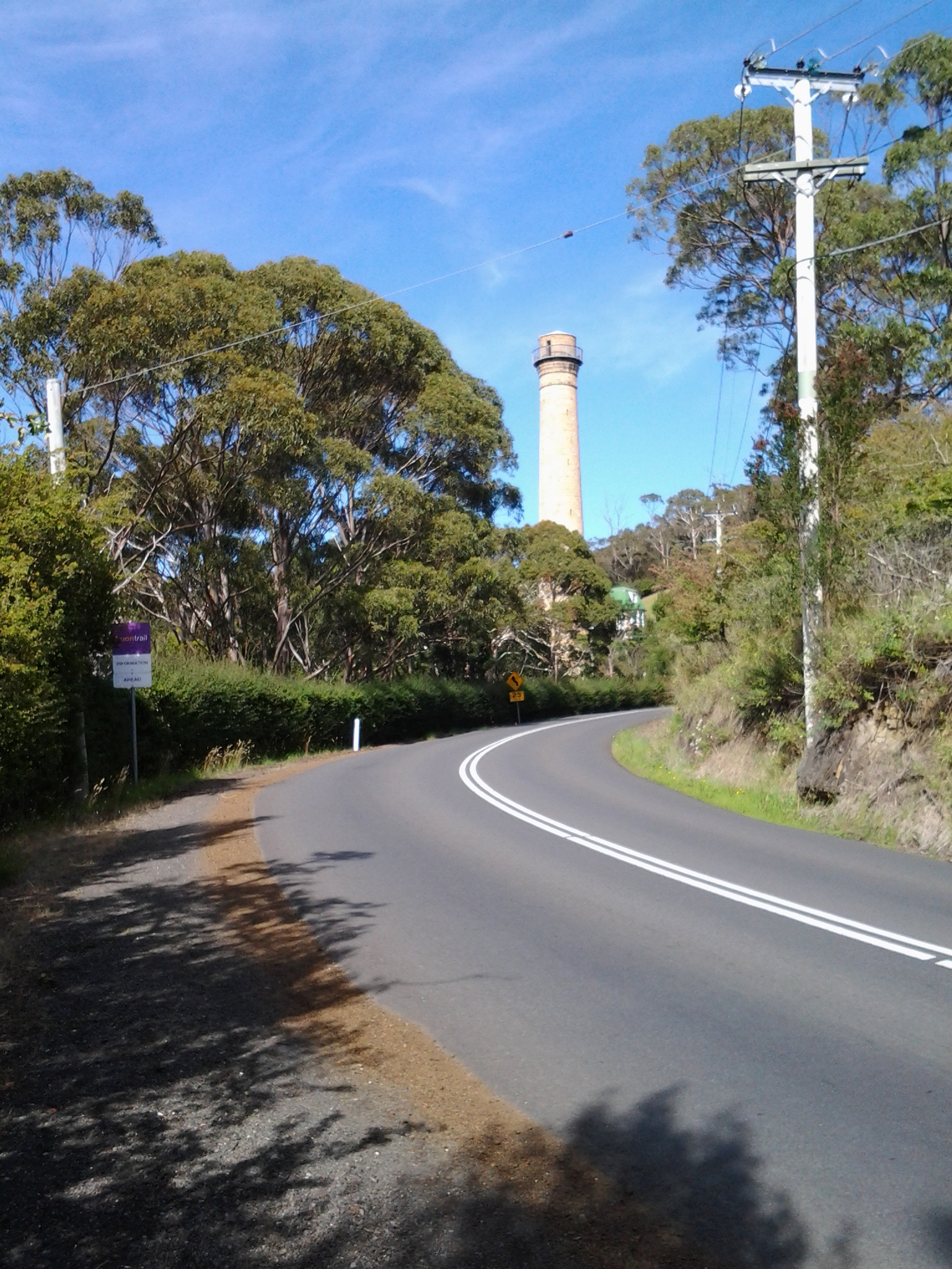
The heritage listed Shot Tower near Taroona
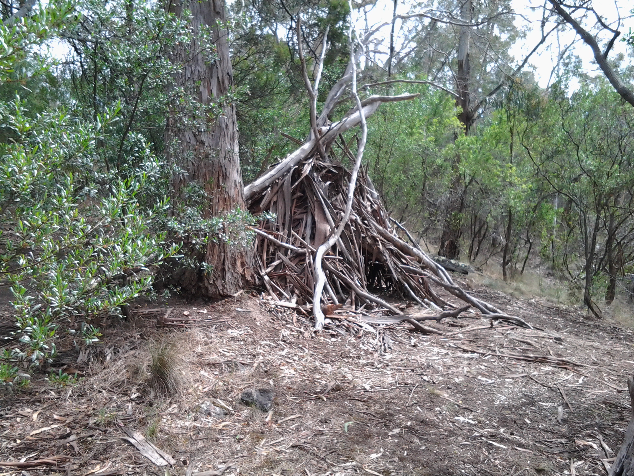
A rough bark and branch ‘hut’ near a track. Shelter from any rain?

Natural rock caves
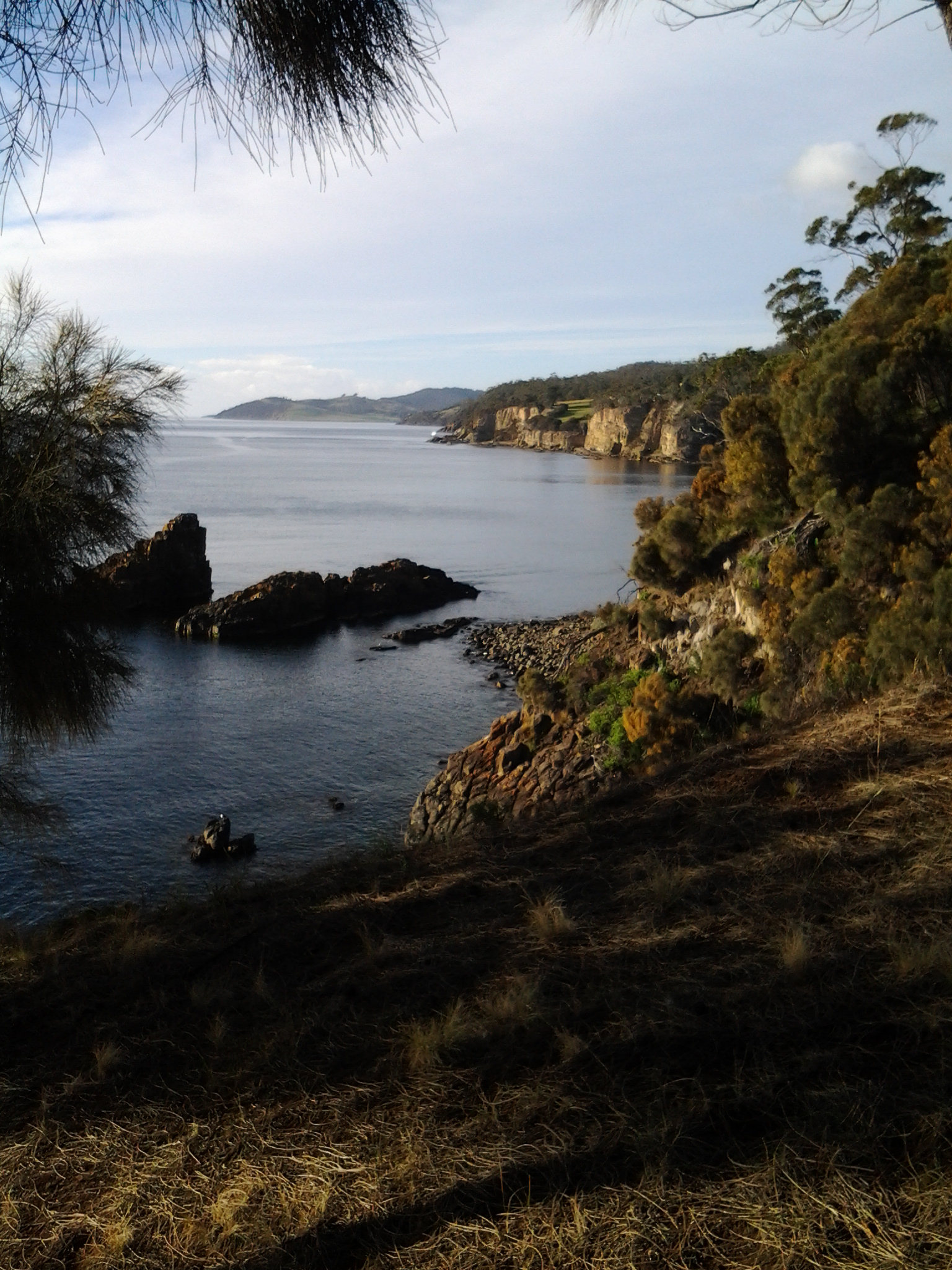
Dramatic viewpoints

The sun. The reflections.
Looking at, listening to, smelling the bush.


And I appreciate the glories of introduced trees and man-made vistas.
Collectively these images provide a reminder of what sits beside the Derwent River as it flows from New Norfolk to its mouth.
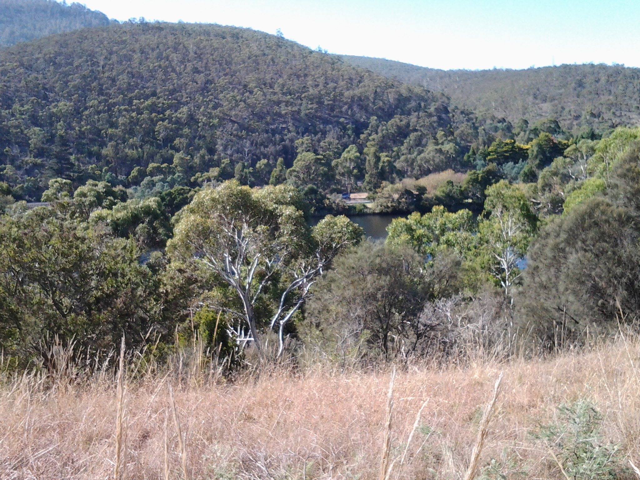
I can’t help myself. Having reviewed my favourite images from the first half a dozen stages of my walk along the Derwent River, I felt compelled to continue looking through my collection from the subsequent walks. I have chosen photos showing aspects of both the natural and man-made world and I believe all will prompt thinking about the Derwent River, Hobart and its suburbs, and the natural environment. My selection of the images with the most memorable impact for me, from stages 7-10, are given below.
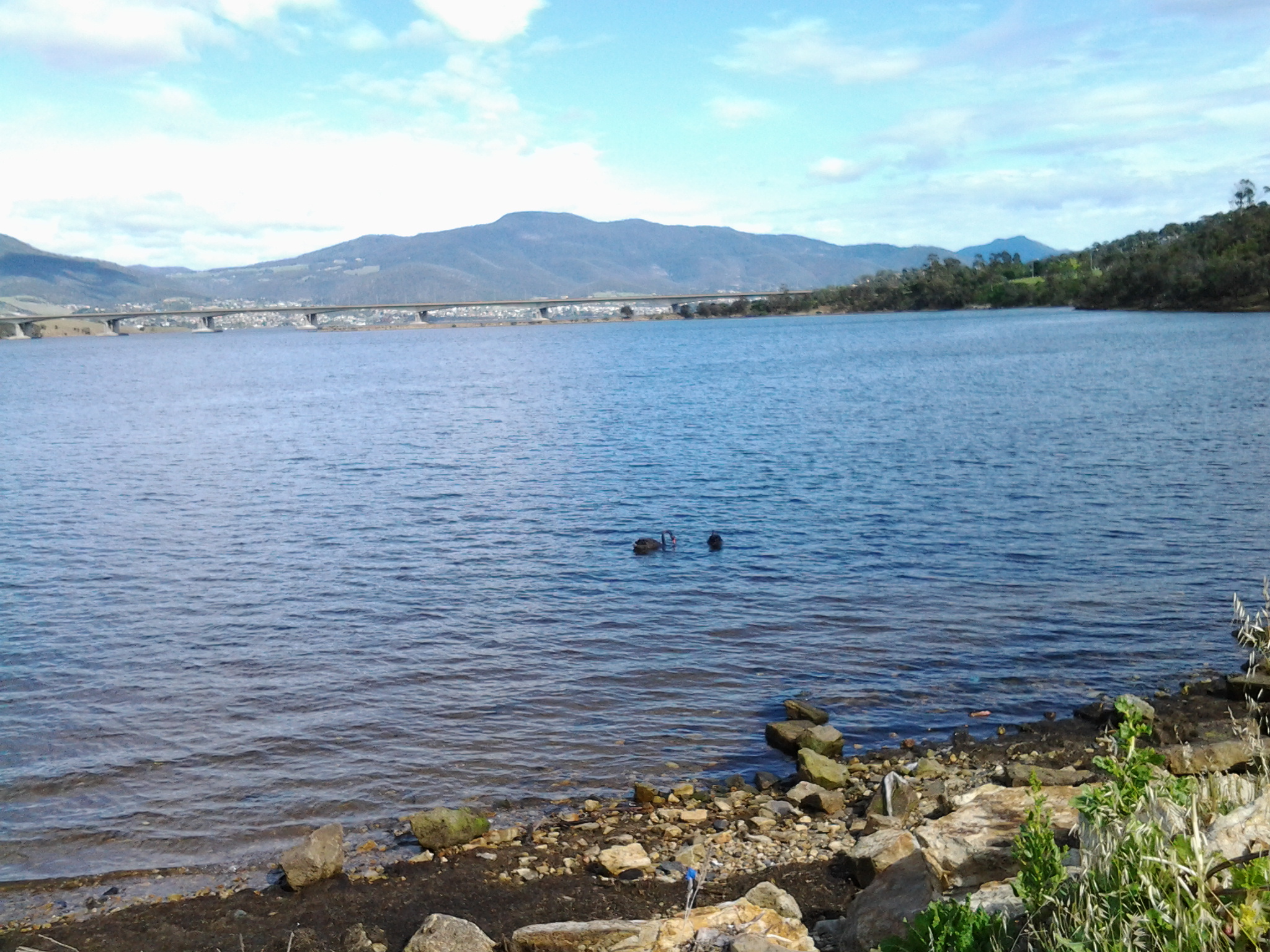
From the eastern shore looking northwards towards the Bowen Bridge, with a couple of black swans on the river.
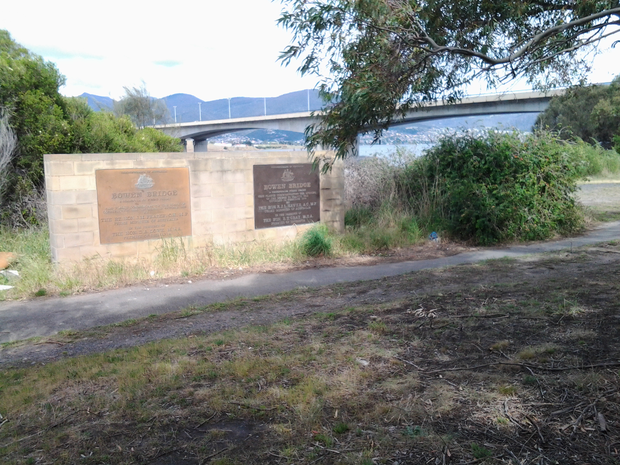
Two plaques ‘opened’ by two great Australian prime ministers near the Bowen Bridge.
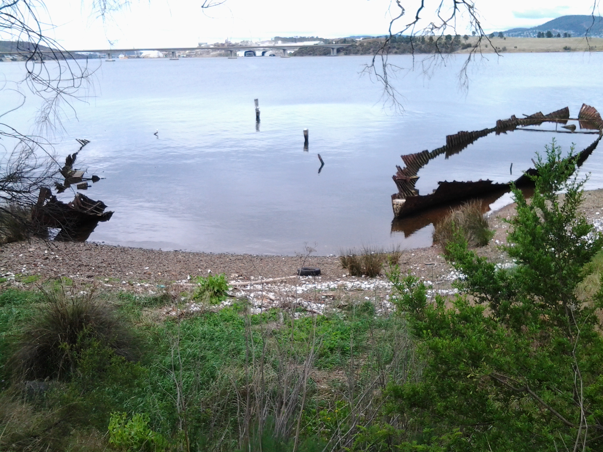
The rusting raw-edged remains of a ship, the Otago, at Otago Bay.
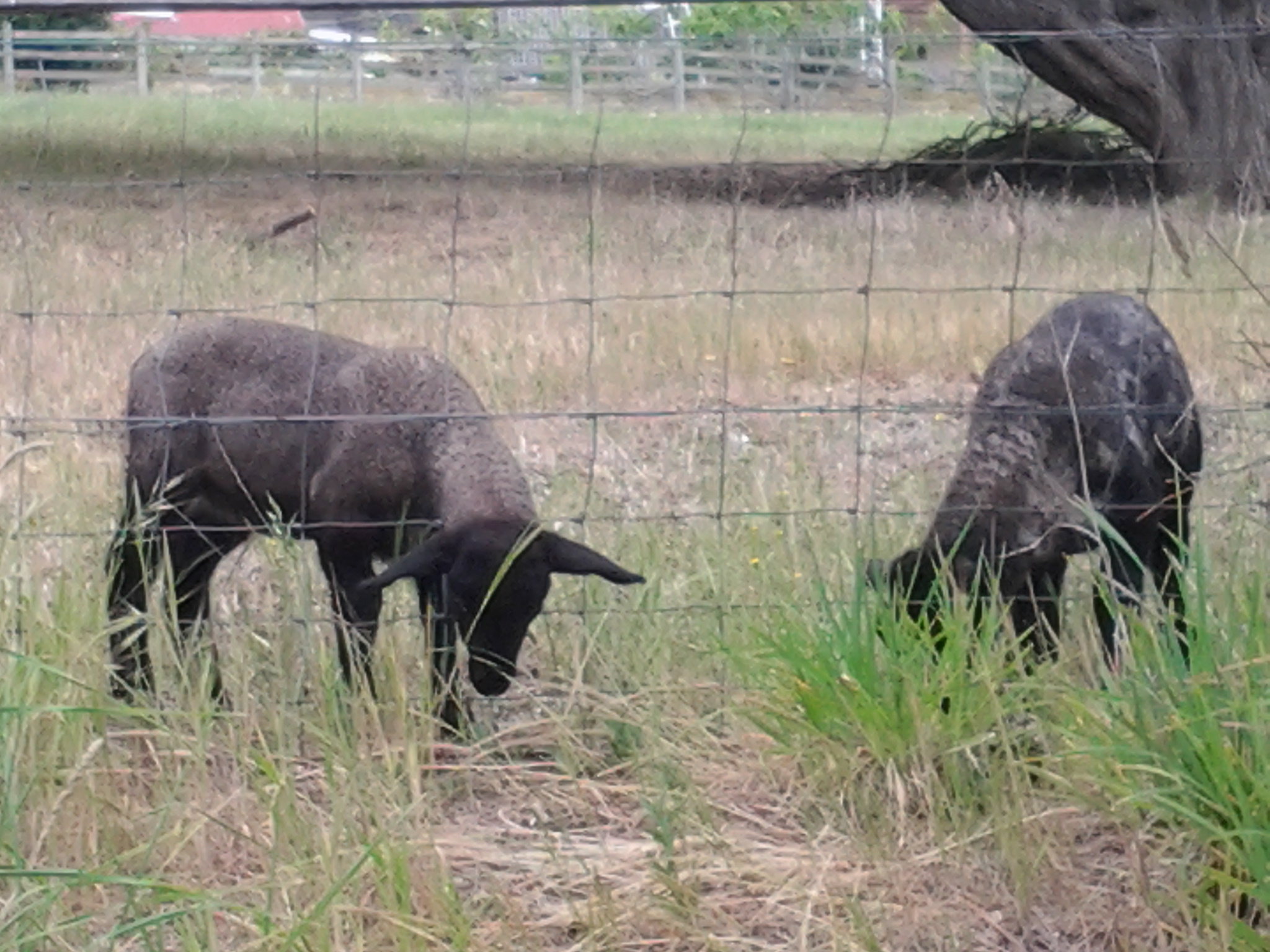
My enjoyment of any family’s black sheep.

Heading into Old Beach and gradually leaving Mount Wellington behind.

The gloominess of the approaching storm when I reached Old Beach.
The pleasures of well-made pathways, thanks to local government.

Looking northward across the Jordon River to Greens Point.

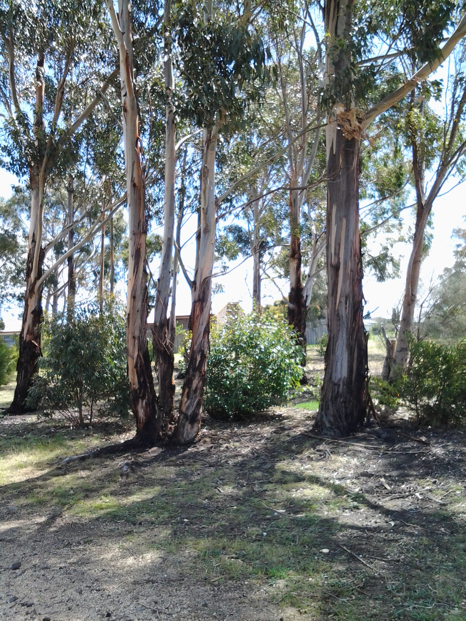
The glories of native flora. In these instances, it was blooming wattle and a spectacular stand of eucalyptus/gum trees which attracted my attention.

The remains and the signs of a burnt out car on a back track.

Knowing that it is still possible to have a laugh when walking.
Arriving at the Bridgewater Bridge.

Walking on the western shore of the Derwent River for the first time during this project.
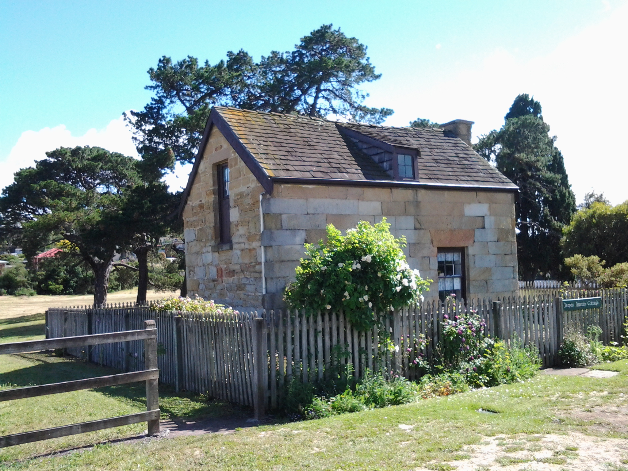
The house of one of first European settlers, James Austin, at Austins Ferry.
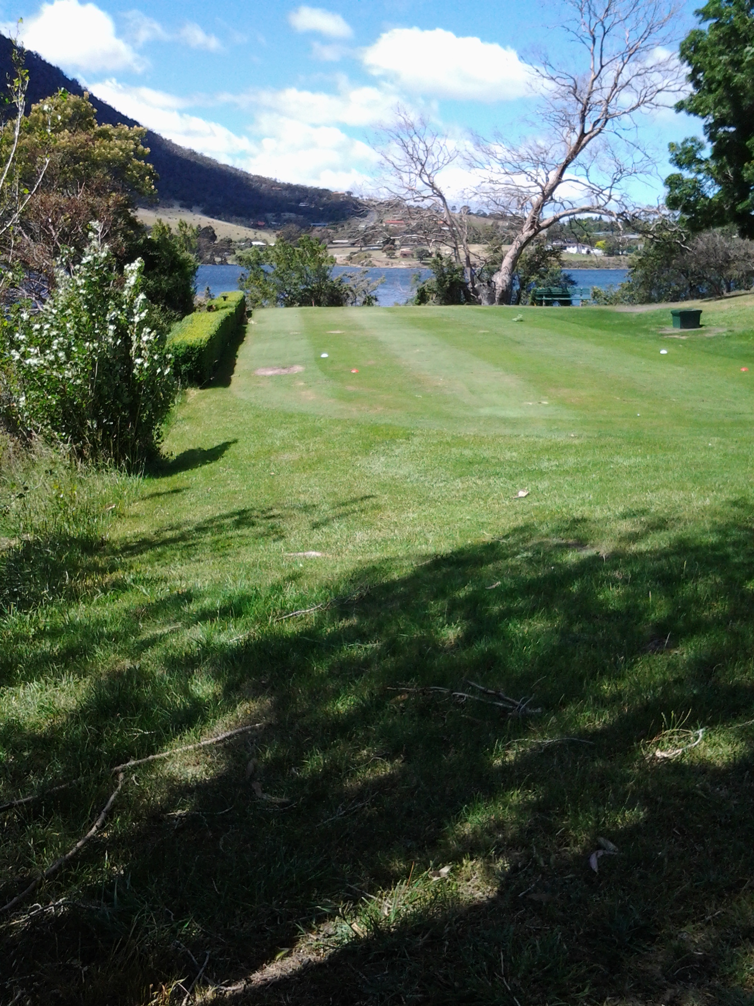
At Dogshear Point, walking around the Claremont golf course, with the thwacking sound of hit balls crossing the greens.

Reaching Cadbury’s chocolate manufacturing factory in Claremont.
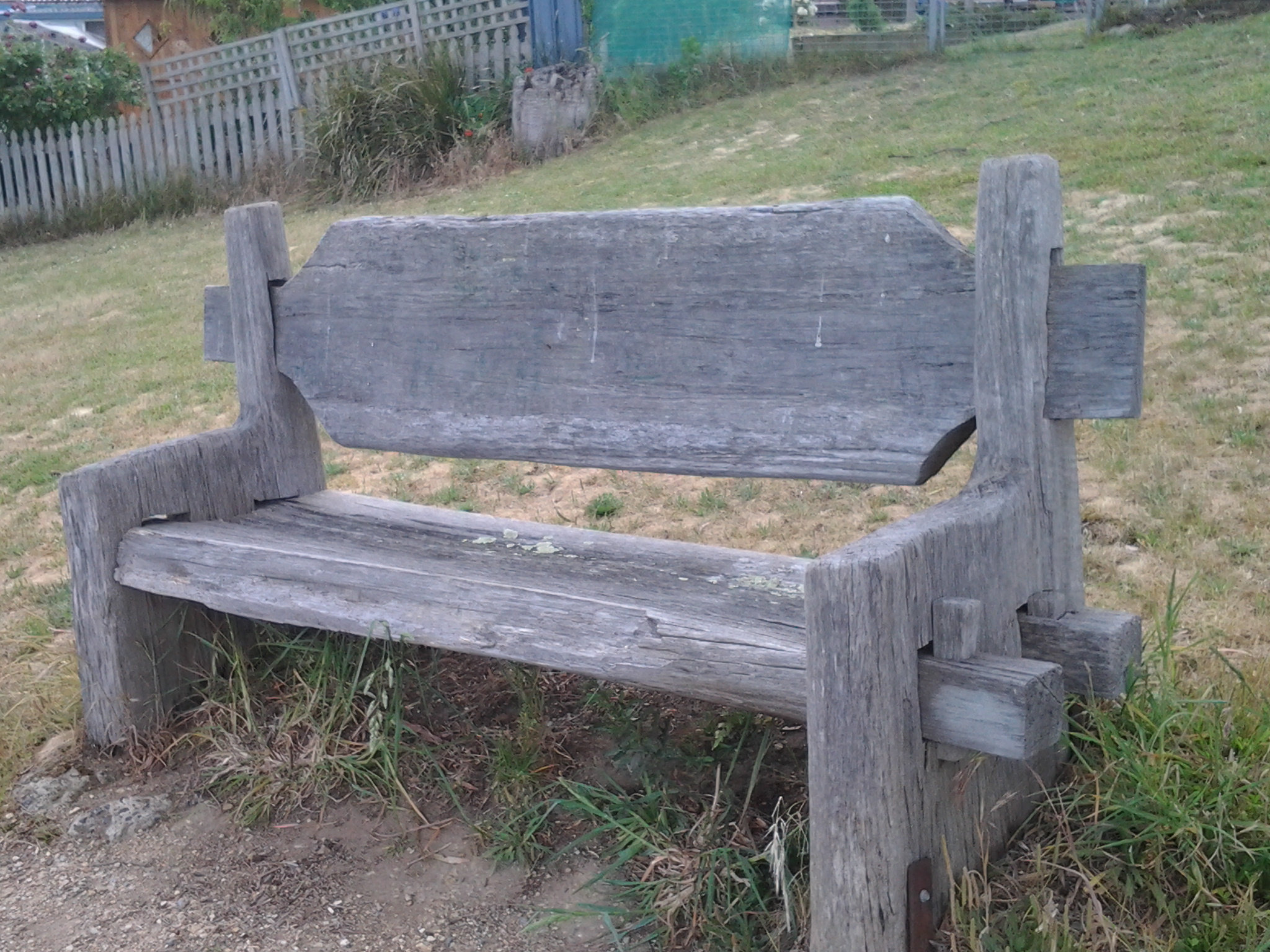
The hand-hewn rustic style seat near Connewarre Bay.
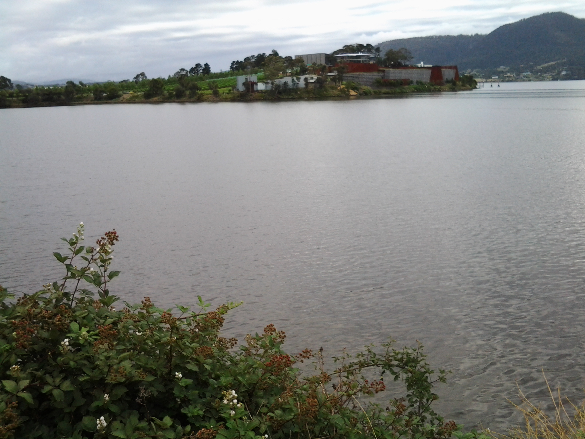
Passing MONA somewhat camouflaged as it nestles into a tiny hill against the Derwent River.
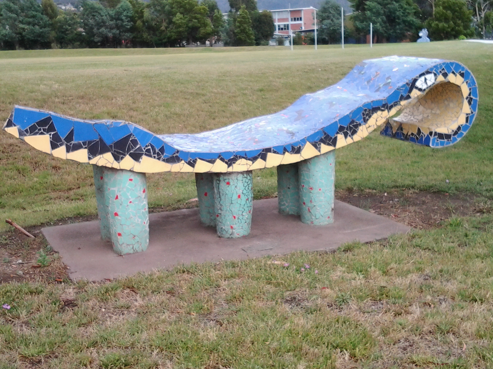
The mosaics along the foreshore.

The jumble of boats and boat houses at Prince of Wales Bay.

Road mark making in Lutana.

Cornelian Bay’s oil tanks up close.

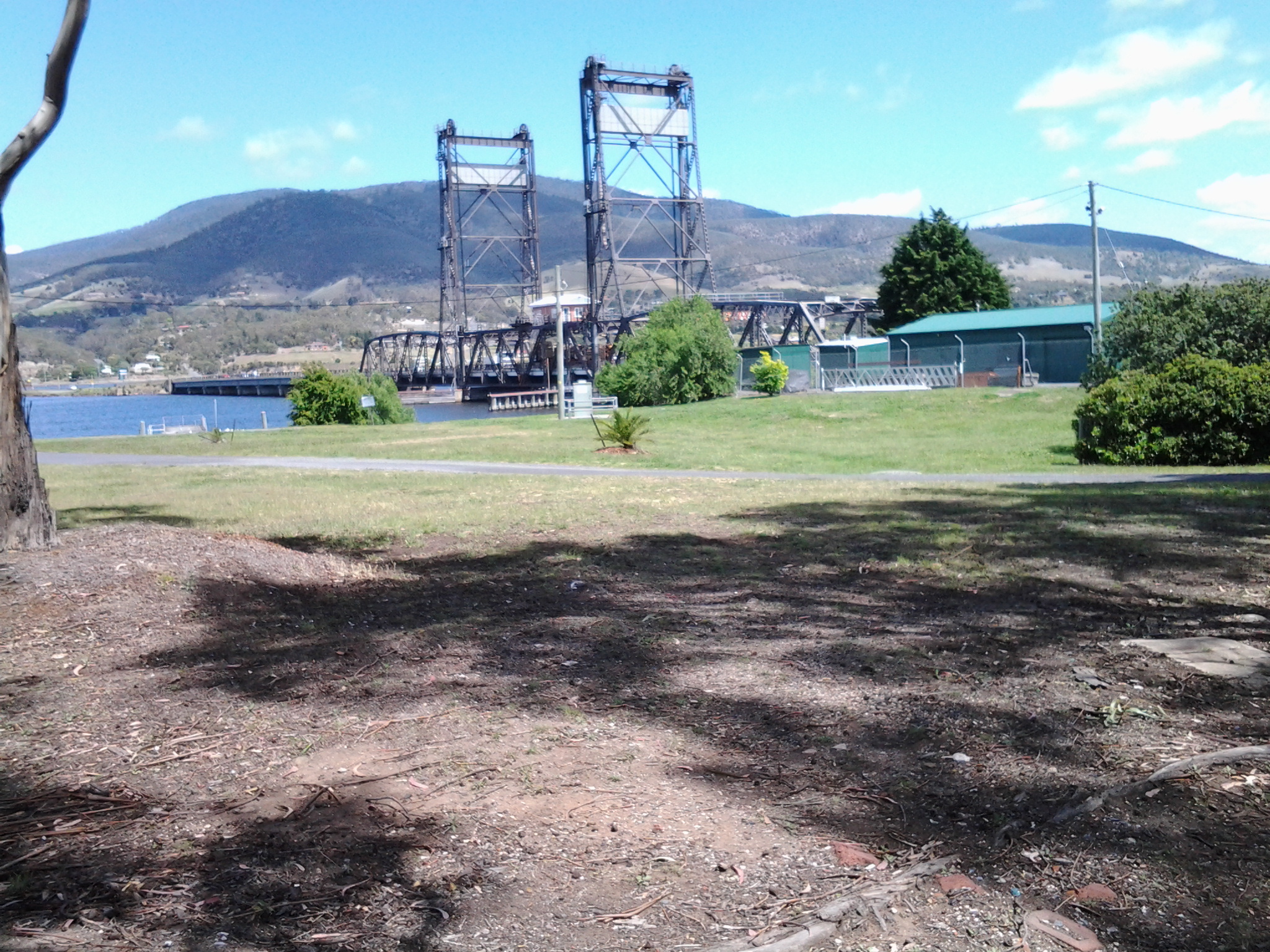
The Tasman Bridge.

The circus had come to town.

The emptiness of an arena of stands waiting to be filled during wood chopping competitions.

Reaching the ‘end of the line’ on arrival in Hobart city.
A Californian fiction writer M.P. Zarrella offered the opinion ‘nature is cheaper than therapy’. Since then, her point of view has spawned posters, cushion covers, and T shirts such as:
 and
and 
The use of this comment spread until people couldn’t help themselves …
 and
and 
Thinking about whether nature is cheaper (with the inference of ‘better’ than therapy), I have been inspired to trawl through my walking-the-derwent photos.
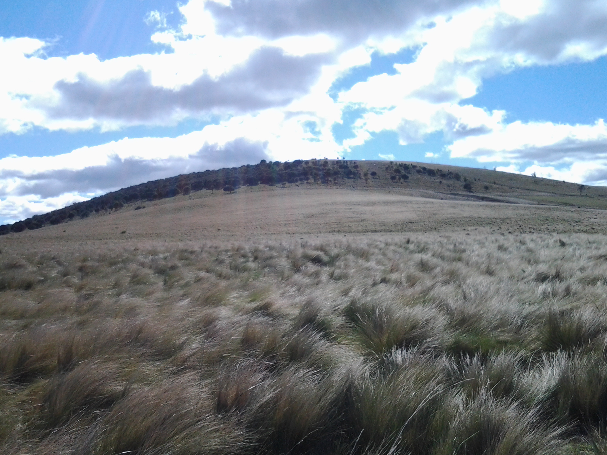
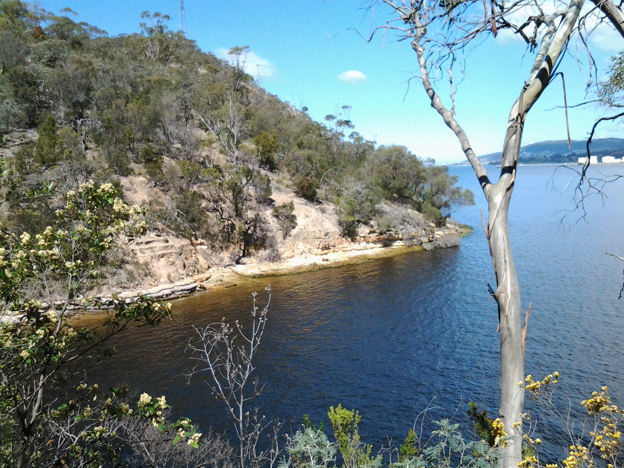
Here are a few favourite natural scenes clicked during Stages 1-6 of my walks along the eastern shore of the Derwent River. Most of these images spent time as my computer screen background where they lifted my spirits daily.

Iron Pot off the southern end of South Arm peninsula

Driftwood beach shack on Pot Bay Beach, South Arm peninsula
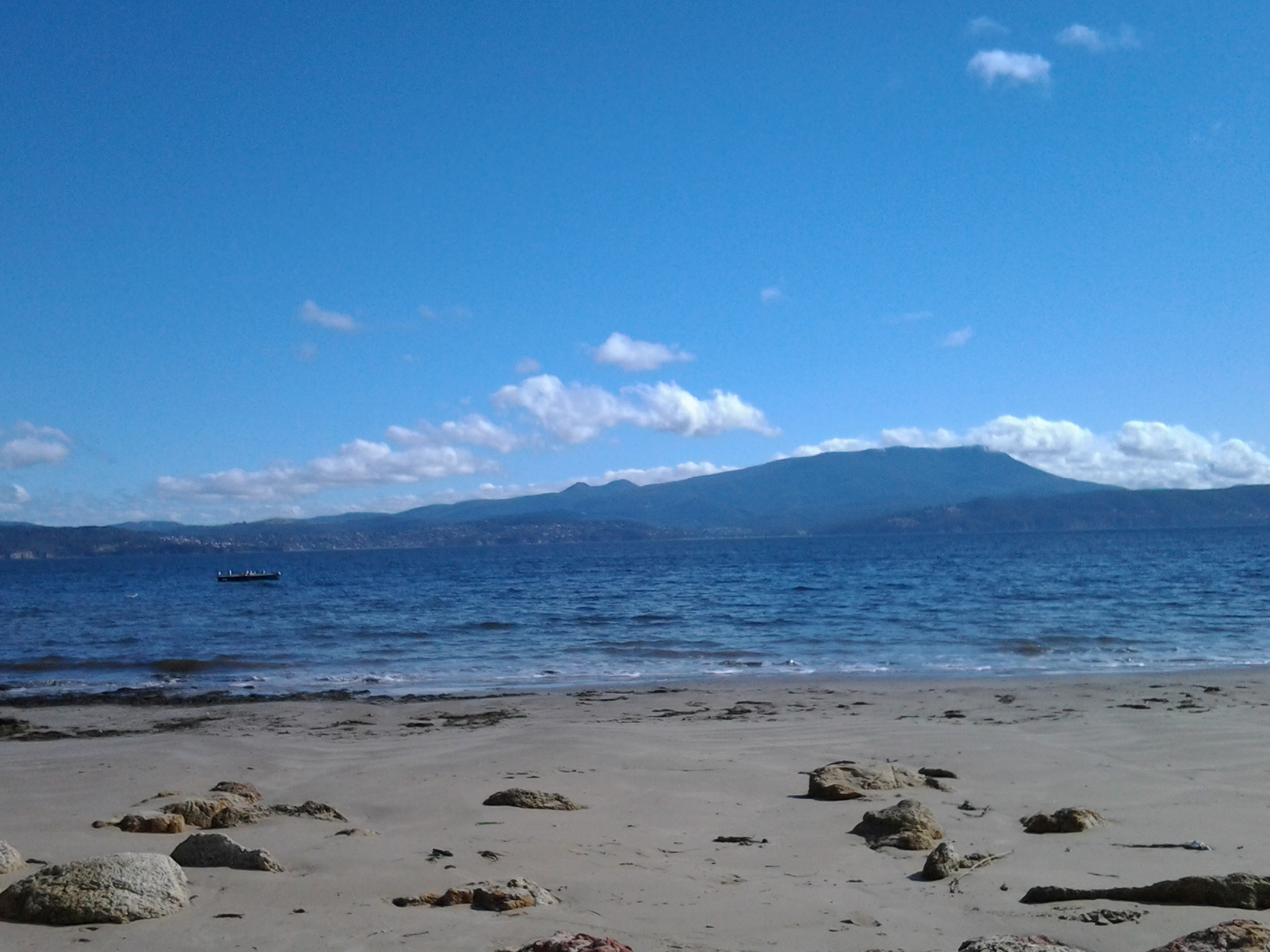
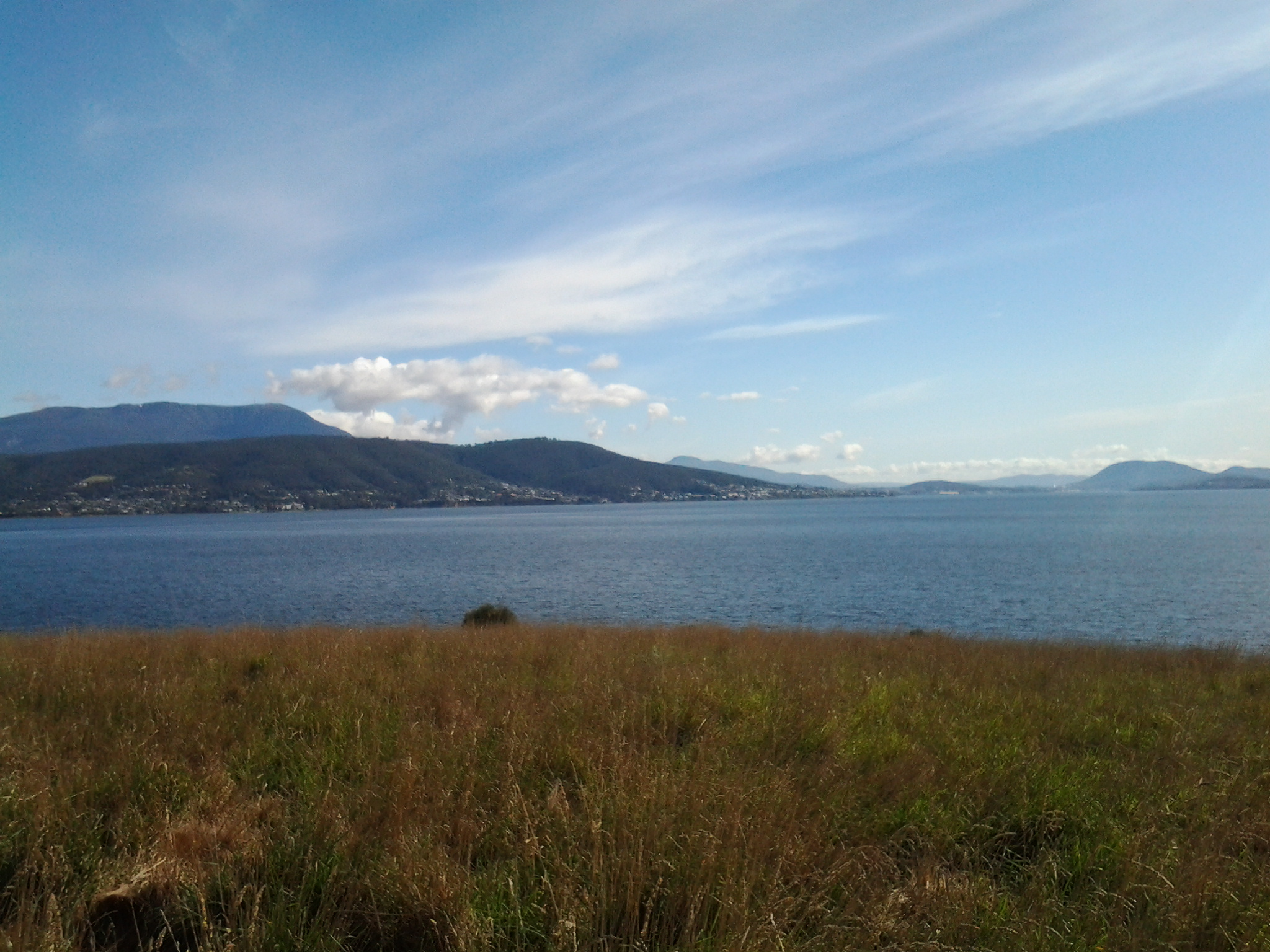
Mount Wellington across the Derwent River from South Arm Beach
Looking northwards into the gigantic Derwent Harbour from Gellibrand Point at the northern end of the South Arm peninsula.
Looking uphill from Trywork Point

Lichen on rocks at Tranmere Point

Little Howrah Beach

Looking southwards along Bellerive Beach

The suburb of Sandy Bay across the Derwent River through the casuarina trees from Rosny Point

Tranquil Geilston Bay looking toward Mount Wellington

Bedlam Walls Point
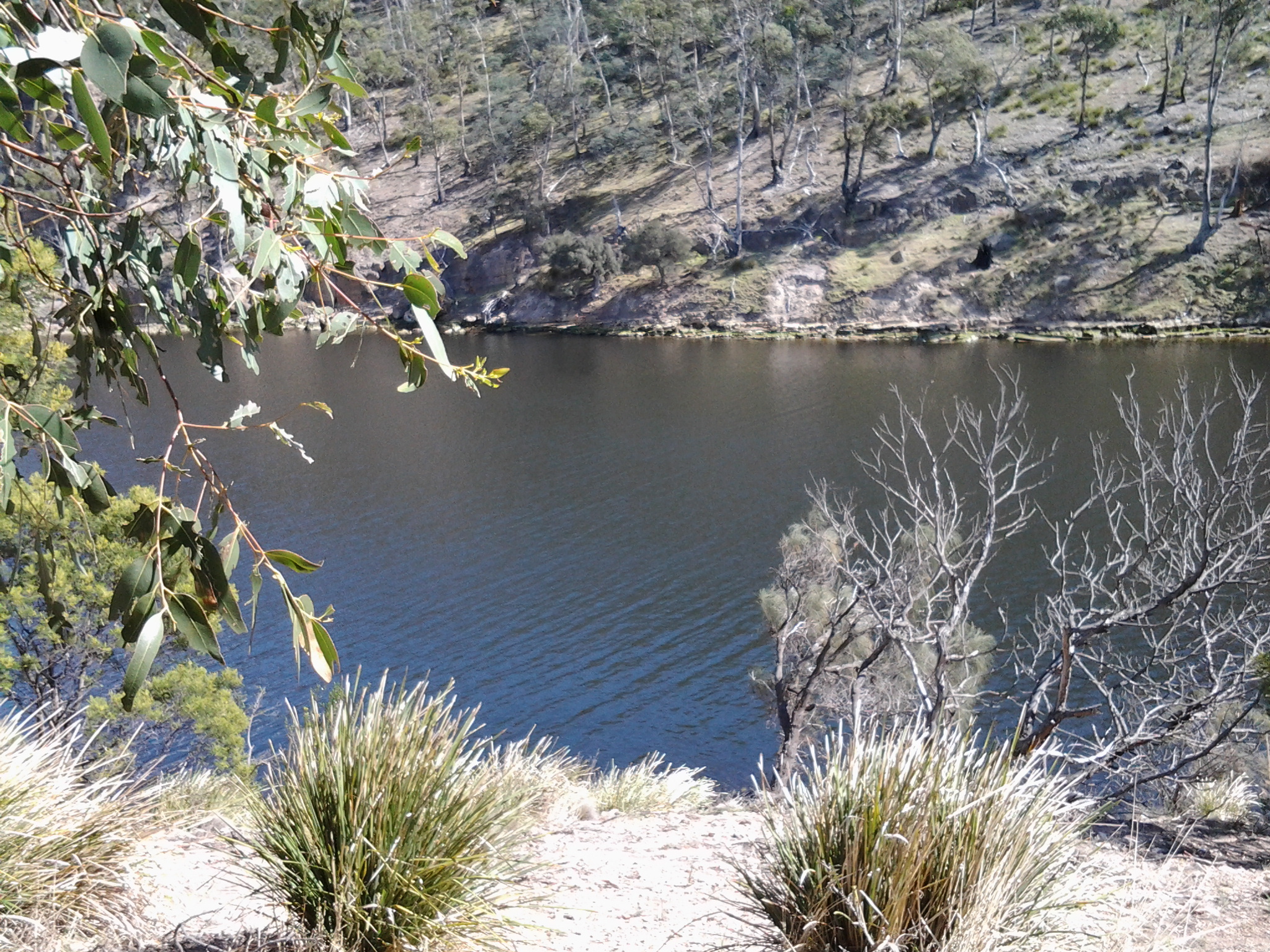
Shag Bay

Native flowers in the East Risdon State Reserve
Tommys Bight
Whenever the weather is deteriorating outside my window, by looking at these photographs from the first 6 of 14 walking stages, I ‘revisit’ the various locations and feel most uplifted. No therapy needed here.
A few days after I wrote the post about the end of the water taxi business on the Derwent River indicating my sadness for such short sightedness by the community and government agencies, I have discovered another sad tale. It was with horror I read the story at http://www.news.com.au/national/tasmania/tasmanian-air-adventures-in-liquidation/story-fnn32rbc-1227328240883.
Tasmanian Air Adventures, despite being incredibly popular and forever in the air over the Derwent River, has not been able to recoup its establishment expenses and get into a profit position. The result is the owners have run out of money and the business has gone into liquidation.
The outcome has been immediately clear to me. I had become used to seeing, many times a day, the water planes lifting off from the waters of Salamanca Cove in the centre of Hobart, and flying along the Derwent River. And now only seagulls fly where once flew entranced tourists and locals.
In a city which has one of the best waterways in the world, Hobart is missing the opportunity which any other city in such a location would be grabbing and making work. Blog followers keep telling me how much they enjoy my photos and information about what can be seen at the shoreline of the Derwent River. I feel sure others would feel the pleasure which the river can offer, as well as appreciating its functionality to transport them hither and thither.
Years ago the Tasman Bridge was accidentally knocked down and immediately people became used to ferrying across the Derwent River/Harbour to and from work. The concept that the river is a lifeline and a connector of peoples; one which wants to be used, seems not to be factored into any level of serious government thinking. Meanwhile valuable resources are used to create more and more city carparks. Say no to car parks, I say. Say yes to ferry and air travel along the river.
On Stage 14 of my walk from Granton to New Norfolk by the Derwent River, a car pulled off the road ahead of me at Sorell Creek. The female driver sat motionless. I plodded on and, as I walked past the car, she wound down her side window and asked for help. A farmer from inland NSW, she and her daughter were staying temporarily in Maydena (http://www.discovertasmania.com.au/about/regions-of-tasmania/hobart-and-south/maydena), a small town on the way to Strathgordon in south western Tasmania – a town where our shy native platypus can be seen in the fast flowing Tyenna River, the waters of which eventually flow downstream to help keep the Derwent River level high.
While her husband worked that day, she decided to take a drive in the car and look around to see more of the country.
When we met, she wanted to find a route to the convict penitentiary at Port Arthur (http://www.portarthur.org.au) without needing to navigate busy Hobart city streets. Her only map was a small abbreviated tourist map of Tasmania that showed the main highways and a few towns. I dragged out some of my maps, and we chatted amiably while many options were considered. Through these conversations I was clear that our road signage is designed for those who know where they are going, and not always for those who don’t know the terrain.
The thought of encouraging her to take the East Derwent Highway, come out near the Tasman Bridge and then need to cross three lanes of traffic immediately, filled me with dread. When you are driving and unsure of where you are and how to get there, many signs and endless traffic can be disorienting. I felt sure she would find herself in suburbia and never understand how to extract herself from there in order to be on her way to Port Arthur.
To take the Midlands Highway by crossing the Bridgewater Bridge, and travel towards Oatlands to find a cross country route, also seemed impractical. Once off that highway, narrow winding roads lead eventually to Richmond but this would not help her easily to get onto a road leading to her destination, without much more direction asking of locals.
We settled on the option where she would continue along the Lyell Highway, drive along the Brooker Highway towards Hobart city, before taking the left hand exit to the Tasman Bridge near Hobart, and then driving across the Bridge. I hope the blue airport symbol was posted liberally during that journey. If she followed that symbol, then once at the final roundabout to the airport she knew to drive straight on. We didn’t exchange contact details so I continue to wonder if she found Port Arthur without getting lost and without losing time.
At 12.15pm we parted company. I was glad to have had someone to talk with. Besides, she had been considering walking (http://www.bicentennialnationaltrail.com.au/) from the north to the south through Australia (a mere 5330kms from Cooktown in far northern Queensland to Healesville slightly east of Melbourne, Victoria). I wish her all the best.
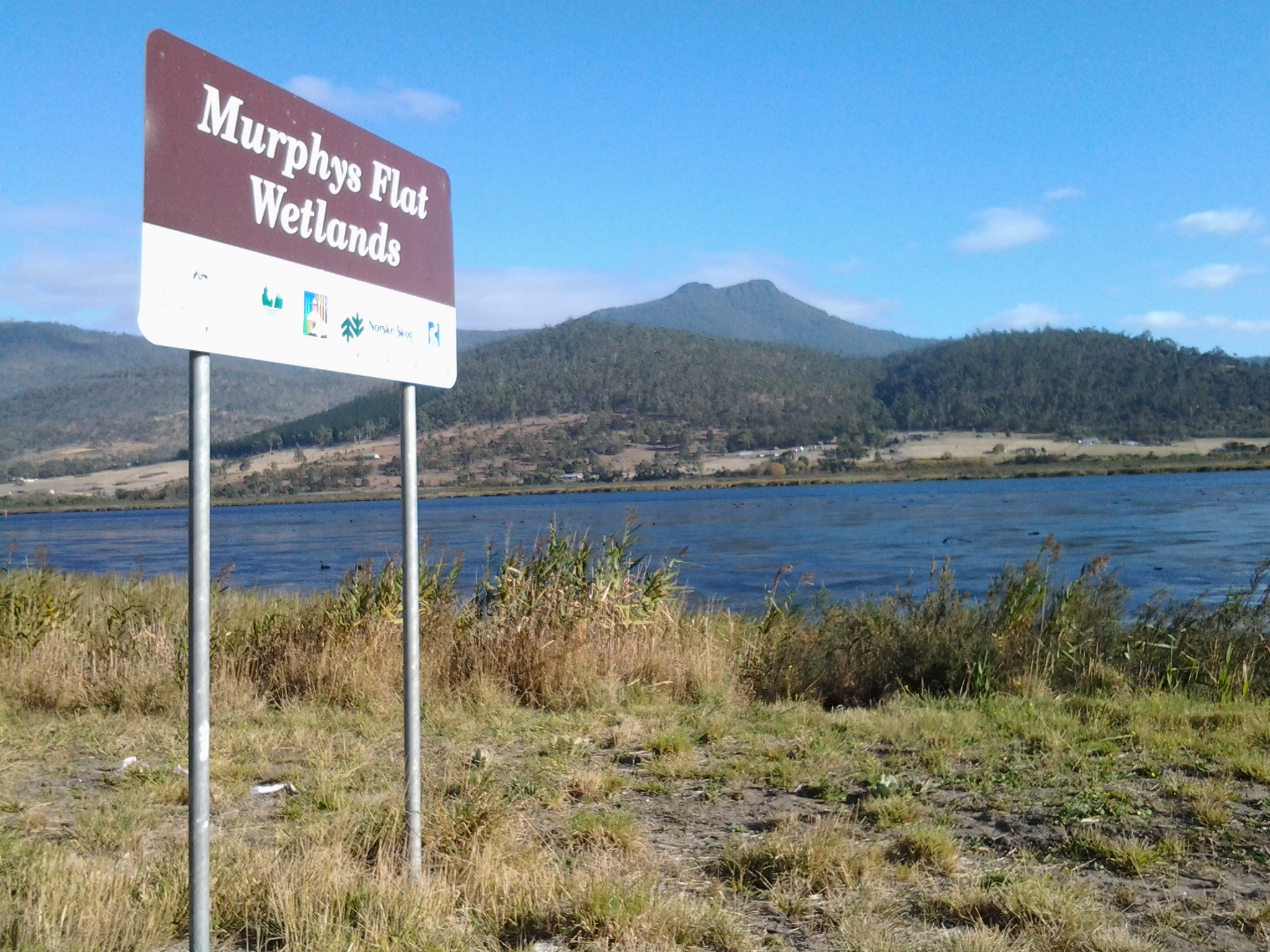
Thanks to http://www.parks.tas.gov.au/file.aspx?id=17347 I know that “Murphys Flat Conservation Area historically formed a portion of the property locally referred to as Marsh Farm, which was established through an ambitious land reclamation endeavour begun by Governor Arthur in 1824. The property was hailed as an agricultural “show place” throughout Tasmania and was one of the earliest land reclamations in Australia.”
The site http://www.derwentestuary.org.au/assets/NIE_-_wetlands.pdf provides the information that “In 1997 we nearly lost 40% of these wetlands when a farmer started draining the 66 hectare marsh known as Murphy’s Flat.” This action was the catalyst for various tiers of government to step in and fund the process to purchase the land and retain it as a conservation area. The area known locally as Murphys Flat was acquired on 1 May 2001 by the Tasmanian Parks and Wildlife Service.
The 2010 Management Statement at (http://www.parks.tas.gov.au/file.aspx?id=17347) is informative.
“Murphys Flat Conservation Area is located within a wetland complex on the southern shore of the River Derwent beside the Lyell Highway between Granton and New Norfolk. The area has been recognised as being particularly species rich, with expansive areas of marshes, underwater grasses, tidal flats and reed beds that provide habitat and breeding areas for large populations of fish, platypus and waterfowl. Murphys Flat Conservation Area comprises 25 to 30 per cent of remaining wetlands in the River Derwent. It is listed within both the Directory of Wetlands of National Significance and the Tasmanian Geoconservation Database.
Birds are particularly abundant in the reserve due largely to the diverse habitat. The vicinity is well known for its large population of black swans and it is a likely hunting and foraging area for five significant bird species including the wedge-tailed eagle, white-bellied sea-eagle, swift parrot, masked owl and great crested grebe. The secretive, little-known Australasian bittern is also known to occur there.
Murphys Flat Conservation Area serves as a nursery for the sandy flathead and also provides important shelter for other juvenile native fish. Backwater areas of the reserve are of particular biological significance with unique botanical assemblages and an abundance of gastropod molluscs.”
Until the early years of this century, “Murphys Flat was used as a dump site for domestic rubbish, garden waste and for overburden from road and earthworks. As a result, the area of wetland vegetation communities has decreased and its condition has been further compromised through the spread of weeds, largely from this source.” Now a weed control program has been instituted. “The vision for Murphys Flat Conservation Area is that it will contribute significantly to regional biodiversity and geodiversity in the upper River Derwent estuary, provide water quality services and research opportunities and be a vehicle for increasing public awareness of wetland values.”
In addition to the natural history and situation, Murphy’s Flat has a cultural history.
Firstly, the site is reported to have been on a travelling route for two Aboriginal tribes (http://www.parks.tas.gov.au/file.aspx?id=17347).
Then, according to Kelvin Markham at http://www.km.com.au/tasmania/ch14.htm “Four miles beyond Granton stood a derelict grey stone house, known to all and sundry as The Haunted House. No one can tell why it received its name, though it is popularly (and wrongly) supposed to have been the country seat of early governors. The haunted house was originally the Golden Fleece Inn, licensed on 22 October 1824 to one Henry Fitzgerald. It did not long cater for travellers and in 1837 was on the market. This building was also called Addington Lodge Villa at one time.”
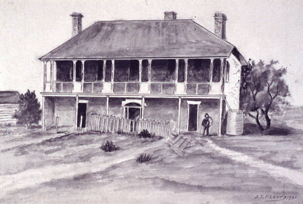
The image above is a drawing of ‘Addington Lodge Colonel Arthur’s Marsh Farm between Bridgewater and Sorell Creek Derwent Valley’ / ‘The Haunted House on the Granton New-Norfolk Road’ by artist A. T. Fleury c1931 – from the collection of Linc Tasmania
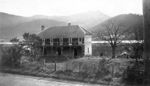
The photograph above is of ‘Addington Lodge, Granton, apparently a former residence of Governor Arthur’ – from the collection of Linc Tasmania
The National Library of Australia (http://trove.nla.gov.au/ndp/del/article/30094484?searchTerm=Anthony+Geiss) offers the information that “Addington Lodge was named after Mr. J.H. Addington, the Secretary to the British Treasury at the time. It was constructed by Governor Sorell to serve as a country house in 1820, a year after the construction of the Hobart to New Norfolk Road. The lodge was a double storey brick house with an architectural style typical of a late Georgian villa with symmetrical doors and windows and a wide fan-lit front door. The lodge was renamed the Golden Fleece Inn and opened to the public after a Mr Barker sold it to Mr. Henry Thomas Fitzgerald in 1824 having owned it for 4 years only. Addington Lodge at Murphys Flat became a popular half-way house for travellers between Hobart and New Norfolk and earned an unsavoury reputation.”
If remains of this house still exist they are now obscured from view by the lush vegetation growing across the wetlands. I saw no sign of it as I walked past Murphy’s Flat.
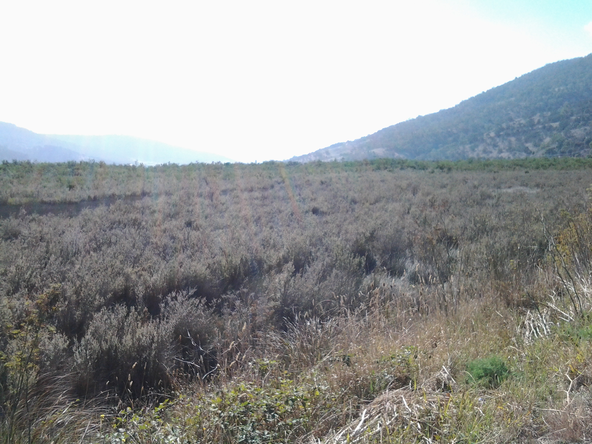
To give you some idea about the look of the wetlands from the Highway, the photo below shows the landscape when I looked back over the road just walked.

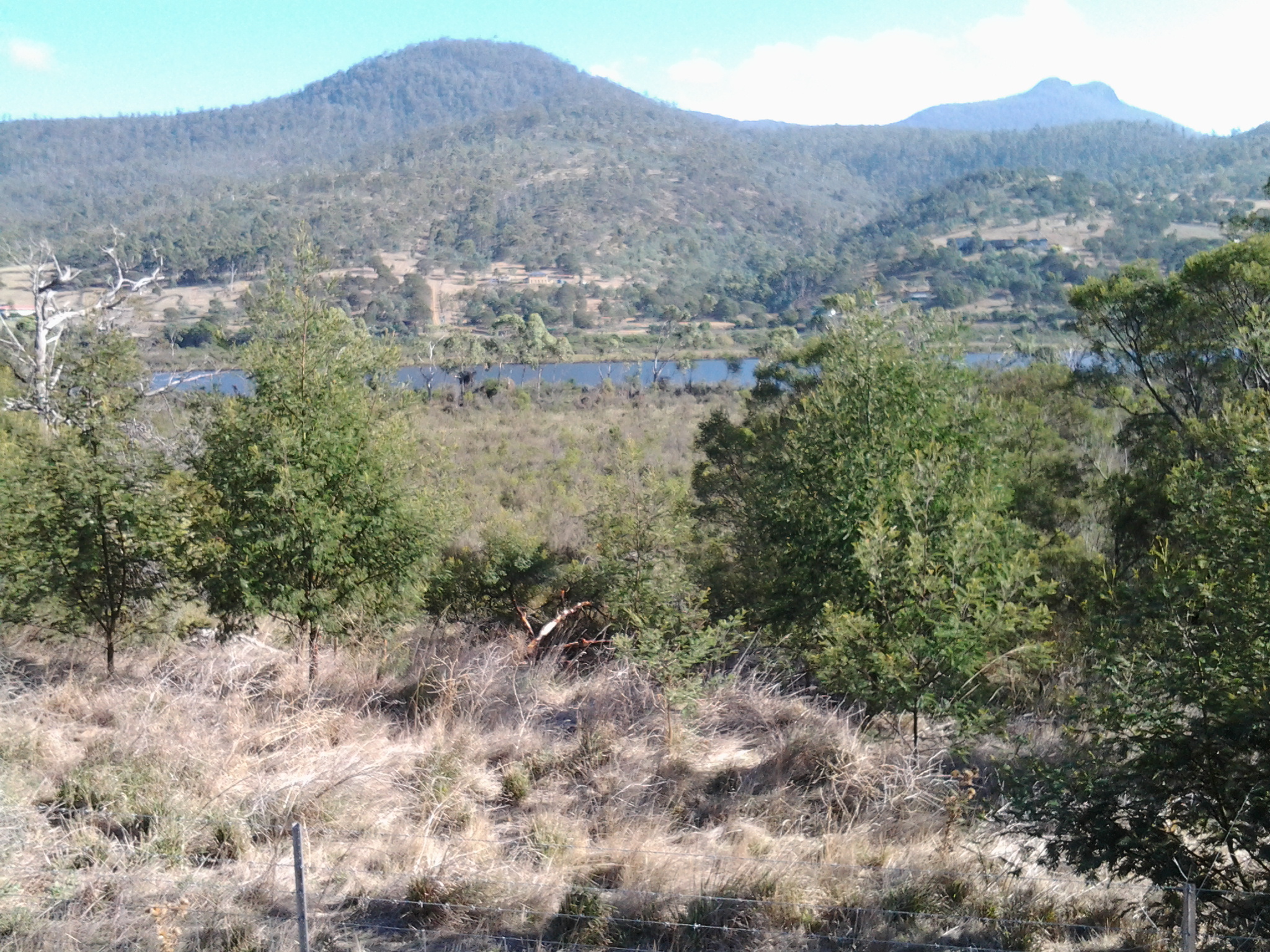
The wetlands looking toward the road yet to be walked.
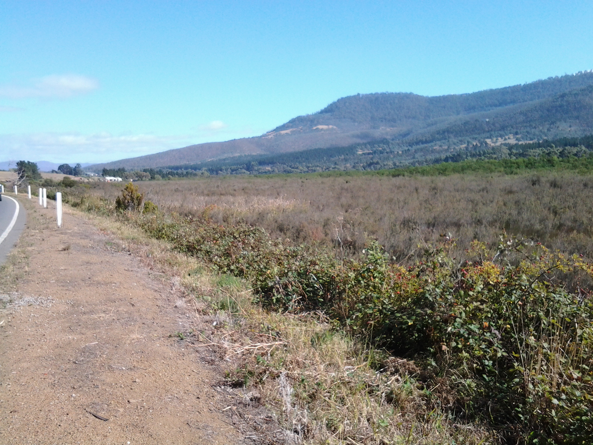
Along the kilometres (Murphys Flat Conservation Area is approximately 2.7 kilometres long and 550 metres wide at its maximum width) of Murphy’s Flat Wetlands, the vista consisted of subtle variations of the following:

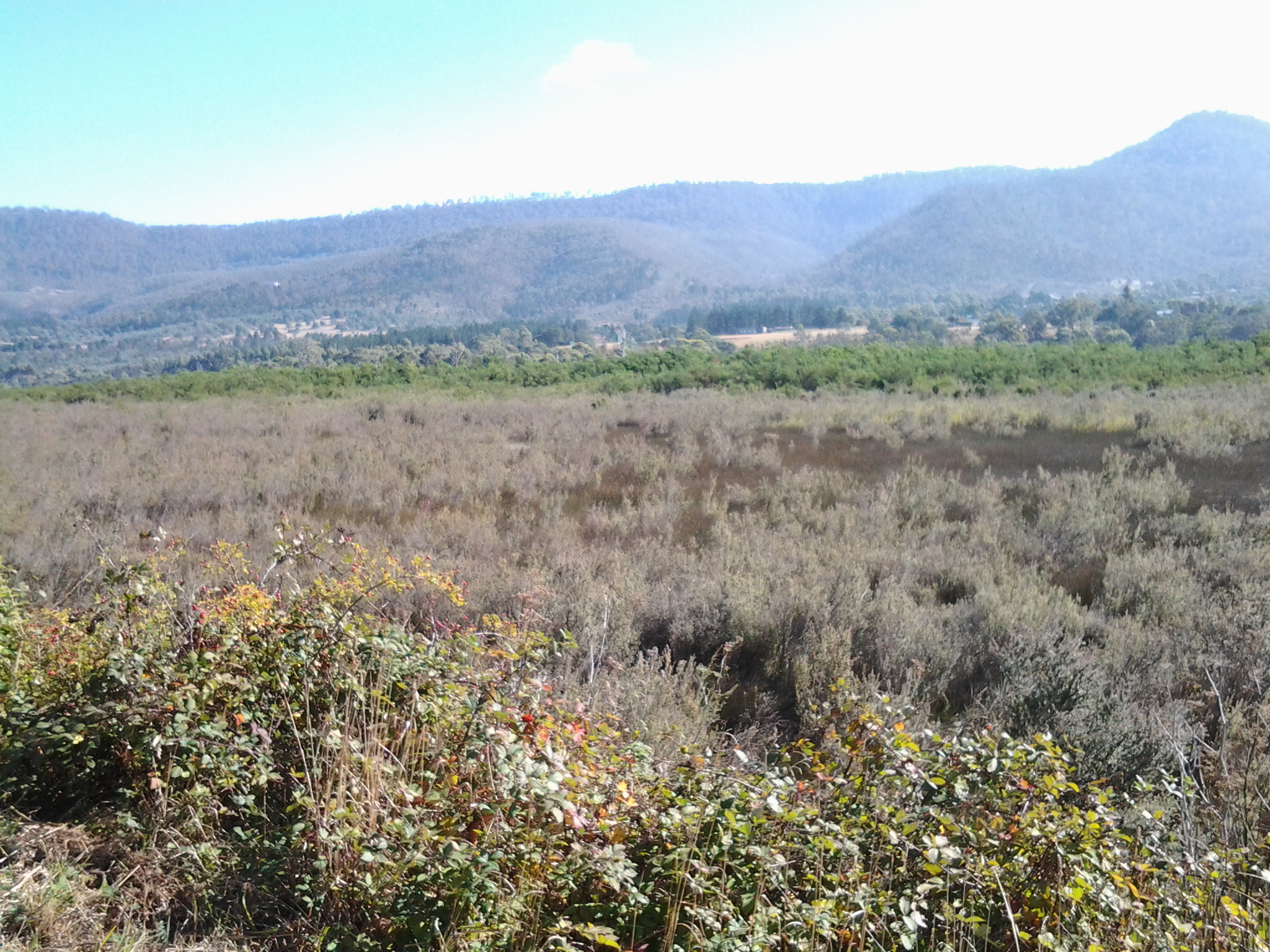
When I walked, most of the landscape between the Lyell Highway and the smoothly flowing Derwent River seemed impenetrable. I can only imagine this is a very safe place for water birds and fishlings to breed, and for native grasses and other plants to re-establish.
This posting started with a question which I have been unable to answer. I cannot discover who Murphy was. Regrettably.
Murphy’s law is a commonly heard saying which is typically stated as: Anything that can go wrong, will go wrong. I wondered if the land now known as Murphy’s Flat had been purchased for the purpose of grazing animals and growing crops without due checking, and then found the wet soggy land to be useless in the days when preservation of native flora and fauna was not considered – I wondered if someone bought the land without really checking how it was and having spent all their money decided Anything that can go wrong, will go wrong. BUT according to the definitive book The History of Murphy’s Law written by Nick Spark, this adage was named after an American aerospace engineer Captain Edward Murphy who said as much around 1950. The naming of Murphy’s Flat at Granton seems to have preceded this ‘law’ so the area must have been named after a local – but who was it? More research required.

Google maps cannot locate Murphy’s Flat so I have attempted to indicate the location this posting has referred to. Within the hand drawn oval above, the Murphys Flat Conservation Area sits contained between the Derwent River and the Lyell Highway.
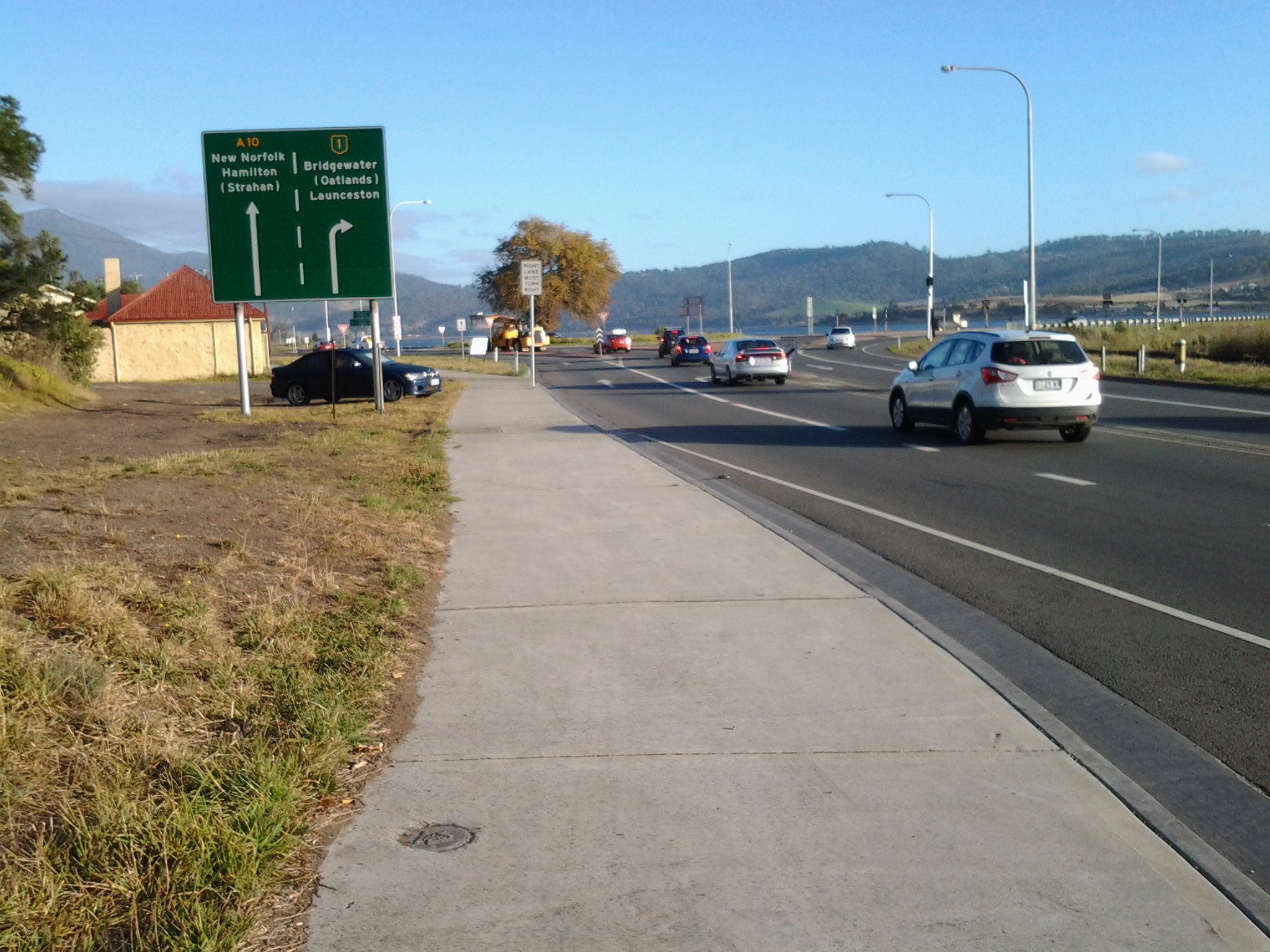
Since walking along the Derwent River in the northern suburbs on the western shore earlier this year, I have revisited MONA at Berriedale on a number of occasions but I have not been further north. So it was a great delight when my X1 Metro bus, which departed from Hobart city at 7.17am, used the old main road after the Glenorchy bus mall to travel through Berriedale, Claremont and Austins Ferry before reaching Granton. I was able to see the acres of majestic gold and red leafed vines of Moorilla Wines, to observe Cadbury’s chocolate factory puffing plumes of white steam into the crisp blue sky morning, to identify a range of native birds that were using Goulds Lagoon as a safe resting place, and to recognise various bays and other features that I had passed previously. Everything seemed edged with the early sunlight which glowed strongly through rain washed, impeccably clean air.
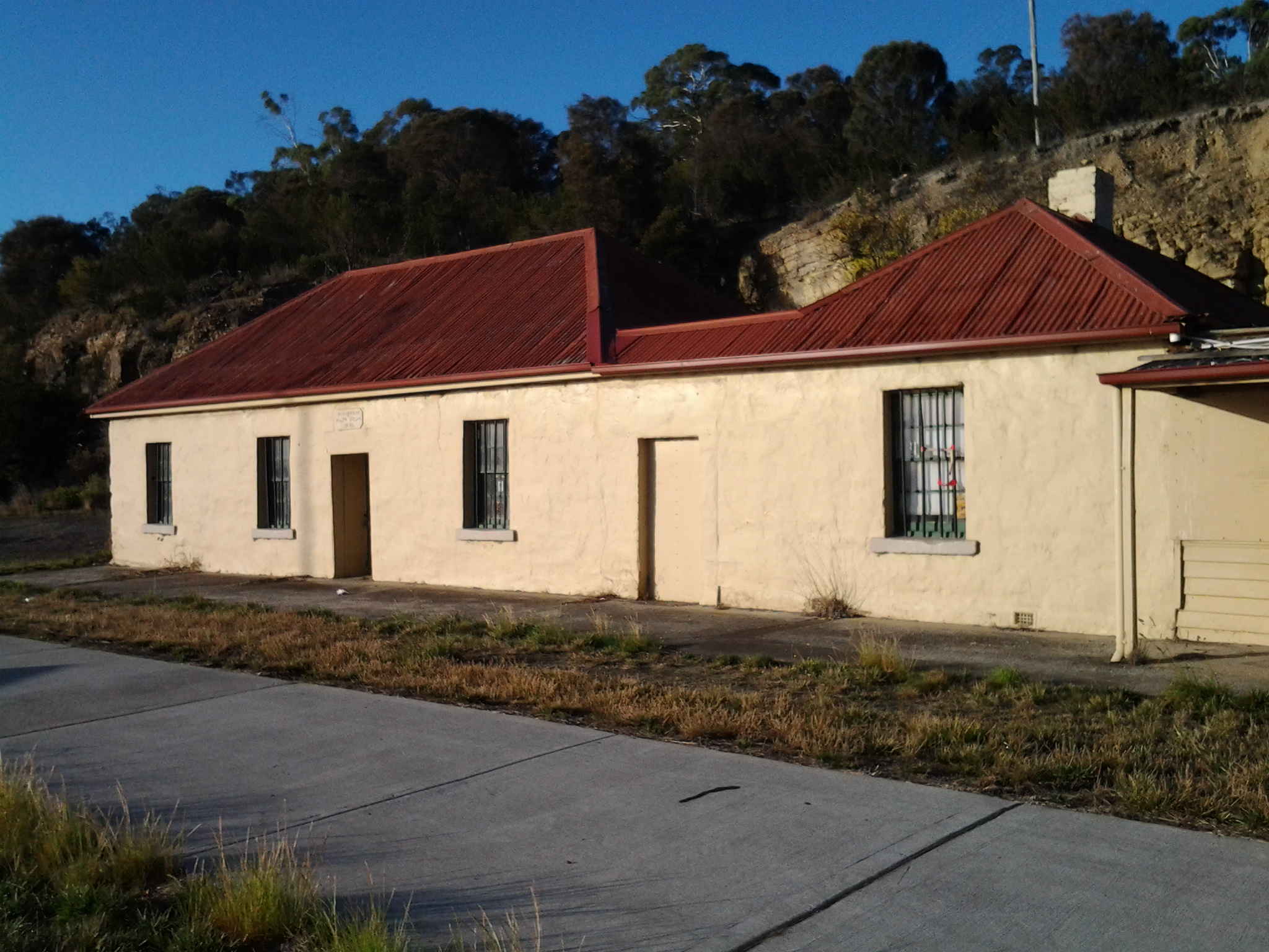
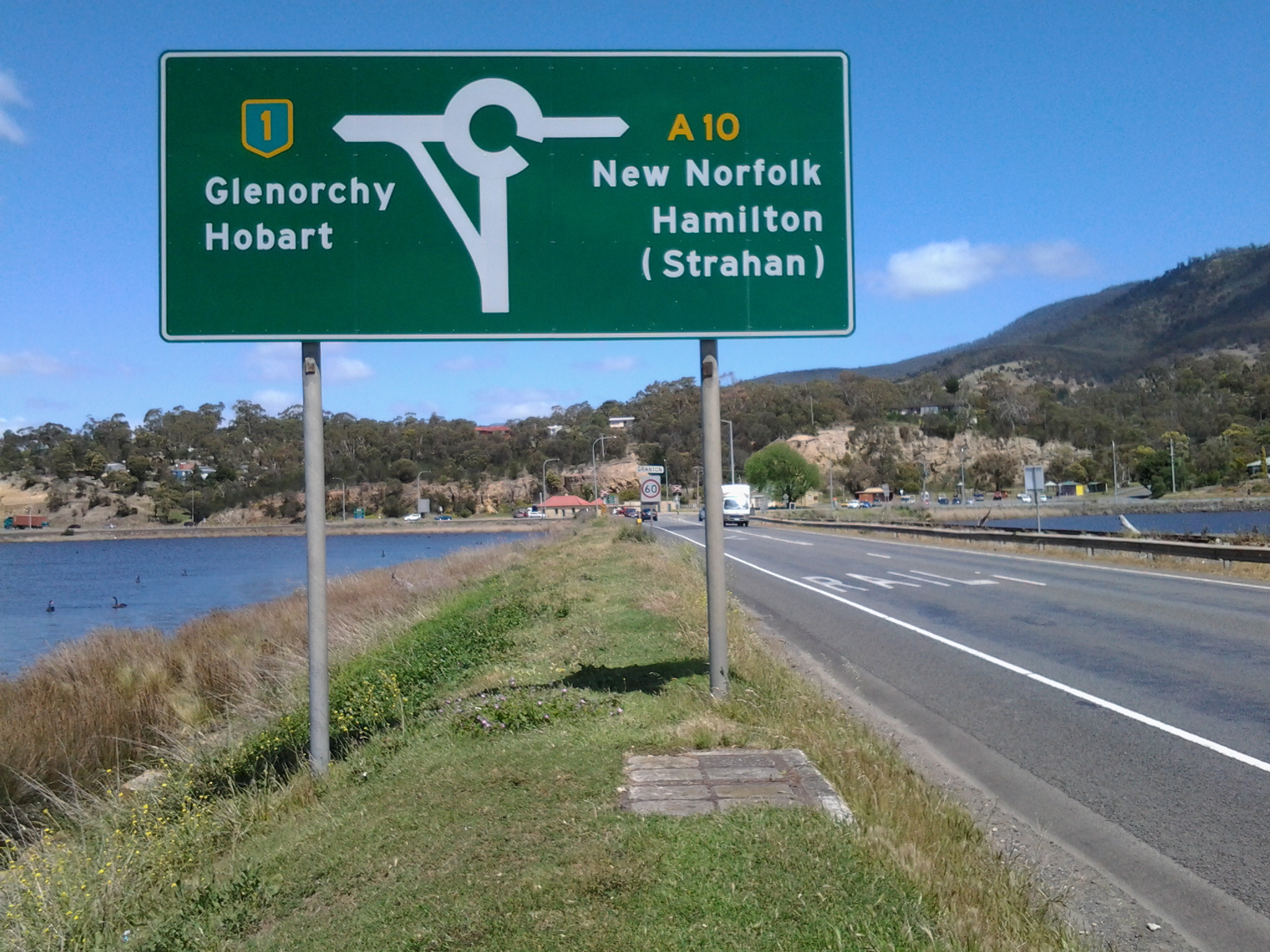
I was off the bus at stop 49 on the last of the Brooker Highway at 7.50am. Looking northwards, the sign made it clear the direction to take was straight ahead. An earlier post introduced the history of the old Granton watch house (search Historic Granton, Tasmania) – that’s the low yellow building on the left in the first photo below, and then the second photo shows the sun-struck front of the building.
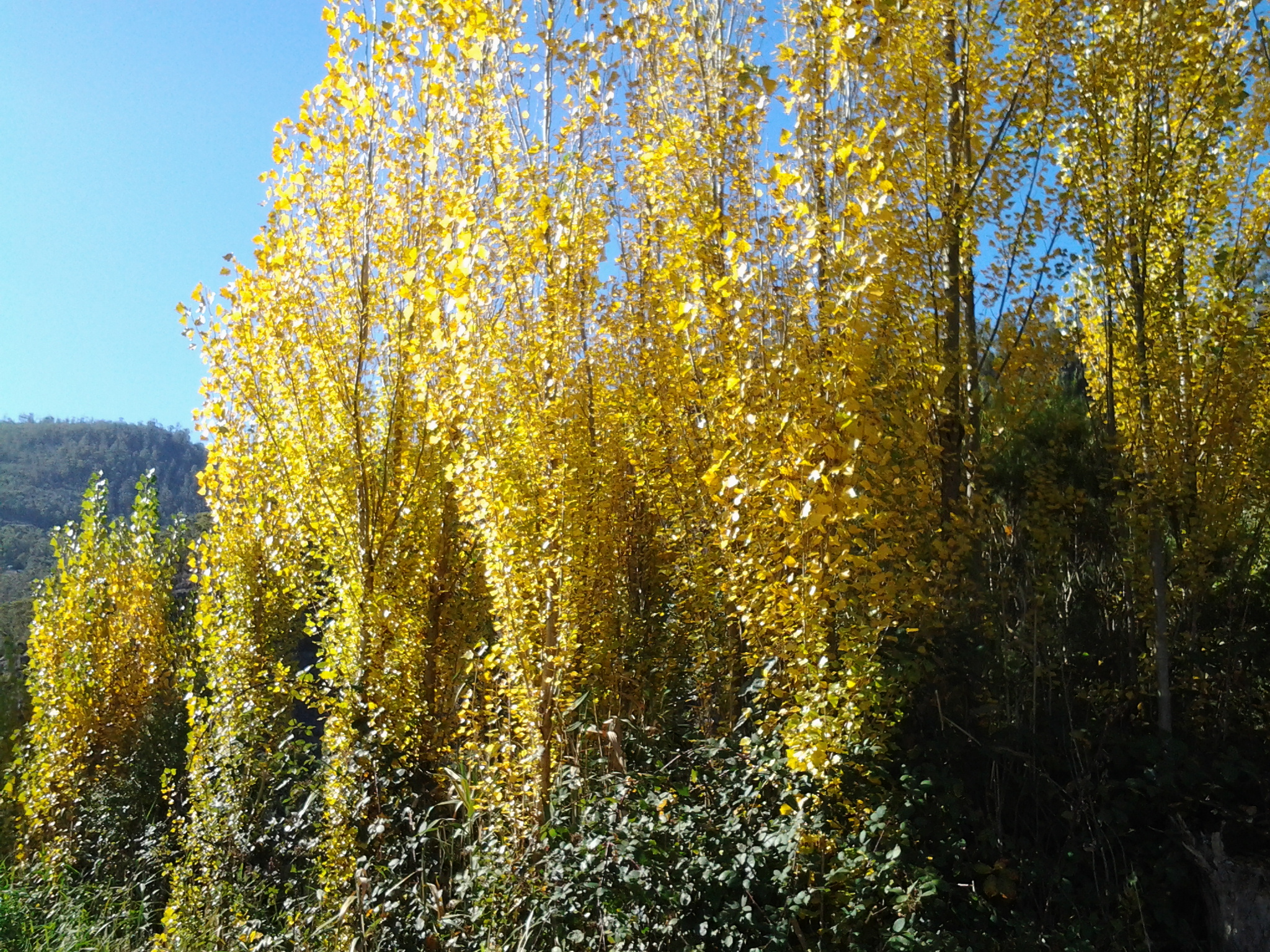
I was aware New Norfolk, over last weekend, had been celebrating the glories of its autumn foliage as indicated by the sign below. The sign served to increase my anticipation of those colourful delights.

The unmemorable architecture of the Granton Memorial Hall solidly facing the morning sun, seemed very out of place in this beautiful area.

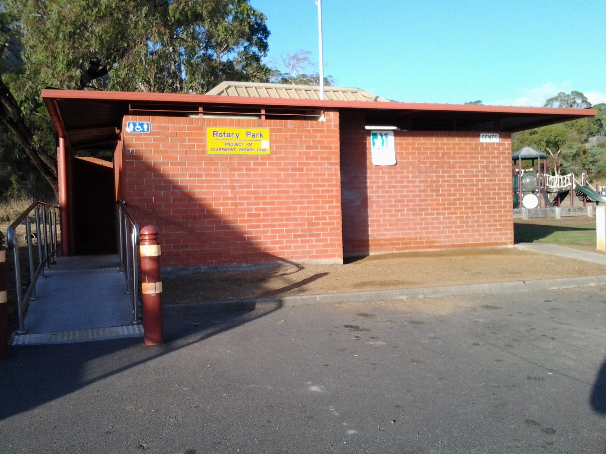
Equally solid and immediately serviceable was the public toilet block at the edge of the carpark used by many city bus commuters.
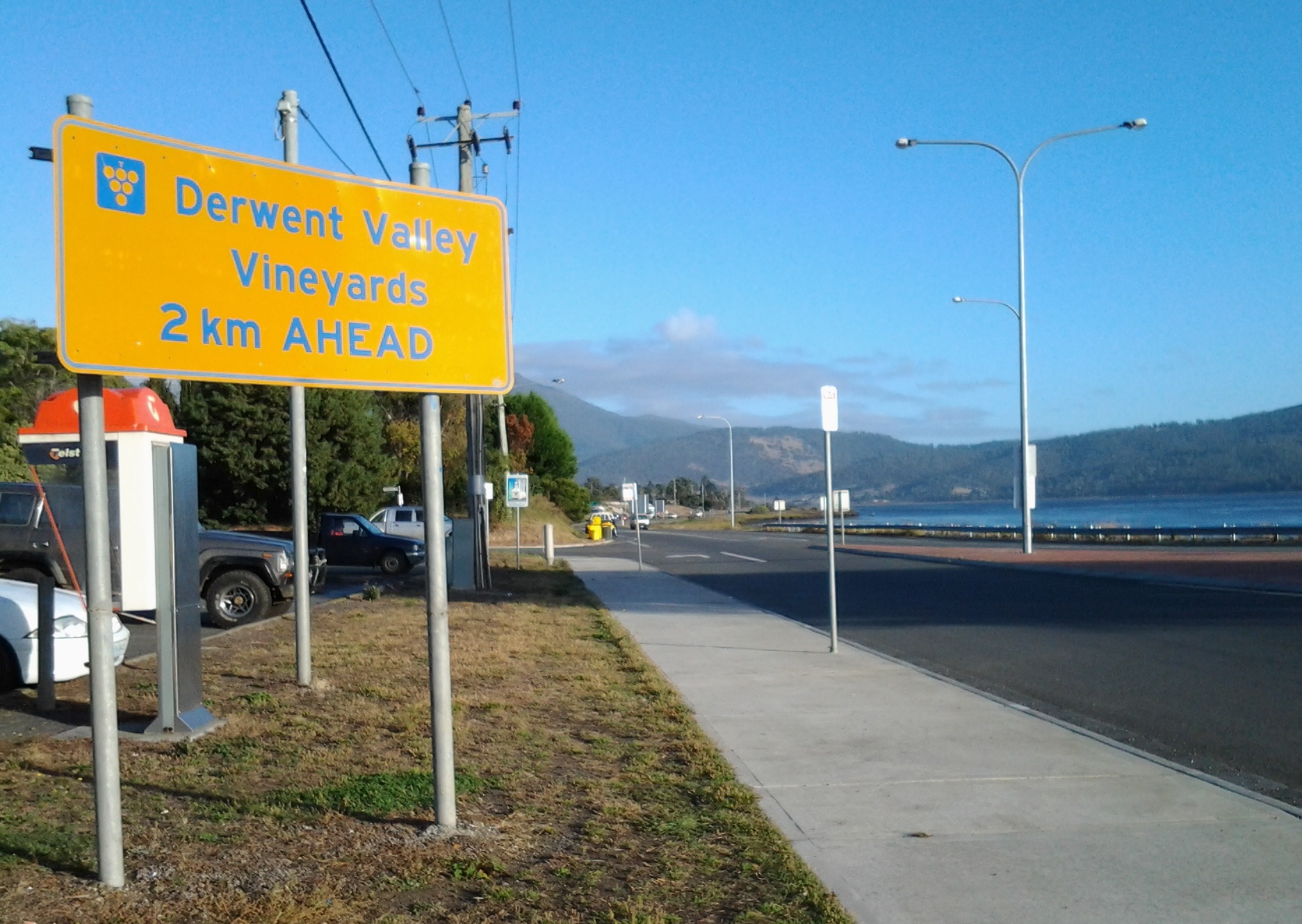
In front of the carpark a sign reminded me of the importance of grape growing in Tasmania – not the least because the wine from our vineyards is very drinkable (as agreed by wine judges from around the world).
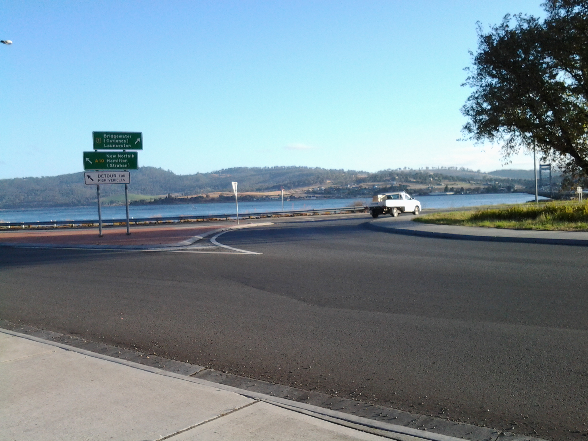
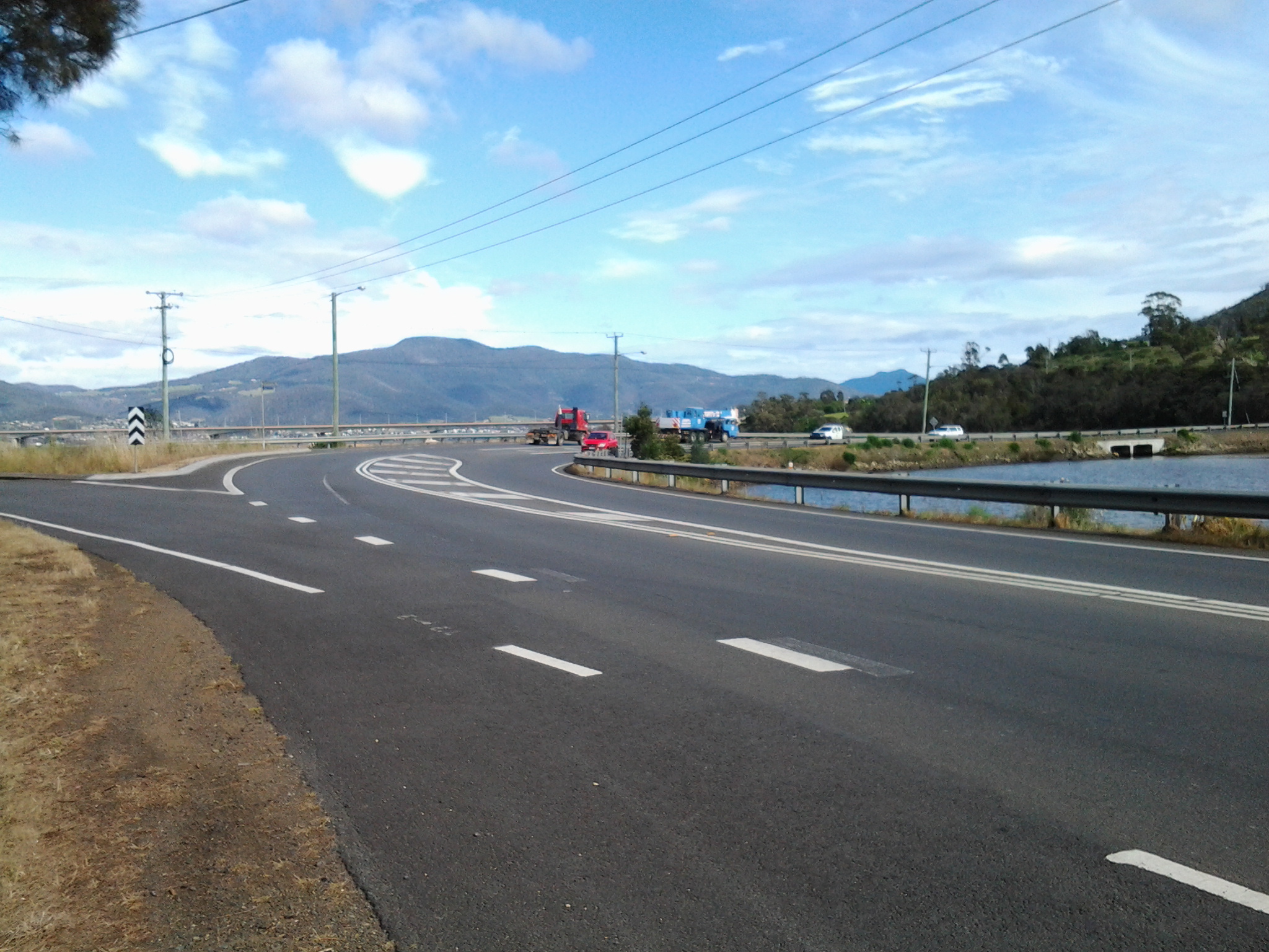
My eyes swung across to the roundabout for vehicles travelling north on the Midlands Highway to Launceston via many rural towns. In the distance, the vertical towers of the Bridgewater Bridge marked the Derwent River crossing. The calmness of the day, and the quality of the light was sublime.
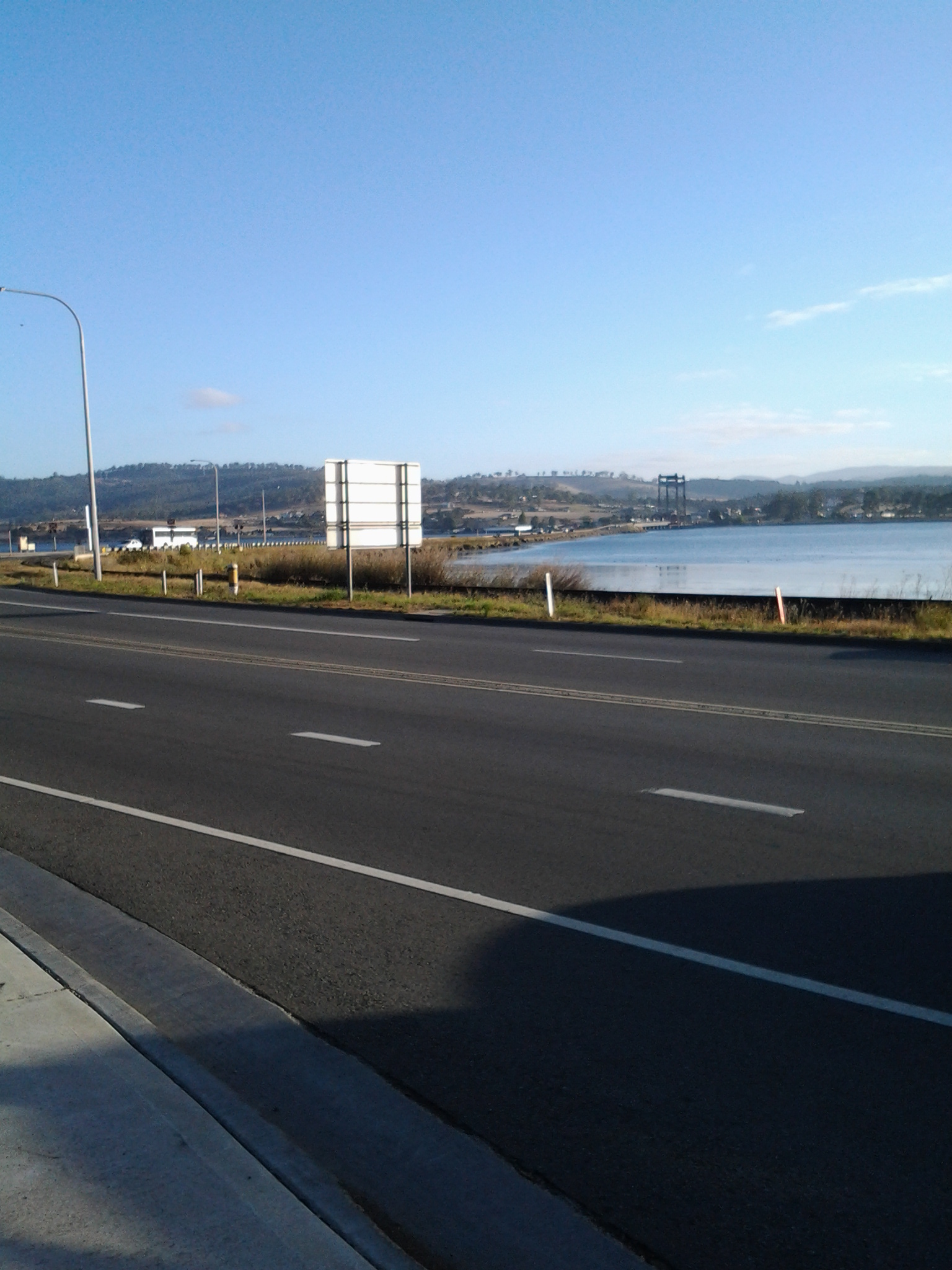
I hadn’t walked far along the Lyell Highway when I saw the sign below which indicated that 16 kilometres further along the highway I would reach New Norfolk. But could I trust the sign? Two or so kilometres further back, when I was still bussing on the Brooker Highway, I had seen a sign indicating the distance was 16 kilometres.

Not far away another roadside sign alerted motorists (and the occasional pedestrian): Welcome to The Rivers Run Touring Route.

Walking on the right hand side of the road facing oncoming traffic and with the Derwent River on my right, I continued into the icy breeze heading towards New Norfolk. It wasn’t much after 8am when I left the (comparatively) built up area of Granton on the first leg of Stage 14.
Today on my blog statistics page, I noticed someone from somewhere entered into their search engine, the following words: time walk from lindisfarne to Hobart city
I understand travellers and locals want to know this type of information but websites have not been set up to help.
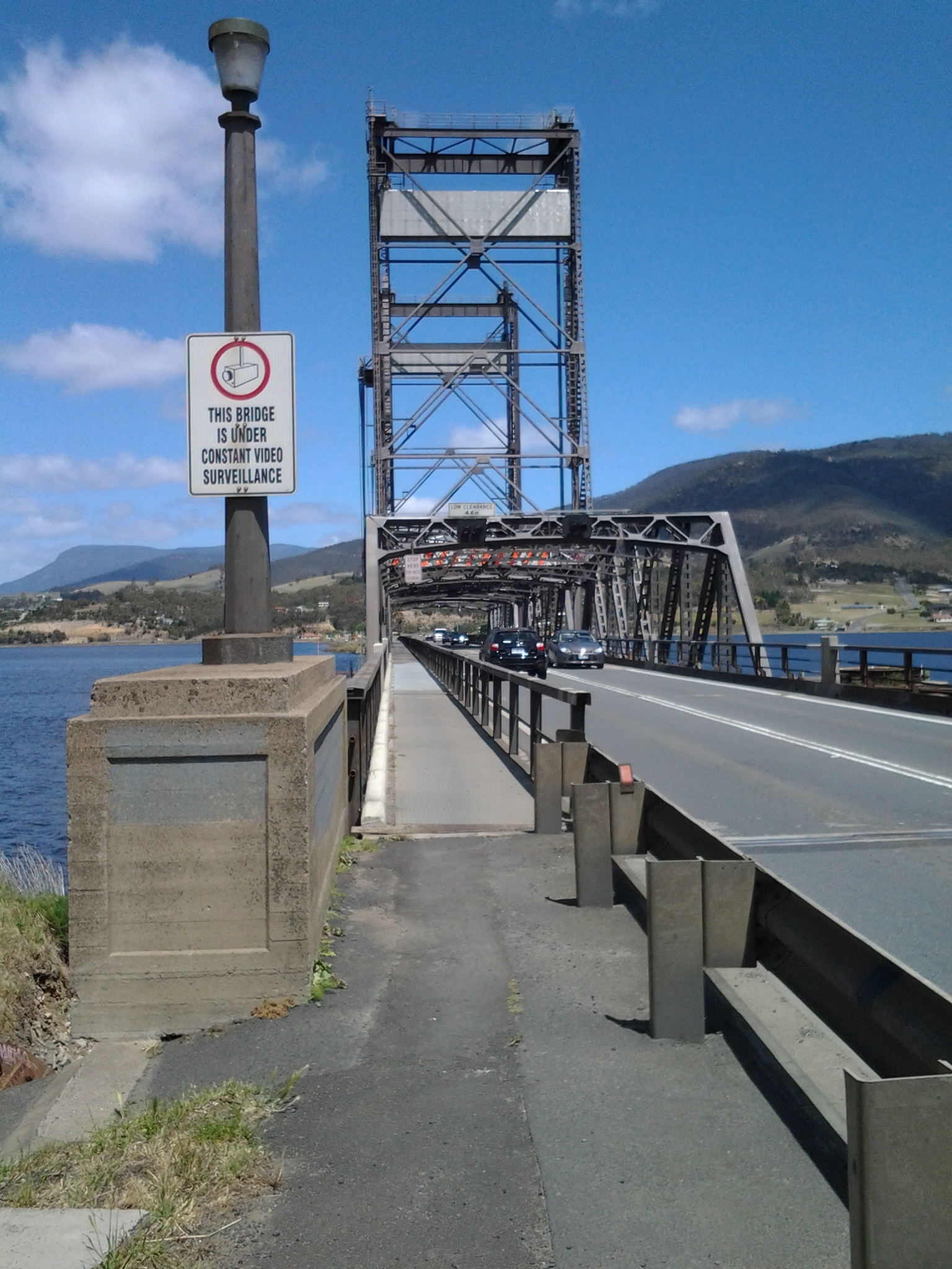
Based on my knowledge, and for an average strolling style walk, I guess the time from Lindisfarne to the Tasman Bridge would be no more than half an hour (only 2.1 kms from Lindisfarne’s Simmons Park to the Bridge), allow 20 minutes to negotiate your way across the bridge on the narrow pedestrian path with cyclists and pram wielding mothers, and then on the western side into the city the walk takes about 20 minutes. This makes a total of approximately 1 hour and 10 minutes to complete the walk. At the beginning and end of the day, there is a constant stream of walkers and cyclists making this trek to and from work in the city. A healthy and pleasant way to live a life.
The achievement yesterday was to walk from the Bridgewater Bridge to the New Norfolk bridge on the western shore of the Derwent River.
I set off from home before the sun was up and I found Hobart was quiet when I arrived at the city bus mall.

Then I bussed to Granton and alighted from the bus at the intersection with the Bridgewater Bridge causeway.
From Granton I walked north-west then west towards the inland town of New Norfolk walking mostly along the Lyell Highway and then on a walking track for the last 5 or so kilometres. The morning was freezing and the afternoon warm. But the sun was out; its hard autumn light made the world seem alive and sparkling. The Derwent River was splendid, often still and reflecting the trees and hills on its surface, under a bright blue sky with the sun shining gloriously.
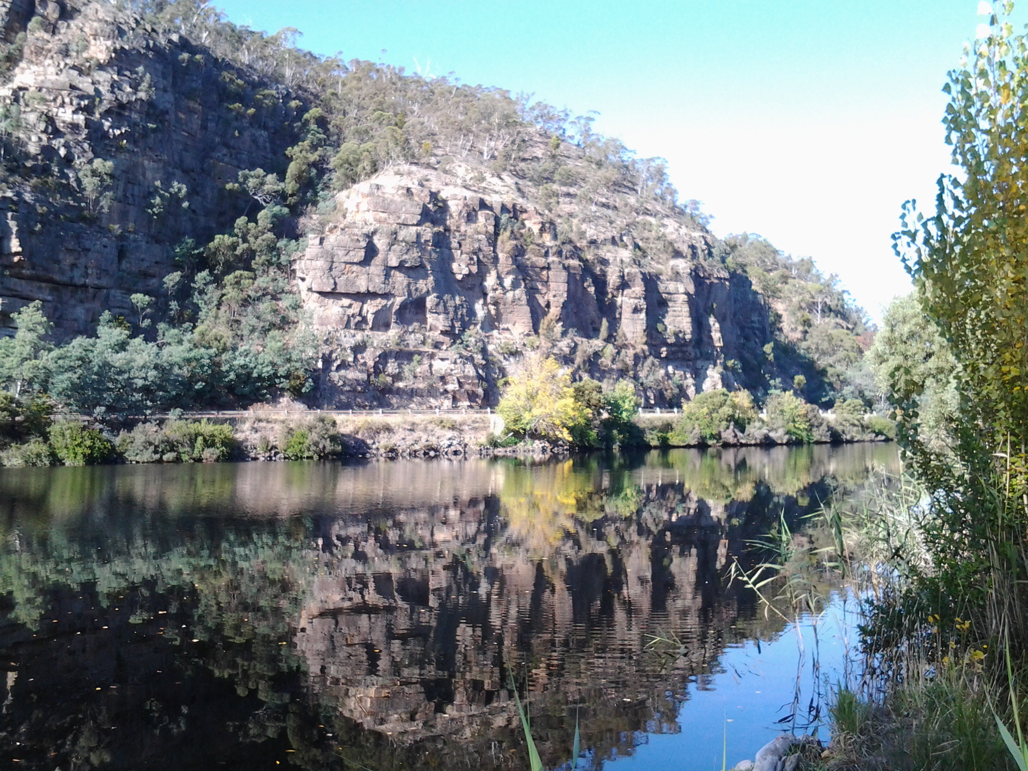
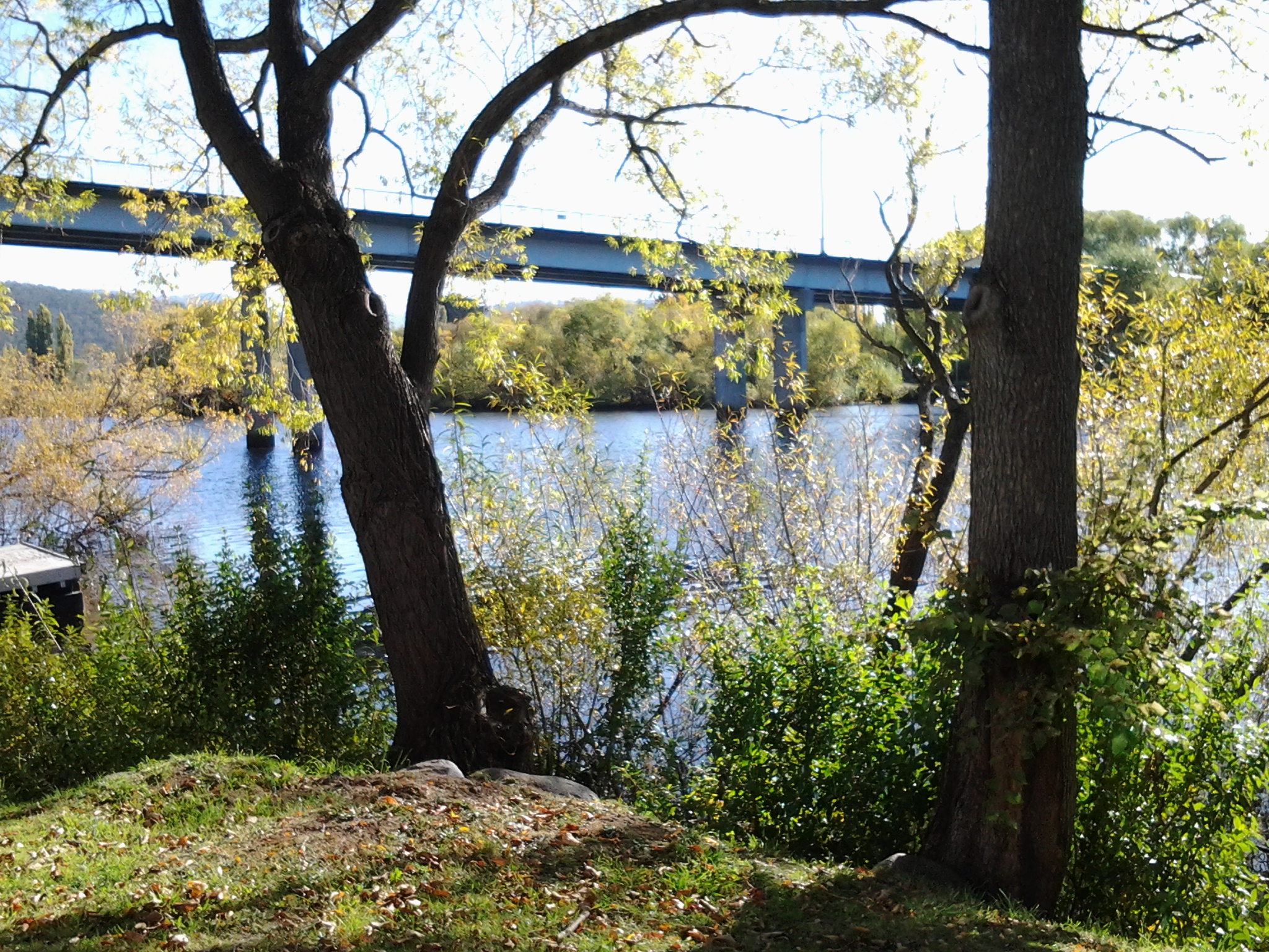
I finished my walk at the bridge crossing the Derwent River in New Norfolk.
During the walk, I covered about 15½km of the length of the Derwent River. By my reckoning, the total distance of the Derwent River on the western shore from the mouth of the River to New Norfolk is 54¼ km.
My walking distance was approximately 20¼kms. I have now walked approximately 191¼ kms not counting getting to and from buses, as part of this project to walk along the Derwent River.
The highlights of the walk to New Norfolk were finding the remnants of two clearly visible heritage lime kilns, seeing a family of 6 pelicans, finding the track along the river leading to New Norfolk, and being mesmerised by the spectacular autumn foliage along the walk and especially in New Norfolk.
I started walking from Granton around 8am and, despite wearing a thick woollen beanie plus a thermal top under my windproof jacket, I was frozen for the first two and a half hours. It was 8 degrees Celsius at Bellerive when I left home, 6 degrees at Glenorchy and I suspect much less with a wind chill factor along the first part of the walk. On this basis, I will not be walking further inland until sometime in Spring, and the timing of starting again towards Lake St Clair will depend on the air temperature.
Over the coming week I plan to enjoy writing up the journey and the discoveries of Stage 14’s walk in a series of different postings.
History
In the first couple of decades of the 19th century, when increasingly the small Van Diemens Land colony demanded more roads and better river crossings, the first road from Hobart Town to New Norfolk was built by McCarty under contract to the government. By 1840, the road to New Norfolk had extended to Ouse and Marlborough (Nive River) to serve remote settlers. During the next forty years the road was further extended for tourist purposes to Lake St Clair (Refer http://www.utas.edu.au/library/companion_to_tasmanian_history/R/Roads.htm).
Wikipedia offers the information that the highway did not reach Queenstown until the 1930s and was not properly surfaced for some time after that. In post cards of the 1940s and 1950s it is called the West Coast Road. When Tasmania’s hydro-electric system was expanding and their works were under construction at Tarraleah in the mid-1940s, the highway was re-aligned to follow the Derwent River until it passed Tarraleah to provide better access to the area for construction vehicles.

2008 details
A 2008 government report (http://www.parliament.tas.gov.au/ctee/Joint/Reports/Lyell%20Hway.pdf), which recommended major changes be made to the road between Bridgewater Bridge and New Norfolk in order to create a safer highway, provided lots of information which added to my knowledge about this strip of road and its environment. I will be looking to see if the recommendations were acted upon when I walk (the temperature plummeted today, and wintry weather yet again made the walking of Stage 14 impossible).
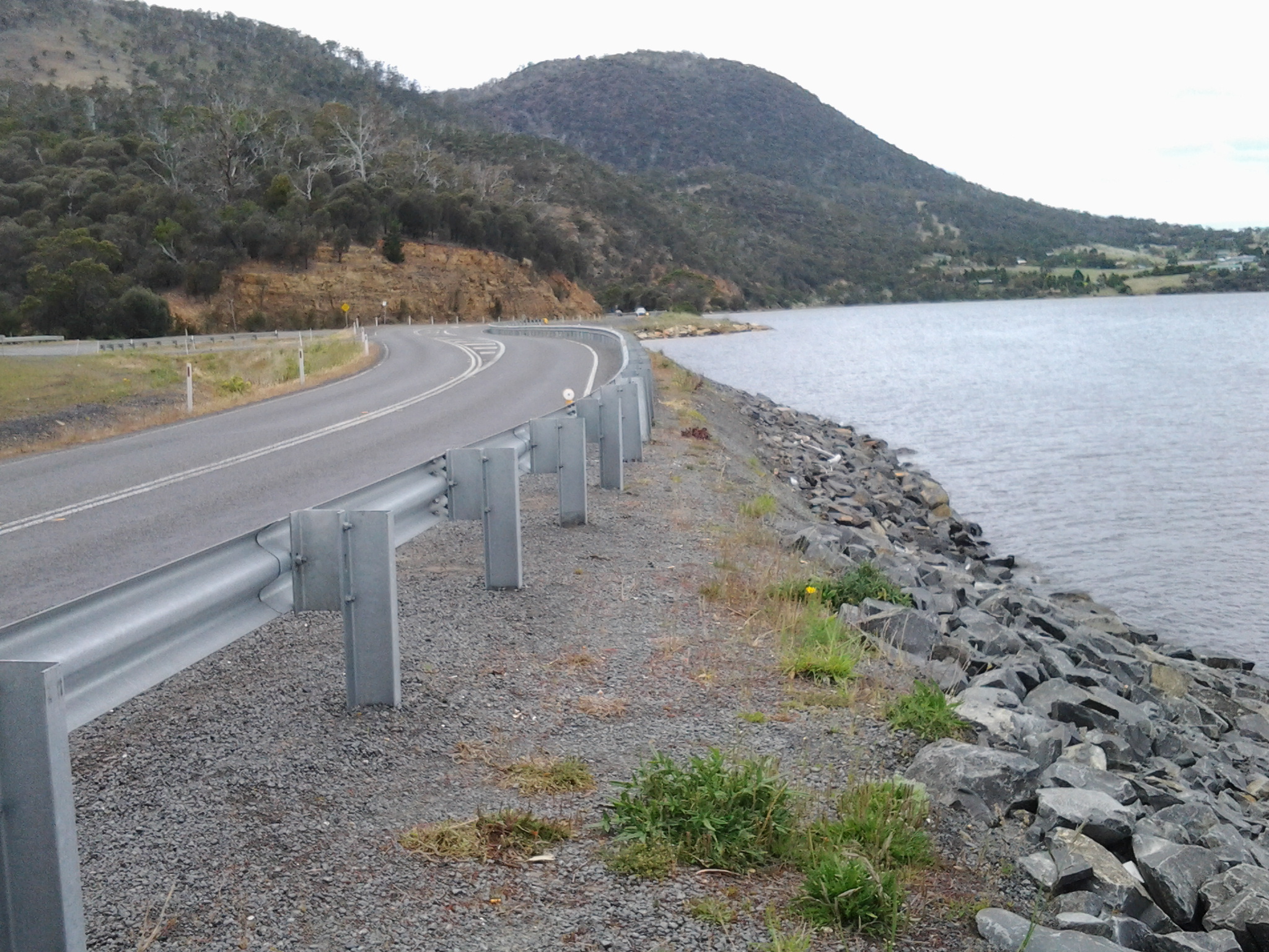
The report explained ‘The Lyell Highway between Granton and New Norfolk is a two lane road with a sealed pavement width that varies in the range of 6.5m to 7.2m wide with unsealed shoulders. The highway follows the southern bank of the Derwent River. The highway is often located at the base of the hillside adjacent to the river flats and as a result has tight curves and sharp crests. The high, steep terrain on the southern side of the highway and deep soft silts on the northern side pose significant design challenges due to cost management and the environmental impact of the proposed works. The abutting land use is rural, dominated by rural residential with some horticulture (vineyards, tomatoes, cherries) and one private recreational facility, the Motor Yacht Club of Tasmania (MYCT). The Derwent River is a conservation area. On the southern side of the highway most of the land is hilly, mainly cleared with some trees along the roadside and a few scattered in the paddocks. There are some properties which remain untouched and vegetated by woodland. There are also rows of trees along the side of the road which form windbreaks and/or landscape features.’
Vegetation
According to the same report, the following three vegetation communities of conservation significance occur in the area:
The trees of Potential Cultural Significance along that stretch of the Lyell highway include
The following two significant flora species, listed on the Threatened Species Protection Act 1995, occur in the area:
Social history
There are a number of additional features in the immediate area that are considered to have some cultural heritage significance. Project 3 Lime kiln, Chain 3250 – 3540, is located on the northern side of highway. This is currently listed on the Tasmanian Heritage Register (THR) (R701)(http://www.heritage.tas.gov.au/thr.html) and hence is subject to the provisions of the Historic Cultural Heritage Act 1995. There are a number of additional features in the immediate area that are considered to have some cultural heritage significance, such as the Marsh Farm and a redundant section of the old main road.
The south of Tasmania is crossed by trunk roads, regional freight roads and regional access roads, including six of the highways for walking on when walking from the mouth of the Derwent River to the source.

2. On the eastern shore of the Derwent from Geilston Bay to Bridgewater Bridge it was the East Derwent Highway which felt the plod of my feet occasionally during stages 5 -8 of my walk.


3. Once I reached Bridgewater on Stage 9, the highway crossing the Bridge was the Midland or Midlands Highway (sometimes referred to as the Heritage Highway).
4. Some of Stage 12 of my walk on the western shore towards the mouth of the Derwent River, included a couple of kilometres on the Channel Highway.
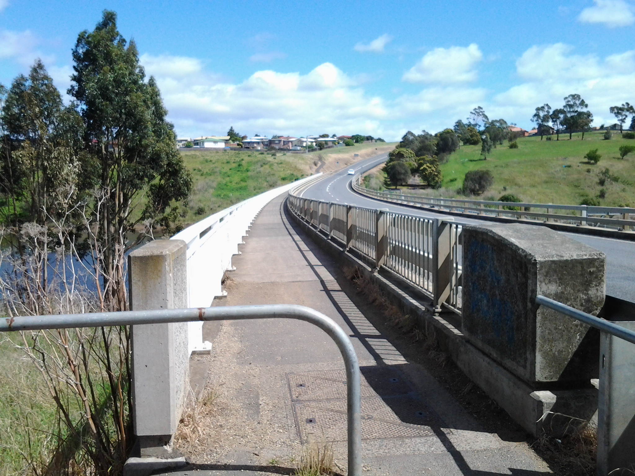
5. At the start of Stage 14 I will walk on the last few metres of the Brooker Highway, the main highway which extends from the centre of Hobart city to the Bridgewater Bridge at Granton. For the first time, at the Bridgewater Bridge, this Highway edges the Derwent River.
6. Immediately after the highway intersection with the Bridge, the Lyell Highway commences. From Granton until I reach the source, the Derwent River winds closest to the Lyell Highway, the highway which extends west to the town of Queenstown (which is overshadowed by the copper bearing Mount Lyell). This highway will be my life line in terms of accessing public buses.
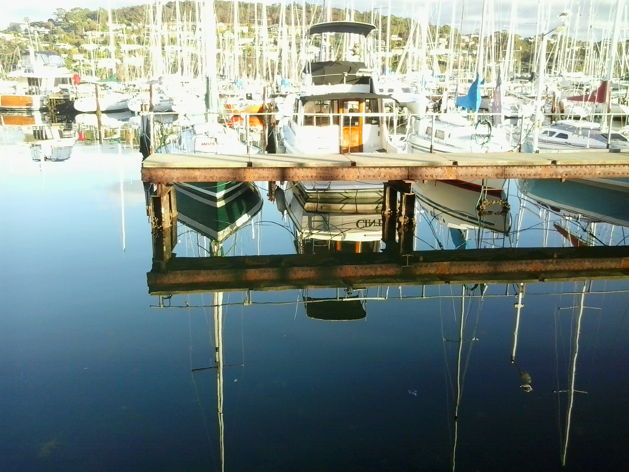
Last weekend, when I walked to Bellerive Village via the Bellerive Yacht Club and Boardwalk, I was stunned by the beauty of the view. The water in the marina was smooth as glass. The yachts were clear edged by the crisp air and hard bright morning sun. Despite puffs of cloud obscuring full vision of Mount Wellington in the distance, the vista was spectacular.


Having established the Theatre Royal’s connection to the Derwent River, it is now an easy step to exclaim about a recent performance staged in that theatre.
Before booking seats for an Indian classical music concert, I conducted no research so I was surprised by the extraordinary powerful and musical voice which flowed effortlessly from the stage one night this week. At the concert I discovered that Meeta Pandit, internationally renowned vocalist in the Hindustani tradition, has established herself as a highly revered singer of classical Indian ragas.
Wikipedia informs me that ‘The term “Hindustan” has been historically applied to the Gangetic Plain of North India… Hindustani classical music is the … North Indian style of Indian classical music.’ I also learned that ‘It is traditional for performers who have reached a distinguished level of achievement to be awarded titles of respect; Hindus are usually referred to as pandit and Muslims as ustad.’
Meeta Pandit’s performance was amazing. Vocal gymnastics of the most wonderful kind. Her perfect pitch, extraordinary breath control, and the rapid precise movement up and down the octaves kept me spellbound. In addition, the hypnotic wandering of her fingers drew me in more deeply.
Later, when I listened to samples of her singing on http://meetapandit.com/, it sounded very nasal, common and unspecial and that’s not what I heard. At the concert it was pure sound. Pure. Music. I travelled to India many years ago and since then have listened to music from India in many forms. Because of Meeta Pandit’s superb vocal quality and performance abilities, I now feel the Indian music I experienced previously only amounts to wailing and unpleasant piercing assaults on my ears by comparison.
My accompanying friend, a follower of this blog, exclaimed ‘who would have thought when the Theatre Royal was built almost two centuries ago that one day someone with a voice as fluid and melodic would travel from a country with even greater rivers than the Derwent, to grace the stage and leave an audience gasping for breath and overwhelmed by such brilliance.’ Meeta Pandit comes from the northern part of India which is slightly west of centre where great rivers such as the Yamuna River flow and, during this week’s concert, she mentioned rivers in her songs. At the risk of alienating readers with words that seem cheesy, it seemed to me the sounds from her vocal chords flowed like the continuous silky smooth waters of inland rivers. It was that good! Okay. Enough of my use of superlatives.
At the Theatre Royal concert, a fellow musician played hand drums and another played a Shruti box with bellows that provide a drone accompaniment, but I saw no string instruments. You can watch You Tube videos on many sites and gain an idea of Meeta Pandit’s vocal ability and musicality; examples include –
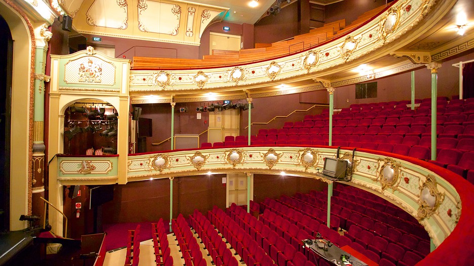
The Theatre Royal located on Campbell St Hobart was built in 1834 and is the earliest theatre built in Australia that is still fully operational today – each week the Theatre Royal stages various events: theatre, dance, musicals, opera, eisteddfods, music concerts or comedy. After a disastrous fire in 1984, the building was restored to its former glory and its delightful small but grand interior is now well worth a visit. Guided tours are on offer during the day.
But what does the Theatre Royal have to do with the Derwent River you may wonder.
Firstly, it is located only a stone’s throw from the Hobart Rivulet that flows into the Derwent River. The Hobart Rivulet was the source of fresh water to the first settlers in Sullivans Cove (a bay in the Derwent River) in the years after they established the colony in 1804. Picking up the crystal clear waters from flows on Mount Wellington, the Hobart Rivulet wound its way through the early ‘Hobarton’ and these days it continues to flow under much of the current city of Hobart.
Secondly, the early shores of the Derwent River were further inland in the early 19th century than today. Considerable land fill has been added over the past two centuries. When the Theatre Royal was built, the Derwent River was a little closer than today.
I have entertained myself with searches for old maps of Hobart so that I could understand where the Theatre Royal was located in relation to the original foreshore.
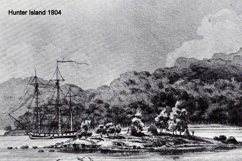
The image of the foreshore at Sullivans Cove below was drawn in 1804 (this was the year of first settlement here). Hunter Island was on its own before it was connected to the mainland by a causeway. This island was located not far from where Campbell St (the street on which the Theatre Royal is built) was established much later. The drawing shows the extensive forests which were removed over subsequent years to make way for the streets, houses and public buildings (image from http://www.tasfamily.net.au/~schafferi/images/Ocean&LNHunterIs1804img141.jpg

The site http://www.tasfamily.net.au/~schafferi/index.php?file=kop15.php offers the opinion ‘It is hard to imagine what Hobart Town would have been like when Lt. Gov. Collins arrived in 1804. The rivulet ran free, (except when it rained heavily sending logs that blocked the rivulet, sending water spilling across its banks) large gum trees stood on both sides of the rivulet, some of which had to be cut down to make room for the new settlement.‘ The drawing below, made by George P Harris in 1805 or 1806, seems to look across Hobarton from what today is referred to as the Domain. I think Harris employed a great deal of creativity when making the picture because the Mount Nelson Signal Station looms large on the distant hill yet it could not realistically have been that height.

Below, the 1811 town layout has an overlay of our contemporary streetscape (from http://www.abc.net.au/news/2015-02-24/footsteps-towards-freedom-art-project-begins/6251596). If you can locate the intersection of Campbell St and Collins St, then you can appreciated that the yet to be built Theatre Royal will be sited a few metres along Campbell St (on the block at the top side of the letter E of Street). You can appreciate how close this is to the Rivulet and to the Derwent River.

George Evans lithograph of 1819 below shows how little progress had been made in terms of new buildings and street construction 15 years after settlement ( http://www.abc.net.au/news/2014-08-22/1819-slnsw-south-west-view-of-hobart-town-1819-george-william-e/5689410)

By 1832 significant developments had been made to Hobarton . The map below (from http://www.auspostalhistory.com/articles/180.php) was made two years before the Theatre Royal was built. Can you locate Campbell St? Once found, can you see the thick black line that crosses it – that line is the Hobart Rivulet? The future location for the new theatre was a couple of house blocks away from the intersection between the street and the rivulet. Looking at the shoreline with the Derwent River, already it is clear land has been reclaimed along the edge; the shape is manmade and the landscape no longer flows naturally.

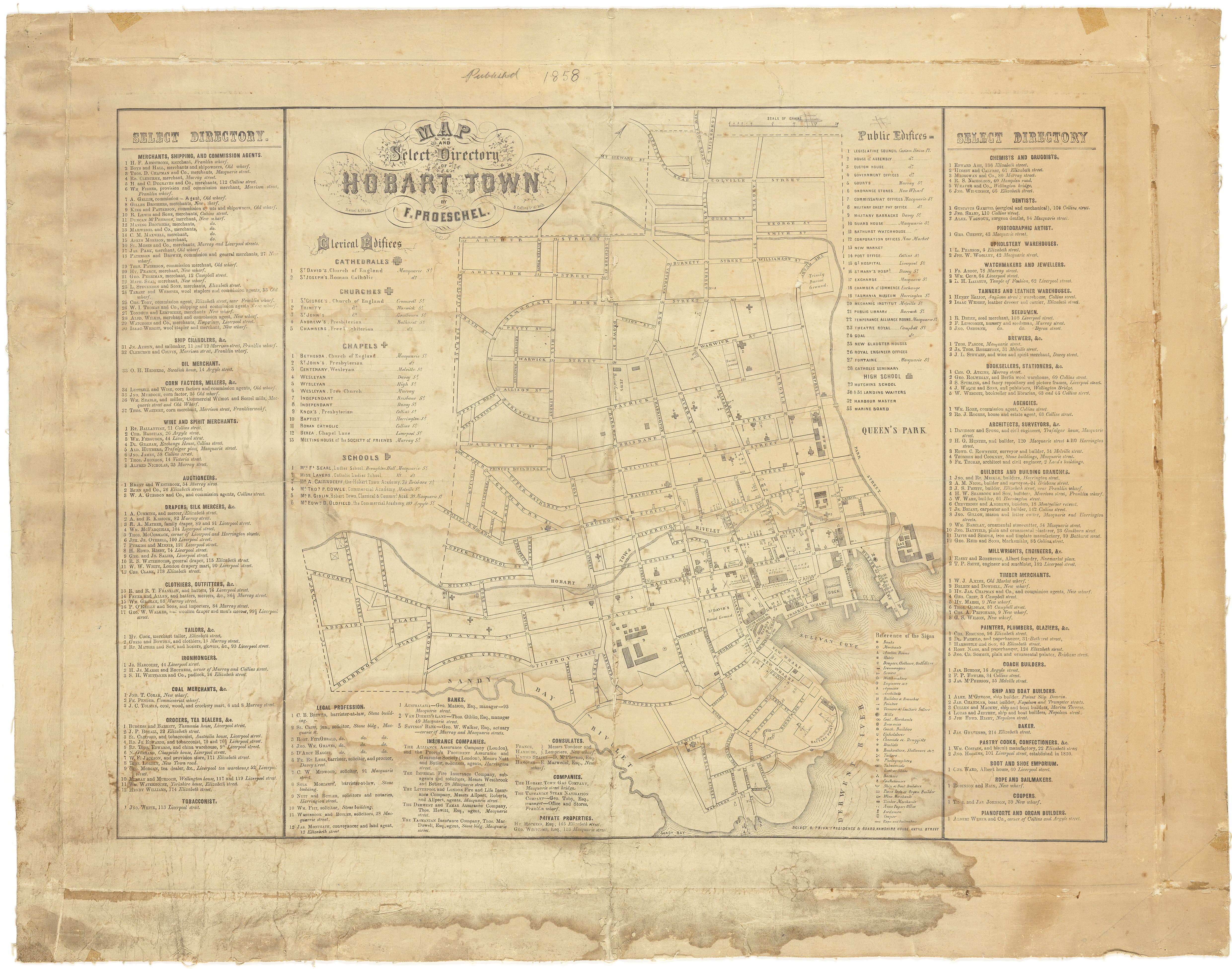
On the Proeschel map below (with the hand writing at the top of the map indicating 1858), locate the intersection of Collins and Campbell Streets. Nearby, the Theatre Royal is listed as Public Edifice number 23 (from http://catalogue.statelibrary.tas.gov.au/item/?id=879658)
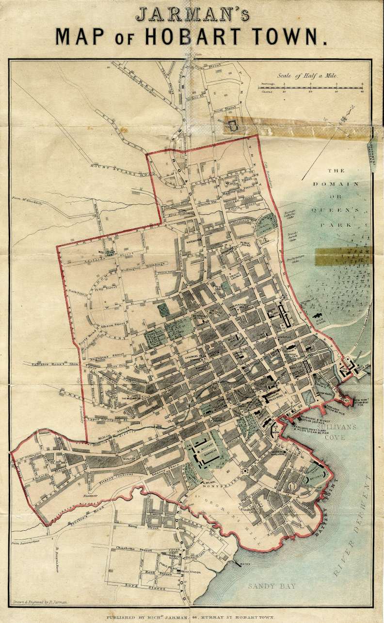
In Jarman’s map of Hobart Town (http://catalogue.statelibrary.tas.gov.au/item/?id=573294 indicates the date for this is 1858, although if the Proeschel map’s date is correct then the differences are too marked for this to be correct. More research required.), the end of Collins St has been modified so that two streets are located one either side of the Rivulet (black rectangle above Collins St is the Theatre Royal).
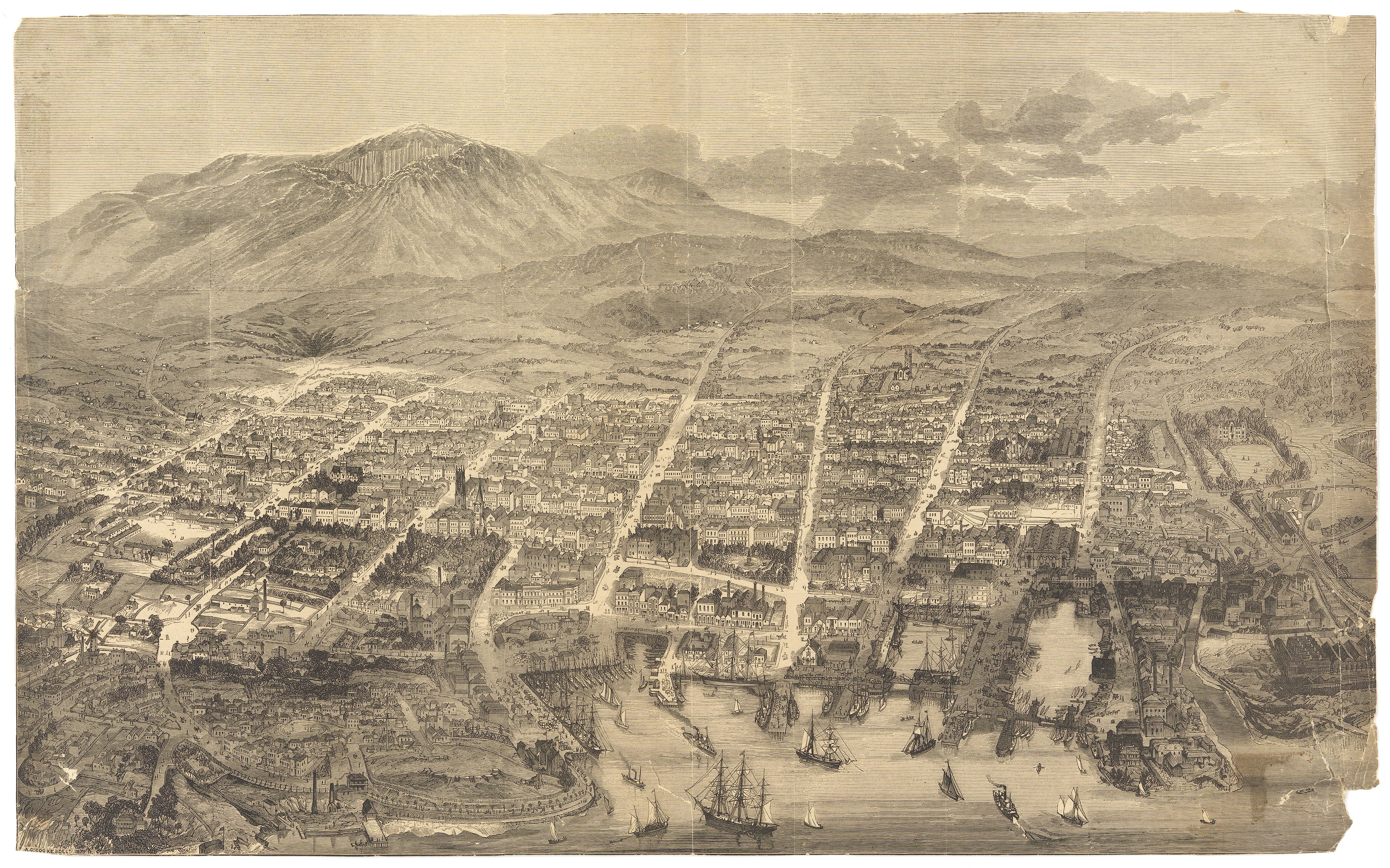
A woodcut map of 1879 by A C Cooke (from http://catalogue.statelibrary.tas.gov.au/item/?id=94421) gives a bird’s eye view of Hobart Town. On the lower right, the large watery dock can be seen intruding into the townscape. At the top end of this water is the large City Hall with Campbell St on its right hand side. Immediately behind the City Hall is Collins St. Therefore the Theatre Royal is located on the right hand side of Campbell St a little above Collins St.
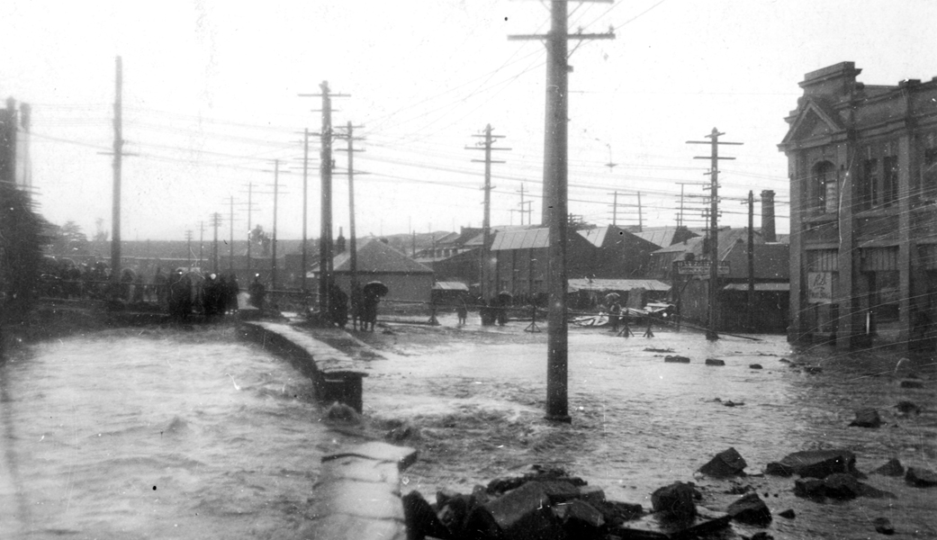
The area around the Hobart Rivulet routinely flooded the streets after heavy rains in the 19th and early 20th centuries (substantial new drainage systems now prevents such occurrences). The photo below (from http://www.linc.tas.gov.au/tasmaniasheritage/browse/exhibitions/hobartrivulet/diversions-and-floods/image-3) was taken after a flood in the 1920s. We are looking back towards the centre of Hobart Town along the Hobart Rivulet. The large curved roof at the right of the photograph is the top of the Theatre Royal and, therefore, the first bridge in the distance which crosses over the Rivulet will distinguish Campbell Street.
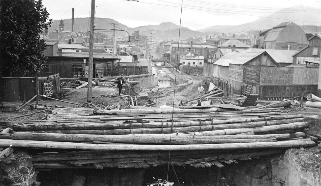
The photo below (http://www.linc.tas.gov.au/tasmaniasheritage/browse/exhibitions/hobartrivulet/diversions-and-floods/image-2) was taken during flooding in the 1930s. The building on the right hand side is the City Hall which still functions as such today. The road to the right of the flooding Rivulet is Collins St and people are standing on Campbell St above the Rivulet. Therefore, the Theatre Royal is just out of shot to the left from where people are standing watching the torrent.
Leo Schofield’s short-lived but internationally renowned Hobart Baroque festival lit up the Theatre Royal with spectacular performances.

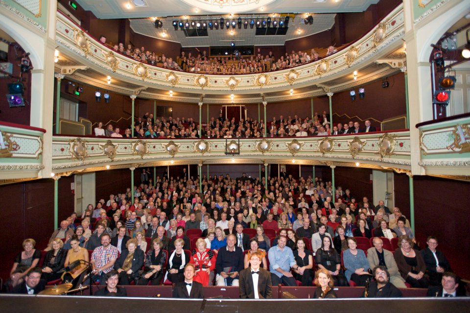
Our Theatre Royal was located for easy public access 180 odd years ago, and the site continues to attract crowds easily. A new performing arts centre will be built next door over the next couple of years. The Tasmanian Art School is located close by in Hunter St adjacent to the wharves and jetties jutting into the Derwent River. It fits with history to develop an artistic precinct near the water.
Visiting Turkey, Italy, Morocco and Hungary
Hotels in Launceston to 1900
The ribbon that separates the eastern and western shores of Hobart, Tasmania's capital city
The ribbon that separates the eastern and western shores of Hobart, Tasmania's capital city
Beautiful wilderness locations and more
Keeping track of our adventures.
Travel and Photography
The ribbon that separates the eastern and western shores of Hobart, Tasmania's capital city
From Hobart to Hobart via four continents
Nature + Health
Solo hiking is an amazing challenge. Let's go... and keep going!
Sharing Inspiration from the Wild
My soul explores where my mind wanders...
A Hundred Years from Philadelphia to New Hampshire
Following her writing dreams
Ariadne's Clew - the Ship's bLog: sailing Tasmania with the Stoneman family
My life's aspirations, inspirations and a little bit about running :)
We are about to embark on great change, we are moving to Tasmania.
Our everyday adventures
