Tag Archives: Nive River

Derwent River water passes via the township of Tarraleah


Earlier this year the entire town of Tarraleah was on the market for sale.  Refer article 1, article 2 , and article 3.

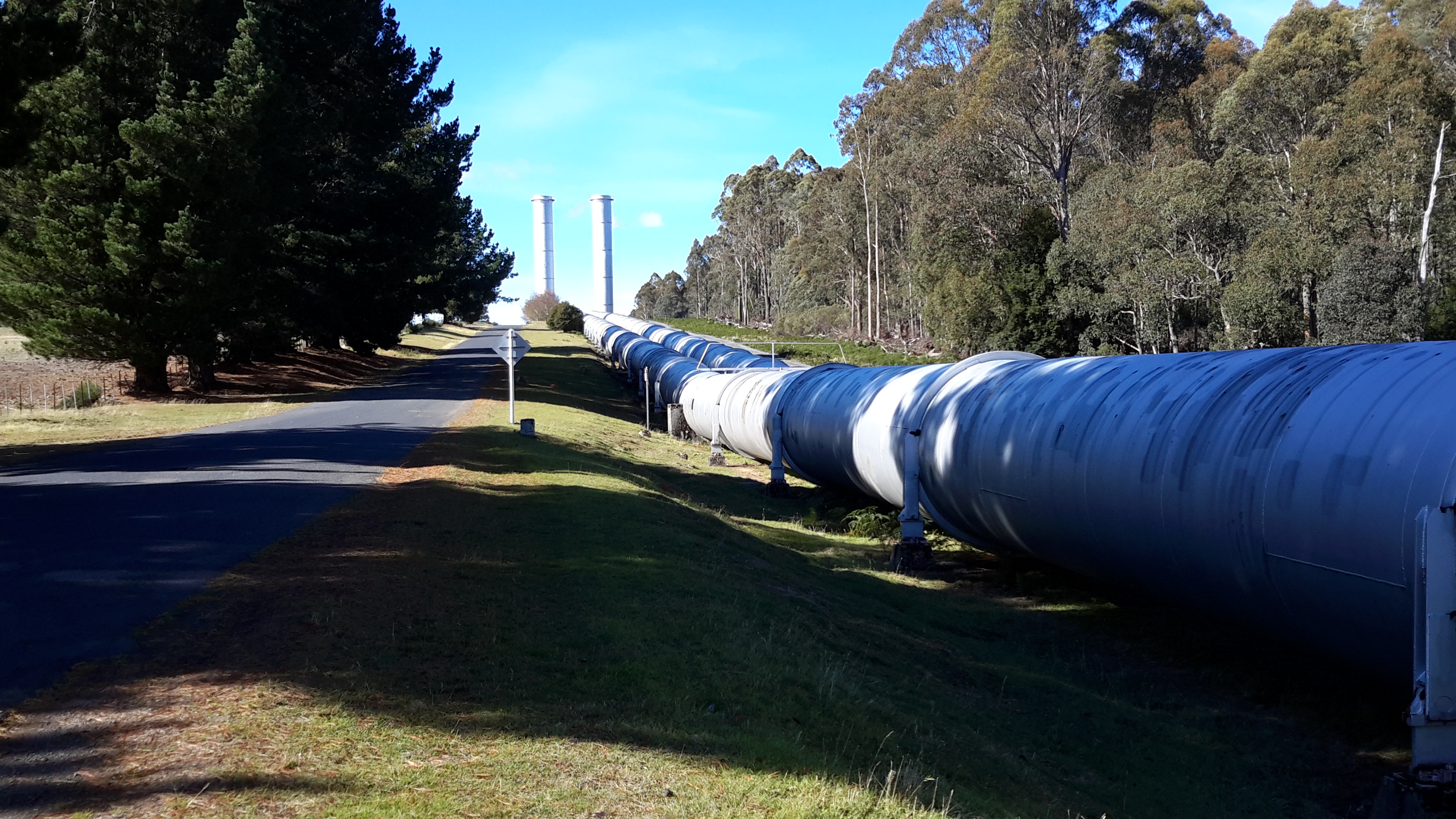
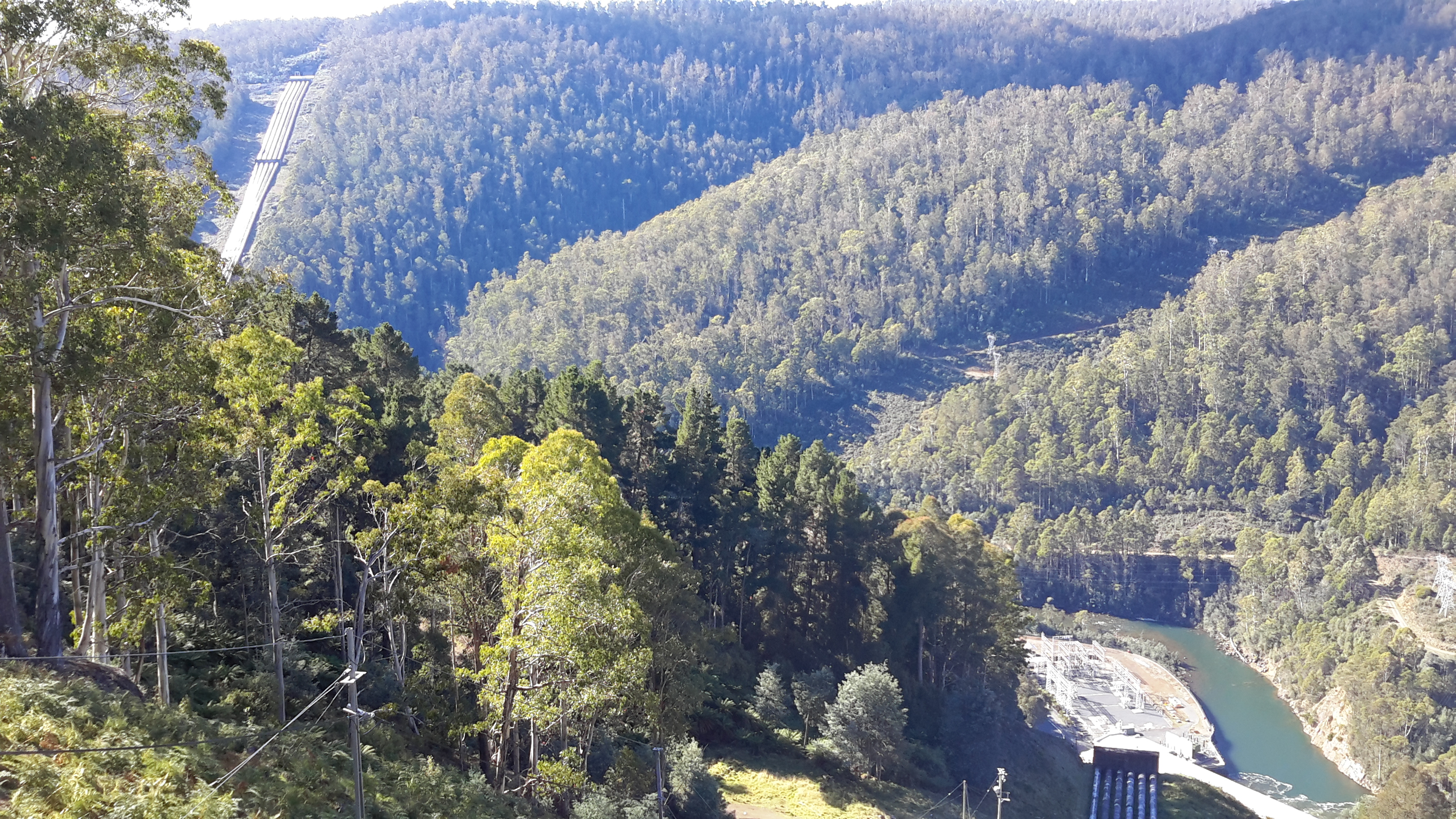
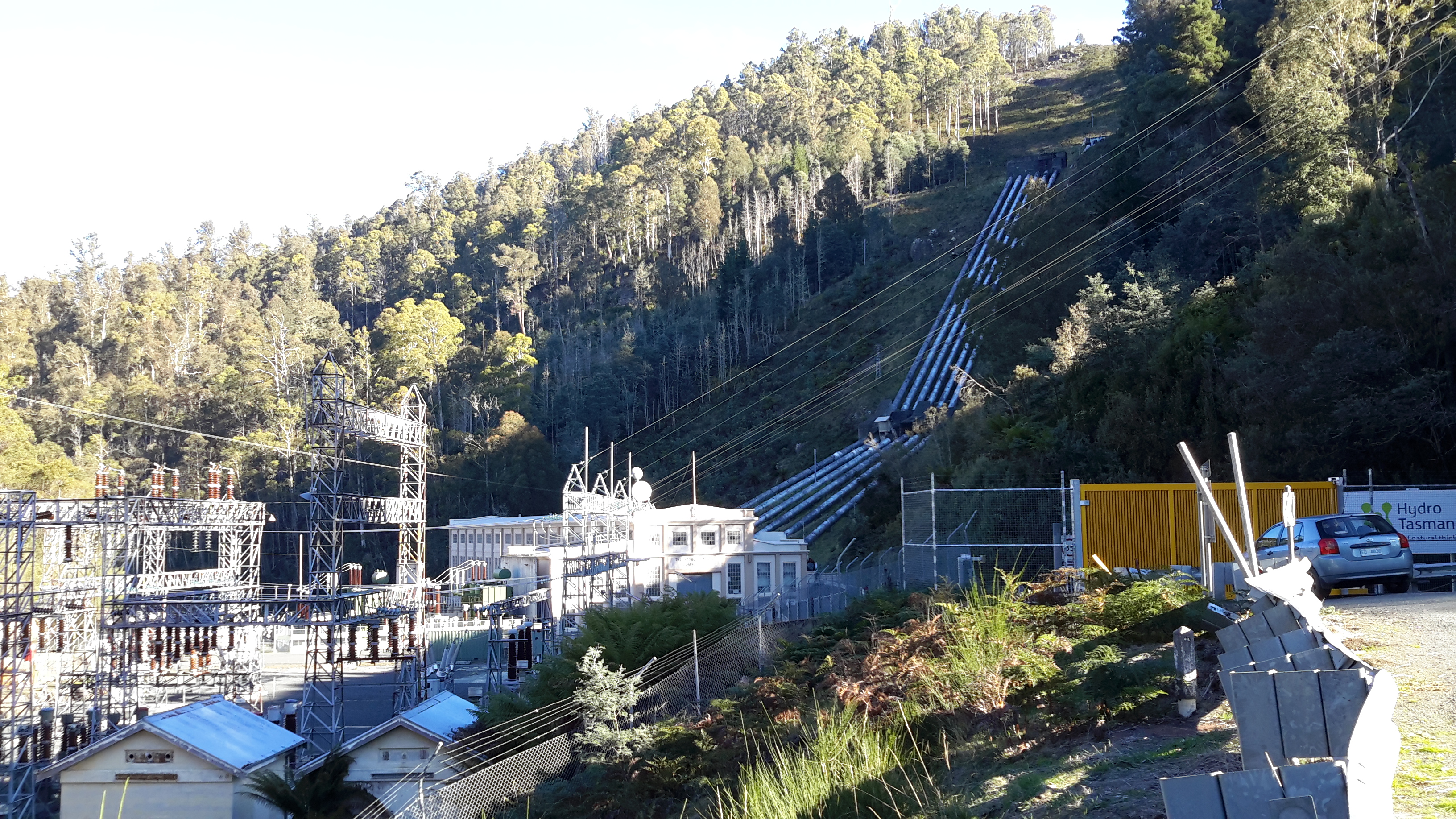
If you were to follow Derwent River water by walking from the western end of Lake Catagunya at the Wayatinah Power Station inland past the Wayatinah Lagoon to the Liapootah Power Station then follow the Nive River to the bridge next to the Tarraleah Power Station (with the Tungatinah Power Station on the other side of the bridge), you could look up the hill to see massive penstock pipes descending the hill from the township of Tarraleah above.

The water falling down these pipes is Derwent River water which has travelled via Tarraleah Canal 1 and Tarraleah Canal 2 after processing through Butlers Gorge Power Station at the foot of Clark Dam that holds back the waters of Lake King William.

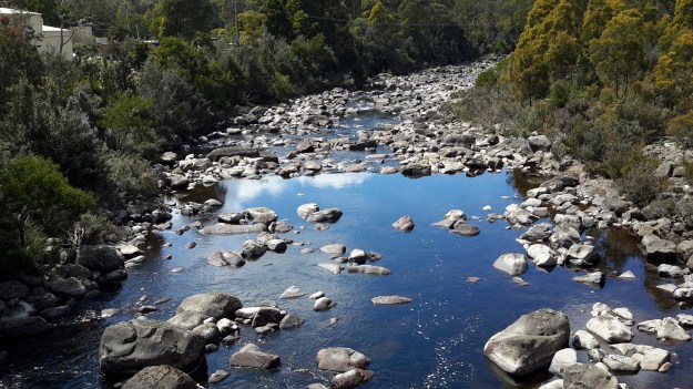
I chose not to walk the route via the penstocks and Tarraleah township when walking from the mouth to the source of the Derwent River,  rather to follow the original river bed albeit a scatter of stones and limited water during the summer, between Wayatinah and Butlers Gorge Power Station.

However, knowing that Derwent River water flowed along the Canals and through the massive pipes, I did visit the township of Tarraleah during the period when it was advertised for sale. I was curious to see what the township of Tarraleah looked like (it had been many years since I last visited). Despite being centred within lush dense rainforest, thankfully no rain fell at Tarraleah and the sky was blue and the day sunny when I visited. I approached the town from the highway and followed the slightly snaking pipes.

20160425_132005.jpg

20160425_132023.jpg

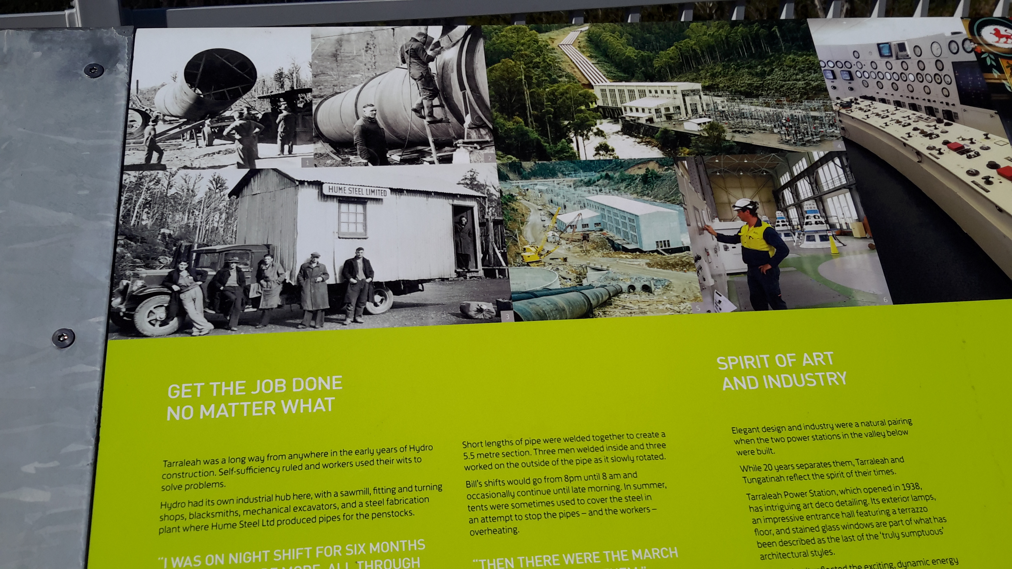
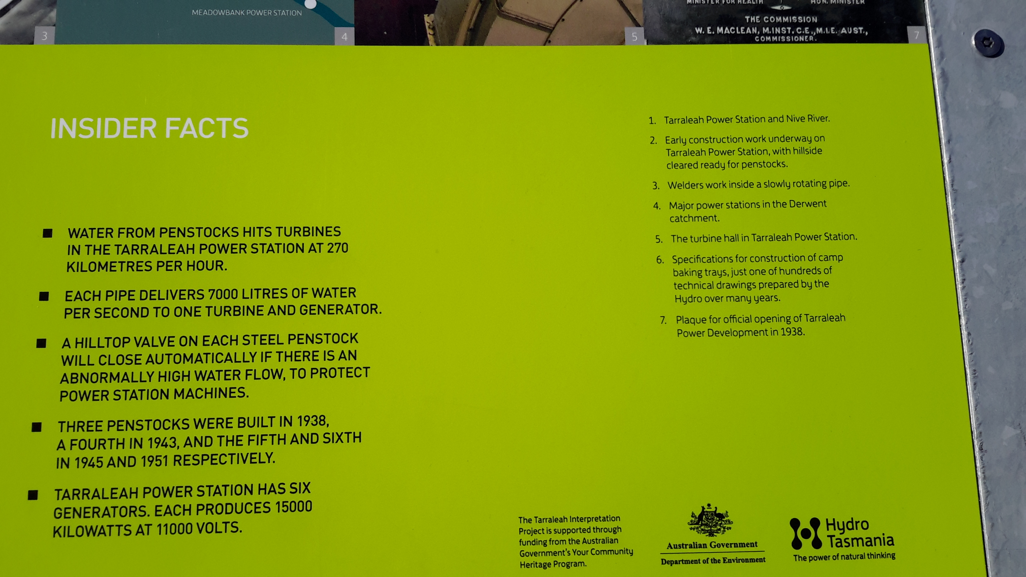
At the point where the pipes arrive at the top of the hill and are about to drop down the hill, I browsed public information boards and plaques.

20160425_132500.jpg

20160425_132512.jpg

20160425_132726.jpg

20160425_132711.jpg

20160425_132826.jpg

20160425_141509.jpg

The views from the township were dramatic. I am forever in awe at the engineering achievements of the past.

20160425_132537.jpg

20160425_132615.jpg

20160425_132653.jpg

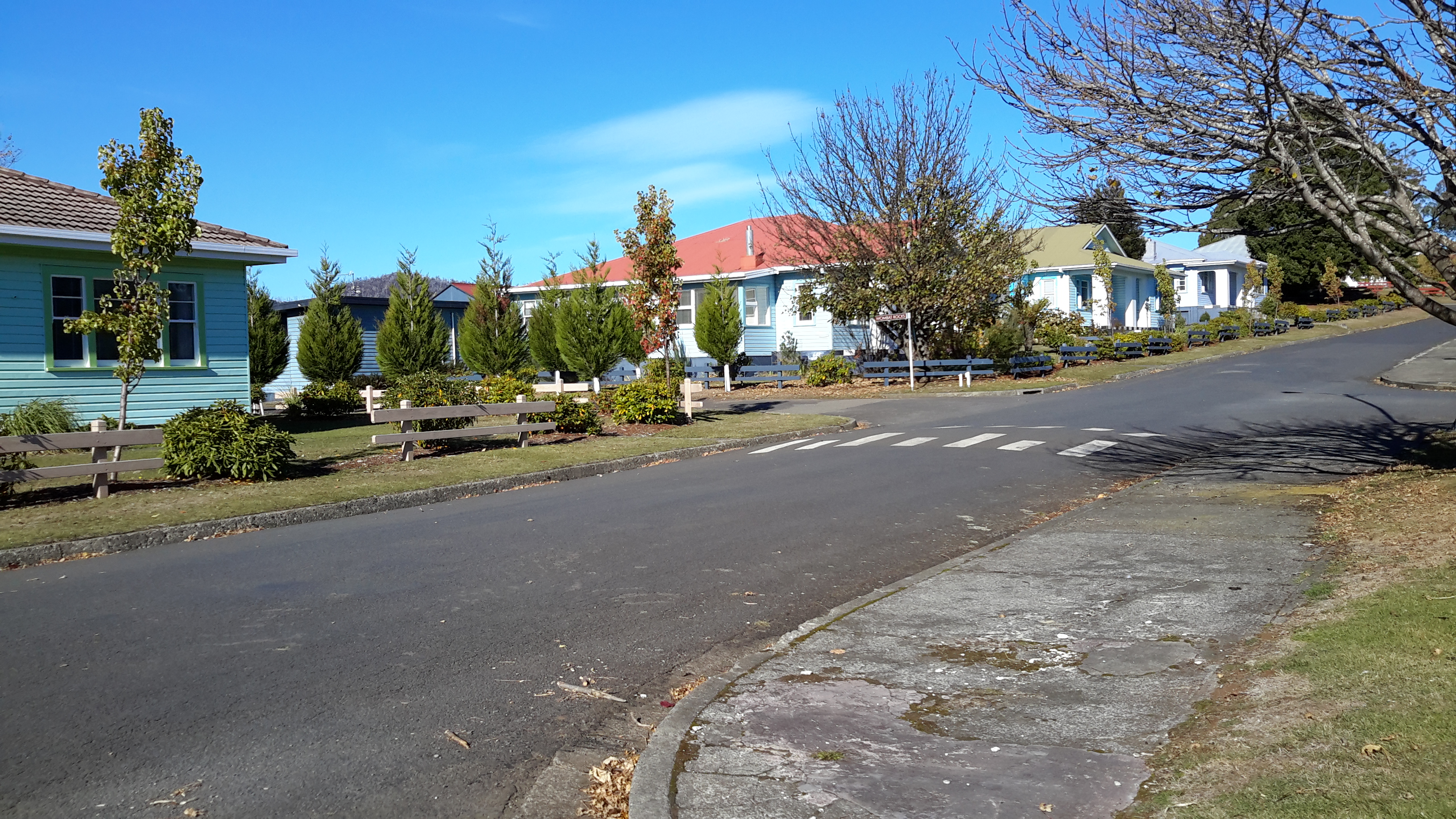
These days Tarraleah is a place that acknowledges its social history from the early days of Hydro Tasmania. I was amazed to see the row of freshly renovated houses each with their own array of pastel coloured paint finishes. Perfect location for a science fiction movie.  I felt there was something strange about its lollipop colours and perfection.

20160425_142056.jpg

20160425_142039.jpg

20160425_144341.jpg

20160425_142110.jpg

Afterwards I travelled out of Tarraleah and down to the bridge over the Nive River. The Tarraleah Power Station was partly hidden in shadow from the afternoon sun. My eyes followed the pipes up the hill knowing the township was there on top.

20160425_145718.jpg

20160425_145849.jpg

The Nive River accepts the Derwent River water after processing for electricity generation through the Tarraleah Power Station.  The water passes through a series of further management processes, and ultimately empties into Lake Catagunya and then continues its long journey towards the sea.

20160425_150151.jpg

I have heard rumours the Tarraleah township sold but I cannot find records supporting this.  I haven’t one idea how a buyer could get a return on an investment of $11 million at Tarraleah, so I will be very interested to hear what will happen to this piece of Tasmania’s history.

The complex that makes up Wayatinah – posting 7 of 7

The Derwent River at Wayatinah

20151029_113841.jpg

20151029_113829.jpg

From my aerial experience, I know the river looks like this all the way north-westwards of the Wayatinah Lagoon to Clark Dam at Butlers Gorge; a distance of not much less than 30kms in very steep country with numerous creeks cutting the landscape and flowing into the Derwent River.  In the post introducing George Frankland’s walk, mention was made of the Nive River. The Nive flows into the northern end of Wayatinah Lagoon. Before the Wayatinah dam was built, the Nive flowed directly into the Derwent.  The river edge between Wayatinah and Butlers Gorge is where Frankland and his expedition found two to four miles per day was the going rate because of the density of the bush. And then they gave up and walked inland away from the Derwent River.

 20151028_115431

20151028_115442.jpg  
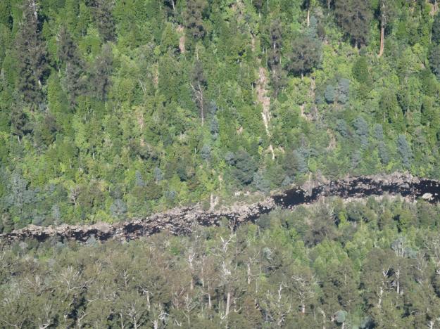
A couple of Chantale’s aerial photos show similar rocky beds along this remote and wild part of the Derwent River.

IMG_3828dryish river bed.JPG

IMG_3832.JPG


The Lyell Highway between Bridgewater Bridge and New Norfolk

History

In the first couple of decades of the 19th century, when increasingly the small Van Diemens Land colony demanded more roads and better river crossings, the first road from Hobart Town to New Norfolk was built by McCarty under contract to the government. By 1840, the road to New Norfolk had extended to Ouse and Marlborough (Nive River) to serve remote settlers. During the next forty years the road was further extended for tourist purposes to Lake St Clair (Refer http://www.utas.edu.au/library/companion_to_tasmanian_history/R/Roads.htm).

Wikipedia offers the information that the highway did not reach Queenstown until the 1930s and was not properly surfaced for some time after that. In post cards of the 1940s and 1950s it is called the West Coast Road. When Tasmania’s hydro-electric system was expanding and their works were under construction at Tarraleah in the mid-1940s, the highway was re-aligned to follow the Derwent River until it passed Tarraleah to provide better access to the area for construction vehicles.

Lyell Highway on map

2008 details

A 2008 government report (http://www.parliament.tas.gov.au/ctee/Joint/Reports/Lyell%20Hway.pdf), which recommended major changes be made to the road between Bridgewater Bridge and New Norfolk in order to create a safer highway, provided lots of information which added to my knowledge about this strip of road and its environment.  I will be looking to see if the recommendations were acted upon when I walk (the temperature plummeted today, and wintry weather yet again made the walking of Stage 14 impossible).

The report explained The Lyell Highway between Granton and New Norfolk is a two lane road with a sealed pavement width that varies in the range of 6.5m to 7.2m wide with unsealed shoulders. The highway follows the southern bank of the Derwent River. The highway is often located at the base of the hillside adjacent to the river flats and as a result has tight curves and sharp crests. The high, steep terrain on the southern side of the highway and deep soft silts on the northern side pose significant design challenges due to cost management and the environmental impact of the proposed works. The abutting land use is rural, dominated by rural residential with some horticulture (vineyards, tomatoes, cherries) and one private recreational facility, the Motor Yacht Club of Tasmania (MYCT). The Derwent River is a conservation area. On the southern side of the highway most of the land is hilly, mainly cleared with some trees along the roadside and a few scattered in the paddocks. There are some properties which remain untouched and vegetated by woodland. There are also rows of trees along the side of the road which form windbreaks and/or landscape features.’

Vegetation

According to the same report, the following three vegetation communities of conservation significance occur in the area:

  • Phragmites australis grassland (generally referred to as a common reed): considered vulnerable and inadequately reserved at the state level.
  • Acacia verticillata dry scrub (commonly known as Prickly Moses): of bioregional significance.
  • Leptospermum lanigerum scrub (sometimes named the Woolly Tea Tree): of bioregional significance.

The trees of Potential Cultural Significance along that stretch of the Lyell highway include

  • A stand of white gums between the roadside rest area and the Derwent River at Chain 7760 – 7860.
  • Two weeping willows on the northern side of the highway at Chain 8215 – 8220.
  • A row of old radiata pines on the southern side of the highway at Chain 10250 – 10350.

The following two significant flora species, listed on the Threatened Species Protection Act 1995, occur in the area:

  • Austrostipa scabra (rough spear grass): southern side of the highway Chain 3300 – 3400, 6430 and 6610 – 6640; northern side of the highway at Chain 6940 – 7010.
  • Vittadinia gracilis (woolly new holland daisy): southern side of the highway at Chain 3300 – 3400.

Social history

There are a number of additional features in the immediate area that are considered to have some cultural heritage significance. Project 3 Lime kiln, Chain 3250 – 3540, is located on the northern side of highway. This is currently listed on the Tasmanian Heritage Register (THR) (R701)(http://www.heritage.tas.gov.au/thr.html) and hence is subject to the provisions of the Historic Cultural Heritage Act 1995. There are a number of additional features in the immediate area that are considered to have some cultural heritage significance, such as the Marsh Farm and a redundant section of the old main road.