Tag Archives: Dogshear Point

Another revision: naturally therapeutic images from stages 7-10

I can’t help myself. Having reviewed my favourite images from the first half a dozen stages of my walk along the Derwent River, I felt compelled to continue looking through my collection from the subsequent walks.  I have chosen photos showing aspects of both the natural and man-made world and I believe all will prompt thinking about the Derwent River, Hobart and its suburbs, and the natural environment. My selection of the images with the most memorable impact for me, from stages 7-10, are given below.

20141031_094126

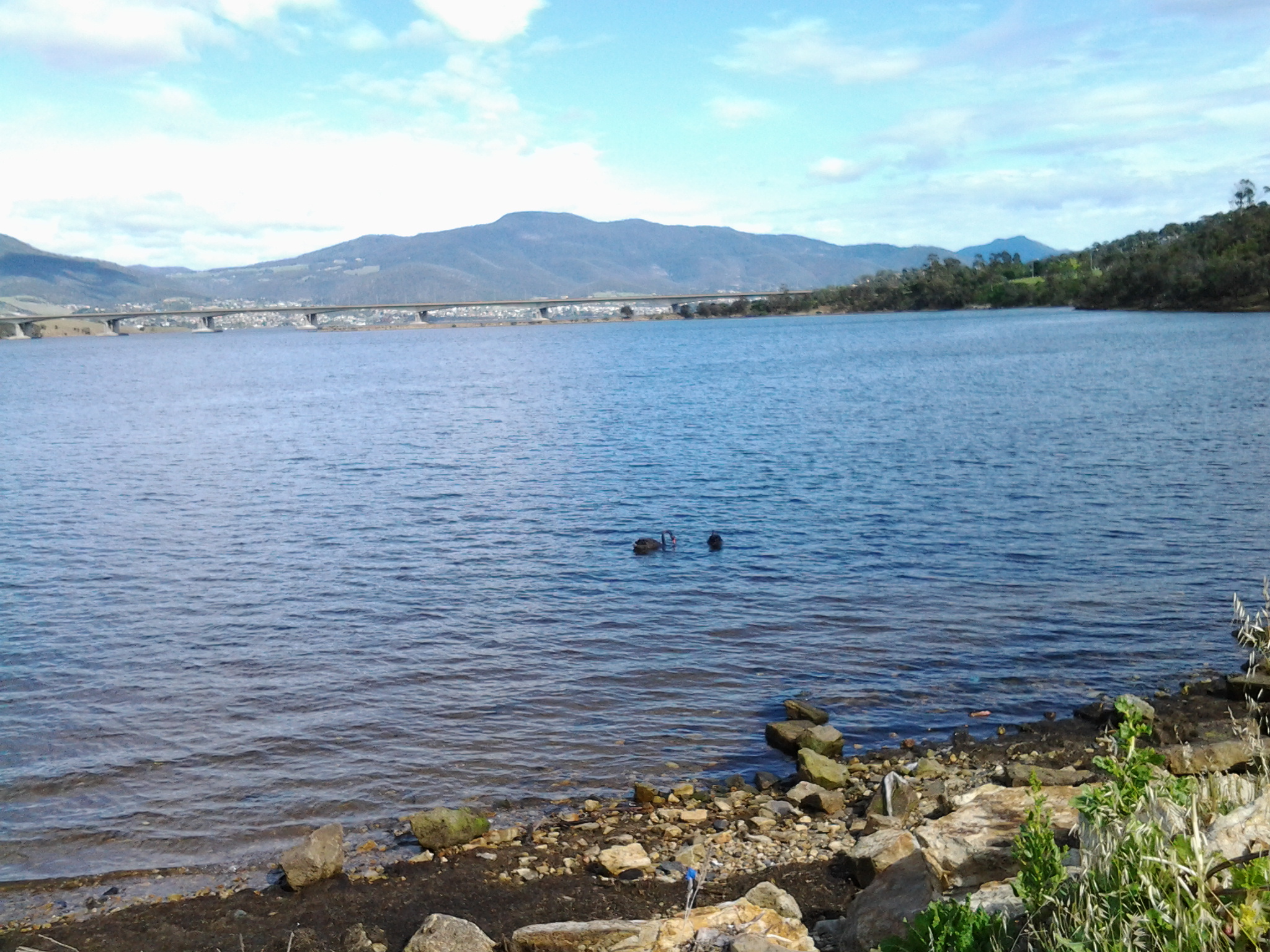
From the eastern shore looking northwards towards the Bowen Bridge, with a couple of black swans on the river.

20141031_100200

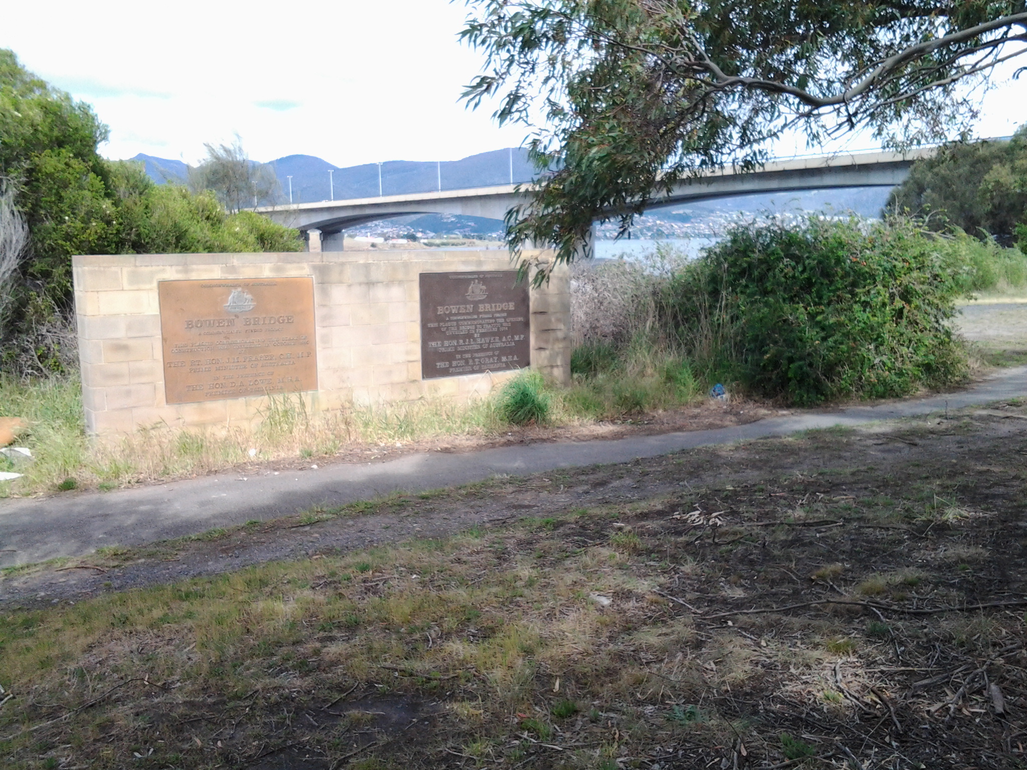
Two plaques ‘opened’ by two great Australian prime ministers near the Bowen Bridge.

20141031_104822

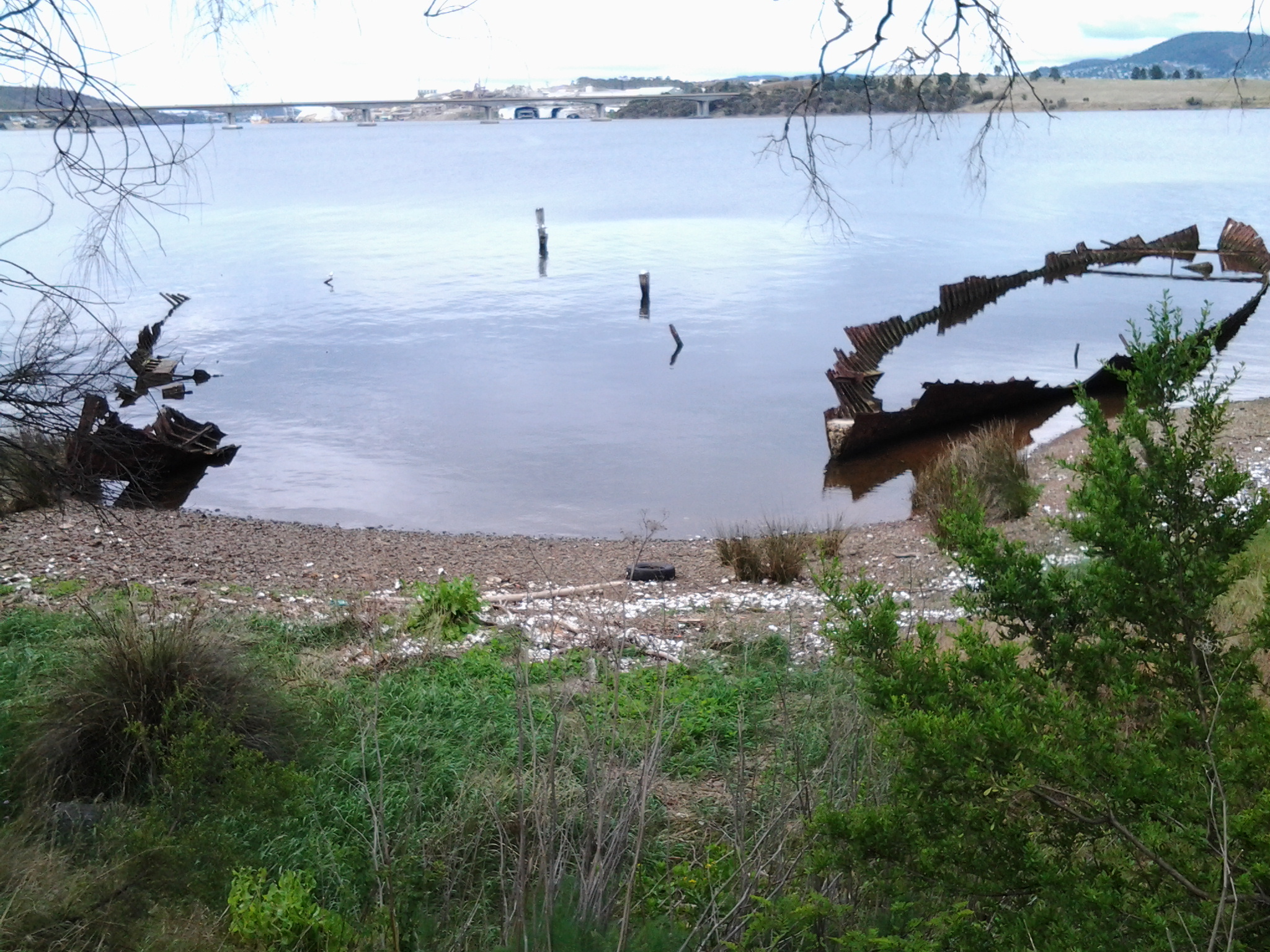
The rusting raw-edged remains of a ship, the Otago, at Otago Bay.

20141031_113132

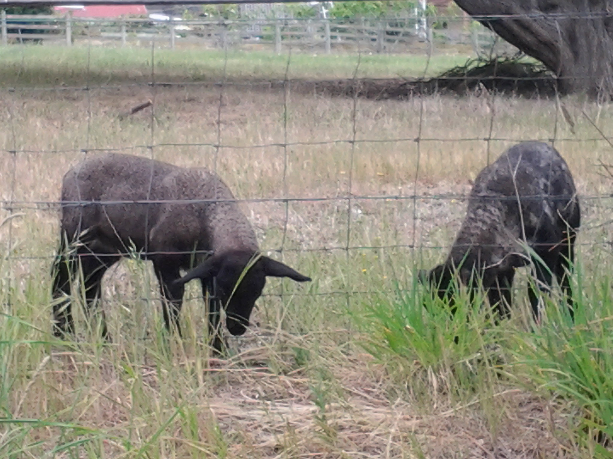
My enjoyment of any family’s black sheep.

20141031_123000

Heading into Old Beach and gradually leaving Mount Wellington behind.

20141031_132519

The gloominess of the approaching storm when I reached Old Beach.

20141111_092342 20141111_092805

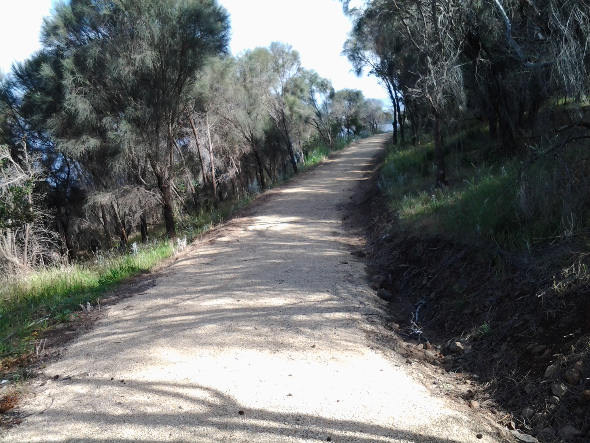
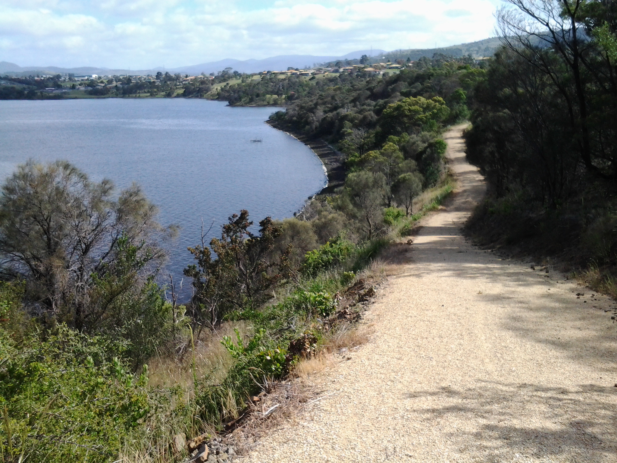
The pleasures of well-made pathways, thanks to local government.

Green Point from new Old Beach

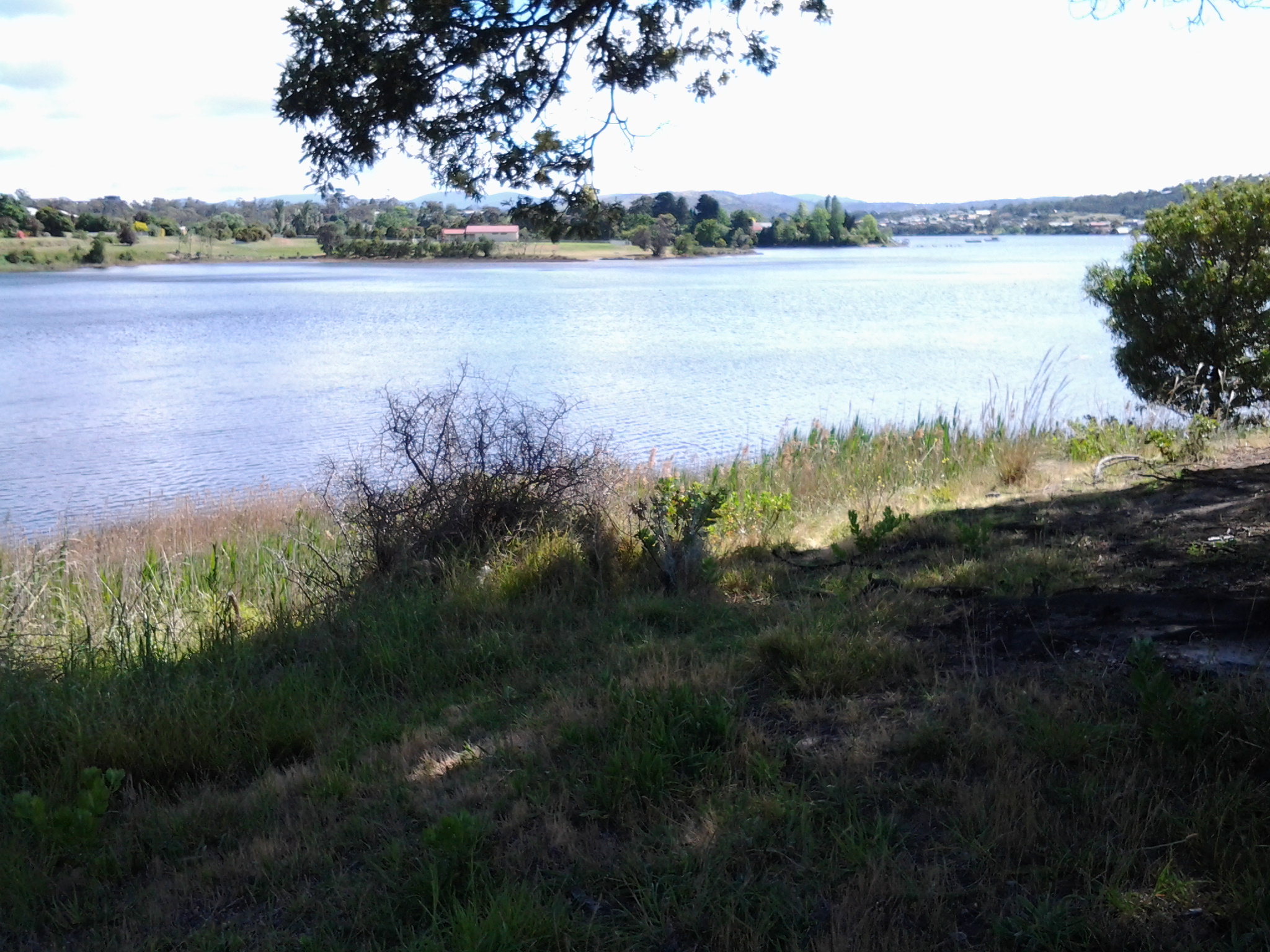
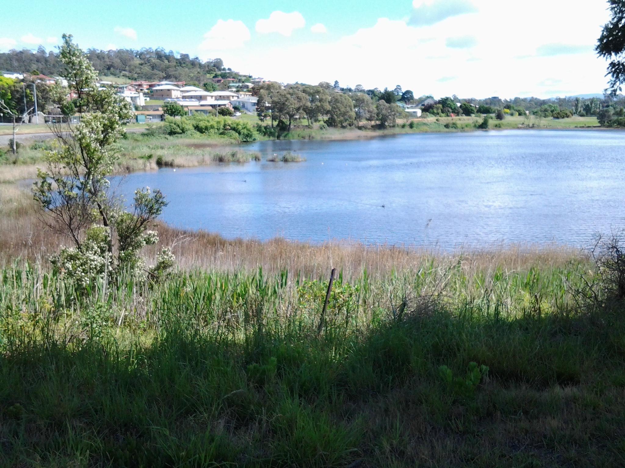
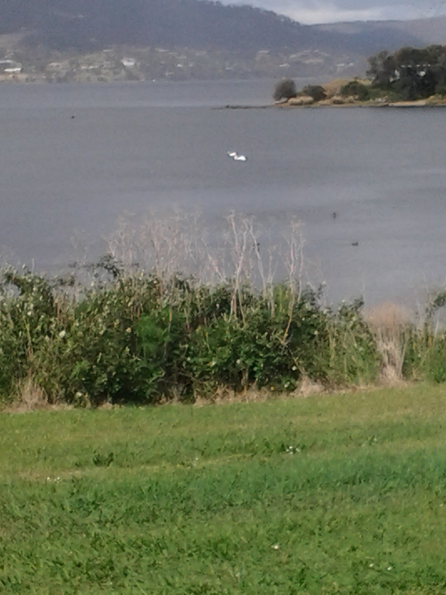
Looking northward across the Jordon River to Greens Point.

20141111_103700 20141111_121906

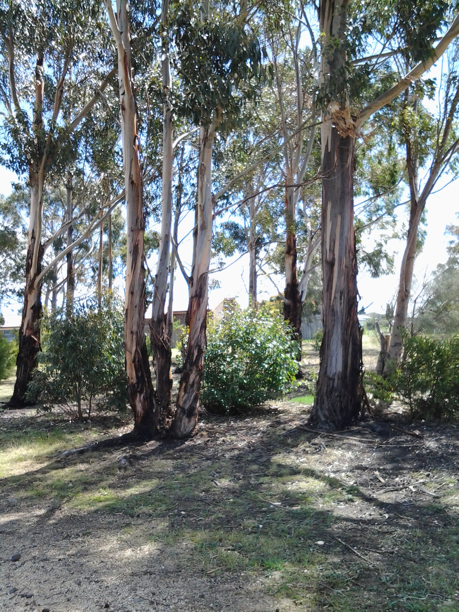
The glories of native flora. In these instances, it was blooming wattle and a spectacular stand of eucalyptus/gum trees which attracted my attention.

20141111_120752

The remains and the signs of a burnt out car on a back track.

20141111_130523

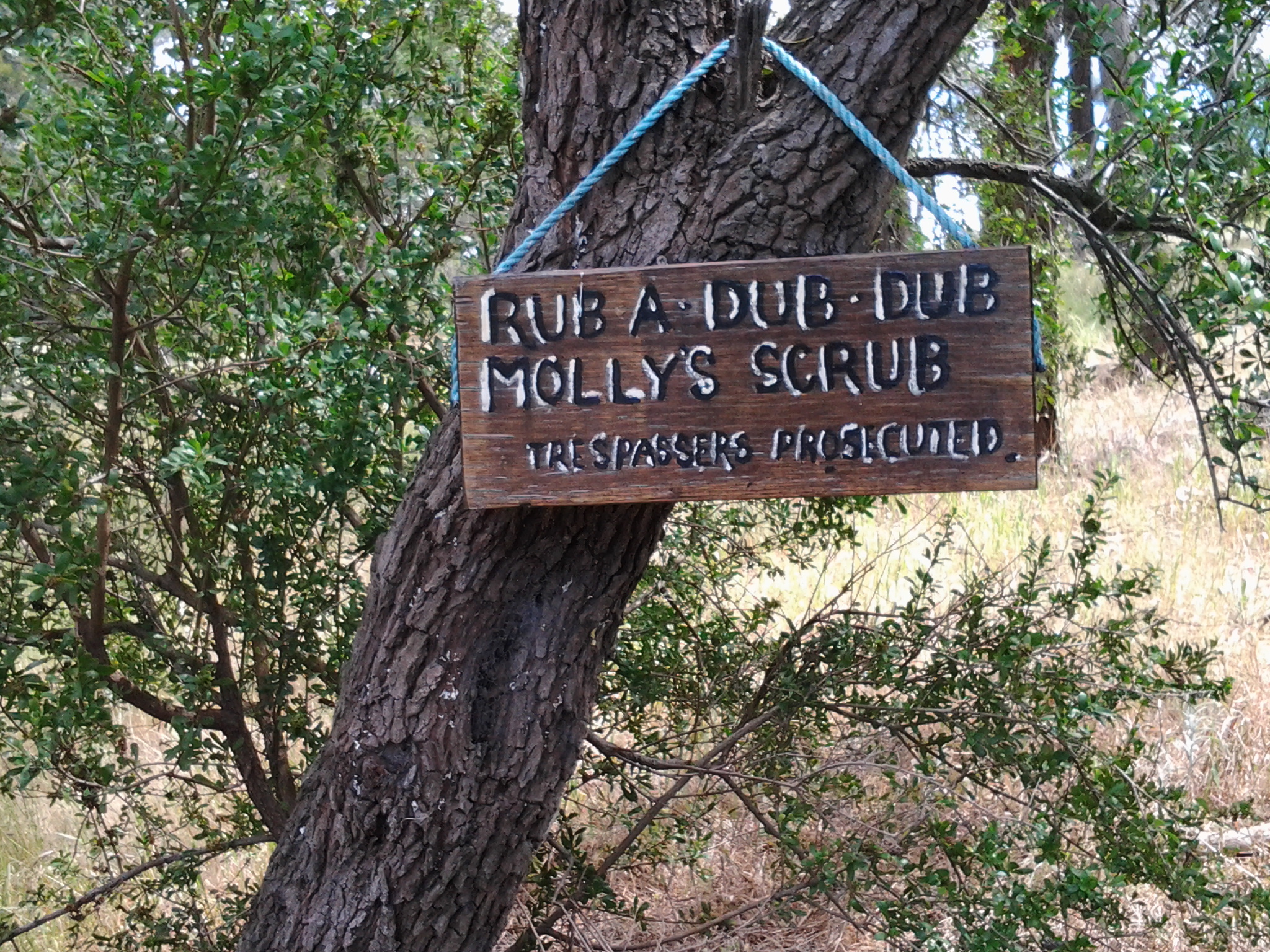
Knowing that it is still possible to have a laugh when walking.

20141111_131133

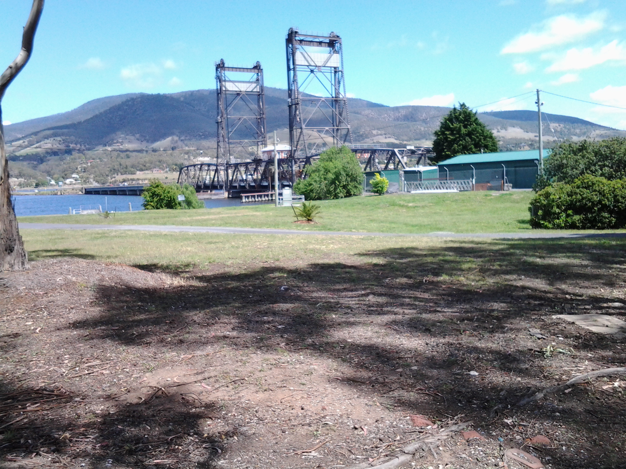
Arriving at the Bridgewater Bridge.

20141111_134311

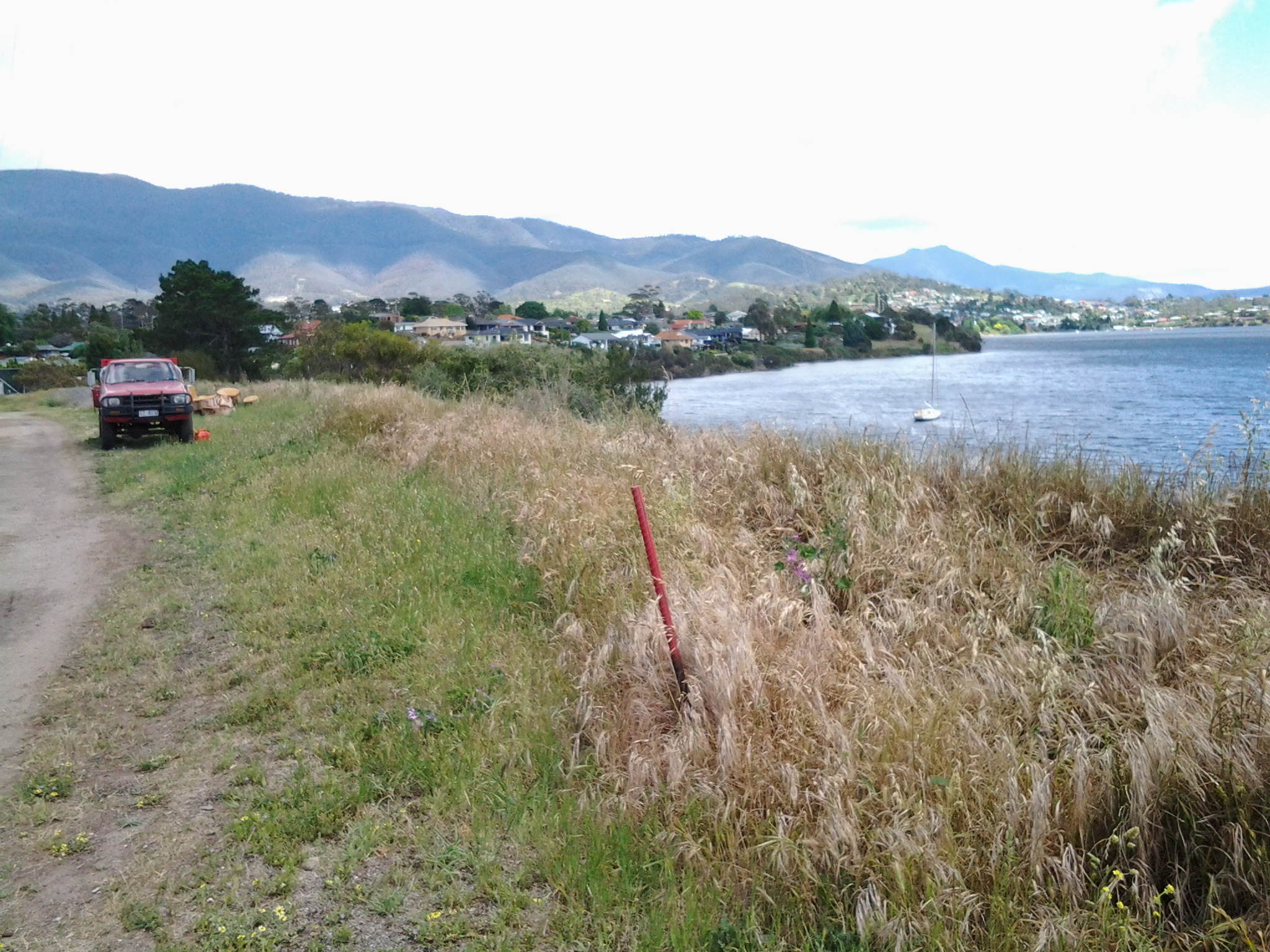
Walking on the western shore of the Derwent River for the first time during this project.

20141125_095438

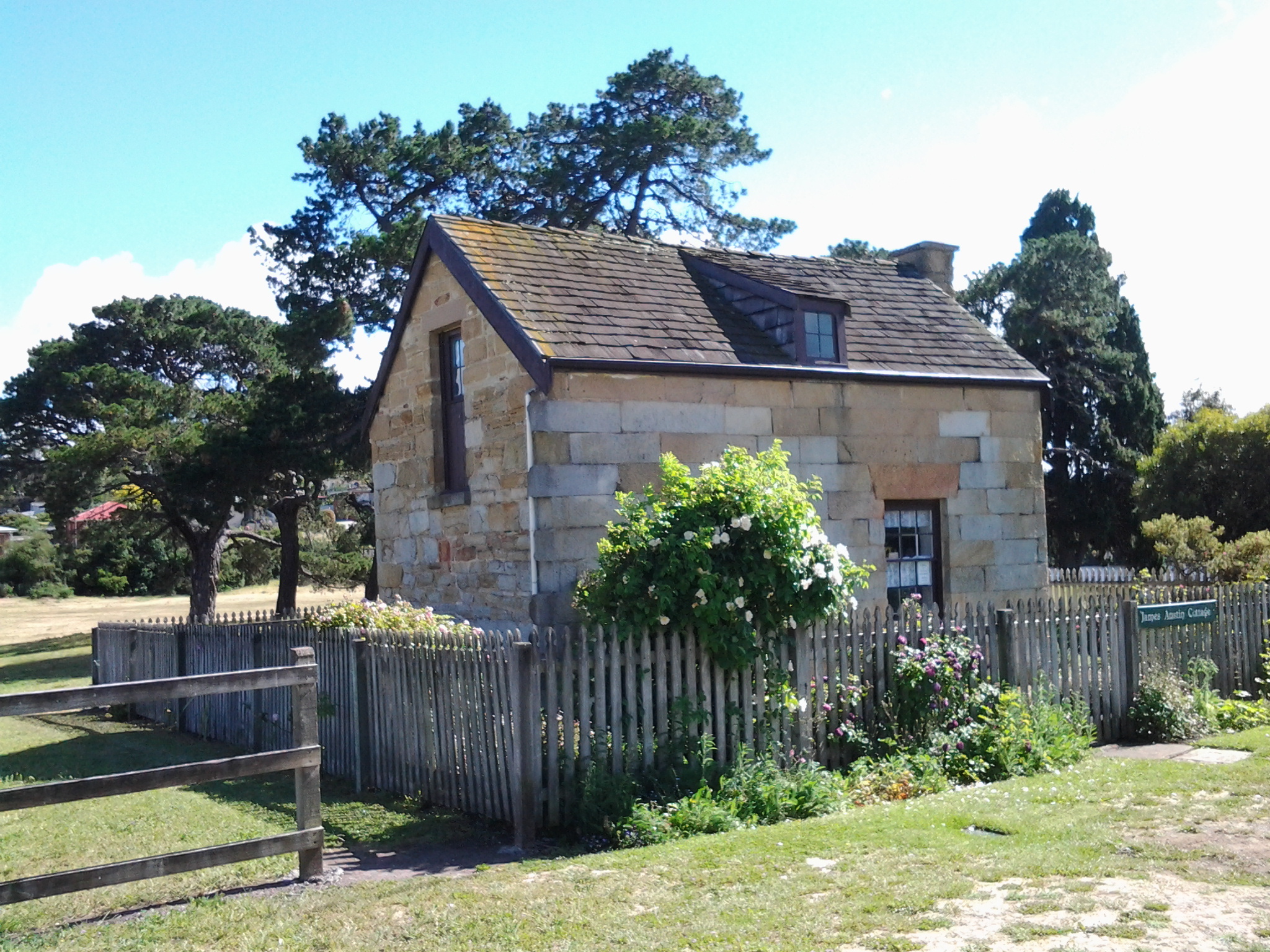
The house of one of first European settlers, James Austin, at Austins Ferry.

20141125_115047

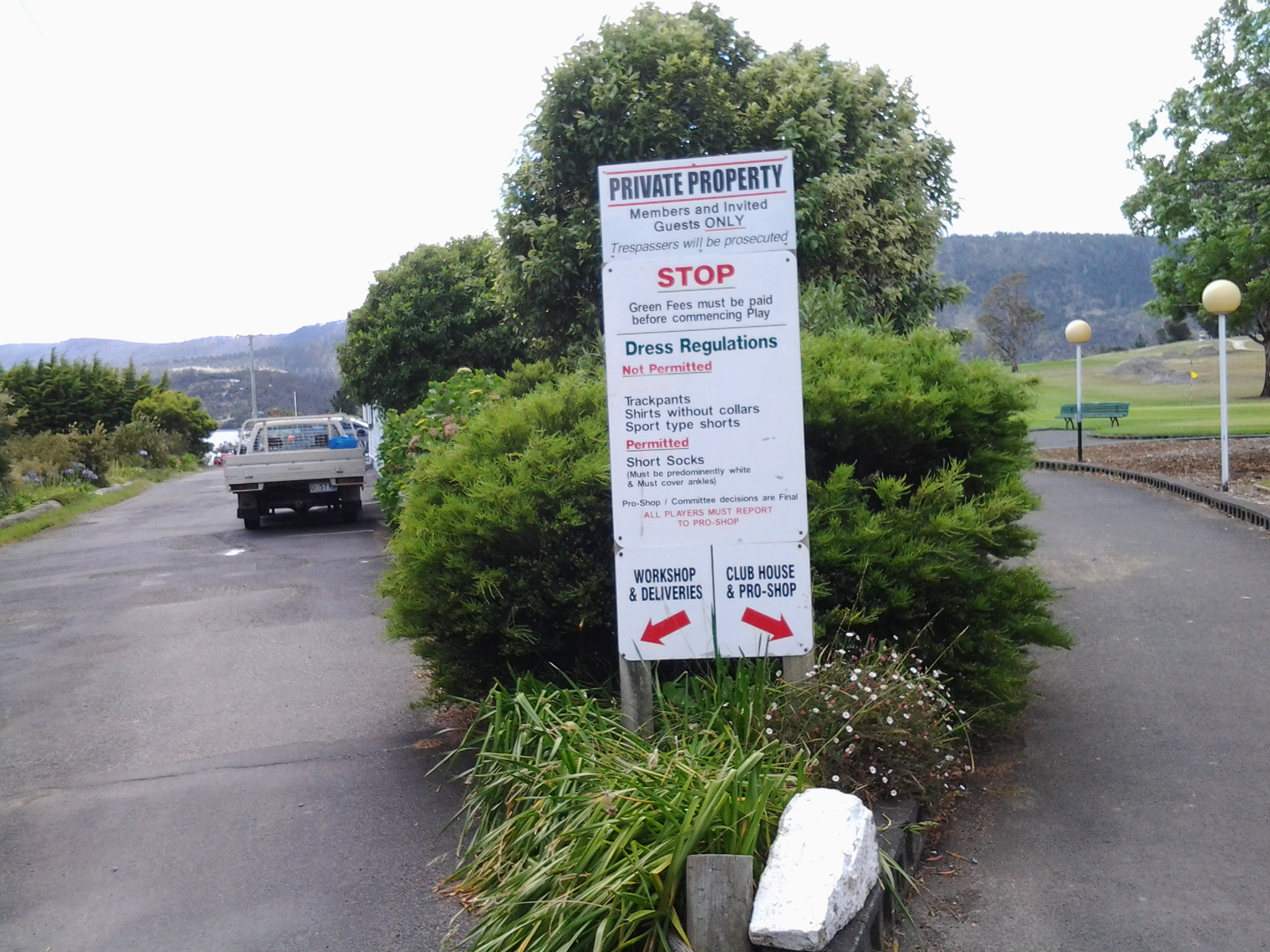
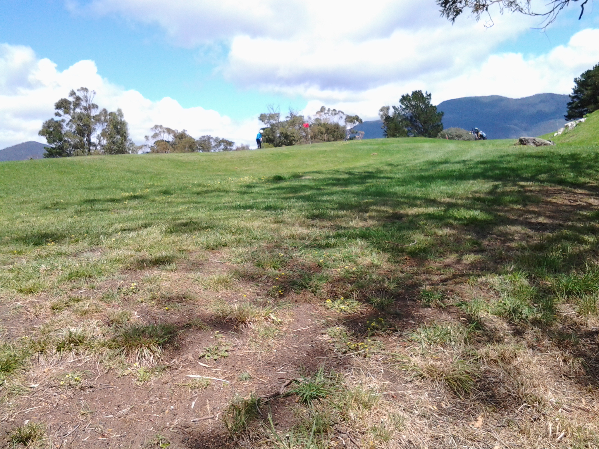
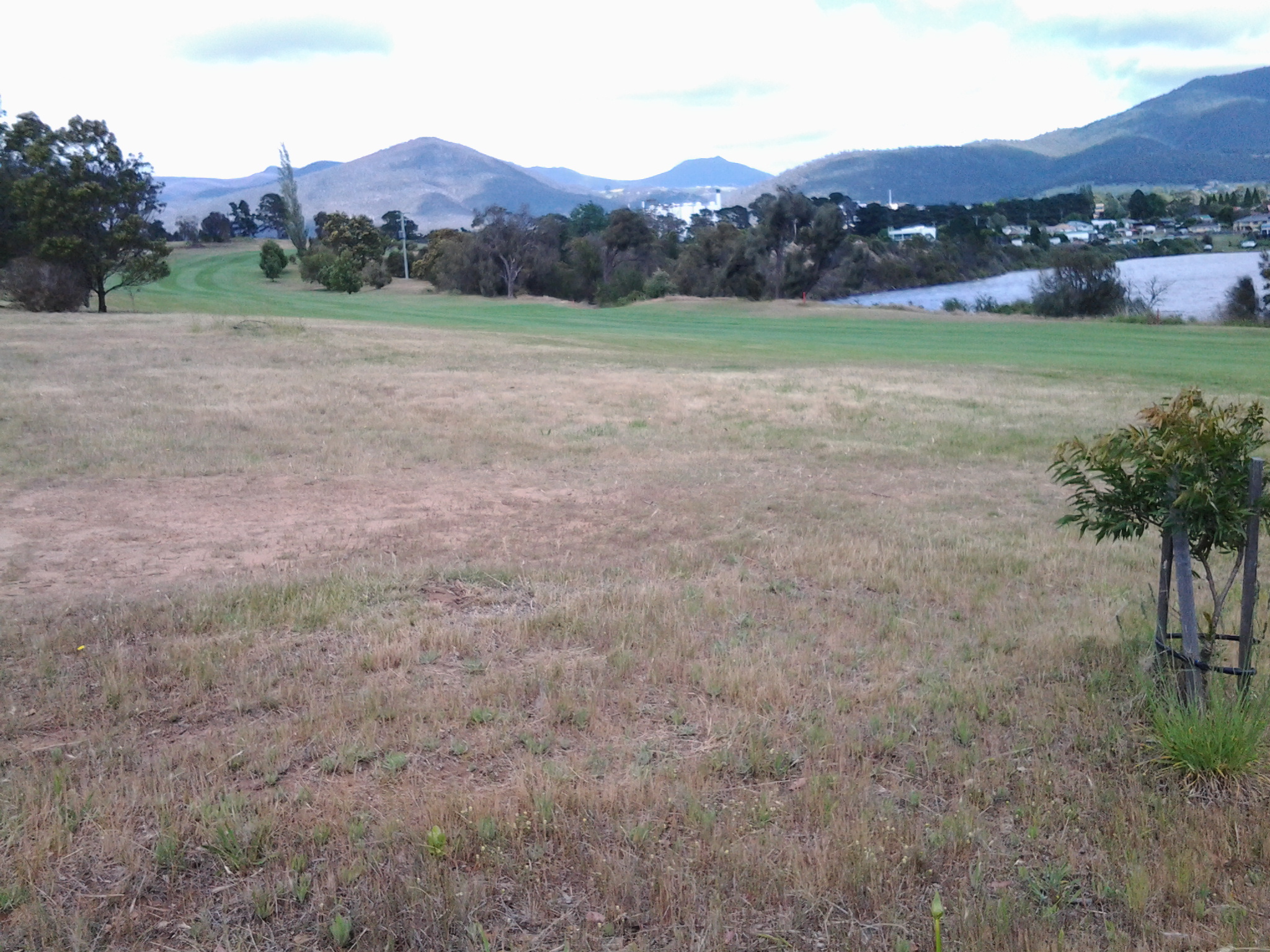
At Dogshear Point, walking around the Claremont golf course, with the thwacking sound of hit balls crossing the greens.

20141125_110906

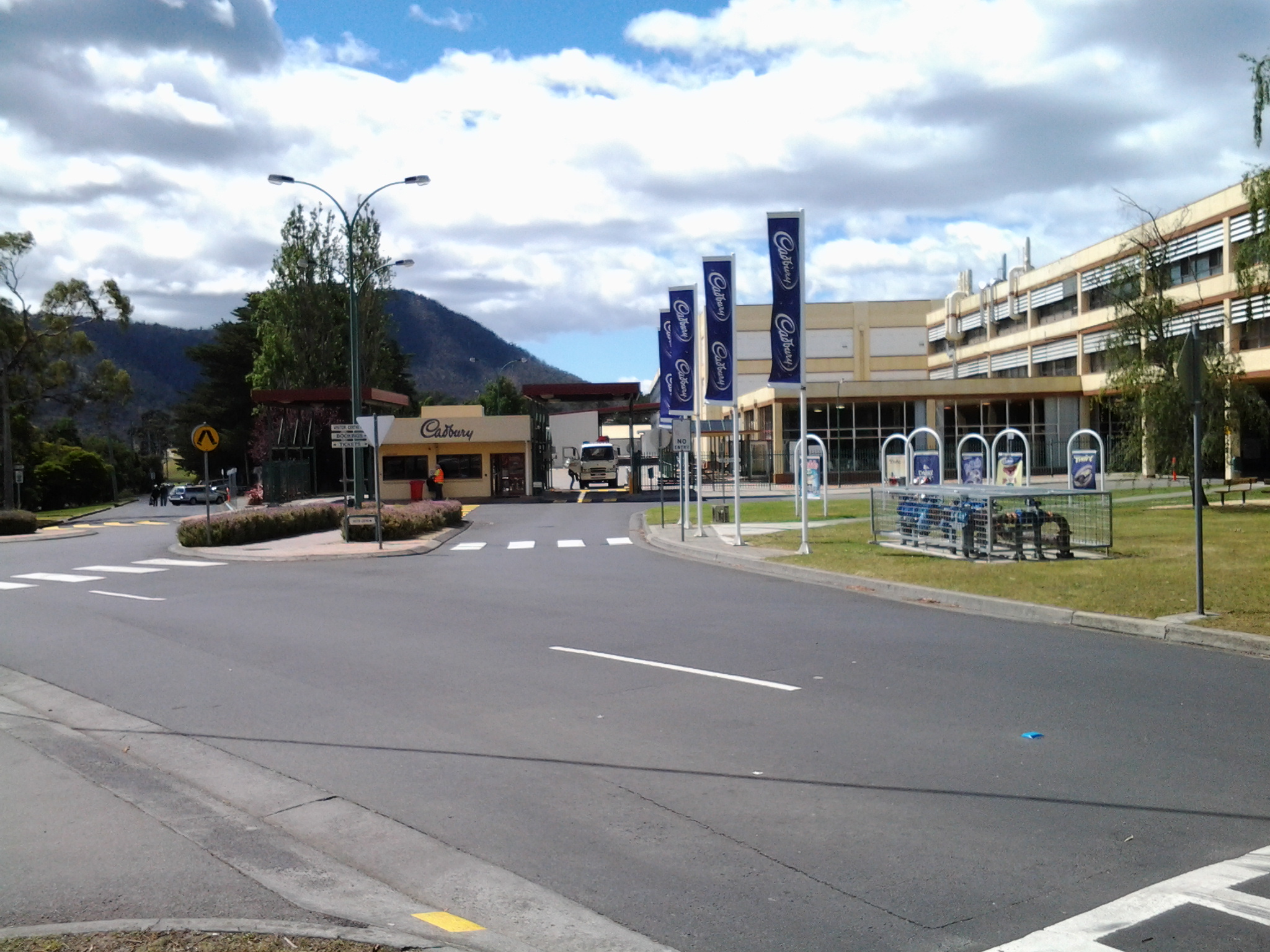
Reaching Cadbury’s chocolate manufacturing factory in Claremont.

20141125_143454

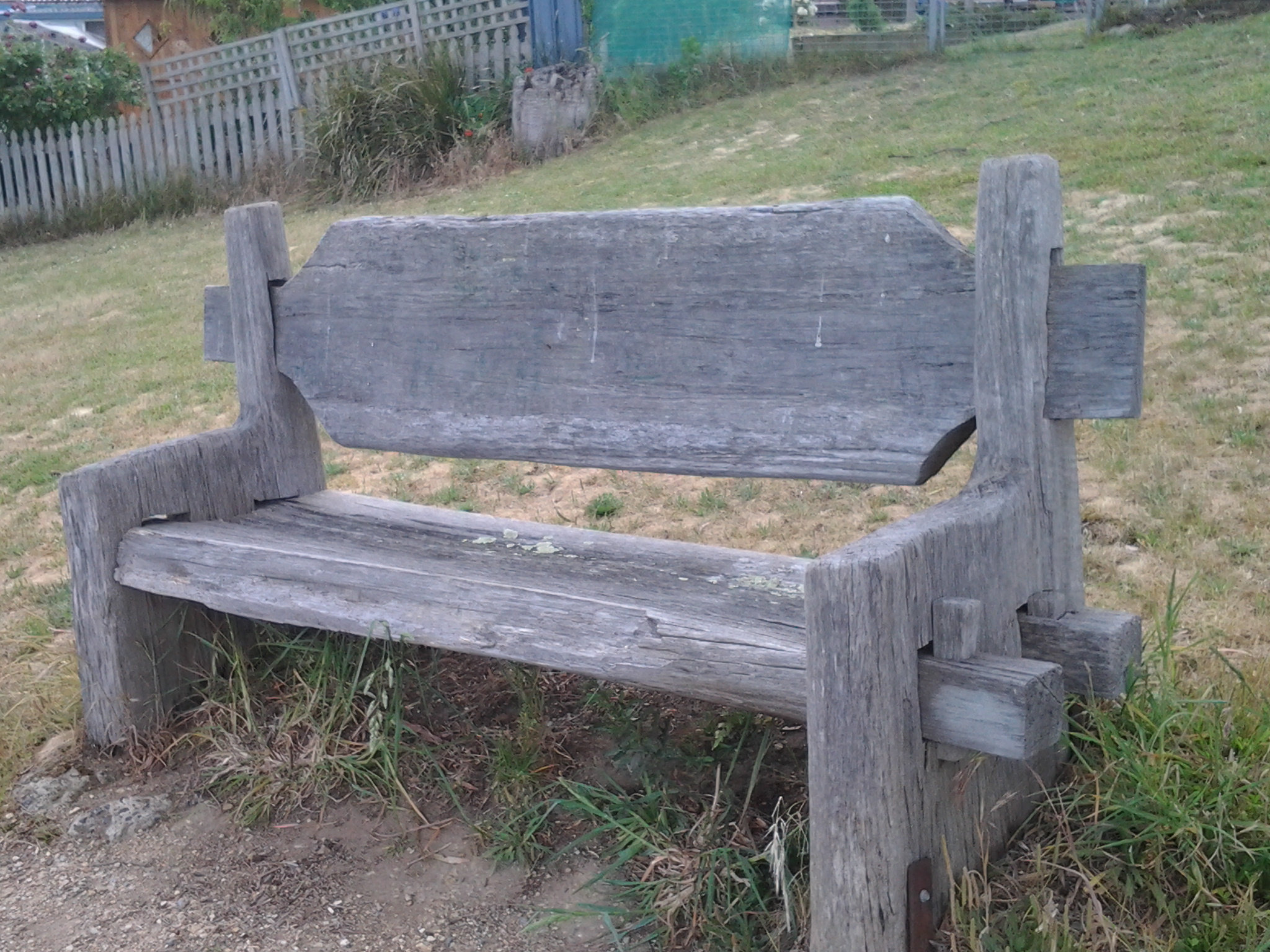
The hand-hewn rustic style seat near Connewarre Bay.

20150109_074126
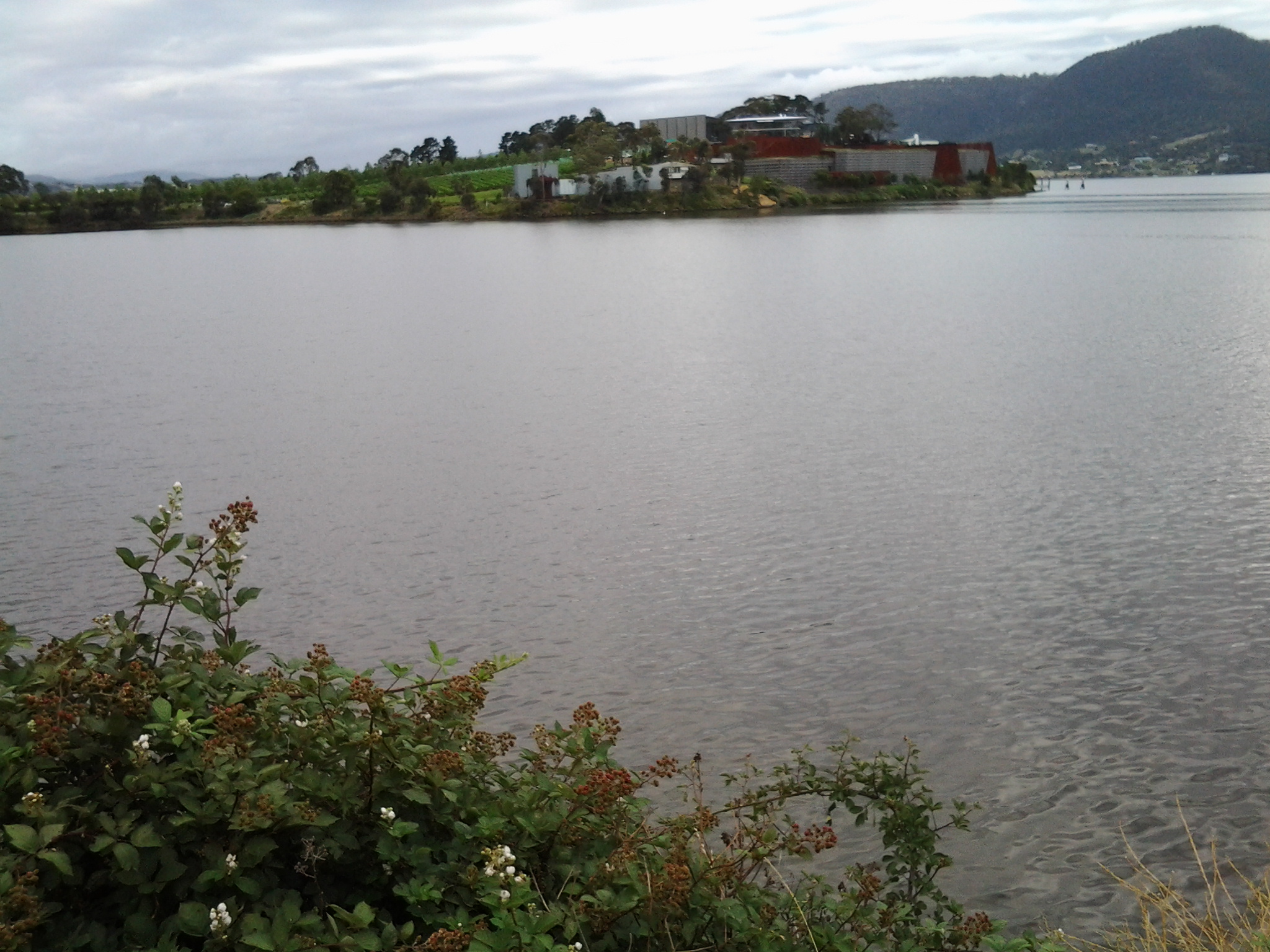
Passing MONA somewhat camouflaged as it nestles into a tiny hill against the Derwent River.

20150109_081644

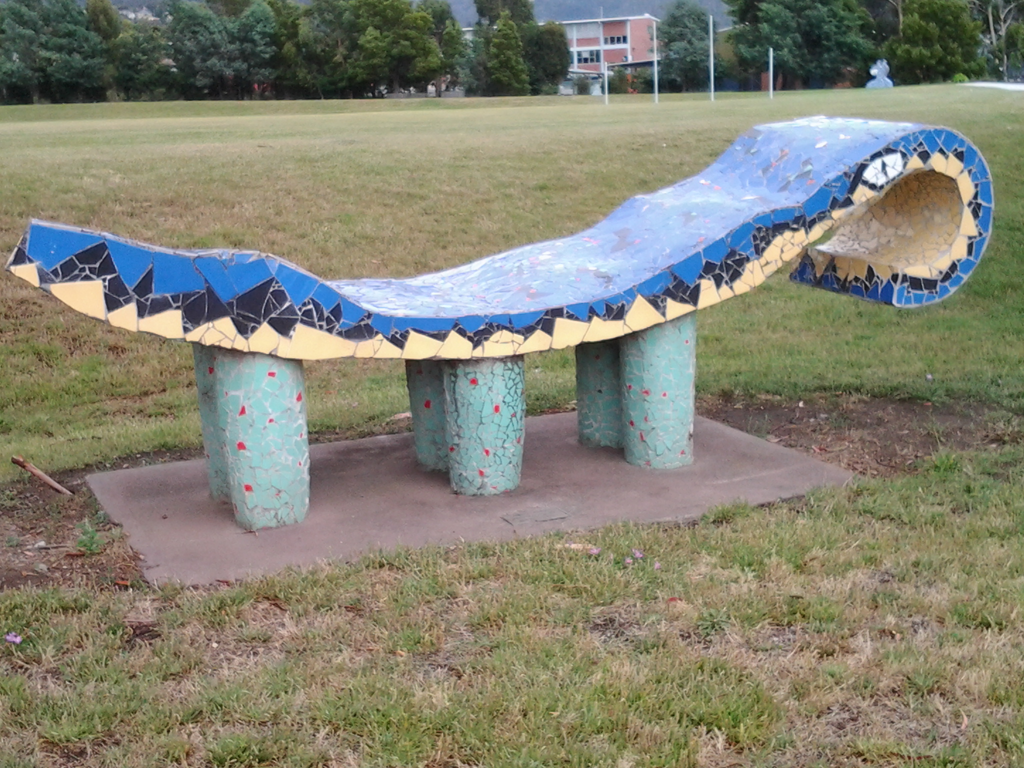
The mosaics along the foreshore.

20150109_101243

The jumble of boats and boat houses at Prince of Wales Bay.

Hoon tyre marks

Road mark making in Lutana.

20150109_132008

Cornelian Bay’s oil tanks up close.

20150109_153103

The Tasman Bridge.

20150109_155515

The circus had come to town.

20150109_161747

The emptiness of an arena of stands waiting to be filled during wood chopping competitions.

20150109_161339

Reaching the ‘end of the line’ on arrival in Hobart city.

Bus/public transport lovers

There are a few of us, and yesterday the internet was running wild with a story of another bus lover.  Did you hear about the black Labrador who gets on a bus and knows when to get off at the Dog Park bus stop, and does this trip regularly in Seattle without her owner – much to the delight of all the passengers and driver.  You can read more at http://www.news.com.au/lifestyle/home/eclipse-the-black-labrador-takes-herself-to-park-in-seattle-on-bus/story-fngwib2y-1227184034770  I guess the regulations are different in Seattle from those in Tasmania; she had her feet on the seats!!!!  People get thrown off buses for less.  Perhaps it is time we loosened up here.

The highlights of the 9th stage of my walk along the Derwent River

The 9th walk took place on 25th November. I loved every part of the day but a number of highlights stand out.

  • The tranquillity of Goulds Lagoon
  • Being at the Austins Ferry point and looking across to the Old Beach jetty
  • Finding James Austins House
  • Being surprised how long it took to walk around the water edge of Claremont Golf Course
  • Arriving at and walking around Dogshear Point
  • The down time at the Cadbury chocolate factory
  • Being followed by a duck
  • Pied Oyster Catchers on the golf course and parks
  • The rough-hewn bench seat near Lowestoft Bay
  • The memorial to defence force dogs
  • Discovering the Worm Mound at MONA

Earlier postings provide more information on these highlights or you can email me for further information

Please note; anyone choosing to walk this stage needs to be aware there are no public toilets. However, a number of businesses have toilet facilities to which you may be able to gain access.

My 10th walking stage will start at bus stop 33 in Berriedale and then will continue south towards Lutana.

The Claremont Golf Club

The first sign which greeted me alerted me that only members and their guests were welcome on this property.

20141125_112349

I stood wondering whether I would simply walk away or investigate further. The peninsula, which the Claremont Golf Course occupies, covers many acres but most importantly it causes the Derwent River to deviate dramatically from a straight path. As such I felt I needed to walk around the edge of this substantial piece of land so I would feel that I had truly walked the length of the Derwent River on the western shore.

I sucked in a deep breath and, feeling less than classy with my wrecked wild hair, I walked into the Golf Club house.

20141125_112420

“Can I help you?”, I was asked by a man who appeared seemingly from nowhere. Briefly I explained my walking the Derwent project, registered that I had read the ‘private property’ sign, and asked if there was any chance I could have permission to walk the perimeter. I was amazed that the answer was yes on the basis that only a few people were playing and they were mostly located in the central area. The answer was yes on the condition that, if I did not return within an hour, he would come looking for me.

I thought I would cover the edge in half the time.  How wrong I was. The time was 11.28am as I stepped out to follow a vehicular road on the northern side of the peninsula and it was 12.25 as I returned from the southern direction north to the Club house to show I had returned unscathed.

Starting out:

20141125_113127  20141125_113821  20141125_113139

Northfacing view:

20141125_113807

Eastfacing views in which I could identify traffic on the East Derwent Highway:

20141125_114928  20141125_114903  20141125_115153

Golf course views (in second image notice the players on the course):

20141125_113824  20141125_114855  20141125_113937

Near Dogshear Point at end of green:

20141125_115047

The views from Dogshear Point and then further around on the southern side (note the first image looks back to the area where I scrambled through spiky roses and brambling blackberries on the eastern shore, the second image shows a delightful placid bay slightly south west of Dogshear Point and the third and fourth images remind me that Mount Wellington is again looming over my walk):

20141125_120415   20141125_120029  20141125_11541920141125_120425

That walk was a beautiful, sweet smelling, bird song filled but scary experience. The golf members were generally playing in the centre but some were working on holes closer to the edge. Initially, while on the vehicular track, there was a hill separating me from the course so I couldn’t see the players and their balls and so I had no idea whether I should duck. We all know how balls can be hit into the rough, and the day was exceptionally windy which I imagined could send a ball even further off course than a player might intend. Sometimes I was walking in the rough and sometimes I was walking on fairways and on the bright coloured manicured greens of specific Holes. The golf course has been designed in part to finish at the top of cliffs overlooking the Derwent River and sometimes there was no way I could walk the edge without being on the actual golf course. I was always looking around me to be sure that when a player was about to hit their ball I could see where the ball was travelling to. Rather unnerving.

I wouldn’t be prepared to walk on this golf course again with players out and about. However I am glad to have had the chance to find new vantage points to see up and down the Derwent River and beyond. I wouldn’t recommend others follow in my footsteps (even if permission was given to you) despite the pleasures of the experience.

Towards the end of my walk around the Golf course, I passed a copse of trees one of which had a sign attached.  Who was Molly?

20141125_121322

The Cadbury confectionary factory is located just over the fence from the Golf course and the closer I walked to the fenceline the more prominently it showed itself through the trees.

20141125_121946 20141125_122231

Then the Claremont Golf Club house came into focus.

20141125_122235

This leg of stage 9 of my walk along the Derwent River was over. It was time to explore the Cadbury chocolate factory.

Walking south and into the suburb of Claremont on the 9th stage along the Derwent River

The intersection of Harbinger Lane and Ferry Road at Austins Ferry marks one corner of Weston Park. At 9.56am I turned left and walked across the Park parallel to Rusts Bay, crossed a single lane wooden bridge and rounded the Shoobridge sporting fields all the while enjoying the pleasures of dogs walking their owners along the edge of the Derwent River.

The photo below shows Shoobridge Park on the northern side of Beedhams Bay.

20141125_102813

I was amused and somewhat puzzled watching a Pied Oyster Catcher picking for worms on the sports oval, and not bothered by an interested German Shepherd. What happened to a little fear? What’s wrong with oysters?

I had an easy walk on mowed grasses to Beedhams Bay and was delighted when a White Faced Heron flew onto the path ahead of me. Slender. Petite. Soft grey.

At 10.10am I crossed the railway line following the tracks of others but there are no official paths. The Main Road was again to my right with the railway line to my left. Native Hens were feeding ahead and noisy plovers let them know I was coming.  Black swans floated on the Bay. I noticed bus stop 40, and realised 1 ¾ hours had passed since I started today’s trek from bus stop 47 in Granton South.

While at Beedhams Bay I was in full view of three mountains: Mount Direction on the eastern shore, and Mount Faulkner and Mount Wellington on the western shore.

I stopped for a morning tea break at 10.18 in a gazebo at the southern end of Beedhams Reserve.  Despite some protection from the elements, the food was blown off my spoon before I could transfer it to my mouth. My hair thwacked back and forwards at every angle across my head creating an interlocking mesh.

The photo below shows Beedhams Bay looking northwards across it.

20141125_102808

My maps indicated that the nearby building sunk low in the earth was a scout hall but I couldn’t see  signs of identification and the building looked locked up and unused. Foot tracks emerged from the area and crossed the railway line that cut through between packs of houses on either side. There was no evidence of being able to continue to walk close to the Derwent River so I walked up above but beside the railway line until I reached a road crossing at Bilton Street in Claremont.

20141125_102823

A local government bike and pedestrian path from Hobart reached its conclusion next to the railway line on the other side of the road. To my surprise Claremont Plaza, a multifaceted shopping village and other organisations, was located in the block diagonally opposite. This was a sensible location to make a toilet stop since there are no public toilets available during my 9th stage of the walk along the Derwent River.

By 10.46am I had returned to the rail/road crossing ready to continue the walk. I followed Bilton Street around the curve until its T junction with Cadbury Road and turned left. On the other side of the road, the lovely red brick unused old Claremont School stood boarded up.

The road turned uphill and passed the Bilton Bay Reserve (10.49am) and the entrance to the Derwent Waters Residential Club – an estate signed as private property thereby denying my access to the River’s edge (10.56am).  I continued walking on Cadbury Road flanked by tall pine trees thrashing in the wind, past the Cadbury Sports Grounds (11.05am), past the Cadbury Visitors Car Park (11.08) and turned left onto Bournville Road.  I knew I would be returning to have a closer look at the Cadbury chocolate confectionery manufacturing factory so I proposed to walk to Dogshear Point first and then be rewarded sweetly later.

20141125_110910

9th Stage of walk along Derwent River completed yesterday, Tuesday 25 November

I caught two buses from my home in Bellerive on the eastern shore, via the Elizabeth St CBD Hobart and the Glenorchy City bus malls, to reach Granton on the western shore of the Derwent River in the northern suburbs of the City of Glenorchy in the Greater Hobart Area.

At 8.26am I stepped off the Metro number X1 bus at stop 47 outside the York Hotel in Granton South and, with excitement about what the day might bring, I looked around and admired the view across the River to the suburb of Bridgewater before starting the tramp south.

20141125_082854

No footpaths or walk ways had been laid for pedestrians and so vigilance was required against the traffic on the Main Road. Occasionally a few metres of concrete or bitumen were laid for a new subdivision but generally a track for smooth safe walking was not on offer.

The weather started sunny but during the afternoon rain passed intermittently. In the photo below you can see the grey background blurred by rain, but meanwhile three pelicans were enjoying themselves on Lowestoft Bay.

20141125_150144

Relentless buffeting wind was the main feature all day. As a result, I couldn’t keep my sun hat attached to my head. Needless to say, I returned home with a blasted red face.  But happy from the pleasure of walking, discovery and the fresh air. Being a tourist in my home town is a revelation and a joy.

I walked southwards from Granton South to MONA (the world famous Museum of New and Old Art) at Berriedale and passed through the suburbs of Granton South, Austins Ferry, Claremont and half of Berriedale.

I experienced Goulds Lagoon, Austins Ferry Bay, Rusts Bay, Beedhams Bay, Bilton Bay, Dogshear Point, Windermere Bay, Knights Point, Windermere Beach, Connewarre Bay, McCarthy’s Point, Lowestoft Bay, and Cameron Bay. I plodded around bays and a golf course (I gained special permission to walk this private property but I would NOT recommend anyone else try it – see later postings), had a stopover at Cadbury’s, and hid from the rain in gazebos and art works. All up, I probably walked 18 kms.

Yesterday I covered 9 ¼ km of the River’s length on the western shore. This adds to my previous tally of 3/4km on the western shore making a total of 10kms covered as I trek southwards from the Bridgewater Bridge to the mouth of the Derwent on the western shore.

Specific details of the different legs of this 9th stage walk will be written up and posted in the coming days.

My favourite photo of the day was taken near the end of my walk, when I sat at the point where the southern end of Cameron Bay met the Derwent River (with MONA just over the hill). The water had been frothed by wind and I liked the lacy remnants floating by.  The intense colours are the result of the rich light quality caused by the heavy clouds overhead.

20141125_153054