Tag Archives: Kangaroo Bay

From Lime Kiln Point northwards towards Murphy’s Flat

Away from the Lyell Highway in southern Tasmania, while looking at the lime kilns, I had enjoyed relative silence, but once back on the road the endless traffic continued to roar past and box my ears.

Have a look below at the video of a car coming towards and passing me. Listen to that sound. Imagine this noise multiplied many times over and over, and then deeper and more invasive when the many trucks passed. For most of the day’s walk.

There was a pleasant moment when a scattering of comparatively slow moving vintage cars were interspersed in long lines of suffering traffic.  I smiled at all of them and they waved back glad to have someone appreciating their passing.

I loved the geological drama exposed by road cuttings.

20150413_090926

Along the way I enjoyed signs such as the one in the photo below. Has anyone ever seen a kangaroo lifting a car?  Before you send me an email indicating your outrage at my ignorance, I know the sign’s message is for motorists to beware of kangaroos hopping across the road and doing great damage to their car and perhaps injury to themselves.  But I also realise it’s not the fault of kangaroos and wallabies that mankind built roadways in their normal travelling routes.

Kangaroo and car sign

By the time the day was heading towards mid-morning,  the bright quality of the sunlight still indicated the air was still hard and cold.  At this stage I was setting a steady pace, and had great ambitions of reaching New Norfolk very quickly. Before long I reached the start of a long marshy area known as Murphy’s Flat.

Pacific Seastars are multiplying in Kangaroo Bay

Recently when I walked past the Marina at Bellerive, I looked down in horror to see hundreds of seastars foraging across the river bottom. The water was clear so their orange arms were spectularly visible.  Some of these starfish were larger than a dinner plate.

2015-03-28 08.21.49

The white lines in the photo above are the reflections of yacht masts.

I talked about these pests in two earlier postings; ‘Northern Pacific Seastars’ of 14 September 2014, and Stage 2 on 4/9/2014 Mitchell’s Beach of 5 September 2014. The Tasmanian government department responsible for parks (http://www.parks.tas.gov.au/file.aspx?id=6917)  provides information about Tasmania’s 3 unique starfish and acknowledges the damage that Northern Pacific Seastars are doing to our marine life.

Pretty some might say.  Perhaps that is why they are multiplying and limited collection and destruction actions are being taken.

For a split second I thought to throw off my clothes, jump in and start throwing these scavangers onto the jetty. Of course, common sense prevailed:  I could have been overcome with hypothermia.  In addition, I realised there were too many for one person to collect.  Their removal needs a devoted crowd of wet suit clad divers to be methodical and dedicated.  Of course the sadness is that thousands more are grazing out of eye shot.  And they continue to breed so well in these cool waters.

2015-03-28 08.21.57

You can read Louise Goggin’s story on these marauding seastars at http://www.abc.net.au/science/slab/starfish/.  ‘Enjoy’ the photo in this article “Community divers pulled 30,000 sea stars from the Derwent River in 1993 and hardly put a dent in the population”.

Mirror smooth waters of Kangaroo Bay, an inlet off the Derwent River

Last weekend, when I walked to Bellerive Village via the Bellerive Yacht Club and Boardwalk, I was stunned by the beauty of the view.  The water in the marina was smooth as glass.  The yachts were clear edged by the crisp air and hard bright morning sun.  Despite puffs of cloud obscuring full vision of Mount Wellington in the distance, the vista was spectacular.

2015-03-28 08.22.12 2015-03-28 08.22.28 2015-03-28 08.22.21

Clarence Jazz Festival (mostly bordering the Derwent River) in southern Tasmania

jazz-1-052314-akp

I don’t know when the Clarence Jazz Festival first started, but it was up and running when I returned to Tasmania to live, in 2000. Ever since, it has grown in scale and excitement.

From one Sunday to the next in the third week of each February, performances are scheduled in historic buildings such as the Rosny Barn, next to the water on various bays such as Kangaroo Bay and Lindisfarne Bay (that empty into the Derwent River, and which blog followers may remember from earlier stages of my walk), at beach reserves and on village greens across the local government area of Clarence City Council.

Most are free events and they culminate in the big day next Sunday.  On that day the Bellerive Boardwalk, with its stunning backdrop of sun-drenched water covered in yachts, hosts a grand finale when many different Tasmanian and national jazz musicians perform on an open stage in front of changing throngs of people sitting and moving around the Boardwalk.  Food, wine and coffee stalls surround the venue, and the Clarence City Council offers free sunscreen for those who come unprotected.  At the Jazz at the Boardwalk is where you can expect me to be next Sunday!  Bring on those sexy saxophones!

TheresaKnott-Saxophone

Typically people walk from home often carrying picnics and refreshments to drink.  Families sit outdoors and soak in the atmosphere while kids clamber over public playground equipment when nearby.  Where I live, sometimes the sounds of music float across the air and I am able to enjoy concerts when I cannot get away from home.

The festival Facebook site shows images of past musos and performances and some of the guests for this year (https://www.facebook.com/clarencejazzfestival).

If you are a Hobart local and have forgotten about the Festival go to http://www.ccc.tas.gov.au/page.aspx?u=933&c=386, read the program, and be prepared to see some musicians strut their stuff.

free_3807275 Trumpet in the lights

The end of the Rolex Sydney to Hobart 2014 yacht race

This afternoon I needed to walk to Bellerive’s Village for basic shopping. Once there (20 minute walk) it seemed a waste to be so close to the Derwent River and not to walk around Kangaroo Bay to Bellerive Bluff and see if any more yachts were sailing up to the finish line.

Today has been exceptionally blustery and Mount Wellington keeps disappearing from view as rain squalls and clouds move across in waves.

2014-12-30 13.37.39  2014-12-30 13.39.41

It was clear to me that a major storm was passing and could reasonably be expected to travel across the Derwent River and saturate me. Nevertheless, knowing its only water and that my umbrella could be expected to be blown inside out with the wind, I walked on.  And it was worth it.

The wild water of the River showed peaks and troughs and there in the blurry distance, trying to keep close to protection of the land on the western shore close to Wrest Point Hotel Casino, two of the last yachts were fighting it out to see who would cross the line first.

2014-12-30 13.40.23  2014-12-30 13.41.19

At home I have checked and learned that the two were Maluka of Kermandie and Charlie’s Dream.  As I stood on that windswept shore, I could see it was a battle between the two but I was surprised to discover their finish time had only 3 seconds between them. Can you imagine?  After hundreds of miles/kilometres in some very testing weather, three seconds separated these two at the line. Inspirational!  The message for me was that one must never give up; I must keep pushing onwards.

Only two yachts are yet to cross the line. One is charging up the Derwent as I type and has almost reached the finish line (Southern Myth) and the other seems almost to be stalled in Great Oyster Bay slightly south of Freycinet peninsula on Tasmania’s east coast.  I can only imagine that yacht is taking it slow and easy to cope with the weather and arrive in one piece.  Many yachts have withdrawn from the race with expensive rigging, sail, rudder, lost masts, and other boat damage. Perhaps the last yacht, Landfall, is considering making landfall earlier than the Hobart docks.

If you don’t mind thickly padded appearances and wind-blown hair, then today is a wonderful day to be wearing your winter woollies and outside walking and filling the lungs with fresh (and it is fresh) air.

What did I see on the walk along the Derwent River from Rosny to the Tasman Bridge last Friday?

Previous posts have explained the route I walked and the bus services that supported my walk from Rosny Point to Geilston Bay last Friday. This and a further couple of posts will provide colour and texture to those bones.

Once off the bus around 9.20am, I walked through a light open forest of wattle, gum, casuarina and other trees and could see snippets of calm Kangaroo Bay to my left. The photo below looks across the Bay to Bellerive Bluff which was the official finish point of Stage 4 of the walk. The suburb of Tranmere with Droughty Hill above, appears in the misty distance (the location of Stage 3 of my walk).

20141010_093831

The beautiful Bay seemed like murmuring silk. Almost no breeze. The whoosh of cars on distant roads seemed oddly out of time and place.

The Clarence Foreshore Trail passes the inaccessible Rosny Wastewater Treatment Plant on the left.  From the Trail, occasionally rough gravel tracks led down making it possible to reach the water’s edge and I could see Dominican Gulls on the rocks and the occasional Pied Cormorant. Around 15 minutes after leaving the bus I reached the Rosny Point curve where the land left Kangaroo Bay and moved around to edge the Derwent River.  A few minutes later, a Trail sign indicated the Tasman Bridge was 1.7 kilometres further on. I was thankful for the Trail because the narrow rocky shore was strewn with sharp broken oyster shells; later on I watched a family of Pied Oyster Catchers preening and resting – obviously they had eaten their fill.

A few days ago I posted the story that the ‘navy had come to town’. The photo below looks across the River from a place between Rosny Point and Montagu Bay and shows the grey green HMAS Arunta to the left of the orange Aurora Australis Antarctic icebreaker. Oh, and by the way, I discovered the Commander of this naval ship was once responsible for the HMAS Derwent.

20141010_094333

Close to 10am, I reached the Derwent River corner of Montagu Bay.  Harsh sounds filled the air; very vocal wattle birds and the growling of power brakes used by large trucks on the Tasman Bridge. From here, I had the choice to walk 200 metres up to the Rosny Hill Lookout. However, I continued on towards the heart of Montagu Bay past a clutter of upturned dinghies partly hidden in the bushes by the shore. By 10.05am, I was out of the forest and soon passing Langdon’s Welding shop on the left with workers out repairing some boats. By the Trail, I noted a large nectarine tree filled with the start of new fruit and made a mental note to walk this way in December when the fruit should be ripe.

At Montagu Bay I was stopped by an elegant contemporary public sculpture (unknown artist) which I did not know existed.  Well worth a visit. This was the Memorial to those who lost their lives when the Tasman Bridge crashed in 1975. Have a look at the photo below.

20141010_100906

The idea is that you look through these circles to pin point the part of the bridge which collapsed.  An information board provided additional information on this tragedy.

20141010_100832

The view across the Derwent from Montagu Bay was magnificent.

20141010_100852

Public Toilets are located near the Montagu Bay Reserve parkland area. This area is one of many that are child friendly with kids play equipment for free use.

20141010_100923

300 metres along the Clarence Foreshore Trail after passing huge old pine trees, massive gums with fanciful ‘painted’ bark trunks, then the Montagu Bay Primary School on the right, I reached the Tasman Bridge which I walked beneath to continue towards Rose Bay. The time was 10.20am.

The pleasures of people along the Derwent River

The people that I see and meet during my walks along the Derwent River always give me unexpected value.  My experience last Friday walking from Rosny Point to Geilston Bay was no exception.  People of all ages, sizes and racial backgrounds enjoyed being out and about.

There were joggers, runners, walkers, dogs leading their owners, a mother and father wrestling their son on the grass all laughing loudly and not a mobile phone or other communication device in sight, a man with a hand reel trying to catch fish from the rocks, cyclists who surprised me when they came up behind me and passed speedily and silently, the excited father and son who had seen a wallaby in the trees, a line of twelve senior men cycling without wearing lycra, five young mums in lycra with five new-baby laden prams in a row, kids skateboarding along the Trail, and families meandering to fill in the end of the school holidays. There was a man rowing a dinghy somewhere, a paddler in his kayak, and a boat motoring with trailing fish lines held by a family of three all wearing their life jackets.  Some I chatted with, for some it was a nod of ‘hello’, and for others we exchanged a wave and a friendly smile. I find that until around midday most people expect to and enjoy acknowledging others, then in the afternoon for some unexplained reason the experience changes and people are more reserved; perhaps the weight of the day has started to drag on them.

Two specialities of my walk last Friday were:

  • Along our public reserves and walkways, dog walkers can collect a black plastic bag so that when their Big Dog or Little Missie does a poop, the owner can collect the droppings from the path into the bag and add it to the garbage bins further along. The common sight is to see owners swinging a bag of excrement as they continue their walk. But on Friday I watched an innovative practice – and not one that is likely to catch on (hopefully not).  A man was walking along and he was emptying his plastic bag. Inside his bag was a mix of dirt and straw.  After the dog had pooped on the path, he poured a little of this mix over the droppings to cover.
  • A woman doing interval training by walking and running along the path stopped to talk to me about the dolphins she had seen. Her eyes sparkled. Apparently 6 dolphins were playing around the boats in Kangaroo Bay (located between Bellerive Bluff and Rosny Point). Where I had left the bus to start the walk, trees obliterated my view of the Bay at the point where the dolphins would have been. I was pleased the dolphins felt safe to be there and sorry to have missed seeing them.  This event reminded me that years ago, after I met an internet dating partner for the first time at Bellerive’s Waterfront Hotel, we walked along the edge of Kangaroo Bay and watched a small pod of dolphins swimming and enjoying themselves. It says something about me that I enjoyed that experience more than the date.

The photo below shows one of the many dogs that enjoyed their morning walk last Friday.

20141010_093850

Kangaroo and Bellerive Bluffs on Stage 4 of my walk along the Derwent River

After lunch, I walked up to the road (Victoria Esplanade), turned left and proceeded to walk around a new headland, Kangaroo Bluff. The photo below looks south along Bellerive Beach to Second Bluff.

20140926_121521

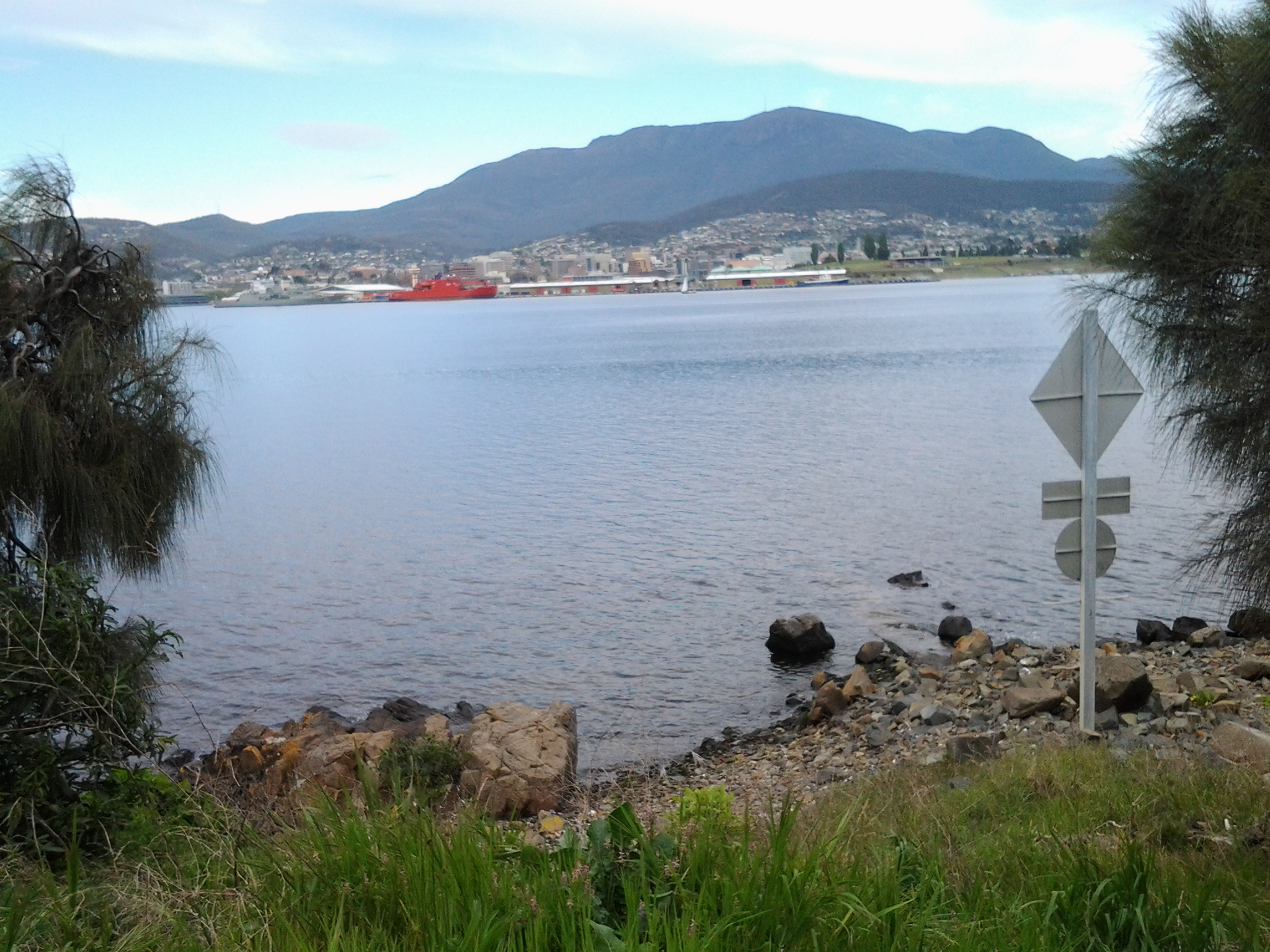
Continuing the walk and a little way ahead at Gunning St, on the right hand side of the road, a sign indicated the Kangaroo Bluff Historic Site could be reached uphill in a couple of hundred metres. I didn’t take this route rather I continued on the Trail around the Bluff until I reached Bellerive Bluff, the official finishing point for my walk on Stage 4 along the Derwent River. Before reaching Bellerive Bluff, I watched the tomato red coloured Aurora Australis, the Australian Antarctic Division’s research and resupply flagship, manoeuvring around the Derwent Harbour.

Once I arrived at Bellerive Bluff, an information sign reminded me that Charles Darwin, the eminent English naturalist, visited when the Beagle sailed into Hobart in 1836. The sign is particularly informative because it includes a map showing exactly the path Darwin walked on the eastern shore, some of which I have walked during Stage 4. Apparently some of the geological research and findings he made here on the eastern shore of the Derwent River, laid the grounds for the development of the significant theory of continental drifts. This information reminded me that it does not matter in which little pocket of the world you live, some important global story will come from it.

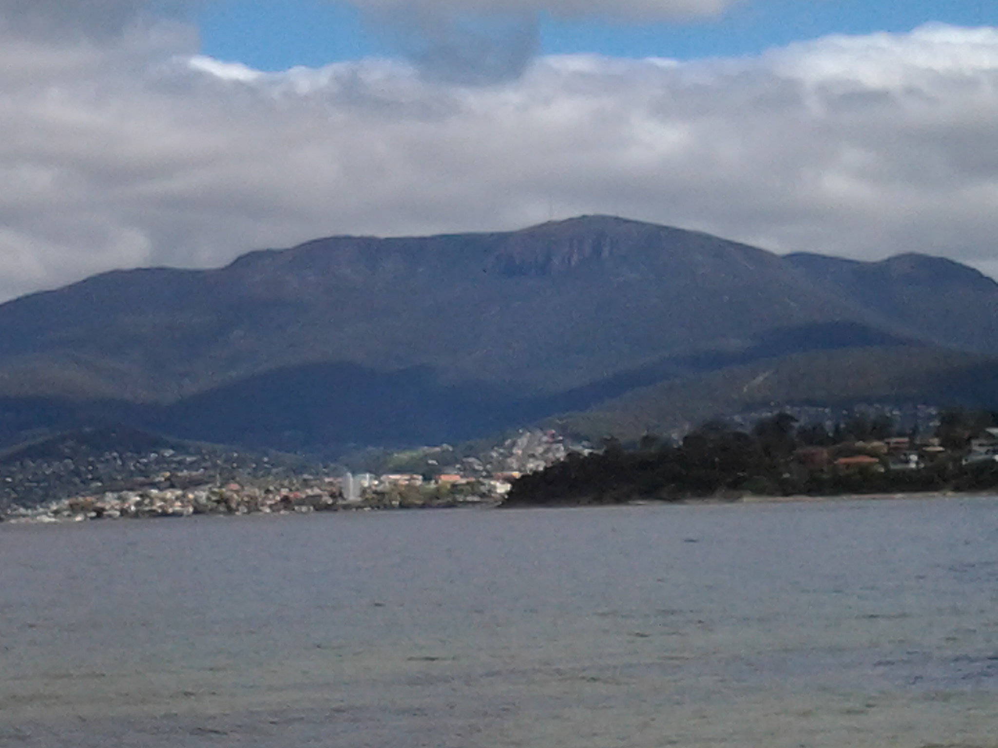
The next, 5th leg of the walk will start opposite Bellerive Bluff at Rosny Point, on a day yet to be determined.  The dark treed headland in the photo below is Rosny Point at the foot of the low Rosny Hill (the ever present Mount Wellington is visible in the distance).

20140926_113324

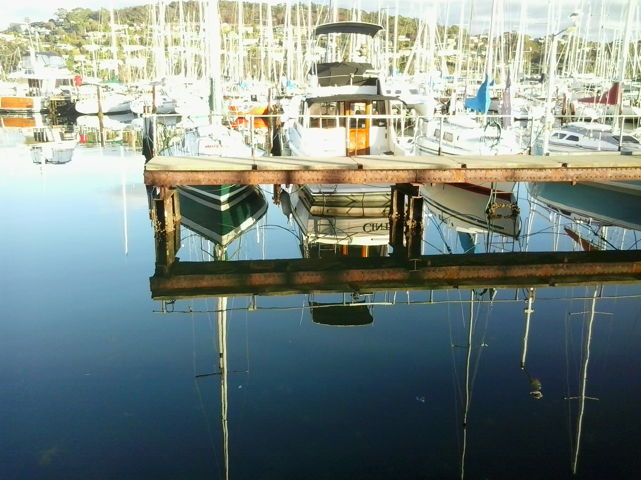
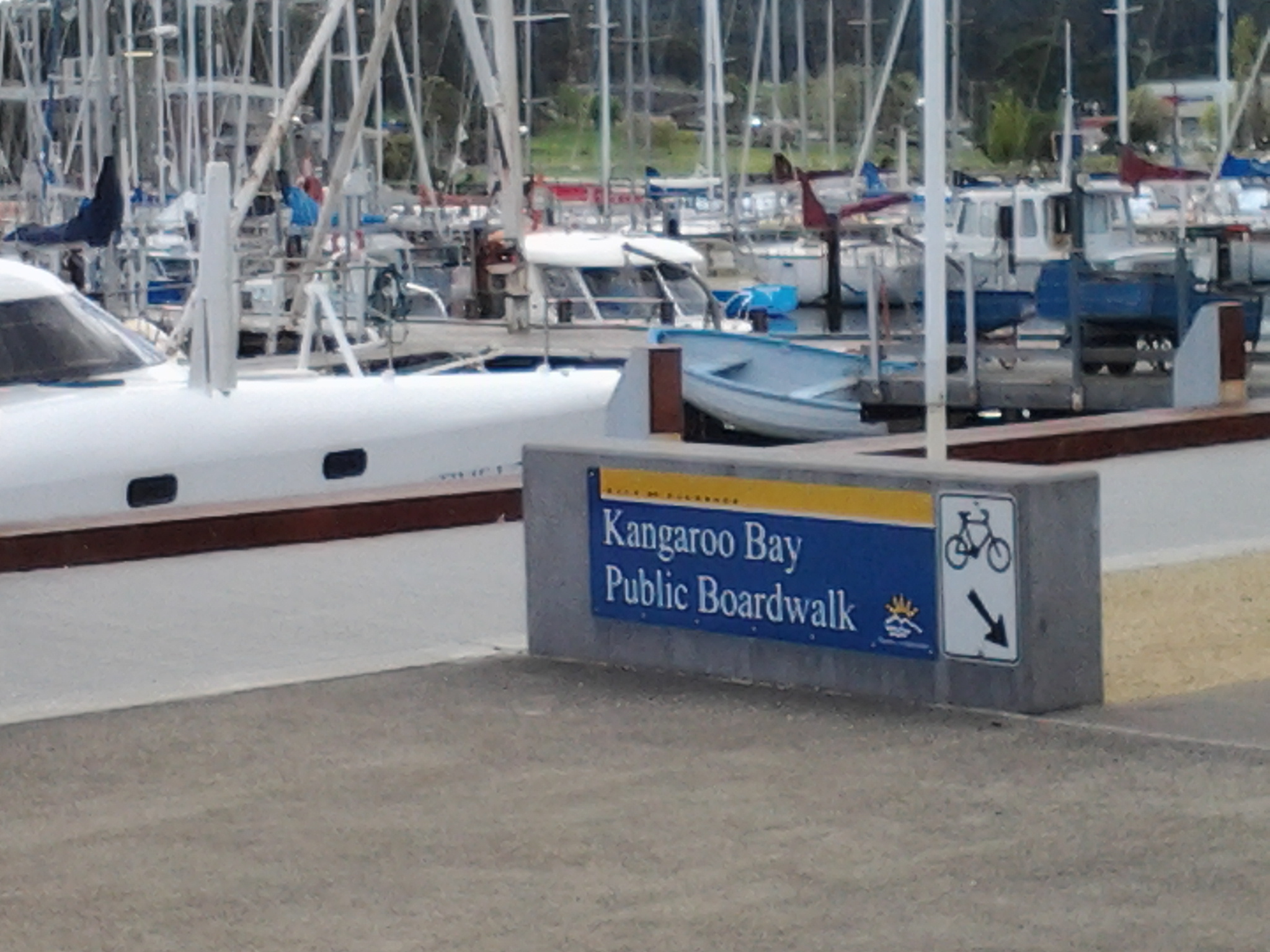
From Bellerive Bluff further walking is required to access bus routes and return to the Hobart city centre (although I walked home nearby). The Clarence Foreshore Trail continues along the edge of Kangaroo Bay from Bellerive Bluff. This pleasant walk leads to the Bellerive Ferry dock, a Fish and Chip Bar, and the Waterfront Hotel all overlooking the calm Kangaroo Bay with its marina full of yachts.

20140926_130133

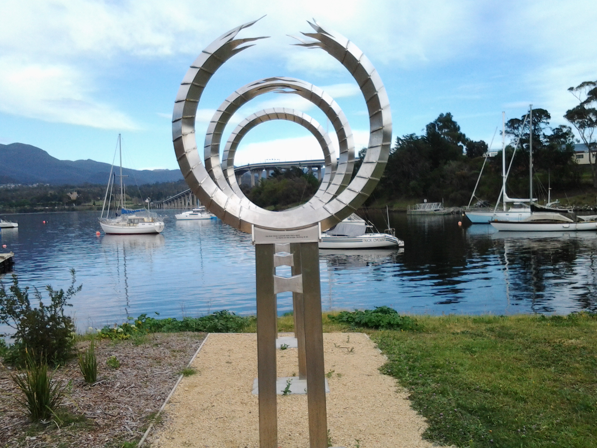
Continuing past the Hotel onto the Boardwalk (which stages wonderful open-air festivals throughout the year such as the Seafarers Festival, the Jazz Festival, and the Fruit Wine Festival) there are two choices: to continue along the edge of Kangaroo Bay and past the Bellerive Yacht Club, or to walk up to the street and access the shops and restaurants of Bellerive Village. On the road (Cambridge Road) after the Yacht Club, after the shops finish and not far from the intersection lights, the sign for bus stop number 8 is planted on the edge. From here a bus can be hailed (please do not expect a bus to stop if you do not hold out your arm and indicate, even though you may be standing at the bus stop).  A timetable of bus services is posted on the bus stand.

Once on the bus, you should feel satisfied (and so lucky) that you exercised your body, cleansed your mind, and experienced the beauty of a portion of the Derwent River and its immediate environment. At the end of every walk I treasure where I have been during the day, and I am always excited thinking about the unknowns of the next stage, and looking forward to it.

My route for Stage 4 walking along the Derwent River

Yesterday’s route took me from Tranmere to Bellerive on the Derwent River’s eastern shore of the Greater Hobart Area.

  1. I caught the Number 615 bus to Camelot Park and got off at bus stop 31 in Tranmere just before 9am. The bus continued onto it final stop 31, while I crossed the road to look down on the rocky foreshore, before striding out along the concreted Clarence Foreshore Trail (CFT) back towards the city.

20140926_085658

  1. When I reached bus stop 29, public toilets were located next to the Trail. I continued along the Trail to the left on a gravel path separating the rocks and water from the back yards of houses lining the river. Fifty odd minutes after leaving the bus, and after passing Punch’s Reef and Anulka Park, I arrived at a significant curve in the Trail. At that point it seemed to be returning up to the roadway for continuation on a concreted pathway next to Tranmere Road.
  2. Instead I walked on northwards, next to the river on a grassy terrace but was eventually forced down onto the rocks of Howrah Point. Fifty minutes later I arrived at the southern end of Little Howrah Beach where I sat and ate some of my lunch. I would not recommend followers take this route because when the tide is in, some rocks will be impassable. At other times some uncovered rocks will be slippery with moss. In addition, there are overhanging prickly bushes which will scratch if you follow this way. I suspect staying on the Clarence Foreshore Trail would have taken half an hour or more off my walk.

The photo below shows the tranquillity of Little Howrah Beach.

20140926_104107

  1. Half way along the road next to the Little Howrah Beach is bus stop 21. Close by are public toilets.
  2. It took 6 minutes to walk the length of this short beach, a minute to walk over a tiny rocky shoreline, and then 30 minutes to walk the long Howrah Beach. The photo below shows the Howrah Beach. Second Bluff is the treed area at the end of the beach.

20140926_105721

  1. From Howrah Beach, I walked up and around the Second Bluff headland on a well-marked path (the rocks below would be impossible to walk around) and arrived at the start of the Bellerive Beach approximately a quarter of an hour later. The leisurely stroll along Bellerive Beach took about 30 minutes. The photo below was clicked looking back along Bellerive Beach after my walk was completed.

20140926_121521

Near this end of the beach a large football and cricket ground is evident through the trees.  Between this ground and the beach you will find public toilets.

  1. I took the stairs at the northern end of Bellerive Beach up onto Victoria Esplanade, turned left and followed the road around Kangaroo Bluff to Bellerive Bluff where this fourth stage of my walk along the Derwent finished.

This Bluff marks the point where the small Kangaroo Bay opens off tto the east of the Derwent River. Northwards across the water I could see Rosny Point which will be the starting point for the next leg of this journey.

20140926_123316

On the other side of the river, the city centre featured prominently below Mount Wellington.

20140926_123103

A number 608 bus runs through this part of Bellerive and continues onto Hobart. Alternatively, if you continue walking along the edge of Kangaroo Bay, then through the Bellerive Village onto Cambridge Road, buses can be hailed to stop at Bus Stop 8 for travel into Hobart city.

How much of the Derwent River have I walked?

I strolled very slowly for almost five hours. If followers choose to stay on the Clarence Foreshore Trail and are not as engaged as I was in making notes and taking photographs, I believe this walk will take a comfortable 3 and a half hours including snack breaks. In total, I probably walked about 10 kilometres because of the convoluted nature of the Howrah Point rocks and other non-Clarence Foreshore Trail pathways which I followed from time to time.  In relation to meeting my goal to walk the 249 kilometre length of the Derwent River, I gained another 4 kms; the total distance covered so far is now 19.5 kilometres.