Tag Archives: Opossum Bay

Fossil Cove posting 1 of 4

On the day when I walked from Blackman’s Bay to Point Pearson near Tinderbox, then retraced my steps to catch a return bus from Blackman’s Bay, I omitted to walk via Fossil Cove. The pathway to this secluded rock strewn cove required a detour of over 2 kilometres. Since my day’s walk to the mouth of the Derwent River on the western shore and return was expected to be over 20 kms, I resolved at the time to return on another occasion to walk this section.

I was delighted when I finally ‘discovered’ what locals and others have known for a long while.

A couple of kilometres along Tinderbox Road after leaving suburban Blackmans Bay, Fossil Cove Drive is clearly marked.  Around a kilometre down that road, a sign indicates the way to the beach.

20160331_105431.jpg

A further sign declares this area to be a public reserve and a site of national geological significance.

20160331_105508.jpg

The steep descent to the Cove was controlled by steps and dirt pathways.

20160331_110054.jpg

20160331_110749.jpg

20160331_110806.jpg

I was dazzled by views across to Opossum Bay and Gellibrand Point on the eastern shore of the Derwent River.

20160331_110828.jpg

Finally I arrived at sea/river level.

20160331_111141.jpg

20160331_111137.jpg


The Derwent River and its Highways

The south of Tasmania is crossed by trunk roads, regional freight roads and regional access roads, including six of the highways for walking on when walking from the mouth of the Derwent River to the source.

  1. The South Arm Highway which extends from Opossum Bay to where the suburb of Mornington reaches the Tasman Highway. I bussed and/or walked on the South Arm highway during Stages 1-3.

20140822_130241 20140904_133309

2.   On the eastern shore of the Derwent from Geilston Bay to Bridgewater Bridge it was the East Derwent Highway which felt the plod of my feet occasionally during stages 5 -8 of my walk.

20141031_093816 20141031_101844 20141031_122945 20141031_111951 20141031_121153 20141111_105455

3.    Once I reached Bridgewater on Stage 9, the highway crossing the Bridge was the Midland or Midlands Highway (sometimes referred to as the Heritage Highway).

20141111_131431 20141111_132913

4.     Some of Stage 12 of my walk on the western shore towards the mouth of the Derwent River, included a couple of kilometres on the Channel Highway.

20150202_095550

5.   At the start of Stage 14 I will walk on the last few metres of the Brooker Highway, the main highway which extends from the centre of Hobart city to the Bridgewater Bridge at Granton. For the first time, at the Bridgewater Bridge, this Highway edges the Derwent River.

6.    Immediately after the highway intersection with the Bridge, the Lyell Highway commences. From Granton until I reach the source, the Derwent River winds closest to the Lyell Highway, the highway which extends west to the town of Queenstown (which is overshadowed by the copper bearing Mount Lyell). This highway will be my life line in terms of accessing public buses.

Wandella Avenue to the Shot Tower, Tasmania

My previous posting explained that the first part of my Stage 12 walk along the Derwent River took me to Wandella Ave but then I retraced some steps and took an Alum Cliff-side disused track, which ultimately resulted in my returning to Wandella Avenue.

So – when you walk from Hinsby Beach and the track arrives at Wandella Ave, turn left, walk for a short while and then turn right into Baringa Rd (the signpost for this is missing). Continue walking around and uphill until you reach the junction with the Channel Highway. I reached there at 9.44am

Nearby was bus stop 32.

I enjoyed soaking in the view across the Derwent River where I could see Gellibrand Point and Opossum Bay.

20150202_094257

Further down the River, South Arm and Fort Direction Hill were visible at the mouth of the Derwent on the eastern shore.

20150202_094443

I turned left onto the Channel Highway (which has no footpath) and was able, for some metres, to walk inside a guard rail and then later on a narrow gravel verge with traffic streaming by.  At 9.50 am I was passing the sign indicating this was the Huon Trail Touring Route.

In the bush which I had clambered through earlier and now as I walked along the road, I was concerned to see an exotic which has escaped and been self-seeding rapidly everywhere.  I don’t know the name of the plant but from experience in my own garden, I know it grows fast and furiously into a medium sized plant with a purple pea flower. I did pull out some of the smaller plants and with the moist soil the roots came out as well.  But there were thousands of plants and continuing my walk was the greater priority, so I stopped pulling.

Further up the road, I could see the top of the Shot Tower above the trees.

20150202_095550

Before long I was standing outside the Shot Tower complex. The time was 10.05am.

20150202_095803 20150202_095850 20150202_095810 20150202_095929

The person manning the souvenir shop and entrance to the Tower gave me a booklet with all the tracks and walks in the Kingborough area, and he pointed out a nearby gum tree just over a rise. ‘That’s where the Alum Cliffs track starts’, he told me. He felt sure the Kingborough Council were ready to build the final part of the Alum Cliffs track from the Shot Tower to Hinsby Beach so I guess we wait and see what progress is made in the months to come.  However, it does seem the track won’t be marked out close to the Cliff edges on that northern part.

On my list of things to do in the future will be to return to the Shot Tower to take the walk up the many stairs and look out over where I have walked. The cost is only $8 including the opportunity to watch an interpretative DVD. The Shot Tower site includes a shop, museum, carpark and public toilets.  Plus the fabulous view!

Yesterday I walked Stage 11 from Hunter St in Hobart city to Hinsby Beach south of Taroona

The goal of my walk along the Derwent River for Stage 11 was to start at my last stopping point, Hunter St at the wharf in Hobart on the western shore of the Derwent River, and continue to Kingston in the local government area of Kingborough.  But I did not get that far.  My feet said enough was enough once I found the delightful and almost hidden Hinsby Beach.

20150119_131327

Over future posts, I will write up the stories of the walk, what I saw and what I experienced, but for now it’s enough to say that I am continuing with this massive project to walk both sides of the Derwent between the mouth and Bridgewater, and then onwards to Lake St Clair.

The day was sunny with a bright blue sky, Mount Wellington was clear, and a cool breeze featured through much of the day – making it perfect walking weather.

Yesterday I covered 8 kilometres of the length of the Derwent River on the western shore (making 30 kms in total on the western shore), and walked approximately 13kilometres (making a total of 143 kms to date) to achieve that distance. This distance also takes in the streets and paths on which I walked that led to dead ends so that I needed to retrace my footsteps.

The highlights of the walk include discovering the road next to Taroona High School is a public access route which took me down to the Derwent River to a row of colourful boathouses, getting off the main road at places like Cartwright Park Reserve, and seeing the Alum Cliffs in all their majesty.  My next walk will start along the top of these.

20150119_125317

It was a revelation to watch the eastern shore and to see the suburbs and beaches on which I walked in the early stages of my walk. The day started with my being roughly opposite Bellerive and finished with my being opposite Gellibrand Point at the northern tip of South Arm.  The photo below, taken from Hinsby Beach, looks across the Derwent River to Opossum Bay Beach.

20150119_131757

I intend my next walk will start from Hinsby Beach and continue to Blackmans Bay.  But before then I need to record the details of yesterday’s walk.  So my walk for Stage 12 could be a week or more away.

Kingston Beach, Tasmania

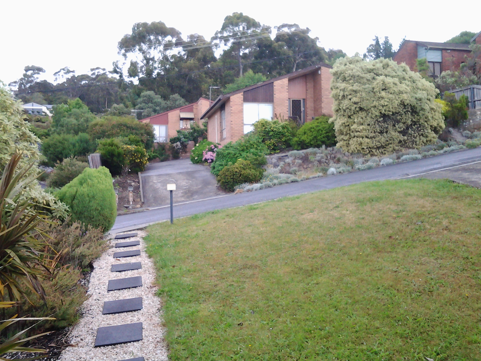
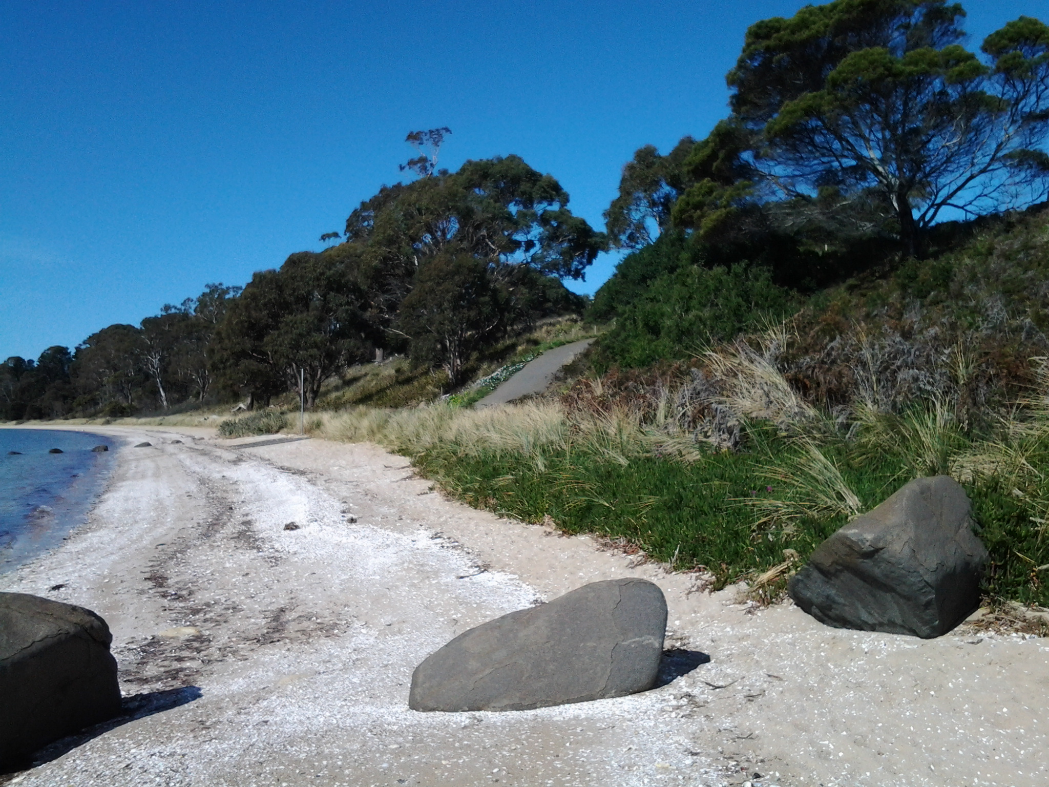
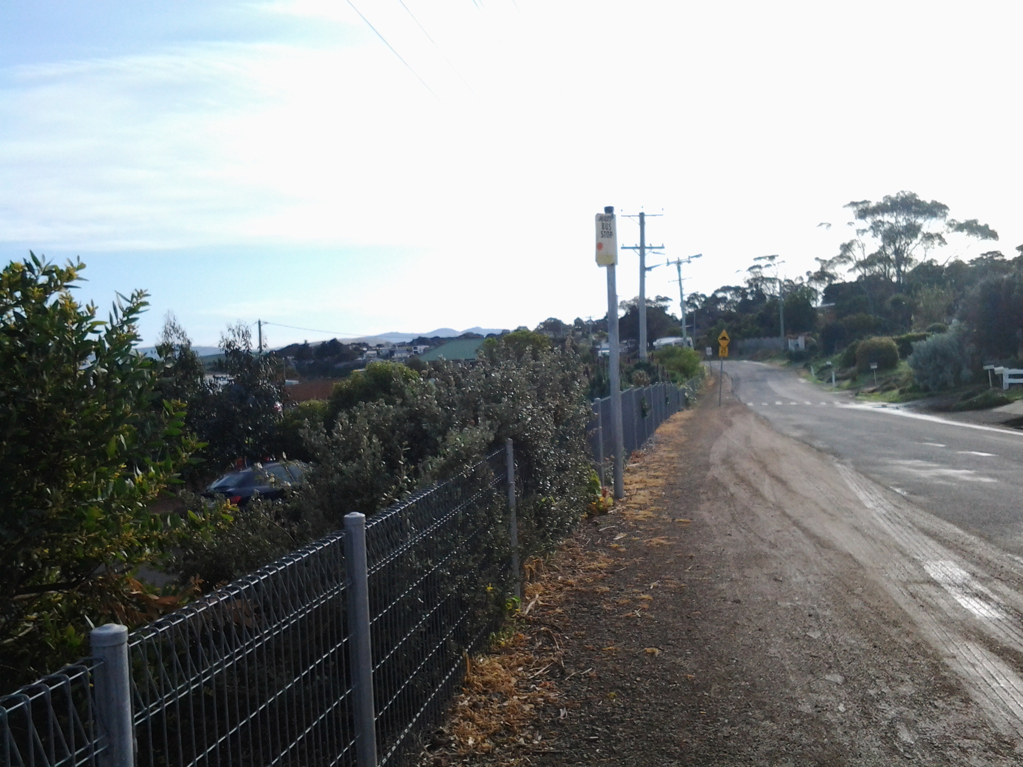
I found a tiny laneway, squeezed between residential properties, which extended from Roslyn Avenue near where I was staying in Kingston, down to Kingston Beach.  The downward stroll took 6 minutes and, later, the return trundle uphill took 10 minutes.  The easy accessibility to the beautiful foreshore is an asset for locals.  I loved the closeness of the lush vegetation along the pathway and then the openness of the Beach extending before me once I reached the Esplanade.

The morning was overcast with a moderate breeze, but the weather did not deter families, groups of children or a kayaker from enjoying the beach and water.

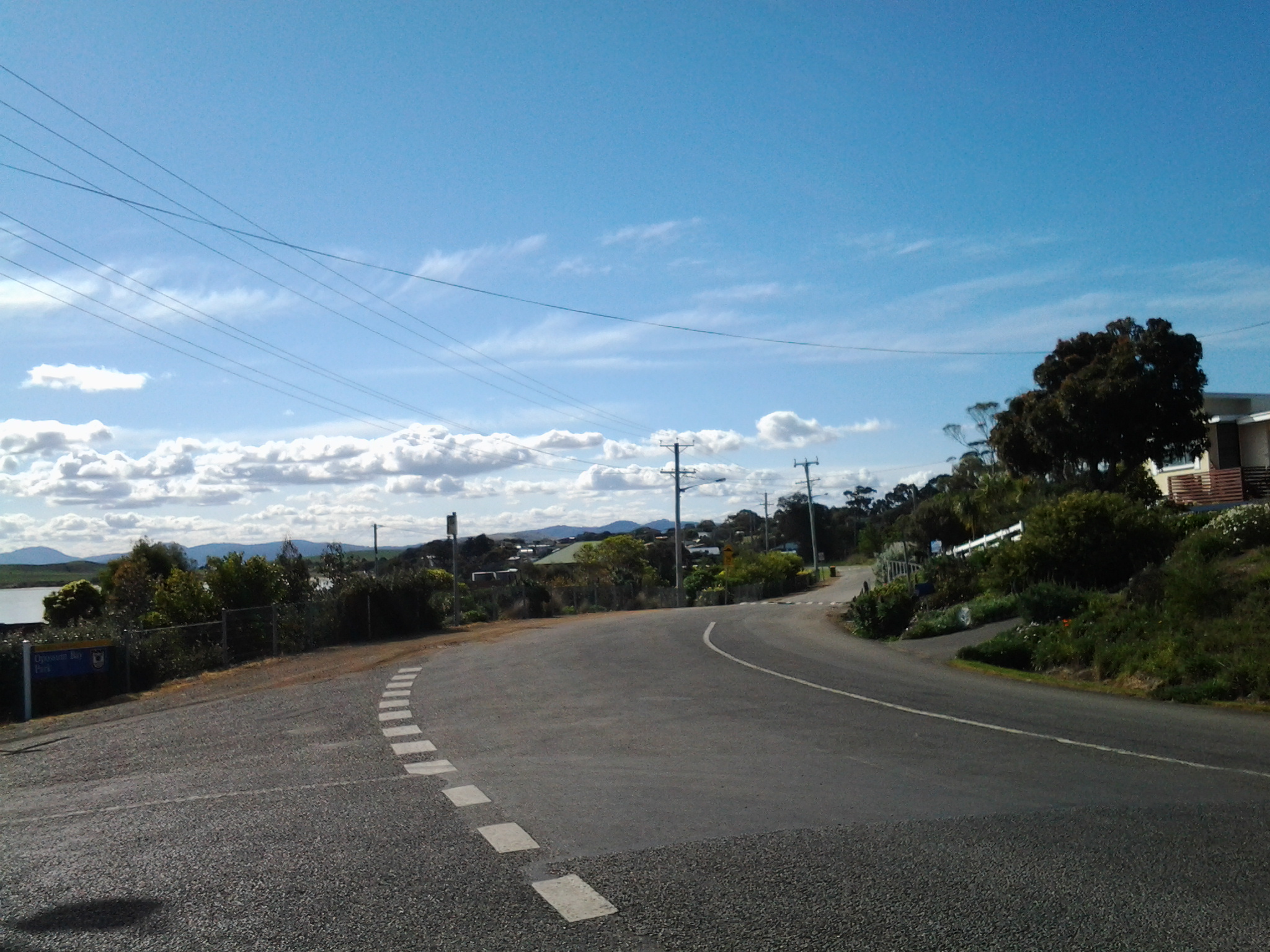
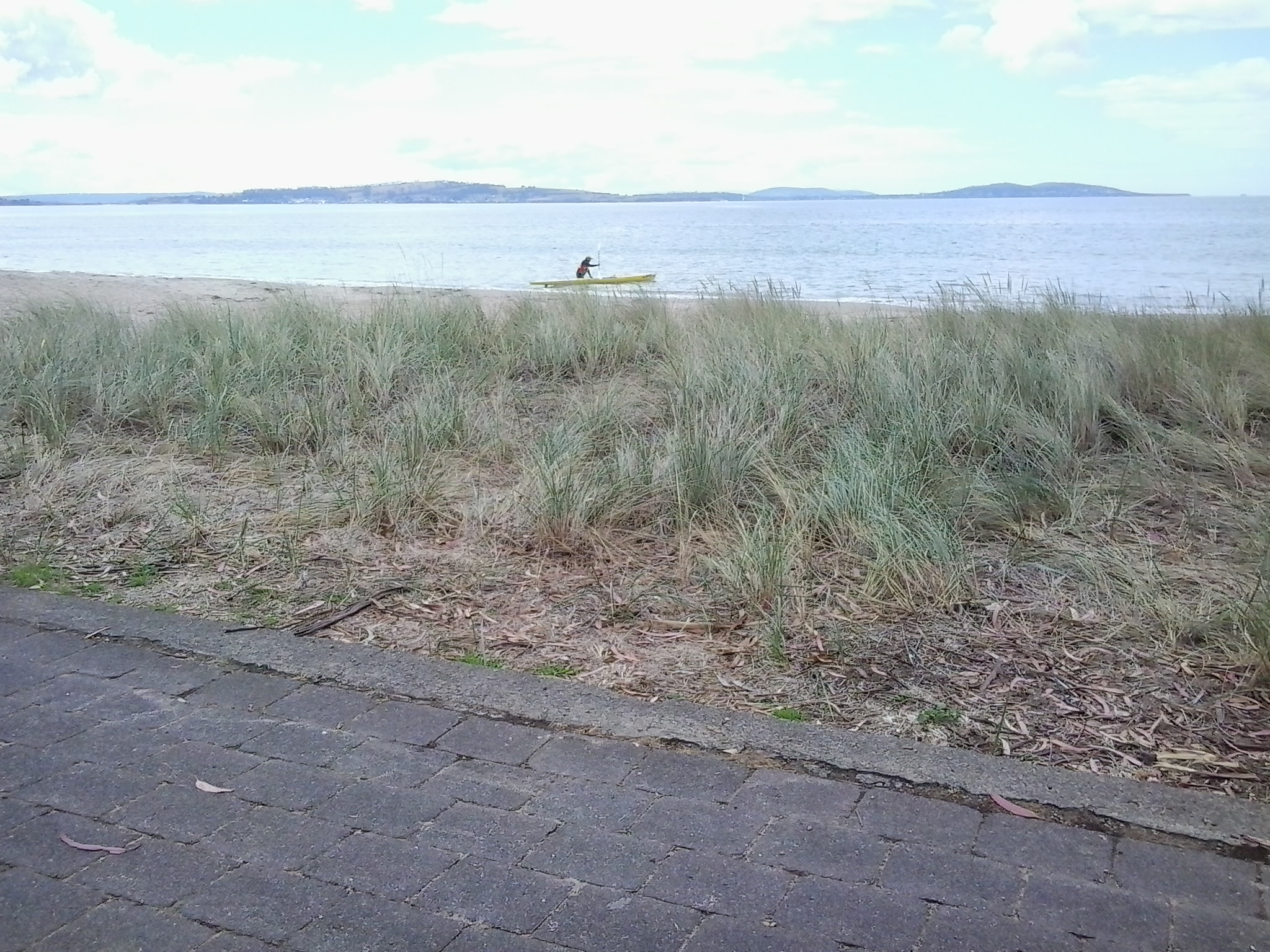
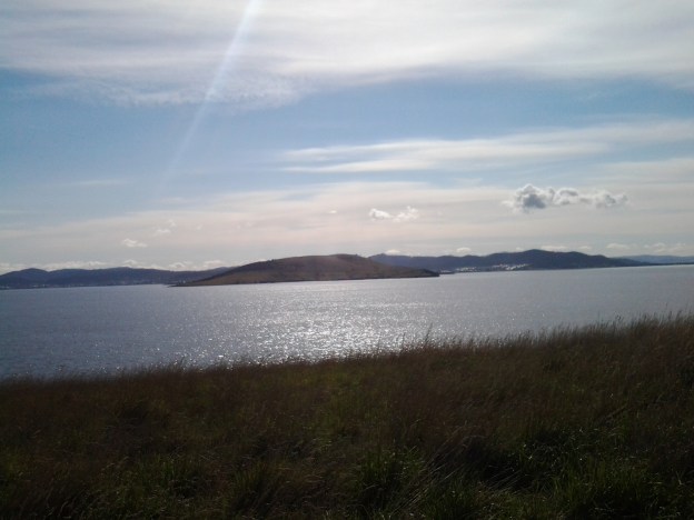
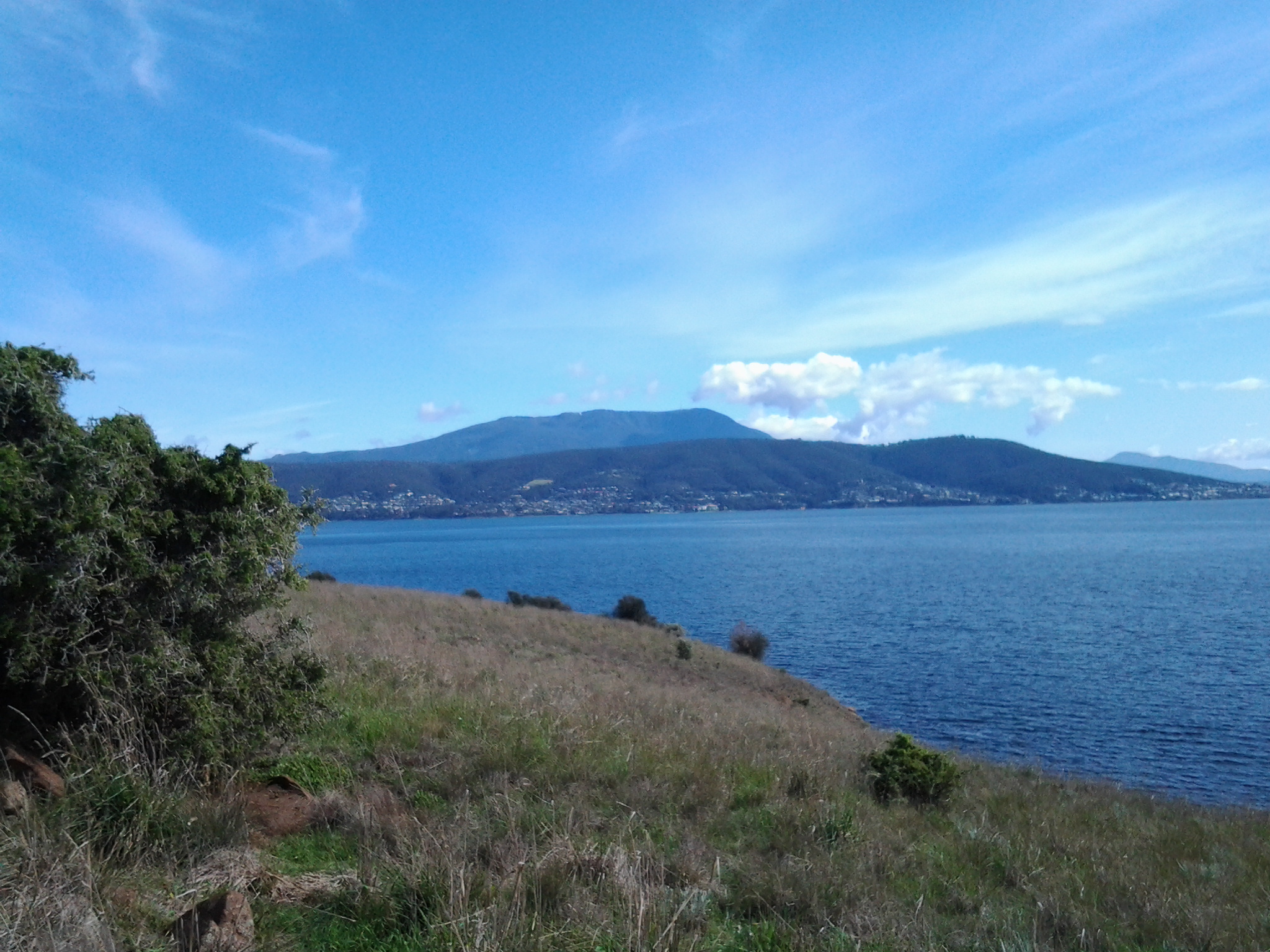
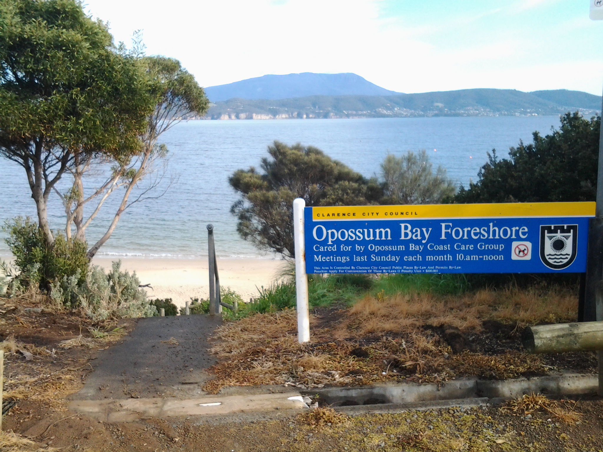
In the photo below the lone kayaker sets off to enjoy a paddle. The land which can be seen across the Derwent River is the South Arm peninsula. Standing on Kingston Beach, I could identify key points along that piece of land which I had walked during Stage 1 and 2: Gellibrand Point, Opossum Bay, South Arm, and Fort Direction Hill.

Kayaker

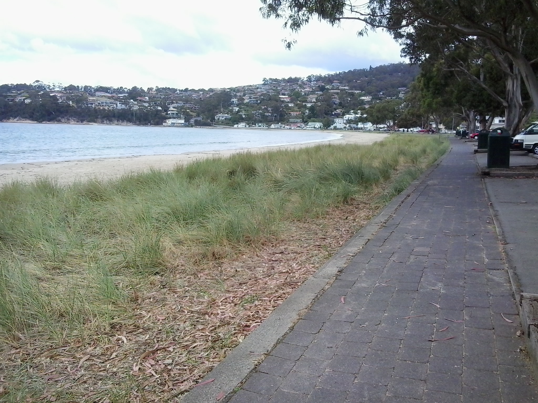
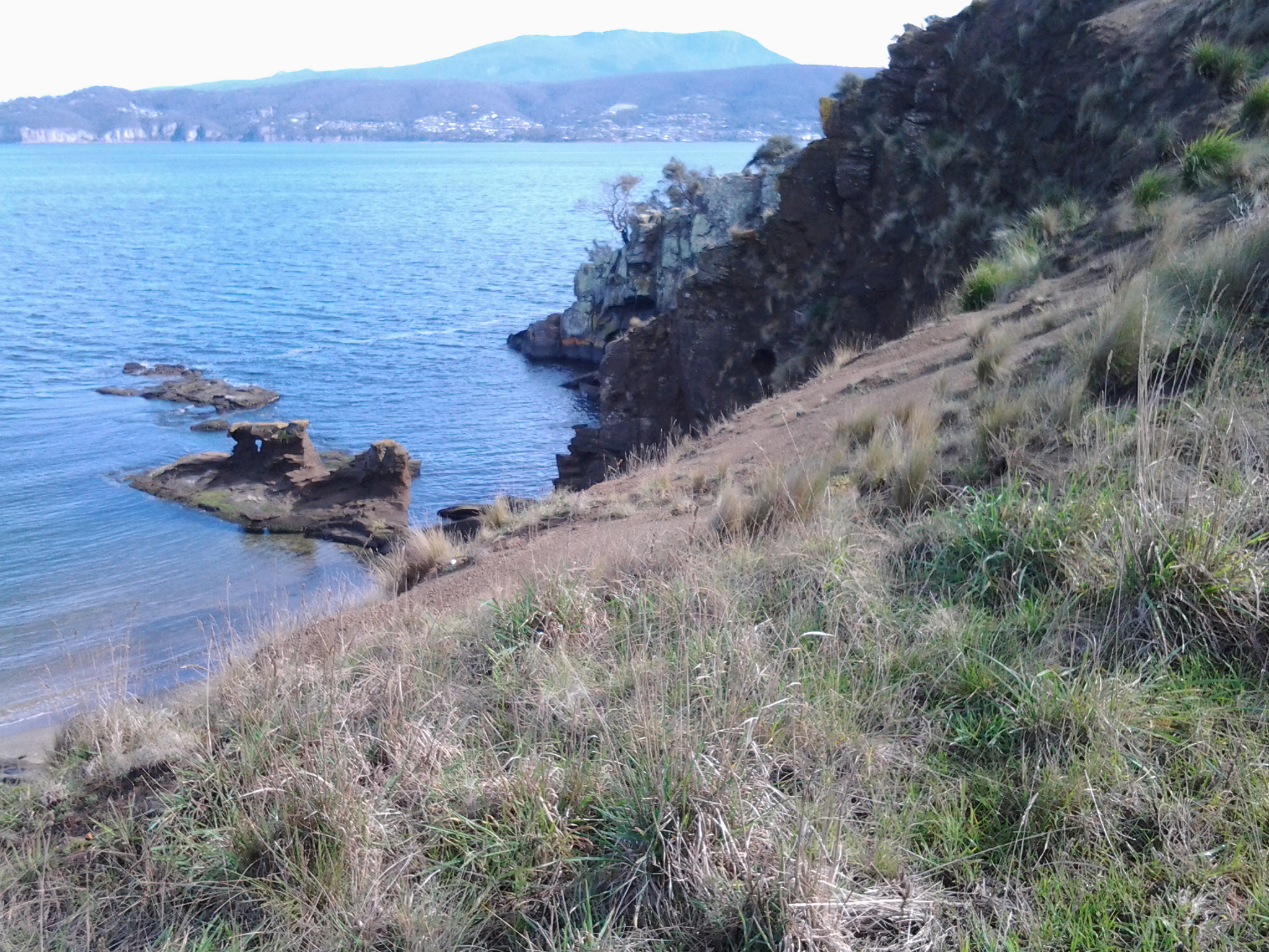
I followed a path along the foreshore northwards to Browns River and then I retraced my steps. Looking towards the mouth of Browns River as it enters the Derwent River.

Pathway along Derwent at KB

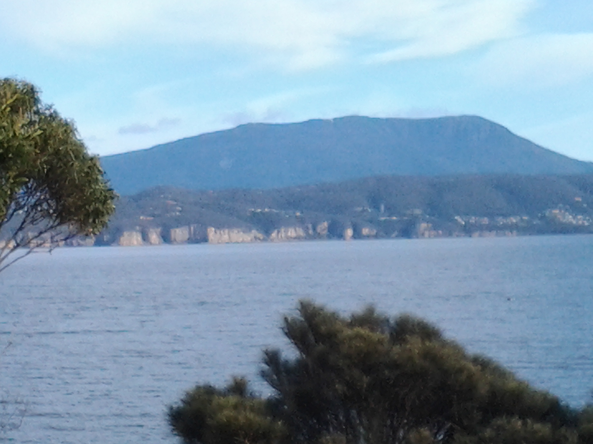
At Browns River, one side of Mount Wellington looms in the distance.

end of Kingston beach road

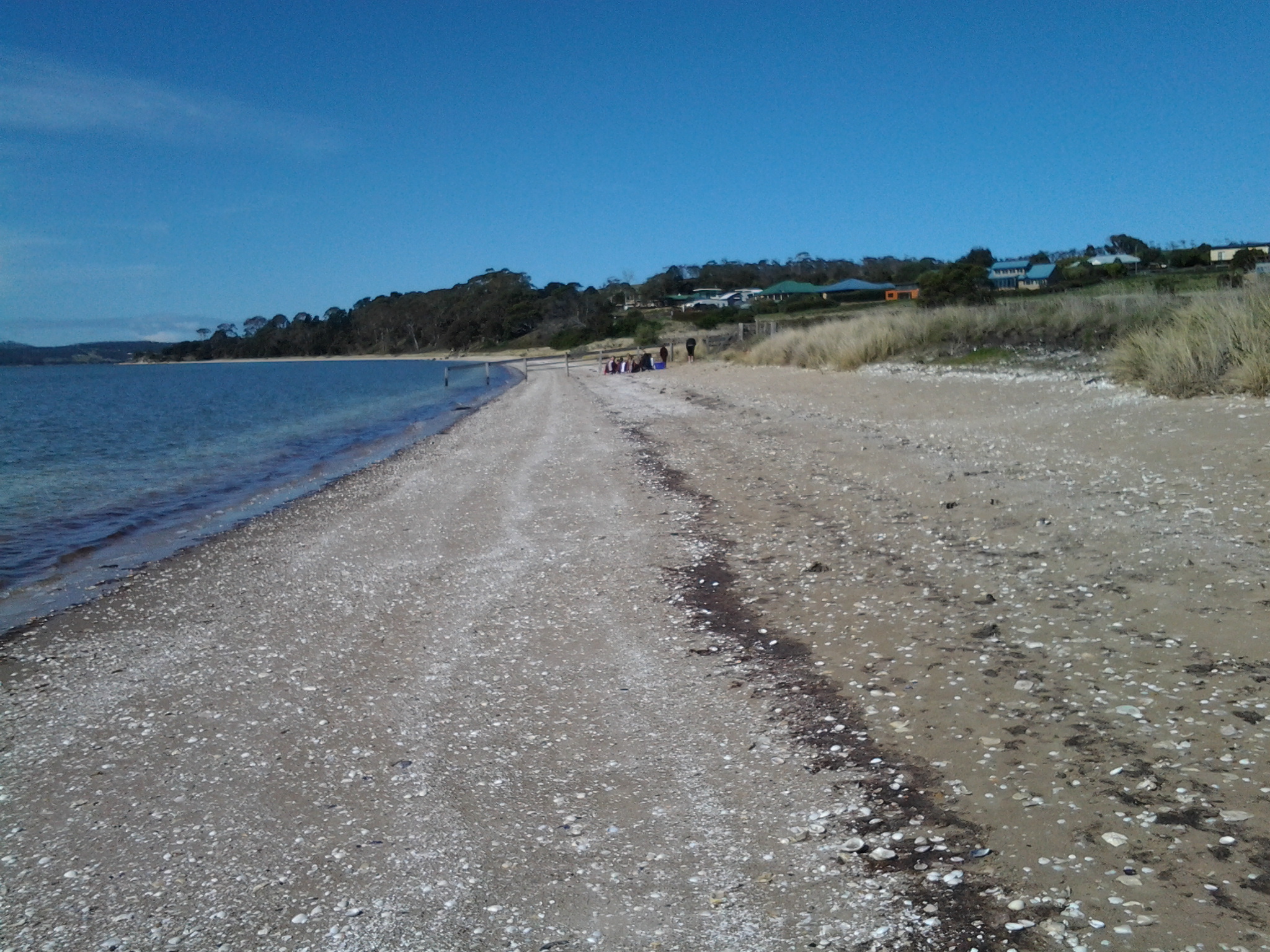
Kingston Beach and Browns River are located within the municipality of Kingborough as part of the Greater Hobart Area. In the photo below the waters of Browns River can be seen meeting the Derwent River.

Sign

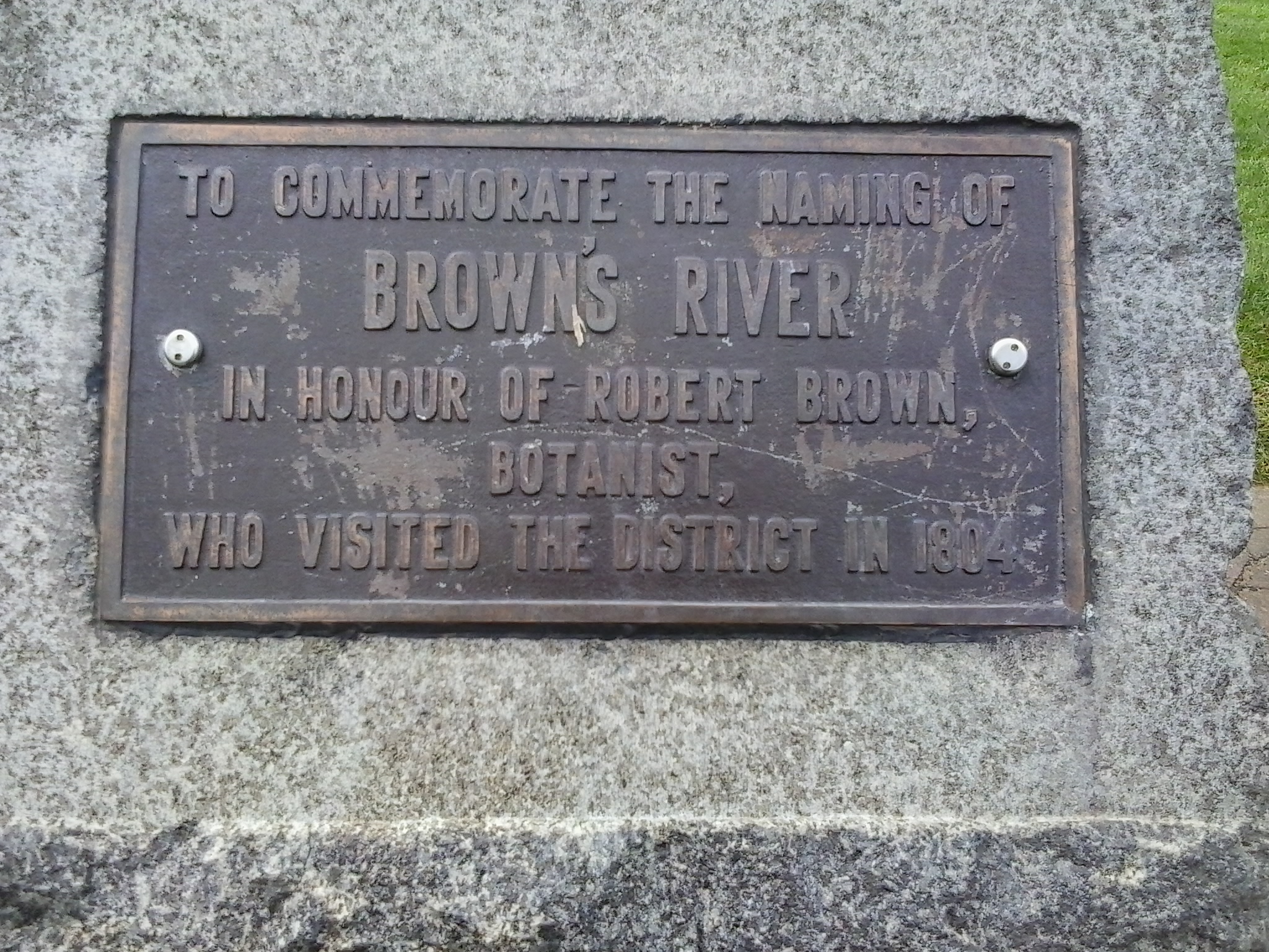
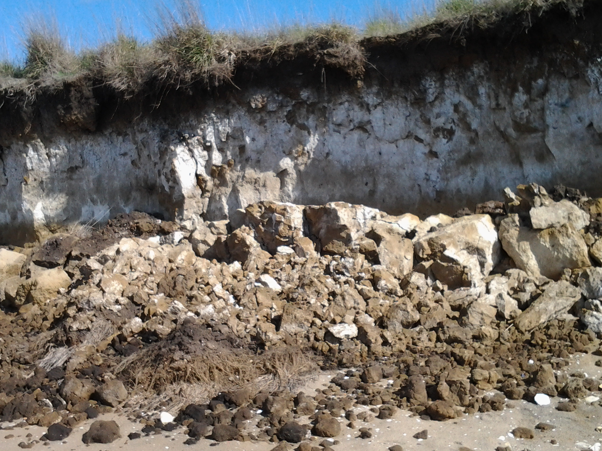
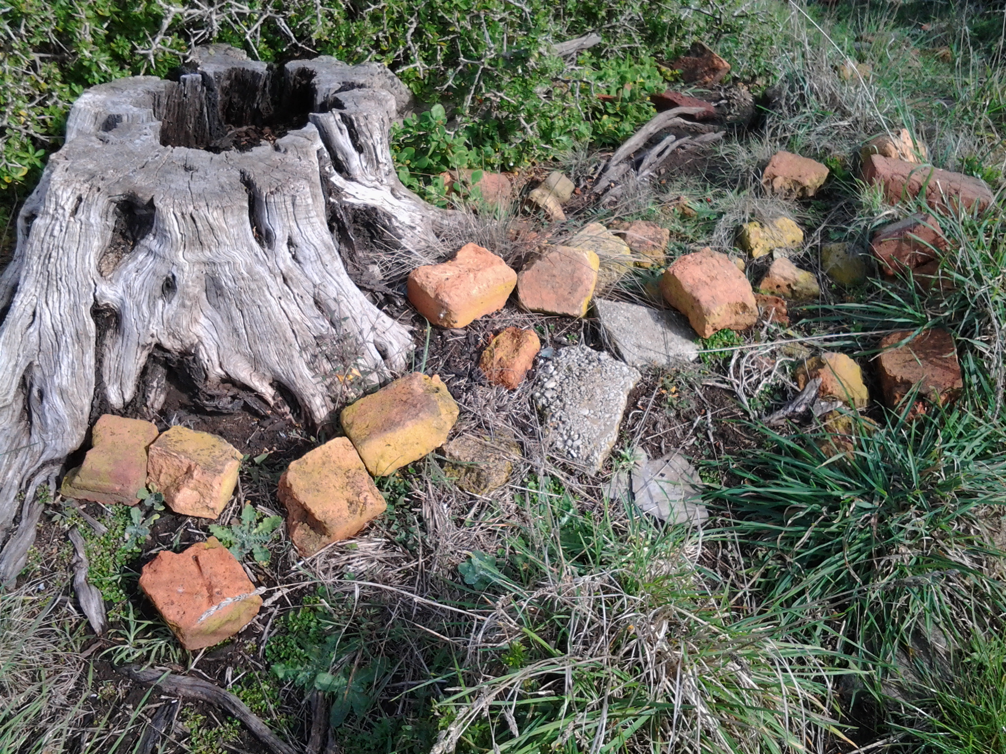
Nearby I discovered a plaque (photo below) and its message surprised me. Browns River was named in 1804 (you can read more about Robert Brown at https://www.forestrytas.com.au/assets/0000/0185/tasfor_12_10.pdf).  From the reports of my earlier walks in this blog, you might recall that Risdon Cove was established as the first white/non indigenous settlement (on the eastern shore, and quite a few kilometres upstream from the mouth of the Derwent River) in September 1803. I find it quite extraordinary that within months of the first white settlement (in fact Brown named the River in April 1804), despite the difficulties of making a new home in this foreign land, new arrivals were off and about checking and naming other edges of the Derwent River. It wasn’t until July 1804 that the area around Sullivans Cove (the site for the central part of the current city of Hobart) was set up for permanent residency. Sullivans Cove is much much closer to Browns River than Risdon Cove, so Brown had a long way to paddle.

Browns River plaque

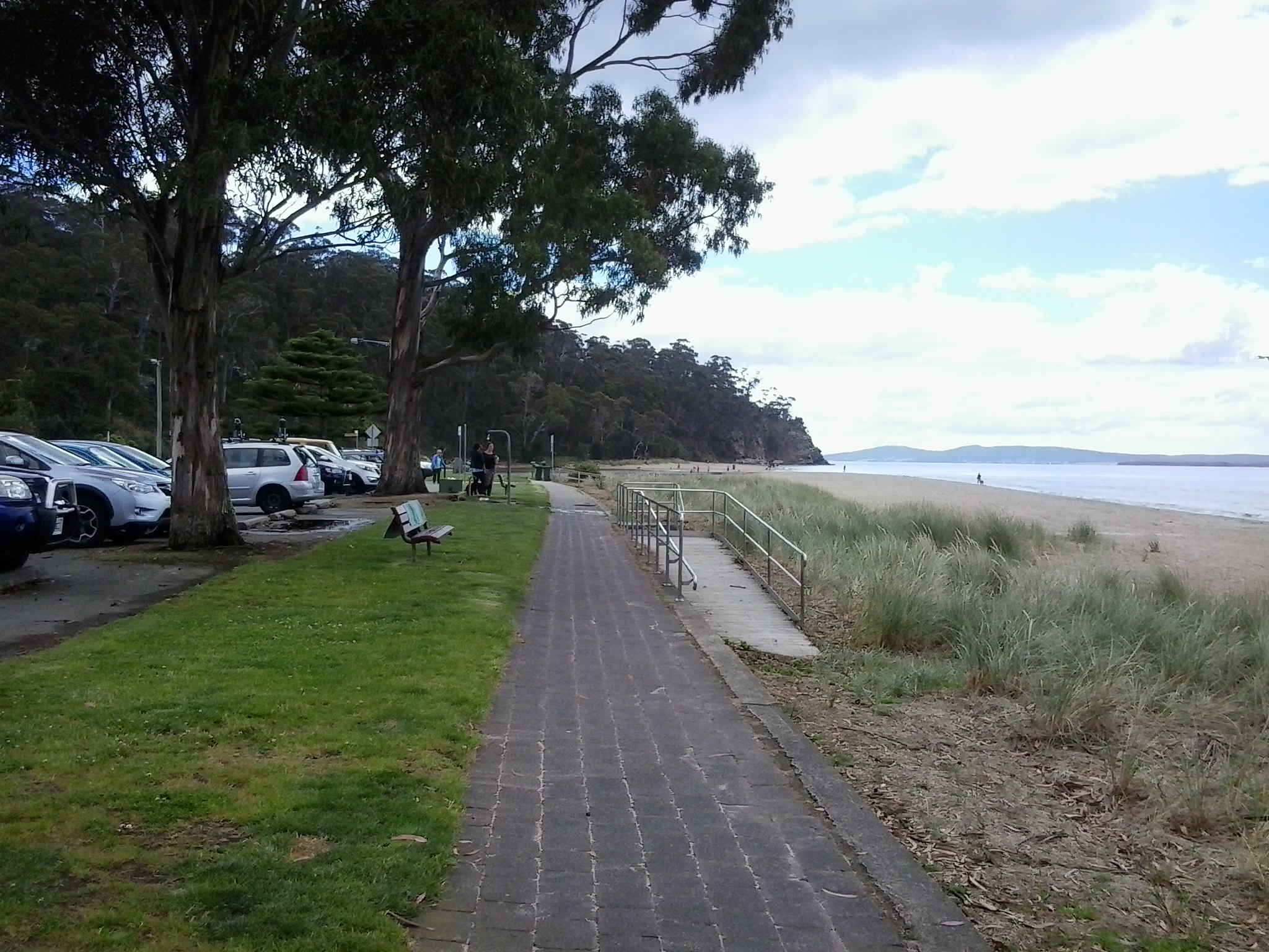
The photo below looks back towards the centre of Kingston Beach from the Browns River northern end.

kb 2

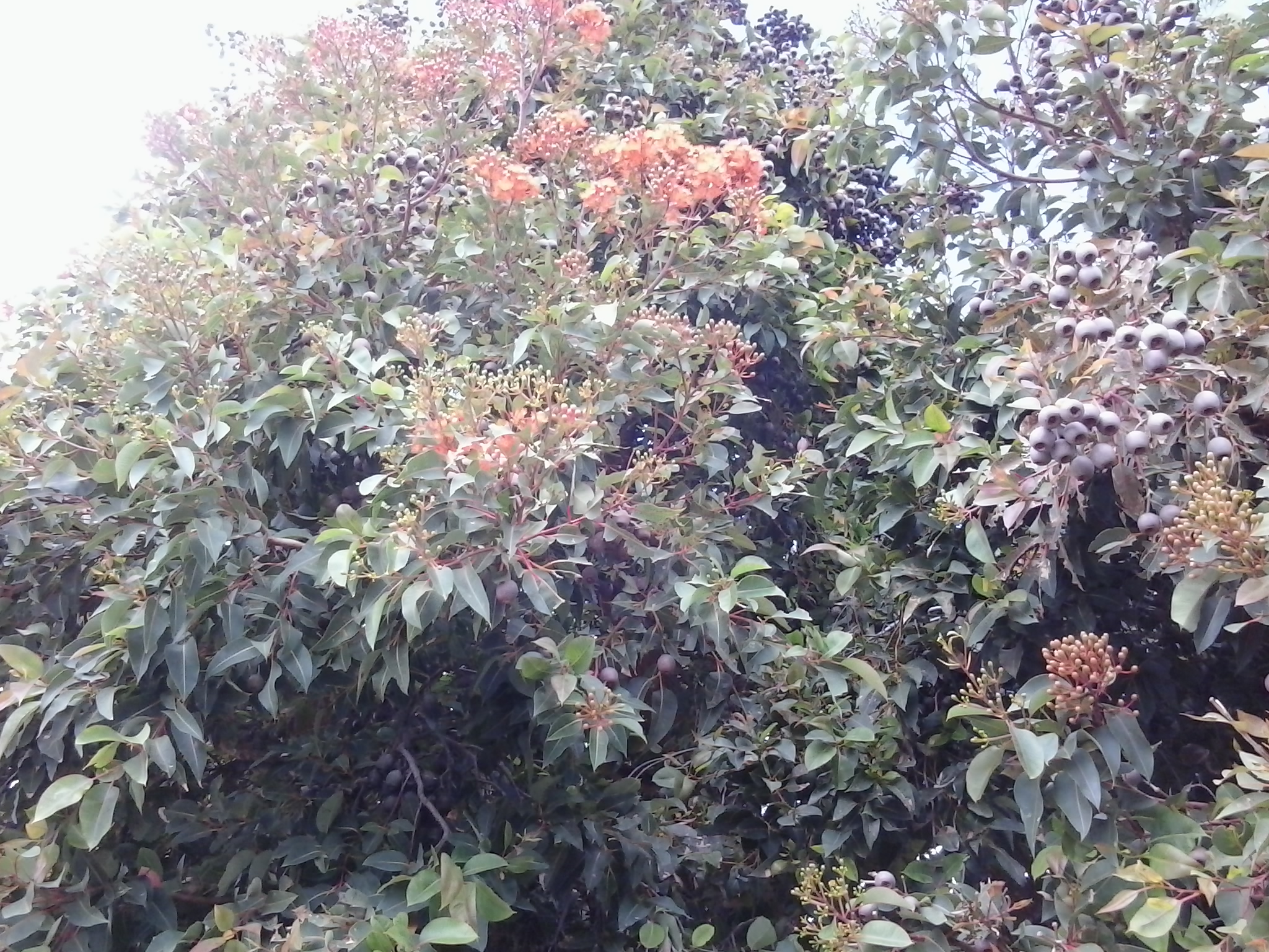
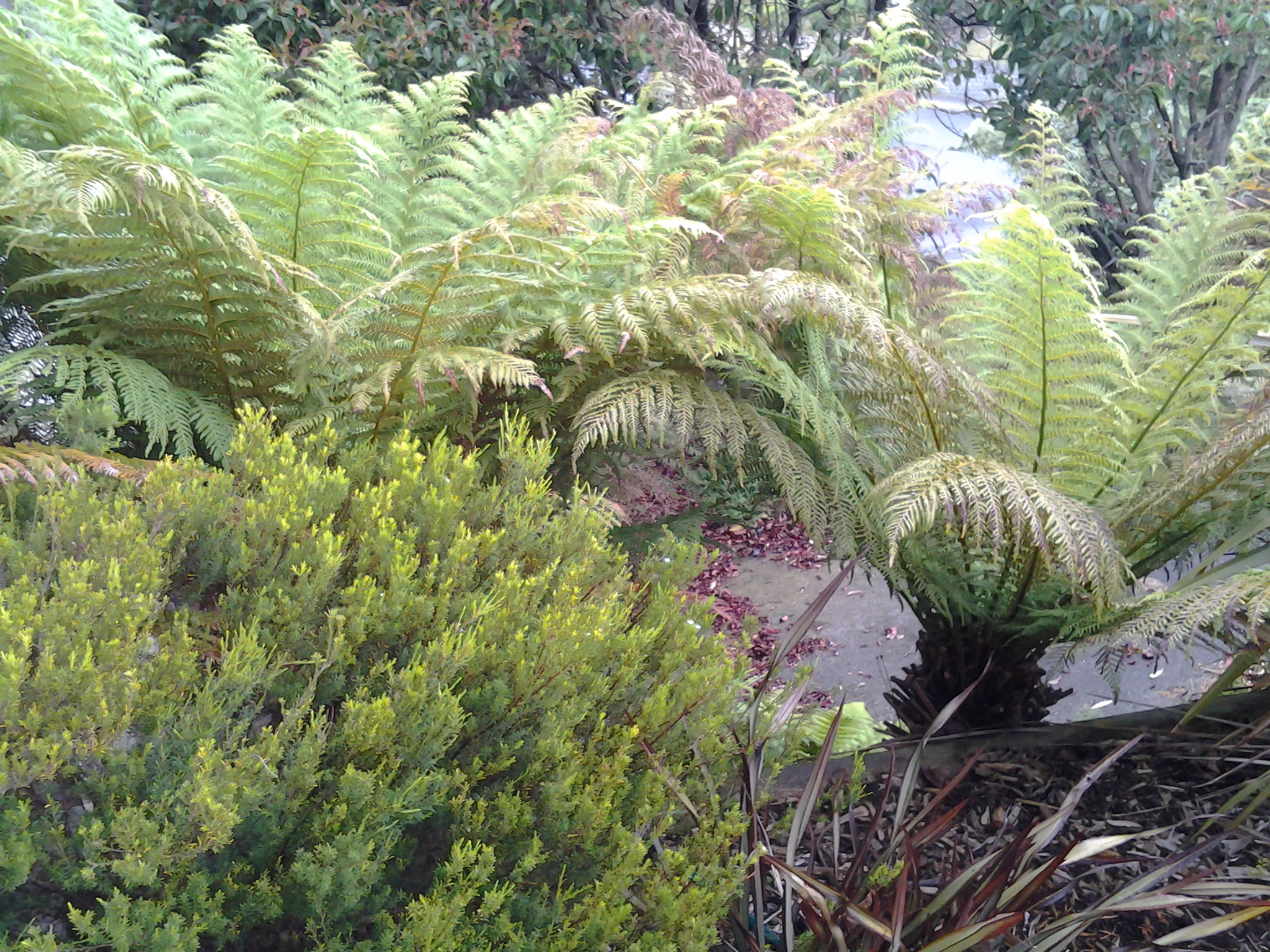
I loved the trees and was especially impressed by one of the flowering gum trees next to the foreshore walkway.

gum blossom

The stroll from the one end of Kingston Beach to the other takes about 15-20 minutes and represents approximately 1 kilometre of the Derwent River’s length.  Immensely pleasant.  If you haven’t enjoyed this part of the Greater Hobart Area, or it’s a while since you have travelled here, then I strongly recommend you make a visit.

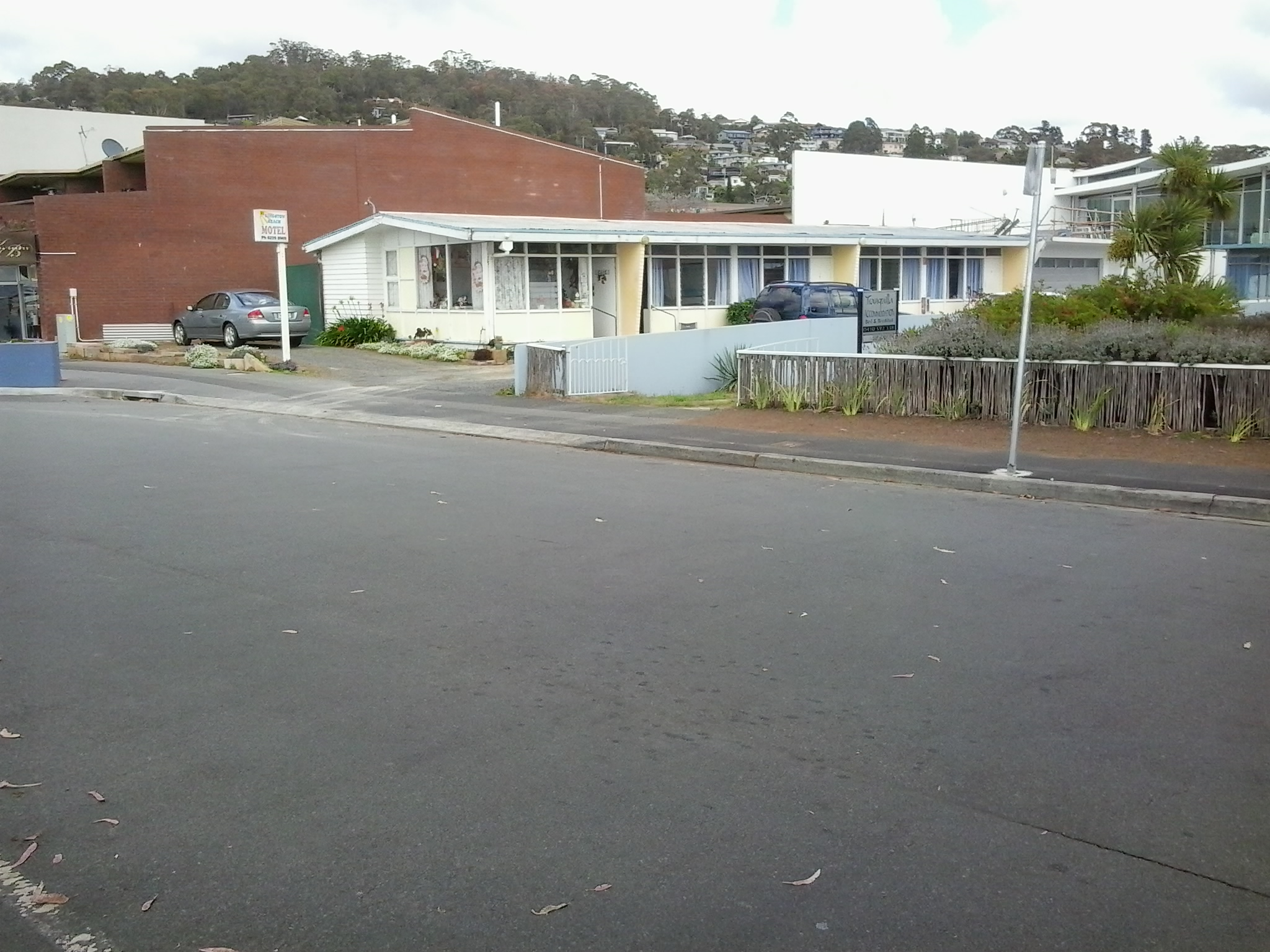
Fish and chip shops, cafes, a sad looking motel and Duncan’s Beachfront Motel Hotel are located across from the beach.  Some readers might know Slim Dusty’s song ‘I’d like to have a drink with Duncan’ (refer to http://www.lyrics007.com/Slim%20Dusty%20Lyrics/Duncan%20Lyrics.html for more information). Jo will recall the hilarious fiasco at a fashion parade in Darwin when this music coincided with a bridal dress being shown on the cat walk.  I wonder who Kingston’s pub is named after? Anyone know?

shops and cyclists  Motel  Duncans pub

Along the street travelling away from the beach towards Hobart, you will pass an assortment of outlets including hair salons, service stations, a community hall and, very surprisingly, the Wafu Works which is a shop selling vintage authentic Japanese fabrics.

Japanese Wafu Works  Japanese fabric shop

Simple street art in the form of inset mosaic panels have been incorporated in the pavements.

Mosaic in pavement  Street mosaic in pavement

This part of Greater Hobart is very attractive, and I am vowing to visit more often.

I am on holiday watching over the Derwent River

Yesterday afternoon I left home, for a week, to live in a unit above Kingston Beach which overlooks the wide expanse of the Derwent  Harbour in Tasmania’s south east.

In future, I will walk along the edge of the Derwent River below as part of my stroll along the Derwent from the eastern shore mouth to the western shore mouth and then from Granton to the source.  Here I am located very close to the mouth on the western shore. I feel tempted to walk the last kilometres this week, and then go back to Berriedale and walk the remaining distance to Kingston. The weather and Christmas commitments will influence the decision.

I am living in a leafy suburb where the rain has pattered through most of the night.  The ground is moist, the air is clean, and the vegetation looks delightfully healthy. This morning, despite slight drizzle, I have taken photos from and around where I am living to give me a sense of place.

20141223_092336 20141223_092147  20141223_092341

The water and the air over the Derwent River are pale and silvery. The sky and water blend softly over disappearing hills so that they all seem to slip from my eyes. Details are scant. Focusing is difficult.  It is not surprising that the photo below shows no water detail.

20141223_092053

Last night in the evening’s continuing light (today is the longest day of the year) I looked across the Derwent River and could identify the land on which I walked in parts of the first three stages of my walk.  The entrance to Ralphs Bay is marked by Trywork Point to the north and Gellibrand Point in the south stands proud at the northern end of the South Arm peninsula. I can see the northern parts of the suburb of Opossum Bay and, further south, the hill above Fort Direction intrudes into the light wispy sky.

Today is the sort of day when ‘you can leave your hat on’ (rain hat that is) and I am enjoying my holiday so much that I have been ‘singing out of key’ around the place … thanks Jo Cocker. Devotees will remember Jo Cocker’s fourth album was titled “I can stand a little rain”.  Bring it on!

Shoreline Shopping and Hotel complex – as a stopover option on a walk along the Derwent River

Situated on Shoreline Drive in Howrah, this smallish shopping centre contains a variety of shops and facilities including a branch of the Commonwealth Bank, Woolworth’s supermarket, an optometrist, a pharmacy, children’s clothing store, a newsagent, a dry cleaner and eating cafes such as Subway and Banjos Bakery Cafe.

Amidst the car park and on the other side of the mini bus mall, the Shoreline Hotel offers a large bistro, bottle shop, a gaming section, 3 bars, a function area and accommodation.

For out of town visitors who want to copy the first four stages of my walk along the Derwent River, the Shoreline would offer a central position: the buses to South Arm and Opossum Bay and to Tranmere all pass through here.

Preparing for the next stage of my walk along the Derwent River

The image featured directly above is of the watery inlet from the Derwent River on the left into Ralph’s Bay on the right. The low hill in the distance is north of and opposite from Gellibrand Point (which is at the northern end of South Arm peninsula). The low hill is Droughty Hill: Trywork Point will be to the lower left of the hill.

Previously, I walked from the mouth of the Derwent River and covered the length of the South Arm peninsula which amounts to approximately 11 km of the River. Stage 1 took me from Cape Direction to the Opossum Bay shop. Stage 2 took me from the Opossum Bay shop to Gellibrand Point. Only 238 Kms to go!

Continuing on from the last walk will require me to leap-frog over approximately 2kms of water for the next starting point Trywork Point which is south of the Rokeby Hills. The reason for my ‘jumping over’ is that I am guessing that the Derwent River was measured as a ‘straight’ length and did not count the many extra kilometres going in and out of every bay and crevice. The water between Gellibrand Point on the South Arm peninsula and Trywork Point is the entrance to the large Ralph’s Bay which feeds off the Derwent River.

So my initial destination for Stage 3 is Trywork Point – that will mark the start of the walk. To reach this starting point I will need to walk south from a bus stop and then later be prepared to retrace my steps or find a more suitable alternative route before continuing northwards through as many Hobart’s eastern shore suburbs as my feet will carry me.  The suburban area has frequent bus services (by comparison with the Opossum Bay bus service) so that timing the duration of Stage 3 is dependent on my health and inclination rather than on bus timetables.

Unfortunately, TasMAP Taroona 5224 is not a great deal of help for reaching Trywork Point. It clearly shows the acres of land between the bus stop and Trywork Point but offers no roads or tracks. I am clear that I will walk from the last Camelot Park bus stop (Metro Bus number 615) south to the Point – somehow. The Hobart and Surrounds Street Directory is only of marginally more use than the TasMAP. However this Directory will be especially useful with the names of streets as I return northwards and walk in and through the suburbs in the later part of this Stage 3 walk.

The most useful mapping and tracking information comes from the Google earth map of the area (which was also useful to see tracks on Gellibrand Point in Stage 2) – although the name Trywork Point is not recorded and does not appear on their map (Note that Trywork Point and some other landmarks are indicated on the TasMAP).  The best that Google can offer is Droughty Point Road. From there I moved the map westward until I found the T junction with Tranmere Rd and Oceana Drive – this intersection is the bus stop from where I will start walking.

Walking south, the bitumen road peters out and the tracks across the land are variously strong and faint on the Google earth map. With this limited information, finding my way will be an experimental process.

Years ago friend Je and I walked from the end of Tranmere Road across some of this land. However, I remember that we encountered stout almost impassable fences. This memory makes me wonder what I will find now, and how easy the access to Trywork Point will be. I look forward to my ongoing discovery of the land besides this wonderful Derwent River.


Stage 2 on 4/9/2014 Summing up Email 14 of 14

I arrived at the Opossum Bay shop at 9.10 am to start Stage 2 of the walking journey, and I caught the return bus (number 638 with a transfer onto bus number 632 at Lauderdale) across from the shop around 2.05 pm.

Between times I walked approximately 10 kilometres.  However, Stage 2 only represents around 4 kilometres of the length of the Derwent River. Adding this to the 7 kms covered in Stage 1, I have now covered 11 kms of the 249 kilometre long river.

I am persuaded that no-one could complete Stage 1 and 2 on one occasion to fit within these bus times. For someone to replicate my journeys two separate trips are required. Alternatively, one longer visit could finish with a return to Hobart on the bus which departs Opossum Bay near Shelly Beach at 5.55 pm.  Unfortunately this latter option would probably leave you with lots of time to fill in waiting for the bus; this eventuality would need to be expected and planned for.

As a post note, in 1995 the Gellibrand property was acquired by the state, on behalf of the people of Tasmania and in 2011 the area was declared a nature reserve and named Gellibrand Point Nature Recreation Area. I feel excited to have walked the trails and found my own way around, for the friendly people I met, the stunning views, the fascinating history, and the discovery of another part of Tasmania, one footstep at a time.  And all for the cost of a couple of bus fares.

 The photo below was taken from Gellibrand Point, Stage 2’s destination. It looks across the Derwent River towards Hobart city with Mount Wellington behind.

20140904_110649

Stage 2 on 4/9/2014 Time to return Email 13 of 14

By 12.50 pm I had walked to the Icehouse Bluff and was starting on the return journey north along the beach to the boat ramp further along the beach and close to where I had eaten lunch. The bitumen ramp presented an easy incline to walk up to the Bangor street bus turning circle of Opossum Bay.  But I never made it that far.

Rather, some way along, I noticed the semblance of a rough-staired track up the gum lined hill next to the beach. Heavy yellow ropes were attached to the occasional stick to give the impression of a supportive rail. At best this turned out to be an additional guide on the direction that the path took.

20140904_125358

I thumped across the lower bracken, stumpy grasses and fallen branches, hoping that these vibrations through the ground would frighten away any snake that might be meandering in the vicinity. I reached the lower steps covered with a mesh of fine branches and dry gum leaves, detoured and  dragged myself up the steep incline, throwing to the side any miscreant branch that had settled across the rough stairs.  At the top I was surprised this wasn’t a public track, albeit seldom used, rather it led to the back garden of a house. The bush was sufficiently dense either side to disincline me to bash my way in any direction.  Besides I had no idea how far I would need to bash my way along through the bush.  I did what I cannot recommend to others (what I would recommend is that you do not take the staired track up the hill). I was simply taking the easy way out for me. I walked through that back yard, to the driveway and out onto the street.  I have no doubt that in the Opossum Bay as a community style neighbourhood, I will have been seen and remarked on. Out on the street I walked along to the bus stop.

I could have waited for the bus here (although there were no seats or shady buildings). However, since the bus wasn’t scheduled to arrive until 2pm, I had time to fill and decided to walk back to the Opossum Bay shop and catch the bus from there.

Walking along Bangor St I passed local houses and another bus stop 200 metres later. I continued until I reached a T junction passing some plump running rabbits. I turned right into Driftwood Drive and continued until the next T junction with South Arm Road. By now I could see the Derwent River again plus some of the shacks and houses that line the Opossum Bay beach.

Turning left at this T junction, I walked on the road above and parallel to the beach (although I could have taken steps down and re-enjoyed the beach experience). There are a couple of bus stops along this road; at Marsh St, and at Howlin Lane.  It was close to 1.30pm when I reached the Public Toilets, and a few minutes later I had reached the outdoor seating at the Opossum Bay shop.

The couple who sat down nearby were lost. Holidaying from Melbourne, their destination was Howrah but in driving to Opossum Bay they had travelled more than half an hour out of their way.  Fortunately, I carried a street directory with me which they pored over and helped them to understand exactly where they needed to travel.  You never know the resources which people around you might have. So many people have helped me through my life so it’s terrific to be able to help other travellers.

Stage 2 on 4/9/2014 Shelly Beach Email 12 of 14

By 11.40 am (only 2½ hours since stepping off the bus) I had taken the trail around Gellibrand Point and south onto the northern end of the narrow sand-based Shelly Beach. Crunching underfoot, millions of sun-bleached shells shattered further. Large empty oyster shells everywhere. Their whites contrasted strongly with the golden dry-brown colours of the sandstone rocks.

The water hardly moved in or out.  Quiet. Calm.

Different schools of 5 inch long fishlings darted from the clear shallows into slightly deeper water.  The bank of sand beneath the Bay was very shallow and I suspect a swimmer might need to wade out quite a distance before being able to lie down and cover themselves comfortably with water. Out a little way in the bay, and like small mirrors, flashes of silver ovals lifted from the water’s surface when slightly larger fish came up for air. Or were they leaping with joy. Perhaps the fishlings that I disturbed when my feet vibrated the ground sending them scurrying for deeper and hopefully safer water, were a delicious meal for the larger fish.

The succulent Pigface with its bright pink flowers grew at the bottom of the sandy cliffs. Were the layers of shells in the cliff strata, remnants of aboriginal middens or simply an older beach level? Was I seeing the shells of the Late Pleistocene?

Sand can be dangerous because, when packed, it doesn’t usually have any structural integrity. Everywhere, I saw crumbling cliffs as a testament to a perpetually ravaging process.  Throughout my walk, on the western beaches and now on this eastern beach of the peninsula, all the sandy cliffs showed erosion and recent falls.  It was clear to me that walking close to the edges on top could lead to a mini landslide if you were unlucky. I feel confident that walking at the bottom of the sandy cliffs poses no risk if you walk nearer to the water’s edge.

20140904_114726

By midday, I had walked to a fence two thirds the way along this long beach.  This fence across the sand to the water of Ralph’s Bay marked one track back towards Opossum Bay.  Because a couple of new groups of older school children were now enjoying a drum playing class on the beach with their teachers near this fence, I decided to walk along the beach further.  Never let it be said that I was a distraction to their lessons!

20140904_115559

Five minutes’ walk past the fence, in the distance was a line of boulders across the sand from the grasses to the Bay.

 20140904_120341

These rocks became my lunch time pit stop while rich brown hawks and protective plover birds whirled nearby.

Looking back where I had walked, the long Shelly Beach stretched into the almost unseeable distance.

20140904_121324

My map informed me that Icehouse Bluff marked the southern end of Shelly Beach. 

Around 12.20 pm I was packed and on my way to the Bluff following in the footsteps of a strolling couple and their dog. We met as they were returning and I asked what they knew about the history of the Icehouse or the Bluff’s name.  Unfortunately, this remains a puzzle to us all.

The advantage of meeting these lovely locals was that I learnt the Bluff was private property and that no access would be possible – so I didn’t waste time looking for tracks up the slopes. We talked about the celebrity locals who have a house at Opossum Bay. I am led to believe that these include Brian Ritchie (MONA) who I thought I saw filling his car with petrol during my Stage 1 walk, Damon Thomas the Lord Mayor of Hobart, Gordon Brown well known heritage artefact collector and television personality, and John Cook who was the last lighthouse keeper for Tasmania’s last two manned light houses (Maatsuyker, Australia’s most southerly lighthouse and later at Cape Bruny).  Quite frankly I imagine everyone who lives on this peaceful South Arm peninsula will have interesting stories to tell and will be celebrities in their own worlds.

Stage 2 on 4/9/2014 Onwards to Gellibrand Point Email 10 of 14

My journey continued up a hill where I recognised two track options; one inside a fence line, and another outside the fence at the top of the cliffs on the side of the Derwent River. I took the track outside the fence (I watched the following children and they were evenly divided between the inner and outer tracks- obviously their teachers thought the outer track to be safe), and at the top of the hill there was an opening to step through the fence and return to a 4 wheel drive track.

20140904_105455

The air was clear. The day was warming up. The views in every direction were sensational. One of those experiences that makes me so happy to be alive.

20140904_105300

The photo above looks across part of the northern end of that part of the Mary Ann Bay, and via the Derwent River, looks towards Hobart city suburbs and Mount Wellington.

Not far away I walked past a pile of broken old convict bricks.

20140904_105102

Gellibrand Point at the northern most point of the South Arm peninsula was the destination for Stage 2 of the walk.

I found the shape of this headland was blunt and rectangular so that there was no hint of a ‘point’. So it was a little difficult to say I had reached the exact spot representing the end of the second stage of my walk along the Derwent River edge. Across the watery opening into the large Ralph’s Bay I could see the goal for Stage 3 of the walk: Trywork Point. This headland is situated south of the suburb of Tranmere, and north of the South Arm peninsula.

20140904_110320

In the photo above, you are looking at Trywork Point across the water.

The photo below was taken from my lunchtime vantage point looking across Ralph’s Bay towards the mound in the distance over the water on the left hand side; this is Trywork Point.

20140904_121302

The Tasman Bridge, which provides the main city crossing between the eastern and western shores of Hobart, shimmered in the distance. Mt Wellington with spots in crevices of hard white ice left over from two or three weeks ago of heavy snow, was majestic.

I wandered along the headland until, between the track and a smattering of Casuarina trees near the water line, I spotted some sandstone boulders that looked perfect as resting spots; the first I had seen. By 11.15 I had rested, eaten a snack for morning tea, and set off again up to and onto the track that extends back to Opossum Bay via the eastern side of the peninsula.

Stage 2 on 4/9/2014 Mitchell’s Beach Email 4 of 14

The roadway above Opossum Bay beach being narrow and without public footpaths meant it was important not to day dream and for me to be vigilant for the occasional car.  But Opossum Bay is a relaxed seaside village and even cars seem to move sedately.

I continued walking on the road from Opossum Bay beach until I reached a 50Km hour sign for cars, then I moved left off the road onto a well-trodden narrow track through a clutch of Casuarina trees and walked down to the next beach – Mitchell’s Beach. When I checked my watch, only 20 minutes had passed since I had left the bus. Yet already my head was filled with ideas and new information, and my heart was open with joy. The pleasure of walking in clean clear environments cannot be underestimated.

The winding track from the road finished on the sandstone rocks. After an easy few movements and a short distance, I walked onto the sand of Mitchell’s Beach. As I padded along the beach, a gentle breeze whispered across my face while the water lapped quietly onto the sandy shore. Silver gulls wandered around. Opened mussel and oyster shells strewn along the beach, were blanching in the sunlight. I marvelled at the various seaweeds thrown up at high tide, at the decaying ribbons of sea grass and at the fish eggs collapsed like bizarre multi-shaped condoms. The air was rich with the sweet and salty smell of dying seaplants. The water a soft greeny grey. Blissful.

When I come across a few bright orange starfish on the edge of the tide, I cartwheeled them into the dry sand at the upper edges of the beach. I was simply doing my tiny bit to reduce the infestation of these seastars (http://www.abc.net.au/science/slab/starfish/) as devastating invaders of our local marine environment.

20140904_094156

From Mitchell’s Beach I looked directly across the Derwent River and could see the suburbs of Kingston and Taroona with the Alum Cliffs below Bonnet Hill between them. Strikingly, Taroona’s Shot Tower stood tall.  Stunning.

20140904_091437

A pair of footprints impressed in the sand let me know that someone had walked the beach earlier.

Mitchell’s Beach was edged with three to four metre high dunes with tussocky grass on top, which were gradually crumbling into the beach. Demarcations between dirt and sand strata were clearly visible. Towards the northern end of the beach, small seas of water smoothed grey stones provided a separation layer between the beach and the dunes.

 20140904_095336

A lone Dominican gull with his pure white tail, pale grey legs and small yellow bill flew off leaving me in charge of his beach.

I reached the end of Mitchell’s beach 40 minutes or so after setting off from the Opossum Bay shop. Again a rocky headland stopped me continuing but I couldn’t see a defined track up the hill onto the land at the top.  Clearly people had found a way judging from a mishmash of bits of tracks.  I chose the least steep section and was surprised when after my first steps up I slid back down. The previous day’s rain had kept the ground lush and damp, and it was clear that the soil included slippery clay. By a more careful choice of foot placements, I eventually reached the top.

20140904_095847

Stage 2 on 4/9/2014 Opossum Bay Email 3 of 14

The bus trip from the city to the starting point for today’s walk takes approximately 1 hour 10 minutes.

Stage 1 of my walk finished at the Opossum Bay shop so Stage 2 needed to start from there.

20140904_090914

By the way, it makes sense to alert the bus driver that you do not know the area you are travelling to, that you want to get off at the Opossum Bay shop, and that you would like him or her to stop and let you off when you reach your destination.  Our Metro drivers are very happy to provide this simple customer service.

When I alight from the bus at 9.10 am, what I see ahead is excitement. I watch the bus disappearing along the road and know that this is the direction I must take, however on different paths. From the Taroona TasMAP, I know the bus will not travel nearly as far as I will walk, so that once I have reached my destination of Gellibrand Point, I will need to retrace my steps to a bus stop.

I am unsure if I might find trails, and whether I might need to exert some pioneering spirit and discover a way. I don’t know who I will meet or where. I wonder what I will smell and what I will hear.  This promises to be a terrific adventure which will use all my senses. Stepping off into an unknown world.  And so I take the first step along the road (no footpaths) from the Opossum Bay shop.

20140904_090925

The sun is shining. Air is crisp. Nobody is out and about and walking around. Opossum Bay is peaceful and quiet except for the soft sounds of water lapping onto a beach in the distance.

100 metres along the roadway a sign points to public toilets which, after an hour on the bus, are a good place to visit. At the bottom of the attached carpark, a large placard indicates a tiny walkway down onto Opossum Bay foreshore.

20140904_091422

I was filled with awe when I stepped onto the pristine white sandy foreshore, and looked along at relaxed houses and shacks overlooking the edge of the beach. Not a soul to be seen.

20140904_091601

Mt Wellington and the western shore of Hobart across the Derwent River looked particularly special.

10 to 15 minutes later I had walked north along the length of the beach until confronted by a rocky headland that needed to be rounded before I could continue the walk.

Instead, I chose to climb the concrete stairs near the end of the beach that returned me up to the road.  I noted that the rocks were reasonably smooth and could easily be accessed, but as usual and not knowing which future obstacles might present themselves I decided on the more obvious route; all the time I remembering my return bus departed at 2.02 pm and that I needed to make sure I caught it (because the later one did not depart until 5.55 pm).

Stage 2 on 4/9/2014 Travelling towards the South Arm peninsula Email 2 of 14

For people with lives normally immersed in the big cities of the world, travelling this route to Opossum Bay will be full of surprises.

Hobart is a capital city yet, after not many minutes of travelling, the bus passes through bush land from time to time, before coming out into clusters of developing real estate. Springing up around many corners, the landscape is meshed with strips of dark bitumen. These cul de sacs and neighbourhood streets are usually featured with white concrete lengths of soon-to-be driveways into soon-to-be built houses on blocks cleared of all vegetation. These new suburbs represent the interest in having and the will to live in your own home – even if it means a 20 minute or so travel time to the city. We know that by the standards of other capital cities around Australia and the world that such travel times are but a blink of time.  The easy accessibility to the centre of the city is a great reason to live in suburban Hobart.

As usual the bus travelled through the suburb of Rokeby. I was eager for another view of Ralph’s Bay remembering its sparkling crisp deep blue expanse when I travelled this way for Stage 1 of the walk. This time the colours were different however, despite the sun shining. Perhaps it was the high level wispy cirrus clouds that filtered the light and affected the colour of Ralph’s Bay on this journey. This time, when travelling the streets at the top of Rokeby, the spread of water was coloured a warmer tone of greys and pale greens. The Bay looked benign and neutral, and was all together welcoming. Further on in the journey, I passed the mud flats at the Lauderdale site of the Bay. The tide was in further than previously and covered most of the mud. I couldn’t help but think how time makes small differences in our world – it is only two weeks since I was travelling here on route for the first walk and, at that time, acres of mud flats were on show.

What else did I see during this bus trip?  Glossy dew on lawns. White blossom on fruit trees. Pink blossom. A well-painted graffiti wall, following a colourful display of clever mosaics in the suburb Clarendon Vale.  Road signs with the symbol of a horse with rider warning of the additional ‘traffic’ which the road might share. Paddocks with grazing horses. Horseboxes. White fences. As the bus started on the road across the isthmus to the South Arm peninsula one sign with a stylised image of a Pied Oyster Catcher bird indicated travellers should be aware that these birds may want to walk across the road from time to time.  Later, on the return to Hobart journey, I noted perhaps 50 Black Oyster Catcher birds resting as a large family, on the sandy edge of Ralph’s Bay near the sign.  They were not in the least put out by the rattling of the passing bus.