Tag Archives: Ouse

Recapping the walk along the Derwent River


I lived the walk along the Derwent with a vital obsession but, after so many months intensely engaged on other projects, now some of the details are vague. To re-immerse myself into the experience, I am writing this post.

In addition, I suspect it will be a great help to people who have become followers of my blog during the past 6 months.  Despite my inactivity, it surprises me how many visitors and views the blog gets daily, how many different posts are read, and how many different countries around the world are represented.

In August 2014, from an impulsive unplanned idea, I took a bus to a spot near the mouth of the Derwent River on the eastern shore, walked to the sea then retraced my steps and began the walk towards the source of this great river approximately 214kms inland.  On day trips, and around other life commitments, I walked in stages along the eastern shore until I reached the Bridgewater Bridge which crosses the Derwent approximately 43 kms upstream.

Instead of continuing inland, I crossed the bridge and headed back on the western shore towards the southernmost  mouth of the River.  Most of the walks along the eastern and western shores between the sea and the Bridgewater Bridge were along designated pathways, although some informal track walking, road walking and beach walking was required during my trips.

Then I returned to the Bridgewater Bridge and began the journey inland expecting only to walk on the side of the river that made passage easiest.  I had no intention to walk both sides from this point onwards in anticipation the landscape would be inaccessible for a number of reasons or particularly wild with dense and difficult forests. I walked to New Norfolk on the western/southern side of the Derwent but from then on, I switched from side to side. Using maps I determined where I must take up each new stage of a walk while switching from side to side, so that I could say I had traipsed the entire length of the Derwent River.

The farthest inland stages of my walk are easily defined.  I walked from near the township of Tarraleah besides Canal 1 (along which is transported Derwent River water) above the actual River bed, past Clark Dam, and around majestic Lake King William to the township of Derwent Bridge.  From there I followed the river to its source at St Clair Lagoon dam.  In case some people believe the source of the Derwent is further inland, I walked onwards to the weir where the Derwent Basin empties into the St Clair Lagoon via passing the southern end of Lake St Clair.

Between New Norfolk and the area near  Tarraleah, my walk beside the River was in country near  townships (some of which were located at a great distance from the River) such as Bushy Park, Gretna, Hamilton, Ouse, and Wayatinah.  This necessitated additional travel to or from the highway and roads, on which these towns exist, to reach the river or to return home from a walk along the river.

Inland, the water of the Derwent River is controlled by dams constructed to create hydro-electricity for Tasmania: I walked past them all. From the end of the river closest to the mouth, these are the Meadowbank, Cluny, Repulse, Catagunya, Wayatinah, Clark and St Clair Lagoon dams.  Each of these has a bank of water behind them:  Meadowbank Lake, Cluny Lagoon, Lake Repulse, Lake Catagunya, Wayatinah Lagoon, Lake King William and St Clair Lagoon.  Most of these dams and bodies of water has a power station: Meadowbank Power Station, Cluny Power Station, Repulse Power Station, Catagunya Power Station, Wayatinah Power Station and Butlers Gorge Power Station.  I was privileged to be shown around one of these power stations during one walk.

Water from the Derwent passes through two other power stations:  Nieterana mini hydro and the Liapootah Power Station.  I did not follow the trail of these Derwent River managed flows.  The water from other locations inland passes through the Lake Echo Power station and Tungatinah Power Station then flows into the Derwent after power generation, thereby increasing the volume of water flowing downstream.  I did not walk along these feeder rivers.

The few stages of the walks which have not been recorded in this blog, are in all the zone between Gretna and the area near Tarraleah – a stretch of perhaps  120 km.  I have written up and posted most of the walks in this zone, and now it’s time to add the missing sections.

Meadowbank Lake is a gem


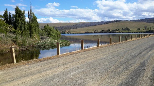
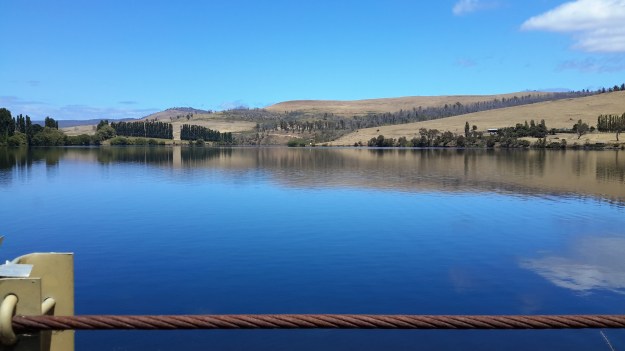
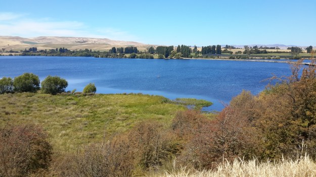
Meadowbank Lake is the closest to Hobart of the six large dammed water masses along the Derwent River. It is also the easiest to access via a bitumen road (Dawson’s Road) that exits from the Lyell Highway between the towns of Hamilton and Ouse.  I have now passed this area many times and strongly recommend it for a picnic or a flying visit.

The views from the eastern/northern side

20151029_161708.jpg

20151029_161758.jpg

20151029_161748.jpg

20151029_161743

The views from the middle of the bridge/causeway

20160115_140356.jpg

20160115_140304.jpg

20160115_140223.jpg

20160115_140317.jpg

The views from the western/southern side

20160121_143135.jpg

20160121_143342.jpg

20160121_143337.jpg

20160121_143333.jpg

20160121_143335.jpg


Starting out for the walk to Lake Repulse Dam

I chose to walk to Cluny Dam from a gated entrance road and then head back westwards all the while walking next to Cluny Lagoon towards my goal which was the Lake Repulse Dam.

To reach the start of the walk, and thanks to Megan, I was driven down the main gravel road from the Lyell Highway (you need to turn off left after the town of Ouse) until we came to a junction indicating the two dams.

20160124_150725.jpg

Of course, we drove down the Cluny Dam road until it was time for me to start walking. The road to the Cluny Dam is blocked by a gate so if you wish to follow in my footsteps, you should obtain permission from Hydro Tasmania.

20160124_150624.jpg

20160124_145612.jpg

The day was marked with rain on the horizon and sometimes a few spots lightly dropped on me. The rain showers softened the distant relatively undisturbed bush landscape in stark contrast to the crisp dry yellow grasses on the cleared land around me.

20160124_140328.jpg

20160124_140454.jpg

The blue of Cluny Lagoon, through which the Derwent River runs, was ever present.  As usual the water uplifted my spirits.

Hamilton and Ouse in Tasmania

These two historic towns straddle the Lyell Highway and both are situated a distance from the Derwent River.  Private farms fill the distance. Direct access to the River can only be achieved by driving approximately 15 kms when leaving Hamilton, or when driving from Ouse, the River or Meadowbank Lake can be reached from two directions; one approximately 7 and the other approximately 10 kms away.

Hamilton is located approximately 4kms ‘as the crow flies’ to the east of Meadowbank Lake.  The Clyde River, which passes through Hamilton empties into Meadowbank Lake (and it once flowed directly into the Derwent River before the Meadowbank Dam was built in 1967).  Tasmania for Everyone claims ‘Hamilton had its origins at a time when early European settlement of Van Diemen’s Land (Tasmania) had progressed from Hobart up the Derwent Valley. The first settlers arrived here shortly after New Norfolk was settled in 1807. A ford across the “Fat Doe River” probably led to the first settlement of the area then known as Sorell Plains, with the village first named Macquarie’s Town, and later, Lower Clyde.By 1828 there were a few weatherboard and sod cottages on the banks of the Clyde, whilst by the 1830s a visitor noted there were some thirty sly grog shops as one entered the town. The name Hamilton had already been suggested for the settlement sometime in 1825 when, during a visit, Lt. Governor Arthur asked if Bothwell would not be suitable, being a Scot himself and dining with the mainly Scottish settlers. The “Fat Doe River” was renamed the Clyde and Hamilton and Bothwell chosen as names for the new settlements, both names recalling towns on the lower and upper Clyde in Scotland.
Occupying a strategic location in the development of roads and agriculture, Hamilton became the focal point of the transport of produce into and out of the district.  By 1832 there were sixty persons living in the settlement and surrounding landholders successfully petitioned for a police establishment as protection from marauding bushrangers and a spate of robberies.
By 1835 the district population had zoomed to 779, including 309 convicts and by 1837 the Police establishment had eleven petty constables and a flagellator (for whipping punishment).  With cheap convict labour it was during this period that many of the town’s buildings (which still stand today) and bridges were constructed.
By 1844 Hamilton was a bustling town, with two breweries, six or seven Inns, a blacksmith, stone quarries, mills, three agricultural implement makers and a large convict probation station; it held its own Races and Hunts, indeed development was so promising that the town was marked out as a major country town, in the style of an English town at the time, with squares, an esplanade, a Circus and Municipal Reserve.
A drive up onto the Hamilton Plains shows the roads laid out, and the decaying, dry stone walls are a reminder of the failed attempt by the mainly Irish settlers to farm the rich volcanic but dry soils of the plains. Nevertheless, Hamilton remained a bustling country town throughout the remainder of the 19th century, with the population peaking at 400 in 1881 and developments like the Langloh Coal mine to the northwest of the town in the late 1930s ensured its importance as a major rural centre.
Increasing mechanisation and improved road transport effectively put an end to Hamilton’s growth. Whilst sadly these factors led to Hamilton’s decay and ultimate demolition of some notable buildings, many fine examples remain in the streetscape having an ambience redolent of our colonial history.’ 

Hamilton is located on the far side of the hill in the photo below. The water is part of Meadowbank Lake.

20151028_114436.jpg

In Chantale’s photo below, the Clyde River is running into Meadowbank Lake. At the top centre of the photo you can see a few houses and these form part of the town of Hamilton.

IMG_3904

Ouse (pronounced ooze) is located approximately 3 kms ‘as the crow flies’ to the east of the Derwent River between Cluny Dam and the north western end of Meadowbank Lake. Tasmania for Everyone claims Ouse is ‘a small rural Central Highlands town on the Lyell Highway, situated on the junction with the Victoria Valley Road and on the banks of the Ouse River. Ouse is the settlement where convicts James Goodwin and Thomas Connolly broke out of the South West Wilderness four weeks after their escape from Sarah Island. Ouse Post Office opened on 1 October 1835.’

In Michelle’s photo below you will need to imagine that Ouse is located over the low hills in the distance away from the Derwent River.

PA280084Top of Meadowbank Lane and then Derwent again.JPG

John Wadsley’s Brighton, Central Highlands, Derwent Valley and Southern Midlands Councils Joint Land Use Planning Initiative – Stage 2 Heritage Management Plan of July 2010 provides additional historical information concerning the building of bridges to enable expansion and ease transport, the significance of convict labour in settling the Valley, and the growth of farming, the development of industries, and the establishment of hydro power generating facilities.

Catherine Nicholson’s Highland Lakes Settlement Strategy of December 2009 offers further information about the history of settlement in the Derwent Valley.

What I notice, in all the histories of the Derwent Valley that I have read, is that attention is seldom given to the Derwent River rather it is focused on the rivers which fed into the Derwent, and also on the central highland lakes.  The search for fertile soil in which to grow wheat and other crops, and for land offering suitable pastures for sheep and cattle, was of paramount importance.

The photo below shows me in Hamilton. Behind me, the Clyde River (which flows into Meadowbank Lake) is located at the bottom of the hill and edges a delightful park which suits picnicking. I am sort of smiling but I was hot and bothered after a delightful day’s walk elsewhere.

20151031_140708.jpg

Lake Repulse Dam

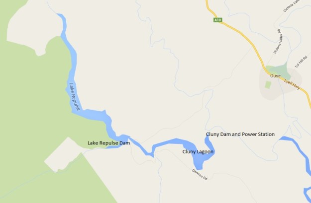
Lake Repulse Map

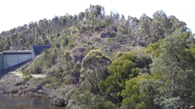
Looking inland, Michelle’s photo shows the Lake Repulse Dam wall backed by Lake Repulse, with Cluny Lagoon in the foreground.

PA280087 Repulse dam.JPG

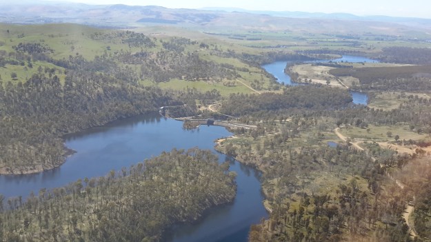
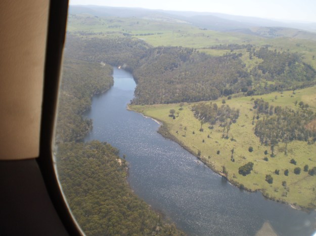
Looking towards Hobart, my aerial photo below shows Lake Repulse, the Repulse Dam and then Cluny Lagoon in the distance.

20151028_114913

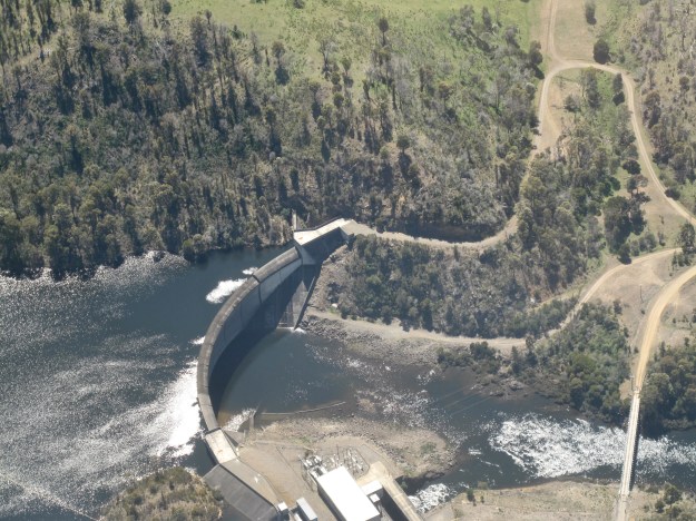
Chantale’s photo provides an excellent overhead view of the Lake Repulse Dam. The photo also gives walkers an indication of the challenges which the landscape offers beside Lake Repulse.

IMG_3893Repulse Dam.JPG

For vehicle drivers, the Dam is reached by heading westward past the Ouse township, turning off the Lyell Highway and travelling down Lake Repulse Road. Aerial views show the roads at the Dam site clearly.

20151028_114858.jpg

The road continues across the Derwent River below Repulse Dam giving you an excellent opportunity for a close look at the structure.

20151029_151244

20151029_151355.jpg

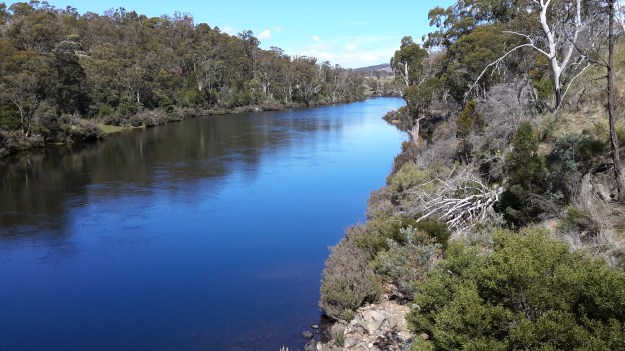
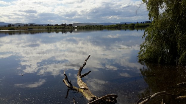
The western end of Cluny Lagoon, located a little downstream from the Repulse Dam, is stunning.

20151029_151317.jpg

To walk further inland around the Dam wall and then along the edge of Lake Repulse, the following photograph gives an indication of the landscape to be encountered.

20151029_151400.jpg

Michelle’s photo below shows part of the 8 km long Lake Repulse is a handsome water storage area.

PA280088Lake repulse.JPG

Historical information can be read, although I cannot vouch for the accuracy of the information.  Hydro Tasmania provides details and adds a technical fact sheet.

Dunrobin Bridge over Meadowbank Lake


Meadowbank Lake map.jpg

Meadowbank Lake, a large spread of dammed water through which the Derwent River runs,  is located west of New Norfolk: an expanse of water which measures at least 15 kms in length.  Like many other dams and lakes on the Derwent, Meadowbank has been designed for electricity generation purposes.  The Meadowbank Power Station was commissioned in 1967. In a document The Power of Nature, Hydro Tasmania provides information about Meadowbank and the other electricity-generating lakes and stations across Tasmania.

The Dunrobin Bridge carries Dawson Road; a road which extends from the Lyell Highway, crosses Meadowbank Lake then continues on the western shore until it reaches Lake Repulse Dam.

The first Dunrobin Bridge over the Derwent River was built in the early 1850s. The National Library of Australia’s Trove repository of historic documents provides information from a 1910 copy of The Mercury newspaper: ‘Dunrobin Bridge was built over the Derwent, between the Ouse and Hamilton during the regime of Governor Denison. Governor Denison’s rule in Tasmania lasted from 1847 to 1855. It is a fine stone structure, and the cost is stated in the Legislative Council Journals of 1856 to have been £13,875. Its construction seems to have occupied six years, from 1850 to 1856. Dawson’s Road, which was named after the man who superintended its construction, went from Dunrobin Bridge…’ westwards.

In 1900, according to the blog Tasmanian Gothic , the bridge looked like:

Dunrobin Bridge

Dunrobin Bridge

The bridge was damaged during flooding in 1952 according to Linc Tasmania.

Dunrobin 1952

This site shows the remains of the bridge in 1963.

Dunrobin Bridgen1851

Once the Meadowbank Dam was built, the gorge behind gradually filled with water. The remnants of the old Dunrobin Bridge apparently remain beneath the current Meadowbank Lake.  I cannot find when the new Dunrobin Bridge was built.  Anybody know the date?

The photos of Chantale, Michelle and I show the current bridge across the northern section of Meadowbank Lake.

IMG_3898Dunrobin bridge.JPG PA280082Dunrobin Bridge over Meadowbank Lake.JPG

20151028_114634

At ground level, the Dunrobin Bridge curves across the Lake in a stunning simple arc.

20151029_161758.jpg 20151029_161743

As I walked in the vicinity, time and again I was almost overwhelmed by the beauty of the landscape.

20151029_161746.jpg

20151029_161842.jpg


Where is the source of the Derwent River?

This question was on the minds of the new settlers to Van Diemens Land in the early 1800s.

In 1835 George Frankland, Surveyor General to the government of the time, organised a ‘search’ party to locate the source. After the expedition he wrote a report for despatch to the ‘mother country’, England.  The brief text has been published as The Narrative of an Expedition to the Head of the Derwent and to the Countries bordering the Huon in 1835.  The small book was reprinted by Nags Head Press for the publisher Sullivan’s Cove in 1983.

No description exists of how Frankland and his party travelled inland until they reached a property or area then known then as Marlborough (now known as Bronte) in the Lake country, located west of Lake Echo and directly east of Lake St Clair by over 30 kilometres. Marlborough was a probation station for North American prisoners in the 1830s/40s.

Map of probation stations including Marlborough

The map above can be seen in the story: ‘They left Jefferson County forever…’

The Marlborough district was discovered by Surveyor Sharland who also found Lake St Clair, in 1832, only three years before Frankland felt compelled to find the source of the Derwent.  It seems Sharland did not realise it was the Derwent River that flowed from the southern end of Lake St Clair. Further information can be read in G. H. Stancombe’s paper Notes on the History of The Central Plateau.

The Lyell Highway, according to the Highland Lakes Settlement Strategy has been known as the Marlborough Road where it runs westwards of Ouse and towards the area around Bronte.

Information, which is totally irrelevant to my writings about the Derwent but nevertheless interesting, concerns an earthquake near Marlborough that was recorded in The Courier, a Hobart newspaper on 25 April 1854. Thomas Bellinger reported ‘I beg to inform you of a very strange occurrence on the evening of the 24th of March last. A shock like that of an earthquake was felt in almost every part of the Marlborough District. Two shepherds were gathering sheep the other day and discovered the cause of it.  I went to the place yesterday: there has been some fearful volcanic eruption, rocks of enormous size have been driven about, the face of the earth appears to have been hoisted in the air and pitched surface downwards. I cannot describe to you the appearance, but if you will come up I am sure you will be highly gratified – the distance is about ten miles from this.’  I have no information about where Thomas Bellinger was writing from but I am curious to hunt out the location of this upheaval.

After that information detour, let’s go back to the expedition to find the source of the Derwent River.

Following a ‘difficult journey from the settled Districts’, all members of George Frankland’s party assembled at Marlborough on the 7 February 1835.  The record shows that George Frankland did not follow the edges of the Derwent, rather he crossed the Nive River (which empties into the Derwent River much further south), then travelled north-westwards. Initially densely forested hills stymied progress with horses, and then the boggy plains ahead slowed him down.  He continued generally in a westward direction and after almost five days, found Lake St Clair; ‘we suddenly found ourselves on the edge of a beautiful Lake in the heart of Scenery of the most picturesque Character’.  After further walking around parts of the lake, Frankland reports ‘It was a fine summers day and the Air was so serene that the surface of the Water was scarcely ruffled but the sandy beaches bore evidence of the Lake being at times as rough as the Sea. I will not here dilate on the extreme beauty of this scenery as it might be considered out of place in an official report, but … I feel it difficult to avoid expressing the impressions of delight which were inspired by first discovering of such a romantic Country…’

On the 14th February, Frankland despatched two of his party to return to the source of the Derwent and follow it downstream on the left bank while he set out to explore the country on the right bank.  Both parties walked across open plains where Lake King William now fills the area.  They reunited the next day.  One of the party, a Mister Calder was despatched to continue along the edge of the river until he met the entrance of the Nive, which he successfully achieved (although details are absent).  Meanwhile Frankland tried to continue following after Calder but was only able to proceed for 3 miles. ‘At that point we plainly perceived that the Country had … become such a thick forest that to take the horses any further was out of the question.’  The result was that Frankland split the party further with the horses taking an easier route to Marlborough.

On their first day trying to walk the edge of the Derwent, Frankland recorded ‘This day was consumed by a laborious march of two miles through a most obstinate scrub – and we bivouacked on the steep edge of the Derwent after wading for a considerable distance through the torrent, up to the middle, as the easiest mode of travelling.’  The forest is as dense in 2015 as it was then, so regular blog followers can appreciate why walking some sections of the rest of the way to Lake St Clair concerns me.

At this point Frankland was for giving up. ‘On the 18th February I determined on leaving the Derwent and accordingly struck away to the N.E. The forests continued depressingly thick – but by dint of labour we accomplished about four miles this day’.  Only four miles in a day for strong men!  What chance do I have of walking this part quickly or easily?

A couple of days later Frankland reached Marlborough and from there he set off to cross the Derwent River and explore the Huon River area further south.

Thank you Andrew for alerting me to this report and for the loan of the book.

Possible locations where the Derwent River can be ‘touched’

I have compiled a list of those locations where I believe, with a vehicle, it will be possible to ‘touch’ the Derwent River occasionally along its length between Gretna and Lake St Clair.  Please let me know if any section listed below takes your fancy and if you would be interested to try it out.

Almost all sections include driving on bitumen highway, gravel roads and poor tracks. Some of these may be forestry roads.  If you wish to volunteer to take me to one of these sections (let me know on walkingthederwent@gmail.com), please feel comfortable that your car can handle the different conditions.  Of course, common sense will prevail and we will never push on if a road is too rough for your vehicle and your peace of mind.

If you are happy to help me reach my goal, albeit differently than originally expected, I would like to fill up your tank with petrol as some compensation.  You know my ‘walking the Derwent’ is a non-commercial project, but since I do not own a car nor drive, I need transport – and therefore, I am happy to cover the cost.

  1. On eastern shore – From New Norfolk drive along the Lyell Highway and then, not far past Gretna’s Sports ground, take a left turn into Clarendon Road and drive to farmstead buildings about 250 metres from the river on a hill. Perhaps 140km return trip.
  2. On western shore – From New Norfolk drive along Glenora Road, and turn left at Bushy Park then right onto Meadowbank Road over the Tyenna River then next to Derwent, then on over Meadowbank Creek to a hill top with buildings. It may be possible to continue quite a way on this road. Minimum 130 and maybe up to 160kms return trip
  3. On eastern shore – From New Norfolk drive along the Lyell Highway and turn left off the Highway onto Meadowbank Dam Road. Continue to dam and southern end of Meadowbank Lake. At least 170 kms for round trip.
  4. On western shore – Travel from New Norfolk and turn left into Gordon River Road at Bushy Park, then turn right off Gordon River Rd into Ellendale Rd and then right onto Rockmount Road before you reach the township of Ellendale. There seem to be many dirt forestry tracks to Meadowbank Lake. At least 170kms return trip and maybe 200kms return or more depending on roads.
  5. On western shore – Travel from New Norfolk and turn left into Gordon River Road at Bushy Park, then turn right off Gordon River Rd into Ellendale Rd and drive on through the township of Ellendale until you reach Dawson Rd / Dunrobin bridge over Meadowbank Lake. Turn left before bridge and it seems we can drive 2kms further up along the Lake edge. Return to Ellendale Road, cross bridge and connect with the Lyell Highway. At least 170kms return trip and maybe 200kms return or more depending on roads.
  6. On eastern shore – From New Norfolk drive up Lyell Highway and continue past the left turn off to Dunrobin bridge and afterwards and to the left there are a number of dirt tracks seemingly without gates. After a while these tracks/roads only extend to the Ouse River and not the Derwent River so map consultation is crucial. At least 180kms return and maybe over 200kms return depending on how many side roads/tracks can be driven along.
  7. On eastern shore – Drive up Lyell Highway past Ouse then turn left at Lake Repulse Road. Continue to intersection with Cluny Lagoon Road and turn left and go to Cluny Dam. Return to intersection and continue on Lake Repulse Road to the Repulse Dam. Can cross a bridge and continue back south around Cluny Lagoon to a ‘settlement’ named Cluny.  Perhaps could access this road from the Ellendale Rd on the western shore? By driving north from Repulse Dam along Dawson Road/then renamed Thunderbolt Road it seems we can take right hand detours to Lake Repulse. Over 200kms maybe 250kms or more minimum round trip.
  8. On eastern shore – Drive up Lyell Highway past Ouse, over the Dee River until the sign appears for a left turn at Catagunya Road. Drive down to Catagunya Dam. 200kms minimum return trip
  9. On eastern shore – Drive up Lyell Highway past Ouse, over the Dee River, past Black Bobs and turn left at Long Spur Road. This runs around Wayatinah Lagoon. Go past the intersection to Wayatinah Dam, turn left and travel to Wayatinah Power Station on Lake Catagunya. Return to intersection and turn left and travel to Wayatinah Dam. Cross bridge and continue on to Wayatinah township. Access dirt tracks in the vicinity of all. Drive south from the Wayatinah Dam on the western shore along the Florentine Road but don’t bother crossing the Florentine River because the road goes inland away from the river. Minimum of 230kms but most likely  at least 300kms round trip.
  10. On eastern shore – Drive up Lyell Highway and when you reach a canal passing under the road, and where the road turns right to go to Tarraleah, go straight ahead on Butlers Gorge Road. Note there are limited roads off and around going closer to the river near that intersection. Continue along Butlers Gorge Road for 10-15 kms heading for Lake King William. Reach Clark Dam and Power Station. Continue onto Switchback Track along side of Lake King William. This track stops and you have to return the same way – swamp separates you from the track north about 500 metres away. This would be a big day and I suggest take overnight accommodation at Tarraleah before setting out. PERHAPS it is possible to walk across the swamp and then walk about 7 kms to Derwent Bridge. Unknown over 300 kms return trip.
  11. On eastern shore – Drive up Lyell Highway to Derwent Bridge and continue past to left hand turn off on the western side of Lake King William and drive the track to the lake. 360 kms return trip minimum.
  12. On eastern shore – Drive up Lyell Highway to Derwent Bridge. Walk from the bridge over the Derwent River near the township of Derwent Bridge to St Clair Dam at the bottom of Lake St Clair Lagoon where the Derwent River starts. Walk to Pump House Point and St Clair Weir at the southern end of the Derwent Basin. 350kms return trip minimum.


Maps

The Derwent River will always be your guide if you choose to walk along its length, but sometimes it is difficult to walk directly next to the river; for example structures may be built to the edge, steep drop down cliffs may raise you many metres above the water, and gates and fences may make access impossibly impassable.  In addition, when the terrain forces you away from the river, the vegetation may be sufficiently dense so that you can get lost (without map and compass – and GPS if your technology allows).

If you choose to walk the entire length of Tasmania’s Derwent River you might consult one or more of the 17 maps which cover the territory. One value is that you learn the name and shape of landmarks. Have a look at the list below:

Maps

Wilderness – what is it?

The word ‘wilderness’ has different meanings depending on context. Dictionaries offer a range of similar meanings:

  • An uncultivated, uninhabited, and inhospitable region. Neglected or abandoned.  A large area of land that has never been developed or used for growing crops because it is difficult to live there. (Oxford)
  • An unsettled, uncultivated region, especially a large tract of land that has not been significantly affected by human activities. A barren or desolate area; a wasteland. Something characterised by bewildering vastness, perilousness, or unchecked profusion. (The Free Dictionary)
  • A wild, uncultivated region, usually where humans do not live. Any desolate tract or area. (WordReference.com)
  • A tract or region uncultivated and uninhabited by human beings. An area essentially undisturbed by human activity together with its naturally developed life community. An empty or pathless area or region. (Mirriam Webster dictionary)

From Old English used in the 13th century, the word ‘wilderness’ is derived from wild dēor ‘wild deer’, wilddēoren ‘wild beasts’, and from wildēornes, ‘land inhabited only by wild animals’. From Middle English, wildern is ‘wild’.

Reflecting on these varying definitions, I realise some of the meanings ring true particularly in relation to the land along the Derwent River between Lake Catagunya and Derwent Bridge (I anticipate this part of the River will take at least 8 days to walk, over three stages).

Lake Catagunya to Derwent Bridge

The sides of the River will be uncultivated and uninhabited. Its dense forest, littered with generations of massive tree falls, will make some sections relatively inhospitable.  The only markers of human kind will be parts where old growth logging has or is occurring, and where the infrastructure associated with dam construction across the Derwent River has occurred and is being maintained.  The area will not be barren, desolate (although I might feel desolate when penetrating some of the denser bush hour after hour), and it is not neglected, abandoned nor a wasteland.  This wilderness will be rich with flourishing flora and fauna, have profound connections with the original indigenous population pre-European settlement of Van Diemen’s Land, hold a social history with the settlers who moved inland in the 1800s and 1900s, and include an occasional contemporary history with photographers, tourists and fishermen.

The United States of America has proclaimed special legislation. ‘The Wilderness Act bans all kinds of motors, roads, and permanent structures from large tracts of American territory. It provides a legal definition of wilderness, as land that’s “untrammelled by man” with a “primeval character and influence”.’  You can read more at this site.  What is the Australian situation?

The Wilderness Society of Aus logo

The Wilderness Society of Australia summarises our state-based rather than national legislation in relation to the wilderness. ‘Dedicated wilderness legislation exists in NSW and SA, which allows the nomination, assessment, declaration and management of wilderness. In other States, such as Victoria, Queensland, WA and the ACT, management of wilderness is provided for under general nature conservation legislation, with varying degrees of usefulness in terms of actually ensuring identification and appropriate protection.’

In Tasmania we have a range of legislation including the most recent Tasmanian Forest Agreement Act that was negotiated to include the requirements of the Tasmanian Wilderness World Heritage Area (TWWHA) – that is, those parts of Tasmania which have been recognised with World Heritage listing for their natural and cultural heritage that is important to the world community.  Tasmania’s Nature Conservation Act talks about biological and geological diversity, and historic sites and provides regulation for our fauna (and strangely it also covers animals which do not live in Tasmania such as dingos and wolves) and flora. The word ‘wilderness’ does not appear.

stock-photo-64271807-walking-boot-and-bike-tread-marks-on-muddy-trail(Image is a free iStock photo)

The land on which I will walk has been walked for thousands of years originally by our indigenous ancestors and more recently by their descendants and European settlers. However, there will be parts on my trek which will not have had many footfalls because of the isolation and the forest density.  Unless there was a purpose such as surveying the Derwent River as part of planning to build dams, sensible people would travel from Lake St Clair towards the coast  via the region around the township of Ouse, or by more hospitable routes. With or without the word ‘wilderness’ being written into our state legislation, much of the inland edges of the Derwent River edge are undoubtedly genuine wilderness.

Piguenit – artist extraordinaire in southern Tasmania

The 19th century lady who wrote her story of a walk from Trial Harbour to Ouse (refer https://walkingthederwent.com/2015/06/20/a-story-of-a-walk-in-19th-century-tasmania/) mentioned Tasmanian artist William Charles Piguenit in her record of the events.

‘… had our first near view of the various peaks of the West Coast Range. From here we kept on rising till we reached the Government hut, 1,500 ft above and 15 miles from Strahan.  Here the first of a series of magnificent views met our eyes; beneath us lay a deep valley, forest clad for miles, and beyond, stretching as far away as the eye could reach, lay the range, its rugged peaks standing out sharply against the sky.

How it makes one long for the brush of a ready painter, to be able to place on canvas at least something to keep one’s mind fresh with the remembrance of all this beauty. Mr Piguenit is, I believe, the only artist who has devoted his time and labour to this district, and the results of his work are to be seen in the pictures now hanging in the Art Gallery of the Hobart Museum, and certainly the next best thing to visiting the West Coast is to see Mr Piguenit’s pictures of different scenes in that region.’

The collection of the Tasmanian Museum and Art Gallery (TMAG) contains a substantial number of his oil paintings.  Years ago I was employed by TMAG as an attendant and stationed in the upstairs ‘colonial’ gallery where the 19th century paintings were hung adjacent to marble sculptures and rare examples of early Tasmanian wood furniture. Back then I was a student of art history, and the establishment deemed me to be the expert amongst their collection of gallery attendants. They felt sure I would be able to help any visitor with enquiries about the collection on show.  One whole end of that 19th century gallery space was devoted to the work of Piguenit.  With much time on my hands to study each work of art, I fell in love with his dramatic descriptions of remote Tasmanian wilderness. But most surprising was that many of the very large oils, surrounded by beautiful carved frames, were compositions of the landscape in many gradations of grey when Piguenit had only chosen to use black and white paint.  Gloriously glossy. Unexpectedly stunning.  Tasmania’s inland environment had never been seen by most people (and still hasn’t been).

It was a surprise to me that I can only find online reproductions of these great paintings in a TMAG published catalogue raisonne of the work of William Charles Piguenit (http://www.tmag.tas.gov.au/__data/assets/pdf_file/0017/73142/piguenit_catalogue.pdf). Unfortunately, the document is incomplete and the images are very poorly reproduced – this booklet does the artist a great disservice. When faced with the paintings, the oils are truly majestic and have a similar power to mountainous work by artists such as Eugen von Guerard, Casper David Friedrich, and those from the Hudson River School such as Frederick Edwin Church.

The collection of the Art Gallery of New South Wales in Sydney holds some of his work including the following paintings (in coloured oils) which show aspects of Lake St Clair (the source of the Derwent River and the goal of my walk).

Mount Ida, Lake St Clair, Tasmania c1881

AGNSW Mount Ida Lake St Clair Tasmaniac1881

Mount Olympus, Lake St Clair, Tasmania, the source of the Derwent 1875

AGNSW Mount Olympus Lake St Clair Tasmania the source of the Derwent 1875

A story of a walk in 19th century Tasmania

In the late 1980s, Hilary Webster compiled a book of short stories written by people who travelled around Tasmania by foot and by horse and carriage in the nineteenth century; The Tasmanian Traveller A Nineteenth Century Companion For Modern Travellers.   Thanks to blog follower Ma, I was alerted to this publication.

The Tasmanian Traveller

These stories helped me to understand the difficulty of travel in early colonial Tasmania when roads were not always developed. Some stories surprised me so that I feel inspired to visit Tasmania’s State Archives in order to discover more.

A standout was the story of a walk from ‘Trial Harbour to the Ouse” because the journey relates to some of the area over which I may walk later this year when I restart my walk along the Derwent River.

Trial Harbour is an isolated tiny community on the west coast north of Queenstown where, these days, the few shacks are built with the strangest chimneys to cope with the weight of the westerly winds which blow fiercely from across the Indian Ocean. The Ouse refers to a small town, then hamlet, somewhat south of the centre of Tasmania and situated most remotely from civilisation.  Back then, it took a day’s coach and train ride to reach Hobart. These areas and the land between is an exceptionally rugged environment today and I have difficulty imagining the situation in the 19th century when the walk in the story was taken.

The subtitle of the 1890s story was ’A Lady’s Walking Tour on the West Coast’. A woman (no name) walked with her husband and a dog through ‘untamed’ wilderness, along mining and forestry tracks and the occasional muddy rutted roads.  They climbed mountains, crossed button grass plains and walked through valleys.  She recorded “More than once we were asked our business, the notion of travelling on foot for pleasure in these regions appeared preposterous.” I would say such a walk is extraordinary in this day and age, and totally amazing 125 years ago.  Innovative means were taken to cross rivers. Overnight accommodation was found in out of the way tiny remote mining shops, shacks, huts and the occasional Inn. Telegraph wires were often their only guide for a way forward. Through the rugged wilderness, routinely they walked 17 or more miles (27+kilometres) each day and on one day they walked 33 miles (53 kilometres). I am staggered.  I know the challenging environment in which they walked.  The mountains are many and very steep with ravine and river gullies that are cut into the rock deeply.

Her pack of provisions weighed 7 pounds while her husband carried 21 pounds.  This makes me wonder if contemporary bushwalkers aren’t tough enough – or are we trying to be prepared for every eventuality. The good will of people they met and the willingness of others to share their meagre food supplies, and help with sleeping arrangements, was perhaps something that could be taken for granted in 19th century Tasmania. Generous hospitality as a given.  ‘We got some bread here, and at a house a mile further on the track, some milk, the first fresh milk we had tasted since Waratah.’  This comment indicates she was walking across Tasmania before Trial Harbour – the significant mining town of Waratah is quite a distance north east of Trial Harbour.  So I suspect there may be earlier stories of her walking across other parts of Tasmania – I look forward to conducting research to find records of these.

The Lyell Highway between Bridgewater Bridge and New Norfolk

History

In the first couple of decades of the 19th century, when increasingly the small Van Diemens Land colony demanded more roads and better river crossings, the first road from Hobart Town to New Norfolk was built by McCarty under contract to the government. By 1840, the road to New Norfolk had extended to Ouse and Marlborough (Nive River) to serve remote settlers. During the next forty years the road was further extended for tourist purposes to Lake St Clair (Refer http://www.utas.edu.au/library/companion_to_tasmanian_history/R/Roads.htm).

Wikipedia offers the information that the highway did not reach Queenstown until the 1930s and was not properly surfaced for some time after that. In post cards of the 1940s and 1950s it is called the West Coast Road. When Tasmania’s hydro-electric system was expanding and their works were under construction at Tarraleah in the mid-1940s, the highway was re-aligned to follow the Derwent River until it passed Tarraleah to provide better access to the area for construction vehicles.

Lyell Highway on map

2008 details

A 2008 government report (http://www.parliament.tas.gov.au/ctee/Joint/Reports/Lyell%20Hway.pdf), which recommended major changes be made to the road between Bridgewater Bridge and New Norfolk in order to create a safer highway, provided lots of information which added to my knowledge about this strip of road and its environment.  I will be looking to see if the recommendations were acted upon when I walk (the temperature plummeted today, and wintry weather yet again made the walking of Stage 14 impossible).

The report explained The Lyell Highway between Granton and New Norfolk is a two lane road with a sealed pavement width that varies in the range of 6.5m to 7.2m wide with unsealed shoulders. The highway follows the southern bank of the Derwent River. The highway is often located at the base of the hillside adjacent to the river flats and as a result has tight curves and sharp crests. The high, steep terrain on the southern side of the highway and deep soft silts on the northern side pose significant design challenges due to cost management and the environmental impact of the proposed works. The abutting land use is rural, dominated by rural residential with some horticulture (vineyards, tomatoes, cherries) and one private recreational facility, the Motor Yacht Club of Tasmania (MYCT). The Derwent River is a conservation area. On the southern side of the highway most of the land is hilly, mainly cleared with some trees along the roadside and a few scattered in the paddocks. There are some properties which remain untouched and vegetated by woodland. There are also rows of trees along the side of the road which form windbreaks and/or landscape features.’

Vegetation

According to the same report, the following three vegetation communities of conservation significance occur in the area:

  • Phragmites australis grassland (generally referred to as a common reed): considered vulnerable and inadequately reserved at the state level.
  • Acacia verticillata dry scrub (commonly known as Prickly Moses): of bioregional significance.
  • Leptospermum lanigerum scrub (sometimes named the Woolly Tea Tree): of bioregional significance.

The trees of Potential Cultural Significance along that stretch of the Lyell highway include

  • A stand of white gums between the roadside rest area and the Derwent River at Chain 7760 – 7860.
  • Two weeping willows on the northern side of the highway at Chain 8215 – 8220.
  • A row of old radiata pines on the southern side of the highway at Chain 10250 – 10350.

The following two significant flora species, listed on the Threatened Species Protection Act 1995, occur in the area:

  • Austrostipa scabra (rough spear grass): southern side of the highway Chain 3300 – 3400, 6430 and 6610 – 6640; northern side of the highway at Chain 6940 – 7010.
  • Vittadinia gracilis (woolly new holland daisy): southern side of the highway at Chain 3300 – 3400.

Social history

There are a number of additional features in the immediate area that are considered to have some cultural heritage significance. Project 3 Lime kiln, Chain 3250 – 3540, is located on the northern side of highway. This is currently listed on the Tasmanian Heritage Register (THR) (R701)(http://www.heritage.tas.gov.au/thr.html) and hence is subject to the provisions of the Historic Cultural Heritage Act 1995. There are a number of additional features in the immediate area that are considered to have some cultural heritage significance, such as the Marsh Farm and a redundant section of the old main road.