Tag Archives: Butlers Gorge

Revisiting Butlers Gorge for missing photos – posting 5 of 5

Bushes with native berries, cushion grasses and all manner of other small plants abounded.  20160425_111936.jpg

20160425_111421 cropped.JPG

Later we continued onto Lake King William and sat in the afternoon sun eating our packed lunch, looking at sparkling water backed up to Clark Dam, and enjoying the smells and sounds of the bush.  Thanks Jeanette for your help in driving me back to this area.

20160425_120952.jpg

20160425_121119.jpg


Revisiting Butlers Gorge for missing photos – posting 4 of 5


Long term blog followers will remember how impressed I have been with the engineering feats that have created the hydro electric power stations and the huge dam structures. Most particularly I love their large scale geometric shapes.The following photos show close ups of Clark Dam and the Butlers Gorge Power Station, neither of which are accessible to the public.  20160425_113937.jpg

20160425_114003.jpg

20160425_114009.jpg

20160425_114102.jpg

20160425_114131.jpg

20160425_114019.jpg

20160425_114039.jpg

20160425_114908.jpg

And let us not forget the Derwent River flowing ever so slightly way down below in the following images.

20160425_115100.jpg

20160425_115106.jpg

20160425_120620.jpg

20160425_120628.jpg


10/2/17

Revisiting Butlers Gorge for missing photos – posting 1 of 5

After I walked from the Lyell Highway at the Butlers Gorge junction and then proceeded to follow Tarraleah Canal No 1 (which contained the bulk of Derwent River water) to Clark Dam holding back the waters of Lake King William, I returned home and checked my photos.  I found some key photos were absent.

I realised that my feet must have been exceptionally painful and my sore knees crumbling so that I was unable to remember to keep taking photos in that last kilometre of the walk.  I had made no record of those last few hundred metres.  Thanks to blog reader Jeanette I returned to the spot one gorgeous morning, walked up and down the area and clicked lots of photos.

At one place we crossed the aqueduct and looked at the serene and clear Derwent River.   20160425_112018.jpg

20160425_112035.jpg

20160425_111710.jpg

The rush of the water through the Canal was recorded.  Watch this video.

20160425_111647.jpg

20160425_111652.jpg

20160425_111614.jpg

20160425_112103.jpg

I loved the views looking along the two strands of the river; the water in the original river bed, and the water in Tarraleah Canal No 1.

20160425_112613.jpg

20160425_112619.jpg

The rocky edges of the river shown above indicate that water is released from Clark Dam from time to time making the river wider.

Andrew Hughes has walked, rafted and canoed the Derwent over the past month

My last post introduced the Expedition Class’s  latest project.  The key man during the journey was Andrew Hughes and now his trek is complete.

The first newspaper coverage of this story was published in The Mercury last May.

The Mercury published another story recently ‘Warm welcome for adventurer Andrew Hughes as he paddles into GASP‘. His journey started north east of Lake St Clair in central Tasmania and now Andrew has crossed an imaginary finish line between the Iron Pot on the eastern side of the Derwent River and Tinderbox on the western side and this conclusion has been covered again in The Mercury.

If you go to the web,  you can read the mini ‘Live Reports’ of the 28 sections of his journey. You can peruse a collection of photos for each section. The information in the reports is limited and no information is offered with the photographs.  Unless you have travelled the  edge of or on the Derwent River, it would be difficult if not impossible to identify locations.

A comparison of some of Andrew’s photos with those I took during my walk from the mouth to the source of the Derwent River, makes for interesting viewing.

Firstly I would like to compare the rush of water over the river rocks between Wayatinah and Butlers Gorge that Andrew saw compared to the low almost absent water level that I experienced on two occasions. Since I completed my walks along the Derwent earlier this year, Tasmania has been inundated with unexpected high levels of rain which have raised the water levels in the dams and the Derwent River.

The photo below was taken by me in October 2015.

20151029_113841.jpg

The next photo was taken by me in January 2016

20160115_130427.jpg

The photo below is by Andrew as shown in his Live Report 18.

1471514898-IMG_3177 from 18 of expedition class live reports.JPG

My photo below shows the water level of the huge 15 kilometre Lake King William was so much lower in October 2015.

20151029_123314.jpg

My photo taken only 2 ½ months later at the beginning of January this year, showed the water level  had dropped dramatically so that the Tasmanian government was considerably worried about our electricity generation options.

20160102_155721.jpg

In Live Report 15 Andrew shows the Lake King William water backed up to Clark Dam at Butlers Gorge. Tasmania is no longer worrying about our water storage facilities and power generation. Again we have enough water to create clean electricity.

1471254936-IMG_3085 from live report 15.JPG

These photos are wonderful reminders of the unpredictability and power of nature.   Andrew’s reports and photos are an excellent example of people getting out into our Tasmanian wilderness and experiencing it’s challenges and wonders.  I hope his trek inspires others not necessarily to cover the same territory, but to find new country to discover and enjoy.  To be refreshed by the purity of the bush.

Growing up as a Hydro boy

Thanks to blog follower Mary, I have discovered a series of online stories about past Hydro workers some of whom helped build the Tarraleah Canal No 1 and others who lived near other electricity generating power stations along the Derwent River. These short stories make interesting reading and include photographs of the people and places.

I recommend you look at Hydro Tasmania’s site where the son of Jack Warren records his history.  The photo below from that site shows Jack at Canal No 1 in 1935.

Jack Warren 1935 from Mary

Simon Stansbie’s record of growing up at Wayatinah can be read on the Hydro Tasmania’s website. Ian Berry tells us what it was like to grow up at Butlers Gorge (where the Clark Dam was built to hold back the waters of Lake King William).  You can read this and see photos at Hydro Tasmania’s site.

Collectively these stories give a little insight into the human reality of living and working in remote central Tasmania to create the extraordinary electricity generating infrastructure last century which used the waters of the Derwent River.

Heather Felton published a book, which tells these and other stories of the people of ‘The Hydro’.  Read more about the book: The Ticklebelly Tales.

Cover Ticklebelly Tales - Hydro.jpg

Information about the book launch can be read in issues of the Cultural Heritage Program Newsletter ; and at a second site.

I am not sure what the word ‘Tickleberry’ refers to.  Do I have any blog followers with this knowledge?  According to Wikipedia part of Tarraleah, the area for the married quarters of the original community, was known as Tickleberry Flat. In addition, during my walks I know that I have passed an area mapped as Tickleberry Flat which is south east of Curringa Farm, and almost south of the town of Hamilton mid-way along Meadowbank Lake – a long way from Tarraleah.  In New Norfolk Tickleberry Farm grows raspberries.  The name Tickleberry comes up in many internet searches.  The Brighton, Central Highlands, Derwent Valley and Southern Midlands Councils Joint Land Use Planning Initiative – Stage 2 Heritage Management Plan tells us “Hydro-electric power schemes which commenced in the early 1910s saw the development of construction villages across the highlands at Waddamana (from 1911), Shannon (1925), Tarraleah (1934), Tickleberry Flats (1935), Butlers Gorge (1938), Bronte Park (1948) and Wayatinah (1952). As these small communities grew, schools, shops, community halls, medical facilities and offices were established.”

After all of this, I still wonder what the original meaning of Tickleberry is: maybe someone’s name or a common name for a plant.

Tarraleah Canal No 1 walk – what is the ‘real’ Derwent?

Will the real Derwent River please stand up!   Where should a person walk if they are ‘walking the Derwent’?

Since the Clark Dam was built in 1952, the Derwent River has not flowed from the area now known as Lake King William downstream across its original bed, until closer to Hobart.  Instead the Tarraleah Canals number 1 and 2 accept Derwent River water from Clark Dam/Lake King William at Butlers Gorge in central Tasmania.  These canals channel the water to penstocks that feed the Tarraleah Power Station.  Electricity is generated and then the water flows on to create more electricity at Liapootah then Wayatinah Power Stations.  Eventually the water empties into Lake Catagunya.

Catagunya Dam to Wayatinah PS.jpg

The old Derwent River bed is stony.  Along its length between Clark Dam and the bridge at Wayatinah, seepage from the steep hills creates pools of water.  There is sufficient water, although limited, to create a continuous running flow between the stones.  At the end of Spring the river bed looking upstream from Wayatinah was as follows:

20151029_113841.jpg

Michelle’s photo shows another view.

PA280100 on route to Tarraleah.JPG

In January the water level had dropped and the river bed looked like …

20160115_130425 Derwent.jpg

Similarly, between the bridge over the Derwent River bed at Wayatinah and the river’s meeting with the Florentine River, and downstream almost to Lake Catagunya, the river is often a stony bed with limited flow.

20160115_124544.jpg

Upstream from the junction of the Florentine and Derwent Rivers, upstream from the Wayatinah Power Station, I walked on the river bed where I could.

20151029_101151.jpg

To ‘walk the Derwent’ should one follow the original river bed or the Canals or a mix of both?

Since Tarraleah Canal number 1 runs more or less parallel to the old river bed and is usually located under 500 metres from that river bed, I chose to walk next to the Canal along the section before it turned inland to travel to Tarraleah Power Station. I rather liked the idea of staying as close to the original Derwent River course rather than following man-made deviations. However this ‘walkingthederwent’ project does raise the question as to what constitutes the ‘real’ Derwent River. Does it exist any longer? And therefore, is it possible to walk the Derwent?

End of day departure time

I usually make a point of starting the walking day as early as possible – to walk when I am the freshest and most alert and if the weather seems fine, then to use it while it stays good (Tasmania is known for its four seasons in one day).  However on the day when I started walking along Lake King William, because I was constrained by other life commitments I did not leave Hobart until 1.30 pm. My driver Emma took me west along the Lyell Highway until a short distance before Tarraleah when we turned left and deviated onto a 16 km gravel road towards Clark Dam at Butlers Gorge.  We dodged a few speeding cars as we travelled the narrow road, when everyone screeched and slewed in the slippery gravel on crests and unknowable corners. But I refused to worry. The sky was golden blue, the bush looked clean, the temperature was perfect for walking, and my excitement grew. My driver dropped me near Clark Dam and I started walking at 4 pm.  Thankfully at this time of year the sun sets around 9pm and I knew the light of day would continue longer.  I thought a three hour walk would be sufficient to isolate me and remove me from the chances of odd bods being in the locality. Not knowing what to expect, I planned for two nights out camping before reaching the town ship of Derwent Bridge.

Near my starting point, fishermen and families were pulling boats from Lake King William behind the arc of Clark Dam.  The water was glossy blue.

20160102_155721 20160102_155854

The late afternoon was stunningly beautiful. I felt apprehensive but invigorated and ready to discover the Lake one step at a time.

Taking stock

I feel emotional when I remember my recent walk to the source of the Derwent River. I had promised to write the stories and post them within days, but since returning I have felt overwhelmed by my breathtaking and wonderful experience and afraid to start writing.  In addition, I claimed to have walked the majority of the river’s length and I was afraid the claim was unfounded.

Today I have made the calculations and posted an update on the pages ‘How far have I walked’, ‘Frequently Asked Questions’ , and ‘The inspiration for my walk’ . To summarise, while I had hoped the number would have been closer to 100%, the fact is I have covered a smidgin over 2/3rds of the 215 km length of the Derwent River.

Of the remaining 70 kms, by my reckoning approximately 25 kms can be achieved relatively easily across farming or forestry land subject to permissions.  However, the remaining trackless, uncleared densely forested 45 kms of river edges may be a challenge I cannot rise to.  Blog followers may recall reading my earlier post Where is the source of the Derwent River? which introduced George Frankland’s discovery party’s finding that some of the bush between the area now known as Lake Repulse Dam (which did not exist when he was around in the early 19th century) and Butlers Gorge provoked a huge effort for grown men to cover little distance.  The landscape hasn’t changed since then.

Regardless, and as usual, my plan will be to continue walking.  But before then, I will share new posts and photos taken during my recent walks.  As a taster, the photos below shows forest and ferns in the Lake King William vicinity.

20160103_092208.jpg

20160103_102339.jpg


News today – significant historic theft

The local Mercury newspaper has reported “Historic bronze plaques stolen from dam”.

In October last year after I visited Clark Dam, one that controls the Derwent River’s waters,  I posted my story and at least one of the photographs published in today’s paper appears to be a cut down version of my photographs.  I have never added copyright protection to my photos so I am glad to have been of assistance in getting the message out and showing the community what has been removed.

20151029_122335.jpg

Clark Dam is isolated and remote and few people drive there:  the gravel road leading to the Dam at Butlers Gorge would not be driven on in hire cars by tourists, so I am guessing the person who removed these plaques is probably a fisherman who visits the area ready to put a boat out onto Lake King William.  It is someone with local knowledge that few people will be in the area. The plaques would have offered some resistance during their removal – they were strongly attached – so it seems to me that a purposeful perhaps pre-planned effort has been made by the thief.

Recently I was in the vicinity, but having previously walked in the area I bypassed the Dam wall so I missed seeing the gaping ‘holes’.  I would have been horrified.  Whether the taker took the plaques for reasons of greed or souveniring, they are markers of early mid-20th century Tasmanian history and need to be returned – if not reinstalled, then dropped on the doorstep of a police station.

Anyone with any information about the theft is asked to call police on 131 444 or Crime Stoppers on 1800 333 000.

Yesterday I walked to the source of the Derwent River

Over the past four days I have enjoyed remote, off-the-main-track inland Tasmania from Clark Dam at Butlers Gorge, along the edge of Lake King William to the town ship of Derwent Bridge, and then further north to where the Derwent River commences out of the gates of St Clair Lagoon.  I continued further north also to the Weir which controls water into St Clair Lagoon from the Derwent Basin (which is kept filled with water flowing from Lake St Clair).  Dozens of posts with all the details of the walks, and accompanied by some grand photos, will be forthcoming over the coming days.

This latest walk means I have walked most of the length of the Derwent River from the mouth to the source.  There are only a few gaps to fill if I have the courage (or a moment perhaps of insanity because of the level of difficulty I believe is involved) in the coming weeks.

For the moment, I thought a few photos would be in order to whet your appetite for more.

The photo below shows one aspect of a view across Lake King William in the late afternoon.

20160102_170531.jpg

The photo below looks across Lake King William early in the morning.

20160103_072935.jpg

Sun passing through gum leaves.

20160103_110629.jpg

The Derwent River early morning near Derwent Bridge.

20160104_064805.jpg

The source of the Derwent River – the water as it leaves St Clair Lagoon. I was standing on the dam when I took the second photo, and watching the water run away eventually to pass New Norfolk then Hobart and finally exit into Storm Bay before dispersing into the wide ocean.  The whole experience was quite marvellous.  The river was fresh and alive!  And so was I!

20160104_075644 20160104_081109


Clark Dam

Clark Dam map

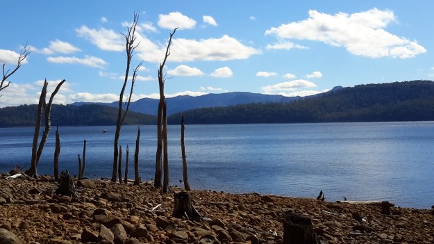
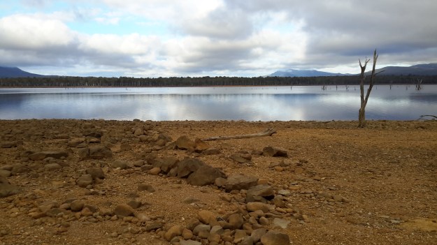
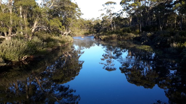
Late in October 2015, on the northern side of the Derwent River, I walked at Clark Dam built on Butlers Gorge, and then along a little of Lake King William. We know that in 1835, George Frankland followed the Derwent River in a southwesterly direction from Lake St Clair across huge plains until the gorge country commenced. The Clark Dam has been built at that junction, and over the decades the plains behind have been swamped with what is now known as Lake King William. The location is a place of extreme weather conditions, from blizzardly snows to ferocious and bitterly cold winds and to scorching sunny days, but always stunning.

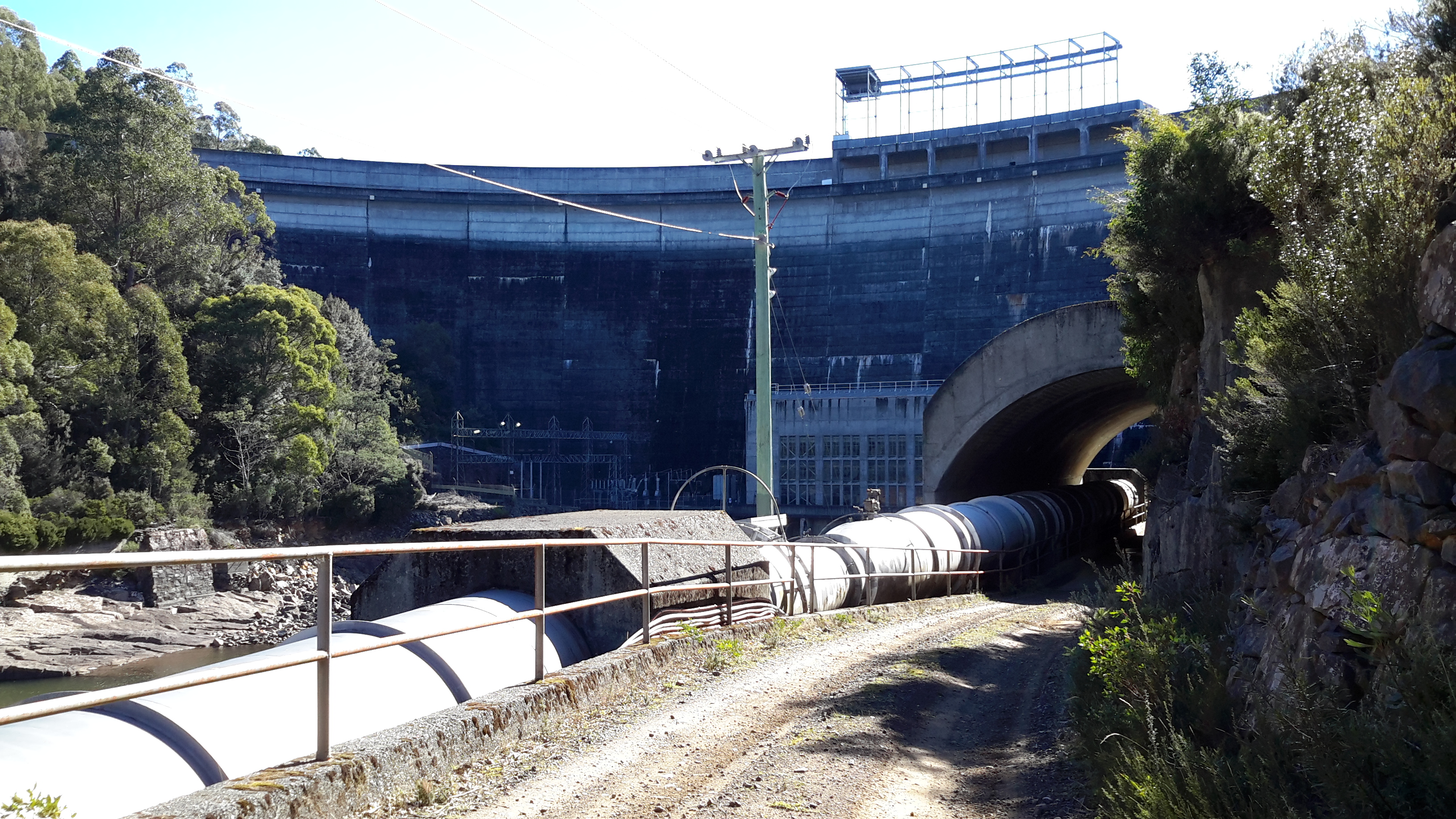
Clark Dam is a massive piece of engineering in a beautiful but remote area of central Tasmania.

20151029_122628.jpg

20151029_122354.jpg

20151029_122454.jpg

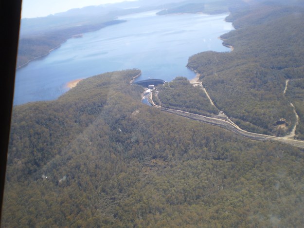
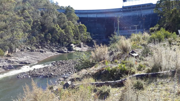
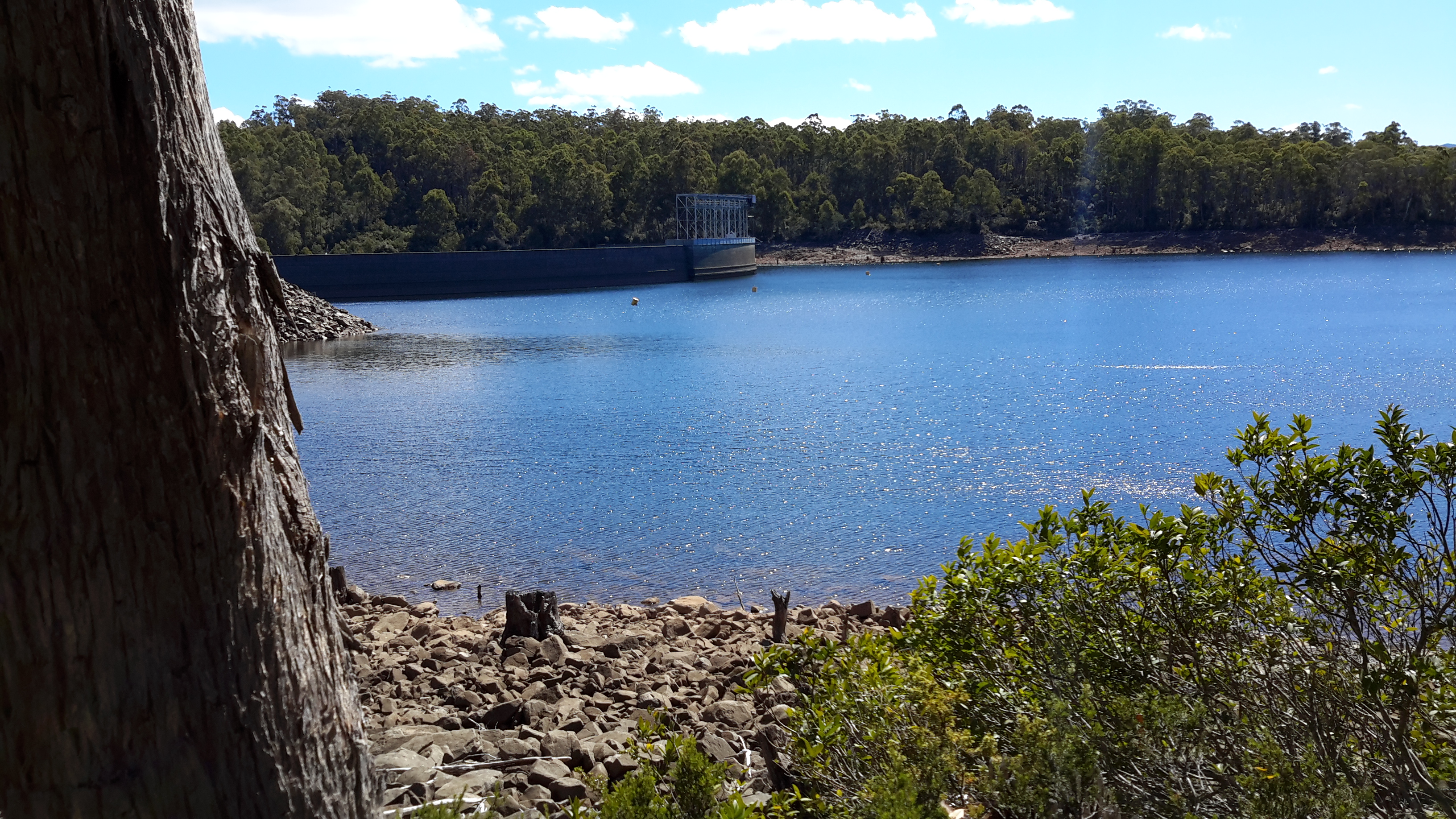
Chantale’s aerial photograph below puts the Dam and Lake King William into context.

IMG_3876Clark Dam

Michelle’s photos below provide similar information.

PA280110Clark Dam.JPGPA280111Clark Dam.JPG

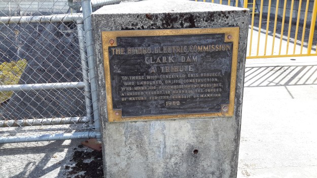
In 1952 a special tribute plaque was installed on the Dam: ‘The Hydro Electric Commission, Clark Dam, A Tribute, To those who conceived this project, who laboured on its construction, who made its accomplishment possible, a united effort to harness the forces of nature for the benefit of mankind.’

20151029_122335.jpg

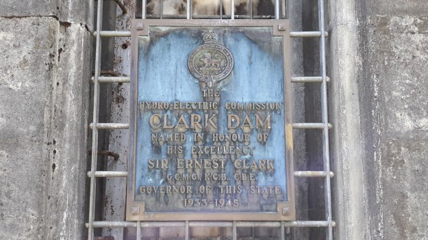
Another plaque nearby records: ‘The Hydro Electric Commission, Clark Dam, Named in honour of his Excellency, Sir Ernest Clark,  G.C.M.G., K.C.B., C.B.E., Governor of this State, 1933- 1945.’

20151029_122849.jpg

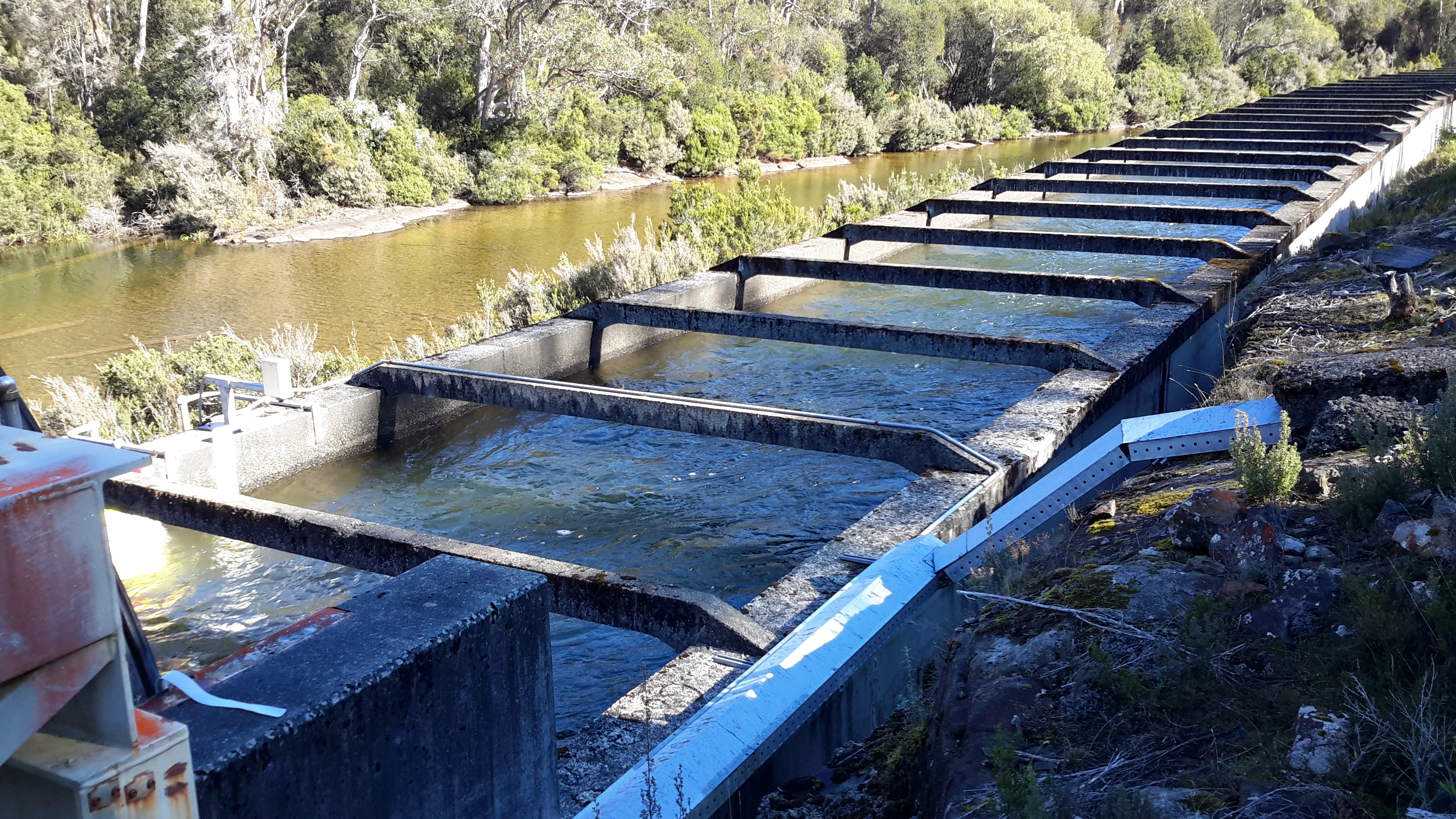
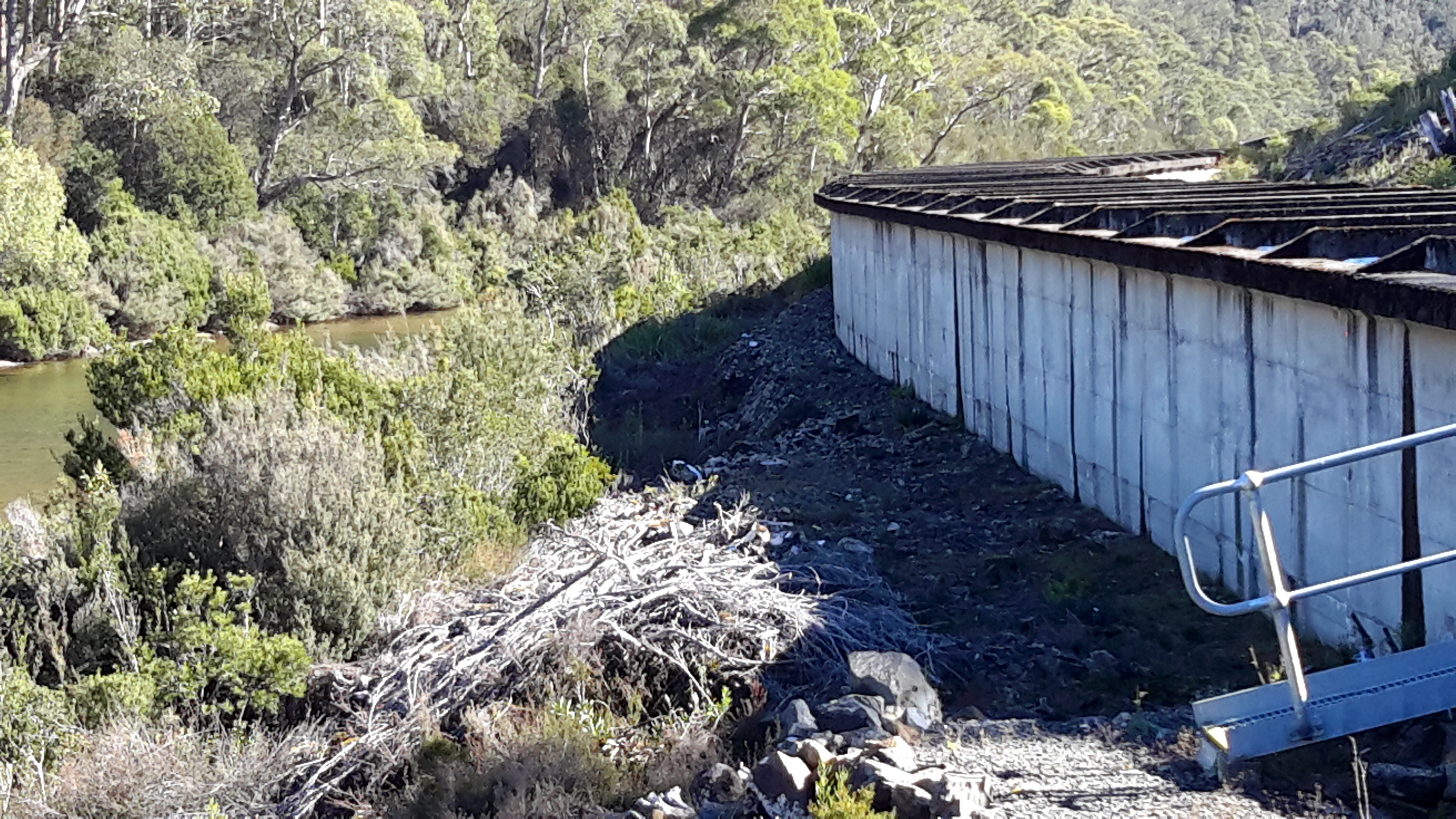
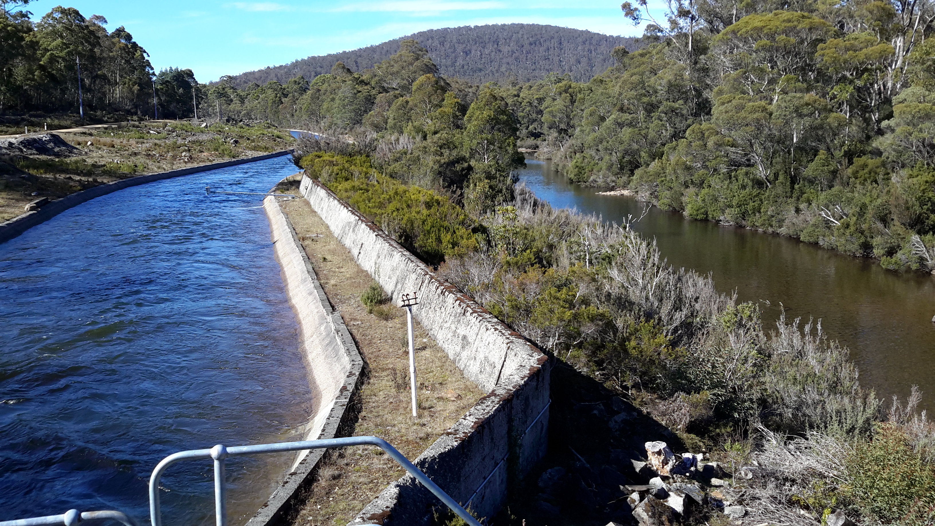
My chauffeur for the day Andrew, remembered years ago he walked across the Dam wall but that is now impossible.

20151029_122312.jpg

20151029_122459.jpg

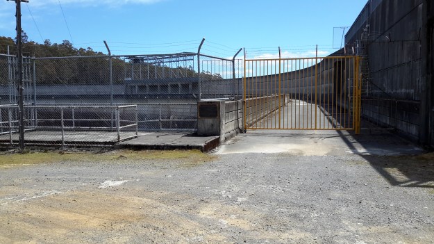
This means it is impossible to change from one side of the Derwent River to the other at this point.  In the photo below despite the walkway beckoning a walker, it was impassably gated at the other end.

20151029_123303.jpg

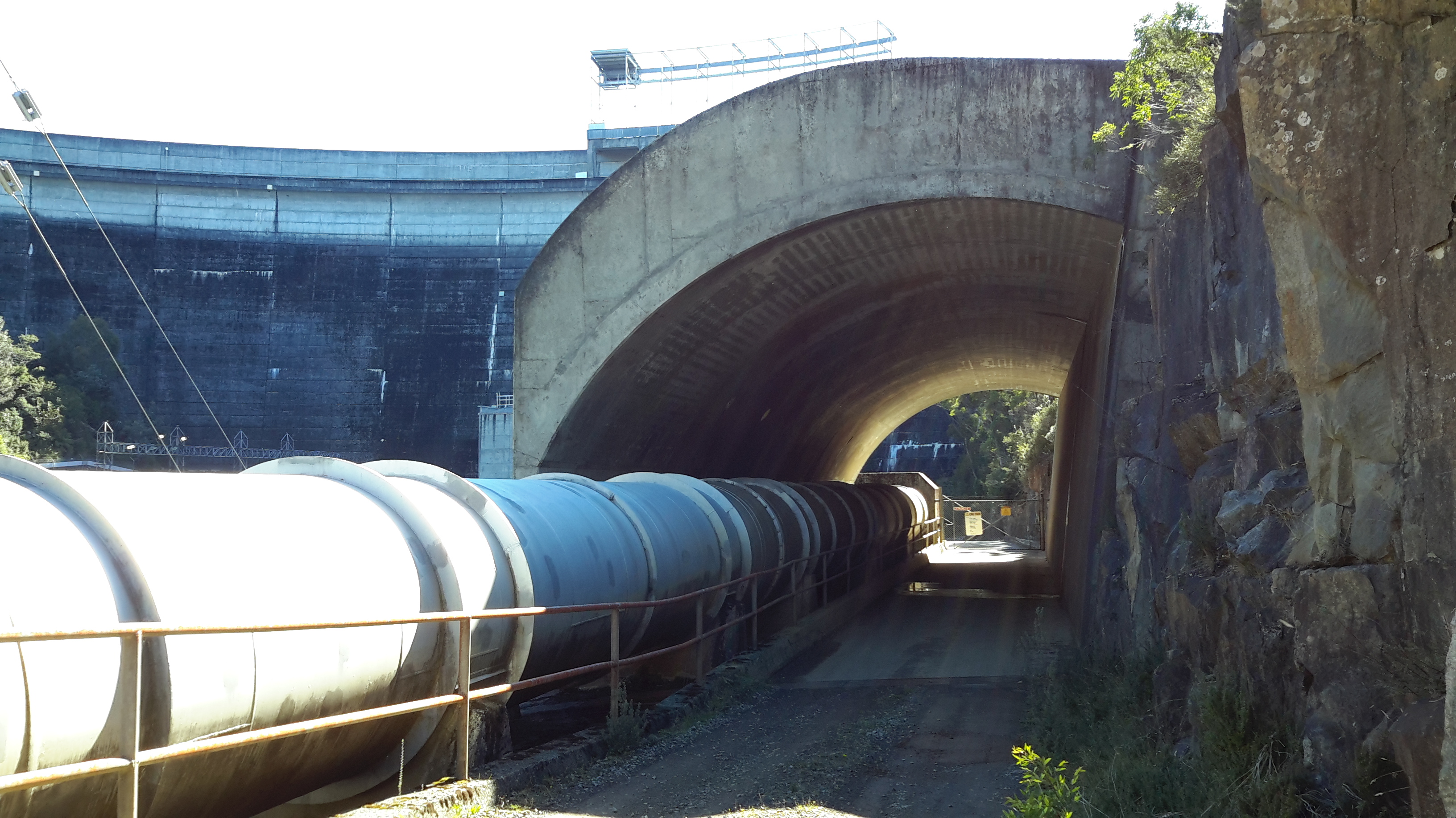
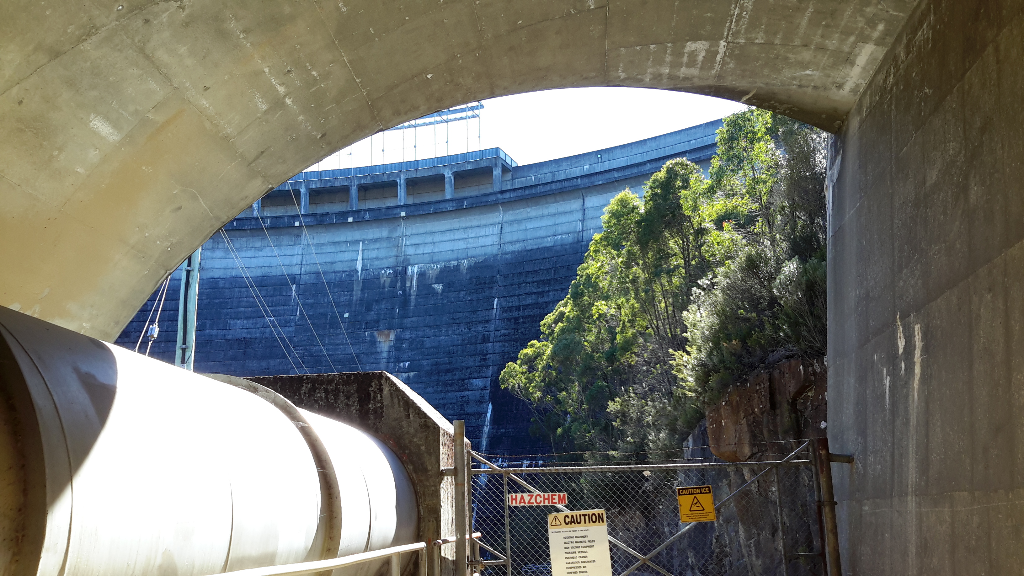
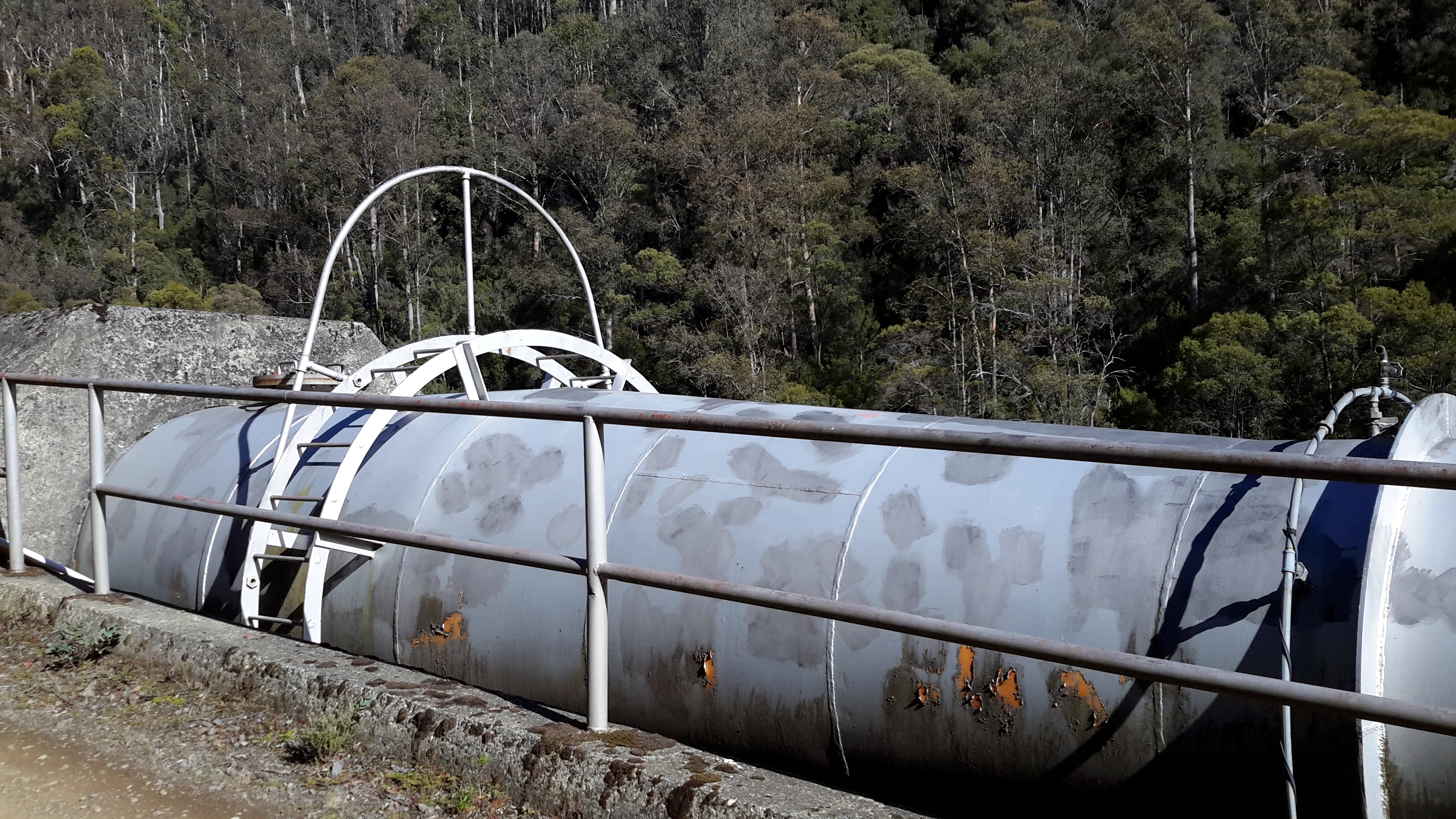
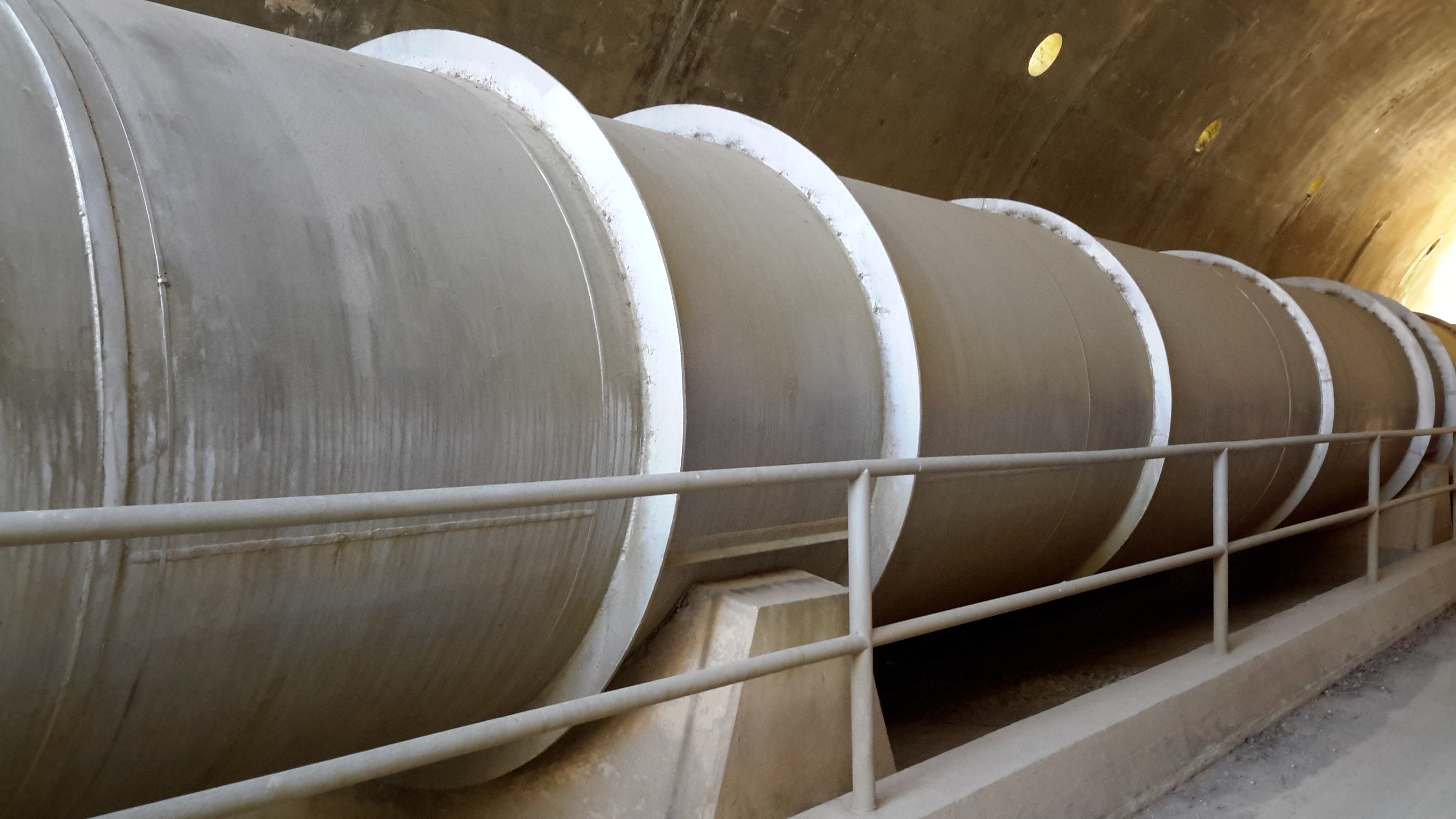
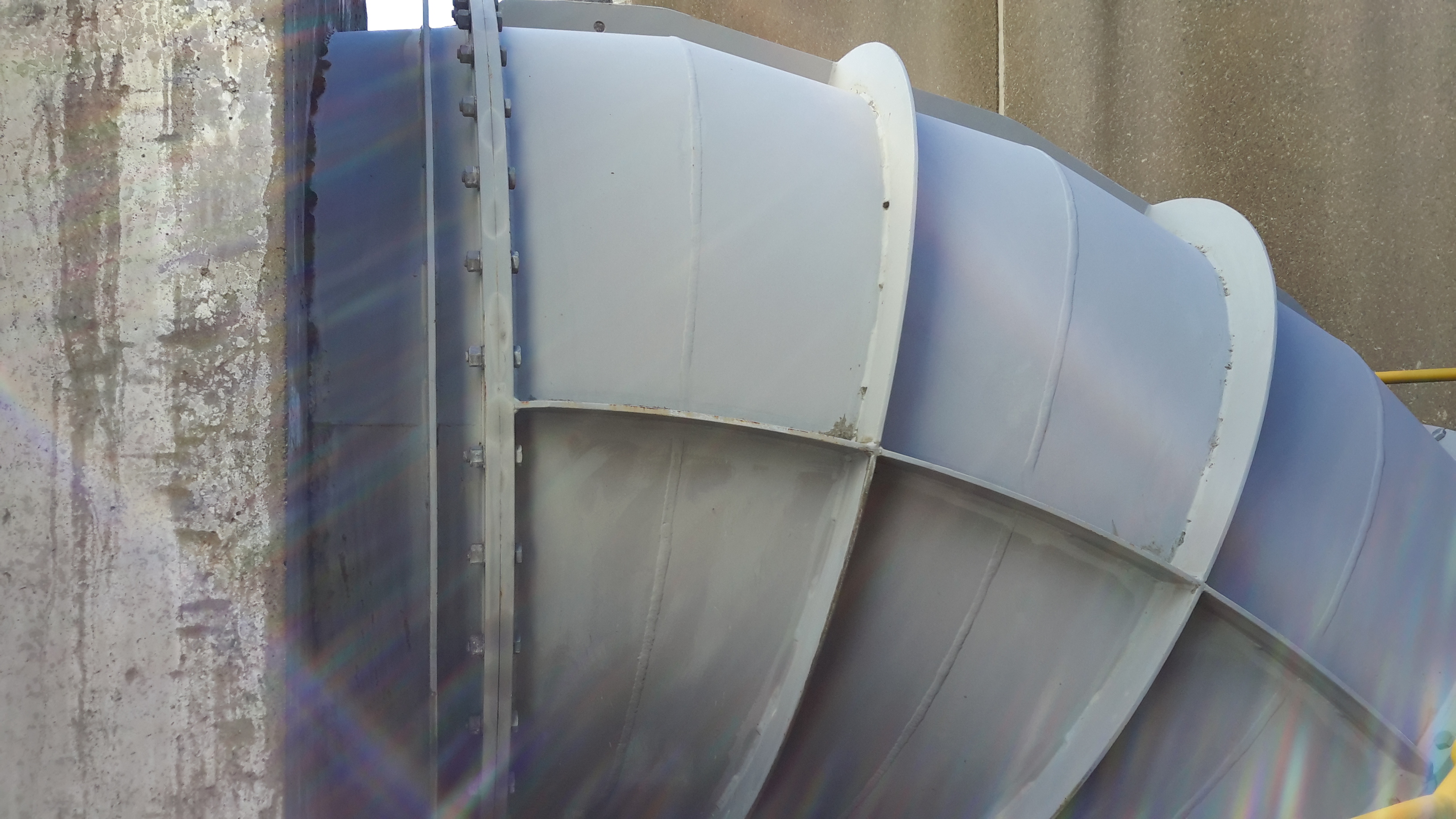
The reminder that the Clark Dam is part of an electricity generating project is everywhere.

20151029_122528

The complex that makes up Wayatinah – posting 7 of 7

The Derwent River at Wayatinah

20151029_113841.jpg

20151029_113829.jpg

From my aerial experience, I know the river looks like this all the way north-westwards of the Wayatinah Lagoon to Clark Dam at Butlers Gorge; a distance of not much less than 30kms in very steep country with numerous creeks cutting the landscape and flowing into the Derwent River.  In the post introducing George Frankland’s walk, mention was made of the Nive River. The Nive flows into the northern end of Wayatinah Lagoon. Before the Wayatinah dam was built, the Nive flowed directly into the Derwent.  The river edge between Wayatinah and Butlers Gorge is where Frankland and his expedition found two to four miles per day was the going rate because of the density of the bush. And then they gave up and walked inland away from the Derwent River.

 20151028_115431

20151028_115442.jpg  
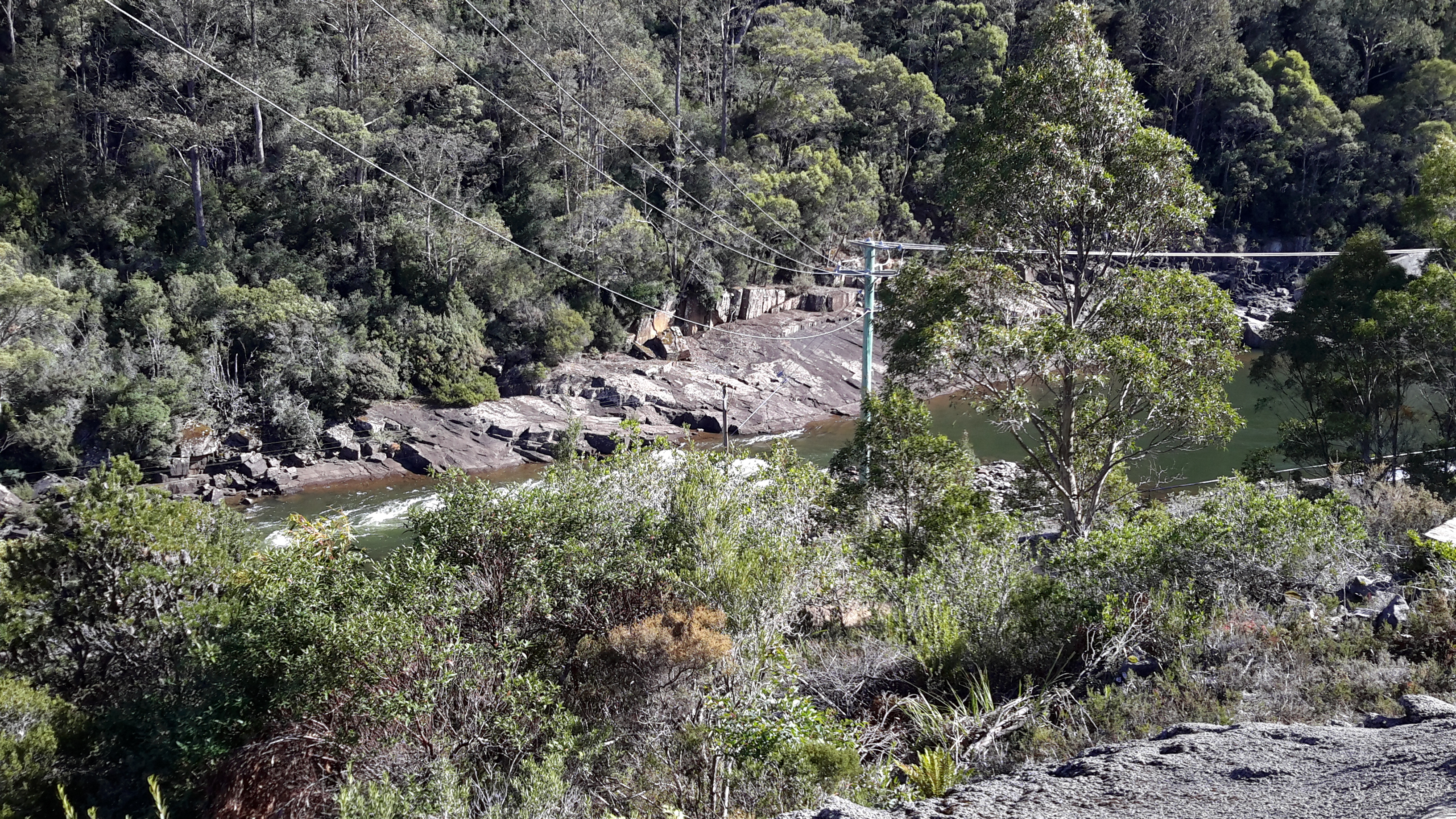
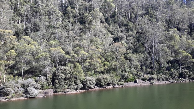
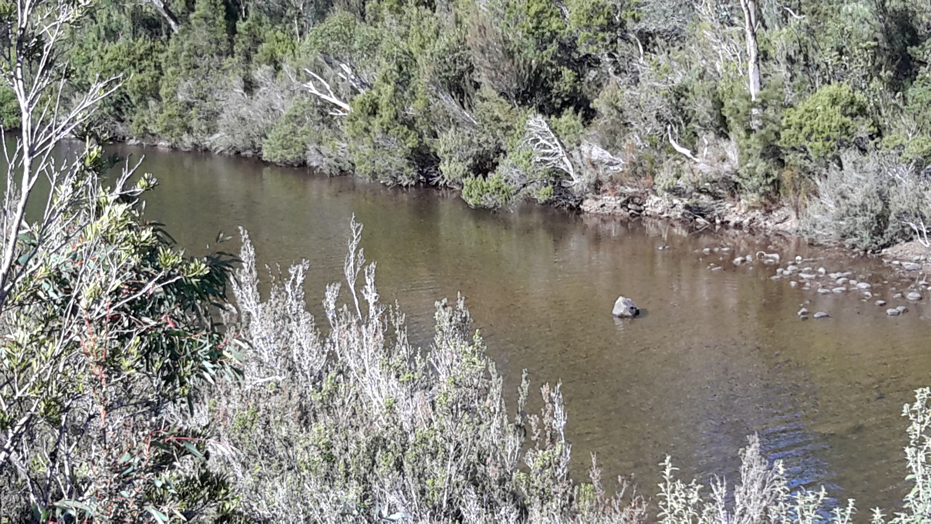
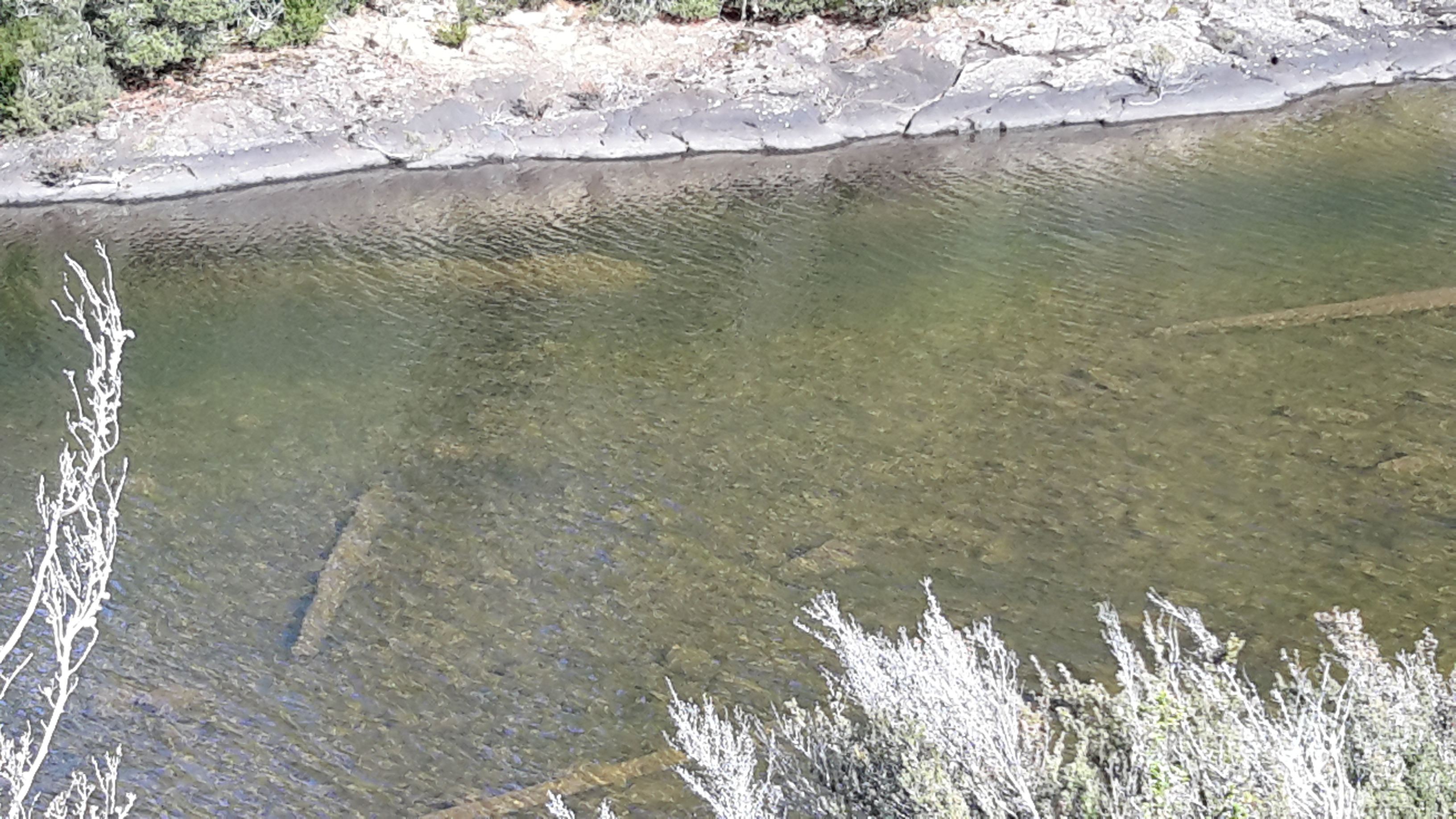
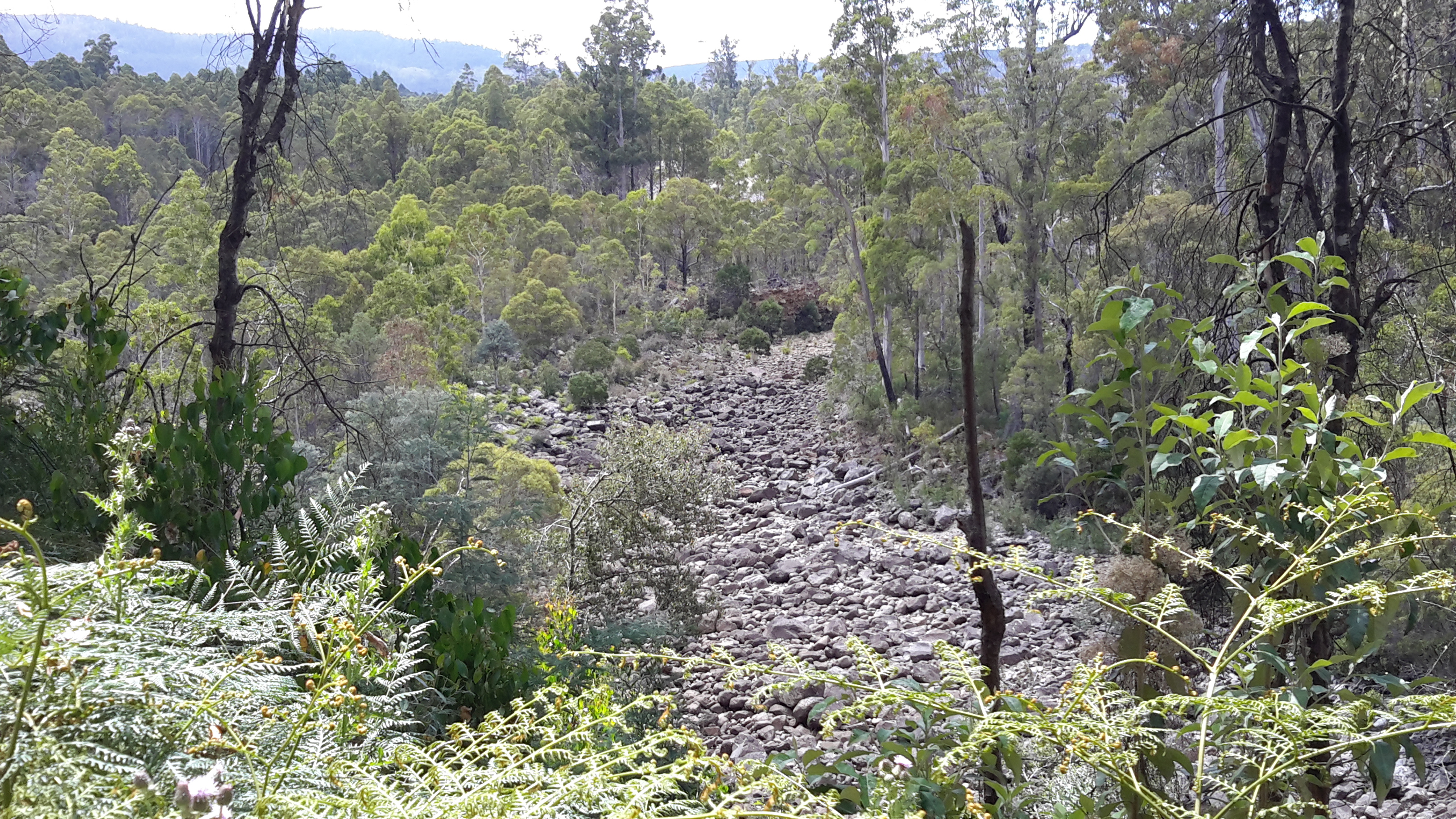
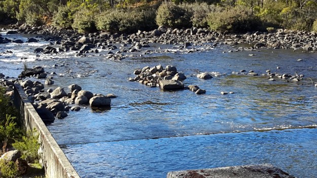
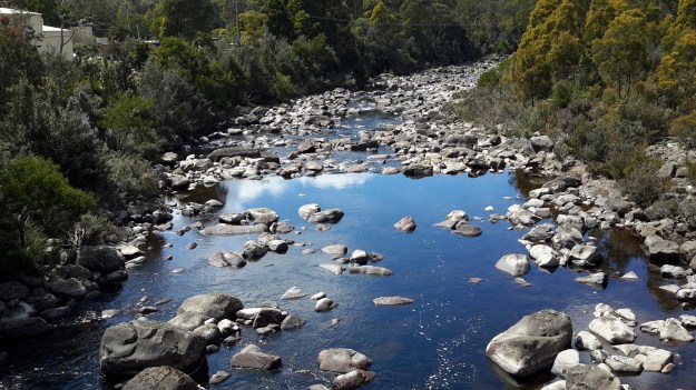
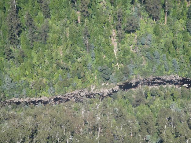
A couple of Chantale’s aerial photos show similar rocky beds along this remote and wild part of the Derwent River.

IMG_3828dryish river bed.JPG

IMG_3832.JPG


Dams on the Derwent River

The potential of the volume of water passing down the Derwent River for hydro-electricity generation was seen over a century ago.  While a few power stations were built in the early decades of the 20th century, with an influx of migrants from war ravaged Europe in the 1940s-50s, the numbers of dams and power stations increased quickly.  Overall, many dams and approximately 30 power stations have been built across central Tasmania.

On my way to Lake St Clair, I will reach and walk past each of the following 7 markers along the River:

  • Meadowbank
  • Cluny
  • Repulse
  • Catagunya
  • Wayatinah
  • Tarraleah
  • Butlers Gorge

One of the Hydro websites provides detailed information about these and others which feed into the Derwent River catchment.  In addition, the site includes the diagram below.

Derwent dams