Tag Archives: Meadowbank Dam

Natural bush remnants amidst agricultural lands –posting 1 of 5

The bush, whether  or not it has been disturbed by farmers, hydro workers, road makers or forestry men, is always alluring and endlessly attractive. It may be open, tangled or dense. Agriculturalists may have cleared land leaving occasional remnants of bush and tufts of its natural grasses. It will contain natives and exotics. The bush may be dry or wet. The colour may be grey-green naturally or from a dusty overlay.  Alternatively, myriads of other shades of green, grey, beige, and brown will fleck against rocky outcrops and the black or green glassiness of the Derwent River passing through.

The following photos and those in the subsequent postings in this series, were taken at various locations between Meadowbank Dam and its Power Station towards Gretna.

20160301_111306.jpg

20160301_112002.jpg

20160301_112058.jpg

20160301_112357.jpg

20160301_112507.jpg

20160301_112416.jpg


Meadowbank Dam and Power Station

Meadowbank Dam and Power Station, as part of Hydro Tasmania’s electricity generating facilities, are located the closest of their properties to Hobart.  Access to the Dam is restricted.

East of the Dam, Meadowbank Dam Road makes the connection with the Lyell Highway but this is a locked gate gravel roadway.  Meadowbank Road is a quite different road; this public gravel road exits the Gordon River Road west of the tiny township of Glenora and travels in a north-westerly direction, but mostly not close to the Derwent River – so that it isn’t reasonable to be used as the conduit to ‘walk the river’. Before reaching the Dam, the road passes Meadowbank Vineyard and acres of vines under cultivation. However, access is restricted: there are quite a few lockable gates barring continuation to the Dam.

20160301_112604.jpg

20160301_112746.jpg

20151128_124320.jpg

20151128_125147.jpg

20151128_125433.jpg

20151128_125155.jpg

The first unit of the Meadowbank Power Station was commissioned in 1967. This was the last such operation to be built in Tasmania.  Photos are on show on Hydro Tasmania’s website and more details are available on their Fact Sheet .  The CSIRO library holds another photo taken from a different vantage point.

I am grateful for Alex driving me as close as we could go by car.

Meadowbank Lake

IMG_3898Dunrobin bridge

Chantale’s photo above shows the north western end (the furthest end from Hobart) of Meadowbank Lake. You can see the trail of Dunrobin Bridge strung across.

Collecting historical information about Meadowbank is not easy, however the information  I have located has added to my store of knowledge.

According to Environmental Flows for the Lower Derwent River Final Report to DPIWE February 2002 Freshwater Systems, Meadowbank Dam is located approximately 107km upstream of the river mouth.  This report divides the lower Derwent into ‘two major sections: 1. The lower River Derwent – the freshwater river between Meadowbank Dam and New Norfolk; and 2. The upper Derwent estuary – the estuary between New Norfolk (in the vicinity of the upstream tidal limit) and Bridgewater.’

A brochure providing information about access to Meadowbank Lake for anglers includes details about Recreational Fishery Management (Meadowbank Lake is managed by the Inland Fisheries Service as a Family Fishery and is open to angling all year round. Regular stocking with brown trout, rainbow trout and trophy sized Atlantic salmon maintains the quality of the angling.); Native Fish Management (The short-finned eel (Anguilla Australis) is stocked upstream of the dam wall. The blackfish (Gadopsis marmoratus), which is native to northern Tasmanian rivers, has been introduced into the Derwent system and may be encountered in the lake.); and Pest Fish Management (Meadowbank Lake has populations of the pest fish species, redfin perch (Perca fluviatilis) and tench (Tinca tinca). If either of these species are caught, anglers are asked to humanely kill the captured fish and dispose of appropriately.)

Discover Tasmania provides information which encourages access to and usage of the Lake and its shores.

Wikipedia gives background information about the Power Station.

The September 2013 LAKE MEADOWBANK PLANNING PROJECT BACKGROUND REPORT  prepared for the Central Highlands Council in partnership with Hydro Tasmania and the Department of Economic Development, Tourism and the Arts includes panoramic photographs of the Lake and explanations of many of its aspects.

Hydro Tasmania provides information about Lake- side facilities and also about changing water levels.

A little history associated with Meadowbank Farm since the 1970s can be read at this site.

IMG_3908

Perched between treed hills sits Meadow Bank dam, roughly 15 kms downstream from Meadowbank Lake’s far western end.   Chantale’s photo shows the start of that water catchment behind the dam wall and the Meadowbank Power Station nestled at its feet.

Gretna to Lake Repulse Dam – an aerial perspective: 2 of 3

Meadowbank Lake, through which the Derwent River runs, is an expanse measuring approximately 15 kms in length. A few kms of Derwent River flow between the Lake’s western end and Cluny Dam.  Between Meadowbank Dam and Cluny Dam, Michelle saw:

PA280076 Meadowbank Dam.JPG

PA280079 Doctors Flt and Tickleberry Flat on other side.JPGPA280081.JPGPA280084Top of Meadowbank Lane and then Derwent again.JPG

OLYMPUS DIGITAL CAMERA

OLYMPUS DIGITAL CAMERA

 Between Meadowbank Dam and Cluny Dam and Power Station, Chantale saw:

IMG_3907.JPGIMG_3905.JPGIMG_3904.JPGIMG_3901.JPGIMG_3898Dunrobin bridge.JPGIMG_3897Top of Meadowbank Lake

Between Meadowbank Dam and Cluny Dam and Power Station, I saw:

20151028_114338.jpg20151028_114404.jpg

20151028_114522.jpg


Gretna to Lake Repulse Dam – an aerial perspective: 1of 3

I have felt bereft at the constraint of not being able to provide details of where I have walked nor present photographs of grand scenery of the Derwent River and its surrounds.  Then I remembered the flight I took from the mouth to the source and return.  I realised I could use a selection of the photos that my two companions and I took during the flight. This series of postings will show you aerial shots covering the area between Gretna and Lake Repulse Dam.  I hope readers will be as thrilled as I am to see the rich expanses of our land by the River and then to be excited by that blue ribbon that winds through that landscape.

Sitting astride the Lyell Highway, Gretna is the tiny town at one end (the closest end to Hobart) of this Gretna to Lake Repulse Dam distance. Approximately 52 kms of Derwent River stretches between these two points and to walk it requires covering considerably more kms.

Between Gretna and Meadowbank Dam and Power Station, Michelle saw:

OLYMPUS DIGITAL CAMERA

OLYMPUS DIGITAL CAMERA

OLYMPUS DIGITAL CAMERA

OLYMPUS DIGITAL CAMERA

OLYMPUS DIGITAL CAMERA

OLYMPUS DIGITAL CAMERA

OLYMPUS DIGITAL CAMERA

PA280073.JPG

Between Gretna and Meadowbank Dam and Power Station, Chantale saw:

IMG_3912.JPG

IMG_3911.JPGIMG_3909.JPG

Between Gretna and Meadowbank Dam and Power Station, I saw:

20151028_11415220151028_114203.jpg20151028_114222.jpg20151028_114228.jpg


Tackling the Derwent in the Meadowbank Lake region

Meadowbank Lake, which backs up behind Meadowbank Dam and its Power Station, is approximately 15 kms long. Downstream, the Derwent River snakes its way through the landscape for about 23 kms until it passes Gretna and heads on towards the sea.  Upstream, after approximately 9 to 10 kms, the Derwent River finishes at Cluny Dam.  The Cluny Lagoon which extends to Lake Repulse Dam extends a further 4 kms.

To walk the Derwent between Lake Repulse Dam and Gretna is not straightforward because some private property owners cannot afford to let strangers on their property for insurance reasons, or their granted permission is a one off special case for me.  As a result, I have walked and will walk sometimes on the western and sometimes on the eastern side of the River and Lake, but I will not be providing a map and location details in my blog.  In this way I will protect the privacy of landowners, and respect the privilege their permission to access their property has given me.

I expect to tackle parts of the area on a total of 6 or 7 separate days. On each of these walks there will be a considerable amount of retracing of steps and walking away from the river/lake in order to reach roads where friends can collect me. For most of this area, public transport will either be absent or a great distance away.  Only the walk between Cluny and Lake Repulse Dams offers a reasonable amount of public access.

To date, I have walked a few sections, but I am not sure how to write up this Meadowbank area considering the confidentiality and privacy agreements I have made.  Once I have started moving west of Lake Repulse Dam and all the walks in the Meadowbank area are complete, then I will create one or more blogs that introduce at least some of the wonders of that environment.

Dunrobin Bridge over Meadowbank Lake


Meadowbank Lake map.jpg

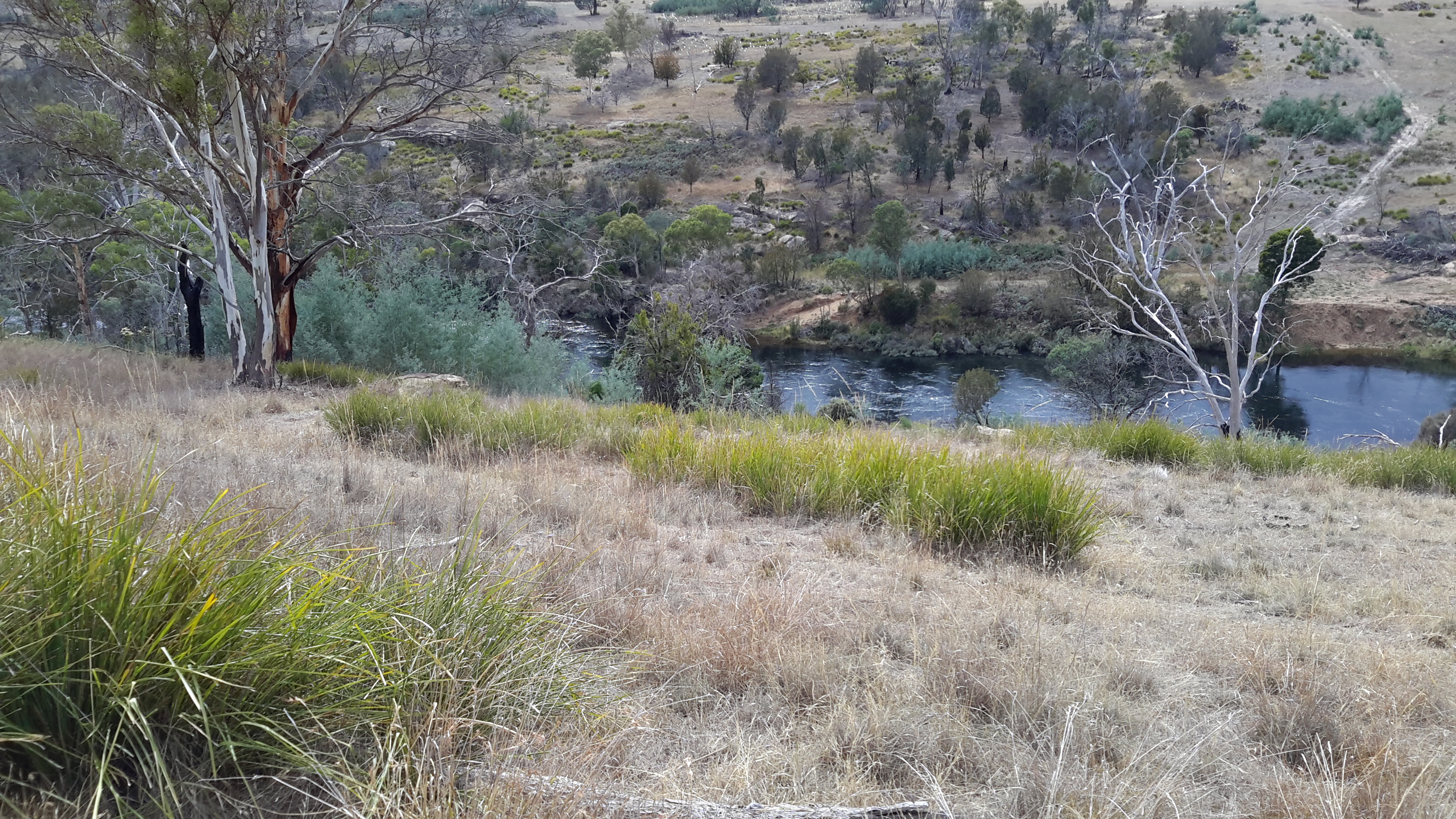
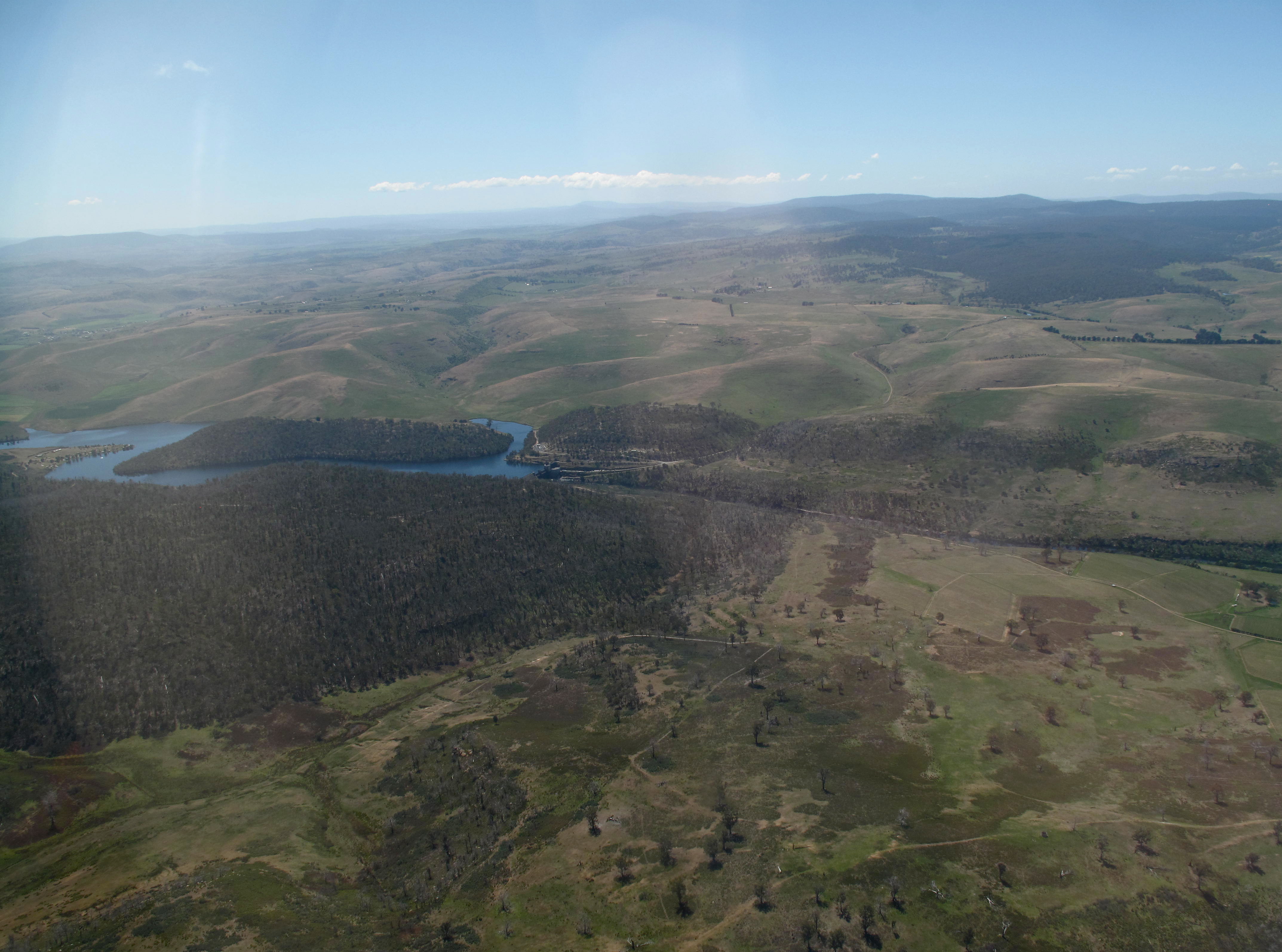
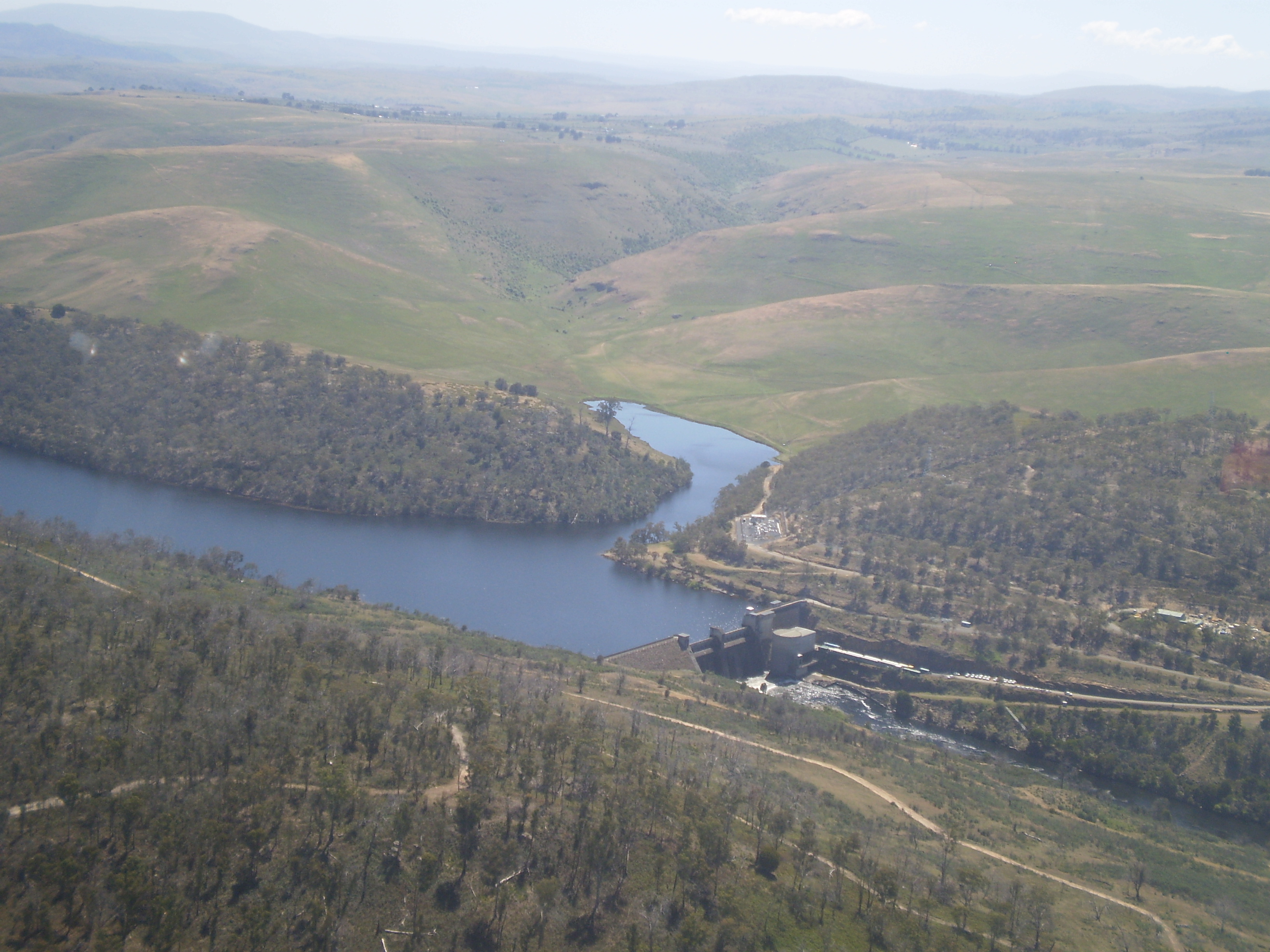
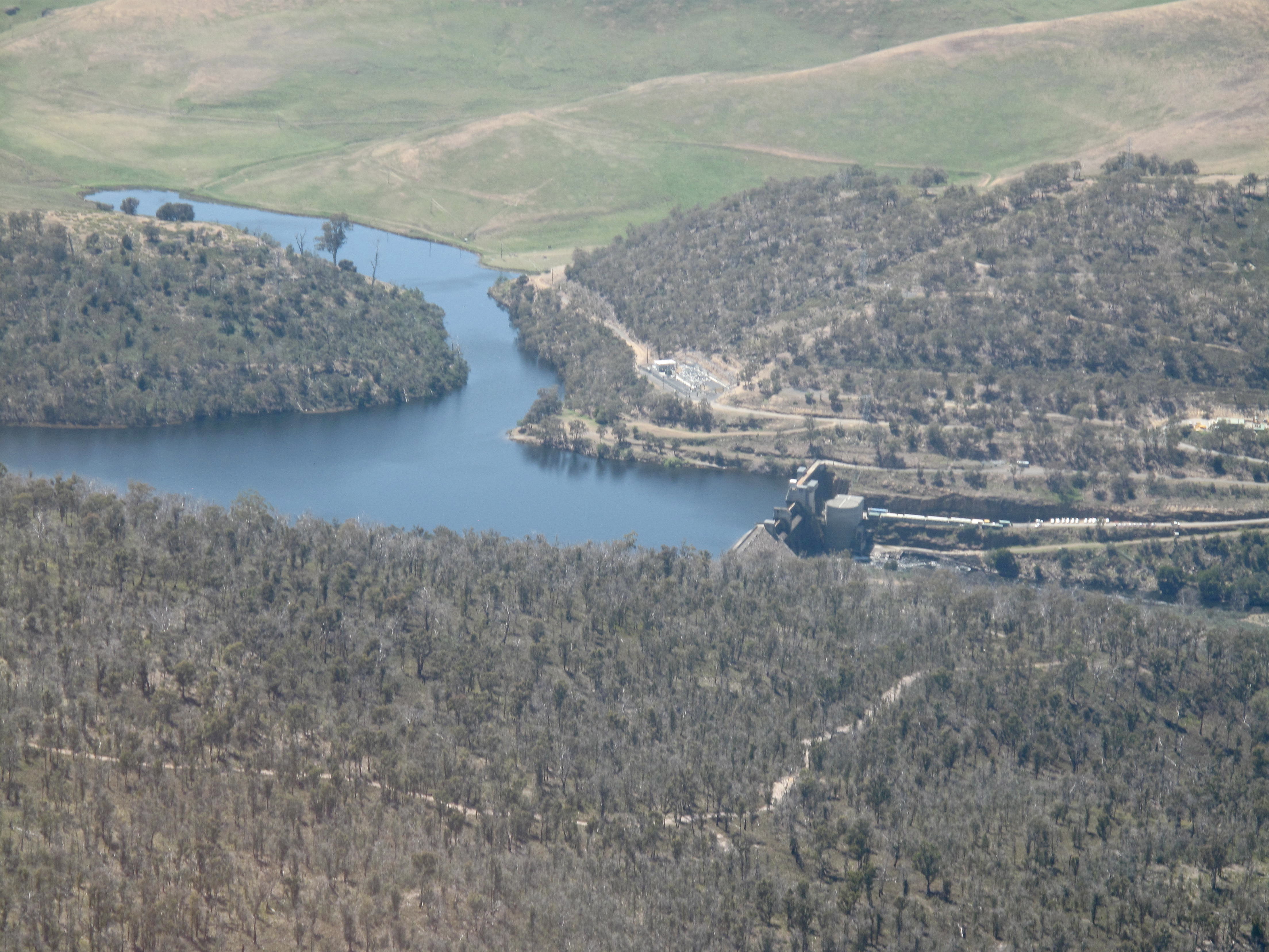
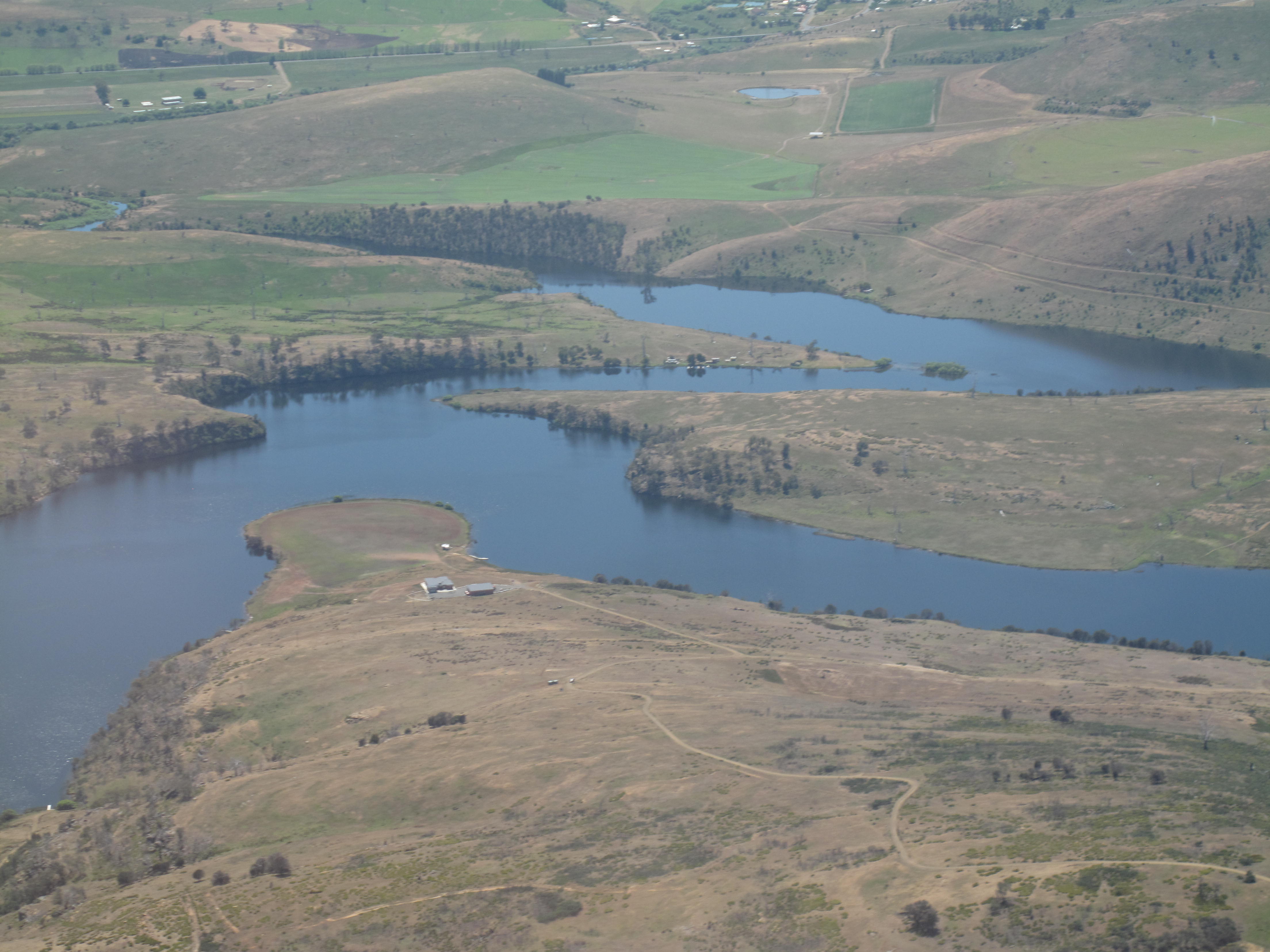
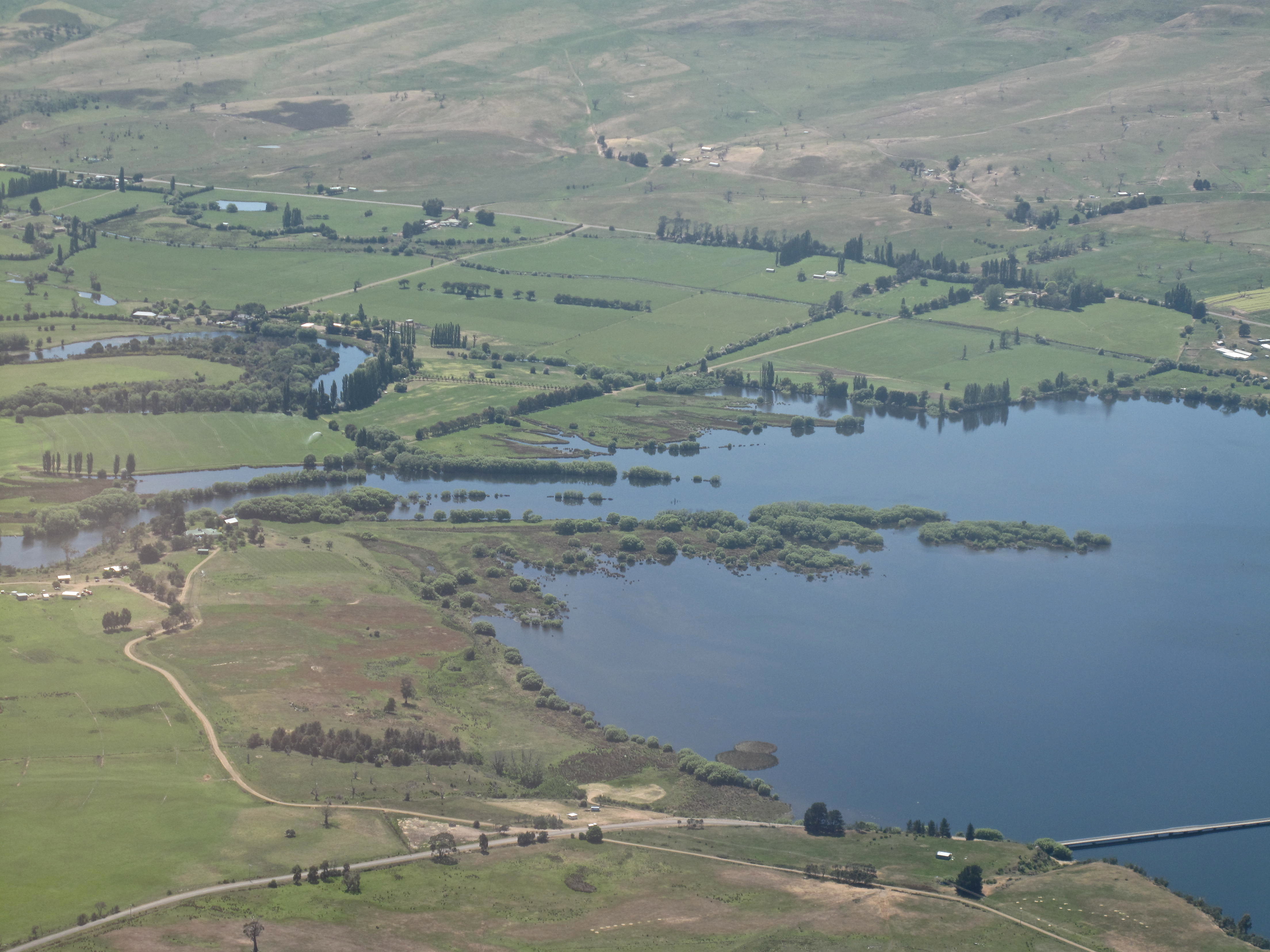
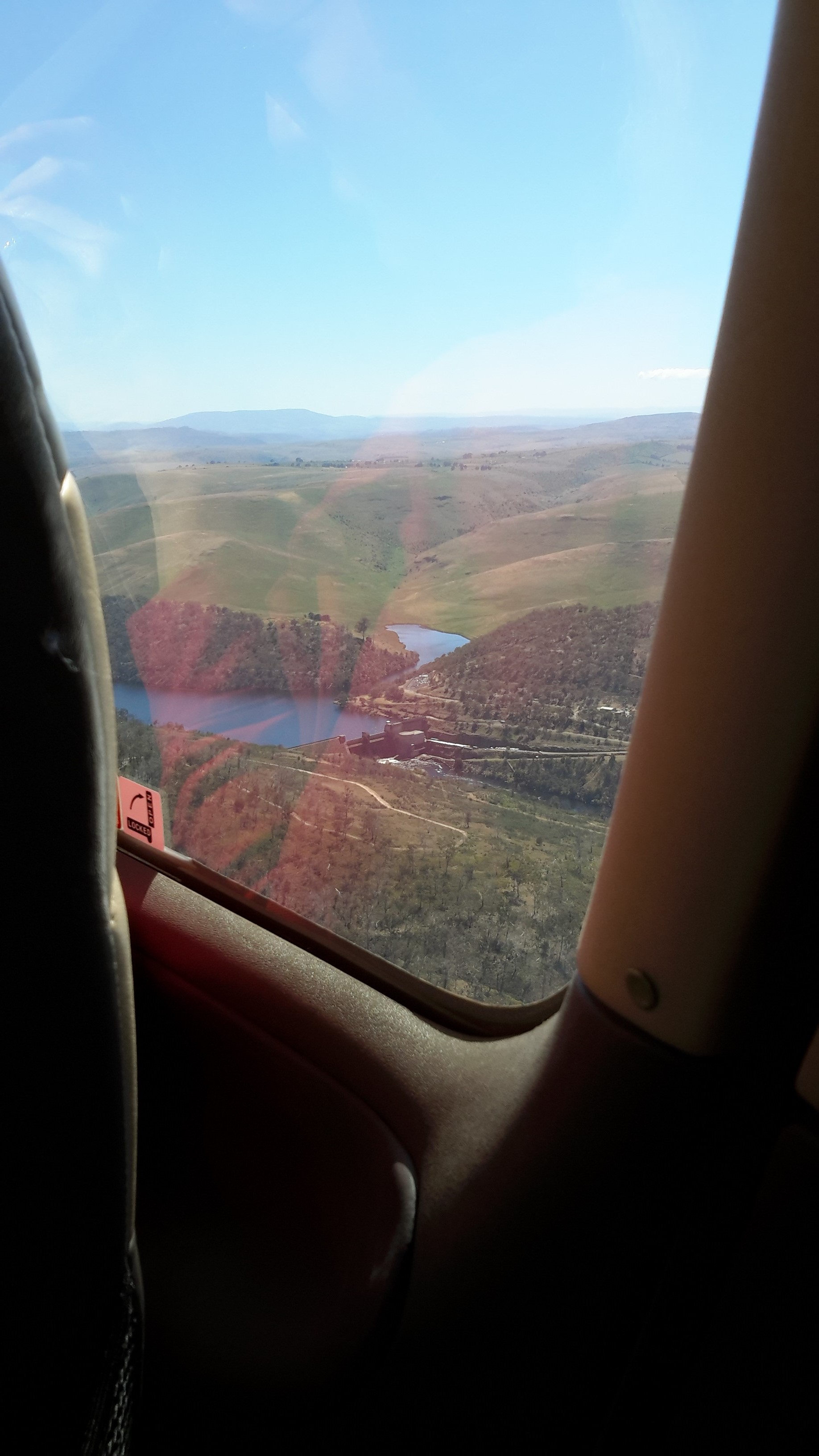
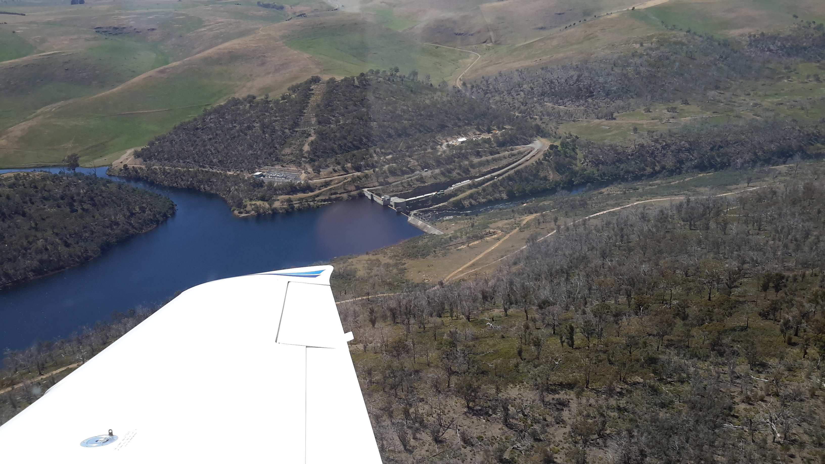
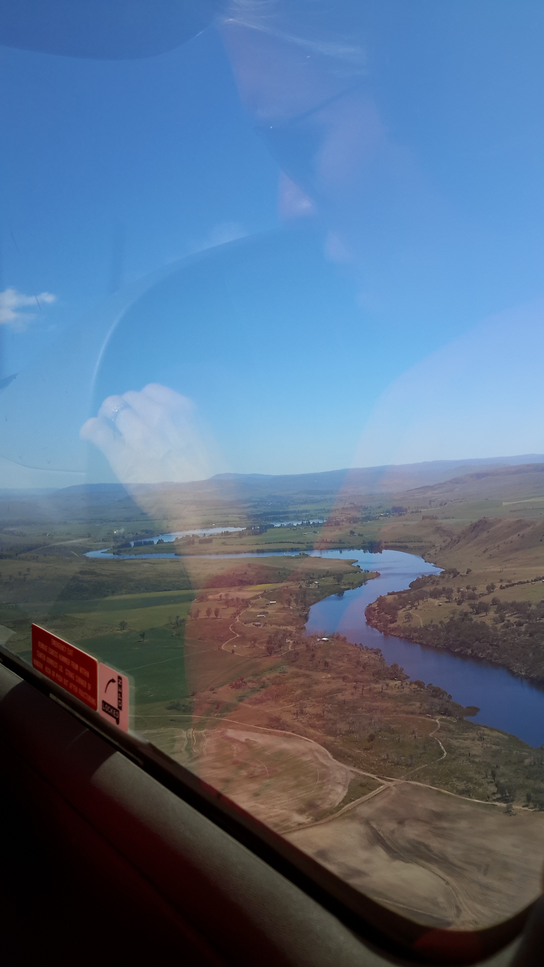
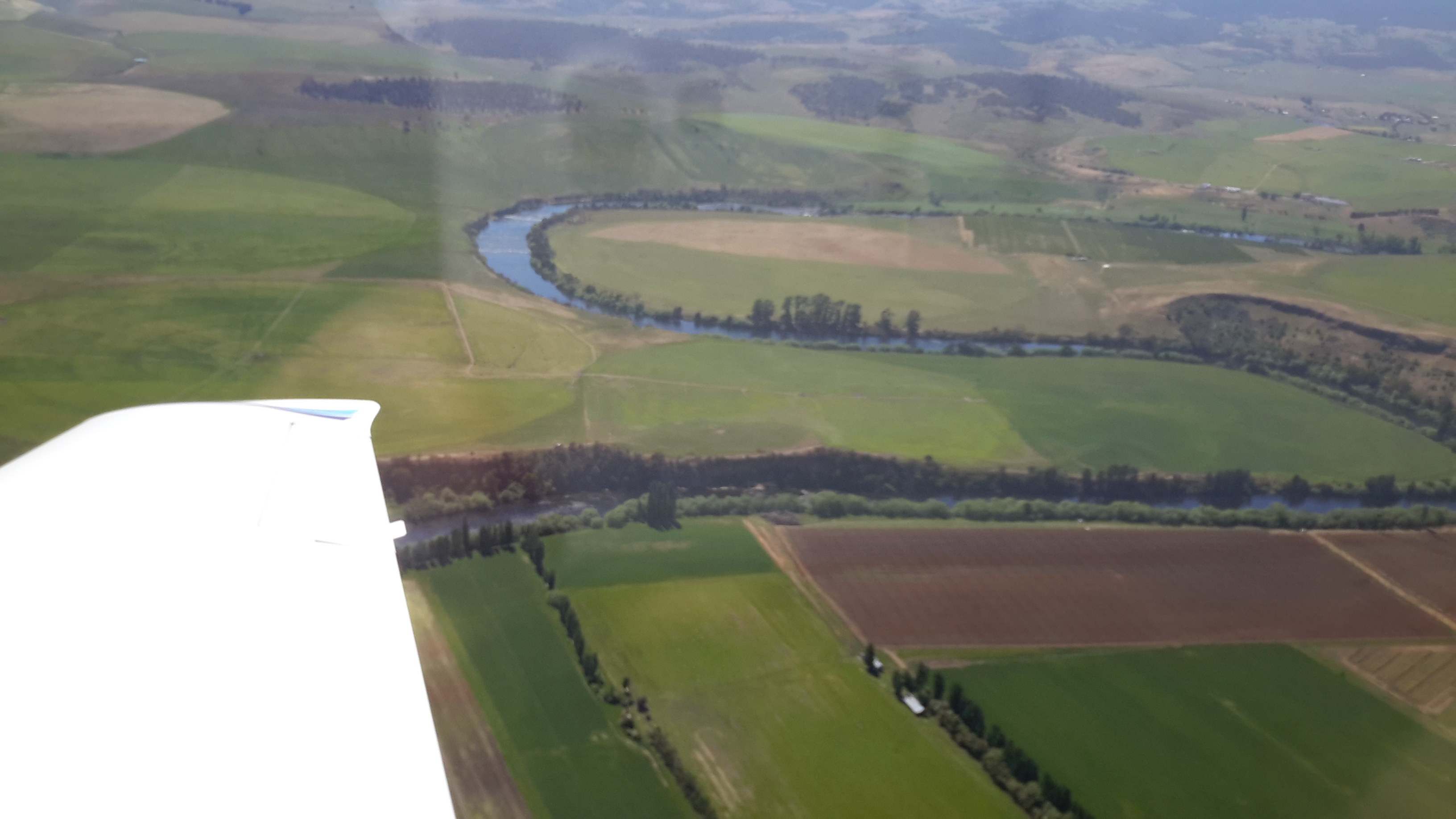
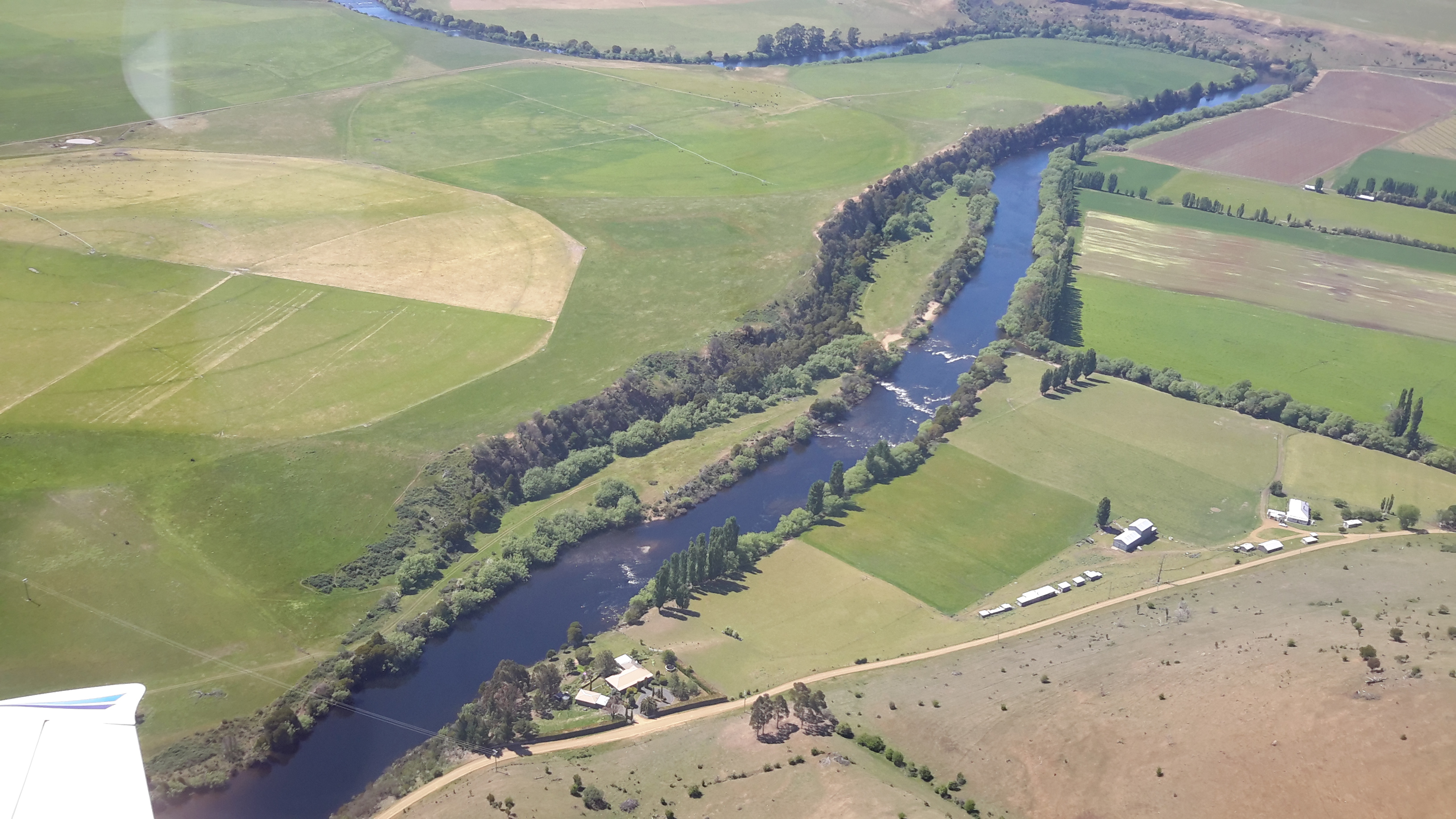
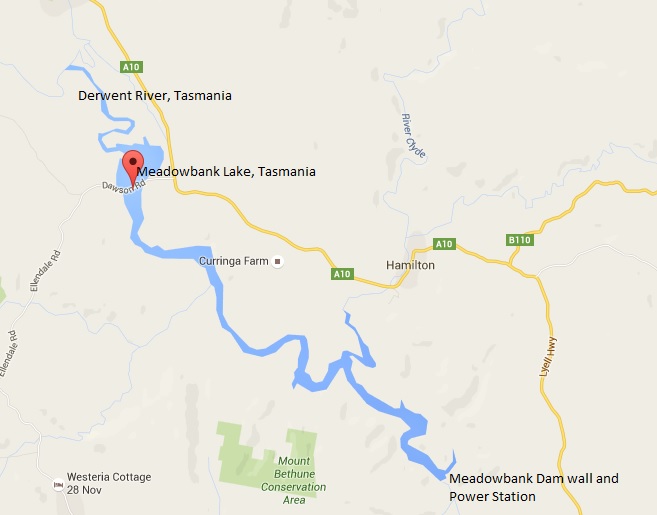
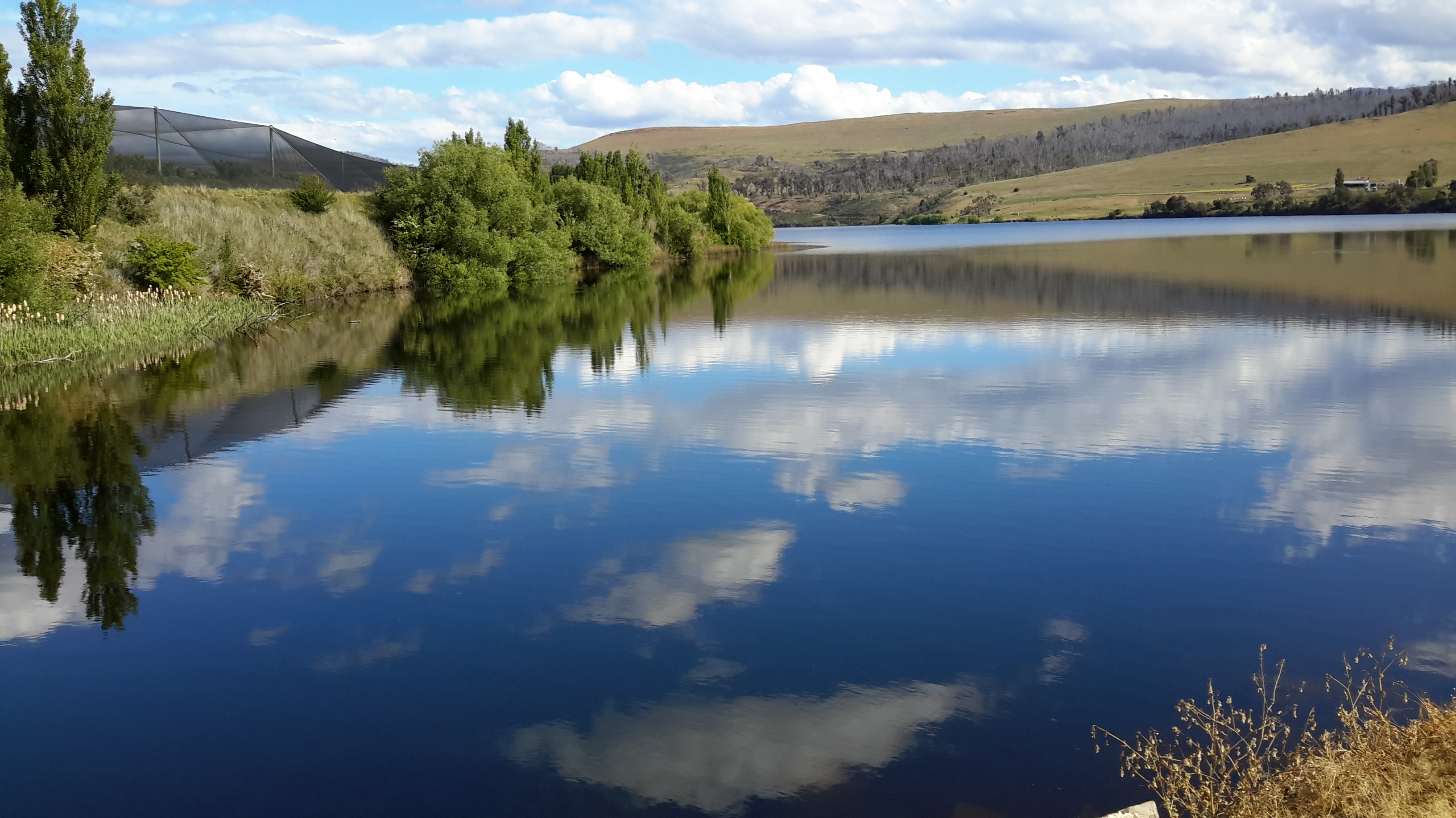
Meadowbank Lake, a large spread of dammed water through which the Derwent River runs,  is located west of New Norfolk: an expanse of water which measures at least 15 kms in length.  Like many other dams and lakes on the Derwent, Meadowbank has been designed for electricity generation purposes.  The Meadowbank Power Station was commissioned in 1967. In a document The Power of Nature, Hydro Tasmania provides information about Meadowbank and the other electricity-generating lakes and stations across Tasmania.

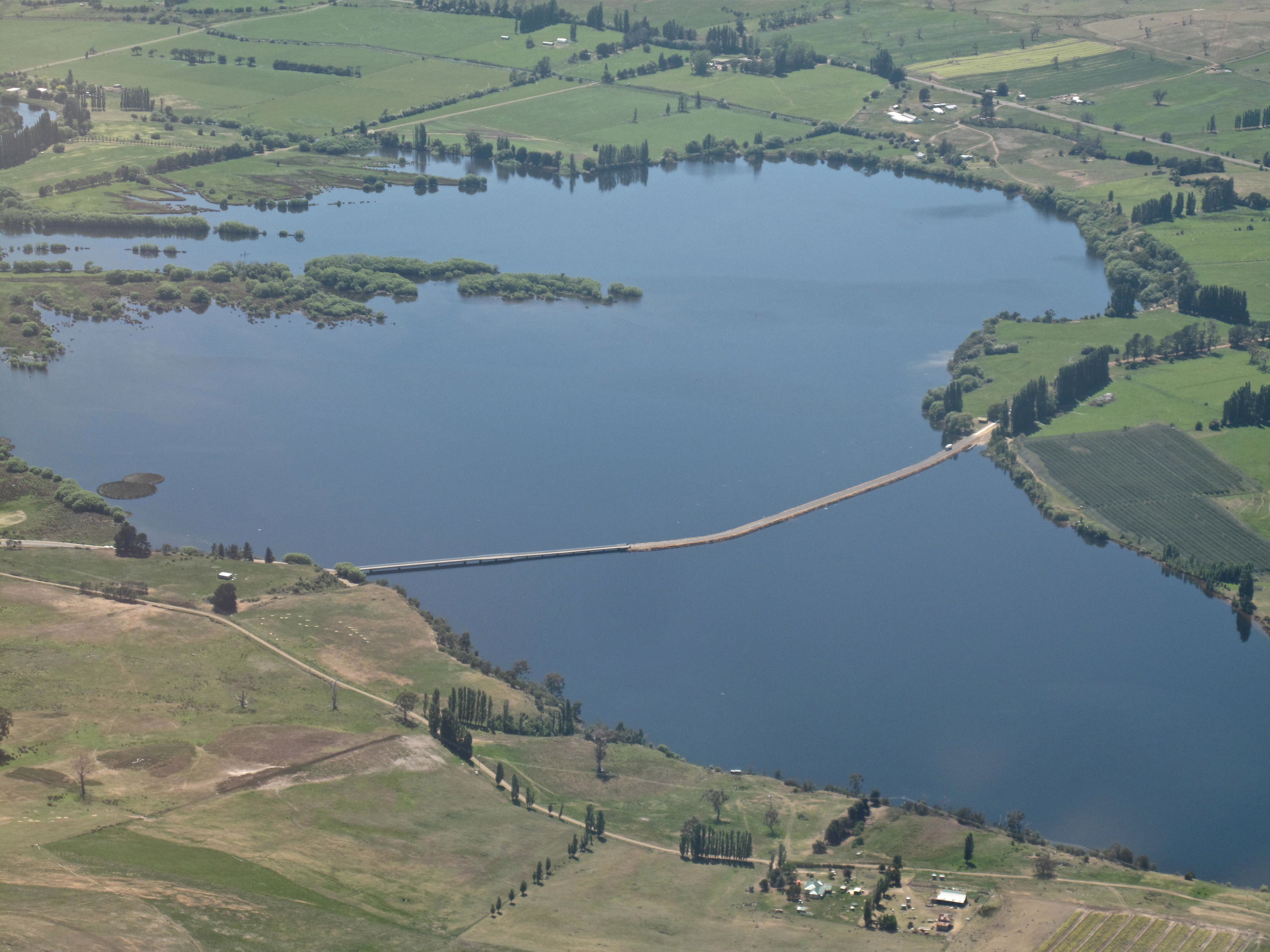
The Dunrobin Bridge carries Dawson Road; a road which extends from the Lyell Highway, crosses Meadowbank Lake then continues on the western shore until it reaches Lake Repulse Dam.

The first Dunrobin Bridge over the Derwent River was built in the early 1850s. The National Library of Australia’s Trove repository of historic documents provides information from a 1910 copy of The Mercury newspaper: ‘Dunrobin Bridge was built over the Derwent, between the Ouse and Hamilton during the regime of Governor Denison. Governor Denison’s rule in Tasmania lasted from 1847 to 1855. It is a fine stone structure, and the cost is stated in the Legislative Council Journals of 1856 to have been £13,875. Its construction seems to have occupied six years, from 1850 to 1856. Dawson’s Road, which was named after the man who superintended its construction, went from Dunrobin Bridge…’ westwards.

In 1900, according to the blog Tasmanian Gothic , the bridge looked like:

Dunrobin Bridge

Dunrobin Bridge

The bridge was damaged during flooding in 1952 according to Linc Tasmania.

Dunrobin 1952

This site shows the remains of the bridge in 1963.

Dunrobin Bridgen1851

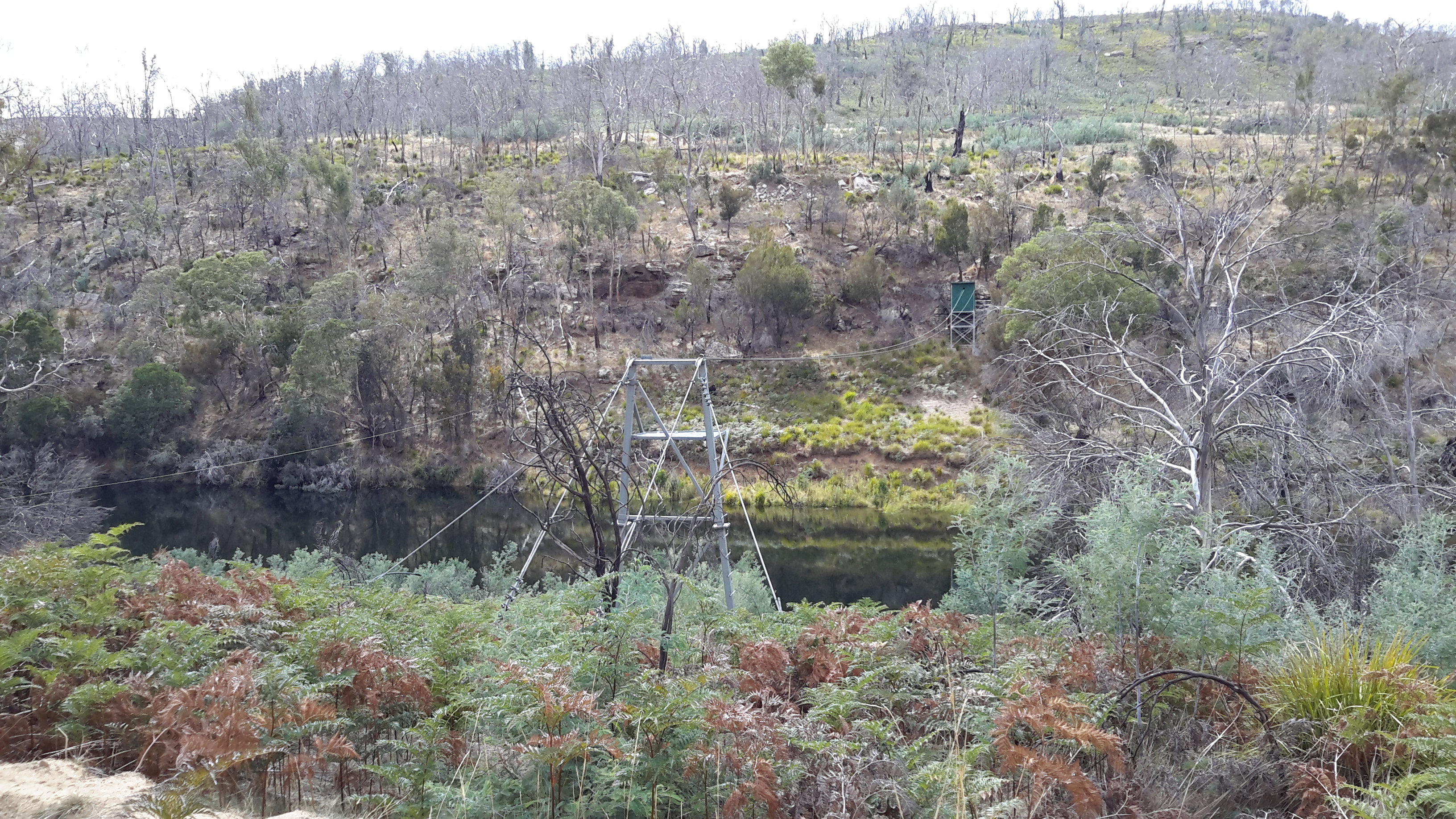
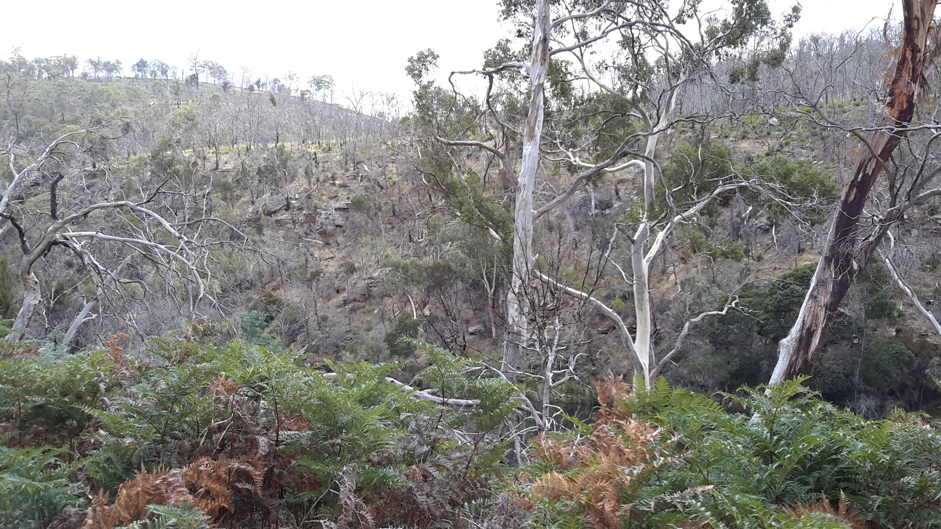
Once the Meadowbank Dam was built, the gorge behind gradually filled with water. The remnants of the old Dunrobin Bridge apparently remain beneath the current Meadowbank Lake.  I cannot find when the new Dunrobin Bridge was built.  Anybody know the date?

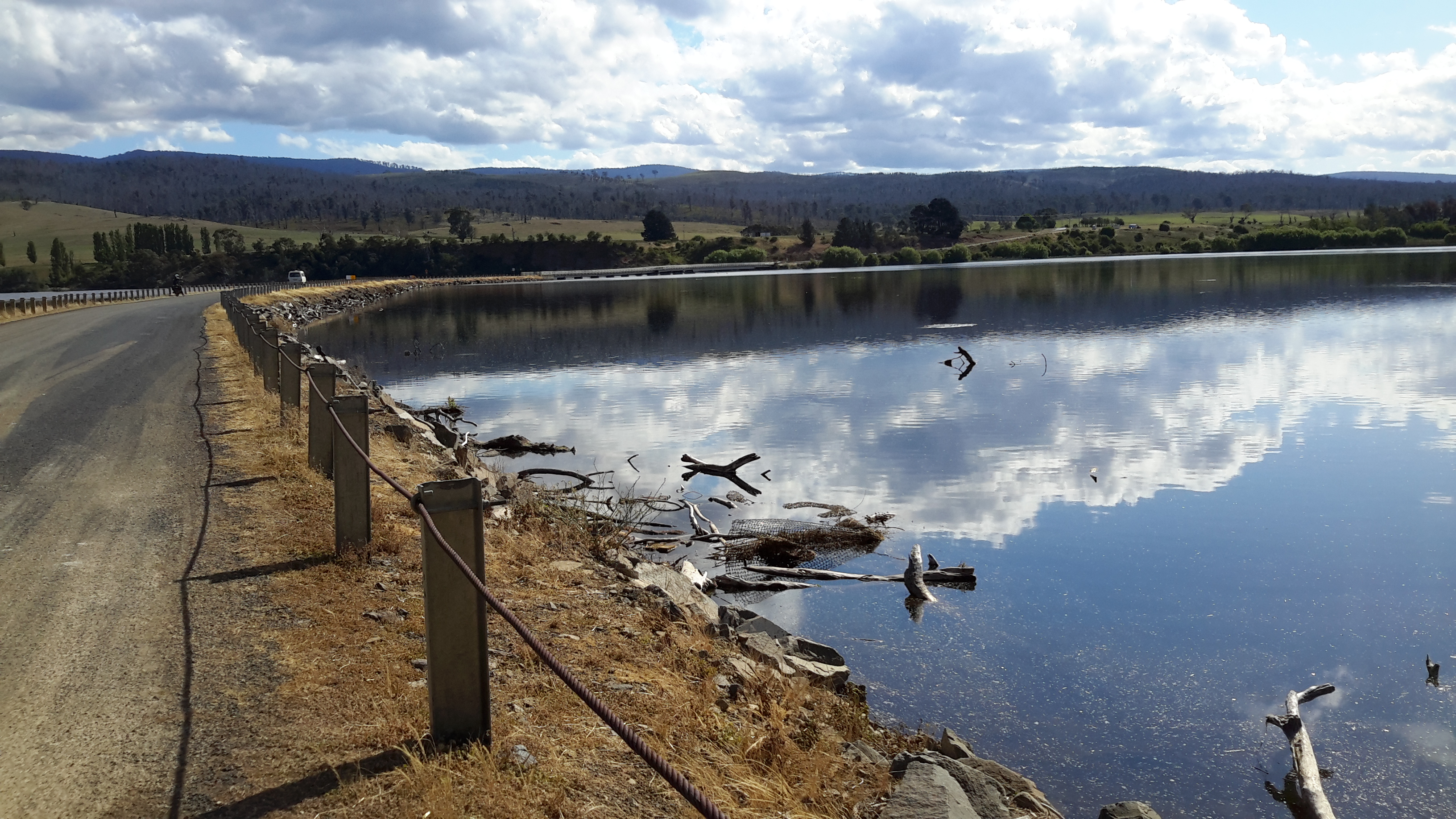
The photos of Chantale, Michelle and I show the current bridge across the northern section of Meadowbank Lake.

IMG_3898Dunrobin bridge.JPG PA280082Dunrobin Bridge over Meadowbank Lake.JPG

20151028_114634

At ground level, the Dunrobin Bridge curves across the Lake in a stunning simple arc.

20151029_161758.jpg 20151029_161743

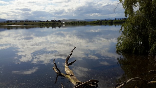
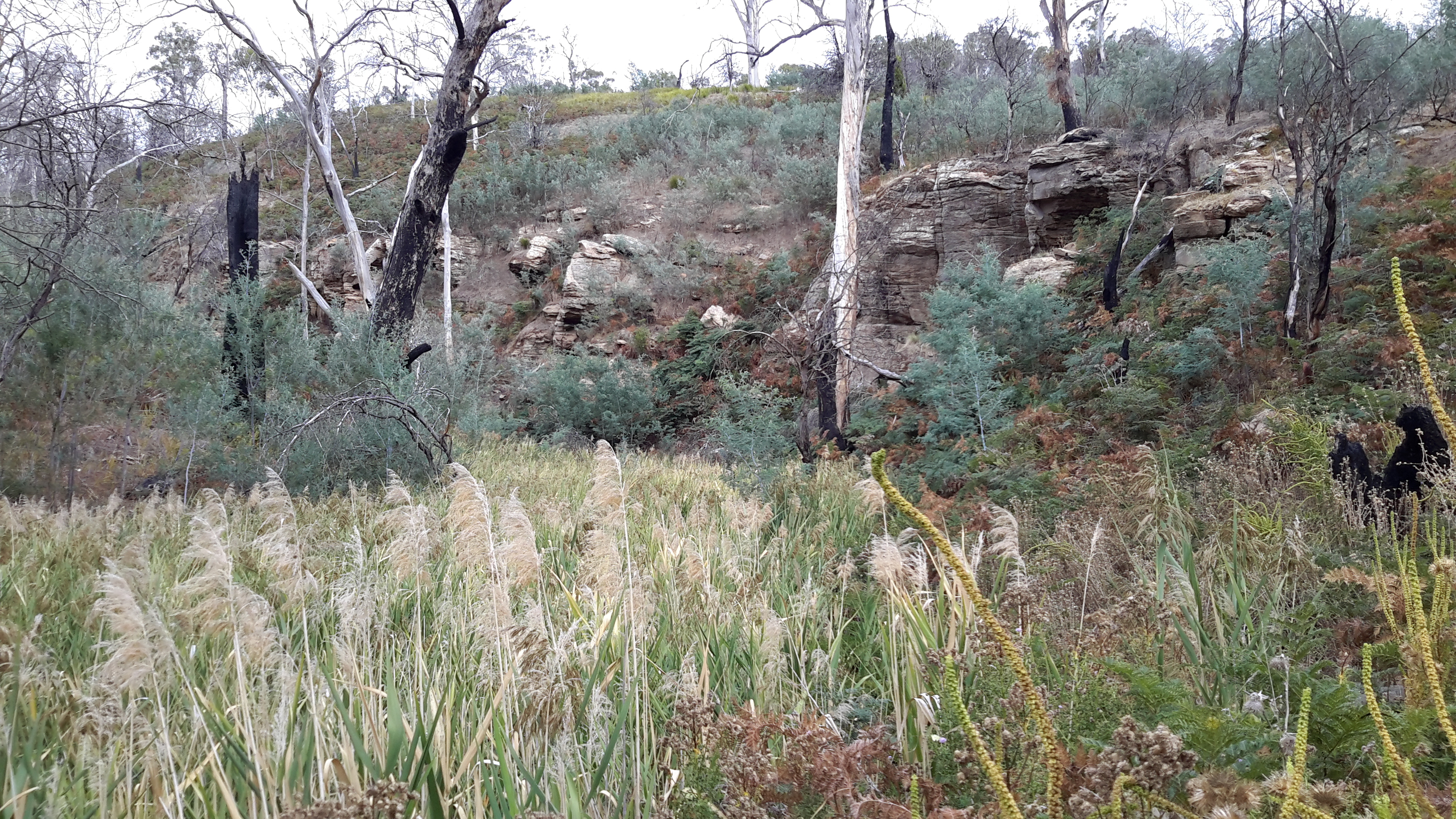
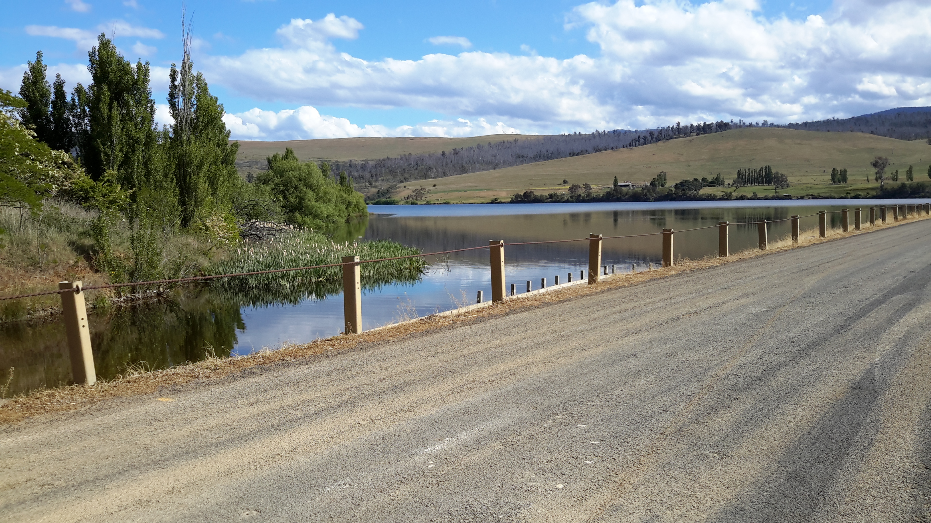
As I walked in the vicinity, time and again I was almost overwhelmed by the beauty of the landscape.

20151029_161746.jpg

20151029_161842.jpg


Possible locations where the Derwent River can be ‘touched’

I have compiled a list of those locations where I believe, with a vehicle, it will be possible to ‘touch’ the Derwent River occasionally along its length between Gretna and Lake St Clair.  Please let me know if any section listed below takes your fancy and if you would be interested to try it out.

Almost all sections include driving on bitumen highway, gravel roads and poor tracks. Some of these may be forestry roads.  If you wish to volunteer to take me to one of these sections (let me know on walkingthederwent@gmail.com), please feel comfortable that your car can handle the different conditions.  Of course, common sense will prevail and we will never push on if a road is too rough for your vehicle and your peace of mind.

If you are happy to help me reach my goal, albeit differently than originally expected, I would like to fill up your tank with petrol as some compensation.  You know my ‘walking the Derwent’ is a non-commercial project, but since I do not own a car nor drive, I need transport – and therefore, I am happy to cover the cost.

  1. On eastern shore – From New Norfolk drive along the Lyell Highway and then, not far past Gretna’s Sports ground, take a left turn into Clarendon Road and drive to farmstead buildings about 250 metres from the river on a hill. Perhaps 140km return trip.
  2. On western shore – From New Norfolk drive along Glenora Road, and turn left at Bushy Park then right onto Meadowbank Road over the Tyenna River then next to Derwent, then on over Meadowbank Creek to a hill top with buildings. It may be possible to continue quite a way on this road. Minimum 130 and maybe up to 160kms return trip
  3. On eastern shore – From New Norfolk drive along the Lyell Highway and turn left off the Highway onto Meadowbank Dam Road. Continue to dam and southern end of Meadowbank Lake. At least 170 kms for round trip.
  4. On western shore – Travel from New Norfolk and turn left into Gordon River Road at Bushy Park, then turn right off Gordon River Rd into Ellendale Rd and then right onto Rockmount Road before you reach the township of Ellendale. There seem to be many dirt forestry tracks to Meadowbank Lake. At least 170kms return trip and maybe 200kms return or more depending on roads.
  5. On western shore – Travel from New Norfolk and turn left into Gordon River Road at Bushy Park, then turn right off Gordon River Rd into Ellendale Rd and drive on through the township of Ellendale until you reach Dawson Rd / Dunrobin bridge over Meadowbank Lake. Turn left before bridge and it seems we can drive 2kms further up along the Lake edge. Return to Ellendale Road, cross bridge and connect with the Lyell Highway. At least 170kms return trip and maybe 200kms return or more depending on roads.
  6. On eastern shore – From New Norfolk drive up Lyell Highway and continue past the left turn off to Dunrobin bridge and afterwards and to the left there are a number of dirt tracks seemingly without gates. After a while these tracks/roads only extend to the Ouse River and not the Derwent River so map consultation is crucial. At least 180kms return and maybe over 200kms return depending on how many side roads/tracks can be driven along.
  7. On eastern shore – Drive up Lyell Highway past Ouse then turn left at Lake Repulse Road. Continue to intersection with Cluny Lagoon Road and turn left and go to Cluny Dam. Return to intersection and continue on Lake Repulse Road to the Repulse Dam. Can cross a bridge and continue back south around Cluny Lagoon to a ‘settlement’ named Cluny.  Perhaps could access this road from the Ellendale Rd on the western shore? By driving north from Repulse Dam along Dawson Road/then renamed Thunderbolt Road it seems we can take right hand detours to Lake Repulse. Over 200kms maybe 250kms or more minimum round trip.
  8. On eastern shore – Drive up Lyell Highway past Ouse, over the Dee River until the sign appears for a left turn at Catagunya Road. Drive down to Catagunya Dam. 200kms minimum return trip
  9. On eastern shore – Drive up Lyell Highway past Ouse, over the Dee River, past Black Bobs and turn left at Long Spur Road. This runs around Wayatinah Lagoon. Go past the intersection to Wayatinah Dam, turn left and travel to Wayatinah Power Station on Lake Catagunya. Return to intersection and turn left and travel to Wayatinah Dam. Cross bridge and continue on to Wayatinah township. Access dirt tracks in the vicinity of all. Drive south from the Wayatinah Dam on the western shore along the Florentine Road but don’t bother crossing the Florentine River because the road goes inland away from the river. Minimum of 230kms but most likely  at least 300kms round trip.
  10. On eastern shore – Drive up Lyell Highway and when you reach a canal passing under the road, and where the road turns right to go to Tarraleah, go straight ahead on Butlers Gorge Road. Note there are limited roads off and around going closer to the river near that intersection. Continue along Butlers Gorge Road for 10-15 kms heading for Lake King William. Reach Clark Dam and Power Station. Continue onto Switchback Track along side of Lake King William. This track stops and you have to return the same way – swamp separates you from the track north about 500 metres away. This would be a big day and I suggest take overnight accommodation at Tarraleah before setting out. PERHAPS it is possible to walk across the swamp and then walk about 7 kms to Derwent Bridge. Unknown over 300 kms return trip.
  11. On eastern shore – Drive up Lyell Highway to Derwent Bridge and continue past to left hand turn off on the western side of Lake King William and drive the track to the lake. 360 kms return trip minimum.
  12. On eastern shore – Drive up Lyell Highway to Derwent Bridge. Walk from the bridge over the Derwent River near the township of Derwent Bridge to St Clair Dam at the bottom of Lake St Clair Lagoon where the Derwent River starts. Walk to Pump House Point and St Clair Weir at the southern end of the Derwent Basin. 350kms return trip minimum.