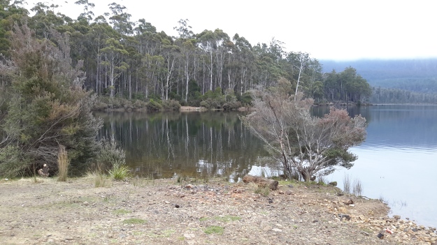
Tag Archives: Wayatinah Power Station

From Catagunya to Wayatinah – post 4 of 4

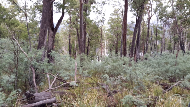
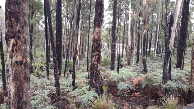
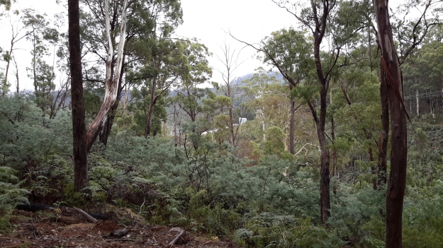
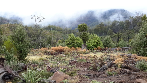
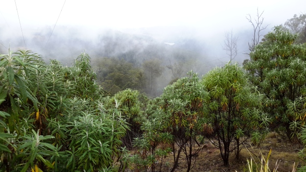
I took a series of forest photos most of which are blurred. I am adding some here to give you an idea of what parts looked like – sorry about the quality.

20170424_113247.jpg

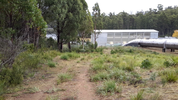
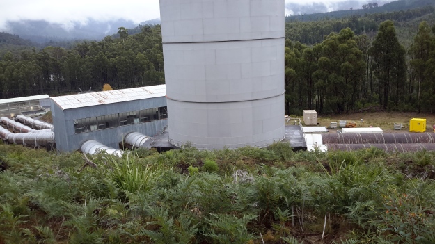
20170424_111909.jpgThen the white shape of the Wayatinah Power Station appeared between the tree trunks.

20170424_114138.jpg

20170424_113538.jpg

The closer I came to the Wayatinah Power Station the steeper the hills seemed. For vehicles travelling down the road, the final gradient requires a low gear in a 4WD. The drizzle on a day like the one on which I went, meant the clay and soil track surface was exceptionally slippery and dangerous for the inexperienced or inept.

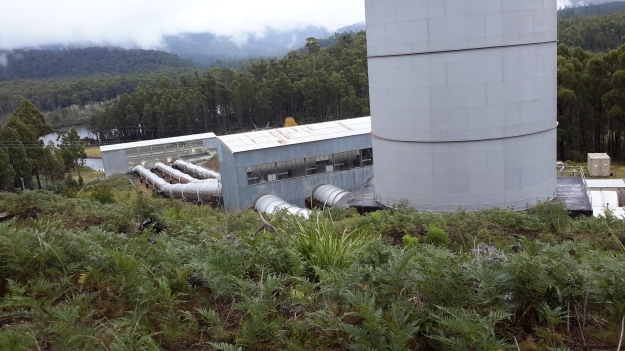
Then I was out in the open again. This time looking down to Lake Catagunya past the Wayatinah Power Station.

20170424_114211.jpg

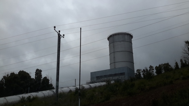
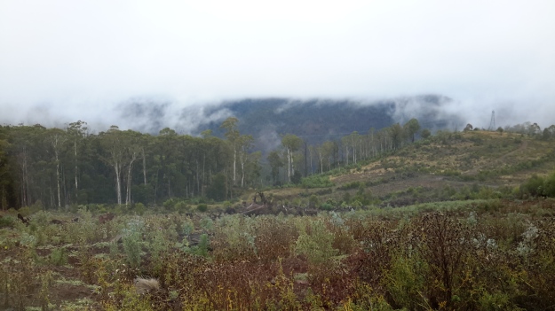
To my right, additional infrastructure punctured the sky.

20170424_114227.jpg

20170424_114340.jpg

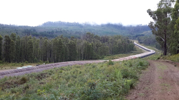
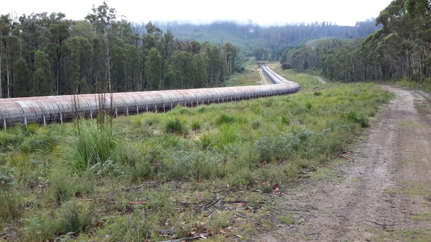
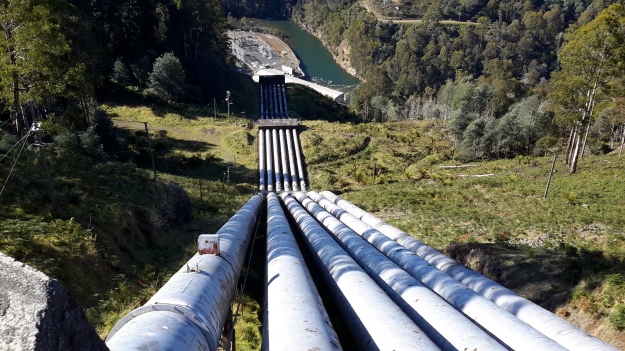
Further up the hill and connecting to the huge surge tank, the snaking length of wooden penstocks started.  See my earlier post for more information about wooden penstocks here. Can you remember the wonderful photos which Andrew took in this blog posting?  My photos are less detailed but still show the dramatic line of the penstocks.

20170424_114338.jpg

20170424_114345.jpg

20170424_114515.jpg

I ended the day with a thick coating of mud on my boots and a smile on my face. Yet another day offering me a memorable experience along the Derwent River. I am especially grateful for the extensive information and access provided by GL. Please note that private and corporate owners control access to this section of the Derwent River and the many gates are locked with an assortment of sophisticated processes. General public access is not available.

From Catagunya to Wayatinah – post 3 of 4


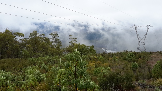
I followed a road aiming to intersect with the transmission lines ready to follow that towards Wayatinah to the extent it would be possible.  Massive heavily forested gullies made continued close access to Lake Catagunya (full of Derwent River water) impossible.

20170424_110654.jpg

Even the cleared area wasn’t clear enough for anyone to walk through on foot, although it was sufficiently clear to keep the power lines unaffected.

20170424_110907.jpg

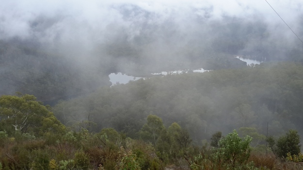
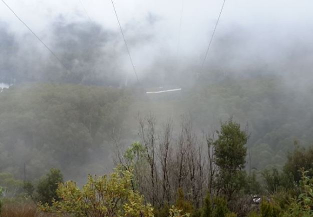
When I stood on high, misty wisps reshaped distant hills and threatened to obliterate views of Lake Catagunya. Fortunately I could always see its glistening surface way below.

20170424_111136.jpg

20170424_111350.jpg

On top of the second last hill before reaching Wayatinah Power Station, the western end of Lake Catagunya appeared through the clouds.

20170424_111533.jpg

Before long the metal pipeline streaming water into the Wayatinah Power Station became visible.

pipelinewpscropped.JPG

Often the bush was amazingly quiet. This film  seems to be without sound. Only near the end can the faint crarking of a crow be heard.  This bush silence was an unexpected beauty of my day from Catagunya to Wayatinah.

From Catagunya to Wayatinah – post 1 of 4

Well over a year ago, one morning I walked through smoky air westwards into the Catagunya Power Station.  After a night camping, entwined by the thick atmosphere of a far distant bush fire and desperate for water, I was relieved to be received hospitably at the Station.  At that time I was thrilled by a guided tour of the building and its operation, however I never proceeded to walk the extra few hundred metres to look at the Dam wall holding back the large Lake Catagunya.  I was most grateful when many months ago, my walking proxy Andrew climbed the hills from Wayatinah Power Station to arrive at and photograph the Catagunya Dam.  A blog search using “Catagunya” as the term, will help you to locate those past stories plus a swag of descriptive photographs.

Recently, I was privileged to make the journey between the Catagunya and Wayatinah Power Stations and to experience that stimulating environment. Thanks to the generous assistance of GL from TasNetworks,  I was able to enter the locked Catagunya Road off the Lyell Highway, and travel the 8 or so kilometres to the Catagunya Dam.

The wall of the Dam curved magnificently and  the landscape-green Lake Catagunya spread impassively to the west. 20170424_104221.jpg

20170424_104055.jpg

Below I could see the old Derwent River bed as a rocky almost water free pathway.

20170424_104042.jpg

Bypassing the river bed, a massive Canal drained water from the Lake into the Power Station. It appeared as a giant marker on the landscape that seemed much wider and more substantial than the Tarraleah Canals that run from Lake King William and the Butlers Gorge Power Station further inland.    20170424_104148

20170424_104228.jpg

20170424_104330.jpg

20170424_104504.jpg

The apparently still Canal water was deceptive. Only on closer inspection could I see the dramatic gush of water moving underneath the left hand entrance at the end of the race.  Obviously electrical power was being generated in the Catagunya Power Station that day.

From vantage points near the Dam and the Canal I could see the Power Station building way below. Oh how tiny it seemed by comparison with the larger constructions. Yet when I had first approached and walked around it, the building seemed cavernous.

20170424_104537 with PSarrowed.jpg

20160210_092533.jpg

More than anything I was as excited as a three year old having a birthday party with lots of surprises.  Recent rain had cleared the air of dust, the day was overcast and the fairy weight of moisture from low clouds kept the air moist. I kept breathing deeply, absorbing the cleanness of the air. Loving the damp air. Feeling cleansed. So profoundly happy to be back in the bush and walking besides my beloved Derwent River.

Between Wayatinah and Catagunya Power Stations- posting 6 of 6


The goal was achieved. It was great to have it done. I am very grateful for Andrew’s generosity of spirit and for his notes and photographs. The walk between Wayatinah and Catagunya Power Stations could be ticked off the list. But a long walk back to the Lyell Highway had to be faced before returning home. Andrew turned north for the 7 km walk on Catagunya Road. He passed a mix of open unfenced paddocks and distant plantations. The Cooma farmstead and outbuildings were the only marker that people had lived in the area.

DSC01747e.jpg

For a brief moment he thought he would have company. Andrew had been walking for a while when, in the distance on a straight stretch of road, he could just make out a couple of figures coming slowly towards him.  Someone to say g’day to and have a natter  – but  – on closer inspection they transformed into ambling sheep. After that, Andrew’s company all the way back to the locked gate was a rather large herd of very healthy looking quadrupedal steaks – which, with a spritely step, he kept ahead of. After some 7 hours of pleasant walking, this walk along the Derwent River was over.   There had been time for plenty of stops during the day to take photographs and to enjoy the surroundings.

Hydro Tasmania, TasNetworks and forestry related employees can drive over the convoluted maze of tracks between the two dams, but there are numerous locked gates and no general public access.  Even during the walking, many locked gates with serious double and complicated locks were seen. I have said in earlier postings that landowners and managers in the Derwent Valley and Central Highlands can recite histories of bad experiences with people entering their lands and not treating it appropriately or stealing their wood or livestock. It is a shame that a few people wreck it for the rest, and remove the opportunities for those who care for the land and the property of others and wish to explore more of our wonderful Tasmanian natural environment.


Between Wayatinah and Catagunya Power Stations- posting 2 of 6

Throughout the walk between the Wayatinah and Catagunya Power Stations, a number of creeks cut across the power line easement creating deep gullies with their own special environments of thick forests. In some spots these make progress slow.

Only the first creek had running and potable water. The other creek beds were dry and even if water had flowed, the extensive plantation forests or agricultural lands where chemicals are used, sit upstream so it would have been inadvisable to drink the water.

Long term readers know how on my walks I have been able to see the Derwent River (and its lakes and dams)  but in almost all cases I could not reach it to refill my water bottles.  The escarpments, rocks, steepness and dense vegetation to the water’s edge prevented access.  With that constraint plus finding dry creek beds, managing my water supply was always a challenge.  Water, water everywhere/over there but not a drop to drink!  Despite the weight of water, I strongly advise anyone walking inland in Tasmania in summer to carry plenty of water.


Between Wayatinah and Catagunya Power Stations- posting 1 of 6

Anticipating a comparatively easy and short day of walking, my proxy Andrew left Hobart at 7 am and drove westwards and inland along the Lyell Highway, until reaching Catagunya Road where he parked his vehicle at the locked gate.

20151029_145020.jpg

A friend drove him further along the highway, turned left just before the Liapootah Power Station and proceeded along the gravel surface of Long Spur Road towards the Wayatinah Power Station.

He arrived at the western side of the Station but needed to be on the eastern side to start this sector of the walk. Because it was not possible to cross over the Power Station outlet, and access through the Power Station is not permitted, Hydro tracks were followed to the most accessible part further away from the Lake Catagunya/Derwent River. Private vehicle access to the penstocks and beyond was prevented by a locked gate on the approach to the top of the penstocks, so the walk started there around 10 am. While it would have been possible to scramble beneath the penstocks, a detour to where the penstock began high up on the hill seemed like a good idea.

Wayatinah’s penstocks consist of two massive parallel pipes that carry water from the tunnel bored through from Wayatinah Lagoon. The pipes are approximately 1.2 km long and are made entirely of timber – coopered like gigantic continuous barrels. To keep it all together they are tightly bound with steel straps which keep the joints snug, save for the occasional trivial leak. Interestingly, inserted into the walls of the pipes every 50 metres of so, is a fire hose outlet (obviously the timber pipelines are not only protected from the inside!).  DSC01655e.jpg

DSC01657e.jpg

DSC01658e.jpg

The walk began by heading around the top of the penstocks where they emerge from the tunnel.

DSC01651e.jpg

There is an impressive view down the length of the penstocks to where they disappear around a distant bend for the final approach to the Wayatinah Power Station.

DSC01663e.jpg

On the far side of the penstocks a good track leads down to the huge surge tank near the entrance to the power station. The glorious panoramic photo below distorts the view so I have also included a Google Earth aerial shot so you can understand the situation.

DSC01666e.jpg

Google Earth view of WPS and surge tank.JPG

Past the surge tank but before the Power Station, a power line easement heads east, then south east, over a series of ridges and gullies to Catagunya Power Station. The forest next to the track leading to the easement was open with healthy eucalypts, dogwoods and some wattle trees sprinkled across the landscape. The day’s walk was a combination of traversing hills and gullies, and the next photo gives an appreciation of one of the more gentle hills.

DSC01670e.jpg

Because of the steep and scrubby terrain, it was not viable to access or follow against the edge of Catagunya Lake (Derwent River) at water level. Instead, following the power line ‘clearing’ was the smart alternative.

Once serious walking along the transmission line ‘clearing’ began, it was obvious that sections had not been slashed in a long while. The going was irregular with patches of scrubby low level vegetation and fallen logs to negotiate so that, occasionally, Andrew walked off to one side for a clearer route. The next photo shows an example of a less straightforward area along the easement under the power lines, and helps to explain why deviating from this line made sense during the walk.

DSC01678e.jpg

Did you know not all penstocks are constructed using steel?

This post provides a background on an extraordinary feature of the walk between Wayatinah and Catagunya Power Stations along the Derwent River.   It is about one of the great surprises of this  ‘walking the Derwent’ project and, as such, reminds me that even the most ordinary of explorations can unearth new discoveries (for those not familiar with an industry – in this case, the industry involved with penstocks).

Okay okay okay I know some readers will have rolled their eyes wondering what a penstock is.  A penstock is a very large pipe that is laid downhill through which water falls at high speed to an electricity generating power station.  Refer to photos in some of my earlier posts such as: Derwent River water passes via the township of Tarraleah .

My typical experience of penstocks, as conduits for water gushing into electricity generating power stations, is of massive steel structures.  I suspect this would be the expectation for others who have seen Tasmania’s penstocks only from the vantage point of our highways.  For people like me, the wooden penstocks feeding Wayatinah Power Station are astounding and therefore I thought it would be of value to undertake some research and learn more. Andrew’s photo below shows the wooden penstocks emerging from an underground tunnel and sloping down towards the Wayatinah Power Station.

dsc01651e

The questions which come to mind include, are there any other wooden penstocks in Tasmania, what wood is used, when were they built, why weren’t they built with metal, who built them, how effective are they, and what is their life span. In my research a constant term was ‘stave’. A stave is a narrow length of wood with a slightly bevelled edge to form the sides of barrels, tanks and pipelines, originally handmade by coopers.

After a little research I now know that wooden penstocks are not unique to Tasmania and have been built in a number of countries including Britain, Canada and the USA. For example, wooden penstocks were built for hydroelectric facilities in Lincoln County, Wisconsin, USA as shown in this article.  This web site contains a great deal of construction and other information which I imagine is similar to that for Tasmanian wooden pipelines, and therefore worth reading. The photo below, from that website, shows redwood penstocks at the Thomson Hydroelectric Station in eastern Minnesota, Wisconsin.

  redwoodpenstock in USA.jpg

The website answered some of my questions: “Why wood? First and foremost, keep the wood thoroughly wet and it will not rot. If there is an issue, it has to do with the quality of the metal bands. Expansion joints are not required as the wood absorbs the water and expands. Steel restraining bands are used and the wood will expand against those. The metal bands are used only to provide strength. Even when they corrode and lose their strength, the wood will hold together and the bands can be easily replaced. The carrying capacity exceeds that of metal pipe, in large part because the interior walls remain smooth and do not form tubercles. The wood components are easily transported to the sites, which can be remote. No massive hoisting apparatus is needed. They do not require concrete foundations, but “float” on the gravel. The wood is easy to bend, so the contractors can follow a more natural contour; for example, bending around curves. There is no need to cover them. The wood has natural insulation. They can last for 40-50 years. Simple carpentry can be used for repairs. Assembly is easy.

Why do we see so any leaks? Leaks do occur at the end of a stave, at what is called the butt-joint, most often when combined with a breakdown or severing of a steel band at that point. In addition, steel plates are sometimes placed in the slots at each stave end, and these steel plates can corrode. Also, some erosion can occur at the end of a stave, and develop into a hole. In this instance, the steel band in that area might corrode and sever, and the pressure of the water inside might break off a section of the stave, however small. Metal corrosion also sets up a mild acidic condition. The acid can degrade the wood. There can be a breakdown in the staves when the water pressure inside varies a lot. You will seldom see wooden penstocks for example in positions where turbines can vary the water pressure output in large degrees. This creates what is known as the hammer effect which can beat up a wooden penstock quickly. It’s best to try to keep the inside water pressure as even as possible. This said, small leaks can self-repair as the wood expands. Even large breakdowns in the staves can be repaired. In most instances, the leaks are tracked closely and there is very little risk of a catastrophic failure. “

The hole in a penstock and the story of its repair speedily within one week for the Jackson Hydro Station in New England, USA can be seen here. Another rupture coverage, this time in Quebec, Canada is covered here.  I was surprised when this website included photos of other wooden penstocks around the world including a photo of one of Tasmania’s wooden penstocks.  It looks remarkably like Wayatinah’s penstock, and there are outbuildings in view and some dates as well.  Perhaps a blog reader can make a more accurate identification.

It seems there are only two Tasmanian power stations being supplied by water flowing down wooden penstocks: Lake Margaret Power Station (not on the Derwent River) and Wayatinah Power Station.   Wikipedia  explains the situation in relation to the Lake Margaret Power Station here. For more information refer to the fact sheet for Upper Lake Margaret Power Station, the fact sheet for the Lower Lake Margaret Power Station, and a  note regarding Innovation and heritage feature in Lower Lake Margaret redevelopment. Photos of the pipeline can be seen in Lake Margaret Power Scheme A Conservation Management Plan. I found the photos on pages 11 and 19 particularly helpful with pinpointing the location.

In relation to the wooden penstocks feeding the Wayatinah Power Station,  a You Tube video is worth watching. Page 25 of the booklet ‘The Power of Nature’ includes a photo of the woodstave penstocks at Wayatinah. Other informative photos of dams and power stations and penstocks associated with other parts of the Derwent River are also presented.  Most are glamour shots taken from excellent locations and, after the gritty often basic photos which I have taken, these make the extraordinary engineering feats look even more magnificent and significant. This website offers the following information:  “Wayatinah is the sixth station on the Nive/Derwent cascade and is downstream of Liapootah HPP. Water is supplied from a small storage lake called Wayatinah Lagoon and diverted into a 2 km tunnel to two 1.3 km low-pressure wood stave pipelines. Finally, water drops 56 m through three steel penstocks to the powerhouse.”

Now the scene is set for the story of the walk between Wayatinah and Catagunya Power Stations.

Visualising walks in advance is another form of planning

A recent blog posting provided the ‘story’ of how I imagined a walking stage would progress along one section of the Derwent River.  On paper, such visualisations have acted as a planning tool to remind me of the potential challenges ahead and the work I needed to do to make sure I was able to have a safe walk within a reasonable time frame.  Another ‘big think’ happened in relation to the walk between Wayatinah and Catagunya Power Stations.

In the photo below, water gushing from the Wayatinah Power Station adds to the volume of Lake Catagunya near its western extremity.   20151029_090827.jpg

20151029_090233.jpg

This expanse of water, fed by the Derwent and Florentine Rivers further upstream, extends approximately 7 -8 kilometres as a substantial water storage holding until it reaches the Catagunya Dam wall and then passes through the Catagunya Power Station at the eastern end of the Lake. Earlier walks had taken me to both hydro electricity generating power stations, and during one walk I was privileged to be shown over the remote and isolated Catagunya Power Station complex.

20160210_092533.jpg

20160210_093101.jpg

How to tackle the distance between the two locations?  Should I start my walk from the eastern or western end?  Should I walk on the southern or northern side of the Lake? The terrain to be covered included private property so what permissions needed to be acquired and from whom?

At first, I inspected the last official map printed by the Tasmanian government, the 1993 map titled ‘Strickland 4630’ in combination with perusing the Google Earth map for the same territory. In addition, I used my on-the-ground first-hand knowledge of the terrain and the vegetation at both ends of the stage from having visited in association with other walks, and aerial photos taken early during this Walking the Derwent project.

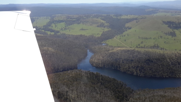
Michelle’s photos show Wayatinah Power Station in the distance near the western end of Lake Catagunya,  a section of the curved shape of the Lake, and Catagunya Dam and Power Station. Each photo clearly shows the incline from water level to the plateau above.

PA280092 Lake Catagunya with Wayatinah PS.JPG

PA280091Lake Catagunya.JPG

PA280090Catagunya Dam.JPG

My aerial photos show  Wayatinah Power Station behind an expanse of Lake  Catagunya, the major inlet close to the eastern end of the Lake, and the Catagunya Dam and Power Station complex.  The density of the forests and the hilly terrain are clearly shown.

20151028_115220 Wayatinah PS.jpg

20151028_115159Wayatinah power station.jpg

20151028_115127.jpg

20151028_115121.jpg

20151028_115107.jpg

Chantale’s aerial photos show the inlet, fed by Black Bob’s Rivulet, near the eastern end of the Lake.

IMG_3888.JPG

What I had seen on the ground and in the air was not what maps showed. For example at the Catagunya end, massive comparatively new pine plantations had swept across hills where natural bush once grew.  This meant that a mesh of unmapped forestry roads would have been built and that these would make navigation confusing without a compass and/or GPS equipment.

Clearly the edges of the Lake were/are exceptionally steep and if my walks elsewhere in the region were used as a guide, the slopes would be a mixture of dense wet rainforest tangled around partially hidden rocky outcrops.  Both sides of the Lake have sections which rise over 200 metres within half a kilometre.  All indications are that walking at water level would be impossible. If Plan A to walk alongside the Lake wasn’t possible, what should be Plan B?

On the northern side, skyscraper-high electricity transmission structures with their connecting wires have been installed in a straight line from the Wayatinah to Catagunya Power Stations and located roughly at the top of the steep incline from the Lake. I felt this line would be the best option for progress. During construction, an area of less than hundred metres wide was cleared to create a pathway for vehicles to use. Perfect for easy walking?  Reflections on past experiences suggest not.  This is rainforest territory and as a constantly regenerating living organism, I realised that I should expect the forest to have begun to re-establish itself. I recalled walking along the ‘cleared’ transmission lines area through the most challenging vegetation on unseeable uneven ground at the northern end of Lake King William. It was slow, tedious work where a snapped ankle was always a possibility.

Thinking of the Wayatinah to Catagunya leg, I made a note to contact TasNetworks to see whether their clearing program had reached this transmission area, and whether I could hope for a reasonably straightforward walk along this line.  Google maps indicate a vehicular road leaves the Wayatinah Power Station area and continues eastwards for the first half a kilometre of the 7 km line of towers.  It seems to stops short of the first heavily forested gully that cuts deeply through the landscape and which contributes water downhill to Lake Catagunya.  400 metres past that obstacle is a new similar impediment to smooth walking.  A third such impasse waits a further 400 metres eastwards.  In advance of the walk, it was easy to imagine the vegetation would be slippery with dripping water from the plants, the light levels amidst the tightly packed vegetation in the ravine would be low, and the flow of water over the centuries would have exposed rocky outcrops that would make descent and then ascent on the other side of the creek time consuming and treacherous.  Until in the presence of each ravine,  judgements could not be made as to whether to walk inland to skirt around the worst of the cuttings or whether it might be possible to descend and ascend on the other side safely and with my backpack still attached to my back.

Approximately half way through the walk after the three creeks, an undulating plateau with a lower gradient should be a welcome change for a few minutes before the terrain drops down to Bushman’s Hill. I would expect this site to be seriously forested and not to offer grand views of the Lake, and I would expect a mesh of unexpected and unpredictable forestry and Hydro Tasmania roads across the land. Ahead the land drops away rapidly, is crossed by another deep creek cutting, until it reaches a significant inlet body of water that is more than 100 metres wide. This water extends inland for over one kilometre.  Into this length of water flows Black Bob’s Rivulet which extends for many kilometres north west of this area. There would be no choice but to walk around this obstacle and cross the Rivulet where possible, until a connection with Catagunya Road could be made.  The degree of deviation will depend on the nature, location and extent of the plantation and natural forests.

Once on the Road, an easy gravel surface leads to Catagunya Dam and Power Station; perhaps 4 to 6 kilometres of road will need to be walked depending on the difficulty getting around the inlet.  After panoramic photos are taken to record the Lake and it’s edges, then a 7-8 km walk to the locked gate at the Lyell Highway will conclude this leg of the walk along the Derwent.

20151029_144956.jpg

All up, and at the best, perhaps 18-22 km would be walked in this stage.  If substantial rerouting around the creeks was required then the distance would be much longer.  Fundamentally, I imagined this was a walk of clambering up and descending steep forested hills relentlessly. Depending on the density of vegetation in the ‘cleared’ transmission line area and then the difficulties crossing the creek cuttings, at best this walk might take 10 hours.  At worst, and probably realistically, it will require sleeping out overnight, and therefore I will walk with the full complement of camping gear.
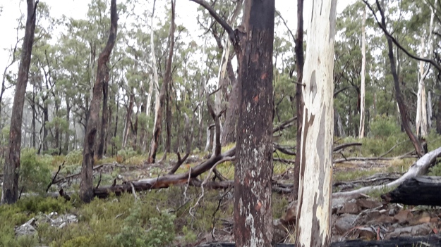
Derwent River water passes via the township of Tarraleah


Earlier this year the entire town of Tarraleah was on the market for sale.  Refer article 1, article 2 , and article 3.

If you were to follow Derwent River water by walking from the western end of Lake Catagunya at the Wayatinah Power Station inland past the Wayatinah Lagoon to the Liapootah Power Station then follow the Nive River to the bridge next to the Tarraleah Power Station (with the Tungatinah Power Station on the other side of the bridge), you could look up the hill to see massive penstock pipes descending the hill from the township of Tarraleah above.

The water falling down these pipes is Derwent River water which has travelled via Tarraleah Canal 1 and Tarraleah Canal 2 after processing through Butlers Gorge Power Station at the foot of Clark Dam that holds back the waters of Lake King William.

I chose not to walk the route via the penstocks and Tarraleah township when walking from the mouth to the source of the Derwent River,  rather to follow the original river bed albeit a scatter of stones and limited water during the summer, between Wayatinah and Butlers Gorge Power Station.

However, knowing that Derwent River water flowed along the Canals and through the massive pipes, I did visit the township of Tarraleah during the period when it was advertised for sale. I was curious to see what the township of Tarraleah looked like (it had been many years since I last visited). Despite being centred within lush dense rainforest, thankfully no rain fell at Tarraleah and the sky was blue and the day sunny when I visited. I approached the town from the highway and followed the slightly snaking pipes.

20160425_132005.jpg

20160425_132023.jpg

At the point where the pipes arrive at the top of the hill and are about to drop down the hill, I browsed public information boards and plaques.

20160425_132500.jpg

20160425_132512.jpg

20160425_132726.jpg

20160425_132711.jpg

20160425_132826.jpg

20160425_141509.jpg

The views from the township were dramatic. I am forever in awe at the engineering achievements of the past.

20160425_132537.jpg

20160425_132615.jpg

20160425_132653.jpg

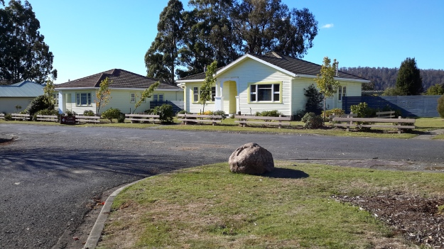
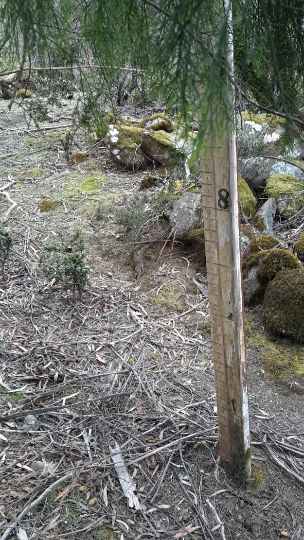
These days Tarraleah is a place that acknowledges its social history from the early days of Hydro Tasmania. I was amazed to see the row of freshly renovated houses each with their own array of pastel coloured paint finishes. Perfect location for a science fiction movie.  I felt there was something strange about its lollipop colours and perfection.
20160425_142056.jpg

20160425_142039.jpg

20160425_144341.jpg

20160425_142110.jpg

Afterwards I travelled out of Tarraleah and down to the bridge over the Nive River. The Tarraleah Power Station was partly hidden in shadow from the afternoon sun. My eyes followed the pipes up the hill knowing the township was there on top.

20160425_145718.jpg

20160425_145849.jpg

The Nive River accepts the Derwent River water after processing for electricity generation through the Tarraleah Power Station.  The water passes through a series of further management processes, and ultimately empties into Lake Catagunya and then continues its long journey towards the sea.

20160425_150151.jpg

I have heard rumours the Tarraleah township sold but I cannot find records supporting this.  I haven’t one idea how a buyer could get a return on an investment of $11 million at Tarraleah, so I will be very interested to hear what will happen to this piece of Tasmania’s history.

Tarraleah Canal No 1 walk – what is the ‘real’ Derwent?

Will the real Derwent River please stand up!   Where should a person walk if they are ‘walking the Derwent’?

Since the Clark Dam was built in 1952, the Derwent River has not flowed from the area now known as Lake King William downstream across its original bed, until closer to Hobart.  Instead the Tarraleah Canals number 1 and 2 accept Derwent River water from Clark Dam/Lake King William at Butlers Gorge in central Tasmania.  These canals channel the water to penstocks that feed the Tarraleah Power Station.  Electricity is generated and then the water flows on to create more electricity at Liapootah then Wayatinah Power Stations.  Eventually the water empties into Lake Catagunya.

Catagunya Dam to Wayatinah PS.jpg

The old Derwent River bed is stony.  Along its length between Clark Dam and the bridge at Wayatinah, seepage from the steep hills creates pools of water.  There is sufficient water, although limited, to create a continuous running flow between the stones.  At the end of Spring the river bed looking upstream from Wayatinah was as follows:

20151029_113841.jpg

Michelle’s photo shows another view.

PA280100 on route to Tarraleah.JPG

In January the water level had dropped and the river bed looked like …

20160115_130425 Derwent.jpg

Similarly, between the bridge over the Derwent River bed at Wayatinah and the river’s meeting with the Florentine River, and downstream almost to Lake Catagunya, the river is often a stony bed with limited flow.

20160115_124544.jpg

Upstream from the junction of the Florentine and Derwent Rivers, upstream from the Wayatinah Power Station, I walked on the river bed where I could.

20151029_101151.jpg

To ‘walk the Derwent’ should one follow the original river bed or the Canals or a mix of both?

Since Tarraleah Canal number 1 runs more or less parallel to the old river bed and is usually located under 500 metres from that river bed, I chose to walk next to the Canal along the section before it turned inland to travel to Tarraleah Power Station. I rather liked the idea of staying as close to the original Derwent River course rather than following man-made deviations. However this ‘walkingthederwent’ project does raise the question as to what constitutes the ‘real’ Derwent River. Does it exist any longer? And therefore, is it possible to walk the Derwent?

Back to the Florentine River

Last year I wrote (The Florentine River flows into the Derwent Riverabout my walk from the Wayatinah Power Station westwards along the north/ eastern side of the Derwent River until I passed the point where the Florentine River entered opposite.  To cover the total distance from the Power Station to the Derwent River near the town ship of Wayatinah, more recently I walked on the south/western side of the Derwent River along the Florentine Road from near the Florentine River.  This short and easy walk, took me mostly uphill on a good gravel road, and allowed me to look down on the running Derwent.  Not a soul on the road, just the sound of birds and gushing water.

20160115_113122.jpg

Thanks to Deb, I was chauffeured to the Florentine River which meant I didn’t need to retrace my steps on that walk. That Florentine River is quite lively.

20160115_112146Florentine river.jpg

20160115_112155 Florentine River.jpg

Soon after leaving the Florentine, a thicket of bush fills the space between the road and the Derwent River.

20160115_113644.jpg

20160115_114026.jpg

As I walked I could see the river below. However now, in the photographs, the colour of the water and the shape of the river rocks blend with the vegetation colours so that I find it almost impossible to identify the water.  But trust me it’s there in the photos below.

20160115_114937.jpg

20160115_114945.jpg


The complex that makes up Wayatinah – posting 5 of 7

The Florentine River flows into the Derwent River.

Westwards from the Wayatinah Power Station, Andrew and I covered some kilometres of bush, clambering over fallen trees and through a mesh of understorey vegetation.  The marks of mankind were clear despite the absence of tracks; various weeds were flourishing.

20151029_091112.jpg

And through the bush in two different locations a well secured lidded white box sat alone with a surname and phone number written on top.  These were not bee hives and we could not determine their function.

20151029_093657.jpg

Once we had walked further westwards past the meeting of the Florentine River with the Derwent River, the Derwent presented with a low water level and stony river base.

20151029_094042.jpg

20151029_094127.jpg

However there were sections containing more water.

20151029_094048.jpg

Along the way we discovered the remains of an old shed and an ancient water level monitoring system, through which a bush fire had passed.

20151029_101015.jpg 20151029_101039.jpg

20151029_100953.jpg

20151029_101649.jpg

Bits of iron and steel were scattered through the cleared surrounds.

20151029_100936.jpg

20151029_100939.jpg

I loved the way the corrugated iron had been ‘stitched’ with wire to create the building. Very enterprising.

20151029_102240

20151029_102243

Amidst this debris a lone native orchid bloomed.

20151029_103015.jpg

Down next to the river bed, a water level height gauge was marked in imperial measurements, therefore indicating a date before the mid-1960s.

20151029_101155.jpg

20151029_101151.jpg

20151029_101548.jpg

20151029_100933.jpg

20151029_101745.jpg

We wondered what sort of electronic or satellite related devices and measurement tools were used these days.

I found this trackless walk to be very hard going (at the pace Andrew set) because negotiating the bush took thought and time.  I reflected on the challenges this section would pose if I had been carrying a full backpack.

Michelle’s aerial view gives an idea of the dense bush on the top side of the River where we walked.

PA280093Florentine & derwent intersection.JPG

The complex that makes up Wayatinah – posting 4 of 7

North west end of Lake Catagunya.

A side track from the Wayatinah Power Station took us to Lake Catagunya where the sign shows evidence of being used for target practice.

20151029_090228.jpg

The Lake was still.

20151029_090233.jpg

Tiny white butterflies flitted at the water’s edge in the tall grasses.  Watch this short video.

An aerial shot by Michelle below indicates the size of the Lake Catagunya. Note the comparatively tiny power station in the centre of the photograph.

PA280092 Lake Catagunya with Wayatinah PS.JPG

The complex that makes up Wayatinah – posting 3 of 7

Wayatinah Power Station

On Thursday 29 October 2015, Andrew drove me off the Lyell Highway and down Long Spur Road to Wayatinah Power Station. An underground pipeline from Wayatinah Lagoon fills penstocks which fall down steep hills to the Power Station.  The water exiting the Station empties into Lake Catagunya, through which the Derwent River flows.

20151029_090827.jpg

Watch the video.

20151029_091538.jpg 20151029_091554.jpg


The complex that makes up Wayatinah – posting 2 of 7

Wayatinah Lagoon

Having taken a turn off Long Spur Road, Andrew and I were the only visitors to this misted expanse of water on the 29 October 2015, the characteristics of which were almost total silence and an immense sense of quiet peacefulness.  I felt privileged to stand in such a serene environment, and smell the clean fresh air.

20151029_084702 Liapootah PS on hill in distance.jpg 20151029_084713.jpg 20151029_084742.jpg 20151029_084845.jpg

Watch the video.

A boat ramp, away from the infrastructure that accepts the water to be transported to the Wayatinah Power Station, ensures the safety of anglers from any unexpected water level changes.

20151029_084906.jpg 20151029_084829.jpg

Michelle’s aerial photo below gives some indication of the size of this Lagoon, and the way the river bed snakes away from it amidst dense vegetation heading towards Hobart.

PA280095 Wayatinah Lagoon.JPG