Category Archives: Hobart

Reliving GASP and MONA with a new walk along the Derwent River

On Stages 9 and 10 of my walk along the Derwent River, I passed the Museum of Old and New Art (MONA) and the Glenorchy Arts and Sculpture Park (GASP).  Yesterday I had the opportunity to introduce two international visitors to these important arts structures.

Mid-morning I met with a follower of my blog, De from upstate New York and her Arizona cousin Ke as we were chauffeured thanks to Ma, from the centre of Hobart to our starting point near the Derwent Entertainment Centre.

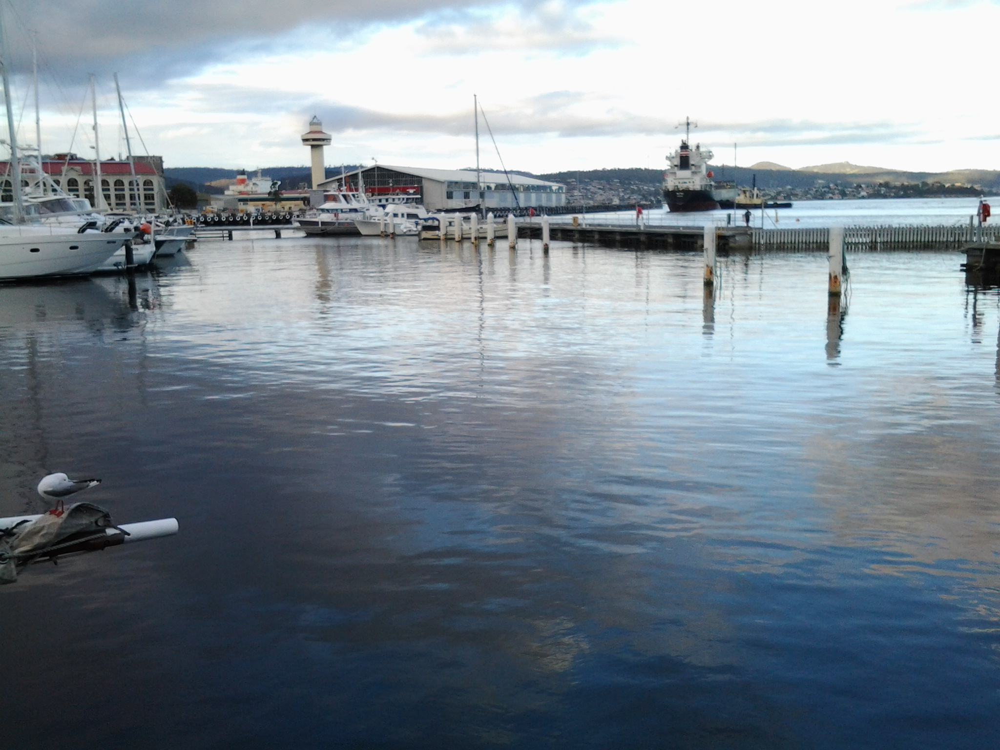
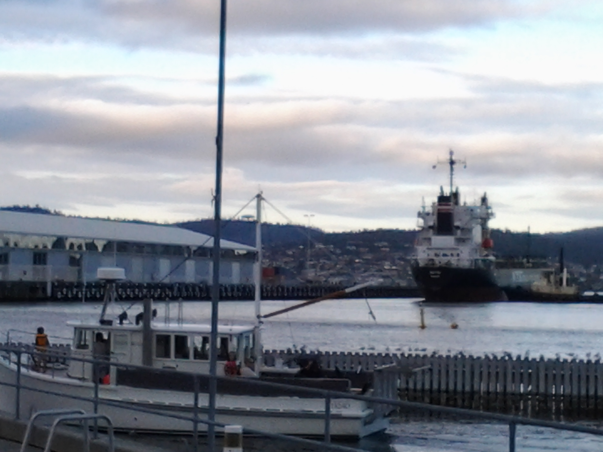
Our excursion started from the Pavilion at the southern end of the Glenorchy Arts and Sculpture Park (GASP) near the Derwent Entertainment Centre.  Do you remember my photos of that surprise pink glass wall?

20150109_085808

From a distance and approaching this structure, it looks dull, industrial and disused. But just as I had felt during my walk, my two new international co-walkers were amazed once we arrived at the site. Quite delightful and I have no doubt De will be displaying her own photos on https://deescribesblog.wordpress.com/ when she has time.

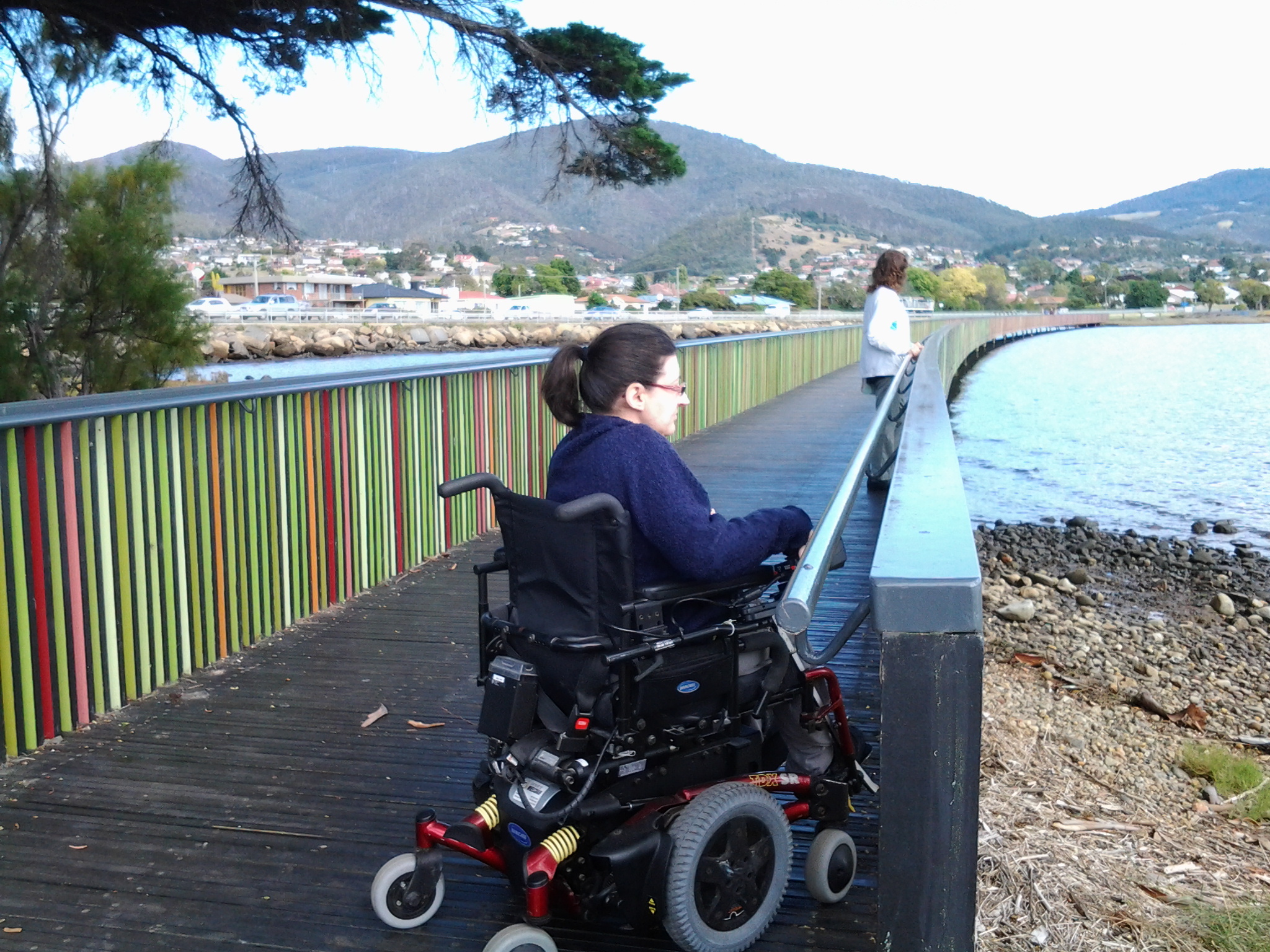
Then we started strolling and rolling along the bike/pedestrian path towards the slatted walkways with their colourful striped edges.  Many photos were clicked every time we reached a new striped walkway with a different set of colours.

20150319_111418

De gets around in a motorised wheelchair so when she spotted a scooter with its dinghy trailer (see photo below) waiting for its owner to return from their boat out on the Derwent River, she stopped in amazement. We talked about how good security seemed to be locally.  The scooter owner had left his/her shoes, helmet and other personal items, and despite a security strap set up to prevent movement, we all knew that enterprising thieves seem to carry bolt cutters with them these days.  But all was well yesterday.

scooter

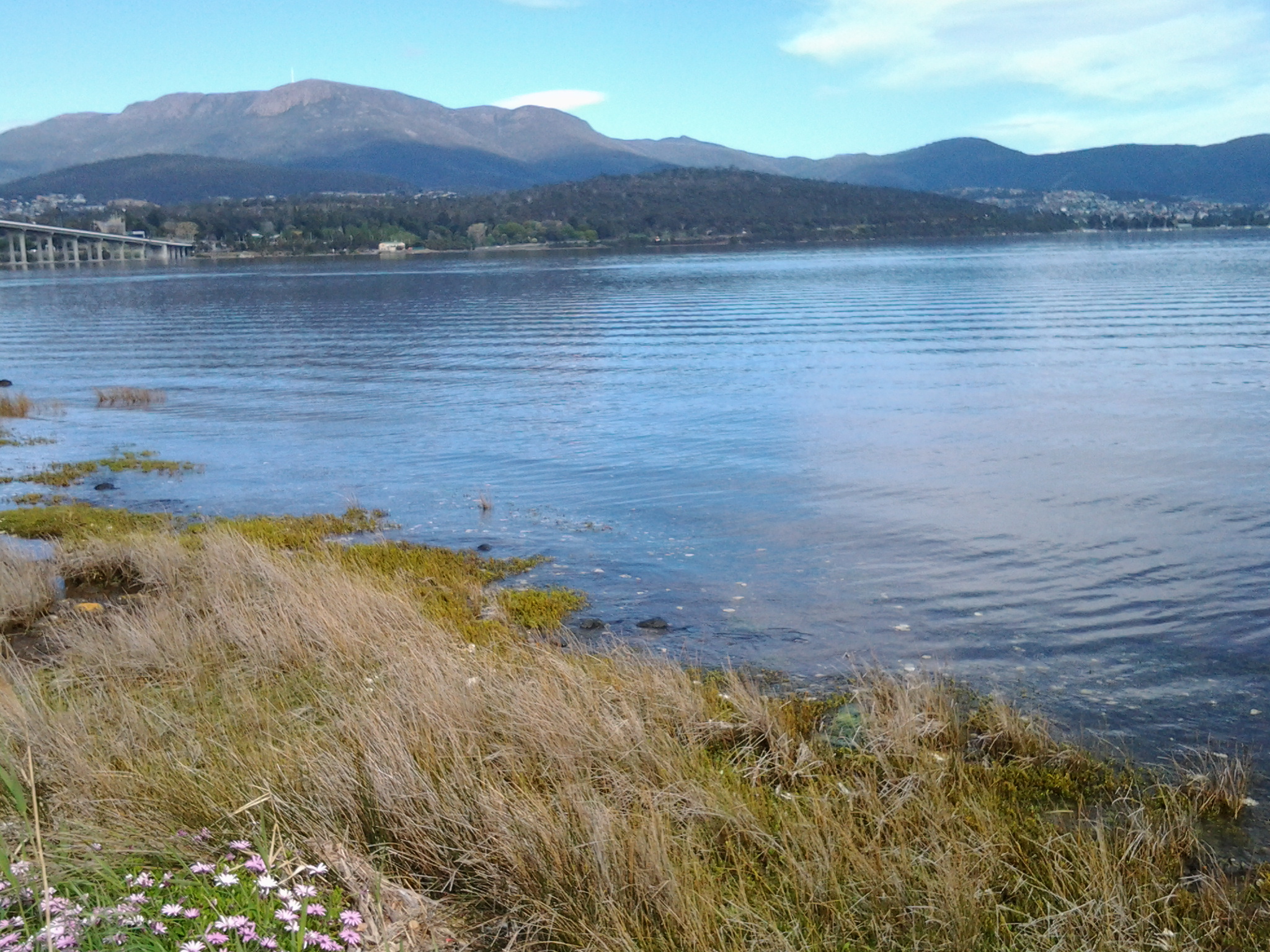
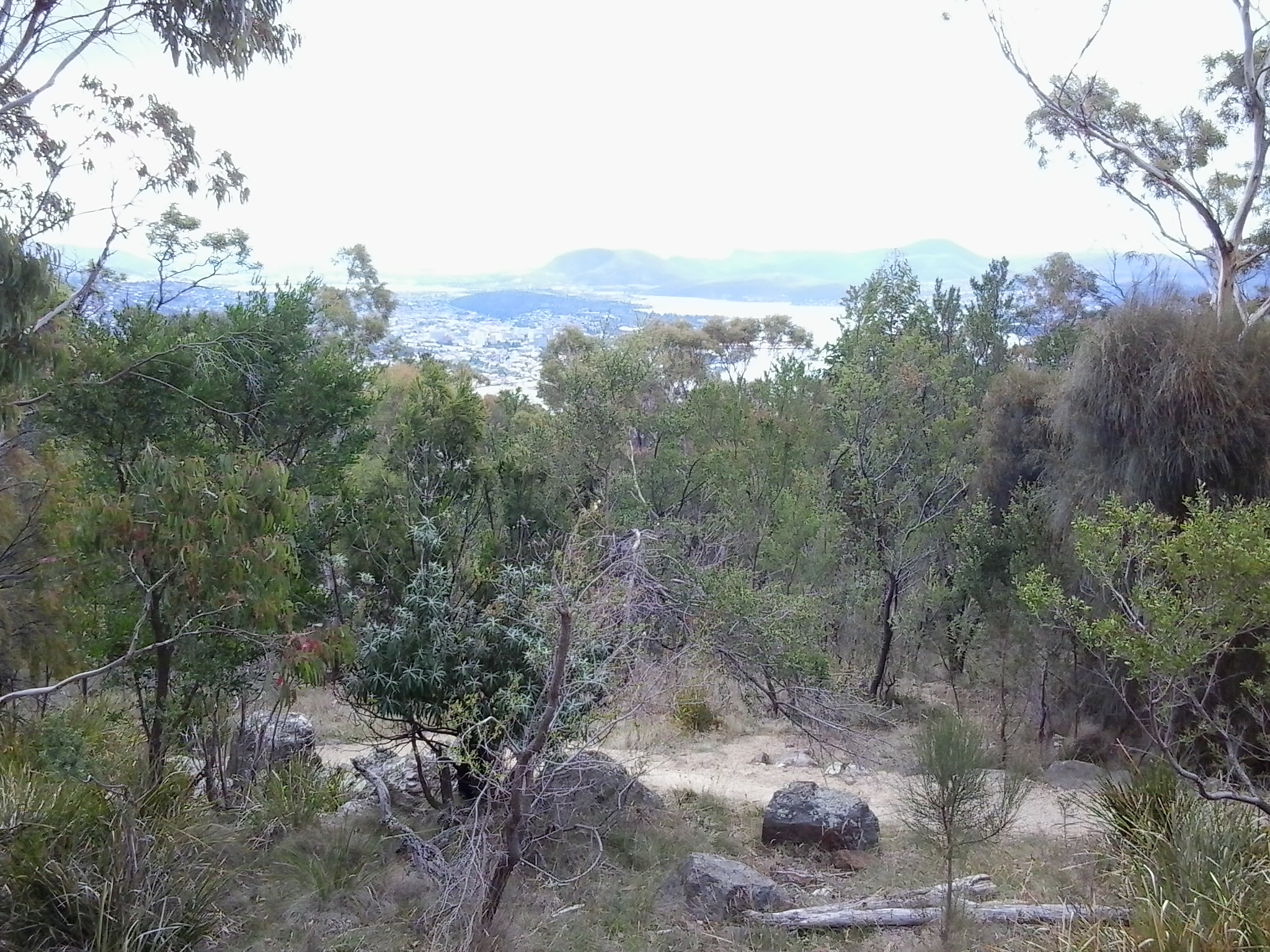
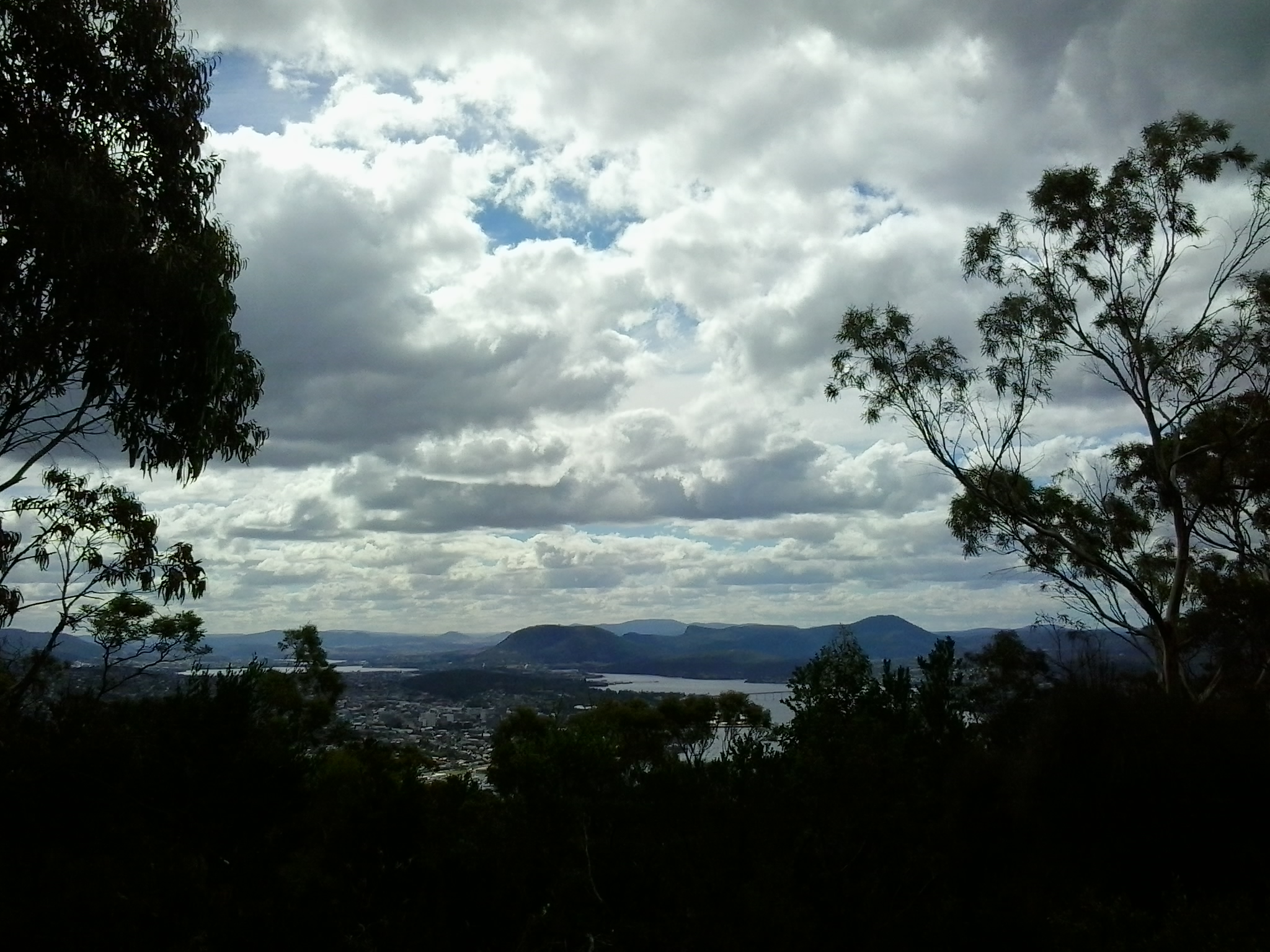
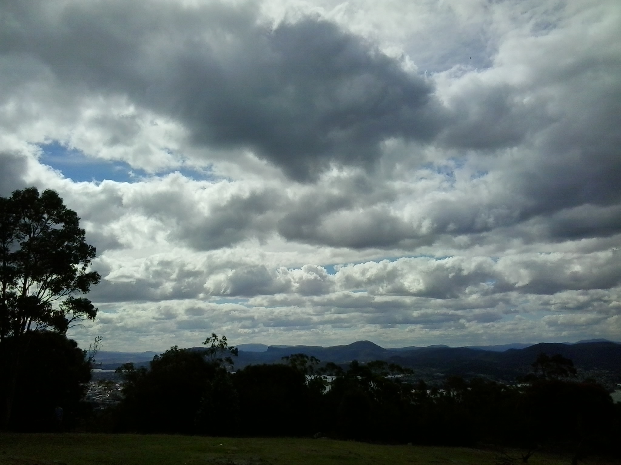
Gradually clouds disappeared, the mountain looked sharp and much of the sky was blue.

20150319_114408

Glorious.  After a very cold North American winter, De soaked up the sunshine as the day warmed and we did everything to stay outdoors that we could.

We continued along the foreshore and turned towards the highway when we reached the Montrose High School. Then we were onto the bike/pedestrian track past Rosetta and into Berriedale before advancing up the entrance incline to the Museum of Old and New Art (MONA).  Along the way we admired the new autumnal colours of the Moorilla grape vines beside the road.

Vineyards

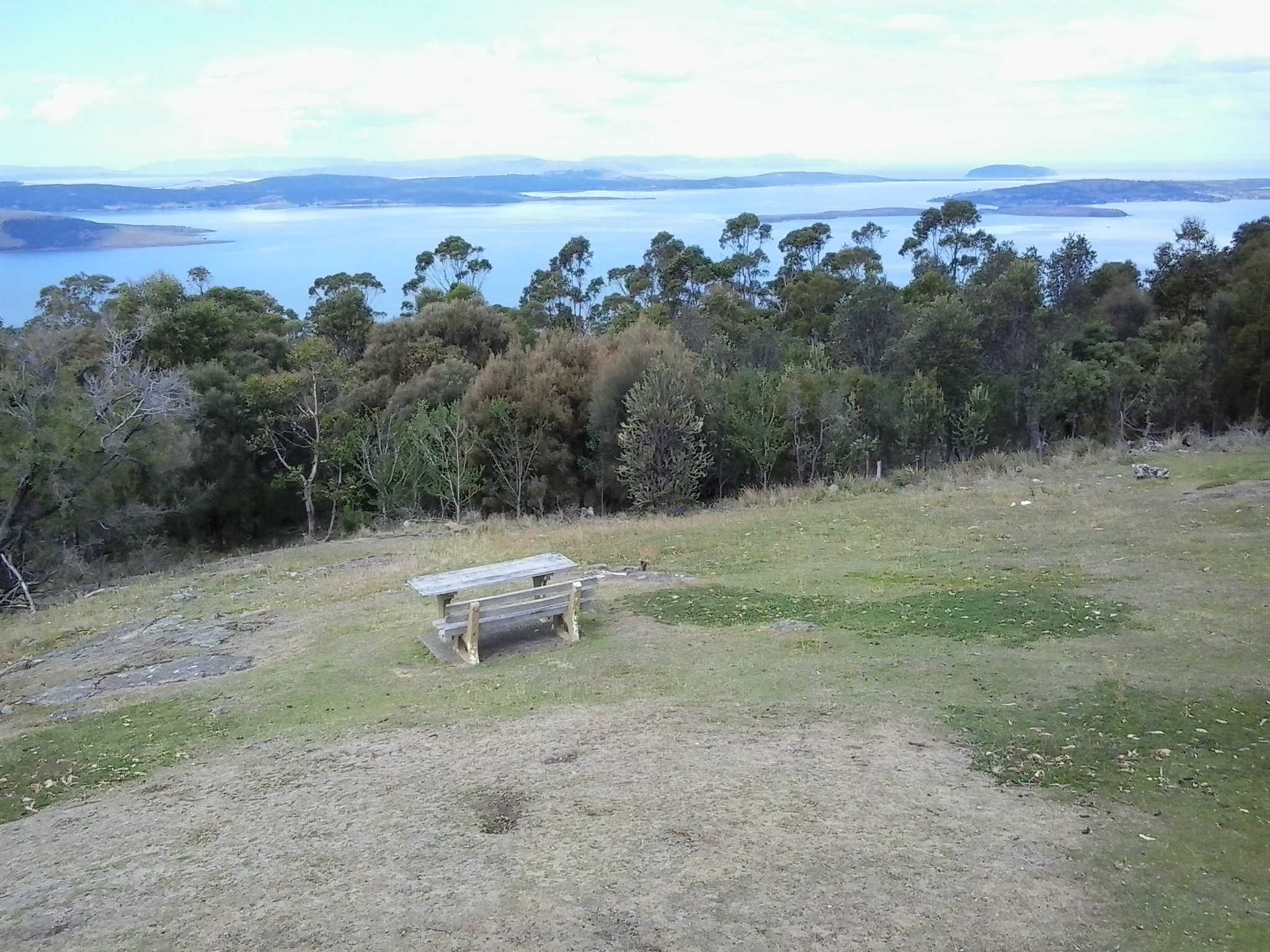
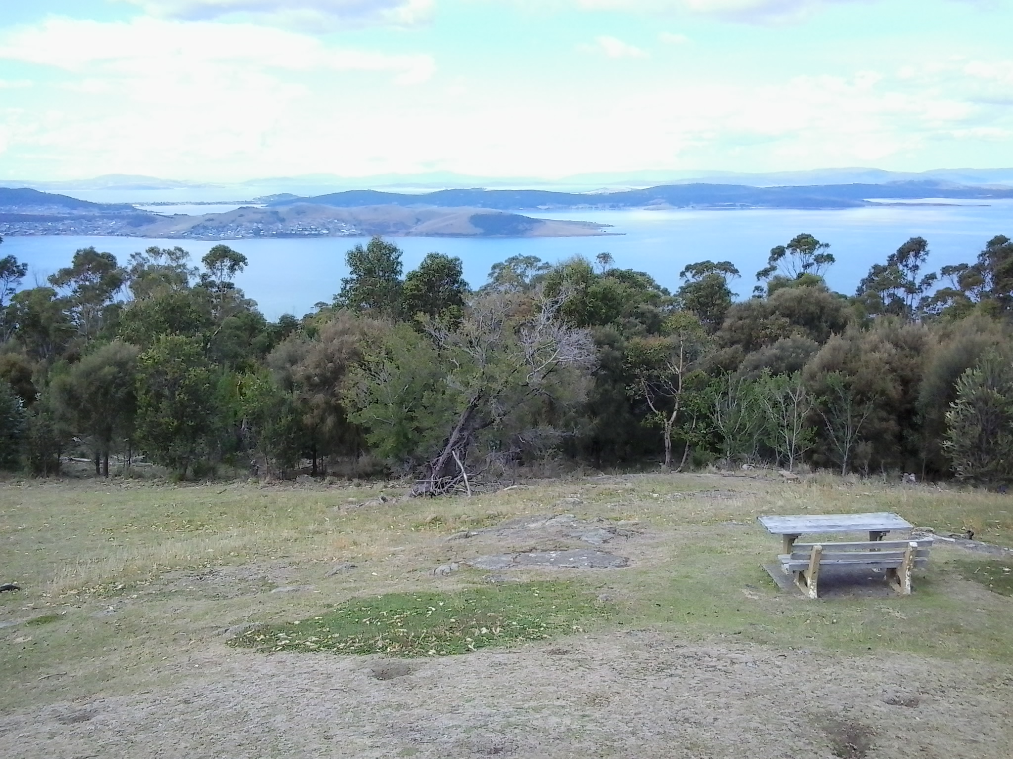
A visit to the exhibitions at MONA requires descent into cavernous spaces below ground so we decided to enjoy a lunch break first.  Despite the busyiness of the café directly above the museum, De motored through gaps in the visitors and took us outside into the open air where tables and chairs are set on the lawn. We admired great views up, down and across the Derwent River.

Our sparkling Moorilla wines were crisp and delicious, and the food choices were expansive.  De and I settled on a soba noodle with spring peas and pickled ginger salad, and Ke tucked into an Italian summer salad which included a great variety of ingredients dressed with the best local olive oil. Ducks and peacocks were out and about, seemingly comfortable with the thousands of visitors that come to MONA each week.

Satisfied by lunch we returned inside and took the lift to the bottom floor of MONA. Over the next couple of hours we wandered through the three levels of exhibits before De and Ke found the upstairs bookshop. The wonderful conclusion to our visit came when De spotted a spectacle outside.  They left the building and, along with a throng of tourists, took photographs of a huge unblemished and bright rainbow crossing over the entire River.

It was a great pleasure to show non-Tasmanians a small part of where I have been along the Derwent River, and De and Ke’s enjoyment enhanced mine. Thanks for your company and best wishes De for your conference presentation in Burnie tomorrow encouraging people to understand there are few limits other than those we set ourselves.

Denise leaving MONA

Both De and Ke gave me permission to include their photos in this blog.

Historic Granton, Tasmania

The northern suburb of Granton on the western shore of the Derwent River adjacent to and extending from the Bridgewater Bridge has significant history in relation to transport and communications across Van Diemens Land/Tasmania. Two heritage buildings, which still stand, are introduced below.

The Black Snake Inn

On stage 8 of my walk along the Derwent River, after I had crossed the Bridgewater Bridge from the eastern shore, I continued south into the start of the suburb of Granton. On that route I soon passed the house in the photo below.

20141111_134404

Located at 650 Main Road, what I was seeing was the building that started life as the Black Snake Inn, apparently Australia’s earliest ferry inn, which was built by the convicts who constructed the Bridgewater Causeway. The Google maps street view of this remarkable building can be seen at https://www.google.com.au/maps/place/650+Main+Rd,+Granton+TAS+7030/@-42.751047,147.229129,3a,52.5y,209h,90t/data=!3m4!1e1!3m2!1sTcT1xn5QTiR_rSA4AsFFbg!2e0!4m7!1m4!3m3!1s0xaa6e12713b1bfcbb:0x1a0841b5479abad1!2s650+Main+Rd,+Granton+TAS+7030!3b1!3m1!1s0xaa6e12713b1bfcbb:0x1a0841b5479abad1!6m1!1e1?hl=en

According to http://www.werelate.org/wiki/Person:George_Robinson_%2838%29, Rhode Island born George Robinson erected a new Black Snake Inn on an earlier ferry Inn in 1833 and continued his business at the Black Snake until 1837.  Robinson showed his enterprising ability in a newspaper notice: “MR. G. W. Robinson has this day started a Van with two splendid horses for the immediate accommodation of persons travelling up and down from the Ferries. The Van will leave the Black Snake at half past nine every morning, and leave Hobart Town at 2 o’clock every afternoon…

Charles F Tomkins

Artist Charles F Tomkins (1798-1844) produced a hand coloured lithograph titled The Black Snake Inn and this was published in London by Smith & Elder in 1833 (Reference: http://catalogue.statelibrary.tas.gov.au/item/?id=98999)

According to the http://www.heritage.gov.au/cgi-bin/ahpi/record.pl?RNE10944 record (of March 2015), The Black Snake Inn ‘is significant for its association with Derwent River ferry and road crossings. Until 1836, when the Bridgewater Causeway was completed and before a bridge completed the crossing in 1849, ferry transport was the only means of crossing the Derwent River. It is significant for its initial function as a ferry inn accommodating passengers using the commercial ferry services run by the Inn’s operator. In addition, the Inn is significant for providing accommodation for travellers on the Main Road between Hobart Town and New Norfolk, and those using the Bridgewater Causeway. Between 1819 and 1825 the diary of Reverend “Bobby” Knopwood noted frequent visits to the Black Snake Inn which was often referred to as the “half way” house. Governor Arthur’s Land Commissioners visited the Black Snake Inn in 1826, remarking that its licensee, Presnell, was in the “true Style of a selfish Settler” giving all who passed “all the trouble in his power”. By 1833, the Inn was acquired by George Robinson. By August he had built a “new house’ at Black Snake and advertised the lease for the old inn premises as a possible store. His new Inn was drawn by Louisa Meredith, probably in the mid-1840s and the structure depicted is almost certainly the building known as the Black Snake Inn today, showing the same form. It is possible that a new facade was erected some decades later because the Victorian Rustic Gothic style became more common after the 1840s.’ This website provides extensive additional historical, architectural and social information.

The site http://www.watersideaccommodation.com/downloads/HistoricalSummarytheClaremontAustinsFerryArea04May07.pdf contains an alternative photograph of the building.

I am grateful to Tasmanian collector and historian George Burrows for his reminder to create a posting about the Black Snake Inn.  In addition, he told me… “I am probably one of the few people who have canoed the river from source to Hobart BEFORE the dams were built.”  How remarkable is that!  Very impressive.

The Old Granton Watchhouse

The building, located at the junction of the Brooker Highway, Lyell Highway and the Bridgewater Causeway, was built by convicts in 1838. Extensive information and photographs can be seen at http://ontheconvicttrail.blogspot.com.au/2014/10/old-watch-house-granton.html

The starting point for Stage 14 of my walk along the Derwent River will be near this Watchhouse.

Kunanyi

Mount Wellington was a prominent feature in the lives of the Moomairremener people for thousands of years before white settlement of Van Diemens Land, later to be renamed Tasmania.  The indigenous names include Kunanyi, Unghbanyahletta and Poorawetter. I understand that the Palawa (which seems to be a collective term for all Tasmanian aborigines – perhaps a blog reader might be able to supply further information?) who are the surviving descendants of the original indigenous Tasmanians, tend to prefer the former name – Kunanyi.

A couple of years ago, the Tasmanian government introduced a dual naming approach to a number of geographical features around Tasmania, and these included the mountain which towers over the Greater Hobart Area and the Derwent River. The then Premier Lara Giddings remarked ‘Dual naming is about recognising the Aboriginal community’s rightful status as the first inhabitants of this land and celebrating their living culture, traditions and language’.

20140926_123103

Photo taken from Bellerive Bluff on Stage 4 of my walk along the Derwent River.

20141010_103145

Photo taken between Rose Bay and Lindisfarne on Stage 5 of my walk.

20141031_132509

Photo taken from Old Beach on Stage 7 of my walk.

20141111_104035

Photo taken from Green Point on Stage 8 of my walk.

I am including a posting specifically about ‘the mountain’ as locals refer to it, because it has been a significant marker on my trek from the mouth to the mouth of the Derwent River via the Bridgewater Bridge, and I am about to lose sight of it.  From Granton, as I walk west along the River and then northwards, the mountain will no longer be in view.

Current official information about walking tracks, facilities, weather related precautions and other details associated with the mountain can be read at http://www.wellingtonpark.org.au/  Note that you can download maps from this site.

International traveller may join me for a walk

A few months ago I was excited when a blog follower from upstate New York, told me she was coming to Tasmania and would love to take a walk with me to see some of the sites I have shown in my postings.  With increasing anticipation we have corresponded and now I expect her arrival this week. Sometime around midweek we expect to undertake a comparatively short ‘stroll’ from the southern end of the Glenorchy Arts and Sculpture Park (GASP) over the wonderful striped edged walkways over the edge of the Derwent River.   Do you remember them? For example,

20150109_083005

and

20150109_084404

Then we will head northwards into Berridale and on to MONA (Museum of Old and New Art) with all its fascinations.  Perhaps we won’t be able to get away but if we do, there is always the possibility we might continue on to Cadburys chocolate factory. This doesn’t seem too shabby an itinerary.  What do you think?

Of course we will exercise our right to choose somewhere else to walk if we wish.

If anyone else is visiting and wants to relive a section of the edge of the Derwent River over which I have passed, please email me on walkingthederwent@gmail.com.

My first walking story video

Thanks to Lara Van Raay, Producer with ABC Open for southern Tasmania, I completed a 3 hour workshop devoted to editing a series of brief video shots that I collected during the week. When long-term blog followers look at my final video story, they may recognise the location. I covered this area in stage 5 of my walk along the Derwent River, when I walked from Rosny Point to Geilston Bay.

This video can be seen at https://vimeo.com/122073284 or

https://open.abc.net.au/explore/14ov5vx

I used VideoPad by NCH Software (http://www.nchsoftware.com/videopad/) for sequencing and editing the video clips. This is freely downloadable. I found it easy to use initially and even easier after taking time to watch some of the excellent and simple online tutorials.

Once the video was complete I uploaded it onto Vimeo (which, unlike You Tube, isn’t a site with advertisements). From Vimeo, I have added the video story to ABC Open’s projects ‘where you will find me’ category (refer https://open.abc.net.au/explore/14ov5vx).  If you are Australian and write stories or make video stories, you can find a place to upload them onto the ABC Open site; it is one way of sharing experiences around our country.

This is my first attempt at story creation in video and I recognise both my filming and editing are very rough around the edges.  Nevertheless, everyone has to start somewhere. During the coming winter months when I cannot continue my walking in the centre of Tasmania because of miserable weather conditions, I may use the opportunity to work on story lines with locations closer to home.

Happy viewing!

I pay my own way as I walk along the Derwent River

stockfreeimage.com Aust money notes rolled

Some friends feel sure I must be asking for freebies, discounts, backhanders, cash-in-hand or other special deals from businesses, restaurants, accommodation facilities, buses and other organisations which I comment on in my blog, as I pass along the Derwent River.  No, I do not. I have not asked for, I do not seek for, and I do not expect to receive service or goods for free or cheaper simply because I have something to say about them in my blog.

I would not like to feel fettered by an obligation to ‘go easy’ on a business or product which was substandard.  I would not like to feel pressured to remark on a particular product or service that I was not interested in, or I could not make relevant to the walk along the Derwent.

In the current environment when travel writers routinely have their costs covered and often have access to premium products and services for no charge, I can understand why some people might be surprised to learn I have not joined that gravy train. That way of funding travel is not necessary for me; to date, my only cost has been small local bus fares.  I would like to be able to make any comment I prefer about Hobart’s Metro bus service and, therefore, I have not approached them for assistance.

Of course, the future is a different place and when I venture northwards, no longer will I be able to organise walks as one day events.

I will need places to stay overnight occasionally. In addition, I will be using different public bus services so my costs may be greater than those which I am used to. Despite the likelihood of increased costs, I view these walks as my ‘holidays’ and I am prepared to pay for them.

When I started the blog, one of my intentions was to inspire local people to follow in some or all of my footsteps. I want local readers to know exactly what the situation is and so my walks will not be doctored by special privilege.

???????????????????????????????????????

Another matter concerns me.  I hear rumours that a few tourism operators away from the main cities and towns are not always serving their customers in the hospitable contemporary way many of us feel visitors to Tasmania should expect.  If I find some ‘bad eggs’ in the more remote parts of Tasmania, then I want to be able to expose their weaknesses or recommend possible improvements in my blog (and probably on Trip Advisor as well).

??????????????????????????????????????????????????????????????????????????????????????????????????????????????????????????????????

(Photo above ‘Fresh Start” from Dreamstime.com)

On the other hand, where I find excellent service, I want to reward that with the words and pictures of my choosing. On this basis, I see no reason to persuade people to give me a free night’s accommodation or meal or pay for any other expense which I might incur.

Hmmmm.  Almost seems a shame to take this point of view!  I wonder if blogger jenspen1961 from Cairns, when she sets off walking around Australia, will think differently.

Freeimage sockfreeimage.com of map of money australia

Pumphouses

Tasmania’s productivity was given a boost from the 1930s onwards with the building of hydro-electricity generating schemes to support the development of manufacturing and other industries.  From this activity a number of decommissioned pumphouses now exist across Tasmania.

Recently, when I revisited the Westend Pumphouse (http://www.pumphouse.com.au/) located in Murray Street Hobart, I wanted a reason to document its great service, good wines and terrific food in this blog. From time to time I wander in with a friend and inevitably a Tasmanian sparkling wine finds its way into tall glasses at our table or with us as we loll about on comfortable couches.  Recently a blog follower Ju helped make a couple of connections between this restaurant and bar (which seems to have no connection with hydro-electricity production, except its name) and my Walking the Derwent project.

Firstly, England also has a Derwent River with a pump history which is documented at http://www.middleton-leawood.org.uk/leawood/history.html

Secondly, blog followers may recall that the source of Tasmania’s Derwent River is located at the southern end of Lake St Clair in central Tasmania. A new-you-beaut boutique hotel recently opened near the remote township of Derwent Bridge (located approximately 2 ½ hrs drive from Hobart, and a few minutes from Lake St Clair) – with the name The Pumphouse Point.  This hotel has been repurposed from an original pumphouse. The web site at http://www.pumphousepoint.com.au provides expanses of interesting and useful information, and the photographs are stunning.  According to Charles Woolley in the TasWeekend newspaper of 8/3/15, an ‘abandoned, swallow-haunted piece of mid-20th century hydro technology’ has been ‘transformed’ into ‘a micro resort’. Further viewpoints are expounded at http://hobartandbeyond.com.au/news-posts/architecture-water/.  I do love the title on the home page – ‘the architecture of water’ – I am pondering how to incorporate this idea and those words into my walks.

When I finish walking to Lake St Clair area (in a year or more’s time), surely it will be most reasonable to stay a night at The Pumphouse Point – as a reward for effort.

Video stories and the Derwent River

Last week I bussed 20 odd kilometres down to Kingston and participated in a workshop, organised by ABC Open (go to https://open.abc.net.au for written and video stories from around Australia), about making video stories with tablets and IPads. Since then, using my Samsung tablet, I have taken a series of video shots beside one section of the Derwent River. To tell a story, different video shots are needed for linking together. At the end of this week I will return for a second workshop to help me edit different shots together into a coherent story.

I would like to share some of what I have learnt so far.

Firstly, we should always make videos using the ‘landscape’ rather than ‘portrait’ orientation. Once I was alerted to the fact that the landscape orientation typifies movie screens, televisions and computer monitors, I understood this was the preferred way for our brains to operate (our eyes ‘sweep horizontally across the landscape’ for survival more often than up and down).  This morning I looked at an online news story which included a short video presumably taken on a smart phone by a public bystander to the event. The film was oriented in the vertical portrait direction so that when screened on my computer monitor, two lumps of black either side of the tall narrow image made it difficult to ‘read’.  So I have learnt that lesson.

Other learnings included: the idea that I should not move the tablet to record the video, rather I should swivel my body from the waist. Doing so creates less shudder movement resulting in clearer videos. I should never use a zoom function when it is an option on a device, rather I should take a series of sequence shots then edit them together.  Not everything has to be in focus if a story is being narrated.  Aim to record a series of peak moments in order to compress time. Beware of recording with the device directly face down because devices can revert to the portrait orientation once in the position of being parallel to the ground – therefore, I must remember to keep an angle on my tablet in such a situation.

We were informed that the journalism standard is a 5 shot sequence where each video shot is taken from a different angle or distance.  Now I watch news broadcasts differently and can analyse the variety of shots. We were recommended to make each shot about 8-15 seconds in length to provide sufficient information for editing. In addition, we were counselled to be patient as we record, in case there is an unexpected (and interesting) change in what we are recording.

At the end of the workshop’s theory session, including watching a number of good and bad videos available on the internet, I started to plan my story.

I was urged to create a story associated with my project to walk along the Derwent River and, while this idea sounds like it should be easy for me to develop, it has not been.  In fact, I have found it quite difficult to determine a story line, create a story board of the shots which will be woven together and then get the best mini videos to demonstrate each part of the story.  When I recognised the hundreds of stories associated with my walks, I realised that it would not matter on which story I worked, all I needed to do was make any choice and then get on with it.

For the past couple of days, I have made a series of brief video shots involving the Tasman Bridge which spans the Derwent River. On my way home, I recorded the following 9 seconds of traffic streaming along and over the Bridge. This video doesn’t fit with my story so I have inserted it unedited.  The video shows traffic on the Tasman Bridge with Mount Wellington in the background, viewed from the Rose Bay High School overpass.    See the video at https://vimeo.com/121886583

I am now ready for the workshop on editing to create a visual story.

From Wrest Point to New Norfolk on the Derwent River

‘Have you got a red hat?’ friend An asked me. Recently she became Princess Pollyanna, an esteemed member of Hobart’s Scarlatt O’Hatters (http://www.hobartredhats.com/), and urged me to join particular excursions that have a connection with my walking project.  The delicious carrot being wriggled before my eyes was a ferry trip from Hobart to New Norfolk on the Derwent River.  I paid my membership fee to Queen Poppi and then found a common red beach hat (although others were wearing all manner of superb creations on their heads – are these the modern day ‘mad hatters’, I wondered). I donned a range of purple clothes and, as the newly appointed Lady Walkabout, jumped on the tiny water taxi ferry with 20 colourful new friends to be.

20150304_093216

The wind was strong and some swell across the River kept us bobbing.  However, the ride was comfortable and no one needed to bark at the fish over the side.  Sprays of salt water marked the windows and there were few opportunities to move outside into the clear moist air.  But the day was beautiful, the wind chopped waves dramatic and the panoramic scenery majestic.

What a thrill the journey was. After we left the jetty at Wrest Point Casino in Sandy Bay, a southern suburb of Hobart, we motored with commentary from our driver.  He pointed out environmental and historical features. This was a wonderful reminder of research and findings I made while walking the edges of the Derwent between the mouth of the River and Bridgewater Bridge, and I learned a few new details.

20150304_093514

The surprise sighting of a white sea eagle perched in a high tree against the cliffs in Shag Bay (an inlet between the Bedlam Walls – refer to my Stage 6 report) inspired the driver to stop and allow us outside to get a privileged view of this large bird.

20150304_095143

One of the great treats of the day was motoring underneath the very low Bridgewater Bridge (reminded me of travelling on some flat top boats in Paris where you feel sure the boat will become wedged against the bridge metal) and passing through without a bump or grind.

During our trip, at one stage hundreds of coots flew up from the water, we were accompanied for part of the journey by a small flock of sleek long necked swans, and in a small inlet a large family of pelicans were flying around.  Our eyes focused on all these birds.

As we continued on the Derwent River against landscape which I am yet to see on foot, it was clear my earlier belief that marshlands will prevent me from walking directly next to the River for most of the way from the Bridgewater Bridge to New Norfolk, is correct.  Occasionally it will be possible to walk on paths and grass, but mostly I will be tramping the hard road verges.  I was not aware the remains of a historic Lime Kiln sits beside the water, and it was good to see that I should be able to walk pass this on my way northwards.

As a result of this one-day excursion and from many car trips up and back to New Norfolk, I have a good understanding of the route. However, I realise that at foot level the world looks completely different and I look forward to finding out more in the near future.

understanding of the route. However, I realise that at foot level the world looks completely different and I look forward to finding out more in the near future.

Mount Nelson Signal Station

Overlooking the centre of the city of Hobart and with a view sweeping across to the eastern shore of the Derwent River, Mount Nelson is host to a significant historical site, the Mount Nelson Signal Station.

2015-03-09 14.49.17

Wikipedia provides the information that originally this rise in the landscape was named ‘Nelson’s Hill’ after botanist David Nelson, who sailed on the ship ‘Bounty’ which visited Van Diemens Land on its way to Tahiti (the ship that was involved in the infamous Mutiny on the Bounty). In geological form, Mount Nelson amounts to not much more than a low foothill, however its name gives an indication that something grand awaits you if you venture to the top.

And such a visit is easy in a vehicle, or if you want to take an uphill walk from Hobart’s suburb of Sandy Bay.  In addition, the Mount Nelson via Dynnyrne and Tolmans Hill Metro bus service can deliver you to your destination.  If you like walking, you might choose to catch a bus to the top and then follow any one of a number of clearly marked tracks downhill. Yesterday I made a visit thanks to blog follower Je’s transport, accompanied by another follower Be who is visiting from Cairns.

From different vantage points, the spectacle of the Derwent River spread out below, made us breathless with delight. When I am walking at ground level along the Derwent River, the grand panoramas extending into the distance are denied me.  But yesterday it was exciting to see the bays and hills further afield.

2015-03-09 14.50.30

The photo above looks toward the mouth of the Derwent River on the eastern shore. South Arm peninsula can be seen extending along the water.  As  I stood on Mount Nelson I could clearly identify the Iron Pot, Fort Direction Hill, South Arm Beach, Opossum Bay and its beach, and  Gellibrand Point all of which I walked on during Stage 1 and 2 of my walk along the Derwent River.

2015-03-09 14.50.16

The photo above shows the eastern shore of the Derwent River with Gellibrand Point to the right on the northern tip of the South Arm peninsula. Then the great gaping space of Ralph’s Bay appeared straight ahead. To the left of the image, Trywork Point is in view; this was the starting point for Stage 3 of my walk (after I had walked there from the suburb of Tranmere).

2015-03-09 14.50.09

The photo above shows Ralphs Bay to the right, Trywork Point and then the suburb of Tranmere to the left – on the eastern shore of the Derwent River.

2015-03-09 14.49.55

The photo above shows the eastern shore from Tranmere on the right, through the suburbs of Howrah to Bellerive on the left – the River edges which I walked during Stages 4 and 5.

Across the parkland at the Mount Nelson Signal Station, native Wrens flitted around feeling safe as they hunted for insect meals on the ground.

I enjoyed looking at information panels on the site and learning more about how the place operated.  In addition, one panel showed the location of walking tracks.

2015-03-09 14.53.12

So … what is the history? Not long after Hobart was settled in the early 1800s, locals needed speedy and efficient communication between the convict settlement at Port Arthur and Hobart.  In addition, Hobart residents wanted foreknowledge of sailing ships approaching from the ocean through Storm Bay and on their way to the Derwent River in case any provided a threat to trade or security. To gather this information, in 1811 the Mount Nelson Signal Station was established and designed to use semaphore.  The method of communication was flags waving across the hills.  Details about the semaphore flag signalling system can be read at http://www.anbg.gov.au/flags/semaphore.html.  The site http://en.wikipedia.org/wiki/Semaphore_line provides further information. At the Mount Nelson Signal Station, flags were run up a pole – this seems a very cumbersome process compared to a person waving flags. I hope that someday the signal station will offer a demonstration to the public so I can understand the process.  Give me a re-enactment please.

This semaphore communication service continued in use until a more reliable system was available (what happened at the Signal Station on windy days, in wet weather and when clouds obscured the view?).   It was not until 1880 that a telephone line connected Hobart and Mount Nelson.

Walking around the area is free of charge.  Some pathways are provided. The site has various public amenities including picnic tables, public toilets, carpark, barbecues and a restaurant.

2015-03-09 14.50.39

For further information about eating in the heritage building pictured above, go to http://www.signalstation.com.au.  I recommend that you phone in advance if you are depending on eating there. Yesterday, despite permanent signs indicating the Brasserie was open, another sign on the building indicated it was closed.

During my visit, clouds loomed powerfully over the city and river. The day light was so bright and strong that when I turned northwards and photographed the land and riverscapes, the sky glowed white.  So I clicked a few images pointed at the sky and this silhouetted the landscape.  Using my simple mobile phone as camera, I was never able to control the light of the images.

2015-03-09 14.55.09 2015-03-09 14.55.16 2015-03-09 14.51.33 2015-03-09 14.51.23

Although these looked like rain clouds, it did not rain.  These large puffs were just passing through.

Freight ships berth on the Hobart docks

After motoring up the Derwent River, I watched a vessel berthing at MAC2/3 (the name of one of Hobart piers) in the early evening. I watched the ship being pushed slowly but powerfully by one large tug boat until nudged evenly to the wharf edge. Having checked the Tasports shipping lists, I could not determine which ship this was because none are listed on that wharf in the time frame in which the photographs below clearly indicate a ship was docking.  I realise it is extremely unlikely their lists are inaccurate so I am puzzled.

20150217_192247

The docking process takes time. During the process a fishing boat passed directly before me.

20150217_192436 20150217_192443

The Derwent River is not a busy shipping route like the Thames River is in London; however, there are sufficient marine vessels moving about the Greater Hobart Area to keep any water watchers alert.

Finally I reached the mouth of the Derwent River on the western shore at Pearsons Point

The goal of walking along the western shore of the Derwent River was to reach the mouth and during Stage 13 I reached this destination marked by Pearsons Point.

Before then at 10.44am I walked past a turn off: Mt Louis Road. There was a lump up in the sky on my right.  Maybe another time it might be pleasant to see what is up there and to look at the view – which is probably a spectacular 360 degree outlook along the Derwent River, the D’entrecasteaux Channel and Bruny Island.

As I panted up the final hill, I heard the thwack of balls and realised the fencing I could see in the distance amounted to a tennis court.  A tennis court!  Ye gods! Out here in the bush and miles from anywhere?  Yes it was.  Two women were slamming the balls up and down the court.  Their two cars were the only vehicles in sight.

10.52am: I reached the Pearsons Point Reserve and was feeling rather chuffed.

20150224_105032

I wandered around the site which included a disused gun emplacement and a couple of large historic cannons.  Guess Pearsons Point would have been the first line of defence against any Russian threat (which seemed to be the main thought through the 19th century).

20150224_105306 20150224_105429

Note: the bump behind the gun emplacement and tennis court is Mt Louis. A large white edifice on the end of the Point (on the other side of the cannon) appeared to be a marine navigation beacon.

In front of me to the right hand side of the Point, the D’entrecasteaux Channel separated the mainland of Tasmania from Bruny Island (famous for its fresh produce such as cheeses, smoked fish and meats, berries, premium wines, and local oysters).

20150224_105437 20150224_105647

I was very surprised how close Bruny Island (Dennes Point) was to this part of Tasmania’s mainland.  So close.  So accessible.  And its green hills and the white sandy Jetty Beach were most attractive.

On the other side of Pearsons Point to my left, the Derwent River flowed out to Storm Bay and then onto the ocean. I could see the Iron Pot and Cape Direction at the southern tip of the South Arm peninsula on the eastern shore of the River.

I found a pleasant picnic table and at 11am ate half my lunch under a small cluster of gum trees hoping no branches would be shed on my head.  Feeling on top of the world. The sun was out and the tiniest of breezes moved through the area.  Past the trees I could see motoring boats leaving white streams behind them as they sliced through the River. I looked back northwards to the Alum Cliffs between Taroona and Kingston.

20150224_112527

With a little sadness I left Pearsons Point at 11.25am.

By 12.40pm I was passing the Hidden Cove turnoff, at 1.05pm I reached the Fossil Cove Drive junction, at 1.25pm I walked across the intersection with Treatment Plant Road, and at 1.30 I stopped for a moment at Suncoast Drive.  I looked at the one bus stop (there wasn’t a pair one either side of the road) and it did not have a timetable attached to the post, so I continued walking to Wells Parade.  I had been told this was a long road, and now I know it is.

20150224_133752

I stopped and waited for a bus which didn’t come (the first in my entire travels) and left and walked up and down and up and downhill until eventually I was back parallel to the Blackmans Bay Beach.  I sat for a while at the beach soaking in the atmosphere, smelling the salt, and relishing the fact my feet were having a rest.  When the time came (according to my bus timetable), I walked to the bus stop where I had alighted hours earlier in the morning, and before long Metro bus number 85 arrived.  After passing via the Suncoast Drive bus stop that I had looked at earlier in the afternoon on arrival back in Blackmans Bay, Maranoa Heights, other suburbs, and Kingston, I was back in Hobart city by 4pm feeling elated.  Stage 13 was over.

On the long and winding road through the Tinderbox area.

The morning had hardly begun when, a little after 9am, I started walking southwards along the Tinderbox Road, knowing that most of the way would not be and could not be directly next to the Derwent River.

In this area, with the exception of the occasional house surrounded closely by bush (I did imagine most of these households placed their trust against bushfires/wildfires in hope and household insurance), there is no way for easy access to the cliff edges, and there is no track along the top.  I did not think it worth the risk to walk alone in an isolated bush area a long way from a road or houses. I have no doubt it is possible to walk more closely to the Derwent River, but doing so would  not be a smart idea.

No track, pavement or pathway exists beside the two lane Tinderbox Road. Throughout the day I walked on the road when no traffic was in sight or within hearing and I stepped along the verges (where there were any) when traffic was approaching.  Thankfully, there were very few cars and sometimes 10 or 15 minutes would elapse without a vehicle on the road.

The most disturbing vision for the day was a fresh road kill; the glistening innards of a young native animal, a Common Ring Tailed Possum, spread across the road and barely connected to the main body. These possums normally go out for their hunting during the evening and this fellow must have been racing home to bed when struck by a car racing down the road.  The image of a ring tailed possum below was created by Greg Hughes of arrowfire.deviantart.com at http://www.deviantart.com/art/Ringtail-Possum-344619937.

ringtail_possum_by_arrowfire-d5p6eg1

On the upside, I was delighted to have a close encounter with a group of 6 large native Green Rosella birds. My good fortune to see these grand birds at close quarters occurred because the noise of two vehicles crossing paths from the two different directions made the birds comfortable and they did not hear my scrunching sounds as I walked on the roadside gravel. I stopped mid step as soon as I saw these heavy birds. During my walk from Geilston Bay to Risdon, I had the privilege of seeing a couple of these birds close by (read the posting From Risdon to Tommy’s Bight via Porters Bay and finally to the bus stop).  Anywhere on the web, photographs of Green Rosellas can be found easily, however they all emphasise the lime green yellow throats as the main colour. In my experience, their deep green camouflaging backs defines their character.

So … what were the birds doing as I watched them (one was employed only a metre away)? They were snacking on ripe blackberries and loving every moment of it.  Inadvertently I moved a foot and the grating sound surprised them.  The small pack of large Green Rosellas rose from the bushes and, in a flash of blue edged tails, were gone. What a thrill to see them: such private birds. Later a local dismissed my excitement. ‘They are everywhere here, and they try and get my blackberries before me as I work along the canes picking them’, she said.

Starting out from Blackmans Bay on Stage 13

Once I was off the bus at Blackmans Bay, the Kookaburras started laughing at me  (again like at the beginning of Stage 12). Ha. Ha. Ha. H.H.H. Ha. Ha. Haa. Was this an omen that I was about to do something foolish? My goal for Stage 13 was to walk to Fossil Cove, and then walk another day for a final stage to the mouth of the Derwent River at Pearson’s Point. If you have already read my posting on the 25 February then you know I reached Pearson’s Point.  Future postings will give more details about this change of mind and destination.

As I turned left from Wells Parade into Hazell St towards the Blackmans Bay Beach, a screech of Sulphur-Crested Cockatoos circled overhead. I was on the beach at 7.45am. The water was calm and I looked over the Derwent River towards South Arm beach on the eastern shore.  The Iron Pot lighthouse on the rocky outcrop just offshore from Cape Direction, on the southern tip of the South Arm peninsula, seemed to stand up from the water like a fat thumb.  Back at Blackmans Bay Beach, the fresh sunny morning was complete with power walkers and dogs leading their owners on a walk. Public toilets are located half way along the Blackmans Bay Beach.  These are the last public toilets for anyone walking further south.

How fortunate Tasmanians are to have morning views along beaches such as that at Blackmans Bay.

20150224_074639

I turned southwards and at 7.51am had reached a tiny yellow sign on a post indicating the Suncoast Headlands Walking Track was ahead. A few minutes later I reached the main sign.

20150224_075230

This sign was accompanied by another nearby.

20150224_075213

I followed the good wide dirt track and initially thought how easy it would be for Mums with prams or people in wheelchairs to follow this path. But not so. Not much further along, I needed to climb rough dirt and log stairs and I encountered such interruptions to a smooth walk a number of times.  There were occasional splits in the track without signage, so it is possible to walk a little way off the main track before you realise what is happening.

How gorgeous the morning was.  For example, the photo below is looking back to Blackmans Bay Beach.

20150224_075545

In the photo below, the rocky outcrop at the far end of the beach is where the Blackmans Bay Blowhole is located (my Stage 12 walk there was described in Nudging my way into Blackmans Bay on Stage 12 of my walk along the Derwent River).

20150224_075925

Before my walk along the Derwent River last Tuesday

As my bus from home into Hobart city passed over the Tasman Bridge before 7am, I looked down onto a dozen or so rowing boats slipping along the Derwent River. The wedges that their passing craft made were the only patterns on the still surface of the River.

The morning was suffused with golden light forewarning the rise of the sun over the hills.  The few wisps of cloud in an otherwise blue sky were coloured silvery pink.  The temperature was a brisk 8 degrees, but I felt clean and alive prompted by such a vital looking day.

Once in the city, I walked to Franklin Square ready to wait for the next bus to Blackmans Bay, my starting point for Stage 13. While waiting, I walked through the park and admired the grand symmetrical fountain splashes around a large bronze sculpture of the eminent 19th century Rear Admiral Sir John Franklin.  Overhead, I watched a squawk of Sulphur-Crested Cockatoos, with their wings lit by the first rays of sunshine, flying as a family.  Street cleaners were clearing rubbish bins and pathway surfaces.  Very few other people were out and about in the centre of the city (people were being active in the suburbs before commuting to work in the city a while later).

The large public chess set had been set out and was ready for play.

20150224_071013

As the sun struck the Treasury buildings at one end of Franklin Square park, clusters of fat seagulls (Silver Gulls) were nipping at early rising insects across the grass lawns.

Metro bus number 84 departed at 7.17am. By 7.33am we had climbed up and travelled along the Southern Outlet and were passing through Kingston. This gave me a clear cut side view of majestic Mount Wellington.  Every rock was hard edge and clear. The air was so clean.

At 7.41am I stepped off the bus at Wells Parade in Blackmans Bay, the location where I had finished Stage 12 of my walk.  The final walk to the mouth of the Derwent River was about to begin.