Tag Archives: Cape Direction

Has the river of blogs dried up? Is my write up of the walks along the Derwent River over?

from MountWellington.jpg

 This wonderful image of ‘Hobart from Mt Wellington’ is the work of Tourism Tasmania and Garry Moore. This free photo has unrestricted copyright.

Has the river of blogs dried up?  Is my write up of the walks along the Derwent River over? The answer to both questions is no.

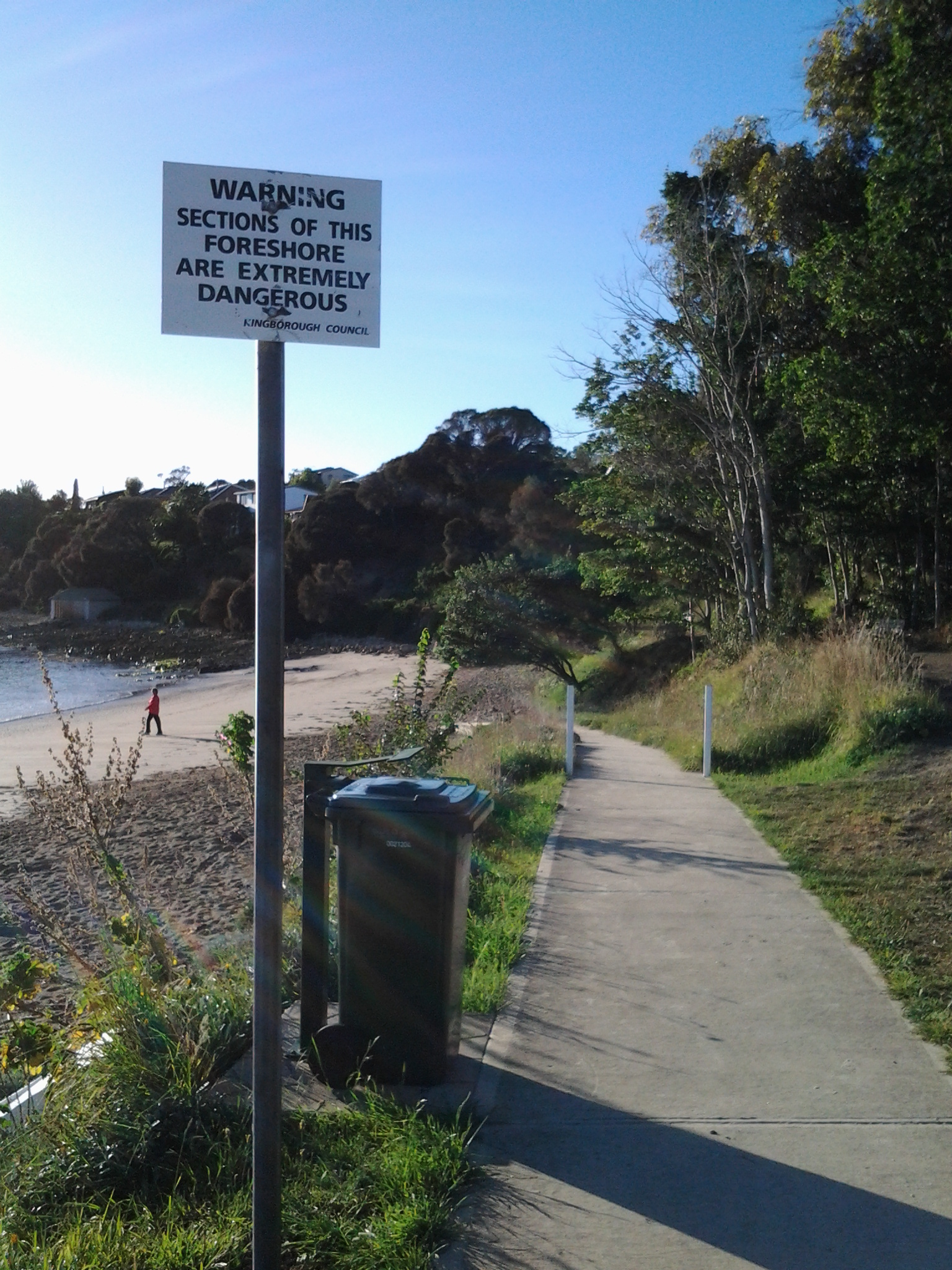
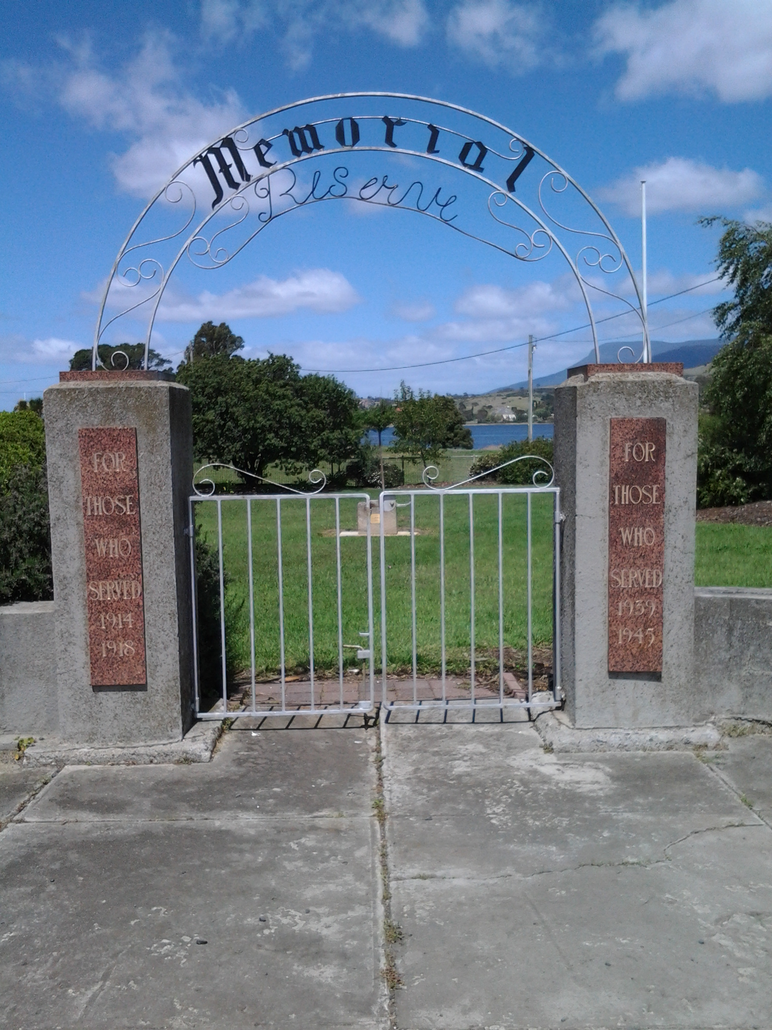
For a long time, blog followers have received a daily post covering my experiences after I have walked sections of the terrain from the mouth to the source of Tasmania’s Derwent River, plus my additional writings about various aspects of the social and natural history of the Derwent River.  Yesterday and this morning were a rude shock for some Australians – no blog post to absorb over the breakfast cuppas– and for my overseas followers spread across many countries, their regular daily dose arrived at many different times depending on the time zone in which they live.

Have I run out of stories to tell, descriptions to give and photos to show? The answer is a resounding no. I have much more to expose. Please be assured that you have not seen the sights of all the kilometres of the Derwent River, nor heard about all its challenges, in my blog yet.  So why the absence of new posts?

I have committed to another major project which cannot wait any longer for my sustained action. I like huge projects.

Last year I discovered that the first Tyzack in my line (3 different lines came to Australia from England in the 19th century) arrived at Port Melbourne 150 years ago this coming December.  Impulsively I decided (without research or planning just as I conceived the idea to walk the length of the Derwent River) to organise a family gathering later this year for all my great great grandfather’s descendants spread across Australia. Two family members agreed to support me –thankfully one has prepared a family tree. The Tyzack 150th anniversary organisation is now my priority, because there is a book to be put together and published, field trip guides to be developed, and much more – I still haven’t received responses to my introductory letters from most of the over 100 living descendants (almost all whom I have never heard of leave alone know) so I have a big job ahead tracking them down and getting them onside and involved.

This family event is scheduled early in October – so, if not before then, from mid-October onwards I expect to continue writing up the Derwent River walking blog stories.  Probably I won’t be able to restrain myself so that, from time to time, a post may appear.

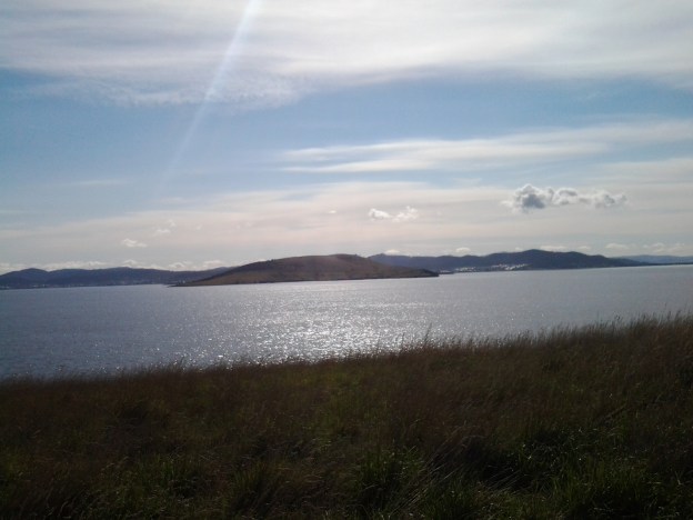
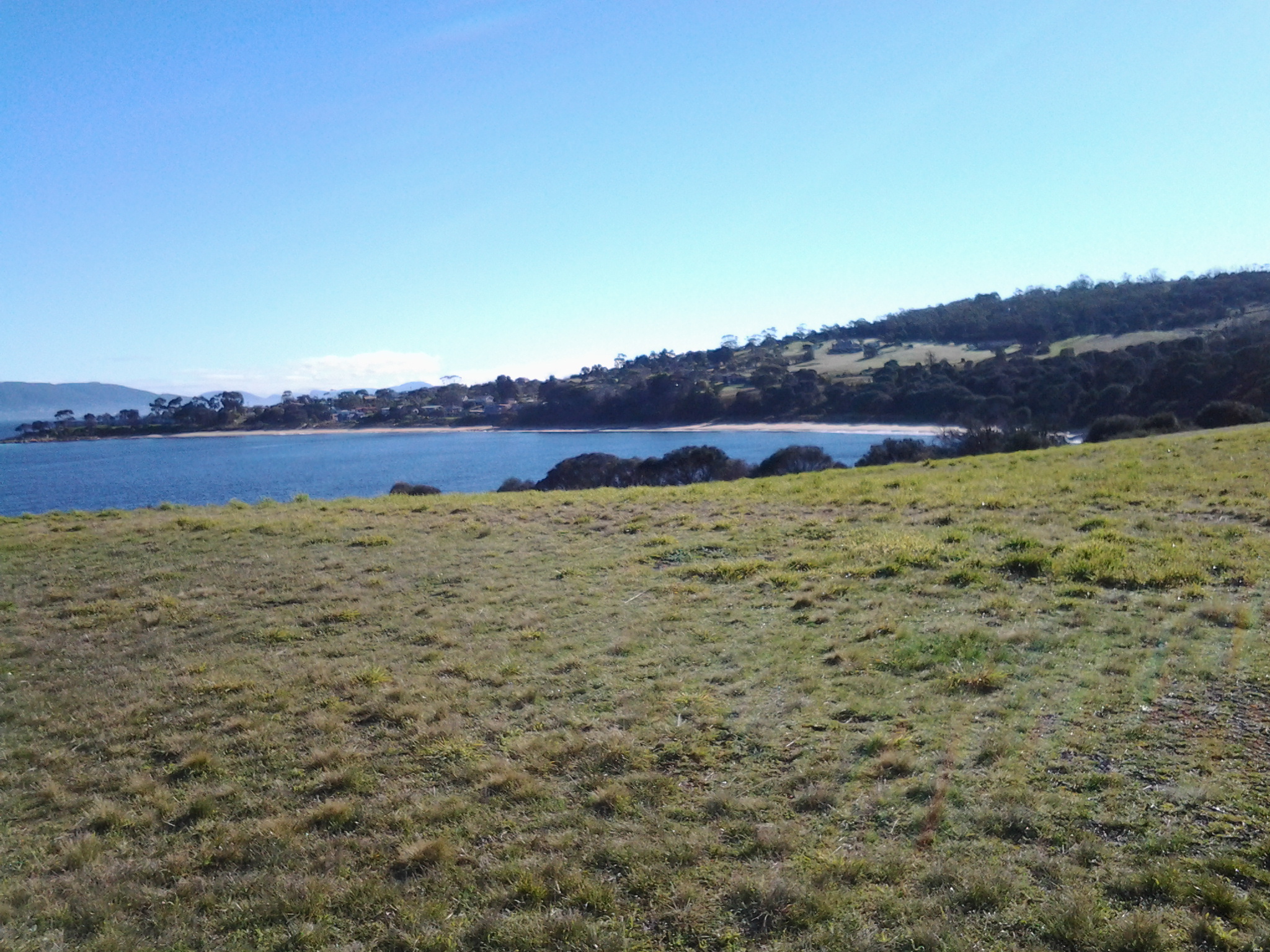
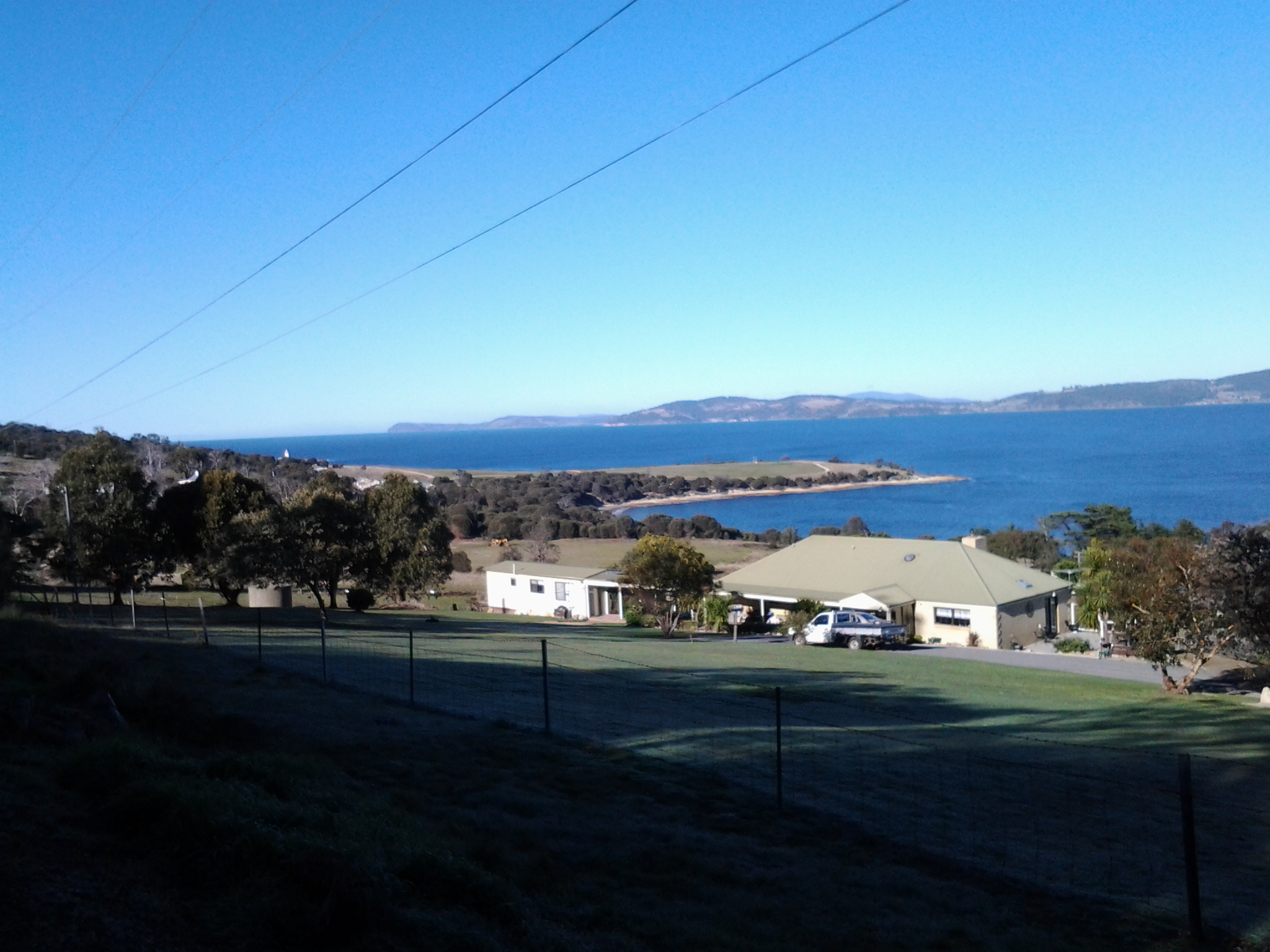
The photo below taken by Michelle shows the eastern shore mouth of the Derwent River, Cape Direction (on the right) and the Iron Pot islet sits out within Storm Bay.

PA280012.JPG


Internet records of measurements may be dodgy

Since my last post, some readers found Google has revealed the length of the Derwent River.  It gives the number of 249km without any indication of where that number was found or how it was calculated. Immediately below this information box are two listings both giving alternative conflicting distances.

My measurement of 214kms was from an arbitrary line between Cape Direction and Pearsons Point to mark the mouth of the Derwent River, and I stopped at the point where the river starts from the southern end of the Lake St Clair Lagoon.

I have noticed that one source indicates the measurement ought to be taken from the point where Lake St Clair meets the Lake St Clair Lagoon.  I have found another source which seems to indicate the mouth might be where Storm Bay meets the sea.  Even if the length of the Lagoon and the width of Storm Bay were added to my 214km, the Google number would not be reached.  I have asked Google to identify its sources because I cannot believe their number can be accurate. Unfortunately, I have not received any feedback.

STOP PRESS – JUST DISCOVERED THE AUTHORITATIVE LENGTH IS 215KMS.  Read my new November 2015 post.

Starting out from Blackmans Bay on Stage 13

Once I was off the bus at Blackmans Bay, the Kookaburras started laughing at me  (again like at the beginning of Stage 12). Ha. Ha. Ha. H.H.H. Ha. Ha. Haa. Was this an omen that I was about to do something foolish? My goal for Stage 13 was to walk to Fossil Cove, and then walk another day for a final stage to the mouth of the Derwent River at Pearson’s Point. If you have already read my posting on the 25 February then you know I reached Pearson’s Point.  Future postings will give more details about this change of mind and destination.

As I turned left from Wells Parade into Hazell St towards the Blackmans Bay Beach, a screech of Sulphur-Crested Cockatoos circled overhead. I was on the beach at 7.45am. The water was calm and I looked over the Derwent River towards South Arm beach on the eastern shore.  The Iron Pot lighthouse on the rocky outcrop just offshore from Cape Direction, on the southern tip of the South Arm peninsula, seemed to stand up from the water like a fat thumb.  Back at Blackmans Bay Beach, the fresh sunny morning was complete with power walkers and dogs leading their owners on a walk. Public toilets are located half way along the Blackmans Bay Beach.  These are the last public toilets for anyone walking further south.

How fortunate Tasmanians are to have morning views along beaches such as that at Blackmans Bay.

20150224_074639

I turned southwards and at 7.51am had reached a tiny yellow sign on a post indicating the Suncoast Headlands Walking Track was ahead. A few minutes later I reached the main sign.

20150224_075230

This sign was accompanied by another nearby.

20150224_075213

I followed the good wide dirt track and initially thought how easy it would be for Mums with prams or people in wheelchairs to follow this path. But not so. Not much further along, I needed to climb rough dirt and log stairs and I encountered such interruptions to a smooth walk a number of times.  There were occasional splits in the track without signage, so it is possible to walk a little way off the main track before you realise what is happening.

How gorgeous the morning was.  For example, the photo below is looking back to Blackmans Bay Beach.

20150224_075545

In the photo below, the rocky outcrop at the far end of the beach is where the Blackmans Bay Blowhole is located (my Stage 12 walk there was described in Nudging my way into Blackmans Bay on Stage 12 of my walk along the Derwent River).

20150224_075925

A new milestone marking the 13th stage of my walk along the Derwent River: I reached the mouth on the western shore. Whoppee Doo!!

Yesterday, I completed the first part of my walk along the Derwent River: an exciting achievement.

Last August I started walking from the mouth of the River at Cape Direction on the tip of the South Arm peninsula and now, at the end of February, I have completed the distance from that mouth to the Bridgewater Bridge and back on the western shore to Pearson’s Point near the settlement of Tinderbox.

On the 8th stage mid-November, I had the first major milestone when I finished the walk from Cape Direction to the Bridgewater Bridge. This 13th stage was the culmination of walks from the Bridge back to the mouth on the western side of the River.

During yesterday’s walk, I covered about 5km of the length of the Derwent River.  By my reckoning, the total distance of the Derwent River on the western shore from the Bridgewater Bridge to the mouth is 38 3/4 km.

For Stage 13 yesterday, I needed to walk to Pearson’s Point from the bus stop where I finished on Stage 12 and then, on reaching my goal, I needed to retrace my steps back to Blackmans Bay to connect with a bus that could return me to Hobart.  This distance was approximately 17 kms. I have now walked at least 171km not counting getting to and from buses.  But when the walks are staggered over time, this number does not mean much.

The highlights of the walk to Pearson’s Point were mostly small and natural: rosehips, green rosellas, hum of bees, resting sheep, and the taste of delicious ripe blackberries along the way.

20150224_103540

I was surprised how close the northern part of Bruny Island was to the mainland of Tasmania (almost felt like I could swim across the D’entrecasteaux Channel) and I felt overwhelmed by the staggeringly expansive and grand views across and up and down the Derwent River.

20150224_114137

The fun part was singing (including mixing up the words in my excitement) Handel’s Hallelujah chorus (from The Messiah) at the top of my voice when I passed a large sign with the words SING. You can listen to a superb version performed in 2012 by the Royal Choral Society at the Royal Albert Hall in London England at https://www.youtube.com/watch?v=IUZEtVbJT5c

https://www.youtube.com/watch?v=IUZEtVbJT5c

Over the next few days I will write up the journey and the discoveries of Stage 13’s walk.  Then I will be looking towards a long main road walk from the Bridgewater Bridge at Granton to New Norfolk which I expect to undertake in the next couple of weeks.  Once I have reached New Norfolk I will be on the way to Lake St Clair, the source of the Derwent River.

Major milestone achieved on 8th stage of my walk along the Derwent River

Originally, I decided to walk the length of Tasmania’s Derwent River without research, foreknowledge of the challenges, and without determining the possible milestones.

With hindsight, actually starting the walk and reaching the Bridgewater Bridge were my two main milestones held subconsciously and not recognised at the time.

In late August this year I started at the southern tip of the South Arm peninsula (Cape Direction) and today I have not only reached the Bridgewater Bridge but crossed it and started the walk back towards the mouth of the Derwent River on the western shore.

I am rather amazed that such a thing is possible; to walk such a distance in this day and age and to do so for pleasure doesn’t seem quite real. And yet it is truly possible, even when my feet feel permanently crippled and I want to crawl. Just one foot after the other and it doesn’t matter how long it takes me to put one foot in front of the other. It only matters that I keep doing it. And then and only then can such milestones as today’s be achieved.  And celebrated, which I am about to do.

I was also mindful that today Australia marked the ANZAC soldiers killed and injured in the World Wars and others more recently with Remembrance ceremonies and a minute’s silence across the nation at 11am (on the 11th day of the 11th month). I have nothing to complain about and only much for which to be grateful. The photo below was taken close to the Bridgewater Bridge on the eastern shore.

20141111_131254

Over the coming days, I will write detailed postings of today’s walks through the suburbs of Old Beach, Herdsmans Cove, Bridgewater and starting into Granton South; the areas that I have passed and the trails that I have followed. For now it is enough to know that I have walked yet again, and the countryside and cityside has simply rolled along beside me.

Today I was away from home for almost 9 hours partly because the walking area was relatively difficult to access and leave from by public transport. Some waiting and bus changes were required. Of these hours, just under 5 hours were involved with walking from the starting point in Old Beach to the start of the Bridge, and 1/2 hour was involved from the Granton end of the Bridgewater causeway until I jumped on a bus somewhere in Granton South. Including crossing the Bridge, I walked approximately 16 kms.  Approximately 14 and1/4 kms on the eastern shore, and 3/4 km on the western shore by the Derwent River. So far I have walked 93 kilometres.

At the end of the 7th stage of my walk I had covered 34kms of the length of the Derwent River. Add another 4.5kms for today’s 8th stage and the total distance from the mouth of the Derwent River to the Bridge on the eastern shore is 38.5 kms as ‘a crow might fly’ more or less straight down the centre of the River (by my reckoning – perhaps others will argue). The length covered today of the Derwent River from the Bridge southwards on the western shore is about 1/2km.

Before each stage of my walks along the Derwent River, I have been somewhat nervous about how everything will go and how my body will hold up, yet there has never been any event or location that has turned out to be a problem. My walks have been ‘smooth sailing’. This morning I was particularly anxious because of the less savoury activities of some of the people who live in Herdsmans Cove and Bridgewater. I was also thinking about Tasmania’s ‘ice’ epidemic and remembering that some addicts can go for 7 or more days without sleep and therefore can be totally irrational. I was hoping not to encounter any unpleasantness and I didn’t. So I am delighted to report that today’s walk was safe, beautiful and calm. Quite marvellous in its simplicity.

The photo below is a close up of wattle blossom. The seductive heady perfume surrounded me most of the day.

20141111_103716

Preparing for the next stage of my walk along the Derwent River

The image featured directly above is of the watery inlet from the Derwent River on the left into Ralph’s Bay on the right. The low hill in the distance is north of and opposite from Gellibrand Point (which is at the northern end of South Arm peninsula). The low hill is Droughty Hill: Trywork Point will be to the lower left of the hill.

Previously, I walked from the mouth of the Derwent River and covered the length of the South Arm peninsula which amounts to approximately 11 km of the River. Stage 1 took me from Cape Direction to the Opossum Bay shop. Stage 2 took me from the Opossum Bay shop to Gellibrand Point. Only 238 Kms to go!

Continuing on from the last walk will require me to leap-frog over approximately 2kms of water for the next starting point Trywork Point which is south of the Rokeby Hills. The reason for my ‘jumping over’ is that I am guessing that the Derwent River was measured as a ‘straight’ length and did not count the many extra kilometres going in and out of every bay and crevice. The water between Gellibrand Point on the South Arm peninsula and Trywork Point is the entrance to the large Ralph’s Bay which feeds off the Derwent River.

So my initial destination for Stage 3 is Trywork Point – that will mark the start of the walk. To reach this starting point I will need to walk south from a bus stop and then later be prepared to retrace my steps or find a more suitable alternative route before continuing northwards through as many Hobart’s eastern shore suburbs as my feet will carry me.  The suburban area has frequent bus services (by comparison with the Opossum Bay bus service) so that timing the duration of Stage 3 is dependent on my health and inclination rather than on bus timetables.

Unfortunately, TasMAP Taroona 5224 is not a great deal of help for reaching Trywork Point. It clearly shows the acres of land between the bus stop and Trywork Point but offers no roads or tracks. I am clear that I will walk from the last Camelot Park bus stop (Metro Bus number 615) south to the Point – somehow. The Hobart and Surrounds Street Directory is only of marginally more use than the TasMAP. However this Directory will be especially useful with the names of streets as I return northwards and walk in and through the suburbs in the later part of this Stage 3 walk.

The most useful mapping and tracking information comes from the Google earth map of the area (which was also useful to see tracks on Gellibrand Point in Stage 2) – although the name Trywork Point is not recorded and does not appear on their map (Note that Trywork Point and some other landmarks are indicated on the TasMAP).  The best that Google can offer is Droughty Point Road. From there I moved the map westward until I found the T junction with Tranmere Rd and Oceana Drive – this intersection is the bus stop from where I will start walking.

Walking south, the bitumen road peters out and the tracks across the land are variously strong and faint on the Google earth map. With this limited information, finding my way will be an experimental process.

Years ago friend Je and I walked from the end of Tranmere Road across some of this land. However, I remember that we encountered stout almost impassable fences. This memory makes me wonder what I will find now, and how easy the access to Trywork Point will be. I look forward to my ongoing discovery of the land besides this wonderful Derwent River.


Preparing for Stage 2 of the walk along the Derwent

Last week, I used TasMAP 5223 Blackmans Bay to help me navigate the South Arm / Cape Direction start of the walk. Stage 2, taking me northwards along the South Arm peninsula, will require a tiny portion of the same map. However, most of the Stage 2 walk will require TasMAP 5224 Taroona. Having said that, I believe it would be possible to walk  in the two ends of the South Arm peninsula without either map simply by asking locals to point them in useful directions.

22 Aug 2014 Leaving South Arm and heading home, and final thoughts – Posting 8 of 8

On the return journey towards Hobart, the bus deviated via large mudflats into the town of Cremorne adding 5 minutes to the trip, then it dropped me at a Lauderdale bus stop for transfer to another bus (because the Opossum Bay bus terminates at Lauderdale) approximately 5 minutes later (with his two way communication, the bus driver alerted the other driver there was a transferring passenger to be collected). Once on the Lauderdale bus, the trip towards Hobart deviated through the suburb of Oakdowns and so a further 5 minutes was added to the journey. After the bussing and the walking I was home in Bellerive at 3.20pm.

In this series of blogs for the first walk stage, I have provided approximate times for various sections of my walk as an indication only. I am short legged and plod slowly (and towards the end I felt I was shuffling like an old man). If you are tall and can happily stride long steps faster, then my walk will not be sufficient to fill the time between buses.  In fact some speedy walkers may be able to continue through the Opossum Bay community and walk to the end of Gellibrand Point, the most western tip of this piece of land before Ralph’s Bay makes its inlet.  My next walk will be designed to complete that section, and then I should be able to advise as to whether fitting it all into 5 hours is possible for the able.

Since it is unlikely anyone else will have my success if they turn up at the gate of Fort Direction and get driven through the site, the only general public approach is to walk along Fort Beach having walked most of Blessington Road.  Based on the information I recorded, I suggest one way on this route from the set down bus stop to the Lone Pine Memorial will take an hour if you take time to enjoy the views and click photographs. Add the half hour return walk between Cape Deliverance and Cape Direction with its gun placement bunker and the whole excursion takes approximately 2 ½ hours.  As an alternative, you could spice it up by jumping the shore rocks like a goat, from South Arm to Fort Beach. I would guess another hour could be added to the duration of the walk.

I noted that the tide was going out while I walked, and that the high tide merged with the dune verges in places on Fort Beach. It made me think that on a high tide, this route might be impassable. In such a circumstance and if you had made the special trip and your heart was set on a beach walk, the expanses of the South Arm beach with their outstanding views, old pines shadowing parts of the dunes, and soft roaring Casuarina trees, would make a very attractive substitute.  You might be lucky, as I was, to see a giant fresh squid washed onto the beach being enjoyed by immature grey feathered winged large Gulls.

Many of our native birds are various shades of black and brown but we also have an array of colourful specimens. During my walk, the sun brought out not only the musical black and white Magpies, the hard cawing jet black Crows, but also plump pink and grey Galahs feasting on the ground, Mr Blue Wren flitting in and out of the shadows, a glorious Mr Robin with his red breast, and a flock of multi-coloured Rosella parrots.

My guess is that I walked around 10-12 kms including getting to the start and then continuing on.  But how much of the 249km length of the Derwent River have I covered? About 7kms. A great start! A memorable day. A very positive experience.

22 Aug 2014 South Arm beach and the walking continues – Posting 7 of 8

Around 11.30 am, I made myself comfortable on a rock on the South Arm beach, ate some pre-packed lunch and enjoyed the glorious qualities of the day and the location. The view across the broad Derwent towards Blackmans Bay, Kingston, and Mount Wellington with a scribble of snow on its summit was sensational. South Arm beach stretched as a thinning arc and seemed impossibly long and pure.

The photo below is the viewpoint directly in front of me as I ate my lunch.  Glorious Mount Wellington on the western side of the Derwent River.  Closer to the shore, a platform bobbed with the comings and goings of Pied Cormorants while they searched for their fish dinners.

 20140822_114606

Meanwhile my feet hurt to walk on. I felt crippled. But I had two hours before the bus returned so, as with any days spent travelling overseas, time was not to be wasted simply sitting around.

It wasn’t part of the plan for my first day walking the Derwent, however I decided to walk (shuffle if I must) the length of the South Arm beach, then take to the road and continue on towards Opossum Bay to find a bus stop.

It took me 45 minutes to plod along the long South Arm beach. Apart from a few locals the beach was deserted, except for the Silver Gulls who entertained me with their happy feet.   George Miller – forget those penguins! Here were normal ordinary seagulls performing a manoeuvre that left me astonished. As the short cold waves spread up the sandy beach, a seagull would stand knee deep waiting for the water to recede. When the water thinned, the gull would stamp both feet alternately on the wet sand at a super speed. Obviously this practice dislodged some wonderful edibles from the wet sand. With speed and agility, the gulls grabbed their lunch with a peck of their beaks. Then the speedy stomping began all over again.  Very funny.  Very clever.

From the end of the beach it was clear there was no track around the headland and later, as I walked towards Opossum Bay, I saw a private house ‘owning’ the space – refer to the photo below.

20140822_130337

I used the gravel bicycle and walking track next to the main road which extended from the beach end of South Arm beach to Opossum Bay Store, with a bus stop opposite. This is where I finished my walk. 

During my walk from South Arm to Opossum Bay I looked back at the long stretch of South Arm Beach. Fort Hill is above the township to the upper right.  The photo below gives some idea of the beauty of the place, and I hope it inspires others to take the walk.

 20140822_124948

This last leg took about 45 minutes. On route to the store, I passed two tourist information stands, both of which referred to this roadway being part of a convict trail, something which a team of local residents have researched (http://www.abc.net.au/news/2013-12-22/a-trail-between-south-arm-and-opossum-bay-tells-tales-of-tasman/5171434). The information which I found most interesting was that approximately 70,000 people came to Hobart on the prison and other ships between 1804 and 1853. I reflected that, of course, they all had to pass by Cape Direction, Cape Deliverance, Johns Point and the beaches on which I had been walking. It’s impossible to imagine how foreign this land of ours would have looked. And to think I started the day with trepidation!

Celebrity spotting: Brian Ritchie, once of Violent Femmes and now of MONA fame, filling up his car with fuel at the Opossum Bay store. Well I think it was him.

If you follow my walk and are in need, the public toilets are located 100 metres further along from the Opossum Bay Shop toward Opossum Bay beach.

Outside the Opossum Bay store are tables and benches, so I took the opportunity to finish my lunch. Sitting nibbling and watching people come and go occupied me until it was time to catch the bus.

22 Aug 2014 Via Fort Beach returning to South Arm road – Posting 6 of 8

I retraced my steps from Cape Direction and Pot Bay to the Lone Pine Memorial.

On the Pot Bay beach I passed an amazing driftwood ‘shack’ on the beach, as shown in the photo below. Are those underpants swinging from on high?

20140822_101716

After a refreshed look at the Lone Pine Memorial, at 10.25 am (only 1 hour 20 mins since I had left the bus – yet, because I had seen and thought about so many things, the time felt much longer), I turned towards the point of Cape Deliverance. Before doing so, I clicked the photo below which scans Fort Beach towards Johns Point.

20140822_094334

The vehicle track, which wound down the hill towards the Derwent then switched back in the direction of Fort Direction seemed the perfect way to get myself down onto the sandy Fort Beach. Twenty or so minutes later I reached the western end of the beach and easily walked up onto Blessington Road.   The alternative would have been to round John’s Point and continue along to South Arm almost entirely by clambering over a rocky shore.  Of course this was possible however, I reasoned that it would take a lot longer to reach my destination. While walking on the very long Blessington Road, I noticed a couple of public walkways down to the shore, so that if a walker started at the river level they could come up to the road at a later time. A couple of empty house blocks with a water frontage made me consider whether these might provide a way to move from the shore to the road – but they are privately owned so careful thought would be needed before deciding to walk across these.

Half an hour later I reached the cross street Rosemount Lane, a short street which took me down to the South Arm Road.  I continued west towards the South Arm beach, passing by the prominent Cenotaph that remembered many wars including the more recent Iraqi war.

20140822_112246

22 Aug 2014 Heading for the start of the first walk at Cape Direction – Posting 5 of 8

The photo below shows Cape Direction. To the left of the headland trees is a concrete bunker.

20140822_095939

Heading toward Cape Direction, I walked along a vehicular track eastwards and down onto the firm sand of the beach at Pot Bay.  Large Gulls either Pacific or Dominican patrolled the beach, letting a mix of Pied Oystercatcher and Sooty Oystercatcher birds have a run around.  The protruding flat sandstone rocks on the beach featured empty oyster shells.

 20140822_095103

20140822_095416

 At the end of the beach I clambered up the rocky earthy banks amidst a rich layer of fleshy vegetation that looked good enough to eat. I knew that the pigface plant with bright pink flowers open to the sun was edible, but what about the rest.

The photo below shows a swathe of blooming pig face on the Pot Bay side of Cape Direction.

20140822_095628 

What did the original aboriginal people eat? I would be very interested to learn whether some of the other plants could be used as food.

I had been warned that most of the old gun placements on Fort Hill were out of bounds, and again a high mesh perimeter fence made that clear.  But I was able to wander towards the one remaining structure outside this fence – one without tunnels. I waded on through high grass and onto another vehicle track that lead uphill to the remains of a massive concrete gun placement structure.

The photo below shows the concrete structure. The Iron Pot lighthouse can be seen in the distance.

20140822_100305

As I wandered inside the structure, it made no sense to me, and with no information to hand I was left puzzling as to why it was surrounded on all sides by rock and earth so the soldiers would not have been able to see an enemy coming towards the Derwent leave alone fire on such a ship.  Perhaps I am the first non-defence services visitor (can that really be true?) and everyone else who has visited perfectly understands how the building was used. 

From this structure it was a short distance east to open and exposed Cape Direction – the starting point for my walk along the Derwent.  Opposite, almost linked to the mainland at low tide by a series of rocky reefs, was the Iron Pot in all its glory.

The photo below shows Mount Wellington above Hobart, past Cape Deliverance and taken from Cape Direction.

 Towards Cape Deliverance and Mt Wellington

22 Aug 2014 Arrival at Fort Direction – Posting 4 of 8

After 20 minutes walking from the bus, I stood at a high mesh perimeter fence with a large open gate and massive signs telling me that the land beyond was the property of the Defence Services and ‘Trespassers will be prosecuted’. Cape Direction was so close, and now my access even to the beach from this location was thwarted. Using a number on one of the signs, I phoned the caretaker of Fort Direction (the cluster of buildings between me and Cape Deliverance and Cape Direction) and asked if the signs really meant what they said.  Yes they did.  This is a serious defence location and casual visitors are not permitted. When the caretaker informed me I could take my car and access the beach from Blessington Road, I let him know I was a walker.  He was surprised. So many people don’t walk these days and are surprised when they come across someone who does.  Not missing a beat, he offered to drive to the gate, collect and take me through (the militarised zone – my expression) and drop me at the Lone Pine Memorial on Cape Deliverance. From there I could walk in select places and then return to South Arm via the beach.

I do love the world. Something so good always comes out of something so problematic (and if this isn’t always true, I choose to forget any exceptions). The caretaker was friendly, amiable and chatted generously. I am so grateful for his help.

 Apparently while the wooden buildings of Fort Direction don’t get a great deal of use except by cadets, they have historic value and have been maintained as the result of very strong local community advocacy. But close by, under lock and key are stores of live ammunition.  I wouldn’t have been interested in any, but I guess others might if casual wandering around had been permitted.  Originally the ammunition was stored in the nearby tunnels beneath the old gun placements on Fort Hill (which was out of bounds) – a very secure place and if an explosion had occurred any damage would have been localised.

Yesterday, I trawled the internet to try and understand what Fort Direction was all about. If you are interested a simple google will bring up a great deal of information and photographs.

The caretaker drove me out onto the flat exposed and open expanse that is modern day Cape Deliverance. It is above sea level but is not high enough to have the handsome cliffs that I could see across the Derwent when looking at the near Pierson’s Point and surrounds in the Tinderbox area. The first thing I noticed were two tall white flag poles, without flags, standing at the end of a large area. A part of me considered that if two more poles were added, a game of one ended AFL footy could be played here. The ground was extensive and very flat. 

The poles framed a remembrance structure with the words Lest We Forget. In an arc at some distance were seven pillars. On each was the name of the seven Australian servicemen who were awarded the Victoria Cross as a result of their actions at the Battle of Lone Pine near Gallipoli. This was the significant battle fought between Australian and Ottoman Empire  forces during the First World War between 6 and 10 August 1915.  I asked my driver how this memorial came to be here considering none of the 7 were Tasmanian, or ever visited Tasmania, leave alone were locals. The question surprised him, and left him worried. Not only did he not have an answer, I sensed he wondered whether the decision to install this memorial in an isolated place without direct connection to the people of South Arm, was appropriate. 

He left me at the Lone Pine Memorial and I tried to see it clearly with the wind lancing my face.  A melancholy spot. But strikingly beautiful. The caretaker had told me that the physical nature of the location and its views had something in common with the Dardenelles, and that most RSL guys thought it was particularly appropriate site for the memorial.  Anzac Day brings 700 plus people to this windswept site for the dawn service. I can appreciate how the landscape would make the ceremony quite powerful.

The photo below looks seaward from the Lone Pine Memorial on Cape Deliverance towards the Iron Pot lighthouse.

 20140822_094232

The photo below looks across from the Lone Pine Memorial on Cape Deliverance towards Piersons Point and the Tinderbox area – the starting point for the Derwent River on the western shore.

 20140822_094317

The photo below shows the single pine planted as part of the Lone Pine Memorial. In a cage.

20140822_102521

22 Aug 2014 Arriving in South Arm and starting the walk – Posting 3 of 8

At 8.50am the bus was darting past the Clifton Beach turn off and then, after speeding across the low lying road of the isthmus, a little after 9am I was stepping off the bus opposite the South Arm shop. For anyone following in my footsteps, if you need a public toilet, there is one near the beach and the South Arm Shop can point you towards it.

The photo below shows the South Arm Shop, a multipurpose village convenience store.

20140822_112154

As I stepped off the bus, a wonderful wedge of water beckoned me. This was the Derwent River showing itself down the end of a track to the beach. That track started from a roadway that passed by the Cenotaph where the road made a 90 degree angle bend to head onwards to Opossum Bay, all a short way down from the bus stop. But instead of walking towards the river, I turned back along the main road to find my starting street.

My main task was to reach the starting point of the walk along the Derwent, and then to walk as far along the river’s edge as my feet would carry me before the return bus arrived. From maps it was clear I could walk along the Fort Direction Road to the starting point at Cape Direction and then I could return via the coast for a change of scenery. Fort Direction Road was a few metres away from the bus stop.  As I walked up the road (which wasn’t level and wasn’t going downhill) the expression that this was ‘a decent short pull’ came to mind. I seem to remember Nan used the word ‘pull’ when talking about getting a team of bullocks up a short steep hill. Thankfully the pull only lasted about 5 minutes before I was able to follow a gentle upward incline in a more relaxed fashion.

Coming over the rise of one hill, I was surprised to see the crisp white lighthouse with its sharp red painted top on the Iron Pot, not far over the water from the flat top of Cape Deliverance. With the fresh smogless air, the outlines were smart and the tiny rocky islet seemed so close to the mainland.  I was thrilled to see it.  For years I have heard how the Sydney to Hobart Yachts ‘round’ the Iron Pot to enter the Derwent River every December. Now I can visualise this happening. What a sight it must be if the yachts are bulging with colourful spinnakers. Perhaps visiting the area between Cape Direction and Cape Deliverance for such a spectacle should be added to my ‘to do’ list.

My research unearthed interesting tidbits about the Iron Pot. The http://www.abc.net.au/local/stories/2008/11/03/2408589.htm tells that “From 1832 until the early 1880s the lighthouse was the main feature of the site, warning ships of the treacherous waters through which they were navigating. Then, in 1884, it was decided to build a home next to the lighthouse for its keeper James Parkinson and his ever growing family. The home was built only 20 feet above sea level and made the most of a minimal amount of land. One of the greatest challenges for the residents came in 1895 when 90 feet waves battered the coastline. “Waves were breaking over the top of the lighthouse. The people that were in the house moved into the lighthouse for safety. The storm left kelp hanging in the iron railings on top of the lighthouse. Stories also claim the Parkinson home was found to have substantially shifted on its foundations following the extreme conditions.” The site http://www.seasidelights.com.au/au/tas/ironpot.asp?fState=TAS gives some dramatic stormy photos.

The photo below was taken from Fort Direction Road. The flat headland is Cape Deliverance. The white Iron Pot lighthouse shows near the horizon over the slope of Fort Hill.

20140822_092426

The photo below shows a piece of Cape Deliverance on the left and a piece of the Tinderbox area on the right. In between the two prominences, flows the Derwent River.

20140822_092437


Planning the first walk

Thanks to Je I was reminded that the grid on a map represents a distance and so, before I started fancifully imagining huge distances could be covered in a single leap, I have slowed down and thought through what is possible. And also what is desirable considering public transport times.

I have made the decision to start on my side of the river, the eastern shore of the Derwent. While stages along the river might be taken in any order, making a start on this epic journey at a key point seemed like the proper thing to do. I will start at the mouth of the river.  I am sure my decision as to where the mouth of the Derwent river starts will be controversial. But this is my walk. My Derwent River walk. Having consulted the maps, I can start where I think it is appropriate.

Previously I have remarked that all walks must be able to connect with public bus services – I don’t own a car, and I realise other future walkers of the Derwent might want to travel without worrying about car ferrying to get them to start and finish points. I accept the bus timetables may limit my possibilities and that I may need to walk additional kilometres simply to reach starting points, or after a finishing point along the Derwent. However, I know I will see and experience additional wonders that someone travelling in a car might miss.

Tomorrow morning the 8.09 Opossum Bay Metro bus from the Eastlands bus stop will convey me to South Arm where I plan to follow the Fort Direction road and continue on to Cape Direction.The Cape will be the starting point of my walk along the eastern side of the Derwent River. Tomorrow’s walk is a study in getting a feel for the time it takes to cover territory in a plodding easy way. It will also give me an indication of the reliability of the State Government maps. I expect to cover about 6-7 kilometres including historical sites, but only a portion of that will be along the Derwent.  This area is serviced by an infrequent bus run and I am aware that I need to be back at a bus stop for the next bus departing Opossum Bay at 2.02 pm.

Today is bright and sunny with that gorgeous cloud free Spring look. I am sorry that I hadn’t planned to start walking today. But my excitement is now building for the start of this epic adventure tomorrow!