Tag Archives: Cape Deliverance

Erratum –correction of the name of a geographical position

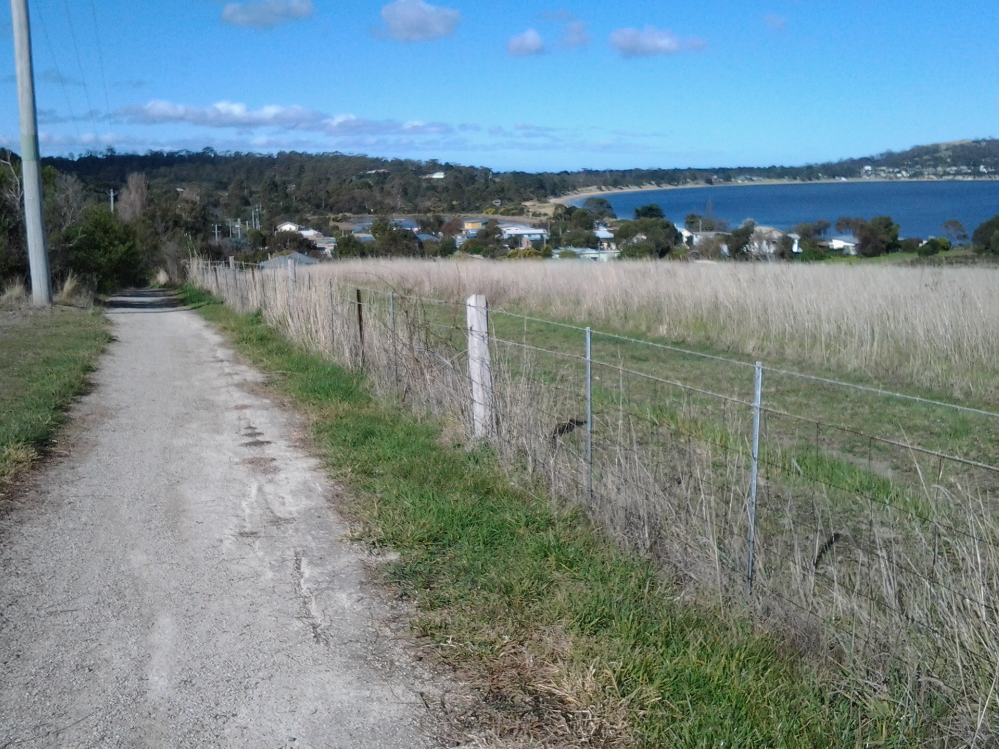
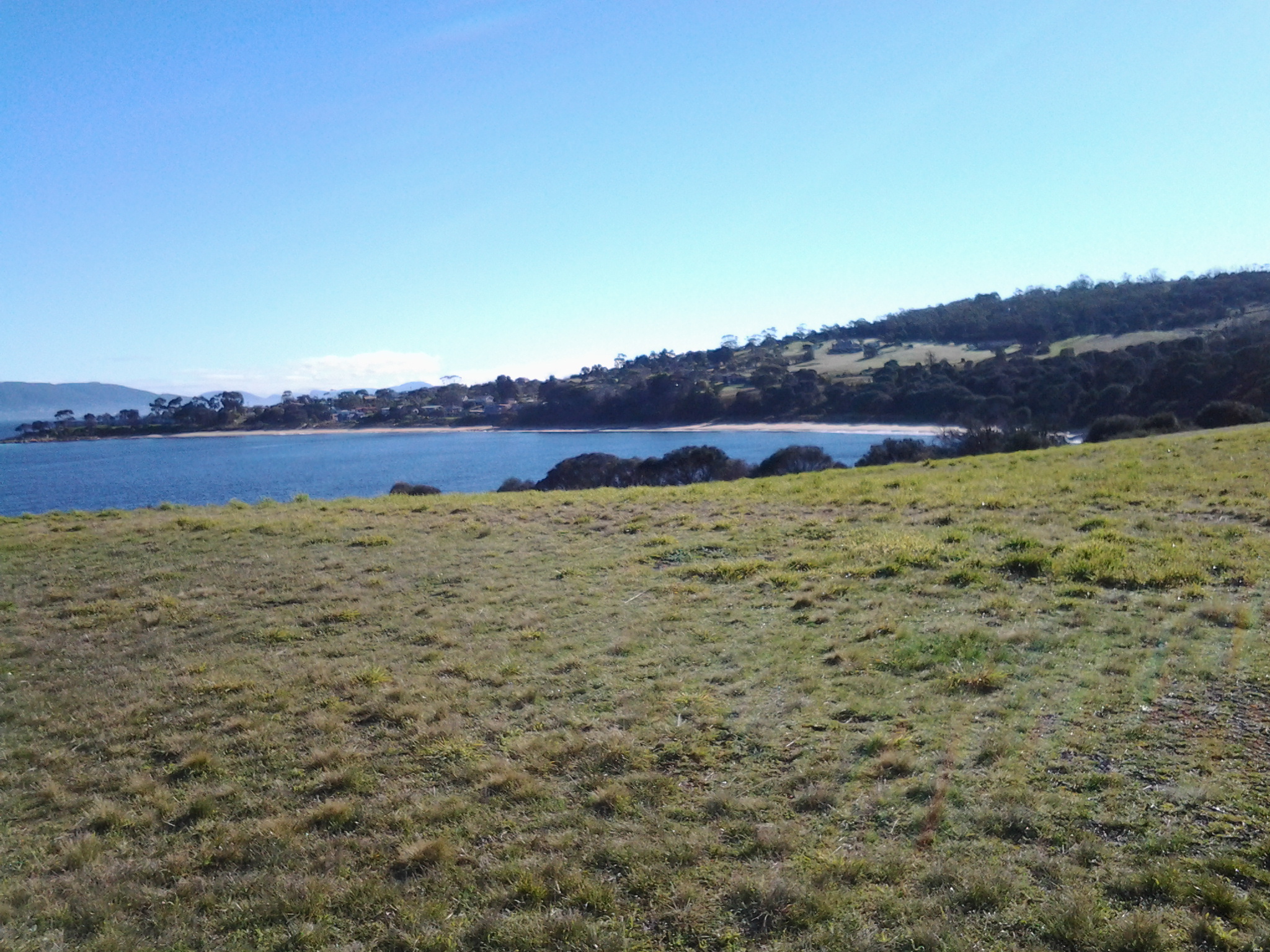
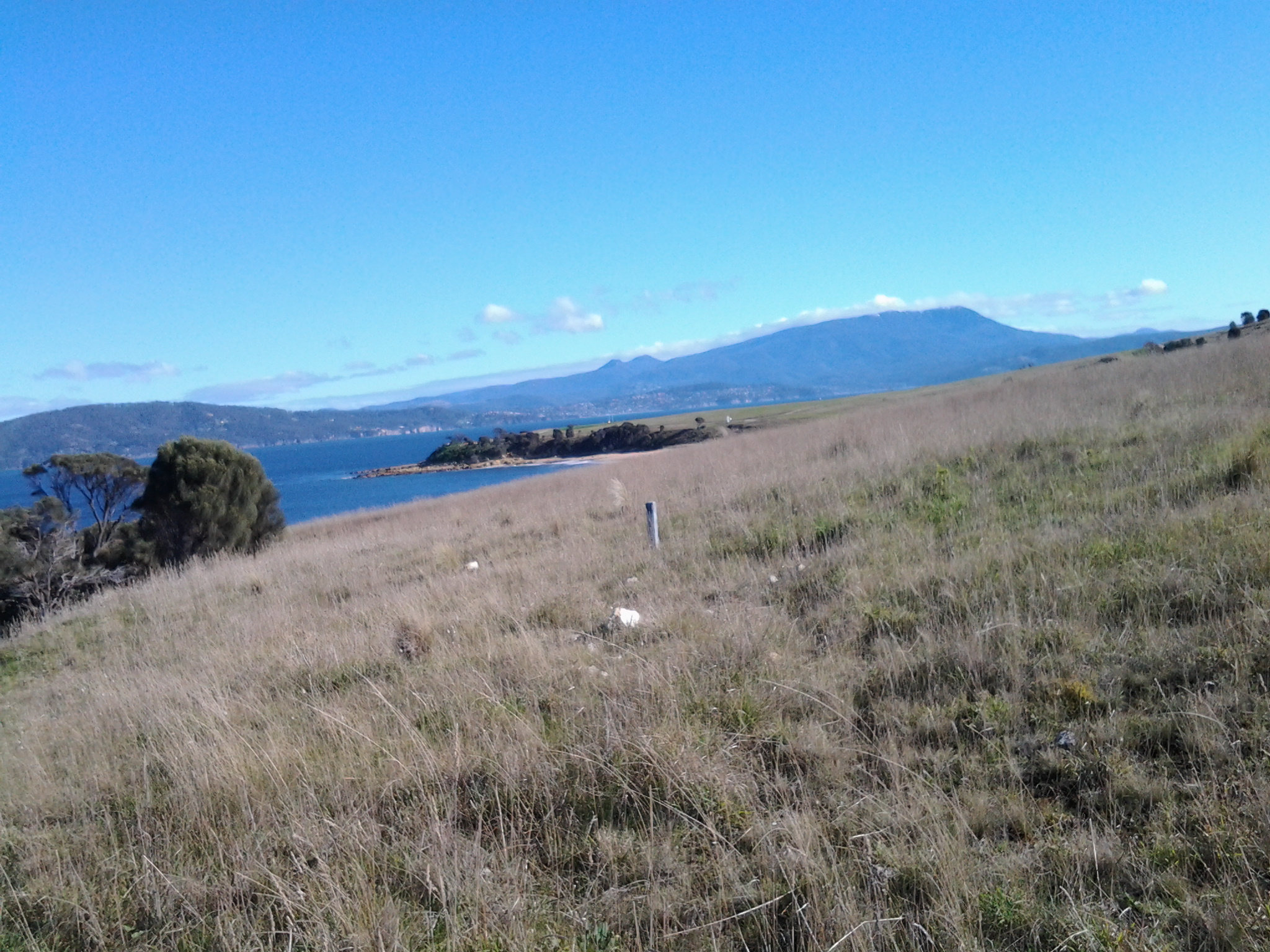
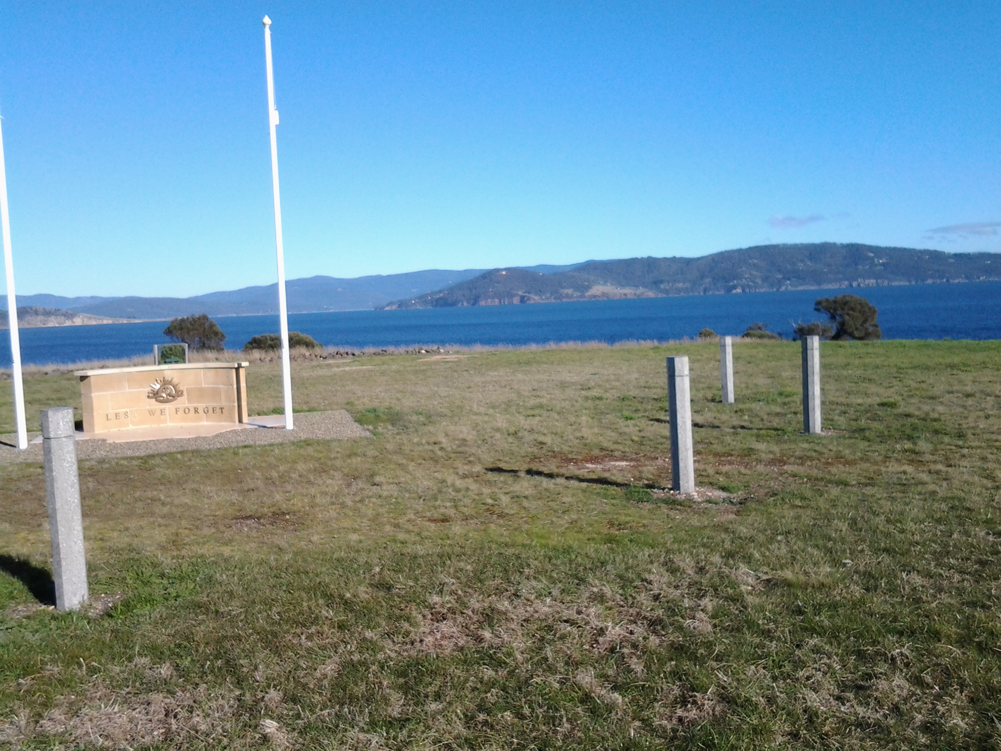
My walk along the Derwent River started at its eastern shore mouth, at Cape Deliverance opposite the Iron Pot. I walked inland along the river’s edge, crossed the bridge at Bridgewater and walked back to the mouth on the western shore.

My blog posts referred to that mouth as Pearson’s Point.  That name was an error. The location was Pierson’s Point, as was clearly apparent in one of the photos I included in the blog posts.20150224_105032.jpgHow could I have got it so wrong!  Thankfully, the error has been drawn to my attention and you can now revisit the blog posts knowing I reached Pierson’s and not Pearson’s Point. The two blog posts that contain the outstanding error are titled:

  • A new milestone marking the 13th stage of my walk along the Derwent River: I reached the mouth on the western shore. Whoopee Doo!!
  • Finally I reached the mouth of the Derwent River on the western shore at Pearsons Point

Pierson’s Point was named after a Benedictine chaplain, Dom or Abbe Ambroise Pierson (1765–94) who assisted conscientiously in essential astronomical work. He undertook this work while travelling on board the l’Espérance, a companion vessel to explorer Bruni d’Entrecasteaux’s La Recherche vessel. In 1792 (note the first European settlement by the Derwent River edge at Risdon did not take place until 1803) these French vessels sailed through what has since been named, the D’Entrecasteaux Channel. As a civilian astronomer, Pierson kept journals recording the readings from the chronometers along with astronomical calculations to determine longitude and workbooks comparing the two.

Ambroise Pierson, the 26 year old astronomer who remained after (Abbe Claude) Bertrand’s departure at the Cape (Town), was a Benedictine whose community, in which he had taught mathematics, had been dissolved during the Revolution.  He joined the Esperance as a chaplain-astronomer on a salary of 2400 livres. His loyalty to the civil constitution of the clergy seems not to have affected his relations with the traditionalists aboard;  he was to be one of the most widely respected amongst the savants. (Looking For La Pérouse by Frank Horner Melbourne Univ. Publishing, 18 Oct 2016)

Stage 4 of the walk along the Derwent River will happen tomorrow

Tomorrow, Friday 26th September will be marked by my fourth walk along the Derwent River.  The first two stages were on the South Arm Peninsula from Cape Direction to Gellibrand Point, and the third walk covered a little territory from Trywork Point to mid Tranmere. Tomorrow I will take up where I left off. This means I will be taking the Metro bus, number 615 which leaves the Hobart City Bus Mall at 8.23am for Camelot Park and travels through Bellerive and Howrah to bus stop 31, the starting point for the walk. The direction I will take will be northwards through the last part of the suburb or Tranmere and into Howrah. My intention is to walk the length of the Howrah Beach, then the Bellerive Beach and beyond. The weather and my feet will be the factors controlling the distance.  There is a 10% chance of rain so I will be unlucky if any drops fall while I am out and about.  All in all this means it should be a great day for anyone to be out and about and enjoying our gorgeous spring weather.

22 Aug 2014 Leaving South Arm and heading home, and final thoughts – Posting 8 of 8

On the return journey towards Hobart, the bus deviated via large mudflats into the town of Cremorne adding 5 minutes to the trip, then it dropped me at a Lauderdale bus stop for transfer to another bus (because the Opossum Bay bus terminates at Lauderdale) approximately 5 minutes later (with his two way communication, the bus driver alerted the other driver there was a transferring passenger to be collected). Once on the Lauderdale bus, the trip towards Hobart deviated through the suburb of Oakdowns and so a further 5 minutes was added to the journey. After the bussing and the walking I was home in Bellerive at 3.20pm.

In this series of blogs for the first walk stage, I have provided approximate times for various sections of my walk as an indication only. I am short legged and plod slowly (and towards the end I felt I was shuffling like an old man). If you are tall and can happily stride long steps faster, then my walk will not be sufficient to fill the time between buses.  In fact some speedy walkers may be able to continue through the Opossum Bay community and walk to the end of Gellibrand Point, the most western tip of this piece of land before Ralph’s Bay makes its inlet.  My next walk will be designed to complete that section, and then I should be able to advise as to whether fitting it all into 5 hours is possible for the able.

Since it is unlikely anyone else will have my success if they turn up at the gate of Fort Direction and get driven through the site, the only general public approach is to walk along Fort Beach having walked most of Blessington Road.  Based on the information I recorded, I suggest one way on this route from the set down bus stop to the Lone Pine Memorial will take an hour if you take time to enjoy the views and click photographs. Add the half hour return walk between Cape Deliverance and Cape Direction with its gun placement bunker and the whole excursion takes approximately 2 ½ hours.  As an alternative, you could spice it up by jumping the shore rocks like a goat, from South Arm to Fort Beach. I would guess another hour could be added to the duration of the walk.

I noted that the tide was going out while I walked, and that the high tide merged with the dune verges in places on Fort Beach. It made me think that on a high tide, this route might be impassable. In such a circumstance and if you had made the special trip and your heart was set on a beach walk, the expanses of the South Arm beach with their outstanding views, old pines shadowing parts of the dunes, and soft roaring Casuarina trees, would make a very attractive substitute.  You might be lucky, as I was, to see a giant fresh squid washed onto the beach being enjoyed by immature grey feathered winged large Gulls.

Many of our native birds are various shades of black and brown but we also have an array of colourful specimens. During my walk, the sun brought out not only the musical black and white Magpies, the hard cawing jet black Crows, but also plump pink and grey Galahs feasting on the ground, Mr Blue Wren flitting in and out of the shadows, a glorious Mr Robin with his red breast, and a flock of multi-coloured Rosella parrots.

My guess is that I walked around 10-12 kms including getting to the start and then continuing on.  But how much of the 249km length of the Derwent River have I covered? About 7kms. A great start! A memorable day. A very positive experience.

22 Aug 2014 South Arm beach and the walking continues – Posting 7 of 8

Around 11.30 am, I made myself comfortable on a rock on the South Arm beach, ate some pre-packed lunch and enjoyed the glorious qualities of the day and the location. The view across the broad Derwent towards Blackmans Bay, Kingston, and Mount Wellington with a scribble of snow on its summit was sensational. South Arm beach stretched as a thinning arc and seemed impossibly long and pure.

The photo below is the viewpoint directly in front of me as I ate my lunch.  Glorious Mount Wellington on the western side of the Derwent River.  Closer to the shore, a platform bobbed with the comings and goings of Pied Cormorants while they searched for their fish dinners.

 20140822_114606

Meanwhile my feet hurt to walk on. I felt crippled. But I had two hours before the bus returned so, as with any days spent travelling overseas, time was not to be wasted simply sitting around.

It wasn’t part of the plan for my first day walking the Derwent, however I decided to walk (shuffle if I must) the length of the South Arm beach, then take to the road and continue on towards Opossum Bay to find a bus stop.

It took me 45 minutes to plod along the long South Arm beach. Apart from a few locals the beach was deserted, except for the Silver Gulls who entertained me with their happy feet.   George Miller – forget those penguins! Here were normal ordinary seagulls performing a manoeuvre that left me astonished. As the short cold waves spread up the sandy beach, a seagull would stand knee deep waiting for the water to recede. When the water thinned, the gull would stamp both feet alternately on the wet sand at a super speed. Obviously this practice dislodged some wonderful edibles from the wet sand. With speed and agility, the gulls grabbed their lunch with a peck of their beaks. Then the speedy stomping began all over again.  Very funny.  Very clever.

From the end of the beach it was clear there was no track around the headland and later, as I walked towards Opossum Bay, I saw a private house ‘owning’ the space – refer to the photo below.

20140822_130337

I used the gravel bicycle and walking track next to the main road which extended from the beach end of South Arm beach to Opossum Bay Store, with a bus stop opposite. This is where I finished my walk. 

During my walk from South Arm to Opossum Bay I looked back at the long stretch of South Arm Beach. Fort Hill is above the township to the upper right.  The photo below gives some idea of the beauty of the place, and I hope it inspires others to take the walk.

 20140822_124948

This last leg took about 45 minutes. On route to the store, I passed two tourist information stands, both of which referred to this roadway being part of a convict trail, something which a team of local residents have researched (http://www.abc.net.au/news/2013-12-22/a-trail-between-south-arm-and-opossum-bay-tells-tales-of-tasman/5171434). The information which I found most interesting was that approximately 70,000 people came to Hobart on the prison and other ships between 1804 and 1853. I reflected that, of course, they all had to pass by Cape Direction, Cape Deliverance, Johns Point and the beaches on which I had been walking. It’s impossible to imagine how foreign this land of ours would have looked. And to think I started the day with trepidation!

Celebrity spotting: Brian Ritchie, once of Violent Femmes and now of MONA fame, filling up his car with fuel at the Opossum Bay store. Well I think it was him.

If you follow my walk and are in need, the public toilets are located 100 metres further along from the Opossum Bay Shop toward Opossum Bay beach.

Outside the Opossum Bay store are tables and benches, so I took the opportunity to finish my lunch. Sitting nibbling and watching people come and go occupied me until it was time to catch the bus.

22 Aug 2014 Via Fort Beach returning to South Arm road – Posting 6 of 8

I retraced my steps from Cape Direction and Pot Bay to the Lone Pine Memorial.

On the Pot Bay beach I passed an amazing driftwood ‘shack’ on the beach, as shown in the photo below. Are those underpants swinging from on high?

20140822_101716

After a refreshed look at the Lone Pine Memorial, at 10.25 am (only 1 hour 20 mins since I had left the bus – yet, because I had seen and thought about so many things, the time felt much longer), I turned towards the point of Cape Deliverance. Before doing so, I clicked the photo below which scans Fort Beach towards Johns Point.

20140822_094334

The vehicle track, which wound down the hill towards the Derwent then switched back in the direction of Fort Direction seemed the perfect way to get myself down onto the sandy Fort Beach. Twenty or so minutes later I reached the western end of the beach and easily walked up onto Blessington Road.   The alternative would have been to round John’s Point and continue along to South Arm almost entirely by clambering over a rocky shore.  Of course this was possible however, I reasoned that it would take a lot longer to reach my destination. While walking on the very long Blessington Road, I noticed a couple of public walkways down to the shore, so that if a walker started at the river level they could come up to the road at a later time. A couple of empty house blocks with a water frontage made me consider whether these might provide a way to move from the shore to the road – but they are privately owned so careful thought would be needed before deciding to walk across these.

Half an hour later I reached the cross street Rosemount Lane, a short street which took me down to the South Arm Road.  I continued west towards the South Arm beach, passing by the prominent Cenotaph that remembered many wars including the more recent Iraqi war.

20140822_112246

22 Aug 2014 Heading for the start of the first walk at Cape Direction – Posting 5 of 8

The photo below shows Cape Direction. To the left of the headland trees is a concrete bunker.

20140822_095939

Heading toward Cape Direction, I walked along a vehicular track eastwards and down onto the firm sand of the beach at Pot Bay.  Large Gulls either Pacific or Dominican patrolled the beach, letting a mix of Pied Oystercatcher and Sooty Oystercatcher birds have a run around.  The protruding flat sandstone rocks on the beach featured empty oyster shells.

 20140822_095103

20140822_095416

 At the end of the beach I clambered up the rocky earthy banks amidst a rich layer of fleshy vegetation that looked good enough to eat. I knew that the pigface plant with bright pink flowers open to the sun was edible, but what about the rest.

The photo below shows a swathe of blooming pig face on the Pot Bay side of Cape Direction.

20140822_095628 

What did the original aboriginal people eat? I would be very interested to learn whether some of the other plants could be used as food.

I had been warned that most of the old gun placements on Fort Hill were out of bounds, and again a high mesh perimeter fence made that clear.  But I was able to wander towards the one remaining structure outside this fence – one without tunnels. I waded on through high grass and onto another vehicle track that lead uphill to the remains of a massive concrete gun placement structure.

The photo below shows the concrete structure. The Iron Pot lighthouse can be seen in the distance.

20140822_100305

As I wandered inside the structure, it made no sense to me, and with no information to hand I was left puzzling as to why it was surrounded on all sides by rock and earth so the soldiers would not have been able to see an enemy coming towards the Derwent leave alone fire on such a ship.  Perhaps I am the first non-defence services visitor (can that really be true?) and everyone else who has visited perfectly understands how the building was used. 

From this structure it was a short distance east to open and exposed Cape Direction – the starting point for my walk along the Derwent.  Opposite, almost linked to the mainland at low tide by a series of rocky reefs, was the Iron Pot in all its glory.

The photo below shows Mount Wellington above Hobart, past Cape Deliverance and taken from Cape Direction.

 Towards Cape Deliverance and Mt Wellington

22 Aug 2014 Arrival at Fort Direction – Posting 4 of 8

After 20 minutes walking from the bus, I stood at a high mesh perimeter fence with a large open gate and massive signs telling me that the land beyond was the property of the Defence Services and ‘Trespassers will be prosecuted’. Cape Direction was so close, and now my access even to the beach from this location was thwarted. Using a number on one of the signs, I phoned the caretaker of Fort Direction (the cluster of buildings between me and Cape Deliverance and Cape Direction) and asked if the signs really meant what they said.  Yes they did.  This is a serious defence location and casual visitors are not permitted. When the caretaker informed me I could take my car and access the beach from Blessington Road, I let him know I was a walker.  He was surprised. So many people don’t walk these days and are surprised when they come across someone who does.  Not missing a beat, he offered to drive to the gate, collect and take me through (the militarised zone – my expression) and drop me at the Lone Pine Memorial on Cape Deliverance. From there I could walk in select places and then return to South Arm via the beach.

I do love the world. Something so good always comes out of something so problematic (and if this isn’t always true, I choose to forget any exceptions). The caretaker was friendly, amiable and chatted generously. I am so grateful for his help.

 Apparently while the wooden buildings of Fort Direction don’t get a great deal of use except by cadets, they have historic value and have been maintained as the result of very strong local community advocacy. But close by, under lock and key are stores of live ammunition.  I wouldn’t have been interested in any, but I guess others might if casual wandering around had been permitted.  Originally the ammunition was stored in the nearby tunnels beneath the old gun placements on Fort Hill (which was out of bounds) – a very secure place and if an explosion had occurred any damage would have been localised.

Yesterday, I trawled the internet to try and understand what Fort Direction was all about. If you are interested a simple google will bring up a great deal of information and photographs.

The caretaker drove me out onto the flat exposed and open expanse that is modern day Cape Deliverance. It is above sea level but is not high enough to have the handsome cliffs that I could see across the Derwent when looking at the near Pierson’s Point and surrounds in the Tinderbox area. The first thing I noticed were two tall white flag poles, without flags, standing at the end of a large area. A part of me considered that if two more poles were added, a game of one ended AFL footy could be played here. The ground was extensive and very flat. 

The poles framed a remembrance structure with the words Lest We Forget. In an arc at some distance were seven pillars. On each was the name of the seven Australian servicemen who were awarded the Victoria Cross as a result of their actions at the Battle of Lone Pine near Gallipoli. This was the significant battle fought between Australian and Ottoman Empire  forces during the First World War between 6 and 10 August 1915.  I asked my driver how this memorial came to be here considering none of the 7 were Tasmanian, or ever visited Tasmania, leave alone were locals. The question surprised him, and left him worried. Not only did he not have an answer, I sensed he wondered whether the decision to install this memorial in an isolated place without direct connection to the people of South Arm, was appropriate. 

He left me at the Lone Pine Memorial and I tried to see it clearly with the wind lancing my face.  A melancholy spot. But strikingly beautiful. The caretaker had told me that the physical nature of the location and its views had something in common with the Dardenelles, and that most RSL guys thought it was particularly appropriate site for the memorial.  Anzac Day brings 700 plus people to this windswept site for the dawn service. I can appreciate how the landscape would make the ceremony quite powerful.

The photo below looks seaward from the Lone Pine Memorial on Cape Deliverance towards the Iron Pot lighthouse.

 20140822_094232

The photo below looks across from the Lone Pine Memorial on Cape Deliverance towards Piersons Point and the Tinderbox area – the starting point for the Derwent River on the western shore.

 20140822_094317

The photo below shows the single pine planted as part of the Lone Pine Memorial. In a cage.

20140822_102521

22 Aug 2014 Arriving in South Arm and starting the walk – Posting 3 of 8

At 8.50am the bus was darting past the Clifton Beach turn off and then, after speeding across the low lying road of the isthmus, a little after 9am I was stepping off the bus opposite the South Arm shop. For anyone following in my footsteps, if you need a public toilet, there is one near the beach and the South Arm Shop can point you towards it.

The photo below shows the South Arm Shop, a multipurpose village convenience store.

20140822_112154

As I stepped off the bus, a wonderful wedge of water beckoned me. This was the Derwent River showing itself down the end of a track to the beach. That track started from a roadway that passed by the Cenotaph where the road made a 90 degree angle bend to head onwards to Opossum Bay, all a short way down from the bus stop. But instead of walking towards the river, I turned back along the main road to find my starting street.

My main task was to reach the starting point of the walk along the Derwent, and then to walk as far along the river’s edge as my feet would carry me before the return bus arrived. From maps it was clear I could walk along the Fort Direction Road to the starting point at Cape Direction and then I could return via the coast for a change of scenery. Fort Direction Road was a few metres away from the bus stop.  As I walked up the road (which wasn’t level and wasn’t going downhill) the expression that this was ‘a decent short pull’ came to mind. I seem to remember Nan used the word ‘pull’ when talking about getting a team of bullocks up a short steep hill. Thankfully the pull only lasted about 5 minutes before I was able to follow a gentle upward incline in a more relaxed fashion.

Coming over the rise of one hill, I was surprised to see the crisp white lighthouse with its sharp red painted top on the Iron Pot, not far over the water from the flat top of Cape Deliverance. With the fresh smogless air, the outlines were smart and the tiny rocky islet seemed so close to the mainland.  I was thrilled to see it.  For years I have heard how the Sydney to Hobart Yachts ‘round’ the Iron Pot to enter the Derwent River every December. Now I can visualise this happening. What a sight it must be if the yachts are bulging with colourful spinnakers. Perhaps visiting the area between Cape Direction and Cape Deliverance for such a spectacle should be added to my ‘to do’ list.

My research unearthed interesting tidbits about the Iron Pot. The http://www.abc.net.au/local/stories/2008/11/03/2408589.htm tells that “From 1832 until the early 1880s the lighthouse was the main feature of the site, warning ships of the treacherous waters through which they were navigating. Then, in 1884, it was decided to build a home next to the lighthouse for its keeper James Parkinson and his ever growing family. The home was built only 20 feet above sea level and made the most of a minimal amount of land. One of the greatest challenges for the residents came in 1895 when 90 feet waves battered the coastline. “Waves were breaking over the top of the lighthouse. The people that were in the house moved into the lighthouse for safety. The storm left kelp hanging in the iron railings on top of the lighthouse. Stories also claim the Parkinson home was found to have substantially shifted on its foundations following the extreme conditions.” The site http://www.seasidelights.com.au/au/tas/ironpot.asp?fState=TAS gives some dramatic stormy photos.

The photo below was taken from Fort Direction Road. The flat headland is Cape Deliverance. The white Iron Pot lighthouse shows near the horizon over the slope of Fort Hill.

20140822_092426

The photo below shows a piece of Cape Deliverance on the left and a piece of the Tinderbox area on the right. In between the two prominences, flows the Derwent River.

20140822_092437