Tag Archives: wilderness

Aboriginal inclusion

My last post explained how someone or some people made their destructive marks on a culturally significant site. In so doing they were showing disdain and attempting to wipe away part of Tasmania’s aboriginal heritage.  Their act sits in stark contrast to a November 2015 document, which was reported in the media a few weeks before the vandalism, that promoted inclusion rather than exclusion.  Refer The Mercury article of 11 April 2016.

ICOMOS (International Council on Monuments and Sites) and IUCN (International Union for Conservation of Nature) produced a report Reactive Monitoring Mission to the Tasmanian Wilderness, Australia with many recommendations.  These included:  ‘The term “wilderness” should be retained in the property name, while future dual naming is strongly encouraged to reflect both the Aboriginal heritage and the relationship of the Tasmanian Aboriginal Community with the property’;’The “Wilderness Zone”, as currently used and interpreted, should be retained in the zonation of the TWWHA, while explicitly providing for Aboriginal access for cultural practices as an integral part of the management of the zone’, and ‘The State Party should support and consolidate the emerging joint management of the TWWHA with the Tasmanian Aboriginal Community’.

The vandal or vandals who defaced the rock art are obviously out of step with growing community attitudes of support for aboriginal heritage and understanding of the values inherent in special sites.

Tarraleah Canal No 1 walk – signs to side roads along the way

Around the Mossy Marsh Creek area and elsewhere, many short roads intersected with the Hydro road. These are pathways to assist Hydro Tas with monitoring and managing various aspects of the water flow.  They allowed me to continue to follow the Canal and be near the original river bed. Enjoy the glorious bush in the photos below.

20160218_105824

20160218_111237.jpg

20160218_111255.jpg

20160218_112211.jpg

20160218_112348.jpg

20160218_115454.jpg

20160218_120000.jpg

20160218_121221.jpg

20160218_145318.jpg

Blog readers will have seen signs before, however the lovely things about these photos include the colours of the adjacent bush, the depth of soft looking leaf mulch beneath the tall trees and the sense of a rich wilderness all around.  The environment was truly splendid. Having a road to walk on was such a boon – manoeuvring through that bush would have been a major trial and perhaps not nearly as pleasant.

Crossing the plain

Before reaching the plain, I stepped across a couple of tiny rivulets the waters of which were heading to Lake King William. The map indicated I should expect a number of these. None impacted on the ease of the walk. 20160103_075628.jpg

After walking approximately two thirds of the length of Lake King William from the south northwards, the track ended in a mire of deep dry criss-crossing ruts a few hundred metres inland. Obviously when the land was wet, vehicles had tried to continue onto the plain using bits of driftwood to give purchase – but the ruts soon stopped so I knew these man-made beasts had retreated, albeit with difficulty. My photo below, with Mount Charles looking down, does not adequately present the depth or the complexity of the intrusion of vehicles.

20160103_081746.jpg

In a recent posting I added in a link to Tassie Rambler’s blog . I suggest you revisit that site to look at the photographs showing what the area looks like when wet. Look for Mount Charles in the photos and then, in the photos that follow, you can see the wet plain that the Tassie Rambler experienced. I am immensely grateful for the dryness I found.

Mount Charles looked down on the plain which stretched wide and extended perhaps a kilometre inland from the Lake.  I knew I needed to aim at the pointed hill (see photo below) in the distance and be prepared to walk around it.

20160103_082040

A snaking crevasse meandered through this seeming flatness. My map named Bethune Creek as the main watercourse in the area so I knew I needed to make a water crossing at some stage.  My passage point was a log resting on both sides of the land. Crossing Bethune Creek was easy.

20160103_082043.jpg

20160103_082220.jpg

The ground either side of the Creek and presumably across the plain was not wet, nevertheless it was springy under foot and I bounced as I walked.

Acres and acres of this ‘ground’ extended in all directions and a decision was required. Should I walk beside Bethune Creek until I was much closer to Lake King William and then try and get through the bush, find a track and continue on solid ground? Alternatively, because I could see the power lines in a row parallel to the plain, I wondered whether I should walk through the bush towards them as soon as I could see an easy route.  From where I stood it was not clear that accessing the power line area would be easy or even possible if I proceeded closer to the Lake so I decided to make a path to the power lines through the band of small bushes and undergrowth which seemed to be the narrowest.  It didn’t look difficult.

This was where the fun started.

Over the years, bushwalkers have groaned at the memory of experiences crossing button grass plains. Until this walk, I had no experience of walking through these plants.  Now I understand bushwalkers’ groans. When you see the images below of the button grass it appears not to present difficulties for walking – but appearances deceive.

20160103_082549.jpg

20160103_082554.jpg

Despite the fact I only needed to cover about 100 metres of these beautiful looking plants, it was one of the most exhausting and frustrating processes I have ever endured. However, even as I tried to negotiate the distance, I could see the funny side if someone else had been watching my antics and halting progress.

Each button grass plant has a thick roughly circular base and then sprouts long arms some of which end with a spherical seed case, the button. Around and between each plant run channels which, in wetter times, would be a muddy, marshy, boot-removing quagmire.  Thankfully, these channels were bone dry when I made the crossing.  The channels were the width of one of my feet so on occasion I tried to walk in the channels. The channels are deep so that the top of the surrounding button grass plants were sometimes around my armpit height. This meant seeing the best forward path was not always possible. After making a few steps around a few plants, I would think I had found a way to continue reasonably comfortably, albeit not in a straight line to my destination. Then suddenly a mesh of grasses from a number of close growing plants would be so thick that I could not force my way through nor step over.  Then I would hump myself up to balance in the middle of a grass plant, my backpack changing my centre of gravity.  The irregularity of the height and thickness of the plants required constant rebalancing to stay upright. And I didn’t stay upright. I couldn’t.  So I would fall onto my back perhaps across a plant or two or perhaps into or straddling a channel. I lay there, rather like a beetle with legs and arms flailing in the air where turning over or getting up seems impossible. Then I would unhitch my back pack, firm my footing in a channel, load my backpack on, and start again. How many times did this happen? I cannot say.  But the landings were always soft and not jarring. These were gentle falls backwards offering marvellous sky views!

After much time – was it an hour or more? – the vegetation changed to a combination of few button grass plants, a nice little short spiky leaved plant (mind over matter was required to proceed through this), and a deeply spongy moss.

In the photo below, across the low level growth, the taller spiky plant can be seen left of centre, and the pale green plant in the foreground is the moss.  Again this photo shows a landscape that looks easy to walk through.  I promise you that looks deceive greatly. The ground beneath the plants was uneven, and some of the plants were deeply compressible by different degrees.

20160103_090753.jpg

I do not think the soft mossy plant, which slowed my progress considerably, was Sphagnum Moss one of Tasmania’s endemic species; however I am unable to identify it. Looking firm, I would step onto a smooth looking mass and that foot might sink a few inches, twelve inches, or I might drop down to knee height in the mass. Meanwhile the other foot and leg stayed elsewhere up someplace on another firmer plant. Unused muscles got a stretch. Keeping my balance was crucial because falling on the spiky plants held no allure.

A couple of years ago I attended classes to learn to dance the Argentine Tango in which balance is critical to success. During the dance, the man leads and the woman may need to stay balanced mid move on one foot for an unknown time. This means every time I made a step I needed to be prepared to stop, not sway, and keep centred. The dance experience proved useful in Tasmania’s wilderness as I negotiated a path through these plants. Speed was never an option.

I am not proud to say that I disturbed the landscape on this section of the walk.  However, the extraordinary resilience of the plants on which I stepped amazed me. They bounced back to their original shape immediately. When I stepped off the button grass plants and the moss, I could not see any mark of where I had been, although I recognise that at a micro level (perhaps even closer inspection) my steps would be in evidence on these plants.

Eventually I reached the power line clearway. It wasn’t clear. Dreams of easy walking remained dreams.

The tracks on the eastern side of Lake King William

Four options are possible for walking along the eastern side of Lake King William (through which the Derwent River flows): walking on the rocky shore because the Lake’s water level is down 75%; following four-wheel-drive vehicular tracks; using the low level vegetation of the regrowth area beneath the power lines; or ‘bush bashing’ to make a new track (I never considered this option except in one trackless area).  I found all options needed to be used at some stage along the way.

Tassie Trails indicates Lake King William is a remote area where the chances of meeting other people is unlikely.  The site suggests walkers/cyclists/bike riders will get wet feet.  I am pleased to say it was drier for me and my feet were never in mud or creeks despite my not taking any inland directed tracks. Tassie Rambler also describes a bike trip along these tracks, as well as how the writer coped with a trackless section. I will refer readers to this site in a later post to use its photos for comparison purposes against how I proceeded for part of my walk.

4WD-drive vehicular tracks criss-cross the area near Clark Dam but soon simplify into the one track mapped as the Switchyard Track.  Despite the above two sites promoting the use of a mountain bike, I suspect cycling would be painfully jarring because mile after mile of the tracks are constructed from various sized sharp lumps of unevenly laid blue metal (dolerite/bluestone). The rocks are loose and mobile so constant vigilance is required for walking.

20160102_172649 20160102_183136

Some days I envy the British and Irish for the ease and simplicity of their towpaths and century-old established walking paths and rights of way next to their rivers and canals.  But then I remember, as I walk in the Tasmanian wilderness, I am the only one around smelling and hearing and seeing an extraordinary diversity of wild nature and it my responsibility to determine the way to my destination. I am incredibly privileged.

20160103_102344

20160103_101857


UNESCO and Tasmania’s wilderness

Matt Smith reported (‘Heritage sites get UN check. Team on way to state’, in Sunday Tasmanian 8 Nov 2015) that Tasmanian government agencies and land conservation associations are ‘gearing up for a visit from UNESCO officials who investigate concerns about logging and mining in World Heritage Areas’.  Apparently UNESCO’s World Heritage Committee has concerns about the current Tasmanian government’s ‘plan to allow logging and mining in the state’s 1.5 million hectares of protected world heritage area. The World Heritage Committee has repeatedly reiterated its position that mineral exploration and exploitation is incompatible with World Heritage status’.  Acting Environment, Parks and Heritage Minister Jeremy Rockliff is reported as saying, ‘We recognise the importance and significance of the TWWHA (Tasmanian Wilderness World Heritage Area) and the importance of managing it in a way that is respectful of its natural and cultural values’. I hope to see UNESCO’s decision is accepted.

Plea as lost walker is found

My recent post Personal Locator Beacon explained how taking only a mobile phone when you walk in our Tassie wilderness isn’t smart: the batteries will go flat over time and any GPS location function may not operate.

A couple of days ago a man phoned the Police to say he was lost in some of Tasmania’s most inhospitable territory.  He carried only a mobile phone and had left his camping gear at a spot while he took off on a solo day walk. Thankfully, after two near freezing nights, the man who was described as an “experienced day walker”, found his way to Tasmania Police and their searchers.

If anyone is planning a walk in remote areas in any part of the world, please protect yourself and make it easy for emergency services in the event of an injury, illness or getting lost. Remember in some parts of Tasmania you can be 10 metres away from another person and not be able to see or hear them because of the density and size of the bush.

Tasmania Police made a plea for everyone to carry an EPIRB location device; a Personal Locator Beacon. “With a mobile phone you can only communicate with us, until the battery fails. AN EPIRB tells us where you are.”

Personal Locator Beacon

When walking away from roads and settlements in our Tasmanian wilderness, the risks of injury or illness must be covered.  Mobile phone coverage does not necessarily extend into some remote areas and, even where it does, if a person takes a tumble or becomes sick then s/he may not know the precise location of the place where they are. Therefore, potential rescuers may not be able to locate the sufferer.  In addition, our Tasmanian bush can be so dense that someone walking 10 metres away won’t necessarily see or hear you; therefore an alternative more reliable technology is needed.

The internet offers many different types of useful technology.

The Personal Locator Beacon which I purchased locally in Hobart is a SPOT GEN 3 Satellite GPS Messenger. It has the essential S.O.S. function plus my SPOT offers tracking with a Google Maps interface, regular check-in messages to friends elsewhere, and a Help option where a friend or other personal contact can be alerted to come and provide assistance in a non-critical non-life threatening situation.  The lightweight SPOT weighs a tiny 114 grams, is a tiny pocket-sized unit and ruggedly constructed.

SPOT GEN 3

Once purchased, I registered my SPOT via an online connection so that in the event of my pressing the S.O.S option and needing urgent medical assistance, the GEOS International Emergency Support Coordination Centre will be able to respond. Once activated, they will get in touch with my key contact to determine if s/he knows additional information such as where I have walked from and where I am walking to (I guess that is just in case I don’t obey the important rule of staying where I am when I activate the beacon). My location coordinates and any other information are then provided to local response teams in whatever country or state is appropriate.

This is an expensive piece of technology including the registration charge.  However buying it is like buying car or house insurance. You buy it hoping you never need to use it.

Religious wildernesses

I remember childhood Bible stories referred to the Wilderness. These days I find it interesting to consider most if not all religions link with the concept of the wilderness. Laura Feldt covered this topic in “Wilderness in Mythology and Religion”: ‘Wilderness is one of the most abiding creations in the history of religions.’ Her book ‘addresses the need for cross-cultural anthropological and history of religions analyses by offering in-depth case studies of the use and functions of wilderness spaces in a diverse range of contexts including, but not limited to, ancient Greece, early Christian asceticism, Old Norse religion, the shamanism-Buddhism encounter in Mongolia, contemporary paganism, and wilderness spirituality in the US.’

In her 2014 article ‘Religions need wilderness’, Kathleen Braden wrote “The three monotheistic religions based on a common root – Judaism, Christianity, and Islam – have an expression of nature and wilderness as places that allow perception of God’s sovereignty. … Wilderness is a territory (both on land and sea) where one encounters God, and it is not always an easy geography. For the ancient Israelites, it may be a place of repentance coupled with renewal. When the Israelites leave Egypt and displease God, they must wander in hostile lands before reaching a promised place. Abraham casts the slave woman, Hagar, into the wilderness, but she is saved by God, who renews her spirit and gives her a vision that she will build a great nation. Similarly, in the New Testament, the gospel of Mark begins with John the Baptist proclaiming God in the wilderness, foretelling the Christ who is to come, and calling for, again, repentance. Jesus has his own time in the wilderness being tested and honed for his ministry. For believing Muslims, creation is a gift from God and a sign of God’s grace. Similar to Judaic and Christian traditions, in Islam, nature reflects the dominion of God, not the hubris of human control. For these three monotheistic faiths that began in the Middle East, groups of believers through history have set themselves apart in monastic communities, often seeking out the wild places in self-imposed exile to allow the voice of God to be understood more clearly.

In other religions, nature and the sacred helps bring humanity into a right relationship with creation. Baha’i traditions hold that nature reflects the perfection of God and thus, sacred spaces help create a sense of harmony, transformation, and wholeness. In Hinduism and Jainism, nature reflects the abundance that the earth provides and also reminds us of the wholeness of humanity with all other life forms: there should be no barriers or separation.

Likewise, Buddhism suggests that nothing that exists is in isolation, but the sacred can lead us to understand the interdependence of all living things and help us express compassion for creation. Some sects of Buddhism also have, like the desert Christian communities, an ascetic tradition, adherents who must be removed from the material world. Their spiritual quests may be best realized in wilderness.

Religions or traditions with cultural hearths further east in Asia – Shintoism, Confucianism, Daoism – also have expressions of harmony and continuity with nature, but perhaps more in a cosmological view, although places, such as sacred stands of trees with shrines in Shintoism, may be manifest of the need to have a holy place of contemplation and refreshment.

Finally, Indigenous religious traditions are so varied and numerous that outlining them in a short essay might risk stereotyping these faiths. But in many regions, Indigenous spiritual traditions connect the wild with a worldview that interweaves humanity with nature in an unbroken relationship. Whether the shamanistic traditions of Central Asia, Native American religions of North and South America, pre-Christian European practices, animistic faiths of the African continent, or contemporary paganism, none are devoid of practices and stories related to the human relationship with nature. 

While the sacred does not have to be wilderness, wild places must be sacred. Religion needs wilderness. Whether we call this hunger an expression of God’s sovereignty or evidence of the union of all living things or connection with ancestors and a world of spirits, religion requires the wild – the not-us – to show a crucial interrelationship. The threats to wilderness, therefore, also pose a danger to the heart of humanity’s most treasured faith doctrines.”

As an atheist I don’t believe a God or other deities exist, whatever name is given by any religion. However, I am happy to be playful with one ancient Greek god who came out of retirement to meet me. A recent comment by my sister about the danger of snakes when I walk in the Tasmanian bush (all Tasmanian snakes inject their venom poisonously), reminded me of my meeting with Zeus last year. While walking in the visitor-less grounds of one of his temples located in Dion, northern eastern Greece, he and I surprised each other. Zeus has the ability to transform himself and appear as a snake. There he was basking in the sun near the end of the path I was following. Having welcomed me, he slipped away quickly.  I felt very safe then, as I will do when walking along the Derwent River. Besides, Tasmania’s Mt Olympus overlooks Lake St Clair on its western flank, and we all know Zeus’s home is Mt Olympus, albeit the one in Greece. I suspect Zeus will look out for me in some form, and make sure I reach Lake St Clair.

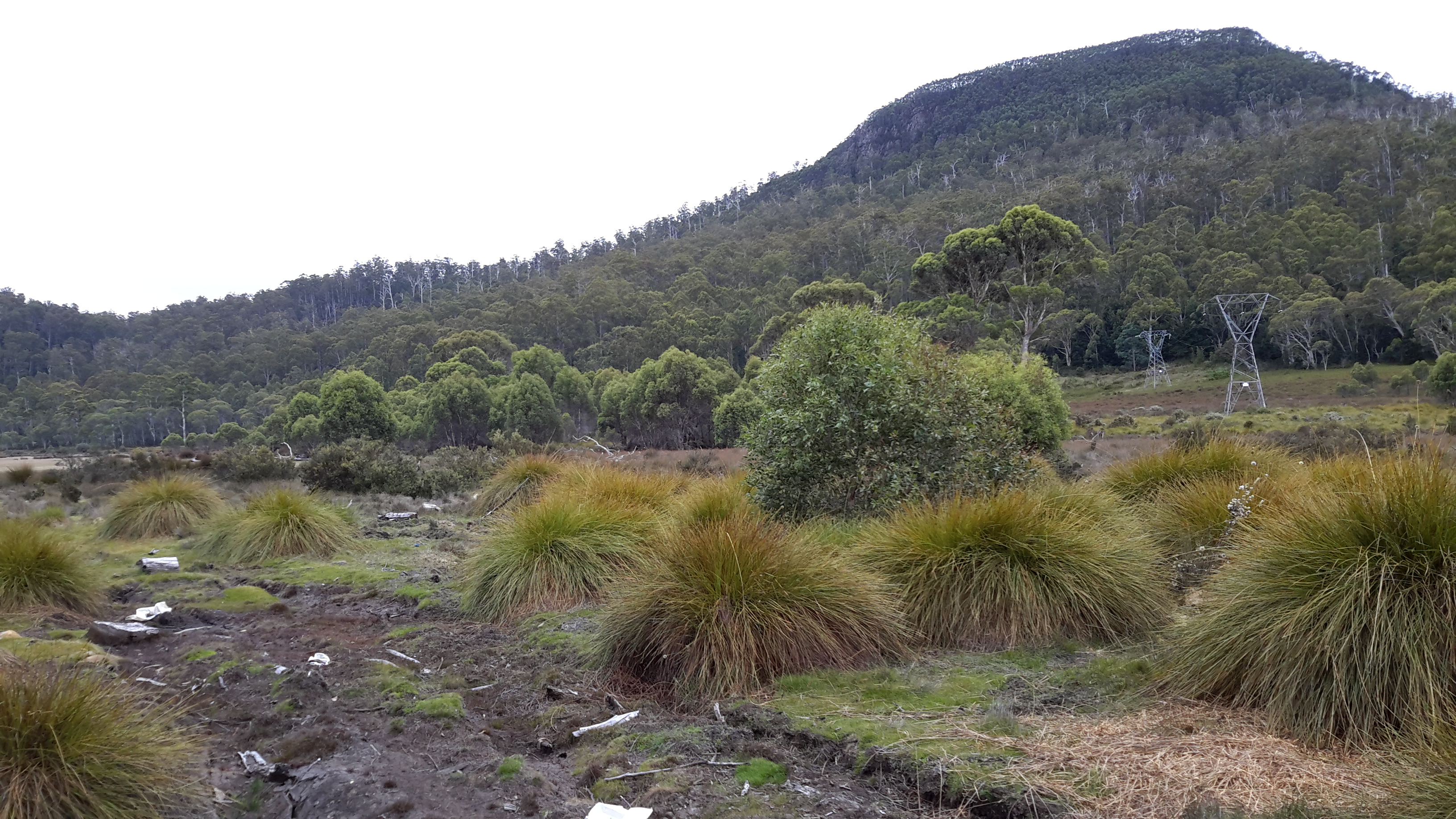
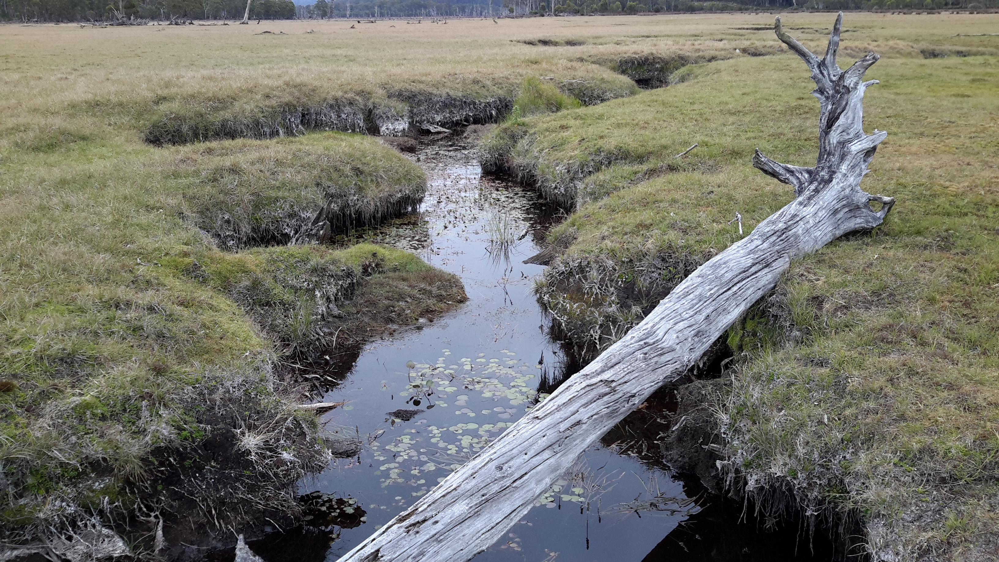
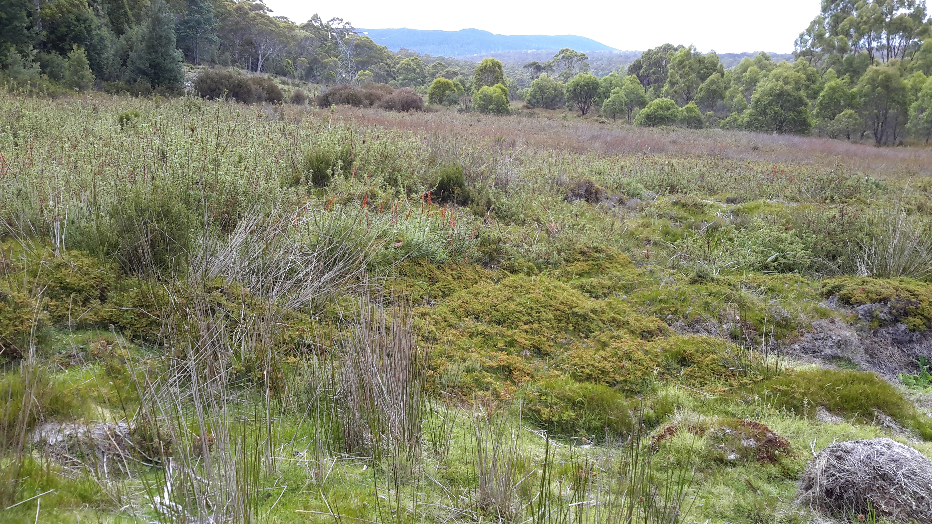
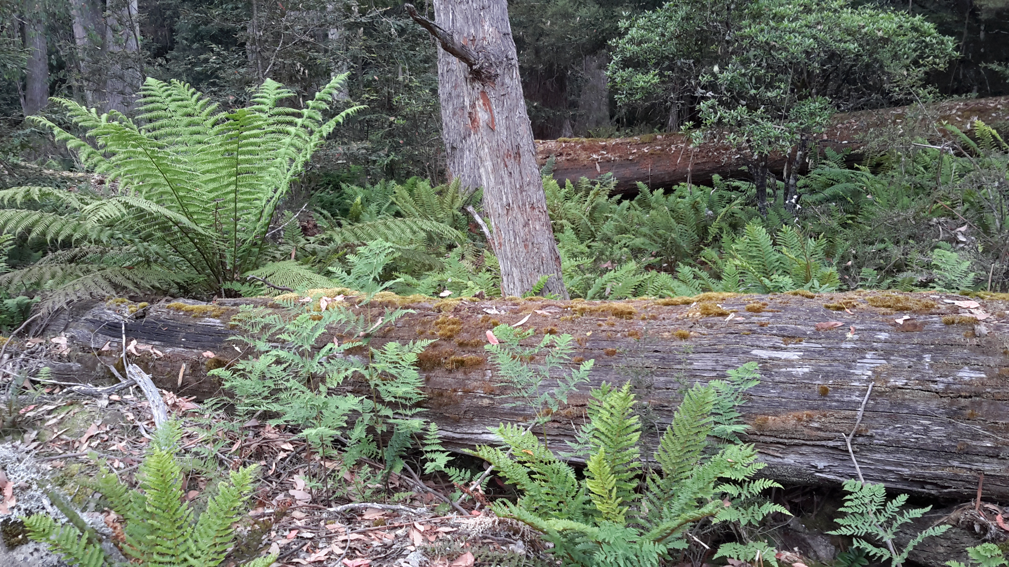
Despite not believing in a God, I do believe in the personally transformative power of the bush, wilderness, forests, whatever you may call those bunches of trees and natural collections of flora and fauna.

When with friends I have talked about walking, particularly in the bush, as a meditative practice. Sometimes the impact of the bush and its flora and fauna is so great that a well of great happiness is tapped – as evidenced, for example, by my bursting into song as described in an earlier post . At the end of any walk, words such as reinvigorated, revitalised, relaxed, uplifted, satisfied and at peace always come to mind. In addition, the power of the bush allows me to put the rest of life and living into perspective. Nature and its forces are so much stronger and more beautiful than any one of us, and it is a delight to be reminded of this in such profound ways. The rich rare world out there, rather than any religious connection, draws me to our wilderness.

Wilderness – what is it?

The word ‘wilderness’ has different meanings depending on context. Dictionaries offer a range of similar meanings:

  • An uncultivated, uninhabited, and inhospitable region. Neglected or abandoned.  A large area of land that has never been developed or used for growing crops because it is difficult to live there. (Oxford)
  • An unsettled, uncultivated region, especially a large tract of land that has not been significantly affected by human activities. A barren or desolate area; a wasteland. Something characterised by bewildering vastness, perilousness, or unchecked profusion. (The Free Dictionary)
  • A wild, uncultivated region, usually where humans do not live. Any desolate tract or area. (WordReference.com)
  • A tract or region uncultivated and uninhabited by human beings. An area essentially undisturbed by human activity together with its naturally developed life community. An empty or pathless area or region. (Mirriam Webster dictionary)

From Old English used in the 13th century, the word ‘wilderness’ is derived from wild dēor ‘wild deer’, wilddēoren ‘wild beasts’, and from wildēornes, ‘land inhabited only by wild animals’. From Middle English, wildern is ‘wild’.

Reflecting on these varying definitions, I realise some of the meanings ring true particularly in relation to the land along the Derwent River between Lake Catagunya and Derwent Bridge (I anticipate this part of the River will take at least 8 days to walk, over three stages).

Lake Catagunya to Derwent Bridge

The sides of the River will be uncultivated and uninhabited. Its dense forest, littered with generations of massive tree falls, will make some sections relatively inhospitable.  The only markers of human kind will be parts where old growth logging has or is occurring, and where the infrastructure associated with dam construction across the Derwent River has occurred and is being maintained.  The area will not be barren, desolate (although I might feel desolate when penetrating some of the denser bush hour after hour), and it is not neglected, abandoned nor a wasteland.  This wilderness will be rich with flourishing flora and fauna, have profound connections with the original indigenous population pre-European settlement of Van Diemen’s Land, hold a social history with the settlers who moved inland in the 1800s and 1900s, and include an occasional contemporary history with photographers, tourists and fishermen.

The United States of America has proclaimed special legislation. ‘The Wilderness Act bans all kinds of motors, roads, and permanent structures from large tracts of American territory. It provides a legal definition of wilderness, as land that’s “untrammelled by man” with a “primeval character and influence”.’  You can read more at this site.  What is the Australian situation?

The Wilderness Society of Aus logo

The Wilderness Society of Australia summarises our state-based rather than national legislation in relation to the wilderness. ‘Dedicated wilderness legislation exists in NSW and SA, which allows the nomination, assessment, declaration and management of wilderness. In other States, such as Victoria, Queensland, WA and the ACT, management of wilderness is provided for under general nature conservation legislation, with varying degrees of usefulness in terms of actually ensuring identification and appropriate protection.’

In Tasmania we have a range of legislation including the most recent Tasmanian Forest Agreement Act that was negotiated to include the requirements of the Tasmanian Wilderness World Heritage Area (TWWHA) – that is, those parts of Tasmania which have been recognised with World Heritage listing for their natural and cultural heritage that is important to the world community.  Tasmania’s Nature Conservation Act talks about biological and geological diversity, and historic sites and provides regulation for our fauna (and strangely it also covers animals which do not live in Tasmania such as dingos and wolves) and flora. The word ‘wilderness’ does not appear.

stock-photo-64271807-walking-boot-and-bike-tread-marks-on-muddy-trail(Image is a free iStock photo)

The land on which I will walk has been walked for thousands of years originally by our indigenous ancestors and more recently by their descendants and European settlers. However, there will be parts on my trek which will not have had many footfalls because of the isolation and the forest density.  Unless there was a purpose such as surveying the Derwent River as part of planning to build dams, sensible people would travel from Lake St Clair towards the coast  via the region around the township of Ouse, or by more hospitable routes. With or without the word ‘wilderness’ being written into our state legislation, much of the inland edges of the Derwent River edge are undoubtedly genuine wilderness.

Food for the walk

I have been planning for overnight camps, which I will need to make when I continue walking into the wilderness along the Derwent River.  On many occasions, the highway, byways and back roads will be far distant from the River making it necessary to pack shelter and supplies for one and two overnight stops. I know I won’t be able to carry much weight and so all things feather light are being researched and sought.

As part of my preparation, recently I purchased an Ezidri food drier.

Ezidri Ezidri mesh layer Ezidri ordinary layerDried food

Over time I have sliced spring onions, carrots, beetroot, capsicum, garlic, leaves of silver beet and mushrooms, and reduced them to tiny dry twigs and flakes. In addition, I have dried pulled slivers of precooked chicken legs and turkey mince.  During the process four bananas were sliced and dried. Can you identify all the shrivelled remains in the glass jars above?

Yesterday I experimented with reconstituting some of these foods and making a meal – albeit on my kitchen stove top.

Firstly, I added a small portion of all the vegetables plus a small quantity of the turkey mince into a small zip lock bag.  Then I sprinkled a little cayenne pepper, ground a few fresh back pepper corns and sea salt crystals, and added a small teaspoon of chicken flavoured powdered stock into the zip lock bag.  After closing the bag I shook it to mix the ingredients.  Into my billy I poured these dry contents and then added a 600ml bottle of cold water.

I was curious to learn how long it would take for the meat and vegetables to swell and soften.  After 15 minutes I could see that full reconstitution had not occurred. However, I was bored with waiting and I imagined that in the bush I would be ravenously hungry.  For the sake of the home experiment, I decanted the ingredients into a normal saucepan and cooked the meal on my kitchen stove top for 10 minutes.

I am delighted to say this was one of the best tasting meals I have had in a long time.  The liquid was gloriously coloured by the beetroot and despite many of the vegetables not being fully reconstituted, all the food was soft and full of original flavour.

When still in the zip top bag before cooking, I weighed the meal: only 100grams.  This low weight is very encouraging. My next experiment will be to cook a meal using the dried chicken. I can only imagine that should be equally successful.  But more research required.

1400km walk around Tasmania concluded yesterday: congratulations Chris Linton

A few weeks ago I read that a Tasmanian father and son (Chris and Kelvyn Linton) were planning an unsupported long-distance charity walk around the perimeter of Tasmania. This huge ambition filled me with excitement, and I hoped they would be able to achieve their goal.

While his son walked 20 of the 46 days it took for the walk, Chris Linton battled around every metre of the coast line.  Chris is reported as saying ‘Out of Queenstown, that hill is unforgiveable. The weather through that mountain pass was quite extreme – lots of snow and constant rain for two weeks.’ Refer to http://www.themercury.com.au/news/tasmania/epic-blues-beater-puts-dad-on-the-map/story-fnj4f7k1-1227357590621 for the arrival story, at Salamanca on the edge of the Derwent River.

I believe his walk is a significant achievement in one of the most challenging environments in the world. I am in awe of what has been done, and even more so because much of the walk was undertaken during one of Tasmania’s most bitterly cold and stormy periods.

More information about this trek, to raise funds for the Black Dog Institute, can be read at http://www.blackdoginstitute.org.au/docs/TasmanianresidentsChristopherandKelvynLinton.pdf

You can read more about an earlier stage of the walk at: http://www.themercury.com.au/news/tasmania/chris-linton-nears-end-of-walk-around-tasmanias-perimeter/story-fnj4f7k1-1227351866303

As a war veteran suffering from post-traumatic stress disorder, I hope the soothing effect of Tasmania’s wilderness environment and the flood of positive endorphins encouraged by the continuous activity, have been healing forces for Chris. An amazing personal achievement! Congratulations Chris Linton!

Paper making mill on the Derwent River

The tiny settlement of Sorell Creek has a perfect view of the Norske Skog newsprint manufacturing mill across the Derwent River at Boyer.  The business website is located at http://www.norskeskog.com/Business-units/Australasia/Norske-Skog-Boyer.aspx

Since the 1940s this mill, along with others dotted around the state, has been a mainstay of the Tasmania’s economy.  Tasmania has been a land of old growth forests which, since European settlement, have gradually been reduced for farming, town and city growth and for the establishment of newer plantation forests.  Norske Skog only uses the wood from plantation forests and in this way protects the remaining ‘original’ forests and wilderness of Tasmania.

You can read more about the history of this plant at http://www.vantagepaper.com.au/BoyerHistory.aspx.

During the Stage 14 walk, I approached the mill during the latter part of the morning until I stood looking across the Derwent River at it. From then on, the mill gradually disappeared from view as I wound around walking paths along the curving Derwent River.

20150413_100955 20150413_105904

20150413_111318 20150413_113308

20150413_113439 20150413_113501

20150413_113710 20150413_122840

Along the way, I passed many more spectacular poplar trees with their golden leaves.

20150413_113530