Tag Archives: Charles Darwin

Fires above the Derwent River

On too many nights last week the sky was dense with a rosy fire haze across my suburb.  The smoke slipped through crevices in my house so that, through each evening, I felt like I inhaled a camp fire.  Back then I checked the Tas Fire Alert website and learned the closest fire was in Quarry Road less than half a kilometre away. Today I went off to see what the burn looked like.

I chose to walk through the bushland of Waverley Flora Park first and then descend down Quarry Road.

2015-11-09 09.37.10

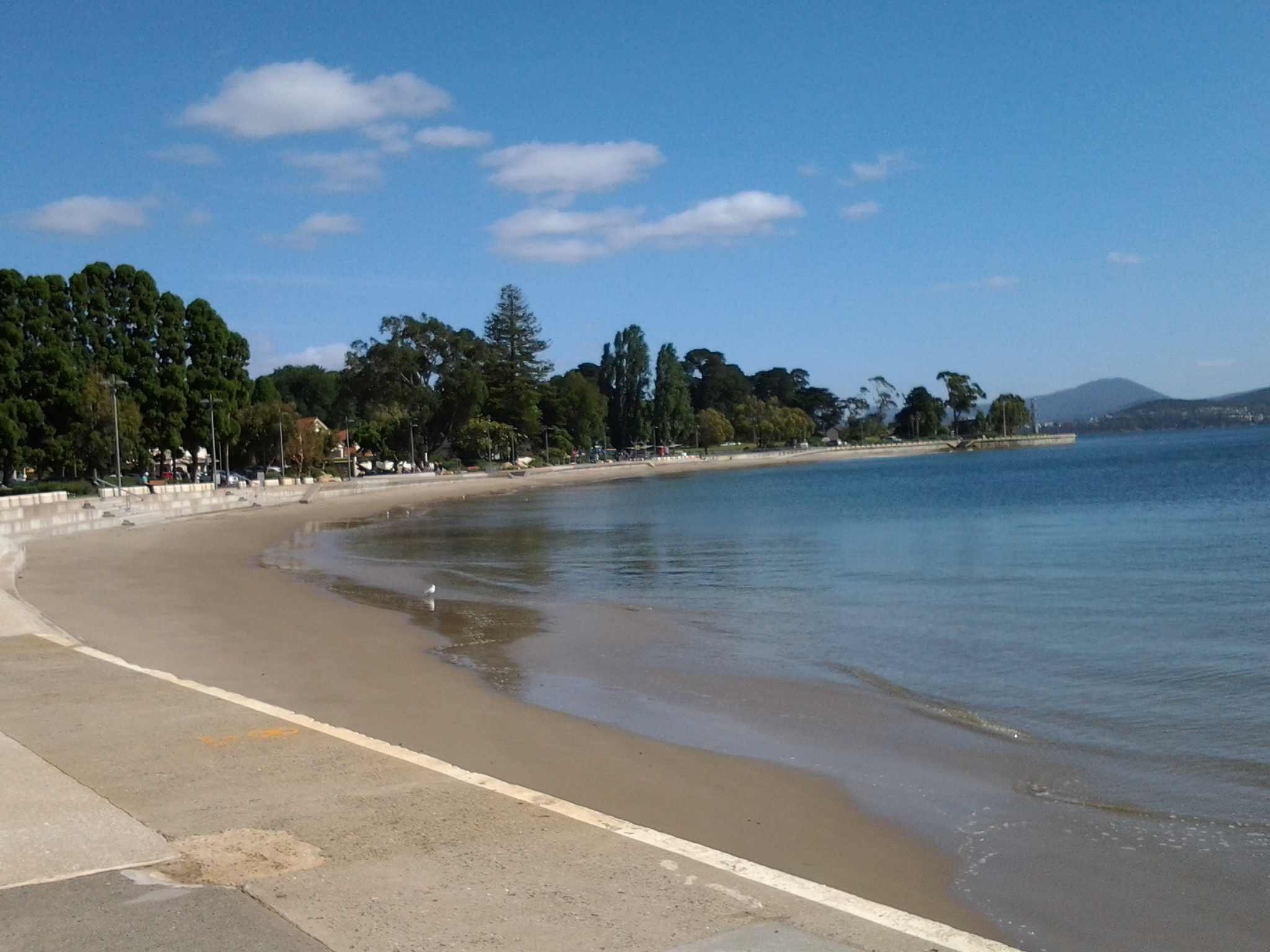
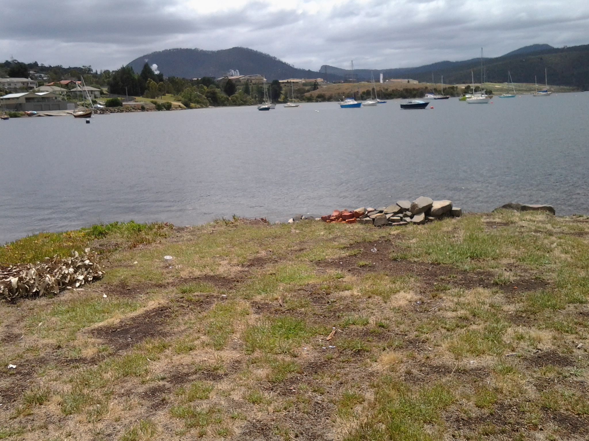
From the top of one of the Park’s walking tracks, I looked through stands of gum trees towards the mouth of the Derwent River.

2015-11-09 09.22.36 2015-11-09 09.22.51

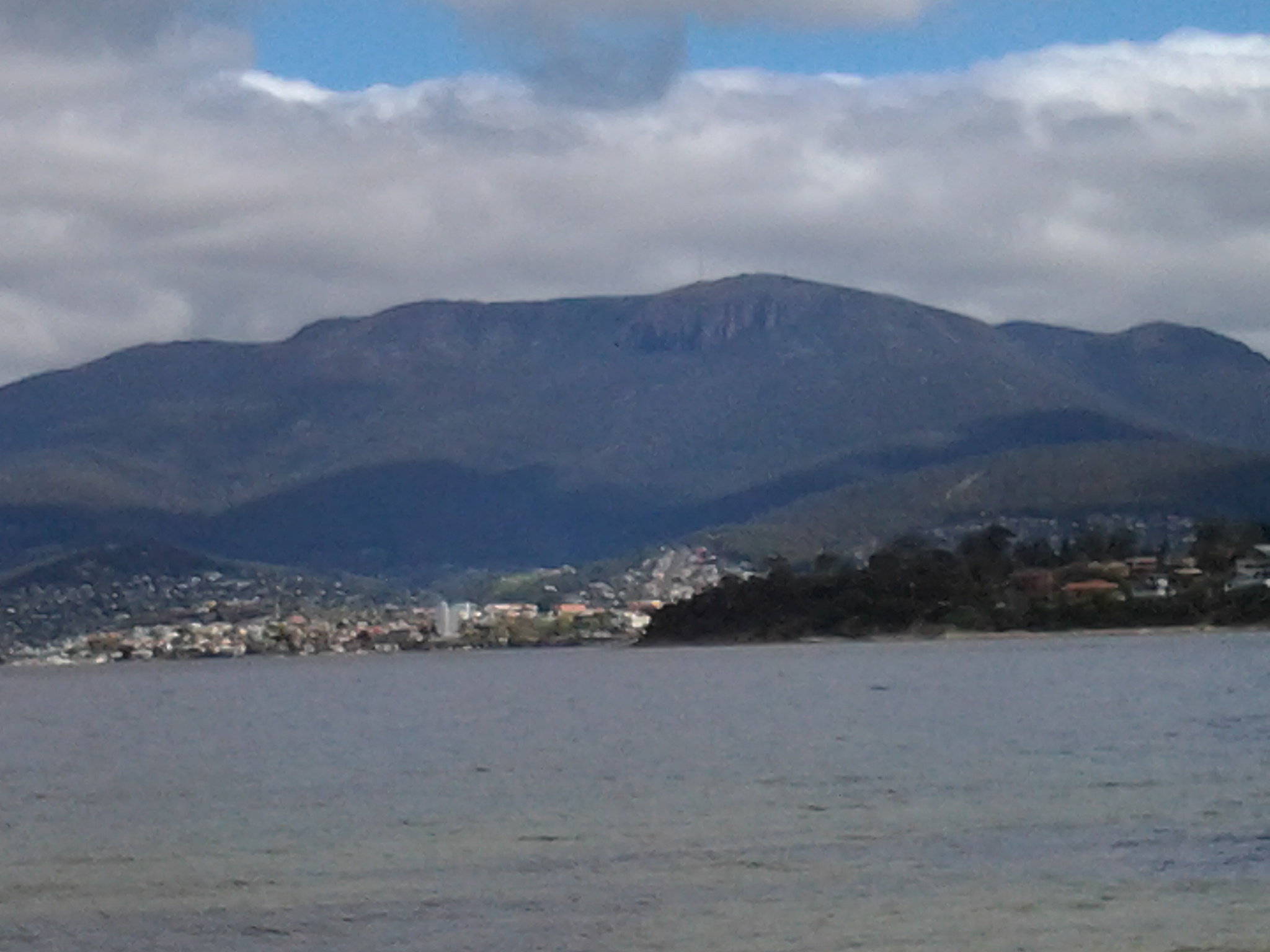
In the other direction Mount Wellington loomed large over the Hobart CBD and the Derwent Harbour.

2015-11-09 09.24.47

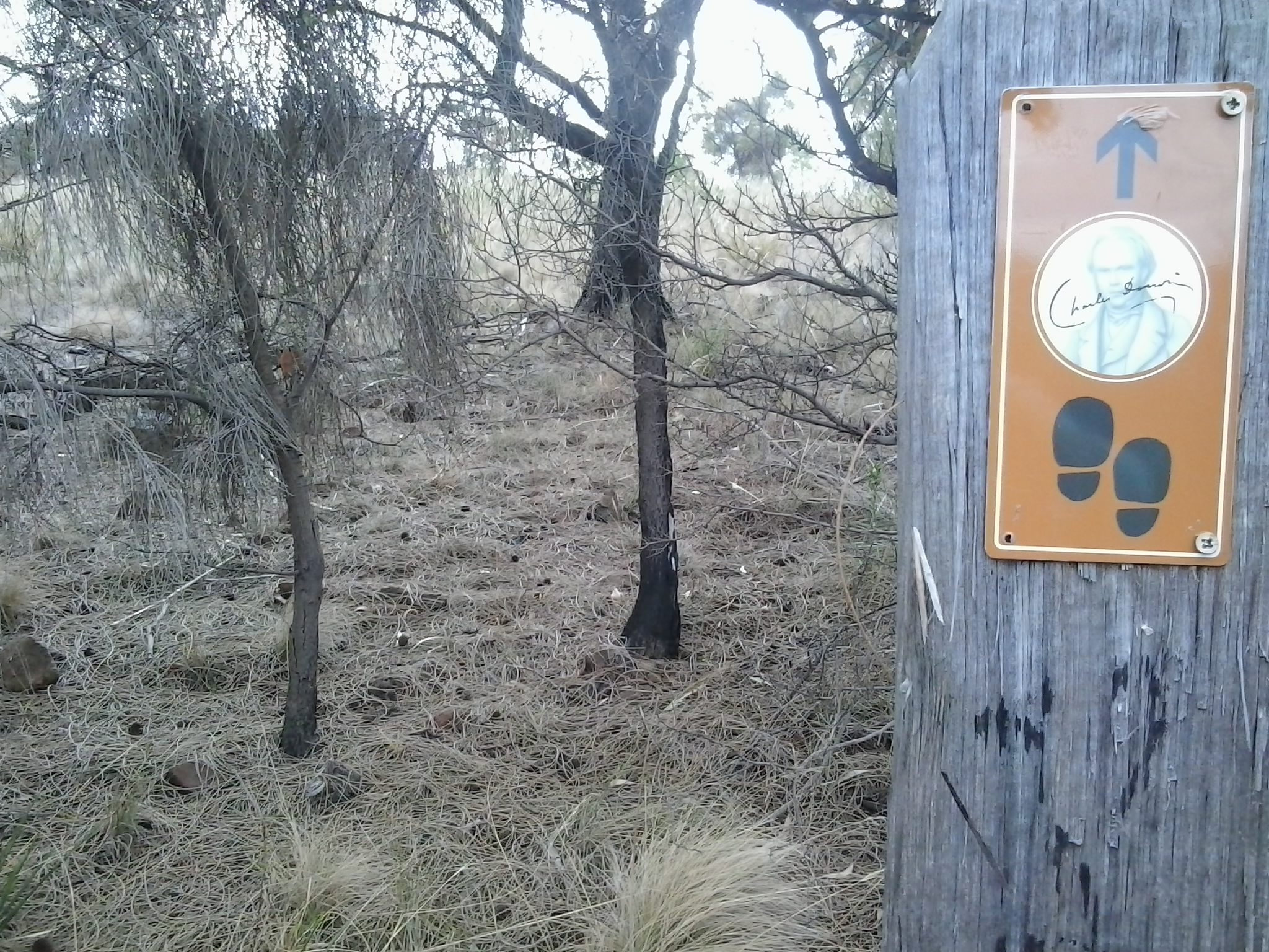
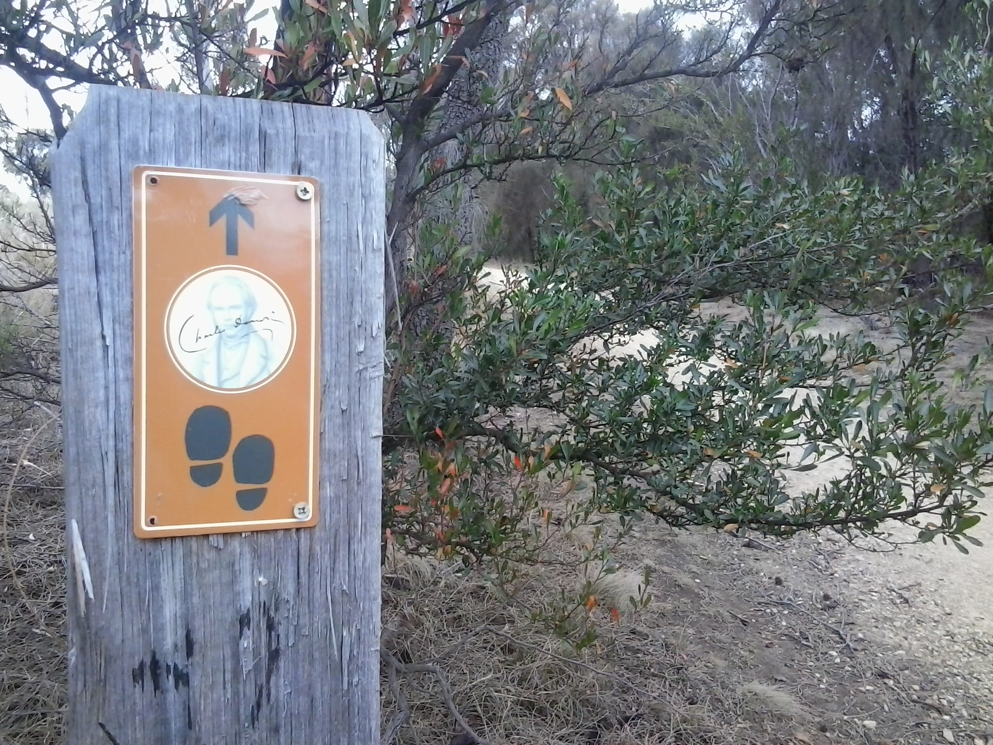
I followed in the footsteps of Charles Darwin, ‘father’ of the theory of evolution, who walked around Hobart in 1836. At some time during that visit he crossed to the eastern shore and wandered around the Bellerive suburb and beyond.

2015-11-09 09.22.59 2015-11-09 09.20.23 2015-11-09 09.20.15

I saw unfamiliar medium-sized birds collecting nesting material and insect food morsels (who flitted away far too fast for me to take a photograph): one was dressed in silvery greys with a long strand floating after its tail, and another with a rich olive green coat. None of my bird books help me to identify either of these birds – any locals with bird knowledge?

A profusion of native spring flowers carpeted parts of the Park, or stood as single colourful spikes amidst the dull dry green grasses.

2015-11-09 09.32.36 2015-11-09 09.25.26

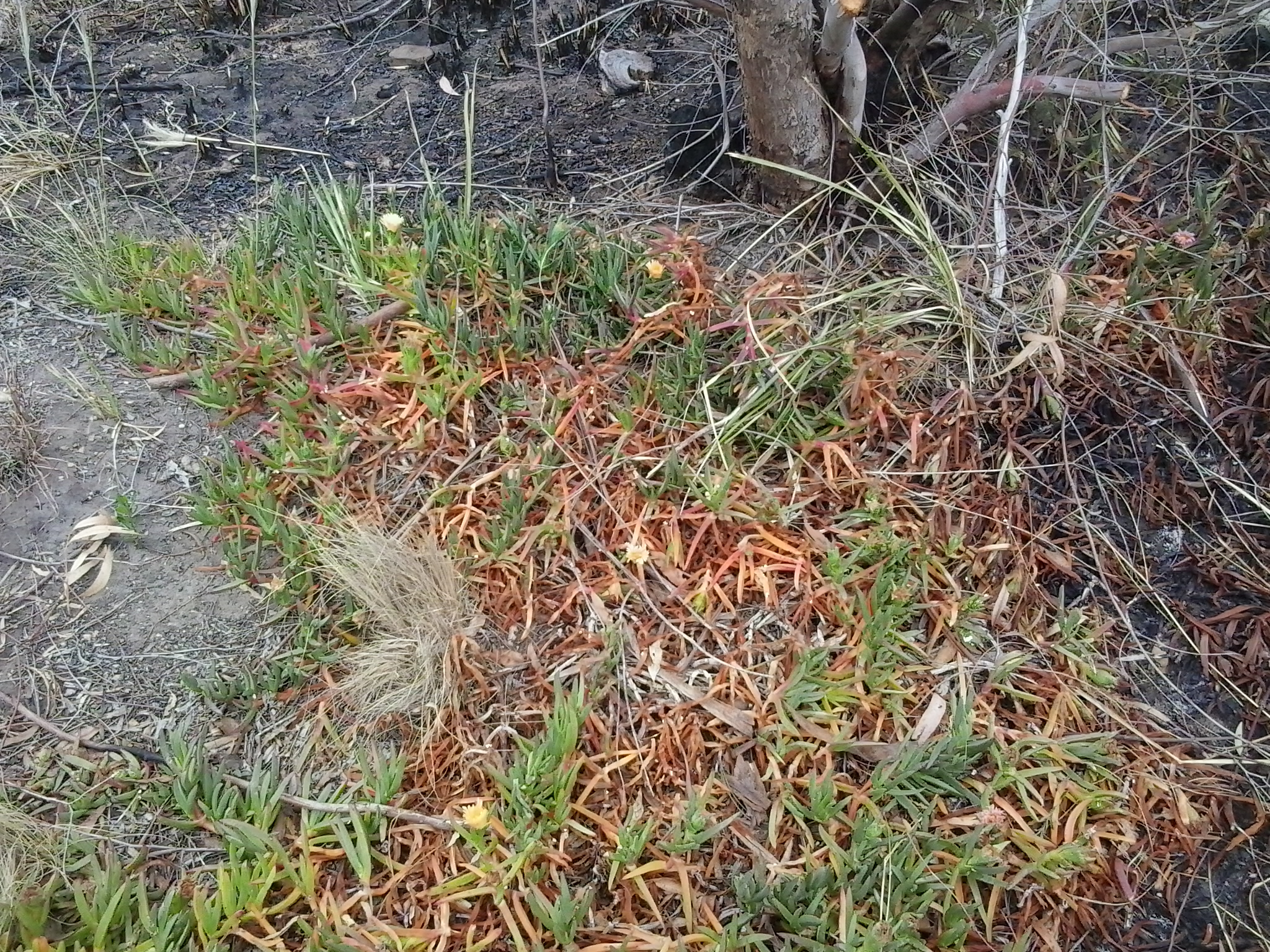
It soon became clear that lots of burned vegetation and scorched earth passages were scattered next to the walking track and beyond.

2015-11-09 09.29.05 2015-11-09 09.28.19

Later when I walked down Quarry Road with not a burn mark in sight, I realised that for bureaucratic purposes the Tas Fire Alert site had to indicate the best road for fire trucks to follow.  It had been parts of the Waverley Flora Park that suffered fire damage.

As I continued downhill, I heard the siren sounds of a fire truck and watched it whip past the intersection below.  When I turned the corner, the truck was parked askew with hefty yellow clad guys preparing their gear.  The screams of other sirens were closing in. I watched wisps of smoke escaping from all manner of slits and slots and dirty brown smoke puffing from the front door of the house below.  I saw an approaching ambulance and guessed this wasn’t someone’s best day.

Blinking Billy Point, Lower Sandy Bay next to the Derwent River

Continuing Stage 11 of my walk along the Derwent River, I walked the foreshore from Long Beach towards Blinking Billy Point. Looking northwards, the crescent of Long Beach stretched before me.

20150119_100336

I passed a new set of public toilets around 10am and ten minutes later I was walking around Blinking Billy Point.

20150119_101600

This was an area to which Charles Darwin (http://www.biography.com/people/charles-darwin-9266433) walked from Sullivans Cove (my starting point for this Stage of the walk) in February 1836. The area’s local government has remembered the occasion with an information plaque.

20150119_101336

Out in the water is a marker for water craft: the John Garrow Light (established in 1953).  I have known this was a marker used in the Sydney to Hobart Yacht race but I had never known where it was located.  Now I know: almost east of the Blinking Billy old lighthouse.  According to http://www.maritimetas.org/sites/all/files/maritime/nautical_news_winter_2002.pdf, John Garrow was a Sandy Bay pastry-cook, who lived in Bath St. Battery Point and died 1924. This begs the question – how did a nautical navigation tool come to be named after someone that seemingly had no connection with the Derwent?

I noticed that the Point has old defence structures embedded in the cliff. I learned that these were an adjunct to the huge hill behind with the remnants of the 19th century Alexandra Battery.

20150119_100941

20150119_101150  20150119_101159

Looking down the Derwent River through the glitter of the distance to the eastern shore, I could pick out Trywork Point (the southernmost tip of land before Ralphs Bay begins) and Gellibrand Point (the northern most point of the South Arm peninsula) both providing the ‘gateposts’ to Ralphs Bay. Previously, I explored these distant Points on Stage 2 and 3 of my walk.

20150119_100933

Then I looked back to Long Beach from Blinking Billy Point with Mount Wellington in the distance. How peaceful the world seemed.

20150119_100704

Despite the promises of a short beach in Geography Bay after the Blinking Billy Point, I knew better than to have expectations that continuing my walk on the foreshore was possible. The Sandy Bay Foreshore Track finishes at Blinking Billy Point.

20150119_101600

Some years ago a friend and I tried to walk the rocky shore southwards from Blinking Billy Point but, as the tide came in, there came a moment when we couldn’t move forward or backwards.  I remembered we scrambled up through someone’s property; the people were not at home and we let ourselves out onto the street hoping no alarm systems would be alerted. We were lucky that day.

Based on that memory, I knew it was not worth proceeding any further and retraced my steps around Blinking Billy Point until I could walk up to Sandy Bay Road.

Heading for Selfs Point as it juts out into the Derwent River

Leaving Lutana, I crossed the bridge on the Queens Walk by turning left off Risdon Road.

20150109_130759

Close by was a sign indicating I was now in the City of Hobart and part of the New Town Bay Reserve. I turned left into Marine Esplanade.  A massive Graham Family Funeral direction sign sat in a rugby field on one corner implying a funeral business was behind.  But it is not – the business premises are located perhaps a kilometre or more away within the suburb of New Town.

As I walked along the gum tree sided Esplanade with New Town Creek to my left, I inhaled deeply of the fresh eucalypt smells. A little before 1.15pm I reached the Tasmanian Bridge Association clubhouse. A minute or so later I passed a University of Tasmania building and stood on a landscaped circle of land marking the mouth of New Town Creek as it enters into New Town Bay.

20150109_131411

Continuing amidst trees by the water’s edge I walked outside a high mesh fence marking the territory of a Sewage Treatment Plant.

20150109_131757

A little after 1.20pm, I was forced to turn back and retrace my steps. The property on which the oil tanks stand was effectively fenced, and the barb wire topped mesh extended out into the water. I wasn’t welcome to continue.

20150109_132116

Irritated, I plopped down on some rocks at the edge of the Bay and nibbled on some lunch.

20150109_132028

For the first time that day I felt the effects of a strengthening wind. I liked watching the MONA ferry dragging a chain of churning white water like a fluffy tail, as it travelled between Hobart and Berriedale.

This route was a pleasant and safe distraction but it did not help me to reach Selfs Point.  And then, as I walked back I found there were no connecting pathways between the Esplanade and Selfs Point Road. But I was not unhappy to have walked this way.  It was really tranquil moving along beside the edge of the Creek and then New Town Bay and the return walk.

In addition, the deviation was valuable because it allowed me to muse about the walkings of Charles Darwin, the English naturalist and geologist best known for his contributions to evolutionary theory. Darwin sailed to Hobart on the Beagle at the end of January 1836 and departed in the middle of February.  You can read more information about his Tasmanian stop over and his opinions at http://www.utas.edu.au/library/exhibitions/darwin/hobart.html.  A few years ago I was told that Darwin decided to climb Mount Wellington by starting at New Town Bay and following New Town Creek.  However, I can find no evidence of this and, in fact, the Royal Society of Tasmania states Darwin only made two attempts to scale Mount Wellington and both were from the South Hobart direction.

By 1.45pm, I had returned to the Queens Walk and turned left to find another route to Selfs Point.

Kangaroo and Bellerive Bluffs on Stage 4 of my walk along the Derwent River

After lunch, I walked up to the road (Victoria Esplanade), turned left and proceeded to walk around a new headland, Kangaroo Bluff. The photo below looks south along Bellerive Beach to Second Bluff.

20140926_121521

Continuing the walk and a little way ahead at Gunning St, on the right hand side of the road, a sign indicated the Kangaroo Bluff Historic Site could be reached uphill in a couple of hundred metres. I didn’t take this route rather I continued on the Trail around the Bluff until I reached Bellerive Bluff, the official finishing point for my walk on Stage 4 along the Derwent River. Before reaching Bellerive Bluff, I watched the tomato red coloured Aurora Australis, the Australian Antarctic Division’s research and resupply flagship, manoeuvring around the Derwent Harbour.

Once I arrived at Bellerive Bluff, an information sign reminded me that Charles Darwin, the eminent English naturalist, visited when the Beagle sailed into Hobart in 1836. The sign is particularly informative because it includes a map showing exactly the path Darwin walked on the eastern shore, some of which I have walked during Stage 4. Apparently some of the geological research and findings he made here on the eastern shore of the Derwent River, laid the grounds for the development of the significant theory of continental drifts. This information reminded me that it does not matter in which little pocket of the world you live, some important global story will come from it.

The next, 5th leg of the walk will start opposite Bellerive Bluff at Rosny Point, on a day yet to be determined.  The dark treed headland in the photo below is Rosny Point at the foot of the low Rosny Hill (the ever present Mount Wellington is visible in the distance).

20140926_113324

From Bellerive Bluff further walking is required to access bus routes and return to the Hobart city centre (although I walked home nearby). The Clarence Foreshore Trail continues along the edge of Kangaroo Bay from Bellerive Bluff. This pleasant walk leads to the Bellerive Ferry dock, a Fish and Chip Bar, and the Waterfront Hotel all overlooking the calm Kangaroo Bay with its marina full of yachts.

20140926_130133

Continuing past the Hotel onto the Boardwalk (which stages wonderful open-air festivals throughout the year such as the Seafarers Festival, the Jazz Festival, and the Fruit Wine Festival) there are two choices: to continue along the edge of Kangaroo Bay and past the Bellerive Yacht Club, or to walk up to the street and access the shops and restaurants of Bellerive Village. On the road (Cambridge Road) after the Yacht Club, after the shops finish and not far from the intersection lights, the sign for bus stop number 8 is planted on the edge. From here a bus can be hailed (please do not expect a bus to stop if you do not hold out your arm and indicate, even though you may be standing at the bus stop).  A timetable of bus services is posted on the bus stand.

Once on the bus, you should feel satisfied (and so lucky) that you exercised your body, cleansed your mind, and experienced the beauty of a portion of the Derwent River and its immediate environment. At the end of every walk I treasure where I have been during the day, and I am always excited thinking about the unknowns of the next stage, and looking forward to it.