Category Archives: Hobart

Linden

20150917_110024

The name Linden is used to name streets, roads and courts in the Derwent Valley and elsewhere across Tasmania perhaps as a marker of someone with that surname who made an impact on the community in the past. But I could not find a Linden family history, or any other historical reason to justify the naming of the property I passed at approximately 5 kilometres west of New Norfolk.

Perhaps the naming was related to Linden trees native to England from where an early property owner may have travelled.  I cannot recognise this tree so I cannot say whether the trees on the property were lindens.

Alternatively, does Elena Gover’s account in Tasmania through Russian eyes (Nineteenth and early twentieth centuries) create another possibility? Was this property named after crew member Lieutenant Vilgelm Andreevich Linden of the Russian corvette Boyerin which arrived in Hobart in 1870 at a time of goodwill in terms of Australia-Russia relations? Linden wrote notes and collected extensive information about many aspects of Tasmania. ‘As well as chapters on geography, he made an analysis of the aftermath of transportation on the economic development of the island. Linden collected interesting information about the government and electoral system of Tasmania, and of the system of land allocation which allowed an influx of free settlers…

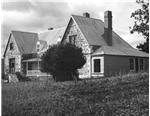
I did not walk down the driveway so I did not see existing residences at Linden. Apparently ‘Bryn Estyn’ homestead was built on the property in the 1840s, and named after the family home of new settler Lieutenant Henry Lloyd who had relocated from Wales. The State Library of Tasmania holds a photograph of the building:

Bryn Estyn

You may recall an earlier posting showed the Water Treatment Plant named ‘Bryn Estyn’. I can only assume the original land grants for Lloyd included the acres for the Treatment Plant.

A sandstone quarry on the property was the centre of attention when the building of Tasmania’s High Court in Hobart was being planned. Back in 1982, when A. A. Ashbolt owned the mineral lease, the quarry on the Linden property was surveyed to determine whether sufficient stone of ‘acceptable quality’ existed that would be suitable for cladding the new Court. Previously this stone was used on the Supreme Court of Tasmania. The stone was found to have been laid down in the Triassic period (about 3 million years ago), a time when the early dinosaurs were roaming the earth.

I suspect the property, marked with Linden at the entrance, is now known as Ashbolt Farm. The farm specialises in producing products from elderflower and olive trees and additional information is located here.  I wish I had known about this property prior to walking because I would have made arrangements to visit and enjoy a cup of hot elderberry tea.  When I passed this property last Thursday, there was no sign of life and no welcome sign posted.

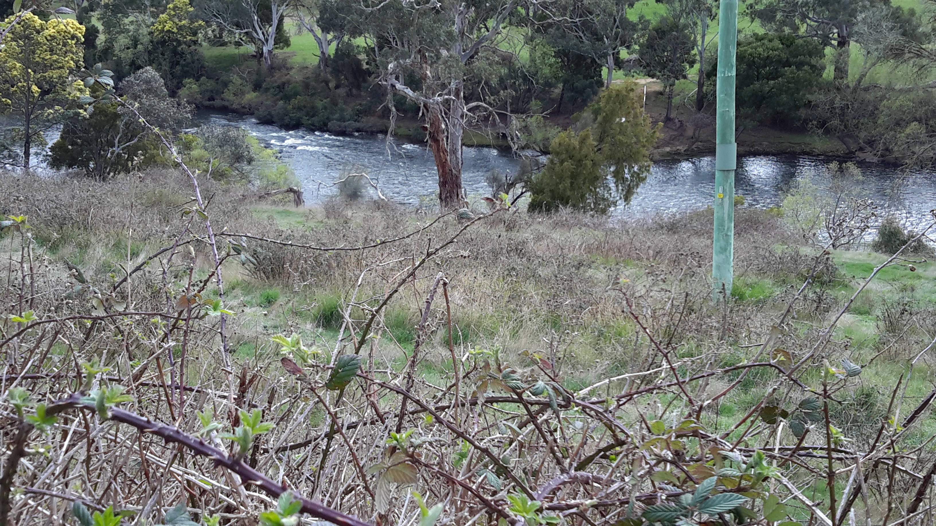
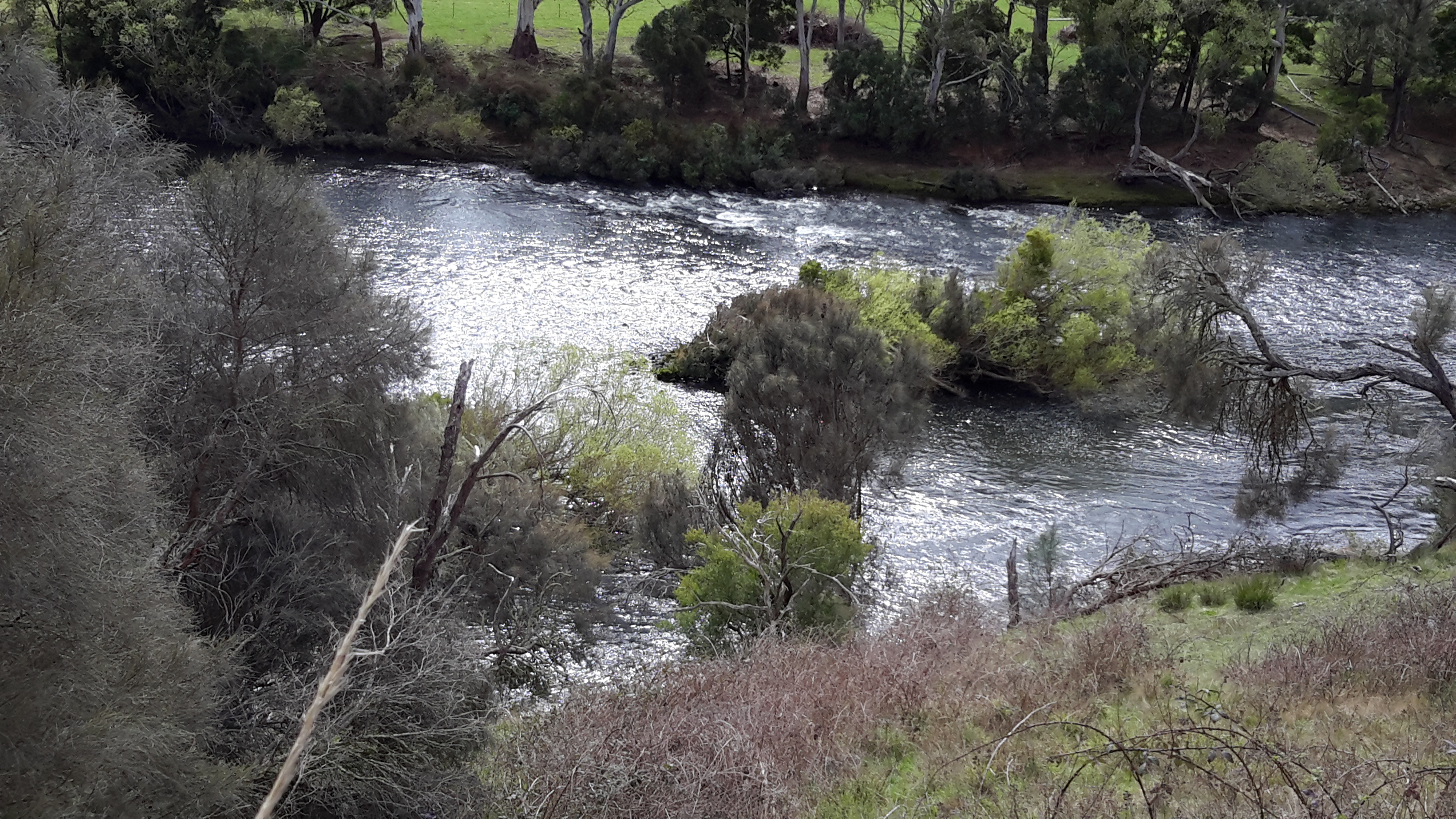
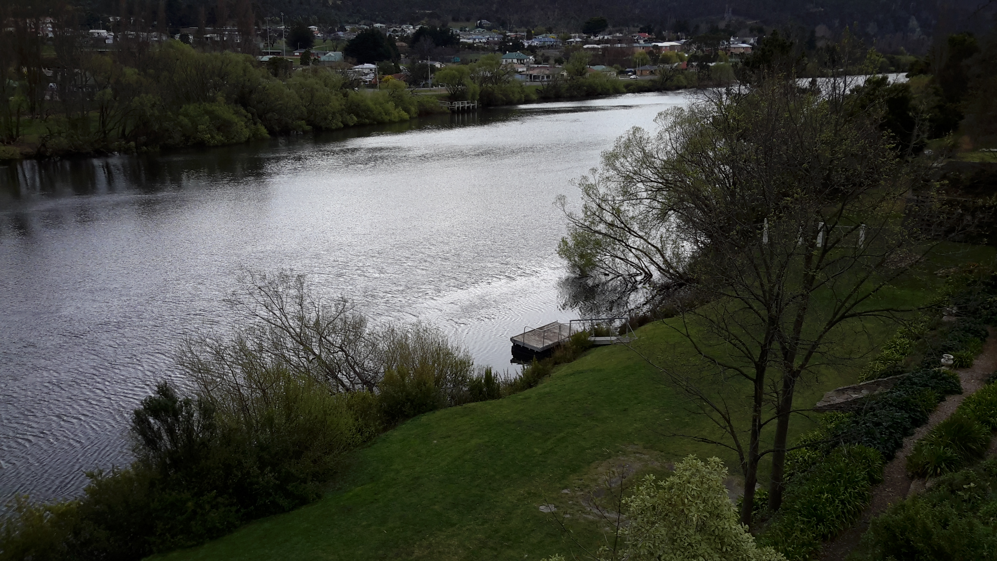
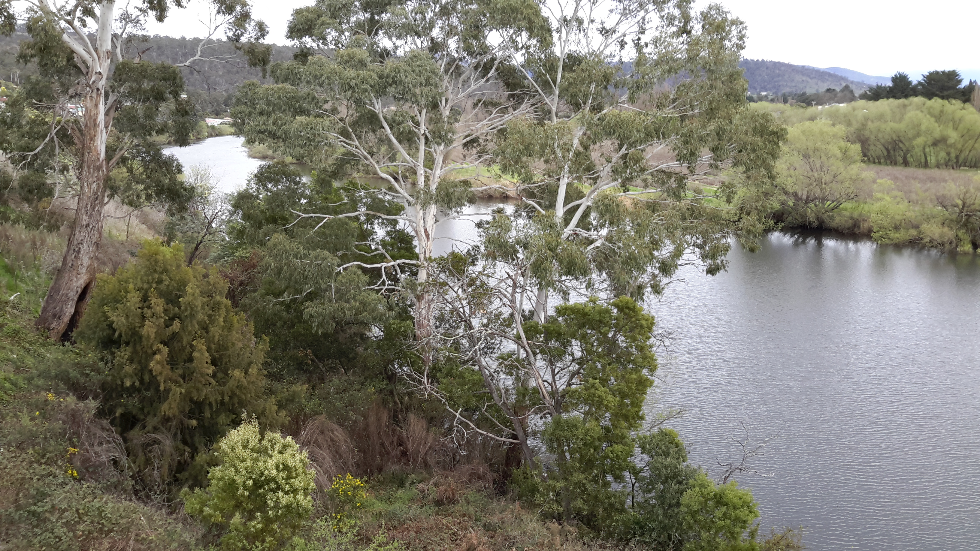
Immediately past and in the vicinity of the property ‘Linden’, the racing Derwent River was visible from the road.

20150917_111214 20150917_111338 20150917_111407 20150917_111617

Starting out last Thursday

Blog followers know I have waited almost impatiently for Spring weather to arrive; I had been so eager for my walk from New Norfolk to Gretna to be pleasantly memorable.  At home the early morning sun shone and Hobart sparkled.  At 8am the Derwent Valley Link bus departed from the city. I was the only passenger until well into the Northern Suburbs when school kids jumped on and took over – as kids do.  By the time the driver dropped me at New Norfolk central the sky was grey and a stiff cold wind blew. The day seemed as dull as the car park (note the bus shelter in the centre).

20150917_090036

Determined not to be distracted by the weather, I headed off towards the bridge over the Derwent River, past the historic Bush Inn.

20150917_090300

I was ready to follow signs.

20150917_090312 20150917_090405 20150917_090656

I needed to follow the road which led to the Salmon Ponds (although I expected to bypass this location during my walk), however I deviated to the right so I could stare at the Derwent River from the bridge.  At first I looked down onto the mown lawn where I finished Stage 14 of the walk.

20150917_090850

Then I swung around to look at the river from the inland/western side.

20150917_090914 20150917_090928

After retracing my steps I was ready to embark on the next adventure. After turning into Glenora Road (designated as B62) on the southern/western side of the Derwent River, I proceeded past St Brigids Catholic School.

20150917_091204

Between the few suburban houses I caught glimpses of the river and then, within minutes, I was leaving New Norfolk.

20150917_092751

For many kilometres, my view of the river was rationed. Occasionally I spotted the beautiful river through an inaccessible profusion of weeds. Mentally I stripped away the vegetation and loved the changing surfaces of the river and the speed with which it flowed.

20150917_093031 20150917_094036

Everywhere I looked was lushly green or silvery blue. I was thankful that the overcast sky allowed the colours to reverberate and seem so much richer.

Tasmanian Writers Festival in Hobart

Through last Friday, Saturday and Sunday I participated in workshops and attended discussion sessions presented by individual and groups of local, national and international writers.  Three wonderful days. The venue was perfect, the scheduling of sessions was well timed, the selection of guest speakers provided a rich cross-section of approaches and ideas, and the administration each day by the staff and volunteers associated with the Tasmanian Writers Centre was seamless and seemingly trouble-free.

In particular, I was alert for approaches by which I might turn my walk from the mouth to the source of the Derwent River into a fictional account once the walk is over. Throughout the weekend, I was reminded that the clichés of real life have no place on the page of a novel, that I must stop emphasizing the factual and place emphasis on the underlying emotional and troubling aspects of the story, and that links between the events of the walks could be made on the basis of association rather than chronology. Overall, it seems I should write to bind a reader to the experience not the facts, and that it is best to do so by following a chain of emotional connections. Easier said than done, however these ideas give me a basis on which to start thinking about how the story might unfold.

Memorable sentences from the Festival include:

  • Stand back from your real/true story and view it as a reproduction; as a photo or video made by someone else.
  • What is in memory is not necessarily real.
  • By assigning characters to aspects of the bush / the landscape we shape our own characters and beliefs.
  • Where you stand influences what you see.
  • Real experience is not necessarily a personal experience.
  • The unexpected makes the invisible visible.
  • Use secondary characters to make main character more plausible.
  • If you have a lot of backstory then you have started too late in the story.
  • It is better to write about something you are apprehensive about.

In one session, internationally renowned author Robert Dessaix remarked that he ‘liked himself in India’ and Paris but not in Rome. I liked myself at the Festival venue Hadleys Orient Hotel Hobart for the duration of the Festival.  I believe I will like myself even more in the vicinity of the Derwent River when I walk the edge during the coming days, on the first stage since April.  Spring has arrived!

Maps

The Derwent River will always be your guide if you choose to walk along its length, but sometimes it is difficult to walk directly next to the river; for example structures may be built to the edge, steep drop down cliffs may raise you many metres above the water, and gates and fences may make access impossibly impassable.  In addition, when the terrain forces you away from the river, the vegetation may be sufficiently dense so that you can get lost (without map and compass – and GPS if your technology allows).

If you choose to walk the entire length of Tasmania’s Derwent River you might consult one or more of the 17 maps which cover the territory. One value is that you learn the name and shape of landmarks. Have a look at the list below:

Maps

The Derwent River at night

Tasmania’s bush, its coast and urban areas offer a photographer’s paradise at all times of day and night across the four seasons.

This Amazing Planet  is one of many blogs that show spectacular photographs of Tasmania’s flora, fauna and landscape. Go to Nightscape-Hobart for a stunning visual treat. Enjoy looking at part of the glorious Greater Hobart Area, at night, photographed from on top of Mount Wellington. Between the two sides of the city, the rich blue Derwent River passes on its way to Stormy Bay and then the sea. The brightly lit Tasman Bridge can be seen to join the two shore lines.

From the sea to the source; stories of a river on the other side of the globe

Two years ago, Helen Ivison published River Derwent: From Sea to Source (Amberley Publishing).

 Ivison River Derwent

 The promotional puff declares this book ‘brings to light tales and stories of fascinating events, landmarks and people. River Derwent: From Sea to Source is essential reading for anyone who knows this river well, and also for those who are visiting the River Derwent for the first time.’  But what is the author referring to?

Hers is the Derwent River in the Cumbrian region of England which flows from the mountainous Lakes District in two strands, one of which starts near Styhead Tarn. The two strands meet at Grains Gill, and continue in a north easterly direction as a single river towards an expanse known as Derwent Water. The river passes through this ‘lake’ then eases into a north westerly direction across country before flowing onwards through Bassenthwaite Lake. Finally, the English Derwent River turns westwards and empties into the Irish Sea.

By contrast Tasmania’s Derwent River flows generally in a south easterly direction from Lake St Clair, through steep narrow gorges, curving around farmlands, before passing between the two sides of the Greater Hobart Area into Storm Bay. The man-made lakes of Lake King William, Wayatinah Lagoon, Lake Catagunya, Lake Repulse, Cluny Lagoon and Meadowbank Lake all disrupt the progress of the River. These lakes have resulted from dam building as part of hydro-electricity generating projects over the past century.

The weather in southern Tasmania

The early non-indigenous settlers in Van Diemen’s Land (now Tasmania), almost all of whom were formerly residents of the typically rainswept and cool British Isles or had lived in hot India, documented their thoughts on the weather.

Their descriptions of our weather were usually based on comparisons with the situation from which they had relocated. Generally the impression given is that the weather on this island is temperate, irritatingly variable, and considerably easier to live with compared to that experienced in the settlers’ original homelands. For example, in James Bischoff’s “Sketch of the History of Van Diemen’s Land” written in 1832, there are many references to the climate and its relationship to agriculture and animal husbandry. More generally he says: ‘To one accustomed to the moist climate and plentifully watered countries of England, Scotland, and Ireland, Van Diemen’s Land, at first sight, may present a dry and unproductive appearance; but upon a nearer acquaintance, it will put on a more inviting aspect.’  It was ‘the regularity and salubrity of its climate’ which Bischoff found attractive.  The author also claims that ‘A book was published at Calcutta, in 1830, giving an account of Van Diemen’s Land, principally intended for the use of persons residing in India, and shewing the advantages it holds out to them for their residence; the following is extracted from that work: Its climate seems so well adapted to the renovating of the constitution of those who have suffered from their residence in India, that it only requires to be pointed out, and the easiest manner of getting there made known, as also the cheapness and comfort of living, when there, to turn the tide of visitors to the Cape and the Isle of France, towards its shores.’

Godwins Guide to Emigrants to VDL

Godwin’s “Emigrants Guide to Van Diemen’s Land more properly called Tasmania held in the collection of the State Library of Victoria, written in 1823, offers the following: ‘This island has to boast of perhaps the most salubrious and congenial climate of any in the known world, for our European constitution: It has been ascertained by the thermometer to be similar to that of the south of France; the general temperature being about 60 degrees Fahrenheit, and the extremes from 43 to 80 degrees. The spring commences early in August, the summer in November, the autumn in March, and the winter in May. The winter, therefore, is not of more than three months’ duration, and the severest part only six weeks.’

Ros Haynes writes on a University of Tasmania site in 2006 ‘In most areas there was adequate rainfall, the climate was more conducive to growing the crops they were used to …. The temperature was also considered more invigorating than the heat and humidity that enervated settlers in the other Australian colonies. Van Diemen’s Land was soon marketing itself as the ‘Sanatorium of the South’, famous for its flowers, fruit and healthy inhabitants.’

Dixons cover

John Dixon, in his 1839 book (available as an E-book) “The Condition and Capabilities of Van Diemen’s Land, as a Place of Emigration: Being the Practical Experience of Nearly Ten Year’s Residence in the Colony“, explained, ‘Lingering illness is seldom heard of in Van Diemen’s Land: and, in consequence, the deaths always seem to be sudden.  These seeming sudden deaths may contribute to praise of the climate: for they may improve its salutary influence, by sustaining the body in health longer there, than in the climate of another country.

These days we would describe our climate as being cool temperate with four distinct seasons. However, across the island, our temperature and rainfall ratings vary according to topography, nearness to the coast and time of the year.  Despite Tasmania’s capital city Hobart being the Australian capital city located closest to South Pole, it is known as the nation’s driest capital city.  By contrast, parts of the west coast of Tasmania expects rain for more than 300 days each year – I lived in Queenstown once and it rained for three weeks straight leaving me feeling very sun deprived.

Helpful tip

When you visit Tasmania for the first time, you will find any and everyone will be happy to talk with you about the weather – for many minutes at a time.  Such conversations may help you to make new friends.  However, please avoid some pitfalls. If you normally live in a super cold climate it may not be appropriate to say our weather is so mild and lovely here, when powder snow tops our mountains in the distance and light drizzle saturates the ground – because we may not think highly of the weather under those circumstances.  Similarly if you come from a very hot climate it may not be appropriate to say the weather is so gorgeously moderate here when we have a 35 Celsius degree day, because it is likely we will consider that to be a hot day. I guess we all have our peculiarities.

Walking again – not yet

Regular blog readers know I am eager to restart my walk inland along the Derwent River, and that my next travel date is dependent on the weather being suitable.

Despite unexpected occasional snow flurries in the higher areas, Hobart’s rising temperature and minimal rainfall has become more agreeable by the day, so recently I decided that it was time to tackle the walk west from New Norfolk to Gretna at the end of this week.

Unfortunately, the long range weather forecasts in the Bushy Park area, where I will be camping overnight before passing through, indicate the mornings will be -3 degrees and the days only rising to 14 degrees maximum (I cannot see any pleasure in breaking the ice in the morning to make a cup of tea).  In addition, a few splashes of rain are forecast. In reading these projections, I am reminded that the climatic situation in Hobart is not the same as in areas located many kilometres inland.  So, regrettably I must let a few more weeks pass before continuing on.

For me the perfect walking environment includes a temperature of between 15 and 21 degrees Celsius, a sunny day preferably without a cloud in the sky, and almost no breeze (definitely no wind). Before each walk I hope rain has cleaned the air so that all the green vegetation sparkles – but that everything I stroll through is no longer wet. During the early walking stages, I had quite a few of such lucky days – and I am hoping for more.

Australian stamping grounds

Blog reader, Ju, surprised me with an unexpected gift; a freshly minted set of postal stamps.  Recently Australia Post released the set noting 4 Great Australian Walks: The National Pass in New South Wales, the Cape to Cape Track in Western Australia, the Larapinta Trail in the Northern Territory, and the Overland Track in Tasmania.

20150804_173448

On each of the four gloriously coloured stamps, a photograph of an iconic landscape represents each Walk. On the edge of each stamp, a white featureless body with a pack-on-the-back shape represents one or more people walking. Mentally you can pop yourself into the body and become that walker.

20150804_173629

The image for Tasmania’s Overland Track is Cradle Mountain. This marks the commencement in northern Tasmania for the 60km walk which winds southwards and ends at Lake St Clair (regular blog readers know the southern end of that Lake is where the Derwent River commences its life).  I walked the Overland Track in 2006 and strongly recommend it to others; leisurely – over 6 days with walks off the main path and plenty of time to soak in the atmosphere.  I remember that when I saw some of the mountains on the west coast of Tasmania way in the distance, I realised Tasmania was not so large. I thought it would be possible to walk across this state from the east to the west but I have not pursued that idea. Yet.

20150804_174429

Looking across to Cradle Mountain and beyond, and at its reflection in the pristine Dove Lake at its feet, I can see a light powdering of snow.  Currently, snow is very topical.

Over the past few days, Hobart and the rest of Tasmania have received loads of snow the likes of which hasn’t been seen here for 30 years.  News and social media are brimming with sensational photos many showing the thrill of this unusual flurry: for example, http://www.abc.net.au/news/2015-08-03/snow-across-tasmania-forces-many-key-road-closures/6666838 and http://www.news.com.au/national/tasmania/cold-brings-warnings-and-snow-wonder/story-fnn32rbc-1227467164313.

Most appropriate for this blog about Walking the Derwent, is the photo I found of The Hungry Wombat Café at Derwent Bridge (the township at the southern end of Lake St Clair to which I will walk sooner or later). When you look at the photo below (taken from the website above), you will understand why I am not walking inland at the moment.

Snow at The Hungry Wombat Cafe Derwent Bridge 030815

Wild West with Ray Mears

Blog reader, Be, alerted me to the third in a BBC program series, ‘Wild West with Ray Mears’. This episode focused on mountains and followed Mears travelling through the Appalachians, the Rockies and the Sierra Nevada to evaluate the landscape and its effect on the early European settlers as they moved west in North America.  Be indicated there was river edge walking and this reminded her of my quest to walk along the Derwent River in Tasmania – so I was eager to watch the documentary.

Ray Mears and Wild West DVD cover

I found that Ray Mears did access various rivers and streams to emphasize parts of his story, but direct connections to my walking project were slight. However, I found his story to be important because it has prompted me to ask new questions about the Derwent River and its most recent European settler history.  Hopefully others have already conducted research and can supply me with some answers – any leads will be welcome.

  • After initial settlement in Van Diemen’s Land at Risdon on the Derwent River in 1803, what was the nature of the westward push along the Derwent River by European settlers? Do we have names of the people and families of those who moved west? What are the dates associated with these movements?  What are their stories?
  • Why did they move along the River? Did they stop and set up camp, house or agricultural property? Do those buildings or farming properties still exist?  Is the land now in private or organisational hands or is it Crown Land? Or were people only passing through?  If so, what was their intended destination? Did people moving inland along the Derwent find some parts of the wilderness edging the River made their further progress impossible so that they moved away from the River? What are the movement stories?
  • To what extent was the River used for transport between Lake St Clair and New Norfolk? Where and when? What was transported on the River? Can anyone name ships/boats that were used? Were there recognised ferries across the River above New Norfolk?  I know the Derwent River has a series of rapids further towards the source.  Did these inhibit river travel?
  • In the rivers of the United States’ Rockies mountains, the ‘mountain men’ trapped beavers for their fur. Their fur was used to create a strong felt which could be used for those increasingly tall hats that were fashionable in the 18th century. What was the nature of any trade in possum skins and those of other animals that might have persuaded hunters to walk the Derwent River?  What are their stories?
  • Massive removal and usage of natural resources supported the westward movement of European settlers across America. When did forestry operations and logging commence west of Hobart in the Derwent Valley and how was the Derwent River used to support those operations? What mining expeditions and investigations were made along the Derwent River? When and by whom?  What were the outcomes of these searches and trials and finds?

Ray Mears met with a muleteer who explained why he loved being in the wilderness: ‘I leave no trace as I pass and just move through like a shadow’.  I hope that is how I walk.

A traveller – at the Salamanca Market set up by the Derwent River

Since April I have been waiting for the weather to warm up so I can continue my walk to the source of the Derwent River more comfortably. Between then and now my posts have connected with the Derwent River by various degrees. This posting is no different. Months ago I walked past historic Salamanca in Hobart as I walked the edge of the Derwent River and last Saturday, I headed back again to the area for the renowned Salamanca Market.

The big find was an Englishman who has relocated to live in Tasmania and had set up a stall to sell his book.  A few years ago his Tasmanian wife lured him here for a holiday and when she flew back to England, he decided to return by hitching his way half way around the world.  After starting from Hobart by accepting a lift on a Sydney to Hobart Yacht Race yacht returning to Sydney, his trek took 6 months via the countries north of the Himalayas.  Apparently it only took 800 rides, through 19 countries! Out of the adventure and experiences Jamie Maslin wrote his story: ‘The Long Hitch Home’.

The Long Hitch Home Jamie Maslin book cover

In more recent times, Jamie has relocated to Hobart for permanent residence.

Past posts have indicated my awe and amazement about the achievements of people who take on, what seem to me to be, herculean tasks – These always excite me to make yet another step.  Inspiring others to make the first step in their own backyard is one of the goals of this ongoing blog.

Unspeakables. Unmentionables.

Where ever we walk some sort of crime is likely to have been committed in past years, centuries, or millennia – that is, if the concept of crime is part of the culture.

In the past week, Tasmanian police have been hopeful for a breakthrough in the search for Lucille Butterworth, a young woman who has been missing for almost half a century, believed murdered.  Reports indicate that police ‘have the best lead yet with credible new information leading them to the lonely gravelled roadside area 8.5km from the Granton turn-off on the Lyell Highway’. The location is next to the Derwent River.

Having seen the latest news media photos, I remember walking this section of the road on my jaunt from Granton to New Norfolk. It was the section where no road verge offered protection from the traffic and I needed to walk on the tarmac.  No sign of human habitation.  Only vehicles with their racing drivers charging along the highway.  I had no clairvoyant moments that day – I never felt the presence of anyone interred in the land nearby.  But I hope the scientific and systematic exploration of the area between the road and the Derwent River will bring answers to the many questions which the family have lived with for decades.

Lucille disappeared at a time in history preceding the invasion of mobile phones.  By all accounts she waited for a public bus in Hobart’s northern suburbs but the bus never arrived so she accepted a ride with someone in a passing car.  These days, a person in a similar situation would simply phone a friend or a relative for help.

Should a blog reader have more information about Lucille Butterworth’s disappearance please contact Tasmania Police.

Bear Grylls guidance

Barely a newspaper or magazine doesn’t publish a story about Bear Grylls, so it seemed only reasonable that I find a way to incorporate him into this blog. His is a life of extreme adventures and fighting for survival in tough environments, so a peaceful walk along a placid river seems a long way from his favoured pursuits.  And none are documented.  However, it is Bear Grylls guidelines for daily life which are useful for me to recall even if the going is easy.  Some of these ideas are recorded below.

  • Make the first step – that should empower you to take more steps. ‘There’s great power in just beginning and committing to action, even when you don’t feel like it.’
  • Challenge yourself – ‘I believe we are like grapes and it is only when we are squeezed that we can see what we are really made of.’
  • Try something you’re afraid of – ‘My Dad inspired me not to be afraid to go for things and take a few risks.’ ‘Failure is never failure rather it is a stepping stone to success.’
  • Energise your day – ‘a little fresh air can do the world of good.’ ‘Almost all cities have some great iconic open spaces and parks. Use them.’

After reading this list, hopefully blog readers will be inspired to get out and about. I found another blogger at http://cdeanblog.blogspot.com.au/2012/04/derwent-river-flows-and-present-people.html referenced Bear Grylls when she faced her fears and descended the cliffs into the Blowhole at Blackmans Bay, located a few kilometres short of the mouth of the Derwent River near Hobart.  Good for her!

From the Nile River in Africa to the Derwent River in Australia

The Nile River in Africa and the Derwent River in Tasmania Australia.  On two different sides of the world.

Q.     What connects these two rivers?       A.     Agatha Christie

You gasp.

In 1922, the now-world renowned detective fiction novelist Agatha Christie took herself on a ten-month Grand Tour of the British empire, including South Africa, Australia, New Zealand, and Canada. Previously she had spent time in Egypt with her mother in 1910. Her travels helped flesh out details for many of her ‘who-done-it’ mysteries.

For those of my blog followers who have not been devotees of Hercule Poirot, I recommend you read Agatha Christie’s story of Death on the Nile written in 1937, visit the theatre to see Murder on the Nile the 1944 play based on the novel, or watch anyone of the many films that have been produced based on this story. I would be surprised if you cannot access something on the internet.

The correspondence of her travels has been collated into the publication The Grand Tour: Around the World with the Queen of Mystery.

 Grand Tour Agatha Christie bookcover

In this book we can read “From Australia we went to Tasmania, driving from Launceston to Hobart. Incredibly beautiful Hobart, with its deep blue sea and harbour, and its flowers, trees and shrubs. I planned to come back and live there one day. From Hobart we went to New Zealand.” Agatha Christie is, of course, referring to the expansive harbour on the sea end of Tasmania’s Derwent River.  She was also making a typical mistake that some mainlanders and most international tourists make. Tasmania is still part of Australia, even though it is a large island to the south.  So, when she left Sydney New South Wales Australia, I suspect Agatha sailed into Launceston Tasmania Australia.

A book reviewer at http://www.amazon.com/The-Grand-Tour-Around-Mystery/dp/006219125X: remarked “The Grand Tour is a fascinating collection of never before published letters and photographs detailing Christie’s travels around the British Empire in 1922. Most of the letters were sent to her mother and included photos taken with Christie’s own camera as well as newspaper clippings and various memorabilia. This collection is an insight into the thoughts and mind of a young Agatha Christie who had just published two novels and would later become the most widely published author of all time. She and her husband, Archie, embarked on a year-long voyage as part of a promotional trade mission, so there was work involved as well as various obligations as they visited South Africa, New Zealand, Hawaii and Canada. Her letters to her mother were, of course, candid which for this reader greatly added to their charm. I especially enjoyed Christie’s slightly wicked sense of humour, such as when she describes a fellow passenger as “the only young thing on the ship, but although very pretty, is a terrible mutt.” Her observations of both people and places are acute and fascinating to read.  Mathew Prichard, Christie’s grandson, has done an excellent job of collecting, editing and introducing these letters. We are in his debt for The Grand Tour reminds us that Christie was not only an outstanding author but a remarkable woman as well.”

The back cover of the book records:

“In 1922 Agatha Christie set sail on a ten-month voyage around the world. Her husband, Archibald Christie, had been invited to join a trade mission to promote the British Empire Exhibition, and Christie was determined to go with him. It was a life-changing decision for the young novelist, a true voyage of discovery that would inspire her future writing for years to come.

Placing her two-year-old daughter in the care of her sister, Christie set sail at the end of January and did not return home until December. Throughout her journey, she kept up a detailed weekly correspondence with her mother, describing the exotic places and the remarkable people she encountered as the mission travelled through South Africa, Australia, New Zealand, Hawaii, and Canada. Reproduced here for the first time, the letters are full of tales of seasickness and sunburn, motor trips and surfboarding, glamor and misery. The Grand Tour also brings to life the places and people Christie encountered through the photos she took on her portable camera, as well as some of the original postcards, newspaper cuttings, and memorabilia she collected on her trip.

Edited and introduced by Agatha Christie’s grandson, Mathew Prichard, and accompanied by reminiscences from her own autobiography, this unique travelogue reveals a new adventurous side to Agatha Christie, one that would ultimately influence the stories that made her a household name.”

The crustacean that walks – and only in Tasmania

My last post introduced a giraffe who took a long walk. Since giraffes typically walk as part of their locomotion, the surprise of that story cannot be as great as the fact of the shrimp (prawn if you like) which walks around the high creeks and streams which flow down into the Derwent River in Tasmania.

Anaspides tasmaniae from Parks&Wildlife Service

(Photo courtesy of Parks & Wildlife Service Tasmania – http://www.parks.tas.gov.au/indeX.aspX?base=11244)

Geoffrey Smith, in his book A Naturalist in Tasmania (Oxford, 1909), describes the Anaspides tasmaniae. “A number of streams rise in the plateau of Mount Wellington, some of them attaining a considerable size before joining the estuary of the Derwent, and all of them characterised by the beautiful clearness of their water, owing to their beds being formed entirely of hard greenstone boulders.

In the pools of the upper reaches of these streams near the top of the mountain, a very peculiar shrimp-like animal is found.  It is now recognised as one of those survivals of a bygone age of which the Australian continent has furnished so many and such interesting examples. The nearest allies of this animal appear to be some marine shrimps which come down to us as fairly common fossils in the sand deposited round the Permian and Carboniferous seas of Europe and North America: subsequent to this very remote period they do not seem to have existed in the seas, at any rate in the northern hemisphere, so that an enormous passage of the earth’s history has occurred between their peopling the northern seas and their survival on the mountain tops of Tasmania.

The Tasmanian Mountain Shrimp (Anaspides tasmaniae) is sometimes as much as two inches in length, of a brown colour, and walks about on the stones and among the weeds at the bottom of the pools, browsing on the mosses and liver-worts and any small creatures it can catch; it very rarely swims, but when frightened it darts forward by flicking its tail and takes cover under a stone.

In other parts of the world no trace of the animal’s survival has been discovered.

Goethe somewhere remarks that the most insignificant natural object is, as it were, a window through which we can look into infinity. And certainly when I first saw the Mountain Shrimp walking quietly about its crystal-clear habitation, as if nothing of any great consequence had happened since its ancestors walked in a sea peopled with great reptiles … time for me was annihilated and the imposing kingdom of man shrunk indeed to a little measure.”

The website http://www.anaspides.net/other/website_name_why.html believes “Anaspides tasmaniae has remained unchanged for 250 million years (Triassic Period): it is a living fossil. The first published record of Anaspides tasmaniae was made in 1893 from alpine pools on Mt. Wellington behind Hobart.”  More details about this discovery, and about the later involvement of the author of the book excerpt above, Geoffrey Smith, can be read at http://www.tasfieldnats.org.au/TasNaturalist/Articles/1967/TasNat_1967_No8_Feb_pp1-2_Hewer_AnaspidesTasmaniae.pdf