Author Archives: Tasmanian traveller

Unknown's avatar

About Tasmanian traveller

Through travel, I have experienced the eccentricities of people and their environments around the world. At the same time, I love where I live. So, for people who cannot travel to discover the wonders of my home town, this blog is an attempt to introduce its exoticness. My goal was to walk along both sides of Hobart's Derwent River from the mouth to New Norfolk, and to walk on one or alternating sides of the River between New Norfolk and the source of the River at the southern end of Lake St Clair. The walk was undertaken in stages around my other commitments of my life. Almost all stages of the walk connected with Tasmanian public transport - my intentions was to inspire people, who do not have access to a vehicle, to feel they can replicate the walks. This blog reports on each stage in the hope it will encourage people to either follow in my steps or to create their own walking project where-ever they live. Please note: The blog background and headliner image of 'Hobart from Mt Wellington' is the work of Tourism Tasmania and Garry Moore. It is a free image with unrestricted copyright and available from http://www.tassietrade.com.au/visual_library

Blinking Billy Point, Lower Sandy Bay next to the Derwent River

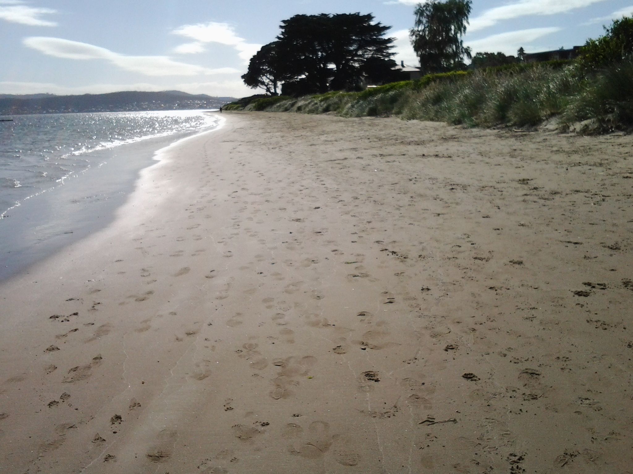
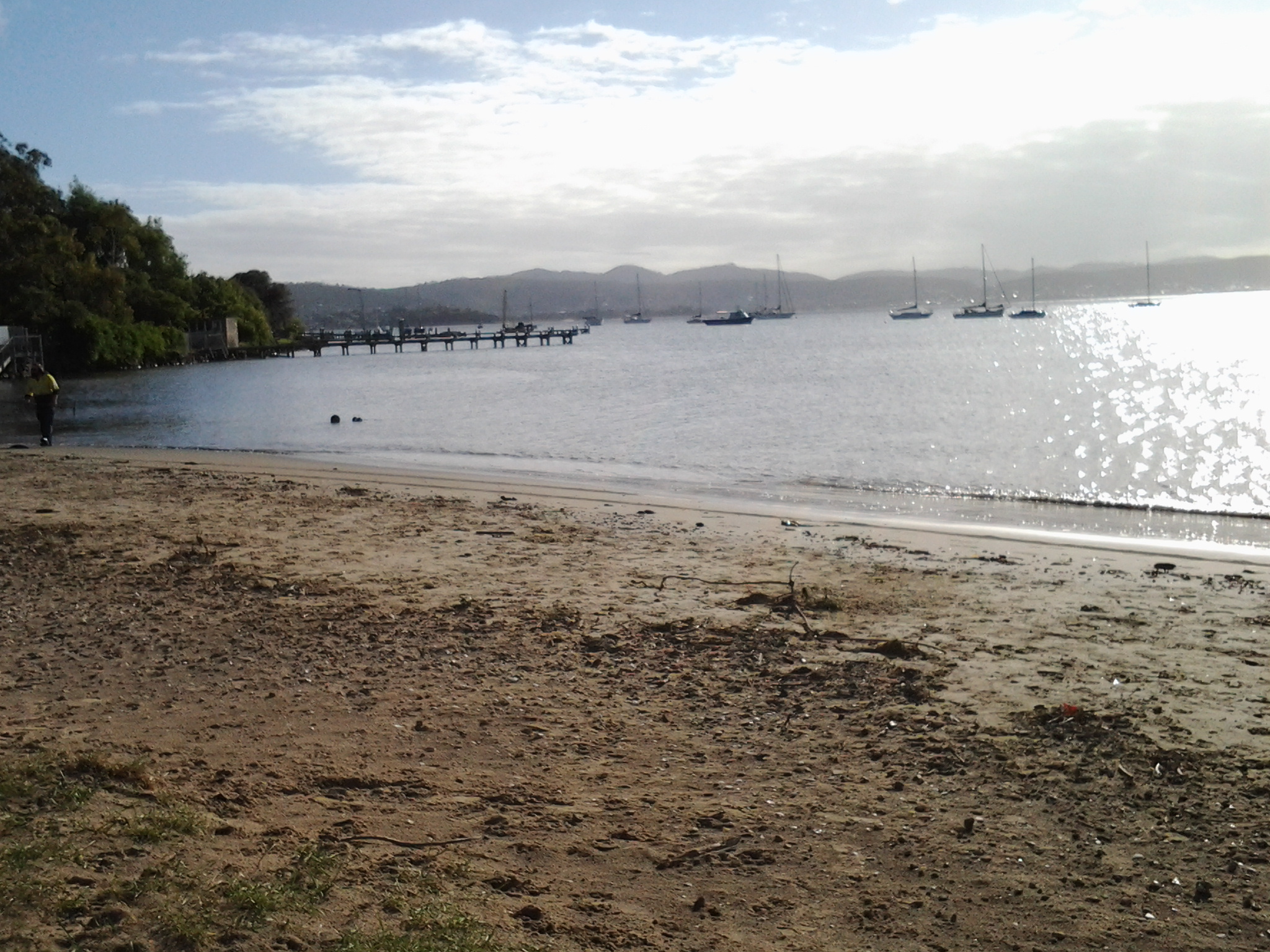
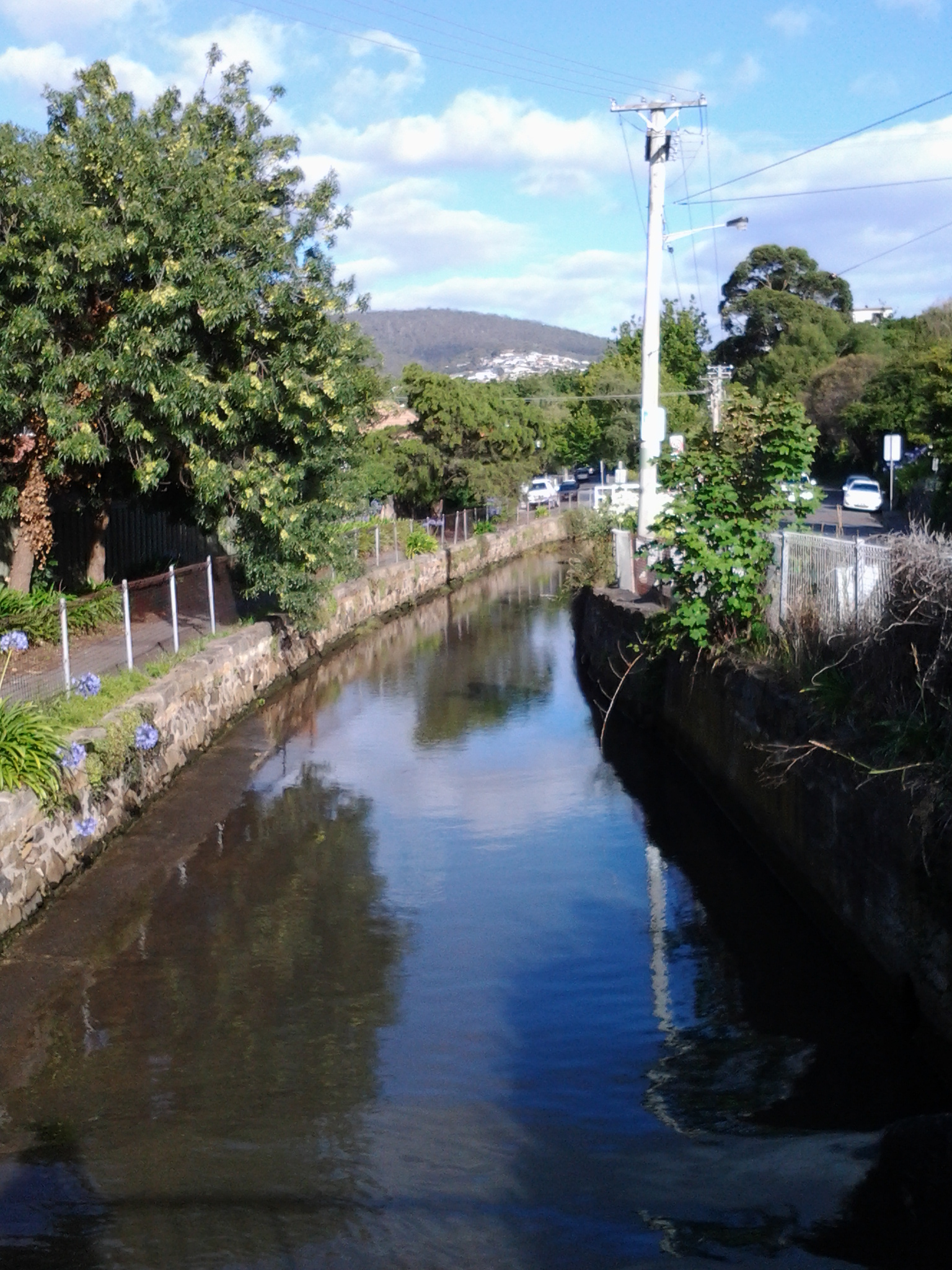
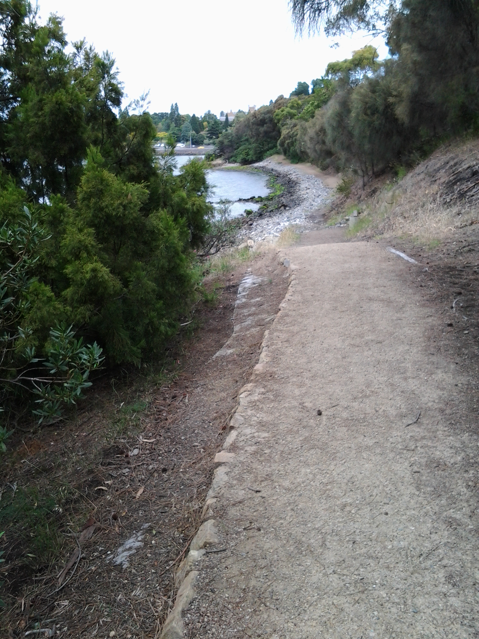
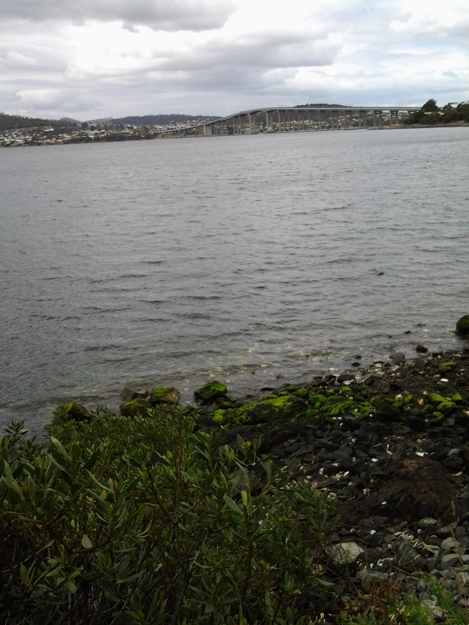
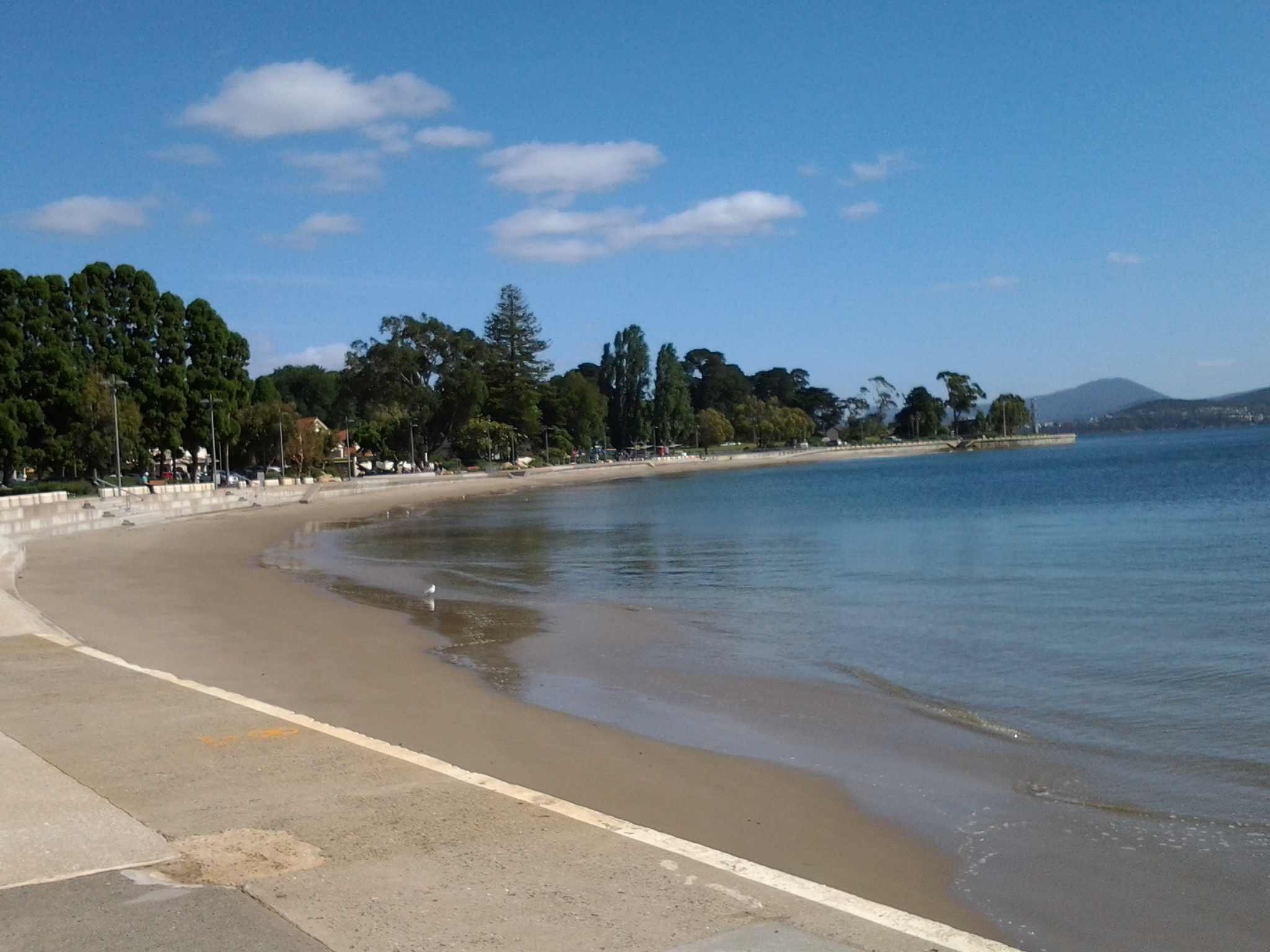
Continuing Stage 11 of my walk along the Derwent River, I walked the foreshore from Long Beach towards Blinking Billy Point. Looking northwards, the crescent of Long Beach stretched before me.

20150119_100336

I passed a new set of public toilets around 10am and ten minutes later I was walking around Blinking Billy Point.

20150119_101600

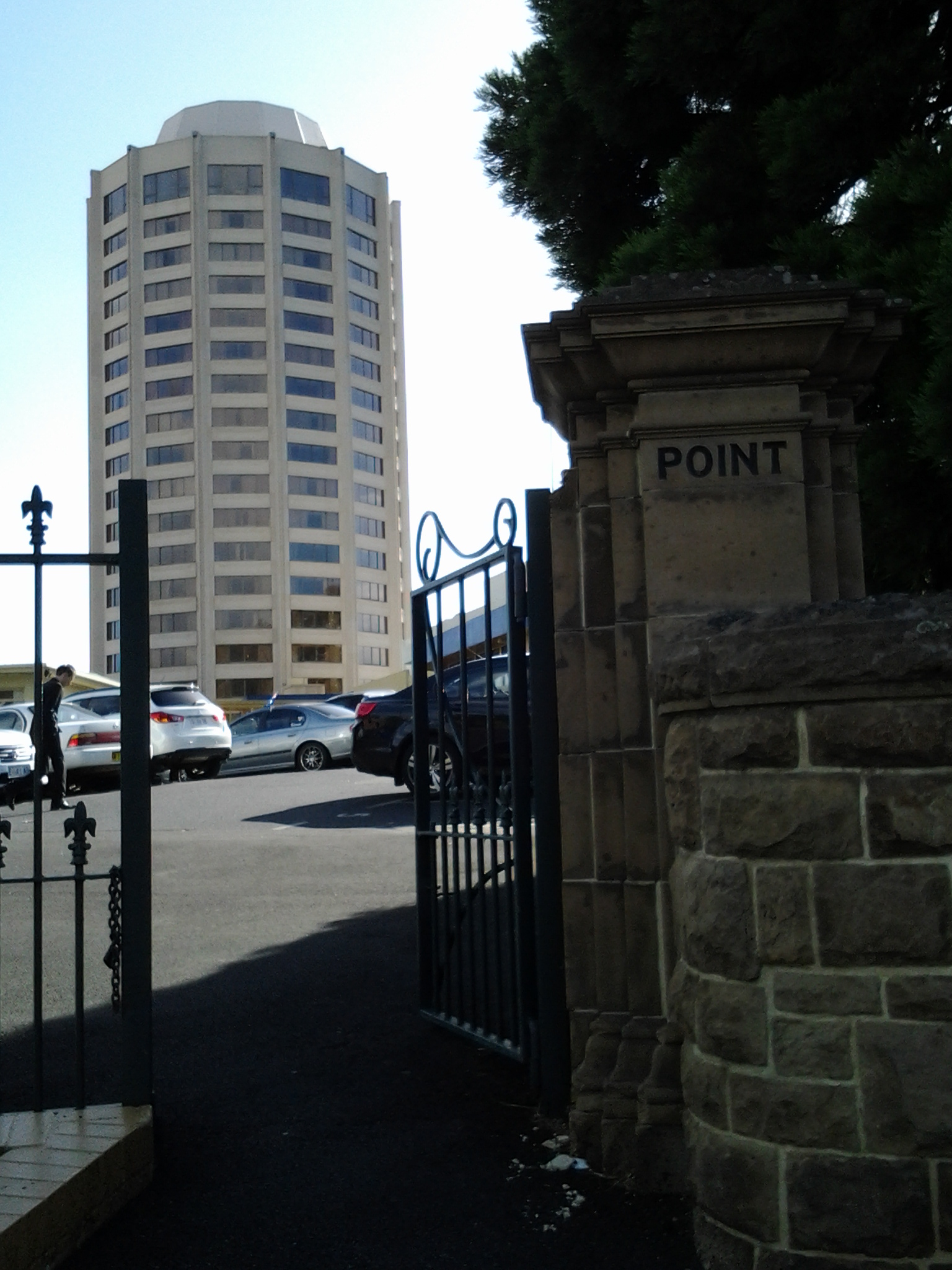
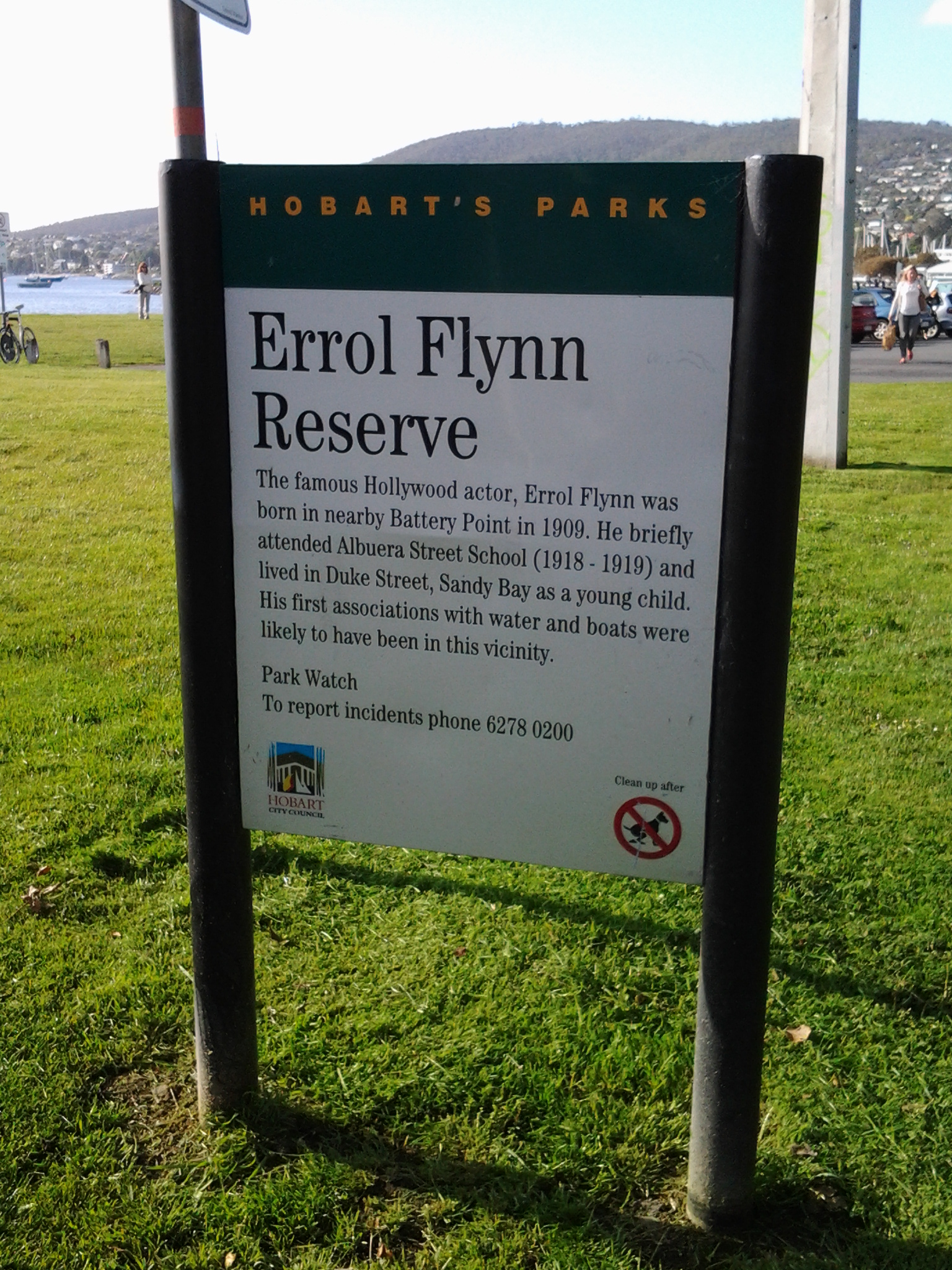
This was an area to which Charles Darwin (http://www.biography.com/people/charles-darwin-9266433) walked from Sullivans Cove (my starting point for this Stage of the walk) in February 1836. The area’s local government has remembered the occasion with an information plaque.

20150119_101336

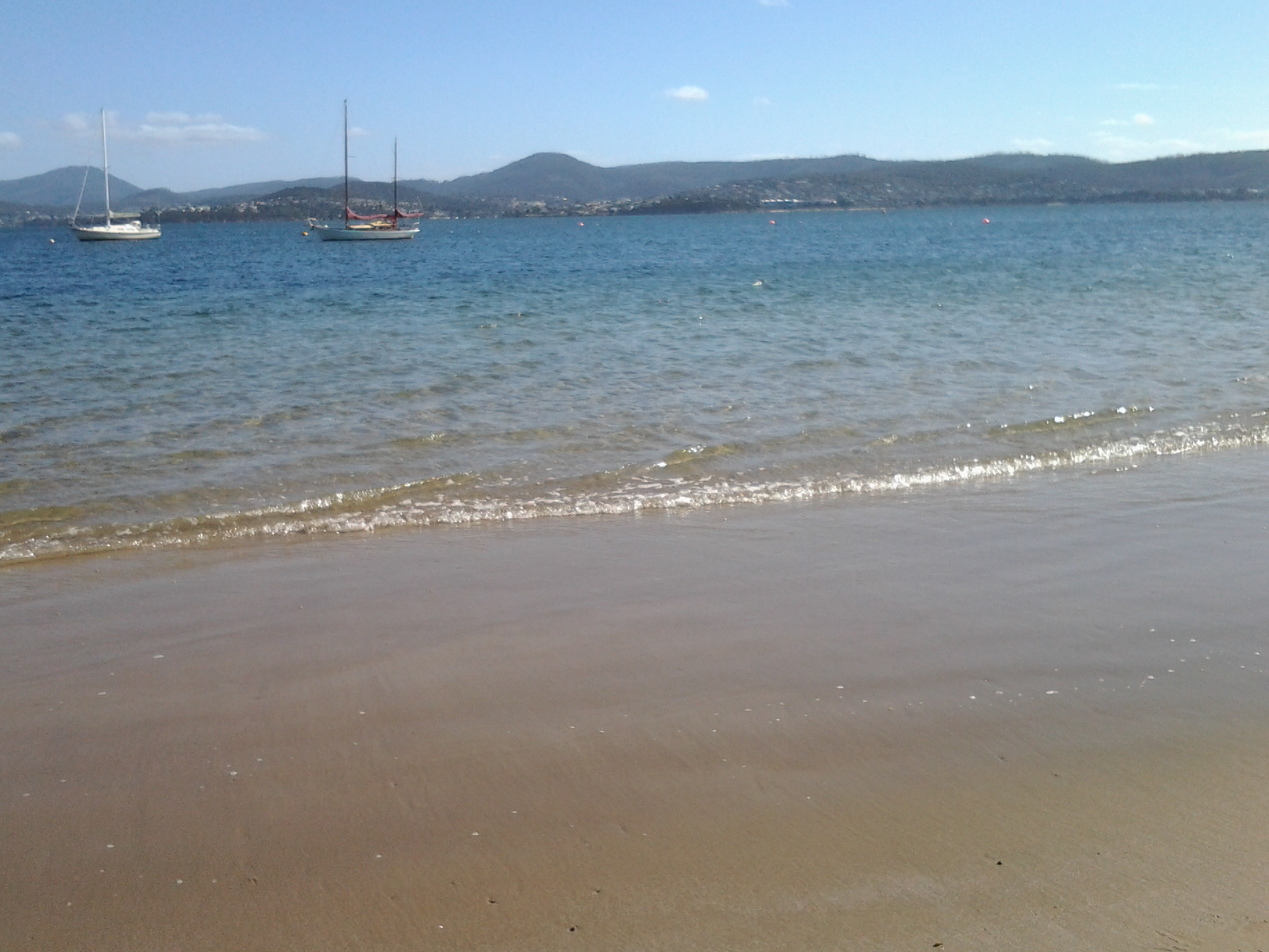
Out in the water is a marker for water craft: the John Garrow Light (established in 1953).  I have known this was a marker used in the Sydney to Hobart Yacht race but I had never known where it was located.  Now I know: almost east of the Blinking Billy old lighthouse.  According to http://www.maritimetas.org/sites/all/files/maritime/nautical_news_winter_2002.pdf, John Garrow was a Sandy Bay pastry-cook, who lived in Bath St. Battery Point and died 1924. This begs the question – how did a nautical navigation tool come to be named after someone that seemingly had no connection with the Derwent?

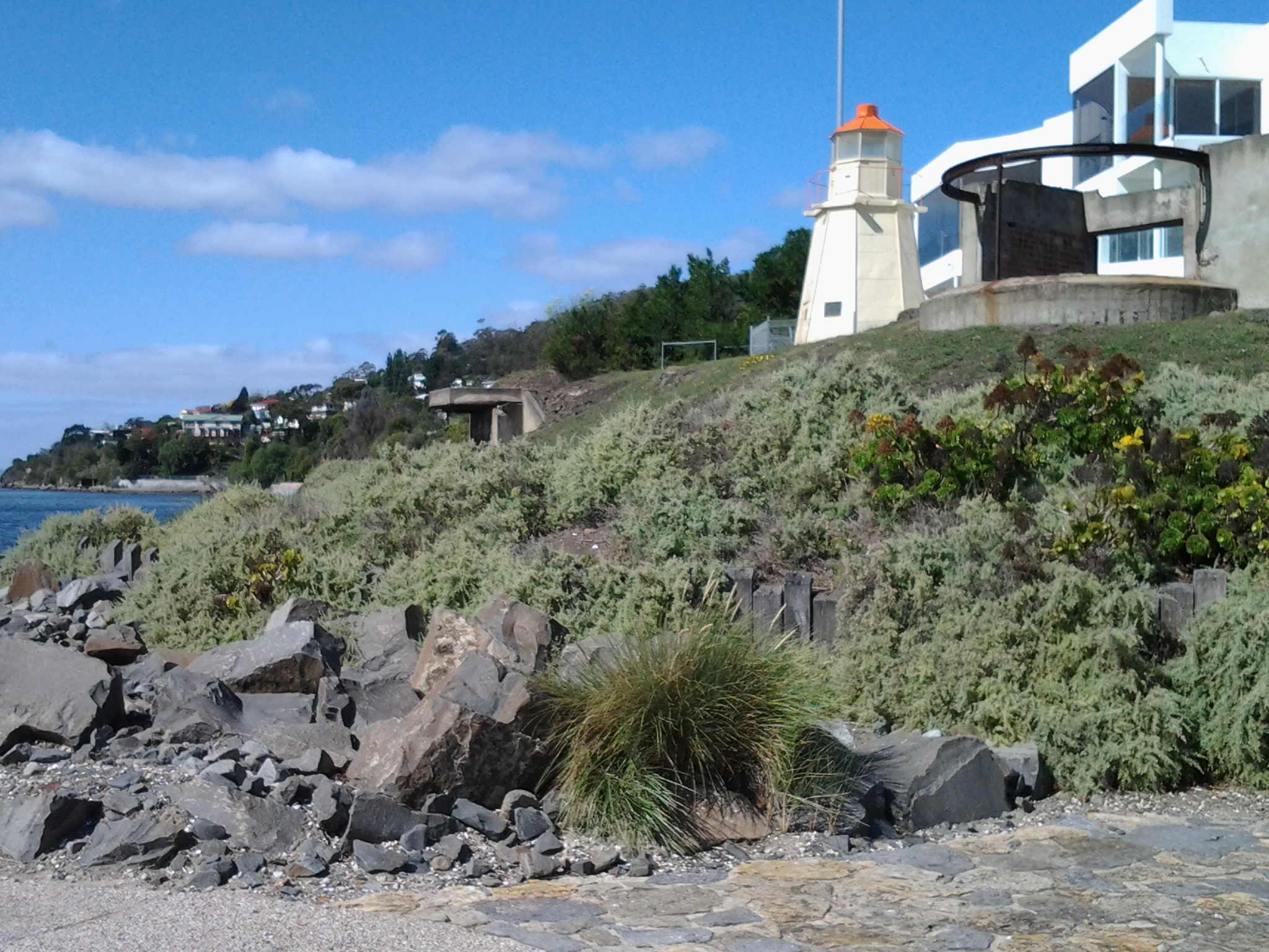
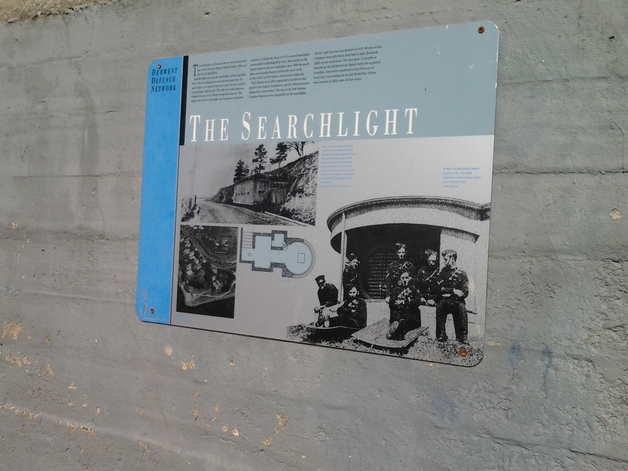
I noticed that the Point has old defence structures embedded in the cliff. I learned that these were an adjunct to the huge hill behind with the remnants of the 19th century Alexandra Battery.

20150119_100941

20150119_101150  20150119_101159

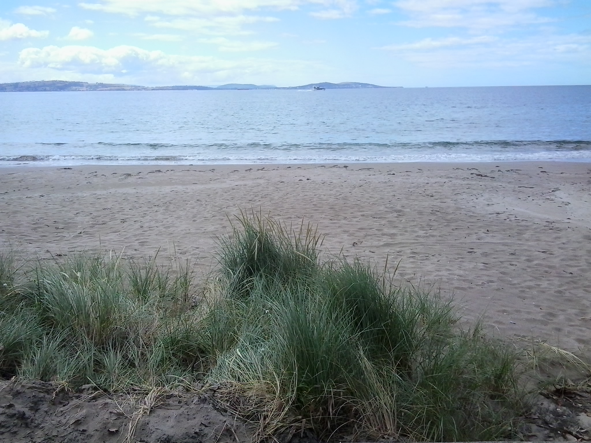
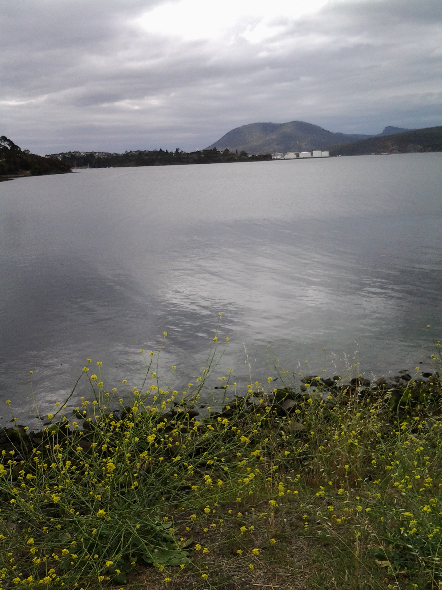
Looking down the Derwent River through the glitter of the distance to the eastern shore, I could pick out Trywork Point (the southernmost tip of land before Ralphs Bay begins) and Gellibrand Point (the northern most point of the South Arm peninsula) both providing the ‘gateposts’ to Ralphs Bay. Previously, I explored these distant Points on Stage 2 and 3 of my walk.

20150119_100933

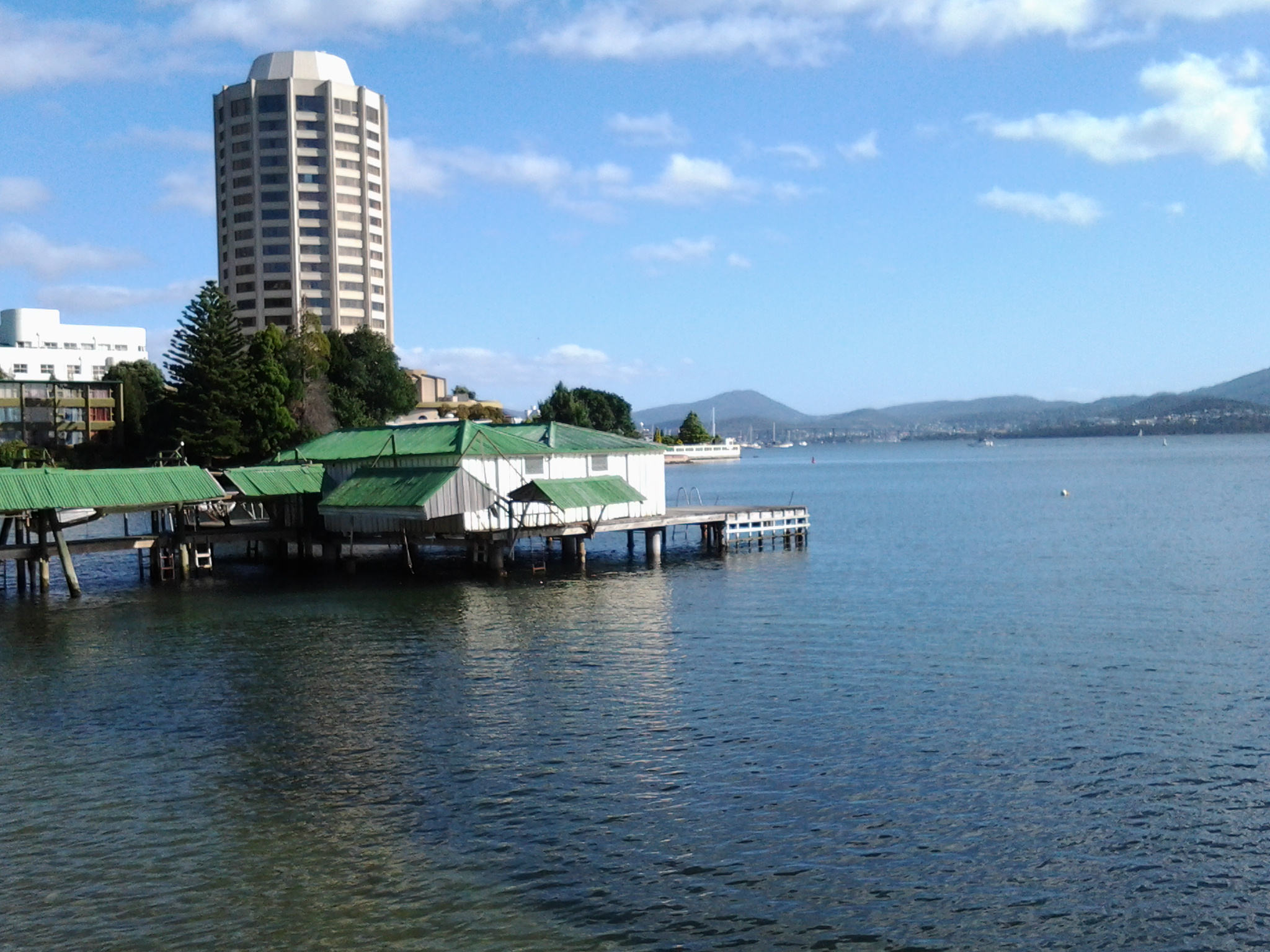
Then I looked back to Long Beach from Blinking Billy Point with Mount Wellington in the distance. How peaceful the world seemed.

20150119_100704

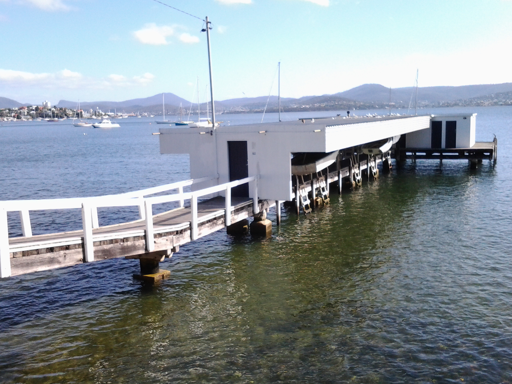
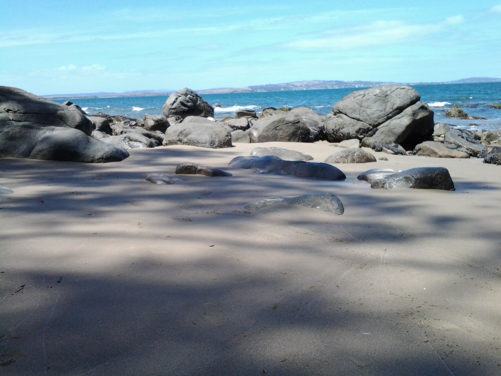
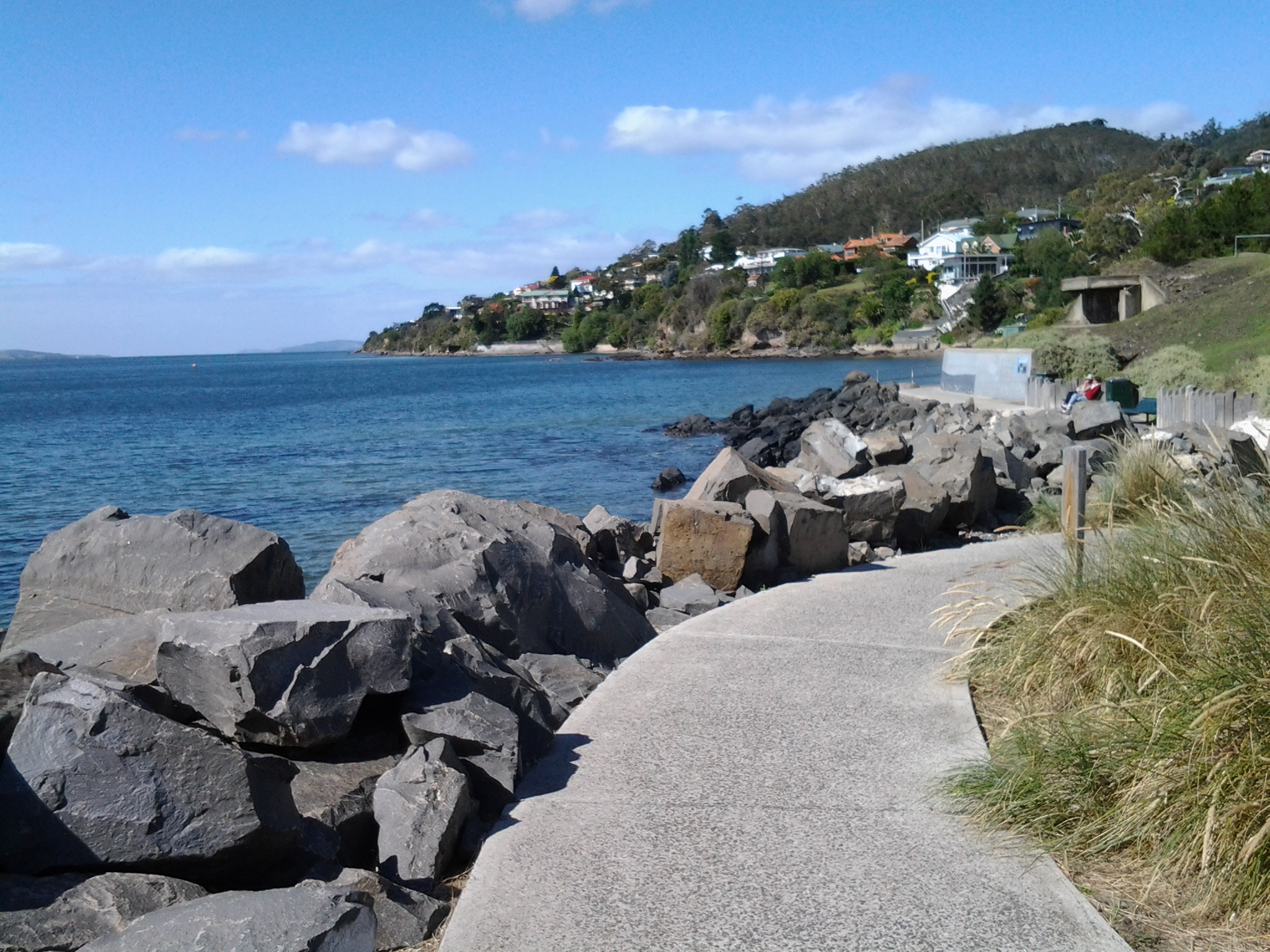
Despite the promises of a short beach in Geography Bay after the Blinking Billy Point, I knew better than to have expectations that continuing my walk on the foreshore was possible. The Sandy Bay Foreshore Track finishes at Blinking Billy Point.

20150119_101600

Some years ago a friend and I tried to walk the rocky shore southwards from Blinking Billy Point but, as the tide came in, there came a moment when we couldn’t move forward or backwards.  I remembered we scrambled up through someone’s property; the people were not at home and we let ourselves out onto the street hoping no alarm systems would be alerted. We were lucky that day.

Based on that memory, I knew it was not worth proceeding any further and retraced my steps around Blinking Billy Point until I could walk up to Sandy Bay Road.

From Sandy Bay to Lower Sandy Bay on Stage 11 of my walk along the Derwent River

After Maning Ave Reserve I continued walking along Sandy Bay Road and used every opportunity to glimpse the Derwent River down the driveways of large houses with expensive River frontage.

By 9.10am I reached the Red Chapel Reserve. Red Chapel Ave is one of Hobart’s well-known streets extending up the hill and connecting to other main streets but I had never known, until this walk, where the name came from. I wonder how many Hobartians know the source. Of course the source turned out to be so obvious once I knew and used my eyes. It was named after the red coloured chapel of the 20thcentury St Stephens Anglican church that was built on the River side of the Road next to the Reserve and opposite the uphill Avenue.  What can be said about the impoverishment of imagination? Refer to https://stainedglassaustralia.wordpress.com/2014/08/02/1914-st-stephens-anglican-church-lower-sandy-bay-tasmania/ for some glorious images. The photo below is courtesy ofhttp://www.anglicantas.org.au/parishes/?item=37

St Stephens Church

A minute or so further down the road and on the right was the highly esteemed Lipscombe Larder on the corner of … Lipscombe Ave.  Where else would it be?

20150119_091152

In addition to all its tasty delicatessen products and wines, this food paradise also sells exquisite cakes: refer to http://lipscombelarder.com.au/  for images.

At some stage during my walk in this suburb, I realised that no one was walking a mongrel dog. At the end of leads were expensive pedigreed dogs.  Certainly their owners seemed happy.

Before long, a set of steep stairs attracted my attention on the left. These were for public access to Nutgrove Beach. As I approached the Beach I was staggered by the size of an old pear tree on the dune edge, and loved the pigface plant which carpeted the area either side of the pathway. I was on the beach at 9.20am and turned right to walk southwards.

20150119_091845 20150119_092401  20150119_091903 20150119_091858

Behind low sand dunes on my right, the roofs and second storeys of beach front houses were visible. At 9.23am, I passed public toilets almost hidden under a large pine tree, and by 9.30 I reached a corner of the beach with the Sandy Bay Sailing Club located up in the dunes.

20150119_093155

Moments later I turned the corner and was no longer able to look back at Wrest Point and Battery Point in the distance.

20150119_092759

I continued on a pathway over the shore and over the dunes some of which would be impassable at high tide without getting wet feet. Some of the rocks were unstable underfoot presenting the risk of a turned ankle or knee. Nutgrove Beach had been a simple delight, and before long I was on an easy, vegetated, and shaded walking track to Long Beach at Lower Sandy Bay. Then I arrived.

20150119_093816

Back out into the open by 9.35am, I could see public toilets nearby, and by looking across the Derwent River to the eastern shore, the yellow strips of Bellerive and Howrah Beaches (on which I walked in an early stage of my walk) were visible.

20150119_100332

I had been walking for over two hours so sat for a while in the gorgeous sun, watched the tiny waves rippling fluidly and regularly, stared at two fishing boats motoring out of the Derwent Harbour, listened to kids’ riotous laughter in a kids’ playground nearby, and then stood up and got going again at 9.50am.

I was delighted to discover Stephen Walker’s huge many part bronze sculpture, Tidal Pools, with its inbuilt water feature at Long Beach in Lower Sandy Bay.

20150119_095728 20150119_095831 20150119_095757 20150119_095739

The remarkable 86 year old Tasmanian artist died only about 7 months ago leaving a great many large scale works around Tasmania and other parts of Australia, such as his Tank Stream Fountain (1981), near Circular Quay in Sydney. In the 1950s, Stephen Walker studied under the celebrated sculptor Englishman Henry Moore. Apparently Walker continued his bronze casting work well into his 70s using his foundry underneath the house.

Five minutes of walking the developed walkways of Long Beach brought me to a cul-de-sac with its carpark full of vehicles.  Further along that loop off Beach Road were bakeries, cafes, restaurants, etc.

A deviation from the record of my walk along the Derwent Stage 11 – today was Australia Day!

Around the edge of Australia, and across inland towns and communities, celebrations are taking place today remembering the start of European settlement in Australia – not that it is expressed as such, rather as a day to celebrate being Australian (Orstrayan – as our accent seems to be saying these days). The day, quite reasonably, antagonises the descendants of the original land owners, our Australian indigenous community, because the day seems to be about being from other countries and not inclusive of the people who were already living here at the end of the 18th century.  Today celebrates the first ‘white’ settlement but not the start of invasion of the lands of those aboriginal peoples who had lived on this land for thousands of years. So it is a day of division across Australia. However, since people with an aboriginal heritage are in the minority in Australia’s population, non-aboriginals go ahead with their barbecues and other family and social events treating today as a public holiday which is their right.  More cross culture chat is needed.

So with that opinion as background, instead of walking to the Bellerive Boardwalk for the annual community Australia Day breakfast and ceremony for new Australian citizens, I decided to try out the Kingston (Kingborough) Australia Day celebrations which were centred on Kingston Beach.

Thousands of people across streets closed to traffic and the endless beach, playing beach volleyball, creating extraordinary structures in sand, and all sorts of other family and activities made the area a hive of activity.  The day’s temperature was comfortably mild for summer, the water so clear, all manner of water craft glided along, swimmers braved the cold water, and happy dogs led their owners on their leashes.  It was an extremely comfortable place to be.

I didn’t take any photographs (more is the pity because Kingston Beach was such a colourful location today) –  you may have read my blog in the area on an overcast non-people day at https://walkingthederwent.com/?s=kingston

The photos I took at that time included:

Sign and river Kingston Beach

Please try and create an image in your mind of sunshine and colour, and of lots of happy relaxed people of all ages and sizes and backgrounds playing and walking on this beach today.

Whatever out ethnic background, Tasmania’s natural sites are incredibly beautiful – and all the better for being so easily accessible.

Today our national Prime Minister released the names of people who have won prestigious Australia Day Awards in recognition of valuable contributions to Australia’s wellbeing and growth and substantial achievement in one or more specific areas.  Today, many Australians are aghast at our Prime Minister’s approval of the English Prince Phillip as a Knight of Australia. Many of us are perplexed and cannot name his contribution to Australia and achievement for Australians, other than in the most general and cursory terms. We have many amazing people in this country, so this announcement of a foreigner getting a special national honour has stopped many in their tracks.

Another opinion can be read at http://www.smh.com.au/federal-politics/political-news/prince-philip-awarded-knight-of-the-order-of-australia-by-prime-minister-tony-abbott-20150125-12xzk8.html – ‘some people worried that this was an Australia Day hoax’.

Selection of landmarks along Sandy Bay Road

Once on Sandy Bay Road I turned left and continued walking southwards.When past the University of Tasmania grounds, over the road on my right was a Catholic co-educational secondary school operating in the Josephite tradition. This Mt Carmel College site includes an attractive 19th century sandstone building.

In a small park, a family of Sulphur Crested Cockatoos feasted on insects in the grass along with ducks and Silver Gulls.

20150119_083933

The day was very peaceful.

20150119_083937

At 8.40am I reached the entrance to Wrest Point Hotel (http://www.wrestpoint.com.au) which, in the 1970s, established the first legal casino in Australia.

20150119_084114

Apart from its poker machines and gambling rooms, this Hotel offers many bars and different restaurants. In addition, it runs a continuous program of concerts, guest artists and other entertainment events so that thousands of people pass through its doors weekly. With exploratory meandering I think it may be possible to walk through different parts of this Hotel and find a route close to the water’s edge. I didn’t feel confident that I would find my way around without finding myself in ‘no go’ areas. Instead I continued walking along Sandy Bay Road.

The business Network Gaming lives in what used to be a well-known and much loved pub, Travellers Rest:  one which I knew well in my student days.

20150119_084249

The Wrest Point Hotel land wraps around the old Travellers Rest hotel so, it wasn’t until I continued to walk along Sandy Bay Road that I discovered an original entrance to the Wrest Point property area.

20150119_084657

I reached the Derwent Water Beach Reserve at 8.50am.

20150119_085149

From there I could see two private jetties jutting out into the water.

20150119_084905

When I walked closer, it was clear that dozens of dinghies hung under protection waiting for their owners to come and row them out to yachts moored on the Derwent River.  In fact, as I watched, one fellow set off rowing.

20150119_085231

The time of day and the quality of the sunlight made this vista exceptionally beautiful; seagulls perched on the jetties, the water sparkled, a mild breeze dappled the surface of the River, happy dogs walked along attached to owners, and I was able to blot out the sound of noisy traffic streaming past behind and beside me. The water was crystal clear.

20150119_085408 20150119_085637

By 9.05am I was reading the information panel at the Maning Ave Reserve. This Reserve seemed to mark the change from the suburb of Sandy Bay to the suburb of Lower Sandy Bay. I learnt Fred Maning arrived in 1824 and his family farmed in the area (however I understand he spent most of his life in New Zealand, and it is not clear why he is remembered with his name on this park and on streets etc in the Lower Sandy Bay area).  Information boards such as these help me to understand how Hobart developed.

Sandy Bay along the foreshore

On Stage 11 of my walk along the Derwent River, having enjoyed Hobart’s wharf area and the edges of Salamanca and Battery Point, I continued walking along Short Beach at the beginning of Sandy Bay, past public toilets at 8.20am, towards the Sandy Bay Rowing Club and then along Marrieville Esplanade.

20150119_081832 20150119_081815

At 8.28am I reached the Royal Yacht Club of Tasmania and remembered my first Hobart job many years ago.  The photo below shows the entrance to this complex.

20150119_082553

A friend waitressed in the Club restaurant and I went to see if I could get a similar job. I had no experience in hospitality but, full of unsubstantiated confidence, I approached the head chef. He told me that without experience he could not give me a job. I stood my ground and said that until I had worked in a job I wouldn’t have experience and therefore the only way I could get experience would be if he hired me.  And he did.  As a washer of dishes and all the kitchen wares.  Eventually I was allowed to place the lettuce on plates, then make the salads, then cook the potato chips and fried rice in large pots, and finally I reached the heights of being permitted to cook steaks for customers.  After many months the head chef recalled his first meeting with me and how (I forget the word he used but its meaning was clearly something like) pushy, stubborn, strong willed and unable to take no for an answer I was, and it was my approach which inclined him to give me a go. It certainly helped to pay the rent and I was very grateful.  I remain grateful because I learnt a lot about human nature in that hot kitchen where pressure turned people into animals.

But back to my Stage 11 walk.

A couple of minutes later I was walking past the Derwent Sailing Squadron buildings and could see yachts everywhere in and out of the water.  Past the Squadron buildings, in the distance, the tall building indicated Wrest Point Hotel was not far away and I knew I would walk past it a little later.

20150119_082956

In the distance, slightly inland on my right, the many buildings of the University of Tasmania cascaded down the hill; part of the slope of Mount Nelson.

20150119_083125

A car drove past and the driver waved and smiled at me. Once friend Ma was out of her car, she explained that with her husband she was about to put their yacht into the water (after its recent debarnacling – if there is such a word) and enjoy a sail along the Derwent.  “Would I like to stay and watch?’ she asked. I wanted to stay focused on my walk in case weather might not be suitable on other days, and declined with some inner hesitation.  What a great offer.  Maybe another time I can say yes.  Perhaps a sail??? Who knows.

The opportunity to continue walking close to the foreshore came to an abrupt stop and it was clear private houses owned the area at the back of their houses to water level. So I took a path to Sandy Bay Road, arriving at 8.35am.

Battery Point on Stage 11 of my walk along the Derwent River

Many websites provide information about the very old suburb of Battery Point; for example, read http://www.batterypoint.net/; http://en.wikipedia.org/wiki/Battery_Point,_Tasmania; or http://www.hobartcity.com.au/community/arts_and_culture/public_art/battery_point

I walked as close to the Derwent River as I could and therefore did not wind around the cute streets with their changing architecture, and I was not on the hunt for historical landmarks within the suburb. A morning’s meander through the streets can be very instructive but a walk close to the foreshore also has its attractions. Besides, every street in Battery Point is interesting.

Having left Salamanca and the Castray Esplanade, I walked to the River and along a pathway. When I reached the A J White Park I looked around and absorbed some of the contemporary sculptural forms which were sited there.

20150119_075652 20150119_075552 20150119_075450

At 7.55am I turned up and away from the water because continuing access around the few rocks jutting out of the water was not possible. At 7.58am I turned left at Clarke Ave and at 8.03am I turned left at Marine Terrace.

A few minutes later, as I approached Derwent Lane which led to a dead-end down at the water (with previous knowledge I decided it was not worth the effort of walking down and then straight back up) a woman stopped and questioned me. ‘What are you writing?’ she wanted to know. Her body frame relaxed when I explained my project. I didn’t need to be told that the issue of public access to the foreshore is a very sore and contested point in this suburb as homeowners are feeling increased pressure to agree to a boardwalk being built in front of their very expensive and private homes  – residents believe they purchased sole and permanent access to the high tide mark. Undoubtedly the woman was wondering whether I had been commissioned to do another survey or some other work without community consultation.

If you are following in my footsteps, then the path southwards continues by walking along Napoleon Street. Either side of the road I enjoyed the spectacle of exceptional houses of many vintages and styles.

20150119_080926 20150119_080931 20150119_081054

Eventually I stepped down an extremely steep part of Napoleon Street and could see Mount Wellington to my right and Mount Nelson to my left with great clarity.

20150119_081413 20150119_081326

At the bottom of the street I crossed the Sandy Bay Rivulet and arrived at the Errol Flynn Reserve.

20150119_081611 20150119_081658

The Rivulet runs out into Short Beach which edges the Derwent River at this point.

20150119_081621

I had left the suburb of Battery Point and arrived in the suburb of Sandy Bay and it was only 8.15am.

From Parliament House via Salamanca towards the suburb of Battery Point

Preceding Salamanca Place where the famed Salamanca Market occurs every Saturday throughout the year, Tasmania’s House of Parliament sits atop a green leafy Parliamentary Gardens on the other side of Morrison Street away from the Derwent River.  I walked past this on Stage 11 of my walk along the Derwent River, at 7.38am.

20150119_073520 20150119_073636

I continued around Princes Wharf as close to the River as possible and joined Castray Esplanade. Within a couple of minutes the historic buildings of Salamanca Place were separated from me by the strip of Salamanca Gardens.  Most of these sandstone buildings were built early in the 19th century and therefore present a considerable part of the story of the early history of Hobart settlement.

20150119_073809 20150119_073821 20150119_074117 20150119_074129 20150119_074133

By 7.43, I had almost reached the southern end of Castray Esplanade, was passing the Institute for Marine and Antarctic Studies, and could see the old buildings on Hunter Street away in the distance.

20150119_074424

A few minutes later I was abreast of the CSIRO Marine Laboratories, behind which I could see that Tasmania’s latest massive ice breaker ship was in port, presumably loading up before travelling to the Antarctic.  Before I reached that location I passed a very red piece of history; an old fashioned postal box.  The large scale of this ‘box’ made me stop. I marvelled about how much postal material must have been in circulation in the 19th century to warrant such a beast.

20150119_074726

At 7.50pm the tiny Princes Park was opposite.

20150119_074955

Near the end of the Laboratories I took a walking path to the left through a car park to the edge of the Derwent River. The photo below shows my view as I continued my walk toward Battery Point.

20150119_075227

Walking along the wharves of Sullivans Cove, Hobart

On Stage 11, after walking along Hunter St, I turned right to walk along the Franklin Wharf street, and had the Derwent River on my left and an enclosure for fishing and other vessels to my right. The morning was fresh, the sun was shining and it was all together delightful. Not many people around. The mountain, clearly visible, looked down on the centre of Hobart and over the wharves. Clouds were reflected serenely in the water.

20150119_072745 20150119_072147

A family of bronze sculptures, perched life-like on rocks on the River side, is much loved by visitors.

20150119_072515 20150119_072503

Passing Mures fish restaurant on my right, I continued on until I could see the row of floating fish shops selling fresh and cooked fish and other seafood.

20150119_072706 20150119_072651

A minute later, I was standing on the celebration platform used when the Sydney to Hobart Yacht race boats arrive. I looked across to Elizabeth Pier which contains accommodation, conference facilities and a number of eateries (where sitting outside is such a pleasure).  In the photo below the ‘tall-ship’ replica Lady Nelson sits outside the T42 restaurant.

20150119_072901

Opposite Elizabeth St pier, a number of buildings of different architectural styles and vintages line part of the street. Continuing to the other side of the Elizabeth St pier, a second tall ship, the Windward Bound offers sailing trips.

20150119_073148 20150119_073111

On the next pier after the one in the photo above, a couple of the contemporary camouflaged MONA ferries sat either side within the slightly mobile surface of beautiful glassy water.  Taking a trip on these ferries down the Derwent to and from MONA (Museum of New and Old Art) located in the suburb of Berriedale (I walked through that on recent Stages) helps you to see parts of Hobart you would not normally see, and it gives you a perspective on the distances over which the Greater Hobart Area sprawls. It is interesting to reflect on the two extremes of water vessel technology, when you look at the 19th century sailing ship close by a state-of-the-art catamaran.

20150119_073231

These starting sections of my Stage 11 were colourful and tranquil. It’s a free, easy, stroll along the waterfront and there is much to see looking out onto the side of the Derwent River. The next posting on this blog will look at landmarks on the non-River side of the streets.

Starting off for Hunter St Hobart on last Monday’s Stage 11 of the walk along the Derwent River

Despite having a severe dislike of getting out of bed early, I always try and ‘get on the road’ as early as possible for my walks in case the weather changes for the worse during the day – the earlyish starts give me all the chances in the world to walk as far as I can. It was no different last Monday. I left home not long after 6.30am (yes I know many of you would still have been snoring) and bussed into Hobart. I walked down to the intersection with the major thoroughfare at Davey St and Evans St near the wharf area. Looking around, notable landmarks for locals surrounded me.

The chimney of the beautiful 19th century sandstone Gasworks now reinvented into a HOGS restaurant and a bottle shop, sits on one corner.

20150119_071455

A warehouse-like building for Tas Ports on another corner.

20150119_071434

The apartment block for residents and tourists known as Zero Davey on another.

20150119_071441 20150119_071510

The concert hall of the Tasmanian Symphony Orchestra at one end of the Grand Chancellor Hotel on the other.

20150119_071542

By 7.15am I had walked to the intersection of Hunter St with Davey St. There are a considerable number of information boards along this street providing lots of information about the history of the area. This was the area where the first European settlers started the colony after giving up on Risdon Cove on the eastern shore of the River.

20150119_071708 20150119_071713 20150119_072250

One side of the street is lined with buildings many of which were built in the 19th century.

20150119_071801 20150119_072104 20150119_072334

The other side of the street has the wharf space which is normally used by fishing boats: for example, the crayfish/lobster boats. Look at how silken soft the water is. Wonderfully colourful.

20150119_071815 20150119_071829

I left Hunter St at 7.25am at the intersection with the Franklin Wharf street that extends parallel to the waters of the Derwent River. If you were to walk along Hunter St and not be note taking and clicking photographs, it would take you a maximum of two minutes to walk.  But if you want to stop and look and read then allow longer.

Yesterday I walked Stage 11 from Hunter St in Hobart city to Hinsby Beach south of Taroona

The goal of my walk along the Derwent River for Stage 11 was to start at my last stopping point, Hunter St at the wharf in Hobart on the western shore of the Derwent River, and continue to Kingston in the local government area of Kingborough.  But I did not get that far.  My feet said enough was enough once I found the delightful and almost hidden Hinsby Beach.

20150119_131327

Over future posts, I will write up the stories of the walk, what I saw and what I experienced, but for now it’s enough to say that I am continuing with this massive project to walk both sides of the Derwent between the mouth and Bridgewater, and then onwards to Lake St Clair.

The day was sunny with a bright blue sky, Mount Wellington was clear, and a cool breeze featured through much of the day – making it perfect walking weather.

Yesterday I covered 8 kilometres of the length of the Derwent River on the western shore (making 30 kms in total on the western shore), and walked approximately 13kilometres (making a total of 143 kms to date) to achieve that distance. This distance also takes in the streets and paths on which I walked that led to dead ends so that I needed to retrace my footsteps.

The highlights of the walk include discovering the road next to Taroona High School is a public access route which took me down to the Derwent River to a row of colourful boathouses, getting off the main road at places like Cartwright Park Reserve, and seeing the Alum Cliffs in all their majesty.  My next walk will start along the top of these.

20150119_125317

It was a revelation to watch the eastern shore and to see the suburbs and beaches on which I walked in the early stages of my walk. The day started with my being roughly opposite Bellerive and finished with my being opposite Gellibrand Point at the northern tip of South Arm.  The photo below, taken from Hinsby Beach, looks across the Derwent River to Opossum Bay Beach.

20150119_131757

I intend my next walk will start from Hinsby Beach and continue to Blackmans Bay.  But before then I need to record the details of yesterday’s walk.  So my walk for Stage 12 could be a week or more away.

Queens Battery

One of the great things about my walk along the Derwent River is that I find sites I did not know existed and I also discover new information. The location of the Queens Battery under the current site of the Cenotaph and Regatta Grounds within the broader area of the Queens Domain is one such item.

The Tasmanian Museum and Art Gallery have created a short video which uses photographs from its historic collection. See www.youtube.com/watch?v=hVEGkgDZMMg

From my time in an earlier stage of the walk, at the Kangaroo Bluff Fort at Bellerive, I knew that Hobart established a series of defensive posts along the Derwent River. Built in the 19th century by the British colonials who settled here, these defence services were designed to counteract their worries about protecting trading ships and then later concerns that Russian forces might invade (I ask you – really? At the other end of the earth!!!! Was this ever likely?).

Wikipedia informs me that … between 1804 and 1942 there were 12 permanent defensive positions constructed in the Hobart region. The start of construction of the Queen’s Battery began in 1838, named in honour of HRH Queen Victoria who was on the throne at the time of the fort’s construction. This was expected to be the grandest of forts and prominently overlook the entrance to Sullivans Cove; however the full plans were never developed. The battery was delayed by funding problems, and  not completed until 1864. The Queens Battery remained in operation until the 1920s. The excavation of the site in 1992 revealed the hot shot oven and the metal parts for rolling the shot were preserved. The oven and archaeological trenches were filled in at the request of the RSL (Returned Services League). The cannon was never fired in anger.”

Location: https://www.google.com.au/maps/vt/data=U4aSnIyhBFNIJ3A8fCzUmaVIwyWq6RtIfB4QKiGq_w,RxhryNB7L5JOppJVjT-1-R9cFyBVxNXF90HhgNOerRCLFKA0zhnI73KC6M5MNa5q95GGnBSCATceYGtWfCO0Xbhedz4BfgEB94Q8t3utHEcf2IzasqMYwzgOJWcTExF5GUO4ledjJPLwKg

Hobart’s Regatta Grounds and Cenotaph; missing Macquarie Point but reaching Hobart’s Sullivans Cove.

Leaving the navy depot on the edge of the Derwent River, I realised the distance to Hunter St and the beginning of Sullivans Cove in Hobart was not far.  That seemed like a perfect finishing destination for Stage 10 of my walk along the Derwent River, so onwards I plodded.

The ex-navy depot sits immediately next to the Regatta Grounds so I reached the Regatta Stand, set up for the annual audiences, very quickly – by 4.10pm.

20150109_160021

Hobart’s Regatta has a long history.  According to http://www.soldierswalk.org.au/walk_domain.html , “The Hobart Regatta is the nation’s second oldest and commenced in 1838 and has been staged every year since, bar two. A grandstand was built in 1877 and replaced by the John Colvin Stand in 1919-20.”  History and photos (including some of Queen Elizabeth visiting) can be seen at http://www.royalhobartregatta.com/History.html.

The day had become bleak and windswept. The area was empty of people and movement. Nevertheless, I continued walking along the dismal disused railway line and passed empty wood chopping competition blocks.

20150109_161232 20150109_161747

Eventually I was stopped from walking to Macquarie Point on the Derwent River by a high fence with locked gates.  I did my best to continue walking around and as far as I could. But it was useless to think I could get much closer to the Point.  It simply was not accessible to walkers like me.

20150109_161339

I clambered up a weedy section and eventually climbed over a lower fence until I was standing on the lower grounds of the Cenotaph, a monument commemorating the men and women who have died in various wars. This is a significant site in Hobart on our nationally celebrated ANZAC Day each April 25th. As I began to leave, the time was 4.18pm.

20150109_161810 20150109_162043 20150109_162225 20150109_162155

I walked around the Cenotaph,

20150109_162351

down an avenue onto the Highway opposite the Aquatic Centre, then turned left and continued until I reached the Grand Chancellor Hotel, which sits opposite the end of Hunter St, at 4.38pm.  A bus stop was nearby and within moments I was on a bus travelling back to the eastern shore to my home in Bellerive.  I felt like I was glowing from the achievement of having covered so much territory and history during this Stage 10 of my walk along the Derwent River. It had been a marvellous day!

The Queens Domain

Hobart’s Queens Domain includes the land encompassing the Botanical Gardens, Government House, the old navy depot, the Regatta Grounds, the Cenotaph and much more.  The Hobart City Council commissioned a Master Plan for the maintenance and development of the social and cultural heritage of this area and it can be accessed at: www.hobartcity.com.au/Recreation/Queens_Domain. A wonderful swag of images of many parts of the Domain can be viewed from this same site.  Simply read down the menu of options and then click on photos of the Domain.

From the Tasman Bridge to Hobart’s old navy depot

Walking from Cornelian Bay towards the city of Hobart and under the Tasman Bridge was something I had not done for a few years. In the past I could see signs of homeless people using areas under the bridge but not this time. I had a sense that some sort of industrial bridge work was in progress and that the authorities would be around and about here frequently.

20150109_152735  20150109_153103

From the Tasman Bridge into the city I remained on the bike path where I was continually vigilant for cyclists riding fast and hard – to help them and to help myself, I stayed firmly to the left of the path so they could whip by.

20150109_153134

I looked over Ross Bay and across the Derwent River to the shores of previously walked suburbs such as Montagu Bay and Rosny.

 20150109_153023  20150109_153050

I looked down the river and could vaguely see the isthmus joining the South Arm peninsula to the mainland of Tasmania; an area where I walked during Stage 1 and 2 of my walk along the Derwent River.

20150109_153056

I continued along the bike path heading towards the old navy depot near the Hobart Regatta Grounds.

20150109_154621

I passed two large tug boats resting at their berths.

20150109_154926

It did not seem to take a long time and much walking before I could look back and see the Tasman Bridge was growing considerably smaller again.

20150109_155228

Uphill on my right, occasionally through the trees I could glimpse parts of the 19th century sandstone block Government House.  Further information about the House can be read at http://www.govhouse.tas.gov.au/. The flag was flying high indicating the Governor was in residence.

20150109_153126  20150109_153944

Tasmania’s new Governor is our first female Governor. Her Excellency Professor The Honourable Kate Warner AM, Governor of Tasmania was sworn into service on 9 December 2014.

At 3.55pm I had arrived at McVilly Drive which crossed my path. On the rise to my right, grandiose circus tents filled my view and I could hear a performance was underway with the booming voice of a ringmaster surrounded by pumping pop music.

20150109_155515

I discovered a family of powerful Clydesdale horses corralled by electric wire fences and comfortably grazing on the lawns around the other side of the circus.

20150109_162654

A different boom startled me. I realised a large ship somewhere close was blowing its ‘trumpet’. I was close to the main Hobart port. A seaplane flew overhead presumably with a load of tourists enjoying the view.

I turned left at McVilly Drive and instead of walking down to the water where I could see there would be no further access southwards, I chose to walk to the right along the metal sleepers of the disused railway line behind a cluster of old white painted buildings, which had started their lives as a navy depot.  Once past the back of the old buildings I walked downhill, watched a cluster of fishermen not yet catching any fish, and turned left and walked northwards along a road leading to an entrance to the navy depot.

Currently known as Huon Quays and located at 17 McVilly Drive, Hobart, you can refer to photographs at http://www.realcommercial.com.au/property-land+development-tas-hobart-501343663 and see that this set of old buildings could be sold for a hotel development.  First built in 1914 as a naval depot, the building includes a ‘Drill Hall’ (major function centre) ‘Club Huon’ (19 rooms for backpackers), ‘Commandants House’ (residence, bar and lounge) plus offices, amenities block, store rooms and night quarters. Originally this was the home port for the navy ship HMAS Huon and the drill hall was constructed for navel cadets.  According to http://www.soldierswalk.org.au/walk_domain.html, the site “served as an important training centre and home dock for a number of small naval vessels until the base was de-commissioned in 1994. The oldest remaining buildings date from 1912-13.”

What I saw on my walk was:

20150109_160405 20150109_160435 20150109_160439

I realise that with increased visitor numbers to Tasmania, accommodation can be difficult to find at times of festivals, special concerts and important sporting events, and that therefore Hobart needs more hotels. However the thought of this rather pretty building being demolished to make way for a less interesting building worries me.  But perhaps the new owners might create something in keeping with the site’s heritage. I will watch with interest.  I left at 4.07pm to continue my walk.

Pushing on to the Tasman Bridge

Leaving the delightful Cornelian Bay boatsheds behind, I followed the gravel track almost until I reached the Botanical Gardens at which time I walked up a slight rise and joined the concreted bike and pedestrian track that extends from Hobart to Claremont.  I could have walked from Cornelian Bay entirely on that pathway but it is not located as close to the waters of the Derwent River as the very smooth and wide gravel track.

20150109_150213  20150109_150750

I enjoyed looking back to see markers of where I had walked such as the white oil tanks at Selfs Point

20150109_151815

and across the Derwent River to Lindisfarne and Rose Bay which were tramped in an earlier stage of my walk along the Derwent River.

20150109_150743

The atmosphere on the track was gentle with the breeze softening through the casuarina trees. The sound of road traffic somewhere above me was audible but did not intrude in such a way that the sound of the water lapping onto the shore could not be appreciated.

Gradually, the Tasman Bridge seemed to be growing larger the closer that I walked towards it.

20150109_150822

The photos below show the bottom entrance to the Botanical Gardens.

20150109_151715  20150109_151834

The bike path crossed to the left over the disused railway line opposite the entry to the Botanical Gardens at Pavilion Point. I followed that way at 3.15pm in order not to stay on the main road with mainstream vehicular traffic and no footpath.

I could have followed the tracks of fishermen through the grasses and scrubby trees to the foreshore and then walked through a weedy parkland and past the Mercantile Collegiate Rowing Club building. I did not take this route because it looked like the length of it was fenced off and I doubted I would be able to get back onto the road or path near the Bridge. My feet were sore and I was aiming to reach Hobart – I did not want to retrace my steps, and therefore I took the easy way out and stayed on the road.  However, once I reached the Rowing Club building I could see that an exit would have been easy because there was no fence or gate on the other side of the building.  It seems that the foreshore would have been easily walkable.

20150109_152513  20150109_152721

Until I reached the Tasman Bridge I walked on the edge of a road and shared this with cyclists, a jogger and the occasional van and car.  At 3.30pm I reached the Tasman Bridge and rejoined the bike path.

20150109_152804