Tag Archives: Cenotaph

A tribute to the Australian men and women who fought in overseas wars hoping for a safer Australia

Today is a powerfully important day in Australia’s psyche. It is ANZAC Day; a day of remembrance and commemoration. In particular, this year’s ANZAC day represents 100 years since our defence forces arrived on the beaches at Gallipoli, Turkey near the beginning of World War 1. In 1914, an officer created the acronym ANZAC to register the coming together of two sets of national troops: the AUSTRALIAN and NEW ZEALAND ARMY CORPS. From then on and because of the actions of those men and women during the first World War, ANZAC has come to mean mateship and extraordinary personal and team efforts in the face of seemingly insurmountable odds. We talk about the ANZAC spirit.

From dawn services, to town and city parades, to commemoration services at cenotaphs, today Australians will watch, march, place floral wreaths or otherwise be involved. We will remember those who have lost their lives, been injured or otherwise involved not only in World War 1 but also in all other arenas of war where Australians have travelled to help out another country.

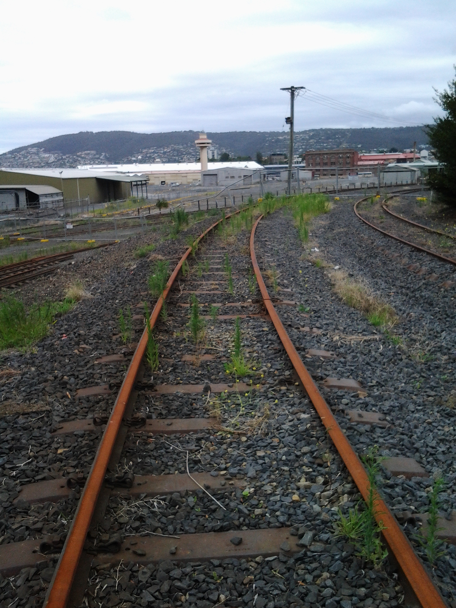
From the beginning of last century, most towns built cenotaphs or other memorials in prominent places. This blog, during the walk along the Derwent River, has shown photos of structures built for such commemoration purposes. It seems appropriate to reshow a selection.

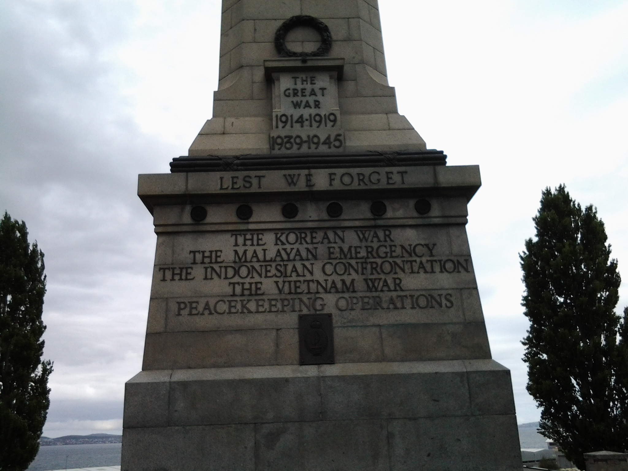
On Stage 1 when walking near the mouth of the river on the eastern shore, I found the Lone Pine memorial standing proudly.  Today, ex-servicemen will gather there to remember the sacrifices of those who stormed the beaches at Gallipoli and went on to battle it out at Lone Pine. ‘Lest we forget’.

20140822_094232

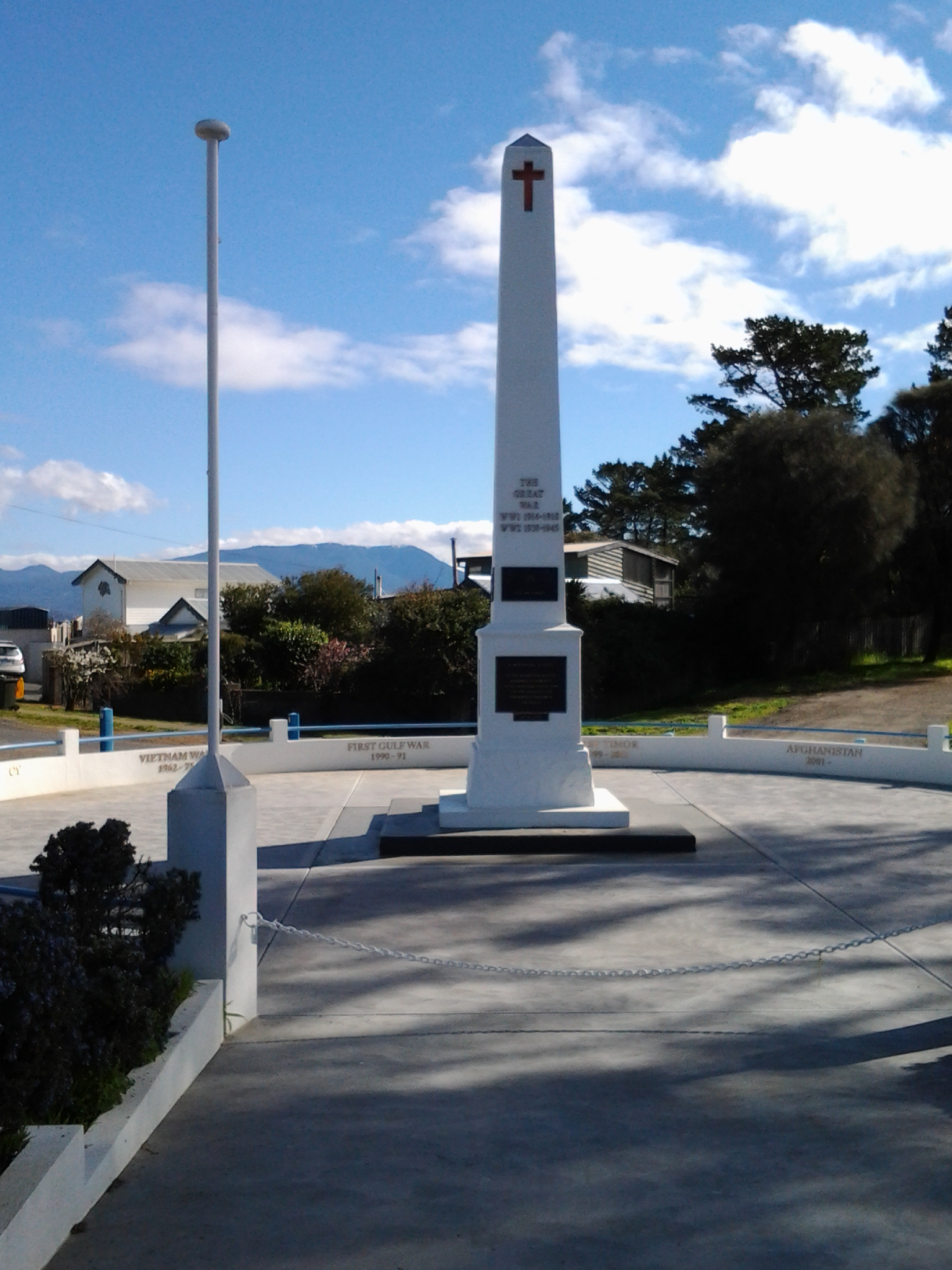
The South Arm cenotaph.

20140822_112319

The Memorial Reserve at Bridgewater

20141111_131258

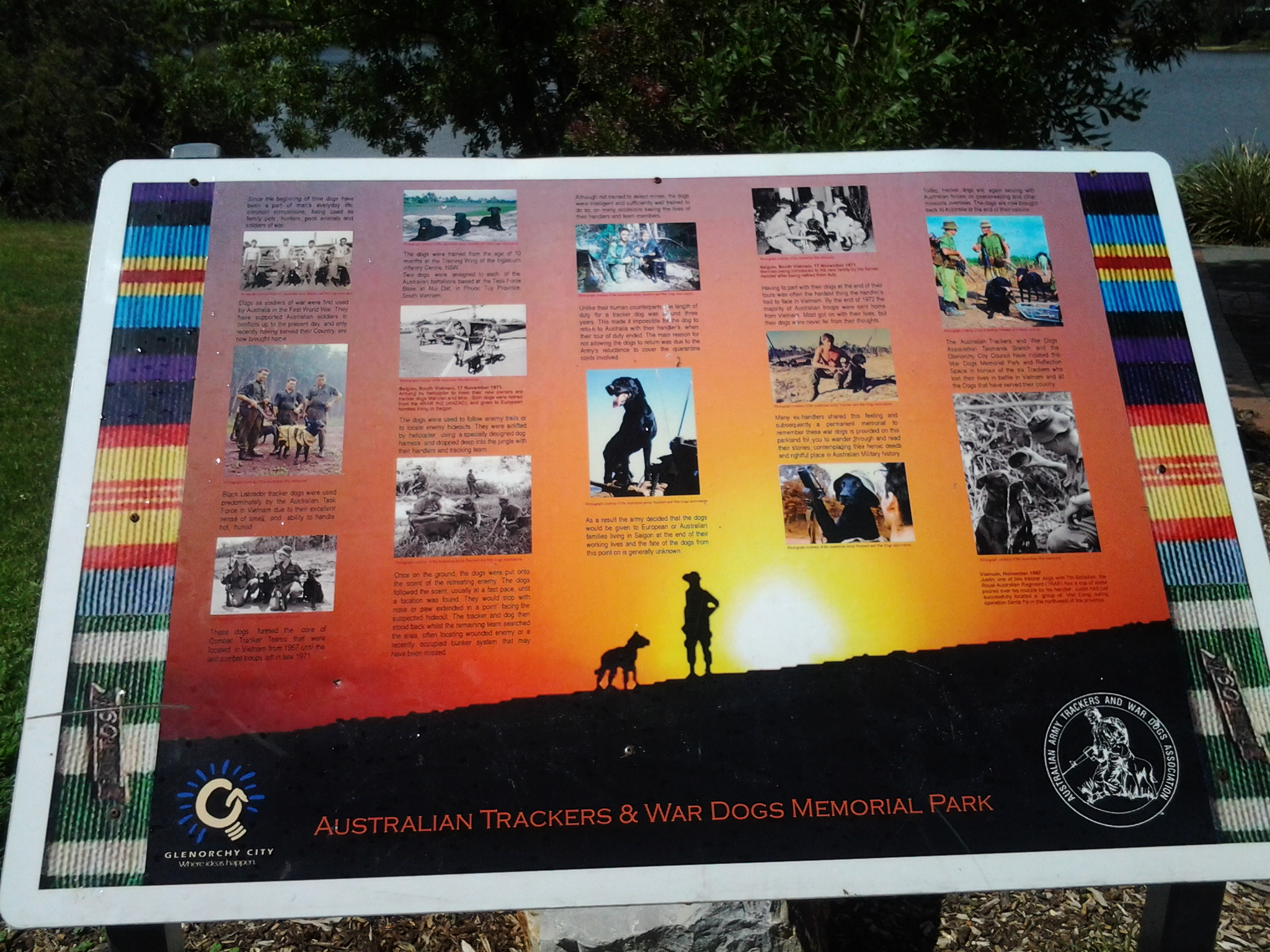
The Australian Tracker and War Dogs Memorial at Lowestoft Bay

20141125_150425

The Hobart City cenotaph on the Domain

20150109_161810

One war memorial, which I am yet to see, is located at Gretna a small rural town located inland from New Norfolk. The Gretna war memorial was built after World War I and sits on a hill overlooking the Derwent River. The spectacular photo below is by Lex Prebski and was taken from http://www.abc.net.au/news/2015-04-22/11-unsung-war-memorials-to-see-in-tasmania-this-anzac-weekend/6401618

Lex Prebski photo of Gretna war memorial

It is interesting that the two most special days on the Australian calender have an element of doing wrong to others: Australia Day on the 26 January celebrates settlement of Australia by foreigners and the displacement of the local indigenous peoples; and Anzac Day on 25 April commemorates the death and activity of thousands of Australian men and women fighting other nationals in wars outside Australia not of our making. The positive sides of these two days are equally clear to me: Australia Day is the chance for everyone who lives in  Australia to enjoy the fact we have a safe and friendly country; Anzac Day offers the chance to value people who had in the past or have currently, a belief and act on it hoping to make the world a safer place for everyone.

Queens Battery

One of the great things about my walk along the Derwent River is that I find sites I did not know existed and I also discover new information. The location of the Queens Battery under the current site of the Cenotaph and Regatta Grounds within the broader area of the Queens Domain is one such item.

The Tasmanian Museum and Art Gallery have created a short video which uses photographs from its historic collection. See www.youtube.com/watch?v=hVEGkgDZMMg

From my time in an earlier stage of the walk, at the Kangaroo Bluff Fort at Bellerive, I knew that Hobart established a series of defensive posts along the Derwent River. Built in the 19th century by the British colonials who settled here, these defence services were designed to counteract their worries about protecting trading ships and then later concerns that Russian forces might invade (I ask you – really? At the other end of the earth!!!! Was this ever likely?).

Wikipedia informs me that … between 1804 and 1942 there were 12 permanent defensive positions constructed in the Hobart region. The start of construction of the Queen’s Battery began in 1838, named in honour of HRH Queen Victoria who was on the throne at the time of the fort’s construction. This was expected to be the grandest of forts and prominently overlook the entrance to Sullivans Cove; however the full plans were never developed. The battery was delayed by funding problems, and  not completed until 1864. The Queens Battery remained in operation until the 1920s. The excavation of the site in 1992 revealed the hot shot oven and the metal parts for rolling the shot were preserved. The oven and archaeological trenches were filled in at the request of the RSL (Returned Services League). The cannon was never fired in anger.”

Location: https://www.google.com.au/maps/vt/data=U4aSnIyhBFNIJ3A8fCzUmaVIwyWq6RtIfB4QKiGq_w,RxhryNB7L5JOppJVjT-1-R9cFyBVxNXF90HhgNOerRCLFKA0zhnI73KC6M5MNa5q95GGnBSCATceYGtWfCO0Xbhedz4BfgEB94Q8t3utHEcf2IzasqMYwzgOJWcTExF5GUO4ledjJPLwKg

Hobart’s Regatta Grounds and Cenotaph; missing Macquarie Point but reaching Hobart’s Sullivans Cove.

Leaving the navy depot on the edge of the Derwent River, I realised the distance to Hunter St and the beginning of Sullivans Cove in Hobart was not far.  That seemed like a perfect finishing destination for Stage 10 of my walk along the Derwent River, so onwards I plodded.

The ex-navy depot sits immediately next to the Regatta Grounds so I reached the Regatta Stand, set up for the annual audiences, very quickly – by 4.10pm.

20150109_160021

Hobart’s Regatta has a long history.  According to http://www.soldierswalk.org.au/walk_domain.html , “The Hobart Regatta is the nation’s second oldest and commenced in 1838 and has been staged every year since, bar two. A grandstand was built in 1877 and replaced by the John Colvin Stand in 1919-20.”  History and photos (including some of Queen Elizabeth visiting) can be seen at http://www.royalhobartregatta.com/History.html.

The day had become bleak and windswept. The area was empty of people and movement. Nevertheless, I continued walking along the dismal disused railway line and passed empty wood chopping competition blocks.

20150109_161232 20150109_161747

Eventually I was stopped from walking to Macquarie Point on the Derwent River by a high fence with locked gates.  I did my best to continue walking around and as far as I could. But it was useless to think I could get much closer to the Point.  It simply was not accessible to walkers like me.

20150109_161339

I clambered up a weedy section and eventually climbed over a lower fence until I was standing on the lower grounds of the Cenotaph, a monument commemorating the men and women who have died in various wars. This is a significant site in Hobart on our nationally celebrated ANZAC Day each April 25th. As I began to leave, the time was 4.18pm.

20150109_161810 20150109_162043 20150109_162225 20150109_162155

I walked around the Cenotaph,

20150109_162351

down an avenue onto the Highway opposite the Aquatic Centre, then turned left and continued until I reached the Grand Chancellor Hotel, which sits opposite the end of Hunter St, at 4.38pm.  A bus stop was nearby and within moments I was on a bus travelling back to the eastern shore to my home in Bellerive.  I felt like I was glowing from the achievement of having covered so much territory and history during this Stage 10 of my walk along the Derwent River. It had been a marvellous day!

The Queens Domain

Hobart’s Queens Domain includes the land encompassing the Botanical Gardens, Government House, the old navy depot, the Regatta Grounds, the Cenotaph and much more.  The Hobart City Council commissioned a Master Plan for the maintenance and development of the social and cultural heritage of this area and it can be accessed at: www.hobartcity.com.au/Recreation/Queens_Domain. A wonderful swag of images of many parts of the Domain can be viewed from this same site.  Simply read down the menu of options and then click on photos of the Domain.

22 Aug 2014 Via Fort Beach returning to South Arm road – Posting 6 of 8

I retraced my steps from Cape Direction and Pot Bay to the Lone Pine Memorial.

On the Pot Bay beach I passed an amazing driftwood ‘shack’ on the beach, as shown in the photo below. Are those underpants swinging from on high?

20140822_101716

After a refreshed look at the Lone Pine Memorial, at 10.25 am (only 1 hour 20 mins since I had left the bus – yet, because I had seen and thought about so many things, the time felt much longer), I turned towards the point of Cape Deliverance. Before doing so, I clicked the photo below which scans Fort Beach towards Johns Point.

20140822_094334

The vehicle track, which wound down the hill towards the Derwent then switched back in the direction of Fort Direction seemed the perfect way to get myself down onto the sandy Fort Beach. Twenty or so minutes later I reached the western end of the beach and easily walked up onto Blessington Road.   The alternative would have been to round John’s Point and continue along to South Arm almost entirely by clambering over a rocky shore.  Of course this was possible however, I reasoned that it would take a lot longer to reach my destination. While walking on the very long Blessington Road, I noticed a couple of public walkways down to the shore, so that if a walker started at the river level they could come up to the road at a later time. A couple of empty house blocks with a water frontage made me consider whether these might provide a way to move from the shore to the road – but they are privately owned so careful thought would be needed before deciding to walk across these.

Half an hour later I reached the cross street Rosemount Lane, a short street which took me down to the South Arm Road.  I continued west towards the South Arm beach, passing by the prominent Cenotaph that remembered many wars including the more recent Iraqi war.

20140822_112246