Tag Archives: Hobart

Finally I reached the mouth of the Derwent River on the western shore at Pearsons Point

The goal of walking along the western shore of the Derwent River was to reach the mouth and during Stage 13 I reached this destination marked by Pearsons Point.

Before then at 10.44am I walked past a turn off: Mt Louis Road. There was a lump up in the sky on my right.  Maybe another time it might be pleasant to see what is up there and to look at the view – which is probably a spectacular 360 degree outlook along the Derwent River, the D’entrecasteaux Channel and Bruny Island.

As I panted up the final hill, I heard the thwack of balls and realised the fencing I could see in the distance amounted to a tennis court.  A tennis court!  Ye gods! Out here in the bush and miles from anywhere?  Yes it was.  Two women were slamming the balls up and down the court.  Their two cars were the only vehicles in sight.

10.52am: I reached the Pearsons Point Reserve and was feeling rather chuffed.

20150224_105032

I wandered around the site which included a disused gun emplacement and a couple of large historic cannons.  Guess Pearsons Point would have been the first line of defence against any Russian threat (which seemed to be the main thought through the 19th century).

20150224_105306 20150224_105429

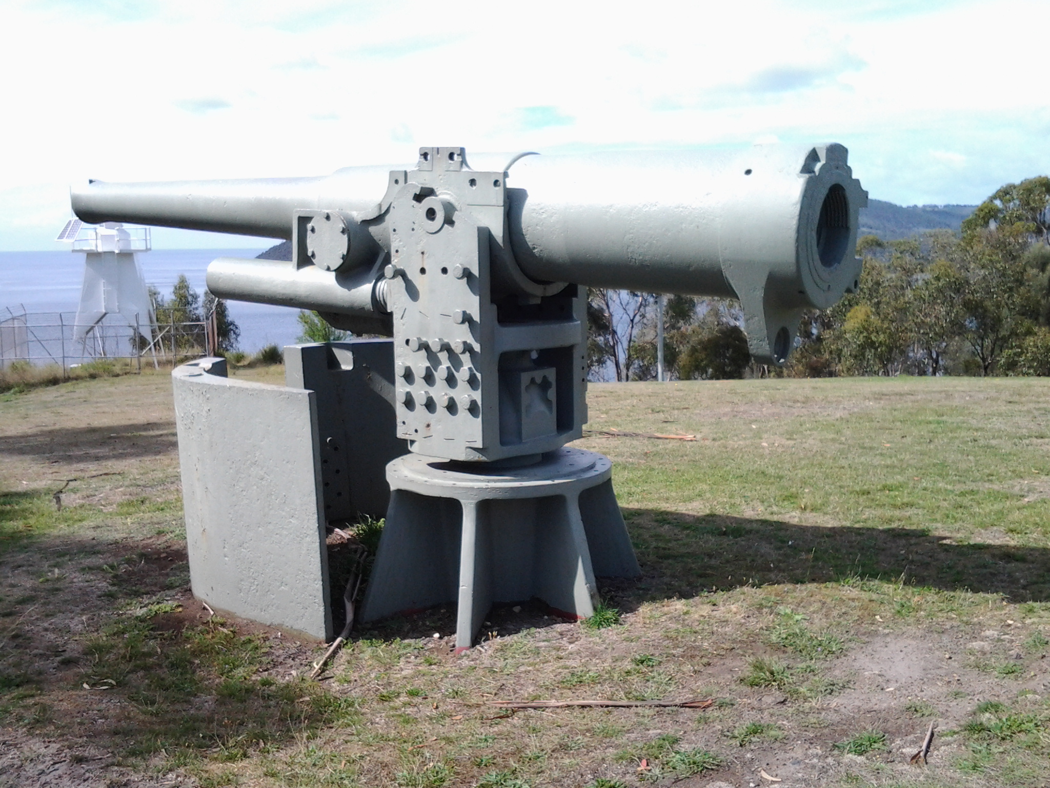
Note: the bump behind the gun emplacement and tennis court is Mt Louis. A large white edifice on the end of the Point (on the other side of the cannon) appeared to be a marine navigation beacon.

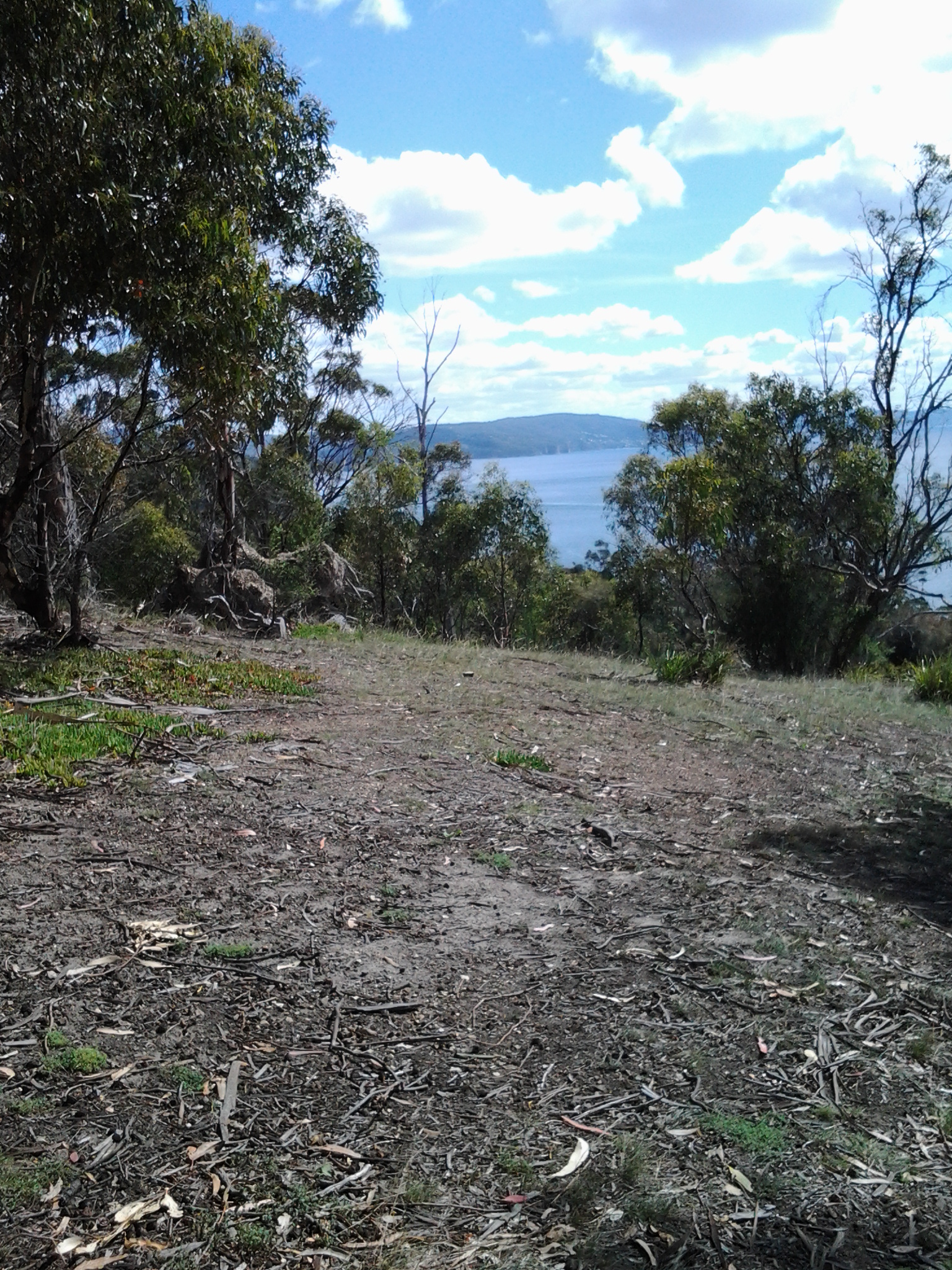
In front of me to the right hand side of the Point, the D’entrecasteaux Channel separated the mainland of Tasmania from Bruny Island (famous for its fresh produce such as cheeses, smoked fish and meats, berries, premium wines, and local oysters).

20150224_105437 20150224_105647

I was very surprised how close Bruny Island (Dennes Point) was to this part of Tasmania’s mainland.  So close.  So accessible.  And its green hills and the white sandy Jetty Beach were most attractive.

On the other side of Pearsons Point to my left, the Derwent River flowed out to Storm Bay and then onto the ocean. I could see the Iron Pot and Cape Direction at the southern tip of the South Arm peninsula on the eastern shore of the River.

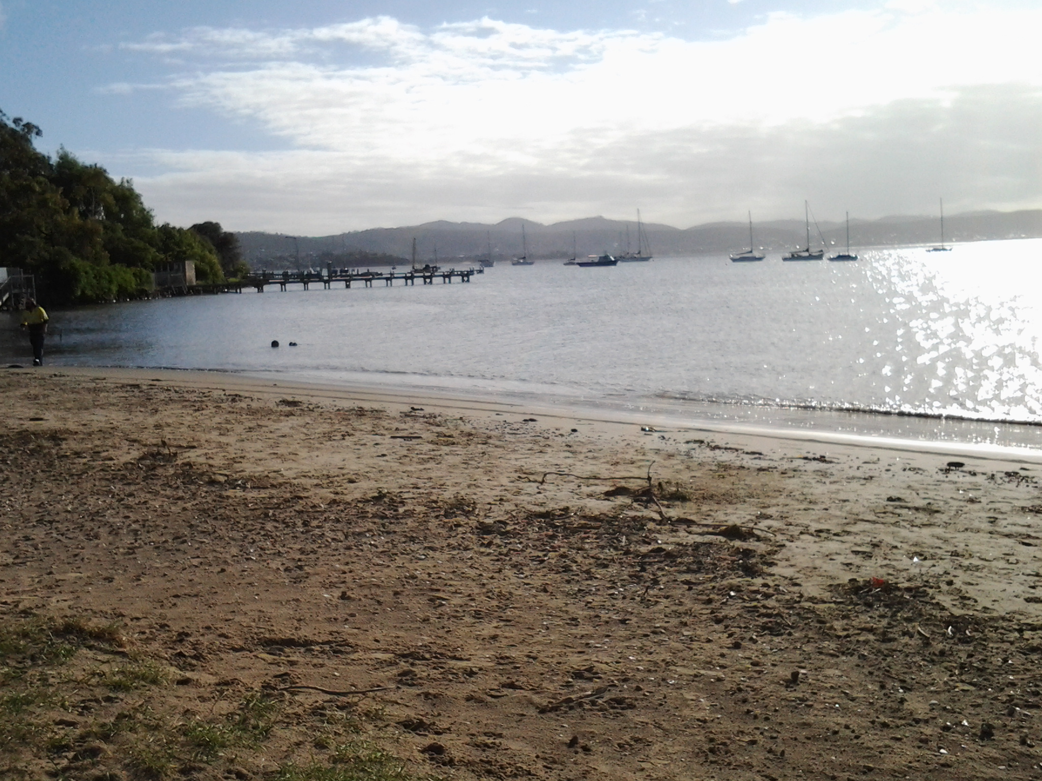
I found a pleasant picnic table and at 11am ate half my lunch under a small cluster of gum trees hoping no branches would be shed on my head.  Feeling on top of the world. The sun was out and the tiniest of breezes moved through the area.  Past the trees I could see motoring boats leaving white streams behind them as they sliced through the River. I looked back northwards to the Alum Cliffs between Taroona and Kingston.

20150224_112527

With a little sadness I left Pearsons Point at 11.25am.

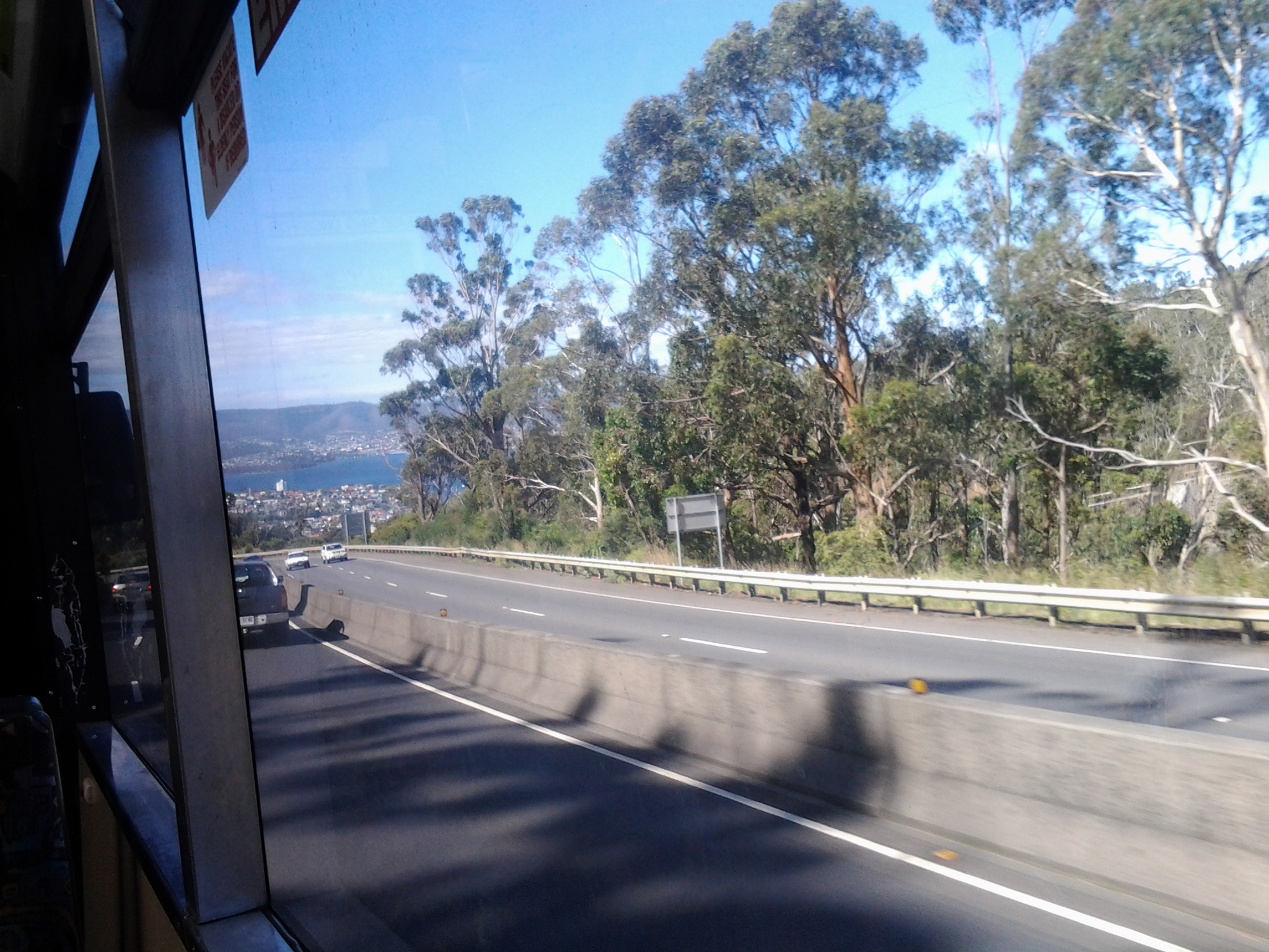
By 12.40pm I was passing the Hidden Cove turnoff, at 1.05pm I reached the Fossil Cove Drive junction, at 1.25pm I walked across the intersection with Treatment Plant Road, and at 1.30 I stopped for a moment at Suncoast Drive.  I looked at the one bus stop (there wasn’t a pair one either side of the road) and it did not have a timetable attached to the post, so I continued walking to Wells Parade.  I had been told this was a long road, and now I know it is.

20150224_133752

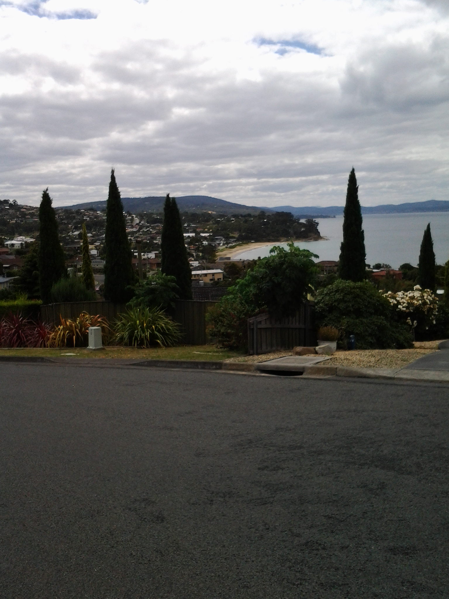
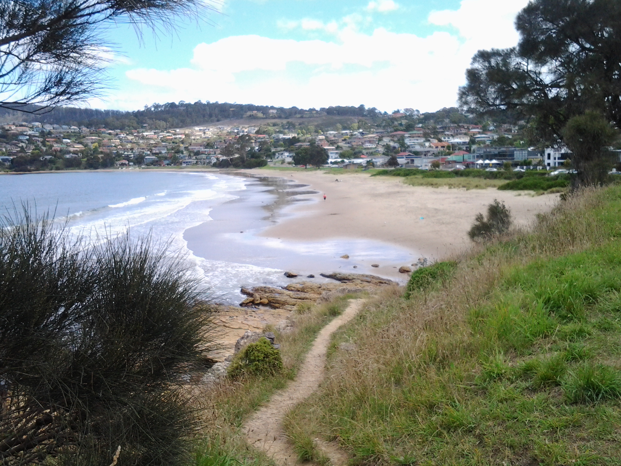
I stopped and waited for a bus which didn’t come (the first in my entire travels) and left and walked up and down and up and downhill until eventually I was back parallel to the Blackmans Bay Beach.  I sat for a while at the beach soaking in the atmosphere, smelling the salt, and relishing the fact my feet were having a rest.  When the time came (according to my bus timetable), I walked to the bus stop where I had alighted hours earlier in the morning, and before long Metro bus number 85 arrived.  After passing via the Suncoast Drive bus stop that I had looked at earlier in the afternoon on arrival back in Blackmans Bay, Maranoa Heights, other suburbs, and Kingston, I was back in Hobart city by 4pm feeling elated.  Stage 13 was over.

Blackberry pie for dinner tonight?

During the Stage 13 walk, I noticed blackberry canes running wild and plump with glistening black berries.  Fruiting blackberries grew rampant on the sides of the roads.  On my return trip to Blackmans Bay from Pearson’s Point, I sampled the odd juicy berry; they were sufficiently sweet to enjoy but sufficiently tart to add sugar in the cooking if wished.

My thoughts flew to hot blackberry pies. I imagine as you read this that, if you have known such leasure, you are licking your lips and savouring the memories of their deliciousness.

As I walked, I considered how easy it would be to make a pie.

For Hobart locals, I thought you should buy a pack of frozen puff pastry on the way home from work or wherever.  Throw it into the fridge, grab your pie dish, jump in the car or take a bus then travel through Blackmans Bay and onto the Tinderbox Road.  When you have passed the intersections with Wells Parade and Suncoast Drive, the next road left is the Treatment Plant Road.  Drive/walk down this road until you reach the Dog Exercise Reserve.  Walk to the left of the enclosure just a few metres and all along the path are easily accessible blackberries ready to be picked.  Fill your pie dish. Alternatively you can continue driving up Tinderbox Road and stop wherever you see the multiglobes of these very ripe berries.

When you get back home, if you wish, sprinkle with sugar to taste.  Place a slab of puff pastry over the dish.  Make some fancy holes with the fork tines to let the steam rise away from the pie so the pastry becomes crisp, then place in a preheated oven and bake around 200 degrees until the puff pastry has risen and turned a golden colour.  I know some people eat their portion of blackberry pies neat, while others scoop icecream or pour cream over the dish.

Nowhere did the berry bushes seem as if they had been sprayed with pesticides. I talked with a local woman who was picking berries off the fence line at her property and she was confident none had been sprayed. I suffered no ill effects from eating them.

If you are a reader who has never seen a blackberry, here is a photo:

blackberry_blackberries_fruit_224333 free image blackberry_186056

Please tell me if you are now inspired to make a blackberry pie, if you live somewhere close to fruiting blackberry bushes.

Cruise ships berthing at Hobart

On a recent afternoon I could see the Marina cruise ship berthed at MAC2/3 (the name of one of Hobart piers). This ship arrived early in the morning from Geelong in southern Victoria on mainland Australia.

20150217_145044 20150217_145014

For more information about the ship go to http://www.cruiseaway.com.au/ship/marina?gclid=Cj0KEQiA6ounBRCq0LKBjKGgysEBEiQAZmpvAxP6_HcT_3xcTvA4bqjanWX6gz9rMqc1ga4ZVAGuCFoaAiMt8P8HAQ

Later, I watched the Marina depart at 6pm.  The early evening sun sparkled across the Derwent River and brightened the ship so it made a spectacle as it gathered steam. The Marina’s next destination is Milford Sound on the south island of New Zealand.

20150217_181250

This cruise ship is one of many which dock in Hobart and release thousands of tourists across the city and further beyond, for day trips. If you want to know which ships  are due in port in the coming days then read http://www.tasports.com.au/port_services/arrivalshobart.html

The overall cruise ship schedule into Tasmanian ports can be read at http://www.tasports.com.au/port_services/arrivalscruise.html. This list is staggering because it shows the bookings up until 2020!

From my Bellerive home I can see these large ‘towns’ on water as they arrive and depart.  I can almost feel the thrill that I expect new arrivals might experience as they reach this new destination ready to discover a new world.  One day I hope one of my blog followers will be on such a cruise ship and will ask me to take them on a walk somewhere along the Derwent River.

T42 on the Derwent River, Tasmania

When a friend suggested we meet for a drink and named the place, I said ‘yes’ immediately. The Tavern 42 Degrees South Elizabeth St Pier Hobart ,usually known as T42, is one of my favourite haunts on the Hobart wharves edging the Derwent River. Late afternoon and into the evening a couple of days ago I enjoyed sitting outside in the fresh air while sipping a sparkling wine or two and, all the while, watching yachts and other boats and ships come and go, as tourists and locals wandered around.  Exceptionally easy and pleasant.

20150217_144651

What does 42 Degrees South mean?  If you read http://en.wikipedia.org/wiki/42nd_parallel_south you can see a list of the countries through which passes the 42nd latitude south of the equator (most of it passes across oceans). Historically Tasmania has made a noise about this parallel in order to make it easier for people elsewhere in the world to locate our island.  It is celebrated in an outstanding quarterly periodical aptly titled TASMANIA 40oSOUTH. More information including subscription details can be read at http://www.fortysouth.com.au.  The stories and the photographs contained in each issue are nothing short of inspiring and glorious.

The tavern T42 on the edge of Elizabeth Pier, one of Hobart’s easily accessible wharves, also acknowledges Tasmania’s location in its name.  To reach the restaurant at the end of Elizabeth Street in the centre of Hobart, firstly you will see another well patronised restaurant, Fish Frenzy, then you walk either to the left or right and find T42 which has entrances both sides of the Pier.

I always prefer to walk on the left side where the Lady Nelson is often moored.

20150217_144739 20150217_145310

Further along, another sailing ship, the SV Rhona H was sitting pretty.

20150217_145208 20150217_145220

Relaxing comfortably at outdoor tables I did not realise my view was so visually obstructed as the following photograph seems to indicate. Instead I found the changing view enthralling.

20150217_154406

The skies were clouded but the atmosphere was not gloomy. The day was mildly humid and not cold.  The water was often mirror smooth and picture perfect.

20150217_145202

This was the place to be!  And I will return.

Clarence Jazz Festival (mostly bordering the Derwent River) in southern Tasmania

jazz-1-052314-akp

I don’t know when the Clarence Jazz Festival first started, but it was up and running when I returned to Tasmania to live, in 2000. Ever since, it has grown in scale and excitement.

From one Sunday to the next in the third week of each February, performances are scheduled in historic buildings such as the Rosny Barn, next to the water on various bays such as Kangaroo Bay and Lindisfarne Bay (that empty into the Derwent River, and which blog followers may remember from earlier stages of my walk), at beach reserves and on village greens across the local government area of Clarence City Council.

Most are free events and they culminate in the big day next Sunday.  On that day the Bellerive Boardwalk, with its stunning backdrop of sun-drenched water covered in yachts, hosts a grand finale when many different Tasmanian and national jazz musicians perform on an open stage in front of changing throngs of people sitting and moving around the Boardwalk.  Food, wine and coffee stalls surround the venue, and the Clarence City Council offers free sunscreen for those who come unprotected.  At the Jazz at the Boardwalk is where you can expect me to be next Sunday!  Bring on those sexy saxophones!

TheresaKnott-Saxophone

Typically people walk from home often carrying picnics and refreshments to drink.  Families sit outdoors and soak in the atmosphere while kids clamber over public playground equipment when nearby.  Where I live, sometimes the sounds of music float across the air and I am able to enjoy concerts when I cannot get away from home.

The festival Facebook site shows images of past musos and performances and some of the guests for this year (https://www.facebook.com/clarencejazzfestival).

If you are a Hobart local and have forgotten about the Festival go to http://www.ccc.tas.gov.au/page.aspx?u=933&c=386, read the program, and be prepared to see some musicians strut their stuff.

free_3807275 Trumpet in the lights

Last weekend Hobart focused on the Derwent River

Last week I posted information in advance of the Royal Hobart Regatta and the Australian Wooden Boat Festival both of which celebrated Hobart’s water-based history on and in relation to the Derwent River.

On Friday afternoon, the Parade of Sails offered a flotilla of yachts and sailing ships which manoeuvred to the starting point of John Garrow Light and then headed upriver to Sullivans Cove at the wharf in Hobart. Followers may recall that, on an earlier stage of my walk along the Derwent River, I passed the John Garrow navigation light in Lower Sandy Bay when I reached Blinking Billy Point.

Last Friday I thought that a raised vantage point would give me a great view of the Parade of Sails, so I joined with neighbours from their balcony to watch.  I saw hundreds of marine craft sailing up the river on a heavenly blue sky day. The wind pushed them quickly upriver to Sandy Bay and then they seemed to stall. The sails congregated en masse close to shore between Wrest Point Hotel Casino and the suburb of Battery Point.

20150206_123340

This was so far away and unless you enlarge my photos you will believe there were few vessels on the Derwent River that day.  When not much forward movement happened, I realised that the finishing time for the Parade of Sails was 1.30pm but it wasn’t yet 1pm. Therefore, I presumed the ships decided to wait so the grand entrance/arrival into the Hobart docks could be on time.

On Monday I watched a swooping display from 4 synchronised planes, the Roulettes. They flew in complex formations around the city, across Mount Wellington and along the Derwent River, spewing steam behind to mark their athletic twists and turns.

It was a packed weekend and the media provided spectacular views of all the activities.  Have a look and consider being around when these events are held next time.

The Royal Hobart Regatta site is at: http://www.royalhobartregatta.com/

The Australian Wooden Boat Festival site is at: http://www.australianwoodenboatfestival.com.au/home

Colourful media coverage of this year’s events include:

Nudging into Blackmans Bay on Stage 12 of my walk along the Derwent River

At 3pm I turned left onto Roslyn Ave having walked up from Boronia Beach. Within 10 minutes I could see Blackmans Bay Beach.

20150202_150926

Five minutes later I turned left at Blowhole Road in search of a Blowhole. The road was narrow with no pathway and limited edges on which to walk.  Wattle trees were blooming and I passed an apple orchard laden with red globes. Flowering gums are spectacular at the moment.

20150202_150406

I reached the Blowhole sign, which indicated the entrance to a small park on a hill at the northern end of Blackmans Bay Beach, at 3.22 pm.

20150202_152145 20150202_152210

The weather wasn’t gusty and so the water ebbed and flowed rhythmically but undramatically beneath a rock bridge. There was no blowing of water through the gap.

20150202_152241

I continued down hill.

20150202_152611 20150202_153012

I reached beach level at 3.34pm and proceeded to walk on the path beside Ocean Esplanade. Inset into the pavement were handmade tiles and mosaics presumably made by community effort.  These were similar to those impressed into the footpath in parts of Kingston.

20150202_153808 20150202_153822

A little way along the Esplanade public toilets and a kid’s playground provided useful amenities.

I decided to stop, look, listen and smell. Looking over the Derwent River to the South Arm peninsula and around about me watching people enjoying the beach and surrounds, listening to the seagulls calling, and smelling the salty air kept me seated for 10 minutes. I had walked two thirds of the way along Blackmans Bay Beach and it seemed a reasonable place to stop for Stage 12.  So I headed for  a bus stop.  I found one by turning into Hazell St and then into Wells Parade.  As I arrived at the stop, a Metro bus came over the hill in the distance.  Wonderful timing.  It was 4pm. The experiences of the day had been rich. I enjoyed the bus trip back into Hobart via the main Kingston shopping centre, and then the southern outlet highway. The view when we came to the top of the final hill is majestic (please ignore the dirty bus windows in the photos below).

20150202_161915 20150202_162002 20150202_162024

Some of Hobart and the eastern shore suburbs are laid out below with the blue Derwent River flowing between. Always stunning. After half an hour on the bus I arrived in Hobart city, then headed off for my Bellerive bus and was home before 5pm.  All together a brilliant day.  Stage 12 was complete!  Because of personal commitments and what I have seen in the weather forecast, I do not expect to walk Stage 13 until next week.

An extra historical morsel regarding Browns River which runs out into the Derwent River

Browns River separates Tyndall Beach (below the Alum Cliffs) from Kingston Beach. On the Kingston side, a plaque remembers Robert Brown.

According to http://www.rampantscotland.com/placenames/placename_hobart.htm  the township of “Browns River was named after the noted Scottish botanist Robert Brown who explored the area a week after Hobart was founded. “  Apparently Hobart (Sullivans Cove) was established on 21 February 1804 (I shall remember the date because it is my birthday – well not the 1804 bit) and therefore before the end of February this ‘township’ of Browns River was in its infancy. A week – ye gods!  How quickly these pioneering settlers got around.  Nothing could happen so fast these days.  But, is the timing true or simply a legend? I don’t know.

The name was changed to Kingston in 1851 by the Governor of Van Diemens Land, Sir William Thomas Denison.  The website http://tasmaniaforeveryone.com/tasmanias-names-the-suburbs-of-hobart suggests “The name Kingston was advocated by the then Police Magistrate, Mr Lucas. Although his exact reason for deciding on the name of Kingston is unknown, there are many theories. His parents, Thomas and Anne Lucas, the district’s first settlers, lived at Norfolk Island before coming to Van Diemen’s Land and the capital of Norfolk Island was Kingston. Another possible reason is that Thomas was born in Surrey, England in a village close to New Kingston. It had been settled in 1808 by Thomas Lucas and his family, who were evacuated from Norfolk Island. He named his property ‘Kingston’, after the settlement on Norfolk Island. “

Wooden boats will be afloat on the Derwent River this coming weekend

The Australian Boat Festival will run from Friday 6th to Monday 9th February centred around Hobart’s city waterfront and the Derwent River.

Every two years we remember that the first indigenous inhabitants made wooden canoes and the first European settlers arrived here in tall sailing ships constructed from wood, and we look at our historical (this time 20 of the boats will be over a century old) and current wooden boats. Around 550 vessels will be part of this Festival in 2015.

Apparently this has now become the southern hemisphere’s largest wooden boat festival.  These days in southern Tasmania we have a new history of a boat building industry that produces custom made craft, and restoration of older boats.

The spectacular Parade of Sails starts the program on Friday at 1pm and so I, like many others, will gather somewhere along the Derwent River to witness the event.

The program is detailed and complex; you can read more and view fabulous photographs taken at previous events at http://www.australianwoodenboatfestival.com.au.

Involved in the last Wooden Boat Festival was a replica of an ancient Viking ship.  I wait with interest to see what surprises will turn up this weekend.

Sandy Bay along the foreshore

On Stage 11 of my walk along the Derwent River, having enjoyed Hobart’s wharf area and the edges of Salamanca and Battery Point, I continued walking along Short Beach at the beginning of Sandy Bay, past public toilets at 8.20am, towards the Sandy Bay Rowing Club and then along Marrieville Esplanade.

20150119_081832 20150119_081815

At 8.28am I reached the Royal Yacht Club of Tasmania and remembered my first Hobart job many years ago.  The photo below shows the entrance to this complex.

20150119_082553

A friend waitressed in the Club restaurant and I went to see if I could get a similar job. I had no experience in hospitality but, full of unsubstantiated confidence, I approached the head chef. He told me that without experience he could not give me a job. I stood my ground and said that until I had worked in a job I wouldn’t have experience and therefore the only way I could get experience would be if he hired me.  And he did.  As a washer of dishes and all the kitchen wares.  Eventually I was allowed to place the lettuce on plates, then make the salads, then cook the potato chips and fried rice in large pots, and finally I reached the heights of being permitted to cook steaks for customers.  After many months the head chef recalled his first meeting with me and how (I forget the word he used but its meaning was clearly something like) pushy, stubborn, strong willed and unable to take no for an answer I was, and it was my approach which inclined him to give me a go. It certainly helped to pay the rent and I was very grateful.  I remain grateful because I learnt a lot about human nature in that hot kitchen where pressure turned people into animals.

But back to my Stage 11 walk.

A couple of minutes later I was walking past the Derwent Sailing Squadron buildings and could see yachts everywhere in and out of the water.  Past the Squadron buildings, in the distance, the tall building indicated Wrest Point Hotel was not far away and I knew I would walk past it a little later.

20150119_082956

In the distance, slightly inland on my right, the many buildings of the University of Tasmania cascaded down the hill; part of the slope of Mount Nelson.

20150119_083125

A car drove past and the driver waved and smiled at me. Once friend Ma was out of her car, she explained that with her husband she was about to put their yacht into the water (after its recent debarnacling – if there is such a word) and enjoy a sail along the Derwent.  “Would I like to stay and watch?’ she asked. I wanted to stay focused on my walk in case weather might not be suitable on other days, and declined with some inner hesitation.  What a great offer.  Maybe another time I can say yes.  Perhaps a sail??? Who knows.

The opportunity to continue walking close to the foreshore came to an abrupt stop and it was clear private houses owned the area at the back of their houses to water level. So I took a path to Sandy Bay Road, arriving at 8.35am.

Walking along the wharves of Sullivans Cove, Hobart

On Stage 11, after walking along Hunter St, I turned right to walk along the Franklin Wharf street, and had the Derwent River on my left and an enclosure for fishing and other vessels to my right. The morning was fresh, the sun was shining and it was all together delightful. Not many people around. The mountain, clearly visible, looked down on the centre of Hobart and over the wharves. Clouds were reflected serenely in the water.

20150119_072745 20150119_072147

A family of bronze sculptures, perched life-like on rocks on the River side, is much loved by visitors.

20150119_072515 20150119_072503

Passing Mures fish restaurant on my right, I continued on until I could see the row of floating fish shops selling fresh and cooked fish and other seafood.

20150119_072706 20150119_072651

A minute later, I was standing on the celebration platform used when the Sydney to Hobart Yacht race boats arrive. I looked across to Elizabeth Pier which contains accommodation, conference facilities and a number of eateries (where sitting outside is such a pleasure).  In the photo below the ‘tall-ship’ replica Lady Nelson sits outside the T42 restaurant.

20150119_072901

Opposite Elizabeth St pier, a number of buildings of different architectural styles and vintages line part of the street. Continuing to the other side of the Elizabeth St pier, a second tall ship, the Windward Bound offers sailing trips.

20150119_073148 20150119_073111

On the next pier after the one in the photo above, a couple of the contemporary camouflaged MONA ferries sat either side within the slightly mobile surface of beautiful glassy water.  Taking a trip on these ferries down the Derwent to and from MONA (Museum of New and Old Art) located in the suburb of Berriedale (I walked through that on recent Stages) helps you to see parts of Hobart you would not normally see, and it gives you a perspective on the distances over which the Greater Hobart Area sprawls. It is interesting to reflect on the two extremes of water vessel technology, when you look at the 19th century sailing ship close by a state-of-the-art catamaran.

20150119_073231

These starting sections of my Stage 11 were colourful and tranquil. It’s a free, easy, stroll along the waterfront and there is much to see looking out onto the side of the Derwent River. The next posting on this blog will look at landmarks on the non-River side of the streets.

Starting off for Hunter St Hobart on last Monday’s Stage 11 of the walk along the Derwent River

Despite having a severe dislike of getting out of bed early, I always try and ‘get on the road’ as early as possible for my walks in case the weather changes for the worse during the day – the earlyish starts give me all the chances in the world to walk as far as I can. It was no different last Monday. I left home not long after 6.30am (yes I know many of you would still have been snoring) and bussed into Hobart. I walked down to the intersection with the major thoroughfare at Davey St and Evans St near the wharf area. Looking around, notable landmarks for locals surrounded me.

The chimney of the beautiful 19th century sandstone Gasworks now reinvented into a HOGS restaurant and a bottle shop, sits on one corner.

20150119_071455

A warehouse-like building for Tas Ports on another corner.

20150119_071434

The apartment block for residents and tourists known as Zero Davey on another.

20150119_071441 20150119_071510

The concert hall of the Tasmanian Symphony Orchestra at one end of the Grand Chancellor Hotel on the other.

20150119_071542

By 7.15am I had walked to the intersection of Hunter St with Davey St. There are a considerable number of information boards along this street providing lots of information about the history of the area. This was the area where the first European settlers started the colony after giving up on Risdon Cove on the eastern shore of the River.

20150119_071708 20150119_071713 20150119_072250

One side of the street is lined with buildings many of which were built in the 19th century.

20150119_071801 20150119_072104 20150119_072334

The other side of the street has the wharf space which is normally used by fishing boats: for example, the crayfish/lobster boats. Look at how silken soft the water is. Wonderfully colourful.

20150119_071815 20150119_071829

I left Hunter St at 7.25am at the intersection with the Franklin Wharf street that extends parallel to the waters of the Derwent River. If you were to walk along Hunter St and not be note taking and clicking photographs, it would take you a maximum of two minutes to walk.  But if you want to stop and look and read then allow longer.

Yesterday I walked Stage 11 from Hunter St in Hobart city to Hinsby Beach south of Taroona

The goal of my walk along the Derwent River for Stage 11 was to start at my last stopping point, Hunter St at the wharf in Hobart on the western shore of the Derwent River, and continue to Kingston in the local government area of Kingborough.  But I did not get that far.  My feet said enough was enough once I found the delightful and almost hidden Hinsby Beach.

20150119_131327

Over future posts, I will write up the stories of the walk, what I saw and what I experienced, but for now it’s enough to say that I am continuing with this massive project to walk both sides of the Derwent between the mouth and Bridgewater, and then onwards to Lake St Clair.

The day was sunny with a bright blue sky, Mount Wellington was clear, and a cool breeze featured through much of the day – making it perfect walking weather.

Yesterday I covered 8 kilometres of the length of the Derwent River on the western shore (making 30 kms in total on the western shore), and walked approximately 13kilometres (making a total of 143 kms to date) to achieve that distance. This distance also takes in the streets and paths on which I walked that led to dead ends so that I needed to retrace my footsteps.

The highlights of the walk include discovering the road next to Taroona High School is a public access route which took me down to the Derwent River to a row of colourful boathouses, getting off the main road at places like Cartwright Park Reserve, and seeing the Alum Cliffs in all their majesty.  My next walk will start along the top of these.

20150119_125317

It was a revelation to watch the eastern shore and to see the suburbs and beaches on which I walked in the early stages of my walk. The day started with my being roughly opposite Bellerive and finished with my being opposite Gellibrand Point at the northern tip of South Arm.  The photo below, taken from Hinsby Beach, looks across the Derwent River to Opossum Bay Beach.

20150119_131757

I intend my next walk will start from Hinsby Beach and continue to Blackmans Bay.  But before then I need to record the details of yesterday’s walk.  So my walk for Stage 12 could be a week or more away.

Queens Battery

One of the great things about my walk along the Derwent River is that I find sites I did not know existed and I also discover new information. The location of the Queens Battery under the current site of the Cenotaph and Regatta Grounds within the broader area of the Queens Domain is one such item.

The Tasmanian Museum and Art Gallery have created a short video which uses photographs from its historic collection. See www.youtube.com/watch?v=hVEGkgDZMMg

From my time in an earlier stage of the walk, at the Kangaroo Bluff Fort at Bellerive, I knew that Hobart established a series of defensive posts along the Derwent River. Built in the 19th century by the British colonials who settled here, these defence services were designed to counteract their worries about protecting trading ships and then later concerns that Russian forces might invade (I ask you – really? At the other end of the earth!!!! Was this ever likely?).

Wikipedia informs me that … between 1804 and 1942 there were 12 permanent defensive positions constructed in the Hobart region. The start of construction of the Queen’s Battery began in 1838, named in honour of HRH Queen Victoria who was on the throne at the time of the fort’s construction. This was expected to be the grandest of forts and prominently overlook the entrance to Sullivans Cove; however the full plans were never developed. The battery was delayed by funding problems, and  not completed until 1864. The Queens Battery remained in operation until the 1920s. The excavation of the site in 1992 revealed the hot shot oven and the metal parts for rolling the shot were preserved. The oven and archaeological trenches were filled in at the request of the RSL (Returned Services League). The cannon was never fired in anger.”

Location: https://www.google.com.au/maps/vt/data=U4aSnIyhBFNIJ3A8fCzUmaVIwyWq6RtIfB4QKiGq_w,RxhryNB7L5JOppJVjT-1-R9cFyBVxNXF90HhgNOerRCLFKA0zhnI73KC6M5MNa5q95GGnBSCATceYGtWfCO0Xbhedz4BfgEB94Q8t3utHEcf2IzasqMYwzgOJWcTExF5GUO4ledjJPLwKg

The Queens Domain

Hobart’s Queens Domain includes the land encompassing the Botanical Gardens, Government House, the old navy depot, the Regatta Grounds, the Cenotaph and much more.  The Hobart City Council commissioned a Master Plan for the maintenance and development of the social and cultural heritage of this area and it can be accessed at: www.hobartcity.com.au/Recreation/Queens_Domain. A wonderful swag of images of many parts of the Domain can be viewed from this same site.  Simply read down the menu of options and then click on photos of the Domain.