Tag Archives: Catagunya Dam

From Catagunya to Wayatinah – post 1 of 4

Well over a year ago, one morning I walked through smoky air westwards into the Catagunya Power Station.  After a night camping, entwined by the thick atmosphere of a far distant bush fire and desperate for water, I was relieved to be received hospitably at the Station.  At that time I was thrilled by a guided tour of the building and its operation, however I never proceeded to walk the extra few hundred metres to look at the Dam wall holding back the large Lake Catagunya.  I was most grateful when many months ago, my walking proxy Andrew climbed the hills from Wayatinah Power Station to arrive at and photograph the Catagunya Dam.  A blog search using “Catagunya” as the term, will help you to locate those past stories plus a swag of descriptive photographs.

Recently, I was privileged to make the journey between the Catagunya and Wayatinah Power Stations and to experience that stimulating environment. Thanks to the generous assistance of GL from TasNetworks,  I was able to enter the locked Catagunya Road off the Lyell Highway, and travel the 8 or so kilometres to the Catagunya Dam.

The wall of the Dam curved magnificently and  the landscape-green Lake Catagunya spread impassively to the west. 20170424_104221.jpg

20170424_104055.jpg

Below I could see the old Derwent River bed as a rocky almost water free pathway.

20170424_104042.jpg

Bypassing the river bed, a massive Canal drained water from the Lake into the Power Station. It appeared as a giant marker on the landscape that seemed much wider and more substantial than the Tarraleah Canals that run from Lake King William and the Butlers Gorge Power Station further inland.    20170424_104148

20170424_104228.jpg

20170424_104330.jpg

20170424_104504.jpg

The apparently still Canal water was deceptive. Only on closer inspection could I see the dramatic gush of water moving underneath the left hand entrance at the end of the race.  Obviously electrical power was being generated in the Catagunya Power Station that day.

From vantage points near the Dam and the Canal I could see the Power Station building way below. Oh how tiny it seemed by comparison with the larger constructions. Yet when I had first approached and walked around it, the building seemed cavernous.

20170424_104537 with PSarrowed.jpg

20160210_092533.jpg

More than anything I was as excited as a three year old having a birthday party with lots of surprises.  Recent rain had cleared the air of dust, the day was overcast and the fairy weight of moisture from low clouds kept the air moist. I kept breathing deeply, absorbing the cleanness of the air. Loving the damp air. Feeling cleansed. So profoundly happy to be back in the bush and walking besides my beloved Derwent River.

Between Wayatinah and Catagunya Power Stations- posting 5 of 6


Above the complex of Catagunya Lake, Dam and Power Station there were a number of viewing points from which to study the construction of the dam, the head race, switch yard, etc. It was so easy to admire the engineering feat that established this enterprise. Water was not moving in the race so it seemed that the Catagunya Power Station was closed down.  Maintenance? Too much power being generated elsewhere? Water conservation and therefore prudent power generation management practices?  The reason is unknown.

DSC01733e.jpg

DSC01736e.jpg

DSC01734e.jpg

Did you notice how thin the water race walls were?  If you imagine the pressure of the water in the race you might believe the walls should be thicker. Certainly, when compared to those of Tarraleah Canal No 1 (refer to photos in my earlier postings) these walls are much slimmer, and they do not have cross beams linking both sides together.

Did you notice the ladder over the wall?  On this side and a second on the other side?  This is more than is on offer in Tarraleah Canal No 1.  Of course the ladders would be used as part of maintenance programs when the race is empty, and only a fool would step over the edge while the race is full of water. Since the power generation could be restarted at any moment, the speed of the water flow would almost immediately turn anything in that water into an electrical spark.

When looking at the Dam wall, Andrew saw specks of movement; these were the only people encountered in the whole day – three workers doing some work on the curving face of dam’s spillway. Can you spot them in the photograph?  They are working on the yellow curved frame which has been custom built to move from left to right across the curve of the dam wall.

Andrew remarked, “I could hear their voices echoing off the concrete walls, but they were far too distant for them to see me”. There was no-one at the Power Station itself – so Andrew passed by with no-one the wiser that the visit had occurred.   One sign attracted his attention.

DSC01740e.jpg

It was quite extraordinary to see a sign with an image of a dolphin so far inland. Hydro Tasmania must be congratulated for alerting others to the damage which can be done to marine life should people pollute Lake Catagunya/the Derwent River.   Apart from the damage to sea life 60% of Hobart’s drinking water comes from the Derwent River so the protection of these waterways is of paramount importance.

Between Wayatinah and Catagunya Power Stations- posting 4 of 6

Eventually Andrew reached cleared paddocks at the point where the transmission line swung to the south east.  The going then was much easier through low scrub in a shallower gully and then up onto the summit of Bushman’s Hill, some three hours after the start of the day’s walk.  From this hill Mt Wellington above Hobart was visible in the distance, and Andrew’s mobile phone pinged. He had come back into mobile phone coverage range. The one occasional bar of reception was enough for a text message but not sufficient for a phone call. Bushman’s Hill offered a very comfortable spot with the occasional shade tree and logs to rest on.

DSC01689e.jpg

After a quick lunch around 1 pm, Andrew followed the power line easement hoping to get to  Lake Catagunya’s edge. Unfortunately, the terrain became impressively steep and scrubby with a coverage of thick ferns towards the bottom so that idea was abandoned.

Before crossing Lake Catagunya’s inlet, as Andrew skirted around looking for a cross over point, Dunns Hill stood prominently. This hill, pictured below, had to be traversed to reach Catagunya Dam and Catagunya Power Station. But first the water had to be crossed or walked around.

DSC01692e.jpg

The challenge was to find a way of by-passing the large inlet of water where Black Bobs Rivulet enters Catagunya Lake. By heading 1 km north, north east, then east through open forest and then progressively steeper country Andrew reached a point where the rivulet hit the Lake. Right at the junction the exposed rock made for an easy rock-hop to the other side (in flood this part would be impassable as it is obvious that it carries a lot of water after heavy rain). He was so glad to see the low water level at that point. otherwise it would have meant wet feet or more kilometres of walking to skirt around this obstacle.

The first photo below of Black Bob’s Rivulet looks upstream and the second looks downstream to where it enters the lake.

DSC01693e.jpg

DSC01695e.jpg

The open hill in the distance on the second photo is located north of Catagunya Dam and on the other/eastern side of Catagunya Road – this is not Dunns Hill.  Once over Black Bob’s Rivulet, the direction taken was south towards Dunns Hill. After a short scrub-bash, the route emerged into the open paddocks of the cattle country surrounding Catagunya Power Station. Andrew then climbed 1 km steeply up Dunns Hill to rejoin the power lines.  The reward for reaching the top of Dunns Hill was a fine view down into the Lake and westwards to Wylds Craig.

DSC01702e.jpg

Looking westwards the continuing power lines disappear into the distance. The undulating nature of the landscape is also on show.

DSC01698e.jpg

The glorious openness of Dunns Hill with its vistas on a sunny day, provided the stimulus for creative photography showcasing the patterns offered by the electricity transmission pylons and the grass.  DSC01711e.jpg

DSC01721e.jpg

DSC01724e.jpg

The final kilometre to the power station was through open grasslands, buzzing with grasshoppers and butterflies.  It was like creating a bow wave; with each step the masses of insects were spread ahead.  My walk from Lake Repulse Dam to Catagunya Dam was in similar country and the postings  3 and 4 of 13 talk about my experiences with grasshoppers and butterflies.

I am very keen on grass with its colours and textures. Long term blog readers have seen many photos of grasses taken in many locations during my walk along the Derwent.  Andrew’s photo below shows Dunns Hill grass moved by the breeze.

DSC01712e.jpg

Navigation during this walk was never in doubt – the prominent shadow on the grass from the transmission cables overhead marked the route to the power station!  See the shadow line in the photo below.  Of course if the inland forest plantation/logging roads had been followed (which might be necessary in wet weather and when Black Bob’s Rivulet was flooding), then using GPS equipment would have been essential to keep track of your location. power-line-shadowv2-1

The day was glorious and the following panoramic photo captures some of that magic.

DSC01708e.jpg

Visualising walks in advance is another form of planning

A recent blog posting provided the ‘story’ of how I imagined a walking stage would progress along one section of the Derwent River.  On paper, such visualisations have acted as a planning tool to remind me of the potential challenges ahead and the work I needed to do to make sure I was able to have a safe walk within a reasonable time frame.  Another ‘big think’ happened in relation to the walk between Wayatinah and Catagunya Power Stations.

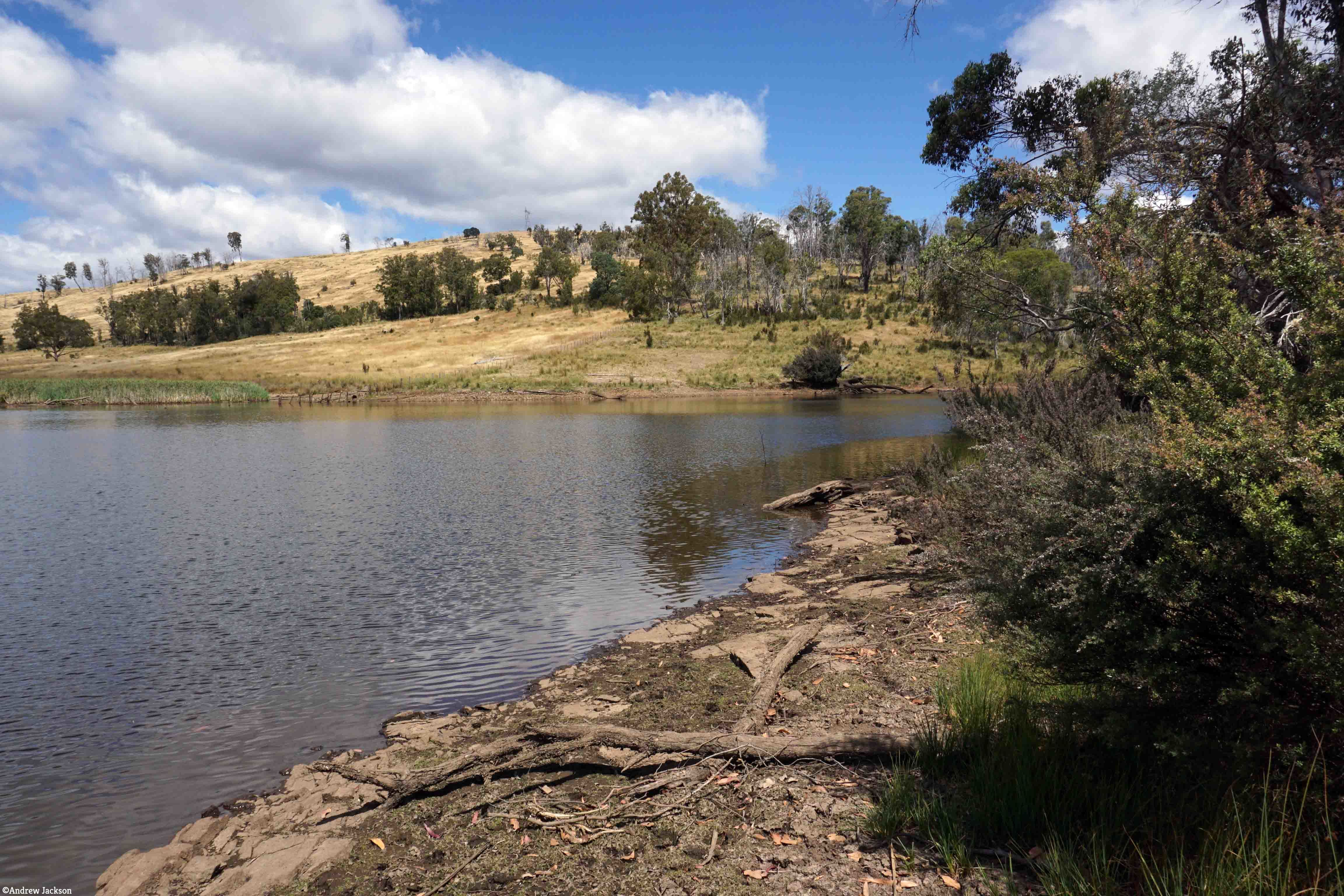
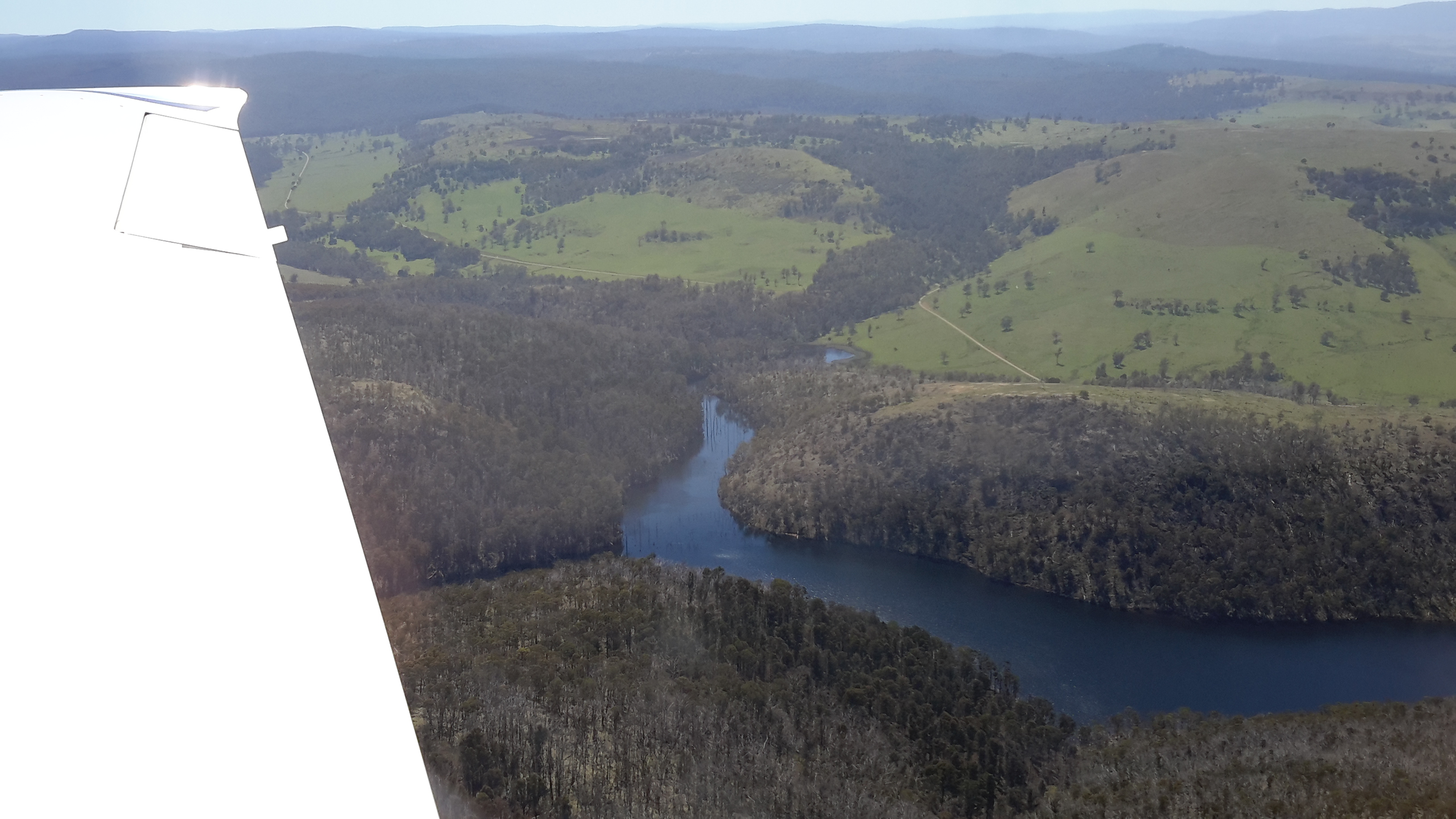
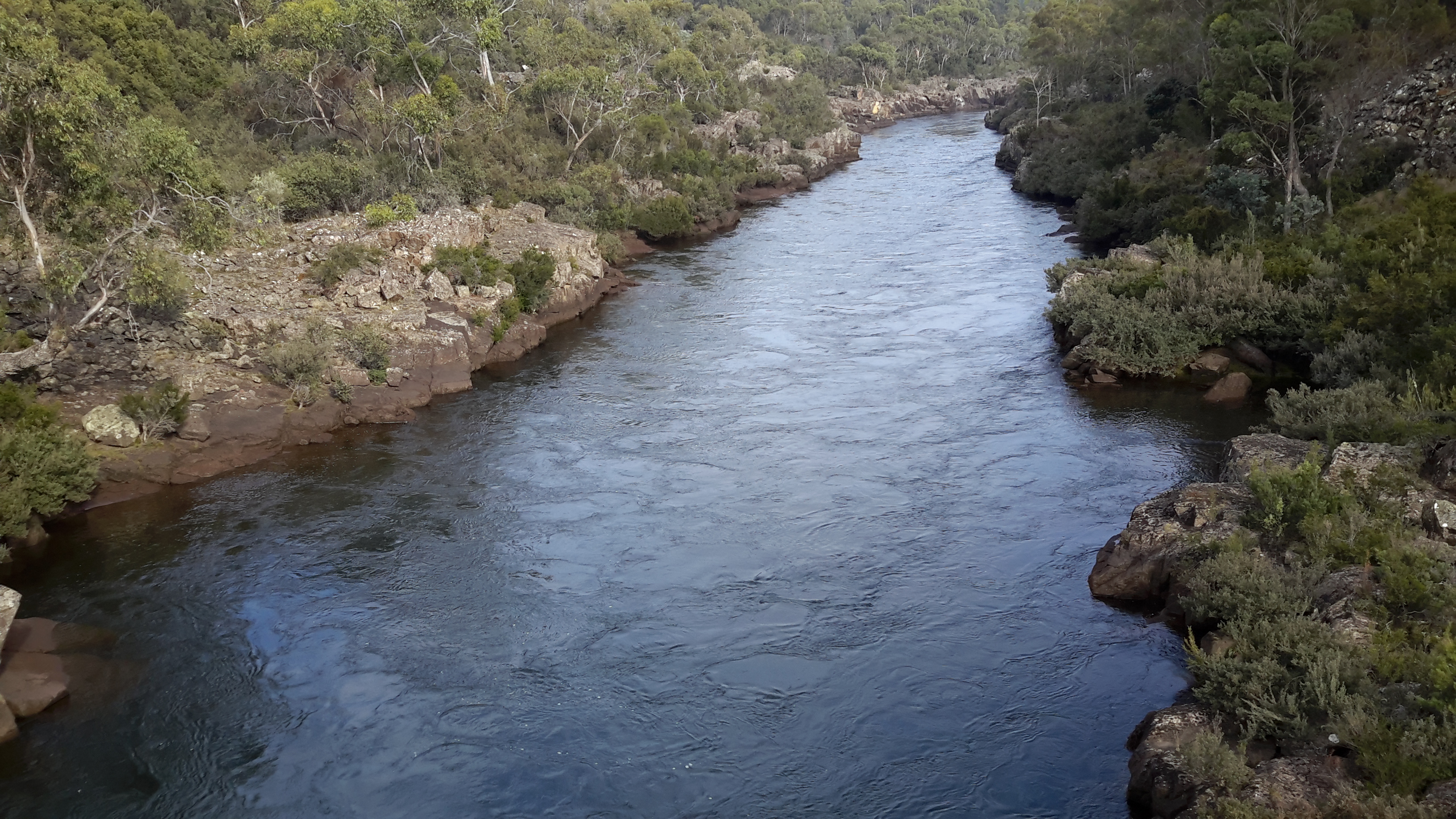
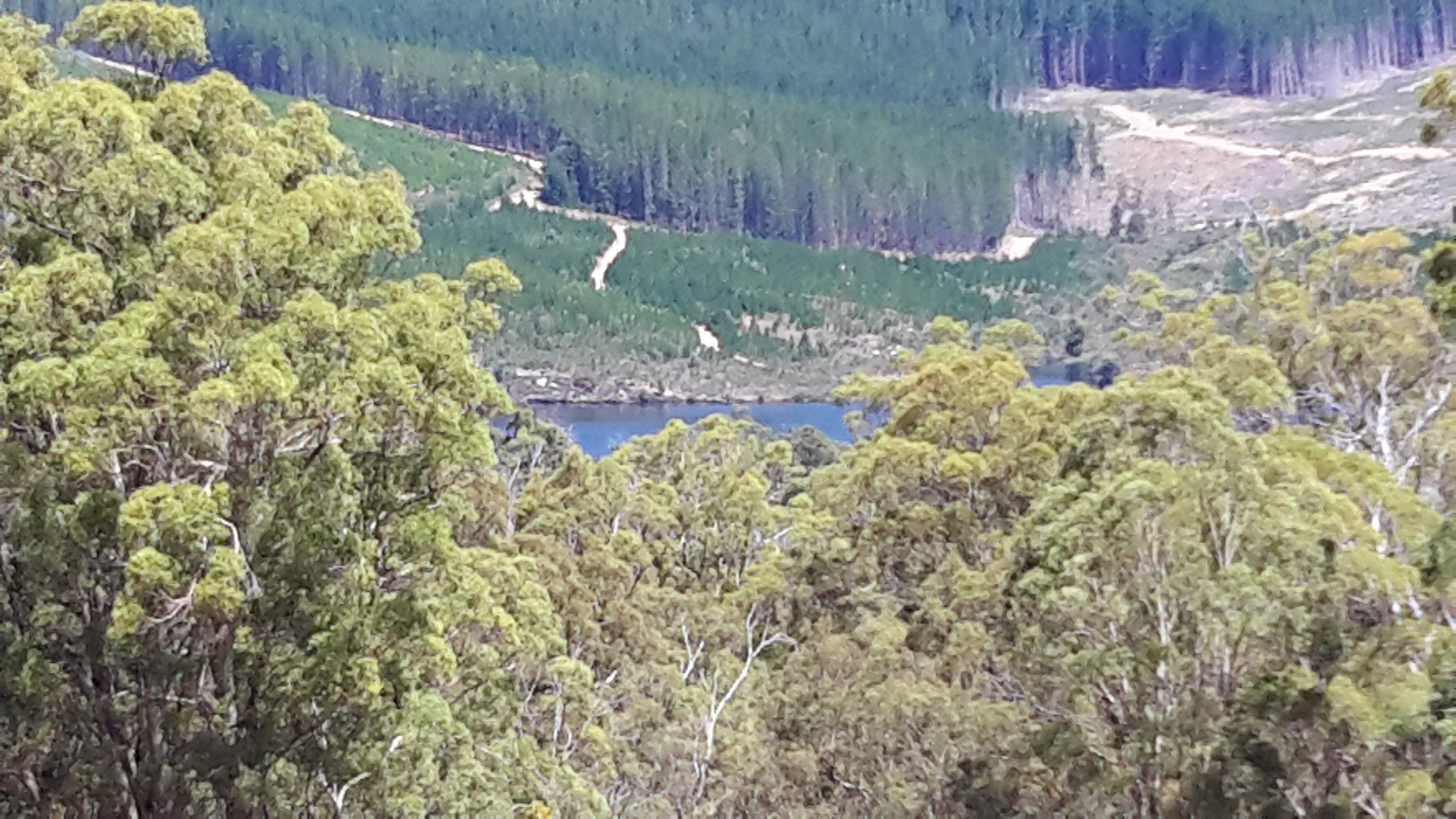
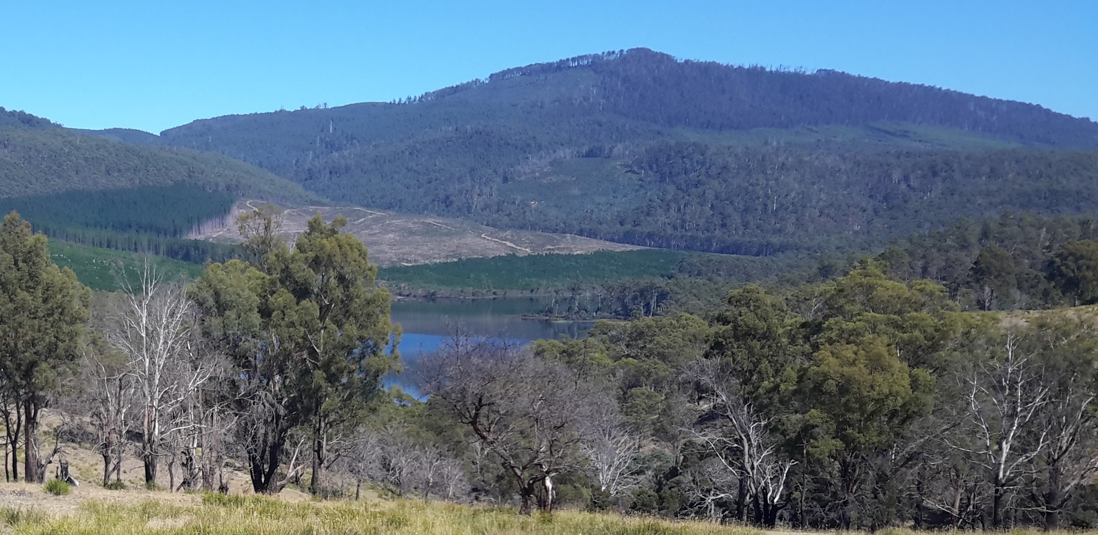
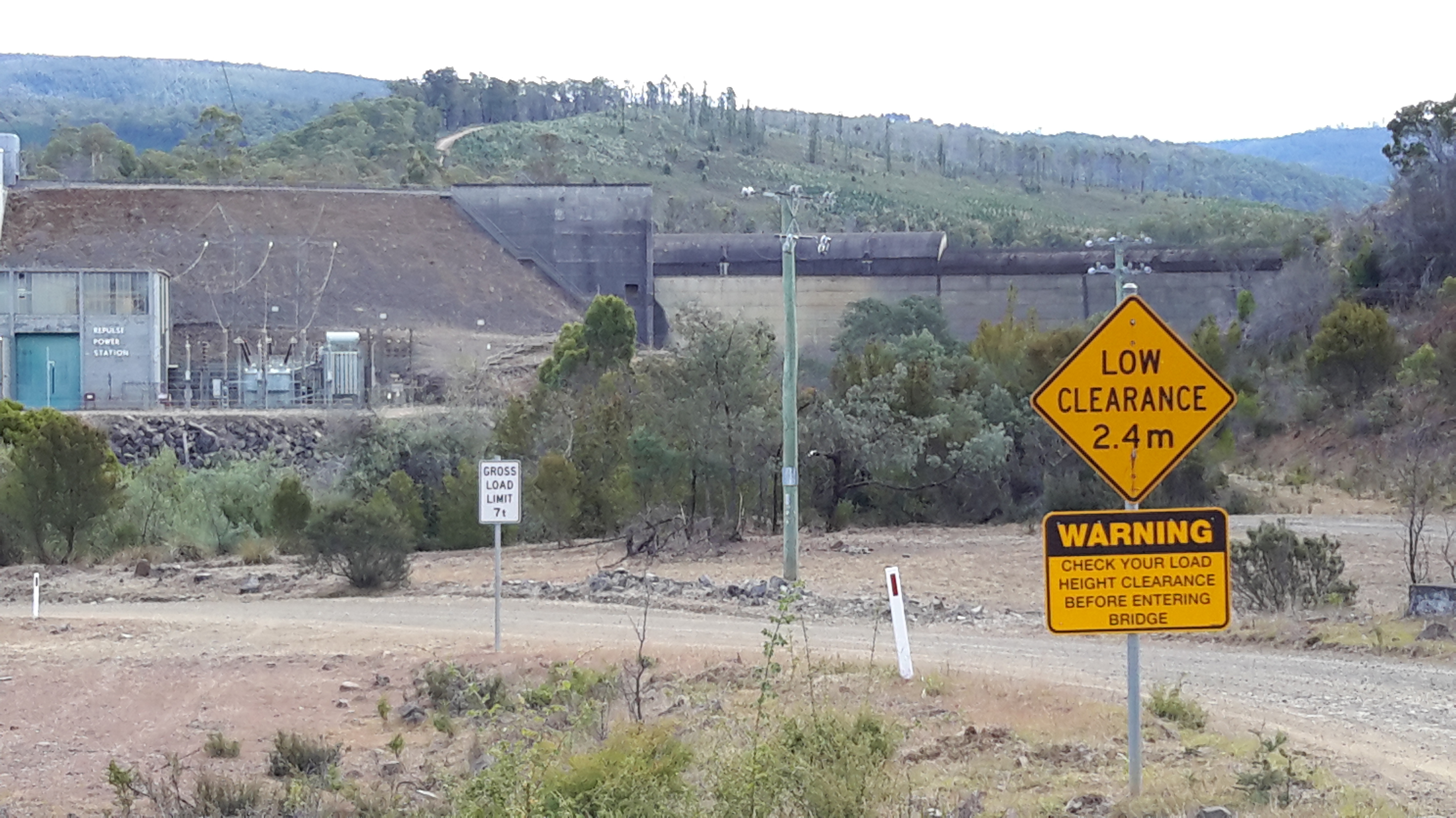
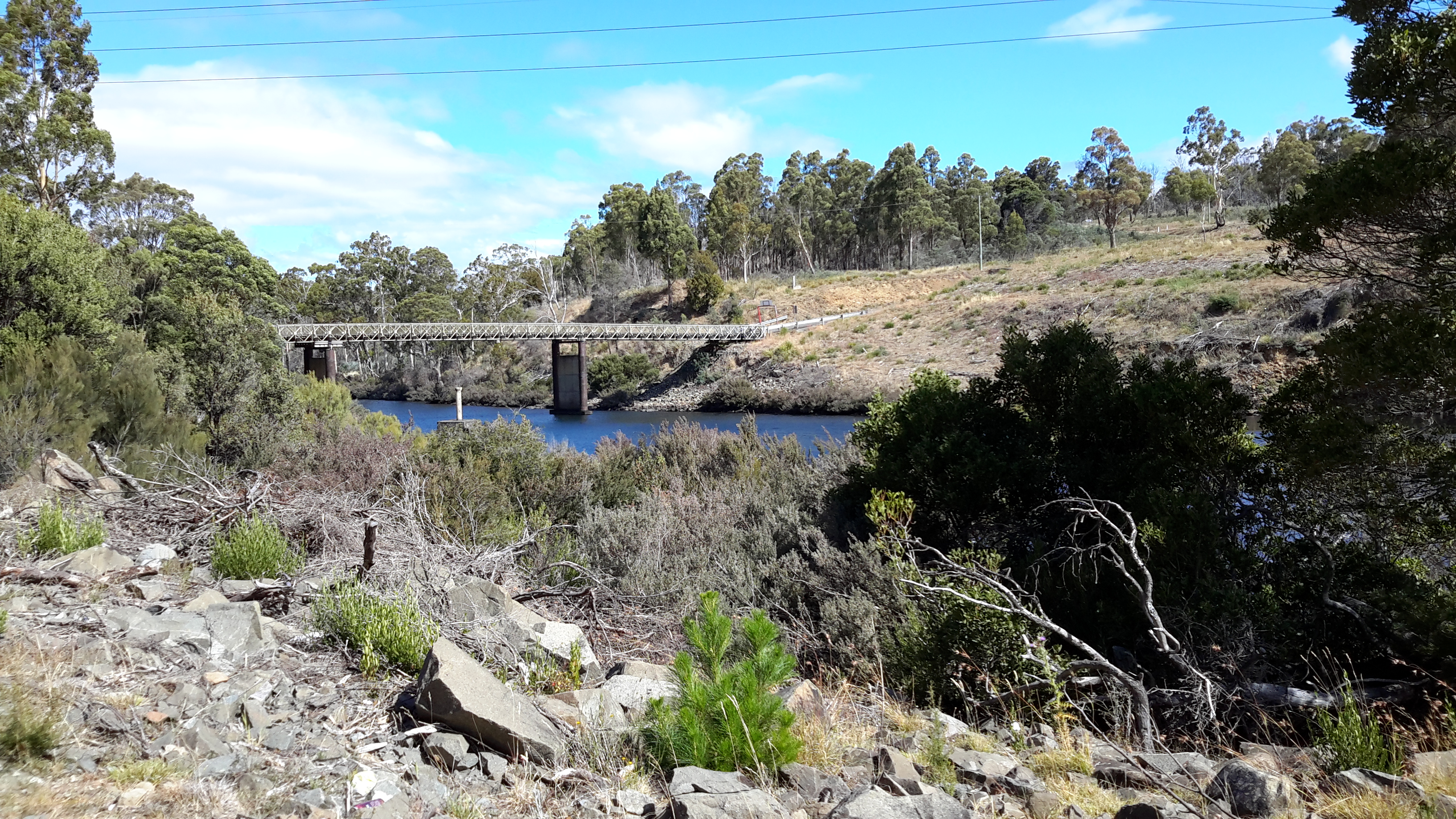
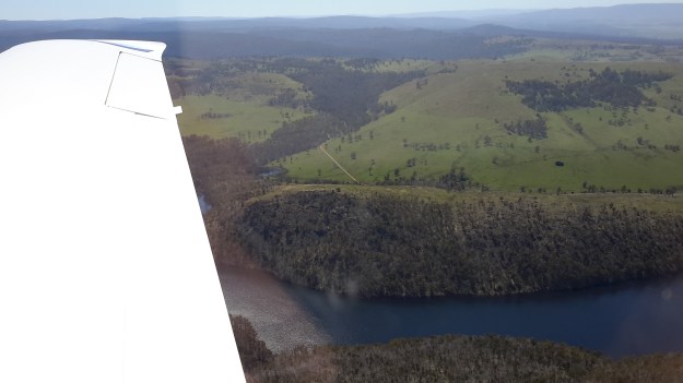
In the photo below, water gushing from the Wayatinah Power Station adds to the volume of Lake Catagunya near its western extremity.   20151029_090827.jpg

20151029_090233.jpg

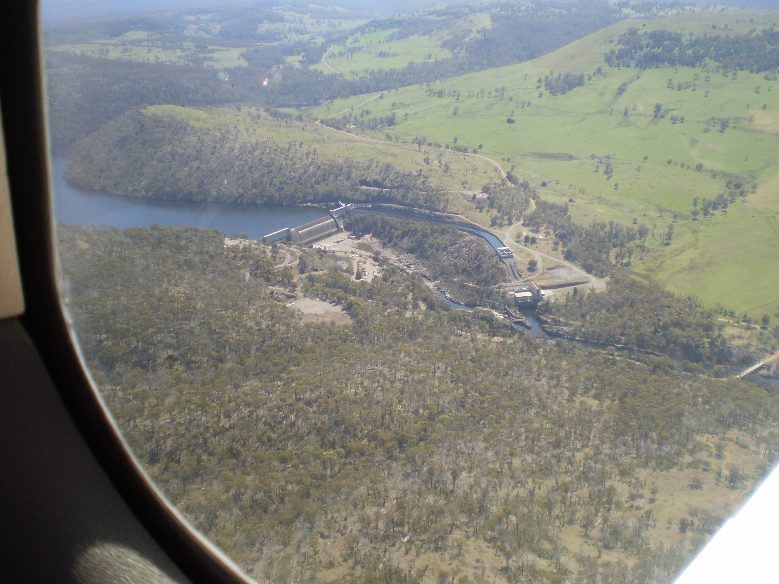
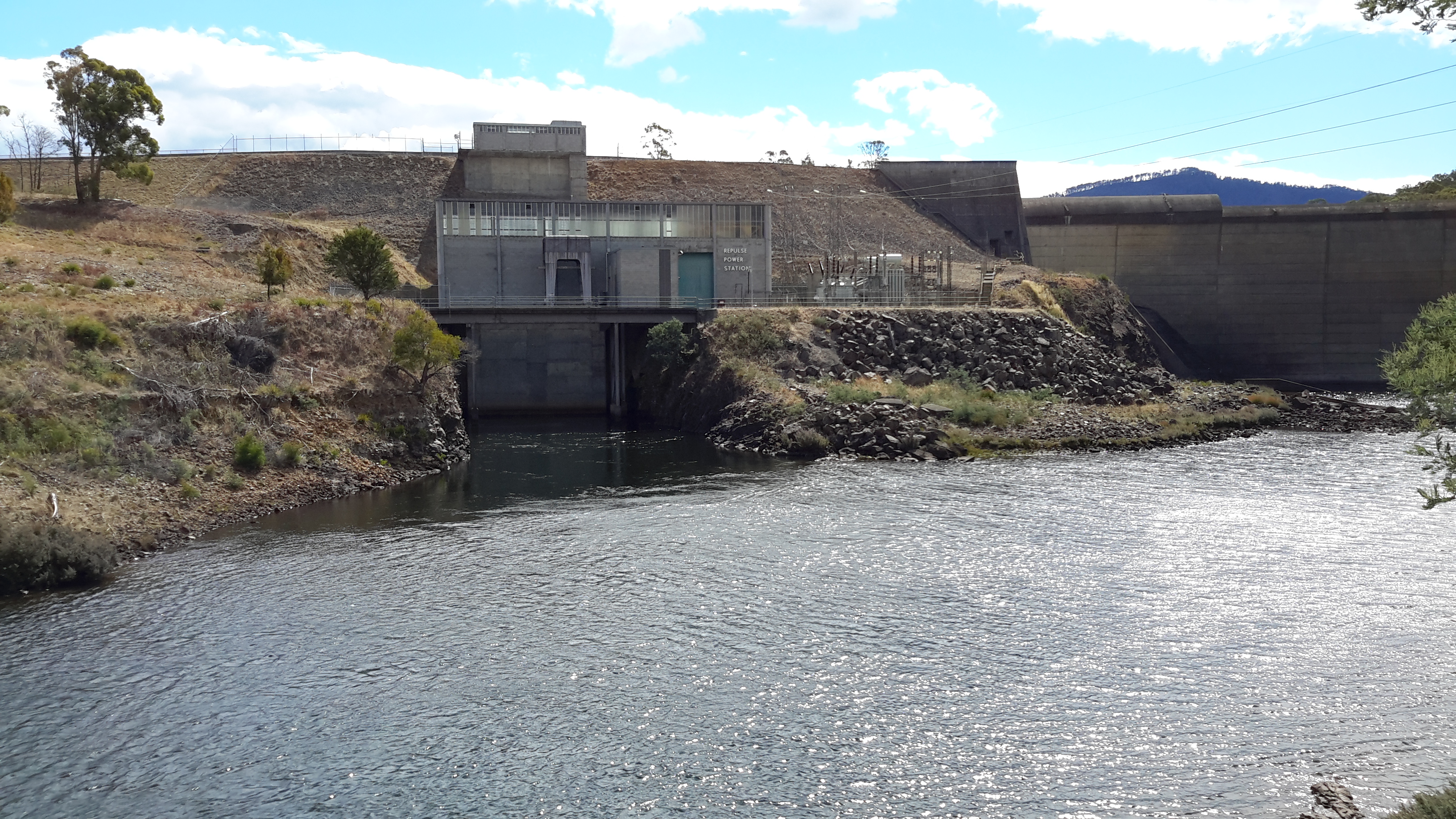
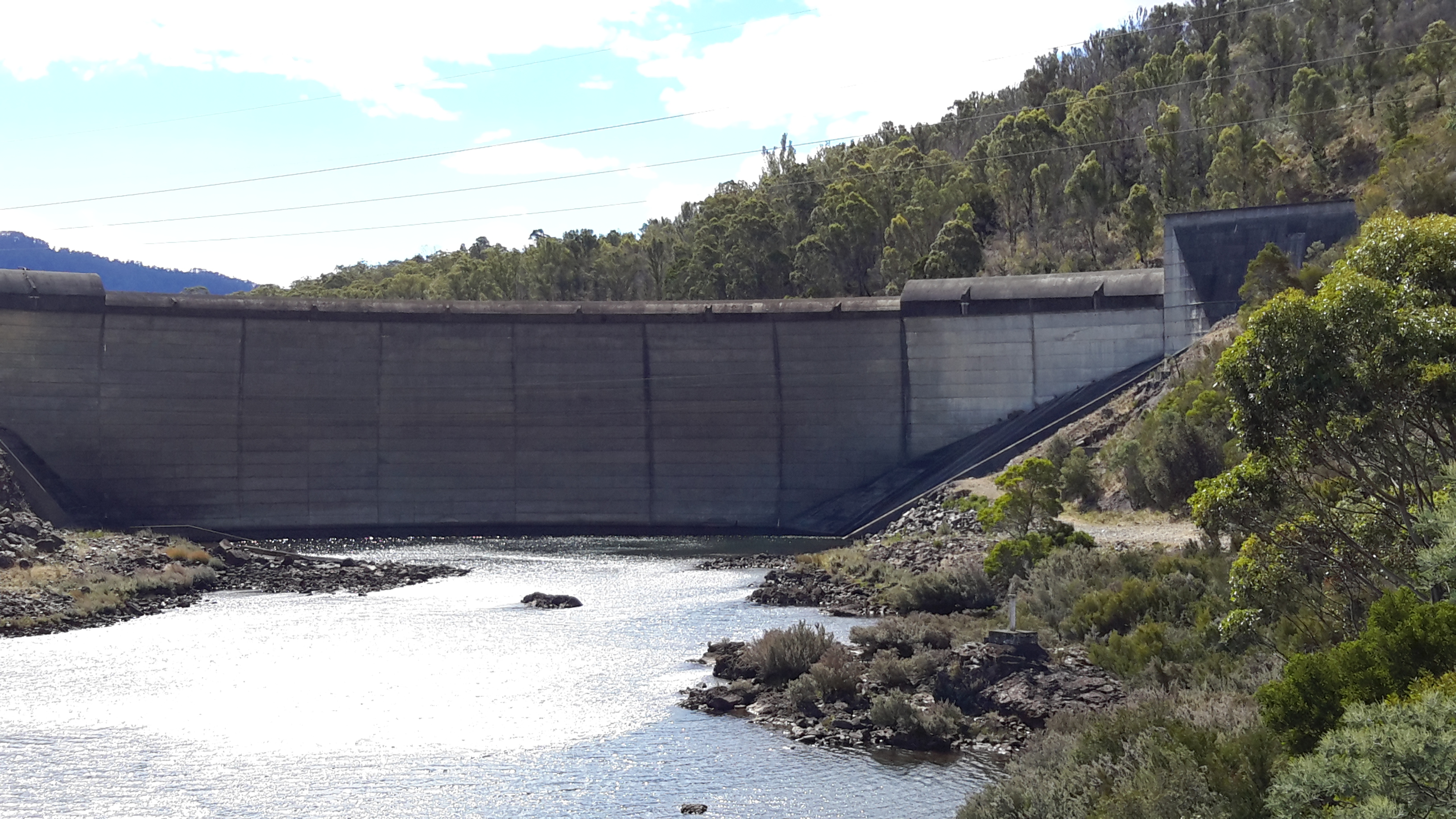
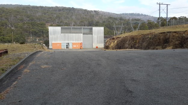
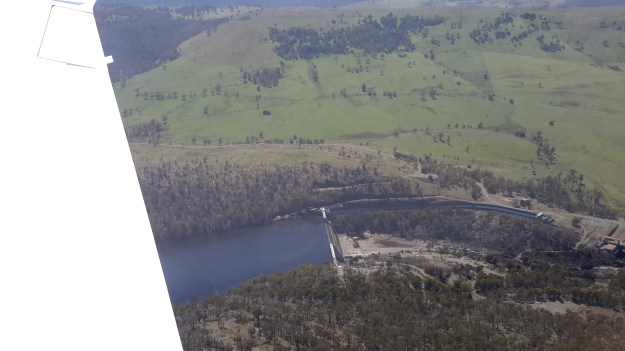
This expanse of water, fed by the Derwent and Florentine Rivers further upstream, extends approximately 7 -8 kilometres as a substantial water storage holding until it reaches the Catagunya Dam wall and then passes through the Catagunya Power Station at the eastern end of the Lake. Earlier walks had taken me to both hydro electricity generating power stations, and during one walk I was privileged to be shown over the remote and isolated Catagunya Power Station complex.

20160210_092533.jpg

20160210_093101.jpg

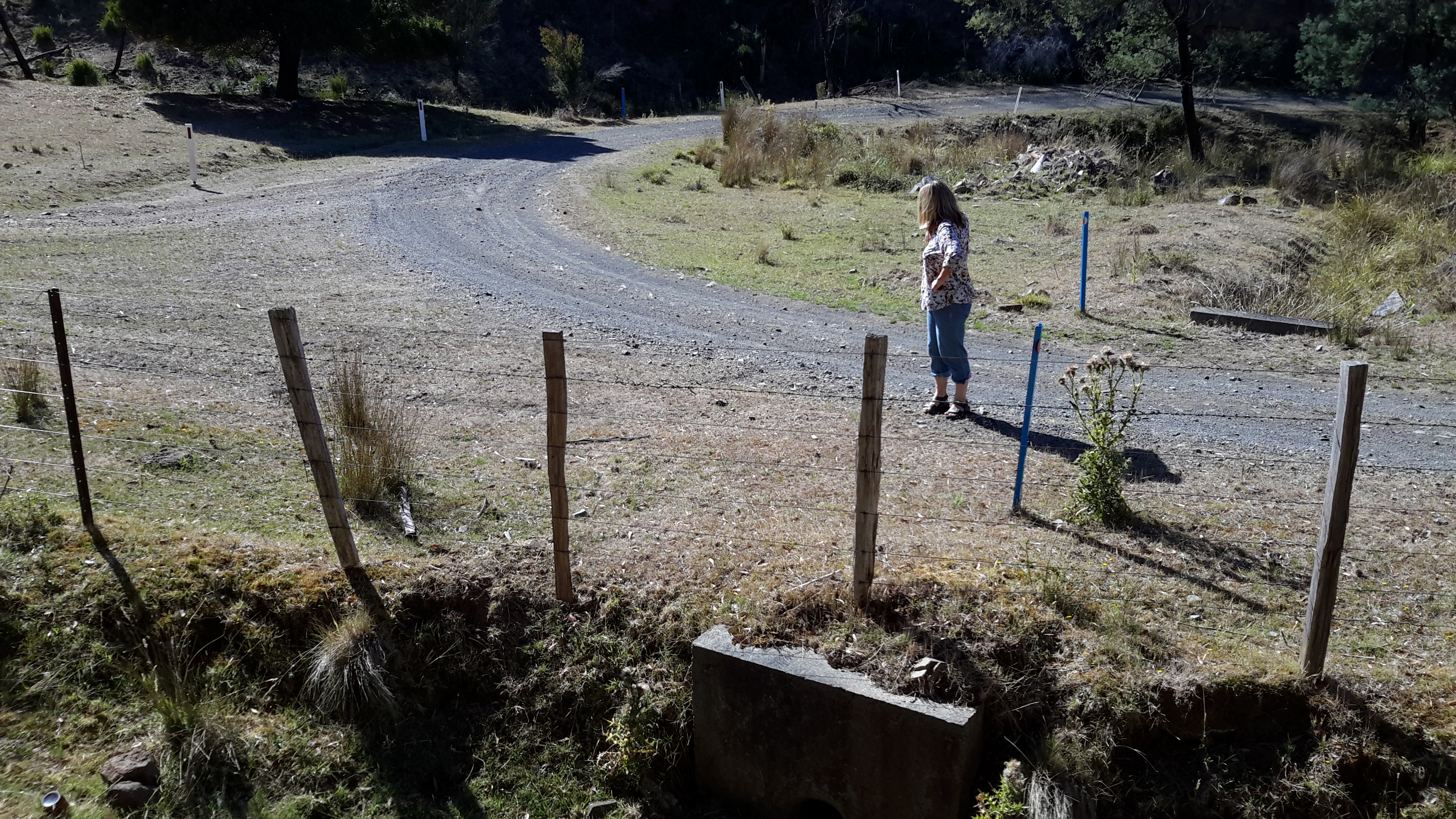
How to tackle the distance between the two locations?  Should I start my walk from the eastern or western end?  Should I walk on the southern or northern side of the Lake? The terrain to be covered included private property so what permissions needed to be acquired and from whom?

At first, I inspected the last official map printed by the Tasmanian government, the 1993 map titled ‘Strickland 4630’ in combination with perusing the Google Earth map for the same territory. In addition, I used my on-the-ground first-hand knowledge of the terrain and the vegetation at both ends of the stage from having visited in association with other walks, and aerial photos taken early during this Walking the Derwent project.

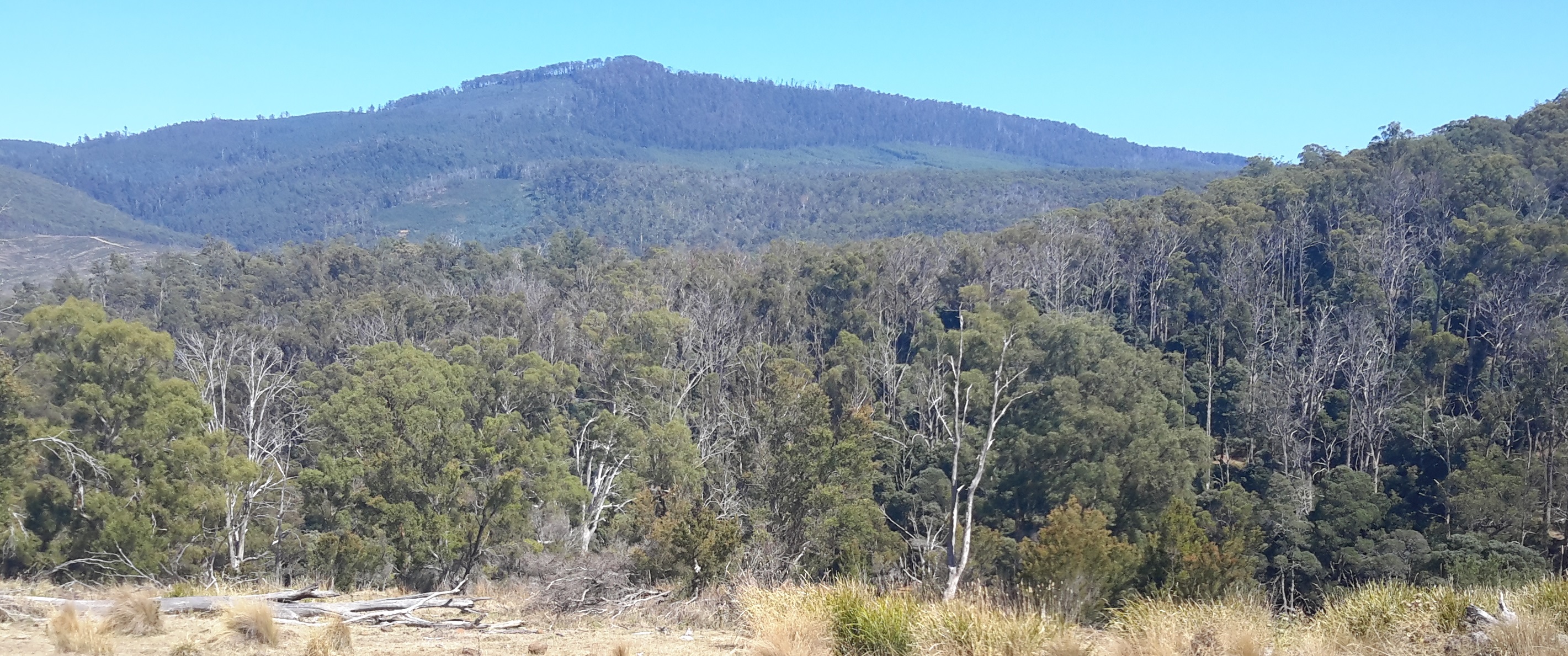
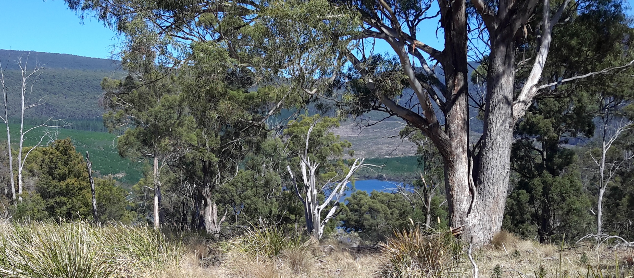
Michelle’s photos show Wayatinah Power Station in the distance near the western end of Lake Catagunya,  a section of the curved shape of the Lake, and Catagunya Dam and Power Station. Each photo clearly shows the incline from water level to the plateau above.

PA280092 Lake Catagunya with Wayatinah PS.JPG

PA280091Lake Catagunya.JPG

PA280090Catagunya Dam.JPG

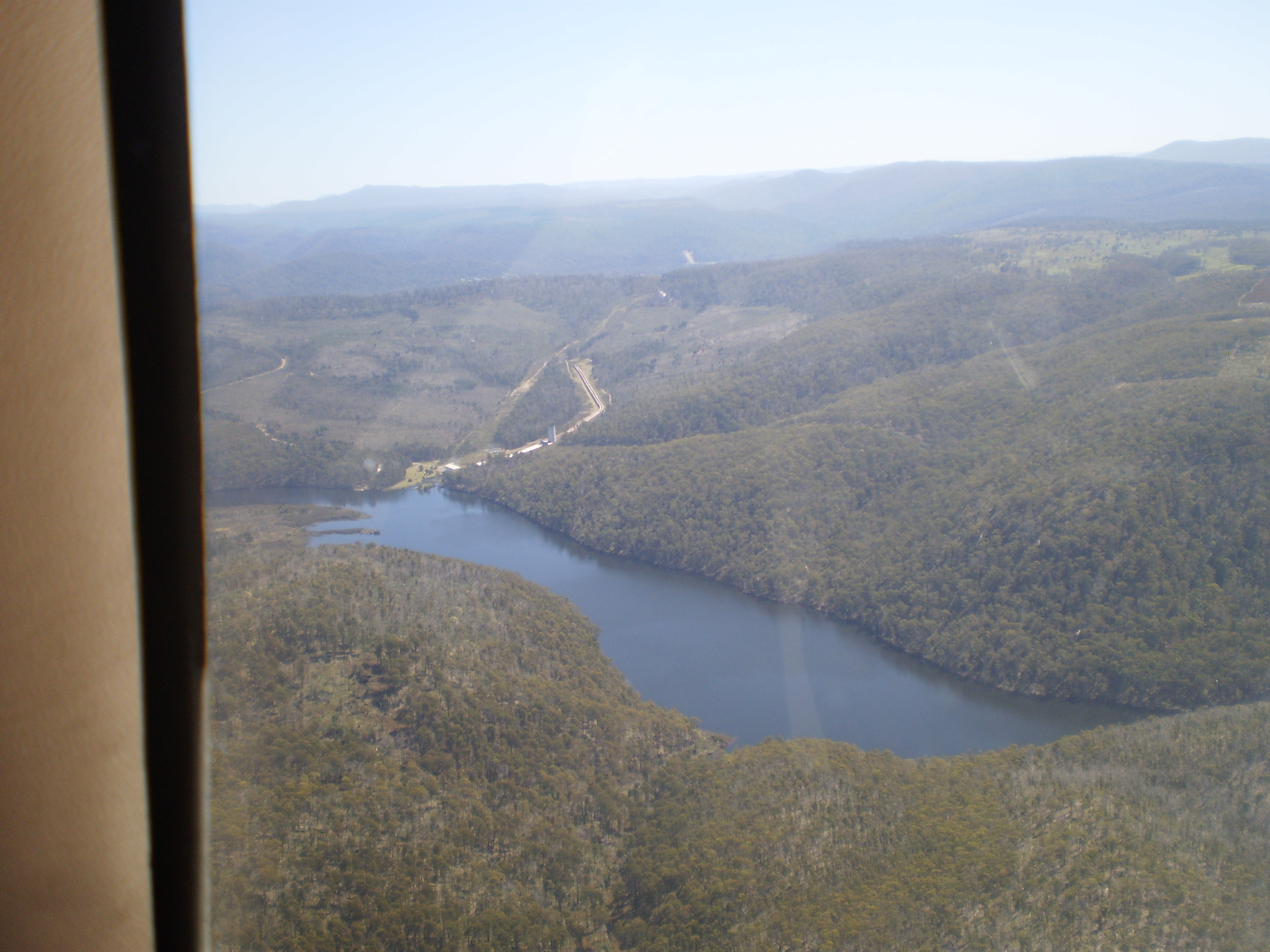
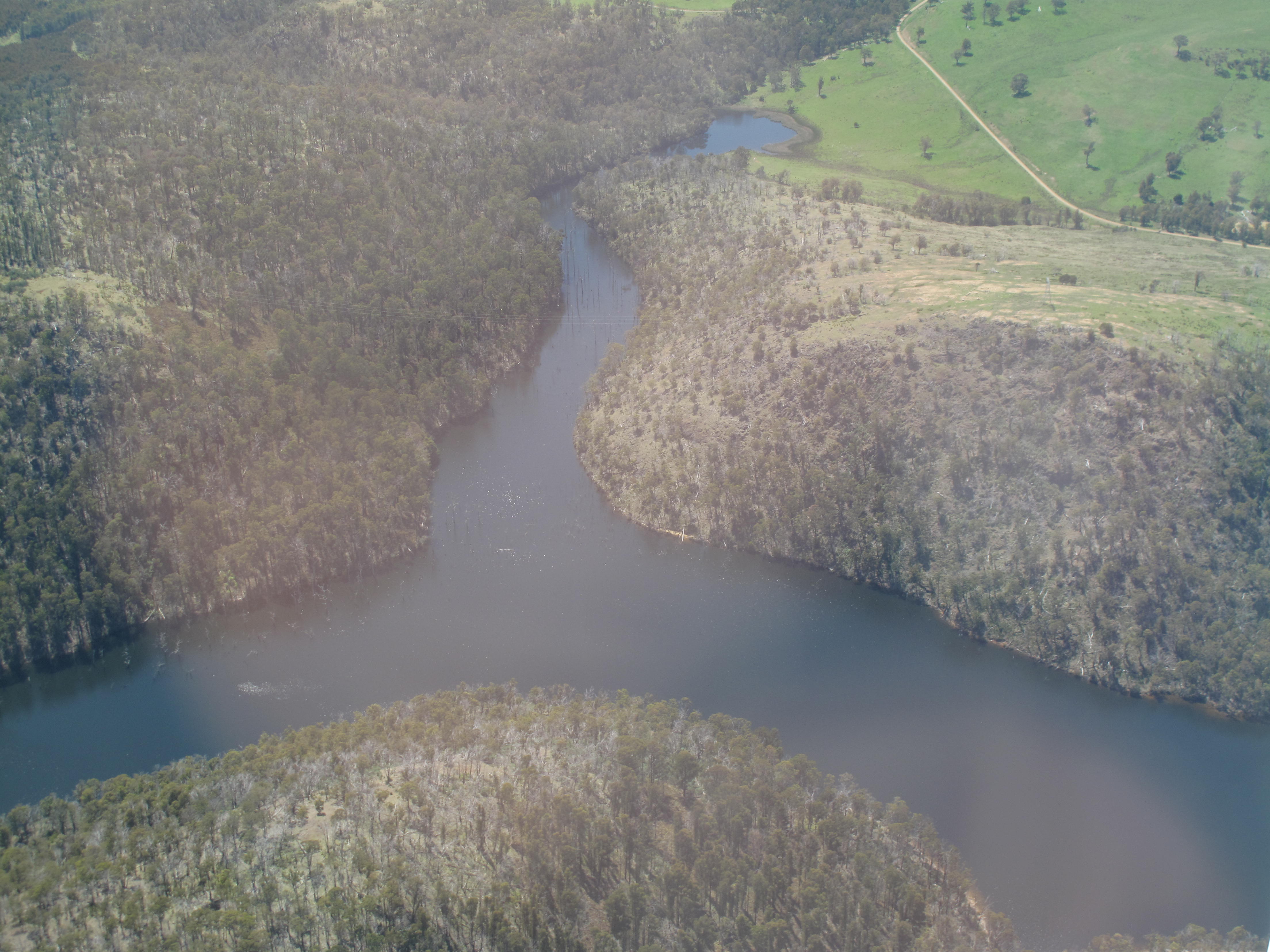
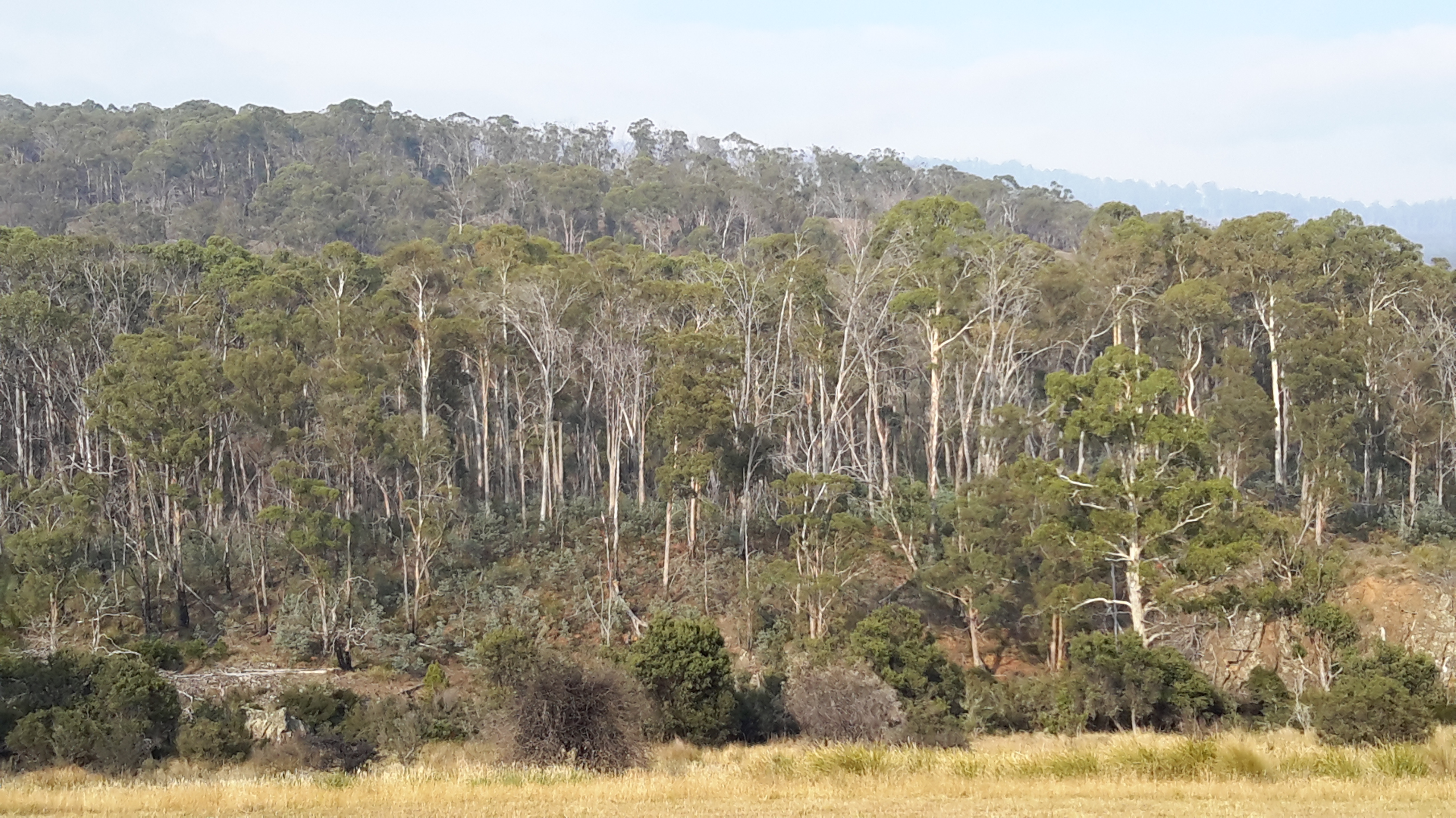
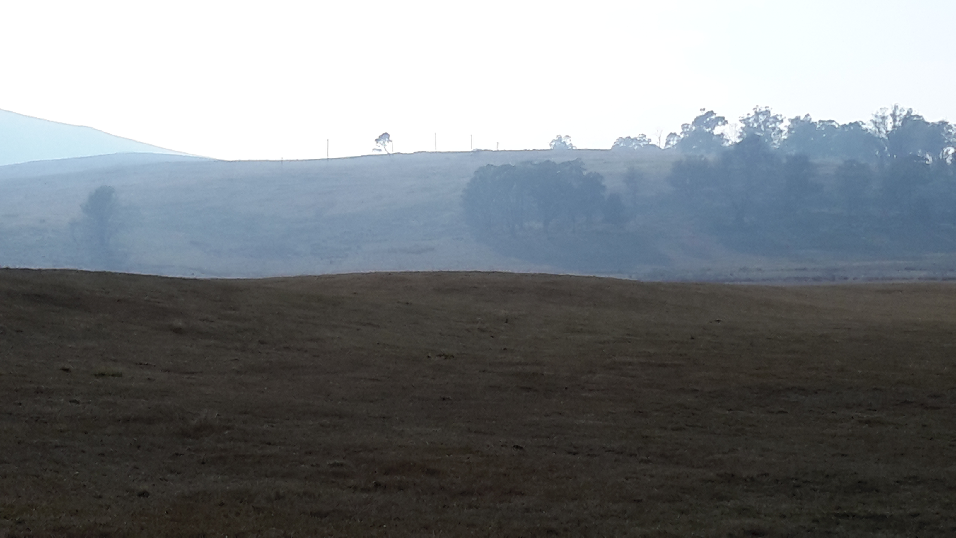
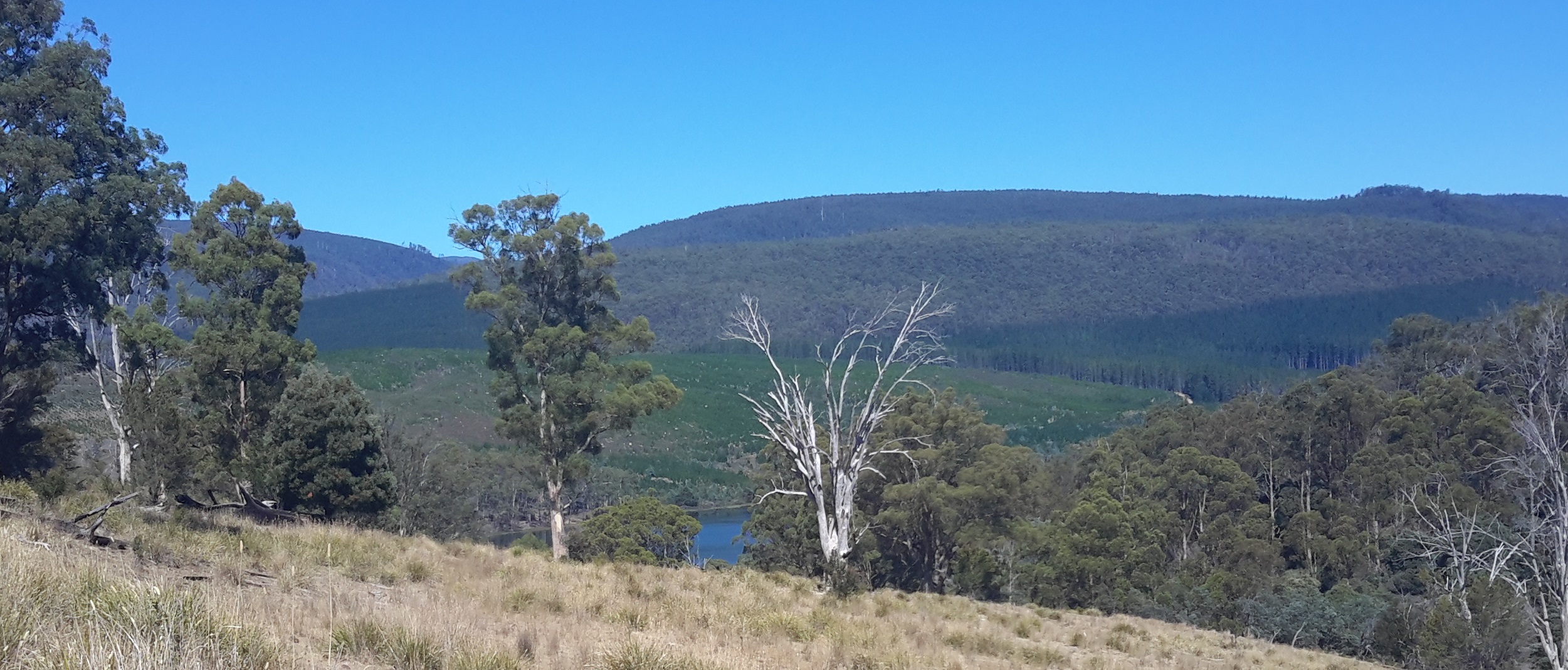
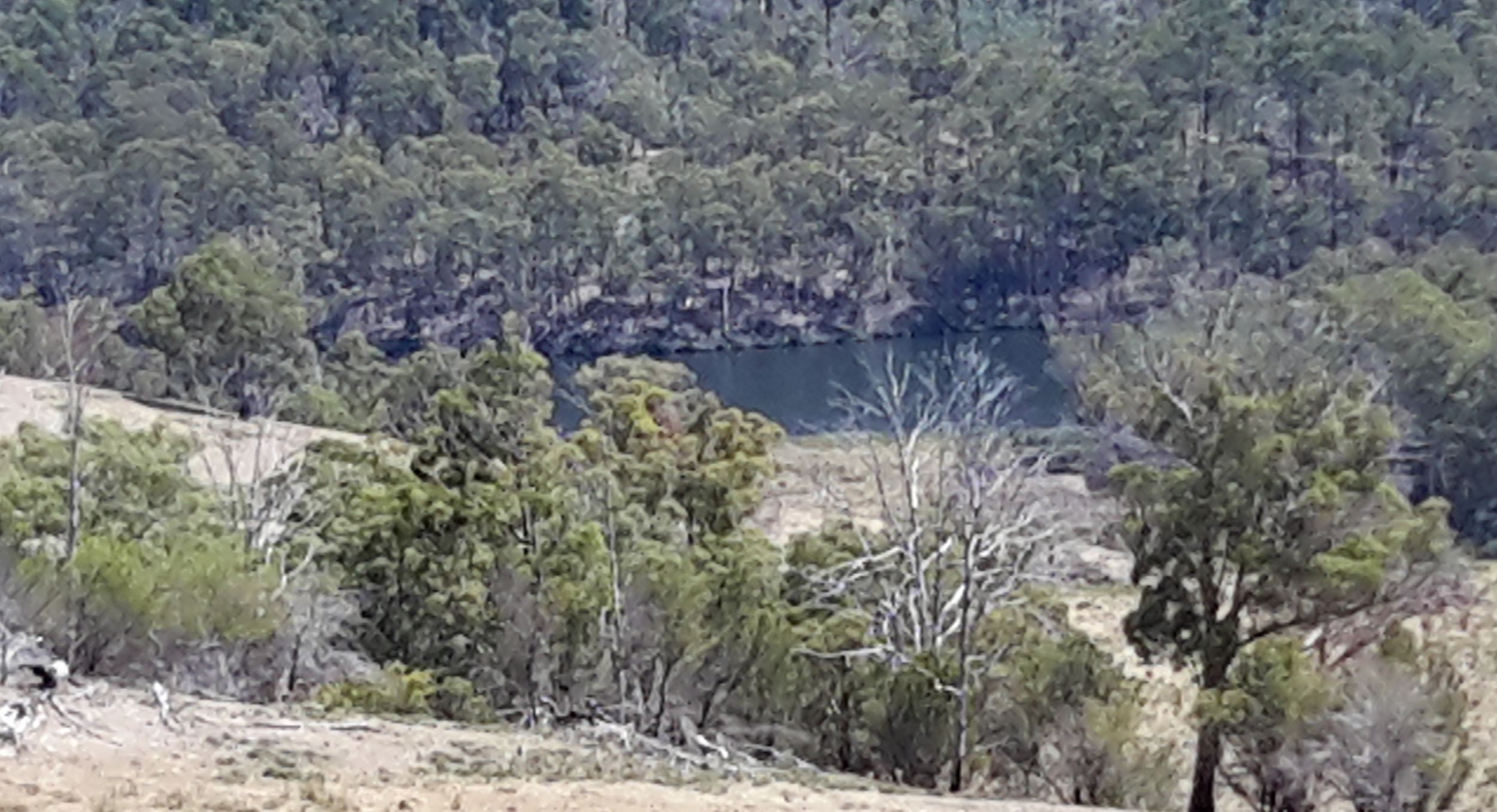
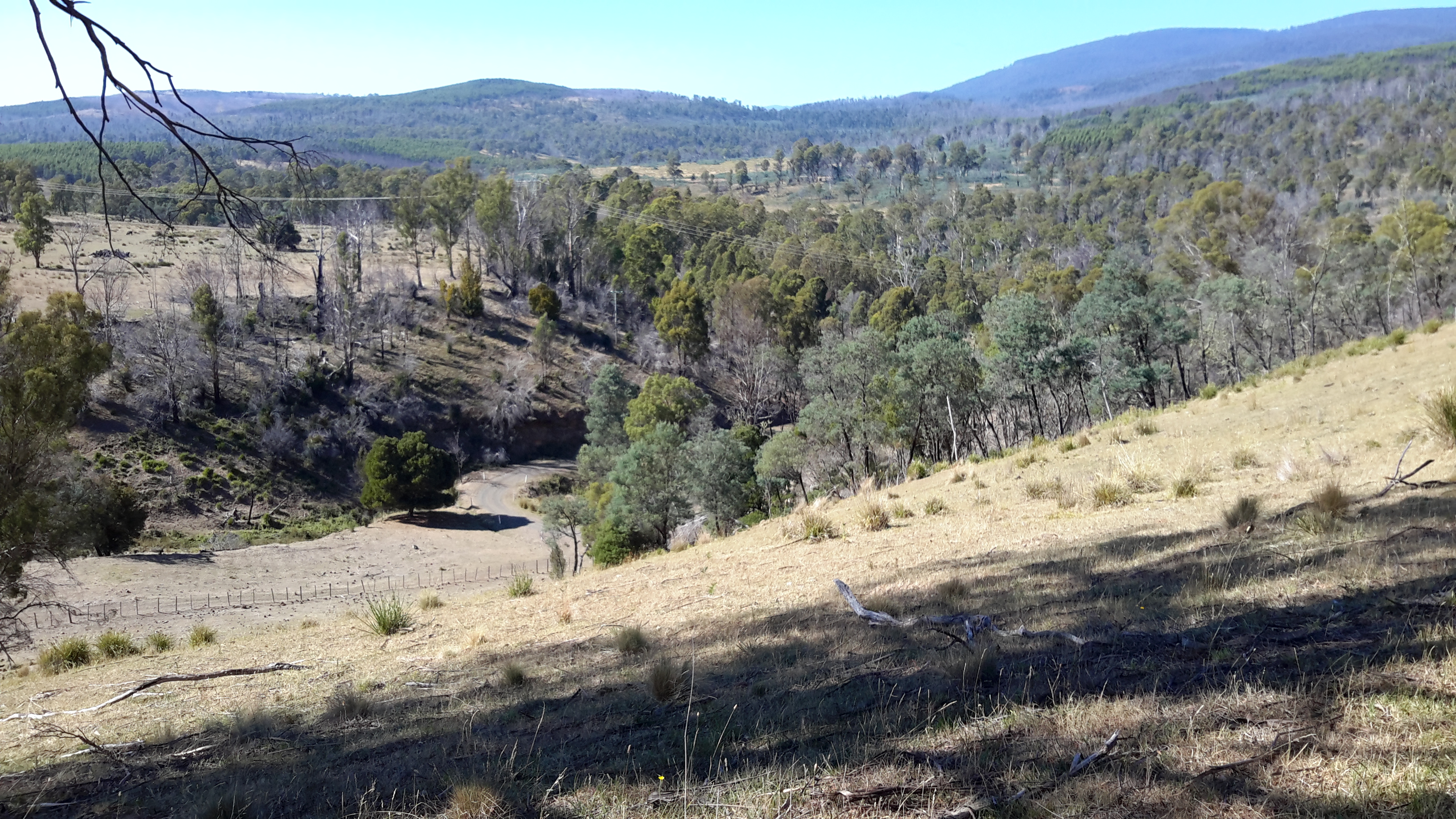
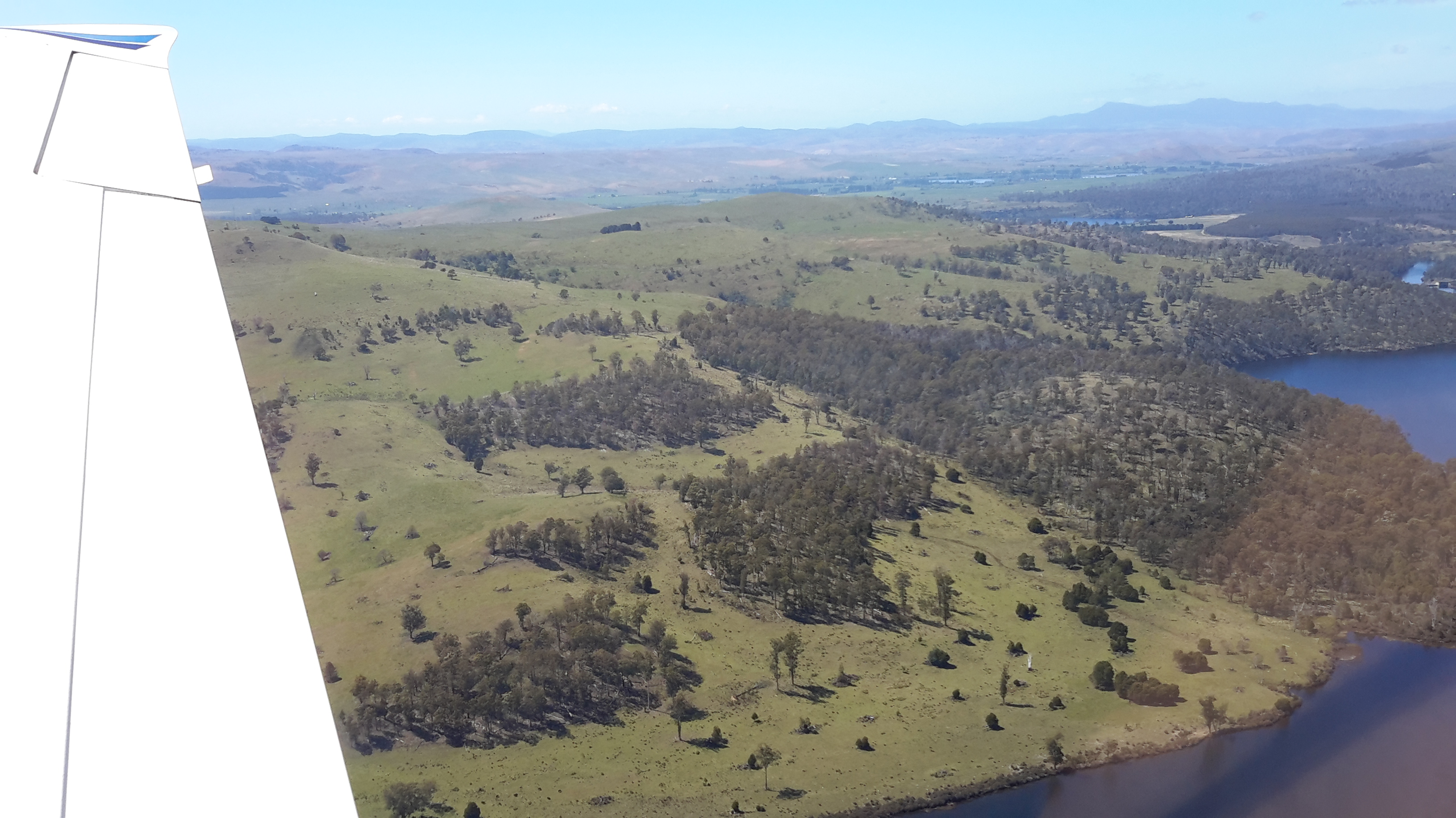
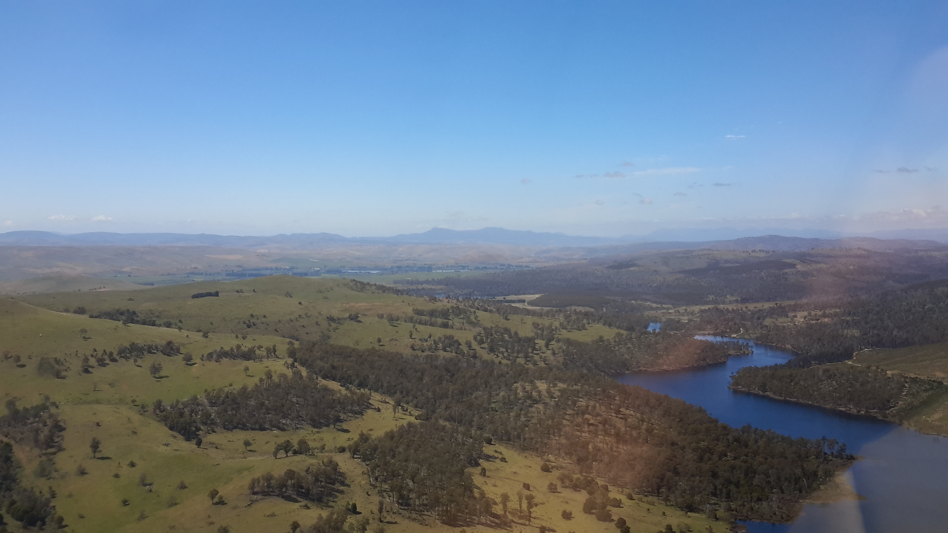
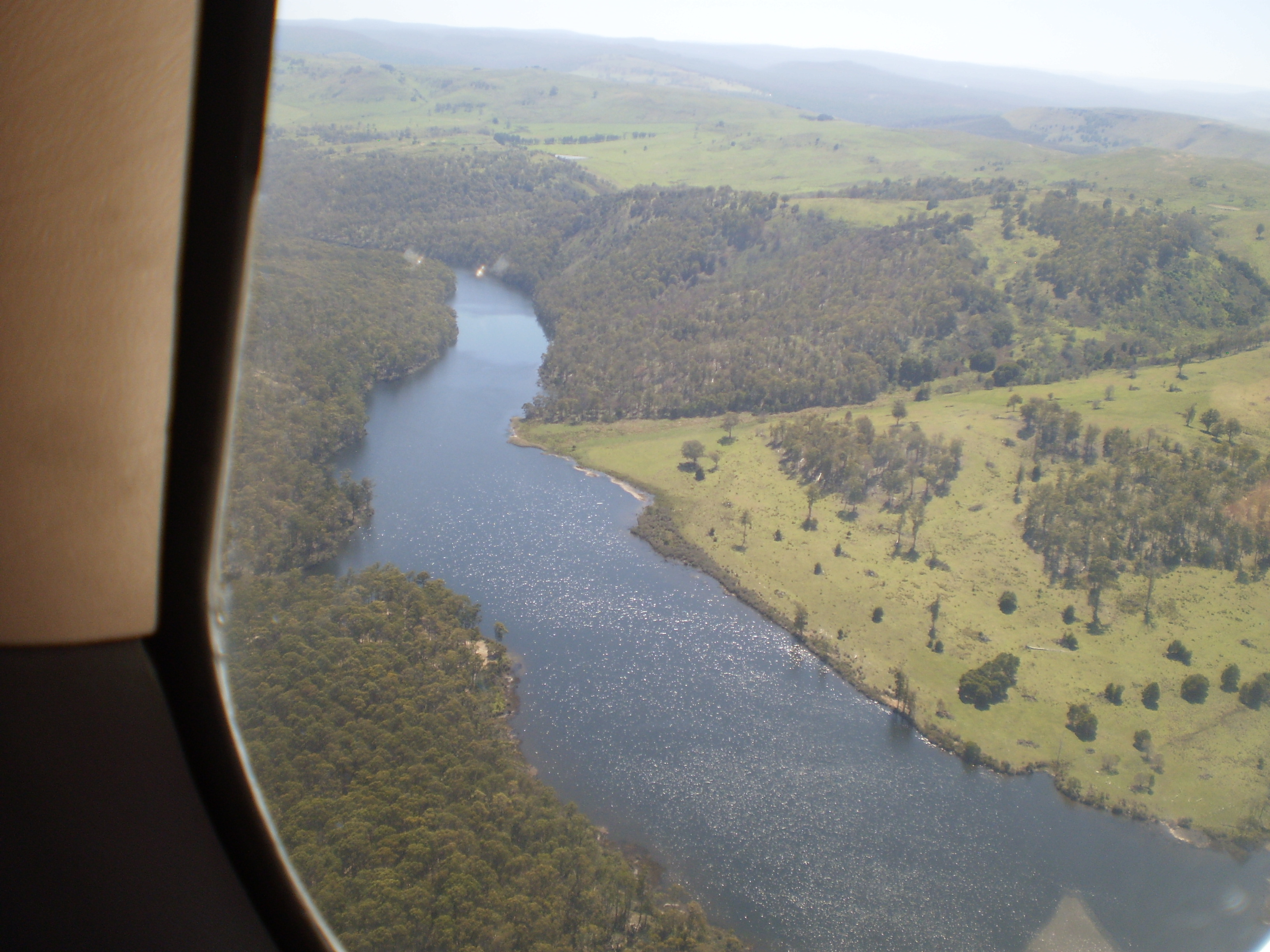
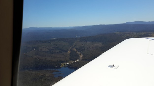
My aerial photos show  Wayatinah Power Station behind an expanse of Lake  Catagunya, the major inlet close to the eastern end of the Lake, and the Catagunya Dam and Power Station complex.  The density of the forests and the hilly terrain are clearly shown.

20151028_115220 Wayatinah PS.jpg

20151028_115159Wayatinah power station.jpg

20151028_115127.jpg

20151028_115121.jpg

20151028_115107.jpg

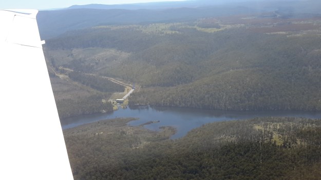
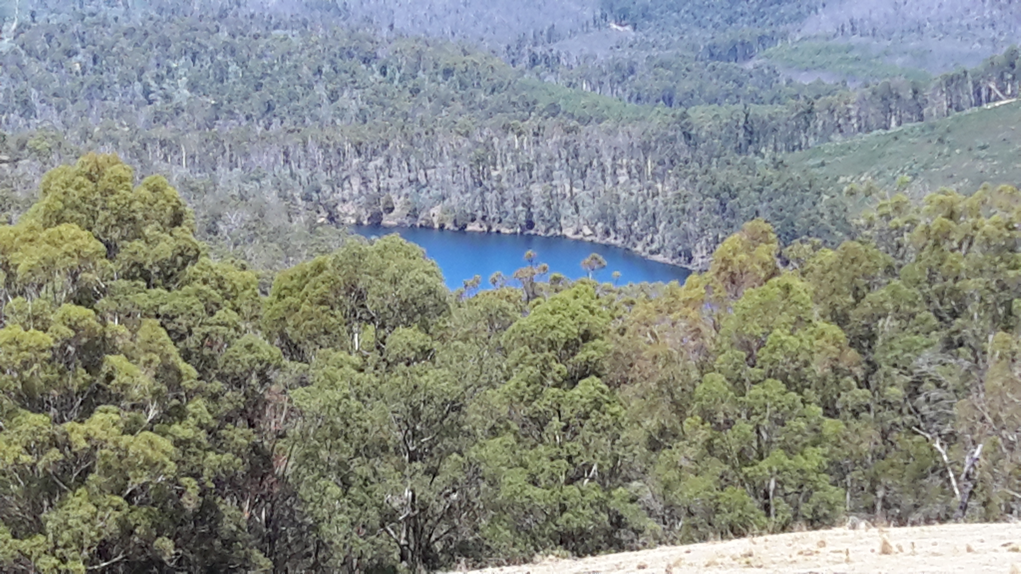
Chantale’s aerial photos show the inlet, fed by Black Bob’s Rivulet, near the eastern end of the Lake.

IMG_3888.JPG

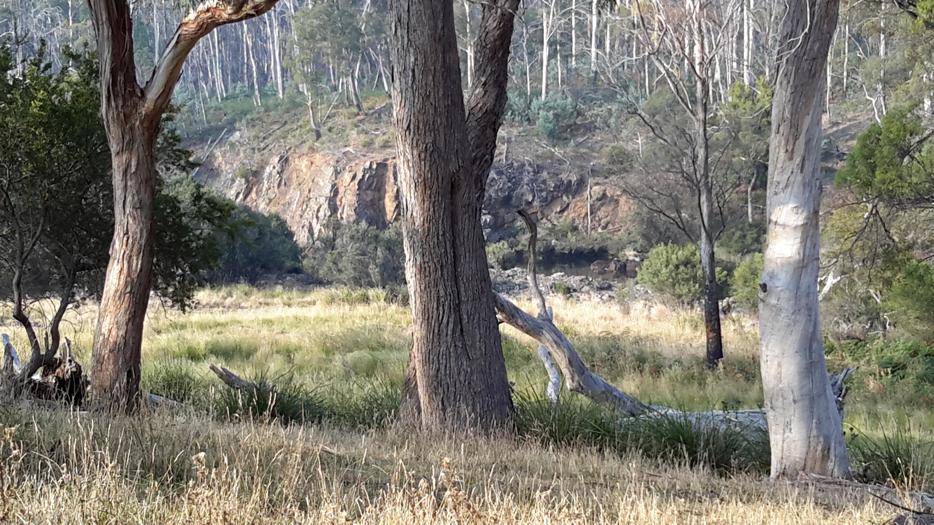
What I had seen on the ground and in the air was not what maps showed. For example at the Catagunya end, massive comparatively new pine plantations had swept across hills where natural bush once grew.  This meant that a mesh of unmapped forestry roads would have been built and that these would make navigation confusing without a compass and/or GPS equipment.

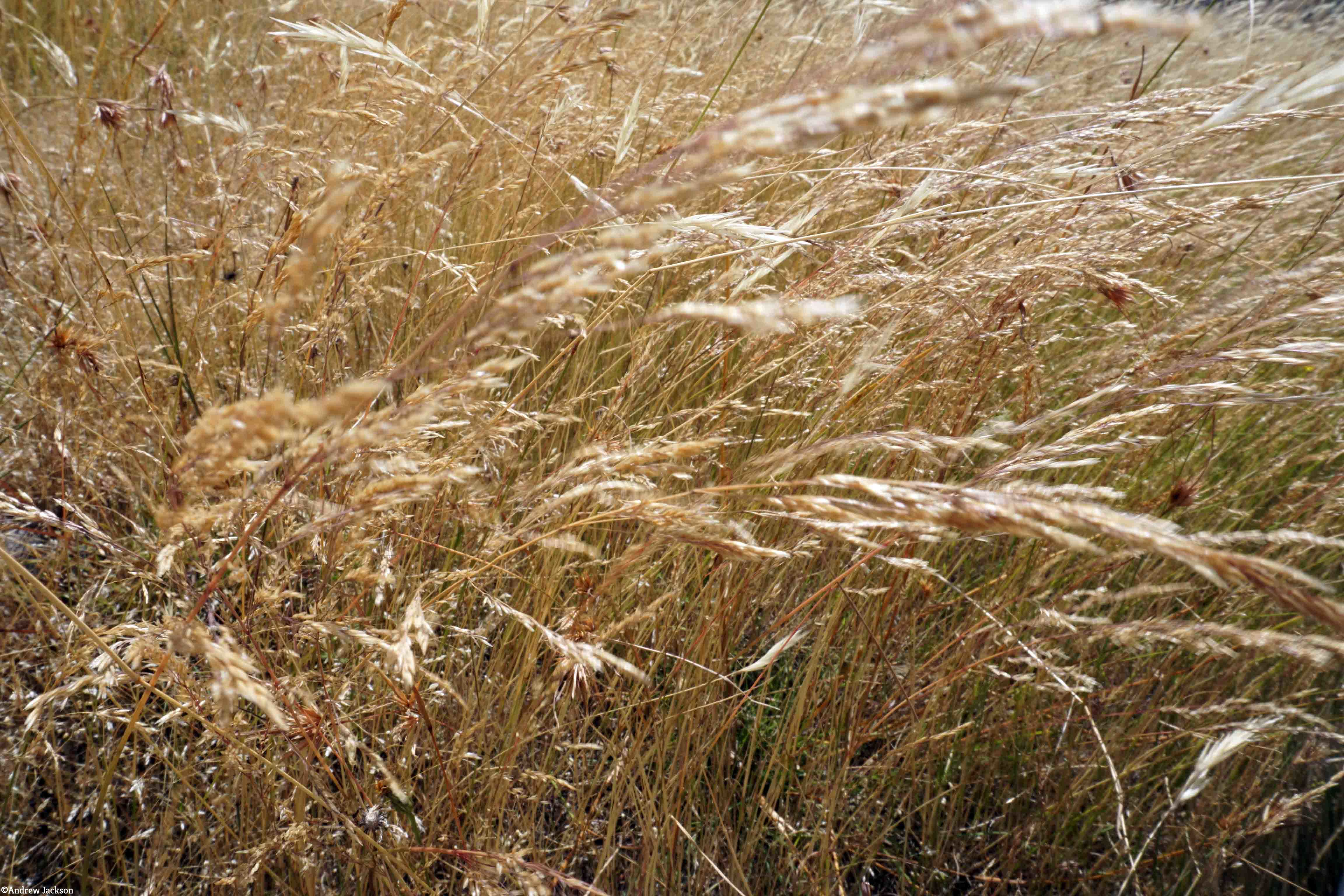
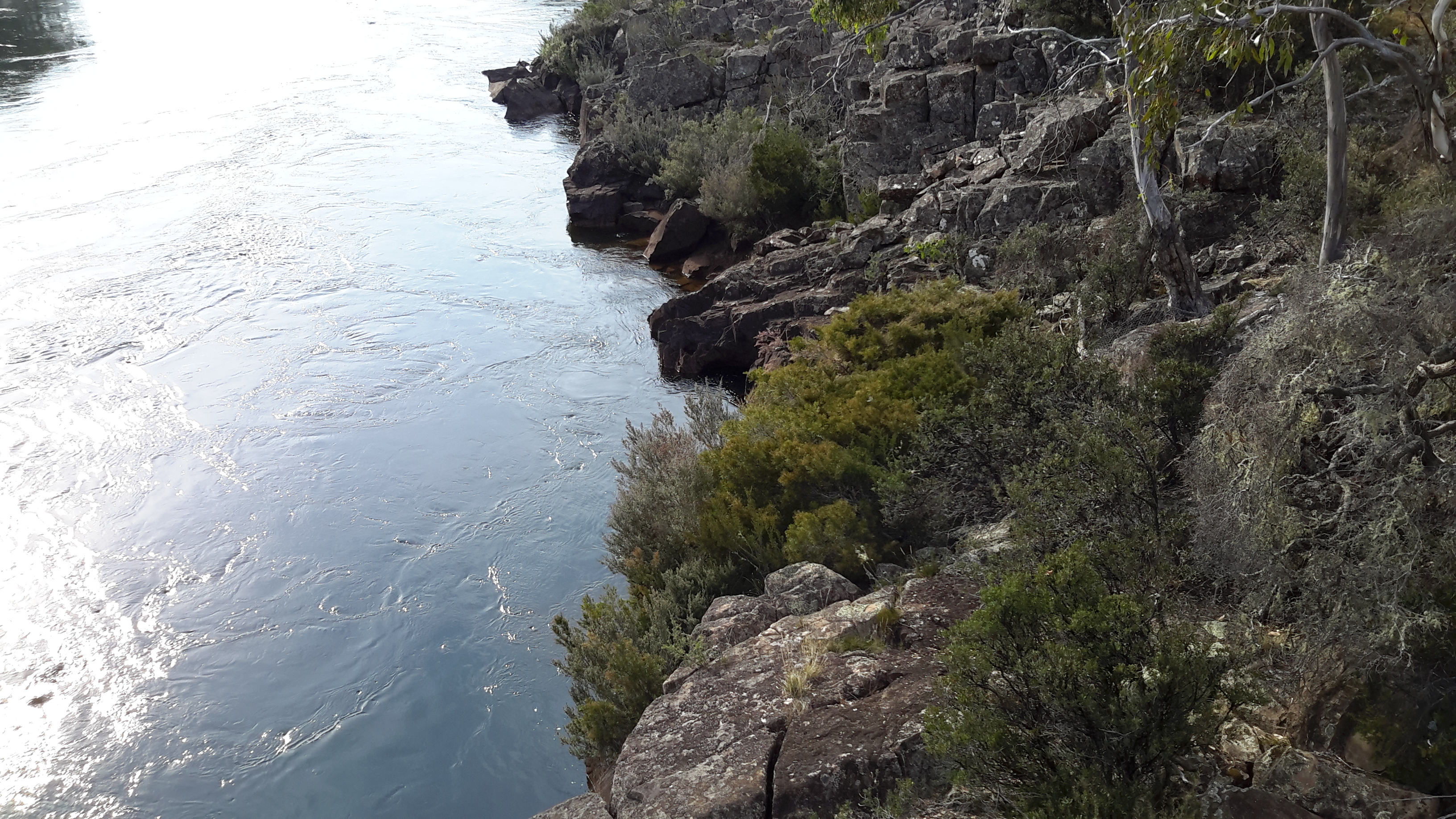
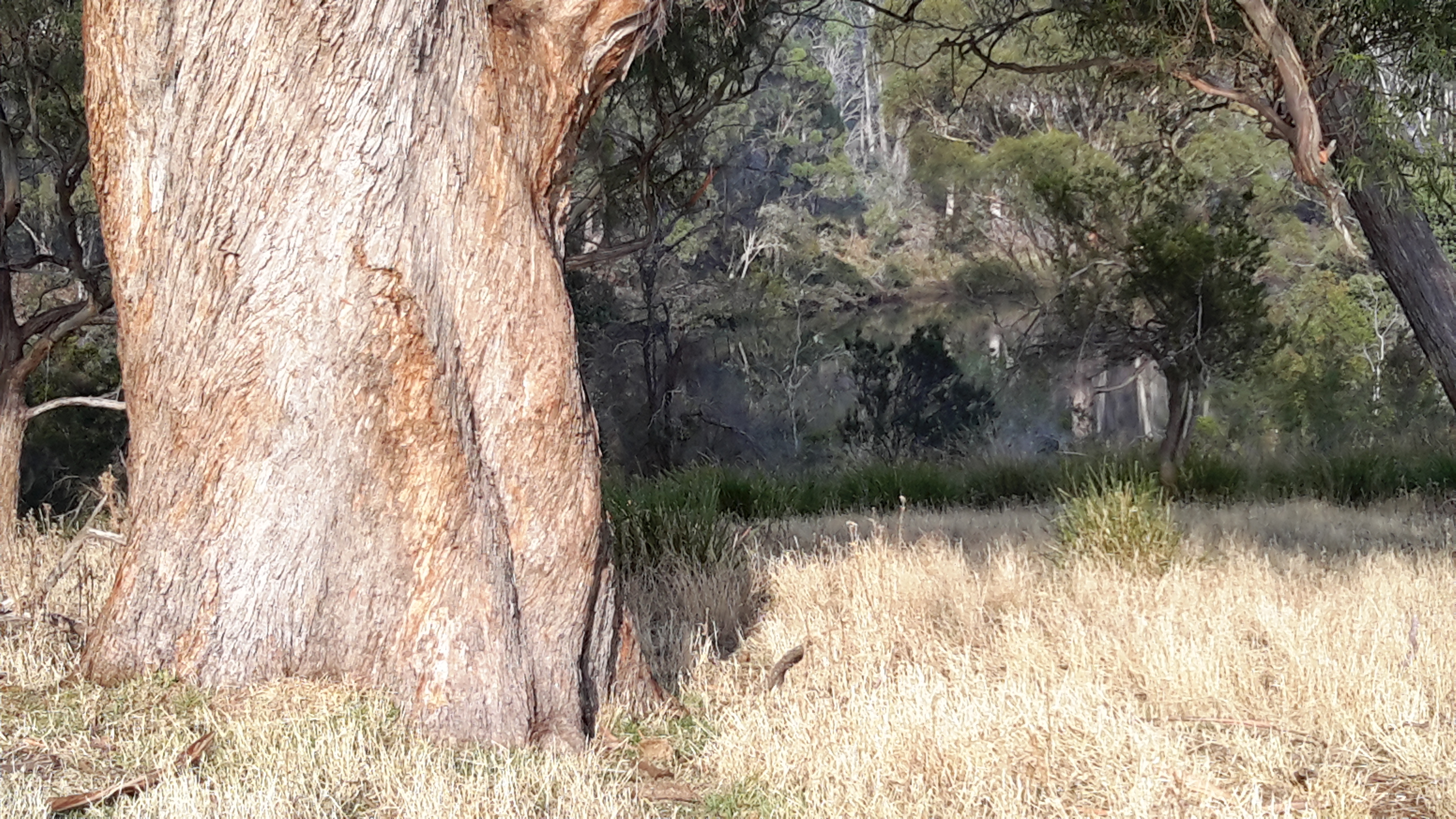
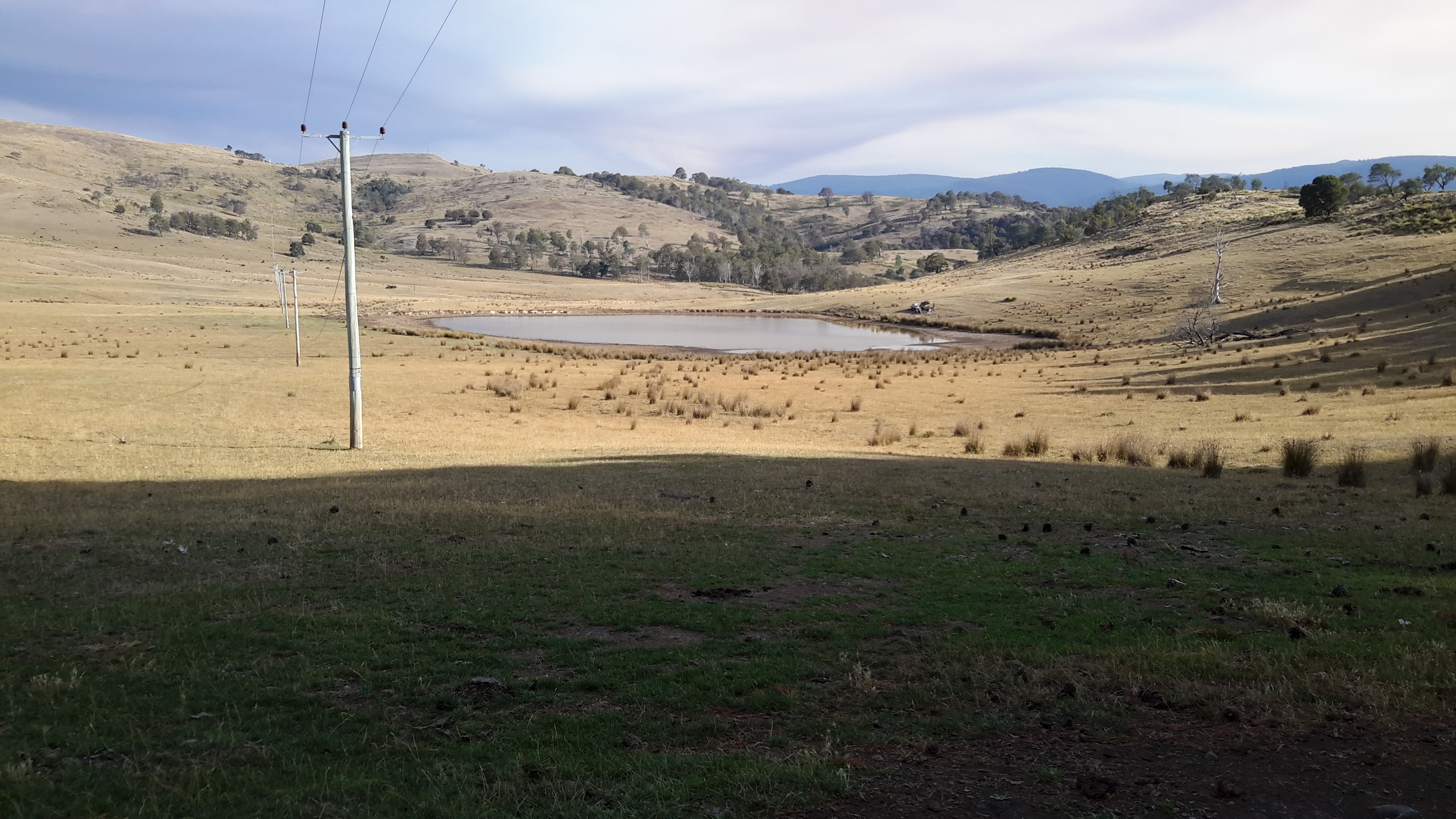
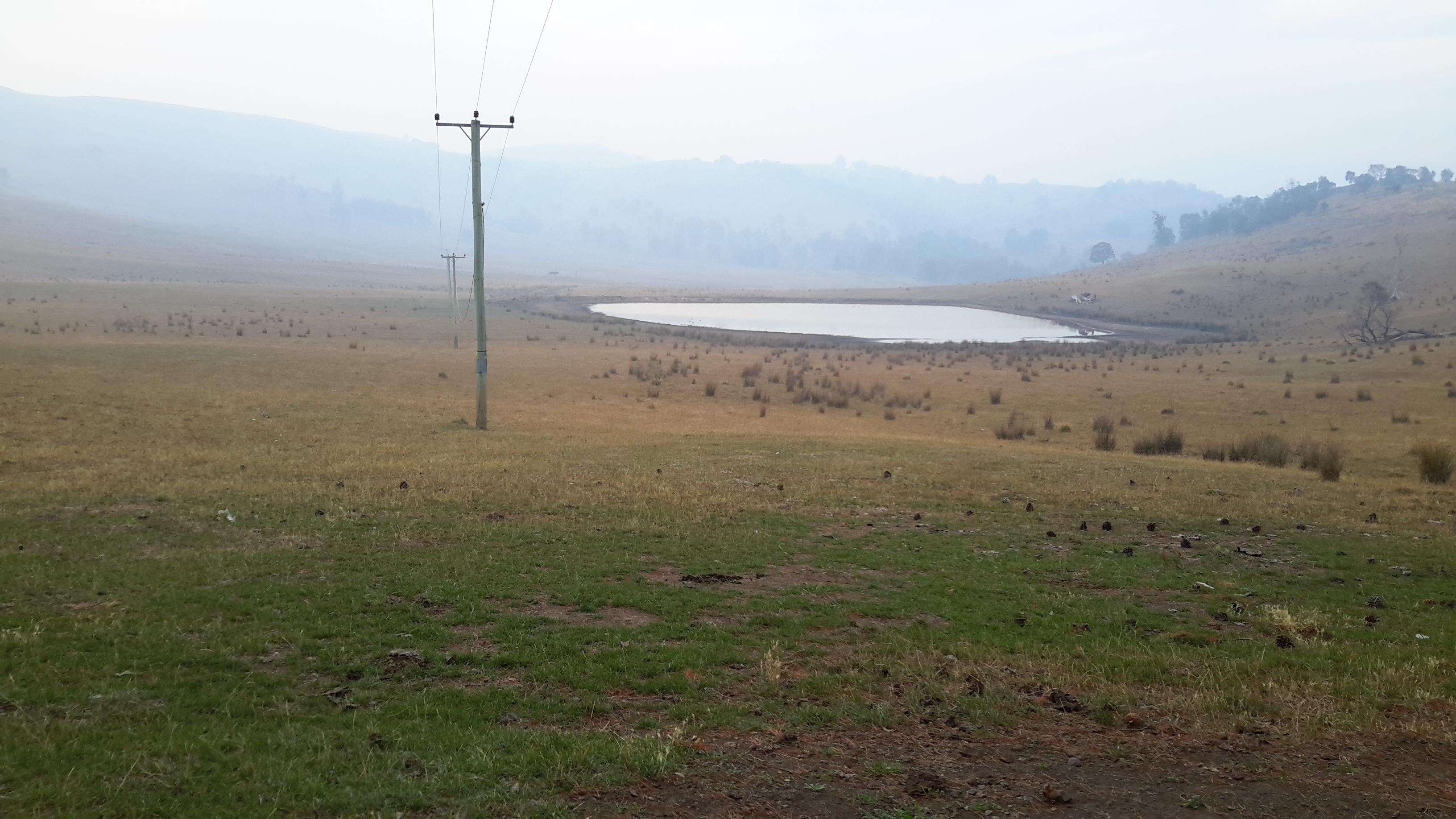
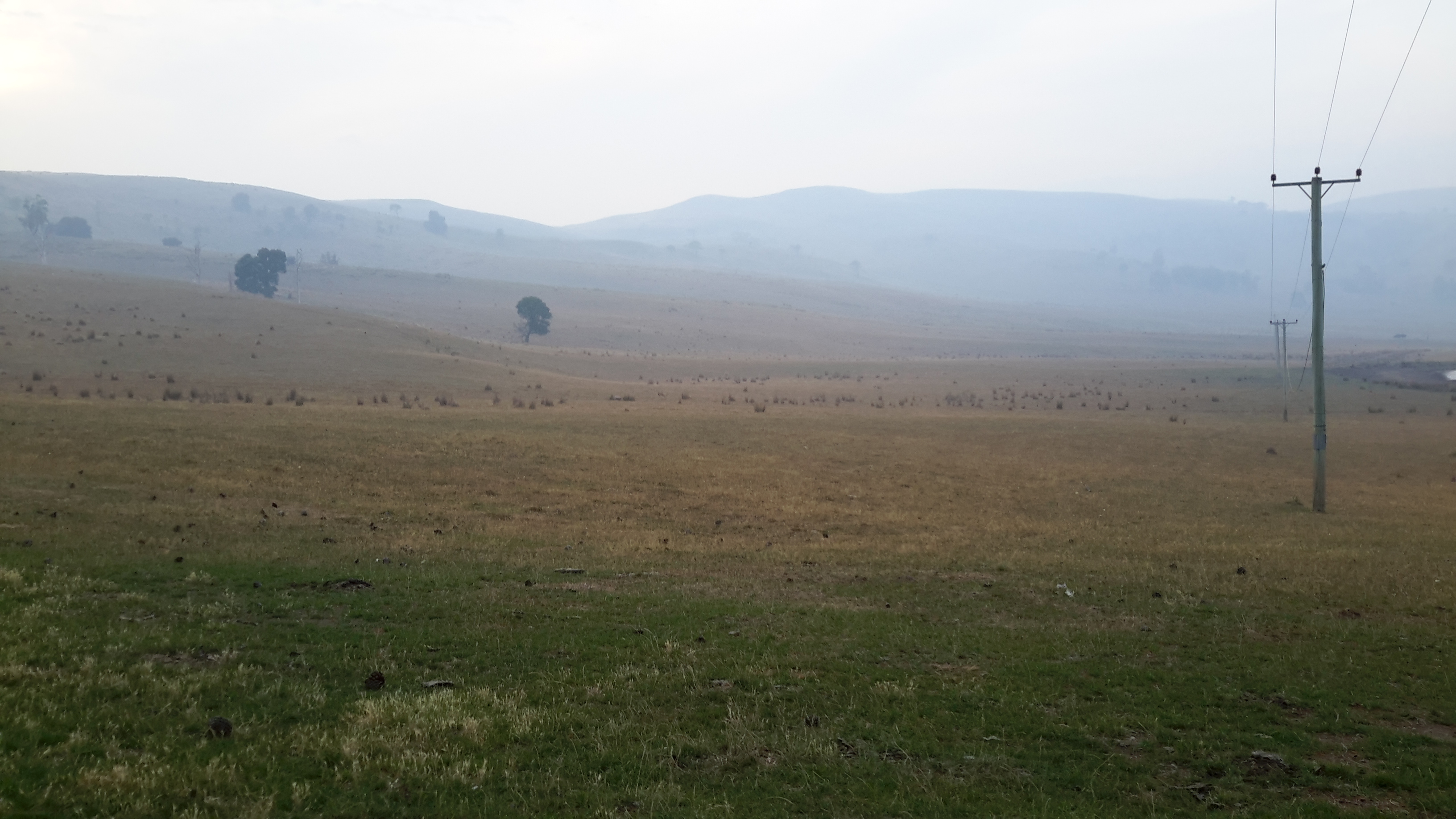
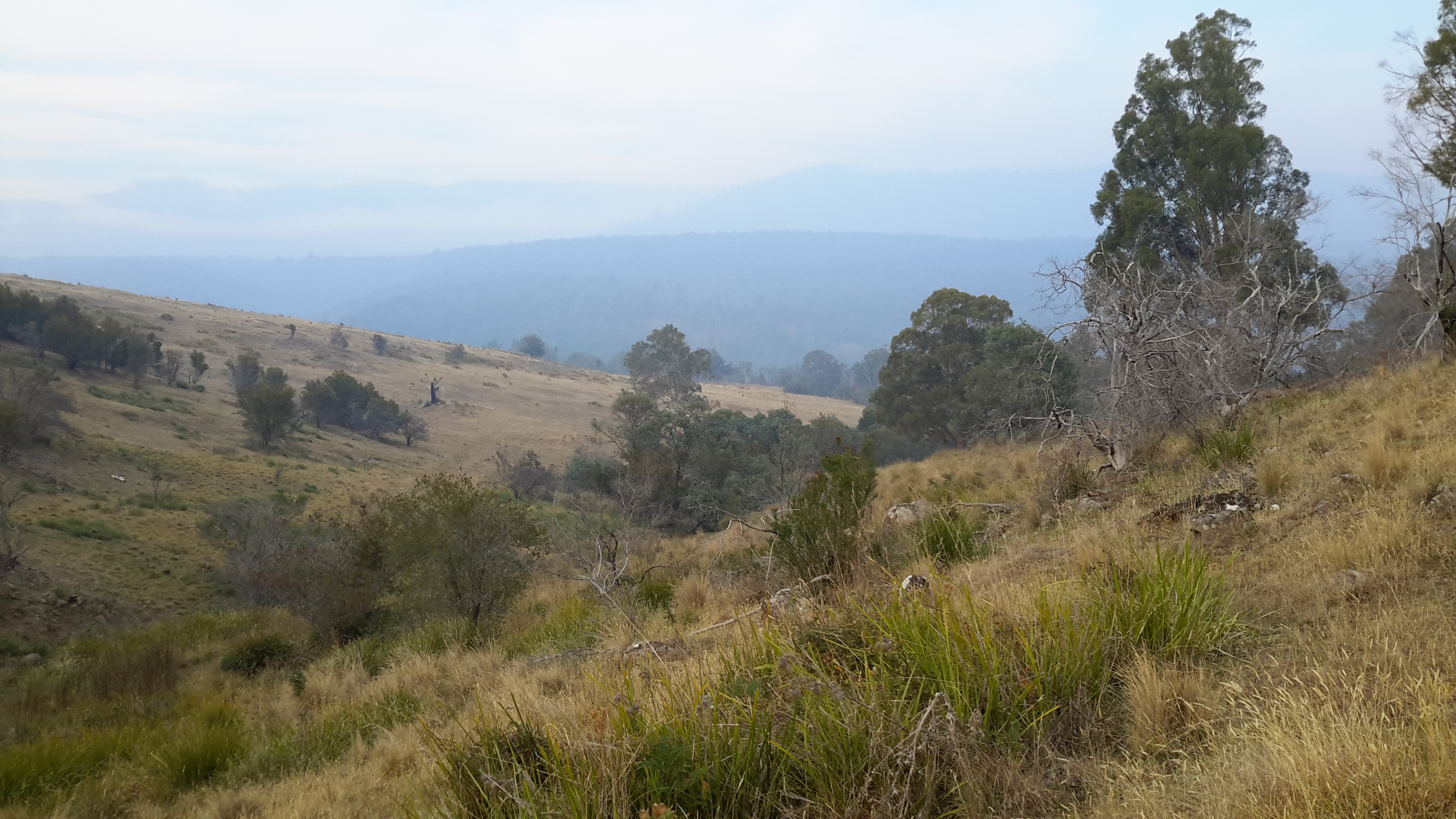
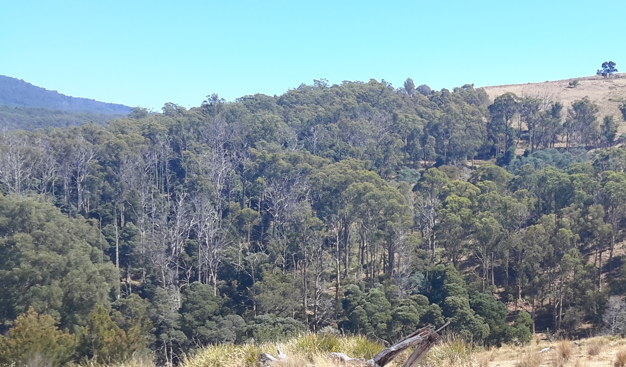
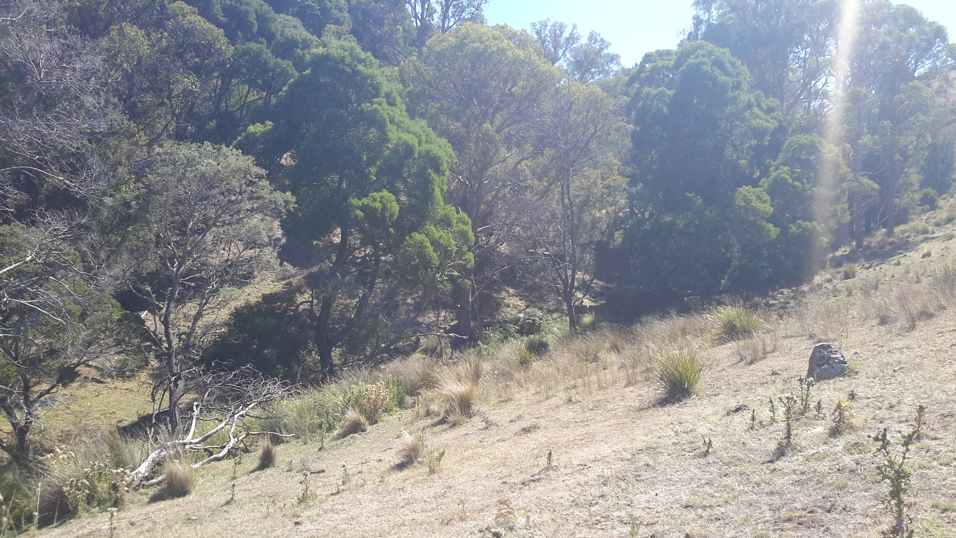
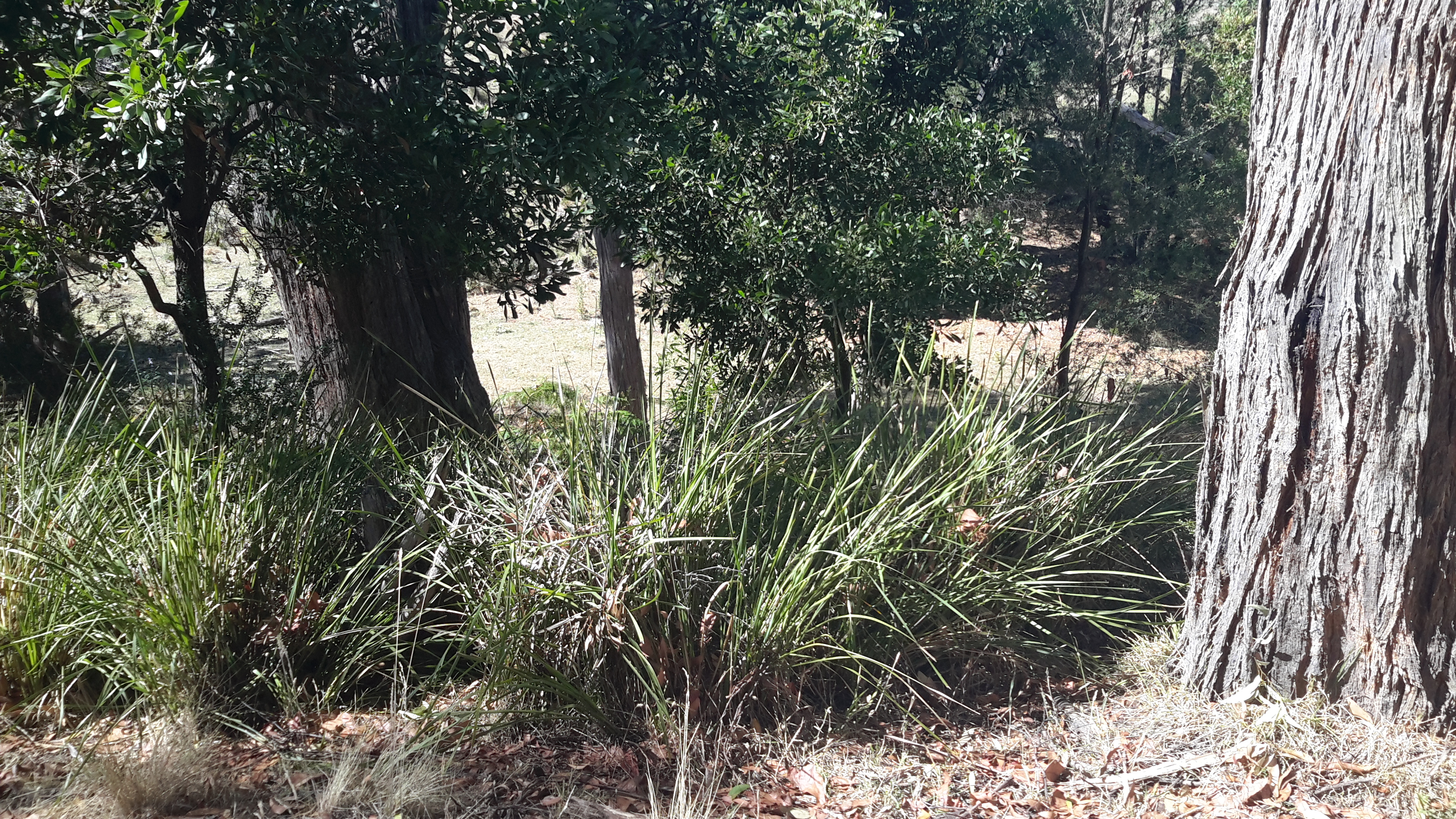
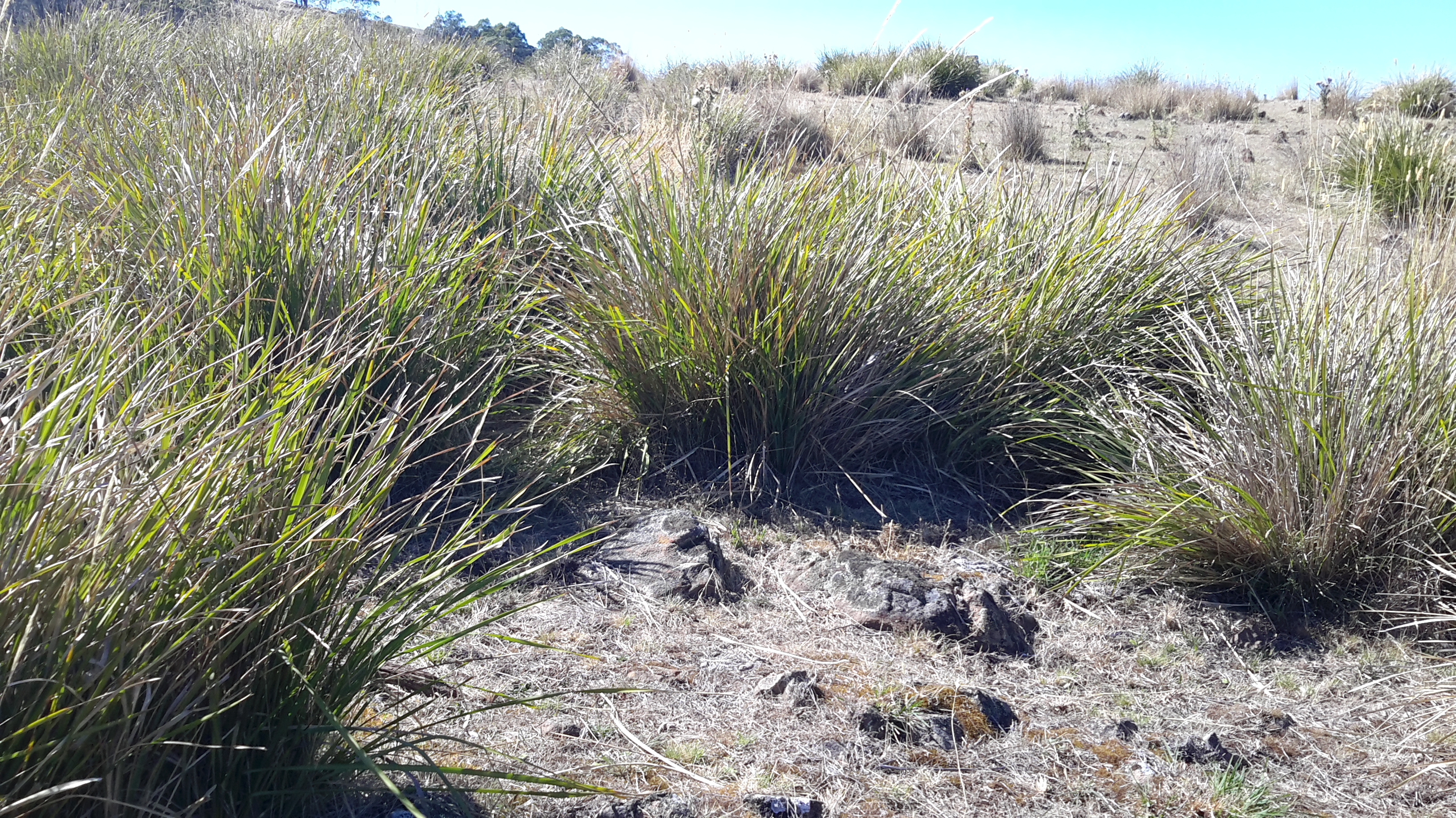
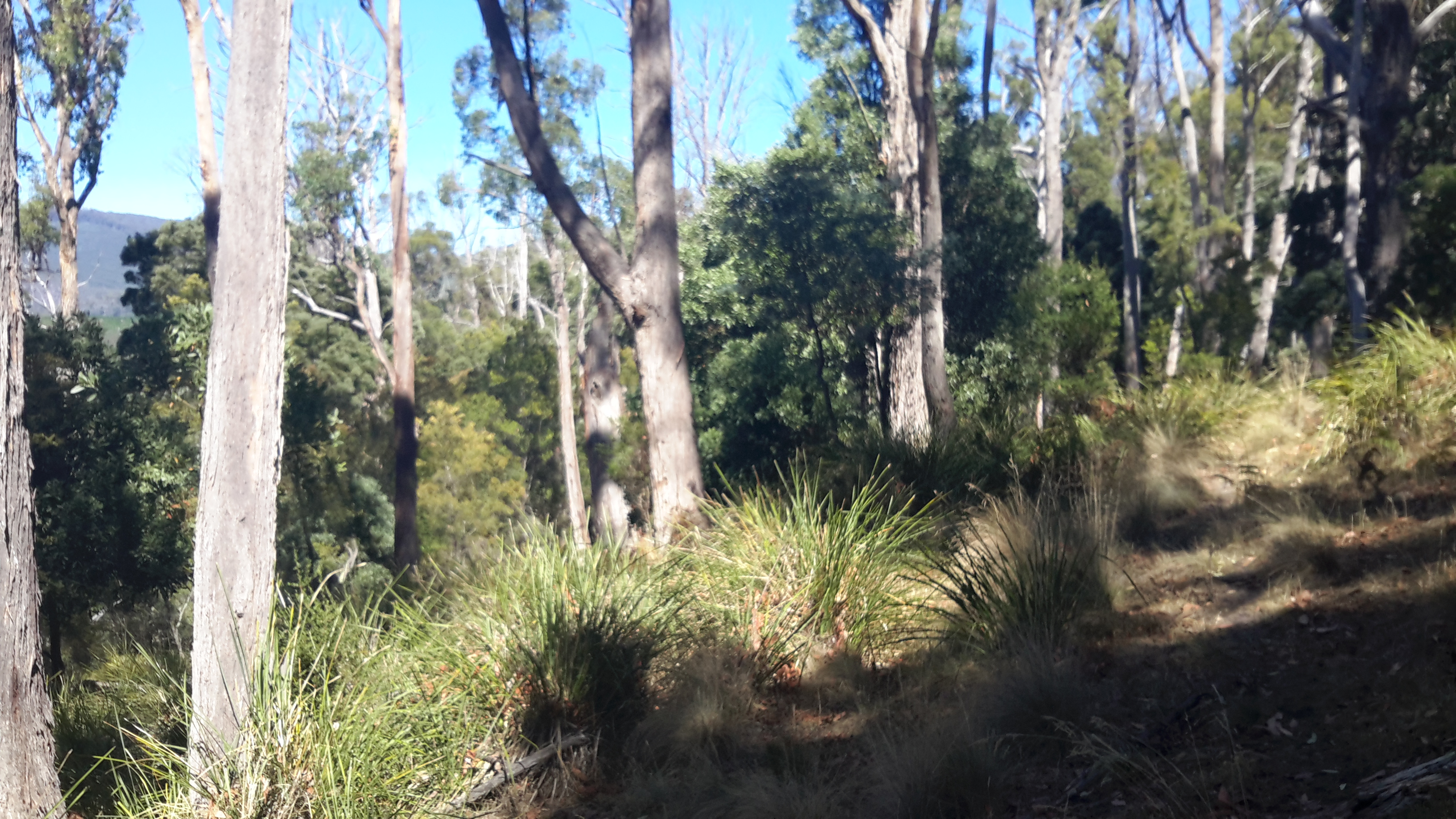
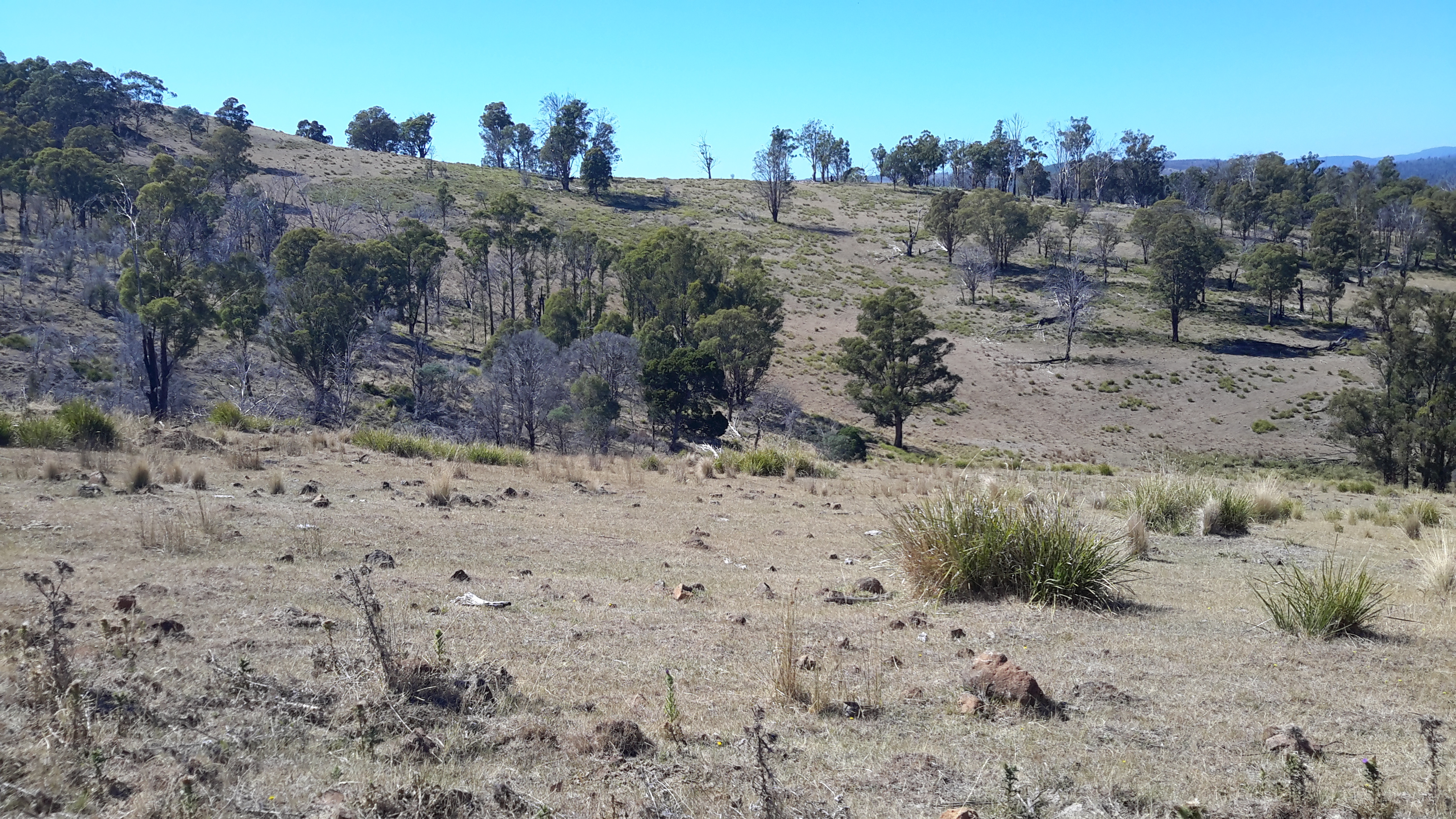
Clearly the edges of the Lake were/are exceptionally steep and if my walks elsewhere in the region were used as a guide, the slopes would be a mixture of dense wet rainforest tangled around partially hidden rocky outcrops.  Both sides of the Lake have sections which rise over 200 metres within half a kilometre.  All indications are that walking at water level would be impossible. If Plan A to walk alongside the Lake wasn’t possible, what should be Plan B?

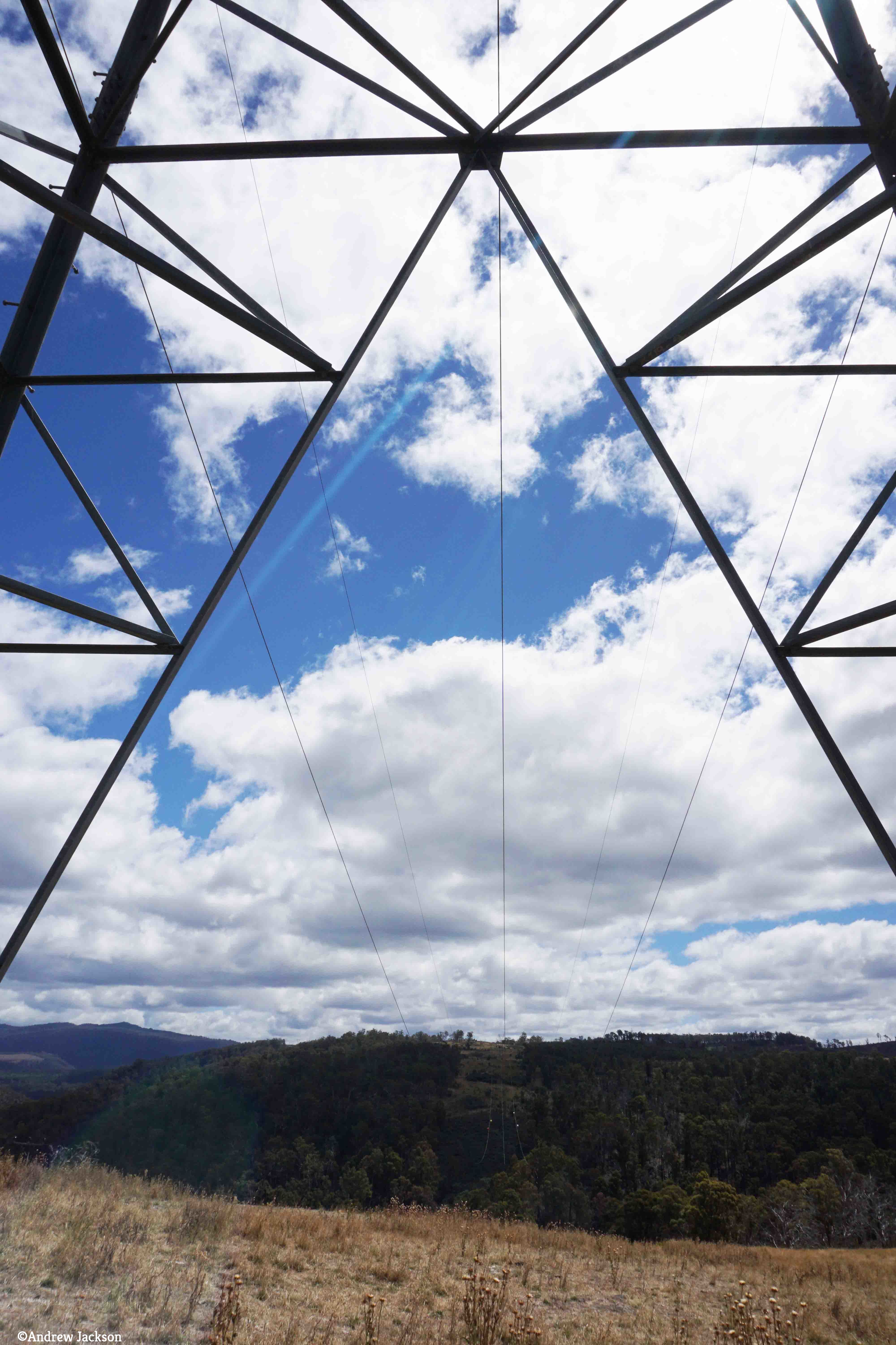
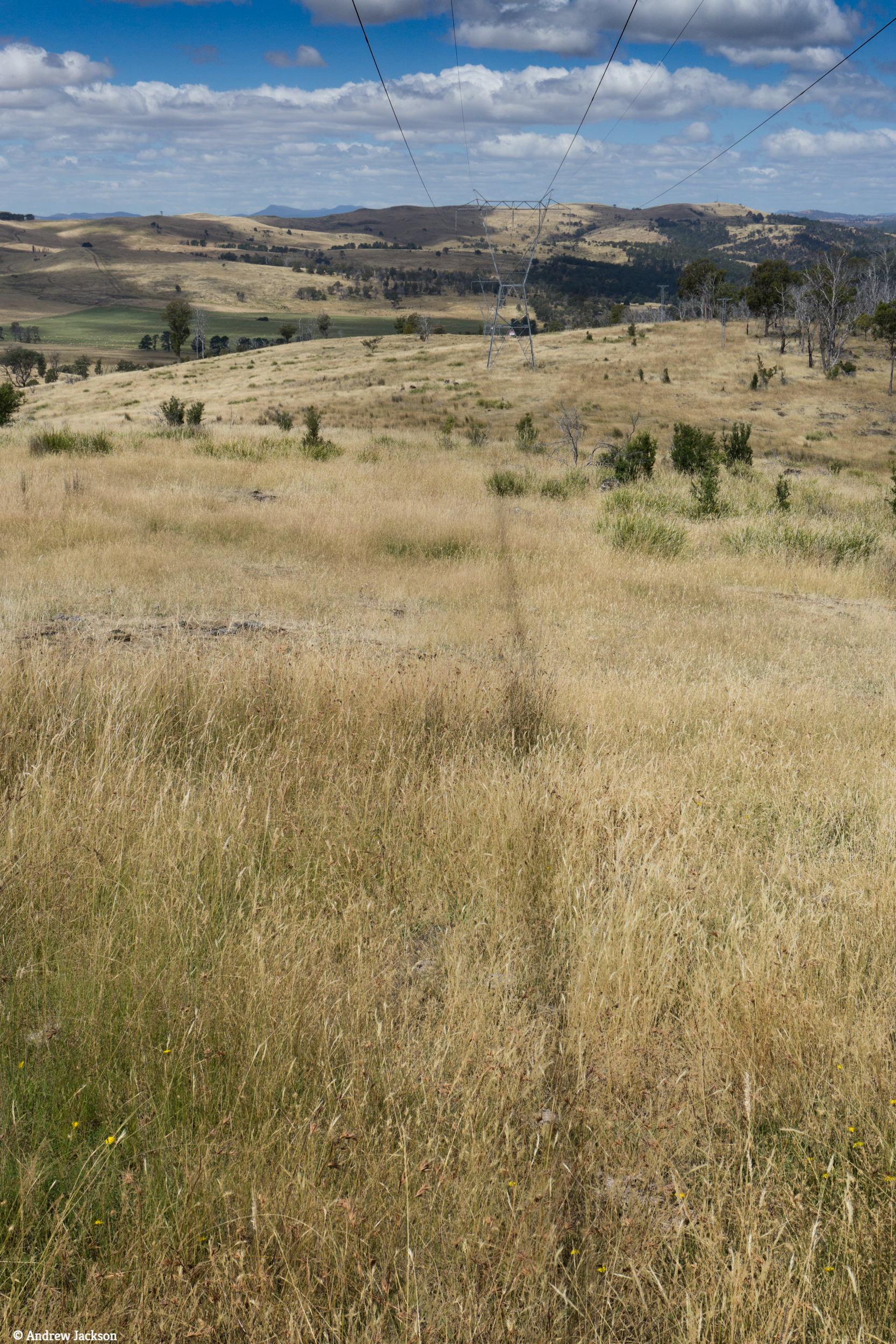
On the northern side, skyscraper-high electricity transmission structures with their connecting wires have been installed in a straight line from the Wayatinah to Catagunya Power Stations and located roughly at the top of the steep incline from the Lake. I felt this line would be the best option for progress. During construction, an area of less than hundred metres wide was cleared to create a pathway for vehicles to use. Perfect for easy walking?  Reflections on past experiences suggest not.  This is rainforest territory and as a constantly regenerating living organism, I realised that I should expect the forest to have begun to re-establish itself. I recalled walking along the ‘cleared’ transmission lines area through the most challenging vegetation on unseeable uneven ground at the northern end of Lake King William. It was slow, tedious work where a snapped ankle was always a possibility.

Thinking of the Wayatinah to Catagunya leg, I made a note to contact TasNetworks to see whether their clearing program had reached this transmission area, and whether I could hope for a reasonably straightforward walk along this line.  Google maps indicate a vehicular road leaves the Wayatinah Power Station area and continues eastwards for the first half a kilometre of the 7 km line of towers.  It seems to stops short of the first heavily forested gully that cuts deeply through the landscape and which contributes water downhill to Lake Catagunya.  400 metres past that obstacle is a new similar impediment to smooth walking.  A third such impasse waits a further 400 metres eastwards.  In advance of the walk, it was easy to imagine the vegetation would be slippery with dripping water from the plants, the light levels amidst the tightly packed vegetation in the ravine would be low, and the flow of water over the centuries would have exposed rocky outcrops that would make descent and then ascent on the other side of the creek time consuming and treacherous.  Until in the presence of each ravine,  judgements could not be made as to whether to walk inland to skirt around the worst of the cuttings or whether it might be possible to descend and ascend on the other side safely and with my backpack still attached to my back.

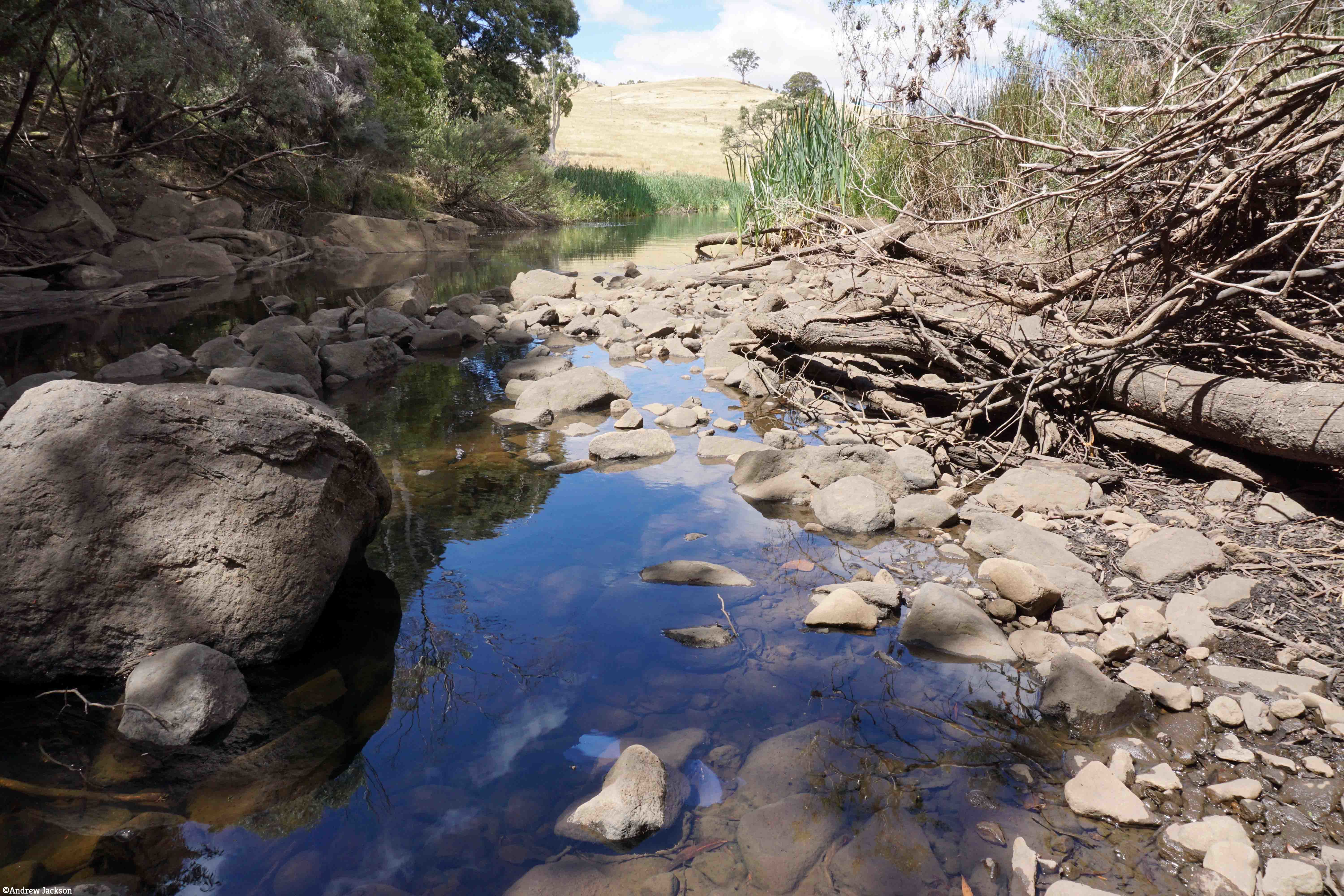
Approximately half way through the walk after the three creeks, an undulating plateau with a lower gradient should be a welcome change for a few minutes before the terrain drops down to Bushman’s Hill. I would expect this site to be seriously forested and not to offer grand views of the Lake, and I would expect a mesh of unexpected and unpredictable forestry and Hydro Tasmania roads across the land. Ahead the land drops away rapidly, is crossed by another deep creek cutting, until it reaches a significant inlet body of water that is more than 100 metres wide. This water extends inland for over one kilometre.  Into this length of water flows Black Bob’s Rivulet which extends for many kilometres north west of this area. There would be no choice but to walk around this obstacle and cross the Rivulet where possible, until a connection with Catagunya Road could be made.  The degree of deviation will depend on the nature, location and extent of the plantation and natural forests.

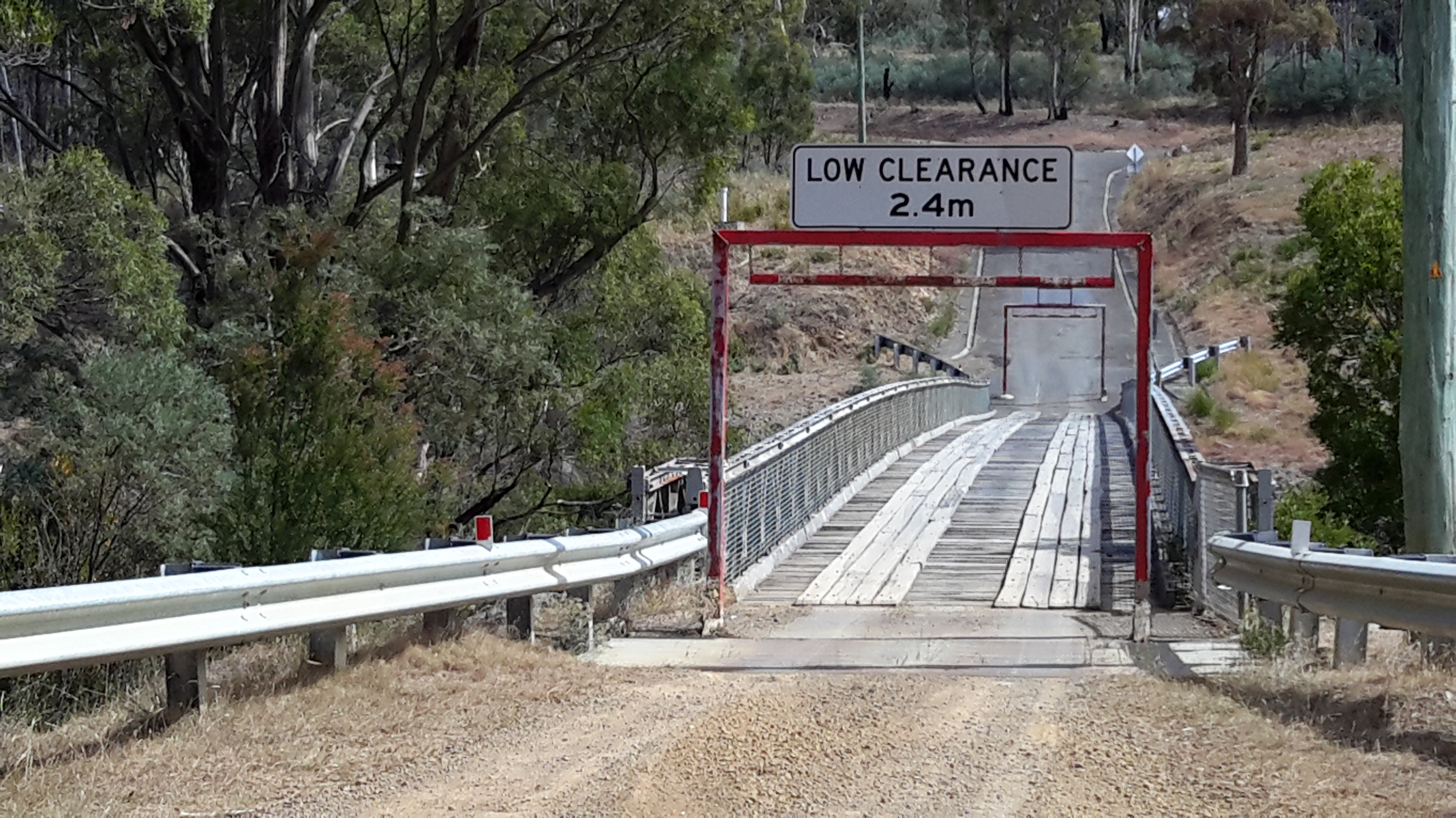
Once on the Road, an easy gravel surface leads to Catagunya Dam and Power Station; perhaps 4 to 6 kilometres of road will need to be walked depending on the difficulty getting around the inlet.  After panoramic photos are taken to record the Lake and it’s edges, then a 7-8 km walk to the locked gate at the Lyell Highway will conclude this leg of the walk along the Derwent.

20151029_144956.jpg

All up, and at the best, perhaps 18-22 km would be walked in this stage.  If substantial rerouting around the creeks was required then the distance would be much longer.  Fundamentally, I imagined this was a walk of clambering up and descending steep forested hills relentlessly. Depending on the density of vegetation in the ‘cleared’ transmission line area and then the difficulties crossing the creek cuttings, at best this walk might take 10 hours.  At worst, and probably realistically, it will require sleeping out overnight, and therefore I will walk with the full complement of camping gear.

Lake Repulse Dam to Catagunya Dam – posting 11 of 13

My first touch with civilisation was a gravel road after I had crossed a challenging fence and stepped between dozens of fresh almost liquid cattle pats (but no cattle in sight).

I followed the road to the river and saw the sturdy bridge. Floods would never sweep that piece of engineering away!

20160210_090638.jpg

20160210_090650.jpg

Would you believe I did not notice the following sign denying pedestrians access until I had walked onto the bridge and then retraced my steps up the gravel road? I later wondered whether the sign meant no access down to the river – and there was none that was safe for me.  The sign was unclear.  It was definitely easy to access the bridge.

20160210_090751.jpg

The views were stupendous from the bridge: maybe one of these will become a background for your computer.

20160210_090923.jpg

20160210_090947.jpg

20160210_091017.jpg

20160210_091046.jpg

I followed the road, and dutifully kept my pace under 20km an hour.

20160210_091755.jpg


Lake Repulse Dam to Catagunya Dam – posting 10 of 13

I enjoyed the walk from my camping spot to Catagunya in the early morning.  Except, as usual, I didn’t enjoy negotiating fences.  Getting from one side to the other took time. Most were rather challenging. Frequently, I needed to unhitch my backpack, lift its 14kg weight in a clean and jerk manoeuvre and tumble it over a fence.  Then I would walk up and down the fence line until I found the easiest (never easy) place for me to crawl under the fence, climb over or squeeze through the fence.  Back to the pack, heave it onto my back, and adjust the straps.  Thankfully the paddocks were huge and I could never see all sides at the same time which means I didn’t have as many fences as one might imagine for this distance. The fences followed the curves of hills and disappeared over crests.  I only ever saw two gates.

From the smaller second dam I followed a creeklet down down down to an almost hill-less flatter space that bordered a section of Lake Repulse.

20160210_080207.jpg20160210_080333.jpg

I turned north-west and meandered up a smaller hill slope until Catagunya Dam came into view.

20160210_080810.jpg

20160210_081245.jpg

Ahead of me were extensive paddocks with sheep.

Beside me, to my left through a thick edge of trees Lake Repulse/Derwent River streamed away in a south-easterly direction.

20160210_082353.jpg

Solid thick trunked trees stood sentry near the water beside rocky outcrops which defined the River edges and stopped the expansion of vegetation.

20160210_082806.jpg

20160210_082829.jpg

20160210_082838.jpg

I looked back from where I had come; way behind all the hills you can see.

20160210_083243.jpg

20160210_083247.jpg

I looked forward to my destination.

20160210_083519.jpg

20160210_085615.jpg

I looked around about me.

20160210_083837.jpg

20160210_084949.jpg

How beautiful the country looked with its softened edges.

Lake Repulse Dam to Catagunya Dam – posting 9 of 13

The signs of a past bushfire were clear on one long hill.  Possibly a year ago.  A little green regrowth in evidence.

20160209_141950.jpg

20160209_145502

Nevertheless seeing the blackened trees was a timely alert and made me wonder how I would cope if a bush fire came my way.  I have been informed the safest place is to find/create a hollow in the ground at the bottom of a hill, dig in and cover yourself as well as you can (remembering that most bushwalking gear and clothes is synthetic and will melt), hope the fire will flash over you quickly and that no trees or burning branches will fall on you, wait until the rush has passed, and then hope you can see somewhere to go.  I don’t ever want to put that to the test.

On the evening of this walk, I dropped off to sleep around 7.30pm (early to bed early to rise!) in my trusty little synthetic tent on the only flat place I could find during almost the entire walk.

20160209_182356.jpg

A little after 9 pm I woke to the smell of smoke.  Hmmmm.  I clambered out of the tent to have a look; 360 degrees of hills were softened with smoke haze.  No wind.  I couldn’t guess the direction from where the fire smoke might be coming.  When I considered collapsing my tent, repacking my backpack and continuing onto the Catagunya complex, I realised it was possible the fire was flaring between me and that destination. I listened for the sound of helicopters doing water drops.  Heard nothing.

A couple of hundred metres below me was the dam with its thick brown water (photo below taken when setting up before the smoke haze arrived) which I felt was the safest place I would find close by. Thought I was safest staying put.

20160209_182342.jpg

So I climbed back into my hot sleeping bag (the evening temperature didn’t cool as forecast), and went to sleep.

In the morning, I took the following photos. They show the smoky cattle-crossed hills surrounding me – and indicate the smoky air I was breathing.

20160210_072356.jpg

20160210_072359.jpg

20160210_072402.jpg

I packed up and walked passed another smaller dam, before travelling around, down and up hills once more. The smoky haze persisted. Didn’t seem worse.  I continued.

20160210_074429.jpg

20160210_074902.jpg

When I saw Catagunya Dam in the distance with the haze behind, I knew the seat of the fire was elsewhere.

20160210_081245.jpg

Later, I learnt the fire was over 70kms away in the south west of Tasmania.  Strong winds were responsible for creating the haze and even Hobart way east was blanketed similarly by smoke from the same fire.

Lake Repulse Dam to Catagunya Dam – posting 6 of 13

I have been asked why I chose to walk on the eastern/northern side of the River.  Quite simply, that side looked easier.  Once on the walk I had grand views to the other side, and felt vindicated in my decision.  On the western/southern side dense virgin bush with no tracks or plantation forests covered the steep hills.

Looking to the other side1

Looking to the other side2.jpg

Looking to the other side3.jpg

20160209_115757.jpg

20160209_125404.jpg

20160209_125534.jpg

Even when the forests opened out, the terrain was rocky and treacherous on the other side of the water.

Looking to the other side4

Nevertheless the landscape was richly beautiful even when tampered with by mankind.  All the photos above remind me of the steepness of the terrain on ‘my’ side of the river, and the impossibility of accessing the waters of Lake Repulse.

Lake Repulse Dam to Catagunya Dam – posting 5 of 13


The forested areas gave me the greatest amount of work.

Treed section coming up

More treed forest.jpg20160209_111227.jpg

20160209_111237.jpg

Clambering up or down through the forests with a backpack changing my centre of gravity and catching on vegetation, swinging a stick in front all the while to relocate spiders, imagining tracks through the undergrowth and finding the cattle had created hundreds of intermeshed occasional pathways to and from nowhere useful for me, and the day’s temperature rising and passing 30 degrees all contributed to produce a constant world of challenge. Where I chose to walk, I struggled and strained yet I can see that my photos make the ground look smooth and trouble free.

20160209_114024.jpg

20160209_112856.jpg

My photographs show me how beautiful the forests were. Usually I focused on a small shrub, the trunk of a tree or a clump of grass as I walked but now that I am looking at my photos I can see the way the object of my attention fitted into a larger environment. In addition, I love seeing the way the light splits through the bush.

Lake Repulse Dam to Catagunya Dam – posting 4 of 13

One of the spiders and the predominant butterflies both attracted my attention because of their prominent orange colourings.  The landscape they lived in was dry and remote and I wondered if the spider’s colouring was a way of distracting or attracting the butterflies onto their web (can butterflies see in colour?).

The spiders caused me considerable work with my trusty walking stick, a stout branch I picked up early in my walk. I was forever circulating the stick in front of me to relocate the spiders and their webs to the side and let me pass. The spiders spread long thick stranded web lines between bushes and tall grasses and tree branches, and then spread their long legs in the centre of a normal circular web at around my chest level.  I guess the whole spider would be around the size of a 50 cent piece. Beautifully camouflaged against a vegetation backdrop coloured in browns, beiges and greys, the odd orange marking was the only way in which the spiders became visible.  You cannot see any of them in the photos below, but they were there.  Hundreds of them. Everywhere.

20160209_105953.jpg

20160209_112847.jpg

I checked the database of all Tasmanian Spiders and did not find a photo corresponding with my memory of the spider on the hills with the orange markings.  I was stunned by the high number of spiders endemic and imported into Tasmania, as listed on this comprehensive website.  I am not so much frightened of spiders rather I never enjoy eight legs running fast and uncontrolled over my body without permission.

An overview of Tasmania’s butterflies indicates 39 varieties are endemic.  After perusing Insects of Tasmania,  I believe the orange marked butterfly flying about the hills between Lake Repulse Dam and Catagunya Dam may be from the Genus Danaus and be commonly referred to as the Wanderer Monarch from the family known as the Browns  (Nymphalidae). But this is only a guess and the butterfly may have been one of the other ‘browns’ shown on this page of the website.

Perhaps a blog follower, as a specialist who knows Tasmania’s spiders and butterflies, can provide more information about the possibilities.

Surprise surprise … as  I type this post I ‘feel (imagine)’ things running all over me and I shudder at the horrible thought.

Lake Repulse Dam to Catagunya Dam – posting 3 of 13

The major landmark nearest to Lake Repulse Dam is Bilton Hill with its local telecommunications tower.  That didn’t help me much. I had no mobile phone or internet reception for the entire walk.  The area between Lake Repulse Dam and Catagunya Dam is an isolated remote part of Tasmania.

20160209_105315.jpg

I walked on, forever looking down unable not to watch the thousands of cricket insects jumping across the ground and around my legs.  Movements everywhere. Movements may signal a snake so I needed perpetual vigilance.  It was exhausting being alerted by the motions of the constant cricket hops and imagining a dangerous slitherer was the cause of the movement. Only once during the walk did I think I glimpsed six inches of a thick glossy black ‘rope’ disappearing into the undergrowth.  This is not something you check on to be certain.  You just keep going.

Lake Repulse Dam to Catagunya Dam – posting 2 of 13

Thanks to Ieky I was driven to Lake Repulse Dam.  I rounded a fence line and left her enjoying the early morning before the temperature rose.

20160209_095805.jpg

Gradually I walked up my first hill for the day.

20160209_100901.jpg

From the bottom of the hill, the top seemed easily achievable. Unfortunately, that view gave false hope. As I reached the first crest another rose above, and this continued to be the way the land was shaped.  Up and up I walked on the cleared land behind the steep forested section that rose from Lake Repulse.  Looking back, Lake Repulse Dam was hidden in the trees.

20160209_101447.jpg

The distant forward views offered the prospect of more uphills but not before I could see I would need to put in some ‘down time’.

20160209_101442.jpg

By mid-morning the day was stunningly beautiful.

20160209_102430.jpg

I began to realise any access to Lake Repulse was a dream.  The steepness of the hills and the dense forest coverage were significant impediments.  I could see the Lake but I couldn’t reach it.

Lake Repulse.jpg

Lake Repulse2.jpg

Sometimes I would walk down the hills towards Lake Repulse, and shudder when I looked back.  I knew that later I would be required to climb up to the height of that which I had dropped down from.  But I kept on trying to reach the water.  Down I would go.  Be stymied. Then up I would go either over cleared land or through forests.

20160209_105206.jpg

And the day grew hotter.  It was heavy going. Nevertheless, I recognised the big wide sky, the solitude, the hard sounds of crows, and the shape of the landscape were all immensely beautiful and beguiling. I felt awe at the size of the country, and marvelled at its colours and textures.  Who wouldn’t feel profound happiness to be alive in such a wonderful arena! What a privilege I have been given.

Lake Repulse Dam to Catagunya Dam – posting 1 of 13

This walk offered steep hills, challenging fences to navigate, endless webs across my path with an orange striped spider waiting to catch insects (or me), no access to fresh water, and worrying hazy smoke spreading from bushfires elsewhere in Tasmania.

The start of my walk began above the steep forested edges of Lake Repulse Dam (photo below courtesy of Chantale).

IMG_3893Repulse Dam.JPG

Inland, past the Dam on the eastern/northern side, the landscape is a mix of forest and land cleared for cattle.  The photo below was taken by Michelle. I walked on the right hand side of the water. Note the thick forest along the water edge.  Note the steepness of those banks.

PA280087 Repulse dam.JPG

The photo below, which looks back in a south easterly direction to Lake Repulse Dam, was taken later last year when the grass was green rather than dried and spiky as it was during summer when I walked.

20151028_114913.jpg

The cleared areas are deceptive. They look easy to walk. Despite holding only a grassy coverage, the ground of these cleared areas was irregular and uneven, and it was always inclined up or down – all of which made walking slow.

20151028_114958.jpg

20151028_115002.jpg

PA280088Lake repulse.JPG

My walk crossed cleared lands and passed through forests.  Wherever I went, either I was climbing up or down 200 metres of hillside. Even the lower undulating hills plucked at my leg muscles. For me “hills ain’t no fun”. Eventually I reached the large Catagunya complex of Power Station, Dam and Lake.  Photos below were taken by Michelle and by Chantale respectively.

PA280090Catagunya Dam.JPG

IMG_3889Catagunya dam.JPG

Lake Repulse Dam and the wooden bridge

I knew I was near the end of the walk when I sighted the concrete top of Lake Repulse Dam.

20160124_155833.jpg

20160124_155838.jpg

I continued walking until the single-lane bridge over the Derwent River came into view.

20160124_160348.jpg

20160124_160405.jpg

20160124_160450.jpg

I expected little traffic in this area so I walked onto the bridge for a good look down towards Cluny Lagoon and then upstream towards the Dam wall and the water being disgorged at its base.

20160124_160548.jpg

20160124_160531.jpg

20160124_161038.jpg

20160124_161143.jpg

Future postings will contain the detail and show photos of my walk through the bush along the top right of the dam wall as I headed inland around Lake Repulse Dam towards Catagunya Dam.

20160124_160617.jpg

20160124_161146.jpg

20160124_160650.jpg

When I was standing close to the dam wall, I was able to look back to the wooden bridge.

20160124_161155.jpg

I felt privileged to see this wooden bridge which must be one of the few left around Tasmania.  I imagine that in not too many years’ time, a ‘modern’ metal one will replace it. Meanwhile this sturdy piece of engineering is a very attractive find located not so far from the Lyell Highway.