Tag Archives: Tranmere Road

Walking through Tranmere to the start of Howrah Point on Stage 4 of my walk along the Derwent River

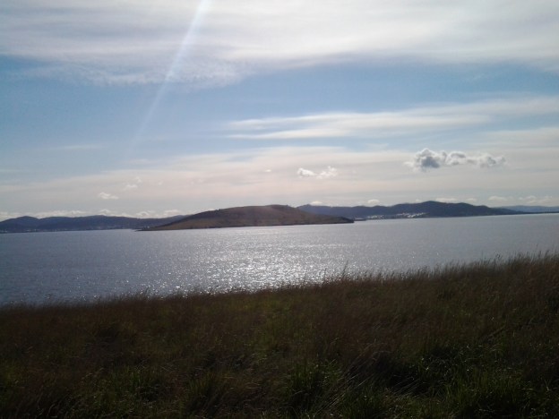
As I walked back towards the city, the Clarence Foreshore Trail started as a concreted pathway for cyclists and pedestrians, then stopped and started as a formal walkway; sometimes I walked on the road and sometimes on the grassy verge.  Car traffic was almost non-existent. At bus stop 30 there were seats to enjoy the view, and a shelter offered protection from the weather. The air was perfumed with the smell of cypress trees expressing their oils as the early morning sun heated their branches. Magpie birds warbled musically from the trees. I spotted the occasional Pied Oyster Catcher, Cormorants holding their breath and diving deep for fish, and a single speed boat whizzing up the River in the distance. Very few people around.

When the track dipped down as a gravel pathway edging the Derwent River, the mowed lawns of the back yards of houses edged this walkway. Green. Peaceful. And without fences, I could appreciate the large picture windows installed in many houses, for the view of the Derwent Harbour and further beyond. Groves of Casuarina trees barely whispered in the slightest of breezes. Stands of almighty gum trees occasionally blocked the sun. Plump yellow beaked Dominican Gulls rested on sunny rocks above the moving water. Pairs of plovers hoping to protect their babies screamed overhead. A tourist sight-seeing aeroplane droned along the river. Walkers with their smiling happy Labradors, German Shepherds, Shitsus and all manner of other canines greeted me.

This was easy strolling but I was always edgy and watchful for any cyclists that might wish to share the pathway.

I saw evidence of Landcare – new trees have been planted, staked and surrounded with protective plastic. Occasionally I noticed public tracks from this Trail that went back up the hill to Tranmere Road, giving walkers the option of where they walked as they continued along the River. Occasionally I came across public seats where you could, if you wished, rest and enjoy the magnificent views. Swings and slides could be used by kids at the small Anulka Park.

Around 50 minutes after leaving the bus, I arrived at a sign which provided a list of plant species in Clarence, and which offered information about weeds and escaping exotics and the dangers these pose to our native vegetation. At this point, the Trail curved uphill and this is the way any future walker should go.  The alternative is comparatively difficult and dangerous.  However, I did not know this at the time and I decided to stay low and hug the Derwent River edge. I was about to walk around Howrah Point.

Preparing for the next stage of my walk along the Derwent River

The image featured directly above is of the watery inlet from the Derwent River on the left into Ralph’s Bay on the right. The low hill in the distance is north of and opposite from Gellibrand Point (which is at the northern end of South Arm peninsula). The low hill is Droughty Hill: Trywork Point will be to the lower left of the hill.

Previously, I walked from the mouth of the Derwent River and covered the length of the South Arm peninsula which amounts to approximately 11 km of the River. Stage 1 took me from Cape Direction to the Opossum Bay shop. Stage 2 took me from the Opossum Bay shop to Gellibrand Point. Only 238 Kms to go!

Continuing on from the last walk will require me to leap-frog over approximately 2kms of water for the next starting point Trywork Point which is south of the Rokeby Hills. The reason for my ‘jumping over’ is that I am guessing that the Derwent River was measured as a ‘straight’ length and did not count the many extra kilometres going in and out of every bay and crevice. The water between Gellibrand Point on the South Arm peninsula and Trywork Point is the entrance to the large Ralph’s Bay which feeds off the Derwent River.

So my initial destination for Stage 3 is Trywork Point – that will mark the start of the walk. To reach this starting point I will need to walk south from a bus stop and then later be prepared to retrace my steps or find a more suitable alternative route before continuing northwards through as many Hobart’s eastern shore suburbs as my feet will carry me.  The suburban area has frequent bus services (by comparison with the Opossum Bay bus service) so that timing the duration of Stage 3 is dependent on my health and inclination rather than on bus timetables.

Unfortunately, TasMAP Taroona 5224 is not a great deal of help for reaching Trywork Point. It clearly shows the acres of land between the bus stop and Trywork Point but offers no roads or tracks. I am clear that I will walk from the last Camelot Park bus stop (Metro Bus number 615) south to the Point – somehow. The Hobart and Surrounds Street Directory is only of marginally more use than the TasMAP. However this Directory will be especially useful with the names of streets as I return northwards and walk in and through the suburbs in the later part of this Stage 3 walk.

The most useful mapping and tracking information comes from the Google earth map of the area (which was also useful to see tracks on Gellibrand Point in Stage 2) – although the name Trywork Point is not recorded and does not appear on their map (Note that Trywork Point and some other landmarks are indicated on the TasMAP).  The best that Google can offer is Droughty Point Road. From there I moved the map westward until I found the T junction with Tranmere Rd and Oceana Drive – this intersection is the bus stop from where I will start walking.

Walking south, the bitumen road peters out and the tracks across the land are variously strong and faint on the Google earth map. With this limited information, finding my way will be an experimental process.

Years ago friend Je and I walked from the end of Tranmere Road across some of this land. However, I remember that we encountered stout almost impassable fences. This memory makes me wonder what I will find now, and how easy the access to Trywork Point will be. I look forward to my ongoing discovery of the land besides this wonderful Derwent River.